
of Architectural Informatics Technical University of Munich
Project Title
Ekaterina Pestriakova
Chair for Architectural Informatics Department of Architecture Technichal University of ScanMunich the city
Student(s) Name(s)


2 Scan the city Chair of Architectural Informatics Prof. Dr.-Ing. Frank Petzold Critical Modeling Ivan Bratoev, Nick Förster, Frank Petzold Ekaterina 03757836Pestriakova
3 28201412864 EthnographyResearchTopic Workshop Sensor PrototypeConceptPrototypingDevelopment Reflection and Outlook Table of Contents
At the same time there are a lot of issues connected to the collection of data, analyses, storage, consent for collecting it. Because of all this issues it was decided to gather information that, first of all, people are willing to provide voluntarily, and second of all, would represent their experience, and their knowledge.
Information that is available about the city nowadays cowers the majority of topics concerning the urban environment — building regulations, surveillance cameras footage, GPS data and countless amount of urban data is out there.
4 Topic
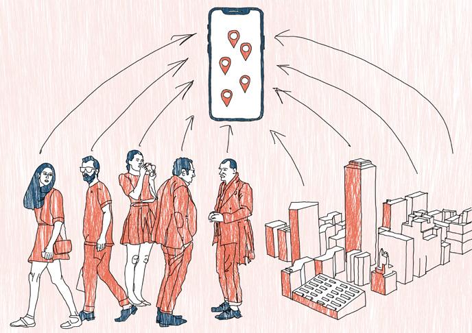
Scan the city is a project aimed to gather information about the city from its citizens and represent this information through the digital tools as well as an on the streets of an actual city. The project designed as a participation tool, people can share their opinions on different topics, exchange their thoughts and get a feeling of exploring the city.

Part of the research was to list main categories of urban data, their connections to one another and ethical challenges that can go with different types of data as well as with different stages of handling it.
Research
It was noted that there are a lot of issues connected to the data. Majority of them were described in the book „Data feminism“ by Catherine D’Ignazio and Lauren F. Klein. As one of the problems, they talk about imaginary objectivity of data: „ ...the data are never „raw.“ Data are always the product of unequal social relations — relations affected by centuries of history.“
It became apparent that despite the amount of data, some areas are uncovered or represented weakly. These are the areas connected with personal experience of people, their view on the city.
6
The research phase was aimed at figuring out the relationship between city and urban data, as well as between this data and its representation.
7

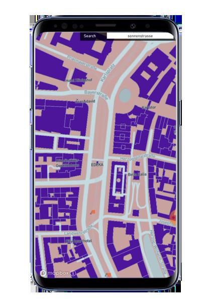
The ethnography workshop took place on the Sonnenstraße in Munich.
Other problems of the place also became apparent after the workshop — a lot of littering on the street, big problem of homelessness, a lot of noise and construction sites, general feeling of discomfort.
8
Also, there was noted that there are two types of traffic lights on the street — the first type is the one people notice (they wait for green light) and the second type is the ones they tend to ignore.
The first idea was to analyze behavior of pedestrians on the street. To take measurements of how fast people walk on the street and find correlations between their speed and the urban environment. It was noted that people do tend to walk slowly along the buildings with rich facades, or they would change their path in order to walk on the side of the street with the sun.
WorkshopEthnography
9
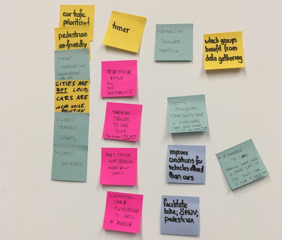
Map, made as a result of the workshop. Map contains all the layers made by other students. Continues pink line and dotted pink line — represents the places where pedestrians walk faster/slower.

Examples of putting together problems, solutions, sensors and bigger issues.


11 Firstly, noticed informal methods of communication on the street.

12
I became curious about this — do people scan them? Are they ready to interact with them? It was noted to be an interesting practice, informal practice, and maybe it can be used later as a form of interaction with people.
To test this idea and understand if people are willing to interact with posters, I printed three posters with different qr-codes and used a service which enables to count the number of times that link was clicked/qr-code was scanned. The link led to a simple Google form with only one question asking: „Ist die Straße fußgängerfreundlich?“
The answer was already pretty obvious, the street is not pedestrian friendly, but the idea was not to see the exact answers, but to get them at all, to test if people would click on a random qr-code. And they did. The posters lasted for about two weeks from the middle of November to the beginning of December 2021 getting in total 53 clicks. This proved that people are willing to interact with urban environment through this „system“ and it is can be used as a basis for a final prototype.
During the ethnography workshop, it was noted that there are a lot of handwritten posters as well as printed posters with small qr-codes attached to them.
Sensor Prototyping
Printed poster near the traffic light Placement of posters on the street and the amount of times they were scanned Printed poster near the bus stop 2813 12


14
A lot of the ads were site specific, they were asking if someone saw a lost item or a pet or a person. They were advertising small businesses nearby or asking for help. And they were everywhere along the street.
DevelopmentConcept
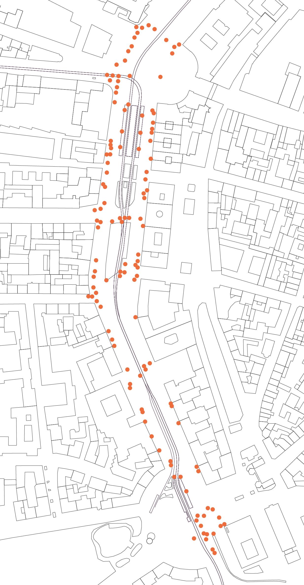
When it was possible to take a phone number or a qr-code attached to a poster, it was apparent that people were doing it, as some of them were missing. There was an attempt to map every ad on the street and determine the „hot spots“ for the ads. As a result of it, I provided the map on page 17. And it is obvious by looking on it that most posters are situated near the subway stations. Later it was decided that the main idea would be that people would be able to move the ads or their parts as they wish, and by doing so they would add a place on the map. And the „hot areas“ are significant only for the placement of the Main poster.
Following the idea of informal interaction and different forms of communication between citizen it was decided to see that posters or ads are out there where are they located, how long one poster can stay on its place before being removed.
15


After deciding the basic form of interaction between the poster and the citizen (that it is a poster with a small qr codes, that one can take and later attach to something else), it was important to understand what kind of information it is possible to get from a user. Earlier, during the storyboard phase it was considered to ask people to share their personal stories of mark significant objects also at the beginning during the research phase from the „Data Feminism“ book it became apparent, that there is a lack of representation for some groups and behind all the different numbers it is easy to lose an actual citizen, who uses this space.
After consulting a sociologist, it became also apparent what it is relevant to ask people what activities they what to be able to do here. How they can imagine this space looking. As a result of that, a city planner or a government official would be able to see different perspective and different issues that are unique to some groups of people and accommodate their needs as well.
16
Because of all this, it was decided to ask people about their feelings and their experience, rather than ask them where do they think the bench would fit the best.
Places with the most ads in them Lampposts with ads on them

18
2 3 4 5 6
This is Alex. He wants to learn more about the city, but he already saw all the places from this tour guide. He also wants to move more and contribute to city development. 1 It is also possible to filter by cate gories one is the most interested in. Alex has a dog Rex, so he can create a unique route hitting all the points of interest specifically for dogs in the area, based on the amount of kilometers he is willing to walk today. He learns about this new app called “urban Explorers” that collects information from users about unique places as well as from open sources. Alex can also collect points passing this points by, taking the pictures of them and updating their current status. The app allows users to add new in teresting pleases and to earn points while doing so. As a responsible citizen, Alex wants to report a problem with this app. He can simply do it by taking a picture and sending it to authorities. For that he would also get points and a title “urban explorer”


19 Anna wants to learn more about the city, and it’s history, through person al stories. It is possible to create a route through different points, “containing” different stories. The app gives a possibility to ex perience the city through someone else’s eyes and to hear stories you would otherwise never come around. Walking through the city, Anna heard different stories, connecting her to the people and to the city. People can share their stories related to the specific city sites. 1 2 3 4 5


It is easy to share an opinion on the specific issue — one sees the poster, reads the main question, downloads a “Scan the city’ app and takes a qrcode attached to the poster. Then they look for a place they think fits the question. The topic of this poster was traffic and the question is “Where do you feel uncomfortable because of traffic?”
The app is developed as a participation tool. It allows citizens to mark actual places not only digitally but also physically, drawing the attention of others to different issues. And connecting digital and analog cities.
topics can be changed depending on the new circumstances. The topic can be related to safety or to the lack of green spaces. All questions translated into 4 languages. The biggest font is used for the German language followed by English, Croatian, Turkish and Italian as people from these countries are the most represented in Munich.
20 Prototype
After finding the place that fits the question a person marks this place with a qr-code, then they scan it, so the app knows where the qr code is located, and also provides them with the topic specific questions. The questions can be changed or clarified later depending on the answers or new issues. After answering the questions, a person is asked to take a picture of the place that can represent the issue. If a person sees the qr-code someone else used to mark an issue they can also share their opinion on the same spot or they can take this qr code somewhere else and scan it there as all the previous answers already stored on the public Mainmap.
21 Digital city Connection Analog city

22


23
The use of an app is simple. From the main screen one can scan a Qr code, open the map, containing all the answers from others or read more about the project. After scanning the qr-code, one is presented with a list of questions. They ask how do you feel here, how would you like to feel here, what would you like to do here, what activities are limited and why. They ask a person to reflect on their feelings and provide their unique opinion on this place.
After submitting the answer, it is possible to review it on the map or see that others have submitted. It can later be used by city planners, enabling them to see the most concerning topics for citizens and also get a glimpse of feelings that people experience while in this area.
24
I was satisfied with a result of this small workshop we did. Their answers and their perspective was different from what I thought. Since October, I spent a lot of time walking around on the Sonnenstraße, but I still did not notice the things they did. These things were not important for me, as my experience was different, but from their perspective these were the things that made them uncomfortable or made them feel unsafe. From their answers, I was able to gain a different perspective on this area, which was an initial goal. Also, it was interesting to walk around sticking QRcodes on the surfaces.
After developing and testing the app myself, I asked my friends to use it and to share their experience.
25


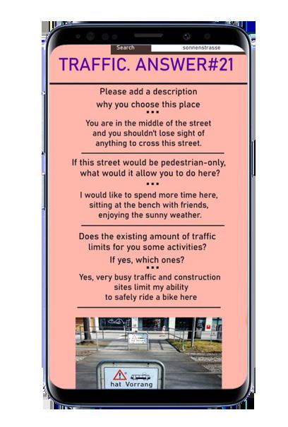
Please add a description why you choose this place.
Alles sieht in dieser Gegen so brutal und anonym aufgrund vom Verkehr und Mangel an grünen Flächen, wo man Versammlungsorte für die Freizeit organisieren könnte. Man will so schnell wie möglich weg von Abgasen und Autolärm.
Man könnte hier verschiedene Aktivitäten ausprobieren, wie zum Beispiel Tempelhofer Feld Berlin.in
Does the existing amount of traffic limits for you some activities? If yes, which ones?
26
Ich würde gerne hier mehr Zeit verbringen, an der Bank mit den Freunden sitzen, sonniges Wetter genießen.
If this street would be pedestrian-only, what would it allow you to do here?
Man befindet sich mittendrin auf der Straße und soll nichts außer Acht verlieren, um diese Straße zu überqueren.
Ja, sehr aktives Verkehr und Baustellen beschränken meine Möglichkeiten um hier sicher Fahrrad zu fahren
Genau, so wird dieser Ort viel attraktiver und sicherer sein.
How adding more greenery would change the activities accessible to people?
Answer. Traffic Please add a description why you choose this place.
Answer. Greenery
Would making this street more green will help to solve other issues? E.g. Make the street to appear safer?
27 Answers and pictures from the workshop


28
Reflection and Outlook
It was also very interesting to look for the patterns or urban paradoxes to develop the initial concept, I have learned to pay attention for things I was not seeing/noticing previously.
It was a unique experience as the project was different from all I have ever done in my professional life. I am overall satisfied with the result, but I do think that the general topic „city as an interface“ and connection between digital and analog city can be developed further or can be more apparent in the final concept. I might get back to these topics to research them further and represent them better through the final concept.
The technical side of the project was the big challenge for me, so I am happy that at the end I was able to get a working app. Hopefully, I can use this knowledge in my future projects.
29
30 Contact EKATERINA PESTRIAKOVA FIRST03757836SEMESTER
31