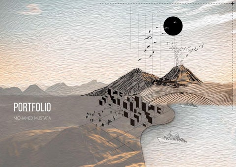
PORTFOLIO
MOHAMED MUSTAFA
My Contacts
•Email: arch.m.mustafa@gmail. com
• Phone Italy : +393245619236
•
• Address : Italy , Piacenza , Viale Dante Alighieri , 121 , 29122
About me
•I’m a 30 years old architect with a master’s degree in Landscape Design and Sustainable Architecture from Politecnico Di Milano Afterathree-yearsperiodofworkinginSudan,Idecided to contine my career abroad to enrich me , both professionally and personally
•I’m an active person with the ability to adapt myself to different tasks and works , as a team or individually I consider myself responsible , creative quite attentive to details and really passionate about art graphics and design . I’m always loooking for cues and ideas to enrich my cultural heritage . I have an open mind with a passion for travelling and reading
01 02
Education
• July-1999 started studying at Khartoum International Primary school Sudan.
• Auguest-2007 started studying at Al Shikh Mustafa Al Amin high school , Sudan
• September-2010 started studying at University of Khartoum Faculty of Architecture , Sudan
• October-2015 graduated from Architecture school with houner
• September-2018 Started my M.Sc in Sustainable Architecture and Landscape Design at Politecnico Di Milano Italy
Lauguages
• Arabic : ( mothertongue )
• English : (fluent-B2)
• Italian : (good-A2)
Software
• Autocad
• 3D studio max
• Revit
• Ecotect
• Photoshop
• Lightroom
• Indesign
• Illustrator
Work Experiences
• January-2016 started working as a teachin assistant at University of Khartoum Sudan.
• Auguest-2007 started studying at Al Shikh Mustafa Al Amin high school , Sudan .
• September-2010 started studying at University of Khartoum Faculty of Architecture Sudan .
• October-2015 graduated from Architecture school with houner
• September-2018 Started my M.Sc in Sustainable Architecture and Landscape Design at Politecnico Di Milano , Italy .
Personal Skills & Interests
• Hard working / focused / committed / energetic / positive / creative / communicative / reponsible / available to travel / team work
• Design / graphic / music / litteraure / photography
• Premiere
• Aftereffect
• Sketchup
• Archicad
• Rhinocerus
• Lumion
• Qgis
• Agisoft metashape
03 04
RESUME LIFE EXPERIENCE
05 06
CONTENTS ACADEMICAND WORK EXPERIENCE
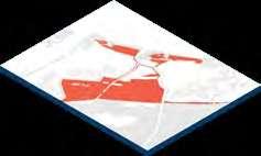
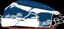
SUSTAINABLEARCHITECTUREAND LANDSCAPEDESIGN (Ravenna-Italy)
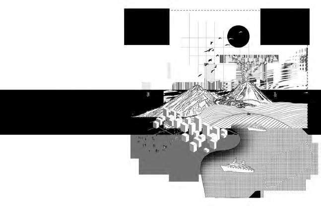
INTRODUCTION
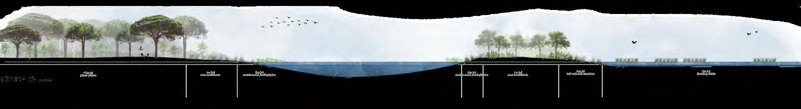
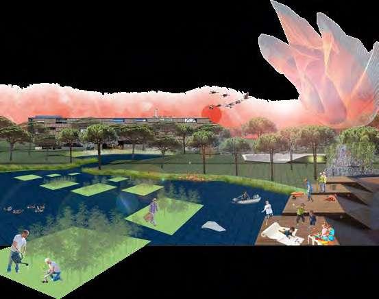
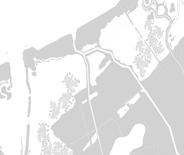
The site along the coastal planes of Ravenna, where we are proposing our intervention for 2100, has undergone drastic changes, over the many years, both natural, and recently anthropological.
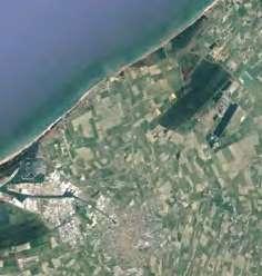
The site was interesting for its fragility and its dynamic interaction between the terra firma and shifting dunes. The pineta, planted during the roman Era as a natural barrier from the wind to protect the agricultural plains, stretched throughout the east coast, forming a stable landscape.
We started our design approach, by analysing and categorizing the risks faced by this land, and adopting strategies to counter it. Hence the design is a proposal to adopt to a resilient coastal landscape and adapt to climate change, sea level rise, and hypothetical anthropological actions.
It is an exercise in understanding the many habitats of the region its coexistence, and relation to water, in order to understand the ideal design approach in a future scenario.

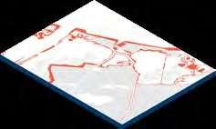
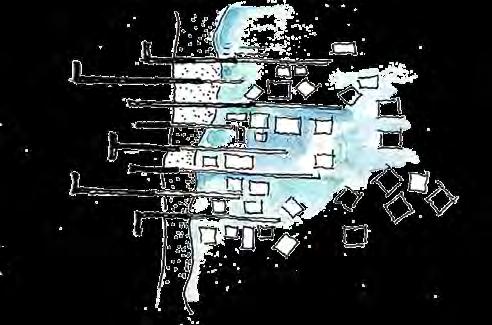
RISKS STRATEGY
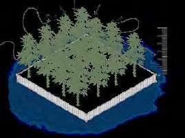
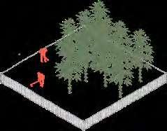
Erosion and saline intrusion
Pine forest as a fragile ecosystem
Natural barrier
Water breaker for new habitat (sea weed cultivation) placed on them
Risk of losing the existing agricultural fields due the to water intrusion and land subsidence
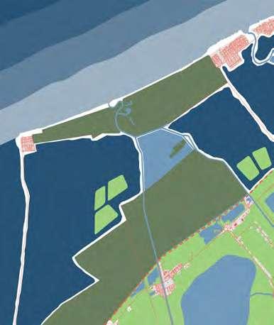
Pine forest extension
The existing pines will be protected and there will be new plantations
Floating fields a new economy will be dictated by the hemp
The area between the road and the railway will be a vacant green space
Threshold Leisure park as an edge between wetland/pine forest and stable land
The existing low land will cause water clogging
Reservoir Treatment and distribution of fresh water
07 08
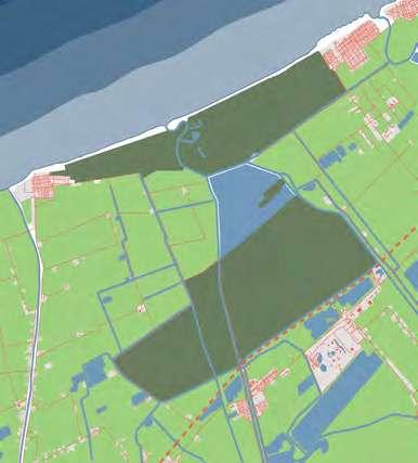
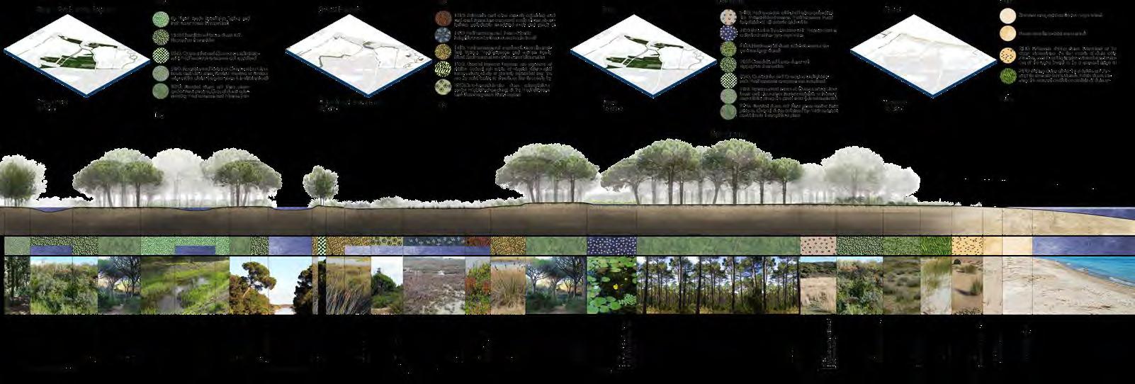
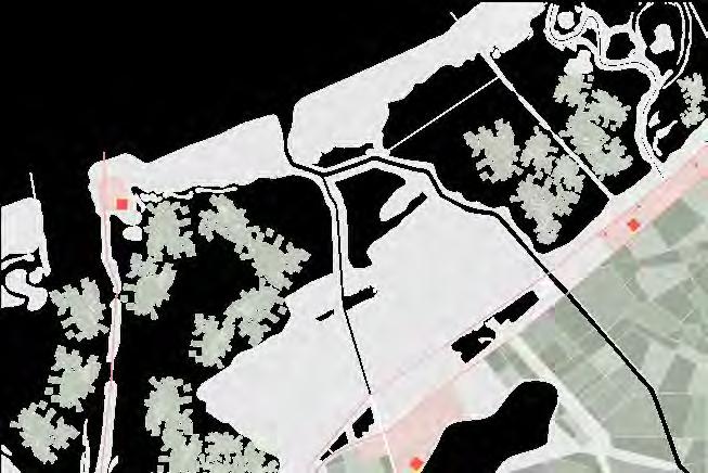
LANDSCAPE
CURRENT SCENARIO
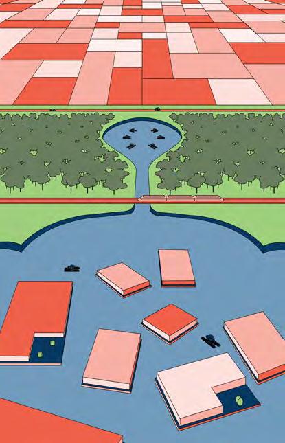
2100 SCENARIO RAVENNA 2100
DESIGN
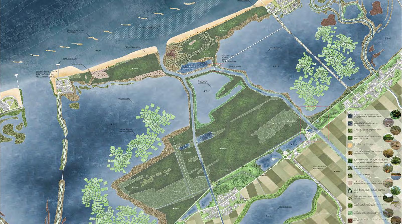
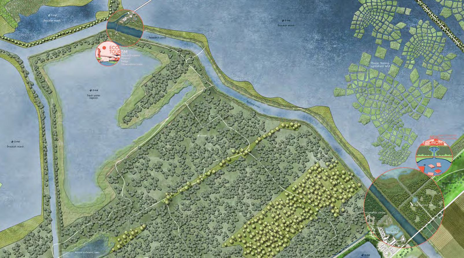
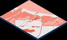
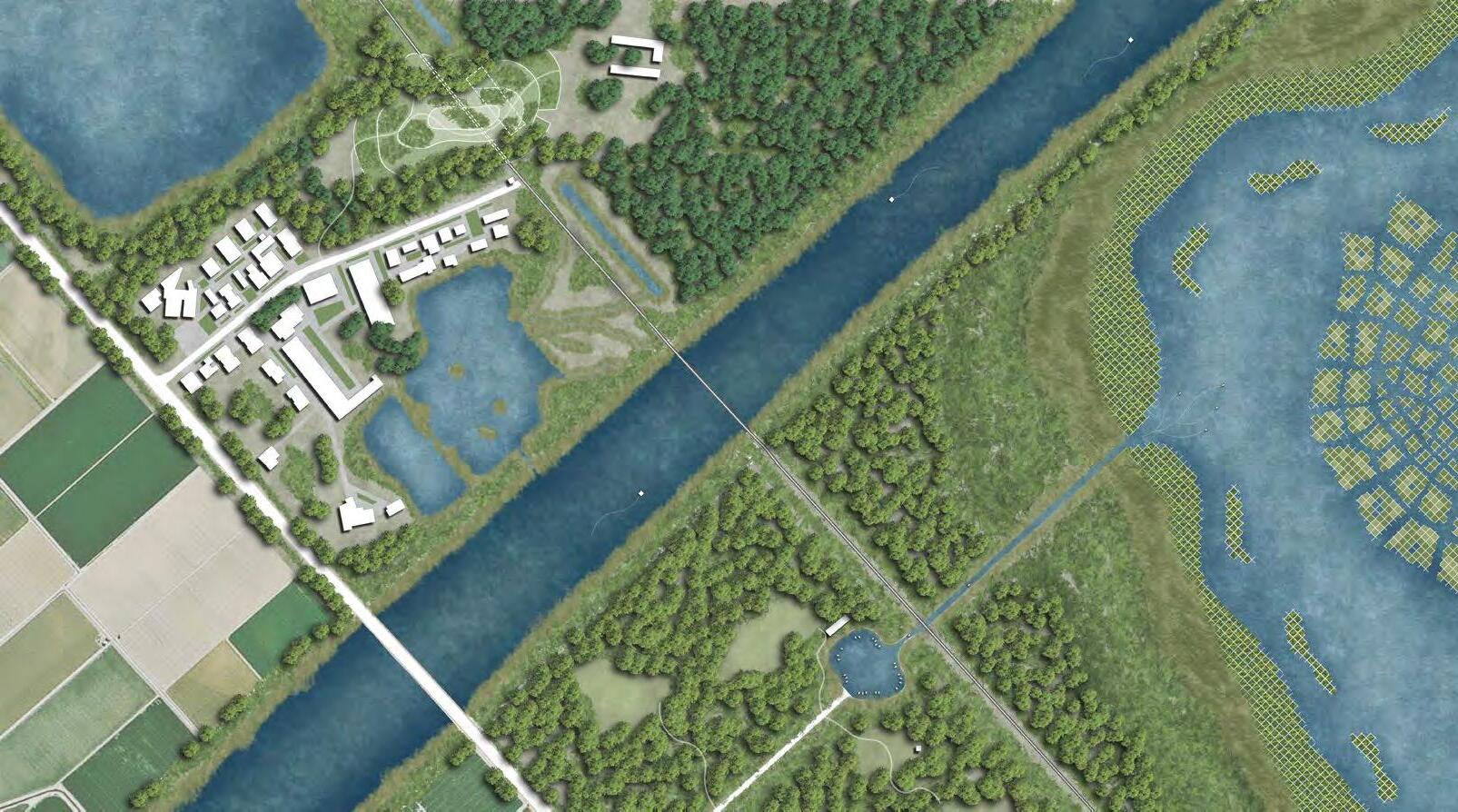
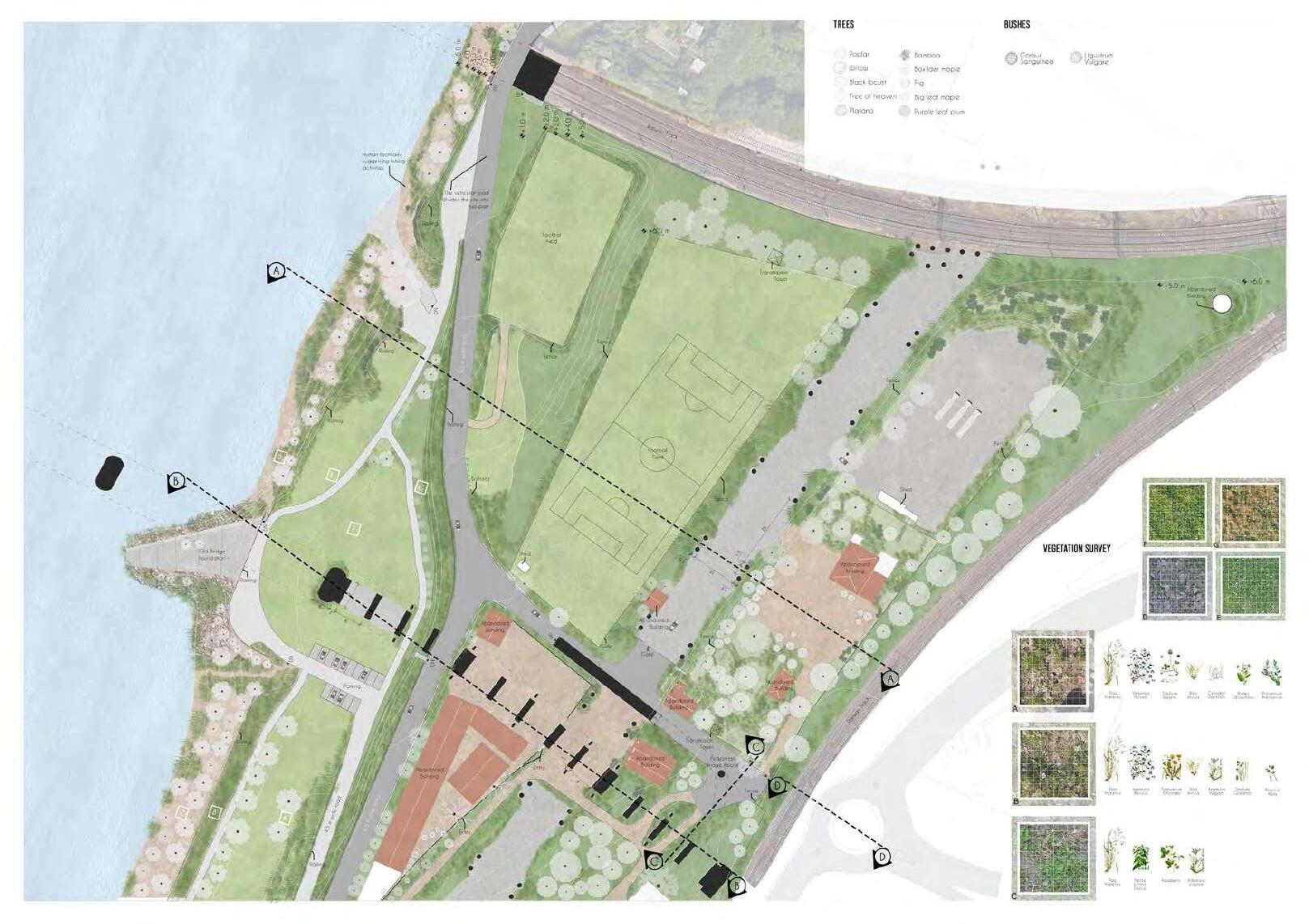
09 10 MASTER PLAN 1:1000O MASTER PLAN 1:500O Urban Fabrics bUFFer agric ltUral landscape pine Forest tidal Habitat types o Water Fresh Brackish Saline Roads Waterways Railway Trails proposed Mobility existing Mobility Roads Railway Trails Tracks Urban Fabrics -Pedestrian friendly streetsParking lots into green spaces
so Mobility Water transit
-Mainly categorized by walkways, bridges, elevated walkways, resting nets, observation cabins and watch towers.
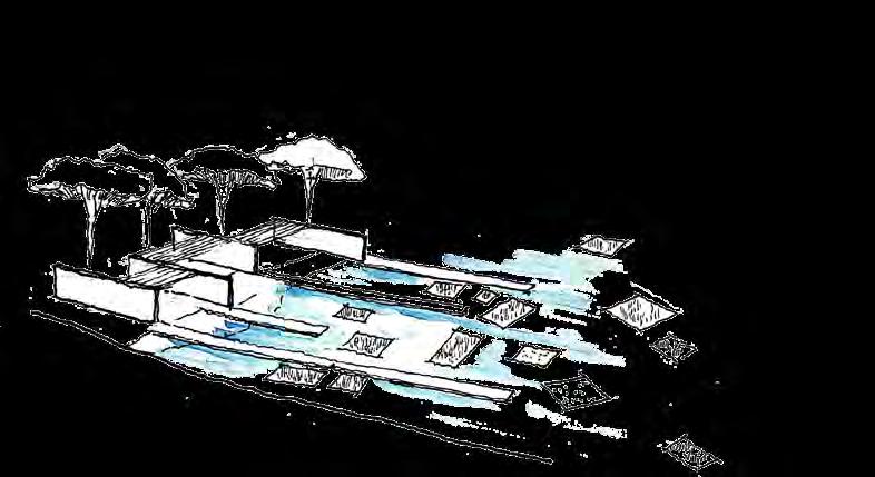
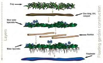
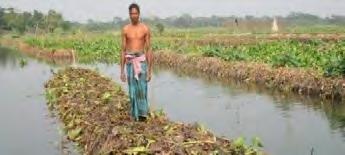
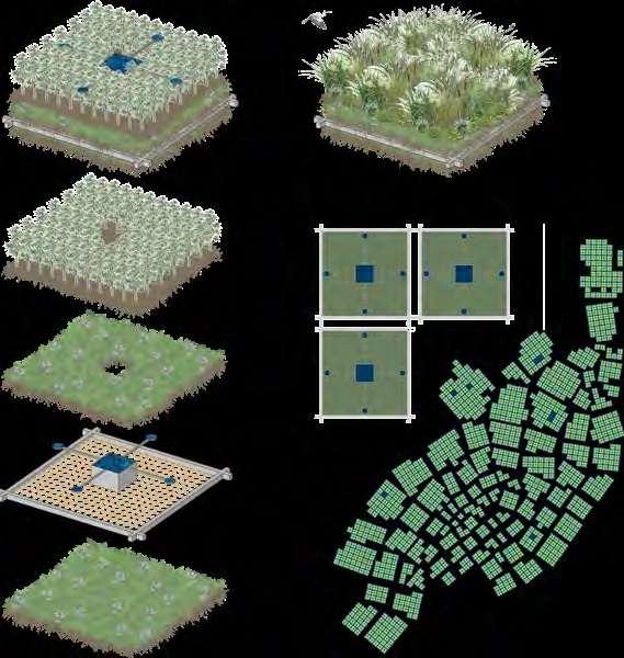
We suggest cultivating industrial Hemp The floating fields are a natural system, using locally available products, and technology to tap atmospheric humidity. The congregation of this will form a mosaic in the inundated landscape of Ravenna.
SKETCHES
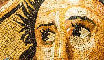
MOSAIC RAVENNA
Ravenna is most famous for its mosaics. During the 5th-century, the city became the centre of late Roman Christian art, and following its absorption into the Byzantine Empire in 540, it hosted a renaissance of Biblical Byzantine mosaics during the second half of the 6th century. This renaissance included the later mosaics in the Basilica of San Vitale and Basilica of Sant’Apollinare Nuovo. The mosaics of Emperor Justinian and Empress Theodora in the Church of San Vitale, for instance, were created just after the Byzantine conquest. The mosaics of the Basilica of Sant’Apollinare in Classe were executed about 549. The final series of Byzantine mosaic art in Ravenna was ordered by Bishop Reparatus in Sant’Apollinare in Classe during the 670s. Other important surviving mosaics include: Christ as the Good Shepherd (450) (Mausoleum of Galla Placidia); the Baptism of Christ (6th century) (Arian Baptistery); Christ Before Pontius Pilate (550) and the Transfiguration of Christ (550) (both in Sant’Apollinare Nuovo, Classe).
(http://www.visual-arts-cork.com/history-of-art/ravenna-mosaics.htm
11 12
LOAT g EL Ag icuLTuRAL hub hEMP cuLTivAT ON
1 - NEW ECONOMY
PROFiLE
SEcT ONS
FLOATING
DETAIL STAGES


SECTION 3-3


13 14
CIRCULAR ECONOMY & PRODUCTION Paper Industrial Hemp Production Compost Fiber Hemp-Crete BioPlastic
Bio-Plastic Production & Compost Center Hemp-crete Production Storage&Retting Textile & Paper Production Floating Fields FloatingFields
Cluster Formation
ture
of Water Hyacinth
bedto planting seeds
plants Module of the field Sawing Harvesting CIRCULAR ECONOMY & PRODUCTION Epidermis BastFibers Herds HollowSpace Transport Growing CO 0.0 m 2.0m
AGRICULTURE/HABITAT
OF HEMP PRODUCTION Layer of Water Hyacinth on flood water
Struc
made from local wood Layer
Reusing organic waste as compost
Water collection through condensation from humidity and distributed to
floating habitat
Tidal plants onbed tocreate
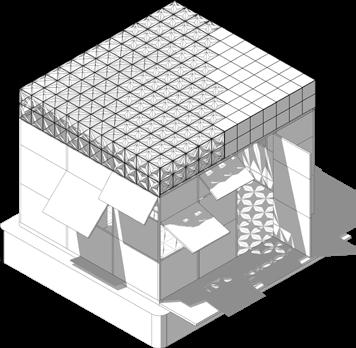
FOCUS AREA 01 (1:2000) - NEW ECONOMY Storage
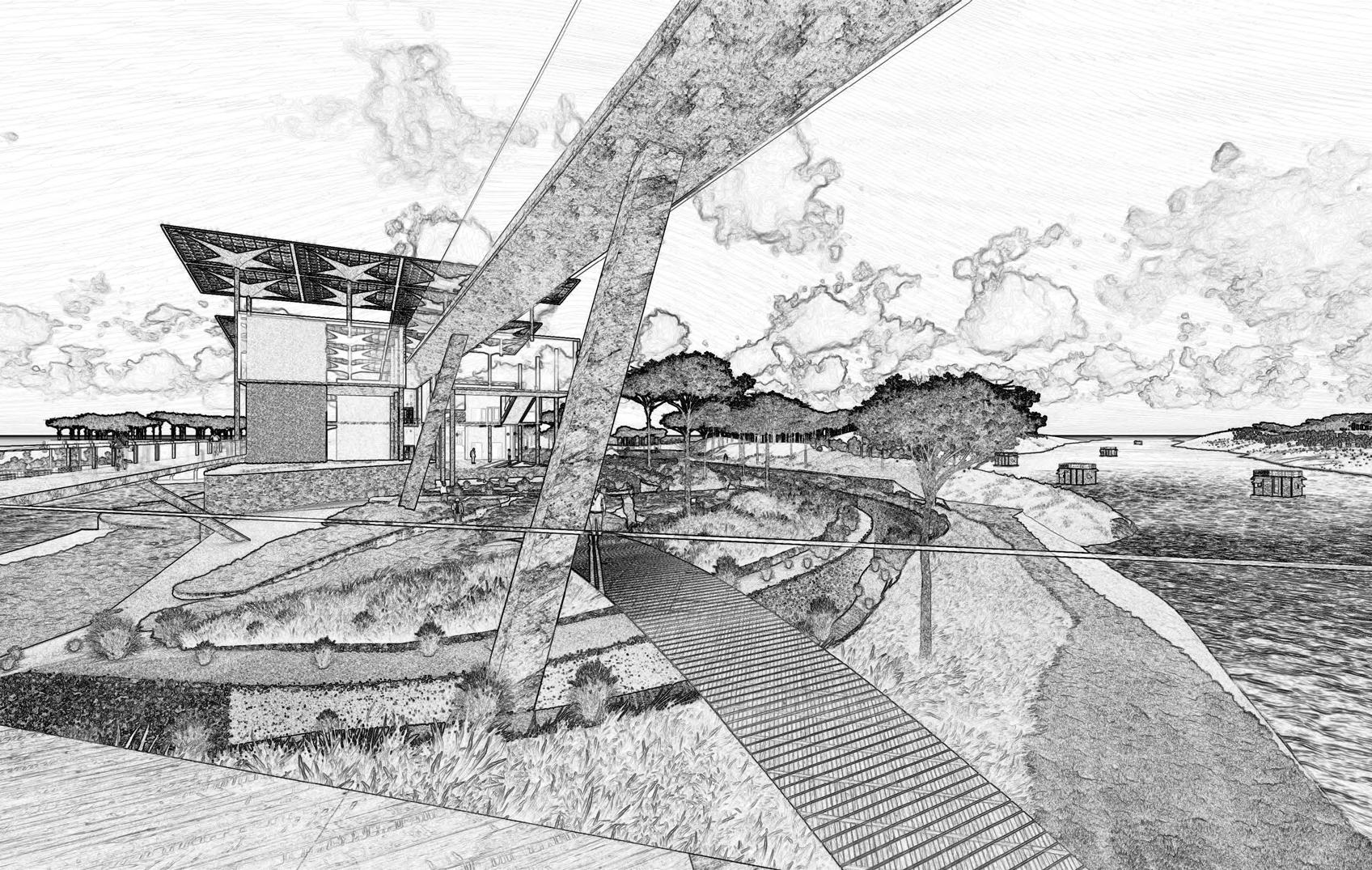
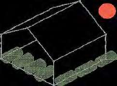
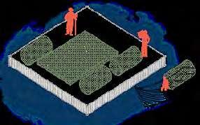
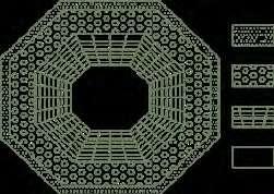
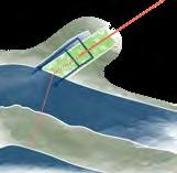
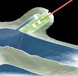
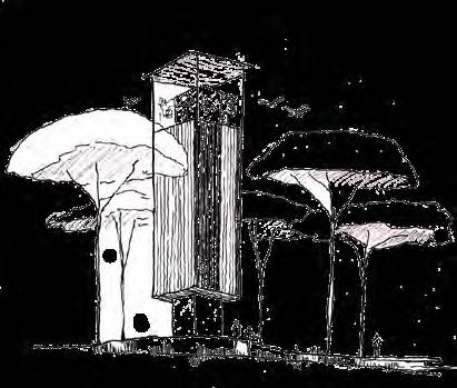
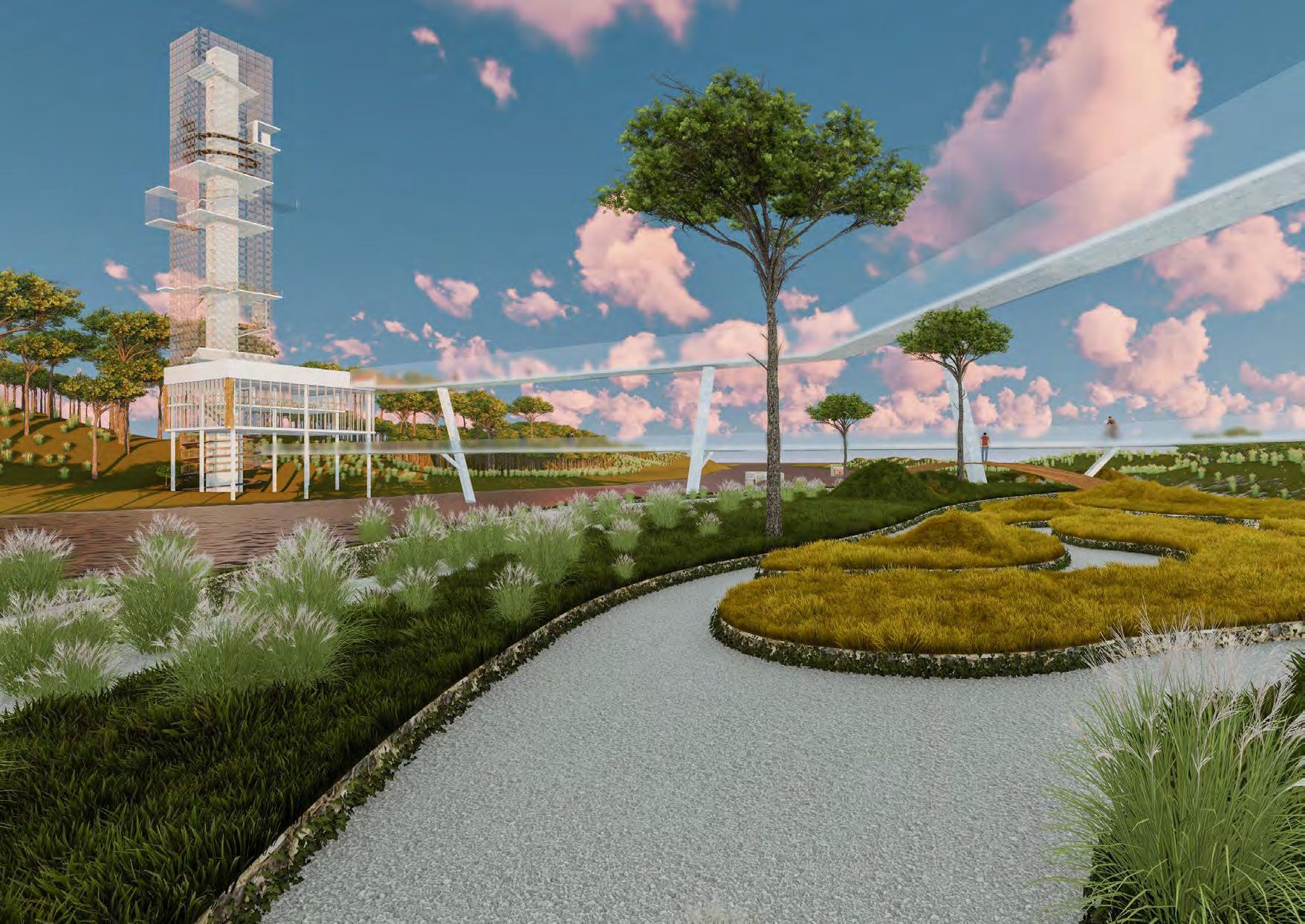
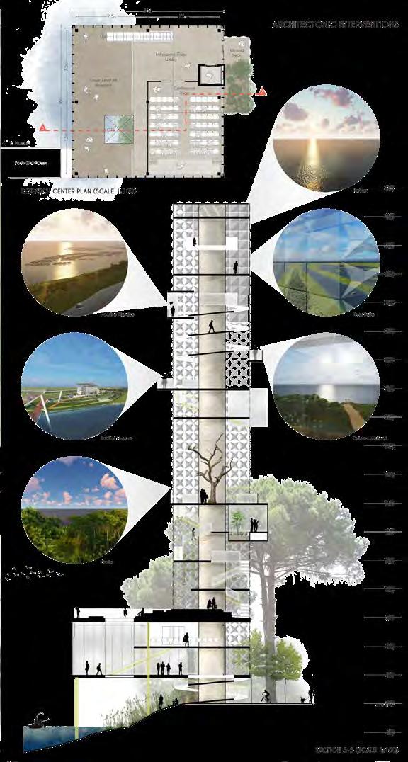
In the project we are proposing a Watchtower which would be a landmark. visible from long distances and give the visitors panoramic view of the landscape. Our idea to shape the tower comes from the historical tower of Ravenna, from which we keep the square base and the dimensional relations.

SKETCHES
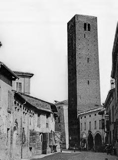
TORRE CIVICA, RAVENNA
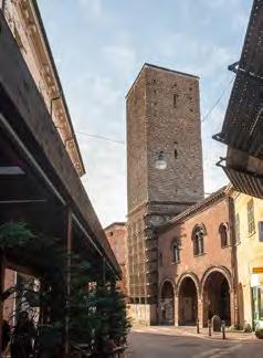
At the beginning of the XI century the ruling class of Ravenna began to raise numerous noble towers as a symbol of power and social prestige. One of them was Torre Civica (Municipal Tower), built in the 12th century and originally called “dei beccai” (of butchers), due to the butchers’ shops that used to stand along the bridge Ponte Marino which crossed River Padenna, the main channel flowing within the medieval walls of Ravenna.
At the end of the 13th century, all noble towers and fortilices were demolished by order of the papal rector, who wanted to establish his power over the city. Torre Civica was the only tower escaping demolition because it had previously become the property of the city. The 39-metre tower was used for centuries as a watchtower and occupied by a guard who would ring a bell in case of alarm, fire or flooding, or for the summoning of the town council. In 2000, the top of Torre Civica was removed in order to prevent the possible collapse of the structure, which is subject to a slow underground landslide and consequently to a gradual inclination, caused by its proximity to the ancient river Padenna.
(http://www.turismo.ra.it/ita/Scopri-il-territorio/Arte-e-cultura/Castelli_-torri_-campanili/La-Torre-Civica)
15 16
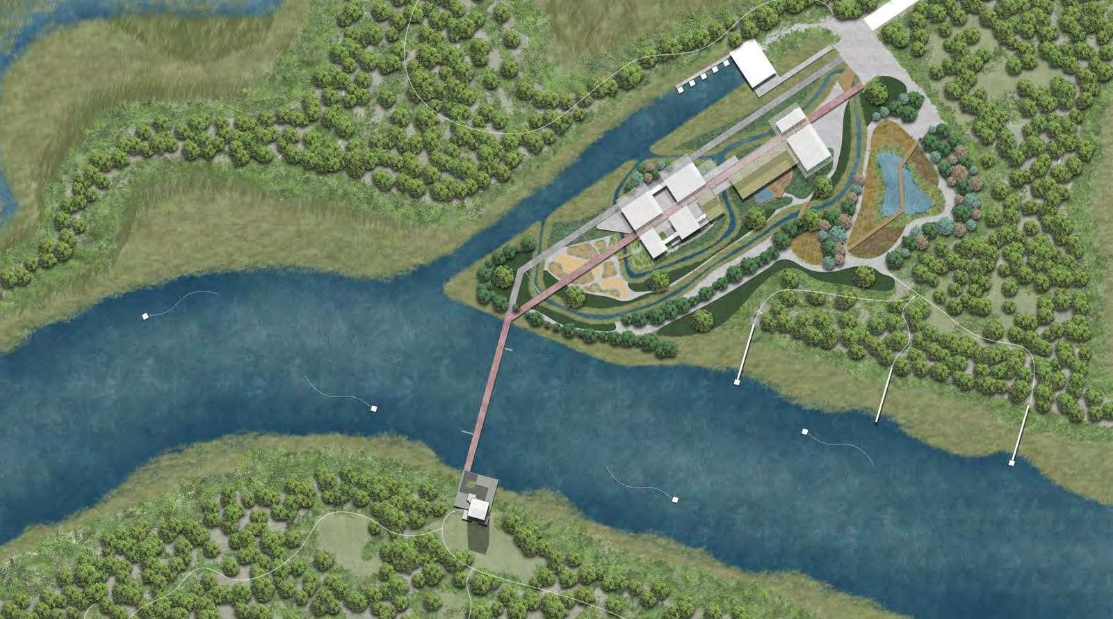
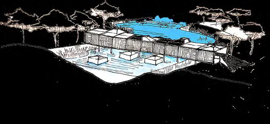
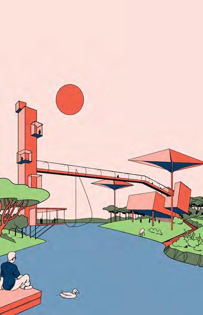
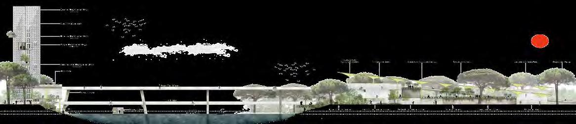
2 - ECO TOURISM RESEARch cENTER MuSEuM bRidg O SERvAT ON TOwER
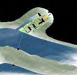
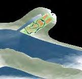
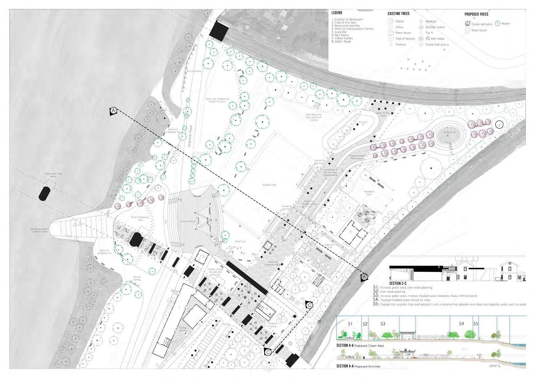
Existing Mus uM Buildings d fining Axis tid ntE ction DESIGN PROCESS HABit distri ution Arc it ctonic nt Action Key plan Legend 1. Nature Museum 2. Service Centre for Pods 3. Tidal Landscape Exhibition 4. Docking Point for Pods (Old Fishing Dock) 5. Floating Research Pod 6. Parallel Pedestrian Bridges 7. Observation Tower 8. Research Centre 9. Nature Trail to Pineta +3.0 msl +3.0 msl +1.0 msl 4. 2. 1. 3. 3. 5. 4 4 6. 8. 7. 9. +2.0 msl
FOCUS AREA 02 (1:500) - ECO TOURISM
Through this project we understood the manifold relationships in nature, water and land, terra firma and Shifting dunes, How this variations in soil also manifests as the various flora and Fauna, for us to perceive.
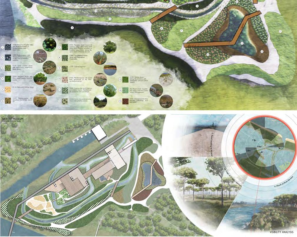
After understanding this concept we tried to take a wholistic approach, in order to create a stable ecosystem, with a possibility to extend beyond
As a hypothetic approach we relied on predicted technological advancement, in various part of our project from agriculture, transport to architecture. We were also aware of the impact on Social, Cultural and Economical situations of the era. We tried to culturally inform our design by drawing parallels between the floating fields proposed, and the mosaics of Ravenna. The architectural interventions were also informed in terms of proportions from the heritage buildings of Ravenna.
17 FOCUS AREA 02 (1:500) - ECO TOURISM SECTION 4-4
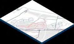
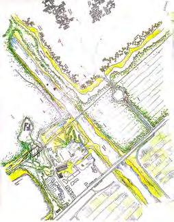
URBAN & LANDSCAPE REGENERATION STUDIO (Piacenza-Italy)

INTRODUCTION
LA VITA TRA I PONTI ( LIFE BETWEEN BRIDGES )
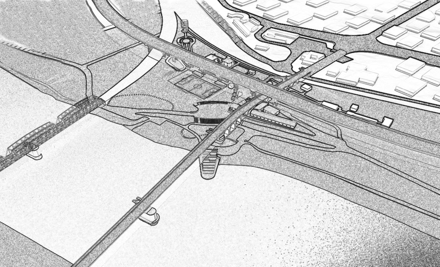
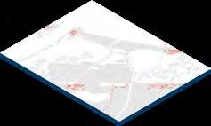
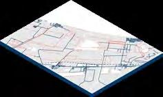
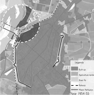
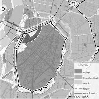
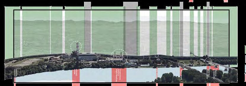
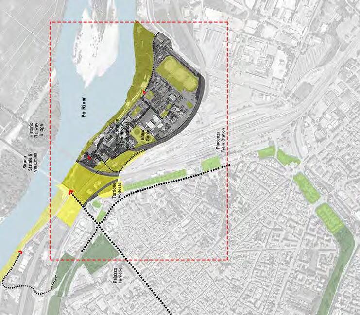
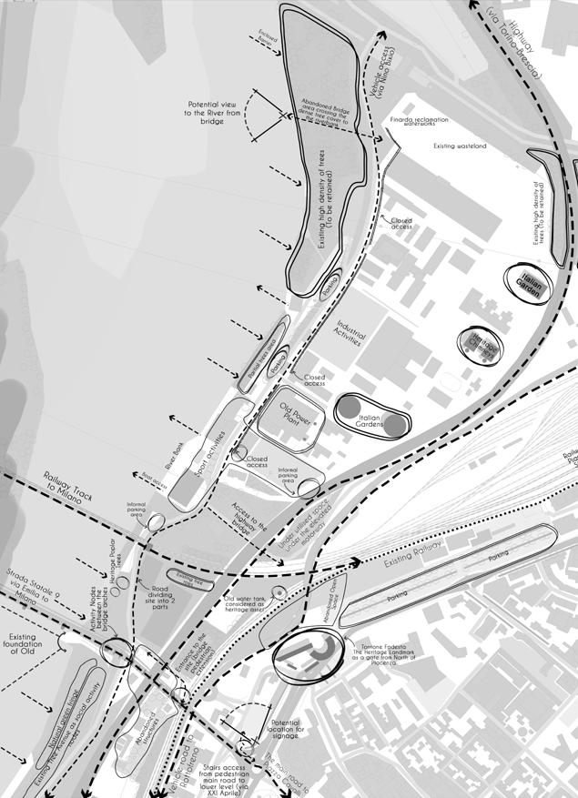
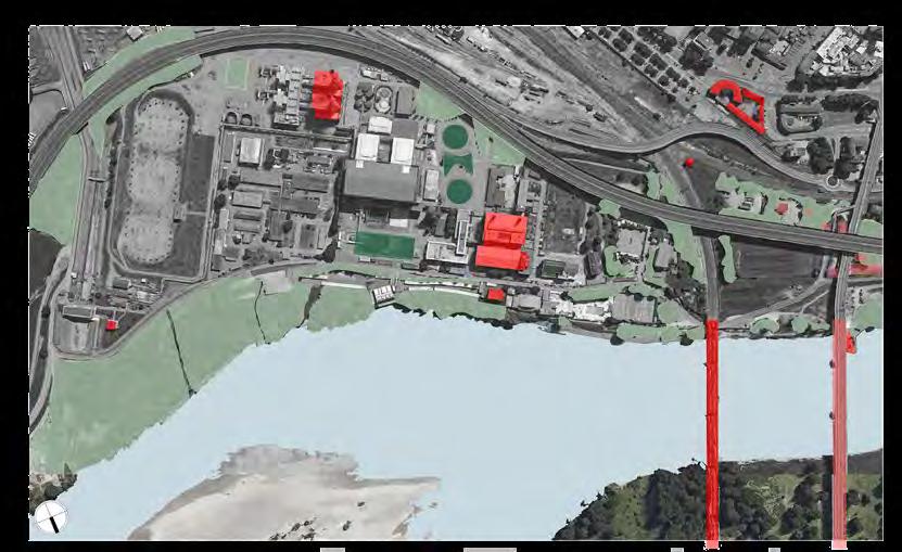
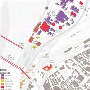
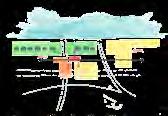
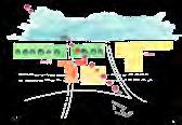
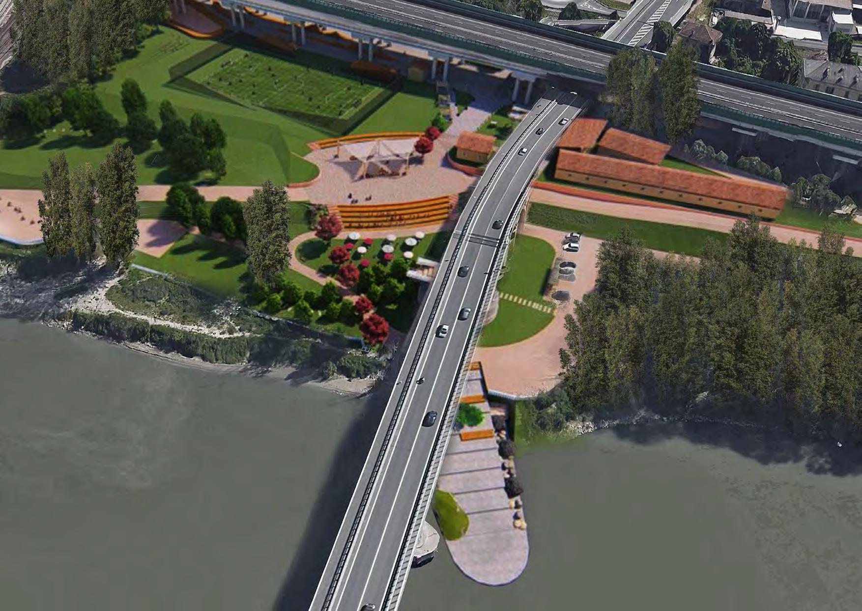
The urban regeneration project is based along the riverfront in the North of the city of Piacenza. The site has a strong significance to the city as it is an interface between its urban and natural landscapes. It displays a variety flora and fauna including some rare migratory bird species and traces of different activities-both dismissed and ongoing in its natural, semi-open and built systems. The area characterized by a diversity of urban elements and situations houses sport facilities, abandoned structures, a heritage power plant, a working power plant, an industrial heritage complex (the Finarda reclamation waterworks), canal and lock with the old jetties, a water tank etc. The site sequentially reveals its changing character manifested through architecture and nature existing in different layers of time as one moves along the via Nino Bixio which anchors all the different activities along its length. The relation between the existing movement corridors and river varying through presence of built elements like paths, arcades, pillars, bridges, buildings etc. instigates different interactions with the nature and river. Thus there is a huge potential to regenerate it as a link that connects the people to nature especially the Po river which is the most important natural heritage element.
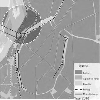
GROWTH PATTERNS
The growth of the city and its economic development has affected the Po riverfront and what were historically lands for agriculture were eventually reclaimed for industrial use due to their location outside the city walls. However with the further expansion of the city in the past century beyond these limits, the boundary between these historic industrial areas and the new residential areas has blurred creating a need to revitalize them into public spaces.
19 20
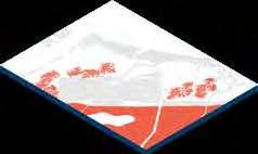
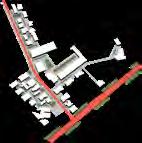
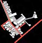
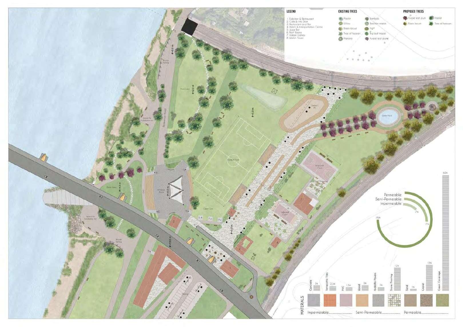
LANDSCAPE AS HERITAGE
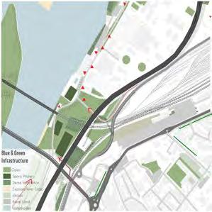
The precinct is rich in heritage both natural and man-made existing in different layers of time. The natural heritage comprises of the River Po and the wild Poplar and willow avenues along the riverfront while the built heritage includes the Historic power plant with its iconic chimneys, the Finarda reclamation waterworks, the railway bridge, the water tank, the foundation of the old bridge and other abandoned structures.
The riverfront is characterized by a rhythm of natural green interspersed with built infrastructure and voids at some places, which allows the glimpses of the architectural heritage veiled in layers of landscape. The density of the green is more towards the edges and reduces between the bridges where it is discontinuous and thin
DESIGN PROSSES
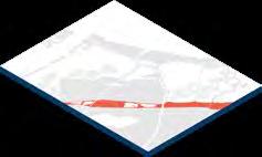
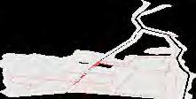
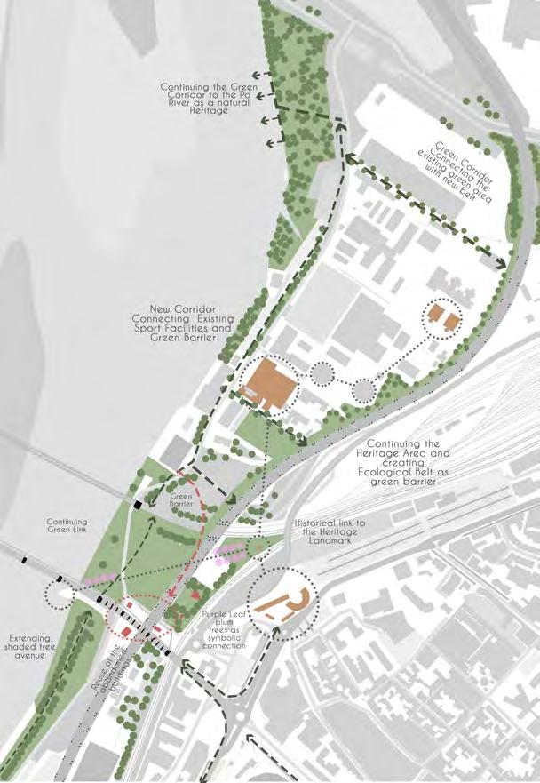
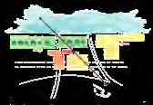
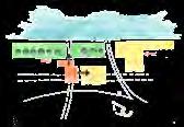
The design connects the site to the system and all the functions within by revitalizing the via nino bixio as a central spine hosting and revealing the diversity of functions and characters sequentially.
This is achieved by opening up new connections between the city and the riverfront and enhancing the functioning of the site through design measures.
Extending the existing poplar avenue along the riverfront
MACRO SITE ANALYSIS
CONCEPTUAL MASTER PLAN - THE IDEA OF MISSING LINK
21 22
Finarda reclamation water works Historic chimneys Old power station ( centrale termoelettrica ) Old water tank Railway bridge Starda statale 9 via Emilia Foundation of old bridge Adap-
buildings
Development
the exist-
plaza cum open air theatre Creation of a soft axis using vegetation connecting important landmarks on site Extending the axis to the opposite river bank as a symbolism of the site Extending
existing sports in-
tive reuse of abandoned
on site to host restaurants
of
ing junction into a public
the
frastructure under the bridge
23 24 EXISTING MASTER PLAN
DESIGN AIM
To regenerate the Po riverfront precinct as a multifunctional and interactive public space that can host diverse activities.
To allow for sequential revelation of the varied characters along the riverfront by redesigning the road along the dyke (via Nino Bixio) as a central spine anchoring diverse activities, open spaces and built environments existing in different layers of time.
To connect the city to its natural heritage and the cultural assets associated with it through improving the existing accessibility as well as opening up new connections.
To regenerate the space between the bridges as the focus of the scheme through adaptive reuse of abandoned structures and re-design of public open spaces, with a special attention to area under the bridges’ arcades and open spaces under motorway.
25
URBAN PROTOTYPE DESIGN (Naples-Italy)
INTRODUCTION
Thesocio-economiclandscapedifferencesbetweentheNorth-SouthofItalyarewell-knownandvisibleinbothstatisticalformsandlifestylesofItaliansandvisitors.Italyremainedan agricultural-basedeconomyforcenturies.Butaftertheindustrialrevolution,theNorthbecomesmoreindustrializedwhiletheSouthernregionsareleftbehind.AccordingtotheEUROSTAT2019 unemploymentrate,bycomparingLombardyandCampaniaregions,thegapisclear,Lombardyrate(3.4–6.6%)whileinCampania(13.4%).

ECO Verde del Sud (The south green economy)
• Geography played a big part in forming Italy’s economic and cultural character since the landscape played a big part in creating a different climate and separate some areas from each other. This diversity helped the economy and culture of Italy to be more diverse on many levels ( Agriculture, food, art, architecture, and fashion) and the unique location facing different seas helped the ports of Italy to deliver theirproductstotherestoftheworld.
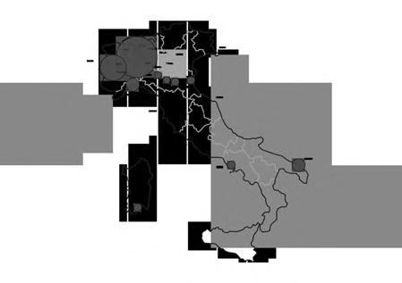
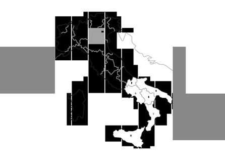
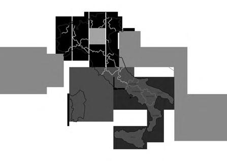
• From the map, we notice that most of the southern regions of Italy are among the lost GDP categories 15.000 - 19.999 thousand euros ) while if we took a look at the more economically active northern regions we notice that numbers go over the double of the previous numbers.
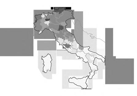
• Italy’s unemployment rate is 9.9% in 2019 which is the third-worst in the EU. At the regional level numbers are more interesting when you see that rate of the northern region from 3.6% (Trentino-SouthTyrol) -6% (Tuscany)meanwhile the southern regions, the rates from 8.1% (Lazio)18.9%(Sicily).
• Duetothelackofjobopportunities in the laber market and economic issues and also the immigrant’s dilemma. also mentioning the smaller income coming from agricultural activities in the south and the more income coming from working in other sectors of the economy services and industry-related activities in the north.
27 28
1.0 SOCIO-ECONOMIC LANDSCAPE OF ITALY
1.1 OBSERVING ITALY LANDSCAPE
1.2 GROSS DOMESTIC PRODUCT(GDP)
1 3 UNEMPLOYMENT RATE BY REGIONS
1.4 EEMPLOYMENT RATE BY SECTOR
2.0 THE SOUTH PROBLEMS AND OPPORTUNITIES
2.1 AGRI-FOOD SECTOR
• Italy’s Southern Regions strongly contribute to agri-food competitiveness with a robust industrial structure revolving around 34 specialised agri-food districts, smartly combining both innovations, andensuringhigh-qualitystandards.
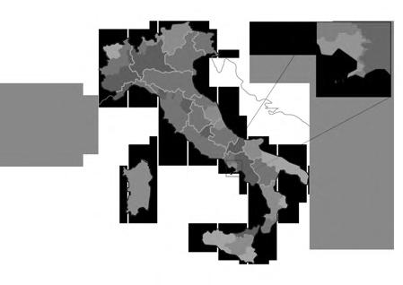
2 3 AGRICULTURE CROPS
• We represent the top three crops in some regions in Italy The most common through all the regions are Wheat Alfalfa Soybeans Graps Fruit andRapessed).
1-Sardinia(Wheat,Grass,Alfalfa)
2-Sicily(Wheat,Alfalfa,OtherCereals)
3-Calabria (Soybeans Alfalfa Wheat)
3-Campania(Wheat Fruit Maize)
2 5 EEUROPEAN TRANSPORT NETWORK
• One of the important projects is the Railway axis(Berlin–Verona/Milan–Bologna–Naples–Messina–Palermo)which is a mixture ofupgrades of existing track and new sections that will increase speeds and capacity along the route Berlin to the Messina Straits where a new road/rail bridge will connectSicilytotheItalianmainland.
2.2 AVERAGE SOIL PRODUCTIVITY
• The map showing average soil productivity of cropland across the Italian regions we can see that many of the southern regions having from average to very good productivity soils which lead us to have a working frame of our project which we decided to focus on agriculture and innovation inthesouthofItaly.
2.4 INDUSTRY FOOD PROCESSING

• Food-processing industry in Italy continues to be highly fragmented, characterized by a growing of smaller companies. Progress in food technology, marketing innovations, “Made in Italy” products, and exports of finished food products have all contributed to Italy’s increasing demand for food ingredients. Italian consumers.
2.6 TARGETED CITIES
• The Port of Naples is located 15 kilometers form the Naples airport with 4 terminals Container terminal has a storage capacity of 1,336,00 m2 and 11.5 km of docks .Comercial section has 4 terminal with 75,000 m2 storage area Automobile terminal with a land area of 120,000 m2. Passenger terminal with a capacity of annual capacity around 1.5 million passengers.
PROPOSED STRATEGY FOR THE SOUTH OF ITALY
1 STRATEGY
• The main goal of this project is to have an impact on the growth of the economy and healthy life for the people, by using Urban and Landscape planning as a tool for this target.
• Theactionswhichhavebeentaken to realize these goals are 'Organic Agriculture' focuses on rural areas and 'Urban Food Hub Market' with a focus on Urban areas-Ports, taking into consideration social, economic, and environmental aspects. Open foodandagriculturetradewithinand across countries can reinforce the positive two-way linkages between growth and employment on the one hand, and food security and nutrition ontheother.
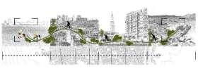
• Our strategy starting from the rural area to the city port through the suburban and the city center through agreencorridor.Theruralareaasan organic agricultural spot and by creating an ecological corridor through the city providing sustainable transportation reaching a sustainable andgreencityport.
29 30
2 N
Ecological Corridor Bike line, green corridor Green intervention Historical Part of the City Redevelopment of the Port Hub Market, Landscape and Integration
APLES CITY CONCEPT
CITY STRATEGY
• To define our strategy in the city map we are showing the proposed area for the agricultural part of our project located in the rural area of Qurto municipality in the northwestern part of the metropolitan area of Naples.
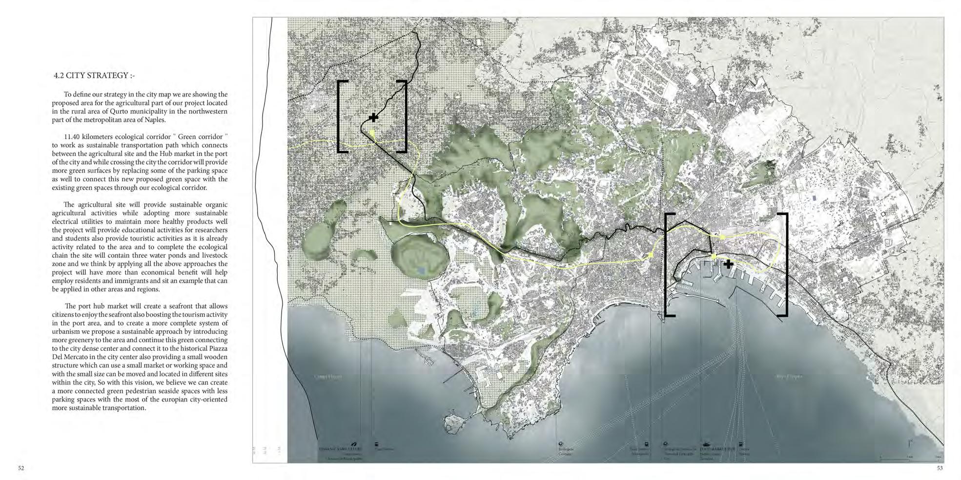
• 11.40 kilometers ecological corridor Green corridor to work as sustainable transportation path which connects between the agricultural site and the Hub market in the port of the city and while crossing the city the corridor will provide more green surfaces by replacing some of the parking space as well to connect this new proposed green space with the existing green spaces through our ecological corridor.
AGRICULTURE LAND DIVISION
• Roman land division and assignation goes back to the 4th century BC, starting with the expansion of Roman power during the Latin and Samnite wars, and saw another heyday during thecivil wars of the late republic when a great numberofveteransrequired land.
• Land division is a case of deliberate shaping of the ruralarea,whichwasin effect initiated by the Roman government. At a closer look it becomes clear that this shaping was also designed to control and optimize soil moisture. This control, and thereby agricultural usability of, the rural area of Roman settlements was taken into account deliberately from the very foundation of these communities.
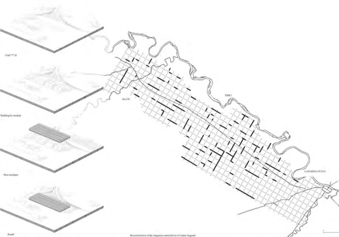
• Thecenturiatioisthesystem of division and allocation of the territories most exploited by theRomans.
• Main measurement units used by the Roman surveyors are the following: Jugerum 71X35m, Actus 35x35m, Heredium4actus.
31 32
PROPOSED STRATEGY AGRICULTURE STRATEGY CONCEPT
Combining both the natural curve and the vertical circulation axes we can make the unit a cross circulation area where the walkway crosses the site which is oriented to the pedestrian and the vertical axes more dedicated to the vehicles andtomakethecirculationmore practical the northern unit is more connected to the north street and the south unit more attached to the southern street so in this case, the dominate axes will be the walkway without crossingtheverticalaxes.
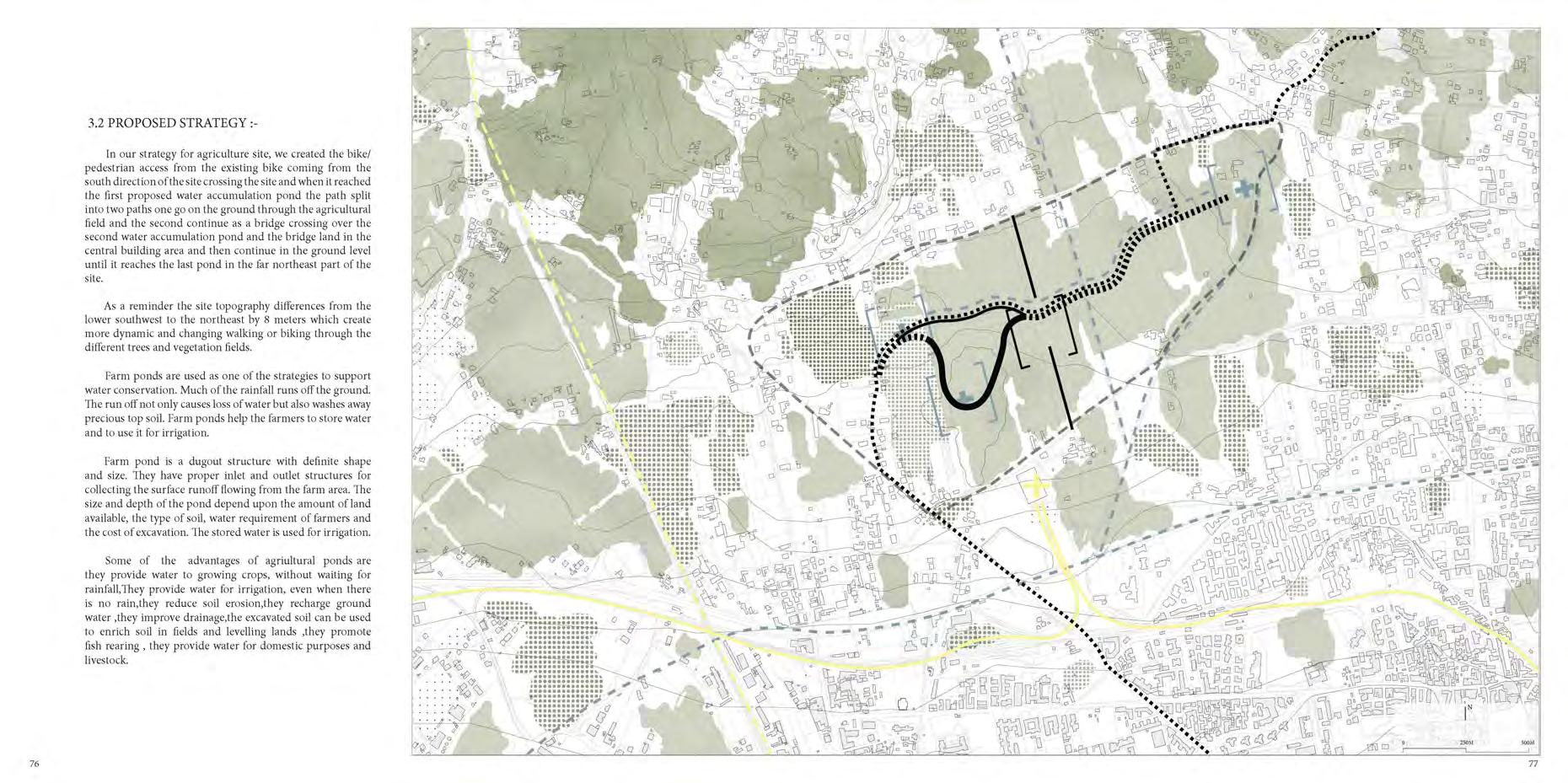
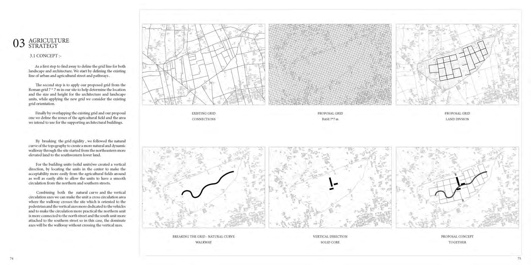
33 34 Inourstrategyforagriculture
3D EXPLODED PLANS AGRICULTURE MASTER PLAN
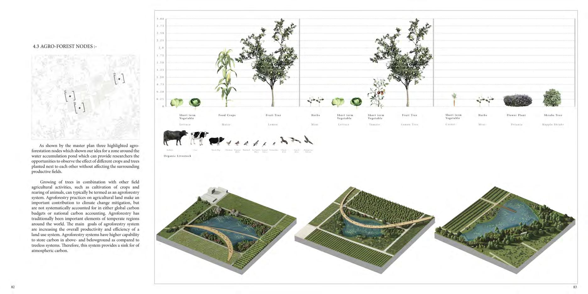
The Master plan representing the whole system of the agricultural site showing the crops and trees and protecting the building's core center in the middleofthesite.


Andthesiteissurroundingby existing and Maples trees to create a green built to protect the crops from the high wind as well as According to the World Agroforestry Center: “Agroforestry is a dynamic, ecologically based, natural resources management system that, through the integration of trees in farmland and rangeland, diversifies and sustain production for increased social, economic and environmental benefits for land users at all levels.”A tree grows tall and deep, spreading both its branches above the ground and its roots underground, therefore it makes the ground fresher and softer for other plants to settle. The roots increase the soil drainage and aeration, some trees can even fix nitrogen and enrich the soil. The leaves and branches of the tree shadow the ground and reduce the soil evapotranspiration and thus reduce the need for irrigation. A tree is the home of various living beings such as insects, birds and plants. A tree is also great for farmers. It can be a source of food and medicine for home, and a source of fodder for the livestock.
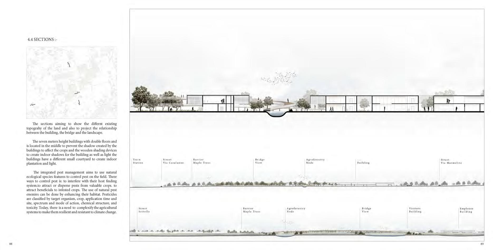
• The architecture general distribution of the functions is divided into three units the longer and bigger unit used as a production unit and the other two units one dedicated to the staff and the last one closer to the southern border of the site is used byvisitorsandresearchers.
35 36
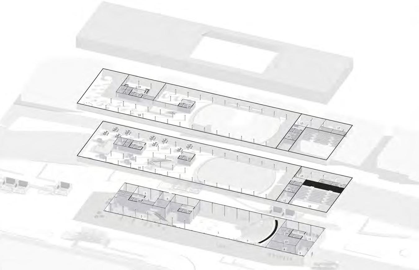
1-Museum 2-Reception 3-Kitchen 4-Restaurant 5-Clinic 6-Offices 7-Staffrestroom 8-Maintanceunit 9-Offices 10- Cleaning&processunit 11- Collectingunit 12- Packingunit 13- Storage 14- Loadingarea 15- Loadingoffice 16- Lectureroom 17- Office 18- Restaurant&bar 19- Meetingroom 20- Manageroffice 21- Daycare 22- Staffrooms 23- Productionline 24- Loadingarea
37 38
AGRO-FORST NODE
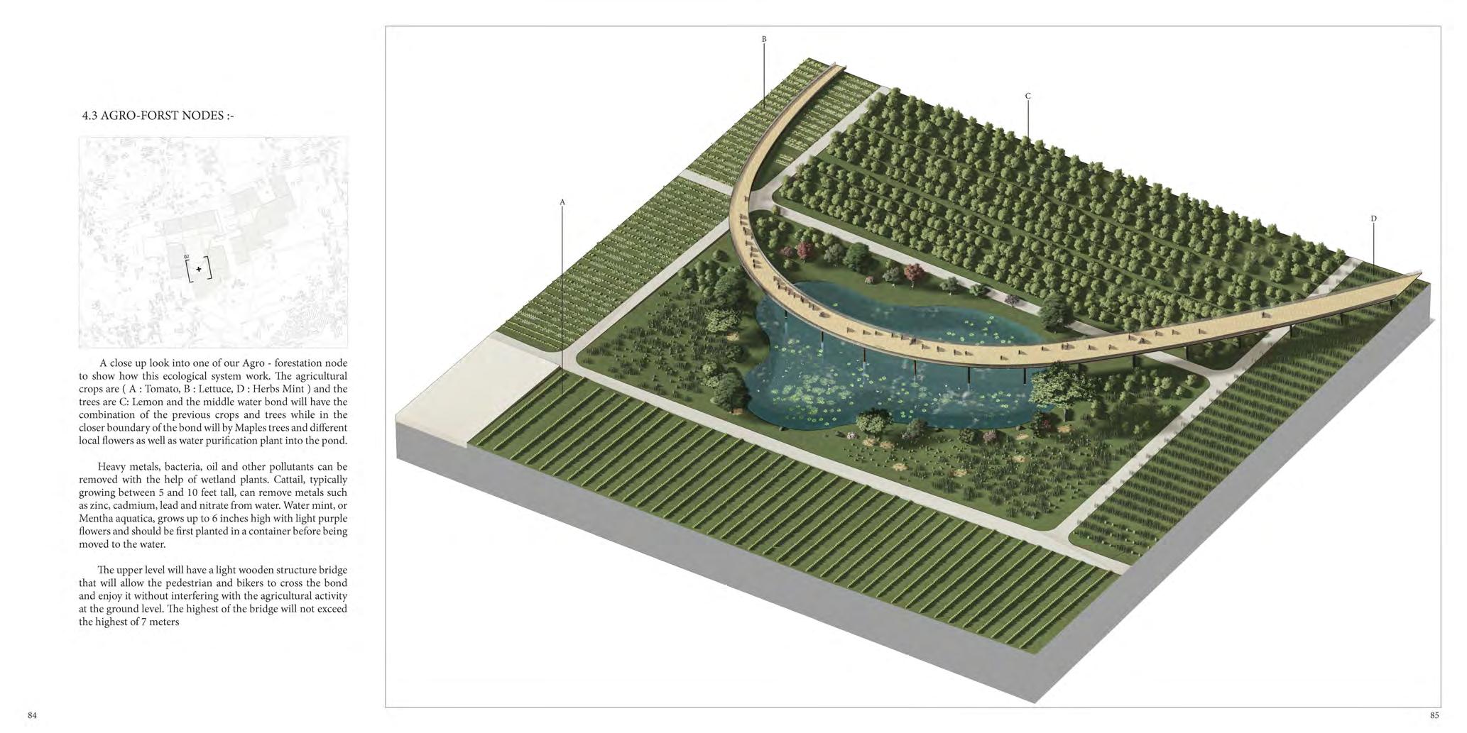
• A close up look into one of our Agroforestation node to show how this ecological system work. The agricultural crops are ( A Tomato, B Lettuce, D Herbs Mint ) and the trees are C: Lemon and the middle water bond will have the combination of the previous crops and trees while in the closer boundary of the bond will by Maples trees and different local flowers as well as water purification plant intothepond.
39 40
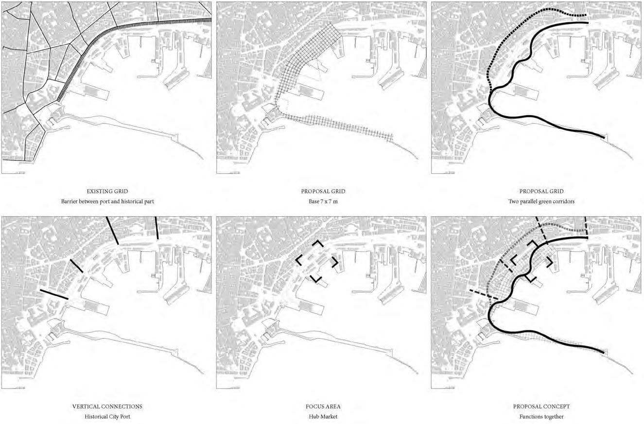
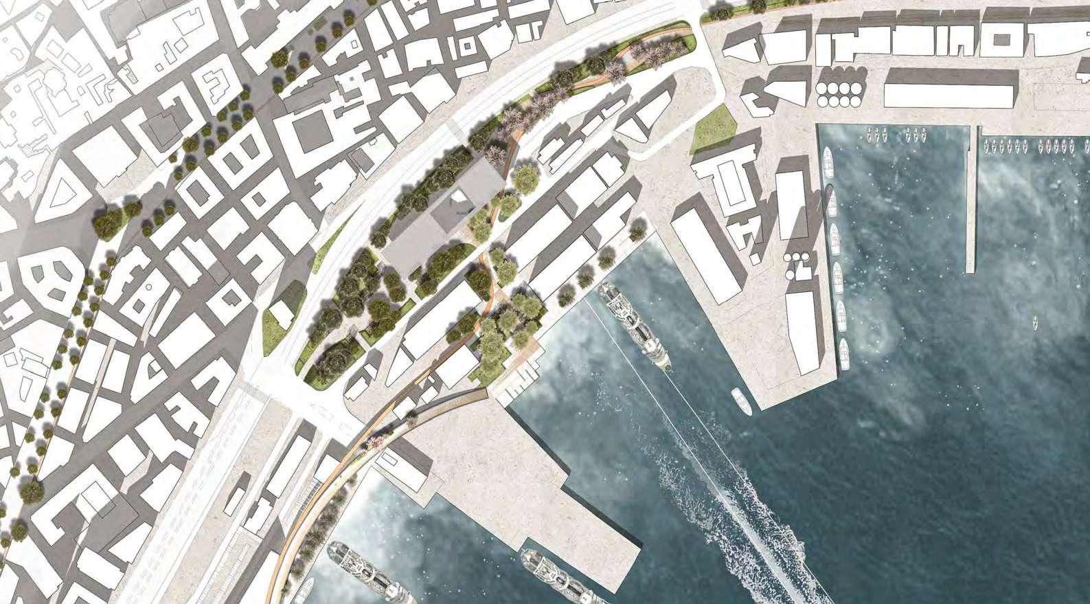
• In the first diagram, we are projecting the existing grid in the port area and the nearbypartofthehistorical old city and by highlighting the streets that create the high dense blocks in both the historical old city and the commercial district .the main issue in this diagram is how the Via Cristoforo Colombo is creating an infrastructure barrier separating the port area fromtheoldcity.
• In the second diagram, we are showing how we want to apply our 7m * 7m grid as a design tool to make the proposal more homogenous with the existing and proposal grid andurbanfabric.
• Finally by overlapping the existing grid and our proposal one we define the zones of the agricultural field and the area we intend to use for the supporting architectural buildings.
• Finally, we are projecting our concept with the new axes and grid to work together as a combined scheme.
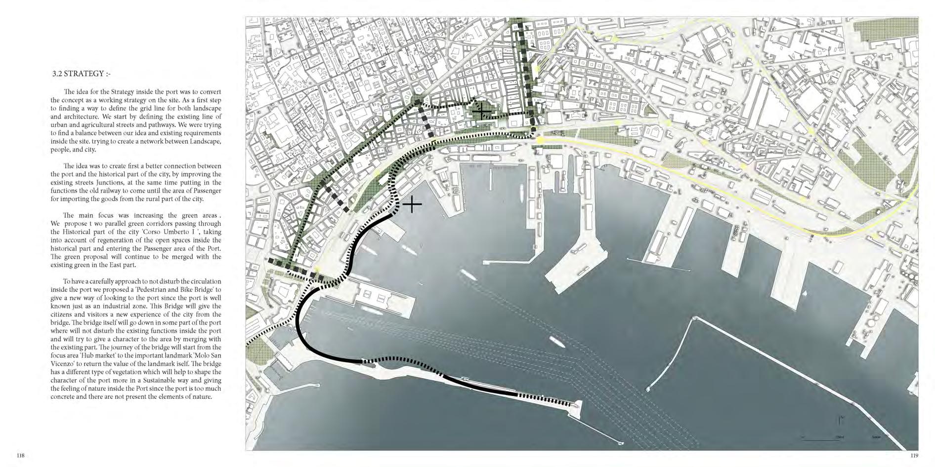
STRATEGY
• The idea for the Strategy inside the port was to convert the concept as a working strategy on the site. As a first step to finding a way to define the grid line for both landscape and architecture. We start by defining the existing line of urban and agricultural streets and pathways. We were trying to find a balance between our idea and existing requirements inside the site. trying to create a network between Landscape, people, and city.
• The idea was to create first a better connection between the port and the historicalpartofthecity,by improving the existing streets Junctions, at the same time putting in the functions the old railway to come until the area of Passenger for importing the goods from the rural part of the city.
• The main focus was increasing the green areas We propose wo parallel green corridors passing through the Historical part of the city 'Corso Umberto ', taking into account of regeneration of the open spaces inside the historical part and entering the Passenger area of the Port. The green proposal will continue to be merged with the existing green in the Eastpart.
41 42
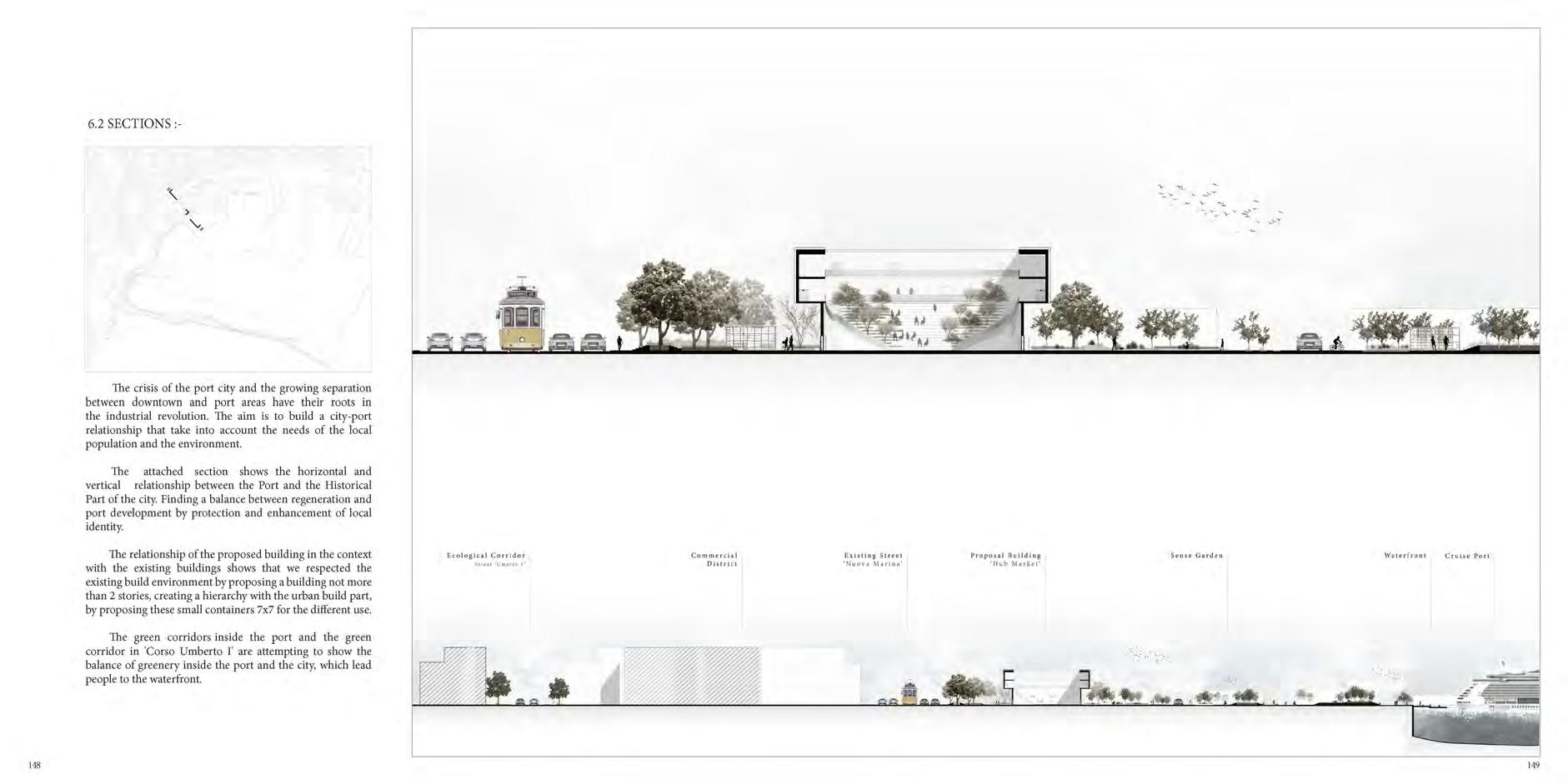
PORT STRATEGY
PORT MASTER PLAN
• In the Masterplan, we can see how the strategy project has been detailed by defending each proposal by scale. It's sustainabledevelopmentfor Naples’ city-port system to be able to implement in other cities. The vision proposed for the regeneration of the area is based on the commercial developmentoftheport
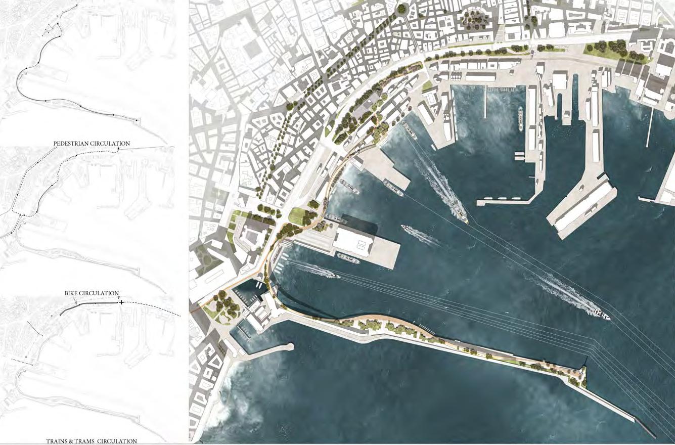
i. The workingareas are:
ii. HistoricalPartgreen corridor
iii. Redevelopmentofthe squareofPiazzaMercato
iv. HubMarketProposingaCenterfor sellinglocalproduct
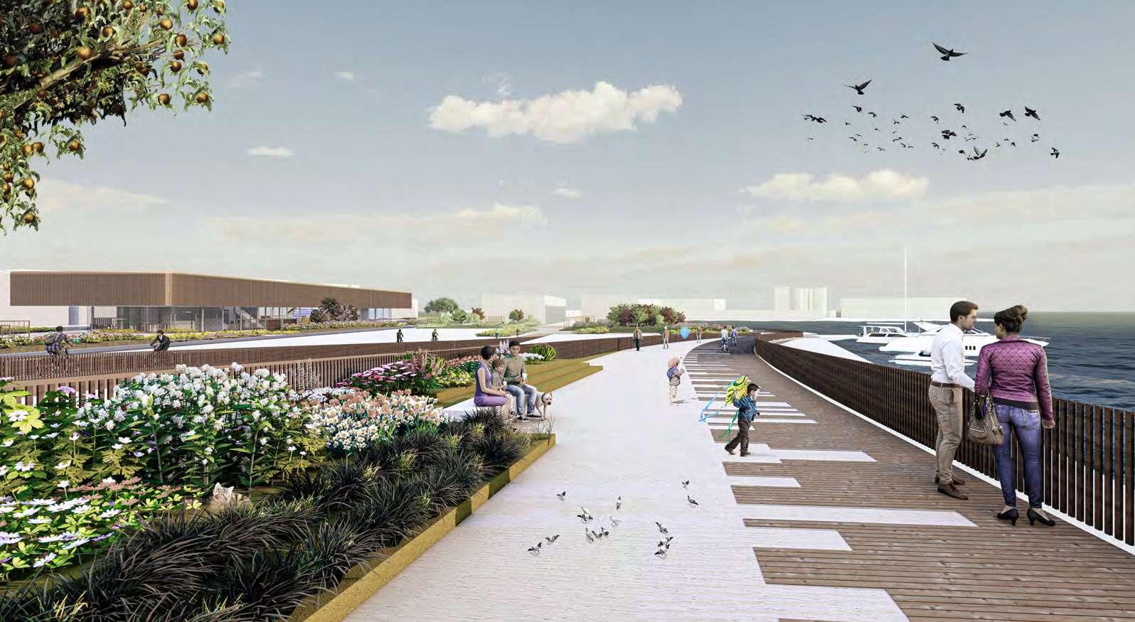
v. Waterfront-Passenger area
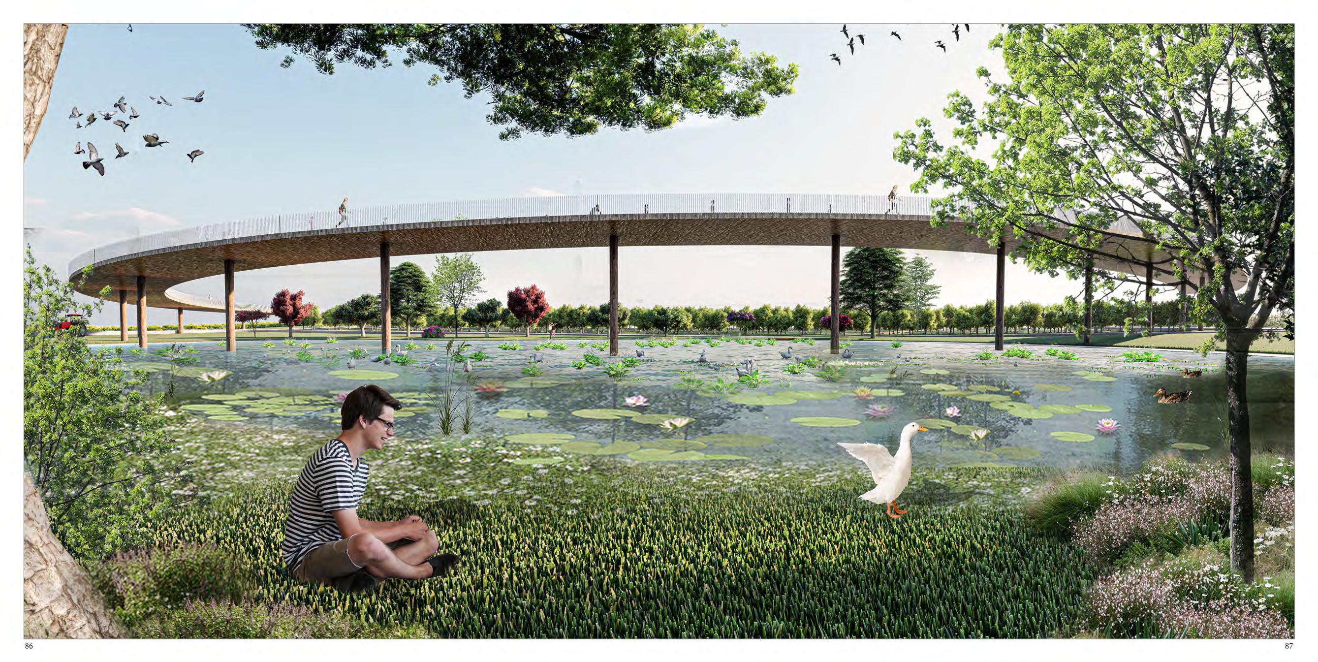
vi. GreenPedestrianand BikeBridge-Sustainable Mobility
• Accessibility inside the port based on our proposal was to create a path of pedestrian, bicycle, and transportation of the goods by considering the existing circulation.Thefirstdiagram shows how this new project is giving people a new walkway inside the port to enjoy more accessibility than before. Giving an extension of the walkway until the Landmark 'Molo San Vicenzo', which now is forbidden to go there due to the military zone which is takingplacethere.
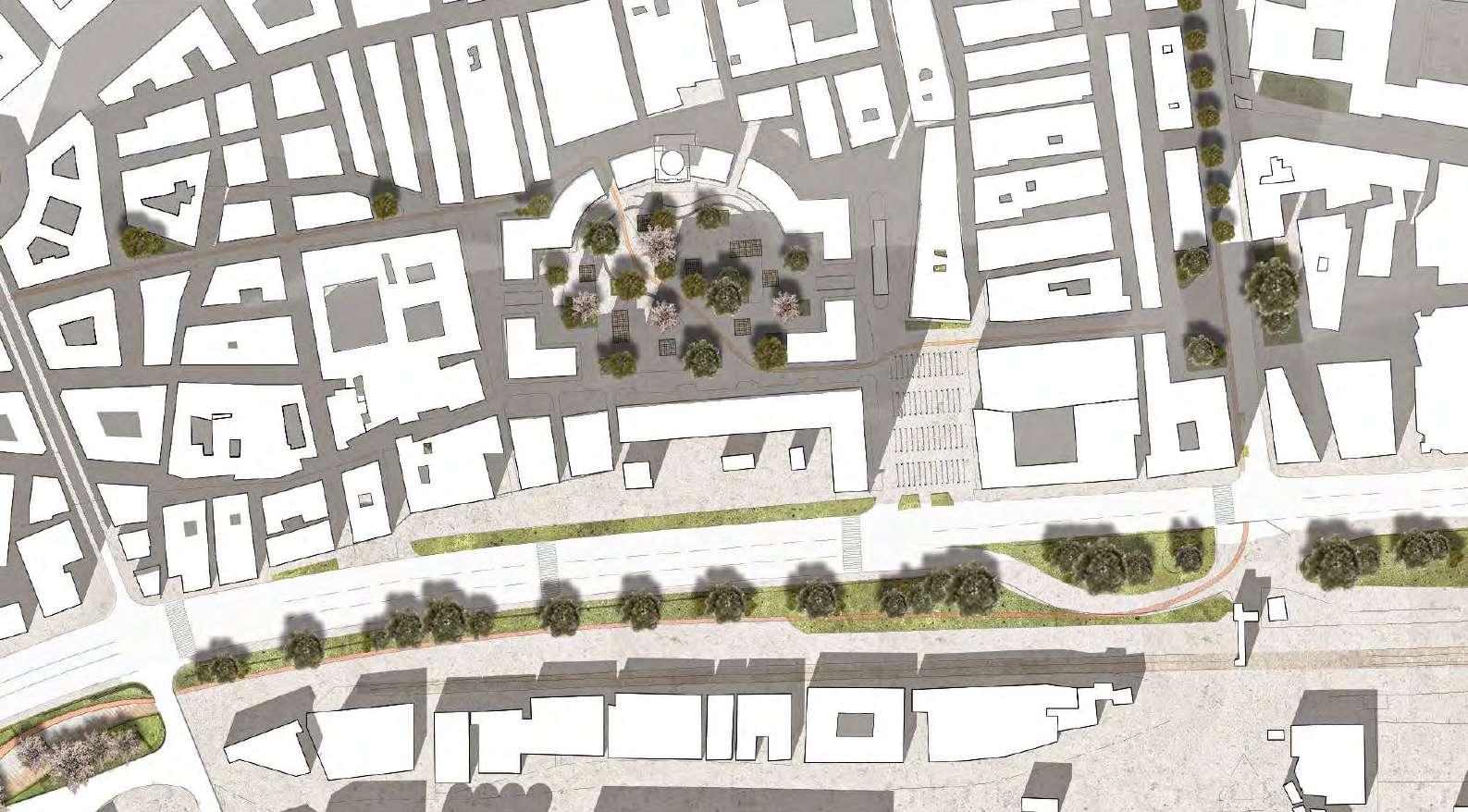
MERCATO MASTER PLAN
43 44
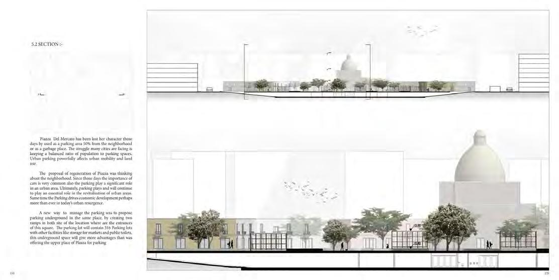
• The proposal of regeneration of Piazza was thinking about the neighborhood. Since those days the importance of cars is very common also the parking play a significant role in an urban area. Ultimately, parking plays and will continue to play an essential role in the revitalization of urban areas. Same time the Parking drives economic development perhaps morethaneverintoday’surbanresurgence.
SECTION 45 46
EXPLODED 3D PLANS
• The general division of the functions in the Hub Market is creating an indoor courtyard to allow circulation as well as light andnaturalventilation.
47 48 PORT OF NAPLES MASTER PLAN
1-PublicPlaza 2-Smallmarket 3-Outdoorcafe 4-Bar 5-Kitchen 6-Stafflockers 7-Amphitheatre 8-Loadingstorage 9-Loadingarea 10-Offices 11-Storage 12-Reception 13-Lecturehall 14-Lecturehallcontrolroom 15-Commercialoffices 16-Publiclibrary 17-Manageroffice 18-Restaurant 19-Preparationroom 20-Servicecore
49 50 BRIDGE VIEW
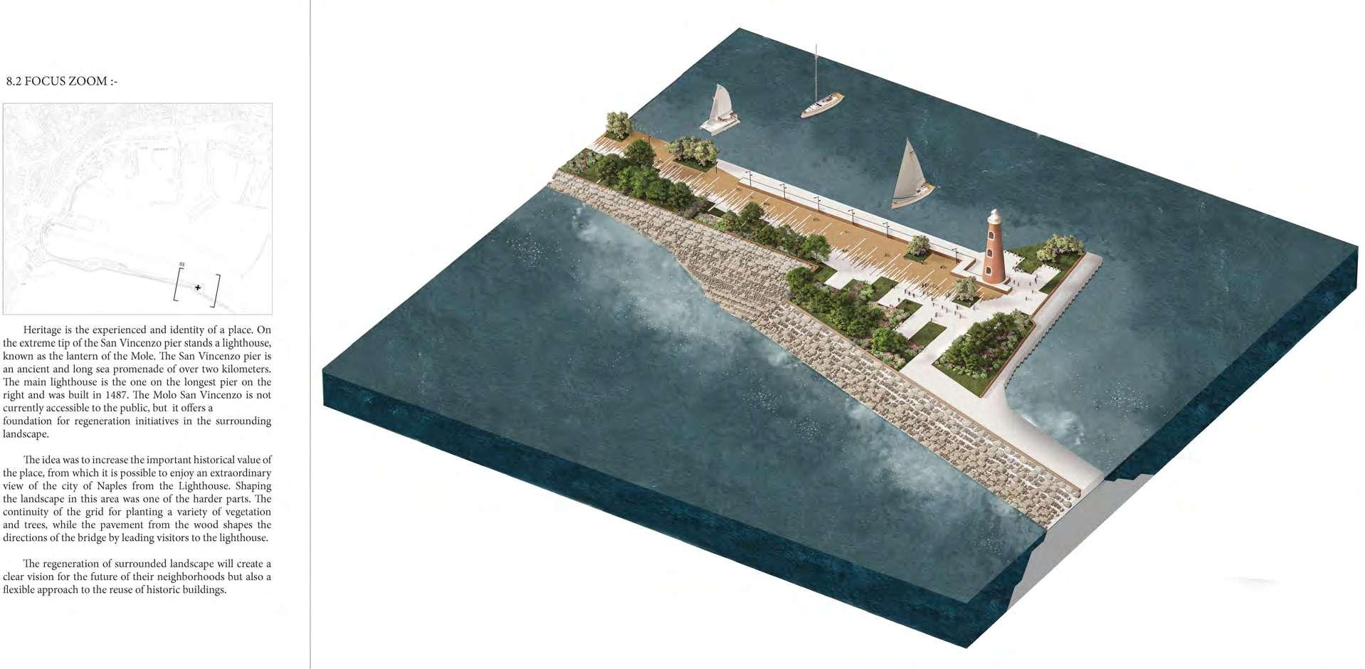
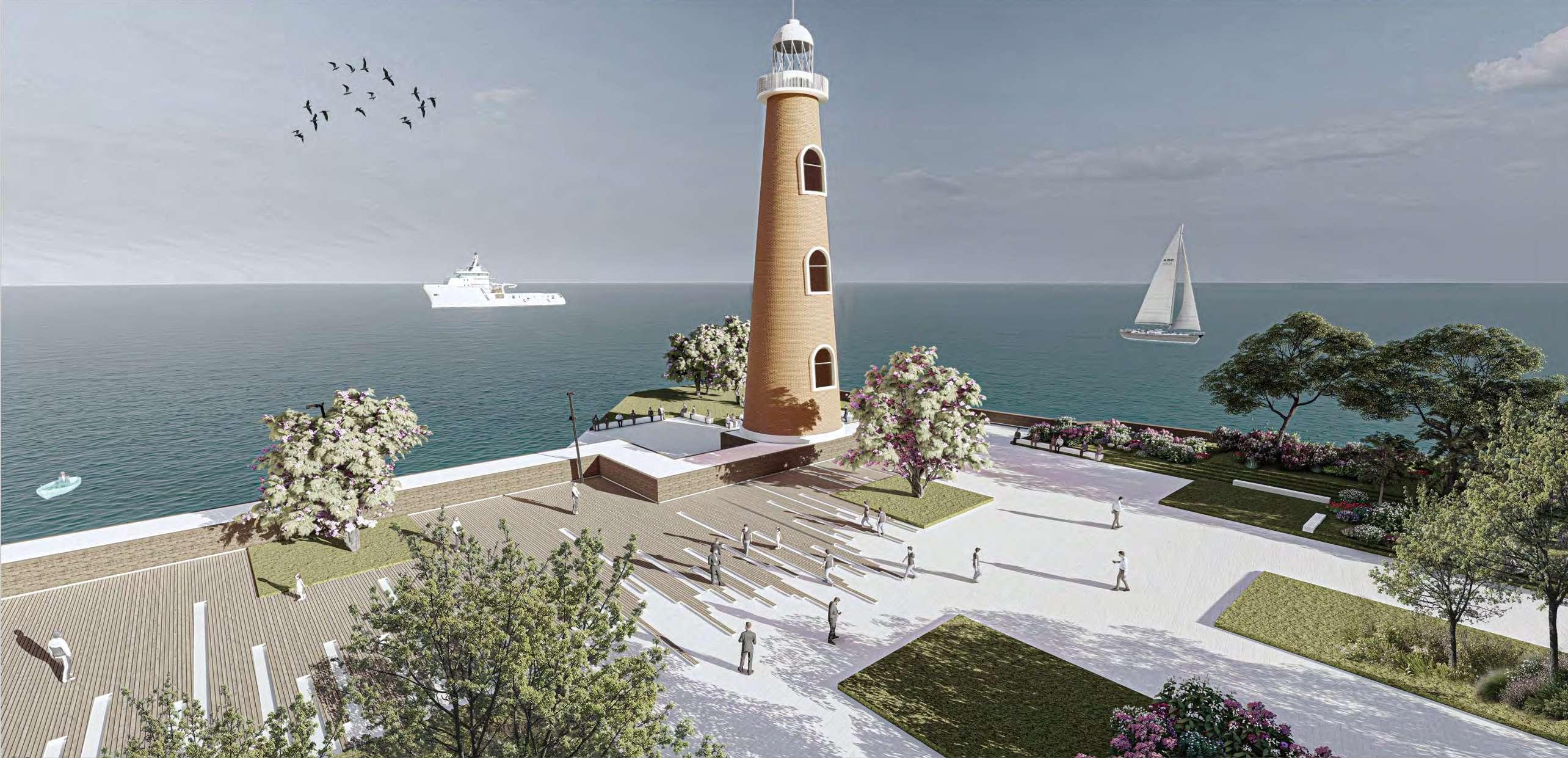
FOCUS ZOOM
• Heritageistheexperiencedandidentityof a place. On the extreme tip of the San Vincenzo pier stands a lighthouse, known as the lantern of the Mole. The San Vincenzo pier is an ancient and long sea promenade of over two kilometers. The main lighthouse is the one on the longest pier on the right and was built in 1487 The Molo San Vincenzo is not currently accessible to the public, but it offers a foundation for regeneration initiatives in the surroundinglandscape.
PROJECT CHALLENGES
As we present our project in detail aim toward facing the economic problems of the south of Italy including unemployment, pollution, and dense urban fabric. We believe our prototype can provide a sustainable landscape/Urban system which at the local level will make provide more jobs in the field of agriculture and services sector in both shipping and tourism which is already the existing major sectors of the region also will help to regrate the port area which now in limbo in relation to the city.
51 52