


Prefeitura da Cidade do Rio de Janeiro Rio de Janeiro City Government
Eduardo Paes Prefeito Mayor
Tony Chalita
Secretário Municipal de Governo e Integridade Pública Municipal Secretary of Government and Public Integrity
Rosa Maria Araujo
Presidente do Arquivo Geral da Cidade do Rio de Janeiro President of the General Archive of the City of Rio de Janeiro
Organização dos Estados Ibero-Americanos (OEI) Organization of the Ibero-American States (OEI)
Museu de Arte do Rio Rio Art Museum
Mariano Jabonero
Secretário-Geral da OEI General Secretary of the OEI
R aphael Callou
Diretor e Chefe da Representação da OEI no Brasil Director and Head of the Representation of the OEI in Brazil
Sandra Sérgio
Diretora Executiva do MAR Coordenadora Nacional de Projetos Especiais da OEI no Brasil Executive Director of Rio Art Museum National Coordinator of OEI Special Projects in Brazil
Capa ( Cover ) Vista tomada do Corcovado View from Corcovado Augusto Malta, 1906

O Rio tem muito a celebrar Rio has a lot to celebrate
Eduardo Paes Prefeito da Cidade do Rio de Janeiro
Este álbum, editado pelo Arquivo Geral da Cidade do Rio de Janeiro, é um retrato de um pouco do que somos: da história da nossa cidade, de nossas famílias, de nossos antepassados. Ao folhear este álbum, nós, cariocas, encontraremos nas belas fotos um pouco daquilo que vivemos. Nas esquinas, nas praças e nas ruas do Rio de Janeiro há um retrato também do que fomos.
As fotos revelam ainda o papel protagonista do Rio na história da Independência e de tantos outros momentos definitivos na formação do Brasil. O Rio foi capital do vice-reino e também foi a cidade onde se deu a Proclamação da República, a Abolição e tantos outros fatos históricos. As imagens apresentadas aqui retratam o século XIX e o século XX, períodos definitivos na formação do Rio de Janeiro. Foi por isso que escolhemos o tema “Rio, Capital da Independência” para as ações desenvolvidas pela Prefeitura nas áreas de cultura, conservação, educação, pesquisa e arquivo.
Um povo que não valoriza sua história não conhece seu presente e não projeta seu futuro. Que este Álbum do Bicentenário funcione como mais uma forma de celebrar a nossa cidade com a certeza de que muito ainda precisa ser feito e de que o espírito de defesa da nossa história e do nosso povo é o que nos empurra para as novas conquistas. O povo é e sempre será o grande protagonista da nossa história.
Eduardo Paes Mayor of the City of Rio de Janeiro
This album, published by the General Archive of the City of Rio de Janeiro, is a portrait of a little of what we are: our city’s history, our families, our ancestors. While paging through this album, we Cariocas will find in the beautiful photos a little of what we experience in daily life. In the squares, on the streets and corners of Rio de Janeiro there is also a portrait of what we were.
The photos moreover cast a light on Rio’s leading role in the history of Independence and so many other pivotal moments in the shaping of Brazil. Rio was the capital of the vice-kingdom, it is also the city where the Proclamation of the Republic took place, the Abolition was decreed, and many other historical turning points transpired. The images presented here portray the 19th and 20th centuries, definitive periods in Rio de Janeiro’s formation. This was why we chose the theme “Rio, Capital of the Independence” for the actions carried out by the City Government in the areas of culture, conservation, education, research and archiving.
A people that does not valorize its history does not know its present and cannot foresee its future. It is my wish that this Album of the Bicentennial will serve as a way of celebrating our city with the certainty that much still needs to be done and that the spirit of defending our history and our people is what spurs us to new achievements. The great protagonist of our history is and will always be the people.
6

Rio, Capital da Independência: retratos em 200 anos
Rosa Maria Araujo
Presidente do Arquivo Geral da Cidade do Rio de Janeiro
Rio, the Capital of the Independence: portraits throughout 200 years
Há quem diga que não há nada a celebrar nos 200 anos de independência do Brasil. Essa seria uma visão simplista. Podemos reconhecer e condenar a grave desigualdade social, o racismo, a mediocridade de nossas representações políticas, o desempenho pífio da economia recente, mas sem derrotismo.
Basta pensar na melhoria educacional, no desenvolvimento cultural e na projeção internacional brasileira.
Nesse contexto, a cidade do Rio de Janeiro, capital por quase duzentos anos, tem papel de protagonista nesta efeméride. Centro das grandes decisões nacionais, o Rio é a capital da Independência.
Disputada por portugueses e franceses, tamoios e tupinambás, ainda que sua história tenha sido marcada e manchada pelo genocídio dos índios e pela escravização dos negros, intensificada com a corrida do ouro, mesmo assim a cidade do Rio de Janeiro se tornou um antídoto contra os derrotistas.
Rosa Maria Araujo
President of the General Archive of the City of Rio de Janeiro
There are those who say there is nothing to celebrate in the 200 years of Brazil’s Independence. This is a simplistic viewpoint. We can recognize and condemn the great social inequality, the racism, the mediocrity of our political representatives, the poor performance of the recent economy, but without defeatism.
It’s enough to think about the improvements in education, in cultural development, and in Brazil’s international projection.
The city of Rio de Janeiro, a capital for nearly 200 years, has played a leading role in these developments. A hub of great national decisions, Rio is the capital of the Independence.
Disputed by the Portuguese and the French, the Tamoios and the Tupinambás, even though its history has been marked and stained by the genocide of the Indians and by the enslavement of black people — exacerbated by the gold rush —, the city of Rio de Janeiro nonetheless became an antidote against defeatists.
8
Cosmopolita, motor da indústria criativa nas artes e na cultura em geral, com ênfase na música; centro irradiador da ciência para todo o país, todos os brasileiros se sentem também cariocas. Dotada de uma beleza natural ímpar, entre o mar e a montanha, o Rio desenvolveu uma vocação para a alegria que nada apagará.
O Arquivo Geral da Cidade do Rio de Janeiro, incentivado pela Secretaria de Governo e Integridade Pública, apresenta esta edição bilíngue com fotos inéditas representando a centralidade do Rio no processo da Independência.
Os cenários mais significativos dessa história no século XIX e início do XX, os que marcaram as comemorações do centenário em 1922 e lugares marcantes do Rio de hoje, estão aqui presentes. Este álbum de retratos da cidade em duzentos anos de independência é prova do seu valor e da sua singularidade.
Vejam as imagens, leiam os textos, relembrem seus passeios e continuem a acreditar no Rio, na sua história e no seu futuro!
Insofar as Rio is cosmopolitan, an epicenter of science for the entire country, the motor of the nation’s creative industry in the arts and culture — especially in the musical field — all Brazilians also feel like Cariocas. With its extraordinary natural beauty, between sea and mountains, Rio developed a penchant for happiness that nothing will ever extinguish.
The General Archive of the City of Rio de Janeiro, with incentive from the Secretariat of Government and Public Integrity presents this bilingual edition with never-before-published photos representing Rio’s central role in the process of Independence.
The most significant scenarios of this history in the 19th and early 20th century — including the celebrations for the nation’s first centennial of Independence in 1922 — are present here, along with striking photos of many of Rio’s landmarks as they look today. This album of portraits of the city throughout 200 years of Independence is proof to its value and uniqueness.
So, enjoy the pictures, read the texts, recall your own travels in the city, and continue to believe in Rio, in its history and in its future!
P. 4
Carnaval de Corso ( Car Carnival )
Os corsos de carnaval e as batalhas de confete ganharam as ruas no início do século XX. Os veículos desfilavam na Av. Central e na Av. Beira Mar, repletos de foliões fantasiados. Foto de Guilherme Santos, 1927.
Carnival cars and confetti battles took over the streets in the early 20th century. The vehicles paraded on Central Avenue and on Beira Mar Avenue, full of costumed revelers. Photo by Guilherme Santos, 1927.
P. 6
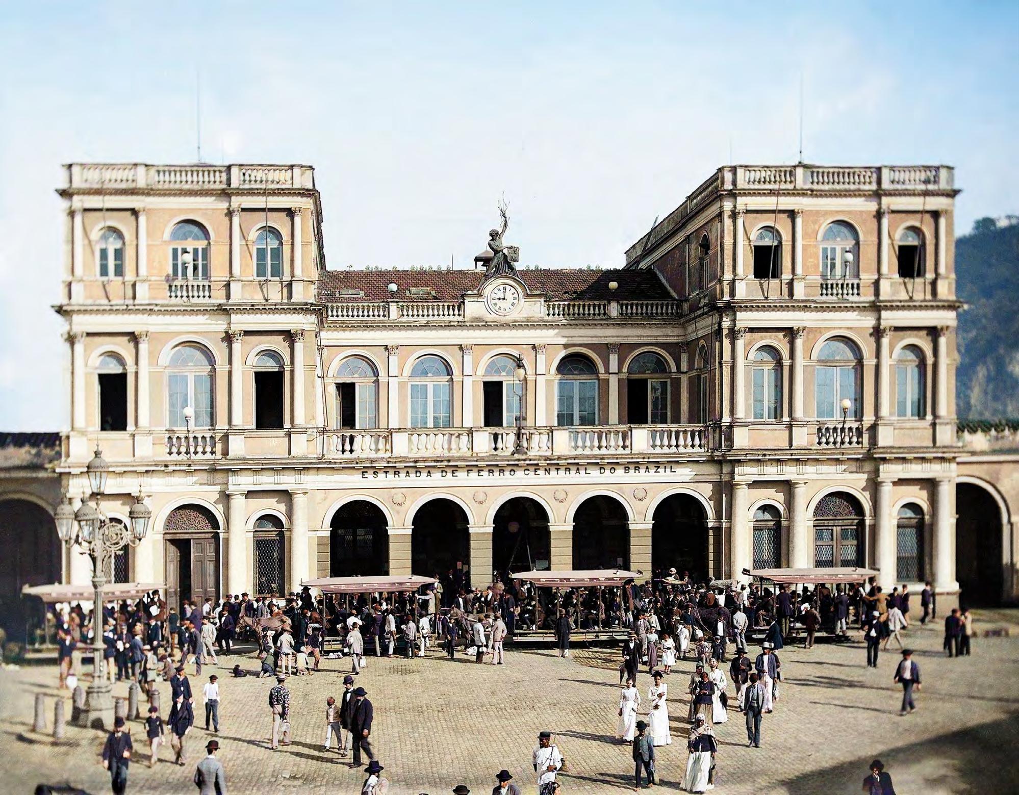
Bonde na Praça Cristiano Ottoni (Tramway at Cristiano Ottoni Square )
Por décadas, os bondes foram a principal forma de transporte. Na típica cena carioca, trabalhadores, na praça Cristiano Ottoni (Central do Brasil), a caminho da Praça XV. Foto de Augusto Malta, 1924.
For decades, trolleys were the main form of transport. Here, a typical scene for its time in Rio: workers, at Cristiano Ottoni Square (Central do Brasil Station), headed toward XV Square. Photo by Augusto Malta, 1924.
P. 9
Bairro do Castelo ( Castelo Disctrit )
Berço do Rio de Janeiro, o histórico Morro do Castelo seria demolido em 1922, abrindo espaço para uma cidade que rapidamente se modernizava. Com as terras do seu arrasamento, amplia-se a capital republicana, uma verdadeira metrópole à beira-mar.
The cradle of Rio de Janeiro, the historic Castelo Hill was demolished in 1922, opening space for a city that was undergoing a rapid process of modernization. The debris from its destruction was used to enlarge the Republican capital, a true seaside metropolis.
9


O Rio em 1822
Elizeu Santiago de Sousa*
Primeiro cronista do Brasil independente, conta-nos Jean-Baptiste Debret que o Rio era a “metrópole do Brasil, a partir de meados do século XVIII”.1 A cidade enriquecera ao longo do século com o escoamento da produção aurífera das Minas Gerais. A sua sorte logo seria selada com outras mudanças. Em 1763, torna-se a capital do vice-reino do Brasil; em 1808, a família real portuguesa ludibria Napoleão Bonaparte e escolhe a Guanabara 2 como o novo centro de um império multicontinental. Em 1815, transforma-se na capital do Reino Unido de Portugal, Brasil e Algarves.
Nos trópicos entre 1816 e 1831, o célebre artista francês captou a cara e a alma de uma cidade vocacionada para a mudança e a capitalidade. Com a presença da corte de Dom João, aqui seriam recriadas as principais instituições de Estado antes presentes em Lisboa. A população da nova capital, estimada em 60 mil habitantes em 1808, quase dobraria no ano da Independência. Metade do seu contingente, no entanto, era formada por mão de obra cativa. Dono do maior entreposto negreiro das Américas, o Rio joanino expandia-se com o sangue e o suor dos escravizados.
Rio in 1822 Elizeu Santiago de Sousa*
The first chronicler of independent Brazil, Jean-Baptiste Debret tells us that Rio was the “metropolis of Brazil, beginning in the mid-18th century.”1 Already enriched by the flow of gold from the mines in Minas Gerais, its wealth was then further increased by other changes. In 1763, it became the capital of the vice kingdom of Brazil; in 1808, the Portuguese royal family fled from the advance of Napoleon Bonaparte and chose Rio, then called Guanabara, 2 as the new center of a multicontinental empire. In 1815, the city became the capital of the United Kingdom of Portugal, Brazil and the Algarves.
In his tropical sojourn between 1816 and 1831, the celebrated French artist depicted the face and soul of an urban center with a vocation for change and for serving as a capital city. With the arrival of the future king João’s court, the main institutions of Lisbon were effectively recreated here. The new capital’s population, estimated at 60,000 in 1808, grew to nearly double that by 1922, the year of Brazil’s Independence. Half of that number, however, consisted of enslaved people. Home to the largest slave-trade depot of the Americas, Rio de Janeiro under King João expanded thanks to the blood and sweat of its enslaved workers.
* E lizeu Santiago de Sousa é diretor do Centro de Ensino e Pesquisa do Arquivo Geral da Cidade do Rio de Janeiro.
1 DEBRET, Jean-Baptiste. Viagem pitoresca e histórica ao Brasil . Trad. e notas de Sérgio Milliet. Belo Horizonte: Itatiaia, 2008, p. 297.
2 D o tupi, “Guanabara” ou “seio do mar” era o nome originalmente dado pela população nativa para designar as terras banhadas pela baía de igual nome. Ao coincidir geograficamente com a cidade do Rio de Janeiro, a expressão indígena foi habitualmente utilizada como termo sinonímico para se referir à principal cidade da região.
* E lizeu Santiago de Sousa is Director of the Center for Study and Research of the General Archive of the City of Rio de Janeiro.
1 DEBRET, Jean-Baptiste. Viagem pitoresca e histórica ao Brasil Translation and notes by Sérgio Milliet. Belo Horizonte: Itatiaia, 2008, p. 297.
2 I n the Tupi indigenous language, “Guanabara,” meaning “bay of the sea,” was the original indigenous toponym for the lands bathed by the bay of the same name. The indigenous expression came to be regularly used as a synonym referring to the region’s main city, which arose there.
12
A partir do Morro do Castelo, a cidade crescia, ao sul, na direção do Morro de Santo Antônio; ao norte, entre os de São Bento e o da Conceição. Testemunha ocular dessa expansão, a Rua Direita, atual Primeiro de Março, era a nossa principal artéria de desenvolvimento urbano. Ao redor do Largo do Paço, hoje Praça XV, estavam as principais repartições públicas e estabelecimentos comerciais. Ao lado, o famoso chafariz da Pirâmide, icônica construção setecentista de Mestre Valentim que fornecia água aos muitos navios e viajantes. Trata-se de um dos cenários prediletos ao talento de Debret, olhar capturado pelo comércio de rua povoado por quitandeiras e barbeiros ambulantes.
Com a chegada de Dom João, a cidade se expandiu para além dos quatro morros fundadores. Os mais abastados abriam passagem na direção de bairros como Catumbi, Rio Comprido, Botafogo, Laranjeiras e Tijuca, localidades recém-descobertas pelos novos palacetes e chácaras. Sobre os mangues de São Diogo, a caminho do Paço de São Cristóvão, nascia a chamada Cidade Nova por contraposição à Cidade Velha, esta última identificada com os limites do Campo de Santana.
The city spread southward from Castelo Hill toward Santo Antônio Hill, and northward, between the hills of São Bento and Conceição. The street called Rua Direita (the current Primeiro de Março) was the main artery of this urban development. The main government agencies and commercial establishments were located around Palace Square (currently XV Square). Alongside, the famous Pirâmide Fountain, an iconic 18th-century construction by Mestre Valentim, furnished water to the many ships and travelers. It was one of the favorite scenes depicted by Debret, a street populated by greengrocers’ shops and by street barbers.
With Prince Regent João’s arrival, the city expanded beyond the four founding hills. Mansions and country estates for the wealthiest residents sprouted up in districts such as Catumbi, Rio Comprido, Botafogo, Laranjeiras and Tijuca. Built atop the mangroves of São Diogo, along the way to São Cristóvão Palace, the so-called New City emerged, as a counterpart to Old City, with the field called Campo de Santana between them.
P. 10
Jean-Baptiste Debret, 1827
“O primeiro ímpeto da virtude guerreira”
(The first impetus of warrior virtue )
Aquarela ( Watercolor )
18 x 22,5 cm | detalhe ( detail )
Museus Castro Maya, Ibram | MTur
P. 13
Jean-Baptiste Debret, 1839
“Desembarque da princesa Leopoldina no Rio de Janeiro” (Disembarking of Princess Leopoldina in Rio de Janeiro ) Litografia de Thierry Frères, Succrs. de Engelmann & Cie. Publicada em 1839 no Voyage pittoresque et historique au Brésil , de Debret (Lithography by Thierry Frères, Succrs. de Engelmann & Cie. Published in 1839 in Voyage pittoresque et historique au Brésil, by Debret )
22 x 30,3 cm | Arquivo Geral da Cidade do Rio de Janeiro (AGCRJ)
13
A imagem retrata a chegada da princesa Leopoldina ao Rio de Janeiro, em 1818, no Arsenal da Marinha, atual Orla Conde. No centro, vemos o majestoso Mosteiro de São Bento. Na extremidade esquerda, o Morro do Castelo; na direita, as montanhas da Tijuca.
The image portrays the arrival of Princess Leopoldina in Rio de Janeiro, in 1818, at the Navy Dockyards, currently Conde Shore. In the center, we see the majestic São Bento Monastery. Along the left edge, Castelo Hill; at the right, the Tijuca Mountains.

14
Antiga propriedade dos jesuítas, transforma-se em casa de veraneio da família real e imperial entre 1808 e 1889. Primeiro núcleo urbano do bairro de Santa Cruz, atualmente é a sede do 1° Batalhão de Engenharia de Combate do Exército.
A former property of the Jesuits, transformed into a summer house for the Royal and Imperial family between 1808 and 1889. The first urban nucleus of the district of Santa Cruz, it is currently the headquarters of the 1st Combat Engineering Battalion of the Army.

15
A família real, a propósito, dividiu-se pela cidade. Dom João residia com a filha mais velha no Paço de São Cristóvão; Carlota Joaquina, em uma chácara em Botafogo. As principais cerimônias públicas eram realizadas no Paço Real, também chamado de Paço da Cidade. Durante a Quaresma, o rei costumava passar alguns dias na propriedade localizada na Ilha do Governador, local de caça e plantio de chá. Em 1826, a imperatriz Leopoldina manteria um jardim zoológico no local. Já Pedro I tinha predileção pelo Palácio de Santa Cruz, antiga propriedade dos jesuítas que logo se converteria em um dos lugares de recreio favorito para os príncipes e princesas.
Mas não só de política se faz uma capital. Teatro e música eram as duas grandes diversões da população carioca. As aquarelas de Debret mostram-nos, de um lado, a marimba do escravizado africano e, do outro, o formalismo da música erudita europeia. Mesmerizado pela melodia popular, o francês registrou em suas pranchas o canto da saudade africana entoado pelas praças e chafarizes cariocas. Além das igrejas, em cuja Capela Real residia o melhor conservatório do país, o Rio ganharia em 1813 o seu principal teatro. Localizado na Praça do Rocio, atual Tiradentes, o Real Teatro São João foi ao longo do século XIX o mais importante centro de espetáculos do Brasil.
The royal family resided at scattered locations in the city. King João lived with his eldest daughter at São Cristóvão Palace; Carlota Joaquina, lived on a country estate in Botafogo. The main public ceremonies were held at the Royal Palace, also known as the City Palace. During Lent, the king would often spend some days on his property located on Governador Island, a place for hunting and tea growing. In 1826, Empress Leopoldina maintained a zoo there. For his part, Pedro I preferred Santa Cruz Palace, formerly owned by the Jesuits, which soon became a favorite recreation spot for the princes and princesses.
But a capital consists of more than politics. Theater and music were two of the great diversions of Rio’s populace. Debret’s watercolors show us, on the one hand, the marimba of the enslaved African and, on the other, the formalism of European classical music. Mesmerized by the popular melody, the French artist recorded in his works the nostalgic singing of Africans in squares and alongside fountains, longing for their homeland. There were various churches, including the Royal Chapel which held the city’s best conservatory, and in 1813 Rio gained its main theater. Located at Rocio Square, currently Tiradentes Square, the São João Royal theater was the most important venue for shows in Brazil throughout the 19th century.
P. 14
Jean-Baptiste Debret, c. 1820–1830 “Fazenda Imperial de Santa Cruz” (The Imperial Farm of Santa Cruz ) Aquarela ( Watercolor ) | 14,4 x 23 cm Museus Castro Maya, Ibram | MTur
16
P. 17
Jean-Baptiste Debret, 1827
“Negra com tatuagens vendendo cajus”
(Tattooed black woman selling cashew fruit )
Aquarela ( Watercolor ) | 15,7 x 21,6 cm | detalhe ( detail )
Museus Castro Maya, Ibram | MTur
Em 13 anos na Guanabara, o reinado de Dom João transformara definitivamente a história do Rio e do Brasil. Nas célebres palavras do historiador Oliveira Lima, fora ele “o verdadeiro fundador da nacionalidade brasileira”. 3 Aqui vivera os melhores anos de sua vida, abruptamente interrompidos pela convocação revolucionária das cortes reunidas em Lisboa. A contragosto, cruzaria pela última vez o Atlântico em abril de 1821. Ao partir, deixou no horizonte a cidade que era não apenas um centro político e comercial, mas o seu recanto predileto no vasto império luso-brasileiro.
De lá para cá, o Rio capitanearia alguns dos mais importantes momentos cívicos que levariam à Independência do país: o Dia do Fico, a aclamação e coroação de Pedro I, a criação da primeira carta constitucional, as negociações diplomáticas pelo reconhecimento da jovem nação. Não por acaso, em 1823, o imperador Dom Pedro I outorgaria ao Rio o título honorífico de “cidade mui leal e heroica”. Única cidade no ultramar a sediar um império europeu, foi, a um só tempo, o berço de dois reis cariocas: Pedro II, do Brasil, e Dona Maria II, de Portugal. A cidade foi não apenas a porta de entrada e o principal cartão de visitas do país, mas, sobretudo, o centro das grandes deliberações políticas nacionais. Não causa, pois, espanto que fosse o Rio a capital da Independência do Brasil.
In 13 years in Guanabara, King João’s reign definitively transformed the history of Rio and of Brazil. In the celebrated words of historian Oliveira Lima, King João was the “true founder of Brazilian nationality.”3 He lived the best years of his life here, abruptly interrupted by the rise of the revolutionary reunited courts in Lisbon. Against his wishes he was forced to cross the Atlantic for the last time in April of 1821. As he sailed away, he left behind him a city that was not only a political and commercial center, but his favorite corner of the vast Luso-Brazilian Empire.
Starting with the arrival of Prince Regent João, Rio was the site of some of most important events that led to the country’s Independence: the day of “Fico” [“I’m staying”], the acclamation and coronation of Pedro I, the creation of the first constitutional charter, and the diplomatic negotiations for the recognition of the young nation. Not by chance, in 1823, Emperor Pedro I bestowed on Rio the honorary title of “a very loyal and heroic city.” The only city overseas from the European continent to ever serve as the capital of a European empire, it was also the birthplace of two carioca monarchs: Pedro II, ruler of Brazil, and Queen Maria II, ruler of Portugal. The city was not only the country’s port of entry and main calling card, but was, above all, the center of great national political deliberations. It is not, therefore, surprising that Rio was the capital of Brazil’s Independence.
3 L IMA, Manuel de Oliveira. Dom João VI no Brasil . 3rd. ed. Rio de Janeiro: Topbooks, 1996, p. 21.
17
3 L IMA, Manuel de Oliveira. Dom João VI no Brasil . 3 ed. Rio de Janeiro: Topbooks, 1996, p. 21.

Jean-Baptiste Debret, 1826
“Primeiras ocupações da manhã”
First occupations in the morning
Aquarela ( Watercolor
18,7 x 24,2 cm Museus Castro Maya, Ibram
MTur
Segundo Debret, a cena se passa às 6 horas, na Rua da Ajuda, no Rio de Janeiro. According to Debret, the scene took place at 6 a.m., on Ajuda Street, in Rio de Janeiro.

19
(
)
) |
|
O Rio de Debret
[...] Acorda-se em geral às cinco horas da manhã, com a salva das fortalezas, que serve igualmente de sinal para a atividade da marinha, e o toque da Ave-Maria, repetido pelo grande sino de cada uma das igrejas da cidade e a que se ajunta não raro o primeiro estampido de foguetes e de bombas soltados do pórtico de uma igreja em que se festeja o dia do padroeiro. Às seis horas, os esmoleiros de diversas irmandades religiosas, espalhados pelas ruas, importunam o habitante com pedidos reiterados ou com a batida de seu bordão às portas ou diante das vendas, obtendo oferendas quase forçadas, mas que os estrangeiros evitam facilmente. Surgem em seguida os carregadores de água e de leite e as vendedoras de pão de ló. Das seis às sete horas encaminham-se sossegadamente para o centro da cidade os negros de ganho; uns preparam durante o caminho folhas de palmeiras para a confecção de chapéus, enquanto outros, menos ativos, acertam sossegadamente o passo ao som da marimba . Na mesma hora, isto é, das seis às oito, os mercados situados nas praias de desembarque, já abastecidos pelas embarcações chegadas de madrugada, apresentam um movimento generalizado de quitandeiras, que se encontram durante o resto do dia nas ruas ou nos mercados internos da cidade. Das oito ao meio-dia, os cafés das grandes praças ou das imediações da Alfândega tornam-se o ponto de encontro dos comerciantes vindos do interior a negócios. Das oito às onze, veem-se as tropas chegadas de São Paulo e Minas estacionarem na Rua Direita, na altura da Igreja da Cruz, descansando da última marcha noturna, depois de descarregada a mercadoria. Das dez às duas da tarde, há um grande movimento de negócios.
Debret’s Rio
Debret describes the city’s activity throughout 24 hours
[...]
One generally awakes at five in the morning to the clap of cannons fired at the forts, also a signal for the Navy’s activity, as well as to strains of “Ave-Maria,” tolled by the large bell at each of the city’s churches and often accompanied by explosions of rockets and bombs let loose from the portico of some church celebrating the day of its patron saint. At 6 a.m., the beggars from various religious brotherhoods, scattered through the streets, importune the inhabitant with repeated pleas, or knock their staffs on doors and storefronts, obtaining nearly forced offerings, though easily avoided by foreigners. Then the water and milk carriers appear along with the sponge cake venders. From 6 to 7 a.m. the negros de ganho [enslaved black people who engaged in commercial activities and paid a portion of their earnings to their owners] walk calmly along the streets downtown; along their way, some prepare palm leaves for making hats, while less active ones measure their steps to the rhythm of the marimba. At the same time, that is, from 6 to 8 a.m., the markets located along the beaches where the ships unload, already stocked by cargo that arrived in the wee hours of the morning, present a bustling of greengrocers, who gather during the rest of the day on the city’s streets or in the indoor marketplaces. From 8 a.m. to noon, the cafés in the large squares or around the Customs House become a meeting spot for merchants coming from the state’s interior to do business. From 8 to 11 a.m., one sees the troops that have arrived from São Paulo and Minas stationed at Rua Direita, near Cruz Church, resting from their last nocturnal march, after the unloading of the merchandise. From 10 a.m. to 2 p.m., there is intense business activity.
20
Debret descreve uma jornada de 24 horas pela cidade
Às duas horas fecham-se a Alfândega e as demais repartições públicas, últimos movimentos precursores da calma sensível que vai reinar na cidade até às quatro horas da tarde, momento em que tornam a aparecer nas ruas as vendedoras de pão de ló para a hora do chá. No mesmo momento aparecem também as vendedoras de velas; outras vendem doces, sonhos, etc.; estas últimas se dirigem para o Largo do Palácio, onde se reúnem das quatro às sete os pequenos capitalistas e negociantes. Às sete horas o canhão anuncia o fechamento dos portos, e o seu troar junta-se ao toque da Ave-Maria. Das sete às dez, ouve-se nas ruas o pregão dos vendedores de amendoim torrado, de milho assado, pastéis quentes, pastéis de palmito, pudim quente, manuê , etc., iguarias todas de grande procura. [...] Finalmente, das sete às dez, veem-se circular nas ruas filas de velas acesas, às vezes interrompidas na sua marcha pelos despejos nauseabundos, obstáculo vencido, entretanto pelas famílias brasileiras, que nessa hora visitam as lojas de modas e novidades francesas para fazer suas compras. Às oito horas começa o espetáculo, e à meia-noite terminam as brilhantes funções do teatro e da igreja. A essa hora recomeça instantaneamente nas ruas da cidade o movimento de carruagens e de inúmeras pessoas a pé, elegantemente vestidas e ainda entusiasmadas com as reuniões suntuosas de onde vêm.
Assim termina no Rio de Janeiro, como em Paris, um dia favorável à indústria pela provocação de um luxo coligado às vaidades mundanas e religiosas, apanágio de todas as capitais do mundo, porém mais agradáveis ainda sob a doce influência do lindo clima do Brasil.
At 2 p.m. the Customs House closes along with the other public agencies, the last movements before the evident calm that reigns throughout the city until 4 p.m., the moment that sponge cake venders reappear in the streets for teatime. At the same moment the candle venders also appear; others sell sweets, desserts, etc.; these latter head for Palace Square, where the small capitalists and businessmen gather from 4 to 7 p.m. At 7 p.m. the cannon announces the closing of the ports, its peal joined by the strains of “Ave-Maria.” From 7 to 10 p.m., the streets resound with the cries of venders of roasted peanuts and corn-on-the-cob, hot pastries, heart-of-palm pastries, warm pudding, manuê , etc., all highly demanded delicacies. […] Finally, from 7 to 10 p.m., lines of lit candles circulate through the streets, sometimes interrupted in their march by the dumping of repulsive waste, an obstacle circumvented, however, by the Brazilian families, who at this time of evening are visiting the stores that sell French novelties and fashion items, making their purchases. At 8 p.m. the show begins, and at midnight the illuminated functions of theater and church end. At this time, once again, the carriages begin to move again through the city’s streets along with countless pedestrians, elegantly dressed and still giddy from the sumptuous get-togethers they are coming from.
Thus ends in Rio de Janeiro, as in Paris, a day favorable to industriousness by the provocation of luxury linked to mundane and religious vanities, an appanage in all capital cities around the world, though more pleasant under the sweet spell of Brazil’s lovely climate.
P. 21, 22-23 (detalhe | detail )
Jean-Baptiste Debret, 1826
“Uma tarde na praça do Palácio” ( An afternoon in Palácio Square )
Aquarela ( Watercolor ) | 15,5 x 21,4 cm Museus Castro Maya, Ibram | MTur
21
A imagem retrata uma típica tarde na praça do Palácio (ou do Paço), atual Praça XV. Centro político da então capital, vemos um intenso movimento de vendedores e viajantes recém-chegados ao cais localizado ao lado do histórico chafariz construído por Mestre Valentim. Ao fundo, o Morro do Castelo, demolido em 1922.
The image portrays a typical afternoon in Palácio Square, currently XV Square. The political center of the then capital, we see the bustle of vendors and travelers recently arrived at the docks located alongside the fountain built by Mestre Valentim. In the background, Castelo Hill, demolished in 1922.

22


O Rio de Janeiro se transformou profundamente no primeiro século de vida independente. Entre 1822 e 1922, sua população se multiplicou por dez. A expansão da cidade se dava na direção das Zonas Sul e Norte, facilitada pelo advento de novos transportes. Nos anos 1850, surge o bonde de tração animal, logo aprimorado pela energia elétrica. Na virada do século, seríamos a ponta de lança de novas tecnologias que mudariam para sempre a rotina dos brasileiros: a eletricidade, o automóvel, o rádio, o cinema. Para cá, fluíram artistas, políticos e homens de negócios do mundo todo. Ano-síntese das nossas transformações, 1922 foi o sinônimo da efervescência e da modernização. De um lado, crises políticas, greves operárias e rebeliões militares. Do outro, a monumental Exposição Internacional do Centenário da Independência, vitrine do progresso e da modernização. Nas páginas que se seguem, em um inédito trabalho de análise, restauro e colorização fotográfica, o(a) leitor(a) apreciará em primeira mão os principais cenários que marcaram a nossa história na segunda metade do século XIX e início do XX.
Rio de Janeiro was profoundly transformed in the first century of Brazil’s Independence. Between 1822 and 1922, its population increased tenfold. The city expanded toward the South and North zones, facilitated by the advent of new modes of transportation. In the 1850s, the animal-drawn trolleys arose, soon improved by electrical power. At the turn-of-the-century, the city spearheaded new technologies that forever changed the everyday life of Brazilians: electricity, the automobile, radio, cinema. Artists, politicians and businesspeople from around the world flocked to it. Epitomizing this process of transformation, the year 1922 was an effervescent period of activity and modernization. On the one hand, there were political crises, workers’ strikes and military rebellions. On the other, there was the monumental International Exposition of the Centennial of Independence, a showcase of progress and modernization. On the following pages, in a never-before-published work of photographic analysis, restoration and colorization, the reader can gain a first-hand look at the main scenarios that marked our history in the second half of the 19th century and beginning of the 20th.
O RIO, 1922
Entrada da Baía de Guanabara EntrancetoGuanabaraBay
Marc Ferrez, c. 1890
A Baía de Guanabara (do tupi, “seio de mar”) é a protagonista destas duas fotos, feitas pelo fotógrafo brasileiro de origem francesa Marc Ferrez (1843–1923). Originariamente habitada pela grande nação tupi-guarani, foi o cenário das mais importantes batalhas contra franceses e piratas pela conquista da região. Viajantes ao longo da história — alguns tão célebres quanto o pintor Debret e o naturalista Charles Darwin — descreveram com linguagem superlativa a luxuriante paisagem dos trópicos. Principal via de acesso à cidade do Rio, é composta por 53 praias e 35 rios. Em 1º de janeiro de 1502, ao adentrar as suas águas pela primeira vez, os portugueses pensaram tratar-se de um grande rio. Do engano, o batismo da futura cidade: Rio de Janeiro.
Guanabara Bay (in Tupi, “Guanabara” means “bay of the sea”) is the protagonist of these two photos, by French-born Brazilian photographer Marc Ferrez (1843–1923). Originally inhabited by the Tupi-Guarani people, it was the scene of many important battles against the French and pirates for control of the region. Travelers throughout history — some as celebrated as painter Debret and naturalist Charles Darwin — used superlative terms to describe the lush tropical landscape. The main means of access to the city of Rio, the bay has 53 beaches and 35 rivers. On January 1, 1502, when entering its waters for the first time, the Portuguese thought it was a large river. That mistake gave rise to the name of the city that would arise there: Rio de Janeiro.

26

Fortaleza de São João, Urca São João Fort, Urca
Augusto Malta, c. 1915
A foto, tomada a partir da Fortaleza de São João, de costas para a Baía de Guanabara, mostra o bairro da Urca na direção do continente. Situada entre o Morro Cara de Cão e o Pão de Açúcar, no exato local da fundação da cidade do Rio, fora importante reduto dos soldados comandados por Estácio de Sá, na luta contra franceses e tamoios. Após a vitória portuguesa em 1567, esse núcleo urbano inicial será deslocado para o Morro do Descanso, posteriormente chamado de São Januário antes de assumir a nomenclatura final de Morro do Castelo. A ideia era encontrar um local mais seco e que oferecesse superioridade estratégica sobre possíveis inimigos.
The photo, taken from São João Fort, looking away from Guanabara Bay, shows the district of Urca with the mainland in the background. Situated between Cara de Cão Hill and Sugarloaf Mountain, at the exact place where Rio was founded, it was an important stronghold for soldiers commanded by Estácio de Sá, in the struggle against the French and the Tamoios. After the Portuguese victory in 1567, this initial urban nucleus was moved to Descanso Hill, later called São Januário Hill, before receiving its current name of Castelo Hill. The idea was to find a drier place that offered strategic superiority over possible enemies.

28

Arsenal de Marinha de Guerra e Mosteiro de São Bento TheNavyDockyardandthe SãoBentoMonastery
Juan Gutierrez, c. 1890
À direita, em imagem de Juan Gutierrez, vemos o Mosteiro de São Bento, em plano superior, e o Arsenal de Marinha, no inferior. A foto retrata o lugar exato em que a princesa Leopoldina desembarcou no Brasil, em 1817, acompanhada pela Missão Austríaca. No local, desde 1763, existiu o mais importante arsenal do país, responsável pelo conserto e construção de navios para a Marinha brasileira. Em 1930, as suas funções foram transferidas para o novo arsenal, localizado na Ilha das Cobras. No alto do morro, vemos o histórico mosteiro erguido em 1590, apenas 24 anos após o nascimento da cidade. Bombardeado pelos franceses em 1711, fora uma das instituições a hospedar os membros da família real em 1808. Por 31 anos, foi a sede da Escola Naval. Em 1858, é fundado o tradicional colégio de São Bento; em 1921, a faculdade. À esquerda, Juan Gutierrez retrata o Cais dos Mineiros e o centro da cidade no final dos anos 1890. Em destaque, a Igreja de Nossa Senhora de Candelária.
At the right, in an image by Juan Gutierrez, we see the São Bento Monastery on the hilltop, and the Navy Dockyard, on the shore. The photo portrays the exact place where Princess Leopoldina disembarked in Brazil, in 1817, accompanied by the Austrian Mission. Since 1763 the site was also home to the country’s most important dockyard, responsible for the repair and construction of the Brazilian Navy’s ships. In 1930, its operations were transferred to the new dockyard, located on Cobras Island. The historic monastery was built in 1590, just 24 years after the city’s birth. Bombarded by the French in 1711, it was one of the institutions that hosted the members of the royal family in 1808. For 31 years, it served as the facilities of the Naval School. In 1858, the traditional São Bento High School was founded, and, in 1921, São Bento College. At the left is a portrait by Juan Gutierrez of Mineiros Wharf in the city’s downtown in the late 1890s, with a highlight on the Nossa Senhora de Candelária Church.

30

Igreja de Santa Luzia e Bairro do Castelo
Santa Luzia Church and Castelo District
Anônimo, s. d. (Anonymous, n.d.) | Georges Leuzinger, c. 1865

Importante núcleo urbano do Rio colonial, o Morro do Castelo foi completamente demolido durante a gestão do prefeito Carlos Sampaio (1920–1922). Empreendimento polêmico em seu tempo, o arrasamento do velho morro abriu espaço para as modernas construções que logo tomariam conta do lugar. Entre elas, vemos, na imagem à esquerda, alguns dos pavilhões da Exposição Internacional de 1922, cuja efeméride celebrava o centenário da Independência. Nos anos 1940, influenciada pela obra de Le Corbusier, a área ganharia um dos mais significativos ícones da arquitetura moderna no país: originalmente sede do Ministério da Educação e Saúde Pública, o atual Palácio Capanema é um dos maiores legados arquitetônicos da era Vargas (1930–1945). Próxima aos limites do Castelo, a Igreja de Santa Luzia debruçava-se sobre a Baía de Guanabara; área hoje aterrada com os escombros do histórico morro. A imagem de Georges Leuzinger, à direita, mostra-nos a secular igreja barroca ainda à beira-mar.
An important urban nucleus of colonial Rio, Castelo Hill was completely demolished in the year 1921 during the term of Mayor Carlos Sampaio (1920–1922). A controversial undertaking in its time, the razing of the old hill opened space for the modern constructions that soon took over the area. These included, as seen in the image at the left, some of the pavilions of the International Exposition of 1922, held in celebration of the centennial of Independence. In the 1940s, influenced by the work of Le Corbusier, the area gained one of the country’s most significant icons of modern architecture: originally the headquarters of the Ministry of Education and Public Health, the current Capanema Palace is one of the largest architectural legacies from the Vargas era (1930–1945). Near the base of the former Castelo Hill, Santa Luzia church was at the edge of Guanabara Bay, next to part of the bay that is now dry land, filled in by debris from the historical hill. The image by Georges Leuzinger, at the right, shows us the age-old baroque church, when it was still on the shoreline.

32

Principal construção política do período colonial, o então Paço dos Governadores (1743) fora mandado construir por Gomes Freire de Andrade, o último dos nossos governadores. Sede do Armazém Real e da Casa da Moeda, a partir de 1763, transforma-se em Paço dos Vice-Reis da nova capital. Localizada na atual Praça XV, foi a primeira residência da família real portuguesa, em 1808. Com a Independência, transforma-se em Paço Imperial (1822). Situada entre o mar e a Rua Direita (atual Primeiro de Março), é a depositária de alguns dos mais importantes episódios de nossa história. Foi o local da aclamação de Dom João VI (1818), do Dia do Fico (1822) e da assinatura da Lei Áurea (1888). O espaço, transformado em agência dos Correios com o advento da República, é hoje um centro multicultural. Simbolicamente, a imagem de Georges Leuzinger (c. 1865) retrata o local no contexto desolador da Guerra do Paraguai (1864–1870), o maior conflito já ocorrido na América Latina. Ao fundo, vemos o histórico Morro do Castelo, desmantelado em 1922.
The main political building of the colonial period, the then Governadores Palace (1743) was built on the order of Gomes Freire de Andrade, the last governor of colonial Brazil. The site of the Royal Storehouse and the Mint, from 1763 onward it was transformed into the Viceroys Castle of the new capital. Located at the current XV Square, it was the first residence of the Portuguese royal family, in 1808. When Brazil gained its Independence, it was transformed into the Imperial Palace (1822). Situated between the sea and Direita Street (currently Primeiro de Março Street), it was the location of some of the most important episodes in our history. It was the site of King João VI’s acclamation (1818), of Fico Day (1822) and of the signing of the Golden Law (1888). The space, transformed into a Postal Service agency with the advent of the Republic, is currently a multicultural center. The image by Georges Leuzinger (c. 1865) symbolically portrays the place in the desolating context of the Paraguayan War (1864–1870), the greatest military conflict ever in Latin America. In the background, we see the historical Castelo Hill, dismantled in 1922.

34
Paço Imperial, Praça XV ImperialPalace,XVSquare Georges Leuzinger, c. 1865

Largo do Paço e Rua Primeiro de Março PaçoSquareandPrimeirodeMarçoStreet
Artéria importante do Rio colonial, a Rua Direita da Praia de Nossa Senhora do Monte do Carmo (ou simplesmente Rua Direita) era o caminho “direto” ou “direito” entre o Morro do Castelo e o Morro de São Bento, os dois principais núcleos da cidade. Na década de 1870, em homenagem ao fim da Guerra do Paraguai (1º/3/1870), a rua teve o seu nome alterado para Primeiro de Março, data que coincide com o aniversário da cidade do Rio (1º/3/1565). Na foto de Marc Ferrez, podemos observar, da esquerda para a direita, o Convento do Carmo, a Igreja de Nossa Senhora do Carmo (Antiga Sé até 1976) e a Igreja da Ordem Terceira do Carmo. Localizadas ainda hoje em frente à atual Praça XV, a imagem traz à saudade a lembrança dos muitos bondes e quiosques instalados pela cidade. À esquerda, em fotografia de Augusto Malta, vemos ao centro da Praça XV o monumental chafariz construído por Louis Sauvageau em Viena. Comprado por Dom Pedro II em 1878, encontra-se atualmente na Praça Mahatma Gandhi, na Cinelândia. Ao fundo, o Paço Imperial e as igrejas da Rua Primeiro de Março.
An important artery of colonial Rio, the street by the name of Direita da Praia de Nossa Senhora do Monte do Carmo (or simply Direita Street) was so named for being the “direct” way between Castelo Hill and São Bento Hill, the two main hubs of the city. In the 1870s, in honor of the end of the Paraguayan War (March 1, 1870), the street’s name was changed to Primeiro de Março [First of March], a date which coincided with the anniversary of the city of Rio (March 1, 1565). In the photo by Marc Ferrez, we can observe, from left to right, the Carmo Convent, the Nossa Senhora do Carmo Church (the former Catholic see until 1976) and the Ordem Terceira do Carmo Church [Lay Carmelites]. Located yet today in front of the current XV Square, the image presents a nostalgic look at the many trolleys and kiosks installed throughout the city. At the left, in a photograph by Augusto Malta, we see at the center of XV Square the monumental fountain built by Louis Sauvageau in Vienna. Purchased by Pedro II in 1878, it is currently found in Mahatma Gandhi Square, in the area of Cinelândia. In the background, the Imperial Palace and the churches on Primeiro de Março Street.

36
Augusto Malta, 1906 |
Marc Ferrez,
c. 1890

Estação das Barcas, Praça XV TheFerryboatStation,XVSquare
Marc Ferrez, c. 1885, c. 1900
Considerada a mais relevante porta de entrada do país, o Largo do Paço (atual Praça XV) sediou algumas das mais importantes construções do Brasil colonial e imperial. À esquerda, em imagem de Marc Ferrez (c. 1885), vemos o Chafariz da Pirâmide, joia da arquitetura setecentista. Projetada por Mestre Valentim em 1789, fornecia água a navios e viajantes que ancoravam às suas imediações. Testemunha da história, o monumento originariamente construído à beira-mar segue em seu local de origem após sucessivos aterros na região. Próxima à histórica construção, a imagem à direita (Marc Ferrez, c. 1900) retrata a estação das barcas e a sede da Companhia Ferry, maior empresa do ramo nas décadas finais do Segundo Reinado. Embora a primeira concessão de transporte aquaviário date de 1817, apenas em 1835 estabeleceu-se o serviço regular de barcas entre os dois lados da Baía de Guanabara. A atual estação na Praça XV, célebre por conectar as duas principais cidades do estado, foi construída entre os anos 1904 e 1912.
Considered the most important entrance to the country, Paço Square (currently XV Square) was home to some of the most important constructions in colonial and imperial Brazil. At the left, in an image by Marc Ferrez (1885), we see Pirâmide Fountain, a jewel of 18th-century architecture. Designed by Mestre Valentim in 1789, it provided water to travelers and the ships that anchored near it. Bearing witness to history, the original monument constructed at the seashore remains in its original position after successive land reclamation projects in nearby areas. Near the historic construction, the image at the right (Marc Ferrez, c. 1900) portrays the ferryboat station and the headquarters of Companhia Ferry, the largest company in the ferry business in the final decades of the Second Reign. Although the first concession for water transport dates to 1817, it was only in 1835 that regular ferryboat service between the two sides of Guanabara Bay was established. The current station at XV Square, celebrated for connecting the state’s two main cities, was built between the years 1904 and 1912.

38

Monumento a D. Pedro I, Praça Tiradentes MonumenttoPedroI,TiradentesSquare

Inaugurada em 1862, a estátua equestre de Dom Pedro I foi a primeira escultura pública inaugurada no país. Nela, vemos o primeiro imperador brasileiro proclamando a Independência do país. Com a mão direita erguida, empunha o Manifesto às Nações , importante documento em que se declara a crescente insatisfação política contra Portugal. Localizada ao centro da então Praça da Constituição, com o advento do regime republicano, o logradouro seria rebatizado para homenagear o mártir dos inconfidentes. Acostumada com a mudança, a atual Praça Tiradentes é o símbolo de uma cidade plural e multifacetada. Entre os seus diversos e sugestivos nomes, já fora chamada de Campo dos Ciganos, da Lampadosa e do Polé; Largo do Rocio e Praça da Constituição. Com a chegada de Dom João ao Brasil, a área foi escolhida para acomodar as novas casas de espetáculo da capital. Em 1859, abrigou a primeira linha de bondes da cidade, conectando a Praça da Constituição ao Alto da Boa Vista. Berço do lazer e entretenimento carioca, na imagem de Marc Ferrez (c. 1885), vemos um típico exemplo de transporte de tração animal do final do Segundo Reinado.
Inaugurated in 1862, the equestrian statue of Pedro I was the first public sculpture inaugurated in the country. It represents the first Brazilian emperor proclaiming Brazil’s independence. His raised right hand is holding the Manifesto to the Nations , an important document that declares the growing political satisfaction with Portugal. It was erected at the center of what was then called Constituição Square, which was renamed, at the advent of the Republican regime, in honor of Tiradentes, the martyr of the “Inconfidência.” Accustomed to change, the current Tiradentes Square is the symbol of a plural and multifaceted city. Its various and suggestive names have included Ciganos Field, Lampadosa Field, Polé Field, Rocio Square and Constituição Square. With future king João VI’s arrival in Brazil, the area was chosen as the site for new show houses. In 1859, it became a node on the first trolley line in the city, connecting it to the district of Alto da Boa Vista. The cradle of entertainment in Rio, in the image by Marc Ferrez (c. 1885), we see a typical example of animal-drawn transport at the end of the Second Reign.
40
Marc Ferrez, c. 1885

Palácio Imperial de São Cristóvão SãoCristóvãoImperialPalace
Marc Ferrez, c. 1884
Sede da família real portuguesa (1808–1821) e da família imperial brasileira (1822–1889), o Palácio de São Cristóvão na Quinta da Boa Vista abriga, desde 1892, o Museu Nacional, a mais antiga instituição científica brasileira. Fundada por Dom João VI, o museu fora inaugurado em edifício próximo ao Campo de Santana. Entre 1889 e 1891, o palácio sediou a primeira assembleia constituinte republicana (1889–1891). Por 64 anos, foi a residência oficial de Dom Pedro II, o mais longevo governante e maior incentivador das artes e ciências no país. Com inúmeras reformas ao longo do tempo, a imagem de Marc Ferrez (c. 1884) retrata a construção após a última grande intervenção arquitetônica, de estilo neoclássico. Nela, vemos o pórtico original do palácio, presente de casamento de Dom Pedro e Leopoldina dado pelo Duque de Northumberland. Atualmente, encontra-se na entrada principal do Jardim Zoológico, também localizado na Quinta da Boa Vista.
The home and headquarters of the royal Portuguese family (1808–1821) and the imperial Brazilian family (1822–1889), São Cristóvão Palace, in the district of Quinta da Boa Vista has, since 1892, served as the premises of the National Museum, Brazil’s oldest scientific institution. Founded by King João VI, the museum was inaugurated in a building near Santana Field. Between 1889 and 1891, the palace held the first Republican Constituent Assembly (1889–1891). For 64 years, it was the official residence of Emperor Pedro II, who governed Brazil longer than anyone else and was its greatest encourager of the arts and sciences. Remodeled countless times over the years, in the photo by Marc Ferrez (c. 1884) the palace is seen after the last significant architectural intervention, in neoclassical style. To its left, we see the palace’s original gate, a wedding gift from the Duke of Northumberland on the occasion of Pedro I’s marriage to Leopoldina. It is currently found at the main entrance of the Zoological Park, also located in Quinta da Boa Vista.

42

Fazenda de Quititi, Jacarepaguá QuititiFarm,Jacarepaguá
Georges Leuzinger, c. 1865
A impactante imagem de Georges Leuzinger, refém de um passado inglório, retrata a crueza do trabalho escravo na fazenda de Quititi, em Jacarepaguá, atual bairro do Anil. Em meio ao terreiro de secagem de café, trabalhadores escravizados dividem a cena com crianças maltrapilhas, sentadas no chão. Em impressionante contraste, ao lado direito, vemos uma criança branca e bem-vestida, sentada em triciclo, acompanhada de sua babá negra e grávida. Ao longo de mais de três séculos, estima-se que cerca de cinco milhões de escravizados foram trazidos ao Brasil. Tomando por registro o ano de 1865, tardariam 23 anos para que a escravidão fosse formalmente abolida em solo brasileiro.
This striking image by Georges Leuzinger bears witness to an inglorious past, portraying the cruelty of slave labor on the Quititi Farm, in Jacarepaguá, currently the district of Anil. On a terrace for the drying of coffee beans, enslaved adult workers share the scene with children dressed in rags, sitting on the ground. In striking contrast, on the right, we see a white child, well dressed, seated on a tricycle, accompanied by his black, pregnant nanny. Throughout more than three centuries, it is estimated that about 5 million enslaved people were brought to Brazil. Counting from the year 1865, it was to take 23 years until slavery was formally abolished on Brazilian soil.

44

Largo do Machado, Laranjeiras MachadoSquare,Laranjeiras Stahl & Wahnschaffe, c. 1862
A área do Largo do Machado era inicialmente ocupada pela Lagoa do Suruí, também conhecida como Lagoa da Carioca ou de Sacopiranha. Depois de aterrado, o local foi chamado de Campo das Pitangueiras, Campo das Laranjeiras e Praça da Glória. O atual nome faz menção a um famoso açougueiro da região, cuja loja tinha um grande machado em sua tabuleta. Conta-se ainda que a denominação diz respeito a André Nogueira Machado, oleiro e proprietário de terras do local no início do século XVIII. O chafariz que vemos na fotografia de Stahl & Wahnschaffe (c. 1862) é marco de um espaço social importante no período colonial, já que ali eram instaladas bicas públicas muito utilizadas pela população. Atrás dele está a igreja Matriz de Nossa Senhora da Glória, construída no século XIX para servir de sede paroquial à recém-criada freguesia de mesmo nome. Em 1842, o imperador D. Pedro II lançou a pedra fundamental do templo que seria finalizado 30 anos depois, recebendo o título de provedor perpétuo da Irmandade do Santíssimo Sacramento da Glória.
The area of Machado Square was initially occupied by Suruí Lake, also known as Carioca Lake or Sacopiranha Lake. After it was filled in, the place became known as Pitangueiras Field, Laranjeiras Field and Glória Square. The current name alludes to a famous butcher in the region whose store had a large machado [hatchet] on its storefront signage. It is also said that the name refers to André Nogueira Machado, a landowner and maker of clay-based products in the locale at the beginning of the 18th century. The fountain we see in the photograph by Stahl & Wahnschaffe (c. 1862) is characteristic of an important social space in the colonial period, as public springs were much used by the population. Behind it is the Nossa Senhora da Glória Church, built in the 19th century as the parish church of the recently created parish of the same name. In 1842, Emperor Pedro II laid the cornerstone of the temple that would only be finished 30 years later, receiving the title of perpetual provider of the Sisterhood of the Holy Sacrament of Glória.

46

Passeio Público, Lapa PasseioPúblico,Lapa
Augusto Malta, 1908 | Augusto Stahl, c. 1862

Criado em 1783, o Passeio Público foi o primeiro parque público das Américas. Projetado por Mestre Valentim, serviu como o mais importante ponto de encontro para cariocas de muitas gerações. Construído sobre o aterramento da Lagoa do Boqueirão da Ajuda, o jardim em estilo francês passou por diversas transformações. Em 1864, o espaço é modificado pela reforma do paisagista francês Auguste Glaziou, dando-lhe características do estilo romântico inglês. Ponto de destaque, uma alameda central conduzia os visitantes a um grande terraço, debruçado sobre a Baía de Guanabara. Ainda hoje, o seu belo portão de entrada em estilo rococó exibe uma das raras imagens da rainha Dona Maria I. No interior, árvores de grande porte, como mangueiras e baobás, seguem como heranças do passado. À esquerda, em foto de Augusto Malta (1908), vemos, dentro do Passeio Público, o Quiosque Chopp Berrante, tradicional bar ao ar livre que alegrava os visitantes do local. Além de apresentações musicais, o estabelecimento exibia filmes em lençóis estendidos, fornecidos pela Casa Marc Ferrez & Filhos.
Created in 1783, the Passeio Público [Public Promenade] was the first public park in the Americas. Designed by Mestre Valentim, it served as the most important meeting spot for Cariocas of many generations. Built on the land reclamation site that did away with Boqueirão da Ajuda Lake, the French-style garden has gone through various transformations. In 1864, the space was revamped by French landscape architect Auguste Glaziou, gaining English romantic-style characteristics. An outstanding feature was a central lane that led visitors to a large terrace overlooking Guanabara Bay. Yet today, its beautiful rococo entrance gate displays one of the rare images of Queen Maria I. Inside the park, large trees including mango and monkey-bread trees continue to thrive as a historic heritage. At the left, in a photo by Augusto Malta (1908), we see, on the grounds of the Passeio Público, the Berrante Draft Beer Kiosk, a traditional open-air bar that gladdened the visitors. Besides musical shows, the establishment screened films on stretched sheets, provided by Casa Marc Ferrez & Filhos.
48

Largo de São Francisco de Paula SãoFranciscodePaulaSquare
 Marc Ferrez, 1885
Antiga Lagoa da Pavuna, a região do atual Largo de São Francisco de Paula foi aterrada em meados do século XVIII, quando Gomes Freire, então governador da capitania do Rio de Janeiro, pretendia expandir a cidade para além da Rua da Vala, hoje Uruguaiana. Ao delimitar o espaço do largo, ordena a construção de uma nova sé que substituiria a paróquia de São Sebastião do Morro do Castelo. Em 1749, é lançada a pedra fundamental do templo que, jamais finalizado, daria origem à expressão “obra de igreja”. Paralelamente, em 1759, a Ordem Terceira dos Mínimos inicia a construção da paróquia de São Francisco de Paula, concluída em 1801. Após sua chegada ao Rio, Dom João autoriza que as estruturas da igreja incompleta fossem aproveitadas na edificação do prédio que vemos em destaque na fotografia de Marc Ferrez (1885). Sede da Academia Real Militar, da Escola Central e da Escola Politécnica, atualmente abriga o Instituto de Filosofia e Ciências Sociais da UFRJ (IFCS). À sua frente, vemos a estátua de José Bonifácio de Andrada, inaugurada em 7 de setembro de 1872, cinquentenário da Independência do Brasil.
The current São Francisco de Paula Square is located on land that was formerly in a body of water called Pavuna Lake. In the mid-18th century, Gomes Freire, then governor of the captaincy of Rio de Janeiro, had the lake filled in as part of his plan to expand the city beyond Vala Street, the current Uruguaiana Street. Upon delimiting the area of the square, he ordered the construction of a new Catholic see that would substitute the parish of São Sebastião of Castelo Hill. In 1749, the church’s cornerstone was laid, but it was never completed. In parallel, in 1759, the Third Order of Minims began construction on the parish church of St. Francis of Paola, finished in 1801. After João VI’s arrival in Rio, on his authorization the structures of the unfinished church were used in the construction of the building pictured prominently in the photograph by Marc Ferrez (1885). Over the years, it housed the Royal Military Academy, the Central School, and the Polytechnical School, and today serves as the facilities of the Institute of Philosophy and Social Sciences of UFRJ (IFCS). In front of it, we see the statue of José Bonifácio de Andrada, inaugurated on September 7, 1872, the 50th anniversary of Brazil’s Independence.
50

Estação Central do Brasil Central do Brasil Station
Marc Ferrez, c. 1889
Estação do Campo, Estação da Corte e Estação Dom Pedro II foram as diferentes designações atribuídas ao prédio que abrigava o ponto inicial da estrada de ferro no Brasil, inaugurada em 1858. Batizada em homenagem ao então imperador do Brasil, foi construída no terreno antes ocupado pela Igreja de Nossa Senhora de Santana. Localizada em frente ao Campo de Santana, fora concebida em meio a uma série de investimentos na modernização e infraestrutura do país ao longo do Segundo Reinado. Dali partia a principal via férrea do país, cujo objetivo era conectar o município da Corte às províncias de Minas Gerais e São Paulo. Com o advento da Proclamação da República, a linha foi rebatizada como Estrada de Ferro Central do Brasil. Trata-se do nome visto na imagem de Marc Ferrez (c. 1889), fotografada pouco após o fim da monarquia. No início da década de 1930, o edifício de estilo neoclássico que vemos na foto seria demolido para dar lugar à construção do prédio atual.
Campo Station, Corte Station, and Pedro II Station have been some of the different names given to the station that began Brazil’s railway system, inaugurated in 1858. Named in honor of the emperor of Brazil at the time, it was built on land previously occupied by the Nossa Senhora de Santana Church. Located in front of Santana Field, it was conceived amidst a series of investments in the country’s modernization and infrastructure during the Second Reign. The station was the starting point of Brazil’s main railroad, aimed at connecting the municipality of the Court with the provinces of Minas Gerais and São Paulo. With the Proclamation of the Republic, the line was renamed Central do Brasil Railroad. This is the name seen in the image by Marc Ferrez (c. 1889), photographed shortly after the end of the monarchy. In the early 1930s, the neoclassical-style building we see in the photo was torn down to make way for the construction of the current building.

52
Praça Onze e Canal do Mangue OnzeSquareandtheMangueCanal
Augusto Malta, c. 1922 | Marc Ferrez, c. 1905
Maior reforma sanitária do século XIX, o aterramento da área compreendida entre o Campo de Santana e a Cidade Nova foi iniciada por Dom João VI em 1808 e concluída por Pereira Passos em 1906. À direita, vemos o Canal do Mangue, importante obra de saneamento, inaugurada em 1860, sobre o manguezal de São Diogo. Financiada pelo Barão de Mauá, a construção se estendia até a Praça Onze, área retratada por Marc Ferrez, à esquerda. Em troca, o empreendedor recebeu concessão para instalar a primeira fábrica de gás do país em suas redondezas. A praça, batizada em homenagem à vitória brasileira na Batalha de Riachuelo, em 11 de junho de 1865, rapidamente passou a atrair imigrantes e negros libertos. Reduto do samba e dos operários, foi também a casa de diversos estabelecimentos judaicos. Em 1933, sediou o primeiro desfile oficial das escolas de samba. Com a abertura da Avenida Presidente Vargas nos anos 1940, extinguia-se um dos mais históricos e cosmopolitas logradouros da cidade.
The largest sanitation reform in the 19th century, the land reclamation site between Santana Field and the New City was begun by Prince Regent João VI in 1808 and finished by Pereira Passos in 1906. At the right, we see the Mangue Canal, an important sanitation work begun in 1860 in the São Diogo mangrove swamp. Financed by the Baron of Mauá, the canal extended to Onze Square, the area depicted at the left, by Marc Ferrez. In exchange, the constructor received a concession to install the city’s first natural gas plant in the surrounding area. Named “Onze” [Eleven] in honor of the Brazilian victory in the battle of the Riachuelo, which took place on June 11, 1865, the square quickly began to attract immigrants and freed slaves. A meeting point for workers and samba musicians and dancers, it was also home to various Jewish establishments. In 1933, the first official parade of samba schools was held there. With the opening of Presidente Vargas Avenue in the 1940s, one of the most historical and cosmopolitan squares in the city disappeared forever.

54

Rua Riachuelo, Lapa RiachueloStreet,Lapa
Augusto Malta, 1916, 1906

Batizada em homenagem à vitória brasileira na Guerra do Paraguai (1864–1870), a Batalha Naval do Riachuelo foi um dos mais importantes e decisivos eventos do maior conflito militar de nossa história. Data magna da Marinha brasileira, foi travada no dia 11 de junho de 1865, em afluente do Rio Paraguai de igual nome. Originalmente chamada de Caminho da Bica, a atual Rua Riachuelo conectava o Morro do Castelo ao bairro de São Cristóvão, além de servir de rota para as Minas Gerais. Aberta em 1567, o seu nome fazia alusão à existência de uma bica, substituída em 1772 por um chafariz. Em 1848, passa a se chamar Rua de Mata-Cavalos, nome dado em decorrência do sacrifício de cavalos machucados pelos muitos barrancos e atoleiros da região. Imortalizada pela obra de Machado de Assis, foi o local de residência de diversos personagens, entre eles, Bentinho e Capitu. Ainda hoje, a rua abriga um histórico chafariz instalado em 1817 por Dom João VI.
Named in honor of an important Brazilian naval victory on June 11, 1865, on the Riachuelo River, an affluent of the Paraguay River, a decisive turning point in the Paraguayan War (1864–1870), the greatest military conflict in our history. The current Riachuelo Street was originally called Caminho da Bica and connected Castelo Hill with São Cristóvão district, while also serving as the start and end of the route to Minas Gerais. Opened in 1567, its original name alluded to the existence of a “bica” [spring], substituted in 1772 by a fountain. In 1848, its name was changed to Rua de Mata-Cavalos [Horse Killing Street], in reference to the killing of horses injured by the region’s steep banks and muddy ruts. Immortalized by the work of Machado de Assis, it has been the dwelling place of many characters, including Bentinho and Capitu. The street is still home to a historical fountain installed in 1817 by the future king João VI.
56

Avenida Central (Avenida Rio Branco) CentralAvenue(RioBrancoAvenue)
Augusto Malta, c. 1908 | Marc Ferrez, c. 1906

Obra síntese da reforma urbana empreendida pelo prefeito Pereira Passos (1902–1906), a Avenida Central conectava a Região Portuária à Praça Floriano, hoje Cinelândia. Inaugurada em 1905, cerca de 1.700 imóveis foram demolidos para a construção daquela que seria um dos cartões-postais do país. Grande símbolo de uma República que se modernizava, o seu atual nome é uma homenagem a um convicto monarquista, o diplomata José Maria da Silva Paranhos Júnior, o Barão do Rio Branco. Os seus belos prédios afrancesados, no entanto, não resistiriam ao tempo. Apenas 10 dos 86 construídos até 1910 seguem de pé. Ao alto da imagem, vemos o Morro do Castelo. À esquerda, na foto de Augusto Malta, o novo hábito motivado pelo número de lojas de artigos de luxo: o footing (passear a pé).
A work that epitomizes the urban reform undertaken by Mayor Pereira Passos (1902–1906), Central Avenue connected the Port Region with Floriano Square, the current Cinelândia Square. Inaugurated in 1905, around 1,700 properties were demolished to make way for this iconic avenue. A major symbol for a Republic that was being modernized, its current name is in honor of a staunch monarchist, diplomat José Maria da Silva Paranhos Júnior, the Baron of Rio Branco. Its beautiful French-style buildings, however, did not endure. Only 10 of the 86 built up to 1910 are still standing. At the top of the image, we see Castelo Hill. At the left, in the photo by Augusto Malta, we get a view of the then new habit catalyzed by the many stores of luxury articles: the so-called footing — which meant going for a stroll. Nas páginas seguintes, exemplares do complexo arquitetônico da Cinelândia. À esquerda (Marc Ferrez, c. 1910), o Theatro Municipal e o Museu Nacional de Belas Artes; à direita (Marc Ferrez, c. 1908), a Biblioteca Nacional com o mesmo museu ao fundo.
On the following pages, examples of the architectural complex of Cinelândia. At the left (Marc Ferrez, c. 1910), the Municipal Theater and the National Museum of Fine Arts; at the right (Marc Ferrez, c. 1908), the National Library with the same museum in the background.
58


Construção do bondinho do Pão de Açúcar ConstructionoftheSugarloafMountainCableCar
Georges Leuzinger, c. 1865 | Therezio Mascarenhas, c. 1910
Símbolo do país e da cidade do Rio, o Morro do Pão de Açúcar é monumento natural constituído por um bloco único de gnaisse. Postado à beira-mar há mais de 600 milhões de anos, sua formação remete ao evento da separação entre a África e a América do Sul. À esquerda, pelas lentes de Georges Leuzinger (c. 1865), vemos o famoso Hotel dos Estrangeiros (1849–1950), situado na Praça José de Alencar, antigo Largo do Catete. Em 1908, durante a Exposição Nacional, o engenheiro Augusto Ferreira Ramos teve a ideia de construir um ousado teleférico entre os morros que adornavam a entrada da Baía de Guanabara. Verdadeiro caminho aéreo, a obra teve início em 1910. À direita, em foto de Therezio Mascarenhas, observamos uma equipe de construção no alto do Morro da Urca, estação intermediária até o topo. Empreendimento visionário, apenas Espanha (Monte Ulia, 280 m) e Suíça (Wetterhorn, 560 m) tinham teleféricos à época. Estima-se que quatro toneladas de materiais tenham sido transportadas. No total, 1.325 m de linhas seriam construídas em perigosas escaladas.
A symbol of Brazil and of the city of Rio, Sugarloaf Mountain is a natural monument consisting of a single block of gneiss. Standing at the seashore for more than 600 million years, its formation dates back to the separation between Africa and South America. At the left, through the lens of Georges Leuzinger (c. 1865), we see the famous Hotel dos Estrangeiros (1849–1950), situated at José de Alencar Square, formerly called Catete Square. In 1908, during the National Exhibition, engineer Augusto Ferreira Ramos had the bold idea to build a cable car system between the high peaks that adorned the entrance to Guanabara Bay. A true aerial pathway, the work was begun in 1910. At the right, in a photo by Therezio Mascarenhas, we see a construction team at the top of Mount Urca, the station midway to the top. A visionary undertaking, only Spain (Mount Ulia, 280 m) and Switzerland (Wetterhorn, 560 m) had cable cars at that time. An estimated four tons of materials were transported. Altogether, 1,325 meters of lines were built, requiring dangerous climbs.

62

Exposição de 1908, Urca Exhibitionof1908,Urca

Malta, 1908
Musso, 1908
Na época das grandes feiras mundiais e exposições universais, a organização da Exposição Nacional de 1908 denota o esforço de autorreflexão e da promoção de uma identidade nacional moderna que agitava o imaginário brasileiro do início do século XX. Tendo por motivo a comemoração do centenário da abertura dos portos às nações amigas, promovida com a chegada da corte portuguesa ao Brasil, o evento pretendia exibir projetos e artefatos que remetiam à modernização do país nos campos da agricultura, das artes e da indústria. A Urca, área da primitiva ocupação portuguesa do Rio de Janeiro, ainda não era propriamente um bairro, mas uma região alagadiça que viria a receber uma série de aterramentos. As águas da enseada de Botafogo ladeavam o Portão Monumental (foto à direita) e alcançavam o sopé do maciço de pedra do Pão de Açúcar. A localidade só teria sua configuração próxima à encontrada atualmente com o assentamento de parte dos refugos extraídos da demolição do Morro do Castelo no princípio da década de 1920.
At the time of the large international expos and world’s fairs, the holding of the National Exhibition of 1908 reflects the effort at self-reflection and promotion of a modern national identity that moved the Brazilian mindset at the beginning of the 20th century. Held as part of celebrations for the centennial of the opening of the ports to friendly nations, which took place with the arrival of the Portuguese court in Brazil, the event aimed to show projects and artifacts that referred to the country’s modernization in the fields of agriculture, the arts and industry. Urca, one of the first areas settled by the Portuguese in Rio de Janeiro, was not yet properly a district, but rather a marshy region that would receive a series of land reclamation fills. The waters of Botafogo Cove lay alongside the Monumental Gate (photo at right) and reached up to the solid rock base of Sugarloaf Mountain. The place’s configuration became like the current one when its shore was extended using debris extracted from the demolition of Castelo Hill in the early 1920s.
64
Augusto
| Luís

A exposição contou com mais de 30 edificações, figurando dentre elas pavilhões representativos de estados brasileiros, como Rio de Janeiro (Distrito Federal), Bahia, Minas Gerais, São Paulo e Santa Catarina, além de um cinema, dois teatros, um jardim botânico, uma pista de patinação e o pavilhão de Portugal, único país estrangeiro convidado a participar do evento. A grande maioria das edificações consistia no que ficou conhecido como arquitetura efêmera, sendo desmontadas após os términos das comemorações. A principal exceção foi o Pavilhão do Estados (foto à direita), atual Museu das Ciências da Terra, localizado na Avenida Pasteur, na Urca.
The exhibition consisted of more than 30 buildings, including pavilions representing Brazilian states, such as Rio de Janeiro (Federal District), Bahia, Minas Gerais, São Paulo, and Santa Catarina, as well as a cinema, two theaters, a botanical garden, a skating rink and the Pavilion of Portugal, the only foreign country invited to participate in the event. Most of the buildings were made with what became known as ephemeral architecture, dismantled after the celebrations. The main one was the Pavilion of the States (photo at right), the current Museum of Earth Sciences, located on Pasteur Avenue, in Urca.

66
Pavilhão dos Estados, Exposição de 1908, Urca PavilionoftheStates,Exhibitionof1908,Urca Augusto Malta, 1908

Instituto Oswaldo Cruz Oswaldo Cruz Institute
J. Pinto, 1910
Inaugurado em 1900 na região de Manguinhos, o Instituto Soroterápico Federal produziu soros e vacinas eficazes no combate à peste bubônica já em seu primeiro ano de funcionamento. Dirigido pelo médico e sanitarista Oswaldo Cruz por cerca de 15 anos, ele rapidamente tornou-se referência não somente na fabricação de fármacos, mas também em pesquisas na área da saúde. Após ser premiado com a medalha de ouro no Congresso Internacional de Higiene e Demografia, em Berlim, a instituição passa a se chamar Instituto Oswaldo Cruz, em 1908. Ao longo dos anos, diversos prédios e laboratórios são construídos em Manguinhos, formando o complexo arquitetônico que vigora ainda hoje. Finalizado em 1918, o pavilhão mourisco, projetado pelo arquiteto português Luiz Moraes Júnior, é o principal edifício deste conjunto, e pode ser visto ao fundo da fotografia de J. Pinto (1910). No primeiro plano, reúnem-se visitantes em torno de Carlos Chagas, posicionado ao centro e vestido de branco. Um dos médicos mais importantes do país, ele assumiu a diretoria do instituto após a morte de Oswaldo Cruz, em 1917.
Inaugurated in 1900 in the Manguinhos region, the Federal Serum Therapy Institute produced effective serums and vaccines for combating the bubonic plague already in its first year of operation. Directed by physician and sanitation expert Oswaldo Cruz for around 15 years, it rapidly became a benchmark not only for the fabrication of medicines, but also in health research. After winning the gold medal at the International Congress of Hygiene and Demography in Berlin, the institute’s name was changed to Oswaldo Cruz Institute, in 1908. Over the years, various buildings and laboratories were built in Manguinhos, forming the architectural complex that still stands there today. Completed in 1918, the Moorish-style Pavilion, designed by Portuguese architect Luiz Moraes Júnior, is the main building of the complex, and can be seen in the background of the photograph by J. Pinto (1910). In the foreground, visitors are gathered around Carlos Chagas, positioned in the center, dressed in white. One of Brazil’s most important physicians, he took over as the institute’s director after the death of Oswaldo Cruz, in 1917.

68

Praça Barão de Drummond, Vila Isabel

Imperial por excelência, o bairro de Vila Isabel é uma homenagem à princesa que assinaria as leis de 1871 (Ventre Livre) e 1888 (Lei Áurea). Fundado em 1872 pelo empresário e abolicionista João Batista Viana Drummond, o local abrigou a Fazenda e depois a Quinta do Macaco, propriedade da imperatriz Amélia, segunda esposa de Dom Pedro I. Um dos primeiros bairros projetados da cidade, nele, o futuro Barão de Drummond construiria o primeiro zoológico público do Brasil. Em meio a dificuldades financeiras, o barão criaria, em 1892, o jogo do bicho. À esquerda, inspirado em Paris, vemos o Boulevard 28 de Setembro, data da assinatura da Lei do Ventre Livre. À direita, a Praça Sete (de Março), atual Praça Barão de Drummond. O logradouro celebra a instalação do gabinete ministerial liderado pelo Visconde do Rio Branco, autor da lei de 1871. Crescentemente identificado com o samba, em 1946, é fundada a Unidos de Vila Isabel. Terra de bambas, é a casa de Noel Rosa e Martinho da Vila.
Imperial par excellence, the district of Vila Isabel is named in homage to the princess who signed the laws of 1871 (Free Womb Law) and 1888 (Golden Law). Founded in 1872 by businessman and abolitionist João Batista Viana Drummond, the area included the Macaco Farm and later the country estate of the same name, owned by Empress Amélia, Pedro I’s second wife. One of the city’s first preplanned districts, it was the location of Brazil’s first public zoo, built by Baron de Drummond. Amidst financial difficulties, in 1892 the baron created the so-called “bicho” lottery game. At left, inspired by Paris, we see 28 de Setembro Boulevard, named after the signing date of the Free Womb Law. Sete Square (currently Baron de Drummond Square), is at the right, named after the date (March 7) of the instating of the ministerial cabinet led by the Viscount of Rio Branco, who authored the Free Womb Law. Increasingly identified with samba, in 1946 the samba school Unidos de Vila Isabel was founded in the district, which was moreover the stomping grounds of both Noel Rosa and Martinho da Vila.
70
BarondeDrummondSquare,VilaIsabel Augusto Malta, 1910

Ligação das Ruas Guanabara e Farani
Malta,
As Ruas Farani e Guanabara eram apartadas por uma pedreira, e desde o Segundo Reinado planejava-se a conexão entre elas. As obras, iniciadas na gestão de Serzedelo Correia (1909–1910), foram concluídas pelo prefeito do Distrito Federal, Amaro Cavalcanti (1917–1918). A Farani foi batizada em homenagem aos irmãos Domenico e Cesare Farani. Italianos imigrados em 1845, fizeram fama e fortuna no ramo da joalheira e, após se lançarem no empreendimento da construção civil, abriram diversas ruas na cidade, entre elas a que hoje leva o seu nome, no bairro de Botafogo. Do outro lado do corte, a rua Guanabara seria renomeada após a morte do senador José Gomes Pinheiro Machado. Um dos homens mais poderosos na política do seu tempo, o gaúcho seria assassinado em 1915 no saguão do Hotel dos Estrangeiros. A atual Rua Pinheiro Machado é uma das mais importantes conexões entre as Zonas Sul e Norte da cidade, além de sede do governo estadual no Palácio Guanabara.
The streets Farani and Guanabara were separated by a stone quarry, and ever since the Second Reign there had been a plan to connect them. The works, begun during the term of Mayor Serzedelo Correia (1909–1910), were completed by Amaro Cavalcanti (1917–1918), mayor of the Federal District. Farani Street was named after the two brothers Domenico and Cesare Farani. After emigrating from Italy in 1845, they made their fame and fortune in the jewelry business and then went into the civil construction field, creating various streets in the city, including the one that currently bears their name, in the district of Botafogo. On the other side of the cut, Guanabara Street was renamed in honor of Senator José Gomes Pinheiro Machado, after his death. Originally from the state of Rio Grande do Sul and one of the most powerful politicians of his time, he was assassinated in 1915 in the lobby of the Hotel dos Estrangeiros. The current Pinheiro Machado Street is one of the most important connections between the city’s North and South zones, besides being the address of the seat of the state government, Guanabara Palace.

72
ConnectionofGuanabaraStreetwithFaraniStreet Augusto
1914

Relógio da Glória
Gloria Clock
Augusto Malta, c. 1910
Durante muitos anos, o Relógio da Glória serviu como ponto de encontro e parada para os muitos bondes que conectavam a cidade. Construído em 1905, na gestão do prefeito Pereira Passos, o monumento possui uma colunata de gnaisse de 7,5 m, na qual está instalada a máquina do relógio, de origem francesa. Em sua inauguração, o monumento foi iluminado pela Companhia de Ferro Carril do Jardim Botânico, uma das mais importantes empresas cariocas de então. Principal transporte público no início do século XX, os ágeis bondes elétricos revolucionaram a vida da população. Inaugurada em 1892, a primeira linha conectava os bairros do Centro e Largo do Machado. No entanto, os primeiros bondes brasileiros, de tração animal, datam dos anos 1850. Na década de 1960, aderindo ao lobby da indústria automobilística, o governador Carlos Lacerda empreende uma campanha para o fim do modal, depois de mais de cem anos de história. Testemunha de um passado glorioso, a linha de Santa Teresa é o último exemplar remanescente em nossa cidade.
For many years, Glória Clock served as a meeting point and stopping place for the many trolleys that connected the city. Built in 1905, during the term of Mayor Pereira Passos, the monument consists of a 7.5-meter-high gneiss pillar with a French-made clock at its top. At its inauguration, the monument was lighted by the Companhia de Ferro Carril do Jardim Botânico, one of the most important firms in Rio de Janeiro at that time. The main form of public transportation at the beginning of the 20th century, the speedy electrical trolleys revolutionized the population’s life. Inaugurated in 1892, the first line connected the city’s downtown with Machado Square. The first Brazilian trolleys, however, pulled by animals, date to the 1850s. In the 1960s, urged by the automobile industry lobby, state governor Carlos Lacerda waged a campaign for the end of the trolleys, after more than 100 years of history. Bearing witness to a glorious past, the Santa Teresa line is the last remaining trolley segment in our city.

74

Praça Tiradentes e Teatro João Caetano TiradentesSquareandJoãoCaetanoTheater
Fundado em 1813 por Dom João, o Real Teatro de São João foi a mais importante casa de espetáculos do país por mais de um século. Em 1821, de suas varandas, Dom Pedro juraria, a contragosto, a constituição portuguesa em fase de confecção pelos revolucionários do Porto. O ato batizaria oficialmente o local, popularmente conhecido como Rocio Grande, de Praça da Constituição. Em 1826, dos escombros de um incêndio, o teatro seria reinaugurado com o nome de São Pedro de Alcântara. Rebatizado como Teatro Constitucional Fluminense em 1831, voltaria ao nome anterior em 1838. O edifício que vemos nas fotos, no entanto, seria extinto no ano de 1928. O novo prédio, inaugurado em 1930 no mesmo lugar, é o atual Teatro João Caetano. À direita, no centenário do histórico teatro, foliões caminham para o baile à fantasia do carnaval de 1913.
Founded in 1813 by the Prince Regent João VI, the Royal Theater of São João was the most important showhouse in the country for more than a century. In 1821, from its verandas, Emperor Pedro I swore allegiance, against his wishes, to the Portuguese Constitution being drawn up by the revolutionaries of Porto. This act gave the place, then popularly known as Rocio Grande, the official name of Constituição Square. In 1826, from the ruins of a fire, the theater was reinaugurated with the name São Pedro de Alcântara. Renamed as the Constitucional Fluminense Theater in 1831, it returned to its previous name in 1838. The building that we see in the photos, however, was gone by the year 1928. The new building, inaugurated in 1930 in the same place, is the current João Caetano Theater. At the right, at the centennial celebration of the historical theater, revelers walk to the costume ball of the 1913 carnival.
Nas páginas seguintes, vemos o espetáculo das ruas durante um carnaval dos anos 1920. Na foto de Augusto Malta (1928), foliões fantasiados desfilam sobre carros na Avenida Rio Branco.
On the following pages, we see the spectacle in the streets during a carnival of the 1920s. In the photo by Augusto Malta (1928), costumed revelers parade in cars on Rio Branco Avenue.

76
Augusto Malta, c. 1920 | Anônimo (Anonymous), 1913


Grande Feira de 1918, Cinelândia
GreatFairof 1918, Cinelândia
Augusto Malta, 1918
Destacando-se no ambiente festivo da belle époque carioca, vemos, ao fundo, uma ilustre presença conhecida hoje apenas por fotos: o Palácio Monroe. A obra, concebida pelo engenheiro Francisco de Souza Aguiar, conquistou o Grande Prêmio de Arquitetura da Exposição Mundial de Saint Louis (1904), Missouri, quando superou outros 50 pavilhões internacionais. Após a sua transferência para o Rio de Janeiro, ficou conhecido como Palácio São Luís. Em 1906, sediou o mais importante encontro diplomático das Américas, a Terceira Conferência Panamericana. Por sugestão de Joaquim Nabuco, o edifício foi renomeado pelo Barão do Rio Branco em homenagem ao quinto presidente norte-americano, James Monroe. Instalado no final da Avenida Central, hoje Avenida Rio Branco, o palácio de estilo eclético abrigou provisoriamente a Câmara dos Deputados entre 1914 e 1922. Torna-se particularmente célebre por ter sido a sede do Senado Federal entre os anos de 1925 e 1960. Em meio a disputas políticas e campanhas midiáticas, foi demolido em 1976.
Outstanding in the festive environment of the Carioca belle époque, we see, in the background, an illustrious presence known today only through photos: Monroe Palace. The work, conceived by engineer Francisco de Souza Aguiar, won first prize for architecture at the St. Louis World’s Fair (1904), in Missouri, beating out another 50 international pavilions. After its transfer to Rio de Janeiro, it became known as São Luís Palace. In 1906, it hosted the most important diplomatic gathering of the Americas, the Third Pan-American Conference. On the suggestion of Joaquim Nabuco, the building was renamed by the Baron of Rio Branco in honor of the fifth US President, James Monroe. Installed at the end of Central Avenue, currently Rio Branco Avenue, the palace in eclectic style held the Chamber of Deputies on a provisory basis between 1914 and 1922. It became particularly celebrated for having held the Federal Senate between the years 1925 and 1960. Amidst political disputes and media campaigns, it was demolished in 1976.

80

Avenida Atlântica, Copacabana
AtlânticaAvenue,Copacabana

Augusto Malta, 1921, 1910
Nos primeiros anos do século XX, Copacabana era um lugar de aparência bucólica. A construção da Avenida Atlântica, entre 1906 e 1908, marca uma nova fase do bairro que foi a ponta de lança da modernidade urbana no Brasil. O calçamento de pedras portuguesas, inspirado na Praça do Rocio de Lisboa, se tornaria um dos grandes cartões-postais da cidade. Ao longo do tempo, com o aumento da popularidade do banho de mar e dos footings pela praia, a orla foi sendo ocupada por palacetes e automóveis elegantes. Entre as décadas de 1910 e 1930, a avenida passou por diversas reformas para seu alargamento, o que facilitaria o fluxo dos carros, e para reparos necessários por conta das destruições causadas pelas fortes ressacas marítimas. Além disso, foram construídas boates, cassinos e hotéis marcantes, como o Copacabana Palace. O Rio de Janeiro, antes voltado para o Centro, caminhava agora na direção do mar, tornando-se uma cidade praieira. Surgia com isso um novo jeito de ser, tipicamente carioca.
In the first years of the 20th century, Copacabana had a bucolic look. The construction of Atlântica Avenue, between 1906 in 1908, marked a new phase for the district, which was the spearhead of urban modernity in Brazil. The sidewalks of Portuguese paving stones, inspired by Rocio Square in Lisbon, became one of the city’s landmarks. Over time, with the increased popularity of ocean swimming and beach walking, the seashore was gradually occupied by mansions and elegant automobiles. From the 1910s to the 1930s, the avenue went through successive widenings, thus allowing for more car traffic, and for repairs of damage caused by ocean storm surges. Bars, casinos and impressive hotels were also built, such as the Copacabana Palace. Rio de Janeiro, previously compact, was now spreading toward the sea, becoming a beach city. This gave rise to a new manner of being, typical of Rio de Janeiro, known as the “Carioca” way.
82

Morro do Pinto, Santo Cristo
Pinto Hill, Santo Cristo
Augusto Malta, 1925, 1912
Situado no bairro do Santo Cristo, na Zona Portuária da cidade, o Morro do Pinto compõe a região do Valongo, maior entreposto escravista do Brasil durante o século XIX. Fomentadas pelo Barão de Mauá durante a década de 1870, algumas indústrias são inauguradas na região, como a fábrica Bhering, produtora de chocolate, hoje um grande centro revitalizado que recebe eventos culturais e exposições artísticas. Na mesma década, uma pessoa chamada Antônio Pinto realiza o loteamento do trecho do bairro que levaria seu nome. Em 1874, é inaugurado o Reservatório do Morro do Pinto, considerado patrimônio cultural desde os anos 1990. O equipamento é símbolo da modernização em armazenamento e distribuição de água numa cidade em plena expansão demográfica. Não muito distante do reservatório, no alto do morro, fica a Igreja de Nossa Senhora de Montserrat, que pode ser avistada por quem passa pela Avenida Presidente Vargas e pelos passageiros do trem da Central do Brasil.
Located in the district of Santo Cristo, in the city’s Port Zone, Pinto Hill composes the region of Valongo, the largest slave trading post in Brazil during the 19th century. Fostered by the Baron of Mauá during the 1870s, some industries were inaugurated in the region, such as the Bhering factory, a chocolate maker, today a large revitalized cultural and art center. In the same decade, a certain Antônio Pinto subdivided the district that would bear his name. The year 1874 saw the inauguration of the Pinto Hill Reservoir, designated as a cultural heritage since the 1990s. Its facilities are a symbol of modernization in the supply and distribution of water in a city undergoing rapid demographic expansion. Not far from the reservoir, on the hilltop, stands the Nossa Senhora de Montserrat Church, visible to pedestrians on Presidente Vargas Avenue and passengers on the Central do Brasil railroad.

84

Igreja da Penha Penha Church
Augusto Malta, 1916, 1903
Uma das celebrações religiosas mais antigas do Brasil, a festa da Penha data do início do século XVIII. Durante as solenidades, quando ocorriam missas, novenas e procissões, fiéis se juntavam no alto do morro para realizarem seus pedidos e agradecimentos a Nossa Senhora. Desde os primeiros festejos, a devoção à santa cresceu rapidamente devido a seu prestígio como milagreira. A fama antiga, que remetia às origens da igreja criada no século XVII, teria se espalhado após a intervenção da Virgem para salvar o antigo capitão português, Baltasar Abreu Cardoso, do ataque de uma cobra. Ao longo dos anos, populares passaram a frequentar a festa para oferecer comidas, bebidas e espetáculos musicais nas barracas montadas ao pé do morro. A música tipicamente brasileira dos chorões divertia os devotos, e o ritmo não demorou a encontrar na Penha um ponto de encontro para muitos de seus intérpretes, como estes que vemos na fotografia à esquerda.
One of the oldest religious celebrations of Brazil, the Penha Festival dates back to the beginning of the 18th century. During the time of the festival, when masses, novenas, and processions were held, the faithful would gather on the hilltop to make their requests and give thanks to Our Lady. From those first years, devotion to the saint grew rapidly due to her reputation as a miracle worker. The church’s fame, going back to the origins of the church built in the 17th century, spread after the virgin intervened to save the old Portuguese captain Baltasar Abreu Cardoso from a snake attack. Over the years, people began to attend the festival to offer food, drink and musical performances in the tents mounted at the foot of the hill. The devotees were very fond of the typically Brazilian “chorão” music, and many of its performers would get together at Penha, as seen in the photograph at the left.

86

Avenida dos Democráticos, Bonsucesso Democráticos Avenue, Bonsucesso Augusto Malta, 1928

Relevante por sua conexão com o porto de Inhaúma e pelo escoamento de produtos agrícolas, o Engenho da Pedra era ponto de parada para muitos tropeiros oriundos das Minas Gerais durante o século XVIII. Atual bairro de Bonsucesso, seu território integrava a fazenda que ficaria conhecida pelo sobrenome de uma de suas proprietárias: Cecília Vieira Mascarenhas de Bonsucesso. A alcunha seria novamente reforçada quando, no fim do século seguinte, inaugurou-se uma capela dedicada à Nossa Senhora do Bonsucesso, cuja imagem, trazida da Europa, seria levada ao bairro em procissão solene. Nas fotografias de Augusto Malta vemos, à direita, o esforço dos trabalhadores na pavimentação da Avenida dos Democráticos, assim batizada em homenagem ao clube carnavalesco homônimo fundado no século XIX. À esquerda, homens responsáveis pela limpeza pública se apresentam enfileirados à frente de seus carros no bairro de São Cristóvão.
Important for its connection with the port of Inhaúma and for the shipment of agricultural products, the Engenho da Pedra was a stopping point for many muleteers coming from Minas Gerais during the 18th century. The area became the current district of Bonsucesso, named after a farm there which in turn was named for one of its owners: Cecília Vieira Mascarenhas de Bonsucesso. At the end of the following century, the nickname was reinforced by the inauguration of a chapel dedicated to Our Lady of Bonsucesso, whose image, brought over from Europe, was carried to the district in a solemn procession. In these two photographs by Augusto Malta we see, in the one at the right, workers paving Democráticos Avenue, named in honor of the carnival club of the same name founded in the 19th century. The left photo shows men responsible for public cleaning, presenting themselves in front of their trucks in the district of São Cristóvão.
88

Primeira grande exposição universal no pós-guerra, a Exposição Internacional Comemorativa do Centenário da Independência do Brasil (1922) trouxe à então capital federal representantes de 14 países e de todos os estados da federação. Como uma verdadeira vitrine do progresso, os expositores exibiam aos visitantes o que havia de mais avançado nas mais variadas áreas do conhecimento — agricultura, indústria e ciências. A foto de Augusto Malta (1922) retrata o Pavilhão da Administração e Distrito Federal, hoje sede do Museu da Imagem e do Som, localizado na atual Praça Luiz Souza Dantas, ao lado do Largo da Misericórdia. Além dessa construção, apenas outros três edifícios sobreviveram: os pavilhões de Estatística (atual Centro Cultural do Ministério da Saúde), o Palácio das Grandes Indústrias (parte do hoje Museu Histórico Nacional) e o Palácio da França, uma réplica do Petit Trianon de Versailles, doado em 1923 à Academia Brasileira de Letras.
The first large world’s fair of the postwar era, the International Exposition Commemorating the Centennial of the Independence of Brazil (1922) featured pavilions representing 14 countries and all the states of the federation, all built in Rio, then the Federal District. A true showcase of progress, the pavilions featured the exhibitors’ cutting-edge developments in a wide range of areas of knowledge — agriculture, industry, and the sciences. The photo by Augusto Malta (1922) portrays the Pavilion of the Federal District and Administration, currently the Museum of Image and Sound, located in the current Luiz Souza Dantas Square, alongside Misericórdia Square. Besides this construction, only another three buildings still stand: the pavilions of Statistics (the current Cultural Center of the Health Ministry), the Palace of Large Industries (part of the current National Historical Museum), and the Palace of France, a replica of the Petit Trianon de Versailles, donated in 1923 to the Brazilian Academy of Letters.

90
Pavilhão do Distrito Federal na Exposição Internacional de 1922 PavilionoftheFederalDistrict attheInternationalExpositionof1922 Augusto Malta, 1922

Centro do Rio, Rua Larga LargaStreetandDowntownRio
Augusto Malta, 1920, 1925
O frenesi da foto à direita não deixa dúvida: estamos diante de uma cena característica do mundo moderno, com bondes elétricos, automóveis e confusão. Era por volta de 1925, ali no cruzamento da Avenida Rio Branco com a Rua Sete de Setembro, centro pulsante da capital da República. Homens de chapéu se aglomeram para ver o que há em frente à sede do jornal O Paiz , periódico de forte viés republicano que teve o jurista Rui Barbosa como primeiro redator-chefe. Na foto à esquerda, vemos a antiga Rua Larga de São Joaquim, importante caminho entre o cais do Valongo e o Campo de São Domingos (atual Campo de Santana). Aberta em 1763, a rua fora batizada em homenagem à Capela de São Joaquim, extinta em 1904. Com a ampliação da rua, após a reforma de Pereira Passos, nasce a primeira grande avenida da capital: a Marechal Floriano.
The bustle in the photo at the right leaves no doubt: we are looking at a scene characteristic of the modern world, with electric trolleys, automobiles and confusion. It was taken around 1925, at the intersection of Rio Branco Avenue and Sete de Setembro Street, a busy hub of the capital of the Republic. Men in hats are gathering to see what is happening in front of the headquarters of the newspaper O Paiz , a periodical with a strong Republican bias whose first chief editor was jurist Rui Barbosa. In the photo at the left, we see the old Larga de São Joaquim Street, an important thoroughfare between Valongo Wharf and São Domingos Field (currently called Santana Field). Opened in 1763, the street was named in honor of the São Joaquim Chapel, torn down in 1904. With the widening of the street, after the reform by Pereira Passos, the city’s first great thoroughfare was born: Marechal Floriano Avenue.

92

Palácio Tiradentes
Tiradentes Palace
Augusto Malta, c. 1926
Sítio de particular importância para a história do poder legislativo no Brasil, o primeiro edifício construído no local ocupado pelo atual Palácio Tiradentes era conhecido como Cadeia Velha. O prédio do século XVII abrigava a Câmara Municipal do Rio e um presídio situado no seu andar inferior. Foi cativeiro dos últimos dias do alferes Joaquim José da Silva Xavier, o Tiradentes, que de lá marcharia para a sua execução. Com o advento da Independência (1822), abrigou a primeira Assembleia Constituinte Brasileira, em 1823. Em 1826, serviu de casa para a Câmara dos Deputados do Império, posição ocupada até o ano de 1914. No contexto das reformas urbanas da década de 1920, a Cadeia Velha foi demolida, dando lugar a atual construção grandiosa, em estilo eclético, inspirada no Grand Palais de Paris. Nomeada em homenagem ao herói republicano, como Câmara Federal deu posse a todos os presidentes eleitos, de Washington Luís a Juscelino Kubitscheck. Após a mudança da capital para Brasília, tornou-se a sede da Assembleia Legislativa do Estado do Rio de Janeiro (Alerj).
A site of particular importance for the history of the legislative power in Brazil, the first building constructed in the area occupied by the current Tiradentes Palace was known as the Old Jail. The 17th-century building held the Municipal Chamber of Rio as well as a jail on its lower floor. It was where Second Lieutenant Joaquim José da Silva Xavier, better known as Tiradentes, was imprisoned, and from where he walked to his execution. With the advent of Independence (1822), it housed the first Brazilian Constituent Assembly, in 1823. In 1826, it housed the Chamber of Deputies of the Empire, until 1914. In the context of the urban reforms of the 1920s, the Old Jail was torn down, making room for the current grandiose construction, in eclectic style, inspired by the Grand Palais in Paris. Named in honor of the Republican hero, it served as the Federal Chamber, where all the presidents from Washington Luís to Juscelino Kubitscheck were sworn into office. After the federal capital was moved to Brasília, it became the premises of the Legislative Assembly of the State of Rio de Janeiro (Alerj).

94

Campo de Santana Santana Field
Uriel Malta, 1941
Um dos mais tradicionais espaços públicos da cidade desde os tempos coloniais, o antigo Campo da Cidade (depois, Campo de São Domingos) receberia o atual nome graças à construção da Igreja de Nossa Senhora de Santana, no século XVIII, onde hoje é a Central do Brasil. Com a chegada da família real ao Rio, a área passou a ser habitada por novas chácaras. A sua ampla dimensão permitiu a instalação na localidade de um quartel de regimento de tropa. Palco de importantes celebrações nacionais, foi o local de aclamação de Dom Pedro I e dos festejos populares pela coroação de Dom Pedro II. Em 1889, é o cenário da Proclamação da República, episódio responsável pelo novo nome do logradouro: Praça da República. Na foto de Uriel Malta, vemos, à direita, o Campo de Santana, reduzido pelas reformas urbanas do século XX. À esquerda, a construção do Palácio Duque de Caxias sob a recém-aberta Avenida Presidente Vargas, concluída em 1944.
One of the city’s most traditional public spaces since colonial times, the former Cidade [City] Field (later, São Domingos Field) received its current name thanks to the construction of the Nossa Senhora de Santana Church, in the 18th century, where the Central do Brasil Station is today. With the arrival of the royal family in Rio, new country houses were built in the area. Its large size also allowed for the installation of a troop regiment barracks. The stage of important national celebrations, it was the site of Pedro I’s acclamation and of the popular celebrations for Pedro II’s crowning. In 1889, it was the scenario for the Proclamation of the Republic, thus gaining its new name: República Square. In the photo by Uriel Malta we see, on the right, Santana Field, made smaller by the urban reforms of the 20th century. At the left, the Duque de Caxias Palace above the then recently opened Presidente Vargas Avenue, completed in 1944.
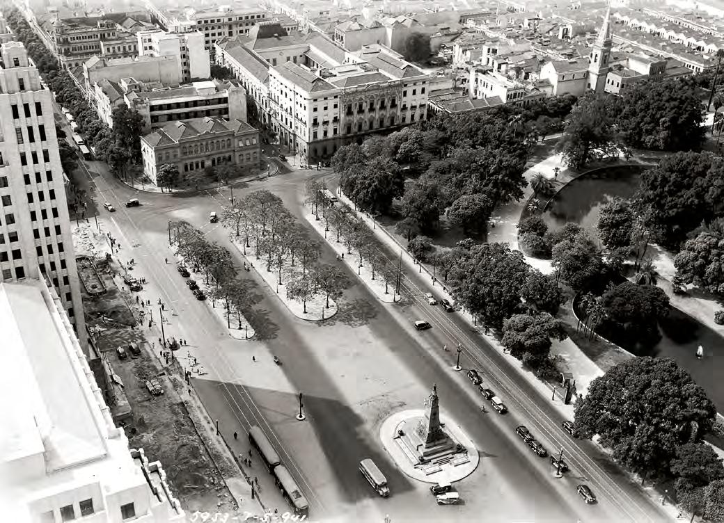
96
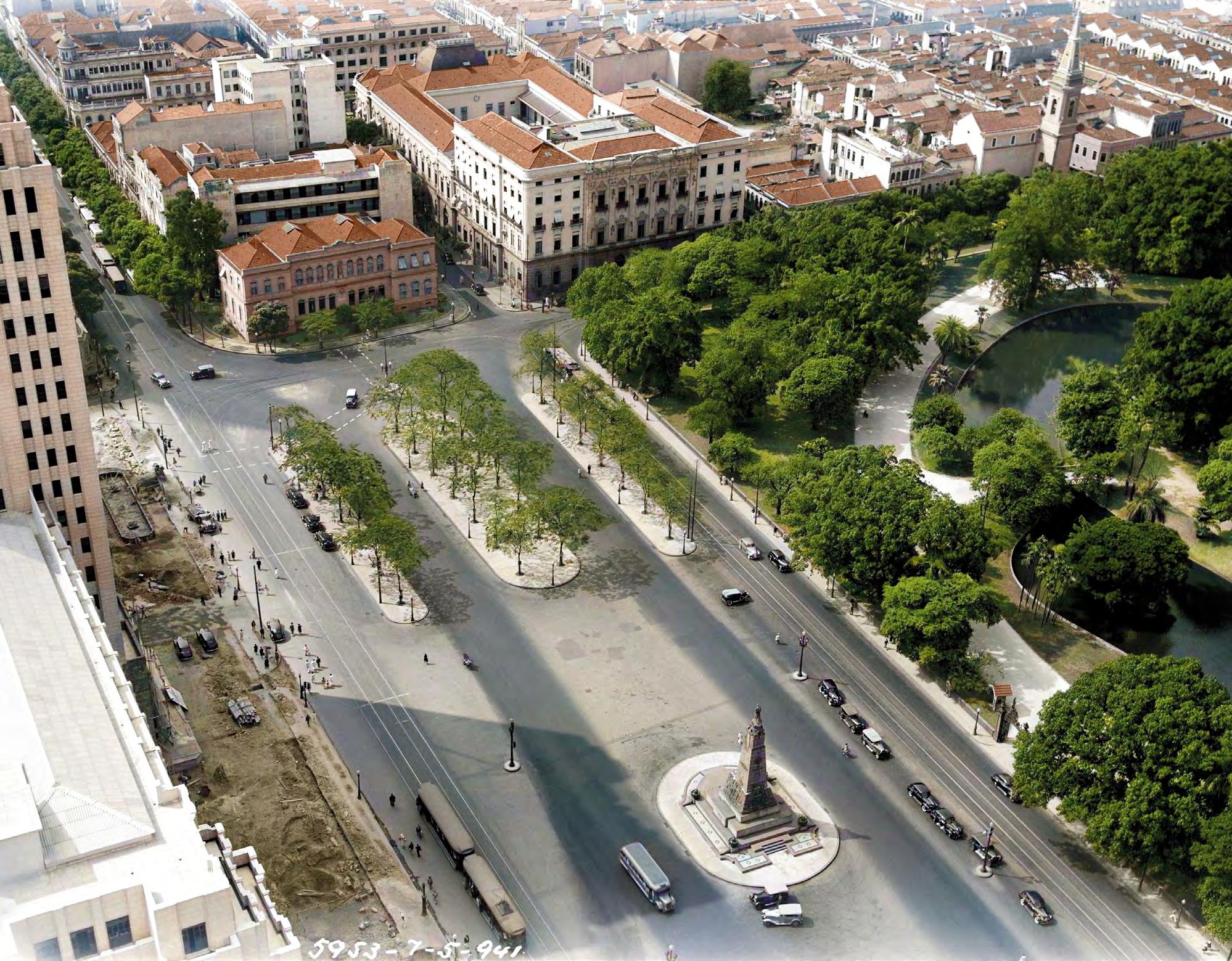
Praça Cardeal Arcoverde
Cardeal Arcoverde Square
Uriel Malta, 1940
A princípio chamada de Martim Afonso (explorador do litoral brasileiro no século XVI) e depois Sacopenapã (nome primitivo do bairro de Copacabana), a atual Praça Cardeal Arcoverde foi batizada em homenagem ao pernambucano Joaquim Arcoverde de Albuquerque Cavalcanti, primeiro cardeal do Brasil e da América Latina. Curiosamente, a praça que celebra um alto dignitário católico desde 1917, possui um chanukiá, tradicional candelabro judaico de nove velas, instalado em 2004. A foto de Uriel Malta retrata uma bucólica localidade dominada pelo verde. Primeira praça criada no bairro de Copacabana, vemos, em primeiro plano, com laje ajardinada, a atual Escola Municipal Dom Aquino Corrêa. Localizada ao lado do Teatro Gláucio Gil, o atual prédio homenageia o membro da Academia Brasileira de Letras e 19º governador do Mato Grosso. Ao fundo, a Ladeira do Leme, local onde foi instalada a antiga muralha colonial conhecida como Reduto do Leme.
Initially with the name Martim Afonso (a 16th-century explorer of the Brazilian coastline) and later with the name Sacopenapã (a former designation for the district of Copacabana), the current Cardeal Arcoverde Square was named in honor of Joaquim Arcoverde de Albuquerque Cavalcanti, a cleric from Pernambuco who was the first Cardinal of Brazil and of Latin America. Curiously, in this square which since 1917 has been named after a high Catholic dignitary, we now find a Hanukkah menorah, a traditional nine-candle Jewish candelabra, installed in 2004. The photo by Uriel Malta portrays a bucolic place dominated by green. At this square, the first created in the district of Copacabana, we see in the foreground the current Dom Aquino Corrêa Municipal School, with a rooftop garden. Located next to the Gláucio Gil theater, the building is named after Aquino Corrêa, a member of the Brazilian Academy of Letters and the 19th governor of the state of Mato Grosso. In the background is Leme Slope, at whose top the ancient colonial wall called the Redoubt of Leme is visible.
98

Avenida Atlântica, Praia de Copacabana AtlânticaAvenue,CopacabanaBeach Anônimo (Anonymous), c. 1930

Inaugurado em 1923, o Hotel Copacabana Palace foi planejado pelo empresário Octávio Guinle inicialmente para acomodar os visitantes da Exposição do Centenário da Independência (1922). Projetado pelo arquiteto francês Joseph Gire, o mesmo do Hotel Glória, o fabuloso edifício seria destaque numa Avenida Atlântica recém-reformada. Ao longo do tempo, o hotel atuaria como força definidora na formação de um dos bairros mais celebrados em nossa cultura popular, além de se tornar símbolo de um dos principais cartões-postais do país.
Inaugurated in 1923, the Copacabana Palace Hotel was initially planned by businessmen Octávio Guinle to accommodate the visitors to the Exhibition of the Centennial of Independence (1922). Designed by French architect Joseph Gire, who also designed the Glória Hotel, the fabulous building was outstanding on the recently reformed Atlântica Avenue. Over time, the hotel acted as a defining force in the formation of one of the most celebrated districts in our popular culture, while also becoming an iconic landmark.
Nas páginas seguintes, uma foto colorizada, com a igrejinha de Nossa Senhora de Copacabana, assim batizada em homenagem à Virgem de Copacabana (Marc Ferrez, c. 1900), abrigada em basílica homônima na Bolívia. Conta-se que, ainda no século XVIII, uma imagem semelhante foi trazida e depositada na pequena ermida localizada no canto da praia. Com o tempo, o prestígio da igrejinha fez com que seu nome fosse atribuído à localidade até então conhecida pela designação tupi de Sacopenapã. Em 1918, no entanto, ela seria demolida para dar espaço ao Forte de Copacabana.
On the following pages, a colorized photo, with the little church of Nossa Senhora de Copacabana, named in honor of the Virgin of Copacabana (Marc Ferrez, c. 1900), housed in a basilica of the same name in Bolivia. It is said that in the 18th century, a similar image was brought and placed in the small chapel located at the end of the beach. With time, due to the little church’s growing prestige, its name was attributed to the place up to then known by the Tupi designation Sacopenapã. In 1918, however, it was demolished to make way for Fort Copacabana.
100


Areia Branca, Santa Cruz
Areia Branca, Santa Cruz
Augusto Malta, s. d. (n.d.)
Antigo território tupinambá, o bairro de Santa Cruz foi gradualmente colonizado pela Companhia de Jesus a partir de 1589. Ao longo do século XVIII, a famosa fazenda que nomeia o local seria criada e posteriormente ampliada com a construção de um convento e prédios anexos. Após a expulsão dos padres jesuítas do Brasil em 1759, a propriedade passaria para as mãos da Coroa portuguesa. Com a chegada de Dom João, a região seria escolhida como casa de campo da família real. Não tardaria para que se transformasse em um dos lugares de recreio favorito para os príncipes e princesas. Um dos bairros mais antigos da cidade do Rio, atuou como importante ponto de parada no caminho para São Paulo. Com a criação de Petrópolis, no Segundo Reinado, perderia gradativamente a importância de outrora. De ar bucólico, a imagem de Augusto Malta retrata a capela erguida em homenagem a São Benedito (atual paróquia de São Benedito), na região conhecida como Areia Branca, em Santa Cruz.
Starting in 1589, lands of the Tupinambá indigenous people were gradually colonized by the Company of Jesus, eventually becoming the district of Santa Cruz. The district’s name derives from a famous farm created there in the 18th century and later enlarged by the construction of a convent and attached buildings. After the expulsion of the Jesuit priests from Brazil in 1759, the site became the property of the Portuguese crown. With the arrival of João VI, the region was chosen as the location of the royal family’s country estate. It soon became a favorite recreation spot for the princes and princesses. One of the oldest districts in the city of Rio, it served as an important stopping place on the way to São Paulo. With the creation of Petrópolis, in the Second Reign, it gradually lost its former importance. With a bucolic air, the image by Augusto Malta portrays the chapel built in honor of Saint Benedict (currently the parish of São Benedito), in the region known as Areia Branca, in Santa Cruz.

104

Avenida Niemeyer, Pedra da Gávea, São Conrado NiemeyerAvenue, Gávea Rock, São Conrado

Maior monolito à beira-mar do mundo, vemos, em ambas as imagens, a monumental estrutura rochosa conhecida como Pedra da Gávea. Com altura superior a 800 m, foi um dos primeiros marcos naturais batizados pelos navegantes portugueses no início do século XVI. Similar à gávea de um navio (vela quadrada acima da maior vela de uma embarcação), a igrejinha em seu sopé foi a primeira construção no hoje bairro de São Conrado. Erguida entre 1914 e 1916, foi financiada com os recursos do comendador Conrado Jacob de Niemeyer, patriarca do bairro de igual nome. Em sua homenagem, a principal avenida de conexão com o bairro do Leblon seria batizada de Avenida Niemeyer. Região pouco habitada até os anos 1920, ganharia os seus primeiros palacetes nos anos 1930. Entre 1933 e 1954, a sua principal avenida sediou importantes corridas automobilísticas. À direita, na foto de Marc Ferrez (c. 1920), originalmente colorida pelo método Autochrome Lumière, vemos a bela igrejinha fundadora do bairro de São Conrado.
The two photos on these pages portray the largest seaside monolith in the world, the monumental rocky structure known as Gávea Rock. With a height of more than 800 meters, it was one of the first natural landmarks named by the Portuguese sailors at the beginning of the 16th century. Resembling a ship’s topsail (the “square” sail above a vessel’s largest sail), the little church at its foot was the first construction in what is now the district of São Conrado. Built between 1914 and 1916, it was financed with funds from Commander Conrado Jacob de Niemeyer, the patriarch of the district bearing his name. In his honor, the main avenue connecting it with the district of Leblon was named Niemeyer Avenue. A region sparsely inhabited until the 1920s, it gained its first mansions in the 1930s. Between 1933 in 1954, automobile races were held on its main avenue. At right, in the photo by Marc Ferrez (c. 1920), originally colored using the Autochrome Lumière method, we see the beautiful little founding church of the district of São Conrado.
106
Marc Ferrez, c. 1920


Ao longo do século XX, o Rio se expandiu para cada vez mais longe do seu centro histórico. Bondes, trens e automóveis adentraram o território na direção dos subúrbios e da Baixada Fluminense.
Por suas orlas marítimas, assistimos à expansão urbana da Baía de Guanabara às praias oceânicas do Recreio dos Bandeirantes. Morros e encostas povoaram-se de cariocas de múltiplas origens. Entre 1922 e 2022, um extraordinário salto demográfico. Cerca de 6,8 milhões de cariocas vivem hoje na cidade, cinco vezes mais do que na data do centenário da Independência. Capital por quase 200 anos, a cidade se reinventou com a inauguração de Brasília. Principal berço da cultura no país, é a sede dos grandes acontecimentos nacionais. Potência cultural, criativa e econômica, o Rio de hoje é protagonista do desenvolvimento sustentável e da inovação. Ao longo das próximas páginas, com imagens exclusivas do fotógrafo carioca Claudio Edinger, com 18 livros publicados e 15 prêmios internacionais, o(a) leitor(a) verá alguns dos mais representativos cenários da cidade que é o reflexo e o coração de um Brasil diverso.
Throughout the 20th century, Rio expanded further and further away from its historical center. Trolleys, trains, and automobiles penetrated the territory toward the suburbs and the Baixada Fluminense region. Along its seashore, the city underwent an urban expansion from Guanabara Bay to the ocean beaches of Recreio dos Bandeirantes. Mountains and slopes were settled by Cariocas from various origins. Between 1922 and 2022, there was an extraordinary demographic leap. Around 6.8 million Cariocas live in the city today, five times more than on the date of the first centennial of Independence. A capital for nearly 200 years, the city reinvented itself after the inauguration of Brasília. A main cradle of culture in the country, it is the hub of great national developments. As a cultural, creative, and economic powerhouse, Rio is currently playing a leading role in sustainable development and innovation. On the following pages, with exclusive images by Carioca photographer Claudio Edinger, the author of 18 books and the winner of 15 international awards, the reader will see some of the most representative scenarios of the city that is the reflection and heart of a diverse Brazil.
O RIO HOJE
Igreja da Penha Penha Church
Claudio Edinger, 2021
Localizada no alto de uma pedra montanhosa, a Igreja da Penha passou por muitas transformações ao longo dos anos. Com sua atual fachada neogótica, ela é conhecida pela escadaria construída no século XIX, por ordem de uma devota que pretendia facilitar o acesso à paróquia. São comuns as histórias de fiéis que sobem ajoelhados seus 382 degraus, cumprindo promessas feitas à santa. Cercado por algumas das maiores comunidades do Rio, como os Complexos da Penha e do Alemão, o bairro é um dos mais tradicionais da Zona Norte da cidade. Na fotografia, os contrastes de azul e amarelo do céu incidem sobre as cores da igreja, reforçando a bela vista do alto do penhasco.
Perched on a rocky hilltop, Penha Church has gone through many transformations over the years. With its current neogothic façade, it is known for its exterior stairs built in the 19th century by the order of a devotee who wanted to facilitate access to it. Stories abound about the faithful who have crawled up the 382 steps on their knees, fulfilling promises made to the saint. Surrounded by some of the Rio’s largest communities, such as the complexes of Penha and Alemão, the district is among the most traditional in the city’s North Zone. In the photograph, the contrasts of blue and yellow in the sky are echoed in the colors of the church, reinforcing the gorgeous view from the height of the crag.
110

Fundação Oswaldo Cruz Oswaldo Cruz Foundation
Claudio Edinger, 2022
Construído em 1918, o Pavilhão Mourisco da Fundação Oswaldo Cruz — Fiocruz surgiu com a proposta de se tornar um “palácio das ciências”. Projetado pelo arquiteto português Luiz Moraes Júnior, o castelo foi fortemente influenciado pelo estilo neomourisco dos prédios históricos de Alhambra, na Espanha. Visitado por Albert Einstein em 1925, o prédio abrigou laboratórios, museus e bibliotecas. Atualmente, funciona como o centro das atividades administrativas da fundação. Principal instituição médico-científica da América Latina, produz, desde 2020, vacinas contra o vírus da Covid-19 em parceria com Universidade de Oxford e o laboratório AstraZeneca.
Built in 1918, the Moorish Pavilion of Oswaldo Cruz Foundation — Fiocruz arose with the aim of becoming a “palace of the sciences.” Designed by Portuguese architect Luiz Moraes Junior, the castle was strongly influenced by the neo-Moorish style of the historical buildings of Alhambra, Spain. Visited by Albert Einstein in 1925, the building held laboratories, museums and libraries. It currently functions as Fiocruz’s administrative headquarters. The main medical-scientific institution of Latin America, since 2020 it has been producing vaccines against the COVID-19 virus in partnership with Oxford University and AstraZeneca laboratories.
112

Estádio Maracanã Maracanã Stadium
Claudio Edinger, 2015
Palco de grandes batalhas futebolísticas, o Maracanã (popularmente apelidado de Maraca) é um dos mais conhecidos templos do futebol mundial. Dono dos maiores públicos da história do esporte, foi em seus gramados que Edson Arantes do Nascimento, o Rei Pelé, marcou o seu milésimo gol. Construído para receber a Copa do Mundo de 1950, voltaria a sediar a competição no ano de 2014. Na certidão, seu nome é Estádio Mário Filho, homenagem ao grande jornalista e cronista esportivo que incentivou sua construção. A alcunha Maracanã deve-se ao rio que corta o bairro onde está localizado, assim batizado por conta da ave popularmente conhecida como arara-pequena ou papagaio-de-cara-branca.
The stage of important soccer games, Maracanã Stadium (popularly nicknamed Maraca) is one of the most well-known temples of soccer worldwide. With one of the largest publics in the history of the sport, on its grass Edson Arantes do Nascimento, Pelé, scored his 1,000th goal. Built to host the 1950 World Cup, it hosted the same competition in 2014. On its deed, its name is Mário Filho Stadium, in honor of the great journalist and sports columnist who encouraged its construction. The nickname Maracanã is owing o the river that cuts through the district where it is located, for its part named after a bird commonly known as the chestnut-fronted macaw or severe macaw.

114

Praça da Harmonia HarmonySquare
Claudio Edinger, 2022
Localizada no bairro da Gamboa, a Praça Coronel Assunção foi nomeada em homenagem ao ex-combatente da Guerra do Paraguai (1864–1870) e chefe da Polícia Militar da Corte. Popularmente conhecida como Praça da Harmonia, sediou, no final do século XIX, o Mercado da Harmonia. Em 1904, foi um dos palcos da Revolta da Vacina, finda a qual passaria por profundas reformas urbanísticas. Cercada por prédios históricos, vemos, ao centro da imagem de Edinger, o 5° Batalhão da Polícia Militar, finalizado em 1908, e à direita, o Moinho Fluminense, inaugurado em 1887. Trata-se da primeira fábrica de moagem de trigo do Brasil, também retratada na foto menor de Marc Ferrez.
Located in the district of Gamboa, Coronel Assunção Square was named in honor of the former combatant of the Paraguayan War (1864–1870) and chief of the Military Police of the Court. Popularly known as Harmonia Square at the end of the 19th century it was the site of Harmonia Market. In 1904, it was one of the places where the Vaccine Revolt took place, after which it went through profound urbanistic reforms. Surrounded by historical buildings, at the center of this image by Edinger we see the headquarters of the 5th Military Police Battalion, completed in 1908, and, on the right, the Fluminense Mill, inaugurated in 1887. It was Brazil’s first wheat mill, also portrayed in the smaller photo by Marc Ferrez.
Em preto e branco, Mercado da Praça da Harmonia e o Moinho Fluminense Foto de Marc Ferrez, c. 1895 In black-and-white, the Harmonia Square Market and the Fluminense Mill Photo by Marc Ferrez, c. 1895

116

Claudio Edinger, 2015
Oficialmente denominada Via Expressa Presidente João Goulart, a Linha Vermelha foi concebida pelo arquiteto grego Constantinos Doxiadis como parte do projeto urbanístico encomendado pelo então governador da Guanabara, Carlos Lacerda. Seu apelido deve-se à sua cor no traçado do plano original, conhecido como Plano Policromático. É fundamental para o escoamento de mercadorias que chegam ao Porto do Rio; atravessa a cidade, ligando o município à Baixada Fluminense. Com trechos ladeados por um mosaico colorido de contêineres, a via conduz à Ilha do Governador, onde se localiza o Aeroporto Internacional Tom Jobim, e à Ilha do Fundão, casa do principal campus da Universidade Federal do Rio de Janeiro.
Officially named President João Goulart Expressway, the Red Line [Linha Vermelha in Portuguese] was conceived by Greek architect Constantinos Doxiadis as part of the urbanistic project commissioned by the then governor of Guanabara, Carlos Lacerda. Its name derives from the color of its line on the original plan, known as the Polychrome Plan. It is essential for the land transport of merchandise that arrives at the Port of Rio; it crosses the city, linking it to the Baixada Fluminense region. With segments fringed with the colorful mosaic of containers, the line leads to Governador Island, where Tom Jobim International Airport is located, and to Fundão Island, home to the first campus of Rio de Janeiro Federal University.

118
Linha Vermelha e Porto do Rio RedLineExpresswayand PortofRio

Ilha Fiscal Fiscal Island
Claudio Edinger, 2015
Inaugurada em abril de 1889 como posto alfandegário, a Ilha Fiscal notabilizou-se como o cenário do último baile do Império, um dos raros eventos de luxo da história imperial brasileira. O belo projeto de autoria de Adolpho José Del Vecchio rendeu-lhe a medalha de ouro na exposição da Academia Imperial de Belas-Artes de 1890. Construído em estilo gótico-provençal, a área hoje integra o Espaço Cultural da Marinha. Em segundo plano, na imagem à direita, vemos a Ilha das Cobras, tradicional reduto de defesa da cidade desde os tempos coloniais. Atualmente abriga o complexo naval da Marinha.
Inaugurated in April 1889 as a customs post, Fiscal Island became noteworthy as the scenario for the last dance of the Empire, one of the rare luxury events in Brazil’s imperial history. The beautiful design by Adolpho José Del Vecchio garnered it the gold medal in the exhibition of the Royal Academy of Fine Arts of 1890. Built in gothic-Provençal style, the area is today part of the Navy’s Cultural Space. In the middle ground, in the image on the right, we see Cobras Island, a traditional stronghold of the city’s defense since the colonial times. The island currently holds the Navy complex.

120

Museu do Amanhã Museumof Tomorrow
Claudio Edinger, 2015
Projetado pelo arquiteto espanhol Santiago Calatrava, o Museu do Amanhã se lança sobre as águas da Baía de Guanabara com uma mistura de ciência, tecnologia e sustentabilidade. Inaugurado em 2015, sua construção foi uma das mais importantes obras do Porto Maravilha, projeto de revitalização da Zona Portuária da cidade. Vemos na fotografia o museu ocupando a área do antigo píer Mauá. Ao fundo, símbolo de duas eras, presente e passado se encontram. À esquerda, de fisionomia pós-moderna, o Edifício Rio Branco 1 (RB1). À direita, o icônico edifício A Noite, sede do jornal que lhe nomeia e da Rádio Nacional. Os seus 24 andares em arte déco foram, por anos, o maior arranha-céu do Brasil.
Designed by Spanish architect Santiago Calatrava, the Museum of Tomorrow juts out into Guanabara Bay with a mix of science, technology and sustainability. Inaugurated in 2015, its construction was one of the most important works of the Porto Maravilha project for the revitalization of the city’s Port Zone. In the photograph we see the museum occupying the area of the former Mauá Pier. In the background, symbols of two eras, present and past meet. At the left, in postmodern lines, the Rio Branco 1 Building (RB1). At the right, the iconic A Noite Building, the headquarters of the newspaper of the same name and of Rádio Nacional. Its 24 floors in art deco were, for years, Brazil’s tallest skyscraper.
122

Museu de Arte do Rio Rio Art Museum
Claudio Edinger, 2022
Situado na Praça Mauá, o Museu de Arte do Rio — MAR é um dos mais importantes espaços de apoio à cultura e educação no centro da cidade. Inaugurado em 2013, é composto por dois prédios interligados por cobertura fluida: o Palacete Dom João VI, em estilo eclético, e o prédio modernista, originalmente um terminal rodoviário. Na fotografia de Edinger, vemos, próximo à estátua de Barão de Mauá, o Veículo Leve sobre Trilhos (VLT), transporte público implementado após a revitalização da praça, em 2016. Conectado à região outrora conhecida como Pequena África, o museu está próximo a locais históricos da cidade, como a Pedra do Sal, o Cais do Valongo e o Morro da Conceição.
Located at Mauá Square, the Rio Art Museum — MAR is one of the most important spaces for the support of culture and education in the city’s downtown. Inaugurated in 2013, it consists of two buildings interlinked by a fluid roof; the Dom João VI Palace, in eclectic style, and the modernist building beside it, originally a bus station. In the photograph by Edinger, we see, near the statue of the Baron of Mauá, the Light Vehicle on Tracks, a public transport system deployed after the square’s revitalization, in 2016. Connected to the region formerly known as Little Africa, the museum is near historical sites of Rio, such as the Salt Rock, Valongo Wharf, and Conceição Hill.
Praça Mauá, Palacete Dom João VI e ao fundo, o Morro da Conceição Foto de Augusto Malta, c. 1920 Mauá Square, Dom João VI Palace, and, in the background, Conceição Hill Photo by Augusto Malta, c. 1920

124

Igreja da Candelária Candelária Church
Claudio Edinger, 2015
Voltada para a Baía de Guanabara, a Igreja da Candelária passou por várias remodelações ao longo do tempo. Suas origens remontam ao ano de 1609, data da edificação de uma ermida no local. Sucessivamente ampliada nos séculos seguintes, carrega camadas de diversos estilos arquitetônicos, tais como o barroco, o art nouveau e o neoclássico. Às suas costas, vemos a Avenida Presidente Vargas, monumental obra de modernização empreendida nos anos 1940. Durante a sua construção, 525 prédios foram destruídos para a passagem de suas largas pistas. Poupada, a Candelária resiste como um dos grandes símbolos de fé e beleza no coração do Rio.
Facing Guanabara Bay, the Candelária Church has undergone various remodelings over time. Its origins date to the year 1609, with the building of a small chapel. Successively enlarged in the following centuries, it bears layers of various architectural styles, including baroque, art nouveau and neoclassic. Behind it, we see Presidente Vargas Avenue, a monumental work of modernization built in the 1940s. During its construction, 525 buildings were destroyed to make way for its wide lanes. Spared, the Candelária Church endures as one of the great symbols of faith and beauty in the heart of Rio.
126

Campo de Santana Santana Field
Claudio Edinger, 2016
Um dos mais antigos espaços públicos cariocas, o multifacetado Campo de Santana já foi palco para manobras militares, celebrações reais e festas populares. Maior área verde do centro do Rio, ainda hoje é a casa de diversas espécies animais e vegetais. Localizado ao lado da Avenida Presidente Vargas, uma das principais vias da cidade, o parque é vizinho de importantes construções, tais como o Arquivo Nacional, o Palácio do Itamaraty e o Palácio Conde dos Arcos, este último sede do Senado imperial. Na imagem de Edinger, vemos, à esquerda do histórico campo, o atual Museu Casa da Moeda, primeira sede do Museu Nacional entre 1818 e 1892.
One of the city’s oldest public spaces, the multifaceted Santana Field has been the stage for military maneuvers, royal celebrations and popular festivals. The largest green area in downtown Rio, it is yet today home to various species of plants and animals. Located alongside Presidente Vargas Avenue, one of the city’s main thoroughfares, the park neighbors important buildings, such as that of the National Archives, Itamaraty Palace, and the Count of Arcos Palace, the latter of which once housed the Imperial Senate. In the image by Edinger, we see, to the left of the historical field, the building that now houses the Mint Museum, but which was the original premises of the National Museum, between 1818 and 1892.
Em preto e branco, Campo da Aclamação Foto de Marc Ferrez, c. 1882
In black-and-white, Aclamação Field Photo by Marc Ferrez, c. 1882

128

Praça XV
XV Square
Claudio Edinger, 2022
Antigo Largo do Paço, a atual Praça XV abriga alguns dos mais importantes edifícios da cidade. Na imagem de Edinger, vemos, à esquerda, o Palácio Tiradentes, sede do poder legislativo estadual; ao centro, o Paço Imperial, primeira residência da família real no Brasil, e à direita, o Chafariz da Pirâmide (ou Chafariz do Mestre Valentim), construído à beira-mar, em 1789, para abastecer as embarcações ancoradas no antigo Cais Pharoux. Esse histórico monumento colonial, em cantaria, ganhou destaque após a revitalização da orla e a demolição do Elevado da Perimetral, em 2016.
Formerly called Paço Square, XV Square holds some of the city’s most important buildings. In the image by Edinger we see, at the left, Tiradentes Palace, the seat of the State Legislature; at the center, the Imperial Palace, the first residence of the royal family in Brazil, and, at the right, Pirâmide Fountain (or Mestre Valentim’s Fountain), built on the seashore, in 1789, to supply the ships anchored at the old Pharoux Wharf. This historical colonial monument, seen here at the right, became outstanding after the revitalization of the shoreline and the demolition of the Perimetral Elevated Roadway, in 2016.
Páginas seguintes ( following pages )
Estação das Barcas
TheFerryboatStation
Claudio Edinger, 2022
Nas páginas seguintes, vemos, ao centro, o belo conjunto arquitetônico da Estação Praça XV, popularmente conhecida como estação das barcas. Inaugurada em 1912, o centenário espaço aquaviário conecta o Rio de Janeiro à cidade de Niterói e às ilhas de Paquetá e do Governador. Ao fundo, a Praça XV e suas imediações.
On the following pages we see, at the center, the beautiful architectural set of XV Square Station, popularly known as the ferryboat station. Inaugurated in 1912, this water transport hub continues to connect Rio de Janeiro with the city of Niterói and to the islands of Paquetá and Governador. In the background, XV Square and its environs.
130


Cinelândia e Avenida Rio Branco Cinelândia and Rio Branco Avenue
Claudio Edinger, 2022
Importante espaço político e cultural da cidade, a Cinelândia, oficialmente Praça Floriano Peixoto, é margeada à direita pela Avenida Rio Branco e ao seu redor, estão algumas das mais simbólicas construções do Rio. Em primeiro plano, o monumental chafariz adquirido da Áustria por Dom Pedro II, em 1878. Originariamente instalado na Praça XV e depois na Praça da Bandeira, ocupa hoje o espaço do histórico Palácio Monroe, demolido em 1976. Ao centro, na esquina, está o Cinema Odeon, de 1926, o mais antigo em funcionamento na cidade. Ao fundo, o majestoso Theatro Municipal, cenário da foto em preto e branco de Augusto Malta com foliões fantasiados em um antigo Ford no Carnaval de 1919.
An important political and cultural space of the city, Cinelândia, officially called Floriano Peixoto Square, is fringed on the right by Rio Branco Avenue and around it are some of Rio’s most symbolic constructions. In the foreground, the monumental fountain acquired from Austria by Pedro II, in 1878. Originally installed at XV Square and later at Bandeira Square, today it occupies the space of the historic Monroe Palace, torn down in 1976. At the center, on the corner, is the Cinema Odeon, from 1926, the oldest movie theater still operating in the city. In the background, the majestic Municipal Theater, the backdrop in the black-and-white photo by Augusto Malta with costumed paraders and an antique Ford in the Carnival of 1919.
Em preto e branco, Carnaval na Cinelândia Foto de Augusto Malta, 1919 In black-and-white, Carnival of Cinelândia Photo by Augusto Malta, 1919

134

Arcos da Lapa LapaArches
Claudio Edinger, 2016
Maior construção do Brasil colonial, o Aqueduto da Carioca transportava água do Rio Carioca ao chafariz localizado no largo de igual nome, no centro do Rio. Popularmente batizada de Arcos da Lapa, no século XIX, serviu de trilho para outro tipo de transporte. Principal via de acesso ao bairro de Santa Teresa por muitas décadas, é ainda hoje o último reduto dos saudosos bondinhos. Ao redor dos seus majestosos 42 arcos duplos, estão importantes casas de espetáculo, como a Fundição Progresso, o Circo Voador e a Sala Cecília Meireles. Centro de uma intensa vida cultural, é um dos principais pontos de encontros de turistas e apaixonados pela cidade.
The largest construction of colonial Brazil, the Carioca Aqueduct transported water from the Carioca River to the fountain located in the square with the same name, in downtown Rio. Popularly known as the Lapa Arches, in the 19th century trolley rails ran across its top. The main access to the district of Santa Teresa for many decades, today it supports the last segment of the nostalgic little trolleys. Around its 42 majestic double arches there are important show houses, such as those of the Progresso Foundry, the Voador Circus and Cecília Meireles Hall. The hub of an intense cultural life, it is one of the main meeting spots for tourists and aficionados of Rio.
Em preto e branco, Aqueduto da Carioca já funcionando como passagem para o Bonde de Santa Teresa | Foto de Augusto Malta, 1906 In black-and-white, the Carioca Aqueduct once served as a route for the Santa Teresa Trolley Photo by Augusto Malta, 1906

136

Igreja da Glória Glória Church
Claudio Edinger, 2021
A Igreja de Nossa Senhora da Glória do Outeiro, também conhecida como Outeiro da Glória, é uma das joias da arquitetura setecentista no Rio de Janeiro. Com paredes caiadas emolduradas por pedras de granito, uma das primeiras igrejas coloniais com planta poligonal, foi inaugurada no ano de 1739 em estilo barroco, e transformou-se em local de predileção da família imperial brasileira. Não por acaso, foi o local de batismo de Dom Pedro II e da princesa Isabel. Originalmente construída à beira-mar, o terreno ocupado pela igreja foi o palco, em 1567, da batalha final entre franceses e portugueses pelo domínio da cidade. Na fotografia, de Marc Ferrez, a bela vista panorâmica do bairro da Glória, com a Baía de Guanabara e o Morro do Pão de Açúcar ao fundo.
The Nossa Senhora da Glória do Outeiro Church, also known as the Outeiro da Glória Church, is one of the jewels of 18th-century architecture in Rio. With whitewashed walls framed by granite stones, one of the first colonial churches with a polygonal floor plan, it was inaugurated in 1739 in baroque style, and became a favorite place for the Brazilian Imperial family. Not by chance, it was where Emperor Pedro II and Princess Isabel were baptized. Its grounds originally lay at the seashore, on lands that were the stage, in 1567, of the final battle between the French and the Portuguese for the control of the city. In the photograph, by Marc Ferrez, we see a scenic vista of the district of Glória, with Guanabara Bay and Sugarloaf Mountain in the background.
Em preto e branco, Bairro da Glória Foto de Marc Ferrez, c. 1904 In black-and-white, the district of Glória Photo by Marc Ferrez, c. 1904

138

Santa Teresa
Santa Teresa
Claudio Edinger, 2021
Simbolicamente apelidada de Montmartre carioca, Santa Teresa encanta com suas belas vistas panorâmicas. O bairro que cresceu ao redor do convento das irmãs carmelitas passaria a ser habitado por pessoas de posse em meados do século XIX. Reduto de intelectuais e artistas de várias nacionalidades, ainda hoje conserva o seu ar bucólico: os casarões antigos, as ladeiras de paralelepípedo e o bonde — tombado pelo Patrimônio Histórico Estadual. Na imagem de Edinger, vemos o elegante Castelo Valentim, cujos traços góticos de sua arquitetura eclética remetem às fortalezas do período medieval. Inaugurado na década de 1870, foi projetado para ser a residência do comendador português Antônio Valentim.
Symbolically nicknamed the Carioca Montmartre, Santa Teresa is charming for its scenic vistas. The district that grew around the convent of the Carmelite nuns began to be inhabited by wealthy people in the mid-19th century. A bastion of intellectuals and artists of various nationalities, it has conserved its bucolic air until today: the old, large houses, the sloping cobblestone streets and the trolley — designated as a State Historical Heritage. In the image by Edinger, we see the elegant Valentim Castle, the gothic lines of its eclectic architecture recalling medieval strongholds. Inaugurated in the 1870s, it was designed to serve as the residence of Portuguese Commander Antônio Valentim.
Páginas seguintes ( following pages )
Morro da Viúva e Parque do Flamengo ViúvaHillandFlamengoPark Claudio Edinger, 2022
Outrora postado à beira-mar, o grande monolito de gnaisse, conhecido como Morro da Viúva, separa a enseada de Botafogo da Praia do Flamengo. Atualmente cercado de edifícios, denota o esforço de adaptação da cidade ao relevo pitoresco da região. À direita, em contraste, vemos os canteiros geométricos do Aterro do Flamengo, com o paisagismo concebido por Roberto Burle Marx. A obra é apreciada e usufruída por cariocas e turistas que visitam os seus impressionantes 1,2 milhões de metros quadrados de jardins arborizados.
Formerly standing on the seashore, the large gneiss monolith known as Viúva Hill separates the cove of Botafogo and Flamengo Beach. Currently surrounded by buildings, it denotes the effort of adapting the city to the region’s picturesque topography. At the right, in contrast, we see the geometric plant beds of Flamengo Park, with its landscape design conceived by Roberto Burle Marx. The work is appreciated and enjoyed by the Cariocas and tourists who visit its impressive 1.2 million square meters of tree-lined gardens.
140


Palácio Guanabara Guanabara Palace Claudio Edinger, 2022
Situado às margens da Rua Guanabara (atual Rua Pinheiro Machado), o palácio construído pelo comerciante português José Machado Coelho teria importante papel ao longo da história. Em 1864, adquirido pelo imperador Dom Pedro II, é dado como presente de casamento à princesa Isabel e ao conde d’Eu. Residência imperial até a Proclamação da República, a histórica construção serviria de palácio presidencial (1889–1945), sede da prefeitura do Rio, então Distrito Federal (1946–1960), e depois do estado da Guanabara (1960–1975). Atualmente abriga o governo do Estado do Rio de Janeiro. Atrás do edifício em estilo neoclássico, vemos os belos jardins idealizados pelo paisagista francês Paul Villon, no começo do século XX.
Situated alongside Guanabara Street (currently Pinheiro Machado Street), the palace constructed by Portuguese merchant José Machado Coelho has played an important role throughout its history. In 1864, acquired by Emperor Pedro II, it was given as a wedding present to Princess Isabel and Count d’Eu. An imperial residence up to the Proclamation of the Republic, the historical construction was to serve as the presidential palace (1889–1945), as the Mayor’s Office of Rio, then the Federal District (1946–1960), and later the headquarters of the government of the state of Guanabara (1960–1975). It currently houses the government of the state of Rio de Janeiro. Behind the neoclassical-style building, we see the beautiful gardens conceived by French landscape architect Paul Villon, at the beginning of the 20th century.

144

Mirante do Pasmado e Enseada de Botafogo Pasmado Belvedere and BotafogoCove
Claudio Edinger, 2022
No topo do Mirante do Pasmado, em primeiro plano, vemos o Memorial do Holocausto. A partir do alto, descortina-se a vista singular do Pão de Açúcar e do bairro da Urca. Ao centro, a encantadora enseada da Praia de Botafogo, histórico local identificado com a gênese e o desenvolvimento do remo no Brasil. Ainda hoje, suas águas abrigam velejadores, pescadores e praticantes de esportes náuticos. Ao fundo da imagem, quase perdidas no horizonte, as belas praias da região oceânica de Niterói.
From the height of the Pasmado Scenic Outlook we see the Holocaust Memorial. Further away lie the singular Sugarloaf Mountain and district of Urca. In the center, the charming cove of Botafogo Beach, a historical place identified with the genesis and development of the sport of rowing in Brazil. Even today, its waters are dotted with sailboats, fishing boats and water sports practitioners. In the background, nearly lost on the horizon, the beautiful beaches of the oceanic region of Niterói.
146

Pedra do Arpoador ArpoadorRock
Claudio Edinger, 2016
A Pedra do Arpoador é a esquina de dois imensos eixos de praia. O primeiro atravessa o Forte de Copacabana, a Avenida Atlântica e chega até à Pedra do Leme; o outro vai de Ipanema ao Leblon, abraçando a encosta do morro Dois Irmãos e a Avenida Niemeyer. Antigo ponto de avistamento das baleias que margeavam o litoral, do alto se tem uma das vistas mais deslumbrantes da cidade, encontro de céu, mar e montanha. Conhecido reduto de surfistas e jovens artistas, foi durante a década de 1960 nas pedras do Arpoador que nasceu um dos hábitos mais adoráveis do carioca: aplaudir, maravilhado, o espetáculo do pôr do sol.
Arpoador Rock is the rocky vertex between two long beaches. The first runs through Copacabana Fort, Atlântica Avenue, and ends at Leme Rock; the other spans from Ipanema to Leblon, embracing the slope of Dois Irmãos Hill and Niemeyer Avenue. Formerly a point for spotting the whales that could be seen along the coast, from the rock one gets one of the most dazzling views of the city, an encounter of sky, sea and mountain. A meeting spot for surfers and young artists, during the 1960s it was on the rocks of Arpoador where one of the most adorable habits of the Carioca people arose: applauding, in awe, at the spectacle of the sunset.
148

Praia de Ipanema IpanemaBeach
Claudio Edinger, 2021
Paraíso costeiro originariamente habitado por população indígena, a atual área de Ipanema foi colonizada no final do século XIX por José Antônio Moreira, o Conde de Ipanema. Mundialmente conhecida no século XX, desde que Tom Jobim e Vinícius de Moraes fizeram a canção Garota de Ipanema , o bairro associou-se à imagem do despojamento e da sofisticação. Era o ponto de encontro de músicos, escritores, cronistas, cineastas e intelectuais — uma verdadeira “civilização de praia”, no dizer do maestro Jobim. Curiosamente a palavra Ipanema vem do tupi “água ruim”.
A coastal paradise originally inhabited by the indigenous population, the current area of Ipanema was colonized at the end of the 19th century by José Antônio Moreira, the Count of Ipanema. Known worldwide in the 20th century, ever since Tom Jobim and Vinícius de Moraes created song “The Girl from Ipanema,” the district is associated with the image of a casual lifestyle and sophistication. It was the meeting point for musicians, writers, colonists, filmmakers and intellectuals — a true “beach civilization,” in the words of master musician Jobim. Curiously, the word Ipanema comes from the Tupi and means “bad water.”
150

Cristo Redentor e Lagoa Rodrigo de Freitas Christ the Redeemer andRodrigodeFreitasLake
Claudio Edinger, 2022
Patrimônio mundial da humanidade e uma das sete maravilhas do mundo moderno, a monumental estátua do Cristo Redentor foi inaugurada no Morro do Corcovado no ano de 1931. Do alto de seus 704 metros, avistamos a mais célebre lagoa da cidade. Localizada entre o Maciço da Tijuca e o Oceano Atlântico, no coração da Zona Sul, a Lagoa Rodrigo de Freitas é um dos cenários prediletos para passeios e caminhadas ao ar livre. Batizada em homenagem ao fidalgo português Rodrigo de Freitas, antigo dono da região no século XVIII, sobre suas águas praticam-se esportes aquáticos, como o remo e a canoagem. Ao seu redor, estão alguns dos clubes de regatas mais queridos da cidade, como o Flamengo, o Botafogo e o Vasco.
A world heritage of humankind and one of the seven wonders of the modern world, the monumental statue of Christ the Redeemer was inaugurated on Mount Corcovado in 1931. From the height of its 704 meters, we see the city’s most celebrated lake. Located between the Tijuca Massif and the Atlantic Ocean, in the heart of the South Zone, Rodrigo de Freitas Lake is one of the favorite scenarios for outings and walks in the open air. Named in honor of the Portuguese nobleman Rodrigo de Freitas, the owner of the region during the 18th century, its waters provide the setting for various water sports, such as rowing and canoeing. Along its shores are some of the city’s most cherished sailing clubs, such as Flamengo, Botafogo and Vasco.

152

Parque Lage
LagePark
Claudio Edinger, 2015
Localizado aos pés do Corcovado no bairro do Jardim Botânico, o Parque Lage encanta os visitantes com a sua exuberante natureza disposta ao longo de 52 hectares de área verde. Antiga residência da família Lage, o seu imponente palacete em estilo eclético fora construído no século XIX e remodelado na década de 1920 como réplica perfeita de um verdadeiro palazzo romano. Cercado por Mata Atlântica, o atual parque público é a casa de majestosas palmeiras imperiais e de um conjunto de pequenos lagos artificiais. Parte integrante da Floresta da Tijuca, desde 1975, abriga a Escola de Artes Visuais.
Located at the base of Mount Corcovado in the district of Jardim Botânico, Lage Park charms its visitors with its teeming nature arranged on 52 hectares of green area. The former residence of the Lage family, its impressive mansion was built in eclectic style in the 19th century and remodeled in the 1920s as a perfect replica of a true “palazzo romano.” Surrounded by the Atlantic Forest, the current public park is home to majestic imperial palms and a group of manmade ponds. Nestled within the Tijuca Forest, since 1975 it is also the location of the famous Lage School of Visual Arts.
154

Jardim Botânico Botanical Garden
Claudio Edinger, 2022
Criado em junho de 1808 por Dom João VI, o Jardim Botânico foi a primeira instituição brasileira dedicada à ciência e à conservação da biodiversidade. No local, o príncipe regente mandou construir uma fábrica de pólvora e um grande jardim para aclimatar espécies vegetais de diversas partes do mundo. Hoje, é um dos mais importantes pontos turísticos da cidade, além de referência mundial nas áreas de botânica e preservação ambiental. Em 2012, um encontro entre história e futuro: o Rio torna-se a primeira paisagem cultural urbana a receber o título de Patrimônio Mundial. Nas imagens, vemos um dos seus símbolos: a alameda de palmeiras-imperiais, cujo primeiro exemplar, plantado em 1809, é a origem dos demais espalhados pelo Brasil.

Created in June 1808 by Prince Regent João VI, the Botanical Garden was the first Brazilian institution dedicated to science and to the conservation of biodiversity. At this site, the future king ordered the construction of a gunpowder factory and a large garden to acclimatize plant species from various parts of the world. Today, it is one of the city’s foremost sightseeing spots, as well as a worldwide reference in the areas of botany and environmental preservation. The year 2012 saw an encounter between history and future: Rio became the first urban cultural landscape to receive the World Heritage title. In the images, we see one of its symbols: the lane of imperial palms, whose first specimen, planted in 1809, was the origin all the other trees of this species scattered throughout Brazil.
Em preto e branco, Jardim Botânico
Foto de Marc Ferrez, 1885
In black-and-white, Botanical Garden
Photo by Marc Ferrez, 1885
156

Vista Chinesa Chinese Belvedere
Claudio Edinger, 2022
Localizado no Alto da Boa Vista, no complexo da Floresta da Tijuca, o mirante da Vista Chinesa foi construído entre 1902 e 1906. Na fotografia de Augusto Malta, podemos vê-lo na época de sua inauguração. Seu pagode, em estilo oriental, homenageia os chineses que trouxeram o cultivo do chá para o Brasil, no início do século XIX. Na foto à direita, vemos, em primeiro plano, o mirante e o Parque Nacional da Tijuca — uma das maiores florestas urbanas do mundo. Ao fundo, os morros do Pão de Açúcar e do Dois Irmãos compõem uma das marcas da paisagem carioca: o dueto de montanha e mar, quase a perder de vista.
Located on a high point called Alto da Boa Vista within the Tijuca Forest, the Chinese Belvedere was constructed between 1902 and 1906. The photograph by Augusto Malta shows how it looked at the time of its inauguration. Its oriental-style pagoda honors the Chinese who brought the cultivation of tea to Brazil, in the early 19th century. In the photo at the right, we see, in the foreground, the scenic outlook and the Tijuca National Park — one of the largest urban forests in the world. In the background, Sugarloaf Mountain and Mount Dois Irmãos compose one of the hallmarks of Rio’s landscape: the duet of mountain and sea, in the very far distance.
Em preto e branco, Vista Chinesa Foto de Augusto Malta, c. 1903 In black-and-white, Chinese Belvedere Photo by Augusto Malta, c. 1903

158

Estádio Nilton Santos Nilton Santos Stadium
Claudio Edinger, 2022
Situado no bairro do Engenho de Dentro, o Estádio Olímpico Nilton Santos, apelidado de Engenhão, foi construído em 2007 para os jogos Panamericanos do Rio. Arrendado pelo Botafogo de Futebol e Regatas, ganhou o nome de um de seus maiores ídolos: o lateral-esquerdo Nilton Santos, também conhecido como “A Enciclopédia” do futebol. Campeão das Copas do Mundo de 1958 e 1962. Na imagem de Edinger, vemos, à direita, a estação de trem Olímpica de Engenho de Dentro. Ao lado, em área com cerca de 35 mil m², a antiga Praça do Trem (atual Praça Carlos Alberto Torres) com os seus dois monumentais galpões.
Located in the district of Engenho de Dentro, the Nilton Santos Olympic Stadium, nicknamed Engenhão, was built in 2007 for the Pan-American games held in Rio. Leased by the soccer team Botafogo de Futebol e Regatas, it was named after one of the team’s greatest idols: left wingback Nilton Santos, champion of the 1958 and 1962 World Cups, also known as “The Encyclopedia” of soccer. In the image by Edinger we see, at the right, the Olímpica de Engenho de Dentro train station. Alongside, in an area of 35,000 m², the former Trem Square (currently Carlos Alberto Torres Square) with its two monumental sheds.
160

Parque Madureira Madureira Park
Claudio Edinger, 2022
Centro cultural e comercial do subúrbio carioca, o bairro de Madureira sedia um dos mais famosos mercados populares do Brasil. Desde 1914, milhares de pessoas circulam diariamente pelas quase 600 lojas do Mercadão de Madureira. Conhecido reduto do samba, é a casa de duas das mais tradicionais escolas da cidade: Portela e Império Serrano. Na foto, vemos o monumental Parque Mestre Monarco, o terceiro maior da cidade. Inaugurado em 2012, tornou-se motivo de orgulho para os moradores da região. Batizado em homenagem ao sambista símbolo da Portela, o local fora projetado de acordo com normas de qualidade ambiental que o qualificam como um espaço totalmente sustentável.
A cultural and commercial center of Rio’s suburbs, the district of Madureira is home to one of Brazil’s most famous popular markets. Since 1914, thousands of people circulate daily through the nearly 600 stores of Madureira Market. A well-known hub of samba, it is home to two of Rio’s most traditional samba schools: Portela and Império Serrano. In the photo, we see the monumental Mestre Monarco Park, the city’s third largest. Inaugurated in 2012, it is a source of pride for the region’s inhabitants. Named in honor of Portela’s foremost samba singer and composer, the park was designed according to standards of environmental quality that qualify it as a totally sustainable space.
162

Rocinha Rocinha
Claudio Edinger, 2016
Importante centro produtor de hortaliças no começo do século XX, o nome Rocinha faz menção às plantações de legumes e verduras dos seus primeiros moradores. Outras fontes, no entanto, o associam à existência de uma antiga moradora, apelidada de “russinha”. Da corruptela, a gênese de uma das maiores e mais conhecidas comunidades.
Localizada entre os bairros da Gávea e São Conrado, é a síntese de opostos. A imagem transmite, a um só tempo, o contraste da desigualdade social com a grandiosidade demográfica dos seus mais de 100 mil moradores. Ao fundo, envolto em névoas, o Cristo Redentor saúda a Baía de Guanabara.
An important area for the production of garden crops in the early 20th century, the name Rocinha [Little Farm] might refer to the vegetable gardens of its first inhabitants. Other sources, however, associate the name with a woman who used to live there, nicknamed “russinha” [little Russian]. A slight change in pronunciation would have thus given rise to the name of one of the largest and best-known Community. Located between the districts of Gávea and São Conrado, it is the synthesis of opposites. Its image conveys the contrast of social inequality with the demographic grandiosity of its more than 100,000 residents. In the background, wrapped by clouds, the Christ the Redeemer statue stretches its arms out wide as though to embrace Guanabara Bay.
164

Barra da Tijuca BarradaTijuca
Claudio Edinger, 2020
Compreendida entre a Pedra da Gávea e o Maciço da Pedra Branca, a área da extensa restinga e suas incontáveis dunas de areia, conhecida como Barra da Tijuca, era pouquíssimo habitada até meados do século XX. No final da década de 1960, o urbanista Lúcio Costa elaborou um plano-piloto para organizar a ocupação da região. Na foto de Edinger, vemos os traçados retilíneos e o baixo gabarito dos edifícios do Jardim Oceânico, previstos no projeto urbanístico original. Posteriormente, ele seria modificado para compreender as grandes torres comerciais e condomínios fechados que hoje caracterizam o bairro.
Squeezed between Gávea Rock and the Branca Rock Massif, the extensive area of sand and its countless sand dunes, known as Barra da Tijuca, was sparsely inhabited up to the middle of the 20th century.

In the late 1960s, however, urbanist Lúcio Costa drew up a pilot plan to organize the region’s occupation. In the photograph by Edinger we see the rectilinear lines and low building standard of Jardim Oceânico, envisioned in the original plan. Later, the plan was modified to include the large commercial towers and gated condominiums that characterize the district today.
Em preto e branco, Barra da Tijuca Foto de Raul Lima, c. 1960 In black-and-white, Barra da Tijuca Photo by Laul Lima, c. 1960
166

Parque Olímpico OlympicPark
Claudio Edinger, 2022
Construído no bairro da Barra da Tijuca, o Parque Olímpico foi a principal obra dos Jogos Olímpicos e Paralímpicos de 2016, sediados no Rio de Janeiro. No local, 16 modalidades olímpicas e 10 paralímpicas foram disputadas. Após viver a magia de um ciclo olímpico, foram construídas no espaço novas áreas de lazer, assim como o Muro dos Campeões, monumento com o nome de todos os 2.568 medalhistas. Com o fim dos jogos, o local passou a servir como espaço para a realização de grandes eventos na cidade, tais como o festival Rock in Rio. Ao fundo, no horizonte, vemos parte do belo Maciço da Pedra Branca.
Built in the district of Barra da Tijuca, the Olympic Park was the main construction project of the 2016 Olympic and Paralympic games hosted in Rio de Janeiro. On that site, events in 16 Olympic and 10 Paralympic sports categories were held. After the Olympics, new leisure spaces were constructed there, such as Champions Wall, a monument with the name of all 2,568 medalists. The place has become a space for the holding of large events in the city, such as the Rock in Rio Festival. In the background, on the horizon, we see part of the beautiful Branca Rock Massif.
168
 Claudio Edinger, 2022
Na imagem, vemos à esquerda a belíssima Lagoa de Marapendi, emoldurada pela vegetação nativa. À direita, a mais extensa faixa de areia do litoral carioca, com cerca de 18 km. Iniciada na praia da Barra, ela se estende pelas praias da Reserva e do Recreio até findar na Pedra do Pontal, famosa pela canção de Tim Maia. A Reserva de Marapendi compreende dois parques municipais que protegem a fauna e a flora das lagoas, áreas de restinga e da orla marítima. No bioma, sobrevivem espécies ameaçadas de extinção, como a borboleta-da-praia, a lagartixa-de-areia e o jacaré-de-papo-amarelo. Ao fundo, a silhueta do Maciço da Tijuca evoca a imagem de um grande gigante adormecido.
At the left of the image, we see the beautiful Marapendi Lake, framed by the native vegetation. At the right, the most extensive band of sand on Rio’s seashore, stretching about 18 kilometers. Beginning at Barra Beach, it extends through the beaches of Reserva and Recreio until ending at Pontal Rock, made famous by the song by Tim Maia. The Marapendi Reserve contains two municipal parks that protect the flora and fauna of the lakes, dunes and seashore. The biome is home to various endangered species, such as the Fluminense swallowtail butterfly, the sand lizard and the yellow-throated alligator. In the background, the silhouette of the Tijuca Massif looks like a gargantuan sleeping giant.
Páginas seguintes ( following pages )
Baía de Guanabara GuanabaraBay Claudio Edinger, 2020
Visto em contraluz ao sol poente, o Pão de Açúcar projeta sua sombra nas águas do oceano Atlântico na boca da Baía de Guanabara. Mais adiante, o Corcovado, o Dois Irmãos e a Pedra da Gávea preenchem a pitoresca paisagem. Uma bruma suaviza o contorno dos morros que, imponentes, fazem parecer pequenos os edifícios da beira-mar. Na alvorada carioca, o horizonte do Rio se transforma num imenso teatro de luz e sombra. Conforme as distâncias se tornam mais amplas, temos a impressão de estar diante de um verdadeiro “mar de morros florestados”.
Seen against the backlight of the sunset, Sugarloaf Mountain projects its shadow on the waters of the Atlantic Ocean just outside Guanabara Bay. Further back, Corcovado Mountain, Mount Dois Irmãos and Gávea Rock fill the picturesque landscape. A fog smooths the outline of the impressive mountains that make the buildings at the seashore look tiny. In the twilight, Rio’s horizon is transformed into an immense theater of light and shadow. As the distances become larger, we get the impression that we are looking at a “sea of forested hills.”
170
Praia da Reserva, Barra da Tijuca ReservaBeach,BarradaTijuca


Equipe ( Staff )
Álbum da Cidade do Rio de Janeiro: Bicentenário da Independência 2022 Album of the City of Rio de Janeiro: 2022 Bicentennial of Independence
Equipe ralizadora do Arquivo Geral da Cidade do Rio de Janeiro Staff of the General Archive of the City of Rio de Janeiro
Organizadores
Organizers
Elizeu Santiago de Sousa Gabrielle Moreira Rosa Maria Araujo
Colaboradores Collaborators
Conrado Werneck Pimentel Lincoln Felipe Lyra Maria Thereza Kahl Fonseca Miguel Mattos Silva Paulo Joaquim da Silva Rodrigues Pedro Higino da Costa Vianna Pedro Paiva Marreca Rafael Martins de Araujo
Coordenação Editorial Editorial Coordination Leonel Kaz
Produção Production Aprazível Edições e Arte | Erilma Leal
Pesquisa de Imagens Image Research Leonel Kaz, Sula Danowski
Fotografias
Photographs A. Ribeiro Augusto Stahl Augusto Malta Claudio Edinger Georges Leuzinger Guilherme Santos J. Pinto Juan Gutierrez Luís Musso Marc Ferrez Raul Lima Therezio Mascarenhas Uriel Malta
Textos Texts Elizeu Santiago de Sousa | AGCRJ Paulo Costa e Silva
Projeto Gráfico Graphic Design Danowski Design | Sula Danowski
Revisão de Textos Proofreading Rosalina Gouveia
Tradução Translation John Norman
Reprodução Fotográfica Photographic Reproduction Jaime Acioli Lincoln Filipe Lyra Silva Canedo
Tratamento e Colorização de Imagens Image Processing and Colorization Danowski Design
Impressão e Acabamento Printing and binding Ipsis Gráfica e Editora
174
Créditos das Imagens (Image Credits )
Acervo fotográfico da Light
Augusto Malta: p. 74; 75
Arquivo Geral da Cidade do Rio de Janeiro
Augusto Malta: p. 89; 175
Anônimo ( Anonymous ): p. 9; 32; 100; 101 Uriel Malta: p. 96; 97; 98; 99
Lincoln Canedo: p. 13 [reprodução de obra de Debret | reproduction of Debret’s work ]
Claudio Edinger p. 108; 111; 113; 114; 115; 117; 118; 119; 120; 121; 123; 125; 127; 129; 131; 132-133; 135; 137; 139; 141; 142-143; 144-145; 147; 149; 151; 152; 153; 155; 157; 159; 161; 163; 165; 167; 169; 171; 172-173; 176
Fundação Biblioteca Nacional
Augusto Malta: p. 54; 104; 105 Raul Lima: p. 166
Coleção G. Ermakoff
Augusto Malta: p. 78-79
Instituto Moreira Salles
A. Ribeiro Maison Chic: p. 80 Augusto Malta: capa ( cover ); p. 28; 29; 36; 48; 72; 73; 76; 82; 90; 91; 94; 95; 124
Augusto Stahl: p. 46; 47; 49
Georges Leuzinger: p. 33; 34; 35; 44; 45; 62 Marc Ferrez: p. 24; 26; 27; 37; 38; 39; 40; 41; 42; 43; 50; 51; 52; 53; 55; 59; 60; 61; 102-103; 106; 107; 116; 128; 138; 156 Therezio Mascarenhas: p. 63
Instituto Oswaldo Cruz, IOC/Fiocruz
J. Pinto: p. 68; 69 Anônimo ( Anonymous ): p. 77
Museus Castro Maya, Ibram | MTur
Jaime Acioli: p. 10 (300 MEA); 14 (447 MEA); 17 (185 MEA); 18 (248 MEA); 21, 22-23 (339 MEA) [reprodução de obra de Debret | reproduction of Debret’s work ]
Museu Histórico Nacional, Ibram | MTur
Augusto Malta: p. 64 (MCab6.8 | 045.728); 66 (MCab6.8 | 45.757); 67 (MCab6.8 | 45.731); 136 (MT15 | 031.605)
Juan Gutierrez: 30 (GT08 | 031263); 31 (GT12 | 031267)
Luís Musso: 65 (MCab7.2 | 45.789)
Museu da Imagem e do Som
Augusto Malta: p. 6; 56; 57; 58; 70; 71; 81; 83; 84; 85; 86; 87; 88; 92; 93; 134; 156
Guilherme Santos: p. 4
Arquivo Geral da Cidade do Rio de Janeiro
Guardião da história do Rio e do Brasil, o Arquivo da Câmara Municipal (atual Arquivo Geral da Cidade do Rio de Janeiro) teve a sua fundação em 1567, momento em que Estácio de Sá derrota os franceses e consolida o primeiro núcleo urbano da cidade. O AGCRJ, com seus 455 anos de serviços ao Rio, é a mais antiga instituição municipal ainda em funcionamento. Foto de Augusto Malta, 1911
General Archive of the City of Rio de Janeiro
Guardian of the history of Rio and of Brazil, the Archive of the Municipal Chamber (currently the General Archive of the City of Rio de Janeiro – AGCRJ) was founded in 1567, when Estácio de Sá defeated the French and established the city’s first urban nucleus. The AGCRJ, with its 455 years of service to Rio, is the oldest municipal institution still in operation. Photo by Augusto Malta, 1911

175
Cristo Redentor e Baía de Guanabara Christ the Redeemer and Guanabara Bay Claudio Edinger, 2016

Álbum da Cidade do Rio de Janeiro é uma edição conjunta da Prefeitura da Cidade do Rio de Janeiro, Arquivo Geral da Cidade, Organização dos Estados Ibero-Americanos, Museu de Arte do Rio e Aprazível Edições e Arte, produzida por ocasião das comemorações do ano do Bicentenário da Independência. Impresso em outubro de 2022, sobre papel Garda Pat 150g/m 2 , em tipografias Bodoni Twelve e Utopia. Edição bilíngue de 1.500 exemplares.
The Album of the City of Rio de Janeiro is published as a joint effort by the Rio de Janeiro City Government, the General Archive of the City, the Organization of Ibero-American States, the Rio Art Museum and Aprazível Edições e Arte, published on the occasion of the commemorations of the year of the Bicentennial of Independence. Printed in October 2022, on 150g/m 2 Garda Pat paper, in Bodoni Twelve and Utopia fonts. Bilingual edition of 1,500 copies.
Dados Internacionais de Catalogação na Publicação (CIP) (Câmara Brasileira do Livro, SP, Brasil)
Álbum da Cidade do Rio de Janeiro : bicentenário da independência 2022 = Album of the City of Rio de Janeiro : 2022 bicentennial of independence / [organização Rosa Maria Barbosa de Araujo, Leonel Kaz ; tradução John Norman ; fotografias Claudio Edinger ; textos Elizeu Santiago de Sousa ; projeto gráfico Sula Danowski]. -- 1. ed. -- Rio de Janeiro, RJ : Aprazível Edições e Arte, 2022.
Ed. bilíngue: português/inglês. ISBN 978-85-89978-24-8
1. Brasil – História – Independência 2. Rio de Janeiro (Cidade) –Fotografias I. Araujo, Rosa Maria Barbosa de. II. Kaz, Leonel.
III. Edinger, Claudio. IV. Sousa, Elizeu Santiago de. V. Título: Album of the City of Rio de Janeiro : 2022 bicentennial of independence.
22-128811
Índices para catálogo sistemático: 1. Rio de Janeiro : Cidade : Fotografias 779.9981531 Eliete Marques da Silva – Bibliotecária – CRB-8/9380
CDD-779.9981531
© 2022 Aprazível Edições Ltda Todos os direitos reservados. Proibida qualquer reprodução de texto ou imagem sem autorização dos detentores dos direitos autorais.
