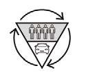
Vilcas Raymi Landscape - Mobility 2020 Built to Grow
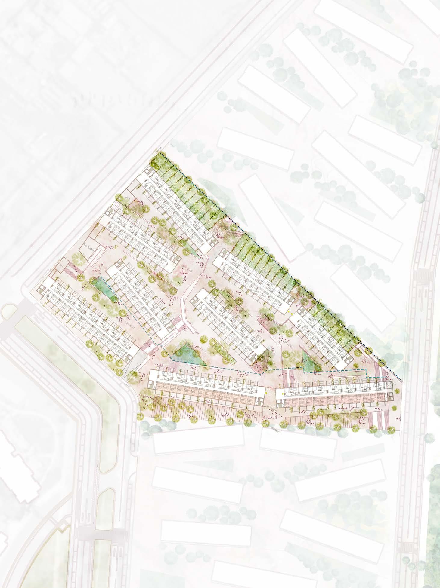
Social housing masterplan 2021
Surveying 2017-2021
La Marina Intersection 2020
01. LANDSCAPE RECYCLING
Cultural landscape | Xerophilous | Topology
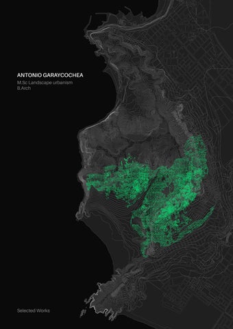
Location: Chorrillos District, Lima, Perú
Project Type: Architecture / Landscape thesis
Project Size: 670Ha
Team Size: 1
Software Used:
- AutoCAD
- Adobe Creative Suite
- ArcMap 10.8
- Sketchup
- Vray - Pix4D
Thesis Tutors:
- Mariana Leguía
- Rafael Zamora
2018-19
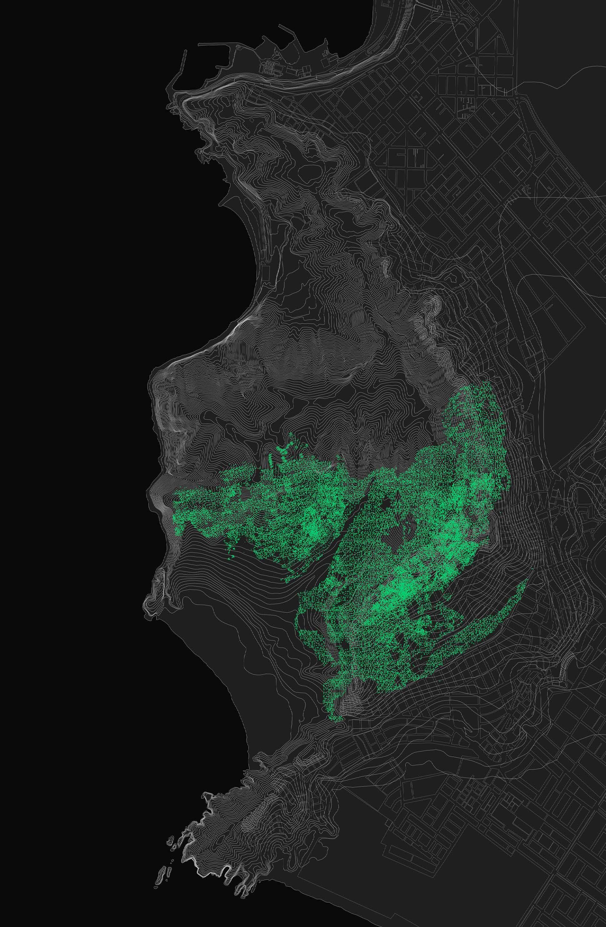
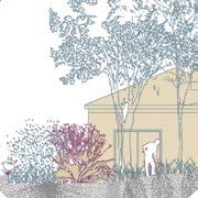
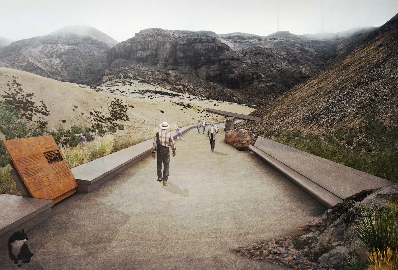
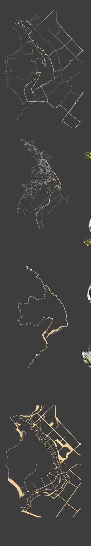
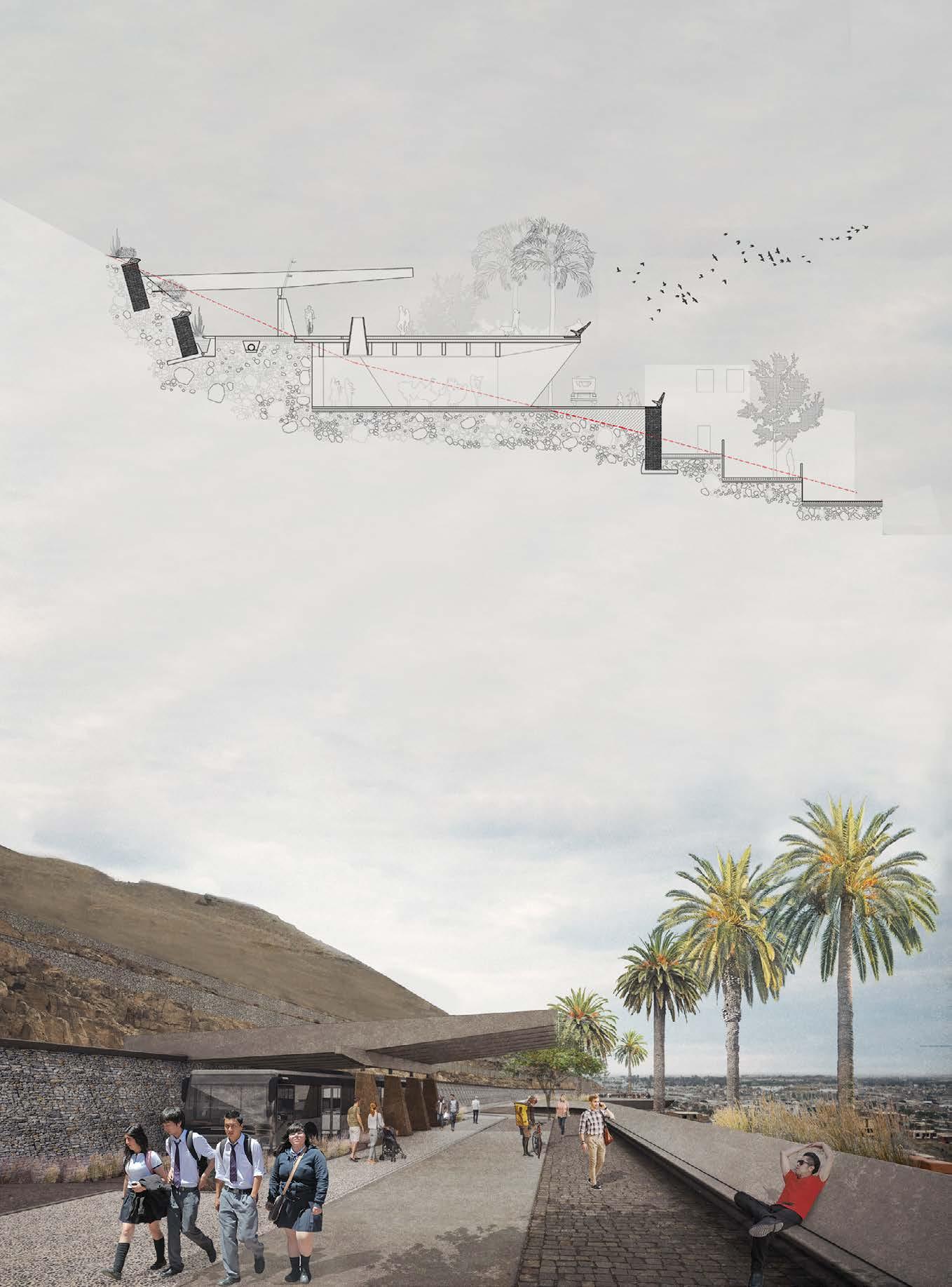
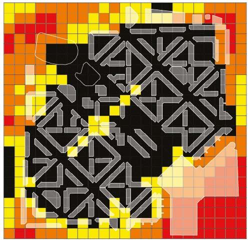
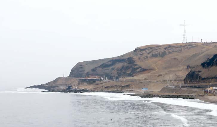
For my thesis, I spent two years working on “Solar Hill,” a rocky range in Lima. One side overlooks the Pacific Ocean; the other faces expanding informal settlements that encroach on the hill each year.
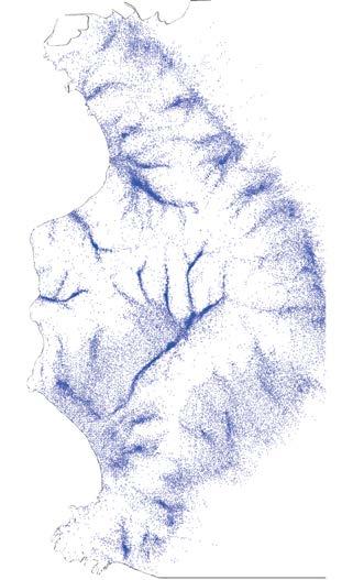
Research involved engaging with local leaders to understand why residents settled on this “intangible territory.” The hill holds historical, archaeological, and ecological significance: it once housed over 10,000 pre-Columbian families, was a key battlefield in the Peru-Chile War, and contains paleontological remains, including a 6m-long Plesiosaur. It is also a geological site and home to a rare Tillandsial ecosystem endemic to Peru’s coast, reinforcing its value as a cultural landscape.
My research questioned the criteria for classifying land as “intangible” and the rigid restrictions on modifying such areas. Despite its designation, informal settlements around Solar Hill continue to grow. By blocking all interventions, intangibility has rendered the hill an underutilized, ambiguous space vulnerable to land trafficking.
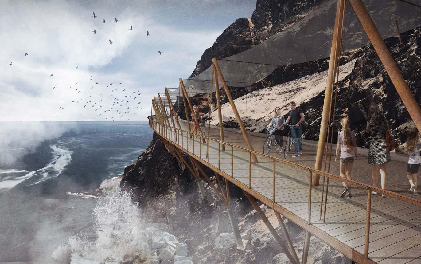
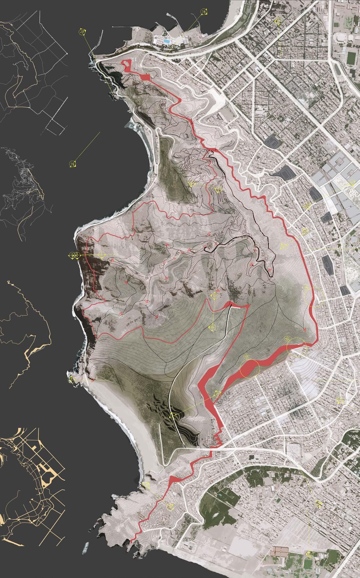
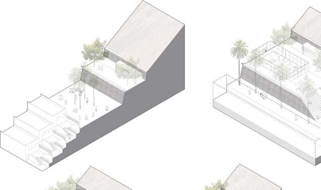
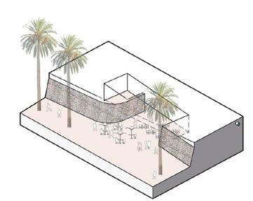
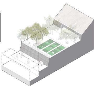
My thesis challenged this by proposing landscape and urban solutions that integrated Solar Hill with the city. A key element was a built limit—a continuous public space running along the hillside, separating the natural slope from unplanned neighborhoods.
To inform vegetation distribution, I conducted cartographic and simulation analyses, including mapping historic Tillandsia concentrations from aerial archives. This research guided a sustainable irrigation strategy using fog catchers on the upper hill and treated greywater from nearby settlements.
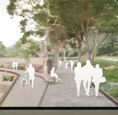
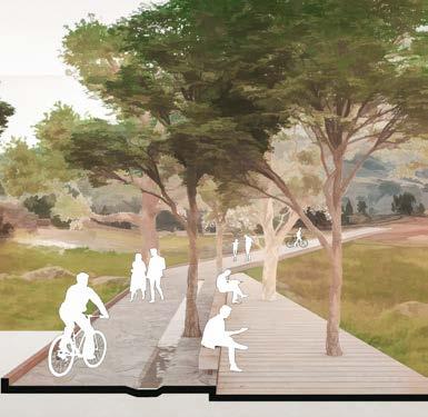
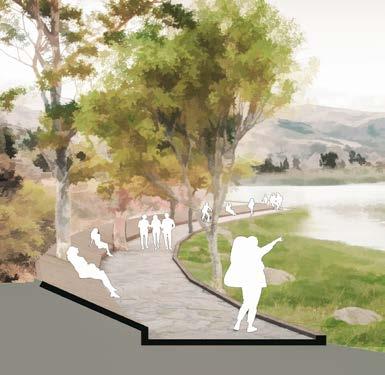
03 | View From The Chira Path, South west Hillside 04 | View from the Cliffside Path - West
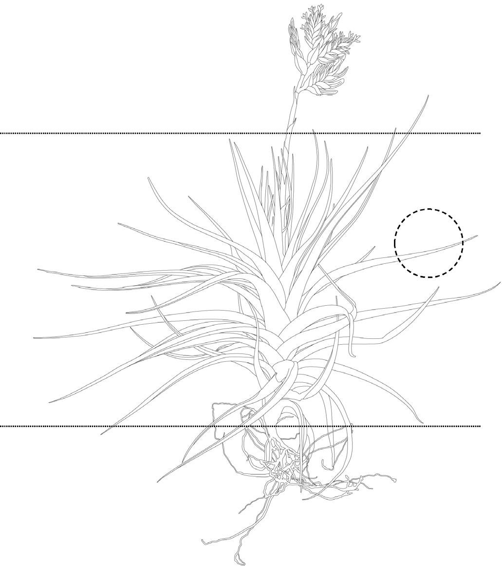
Tillandsia Latifolia: Detailed Drawing 07 Solar Hill Masterplan: Interventions in Three levels
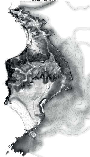
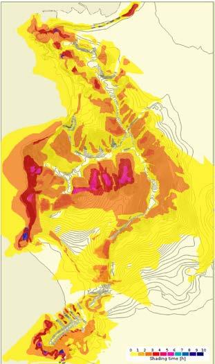
| Environmental Analysis: Solar, Wind, and Soil Mapping for Informing Vegetation Strategy
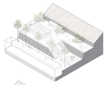
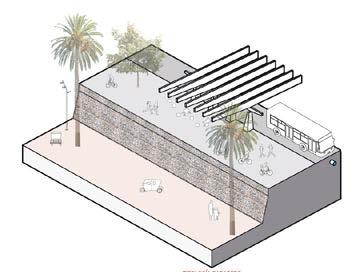
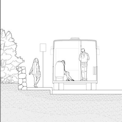
The promenade housed hydraulic infrastructure to provide potable water to settlements below, along with other services like a bus line, community centers, public bathrooms, and moto-taxi garages. Its continuous horizontal layout ensured accessibility to Solar Hill’s diverse landscapes, even for those with limited mobility.
The project was structured into three horizontal planes:
Focused on external access and mobility.
Meseta (Plateau): A reinforced urban edge addressing internal mobility.
Summit: Included trails, lookouts, and a redesigned telecommunications tower using tensegrity for fog water collection.
A water and vegetation strategy connected all three levels, ensuring the restoration of the Tillandsial ecosystem and the introduction of regional xerophile vegetation. This system integrated fog catchers at the summit with greywater treatment at lower levels, distributing water across the hillside.
Armatambo:
08 | Topology of Components: Structuring the Plateau-Belt Programmatic
10 View from a typical Plateau-Belt Bus Stop
09 | Community Centre Section at the Plateau-Belt level
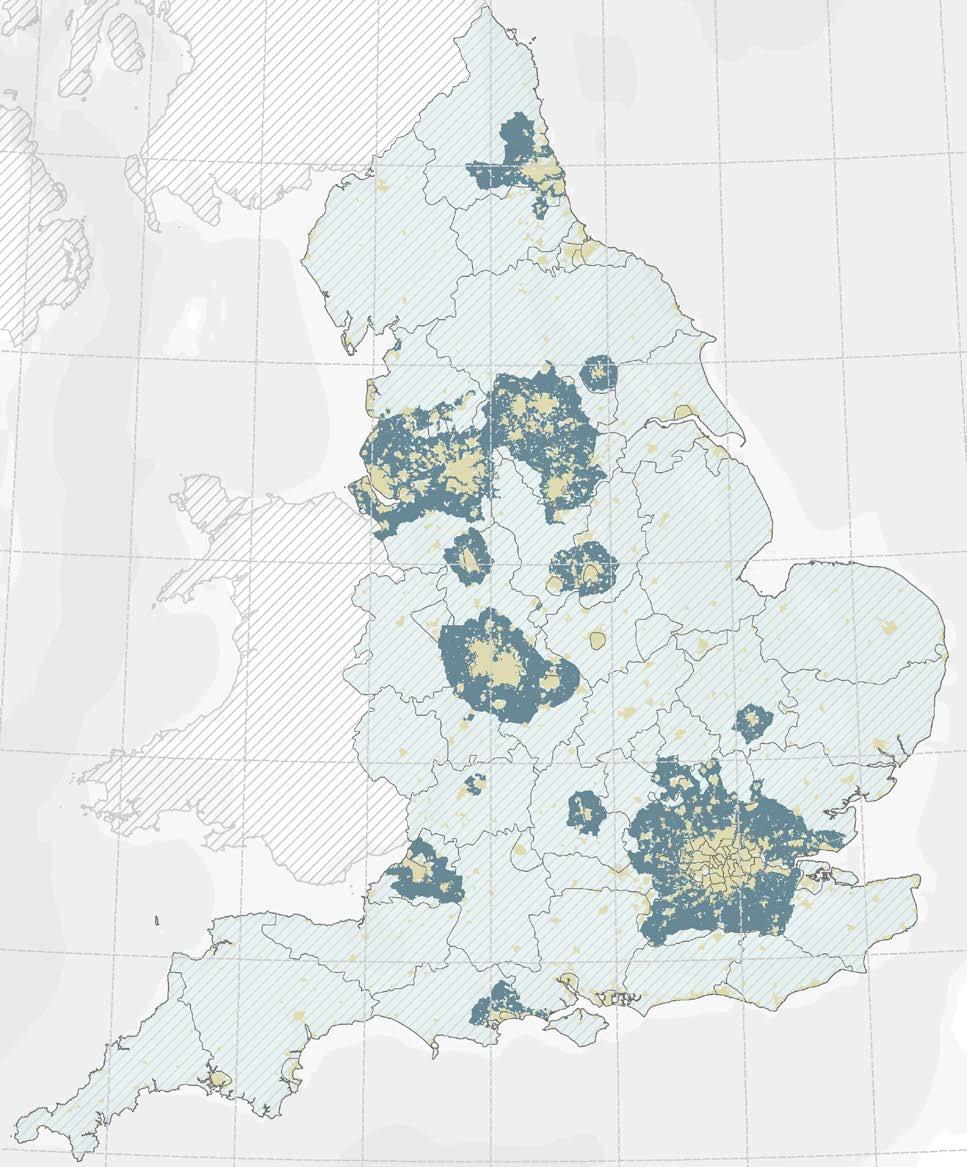
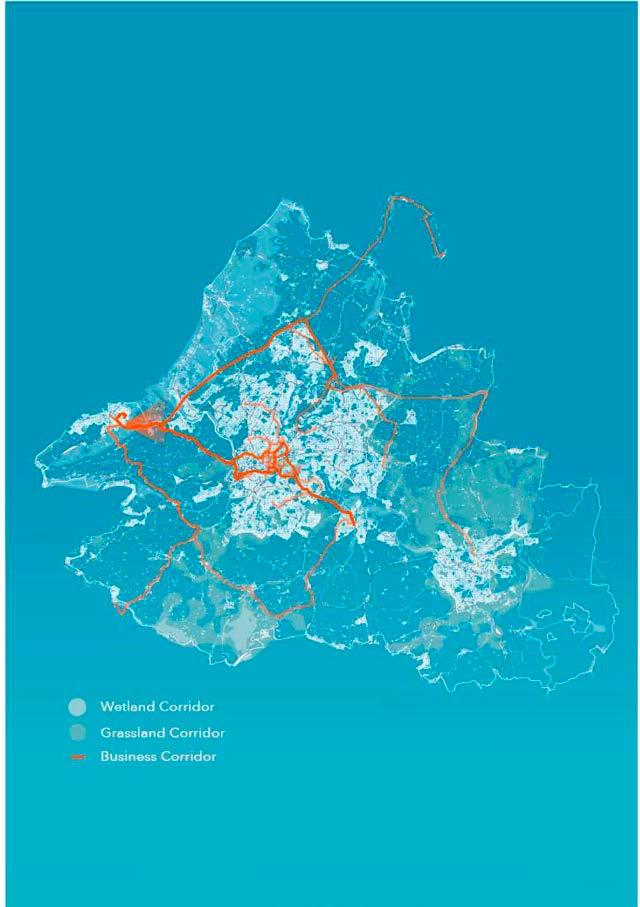
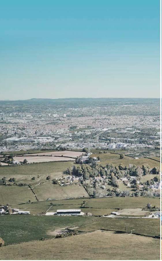
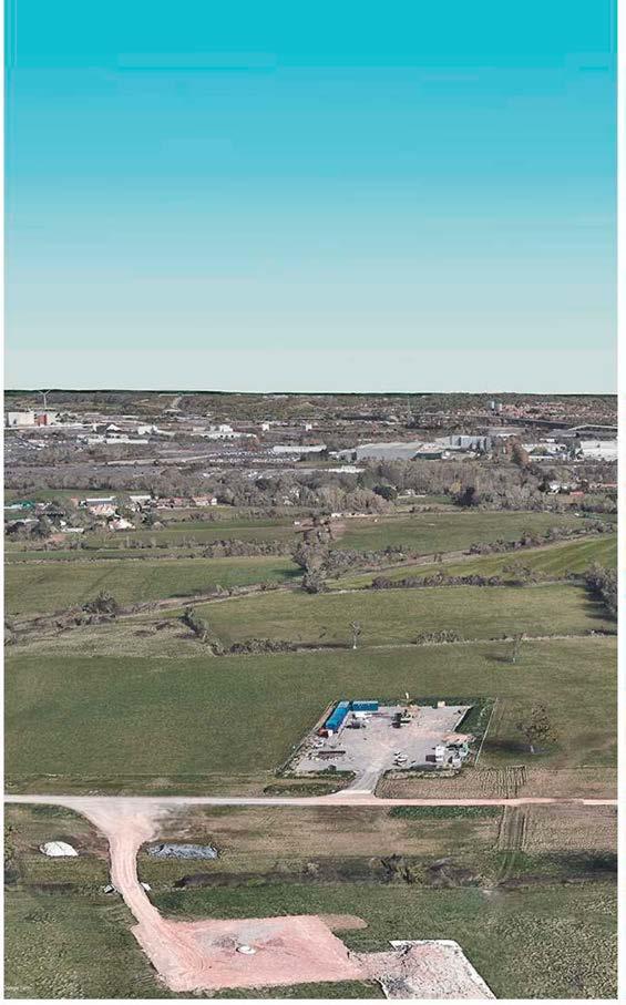
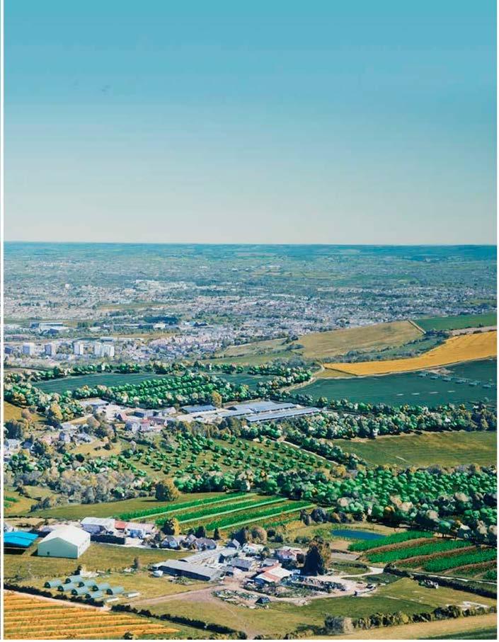
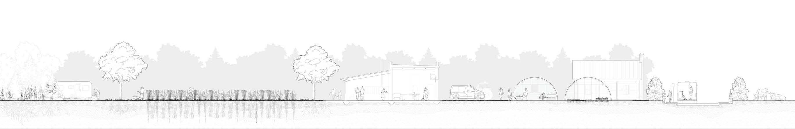
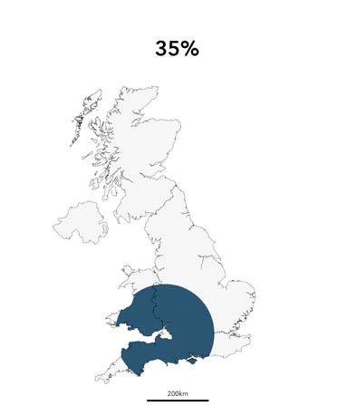
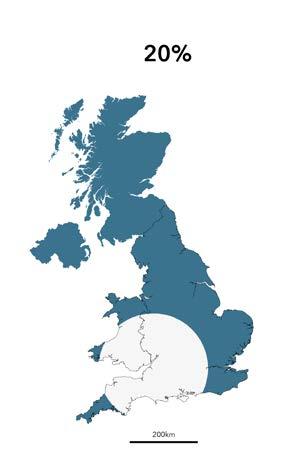
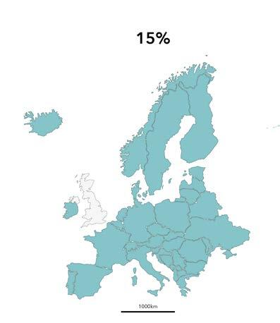
In the UK, 70% of land is used for agriculture, predominantly conventional monoculture. Yet, the country remains heavily dependent on food imports, increasing its global footprint and reducing biodiversity. Greenbelts, strategically located near cities—the main consumers—offer a solution.
This thesis explores policy modifications to drive an agroecological transition, placing greenbelts at the core. By leveraging their proximity to urban centers, this shift can shorten supply chains and strengthen local food systems.
The research examines the disconnect between cities and greenbelts, analyzes existing policies’ impact on agroecology, and proposes reforms with a focus on the Bristol Green Belt and its potential for cereal crop production.
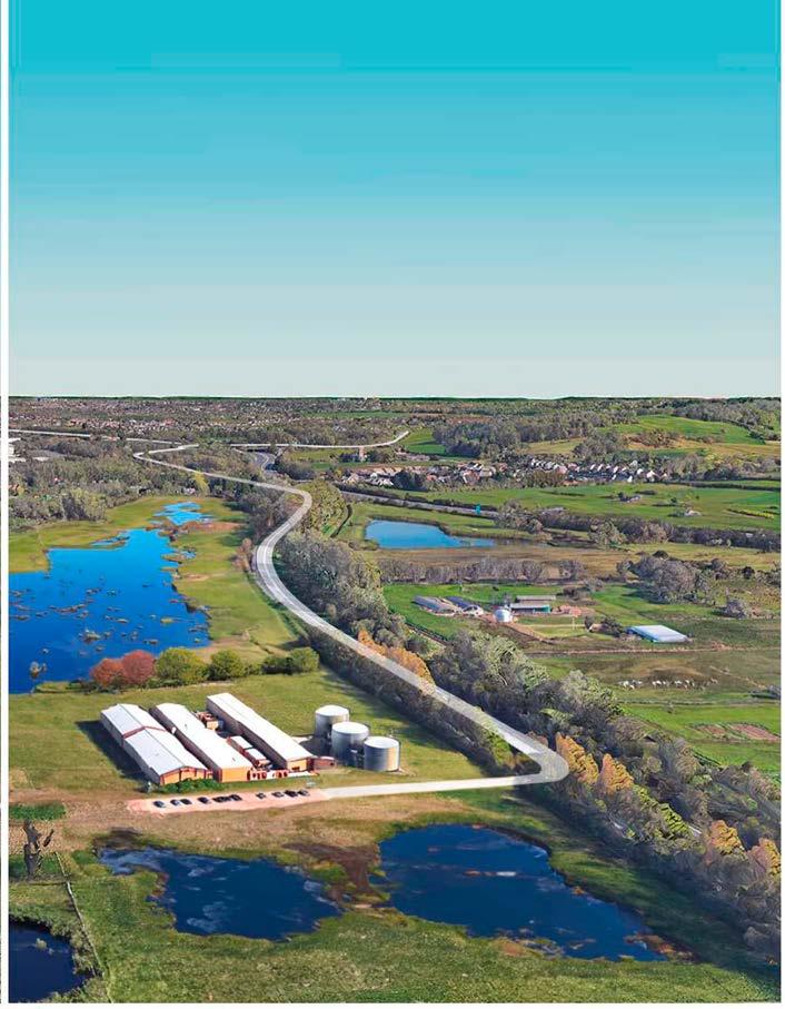
// As farmers retire, they sell their land to the community or the council, which temporarily holds it before facilitating sales to tenants. These tenants form clusters, linking ecological corridors with sustainable farming practices.
Public-commons partnerships help establish intermediate industries like malting and flour milling, supporting the cultivation of perennial cereal crops. Malt and flour are then distributed to local breweries and markets.
Rooted in farms, these supply chains create a local cereal business corridor that works alongside ecological restoration, shaping a highly productive peri-urban farming landscape.
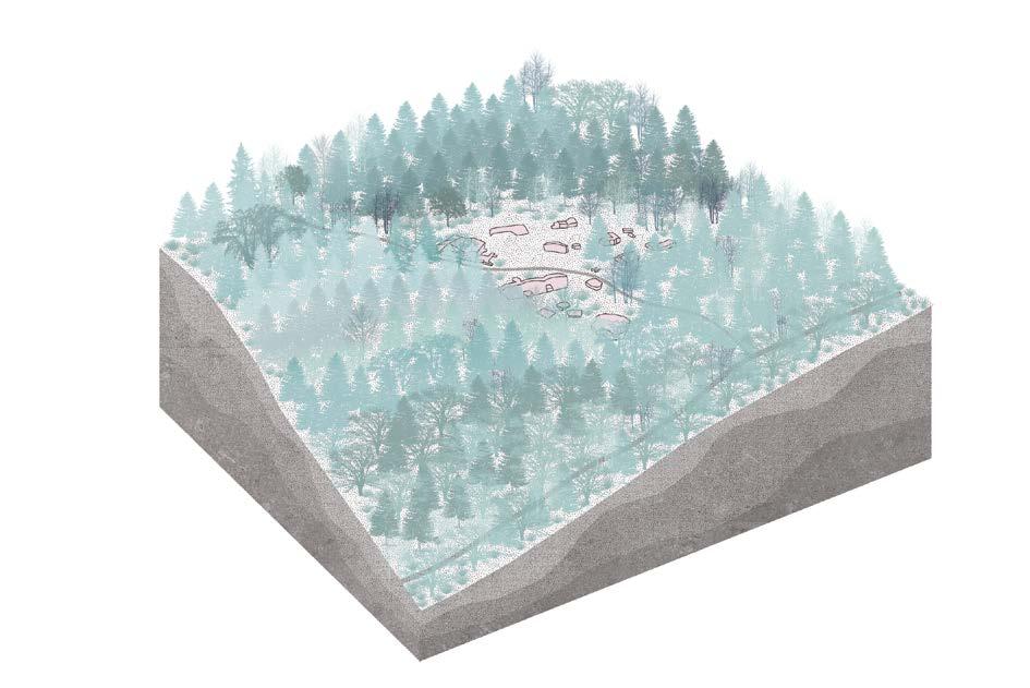
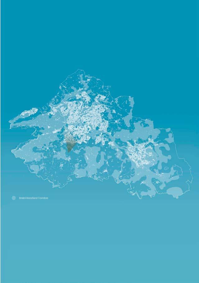
13 Agroforestry Farms and Woodland Corridors
14 | Malting Facility Within Wetland Corridor
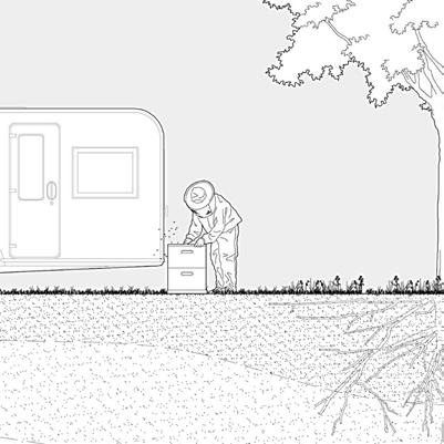
Enterprise stacking with other businesses that Benefit from being on the farm such as bee keeping
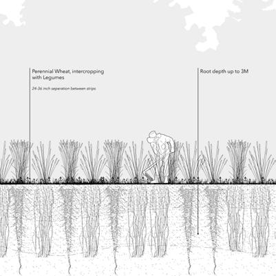
Perennial wheat Grass is Under-sown with clovers and inter-cropped with legumes. Longer root systems are developed and the soil horizons are thickened.
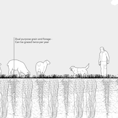
The strips of perennial wheat are grazed twice a year by animals from another farm in the cluster. The field benefits from the animals’ fertilizer and, in return the second farmer’s animals receive forage.
Multi-purpose spaces are used for psychological retreats and workshops.
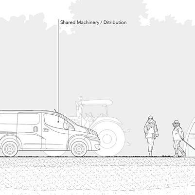
Shared machinery and resources within the cluster also extends the methods of distribution. Veg boxes are delivered by a shared van which collects produce from all the participant farms.
Farms require more human input eventually leading to public transport networks that extend from the city out to the green belt.
- Team coordination between landscape, ... development, supervisors and competition organizers
- Co-design and development of proposal from conceptual phase to spatial detailing
- 3D modelling, thermal and shadow simulation
- Presentation panel design and diagrams.
- Rendering
Software Used:
- Rhino3D
- Lumion
- AutoCAD
- Adobe Illustrator
- Adobe Photoshop
- Procreate
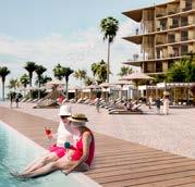
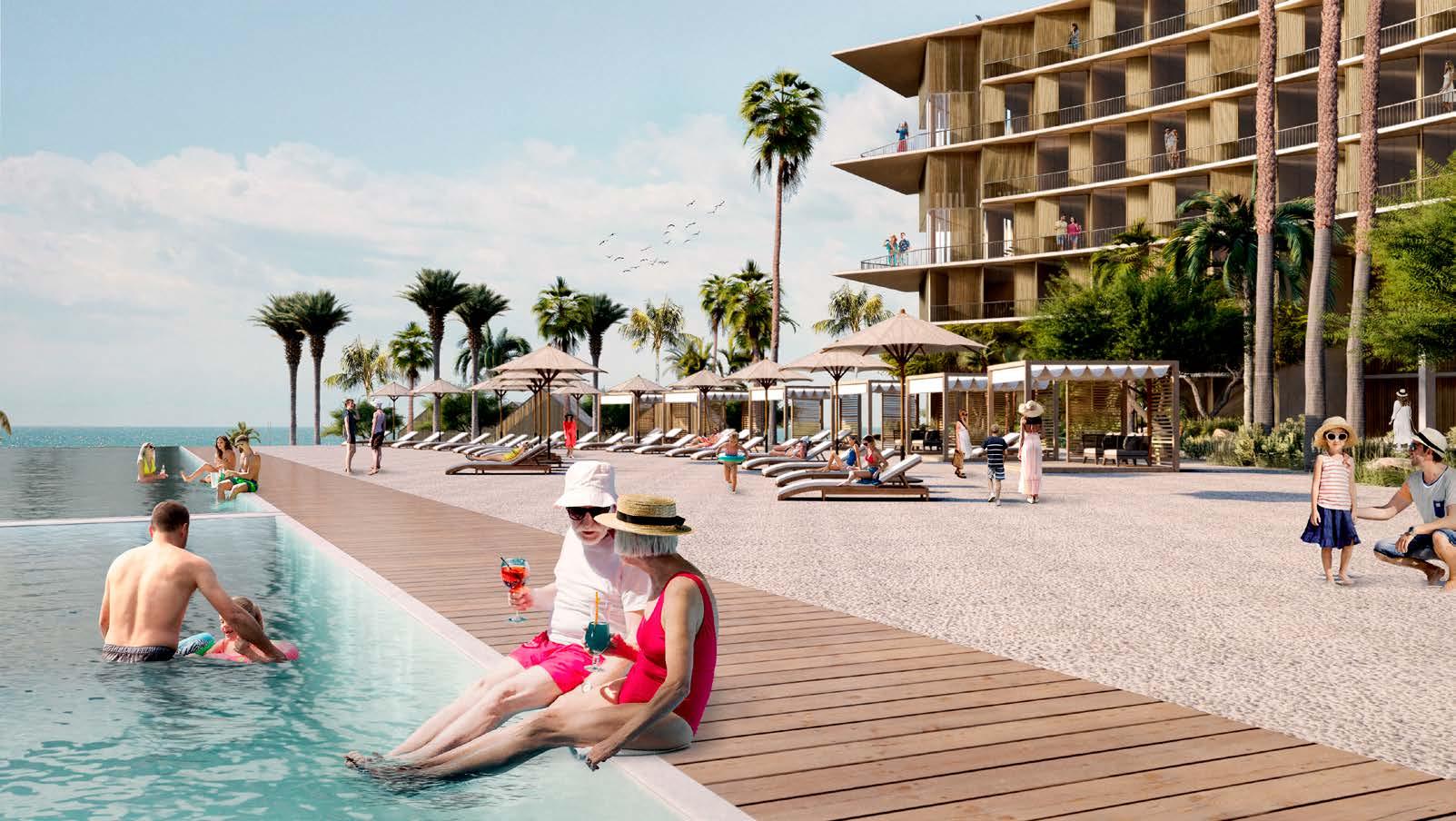
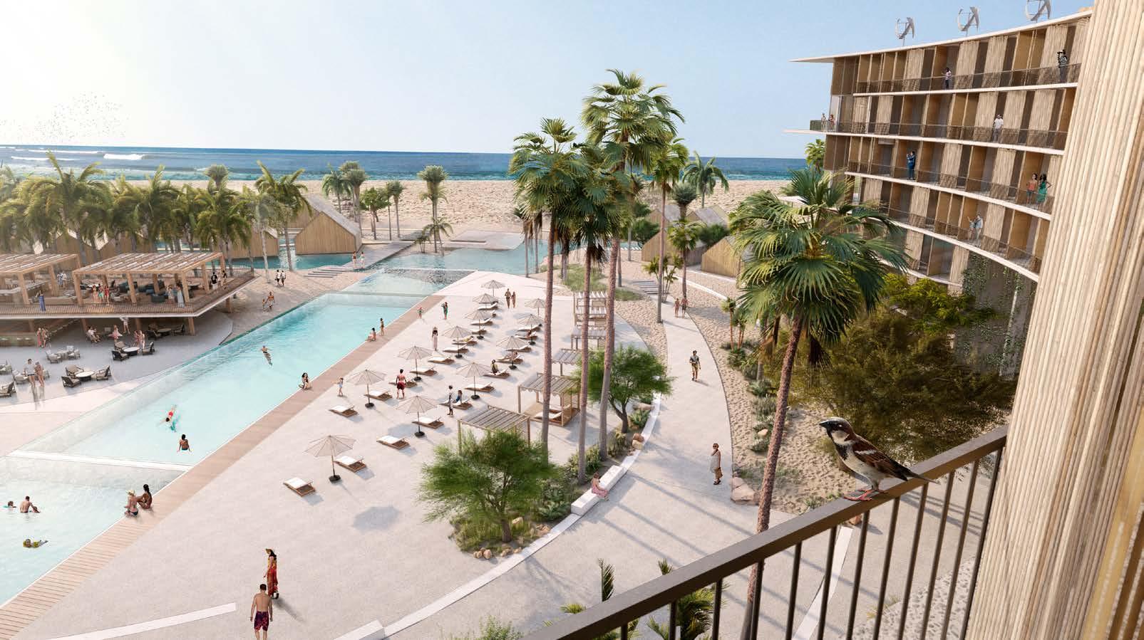
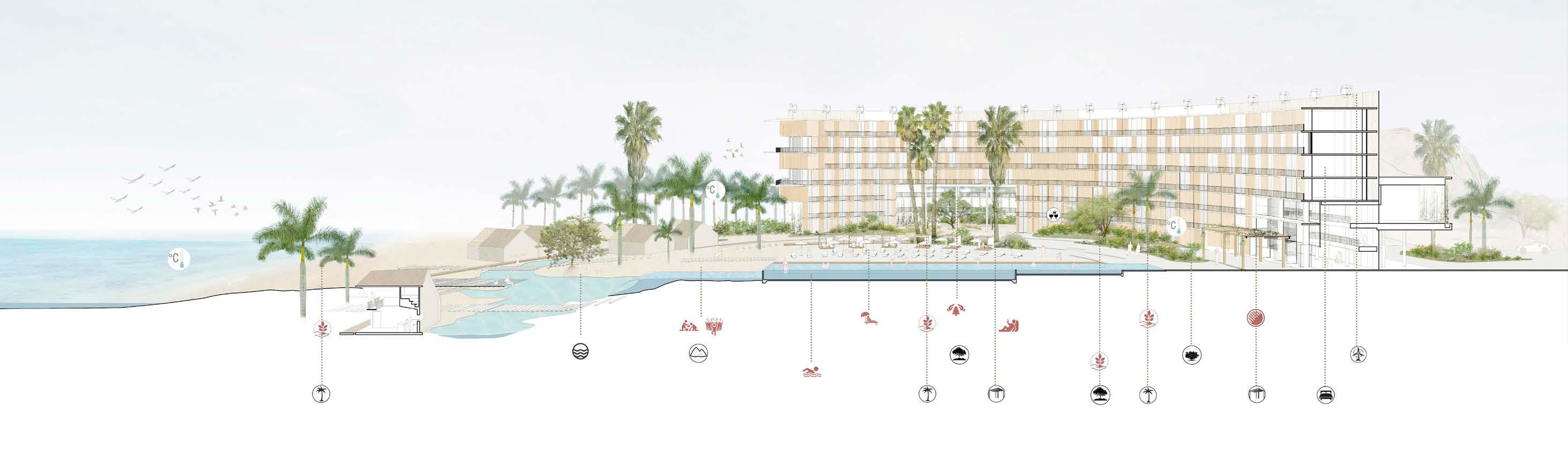
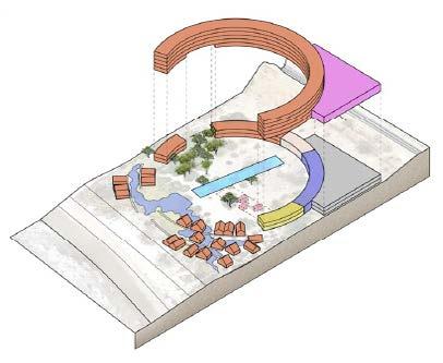
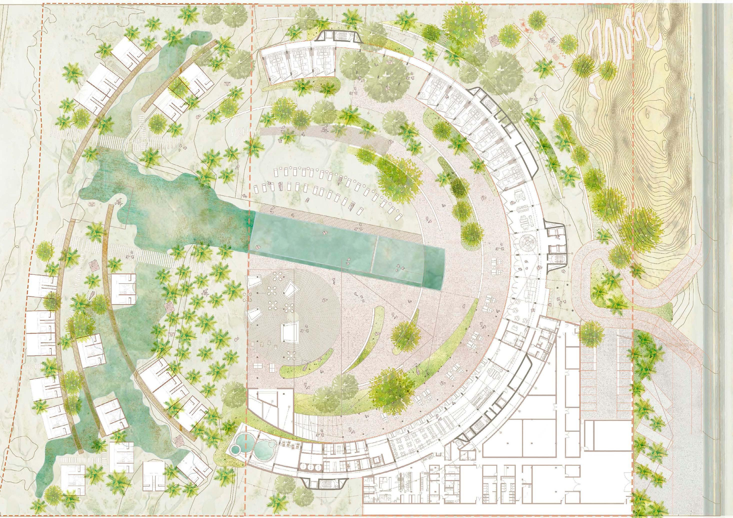
The project involved designing a hotel and resort in northern Peru, a dry, sunny region vulnerable to El Niño flooding. Site analysis revealed that half the terrain sat closer to groundwater, confirmed by vegetation patterns and aerial imagery of the 2017 floods.
To adapt, we placed bungalows in this area, elevating them to allow natural water flow, creating a swimming pool rather than a rigid basin in the main plaza. The main building, a semi-circle facing the ocean, was positioned along the highway for optimal views and noise buffering. Its placement also preserved existing trees, which pass through an opening on the northeastern side and extend into the plaza.
18 | View from the central plaza and swimming pool
19 View towards the central plaza and swimming pool from fifth floor
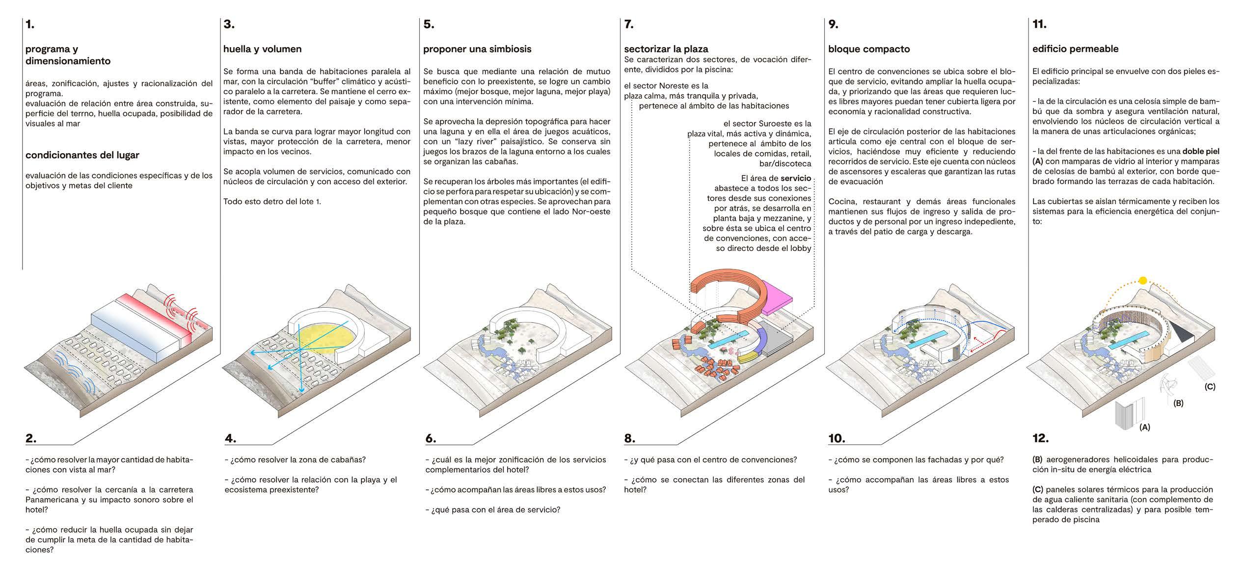
Program and dimensioning
Areas, zoning, adjustments and program rationalization.
Evaluation of the relationship between built area, lot surface, occupied area and possibility of seeing the sea
Site conditions
Evaluation of the specific conditions and client objectives
-How to solve the largest number of rooms with sigh line to the sea?
- How to solve the acoustic impact of the highway’s proximity to the hotel?
- How to reduce the occupied footprint without compromising the required number of rooms?
Footprint and massing
A band of rooms is formed parallel to the sea with the circulation as a thermal and acoustic buffer towards the highway. We maintained the pre existing section of hill that crossed the highway, as an iconic landscape element.
The service mass is connected by circulation cores which are also external to the main curved mass
Proposing symbiosis
We sought to create a better relationship of mutual benefit with the pre existing terrain through minimal intervention of it
We took advantage of the topographic indentation between the sea front and the main building in order to create a lagoon and placed the bungalows surrounding it.
We preserved the most important tree species and complemented them with new ones, creating a small forest on the north - east side of the plaza
Sectorize the plaza
The plaza has 2 sections with different vocations and divided by the pool
The north east sector is the quiet plaza. It corresponds to the surroundings of the ground level rooms
The south west sector is the vital plaza. It corresponds to the food stalls, retail and bar
The service area supplies al sections from the back through its connections with the intermediate cores. The service block occupies ground level, mezzanine, and on top is a convention centre with direct access from the lobby
-How to resolve the bungalow area?
- How to resolve the relationship with the beach and the pre existing ecosystem?
- What is the best way of zoning complimentary services to the hotel?
- How do the open areas accompany these uses?
- What happens with the service area?
- What happens with the convention centre?
- How are the different parts of the hotel connected?
Compact block
The convention centre is located over the service block, to avoid amplifying the footprint over the terrain and prioritizing the areas that require larger spans
The rear axis of circulation to the rooms articulates with the service block on the opposite side, making it highly efficient and reducing service routes.
Kitchen, restaurant and other functional areas maintain their product and personnel flows through an independent access
Permeable building
The main building is clad with two specialized façades:
- The circulation facade is a simple lattice made of bamboo, which provides shade and ensures natural ventilation, wrapping the cores organically
- The side of the hotel rooms has a double facade (A) with sliding glass doors on the interior and a bamboo lattice towards the exterior, with a broken border that gives shape to the terraces of each room
- How are the façades composed and why?
- How do the open spaces accompany these uses?
(B) Helical wind turbines for producing in-situ electrical energy
(C) Thermal solar panels for the production of hot water (with complementary centralized heaters) and for possible heating of the pool
LIMATAMBO ON FOOT
Location: Surquillo District, Lima, Perú
Project Type: Urban Design
Project Size: 13Ha
Number of Floors: 2
Team Size: 5
Tasks Performed:
- Research and urban design masterplan
- Urban furniture system design
- Competition panel design
- 3D modelling
Software Used:
- Rhino 3D
- AutoCad
2018-19
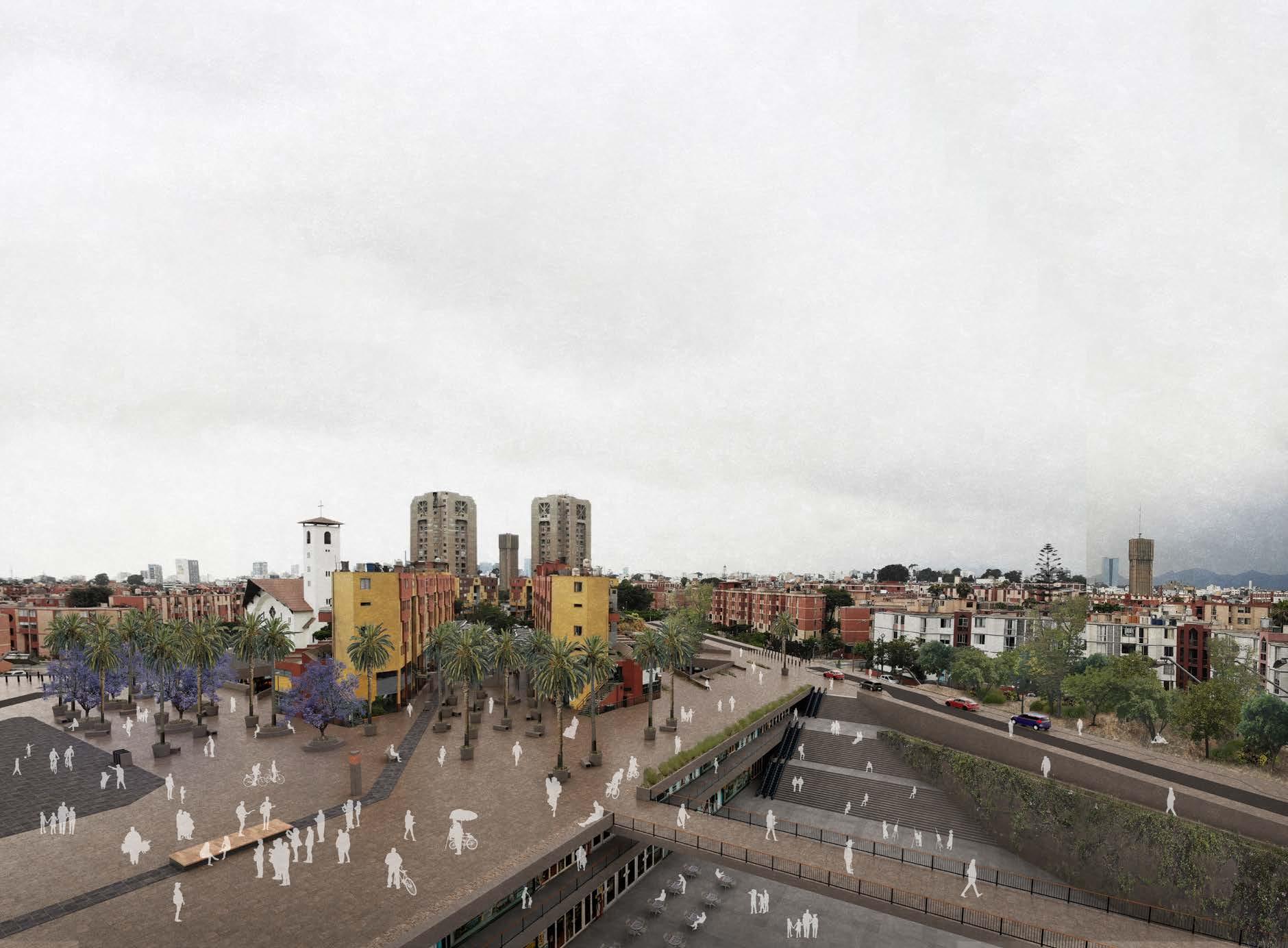
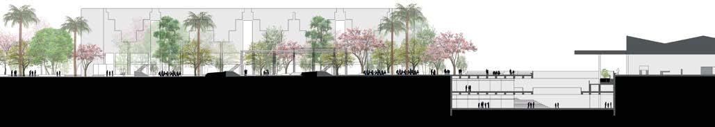
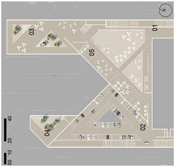
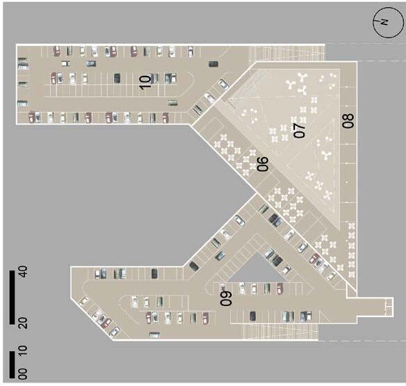
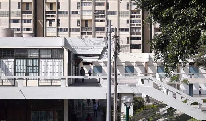
Limatambo, a 1970s housing complex in Lima’s San Borja district, is a landmark of modernist architecture but suffers from urban design issues relating to excessive car space and rigid zoning.
The municipality launched this competition to revitalize Limatambo’s central axis, which faces a parking lot behind a shopping center on one side and an archaeological park around a preHispanic pyramid on the other. While the park is a key asset, it is the only public space attracting people, leaving the rest of the axis underused and leading to failing ground-floor businesses.
Our proposal aimed to better integrate Limatambo with the city and transit systems. A key strategy was to open the shopping center to its rear parking lot, creating an active facade that, along with the pyramid park, would generate pedestrian activity along the central axis.
Hermetic. Closed of to the city ant to itself.
Lack of a central gathering space.
The protagonism of the automobile. Connect the park and shopping centre through a large common space.
COMPETITIONS / INDEPENDENT
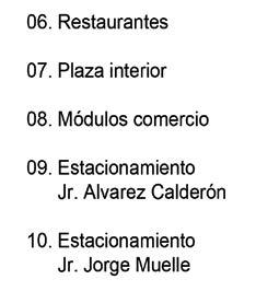
VILCAS RAYMI
Terminal | Public | Micro-mobility
Location: Ayacucho, Perú
Project Type: Public Competition
Project Size: 11,427m2
Number of Floors: 5
Team Size: 3
Tasks Performed:
- Co-design and development of architectural proposal from concept to spatial distribution
- 3D modelling
- Design of modular furniture for public space
Software Used: - Rhino 3D - AutoCAD
2021
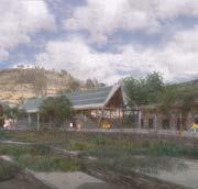
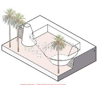
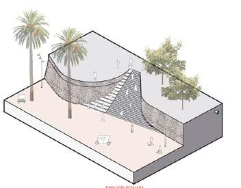
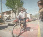
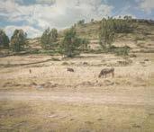
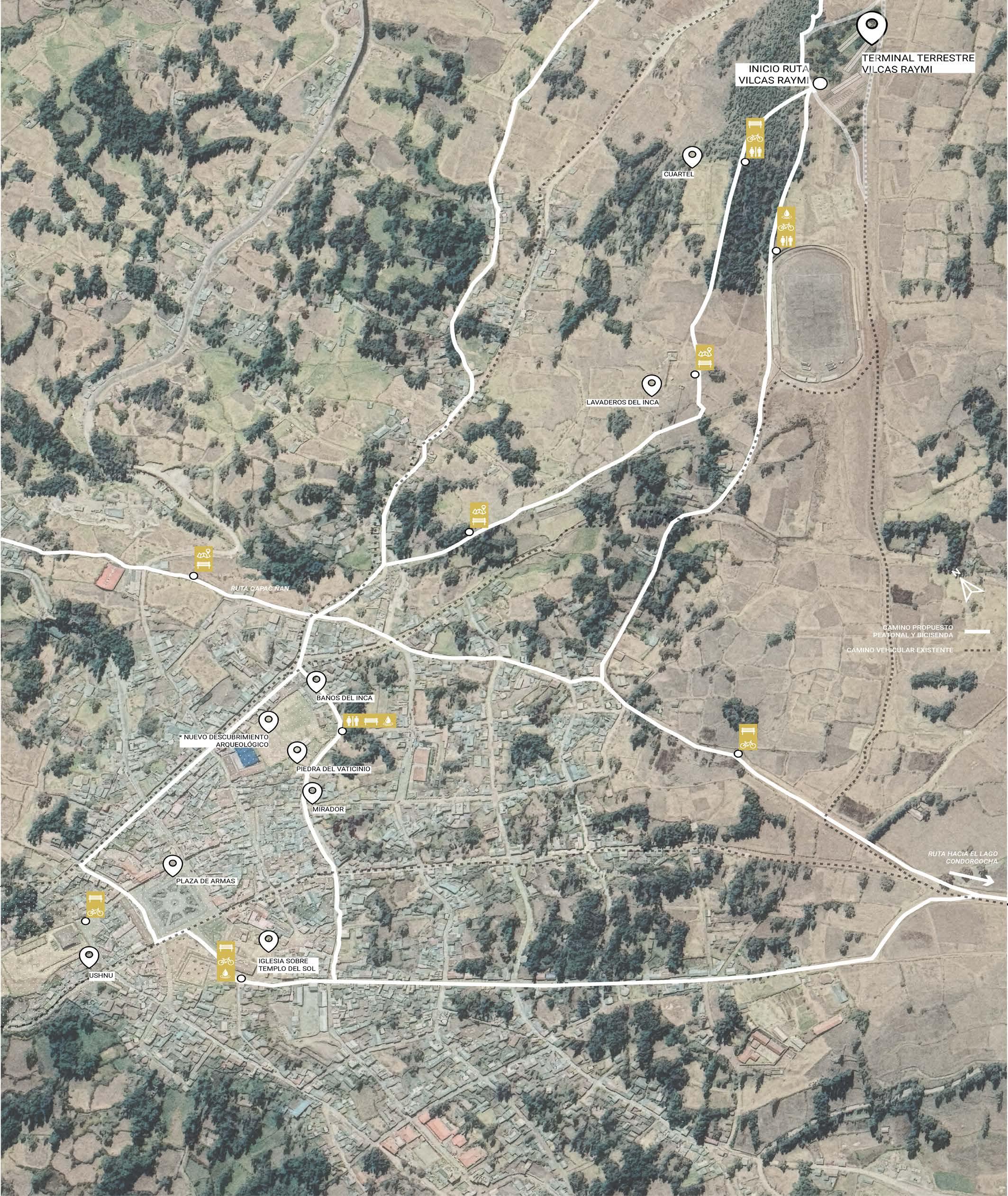
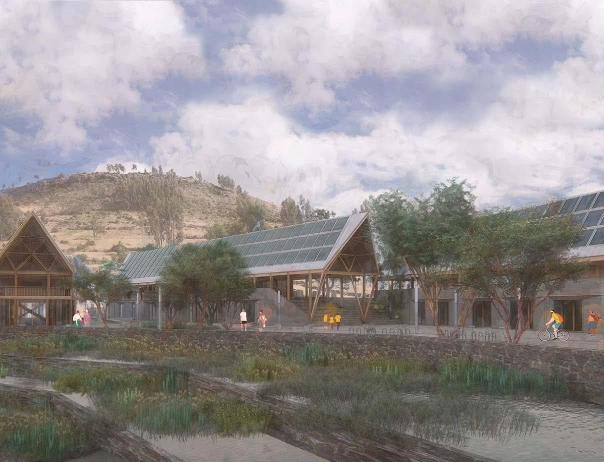
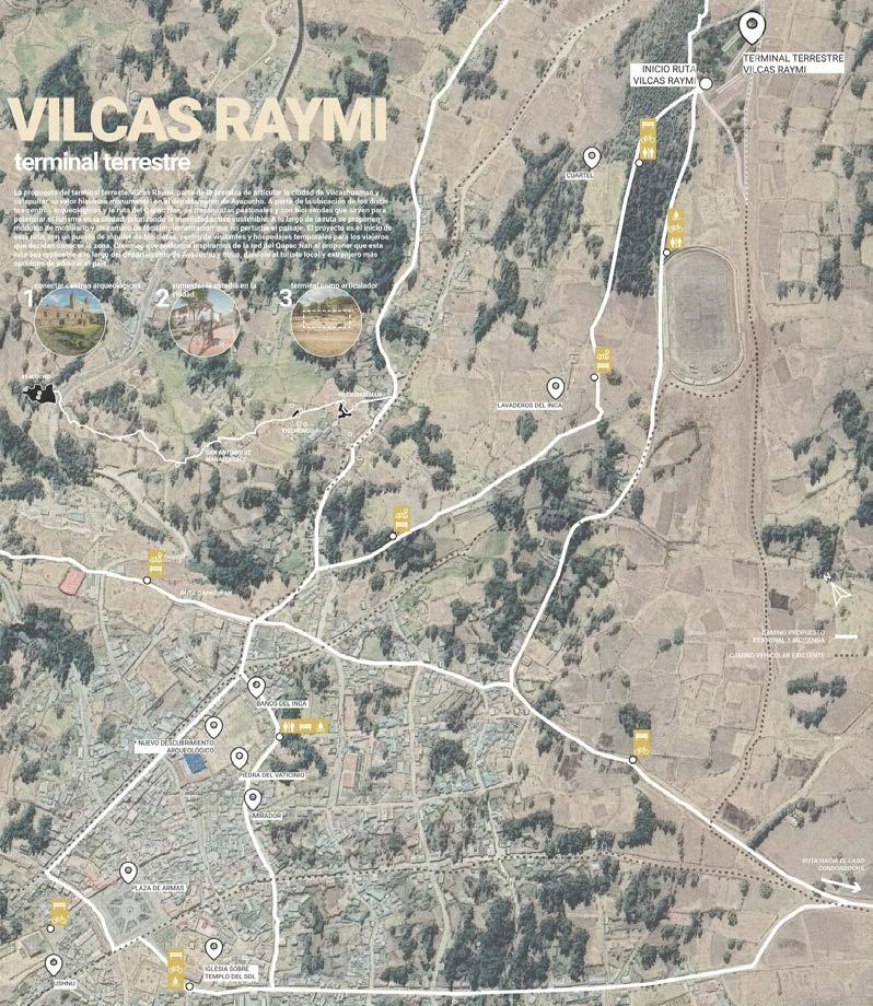
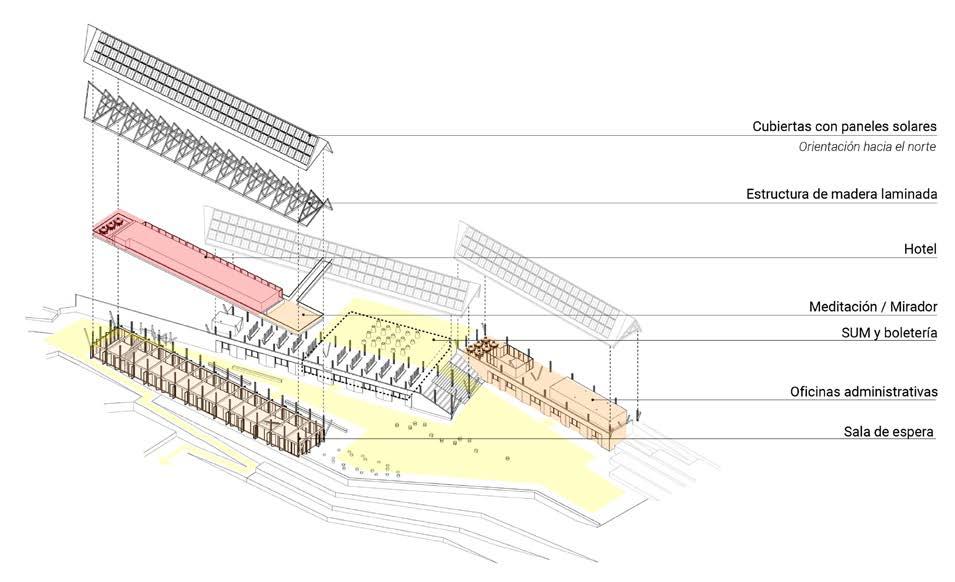
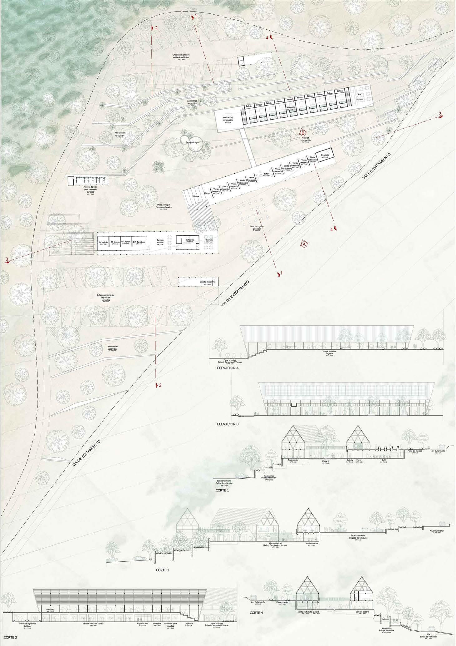
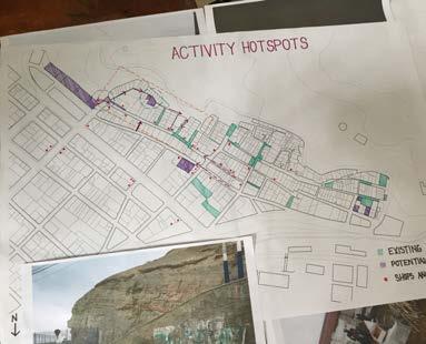
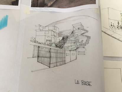
Vilcashuamán, a district in Ayacucho, has long been a brief stop for tourists en route to larger towns. To attract long-term visitors, the municipality launched this competition for a bus terminal as part of its plans for new infrastructure.
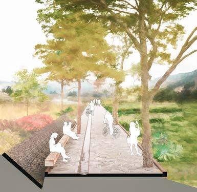
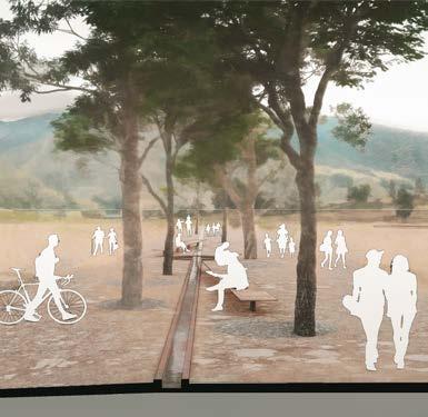
However, the terminal site is on the outskirts. To address this, we designed it as another stop on the journey rather than the final destination. Passengers with limited mobility can take moto-taxis to the town plaza, while others can rent bicycles to follow a new trail linking Vilcashuamán’s attractions and connecting to the larger Route of the Potato hiking network.
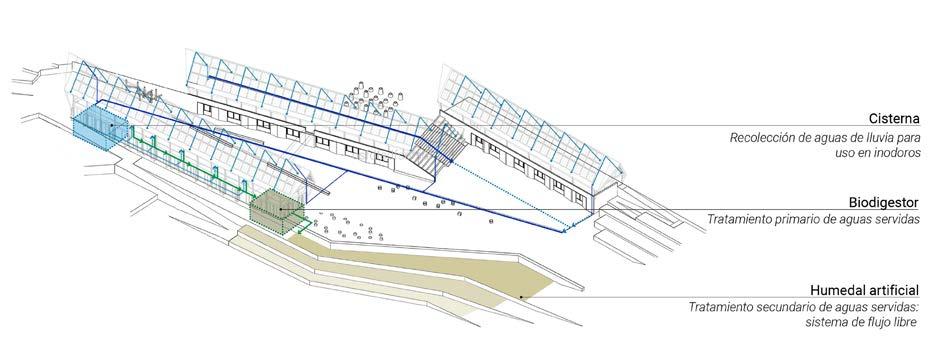
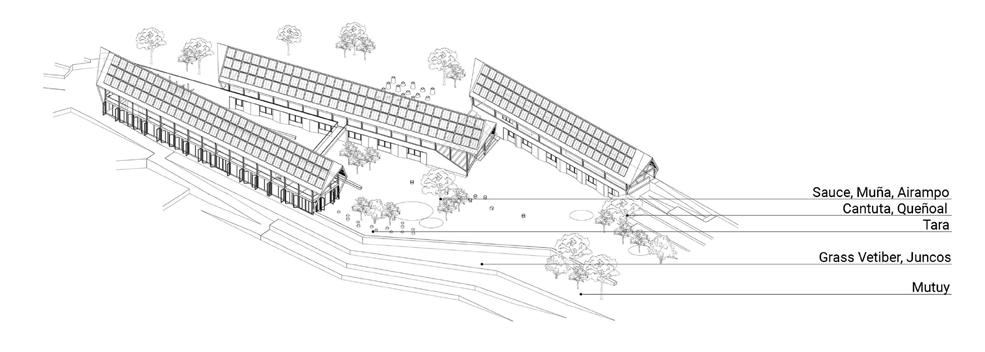
The terminal consists of three linear volumes framing a public space. Shops face the road, while multipurpose rooms and workshops open to an internal plaza. The sloped terrain allows for a terraced phytodepuration system, naturally treating wastewater for the building.
30 Proposed Pedestrian Network: Connecting the Bus Terminal to the Town and key Landmarks
| Bus Terminal view from the Phytodepuration Terraces
| Terminal Building Isometrics: Spatial Layout, Structural Organization & Vegetation
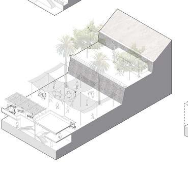
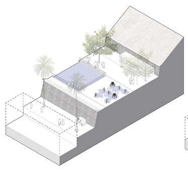
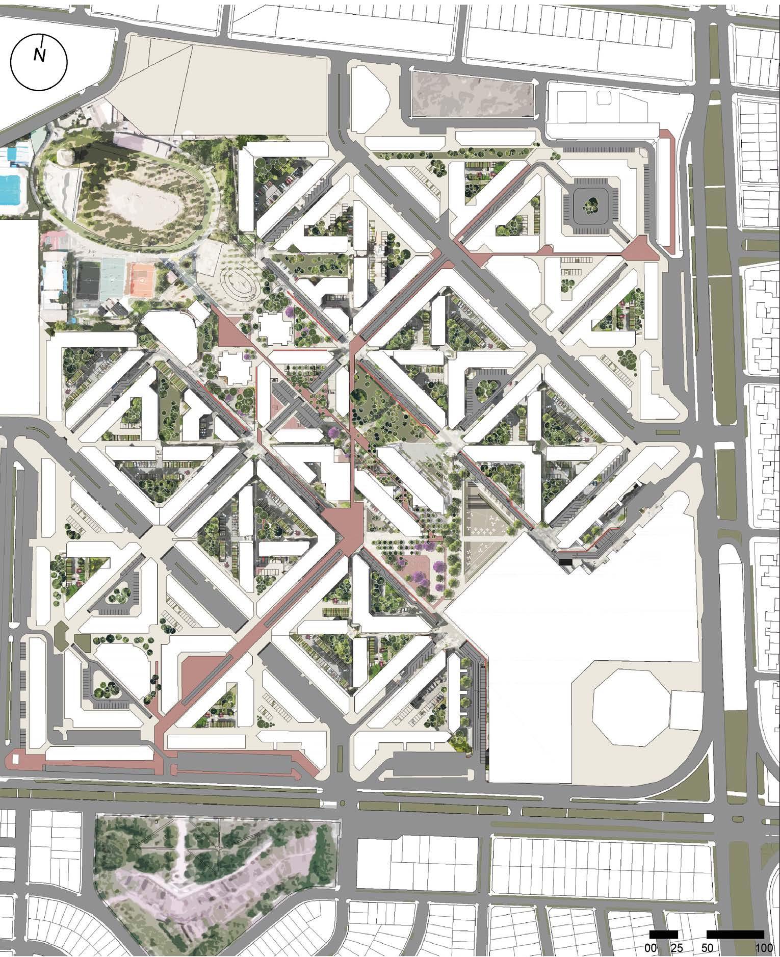
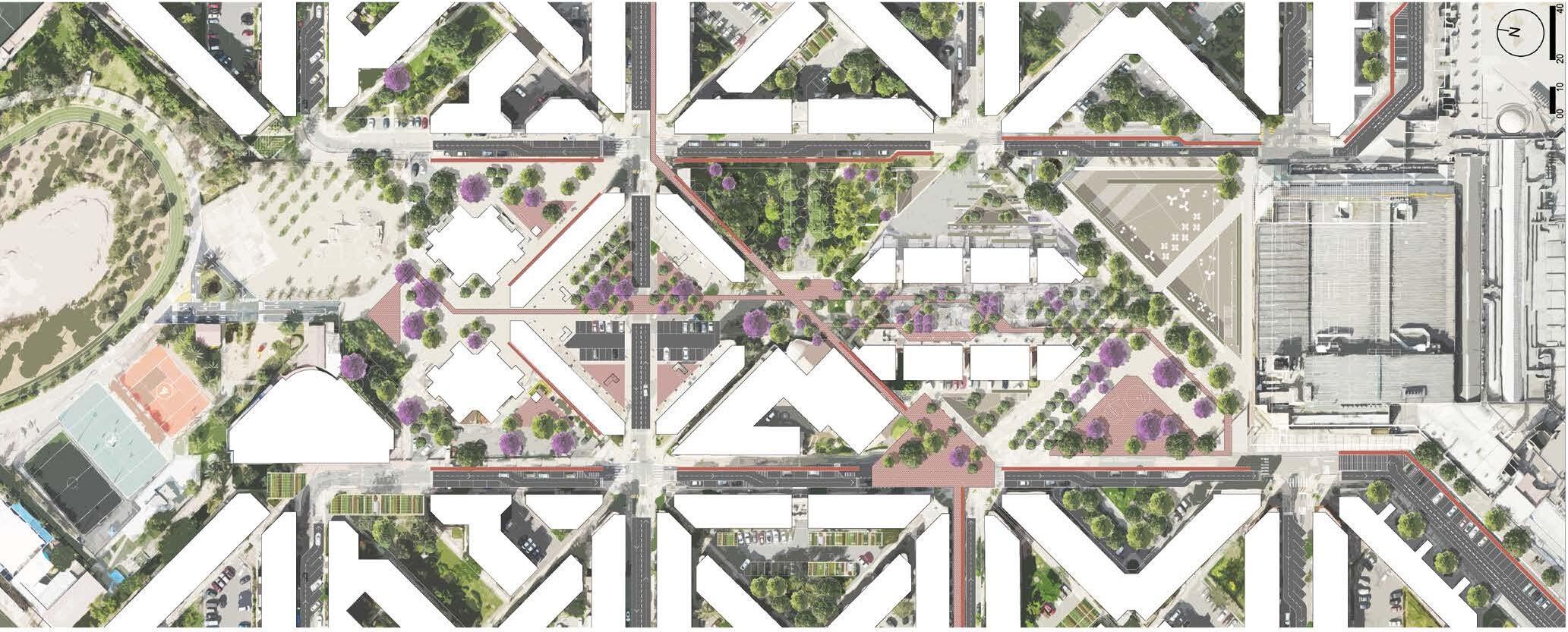
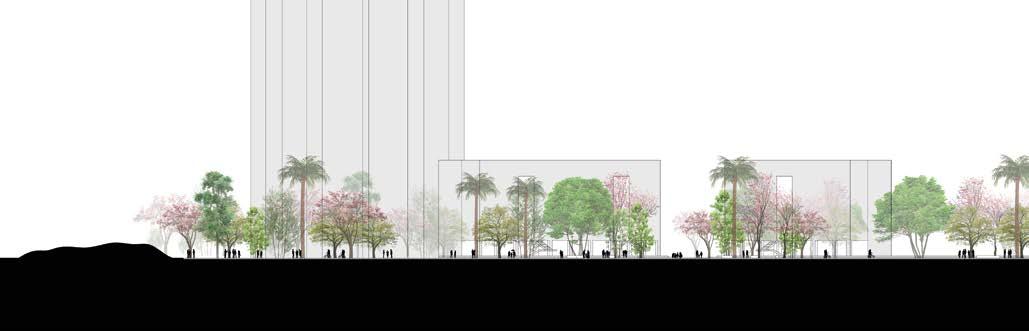
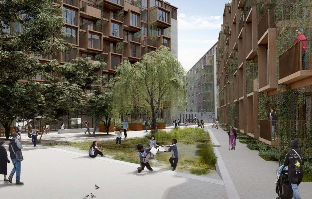
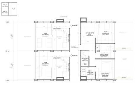
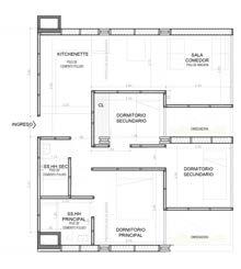
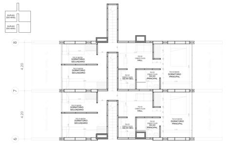
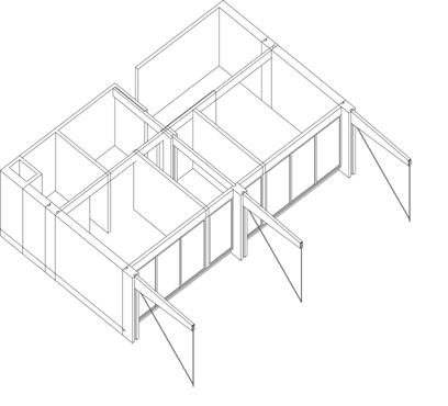
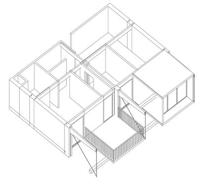
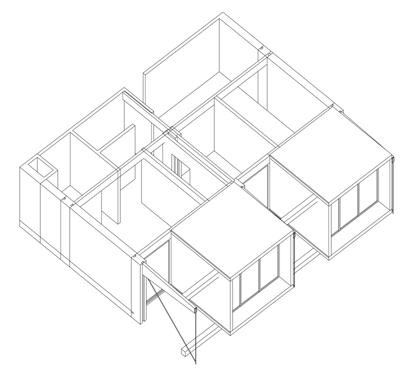
BUILT TO GROW
Social housing | Incremental | Wood
Location: Chorrillos District, Lima, Perú
Project Type: Social Housing
Number of Floors: 6-9
Team Size: 5
Consultants: Landscape
Tasks Performed:
- Team coordination between landscape, ... development, supervisors and competition organizers
- Co-design and development of proposal from conceptual phase to spatial detailing
- 3D modelling, thermal and shadow simulation
- Presentation panel design and diagrams.
- Rendering
Software Used:
- Sketchup
- Lumion
- AutoCAD
- Adobe Illustrator
- Adobe Photoshop
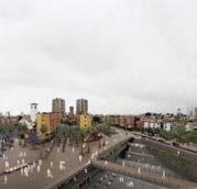
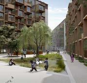
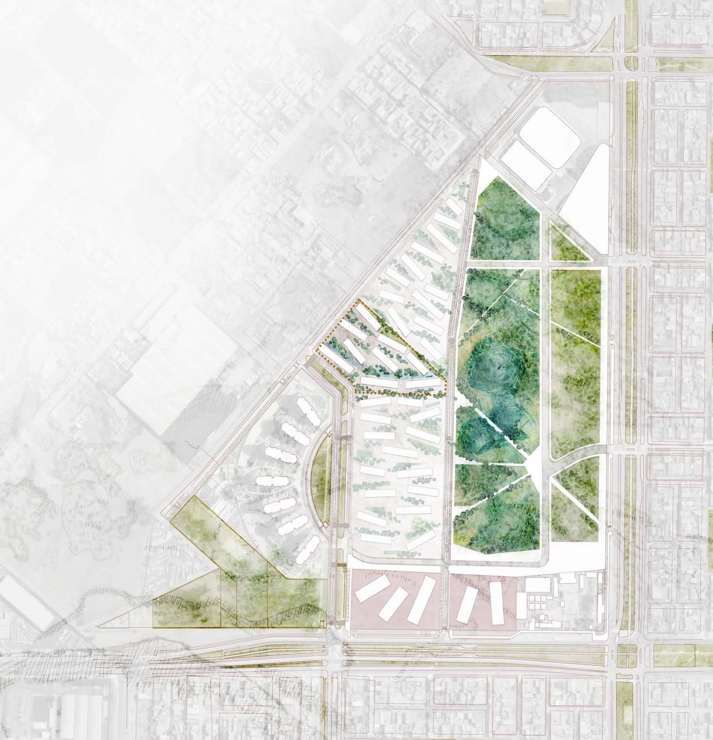
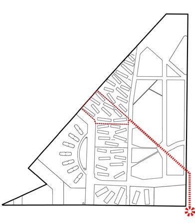
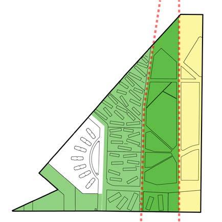
In 2019, Lima, Peru hosted the Panamerican Games. Athletes were housed in seven towers built in Villa El Salvador, previously a park with a water treatment facility irrigating the land. The construction rerouted the water treatment, leaving the park barren and affecting local agriculture, with no restoration plans.
In 2021, a competition was launched for social housing development on a parcel neighboring the towers. Our proposal, an extendable system applicable to all villa parcels, reinstates the water treatment facility. We suggested supplementing primary water treatment with an artificial wetland for irrigation and recreation. The architectural design comprises incremental, sustainably-sourced wooden buildings, directing pedestrian flow towards the park and wetland.
Lima Biennial 2021 - Sustainability Category
Construye Para Crecer 2021 Honorable mention
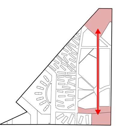
Strengthen the relationship between the school, to the south, and the stadium, to the north
Urban Derive | Documentary VIDEOGRAPHY
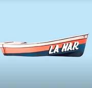
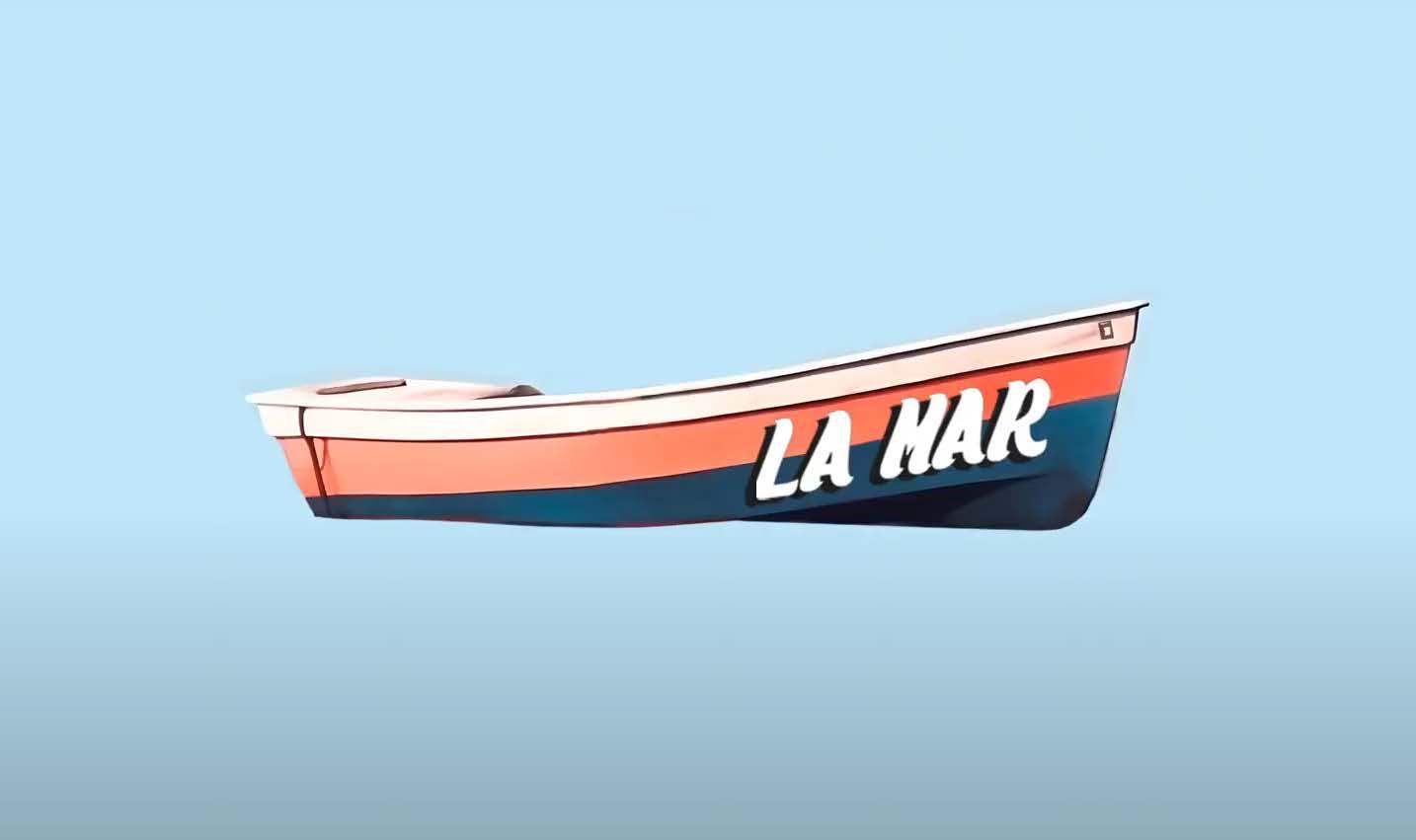
This section contains clickable links to some of the video work I do in my personal time. One is a 10 minute documentary named “La Mar” which won 3rd place in a national amateur film festival under the category of short documentary. It was filmed in Pucusana - a fishing town to the south of Lima.
The other two are short compilations of urban Derives. One was conducted in the Solar Hill area of Lima, a stretch of hills within the city that are host to various forms of appropriation despite being neglected by the city. The other was filmed at “San Felipe”, a 1960s modernist residential development which remains an iconic area of the city until now
San Felipe - Urban Dérive
Morro Solar - Urban Dérive
LA MAR - 3rd Place Winner @ Festilima Film Festival - Category Short Documentary
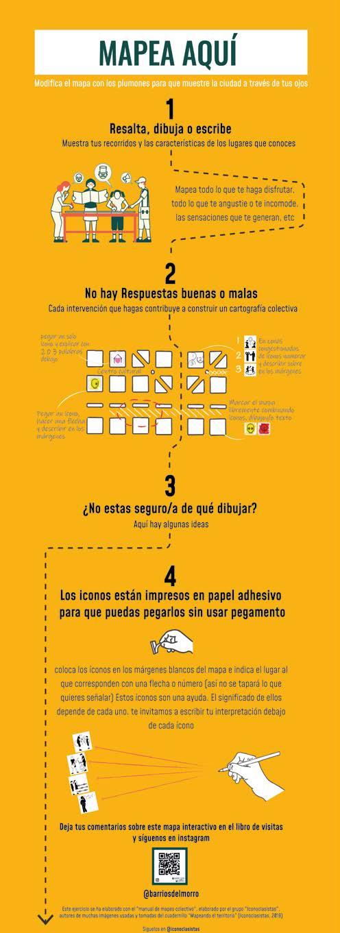
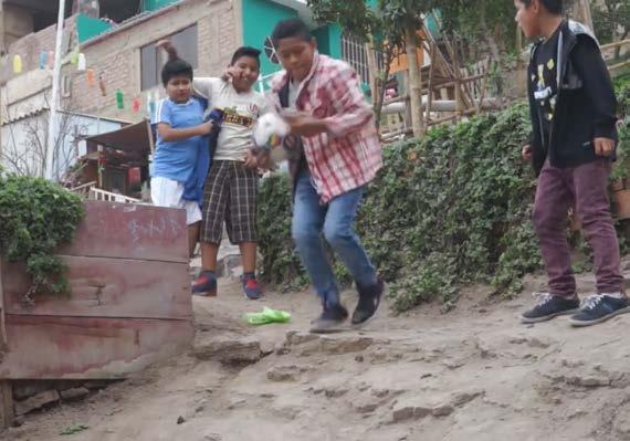
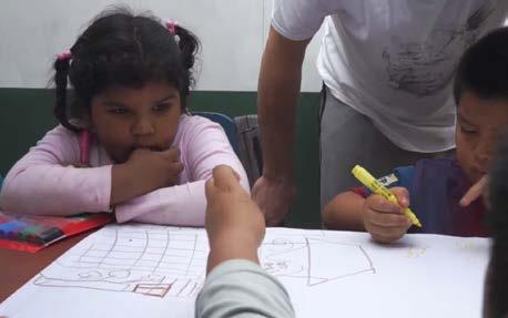
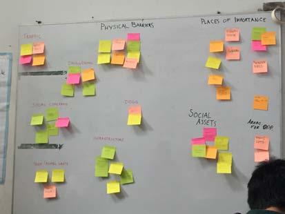
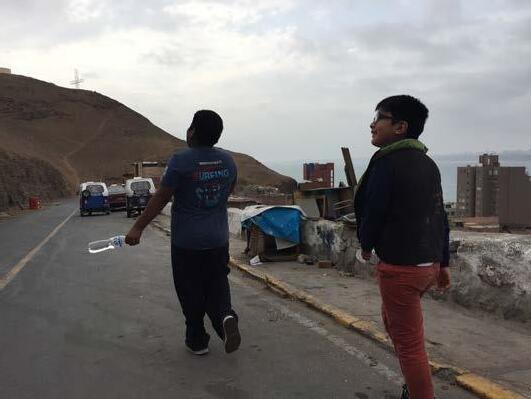
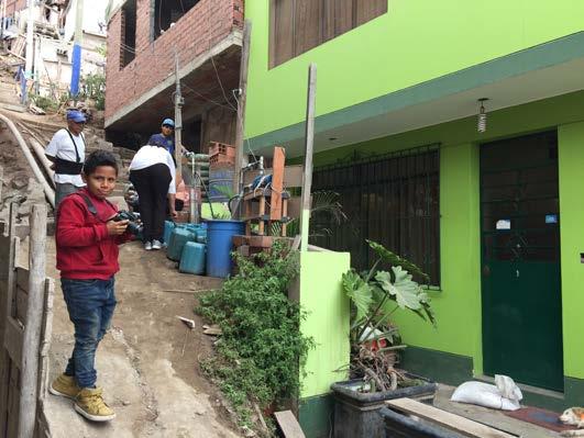
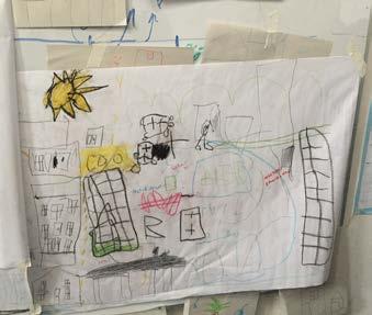
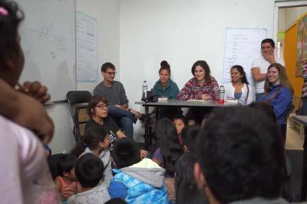
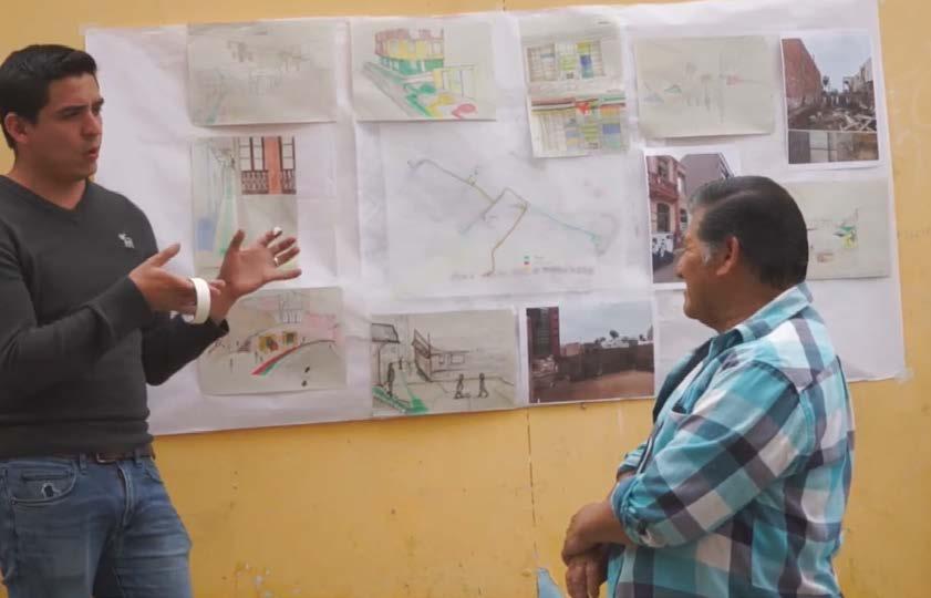
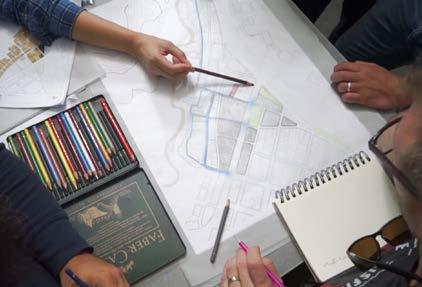
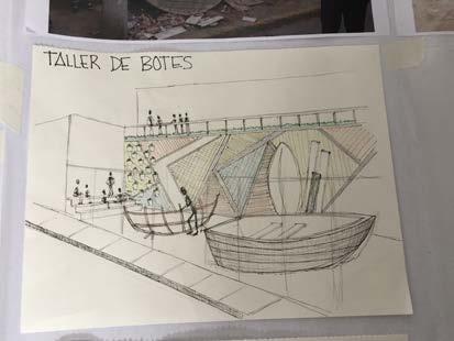
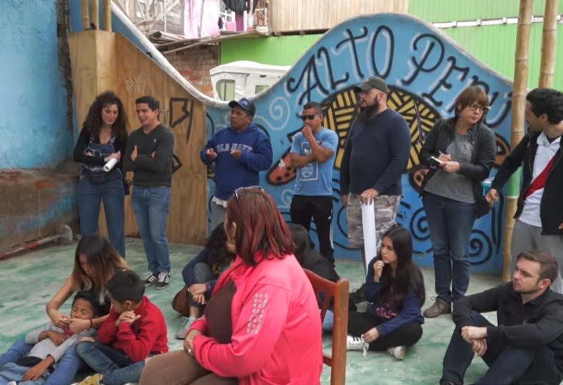
As a facilitator, guided participants through a workshop focused on improving their neighborhood from a child’s perspective.
The workshop began with children leading older participants on a neighborhood walk to help them understand the area from their point of view. In the next session, children created subjective maps, highlighting key spaces and issues. Older participants analyzed these maps to identify common themes, which were organized on a sticky note board.
Participants then sketched over photographs taken during the walk, developing ideas to address identified problems. The workshop ended with a presentation where participants shared their proposals and gathered community feedback.
SURVEYING PUBLICATIONS
To address the shortage of educational infrastructure in Peru’s rural highlands, the state has invested in modular classrooms. However, users report discomfort with these facilities.
This study proposed design improvements by measuring an existing module, calibrating a simulation model (Design Builder), and testing potential solutions. The goal was to enhance thermal comfort cost-effectively.
Full report: https://doi.org/10.22320/07190700.2023.13.01.05
book chapter “The Challenges of Peruvian Cities in the Face of Climate Change” in Challenges and Perspectives for the Peruvian Climate Situation.
Full book: https://doi.org/10.18800/978-9972-674-30-3
Location: Multiple parts of Perú Team Size: 2
Consultants: Topographer
Tasks Performed:
- Drone Piloting
- Flight planning
- Point cloud Data processing
- Technical coordination with topographer
- Preparation of package delivery to clients
Software Used:
- Cyclone 360
- Pix 4D
- Drone Deploy
- Agisoft Metashape
- AutoCAD
2017-21
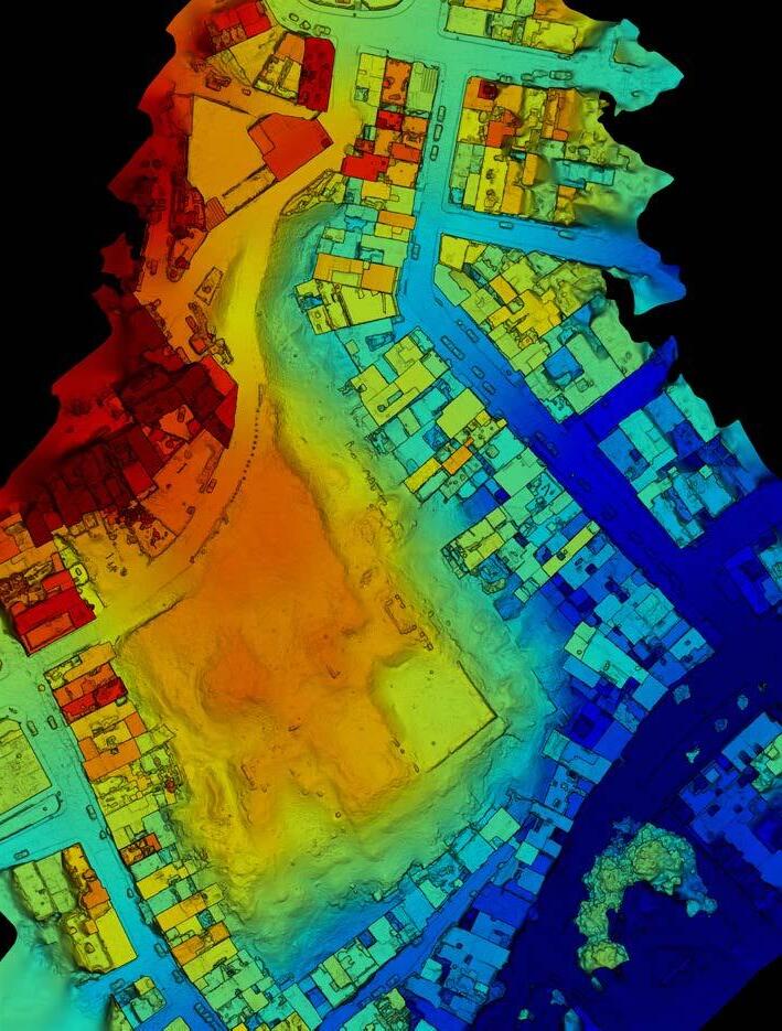
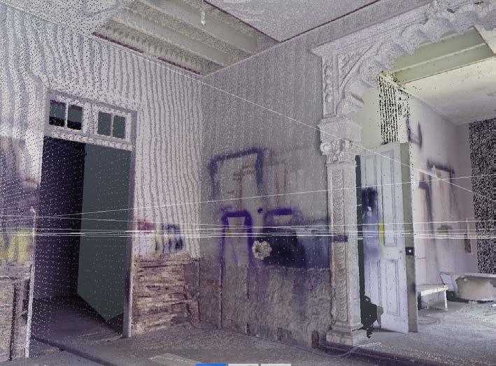
Between 2017 and 2021 have Freelanced as a surveyor, conducting over 40 flights and 7 laser scans over the course of four and a half years (with the support of a topographer on larger missions)
Clients have ranged from academic to municipal and institutional including the ministry of culture and the Spanish Cooperation for development. The first image shows a 3D laser scan of a historic monument building for use in the process of a restoration and re-use proposal. The secons image is of a Drone Survey used to map the immediate urban context of a Pyramid within the Armatambo archaeological complex. Used to assess the damage to the pyramid resulting from outward expansion of homes.
44 | Laser Scan Capture: 140-Year-Old Listed Building in Lima’s Centre for Restoration
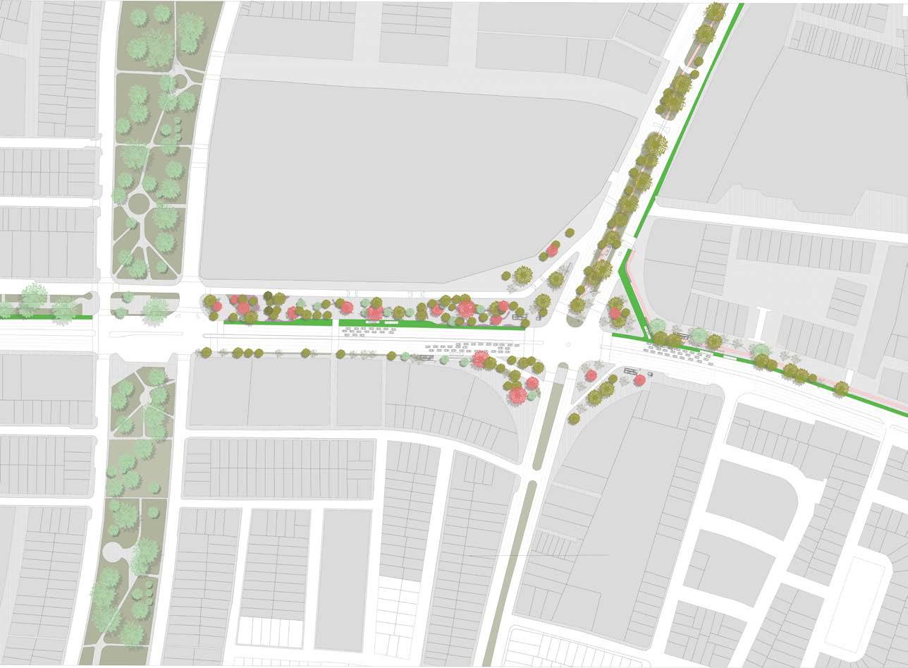
La Marina Intersection
Mobility | Urban | Mass Transport
Location: Lima, Peru
Project Type: Final Diploma project
Project Size: 67,000M2
Team Size: 3
Software Used:
- AutoCAD
- Adobe Creative Suite
- PTV Vissim
- ArcMap 10.8
Diploma Director: - Juan Carlos Dextre
2020
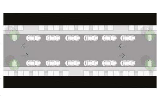
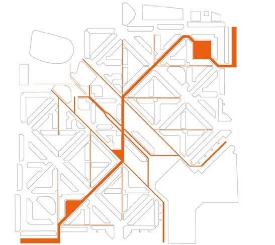
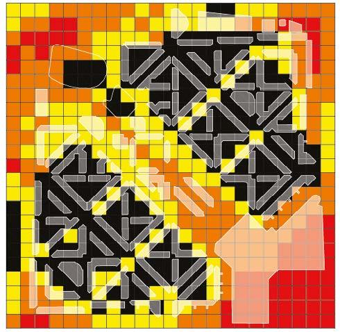
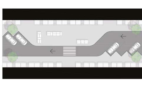
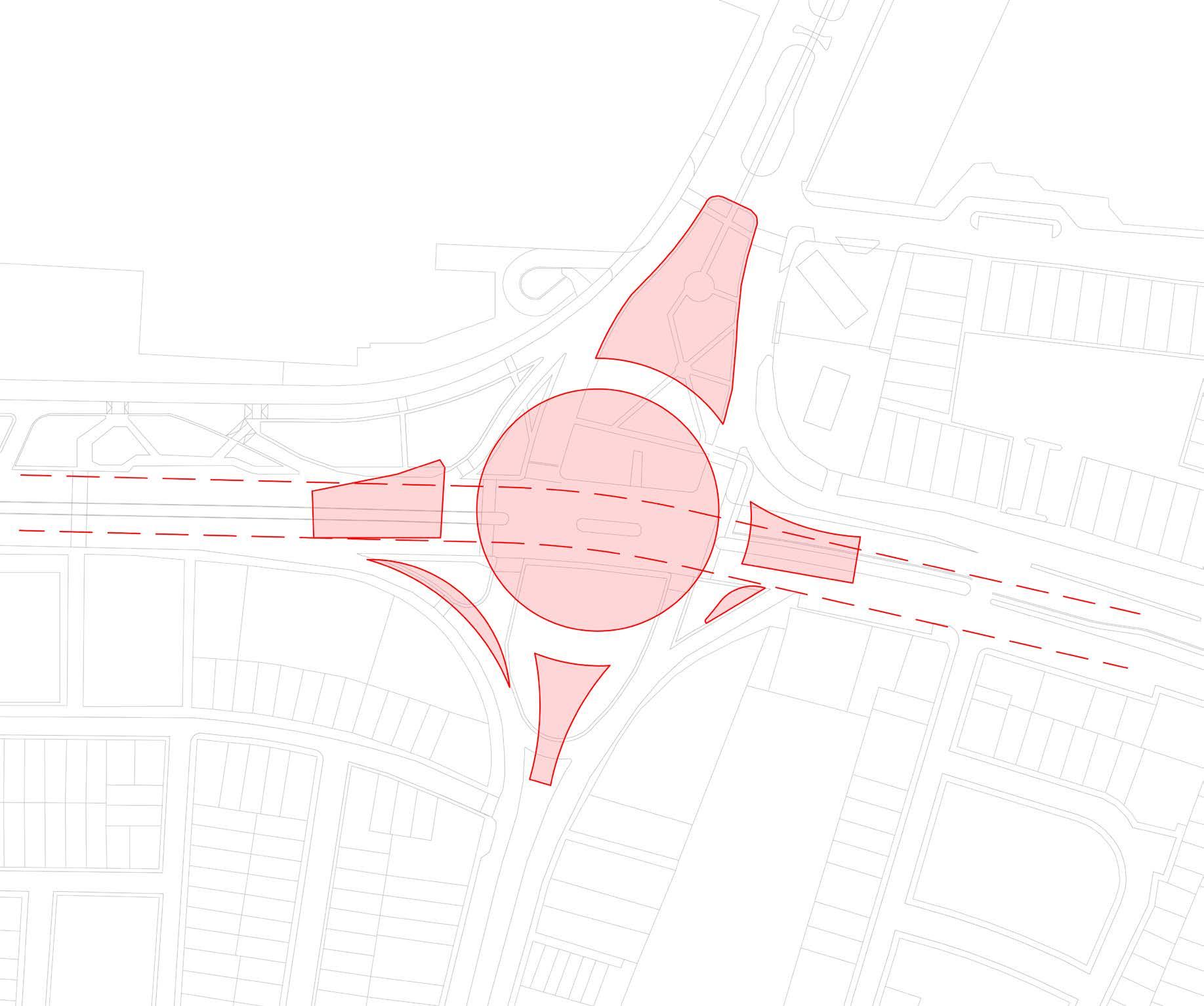
This project, part of a Postgraduate Diploma in Sustainable Urban Mobility, focused on redesigning a major intersection in Lima, Peru, set for redevelopment due to the Line 2 subway expansion. Existing plans, which included a roundabout and bypass, were found inadequate as they concentrated traffic at a single point, likely causing congestion 800 meters downstream.
Objective: Develop an alternative design to improve traffic flow and pedestrian mobility while mitigating future congestion.
Methodology:
1) Safety Audit – Identified key safety concerns in the proposed design (full report available upon request).
2) Carrying Capacity Analysis – Measured traffic and pedestrian flow through on-site observations and drone surveys.
3) Proposal Design & Simulation – Modeled the new design in PTV Vissim to assess its functionality and impact.
The final submission presented a data-driven redesign prioritizing mobility and pedestrian safety, offering a sustainable alternative to the original plan.
Current Development Proposal - Round about and bypass