ANNA JOHANSSON
Landscape Architect
annaaajohanssonn@gmail.com
+46767765665

linkedin.com/in/anna-johansson-160321135


MynameisAnna,andIwillsharemybestlandscape architectureprojectsfrommystudiesinthisportfolio. Iaminterestedinlarge-scalelandscapedesignand urbandesign,andIampassionateaboutdesigningand planningplaceswherehumansandnaturewillthrive sidebyside.Reachouttomebymail,LinkedIn,or phonetogettoknowmebetter.
Iamlookingforwardtohearingfromyou!
Hello!
Content
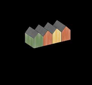
1. Kungsängens Gård (Urban Design)
2. Transforming the Peel With Tiny Houses (Regional Design)
3. A Lively Friesland (Regional Desin)
4. Uppsala Garden City (Urban Design)
5. Kungsängstorg (Green Square Design)
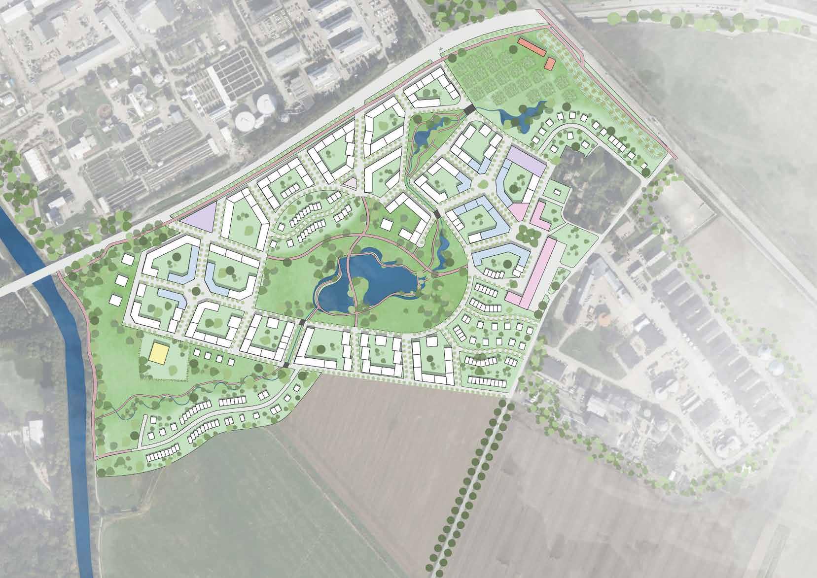
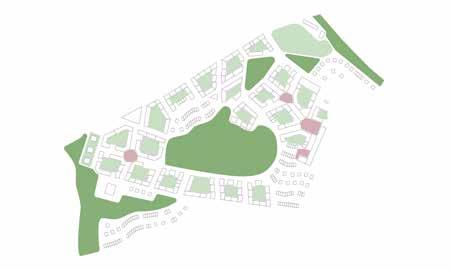
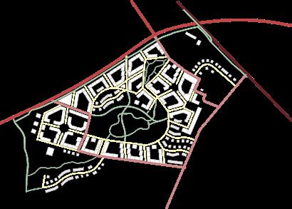
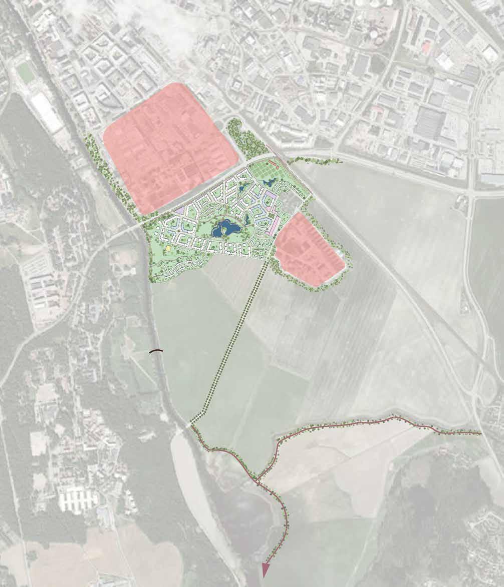
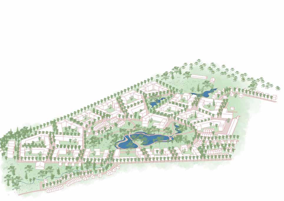
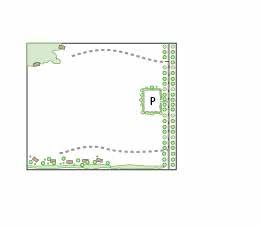
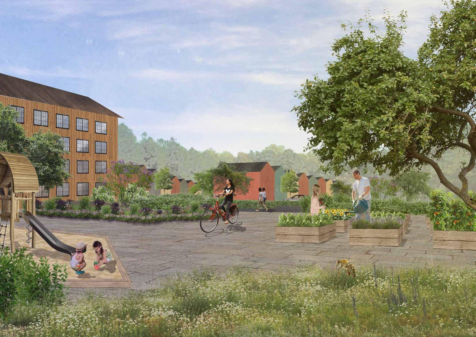
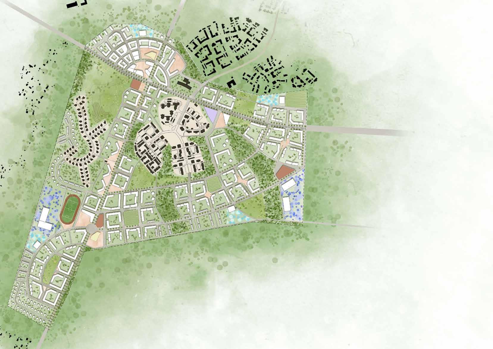
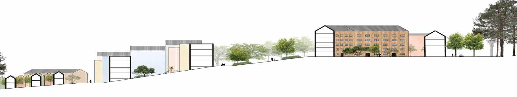
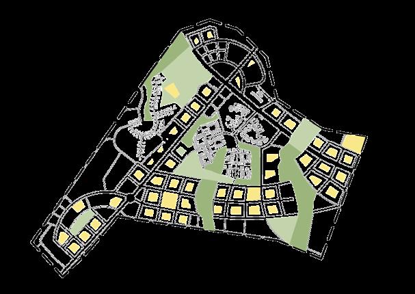
Kungsängens Gård
Swedish University of Agricultural Science. Course: Studio - Landscape Architecture for Sustainable Urban Design. Fifth year, individual project.
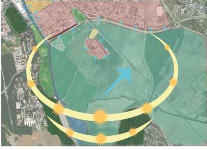
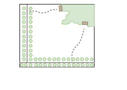
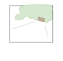
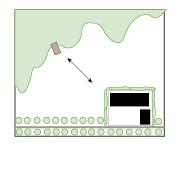
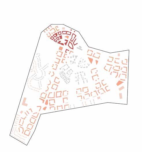
This design proposal for Kungsängens gård provides 1500 new residences, 10 000 m2 for business and offices, and 20 000 m2 of allotment gardens. The bluegreen heart in de center of the district imbues it with life, facilitates water flow and cleaning, and serves as a habitat for animals and insects. The stamina and resilience associated with hearts are the core of the proposal. Kungsängens gård is designed to be adapted to a future with a more extreme climate. The proposal has a high capacity to handle stormwater; the heart
stores it, the blue vein stretching through the whole neighborhood cleans it, and design measures to capture and infiltrate stormwater are incorporated in every block. The micro-climate in Kungsängsgård is designed with great care to keep chilly winds out and keep temperatures down in the summer. But above all, the concept of the heart symbolizes human interaction, connection, and community facilitated by generously sized green spaces available everywhere in the district.
Site Analysis
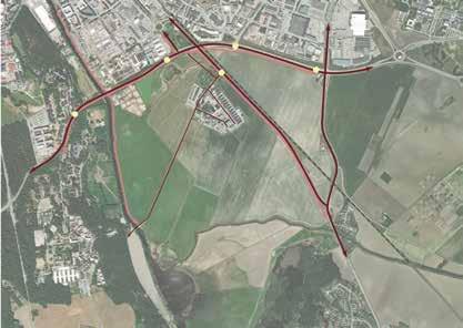
Context
Boländerna (industrial area)
Transportation
Barriers and Noise
Main area
Overview area
Green Structure
Bus stop
Car road
Biking path
Railway
There is potential for improvement of biking paths.
Blue Structure
Forest
Park and greenery incorporated in urban structure
Open fields
Nature reserves
Tree row
There is sensitive nature in connection to the area.
Water Polution
The stormwater pond on the site fails to clean the polluted stormwater from Boländerna, polluted water reach fyrisån.
Barrier
Noise
Barrier crossing
There is a risk that the barriers segregate the area.
Weather and Climate
Mainwind direction
Summer sun
Winter sun
Open landscape climatope
Forest climatope
Park climatope
Garden city climatope
City climatope
Industrial climatope
Air flowing from colder to warmer climatope
Vegetation blocking cold airflow
Uppsala centrum
Ulleråker Sävja
Water

Residential yards and gardens
Park
Housing
Kindergarten
Housing and bussiness
Bussines an offices
Parking house
Preserved historical buildings Road Bridges
Pedestrian and bike path
Allotment gardens Trees
Scale 1:6000/A3
Ridge with apple tree orchard shutting out noise from railway.
200 300 m N
0 100
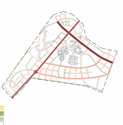
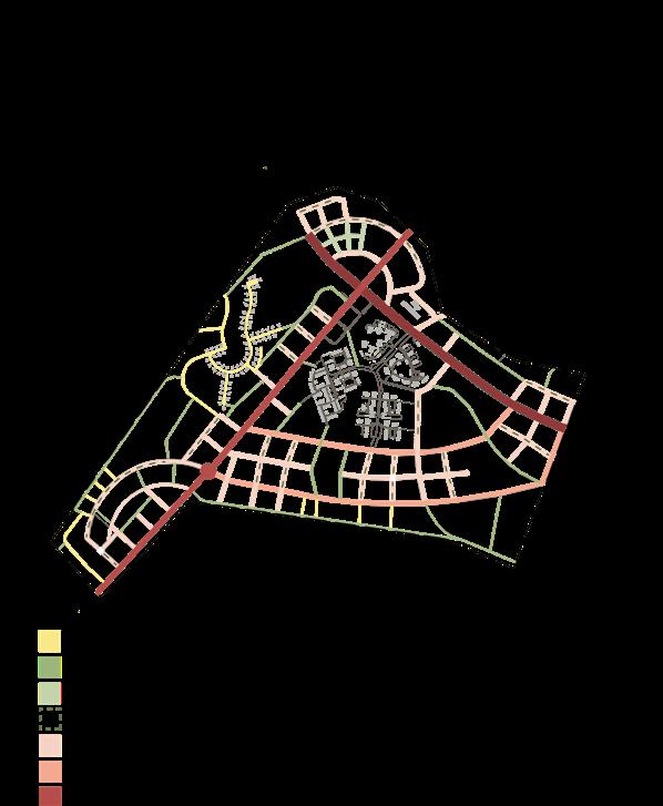
Square Master Plan
Square Square
Spaces
Street Network

House heights
Scale 1:20 000/ N 0 600 m Bridge Bridge New biking paths Towards Sävja Future transformation Future transformation Natural planting 70 km/h 40 km/h 30 km/h 10 km/h, cars only allowed for accessing buildings Pedestrians and bikes only 5 stores 4 stores 3 stores 1-2 stores Overview Plan
yards and allotment
District
Social
Public Parks Private
gardens Public squares
park
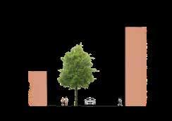
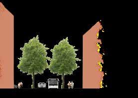
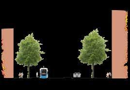
Design Principles
Narrow tree species, letting heat radiation out at night
Sloped roofs, letting sun in
Urban Blocks
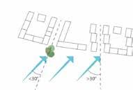
Angles and vegetation preventing wind tunnels

Green roofs
Roof tops can be used for energy production. Joining up buildings saves energy.

Enclosed yard provide safety for children to play.
Enclosed yards facilitate community building between neighbors.
Urban farming.
Enclosed yard with ventilation openings provides pleasant microclimate.
Blocks subdivided to separate buildings creates variation.
Distortion and height differences of the houses creates an dynamic cityscape.
Park close to all houses
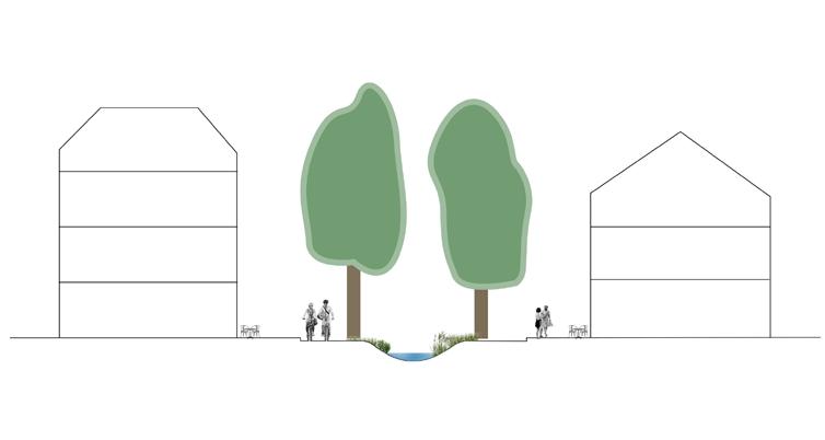
Shadowed water bodies
Design Principles
Permeable ground cover Green foreground
Microclimate
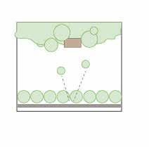
Stormwater Management
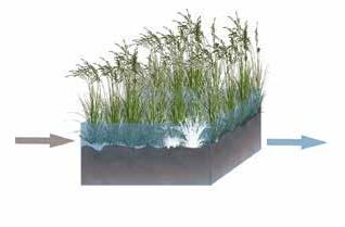
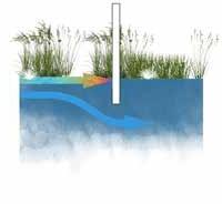
Oil is separated from the water with a screen.
In sedimentation ponds, dust and larger particles sink to the bottom of the pond.
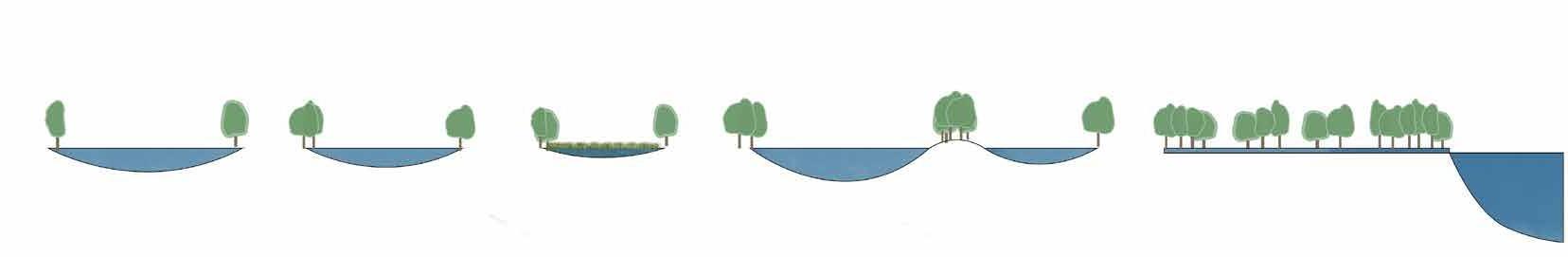
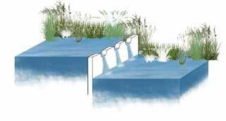
Main stormwater pond, the primary purpose is the storage of large volumes and recreation. Shallow wetland with lots of water vegetation. Plants clean the water from finer particles.
A tiny “waterfall” adds oxygen to the water, which benefits all water life.
A Inlet Outlet a B b E F e f
D d A a B b c C D E e d f F c C 12 m 12 4 4 3,5 3,5 8
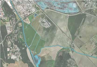
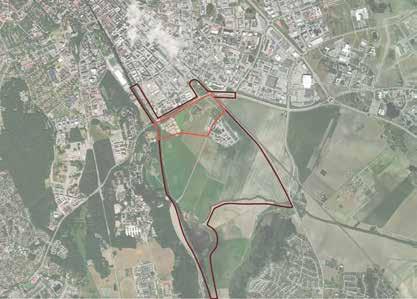
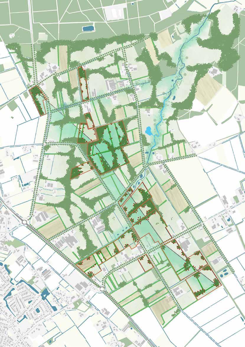
Transforming the Peel With Tiny Houses
Wageningen University and Research

Course: Academic Consultancy Training. Fourth year, Group project.
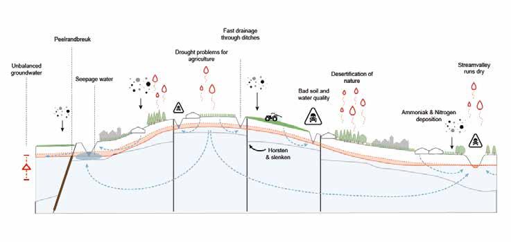
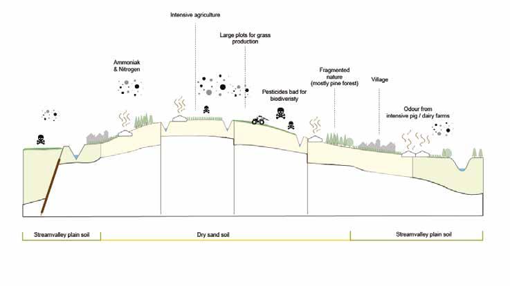
The Peel is a part of the North Brabant province in the Netherlands. The ecological system and the landscape experience have degenerated in the last decades due to the highly intensive livestock farming. The local organization Peel Natuur Dorpe was founded to work for the restoration of the cultural and biodiverse ”coulisse Landscape” that historically characterized the Peel. To create an incentive for farmers to transform their practice towards being more nature-inclusive, Peel Natuur Dorpe has created a new revenue model for them. The concept is that the farmers will plant new nature
on their land and build tiny houses in it for rental. In that way, they will profit from strengthening the ecological system in the landscape. However, it is currently not allowed to live on farmland according to the zoning policies. Peel Natuur Dorpe is facing the challenge of convincing the municipalities and the region to adjust these policies. This design proposal aims to show the positive impact of the concept on a regional scale. Tiny houses can be a tool for recovering the ecological system of the landscape in the Peel.
Existing forest
Existing water bodies
Stream valley Settlement
Flight field
Semi-dense coulisse landscape

Dense coulisse landscape
Herbarous grassland and extensive agriculture

New nature
Water storage
Water raising from the ground
Main ditches with buffer
vegetation zone
Area for detailed design

0 1 2 3 km N Scale 1:60 000/A3 Master Plan
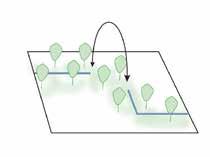
Widen and lower ditches to allow plants to grow.
Store water for irrigation in the area. Restore meandering shape of streams.
Regional Design
Riparian buffer zone along ditches and streams.
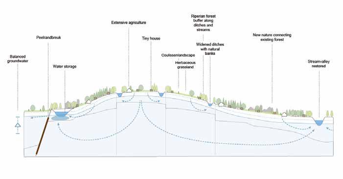
Flower strips along fields. Extend forests with curvy edges.
Connect riparian forests and tree lines on the plateau with the forest along the edges.
Create solid ecological connections between forest patches.
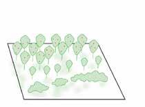
Let riparian forests connect, also in the places where the water is not conected.
Food forests. Strip croping. Rotational grazing.
Landscape problems
Principles
Existing forest
New nature
Wet meadow
Dry meadow
Existing strem and ponds
Designed stream and water storage
Extensive cultivation of crops

Riparian forest
Tree row
Houtsingel
Tiny house
Boarders for pilot area
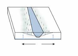
Peelrandbreuk
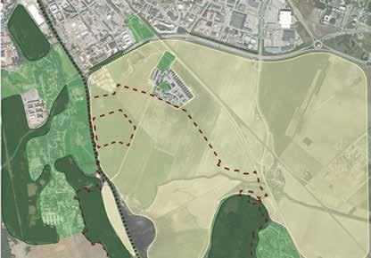
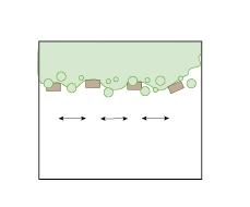
Design PrinciplesHouses
Tiny house close to farmyard for social interaction
Tiny house set back from the road, max 400 m.
Shared parking lot, max 800 m from house.
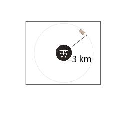
Tiny house in a radius of 3 km to facilities.
Scale 1:11 000/A3
Provide privacy through distance.

Clustered, facing away from each other.
Provide privacy with vegetation.
In a row along forest edge.
Placement close to the road.
Placement on forest edge.
Vegetation cover the house from the road to prevent cluttering.
0 250 500 m N
Placement in hedgerow in the field.
Detail Plan
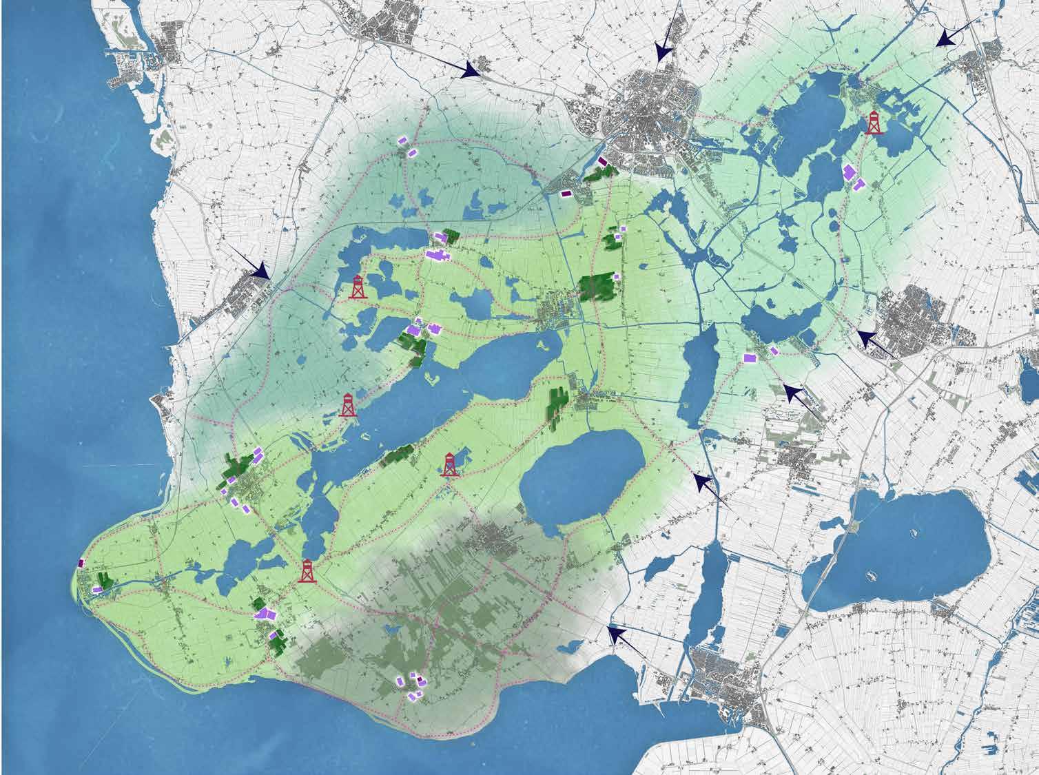
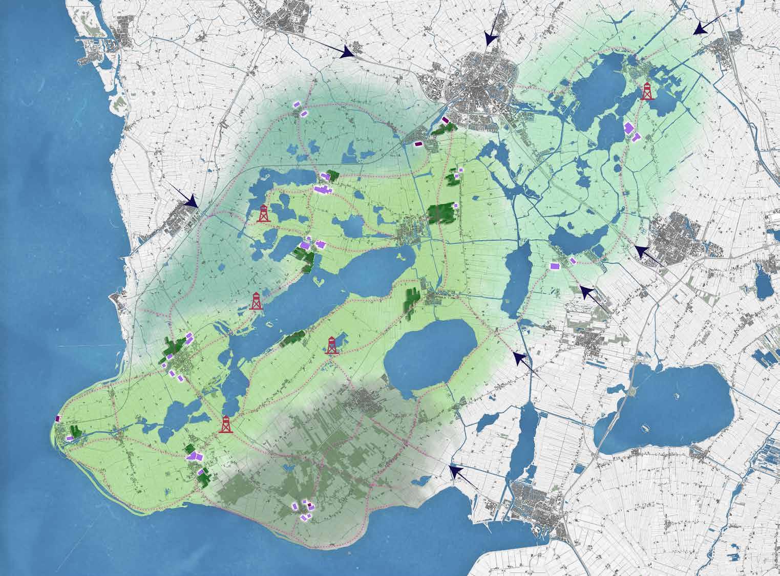
A Lively Friesland
Wageningen University and Research Course: Studio - Regional Design
Fourth year, individual project
Friesland is a developing region of the Netherlands with many potentials and challenges. The essence of the Friesian landscape includes openness, flatness, dairy farming, water, and tiny villages. The province of Friesland has the vision to unlock the landscape’s full potential to attract more visitors and get more people to move here. Currently, many parts of it are perceived as empty and monotone, and the population of Friesland is aging. This design proposal suggests strategic interventions
to increase the recreational qualities of the biking and hiking routes and expand the villages with more settlements. By implementing this plan in phases, the intention is to start a positive feedback loop where more visitors in the area stimulate more people to move here to start a business, a more lively and active landscape, even more visitors are attracted, and so on.
Context
Landscape characters
Friesland is a region in the north of the Netherlands, and the design area is located in the southwest of Friesland. The site is, with its many lakes and waterways, also known as the Waterland of Friesland. However, in most places, the lakes are hidden from the roads by reeds, and the name does not match the experience of moving through the landscape by bike or foot.
Settlement Network and points of interest Landscape


Inhabitants < 1000. No or very scarce service supply.
Inhabitants > 1000. Sufficient service supply, a lively node in the landscape.


Inhabitants > 1000. Underdeveloped service supply.
Inhabitants < 1000. No or very scarce service supply, close to the city.
Inhabitants > 30 000. Shortage of small apartments for young people.

Mainly clay and clay on peat, irregular parcel patterns, and curvy roads.

Open peat landscape with strict, rectangular parcels and straight roads. Acknowledged area for sailing due to the many waterways in the landscape.
Open peat landscape with strict, rectangular parcels and straight roads. Experienced monotone while biking.
Semi-closed mosaic of mixed forest and open agricultural land on sandy soil.
Car roads. The size of the fuzziness indicates the size of the road and the level of disturbance in terms of noise and movement in the landscape.
Biking paths in the landscape. Fragmented and recurringly located next to cars road. Failing to connect villages and places of interest.
Churches, serving as landmarks in the landscape.
Places of interest, including cultural heritage sites and activities.
Beaches
Analysis
Water

Western open peat landscape
Forest-field mosaic
Semi-open clay landscape
Eastern open peat landscape
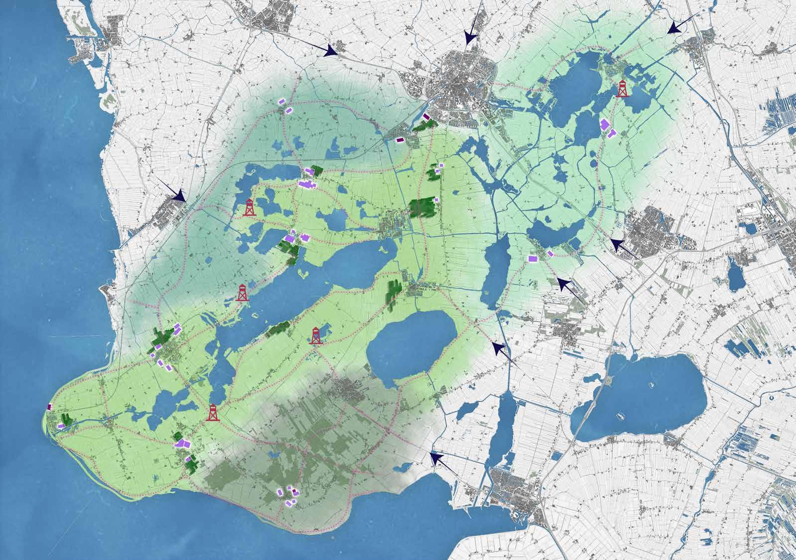

New forest
New apartment houses
New houses and row houses
Entrances
New biking paths
Sight towers

Area for detailed design


This is a scaled version of the original plan that is 1:50 000/A0.
A a
Master Plan
The characteristic curved roads, alleys, and vegetation Islands in the fields are increasingly emphasized by planting more trees.

This part of the park is appreciated as it currently appears. Alleys, single trees, and groups are planted along monotone roads outside the


Conceptual cross-section showing how the openness of the landscape varies. The scale is not accurate.

The open character of the peat landscape is preserved, and the waterways are prioritized over new biking paths. New vegetation is sparsely planted to not block the wind for sailing boats.


The open character of the peat landscape is perceived. Small patches of forest and rewetted areas are added along the biking paths, as well as trees and bushes in varying compositions to make the landscape more varied.

A a
The Semi-open Clay Landscape
The Semi-open Clay Landscape
The Forest-field Mosaic
The Forest-field Mosaic
The Western Open Peat Landscape
The Western open peat landscape
Picture
Oberger
htt-
4 Landscape Types
Eastern Open Peat Landscape
source:
2020
ps://commons.wikimedia.org/wiki/ File:IF-segelb%C3%A5t.jpg
Biking paths
Walking paths
Existing roads

Houses and row houses
Apartment houses
Tiny houses

Open peat landscape
Semi-open clay landscape
New wet forest
Water
Re-wetted area


New train station
Boat rental


Bird watching

Picknick spot
Sight tower Beach
Camping
Hoarse riding

A a 0 1,7
3,5 kilometers
This is a scaled version of the original plan that is 1:13 000/A0.
A a
Detail Plan
Forest Tiny housing Current houses Apartment houses Houses and row houses
B

b A a
Plant new forests and re-wet agricultural land along the biking network in a small patch pattern. Recreational Routes C


Compose the smallscale design interventions around the networks and nodes pattern.
Use species significant for the area, like Alnus, Populus, Salix, Aesculus, Betula, Amelanchier, Sambucus, etc.


3 250 6 0,5 0,5 m 0,5
c C
The biking path is placed apart from the car’s road, crossing through the empty and peaceful landscape.
3 1,5 6 m
B b 1 m
Biking paths are placed next to car roads in cases where the car roads are not busy or when it is the closest way between destinations.
0,5 0,5
0,5 0,5
Walking paths. Constructed of gravel placed on top of the peat. a
A
Create more depth in the landscape, while still keeping it open.
Make the water visible from land by designing the new roads next to the water. c
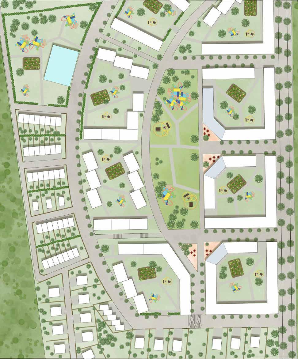
Uppsala Garden City
Swedish University of Agricultural Science. Course: Studio - Urban Open Spaces. Third year, Group project.
Uppsala Garden City is a modern version of the historical garden city concept. It is a testbed for increased self-sufficiency in urban areas; all residents are given the opportunity to cultivate. The proposal aims to explore to what extent urban farming can gather neighbors, sustain them with
food, and increase the knowledge and appreciation of the food chains. The proposal is designed around a network of public and private outdoor spaces. These are in different ways bonded to the concept of countryside farming but in an urban context.
The project will be built in connection to the existing residence area Sävja, which is located 7 km from Uppsala centrum. The proposal has an area of 180 hectares and contains 6 000 new residences. A new railway station is planned near the area, increasing the opportunities for travel between Uppsala and Stockholm. In addition, a new bridge over Fyrisån will connect Uppsala Garden City with the southern parts of Uppsala.

Currently, the landscape in the area consists of coniferous forests and settlements. However, there are some agricultural fields and farms close to the area.

The settlement in the area is relatively small-scale and merged with nature, which should be considered when designing new settlements.


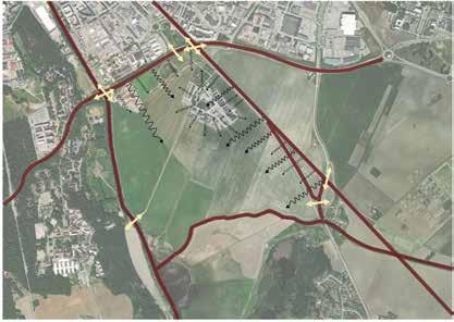
The topography within the area is slightly rough. The most significant height differences are in the west, highlighted with red circles. The water outflow direction is from the east towards the west.

Road 255 has a barrier effect, dividing the area into two parts. It needs to be redesigned to make the area integrated and safe.
Nature reserves are valuable recreational assets for the residents. The nature of higher values should be prioritized when saving nature in the area.
There are no public facilities within the area, and the facilities northeast of the area will not be enough to cover the needs of 6000 new residences. The retirement homes, supportive housing, and the playground have a direct connection to nature, which is important to respect when designing.
Future tramway
Swedish university of agricultural sience
Lunsen nature reserve Årike fyris nature reserve N
Uppsala railway station Railway
High nature value Very high nature value Nature reserv Site analysis 1-5 floor houses 1-2 floor houses Car roads Bike roads Node with school, supermarket, sports facility, etc School Kindergarten Supportive housing Playground Retirement home 255
Scale 1:6000/A3
0 150 300 m N
Sports ground
Indoor swimming pool
Library and culture
Multistorey car park
New buildings
Existing residence area

Kindergarten
School Square Park
Urban cultivation park
Preserved nature
The public squares are places where markets for locally produced food, open-air restaurants and cafes, and other events gather people.
The farming yards gather the neighborhoods around the opportunity for collective urban farming.
The residential yards are the residents’ green living rooms. Here residents can play and practice small-scale urban farming.

Kindergarten and school yards are directly connected to nature to enable kids to interact with nature.
In the parks, people meet to practice their hobbies, play and rest. Unprogrammed lawns allow gathering for bigger events like outdoor cinema, group work out, and small concerts. In the largest park, there is a collective farming yard.

Master Plan
Green-structure and urban farming
Preserved


Pedestrians only
Bikes and pedestrians only
Local
Local
Boulevard
Boulevard
Tramway boulevard Boulevard Local street, 30 km/h Section A-a, scale 800 A a Local street, 10 km/h
km/h
streets, 10
streets 30 km/h
40 km/h
farming
with tramway 40 km/h Urban
nature
floors
Parks House heights 1-2
3-4 floors 4-7 floors
Play
Social space
Square activity


Fence
Kindergarten
Residence building
with commersial activity on first floor
Residence building
Square
Stramp
Stairs
Ground level IV +43,0
Number of floors
House types

Linked blocks, enclosing residential yards, 4-7 floors
Houses
Row houses
+49,0 +49,0 +48,0 +43,5 +40,0 +48,5 +47,0 +45,5 +43,5 +34,0 +34,0 +29,0 +36,0 +31,0 +47,0 +48,0 +42,0 +37,0 +35,0 +37 +35,5 +34,0 +34,0 +31,0 +45,0 IV IV IV IV IV V V V V V V V V V V V V V V II II II II II II II II II II II II II IV IV IV IV IV IV IV IV IV IV IV IV IV IV IV IV IV IV A
a
Urban cultivation
Detail Plan 0 50 m N Scale 1:2000/A3
Kungsängstorg

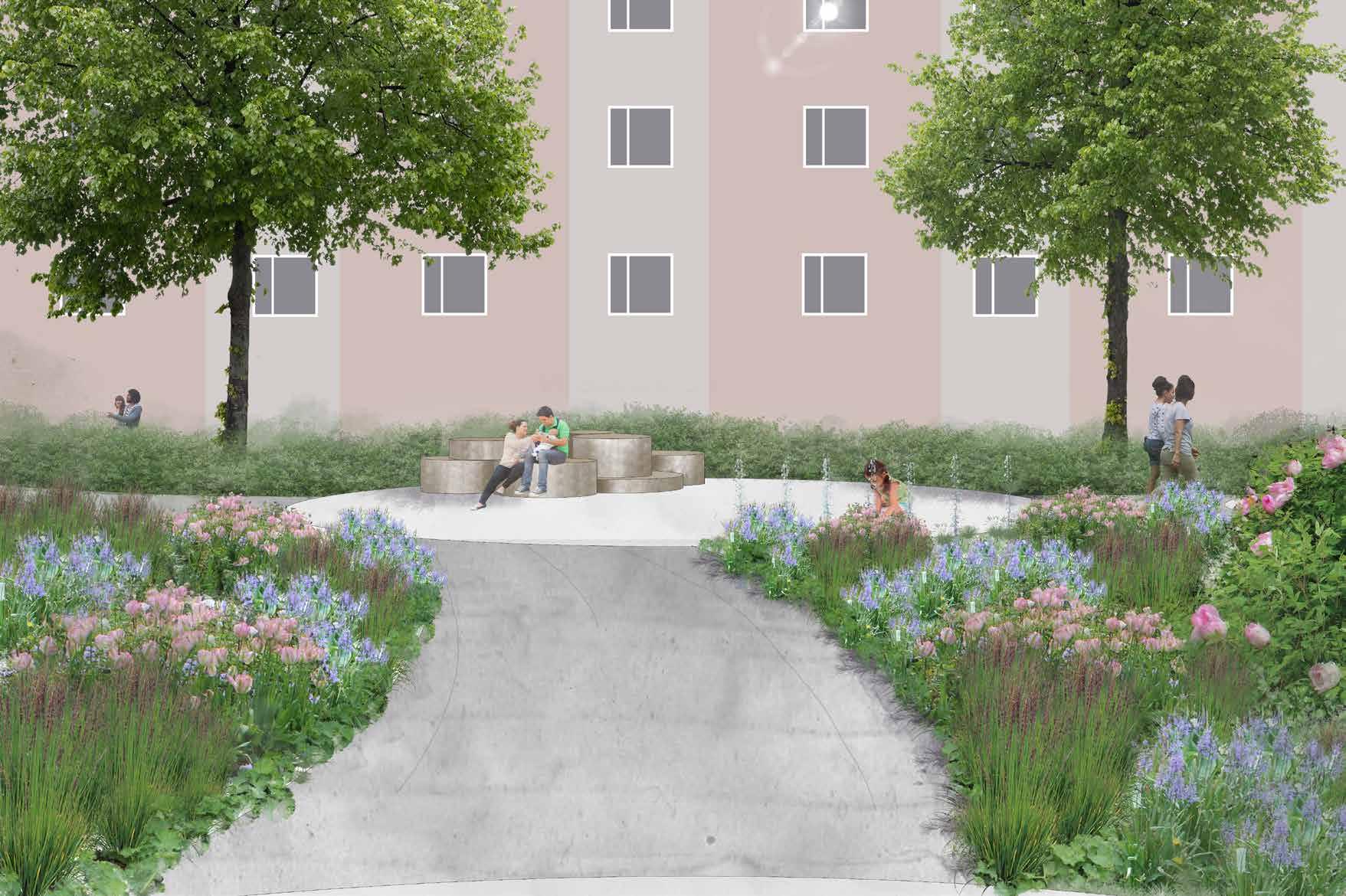
Kungsängstorg
Swedish University of Agricultural Science. Course: The Urban Space and Plantknowledge 2. First year, individual project

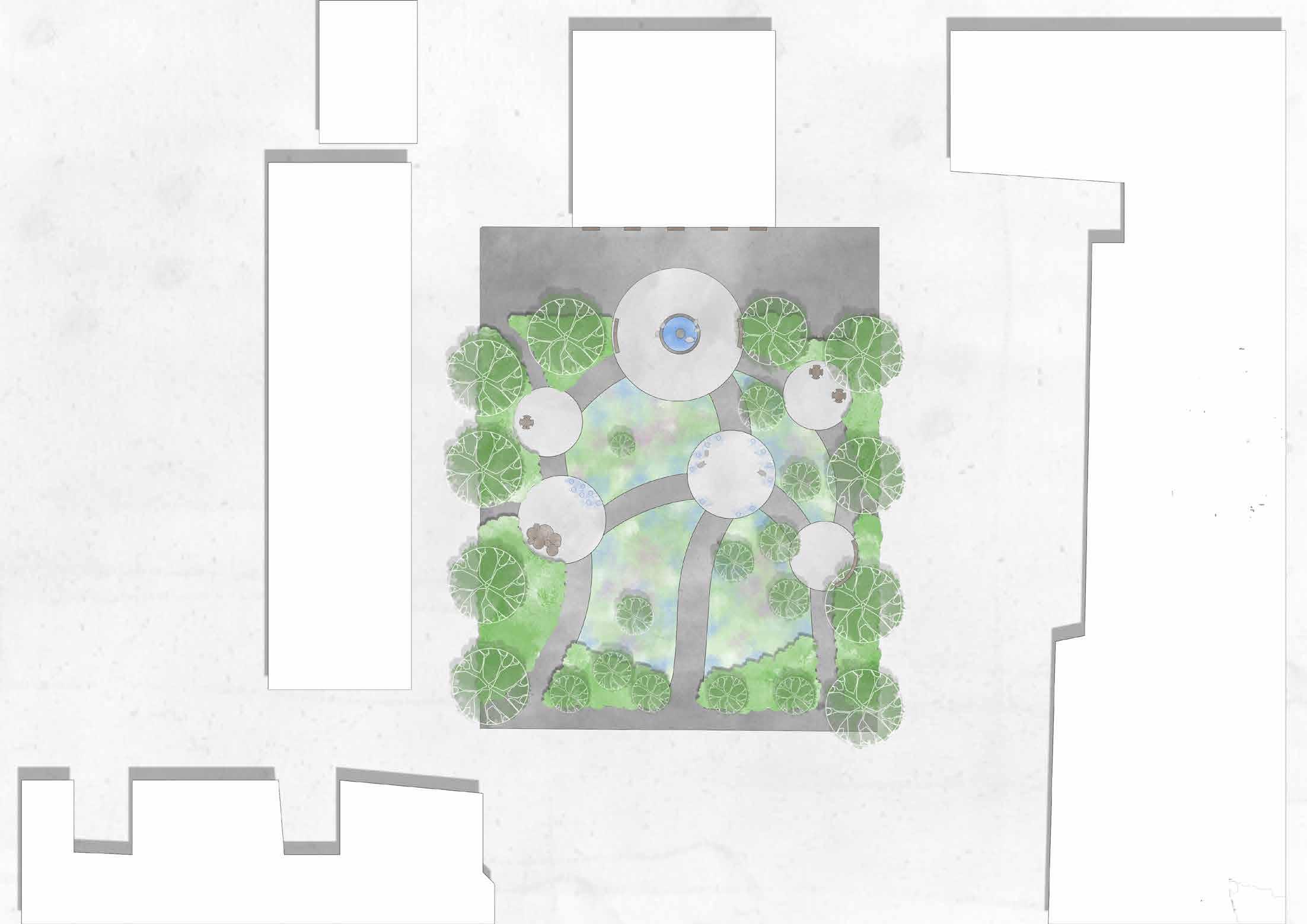
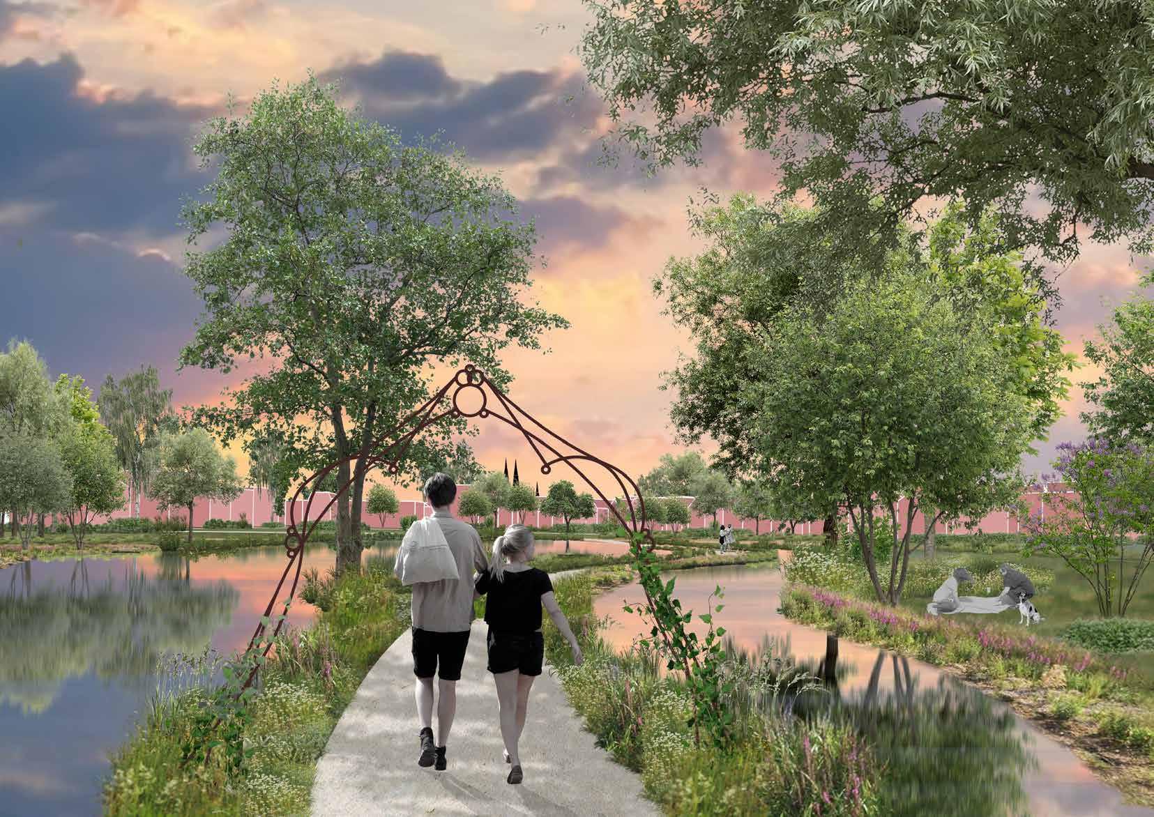
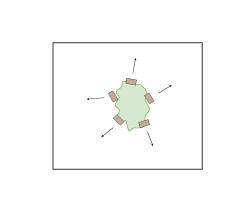
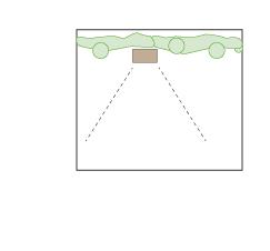
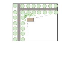
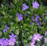
At the new Kungsängstorg in Uppsala, Sweden, six circular spaces are linked with softly curved paths that pave the way through an ocean of exuberant perennials. Free-growing hedges frame the park, the crowns of the trees form a shadowing ceiling, and together with the perennials, the trees and the hedges offer a green oasis in the vivid city. Here you can sit in sunlight or shadow, enjoying lunch or Swedish ”Fika”. Both separate benches for reflection and rest in solitude and larger size seating furniture for more prominent groups are offered. The square has a history of trading, and because of people woke up to the scream of swines on Tuesdays, its historical name is ”The Swine Square”. Therefore the existing fountain with the swine statues is preserved. The swines also get company from other animal statues in the middle of the square, where they, together with the waterjets that spout from the ground, invite spontaneous play.
Upps
Scale 1:200/A3 N 0 5 10 15 m
A a Con t e x t
office building auction
retirement home
house
Uppsalas Municipal Park, Stadsträdgården
house
concrete slabs existing fountain
road
water jets
sitting furniture
bench with table
benches
animal statues
tree
bushes
perennials and ornamental onions
Master plan
bench
The three main entrances to the park are highlited by small ornamental trees and framed by two old linden trees that stand on the site today.

Planting palette


”Off stage seeting” where people can find a calm space and rest.


Section A-a, showing the variation of the vegetation as well as the auction houses role for the space.
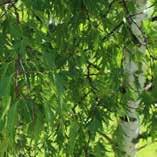
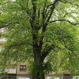
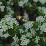
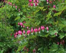
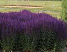
Tilia europaea Betula pendula ’Dalecarlica’
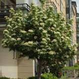
Sorbus decora
Lamprocapnos spectabilis
Salvia nemorosa
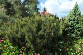
Pinus mugo var. Pumilio
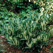
Arona melanocarpa ’GLORIE’ Prunus laurocerasus
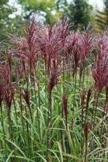
Calamagrostis brachytricha
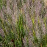
Luzula sylvatica
Aruncus aethusifolius Echinacea purpurea
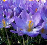
Crocus tommasinianus
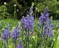
Camassia leichtlinii
Looking forward to connecting with you!