Portfolio
Urban Design and Architecture
Anju Mathew

Anju Mathew
I am an Architect and Urban Designer with over 10 years of experience in master planning, architectural design, and urban research. My background includes large-scale regional planning projects, mixed-use developments, and public realm enhancements across the Middle East and Canada. I recently completed the Urban Design program at Sheridan College, where I focused on sustainable urbanism, community wellbeing, and public space design. With a strong command of design tools and a deep appreciation for context-sensitive planning, I aim to contribute to people-centered, inclusive, and resilient urban environments across Canada.

Anju Mathew
Architect Urban Planner and Project Coordinator
B.Arch / Urban Design / Project Mangement
Ph: 2496880297
Email: anjuovil@gmail.com
01 02 Port Credit Development Proposal, Mississauga Redevelopment Project, Liberty Village Toronto
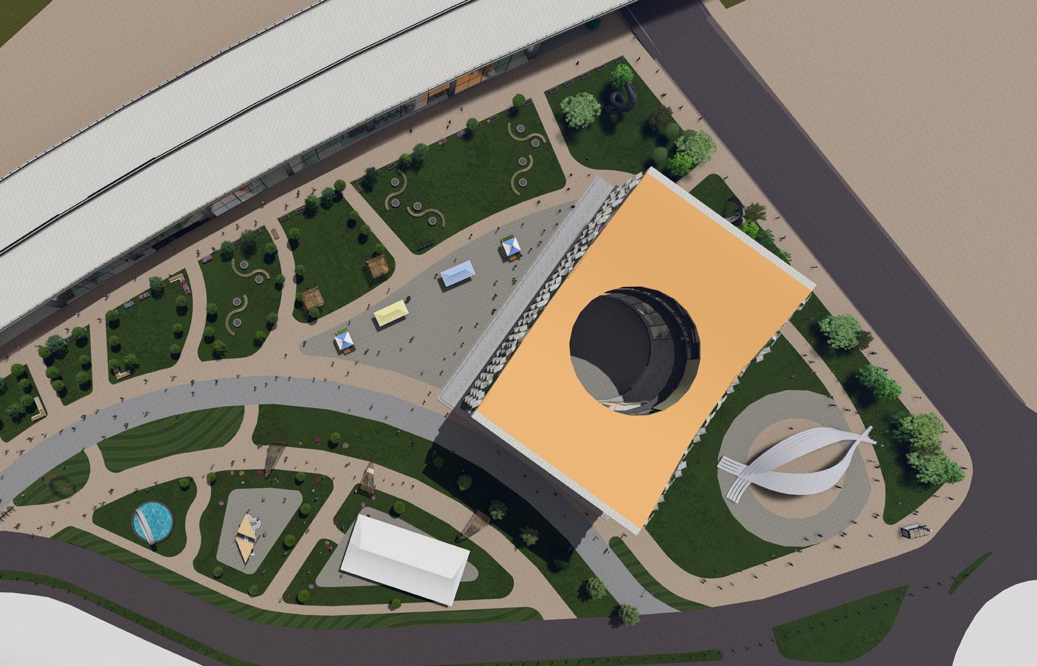
03 04 Urban Revitalization / Cultural Hub Exhibition Place, Toronto
05 Navigating Mississauga Public Place Activation - Diabetes Prevention in Mississauga - Samuel Common Park
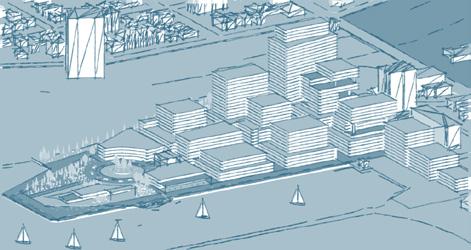
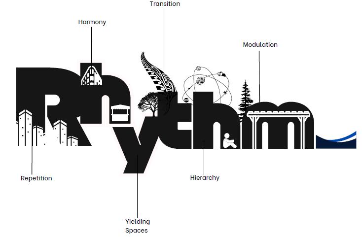
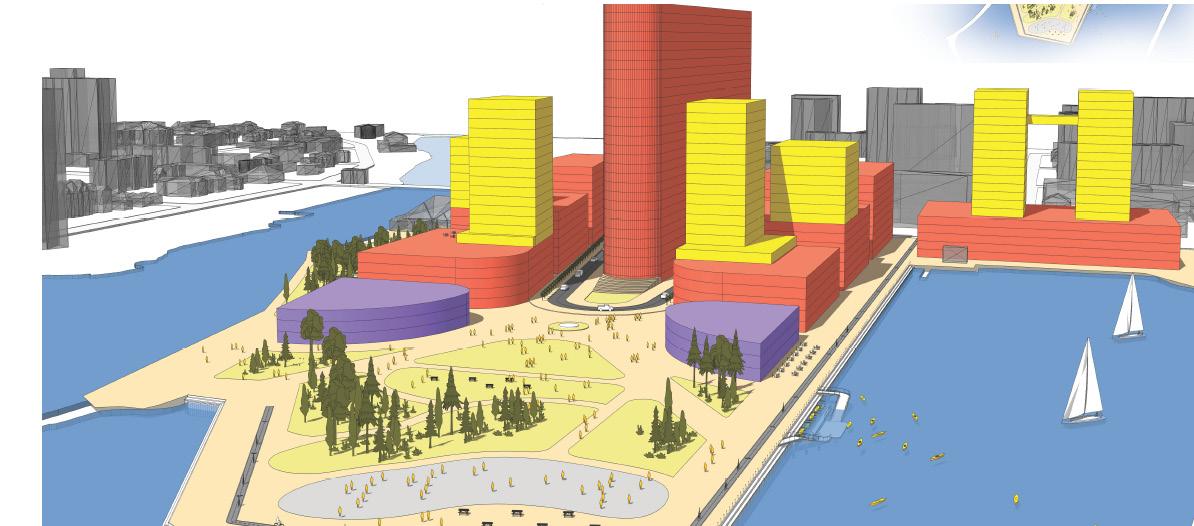
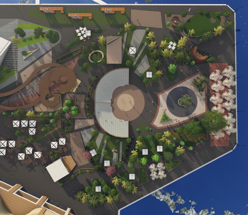
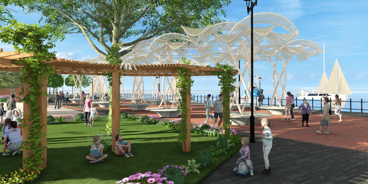
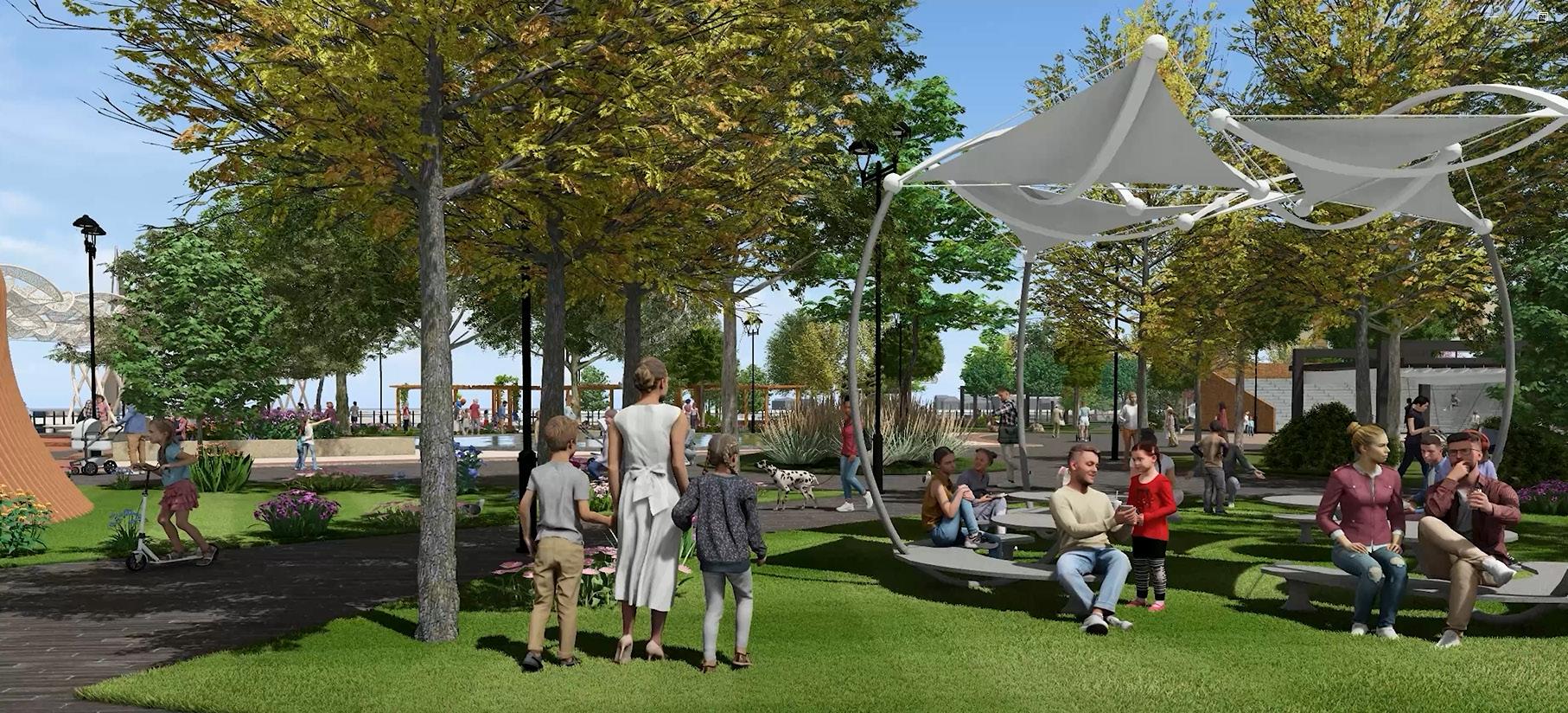
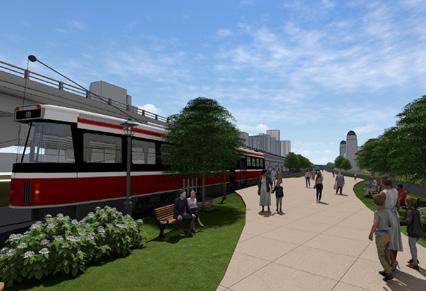
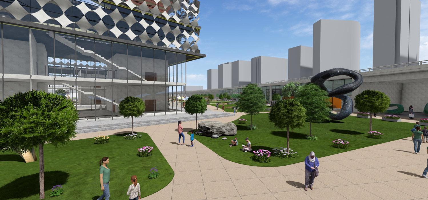
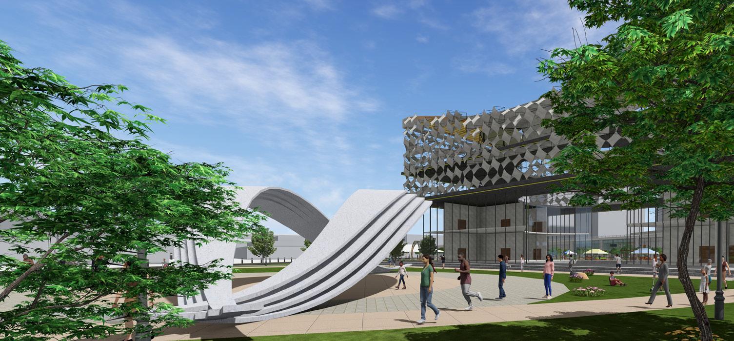
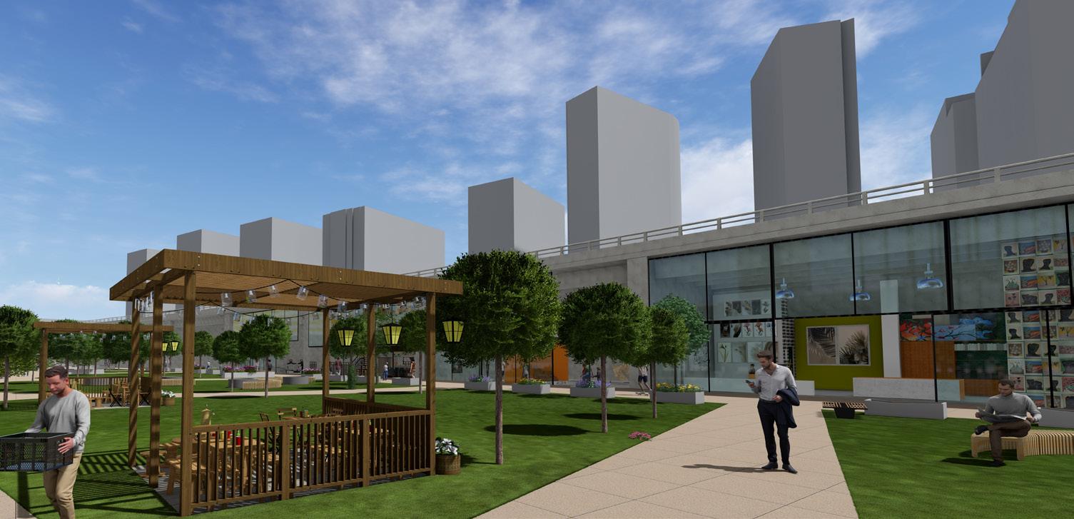
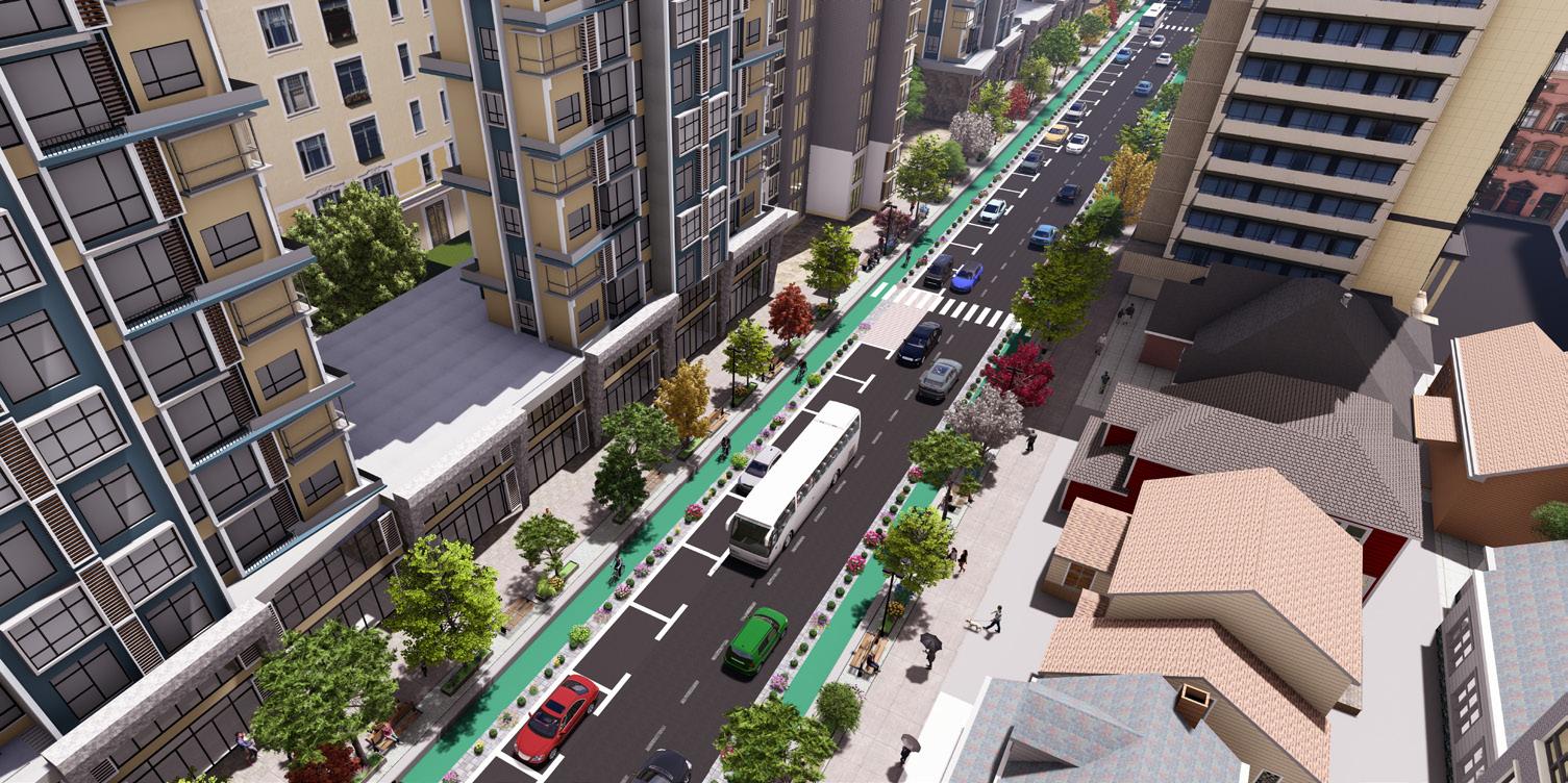
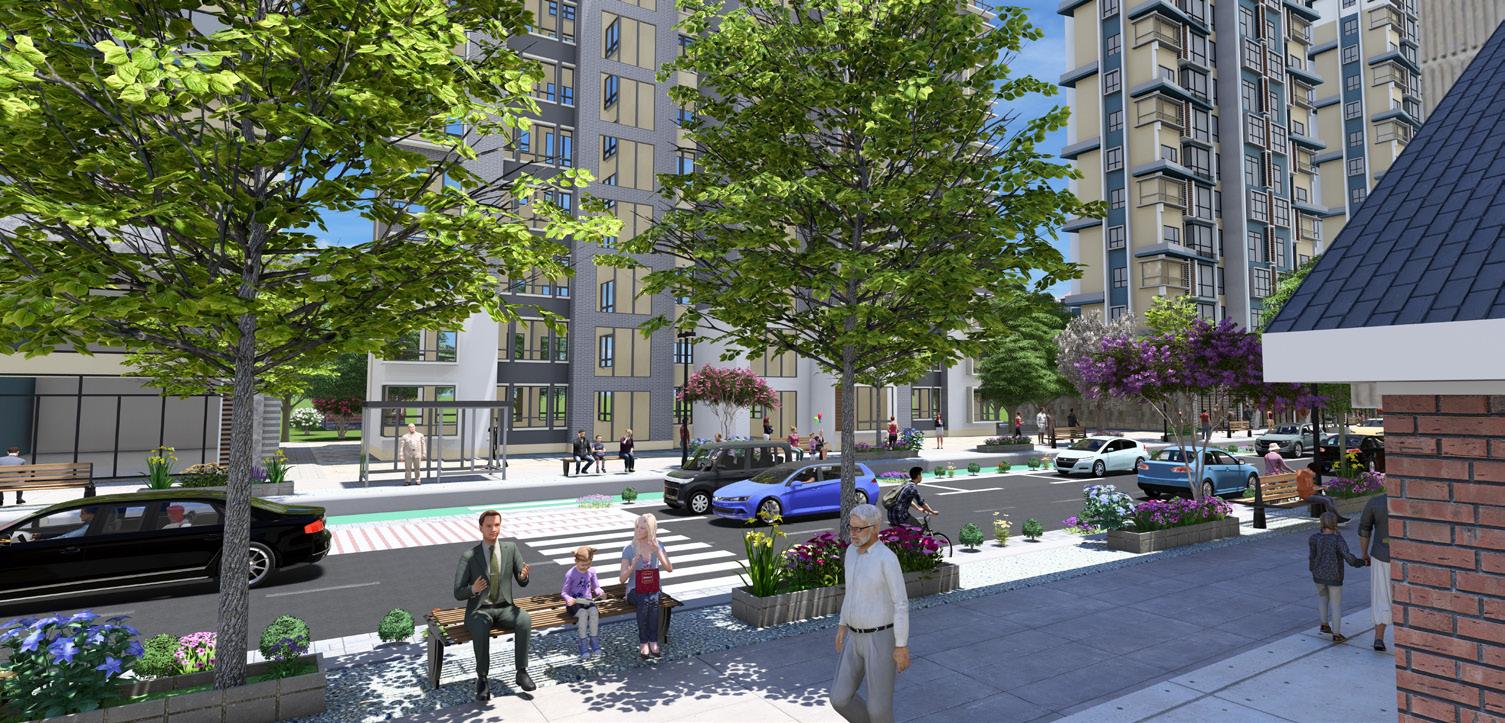
The Port Credit development project, guided by the concept of "Rhythm," reimagines the urban landscape as a vibrant, mixed-use community that harmonizes movement, culture, and sustainability. The design integrates public, commercial, and residential spaces to foster social interaction, cultural engagement, and ecological balance.
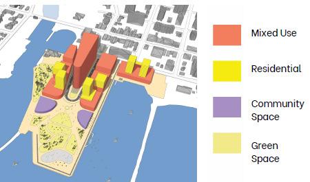
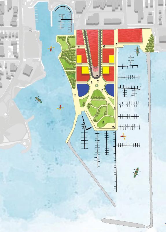
In designing the Port Credit development, we’ve integrated a vibrant, mixed-use environment focusing on connectivity, cultural engagement, and accessible public spaces.
Mixed-Use Development: Ground-level commercial spaces along pedestrian corridorsenergize the area, while residential towers above offer diverse housing options for asustainable, 24-hour community, promoting urban vitality and a strong sense of place. Community Facilities: A museum dedicated to Indigenous history and a planetariumenrich the site’s cultural and educational appeal, fostering both local identity andbroader engagement.
Public Space and Green Infrastructure: Two major parks anchor the green network, withCentral Park featuring local art installations as a cultural gathering space. This approachenhances sustainability, social bonds, and community well-being.
In designing the Port Credit development, our team created a vibrant, misxed-use developemnt focused on connectivity, cultural engagement and accessible public spaces.
Key features include an Indigenous museum and planetarium, dynamic public spaces such as an amphitheater and an ice-skating rink, and green corridors that enhance connectivity. Streetscapes prioritize pedestrian and cyclist movement while blending functionality with aesthetics through thoughtful materials and landscaping. The project celebrates local history and culture while envisioning an accessible, lively urban environment for future generations.
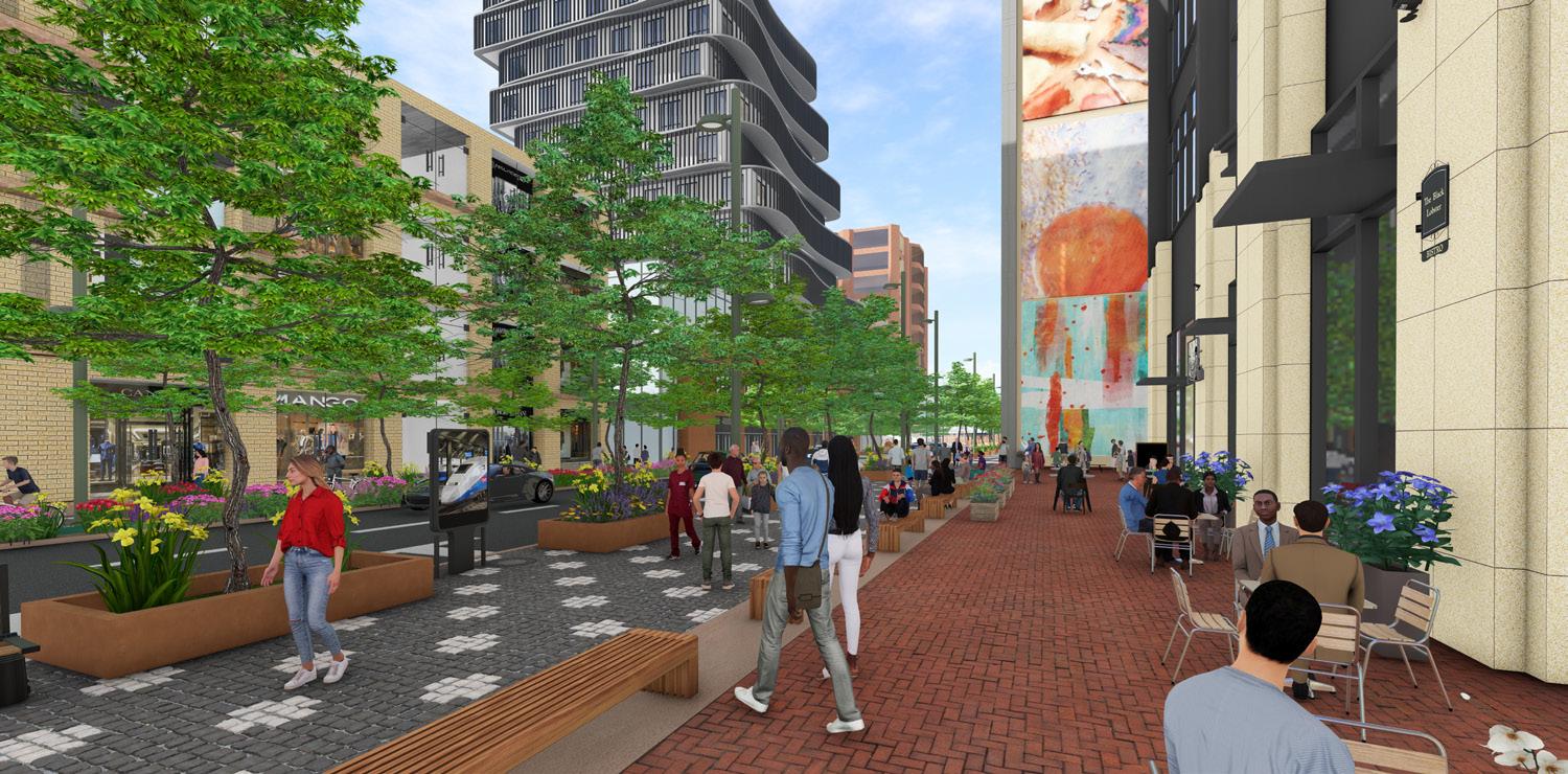
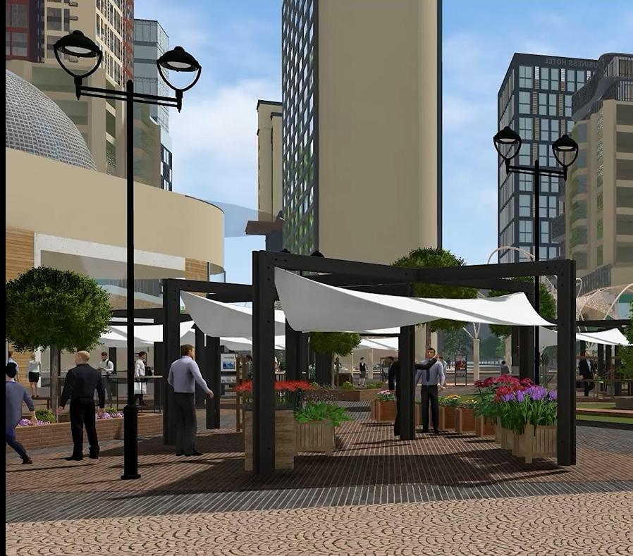
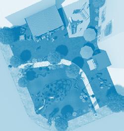
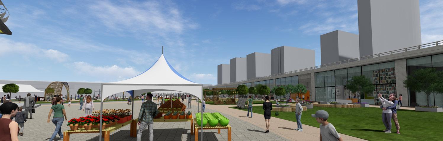
For the proposal in Pardee Avenue and Liberty Street parking lot, the space is transformed from underutilized space into a vibrant, multifunctional community space. This designed is inspired by Market Street Prototyping Festival in San Franscisco. Similarly this design introduces flexible and temporary activation space.
A weekend Farmers Market with Temporary stalls will serve as the central feature and allows the local community to contribute and promotes local businesses. Adjacent to the market temporary small cafe with few outdoor seating will provide as a social space for the visitors. Adding this even attracts people visiting the near by areas to the site. The seating of the cafe will be movable and the community can decide on local cafe owners to temporarily use the space monthly.
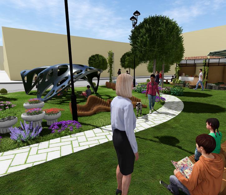
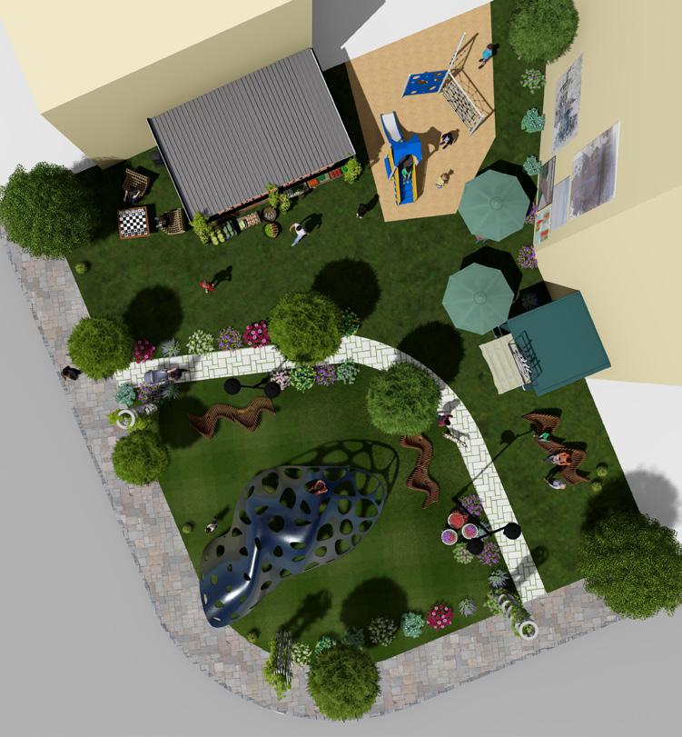
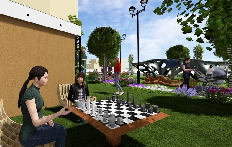
A dedicated corner is with builtin chess table where seatings are placed for casual gathering and startegic games. This design creates an inclusive dynamic urban space and the site remains activated even beyond the market hours. This creates integrating culture, recreation and social engagement within the Liberty Village.
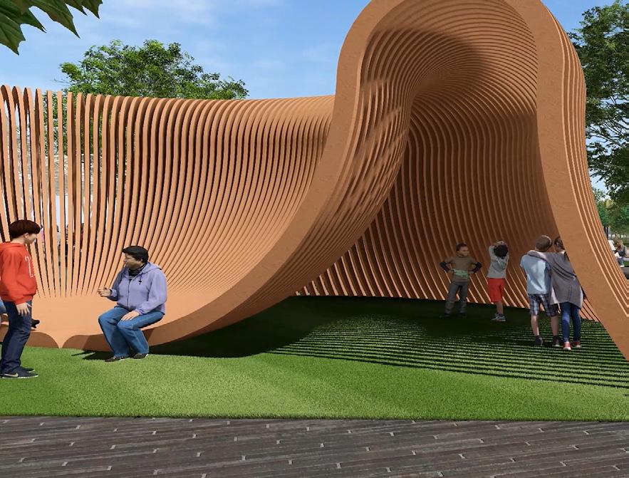
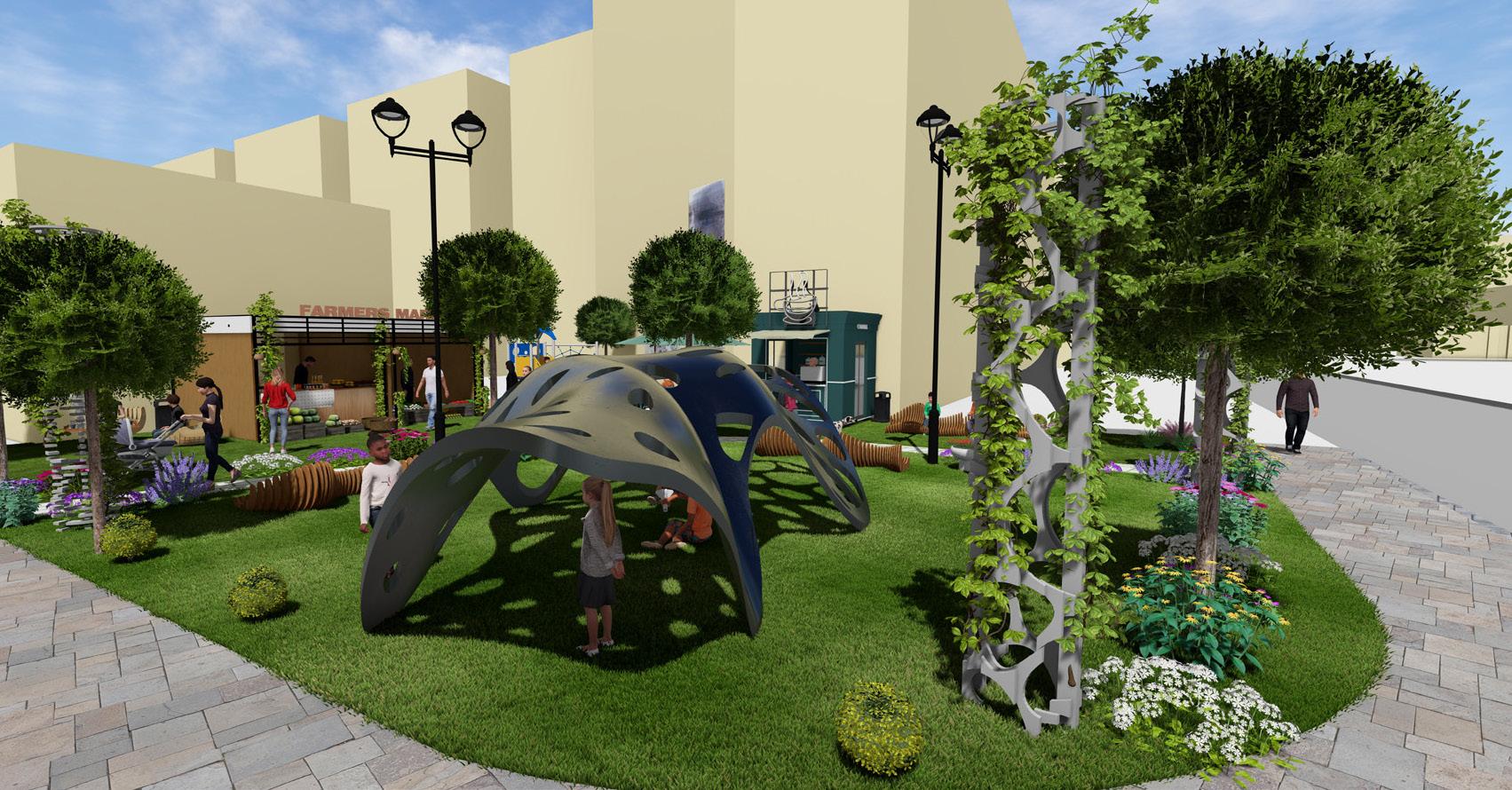
To promote the recreational use of the space a dedicated childrens play area is introduced into the design. A sculpture is aded to the heart of the park which acts as an artists master peice as well as a playful elements within the site. Throughout the site multiple seatings are added with flowers and elements within the space.
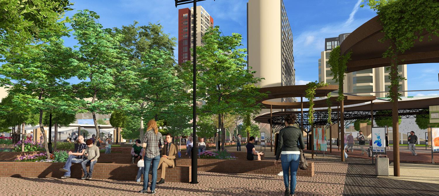
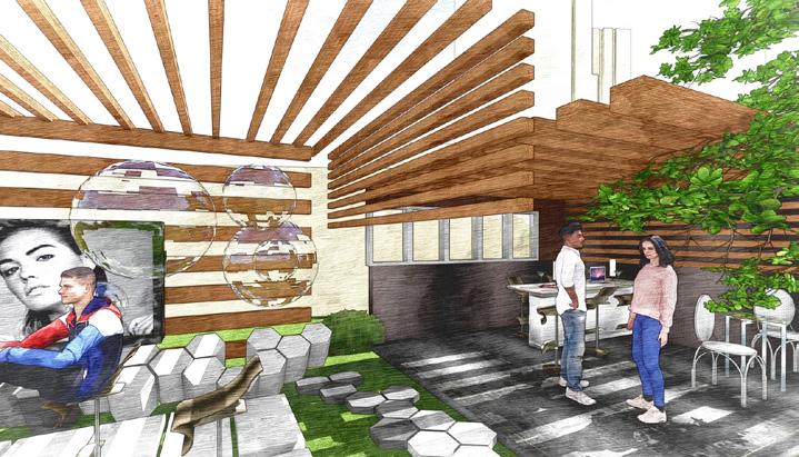
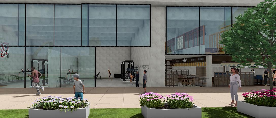
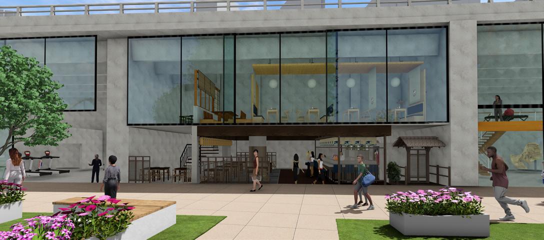
Liberty Atelier is a people-centric urban design proposal focused on revitalizing underutilized space into a vibrant, inclusive, and adaptable cultural corridor in Liberty Village. The master plan integrates a scenic zig-zag pathway, strategically connecting key activity nodes like co-working spaces, artist studios, community gardens, and temporary markets.
The design enhances connectivity to public transit, following natural pedestrian flows and encouraging seamless movement. Inspired by precedents such as Stackt Market, the project emphasizes flexibility, community interaction, and creative expression.

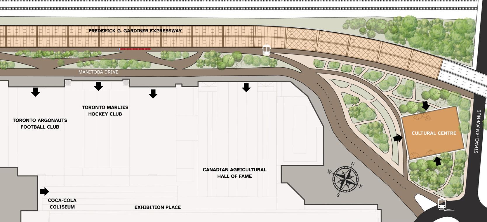
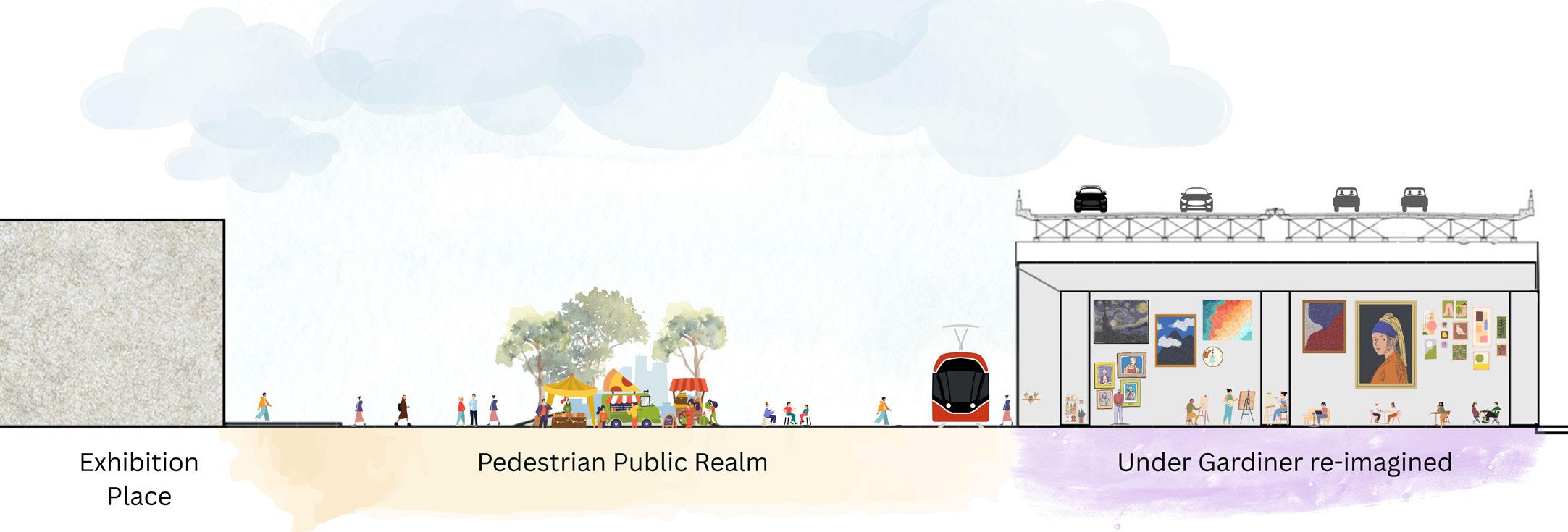
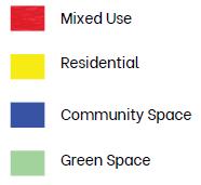
Street section showing the Manitoba drive and Under Gardiner expressway
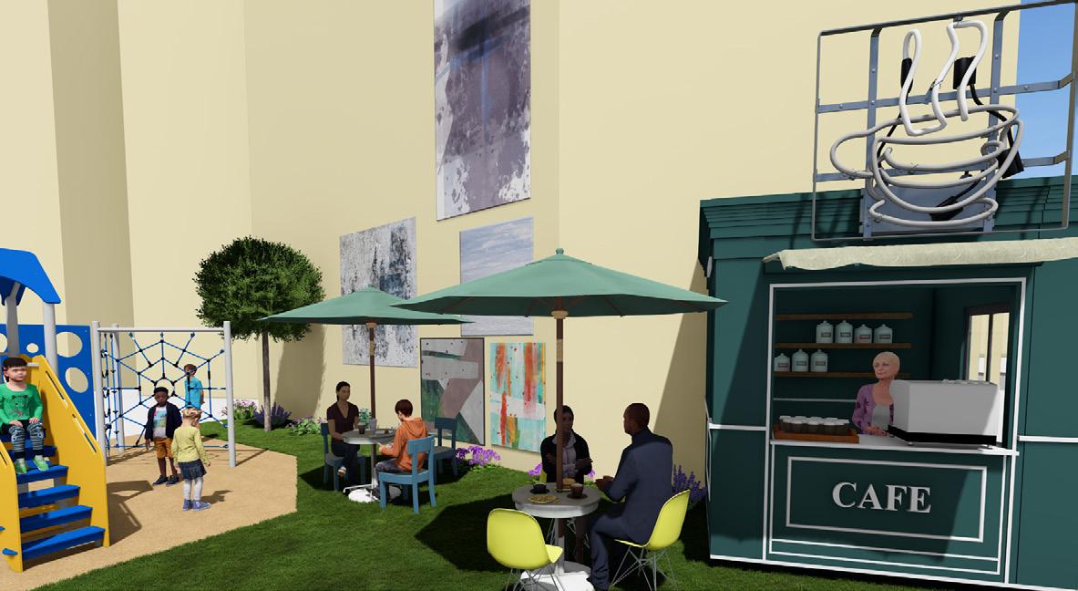
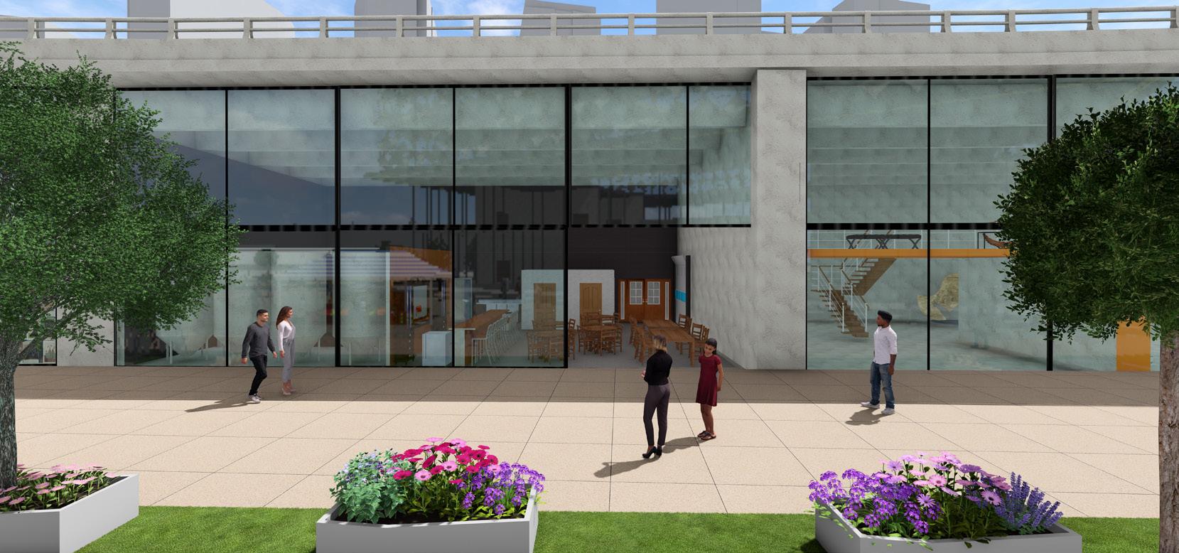
By widening sidewalks, integrating interactive art, and enhancing landscaping, the plan aims to foster social engagement and economic vitality. A central cultural hub beneath the Gardiner Expressway, along with open gathering spaces, supports diverse community events and celebrates the area's industrial legacy.

Key Features:
• Cultural hub under the Gardiner: artist studios, music venues, bookstore, brewery, restaurants, gym, and gallery.
• Scenic zig-zag pedestrian pathway with improved transit access.
• Pop-up markets, community gardens, and gathering spaces.
• Walkable, inclusive streets inspired by Allan Jacobs' vision of delightful urban experiences
• Integration of interactive art and flexible public space.
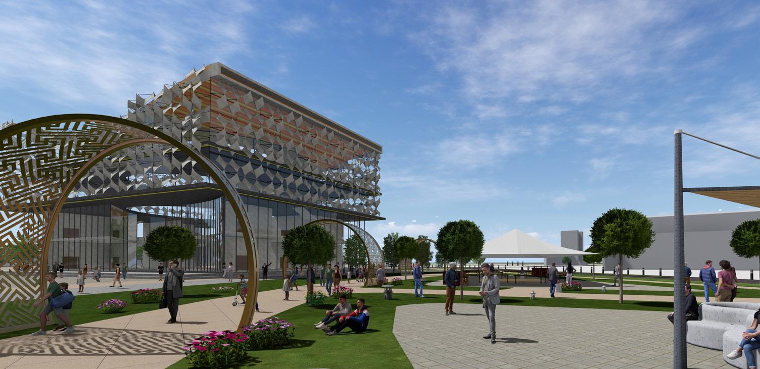
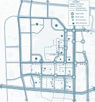
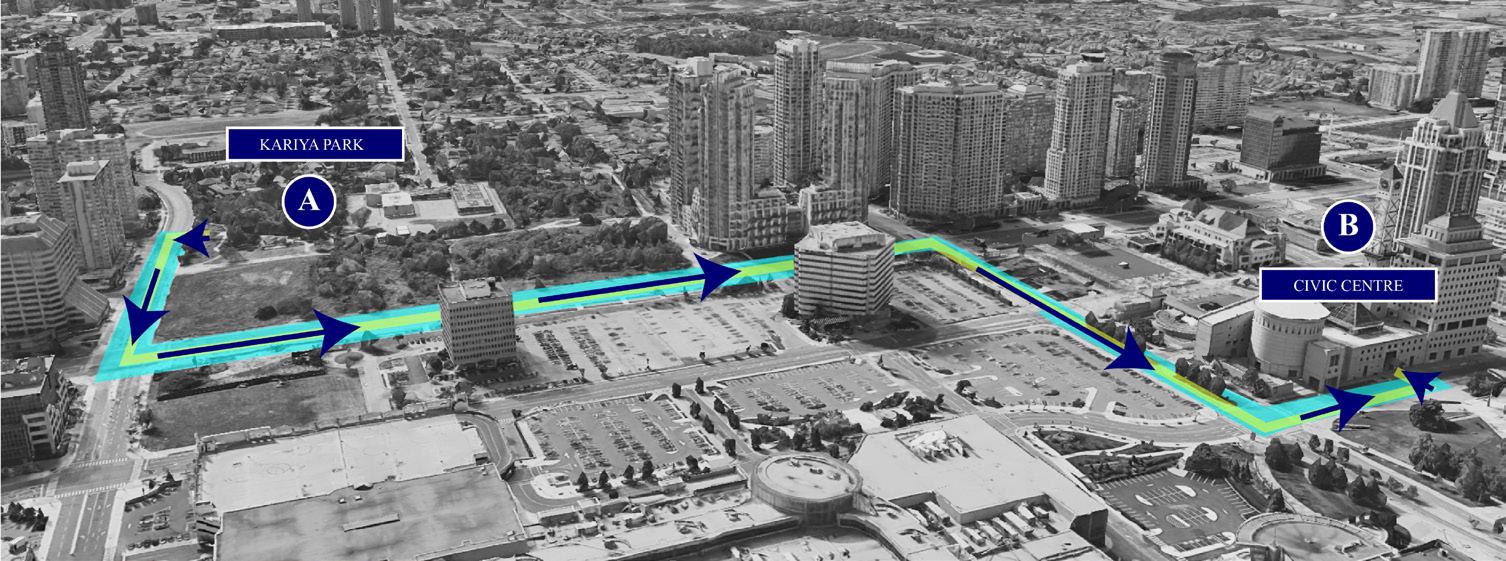
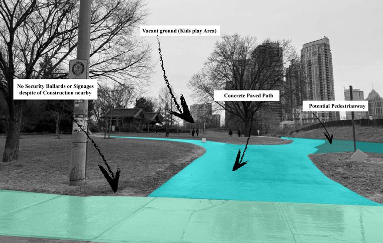
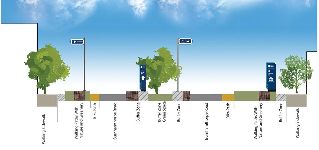
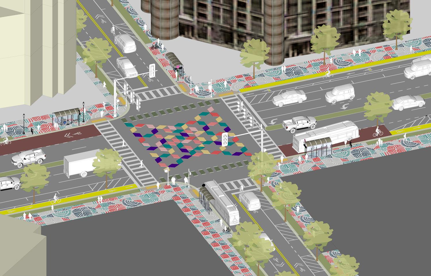
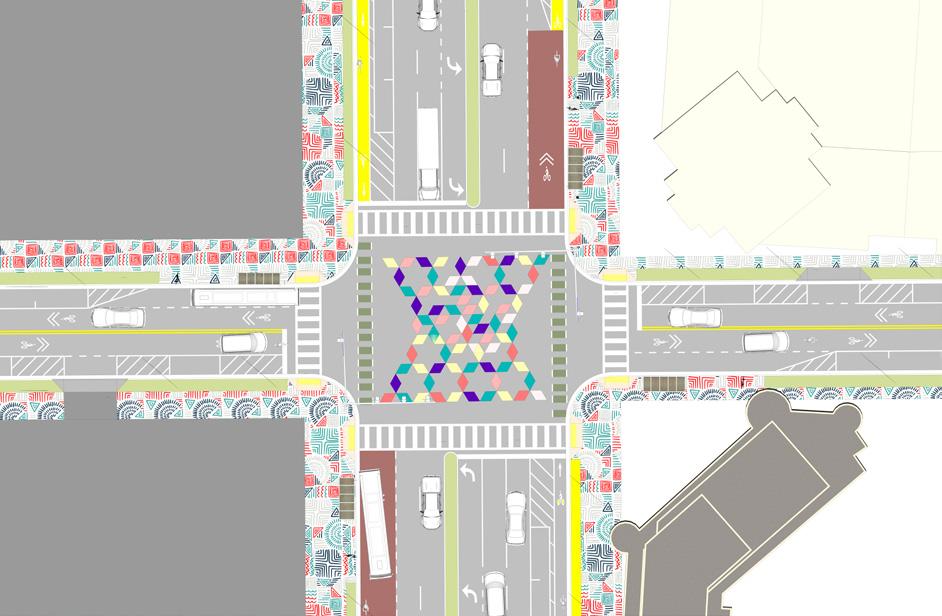
Navigating Mississauga was a collaborative urban design project undertaken as part of the Winter 2025 studio at Sheridan College. Focused on the corridor between Kariya Park and the Civic Centre along Burnhamthorpe Road, the project aimed to improve walkability and wayfinding in one of Mississauga’s most prominent but car-centric areas. Through comprehensive site analysis, our team identified key challenges such as poor lighting, lack of signage, narrow sidewalks, and missing pedestrian crossings—and evaluated existing assets like public landmarks, transit connections, and scenic vistas that offered significant potential for enhancement.
Design Approach and Tactics for Walkability

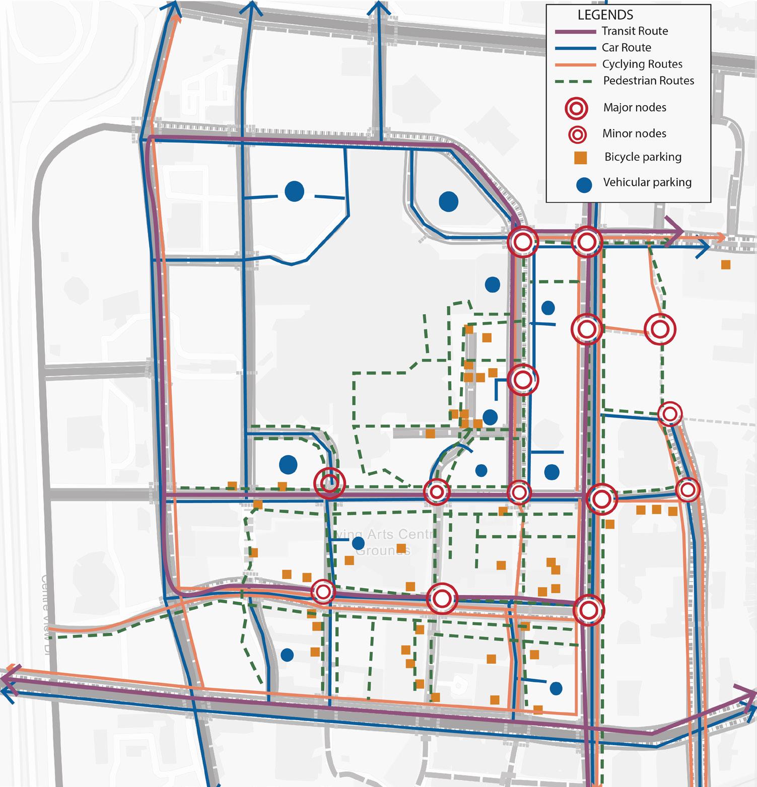
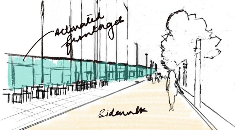
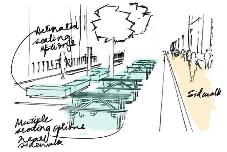
The design strategy prioritized creating a pedestrianfriendly environment by transforming Burnhamthorpe Road into a vibrant and accessible streetscape. We proposed wider sidewalks, shaded walkways, dedicated bike lanes, and resting areas with benches and public art. Mixed-use developments and activated frontages, including cafés and shops, were integrated to create visual interest and promote foot traffic. The proposed enhancements also aimed to improve safety through traffic calming, reduce vehicle dominance, and foster community interaction by encouraging people to linger and explore rather than pass through.
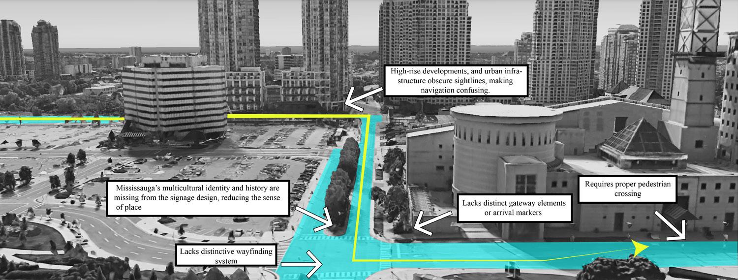
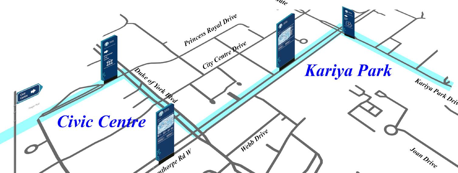
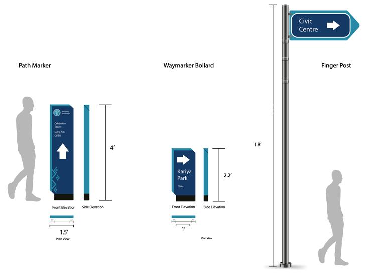
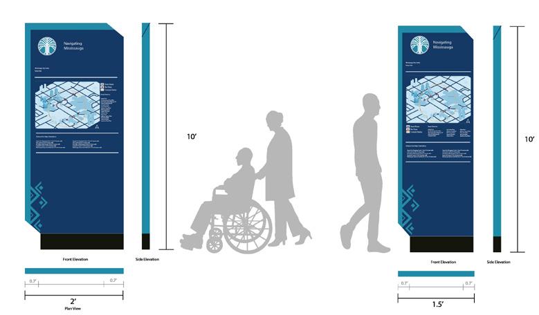
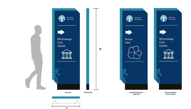
A central component of the project was the dual-layered wayfinding strategy. Formal elements included directional signage, informational monoliths, and landmark-based navigation using prominent civic structures. Informal wayfinding emphasized placemaking through public art, Indigenous storytelling, and seasonal design interventions that reflect Mississauga’s diverse cultural identity.
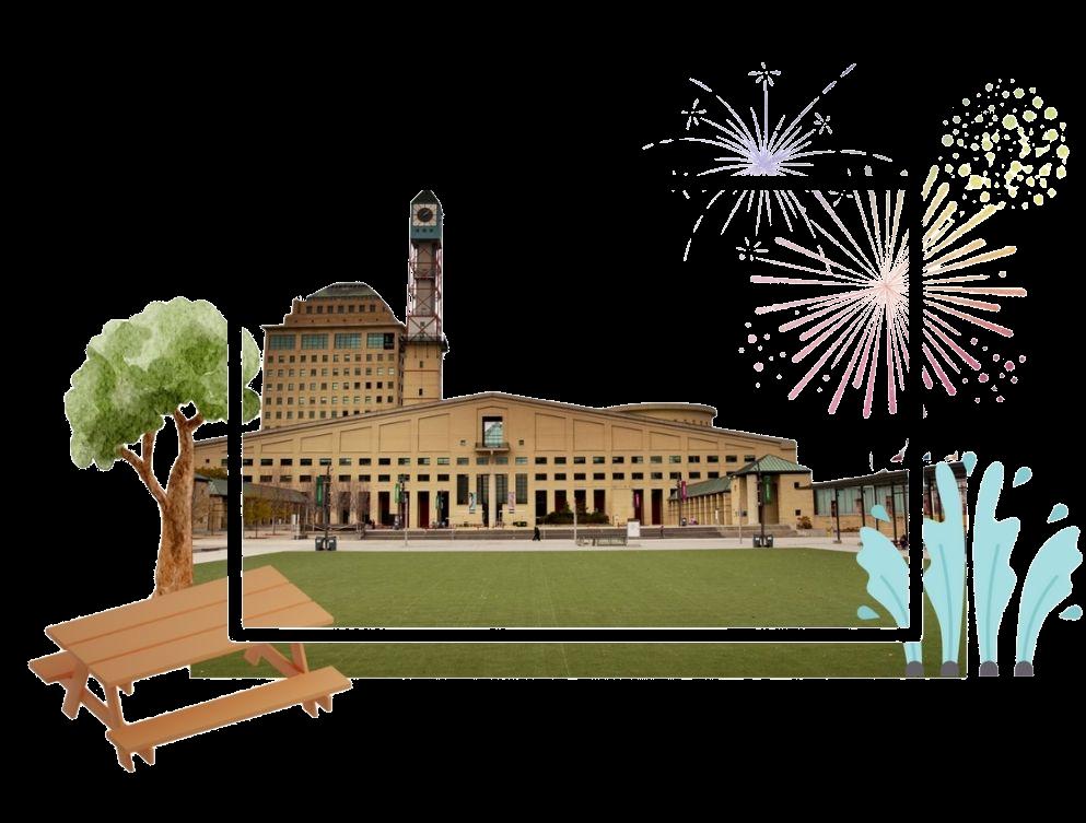
The Hazel McCallion Library was reimagined as a vibrant social hub, surrounded by interactive spaces such as patios, pop-up markets, and pathways embedded with cultural markers to foster intergenerational engagement and discovery.
This project envisioned Burnhamthorpe Road as more than just a connector— it became a destination in itself.
Our design celebrated Mississauga’s local character while addressing critical gaps in mobility and urban navigation.
By enhancing comfort, clarity, and visual appeal, we aimed to shift the mindset in a vehicle-oriented city toward embracing walking and active transportation. Ultimately, the proposal contributes to a healthier, more inclusive, and experience-rich urban environment that invites people to slow down, connect, and thrive.
Client: City of Mississauga + Peel Public Health
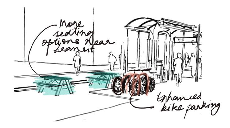
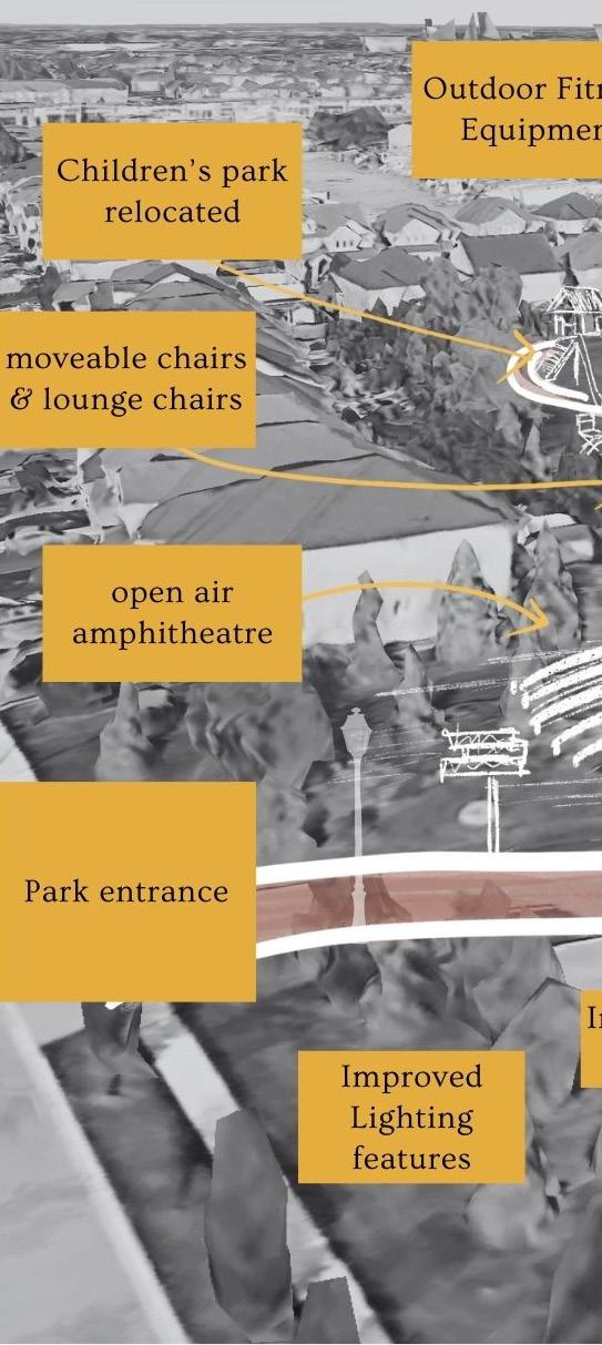
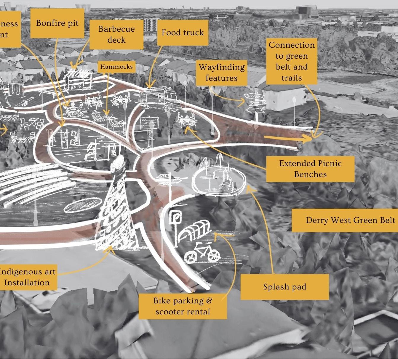
As part of a live urban design studio, I collaborated with a team of four to analyze and redesign Samuel Common Park in Mississauga under the city’s Diabetes Healthy City Strategy Our work focused on placemaking strategies that promote active, inclusive, and community-focused public space.
We conducted site visits, observational fieldwork, and urban design analysis to identify challenges in accessibility, social engagement, connectivity, and recreational diversity. Our proposals included:
• A new loop trail connection to the Derry West Greenbelt
• Relocation and enhancement of the playground with inclusive features
• Outdoor fitness stations, multi-use lawn, and nature learning zones
• Public art and social gathering areas to strengthen identity and sociability.
Our team was recognized by the City of Mississauga as one of the top project submissions, demonstrating excellence in community engagement, design innovation, and public health alignment.
This project enhanced my ability to apply urban design frameworks to real-world contexts and collaborate across disciplines in a client-driven environment.
Proposed Placemaking Strategies
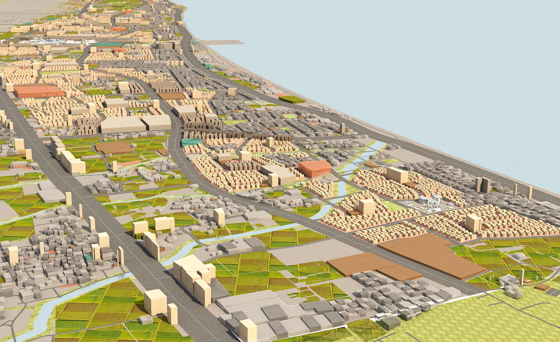
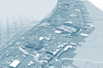
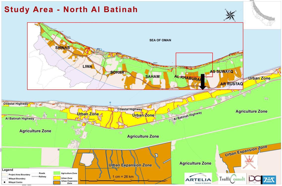
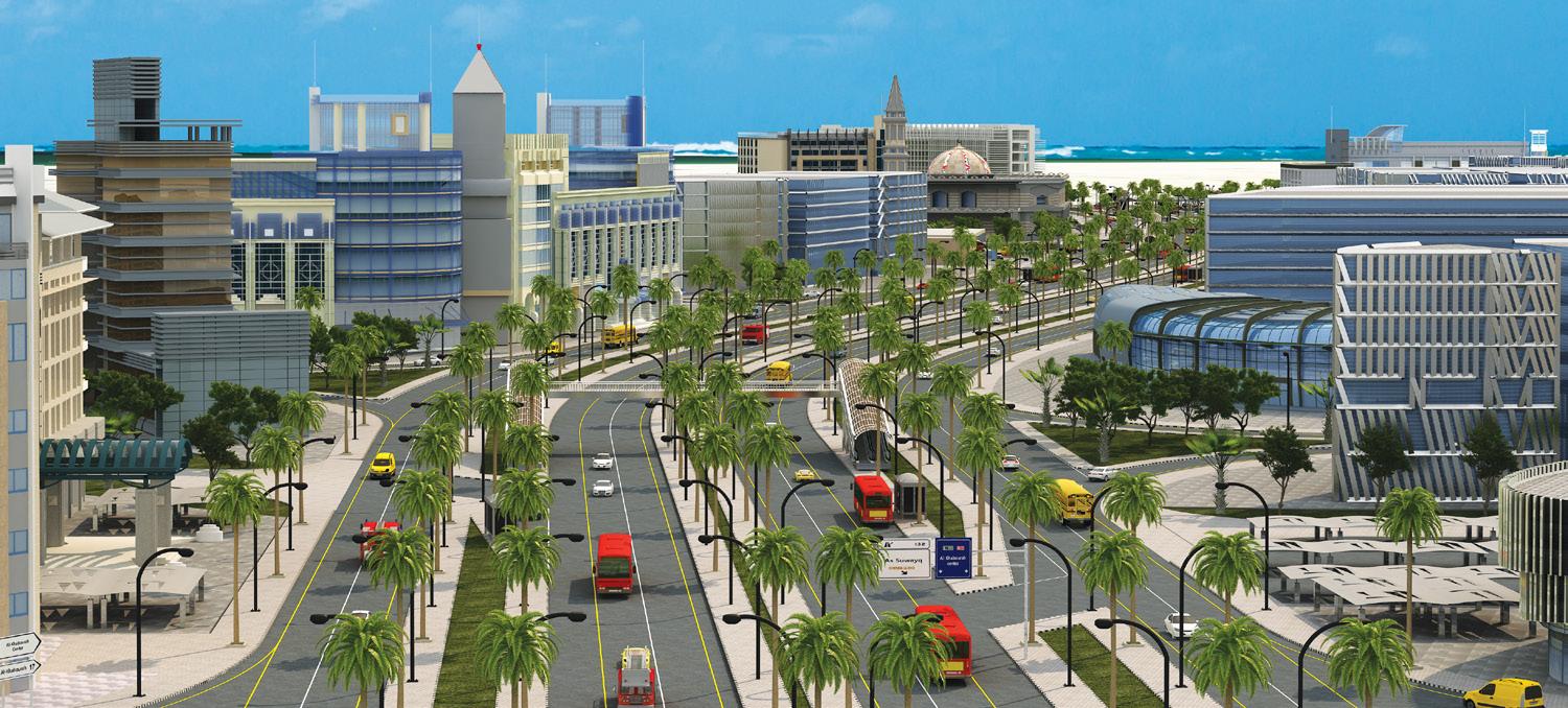
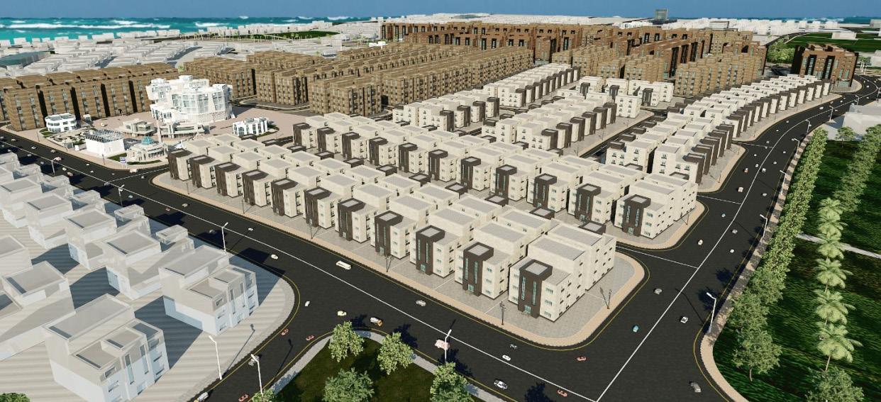
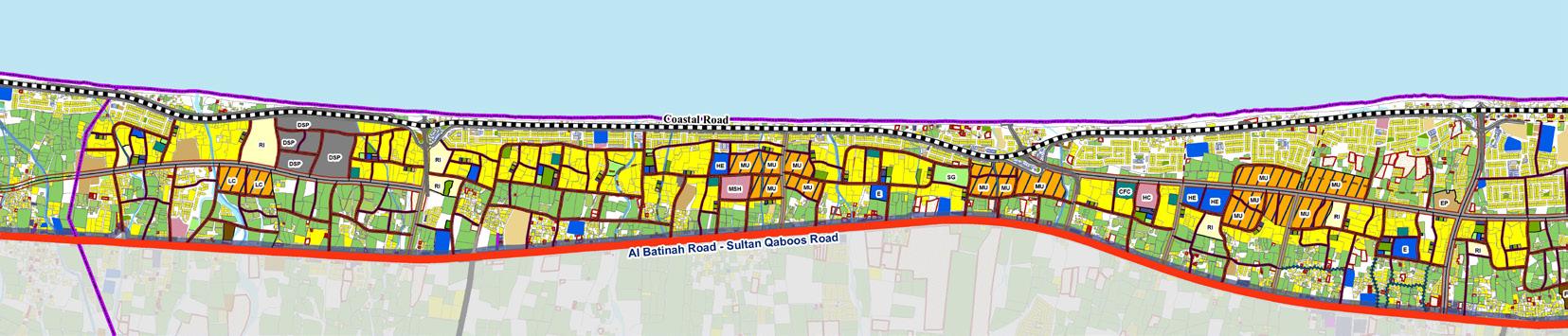
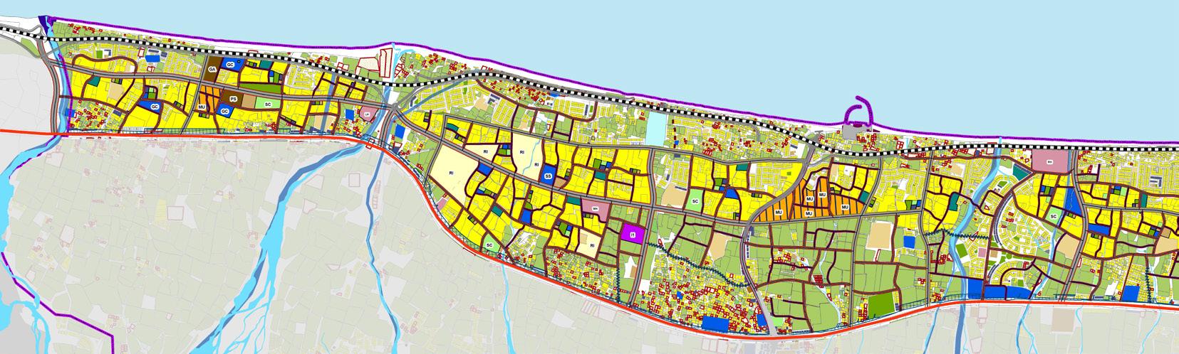
The Ministry of Housing, Oman was responsible for the preparation of a Detailed Land Use Master Plan for the North Al Batinah Coastal Plains as part of the strategic framework of the Al Batinah Master Plan. ARTELIA Muscat Engineering Consultancy LLC has been appointed as the consultant for this multi-phase project. This project involves the development of a Detailed Land Use Master Plan for the designated Urban Zone within North Al Batinah. The master plan and structure plan have been prepared based on an approved concept by the Technical Committee, guiding sustainable urban growth in the region.
The detailed master plan was prepared for 5 wialyats (cities) including As Suwayq, Al Khabourah, Saham, Liwa and Shinas. The design started with analysing the forcasted population and land requirement for Oman vision 2040.
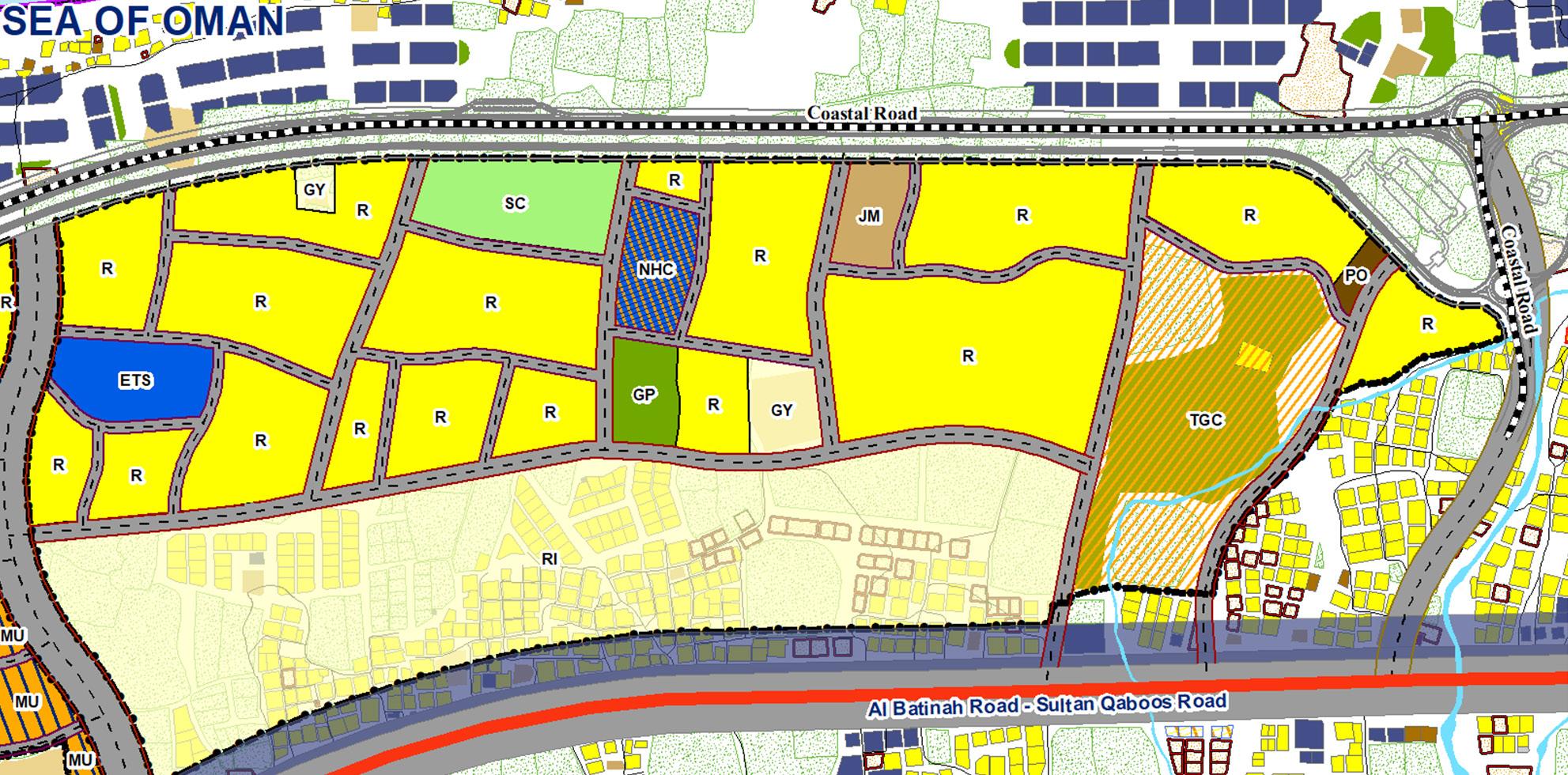
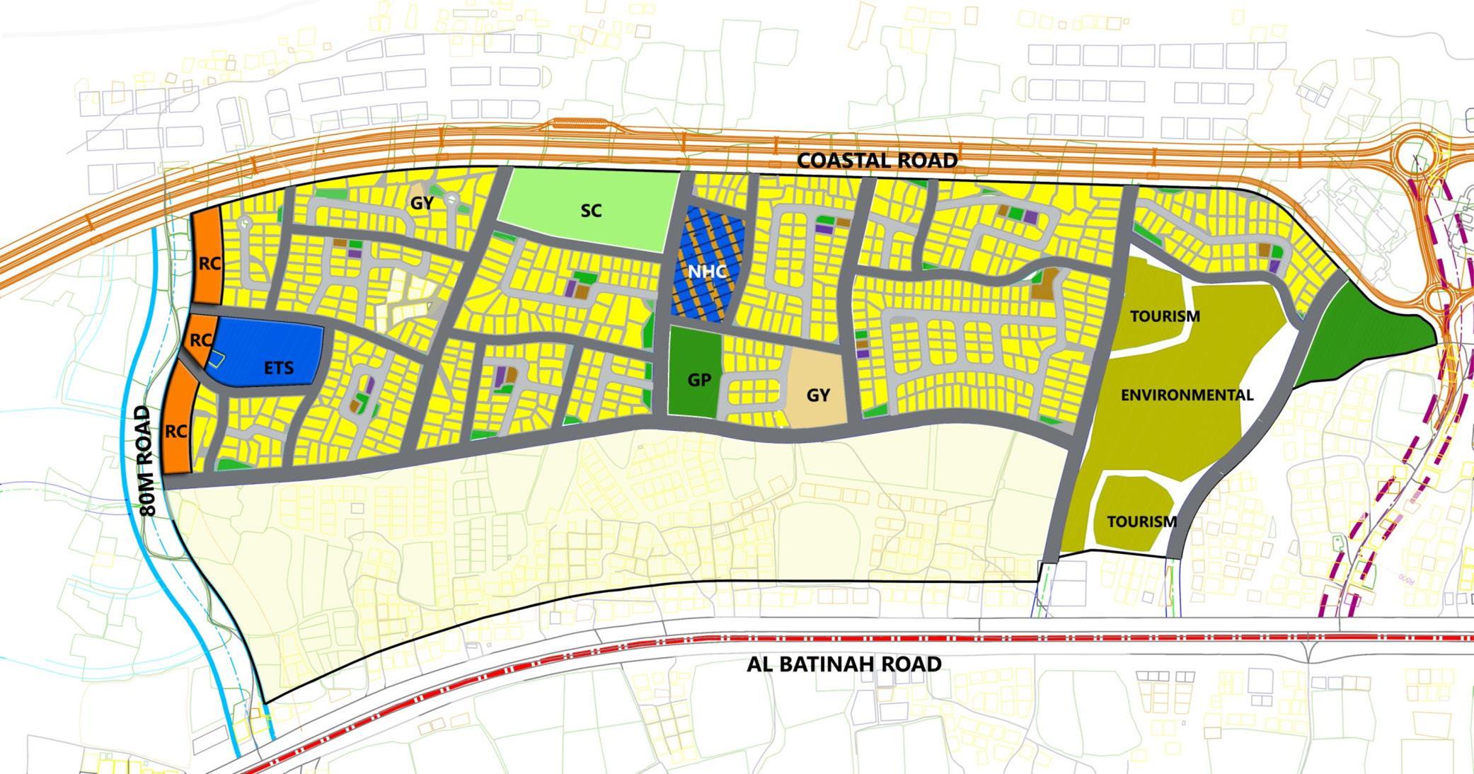
Subdivisional plan for a land use parcel in Saham, Al
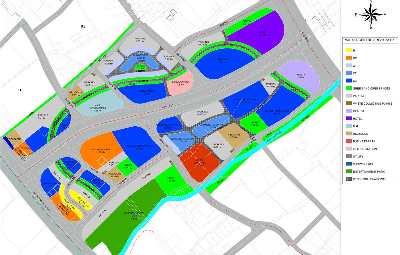
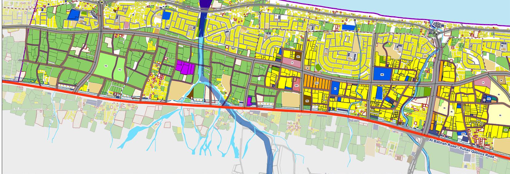
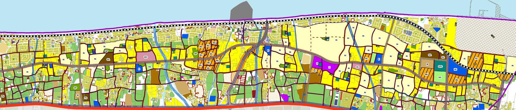
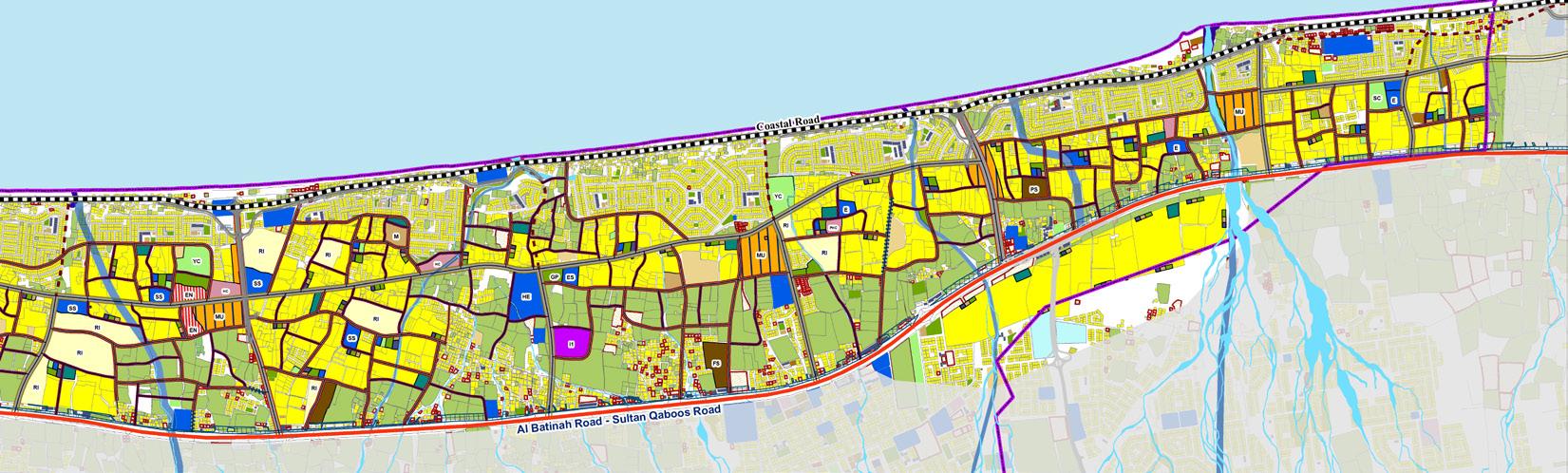

Detailed Land Use Master Plan for Al
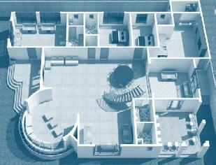
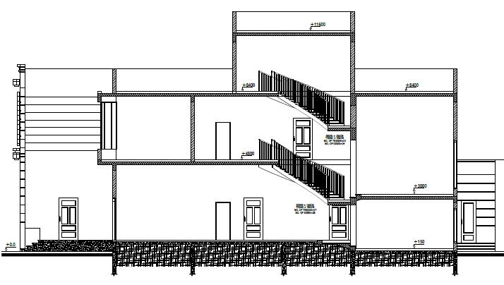
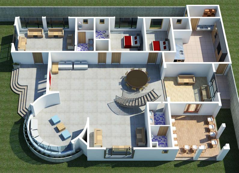
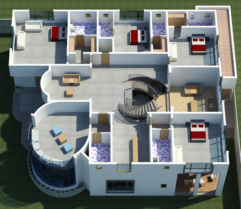
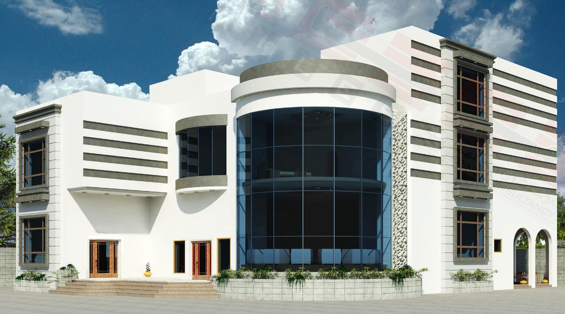
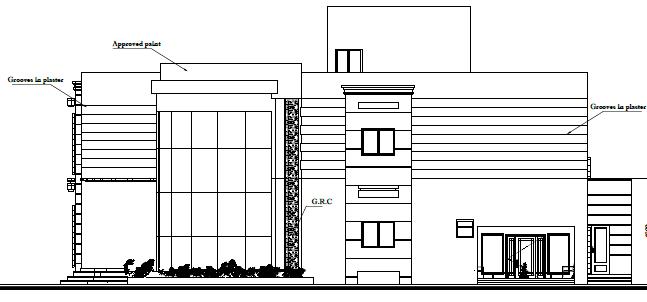
This luxury two-storey villa in Al Khoud, Oman, was designed for Mr. Khalid Al Kalbani as a spacious private residence tailored for family living. The villa features six bedrooms along with dedicated living and family rooms on both floors, offering a balanced blend of comfort, privacy, and functionality. The basic layout of the furniture was provided by the client, serving as a foundation for spatial planning and design development.
My role involved preparing comprehensive architectural, structural, and electrical drawings, ensuring every aspect of the villa aligned with the client’s vision and lifestyle. The design focused on optimizing natural light, circulation, and usability while incorporating high-quality finishes suitable for a luxury home in Oman’s climate. Close attention was paid to detailing and technical coordination to meet local building codes and deliver a refined, build-ready design package.
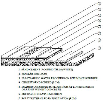
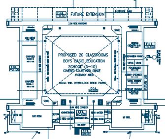
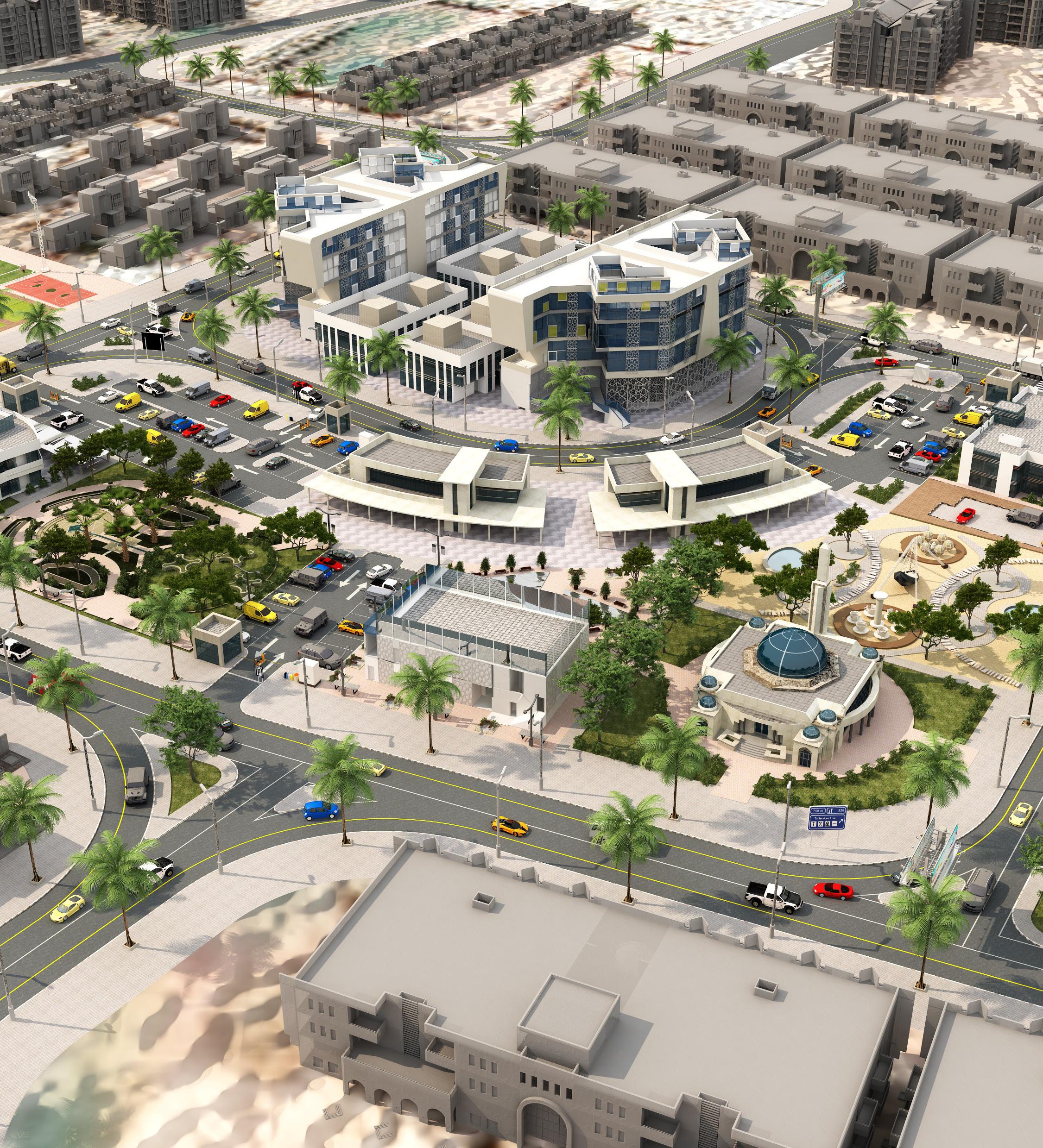
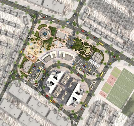
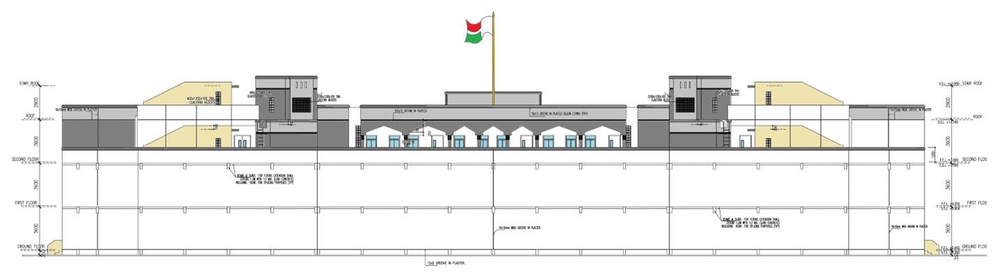
As part of the national initiative to improve educational infrastructure, this project involved the architectural and structural design of a 20-classroom boys’ school for grades 5 to 10, located in Al-Quraim, Wilayat. The design focused on creating functional, adaptable learning spaces with attention to climate responsiveness, circulation, and long-term usability. The scope included both conceptual and detailed design phases, as well as site supervision during construction. This school was part of a larger programme involving the design and development of six schools across Oman. Project Locations:
• Mixed School – Al-Hashiya, Wilayat Al Amirat
• Al-Hail Al Ghaf – Wilayat Quriyat, Muscat Governorate (2014)
• Al-Hajer – Wilayat Al Amirat, Muscat Governorate (2015)
• Al-Jabal Al-Abyadh – Wilayat Dima Wa Taeen,
• Sharqiya North Governorate (Phase II – 2012)
• Yanqul – Al Dhahira Governorate
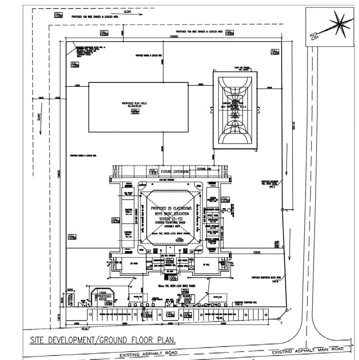
• Al Homaniyyah – Wilayat Ibri, Al Dhahira Governorate Site Plan
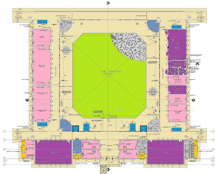
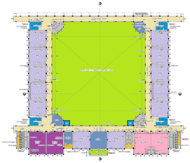
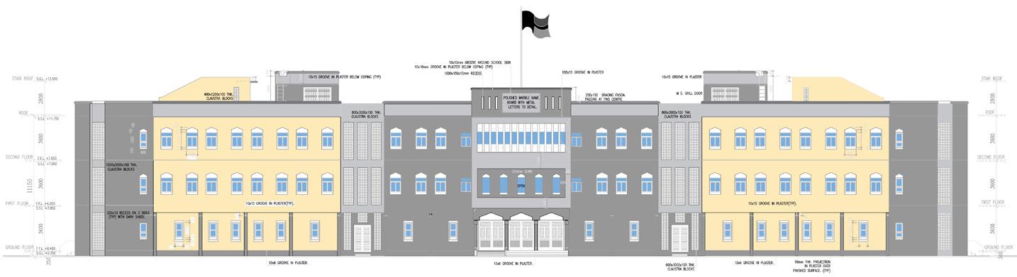
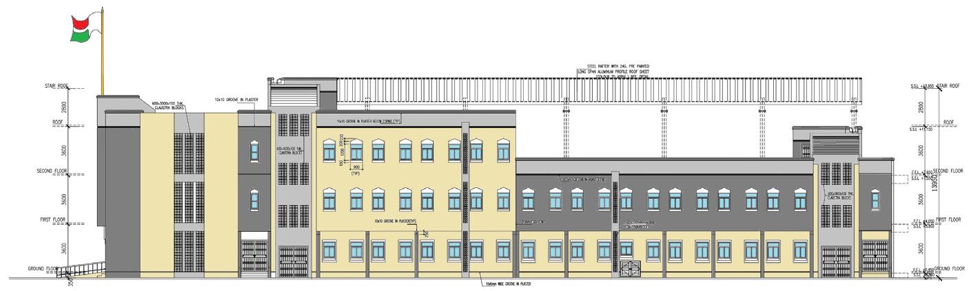
Scope of Work:
• Preparation of conceptual and detailed architectural designs
• Site development plans ensuring optimal layout and flow
• Complete set of architectural drawings including floor plans, elevations, and sections
• Design of supporting structures: guard room, substation, and kiosk
• Sports facilities design: football and basketball courts
This project exemplifies the integration of educational facility planning with thoughtful site development, aligning with the Ministry’s vision to enhance learning environments across the Sultanate of Oman.
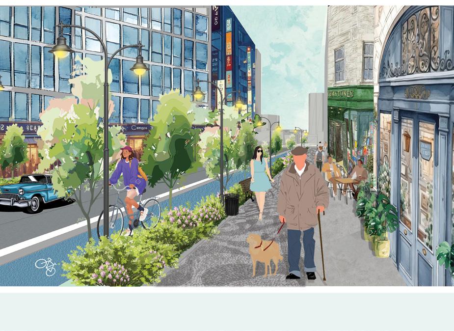
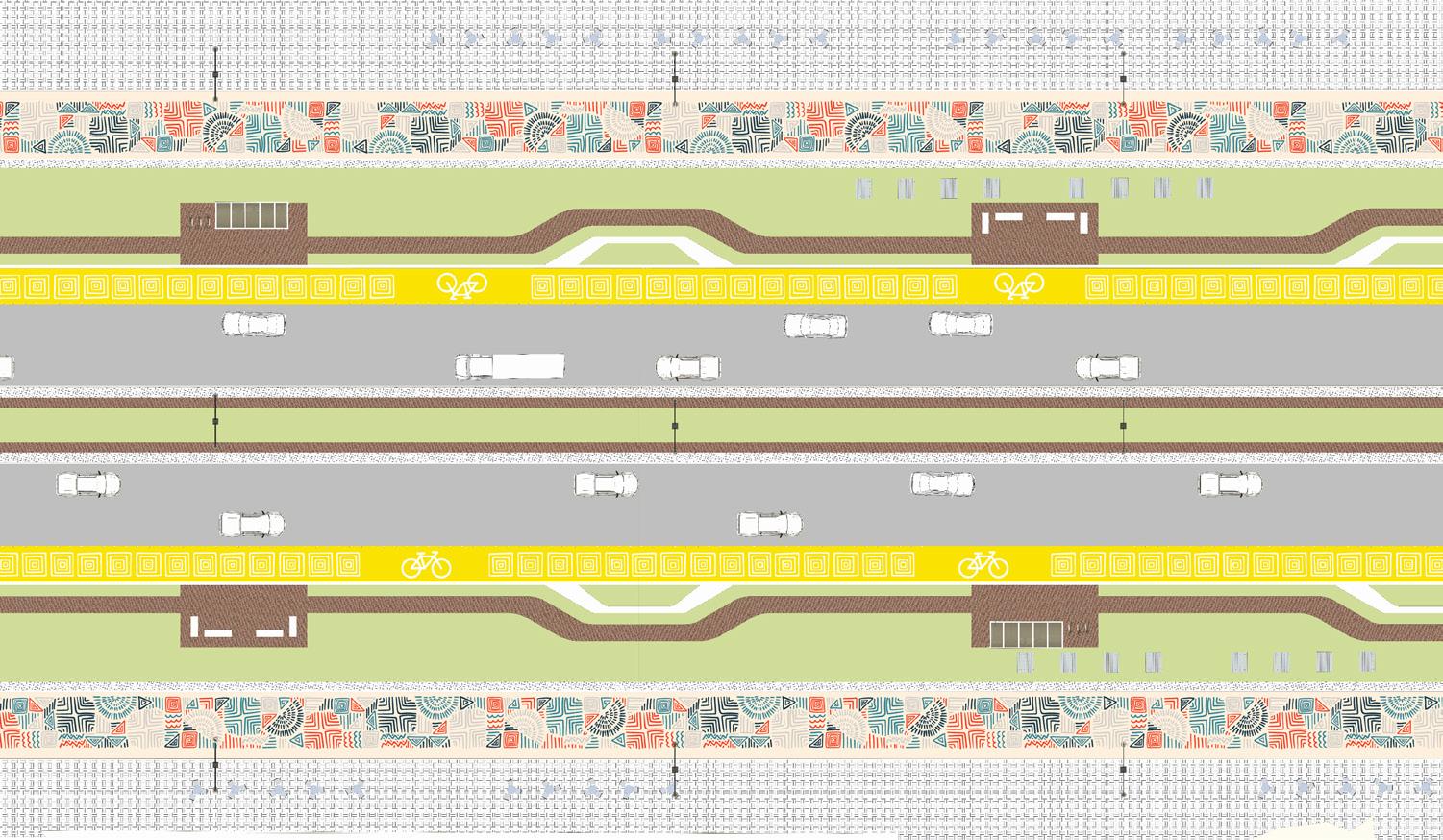
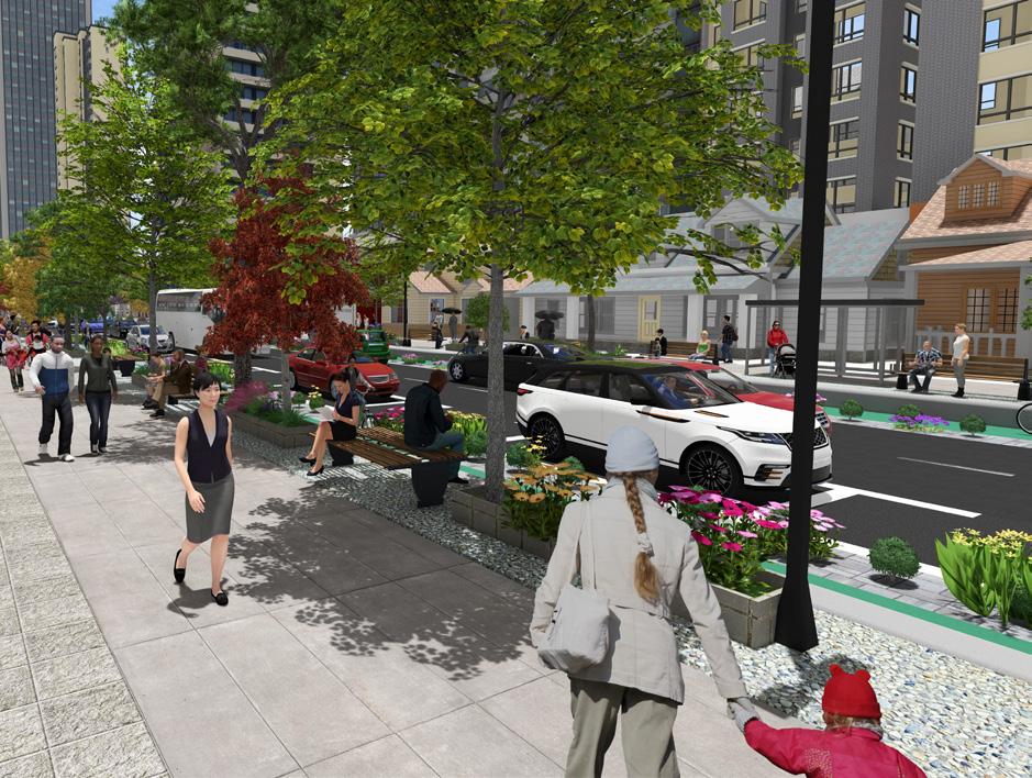
The Downtown and Centre Residential Street design proposes a streetscape that thoughtfully balances functionality, safety, and community livability.
Structured around a 24-meter right-of-way, the design accommodates multiple modes of transportation, ensuring comfort and accessibility for pedestrians, cyclists, and vehicles.
Residential typologies are diversified, with apartment buildings on one side of the street and detached houses on the other, supporting a vibrant and inclusive urban fabric.
To promote active transportation, dedicated one-way bike lanes are integrated on both sides, physically separated from vehicular traffic.
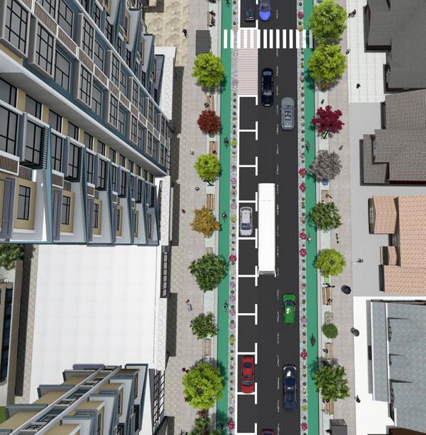
A parking lane is provided along one side to support residential and visitor needs.
Wide 3-meter sidewalks enhance pedestrian comfort and encourage walkability throughout the corridor.
Street trees and landscaping on both sides contribute to a green, human-scaled environment, offering shade, visual appeal, and ecological benefits.
Together, these elements support a safe, attractive, and socially engaging residential street that fosters everyday interaction, sustainable mobility, and a sense of neighborhood identity.
Urban Design & Planning
• Master planning and urban frameworks for large-scale developments
• Land use planning, zoning analysis, and density strategies
• Site planning, block and parcel layout, and Transit-Oriented Development based approaches
• Public realm design: streetscapes, parks, plazas, and pedestrian environments
• Community wellbeing assessments and context-sensitive urban solutions
Architectural Design & Development
• Design development for residential, commercial, and institutional buildings
• 3D conceptual modeling, façade articulation, and massing studies
• Coordination of drawings and visual presentations for stakeholder engagement
Software Proficiency
• 2D & 3D Design: AutoCAD, SketchUp, Lumion, Revit (basic)
• Graphics & Layout: Adobe Photoshop, Illustrator, InDesign
• GIS & Mapping: ArcGIS Pro
• Productivity: Microsoft Office Suite, Google Workspace
• Hand Tools: Technical sketching, clay modeling, rapid ideation
• Project Mangement: Microsoft Project, Clickup