Andrés Chun PORTFOLIO
CAPTURE AND GEOGRAPHIC INFORMATION SYSTEMS

Freelance architect.
Architect in the public sector. Master in Advanced Architecture and Environmentally Sustainable Environments - EADIC/UDIMA. Architect with experience in design of single-family housing projects, remodeling, design of urbanizations and green areas, bank branches, etc.
Contract Administrator in Consulting, Services and Goods. Coordinator of expropriation processes. Responsible for planimetric surveys with RTK and drone flight. Review of inspection and construction reports.
01 04 02 03
Master's Degree in Smart and Sustainable Cities - Universidad Complutense de Madrid (Ongoing)
Knowledge in sensors and arduino, Python, GIS, Image capture and analysis, Pollution, urban climate and climate comfort.
Expertise in Sustainable Urban Mobility Plans, Sustainable Architecture, LEEDPassivhauss Certifications, IoT Sensors, Energy Certification Audits and Smart Cities.
Click here to view the video: https://youtu.be/vIgWP2q8dnA?si=zX6n7lclRA_lAcf6
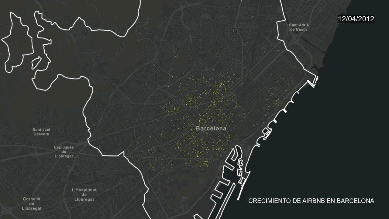
Stochastic models play a key role in disaster prevention, as noted in The economic appraisal of adaptation investment under uncertainties: Policy recommendations, lessons learnt and guidance.
This highlights that incorporating uncertainties in economic evaluations is key to analyze adaptation options for river and coastal flooding in Bilbao, promoting resilience to climate change.
https://ucmadrid.maps.arcgis.com/apps/instant/atlas/index.html? appid=6cb05d71e2c94806ad0cb1ff7ef3832d Link to
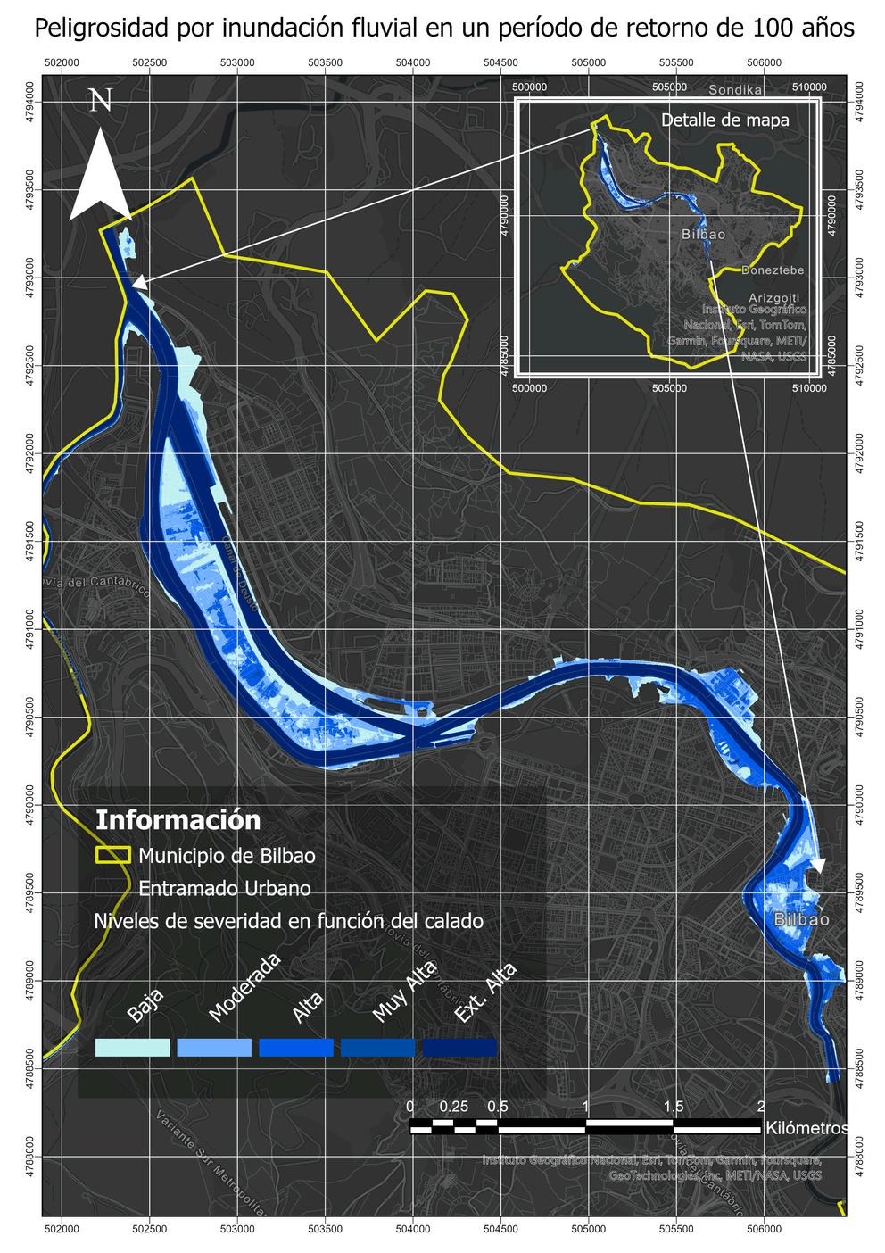
Determination of fluvial flood hazard for a 100-year return period.
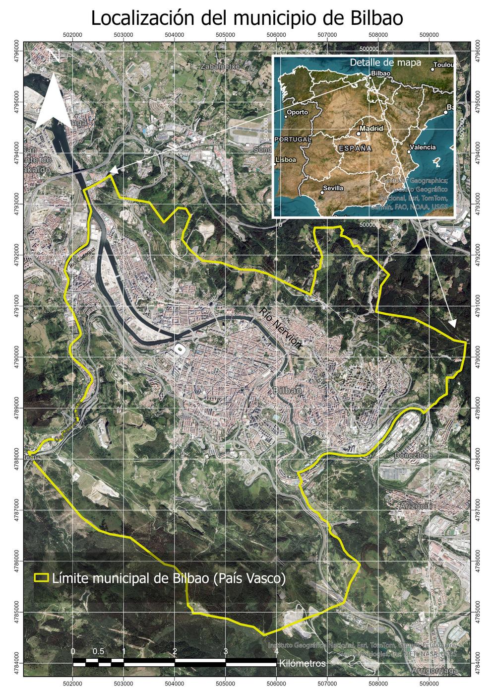
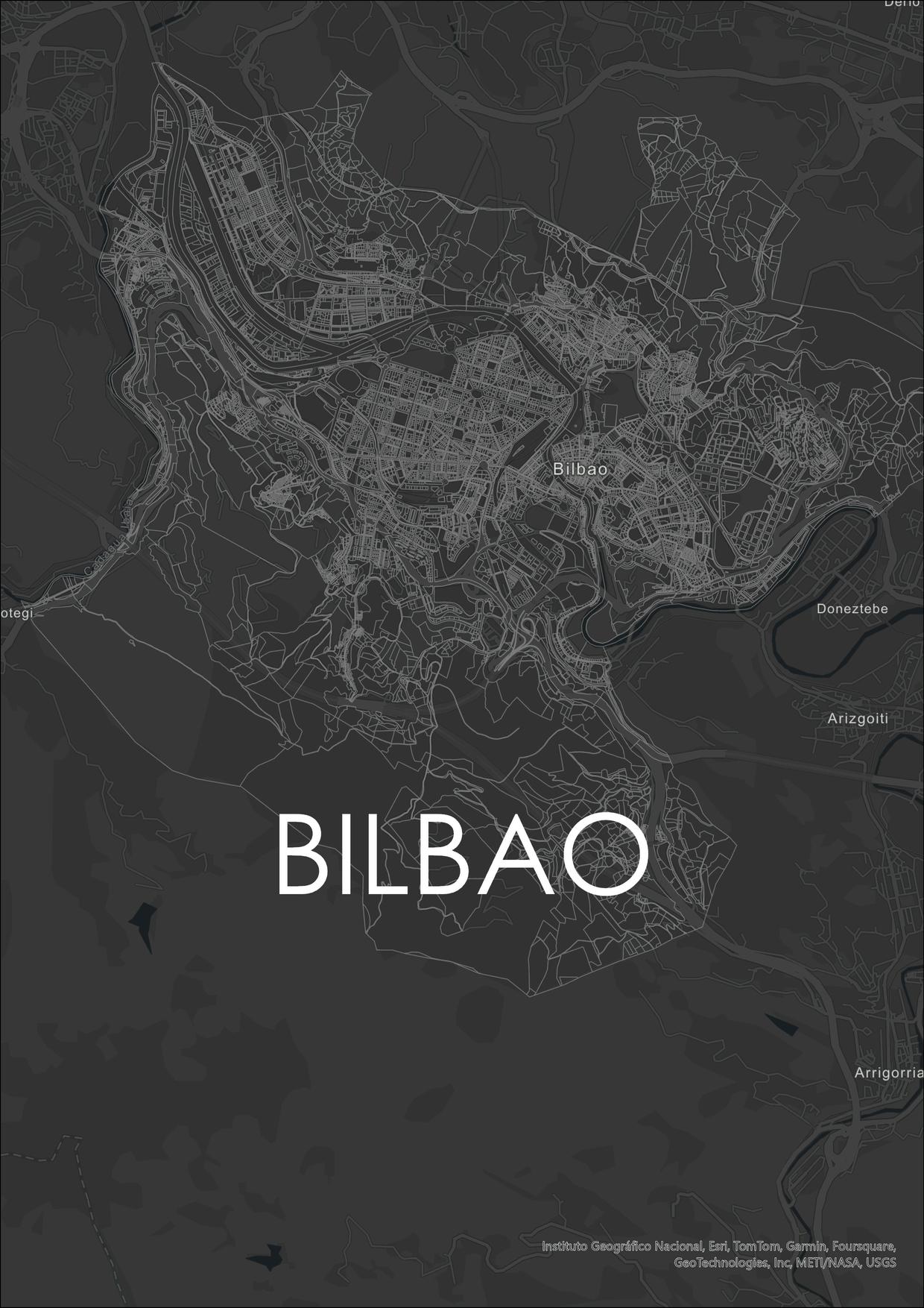
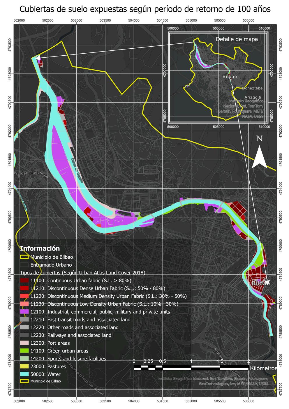
Exposed ground covers based on 100year return period and severity levels. Location of the municipality of Bilbao.
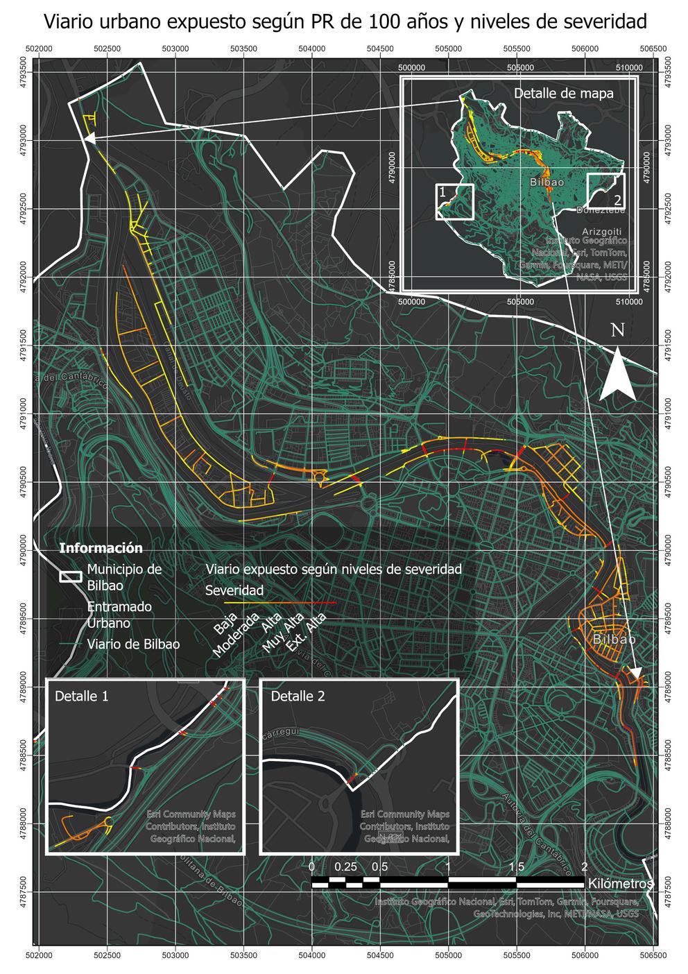
Exposed urban roads according to 100-year return period and severity levels.
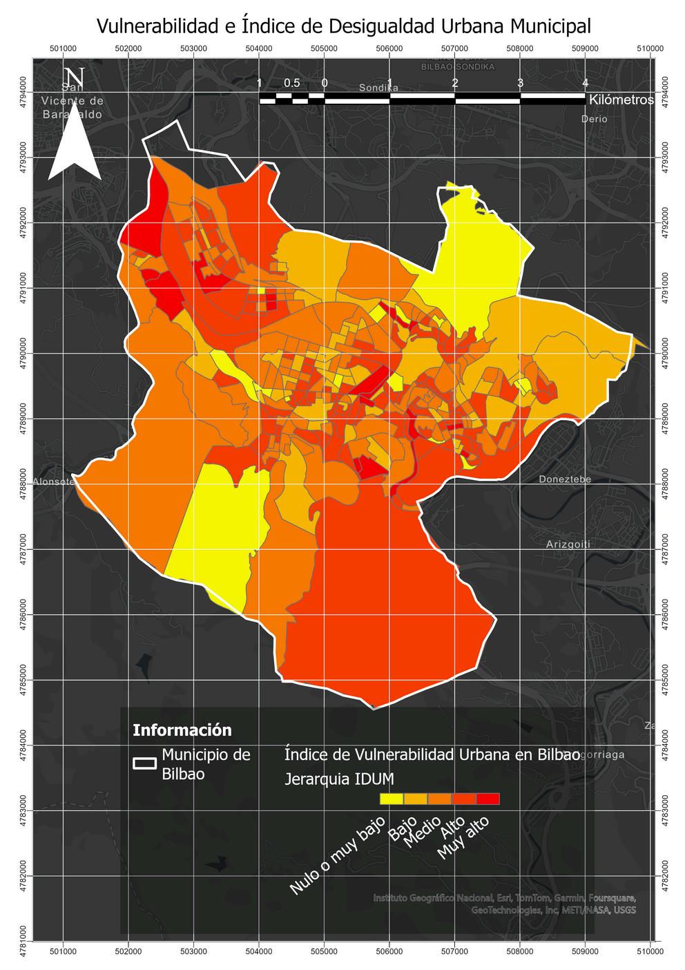
Vulnerability based on the Municipal Urban Inequality Index (IDUM).
Risk for 5 levels based on vulnerability according to IDUM and severity levels
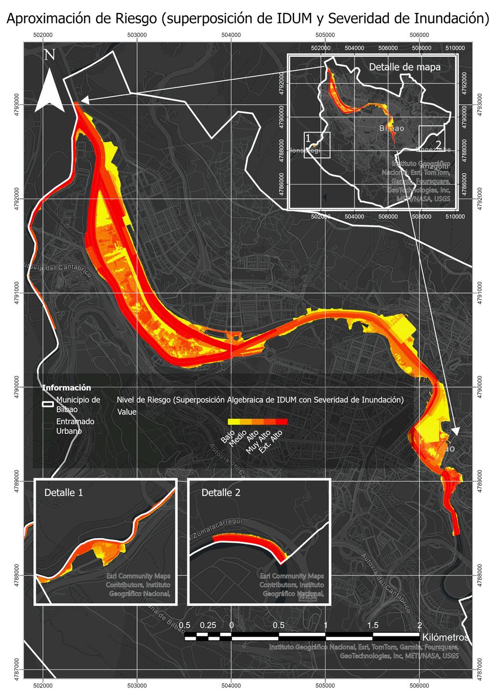
Link to ArcGIS Online:
https://experience.arcgis.com/experience/ b9421d1bdaf9458c850ed3bd7cf8fdf2/
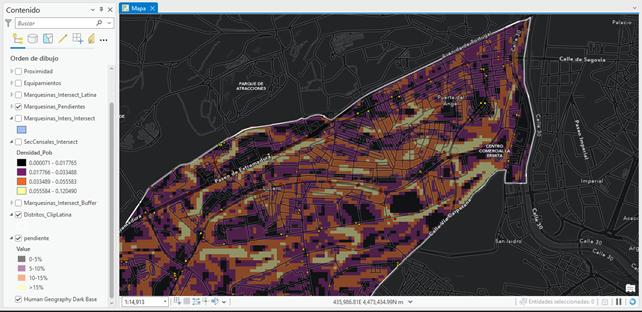
This study sought to identify how urban infrastructure influences accessibility for people with visual impairments, evaluating whether bus shelters are strategically located and whether topography affects their effectiveness. Optimizing the use of NaviLens not only improves inclusive mobility, but also represents an opportunity for the development of better urban systems. Description:
Accessibility buffer: 300-meter buffers were generated to simulate reasonable walking times (5 minutes), based on urban mobility studies indicating that this is the typical range accepted for pedestrian access to services.

Proximity to points of interest: In addition to health centers and hospital, points of interest such as schools and commercial areas were included. These points were manually prioritized according to their proximity to areas with high population density, as this increases the relevance for urban mobility.
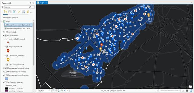
Slopeanalysis: By integrating the slope layer with the buffers, potential problem areas were identified. This crosswalk allows us to quantify the percentage of area affected by hilly terrain, which is vital for assessing accessibility.
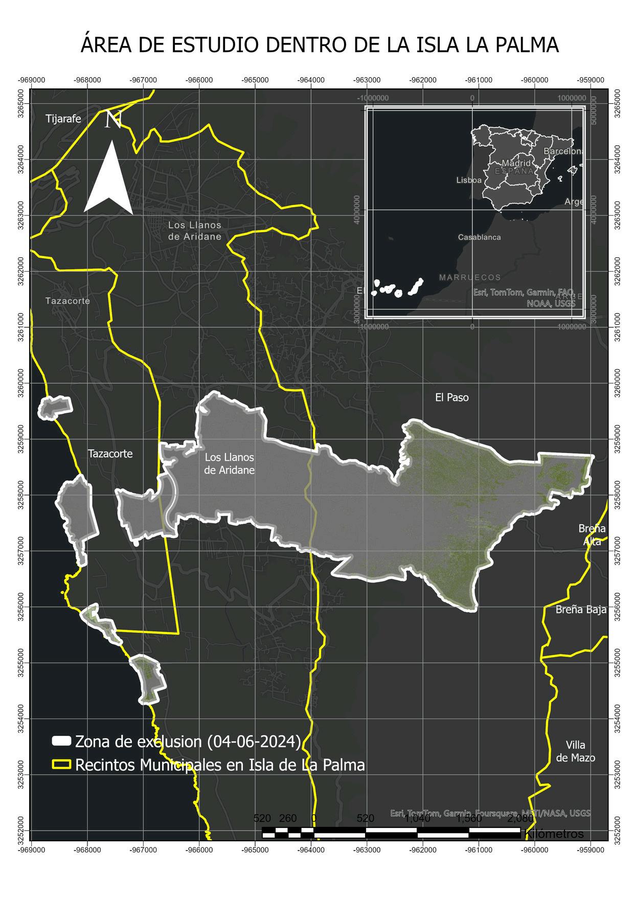

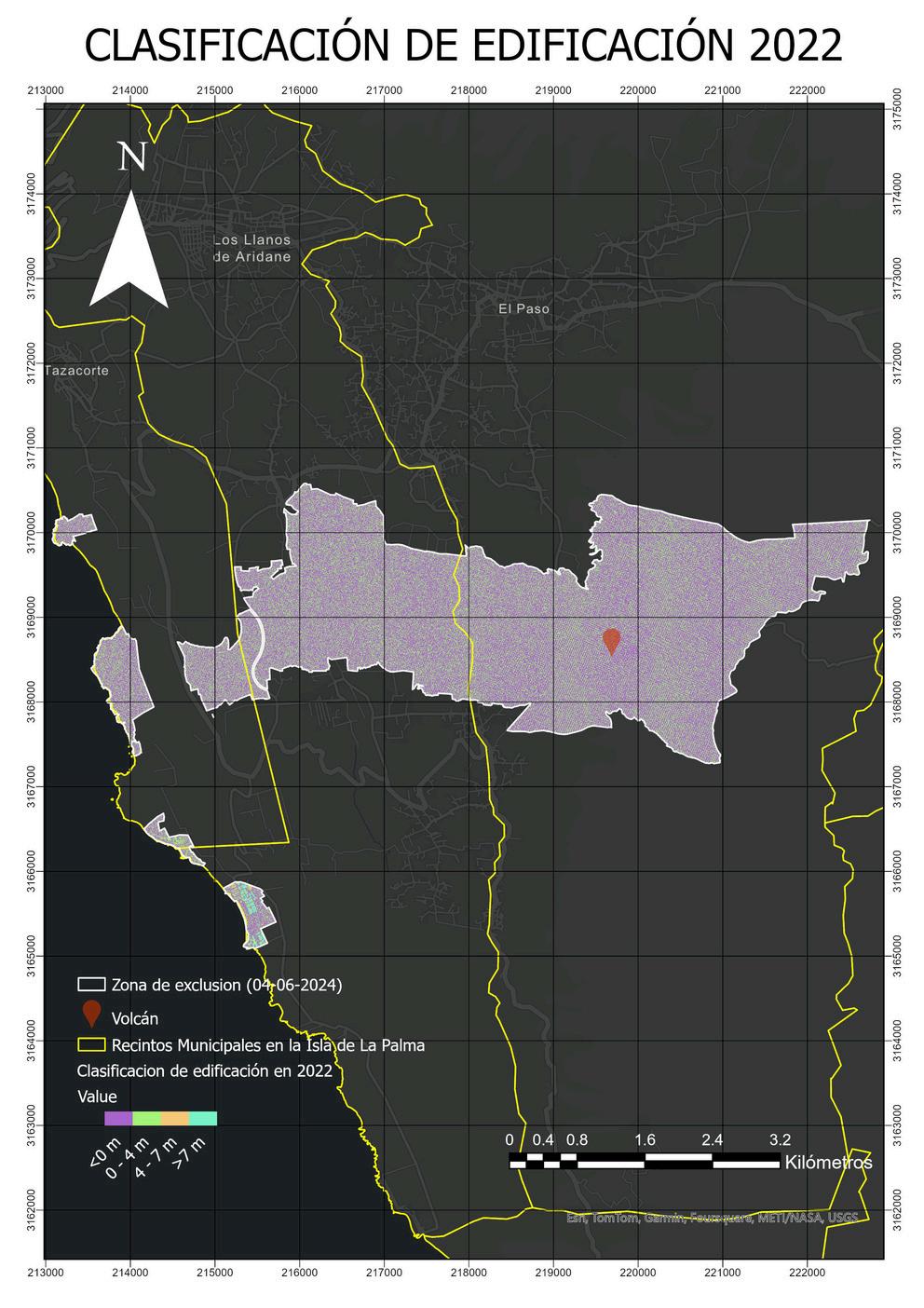
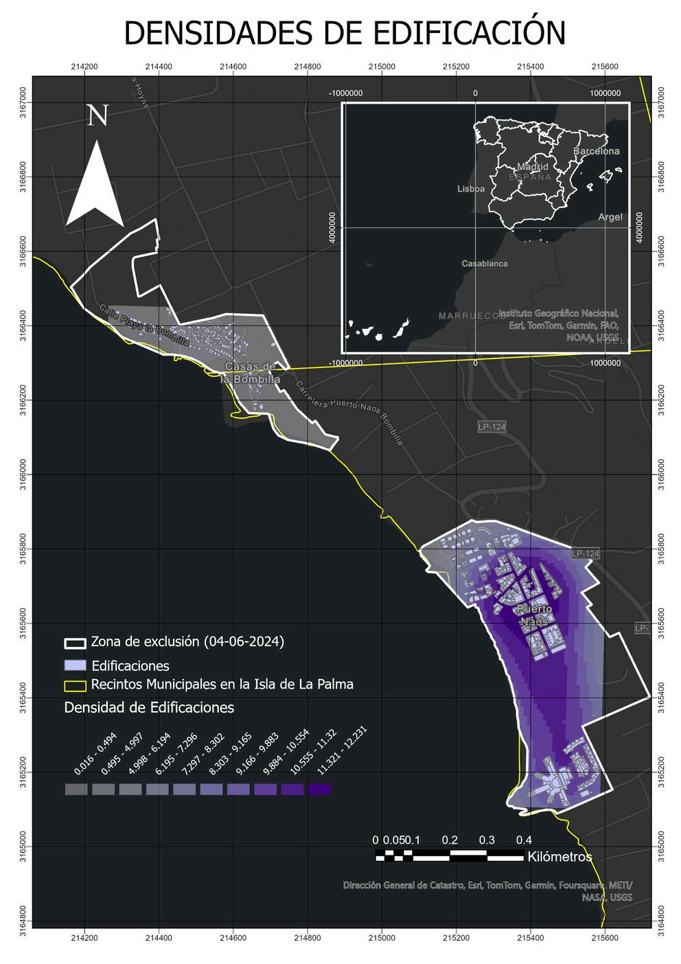
The study area was selected due to the significant transformations caused by the volcanic eruption of September 19, 2021, which severely affected the socioeconomic level of the island, which still has limited resilience. This event resulted in considerable loss of vegetation and infrastructure.
The analysis was carried out using high quality LiDAR data (2nd and 3rd coverage in LAZ format) provided by the IGN. From these data, Surface Models, Vegetation Models and Building Models were generated by applying selected LAS filters.
At the time, the work proposed incorporating lava flow simulations in land management plans, using Digital Terrain Models (DTM) to anticipate and mitigate the impacts of future volcanic eruptions.
Building classification in the year 2022 based on the 2024 Exclusion Zone.
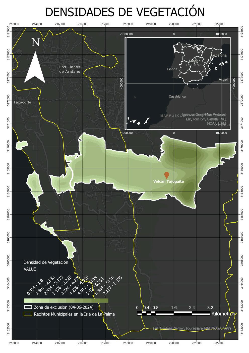
Densities of the only zones with building density in the year 2022 based on the delimitation of the 2024 Exclusion Zone. Vegetation density in the year 2022 based on the 2024 Exclusion Zone delineation.
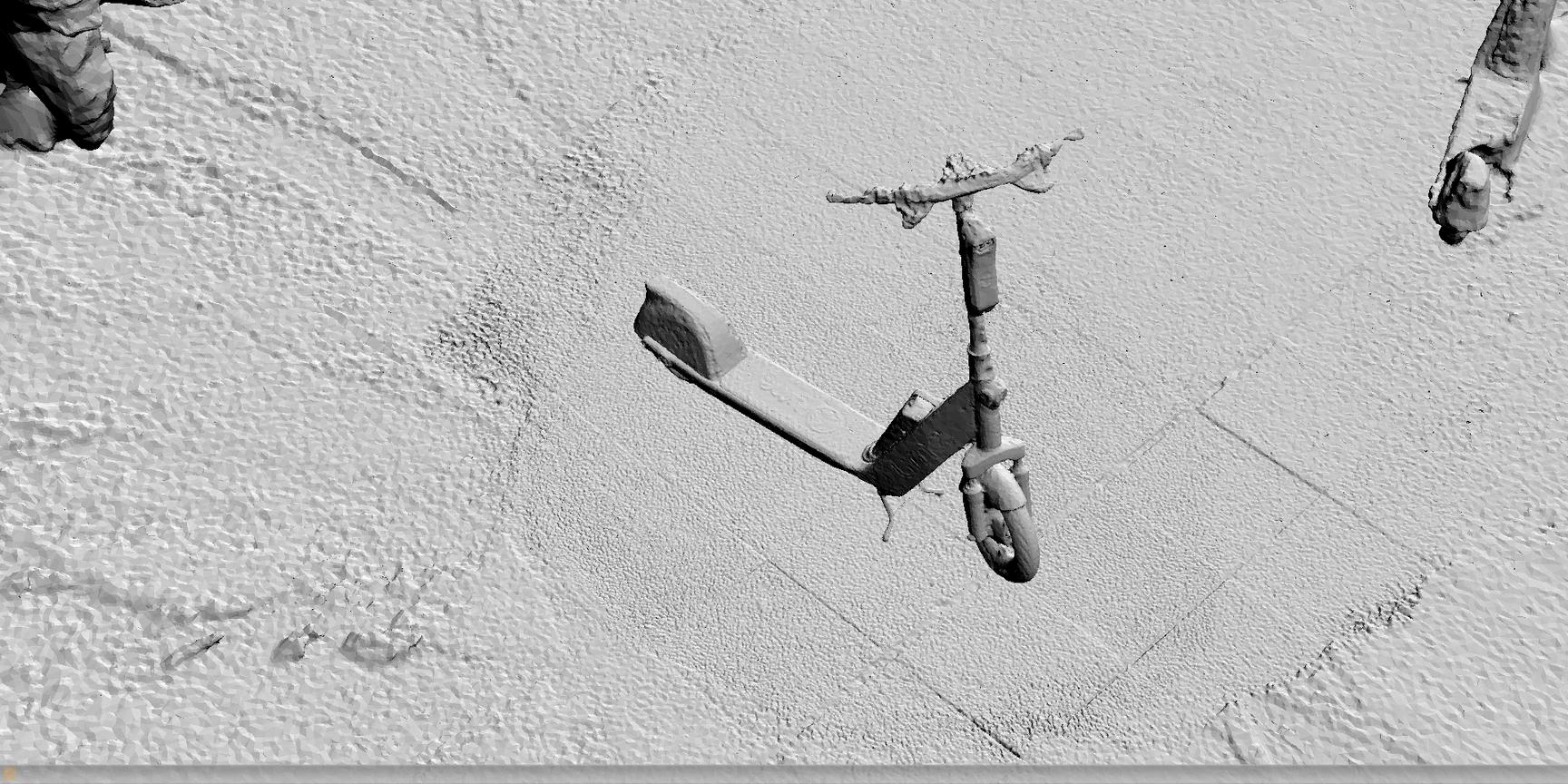
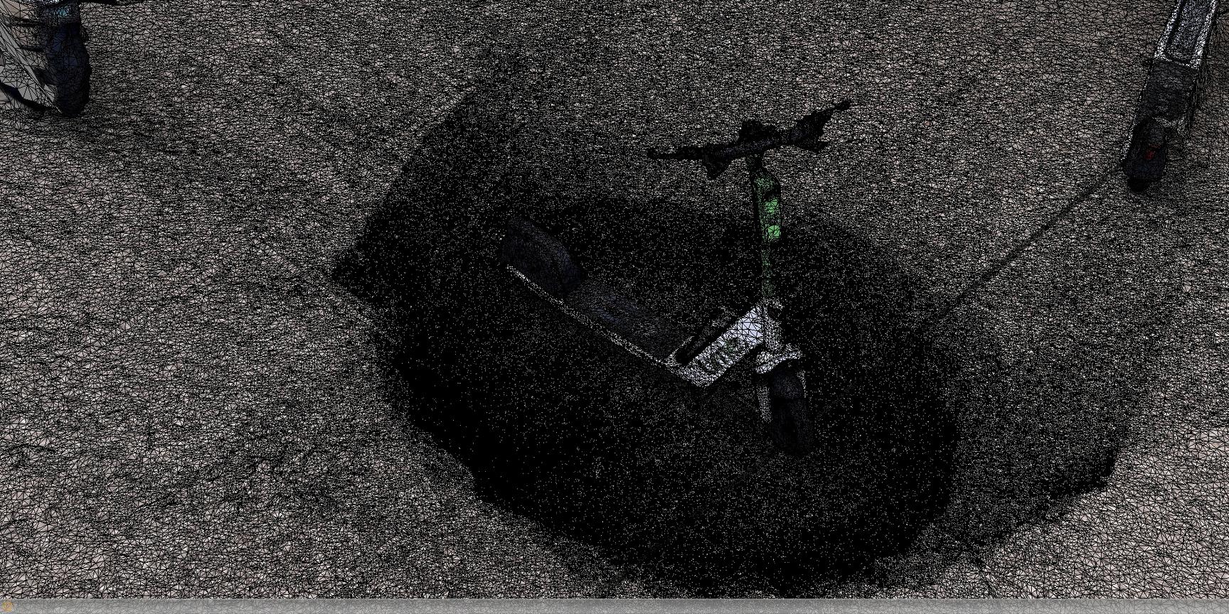
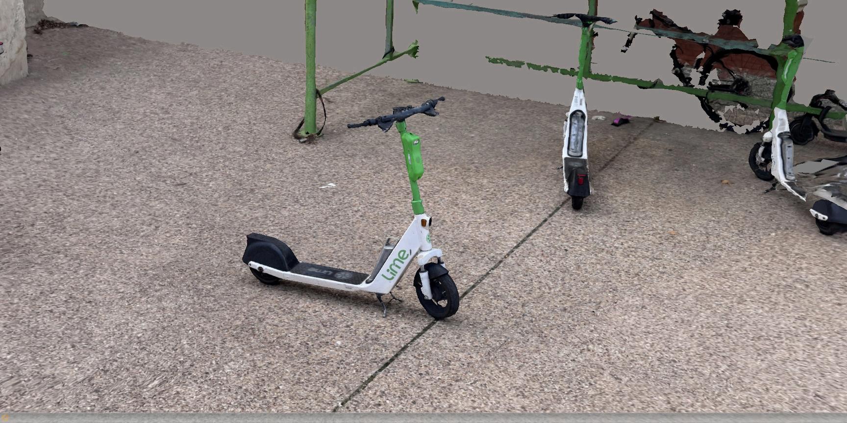
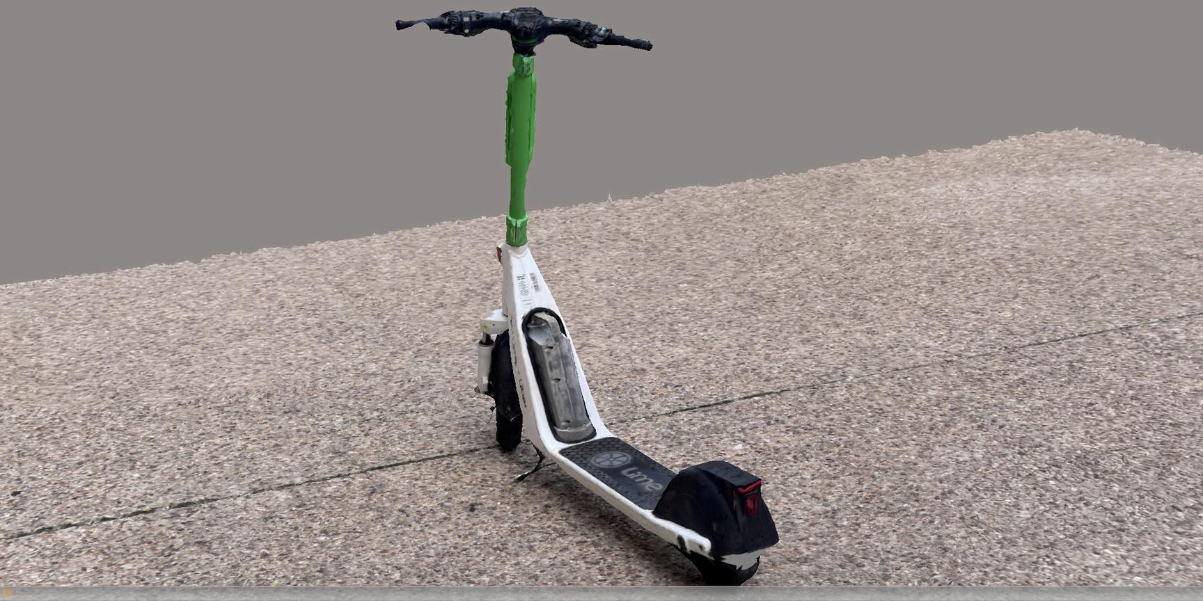
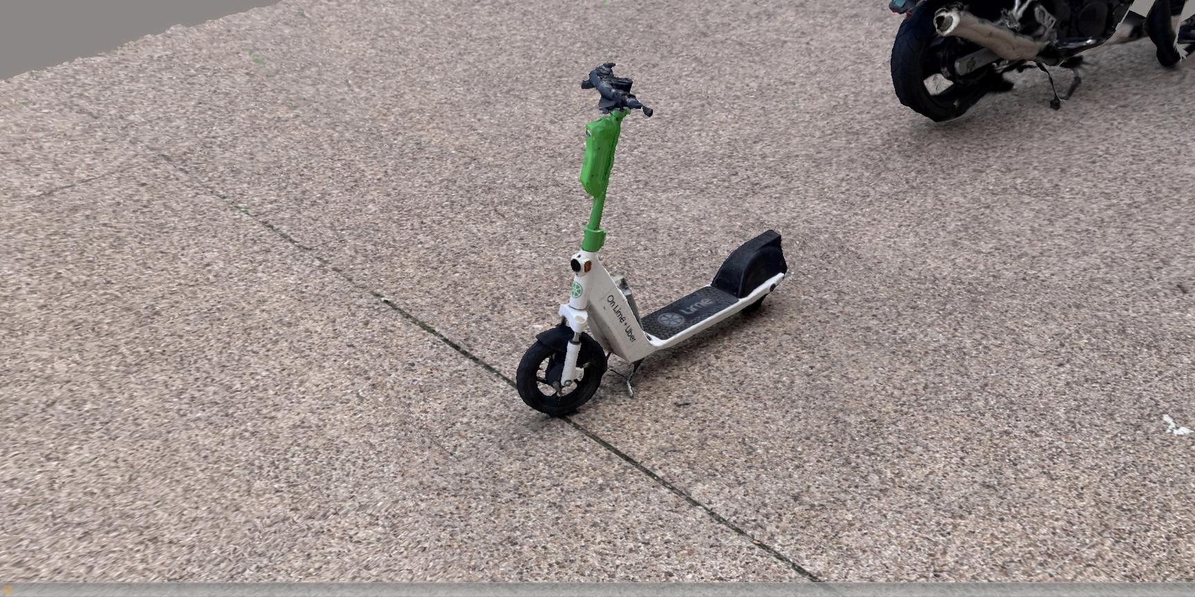
My role: Performing aerotriangulation process, survey point, constraints, and point cloud.
ARCHITECTURE, CAPTURE & GEOGRAPHIC INFORMATION SYSTEMS ANDRÉS