D E S I G N


D E S I G N

Thank you for your time and consideration for viewing my work ... hope you enjoy!


PROJECT TYPE: ACADEMIC (CAL POLY POMONA)
PROGRAM: URBAN DESIGN / RESTORATION
COURSE: MLA CULMINATING EXPERIENCE
TIME: FALL 2023 & SPRNIG 2024
ROLE: DOCUMENT MANAGER (TEAM)
In 2022, Rey León, the Mayor of Huron, California, applied to the National Park Service for assistance in transforming a large, federally owned parcel bordering the California Aqueduct into a regional park and nature preserve. Mayor León’s vision was that the parcel could provide recreational, ecological, and educational benefits to his community and to the region at large, while serving as a model for sustainable land use and ecosystem restoration in the San Joaquin Valley. Mayor León titled his application "Huron the Beautiful." On May 18th, 2023, the National Park Service, Rivers, Trails, and Conservation Assistance (NPS RTCA) selected the project to receive technical assistance.
Huron is located in the agricultural heart of southwestern Fresno County, situated between the San Luis Canal to the east and vast farmlands stretching west toward Interstate 5. State Highway 269, runs through the heart of Huron, carrying the lifeblood of the region—agriculture. Trucks and freight trains loaded with produce regularly pass through, connecting local farms to markets.
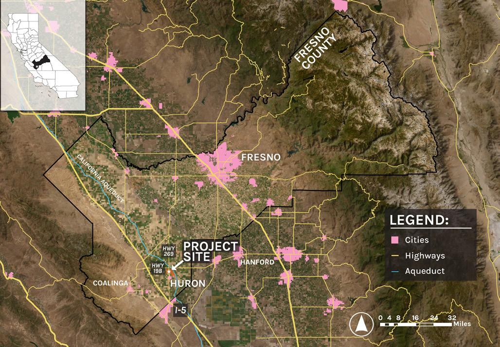
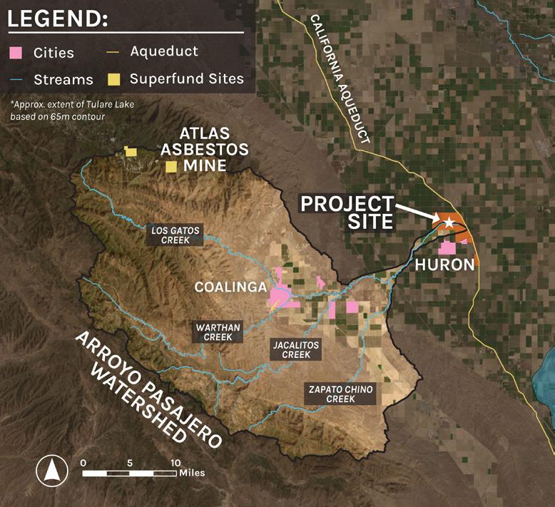
The project site sits at the terminus of the Arroyo Pasajero, a network of four seasonal streams that run dry in summer but transform into powerful flood channels during winter. Draining a vast, rugged watershed of about 500 square miles from the steep, erosive slopes of the Diablo Range, these streams can unleash massive floodwaters—up to 30,000 cubic feet per second—bringing over 50,000 acre-feet of water into the project site.
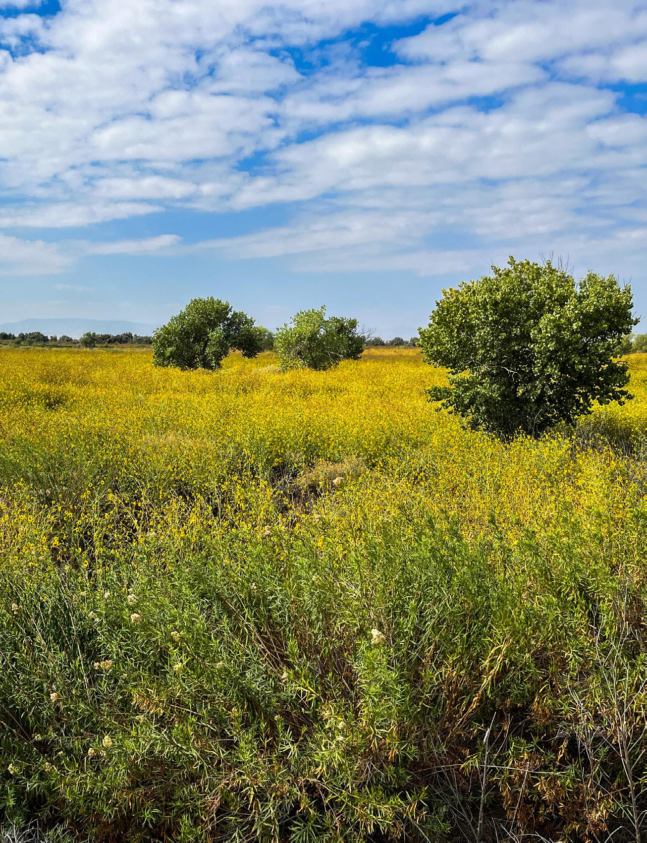
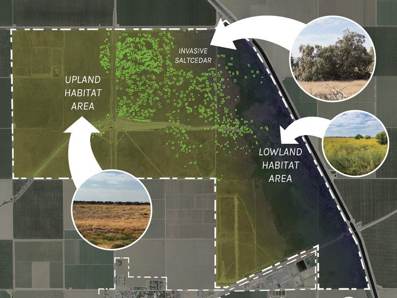
Less than 1 mile north of Huron and bordering the western side of the California Aqueduct is a 3000-acre public parcel officially referred to as the "San Luis Canal Westside Detention Basin." This parcel is owned by the U.S. Bureau of Reclamation. The project site contains a mix of upland grassland/San Joaquin desert scrub habitat, as well as lowland riparian/seasonal wetland habitat. the portion of the project site east of Highway 269 has been invaded by over one thousand saltcedar (Tamarix spp.) trees, some of which exceed 40 feet in height.
Vision Statement: The project site is more than a flood detention basin... The site should function as part of an ecological network, a living educational environment, a landmark that draws people from across the state, a connection to nature for the people of Huron, and a model of resilient ruralurban-natural relationships in the San Joaquin Valley.
In this vision, water, wildlife, and people move together, and in doing so, they form something new: a land management paradigm that could be applied across the San Joaquin Valley, and a human-ecosystem relationship that can endure even the fiercest of environmental challenges.
La Vida Pasajero faces these challenges head on through design and planning concepts that mitigate the most extreme issues, such as flooding and pollution, while also leveraging existing opportunities in and around the project site.
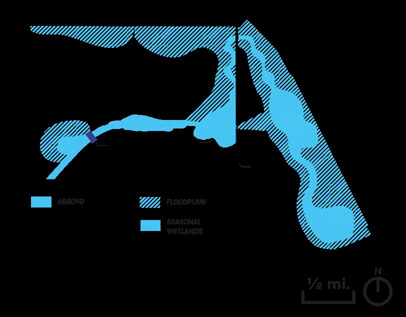
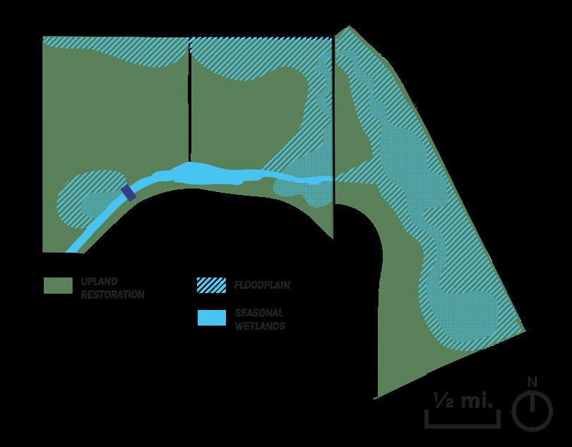
GOAL #2: RESTORE NATIVE UPLAND, FLOODPLAIN, AND WETLAND HABITAT IN THE PROJECT SITE.
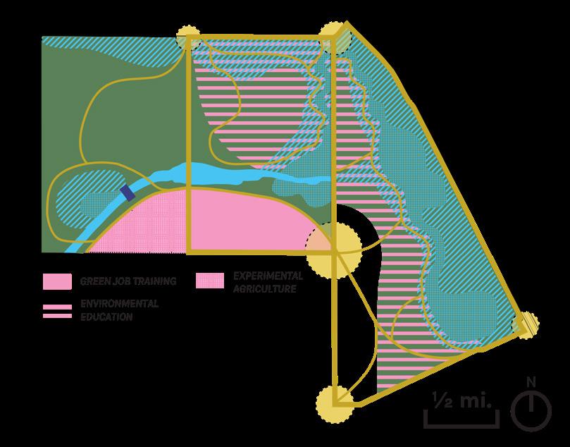
GOAL #4: ESTABLISH THE PROJECT SITE AS A CENTER OF ENVIRONMENTAL EDUCATION AND GREEN JOB TRAINING.
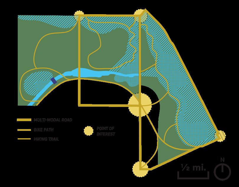
GOAL #3: ATTRACT REGIONAL VISITORS AND PROVIDE MULTI-MODAL COMMUNITY ACCESS TO THE PROJECT SITE.
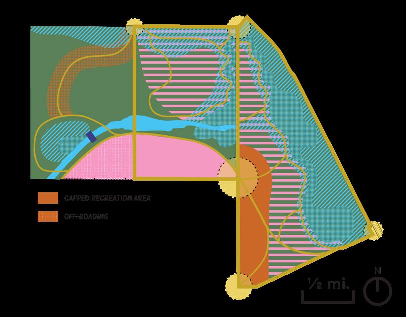
GOAL #5: CREATE OPPORTUNITIES FOR SAFE OUTDOOR RECREATION ON THE PROJECT SITE.
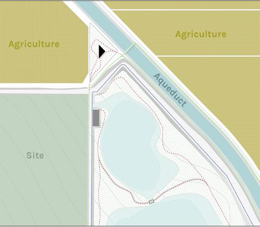
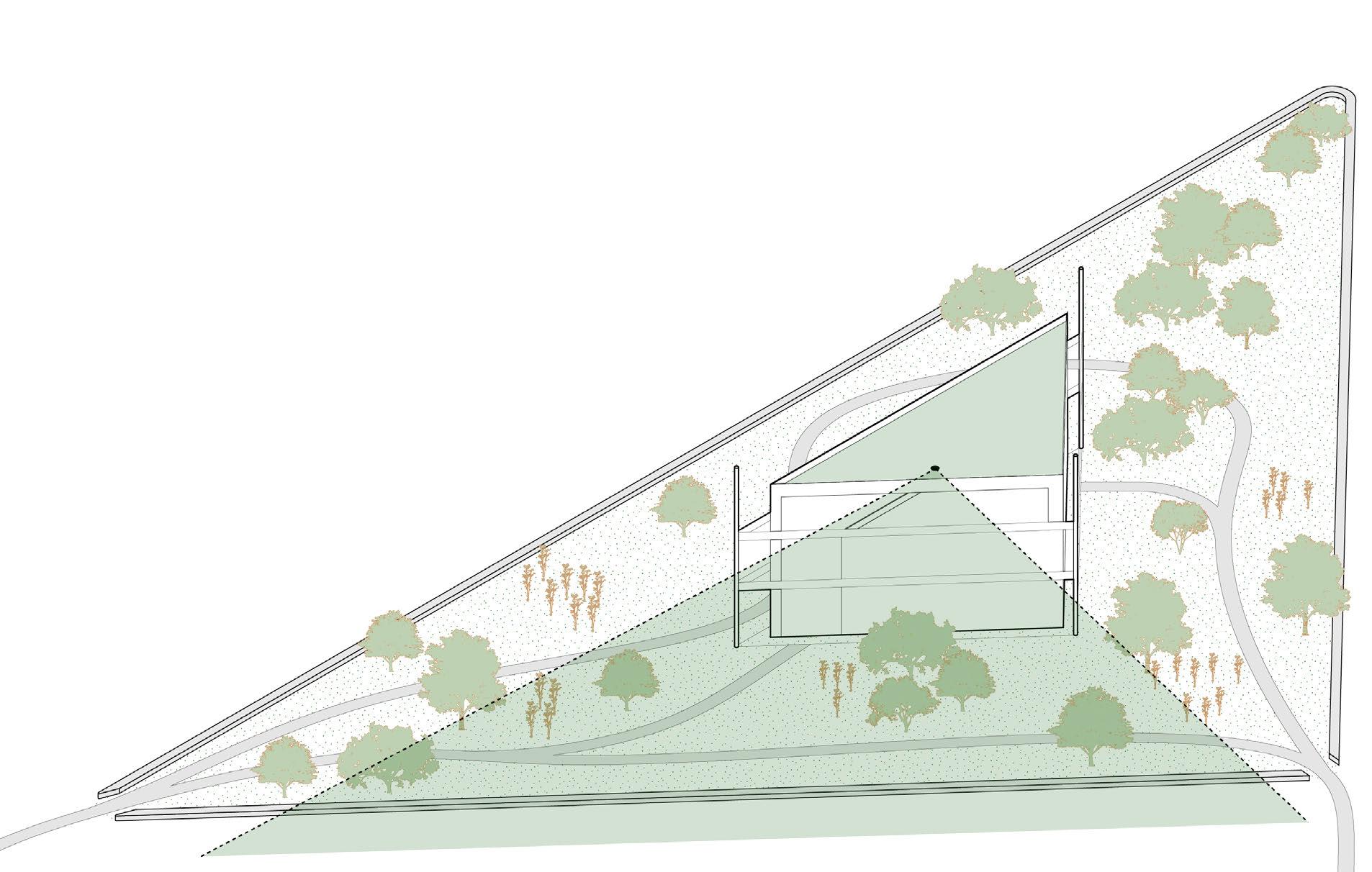
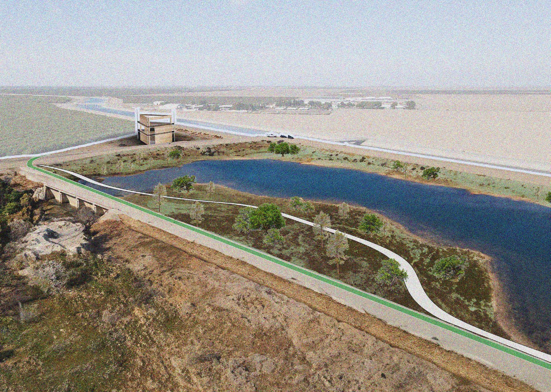
This deisgn focuses on the goal of enhancing the connectivity and perception of the site. It attracts regional visitors, providing multi-modal community access to the project site, and establishing a landmark for the project site. It focuses on the outer node in the northeastern part of the site. What is distinct about this node is that apart from it being an intersection point for hiking trails, bike trails, and vehicle roads, it is also an intersection point of the endless agricultural land, the California aqueduct, and the site itself. The main design feature in this node is an interactive educational lookout tower that frames these 3 distinct landscape elements. The concept plan further highlights that the focus area is in evident contrast with its context.
PROJECT TYPE: ACADEMIC (CAL POLY POMONA)
PROGRAM: COMMUNITY / RESIDENTIAL
COURSE: DESIGN IV (DESIGING COMPLEX SYSTEMS)
TIME: SPRING 2023
ROLE: PROJECT DIRECTOR (TEAM)
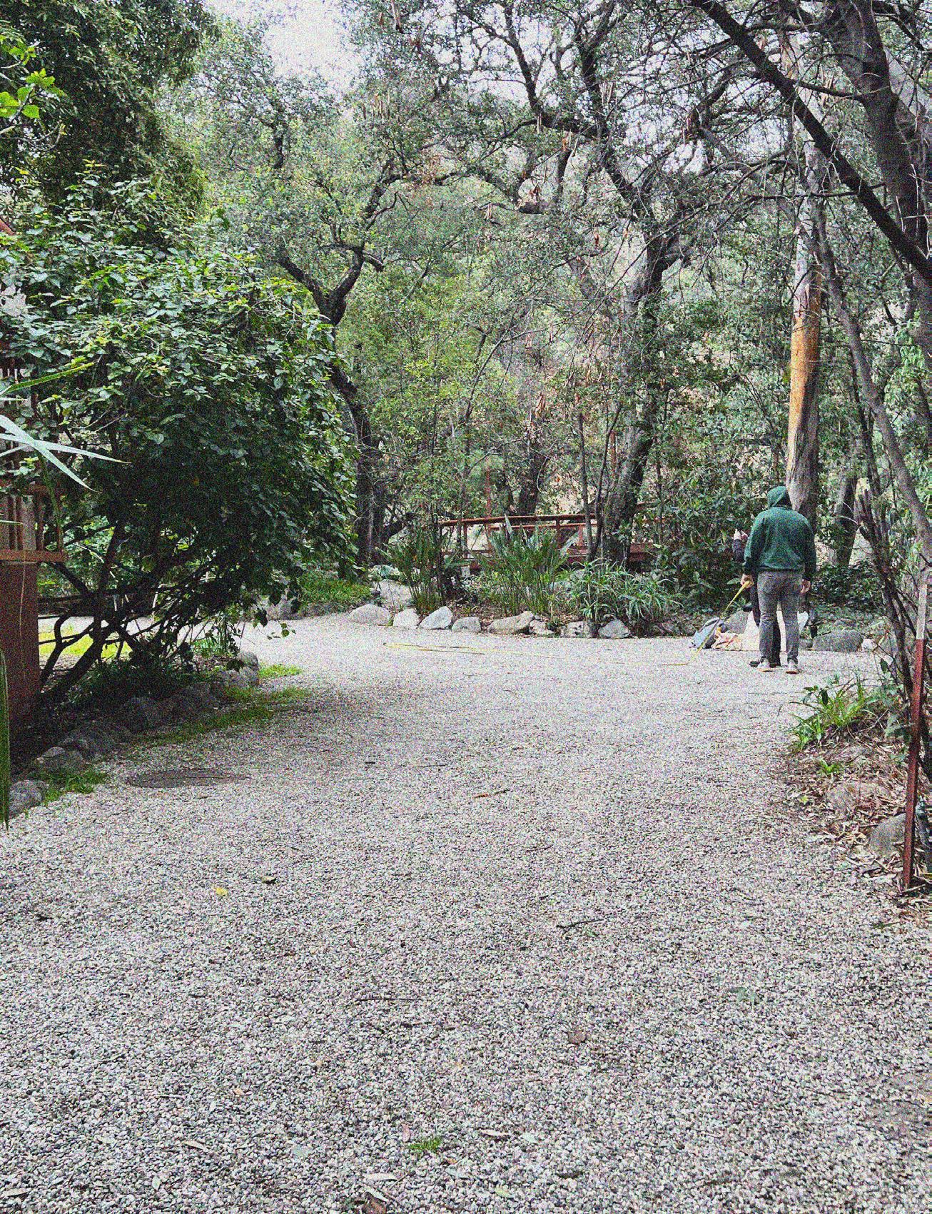
GENTLE because most things require a steady, patient, and caring hand to understand all the nuances of the land. Reconnection because the prefix RE means another time, once more, anew and CONNECTION implies a relationship to be had. A steady, patient, caring relationship with the land once again. This is the lens that has formed after my best attempt to listen deeply to those in the Tongva Taraxat Paxaavxa Land Conservancy and their aspirations for this first land back project. There is a need not only to reconnect the land within the property lines of what has been given back but also beyond those lines into the ecology of Eaton Canyon and the neighborhood. These are parts of a greater natural system that work better together, than apart.

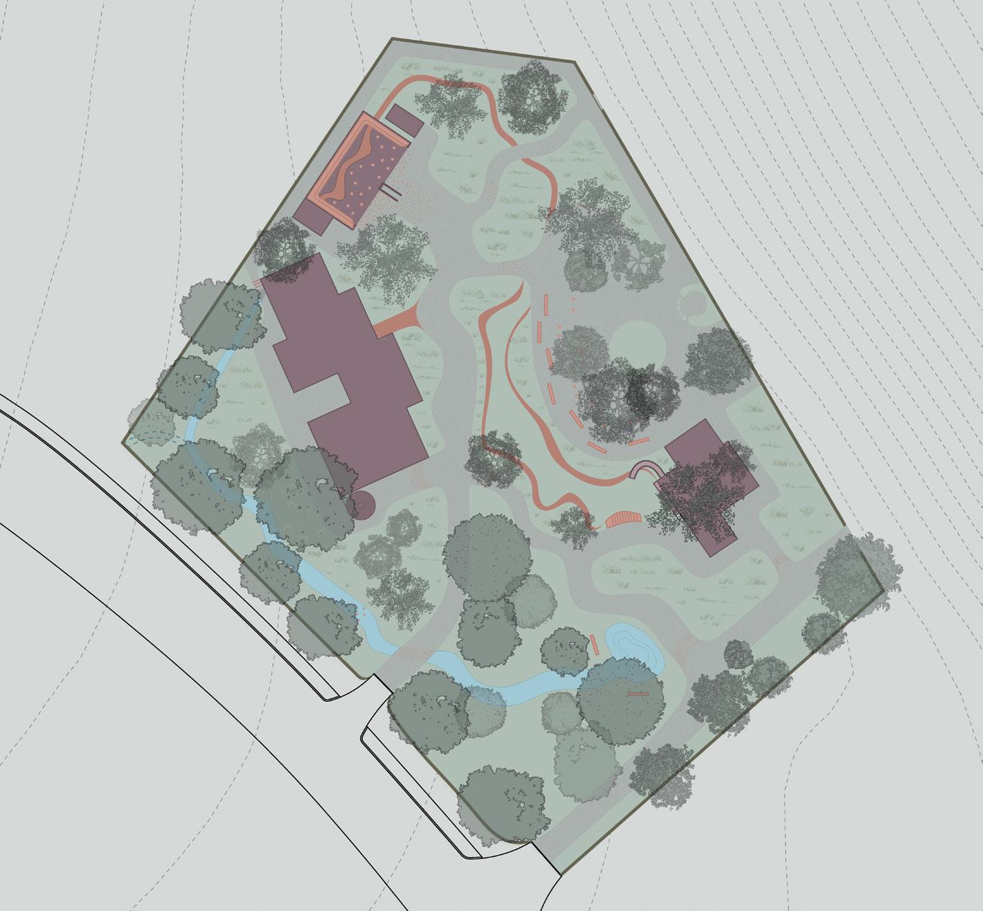
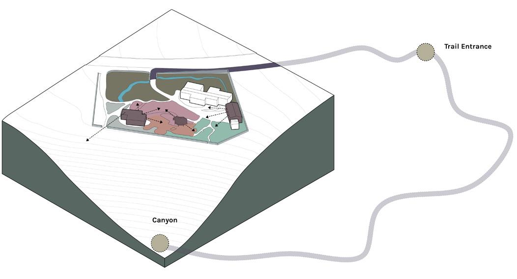
Shifting the dynamic of the pre-existing structures like the garage and cottage which appear to be outliers to serve programs on the land like the Ceremonial Space, Play Area, and Nursery. Blurring the lines between interior and exterior space will be the main focus of these structures. Looking at the scale of the canyon the dialogue of reconnection there has already begun with black bears being on-site, tribal members harvesting in Eaton Canyon and Viewsheds peaking out.
CONCEPT DESIGN & PROGRAMS
HABITAT RESTORATION
RAINWATER HARVESTING
NURSERY
PLAY AREA
CEREMONIAL SPACE
STRUCTURES
EDIBLE GARDEN
SIDEWALK
HIKING TRAIL
POINTS OF INTEREST

PROJECT TYPE: ACADEMIC (CAL POLY POMONA)
PROGRAM: GARDEN / ART INSTALLATION
COURSE: DESIGN I (THE INDIVIDUAL SELF)
TIME: FALL 2021
ROLE: INDIVIDUAL
The objective of this project was to develop design goals in line with my personal values from a landscape of my choosing no larger than 10,000 square feet.
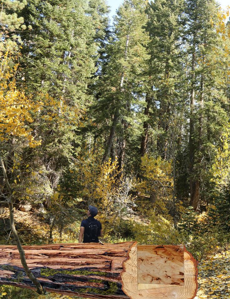
The garden of my dreams is located on the Cold Springs Campgrounds nestled in Sequoia National Park. The first time I visited this site was when my parents took me camping when I was 6 months old. To their recollection, I wasn’t having fun until they let me play along the river and it’s as if I was a new child apparently. Their retelling of this trip has in a way recreated this lost memory into a joyful and surreal moment in my early childhood. Since then I have visited the national park twice, back in 2017 which finally gave me a concrete experience of the gentle giant sequoias and having a great time hiking through the forest. The last time was 2020, and this trip brought in a mix of emotions and concern of the over looming fire that was happening, and air quality advisories. These experiences begin to layer on top of one another, but I can’t deny the reality that the national park
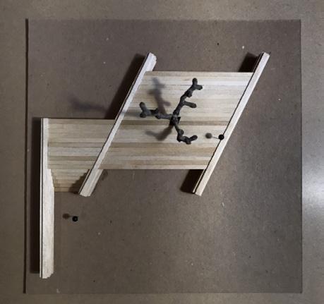
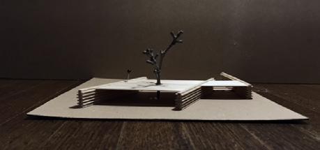
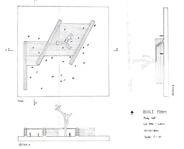
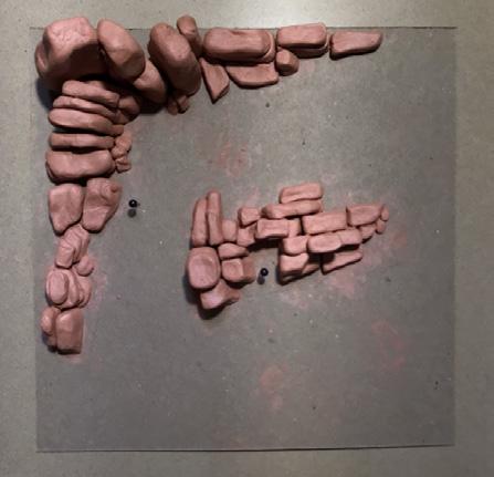
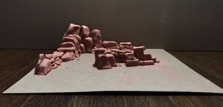
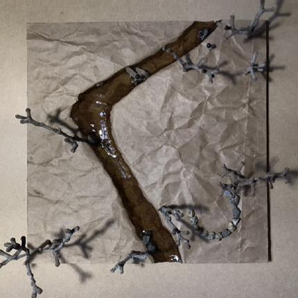
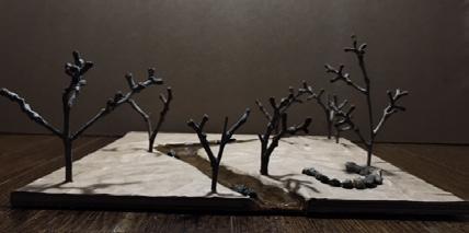
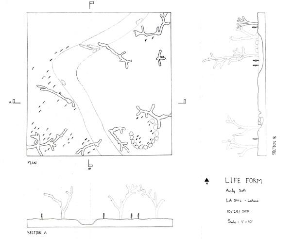
The process began with a series of three models (Built form, Landform, Life form) and drawings to explore the principles and strategies of defining outdoor spaces. The parameters of this exercise were that each abstract space had to fit into a 100’ x 100’ area, contain a small space (1-3 people), medium space (5-7 people), and large space (~20 people).

This site analysis zones in on the wildfires that have taken place since 2017, with the current KNP Complex fire burning over 88 thousand acres. Fires are necessary for the Sequoias to release their seeds in these dry conditions and at the same time to burn off woody debris and expose the soil. These cultural fires were conducted regularly by Native American peoples for thousands of years, but with the transition of fire suppression and climate change, we are seeing unprecedented wildfires that are out of control. Climate change is daunting and oftentimes very intangible, and even the graphic of the wildfires is oversimplified. With the garden of my dreams, I want to layer my experiences along with the harsh realities.

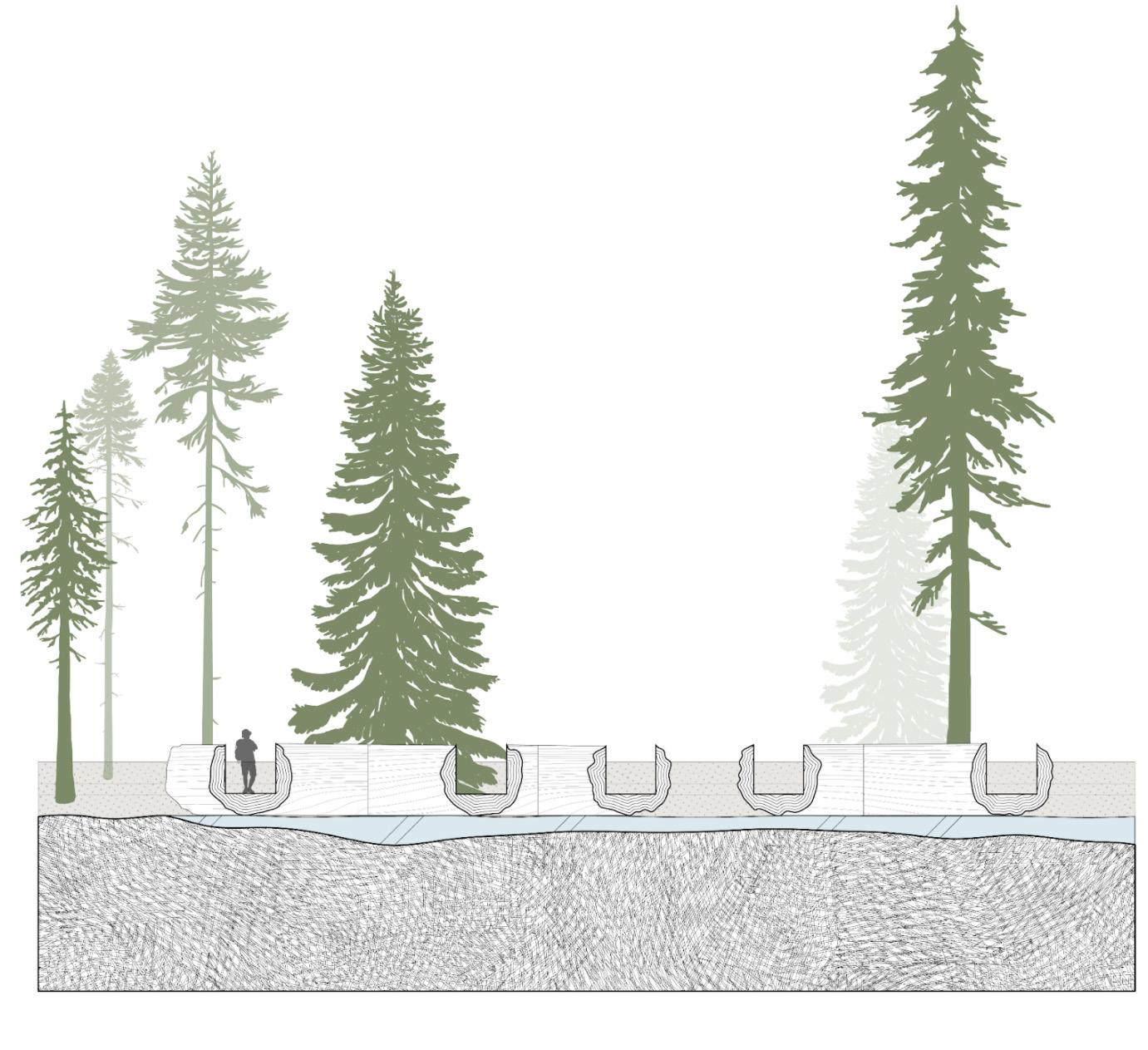

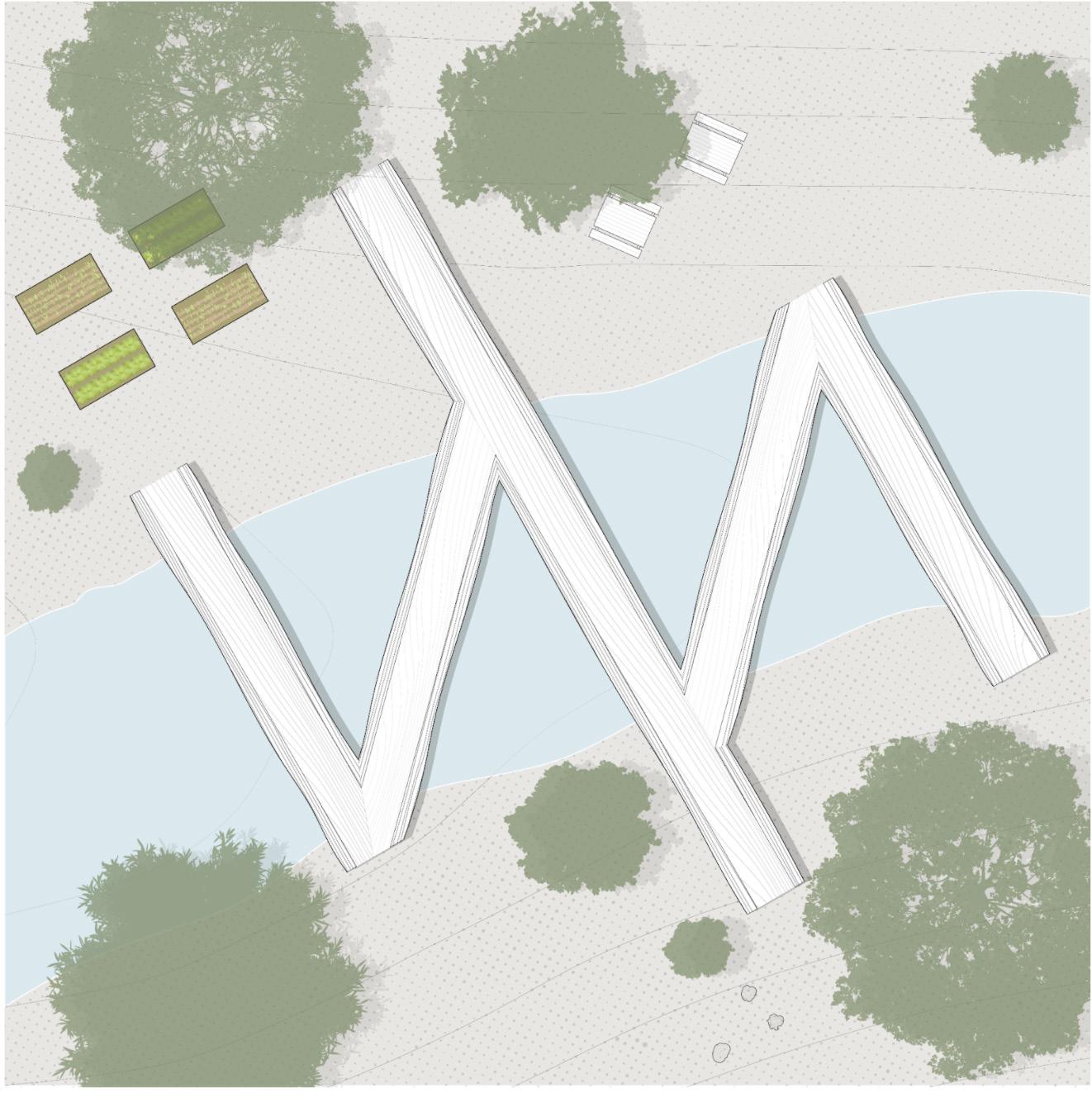
The character of the garden takes the form of an installation garden/ structure taking the reality of the burnt sequoias that remain from these fires and using them to make a series of bridges that go back and forth the riverbank, and keeping a dream of hope and rebirth. Making a beautiful space from a devastating event. These Sequoias clearly show their scars in an unapologetic manner, but slowly vegetation like moss and ferns start to grow on the burnt surfaces. They’re given a new life in a way to give a new experience to people who camp here.
In plan view we see the 5 sequoias each from a different fire, joint together making a shape of a stitch that gives a symbolic emphasis to healing and providing 3 points of entry on either side of the riverbank. In Section, They all peek out through the hallowed u shape to frame what is up ahead. To respect the Kumeyaay that inhabited this region I propose these 5 sequoias be named after indigenous leaders and advocates just like other famous sequoias are named.
PROJECT TYPE: DESIGN WORKSHOP (AA VISITING SCHOOL)
PROGRAM: URBAN DESIGN
COURSE: TRANSBORDER LANDSCAPES
TIME: SUMMER 2022
ROLE: PARTNER (TEAM)
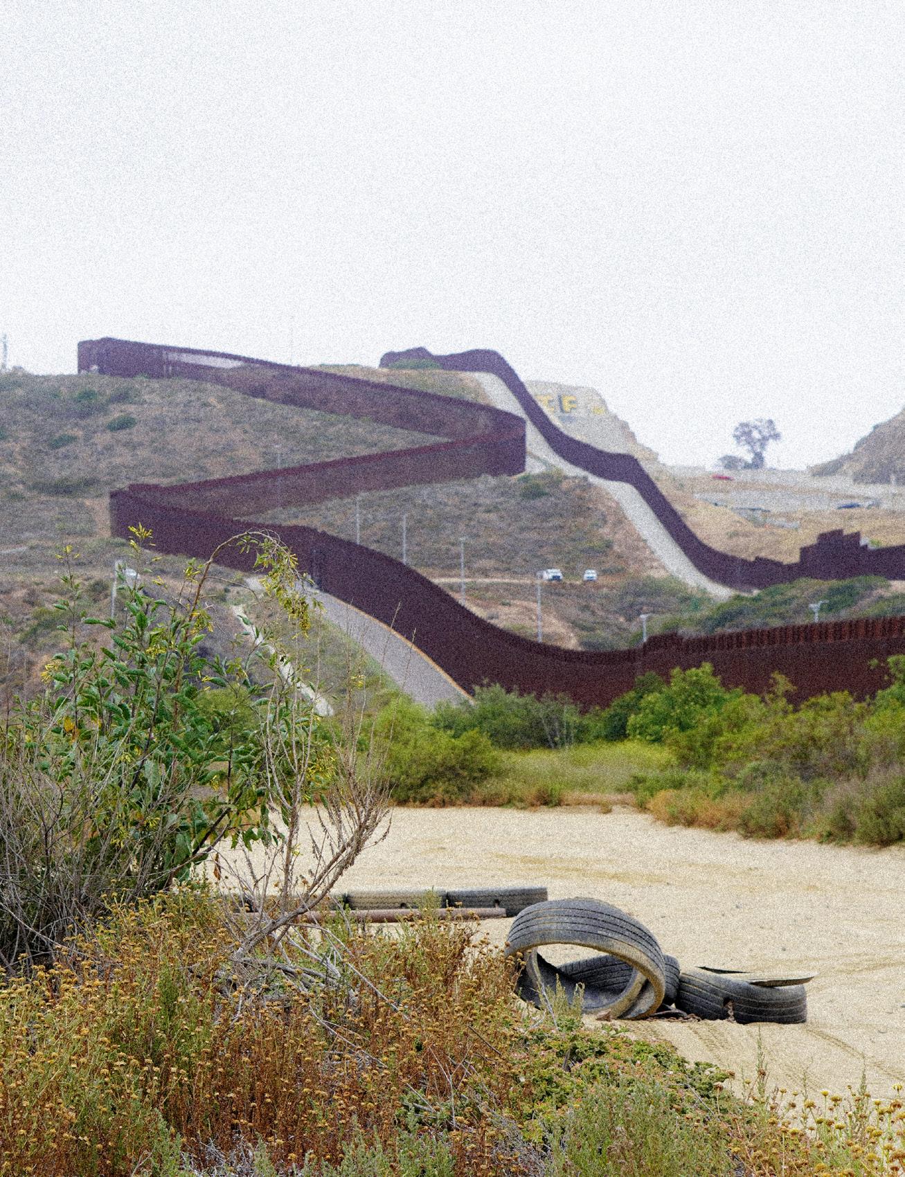
Transborder Landscapes examines the Tijuana River juxtaposed between US and Mexico. San Diego and Tijuana face contrasting economies, cultures, and policies, despite the shared landscape. This dual governance led to the demise of the river landscape because of largely opposing agendas between the two nations. This course looked at the geomorphological process of the region and the methods in which each country manages the river.
San Diego and Tijuana carry a symbiotic relationship where one city fulfills the needs of the other and vice versa, resulting in a beautiful exchange of cultures. Yet as humans we tend to create these borders where an exchange is yearning to be met; one dividing nations and the other dividing man from nature. As a point of departure acknowledging the section of the Tijuana river that is channelized is the man/nature border where it allows pollution and harmful contaminants to seep into the waterway leading into the wetlands of the coast. The need to dismantle that border is there.
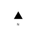
In comparison on the San Diego region, we focused on the environmental conditions of the unique land- scape that Rio Tijuana has created as the river flows out of Imperial Beach in San Diego. We used GIS data to demonstrate environmentally sensitive areas, which consists of areas where endangered species, wildlife, and incorporate areas of biological significance that is established on the Clean Water Act. The different shades of blue display the range of historical habitats. The wide range of ecological diversity within the Rio Tijuana are examples of the urgency to continually support healthy practice to protect the life that the river brings.
HIGH MARSH TRANSITION ZONE

MUDFLAT / SANDFLAT FRESHWATER WETLAND

RIVER CHANNEL RIPARIAN SCRUB
HIGH MARSH TRANSITION ZONE
SENSITIVE AREAS
FLOWLINES
DISPERSED RESIDENTIAL
RESIDENTIAL
COMMERCIAL
INDUSTRIAL
FABRICAS
MAQUILADORAS
MANIFACTURAS
ECOLOGICAL SIGNIFICANCE
SUBTIDAL WATER

INDUSTRIAL BYPRODUCT
PROJECT TYPE: ACADEMIC (UCLA)
PROGRAM: URBAN DESIGN / MULTI-USE
COURSE: STUDIO III
TIME: SPRNIG 2020
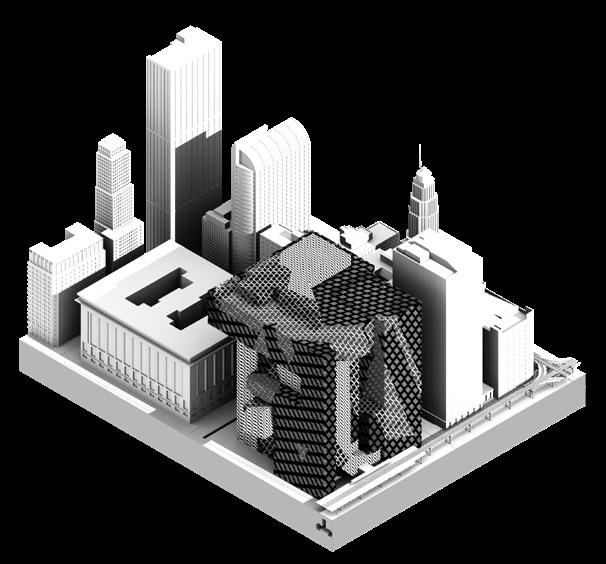
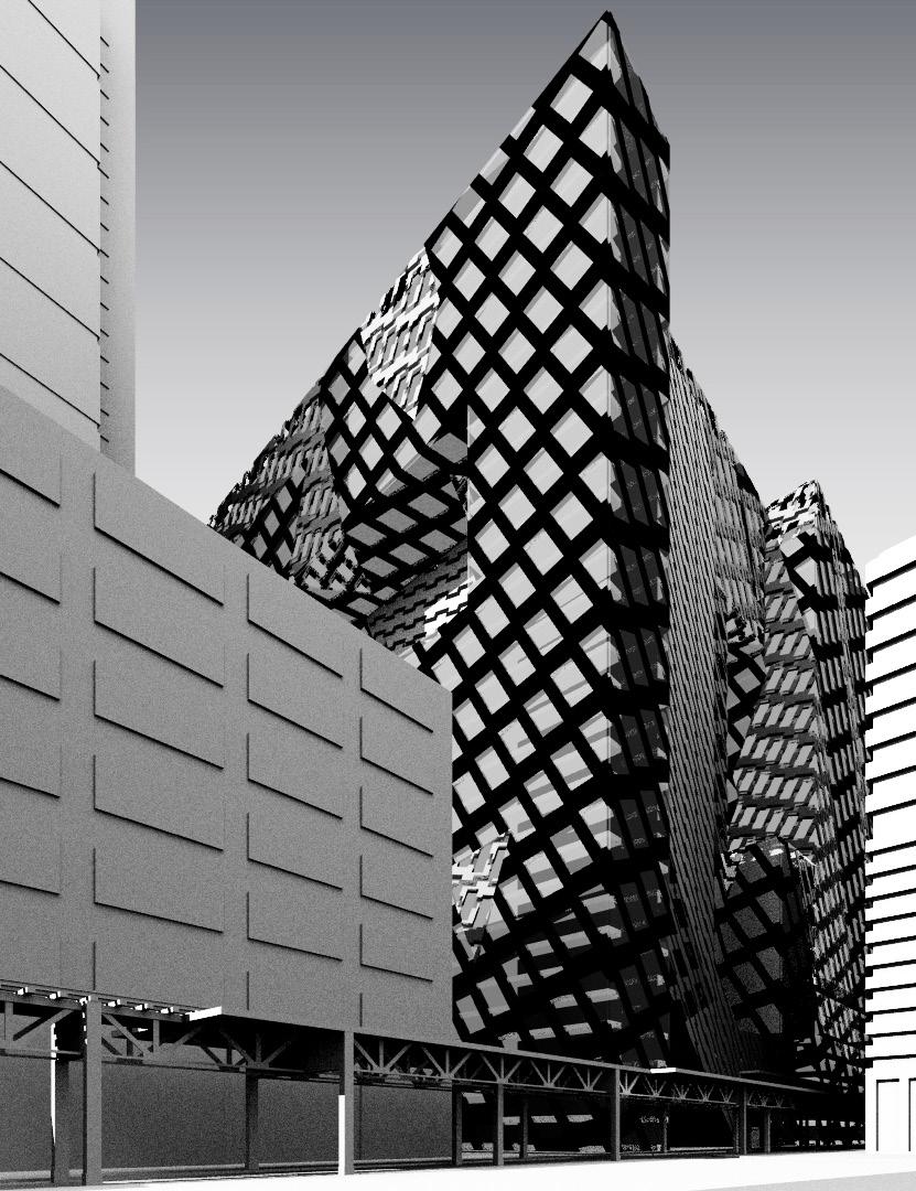
This studio focused on the study of the relationship of architecture to urbanism, and the architectural artifact as urbanism. The studio project is for a very large mixed-use building in the Chicago loop to replace Helmut Jahn’s James R. Thompson Center and is to be conceived in relation to the recent controversy surrounding the proposed sale of the building. The studio’s main focus is on disciplinary questions of the relationships amongst typology, function, and form in urbanism.
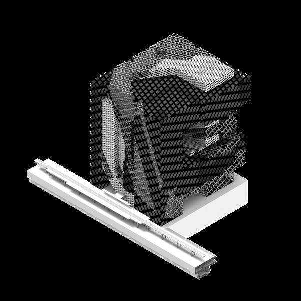
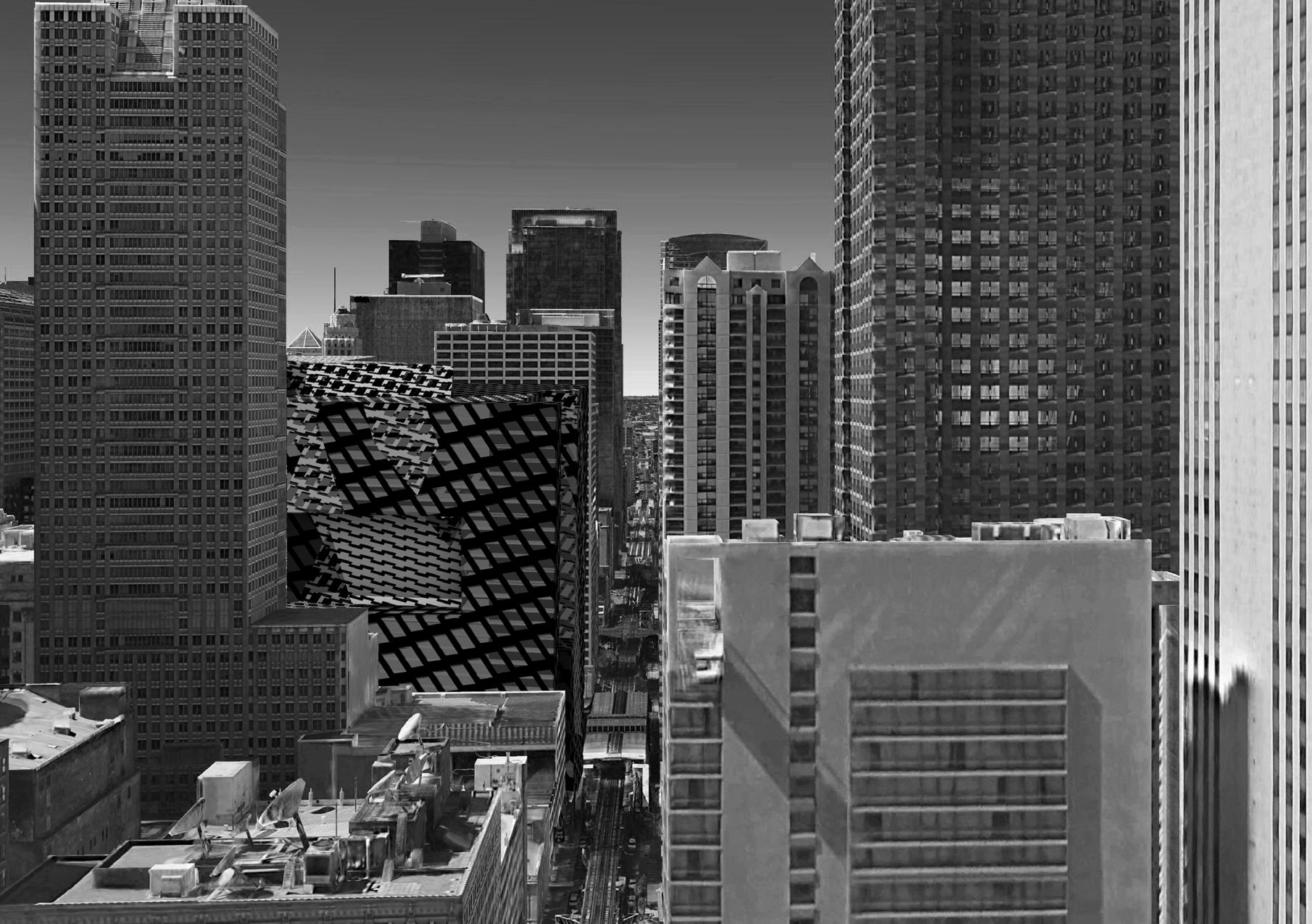
From an exterior perspective, my project demonstrates an overall rectilinear form, which can be imagined as an eroded cube along with the surface articulation of latticelike skin that surrounds most of the building to enforce a dominant presence.
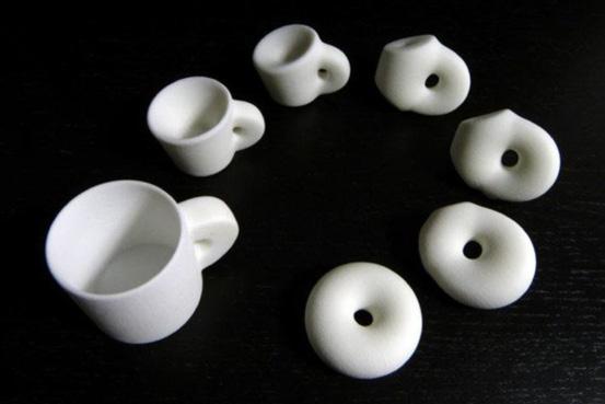
TOPOLOGY EXAMPLE
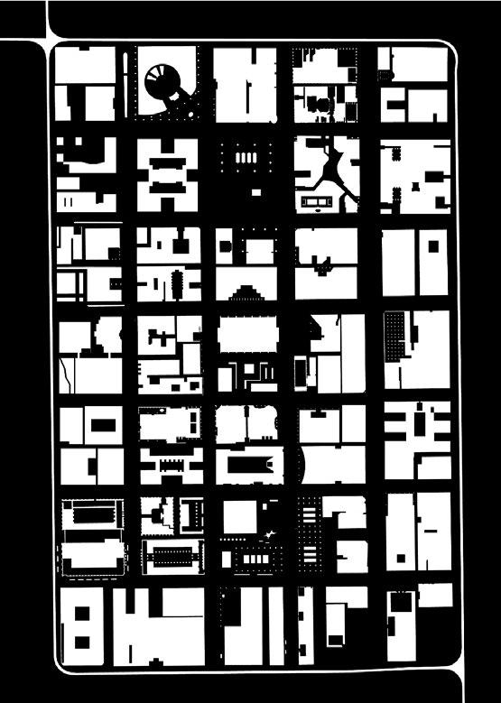
The initial focus was on a formal agenda that combines typology and topology to produce large interior urban voids. Working from the inside out, typological volumes extracted from large building precedents by Claude Ledoux were folded topologically as a way to redistribute atrium space that both challenges the hierarchy of the Z-axis typically found in these types of spaces and coherently addresses the differences intrinsic in a mixed-use building. Simultaneously the relationship of figure to ground was investigated to serve as a driver of how the relation of solid and void would operate in relation to the scale of the Chicago Nolli Loop.
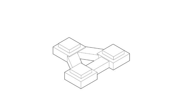
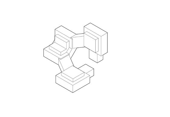
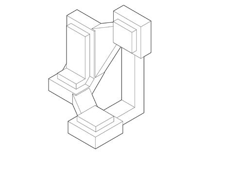
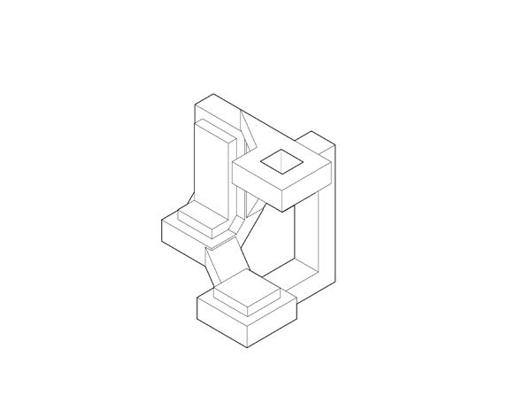
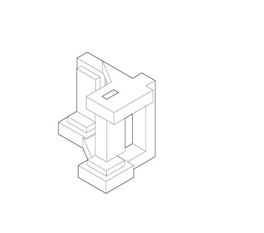
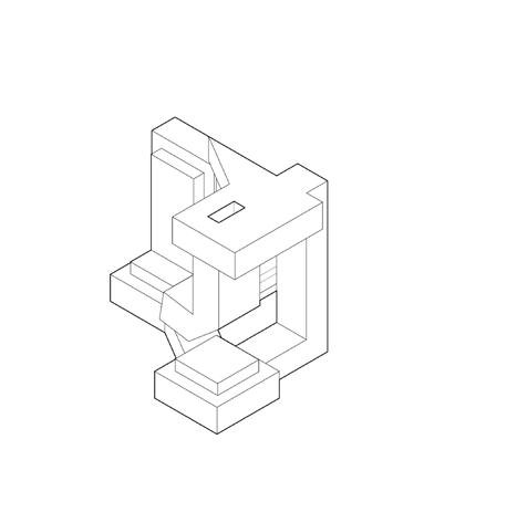
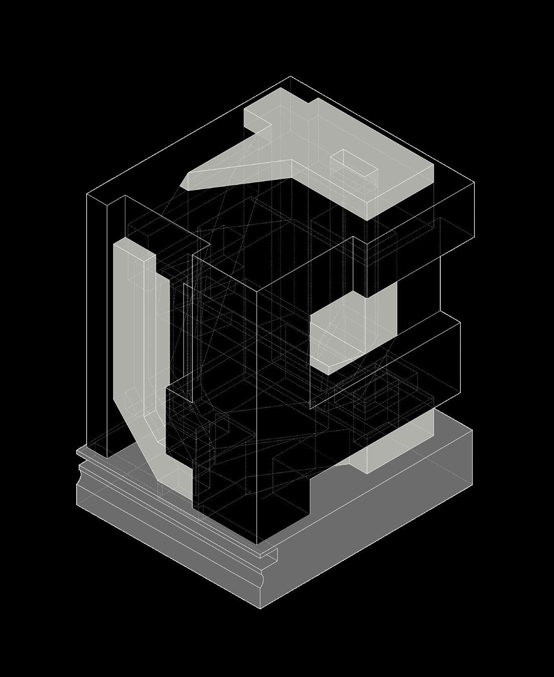
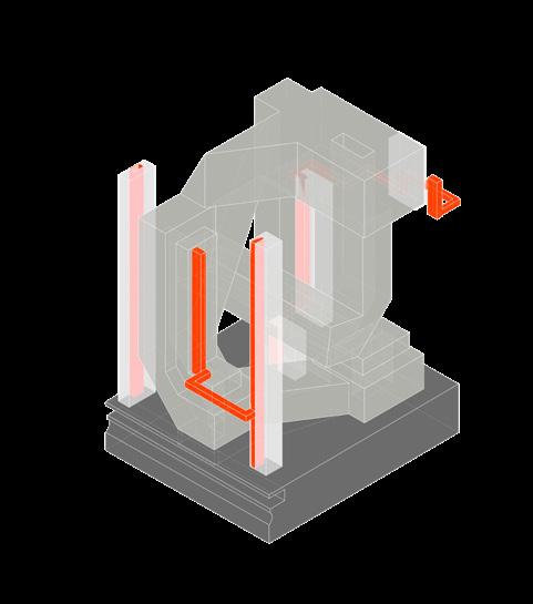
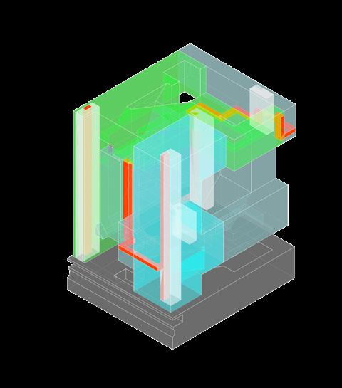
The program mimics the relation between mass and void, where boundaries from the different programs appear to be contesting each other, but instead interlock, or inhabit a narrow vertical and settles in the horizontal and vice versa.

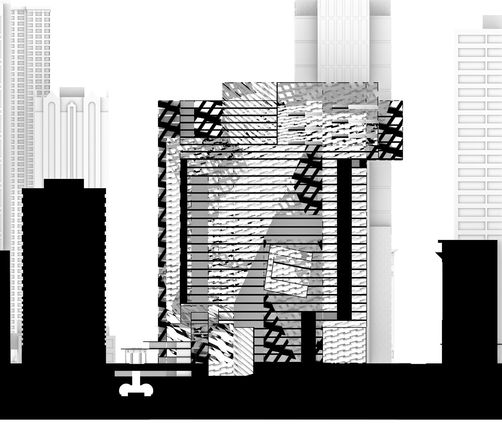
When looked at from an interior perspective, the dynamic shifts from the void that is encapsulated by the overall mass of the building becomes apparent as sporadic, appendage-like moments. In section the role of the void remains the same, unevenly distributed, but creates signage for moments of ramping, over-looking into different segments of that space, bypassing, and direct connection into the infrastructure of the city, and ground relationship.
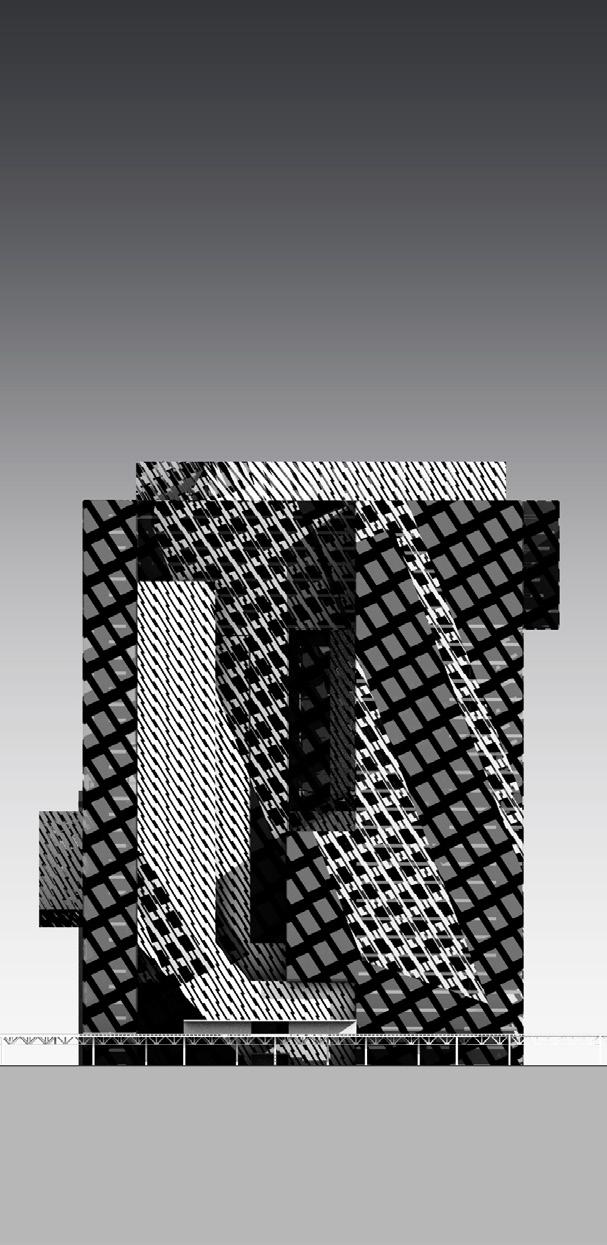
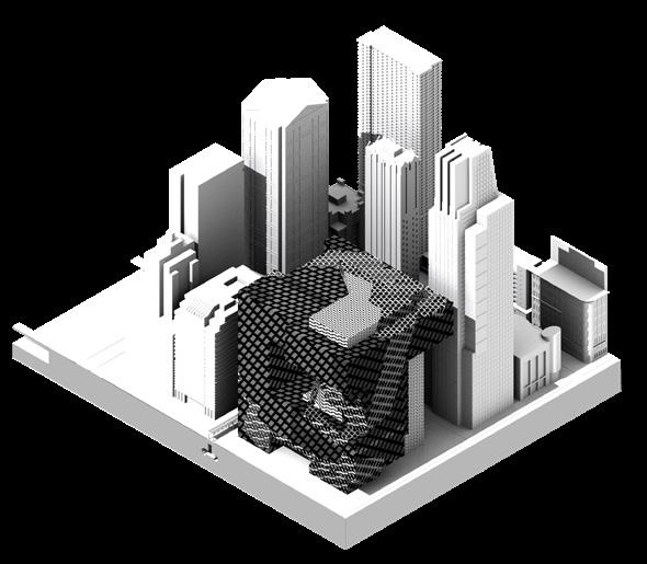
The idea of the pattern articulation was to serve as an allusion to the grid plan of Chicago which is fixed on the component of the building that represents mass but to find a balance to create the asymmetry in the interior, and it is angled to give directionality back to the infrastructure which is the El Train and subway. In turn, the first moment one experiences is the void, in which it immediately accommodates the city for this space to serve as a bypass. Overall this project seeks to create a dialogue between mass and void, that is both dominant and submissive in their appropriate contexts and create a connection to the urban fabric through the use of pattern directionality.
