
ARCHITECTURE PORTFOLIO ANDY SETT
Thank you for your time and consideration for viewing my work ... hope you enjoy!


A GENTLE RECONNECTION
PROJECT TYPE: ACADEMIC (CAL POLY POMONA)
PROGRAM: COMMUNITY / RESIDENTIAL
COURSE: DESIGN IV (DESIGING COMPLEX SYSTEMS)
TIME: SPRING 2023
ROLE: PROJECT DIRECTOR (TEAM)
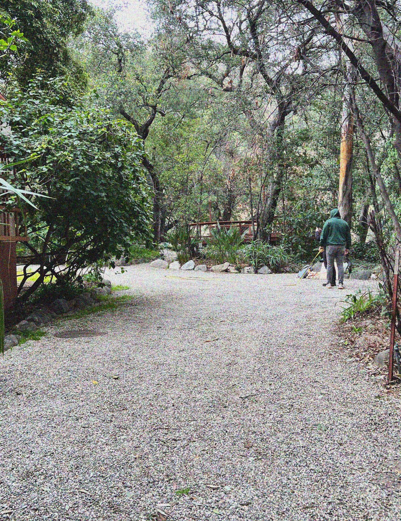
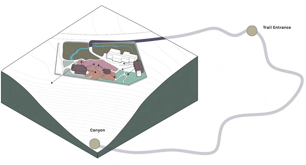
GENTLE because most things require a steady, patient, and caring hand to understand all the nuances of the land. Reconnection because the prefix RE means another time, once more, anew and CONNECTION implies a relationship to be had. A steady, patient, caring relationship with the land once again. This is the lens that has formed after my best attempt to listen deeply to those in the Tongva Taraxat Paxaavxa Land Conservancy and their aspirations for this first land back project. There is a need not only to reconnect the land within the property lines of what has been given back but also beyond those lines into the ecology of Eaton Canyon and the neighborhood. These are parts of a greater natural system that work better together, than apart.


SCHEMATIC PLAN

Shifting the dynamic of the pre-existing structures like the garage and cottage which appear to be outliers to serve programs on the land like the Ceremonial Space, Play Area, and Nursery. Blurring the lines between interior and exterior space will be the main focus of these structures. Looking at the scale of the canyon the dialogue of reconnection there has already begun with black bears being on-site, tribal members harvesting in Eaton Canyon and Viewsheds peaking out.
LEGEND
LAND ART / LEARNING SPACE
EDIBLE GARDENS
CEREMONIAL SPACE
AREA
OAK GROVE
NATIVE PLANT RESTORATION
CONCEPT DESIGN & PROGRAMS
LEGEND
HABITAT RESTORATION
RAINWATER HARVESTING
NURSERY
PLAY AREA
CEREMONIAL SPACE
STRUCTURES
EDIBLE GARDEN
SIDEWALK
HIKING TRAIL
POINTS OF INTEREST

THERE’S SOMETHING IN THE AIR
PROJECT TYPE: ACADEMIC (ITALY)
PROGRAM: RESEARCH / URBAN DESIGN
COURSE: EVOLVING ISSUES IN ENVIRONMENTAL DESIGN
TIME: FALL 2022
ROLE: INDIVIDUAL
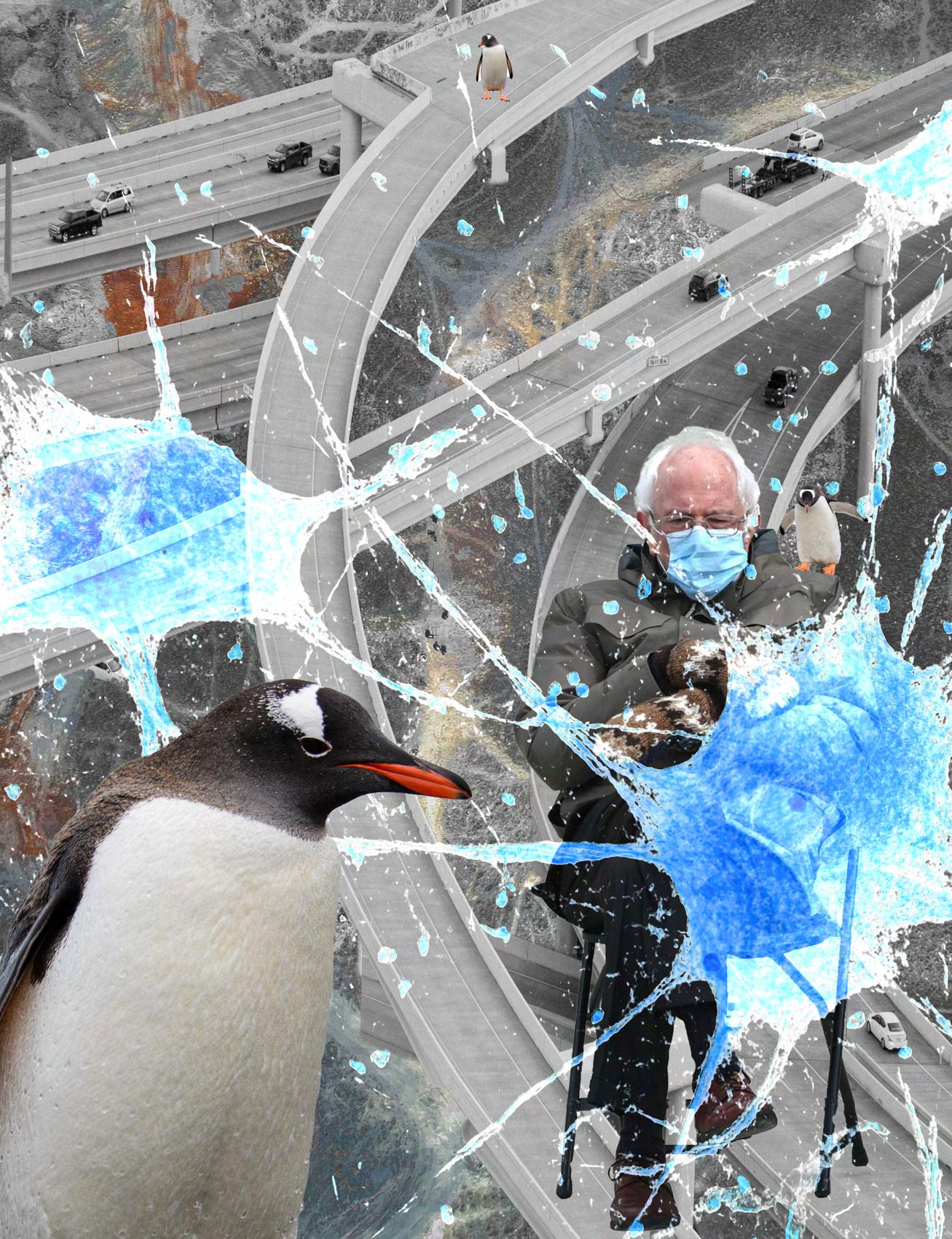
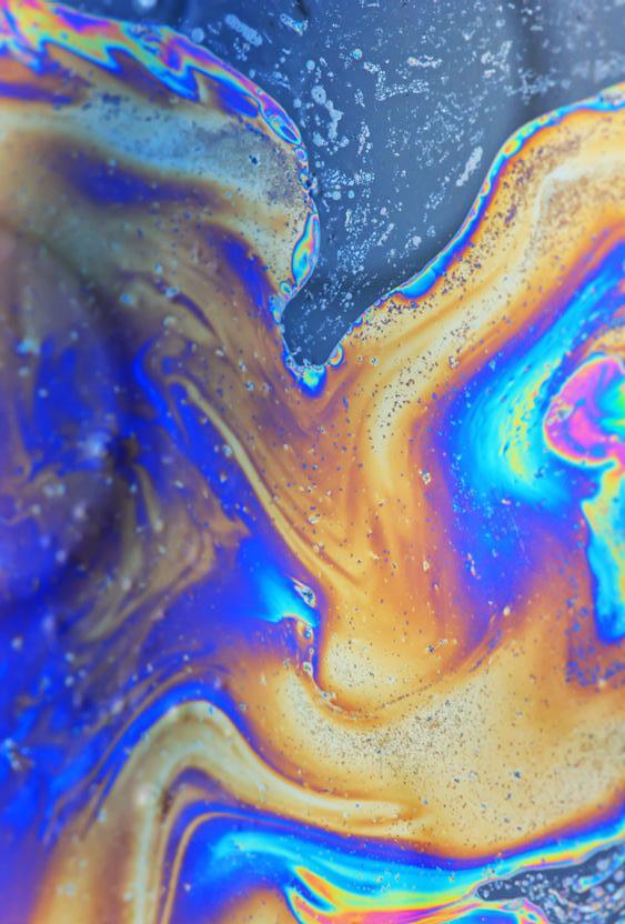
The objective of this project was to develop a map of Venice or Rome that identifies issues that contribute to climate change and propose mitigation strategies in the respective Italian Cities. Prior to the conducting research and and analysis the project was framed around the reading of Tentacular Thinking by Donna J. Haraway and an initial *collage to launch the project.
The city of Venice has for a long time been a major hotspot for tourism due to its unique built environment on a lagoon next to the Adriatic Sea, along with its cultural commodities and architectural attractions. Currently Venice is ranked as the 46th most visited city in the world, which by the sound of it doesn’t seem so impressive in comparison to other cities but it is one of the top cities in which tourists have been outnumbering local Venetians 140:1 and 78:1 since 2014. Looking at Venice, situated as a city on a lagoon and having vast numbers of tourists visiting on a daily basis has caused indirect and complex problems that have contributed to the current global climate
VENICE CLIMATE EVENTS
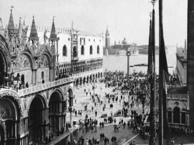


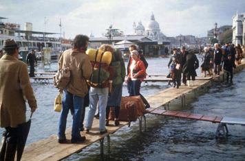

Italian economic planners undertook a “modernizing” program that transformed the continental shore of the Venetian Lagoon
City installs a network of walkways along the main pedestrian paths, generally at 120cm above the standard sea level
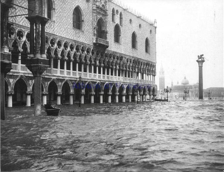
Flooding was the second highest in the city’s history, peaking at 6.3 feet and killing 11 people
Venice officially starts aqcua alta records
1.94-meter acqua alta, known as the Acqua Granda, ravaged the city. Thousands of citizens were forced to evacuate their homes
Italy's national government decided to conceive a project called MOSE, that serves as flood gates to the Venetian Lagoon
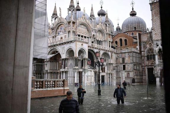
Moses was activated for the first time on October 3, 2020 to meet a tide higher than four feet
1872 1920 1966 1974 1987 2019 2020Looking through the lens of climate change Venice is infamous for its acqua alta (high tide) events that have continuously damaged so much of this historic city for centuries and is only getting worse. The frequency and severity of these events is so strong that it has become part of the identity of Venice. So much time, effort, and money has been invested in mitigating the flooding of the city ranging from MOSE, elevated walking paths, sandbags, etc. I want to frame one of the many symptoms of climate change that is unique to the Venetian Lagoon, and instead focus on some of the causes that tourism in Venice is responsible for.
Tourism via air travel is a very unsustainable industry that currently contributes a large amount of greenhouse gas emissions, with 86.5% of tourists arriving outside of Italy making air travel the most viable option for most. Having Venice as a car-free city is a double edged sword with the vaporetto being the main resource for public transportation in the lagoon causing air and water pollution. With Venice mainly accommodating tourists this creates an interesting dynamic for local Venetians since they have to constantly work in a tourism model which in turn is also unsustainable, and many having to commute to the more densely populated tourist BnBs.
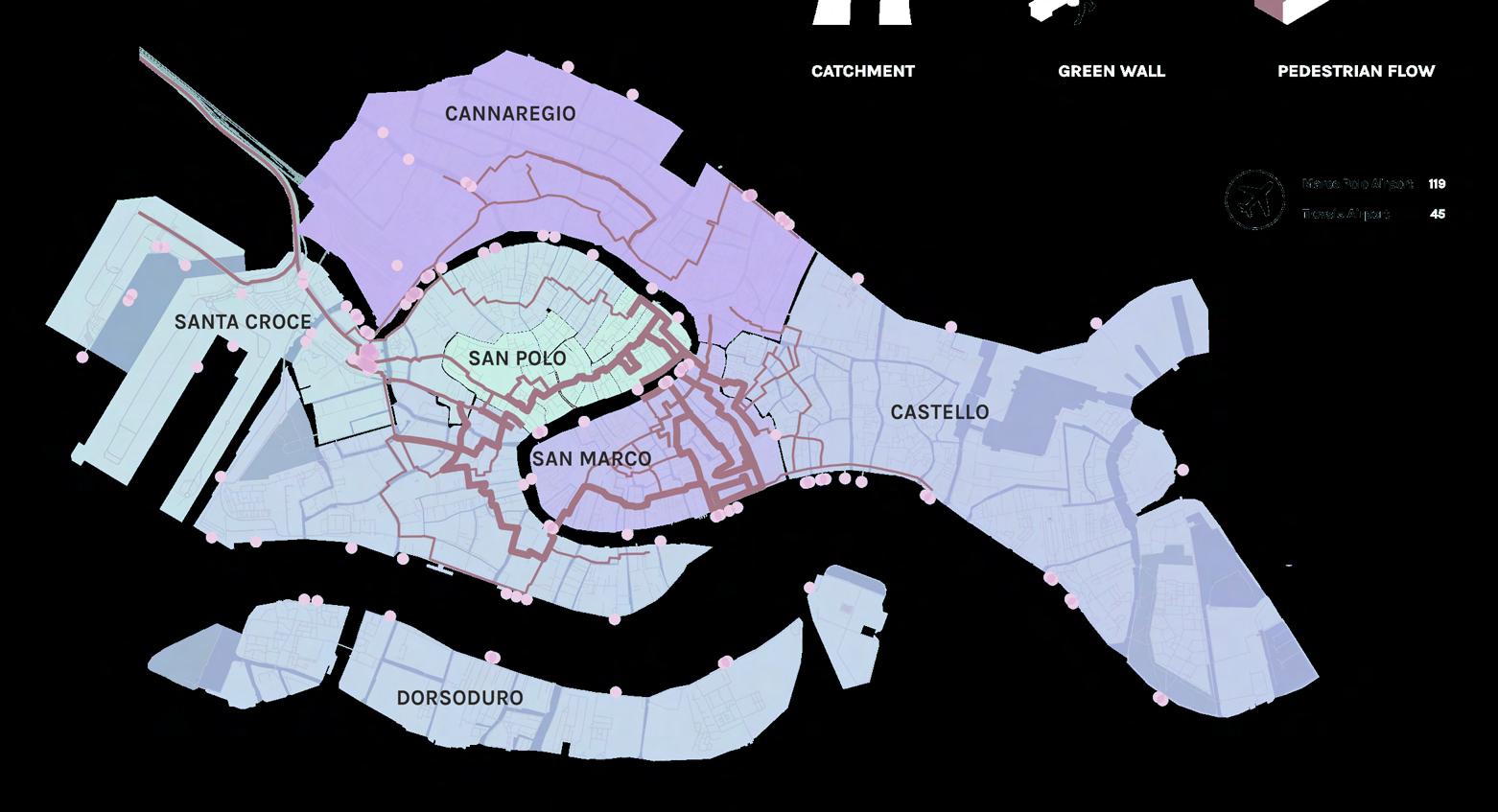


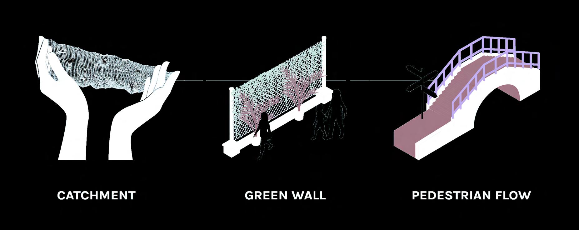
This map analyzes all the vaporetto stops in pink dots, the density of Airbnbs per neighborhood, and the most congested streets in the city highlighted by the reddish lines. These attributes add to the issue of littering, noise pollution, and air pollution. Three mitigation proposals that could help the city of Venice are a series of garbage catchment installations underneath bridges with high pedestrian traffic.
The Venice Biennale has used statues of hands as expressive pieces and since that design language is already part of the identity of the city having these catchments with hands holding nets will provoke a sense of urgency in acknowledging the climate crisis. The second one is to install green walls along the waterfront of high vaporetto traffic to screen off air pollution of pedestrians and people eating at restaurants. The third one is to encourage the construction of more bridges to increase pedestrian flow in highly congested areas to encourage people to walk instead of taking the vaporetto, along with better signage since a lot of the streets are difficult to navigate.
A SEQUOIA’S SECOND LIFE
PROJECT TYPE: ACADEMIC (CAL POLY POMONA)
PROGRAM: GARDEN / ART INSTALLATION
COURSE: DESIGN I (THE INDIVIDUAL SELF)
TIME: FALL 2021
ROLE: INDIVIDUAL
The objective of this project was to develop design goals in line with my personal values from a landscape of my choosing no larger than 10,000 square feet.
The garden of my dreams is located on the Cold Springs Campgrounds nestled in Sequoia National Park. The first time I visited this site was when my parents took me camping when I was 6 months old. To their recollection, I wasn’t having fun until they let me play along the river and it’s as if I was a new child apparently. Their retelling of this trip has in a way recreated this lost memory into a joyful and surreal moment in my early childhood. Since then I have visited the national park twice, back in 2017 which finally gave me a concrete experience of the gentle giant sequoias and having a great time hiking through the forest. The last time was 2020, and this trip brought in a mix of emotions and concern of the over looming fire that was happening, and air quality advisories. These experiences begin to layer on top of one another, but I can’t deny the reality that the national park
STUDY MODELS
The process began with a series of three models (Built form, Landform, Life form) and drawings to explore the principles and strategies of defining outdoor spaces. The parameters of this exercise were that each abstract space had to fit into a 100’ x 100’ area, contain a small space (1-3 people), medium space (5-7 people), and large space (~20 people).

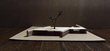
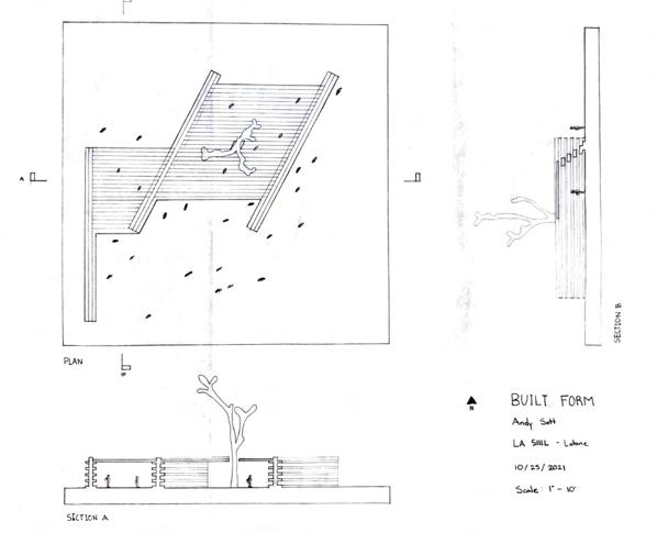
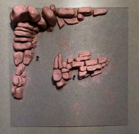
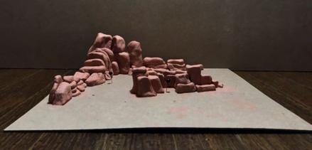
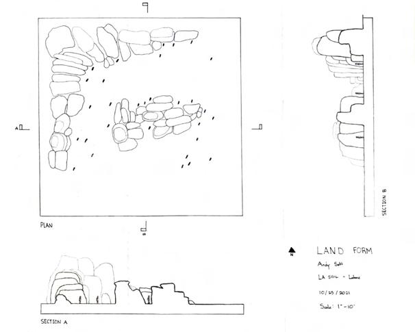
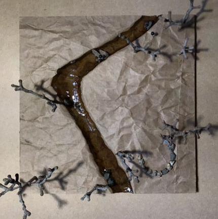
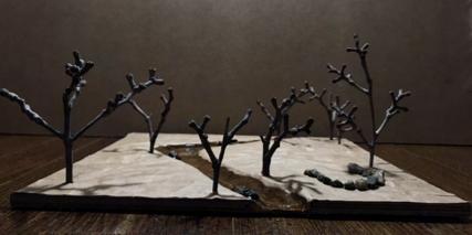
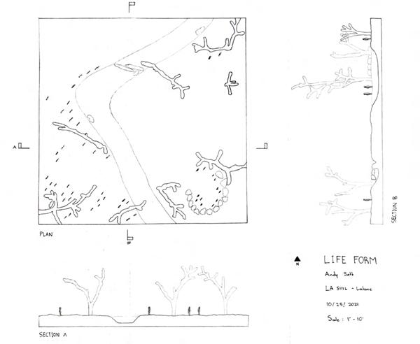
This site analysis zones in on the wildfires that have taken place since 2017, with the current KNP Complex fire burning over 88 thousand acres. Fires are necessary for the Sequoias to release their seeds in these dry conditions and at the same time to burn off woody debris and expose the soil. These cultural fires were conducted regularly by Native American peoples for thousands of years, but with the transition of fire suppression and climate change, we are seeing unprecedented wildfires that are out of control. Climate change is daunting and oftentimes very intangible, and even the graphic of the wildfires is oversimplified. With the garden of my dreams, I want to layer my experiences along with the harsh realities.

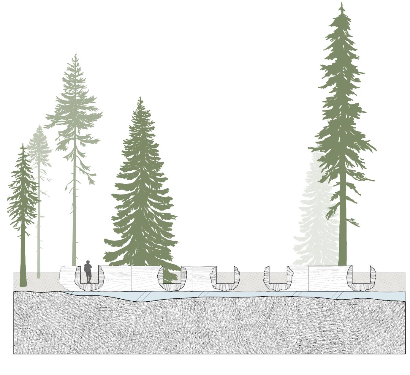

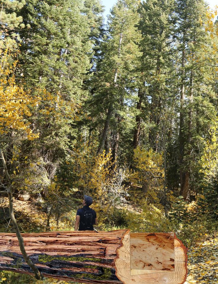
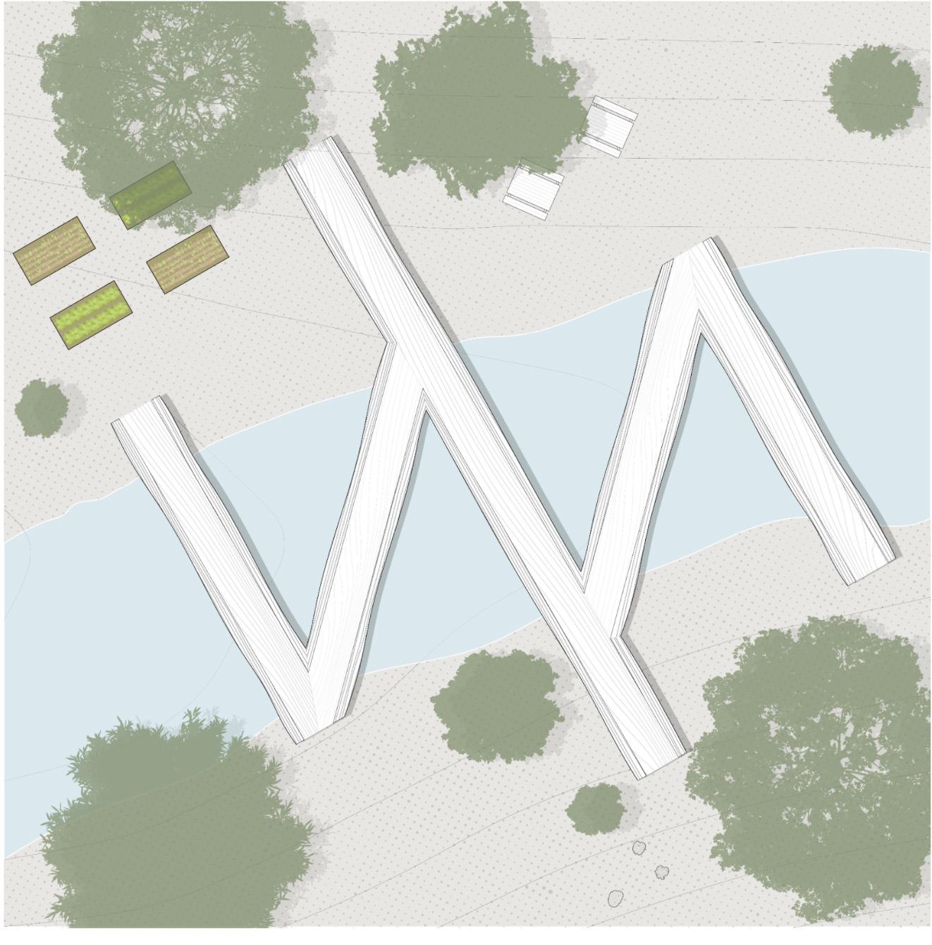
The character of the garden takes the form of an installation garden/ structure taking the reality of the burnt sequoias that remain from these fires and using them to make a series of bridges that go back and forth the riverbank, and keeping a dream of hope and rebirth. Making a beautiful space from a devastating event. These Sequoias clearly show their scars in an unapologetic manner, but slowly vegetation like moss and ferns start to grow on the burnt surfaces. They’re given a new life in a way to give a new experience to people who camp here.
In plan view we see the 5 sequoias each from a different fire, joint together making a shape of a stitch that gives a symbolic emphasis to healing and providing 3 points of entry on either side of the riverbank. In Section, They all peek out through the hallowed u shape to frame what is up ahead. To respect the Kumeyaay that inhabited this region I propose these 5 sequoias be named after indigenous leaders and advocates just like other famous sequoias are named.

BOLSA CHICA RESTORATION
PROJECT TYPE: ACADEMIC (CAL POLY POMONA)
PROGRAM: WETLAND RESTORATION
COURSE: DESIGN II (PUBLIC COMMUNITY DESIGN)
TIME: SPRING 2022
ROLE: DOCUMENT MANAGER (TEAM)
History goes as far back as 9000 years ago with Native American tribes known as the Tongva and the Acjachemen. They thrived off the land using it resources to create huts known as wigwams, utilizing reed and grass, they were also particularly skilled at creating canoes for fishing and travelling. Much of their history has been erased by colonization so not a lot is known about them with the exception of a few archeological preservations, the most interesting being the cog stone which can only be found in coastal southern California and is what inspired our design for our wetlands cultural center.
The bolsa chica wetlands depict the contrasting impacts that humans have on our natural world. How we can be devastatingly harmful, because of our desire to exert control over the environment, yet at the same time, our ability to invoke positive change is extraordinarily crucial for our existing ecosystems. This positive and negative contrast can be seen in the remnants of what were once extensive marshlands that played home to a diverse
PROCESS DRAWINGS
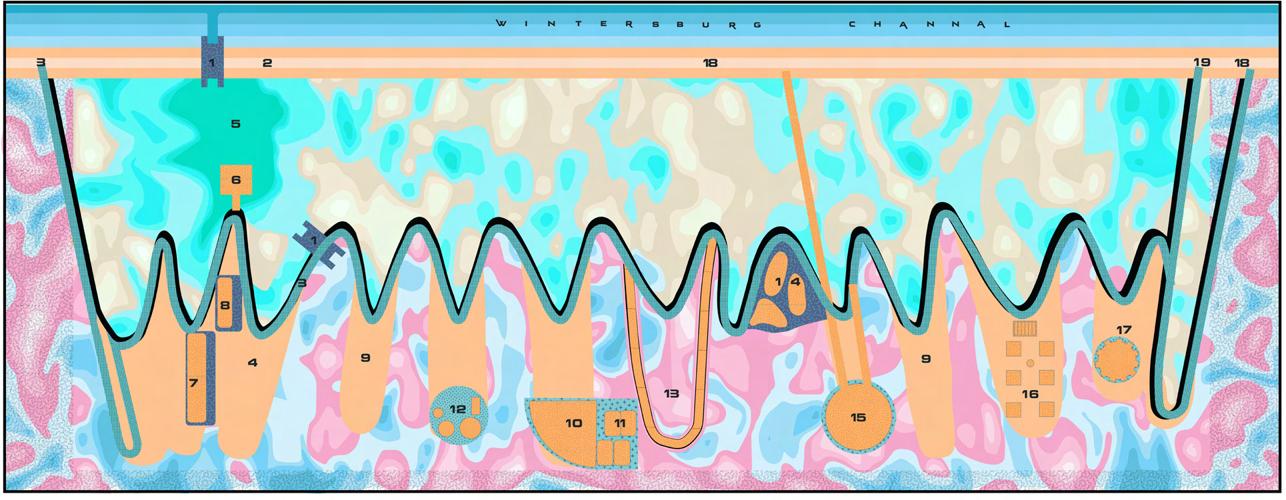
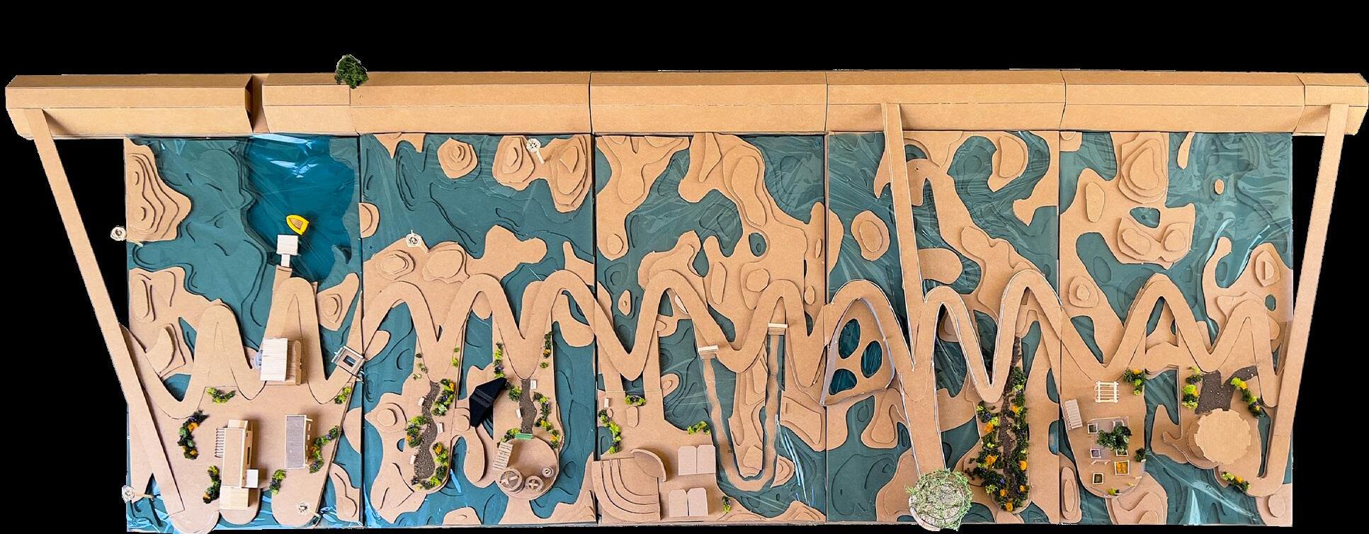
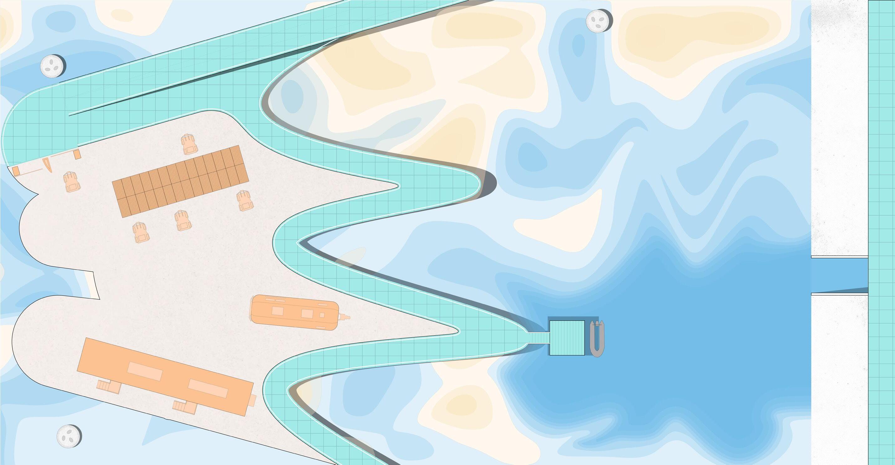
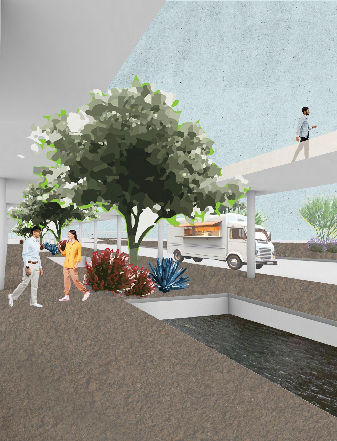
Much of the degradation occurred from oil drilling in the 1940s which led to the construction of raised service roads on the wetlands to allow access to oil wells that are scattered throughout the lowlands. In our design rather than having to excavate all of these roads we used the paths to our advantage to create a rehabilitation area for the wetland as well as to act as a path of travel for guests.
In 1973,1,200 acers of the area were designated for restoration, although major restoration projects did not occur till 1997. Some of the restoration projects included removal and clean-up of oil extraction facilities, creation of nesting and feeding islands for threatened and endangered species, and the creation of a tidal basin and bridge to name a few.
SCHEMATIC DESIGN
LEGEND
1. TIDEGATE INFLOW
2. BERM
3. STAFF ENTRANCE
4. PARKING STRUCTURE
5. BROWN FIELD EXCAVATION
6. DOCK
7. LRC / GIS BUILDING
8. AIRSTREAM
9. PLANT RESTORATION
10. AMPITHEATER
11. PUBLIC RESTROOMS
12. BIRD REHAB CENTER
13. WALK ON WATER EXHIBIT
14. PINNAPED REHAB CENTER
15. SHADED OVERLOOK
16. PLANT NURSERY
17. CULTURAL EDUCATION CENTER
18. ADA ENTRANCE RAMO
19. ENTRANCE STAIRS
SEAWALL BOARDWALK
STAFF AREA
OFF SITE AREA OF INTEREST
REHAB ZONES
For the other half our site we took on the challenge of rewilding which differs from restoration. Restoration programs require long-term financial commitment, compared to rewilding projects that aim for little ongoing intervention. So the intent behind this is to have a full return to nature in order to see the contrast between the two rehabilitation practices as well as physically showing the acknowledgement of human impacts in the wetlands.

PARQUE EN LA CARRETERA
PROJECT TYPE: DESIGN COMPETITION
PROGRAM: REVITALIZATION / URBAN DESIGN
ENTITY: SOCIEDAD DE ARQUITECTOS PAISAJISTAS DE MEXICO
TIME: SUMMER 2023
ROLE: CREATIVE LEAD (TEAM)
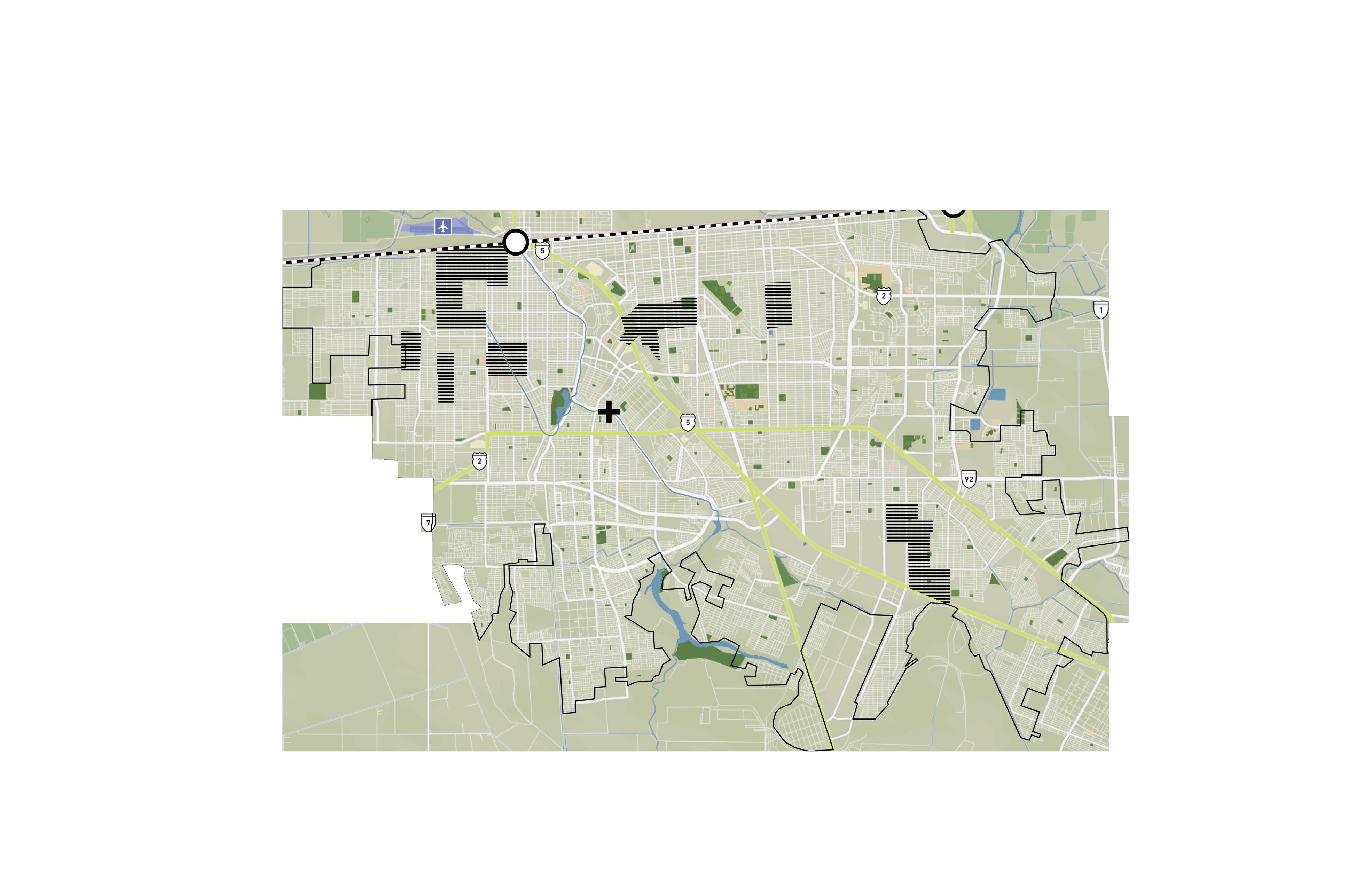
This map zones in on current conditions in Mexicali that affect the proposed site. The two highways in Mexicali are in close proximity to which flow into one of the major roads that the site is on. The site is also positioned not even three miles from the West port of entry in and out of the United States. The most interesting discovery in our research was that directly under the site lies a channelized part of the Rio Nuevo, which flows north into the Salton Sea. Along with that are areas mapped with potential flood zones in the city.
This design solution aims to create cohesion and connectedness in the city of Mexicali. Physical connections on the site occur with a system of bridges that connect the 3 areas along the street and into 4 auxiliary streets into the surrounding neighborhood to create safe pedestrian circulation and moments of escape from the heat. Through a revelatory process, the canalized river will be exposed and revitalized to the public to be better utilized for moments of refuge from the extreme heat and plant irrigation.

CURRENT SITE CONDITIONS IN MEXICALI, MÉXICO
LEGEND
PORTS OF ENTRY
FLOOD ZONES
INTERNATIONAL BORDER
SITE
AIRPORTS
HIGHWAYS
RIVERS / WATERWAYS ROADS
MEXICALI LAND
RECREATIONAL AREAS

POLLUTION PAST BORDERS
PROJECT TYPE: DESIGN WORKSHOP (AA VISITING SCHOOL)
PROGRAM: URBAN DESIGN
COURSE: TRANSBORDER LANDSCAPES
TIME: SUMMER 2022
ROLE: PARTNER (TEAM)
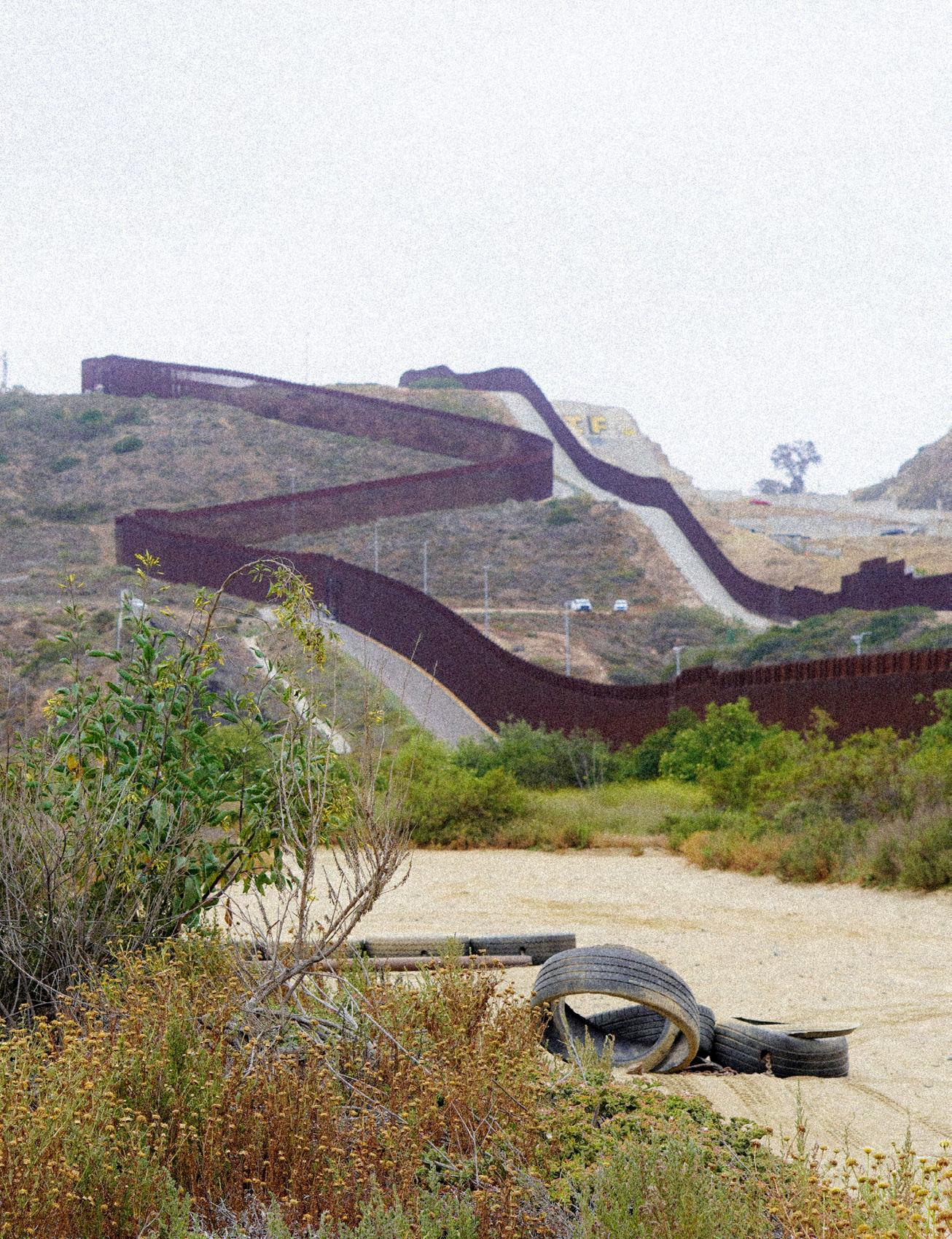
Transborder Landscapes examines the Tijuana River juxtaposed between US and Mexico. San Diego and Tijuana face contrasting economies, cultures, and policies, despite the shared landscape. This dual governance led to the demise of the river landscape because of largely opposing agendas between the two nations. This course looked at the geomorphological process of the region and the methods in which each country manages the river.
San Diego and Tijuana carry a symbiotic relationship where one city fulfills the needs of the other and vice versa, resulting in a beautiful exchange of cultures. Yet as humans we tend to create these borders where an exchange is yearning to be met; one dividing nations and the other dividing man from nature. As a point of departure acknowledging the section of the Tijuana river that is channelized is the man/nature border where it allows pollution and harmful contaminants to seep into the waterway leading into the wetlands of the coast. The need to dismantle that border is there.
SAN DIEGO - TIJUANA BORDER MAP
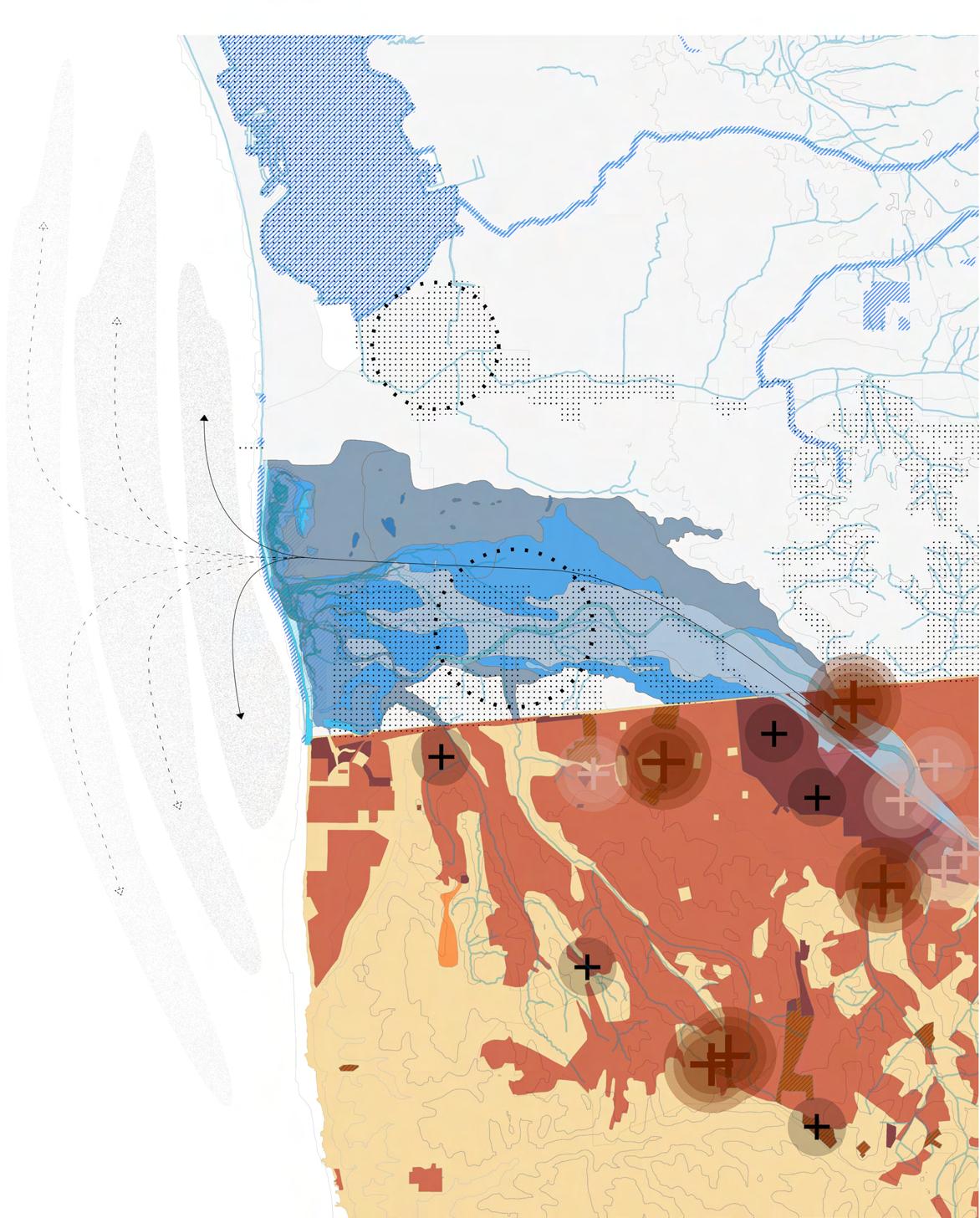
In comparison on the San Diego region, we focused on the environmental conditions of the unique land- scape that Rio Tijuana has created as the river flows out of Imperial Beach in San Diego. We used GIS data to demonstrate environmentally sensitive areas, which consists of areas where endangered species, wildlife, and incorporate areas of biological significance that is established on the Clean Water Act. The different shades of blue display the range of historical habitats. The wide range of ecological diversity within the Rio Tijuana are examples of the urgency to continually support healthy practice to protect the life that the river brings.
LEGEND
HIGH MARSH TRANSITION ZONE
BEACH
DUNE
GRASSLAND
MUDFLAT / SANDFLAT
FRESHWATER WETLAND
POND
RIVER CHANNEL
RIPARIAN SCRUB
OPEN WATER
SALT MARSH
SUBTIDAL WATER
HIGH MARSH TRANSITION ZONE
SENSITIVE AREAS
FLOWLINES
DISPERSED RESIDENTIAL
RESIDENTIAL
COMMERCIAL
INDUSTRIAL
FABRICAS
MAQUILADORAS
MANIFACTURAS
ECOLOGICAL SIGNIFICANCE

INDUSTRIAL BYPRODUCT
SAN DIEGO
THE ARCHITECT’S HANDBOOK
PROJECT TYPE: ACADEMIC (UCLA)
DELIVERABLE: PRINTED MEDIA
COURSE: DESIGN FOR ARCHITECTURAL REPRESENTATION
TIME: WINTER 2019
ROLE: INDIVIDUAL

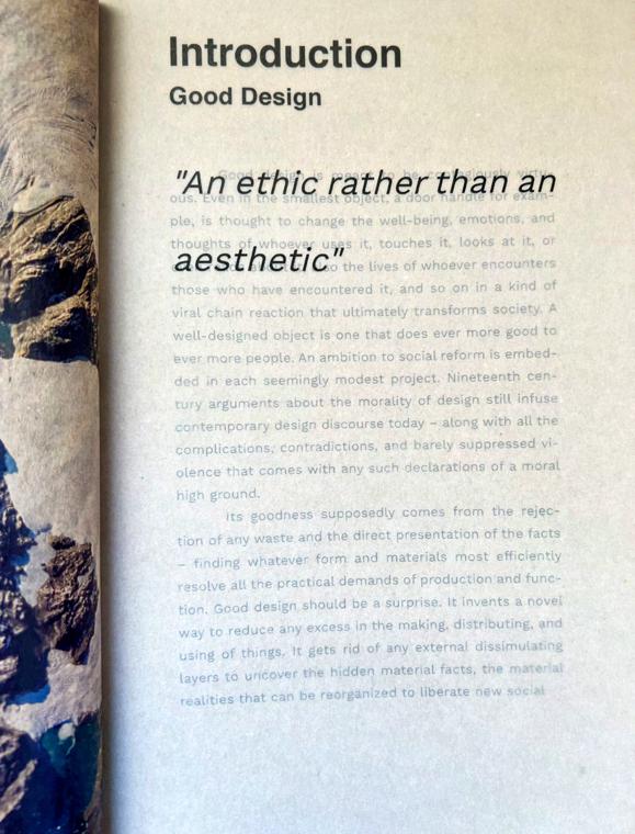
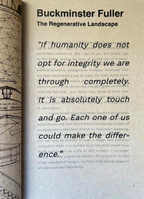
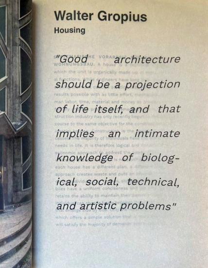
This printed matter takes selection, structure, composition, and design as the basis for successful communication. In conjunction understanding the process of editing as a premise for successful design and visual communication.
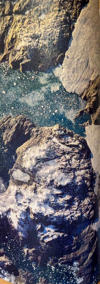

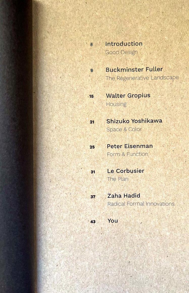
This printed matter takes the medium of a journal/book hybrid comprised of excerpts and main ideas from the book "Are We Human?" by Beatriz Colomina & Mark Wigley, specifically from chapter 7 "Design as an Anesthetic" with images promoting and driving these ideas, and white space. This white space is used to enable the immediacy of the sketch, which is the embodiment of an idea or concept in its purest form. Most designs that are intrinsically good retain features from their conception and this is the driver that will be carried out through this journal/book hybrid printed matter. The target audience will be both architects, landscape architects, and graphic designers or those studying in a related field since the processes are similar in nature and collaboration between designers is inevitable and vital.
