1 minute read
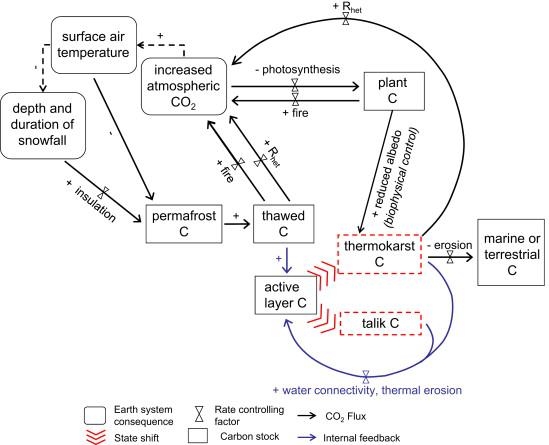
Permafrost geohazards


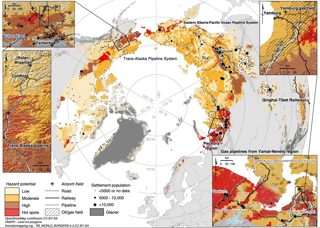
Pan-Arctic infrastructure hazard map with close-ups from central Alaska and northwestern parts of the Russian Arctic. A consensus of three geohazard indices (settlement index, risk zonation index, and analytic hierarchy process-based index) showing hazard potential by risk level (low–high) for infrastructure damage by the middle of the century (2041–2060). Hot spots indicate areas where all three indices showed high potential for infrastructure damage.
Advertisement
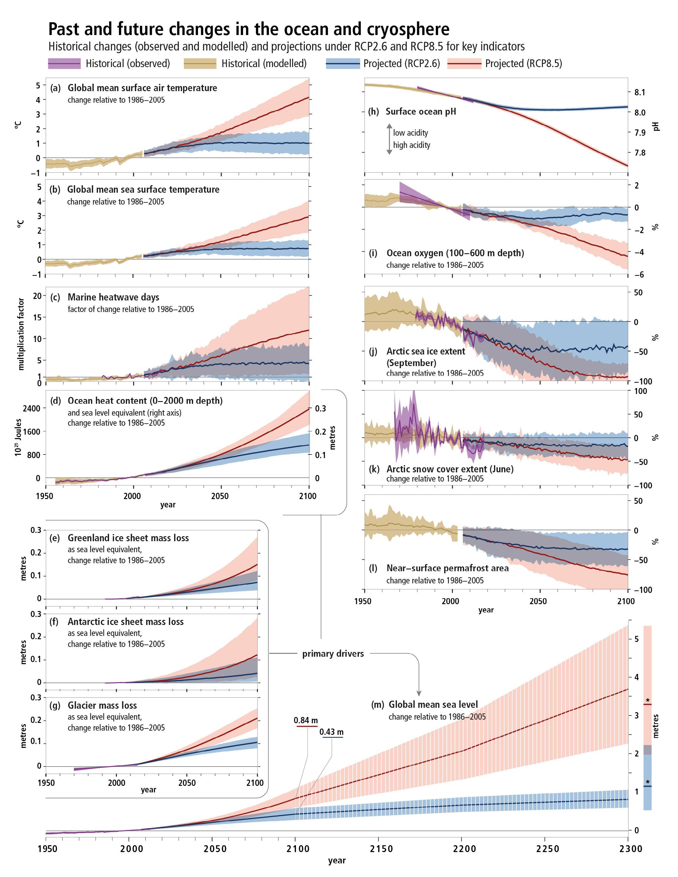
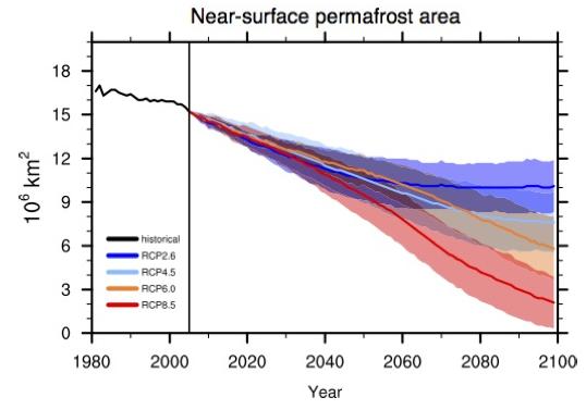
CMIP5 modelled future permafrost area in the Northern Hemisphere. Black line indicates historical data, coloured lines indicate predicted areas based on different Representative Concentration Pathways(RCPs); shaded regions show uncertainty (IPCC, 2013).