3 minute read
Gas blowout craters


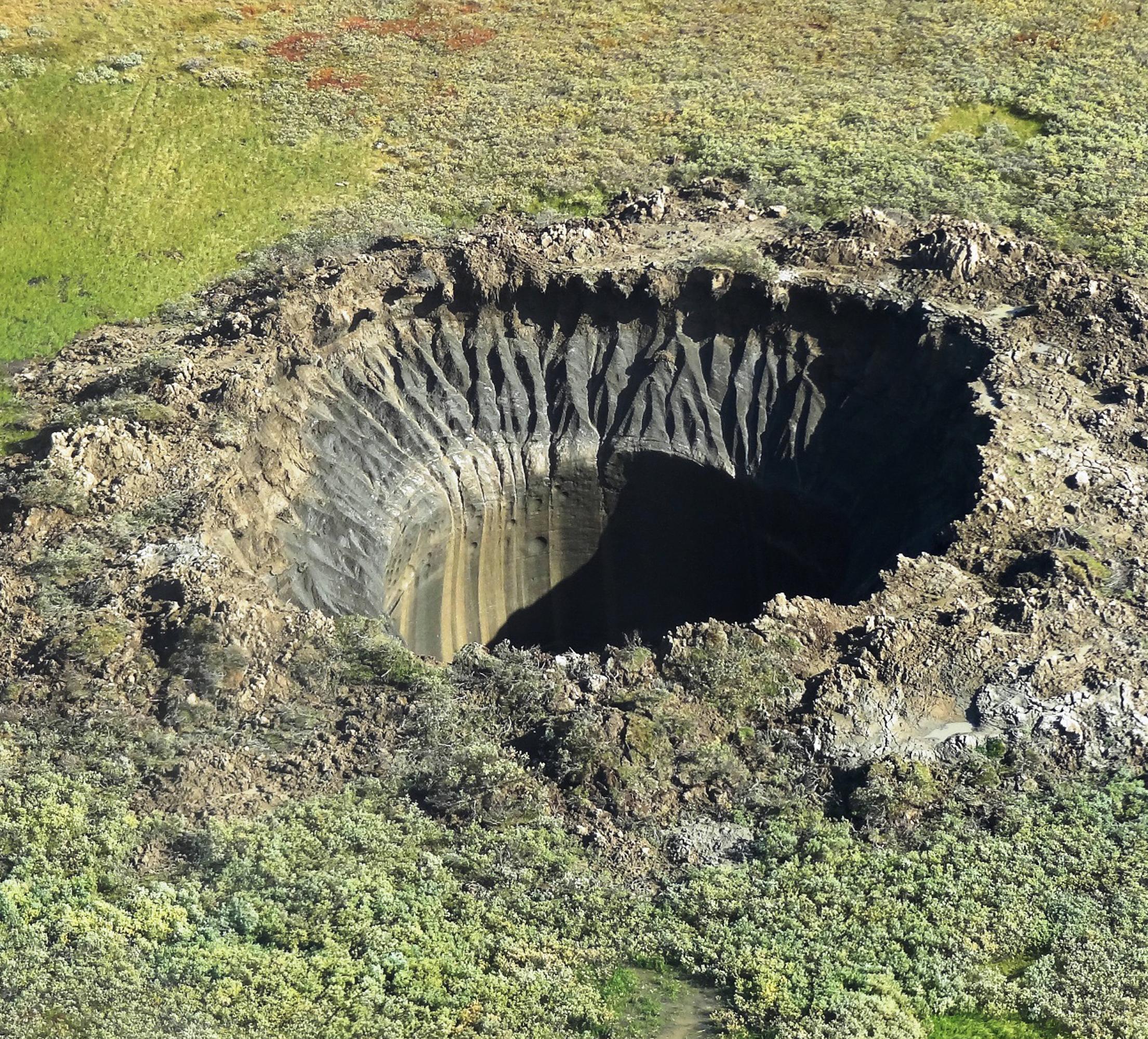
crater C16, Yamal Peninsula, 2019
The first photo of the C17 crater from the helicopter taken by Andrey Umnikov on 16 July 2020. According to the permafrost-parametric drilling data to a depth of 350–550 m, carried out during the period 1991–1997 by the permafrost engineering company “KRIOS”, crater C17 is located in the area of continuous permafrost distribution within the third marine terrace with specific tundra moss and shrub vegetation. This terrace consists of Upper Pleistocene fairly homogeneous clay deposits (mIII2-3) up to 30 m thick. Clay deposits are characterized by a fairly high gravitational moisture content of 40–80% and more for highly icy layers. The content of organic material in clay deposits is 7–9%. These deposits are saline clay. Their total salinity mainly varies from 0.7 to 1.8%. The minimum salinity values (up to 0.2–0.3) are confined to the ground ice layers. The high salinity of the clay soil of the third marine terrace determines a significant content of unfrozen water up to 15–20 wt.%. The freezing point of investigated clay depends on soil salinity and can reach 2.5 C. In the lower part of these deposits, formation ice is widely represented. As a rule, it is not saline. They are mainly underlain by sandy and sandy loam marine sediments of the Upper Pleistocene (mIII1). From a depth of about 70 m, sandy and sandy-loam deposits of the Yamal Series (mI-II1-2) occur, and at a depth of about 200 m, they come into contact with clayey deposits of the Paleogene (mP1-2). The study area is characterized by a high gas saturation in the upper part of the permafrost. In the works by the LLC “KRIOS”, it was proven that “... in some areas the frozen strata has a two- and, possibly, three-layer structure” separated by permeable salt water layers—cryopegs. In some areas, the frozen stratum is heterogeneous, has a different lithological composition and salinity and therefore, it can contain extended horizons of cooled sediments with cryopegs. This pattern is also found in other land and water areas of the Russian Arctic. This creates additional possibilities for the sub-horizontal migration of fluids (water and gas), some of which come out to the ground surface and into the atmosphere through numerous taliks that exist below thermokarst lakes and large rivers. During the drilling of many wells, gas was released from the upper permafrost horizons (in the intervals of 20–130 m) with a flow rate of hundreds and even thousands of cubic meters per day, and in some cases, the flow rates reached 10,000–14,000 m3/ day. The longest gas emission was observed from the 72–80 m interval with a reservoir pressure of 8 atm in the well No. 64 in the southern part of the Bovanenkovo field—the flare was burning for 550 days. For the first 30 days, the gas flow rate varied from 3000 m3/day to a stable 500 m3/day. In total, about 300,000 m3 of gas burned out in this flare. Reservoir pressures in permafrost gas reservoirs were usually below hydrostatic; only at five sites they exceeded it by 3–14%. The composition of the gas was mostly methane (74.8–99.8%).
Advertisement
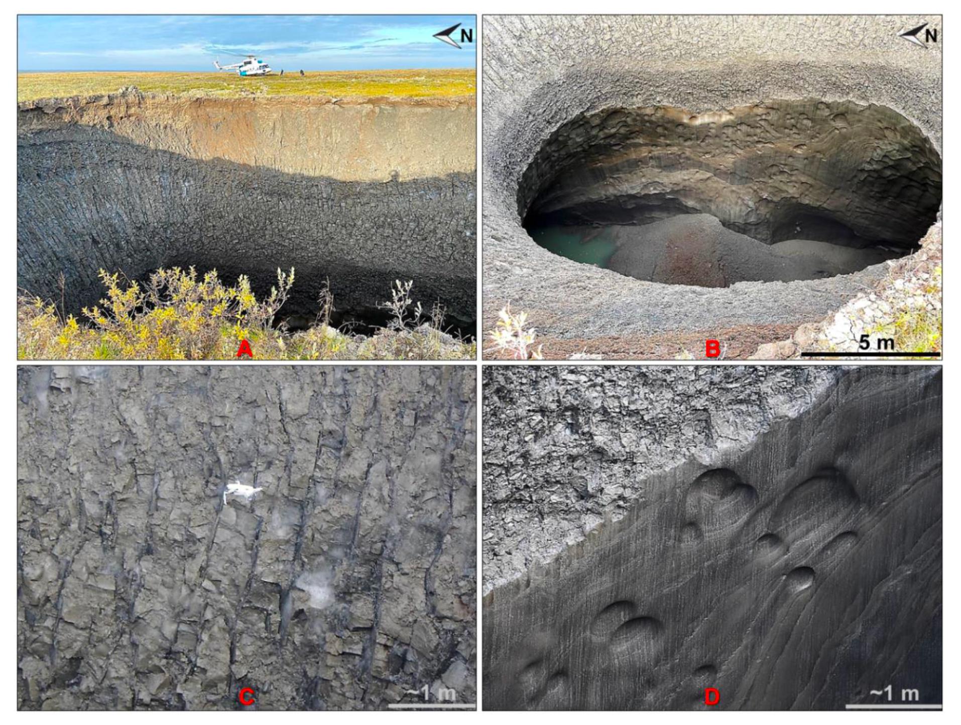
Features of the structure of the crater walls (photos by Vasily Bogoyavlensky (A,B), Roman Nikonov (C) and Evgeny Chuvilin (D), 26 August 2020).
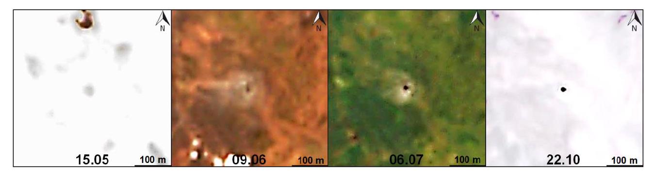
Images of the C17 object from Sentinel-2A (9 June and 6 July) and Sentinel-2B (15 May, 22 October) satellites in 2020.
Remote sensing data

Aerial photographs of the C17 crater from the height of 50 m above sea level (A), its northern (B) and southern (C) grottoes from inside the crater (photo from unmanned aerial vehicle (UAV) taken by certified external pilot Igor Bogoyavlensky, 26 August 2020).
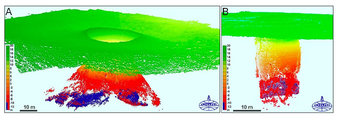
Yamal gas blowout crater C17: 3D model of the ground surface and underground cavity in two orthogonal directions (A,B) according to aerial photography from UAV (field data of August 26, 2020).