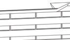
Charleston AIA, Parklet Design Competition, Student HONOR Award Winner 2021
Designing Our History: An International Ideas Competition, HONOR Award Winner 2021
SOFTWARE
SKILLS
Mapping + Data Analysis
ArcGIS | QGIS
geothinQ | Urban Footprints
Drafting AutoCAD
Modeling Sketchup
Visualization V-Ray |
Twinmotion
Post Production
Adobe Photoshop | Adobe
Illustrator | Adobe InDesign
WORK EXPERIENCE
Hydrologist and Environmental Designer
(256) 415-0125
amyquyen21@gmail.com /in/amyquyennguyen/
Robinson Design Engineers | Charleston, South Carolina | Aug ‘21 — Present
• Spearheaded the design and organization of the Nature-Based Exchange Compendium done in collaboration with The Nature Conservancy, local private firms, Clemson University, and the City of Charleston
• Designed educational signage for Laurel Green Park for visitors to understand the restoration project methodology, different processes occurring at the site, as well as the added benefits of utilizing nature-based solutions
• Led social, physical, and ecological research and spatial analysis for project sites across the state of South Carolina and Western North Carolina
• Produced educational communication tools for multiple HOA/POA community meetings including but not limited to schematic plans, sections, and renderings
• Generated tidal flood studies and map exhibits to assist clients in understanding the hydrological system of their project site
Riley Mayors’ Design Fellowship Intern
The Riley Center for Livable Communities | Charleston, South Carolina | Dec ‘20 — Aug ‘21
• Designed plans and 3D perspectives, in collaboration with the City of Inman, to be presented at the South Carolina Riley Mayor’s conference
• Engaged in community participatory processes to define community goals surrounding downtown Inman’s revitalization efforts
• Compiled and edited 15 South Carolina city reports for the 2019 & 2021 Briefing Books
• Arranged post-conference Proceedings Report to be sent out to all participating mayors
Keeping History Above Water Intern
The Newport Restoration Foundation | Charleston, South Carolina | Apr ‘21 — Aug ‘21
• Designed maps and supplementary graphics for the conference’s 2021 program book
• Prepared event documents and materials including agendas, posters, name tags
VOLUNTEER WORK
Director of Collegiate Programming
Delta Phi Lambda Sorority, Inc. | Athens, Georgia | Jun ‘20 — Jun ‘21
• Coordinated national initiatives, programs and services for collegiate members
• Spearheaded program changes of National Operations and Policies through community workshops and participatory processes to better align with organization values
• Maintained and evaluated 21 chapter’s Chapter Excellence Program and Chapter Good Standing Reports
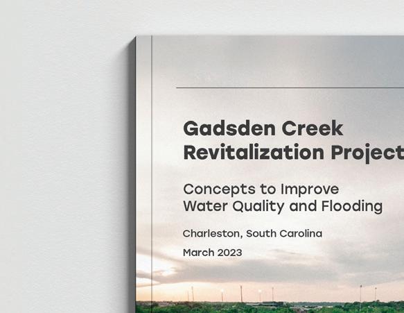
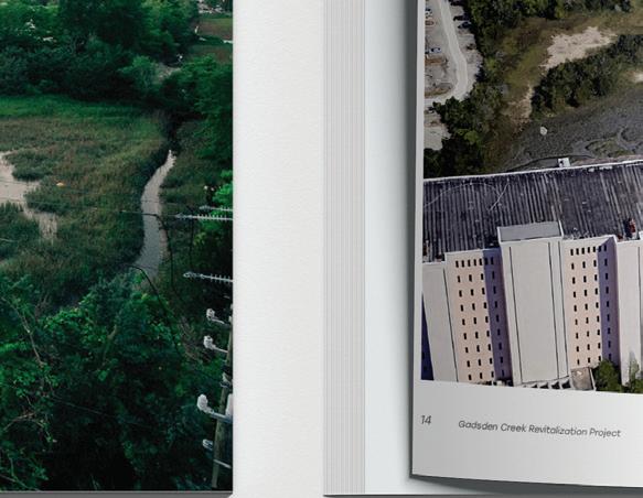
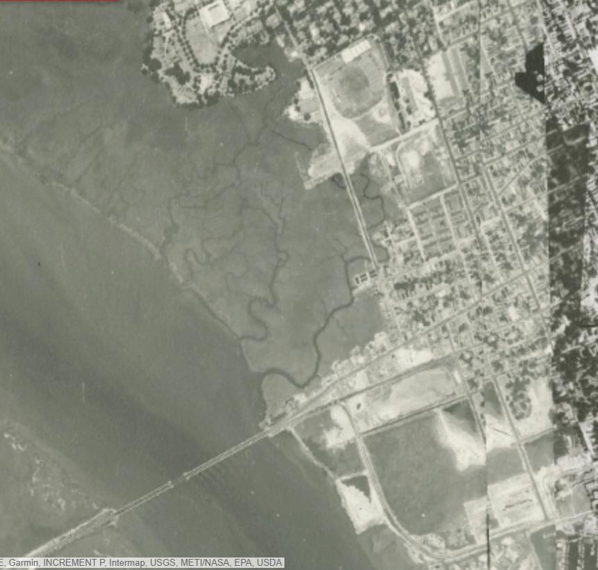
GADSDEN CREEK
REVITALIZATION PROJECT
Location: Charleston, SC
Study Duration: 2021-Present
Collaborators:
Emma Collins, MS
Philip Ellis, PE
Chris Grose, EIT
Amy Nguyen, MRUD
Joshua Robinson, PE
Nolan Williams, PE
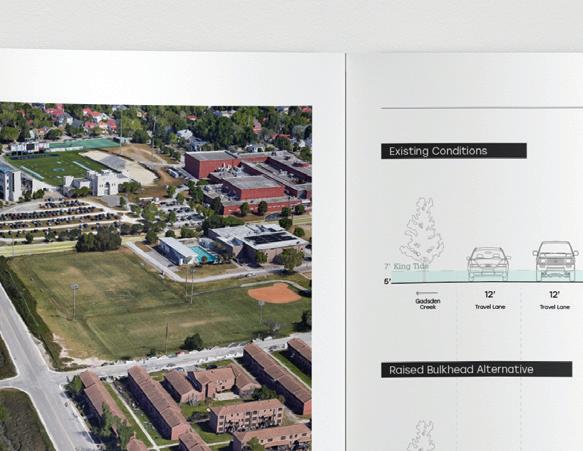
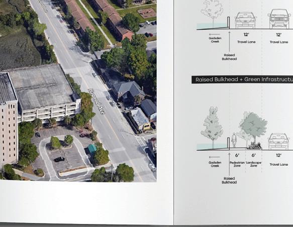
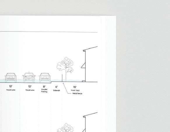
The Charleston community is contemplating the future of Gadsden Creek. While cities around the world are working to clean up polluted waterways and resurrect buried streams, Charleston is considering paving over one of its last remaining urban tidal creeks to make way for new parking garages and condos.
This report serves two purposes:
(1) provide an educational resource to help community members, stakeholders, and beyond understand the historic, present, and potential future conditions of the Westside as it pertains to stormwater flooding, sunny-day flooding, storm surge and water quality concerns
(2) memorialize a collective effort from the community and document suggestions as described from various federal agencies and city sponsored studies.
Personal contributions to this report include spearheading the creation and organization of the document, GIS mapping, researching of historical and present conditions, illustrating alternative concepts, and flood modeling.
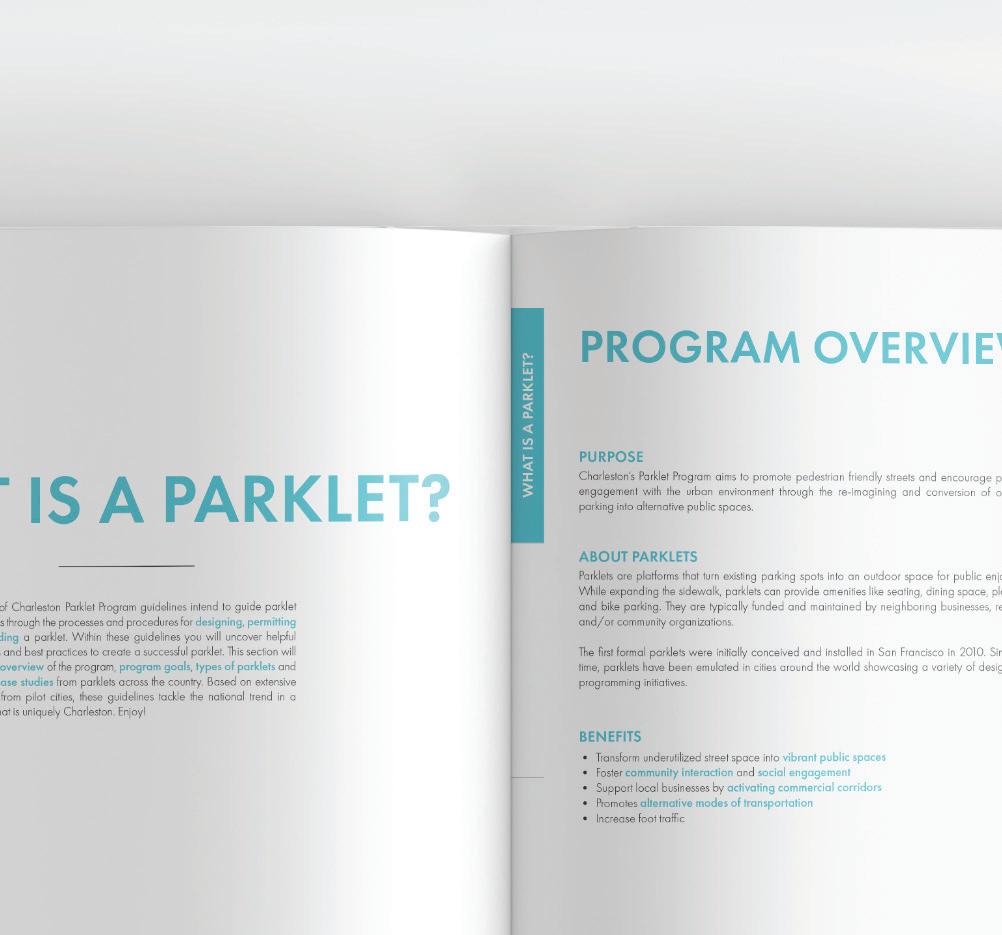
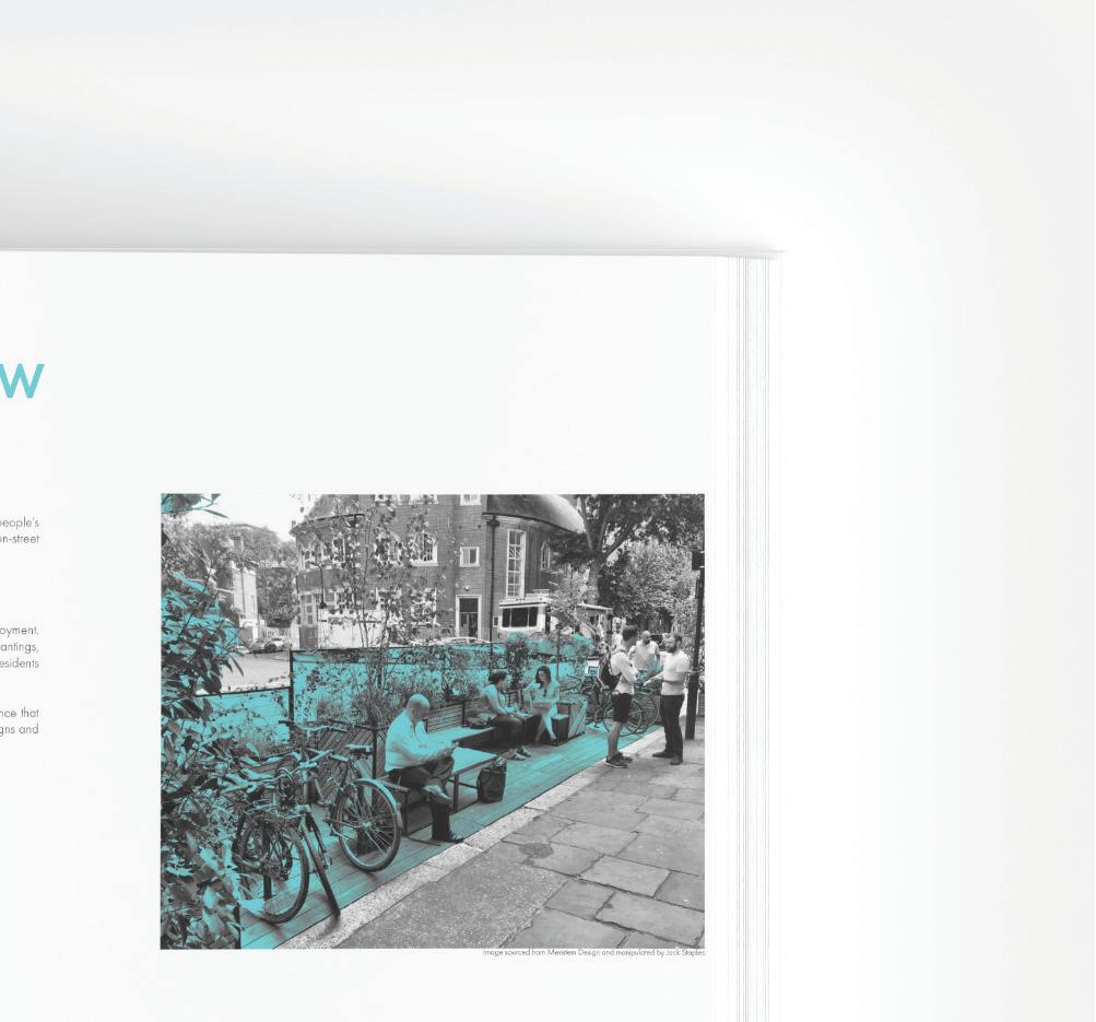
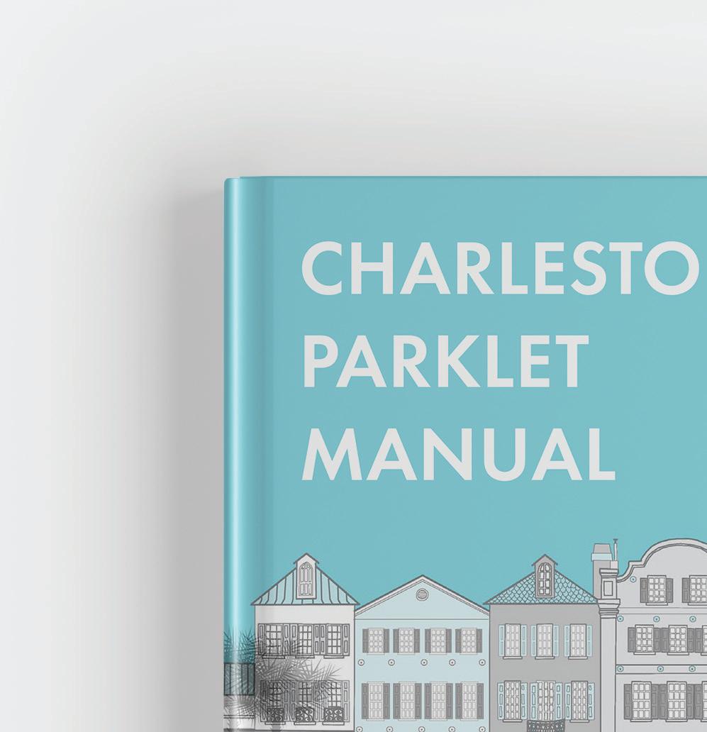
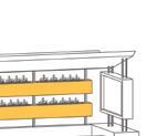
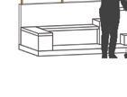
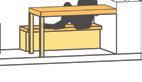
CHARLESTON PARKLETS
Graduate Urban Design Studio, Fall 2020
Mentor:
B.D. WorthamGalvin
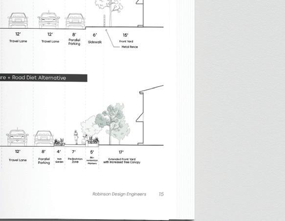
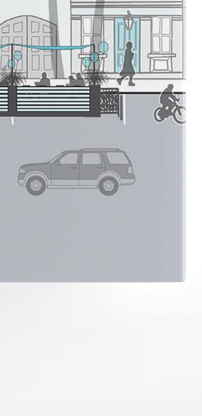
Parklets are created and placed as a sidewalk extension, usually in place of a former roadside parking space. They are small seating areas or can serve a variety of programming initiatives. Originated in San Francisco in 2005 as a formalization of tactical urbanism. Many cities soon after adopted a parklet program to support alternative and unique outdoor space experiences as well as reclaim the public right of way. Small-scale design interventions and new forms of public spaces are needed to be explored in the City of Charleston more than ever now with a worldwide pandemic altering demands of the public realm.
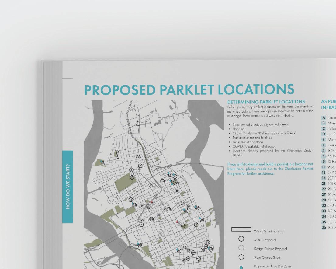
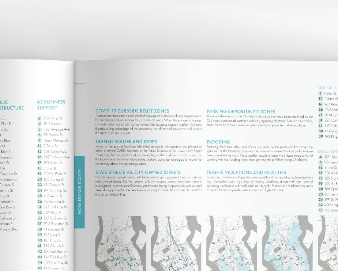
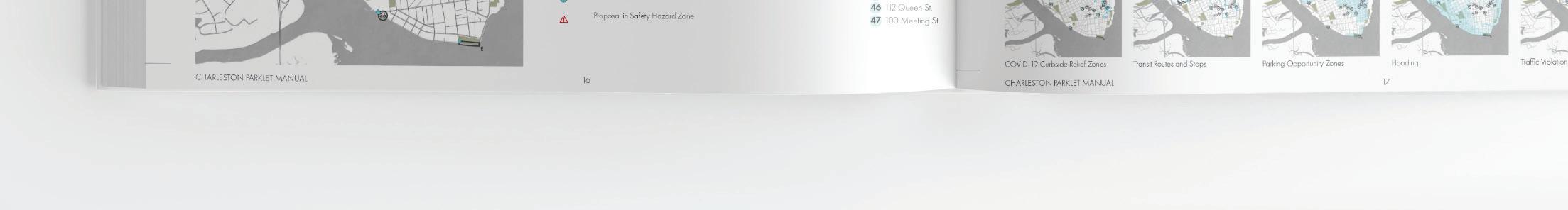
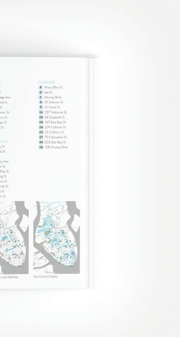
The studio objectives include (1) producing a set of parklet design guidelines for the City of Charleston and (2) produce three parklet designs that is programmed to address the context of the area chosen. The production of the Charleston Parklet Manual was a collaborative process and included broad analysis of Downtown Charleston’s physical, cultural, environmental context, precedent of parklet programs in other cities and community engagement processes. Parklet designs were produced individually with location and programming left up to the student.
In this manual, guidelines were produced by the studio for the City of Charleston to facilitate the efforts of implementing a new parklet program. Personal contribution includes crafting the program goals, site analysis, map creations, creation of a case studies section as well as a parklet impact study page and its contents.
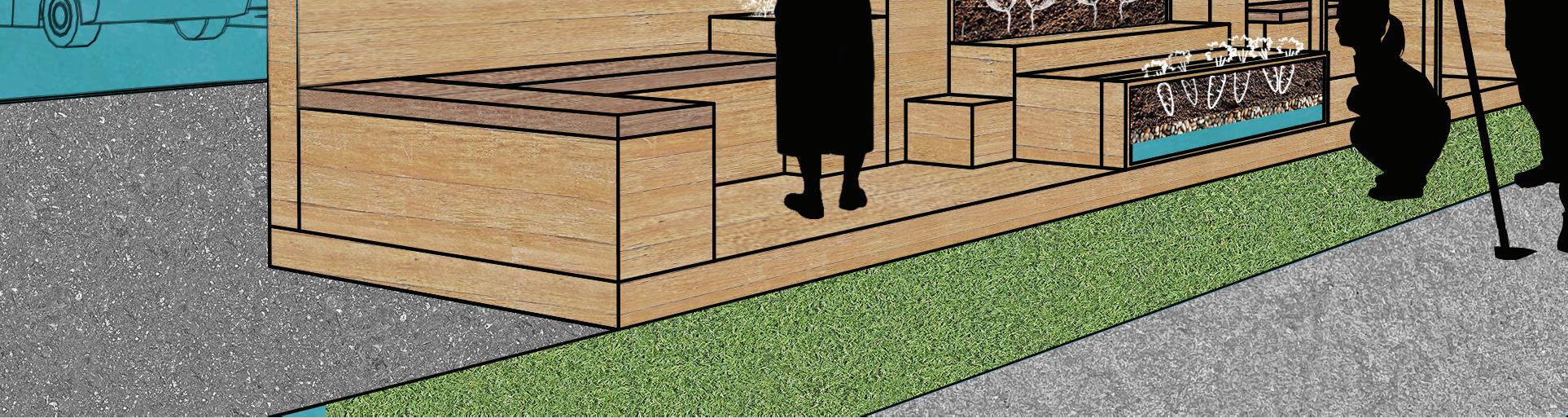
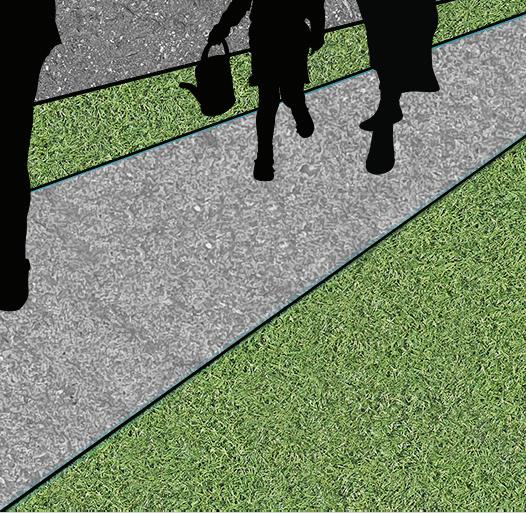
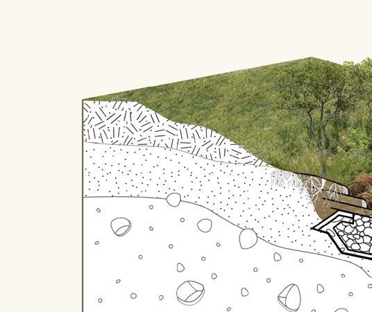
EDUCATIONAL SIGNAGE
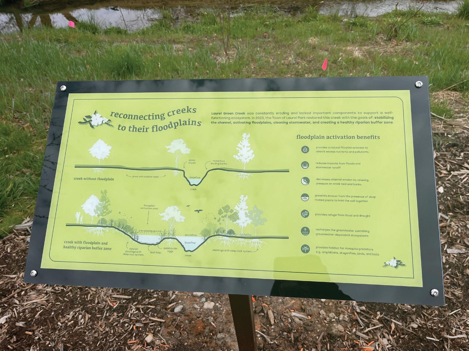
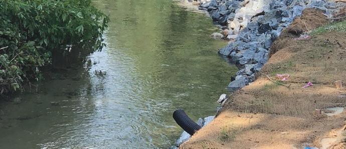
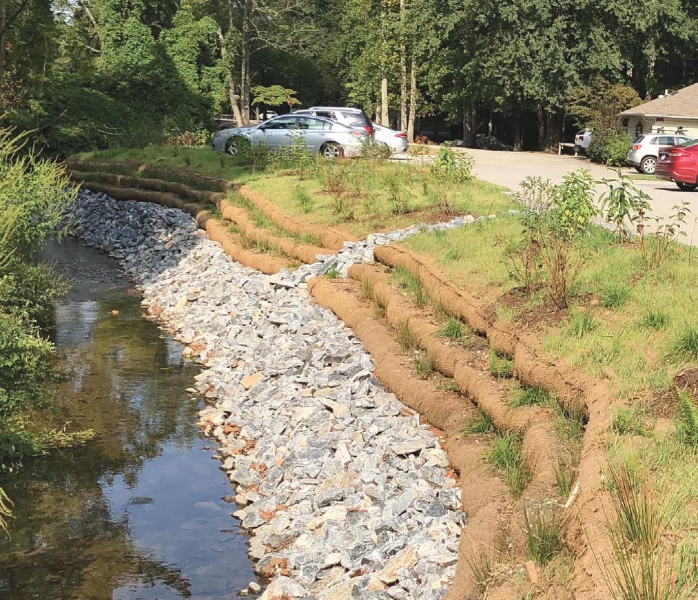
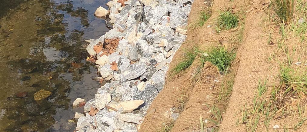
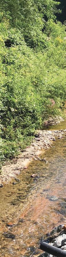
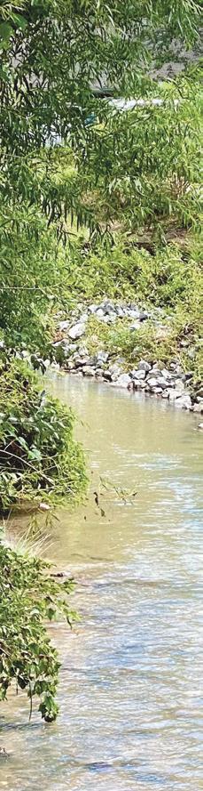
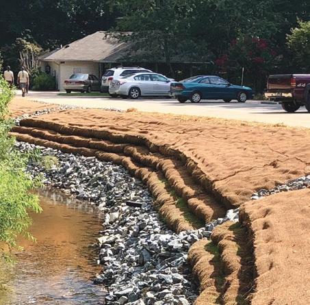
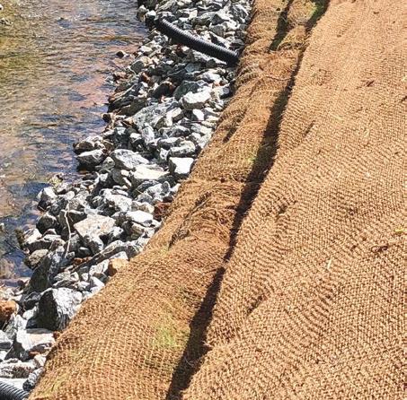
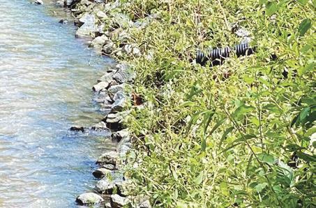
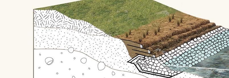
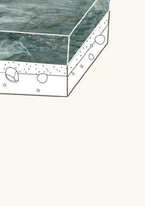
This project includes approximately 820 linear feet of an unnamed tributary to Wash Creek that flows through the Laurel Green Park in the Town of Laurel Park; herein this stream is referred to as Laurel Green Creek. Laurel Green Park is a 4-acre public park that is owned and maintained by the Town of Laurel Park and approximately 1 mile west of Hendersonville, NC.
The Laurel Park Watershed Improvement Study commissioned by the Town underscored issues of impervious surface coverage, sedimentation, fast flow velocities, and lack of native vegetation. This study identified the causes of these instabilities and explored concepts for stabilizing the channel. The study also identified a lack of step-pool structures that are needed to create channel roughness, slow the flow velocity, and provide appropriate aquatic habitat. Alongside restoration work, educational signage are being developed through a community outreach process as well as getting final approval from the Town. With the Watershed Improvement Study in mind, these designs address main concerns as well as showcase restoration efforts, how they work, and what the added benefits are.
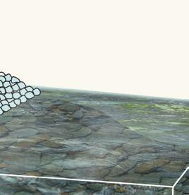
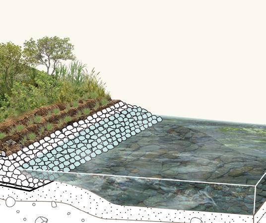
reconnecting creeks to their floodplains
Laurel Green Creek was constantly eroding and lacked important components to support a well-functioning ecosystem. In 2023, the Town of Laurel Park restored this creek with the goals of: stabilizing the channel, activating floodplains, cleaning stormwater, and creating a healthy riparian buffer zone
floodplain activation benefits
provides a natural filtration process to absorb excess nutrients and pollutants
reduces impacts from floods and stormwater runoff
steps
Steps and pools are a naturally-occuring creek features that allow stream flow dampen erosive potential by providing energy dissipation. These features are known to re-orgnize extreme flood events.
floodplain activation
creeks are known to be cut-off from their floodplains. Floodplains and wetlands are a necessary habitat for some aquatic plants and animals. Re-activating urban floodplains can provide pockets of refuge for these fragile and interconnected ecosystems.
decreases channel erosion by relieving pressure on creek bed and banks
prevents erosion from the presence of deep rooted plants to hold the soil together
provides refuge from flood and drought
recharges the groundwater sustaining groundwater-dependent ecosystems
provides habitat for mosquito predators e.g. amphibians, dragonflies, birds, and bats
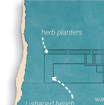
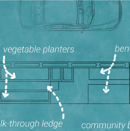
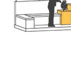
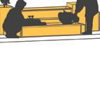
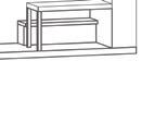
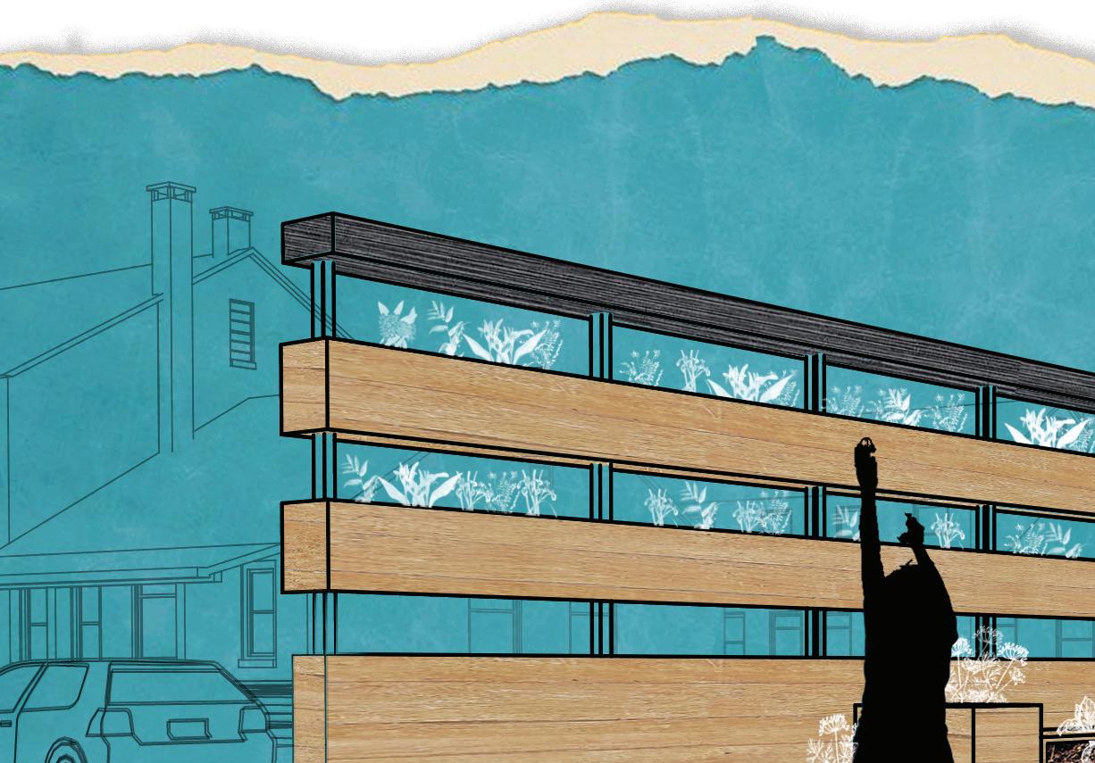
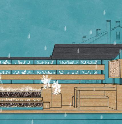
In its first two years of inception, the Charleston Housing Authority constructed Meeting Street Manor and Cooper River Court in 1935. Located on the Eastside of the peninsula and both properties spanning 16 acres, over 268 families occupy the area. With the nearest grocery store being a 23-minute walk and a 17-minute bus ride, the introduction of the Hydro-Garden may reduce the impact of food desserts and offer fresh vegetables and herbs to the community while creating a unique gathering and educational experience.
The south-facing 6’ x 32’ parklet includes vertical and platform planters. The platforms planters have a see-through screen allowing visitors to check in on root growth and learn about the cycle of plants. In addition to food insecurity, the peninsula faces a flooding crisis and with climate exacerbating flooding potential, how can small scale interventions help the most vulnerable communities on the Eastside?
The Hydro-Garden addresses this concern in its design to utilize a self-watering system with captured rain and storm water runoff as a water source. The overhang not only provides shading for the workbench area but also allows for rain capture. Additionally, a water inlet opening located on the street-side of the parklet allows for storm water runoff to flow into an internal water storage tank.
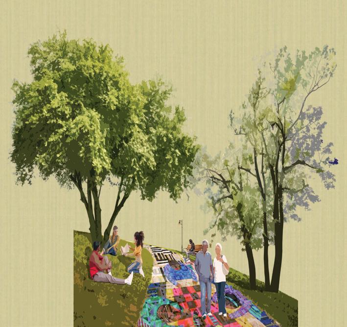
STORIES STITCHED TOGETHER
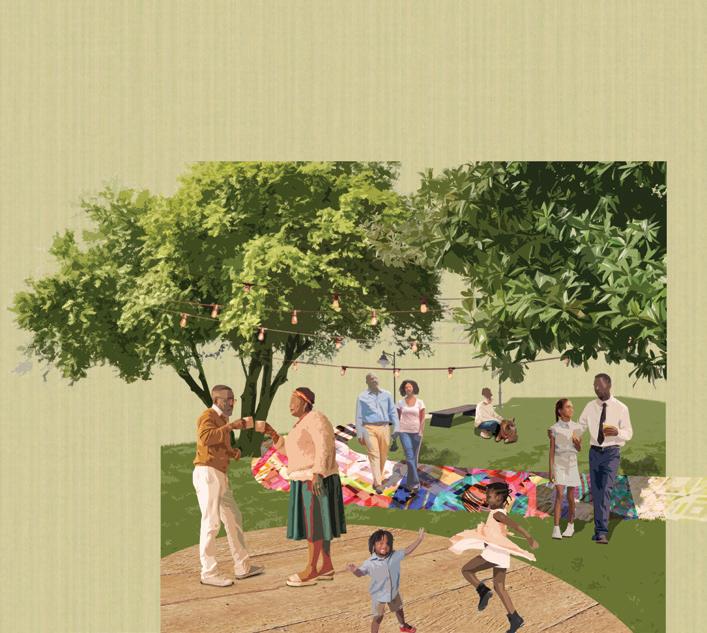
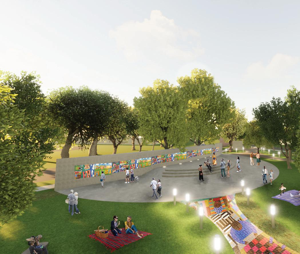
SCANLONVILLE INTERNATIONAL IDEAS COMPETITION Honor Award Winner 2021
Scanlonville is historically an African-American community located in Mount Pleasant, South Carolina. This community was founded in 1868 by John Scanlon, a freedman who purchased 641 acres of land off of what was Remley Plantation. With waterfront access and beautiful marsh views, it is now one of Mount Pleasant’s hottest real estate market. The community has since faced continual threats against heired lands being taken from them, multi-million dollar home developments on the waterfront, and threats to their heritage preservation. A community led group, East Cooper Civic Club, acquired a parcel of land back from the city and sponsored an international design competition called Designing Our History for the space.
Scanlonville’s Stories Stitch Together Heritage Park seeks to celebrate Scanlonville’s history and traditional arts. The park design aims to reimagine storytelling through a collaborative and artistic process. Monuments, mosaic paths, and a main gathering space with a mural encourages a space for celebration and fostering the importance of the traditional arts and skills. A Story Stitched Together event can be programmed annually as a quilting festival for the community.
The creation of the mosaic paths and mural can be done in collaboration with the community and local artists. Community stories will be recorded and then imagined by artists. The community can participate in the creative process during a Tile Painting Day and then placed together during a Community Build Day. The mural story panels at the amphitheater can be painted by local artists. The park offers a mixture of hard and soft spaces to support different modes of relaxation and celebration
storytelling through mosaic paths
story wall mural
tree canopy preserved
plantings
TECHNICAL VISUALIZATIONS
Presenting nature-based solutions to clients presents a variety of challenges, often stemming from concerns related to aesthetics, the potential increase of unwanted pests like mosquitos, and uncertainties regarding immediate problem resolution. A pivotal step in addressing these concerns involves providing visual representations depicting the expected processes for different concepts.
This visualization tool was created for a client seeking concepts to stabilize their streambanks. One of the more high-end options proposed was the implementation of a Stone Toe with Vegetative Soil Lifts (VSL). This method to stabilize their banks would address the immediate concerns and increase in resiliency over time. A VSL incorporates engineered riprap at the toe of the bank, some grading efforts, geolifts with choir matting, plant plugs, and native tree live stakes.
The section renderings showcase the existing conditions characterized by failing banks, undermining processes, and compromised tree trunks. Post-construction conditions are also depicted, along with the changes after a few growing seasons. This illustration enables the client to comprehend the entire system’s functionality and grasp the additional benefits inherent in opting for nature-based solutions, as opposed to relying solely on grey infrastructure.
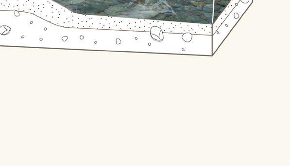
11x17 inches
Stone Toe with Vegetated
EXISTING ERODING RIVERBANK
Vegetated Soil Lifts (VSL) for Riverbank Stabilization
STONE TOE & VSL AFTER CONSTRUCTION
STONE TOE & VSL AFTER A FEW GROWING SEASONS
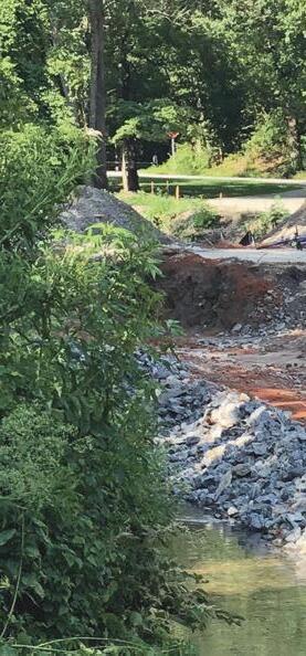
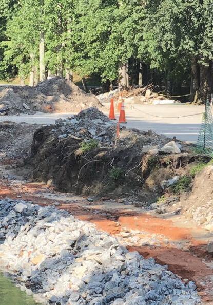
Top Left: A Stone Toe after installation in Wash Creek. Located in Hendersonville, North Carolina at the Sunnybrook Retirement Community, Wash Creek was eroding at alarming rate next to the property and main driveway. (Project by RDE)
Top Right: Vegetated Soil Lifts installed in Wash Creek, North Carolina.
Bottom Left: Plant plugs and live stakes were added to the Vegetated Soil Lifts with growth can be seen.
Bottom Right: After two growing seasons, the vegetation has grown significantly.
The diagram visualizes the multiple processes that can happen after the construction of a Stone Toe and VSL approach. With the incorporation of native and non-invasive plant plugs and live stakes, roots will grow deep down into the stone toe and anchor and stabilize the bank while increasing and supporting local habitat.
STONE TOE & VSL DIAGRAM
PHOTOS
PLANTING PLANS
Presenting nature-based solutions to clients presents a variety of challenges, often stemming from concerns related to aesthetics, the potential increase of unwanted pests like mosquitos, and uncertainties regarding immediate problem resolution. A pivotal step in addressing these concerns involves providing visual representations depicting the expected processes for different concepts.
This visualization tool was created for a client seeking concepts to stabilize their streambanks. One of the more high-end options proposed was the implementation of a Stone Toe with Vegetative Soil Lifts (VSL). This method to stabilize their banks would address the immediate concerns and increase in resiliency over time. A VSL incorporates engineered riprap at the toe of the bank, some grading efforts, geolifts with choir matting, plant plugs, and native tree live stakes.
The section renderings showcase the existing conditions characterized by failing banks, undermining processes, and compromised tree trunks. Post-construction conditions are also depicted, along with the changes after a few growing seasons. This illustration enables the client to comprehend the entire system’s functionality and grasp the additional benefits inherent in opting for nature-based solutions, as opposed to relying solely on grey infrastructure.
11x17 inches
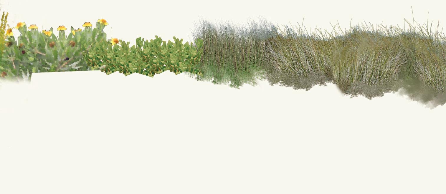
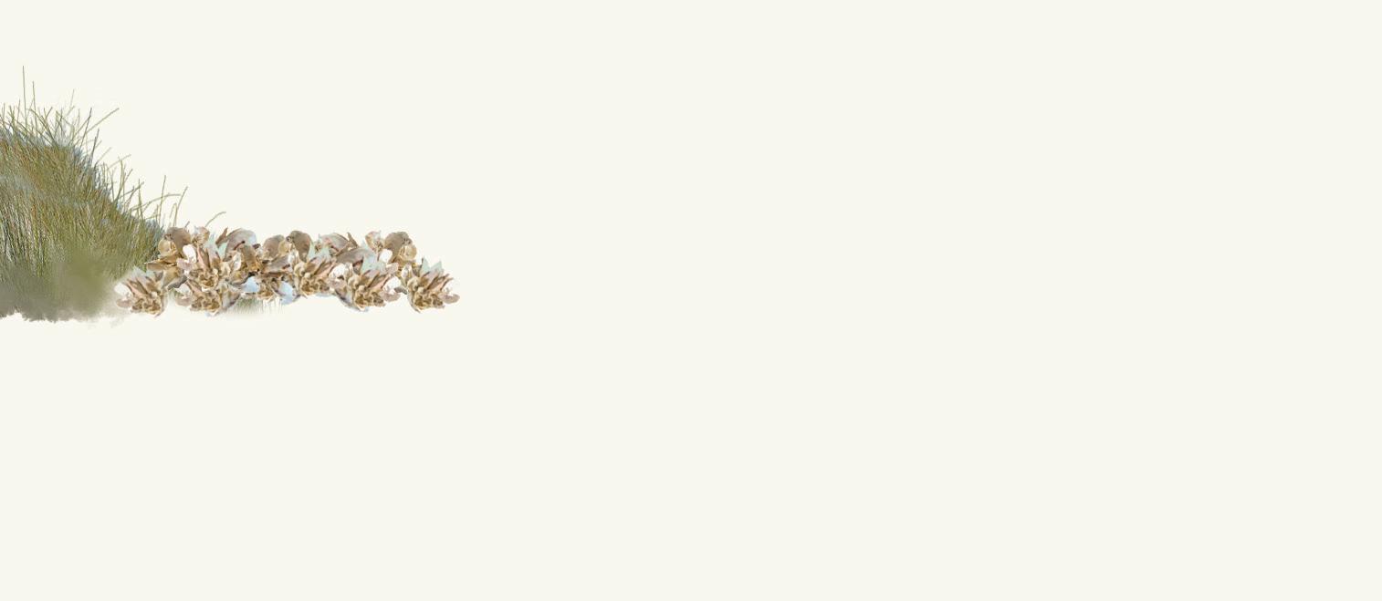
Plants for Vegetated Salt
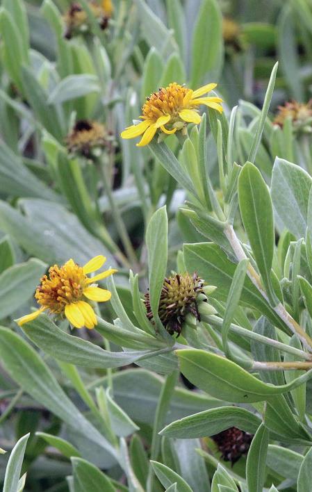
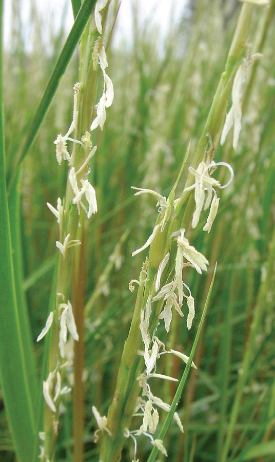
Sea ox-eye daisy - Borrichia frutescens is an early summer bloomer here in South Carolina, and a few flowers will remain as late as September. This plant marks the transition zone between the marsh and the high salt thicket, delineating the elevation so consistently that surveyors sometimes use it to mark the critical setback lines.
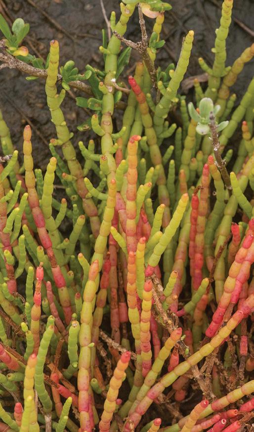
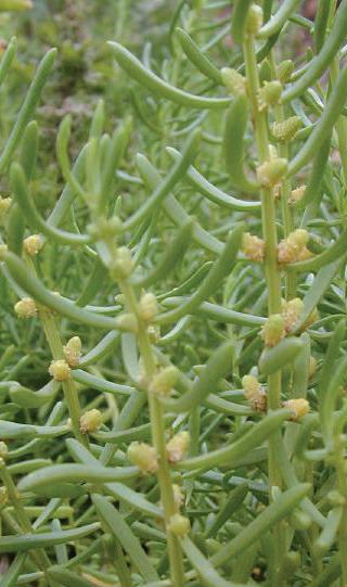
Perennial glasswort - Salicornia is a fleshy herb with prostrate decumbent main stem and branches. Leaves are reduced to scales which makes the stem leafless. Bright green to brown mm inflorescences that occur round.
virginica prostrate or jointed to minute appear with 3-4 occur year-
Saltwort - Batis maritima is a coastal species where it may become abundant and form dense colonies in salt marshes, brackish marshes, at the upper edges of tidal flats and on the margins of salt pans. It typically occurs at elevations less than 1 m above mean sea level and where salinity ranges from 18 to 50 ppt.
Sea ox-eye daisy
needlerush
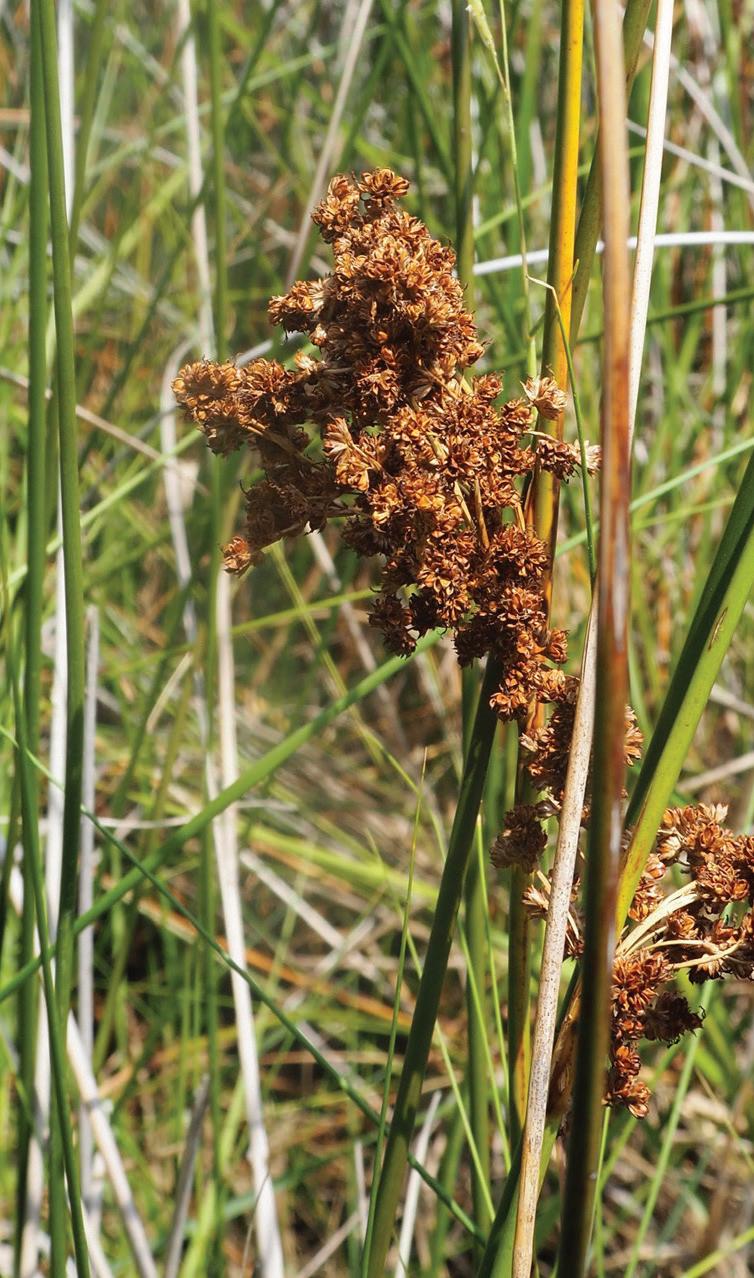
Black needlerush - Juncus roemerieanus is commonly located upriver further away from the ocean where the water is less salty. Dense stands of black needlerush form deep fibrous root systems, which provide very good shoreline protection, filter suspended solids, uptake nutrients, and facilitate substrate oxidation.
cordgrass
The Intertidal Zone – The intertidal zone is part of the designated critical area; any activity-taking place in the intertidal zone will require a special permit from a regulatory authority. A vegetative buffer is created in the intertidal zone best by leaving the area untouched; for example, avoid the use of a lawn mower, weed eater or planting in areas reached by the high tide.
The intertidal zone is highly variable, parts of this zone may be inundated with water twice daily during high tide where as some portions of the zone may typically be above the high tide mark, thus rarely inundated by the tides. Regardless, this transitional area of land lies above water at low tide. Plants that occur naturally in this area and can potentially volunteer include the following:
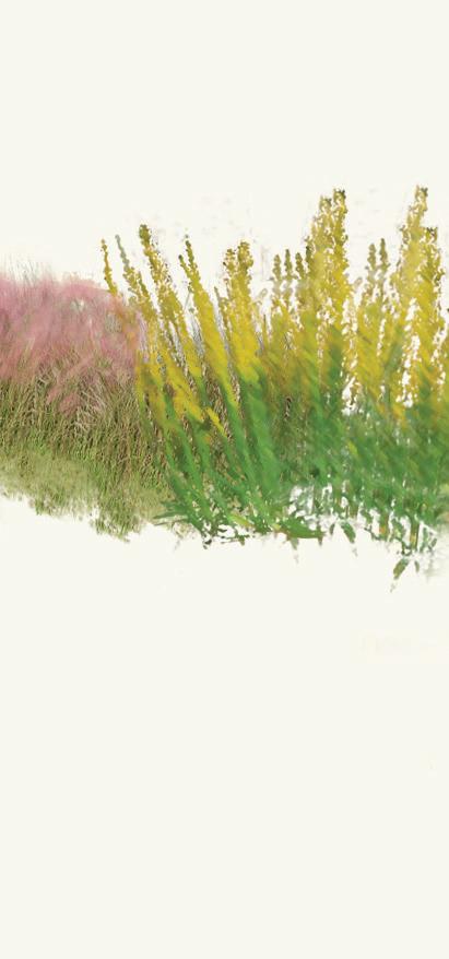
Smooth cordgrass - The salt marsh is often dominated by Spartina alterniflora as this plant can withstand the dynamic conditions created by the tides. In South Carolina, smooth cordgrass is found along all major estuarine waterways. The species dominates the regularly flooded marsh (“low marsh”) and is a common species in the irregularly flooded marsh (“high marsh”).
□ Smooth cordgrass Spartina alterniflora
□ Black needlerush Juncus roemerieanus
□ Saltwort Batis maritima
□ Perennial glasswort Salicornia virginica
□ Sea ox-eye daisy Borrichia frutescens
*Information is credited to the ClemsonUniversityCooperative ExtensionService, JudyFairchild (SouthCarolinaMasterNaturalist),S.C. DepartmentofNaturalResources,and U.S.DepartmentofAgricultureNRCS National Plant Data Center.