SOUTH BAY: SACRIFICED ZONE
Northeastern University | Professor Kearon Roy Taylor | Boston, MA | Masters Thesis
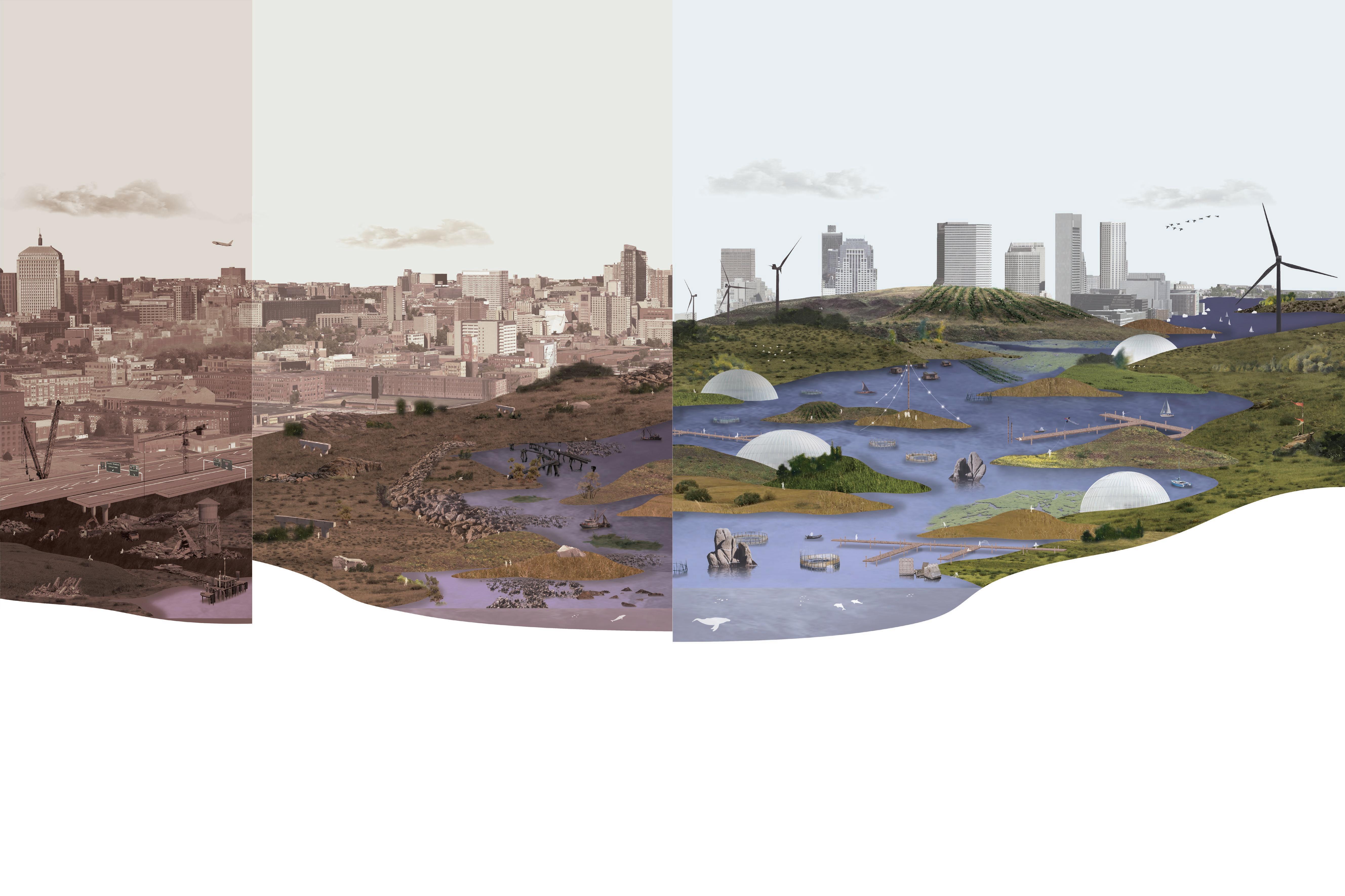
This thesis investigates waste-based climate responsive infrastructure and managed retreat to critique short-term planning horizons and explore radical cultural and social disruption centuries into the future.
The project speculates on the history of Boston under current sea level rise projections with a narrative perspective fifteen generations into the future.
With the undeniable certainties of sea level rise and climate change, there is the potential for social and economic reordering that can trigger more positive outcomes in the anthropocene.
To care for future generations, society must question cyclical ways of being and work towards collective projects that transcend a single lifetime.

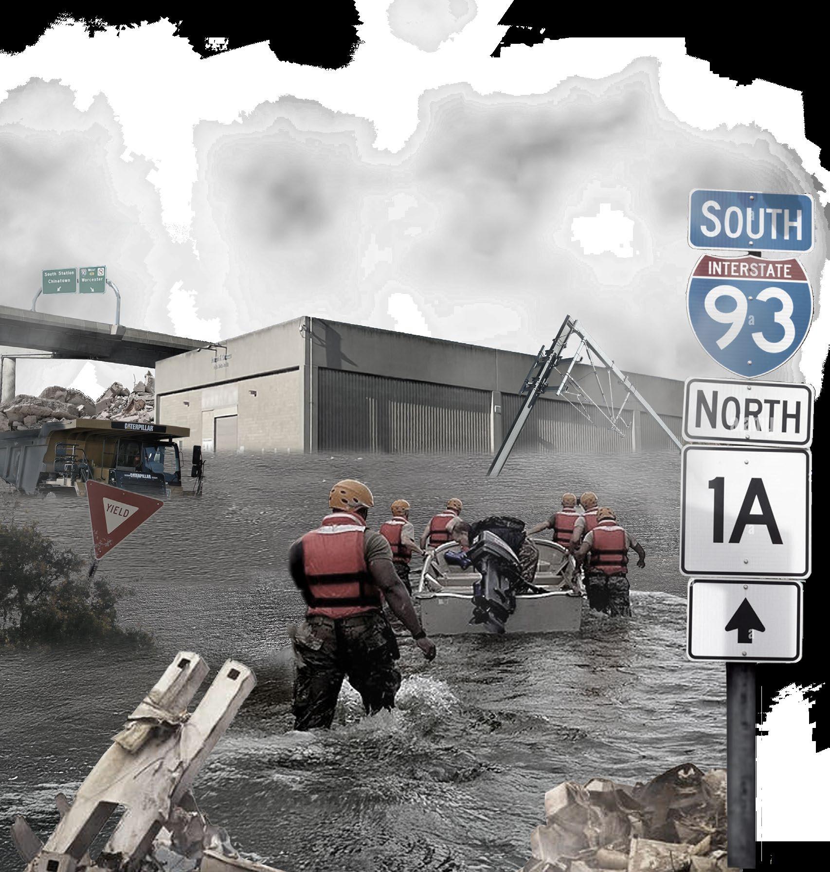
I-93/ CENTRAL ARTERY
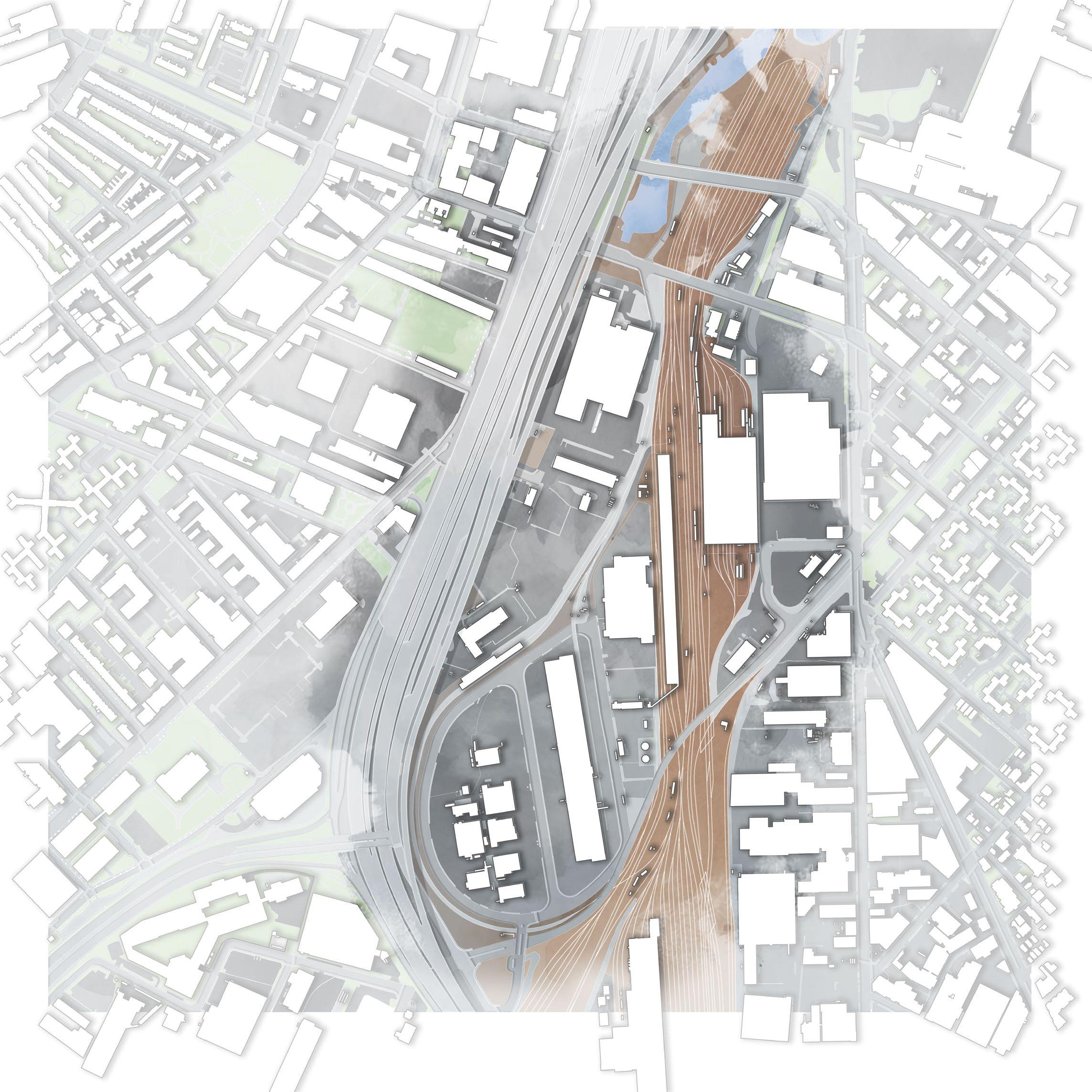
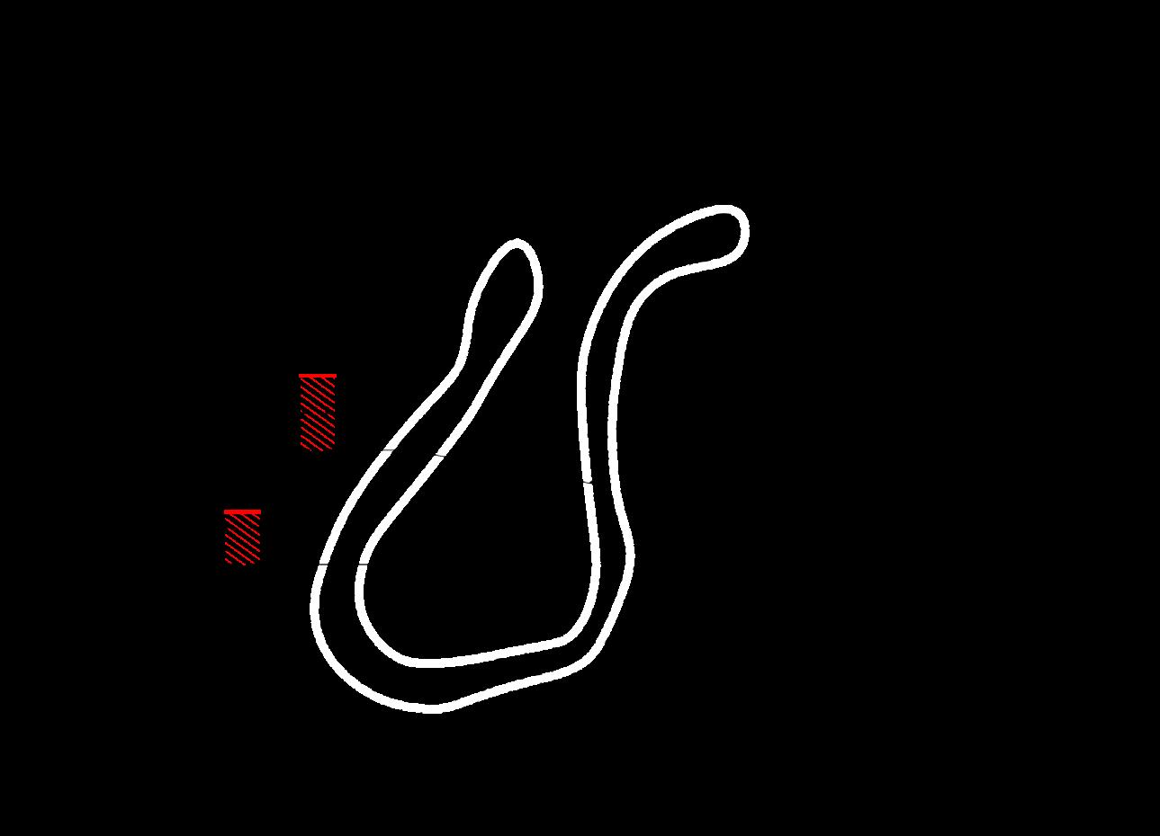
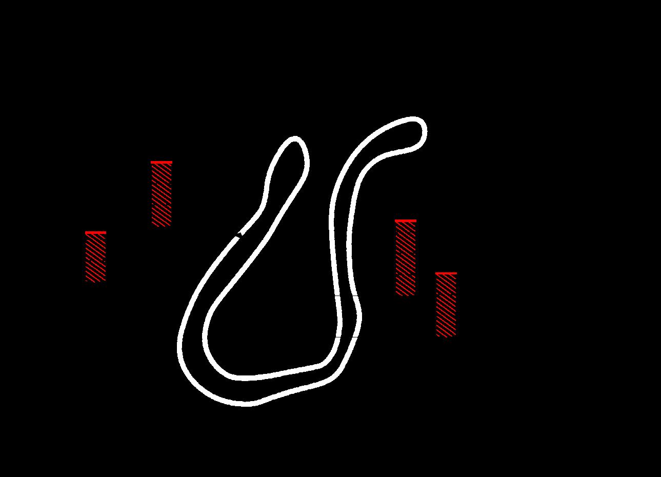
South Bay was filled with salt mud to house Irish immigrants away from Yankee populations in Back Bay. A knot of infrastructure surrounds the site, including highways, public transit routes, culverts, municipal services, parking structures, and storage buildings.
This zone definitively separates the adjacent South End and South Boston neighborhoods and becomes the initial site of waste accumulation.
SOUTHAMPTON YARD TRANSPORTATION DEPARTMENT
BWSC OUTFALL
PUBLIC WORKS
CABOT YARD
LAYOVER FACILITY FOOD DISTRIBUTION
IMPOUND LOT
TRAIN WASH
COLD STORAGE
PINE STREET INN
SOUTH END
ROXBURY
SOUTH BOSTON
BASS RIVER
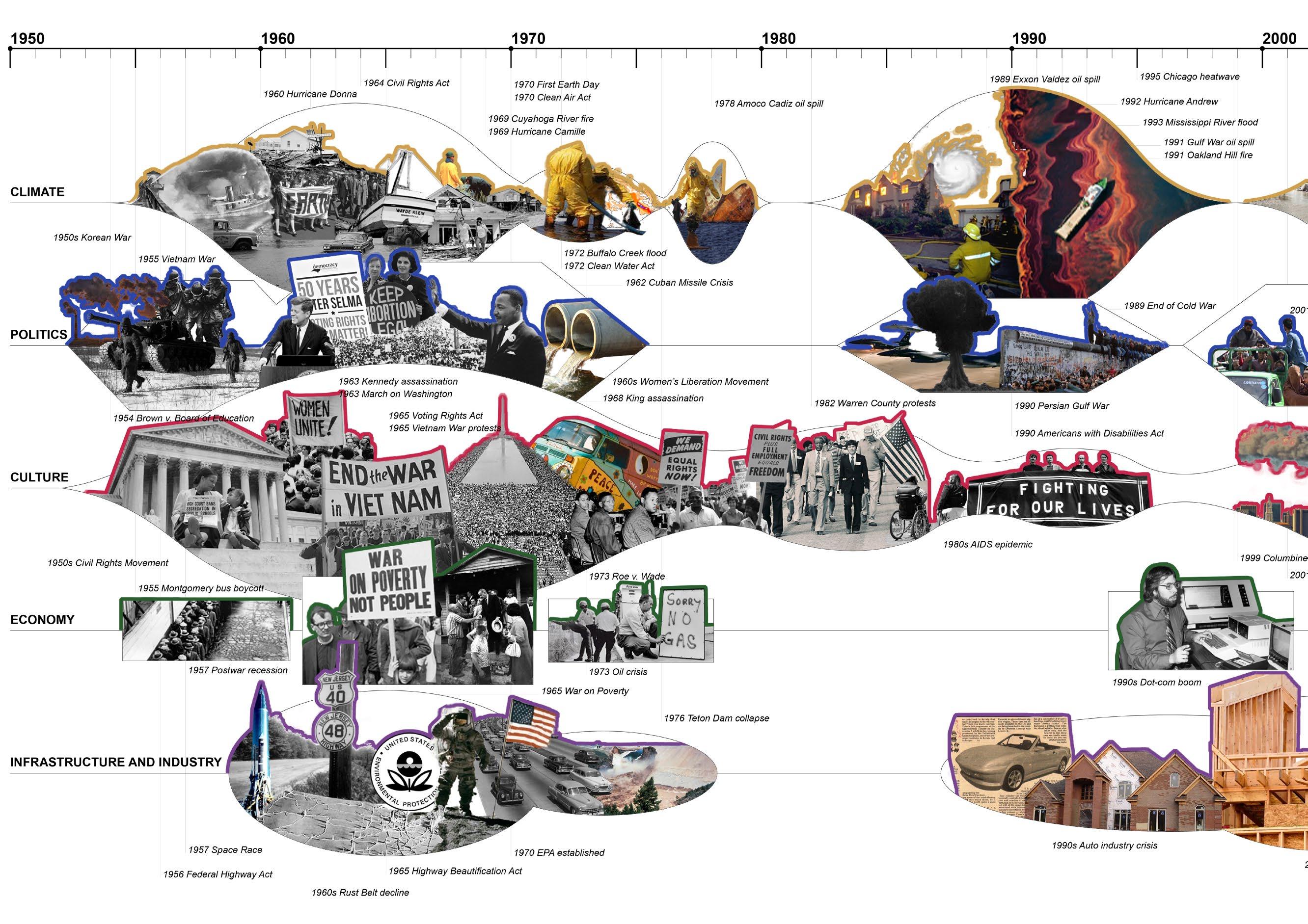
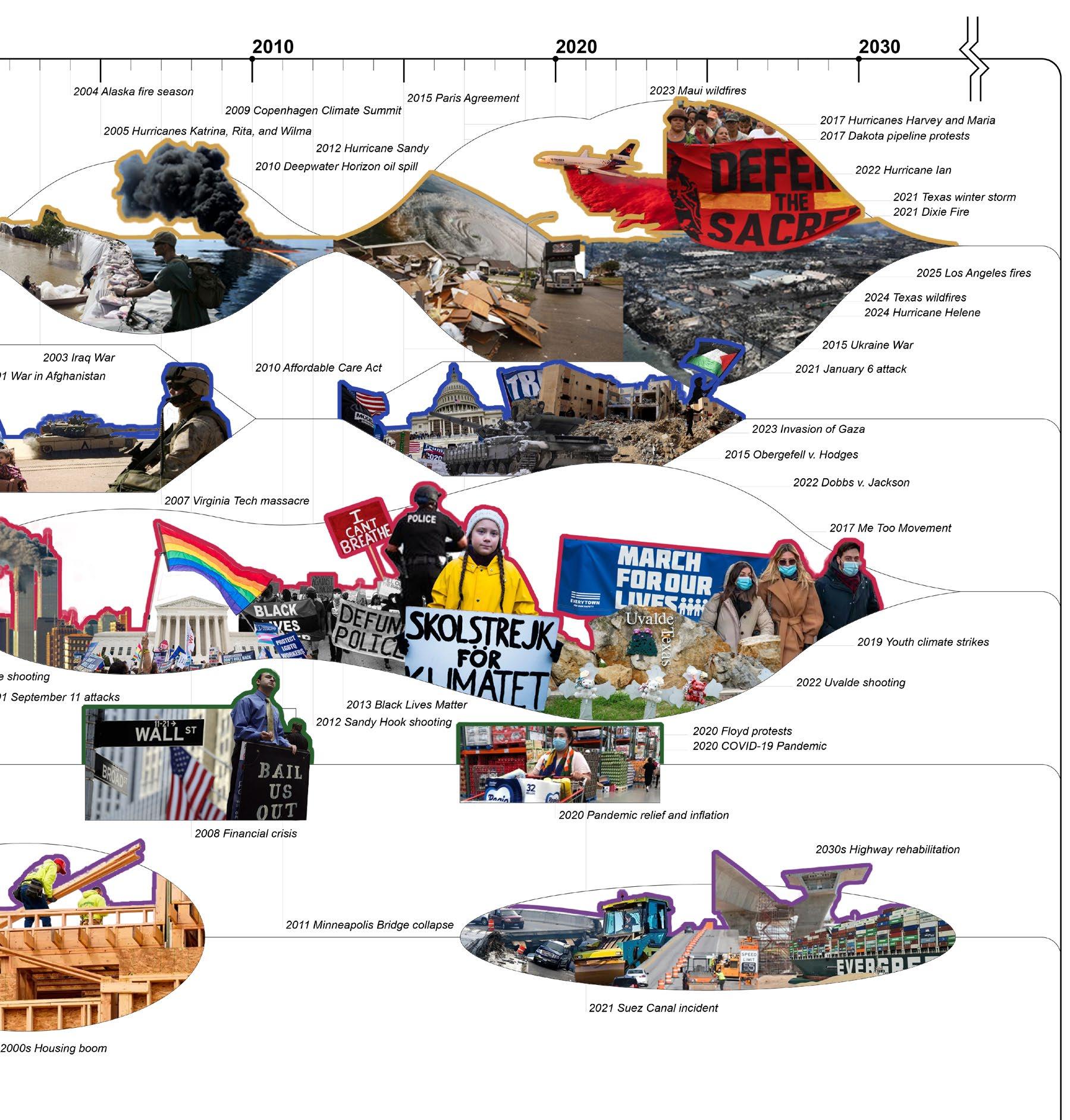
As culture and media are caught up in economic and political cycles year to year, climatic events and global indicators are largely ignored.
Local and national planning strategies such as Net Zero 2050 and the Boston Climate Action Plan only project 25-50 years into the future, while expected sea level rise will require generations of coordinated adaptation.
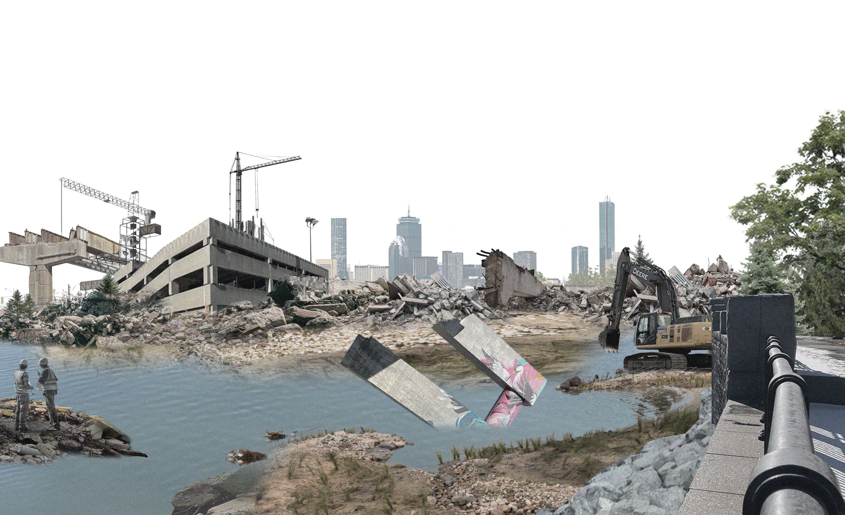
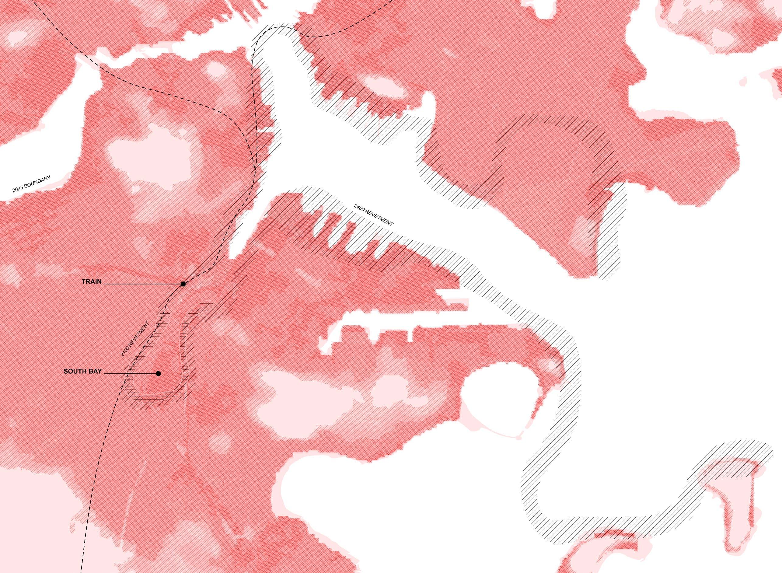
Sacrifice zones are used to defend the city from the first inundations. The city begins to use construction waste to build revetments, embracing waste as a resource for the future and transforming public buildings into sorting and processing facilities.

HIGHWAY DECONSTRUCTION
As the I-95 is decommissioned at the end of its life, it is buried and covered with construction waste as part of the revetment.
After supply chain disruptions and the fall of the automobile industry, the public advocates for collective transportation and a train replaces the highway.


Waste piles beyond the site as buildings were lost. The project expands to the harbor islands, but gradually more people migrate away as the government subsidizes retreat and funds land buyouts.
New industries arise as people develop more localized, informal economies. Reef seeding, salt harvesting, fishing, and algae farming flourish.

These economies survive for many decades and lead to more harmonious relationships with the land as all produce and fish in the remaining communities are harvested from the new landscape.


Communities centralize around topographically strategic areas until floating districts are founded that connect to the ruins of neighborhoods below.
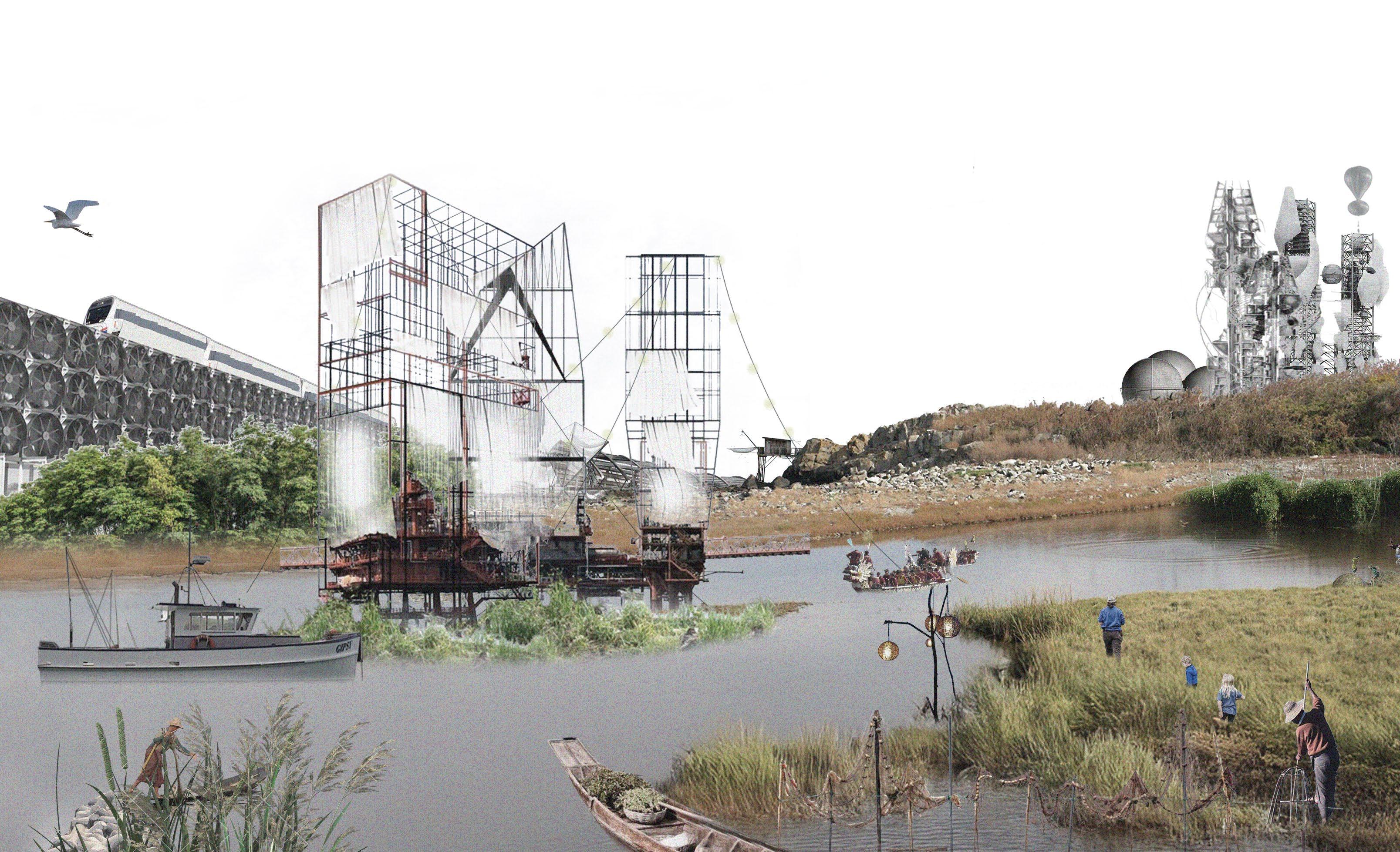
The Tidal Memory Project records oral histories, monitors former city monuments, and hosts heritage diving pilgrimages to submerged city areas for salvage and archaeology projects.
Yearly tide ceremonies record annual rise with salt markers, as generations of Bostonians who remain remember their ancestors’ drowned home.

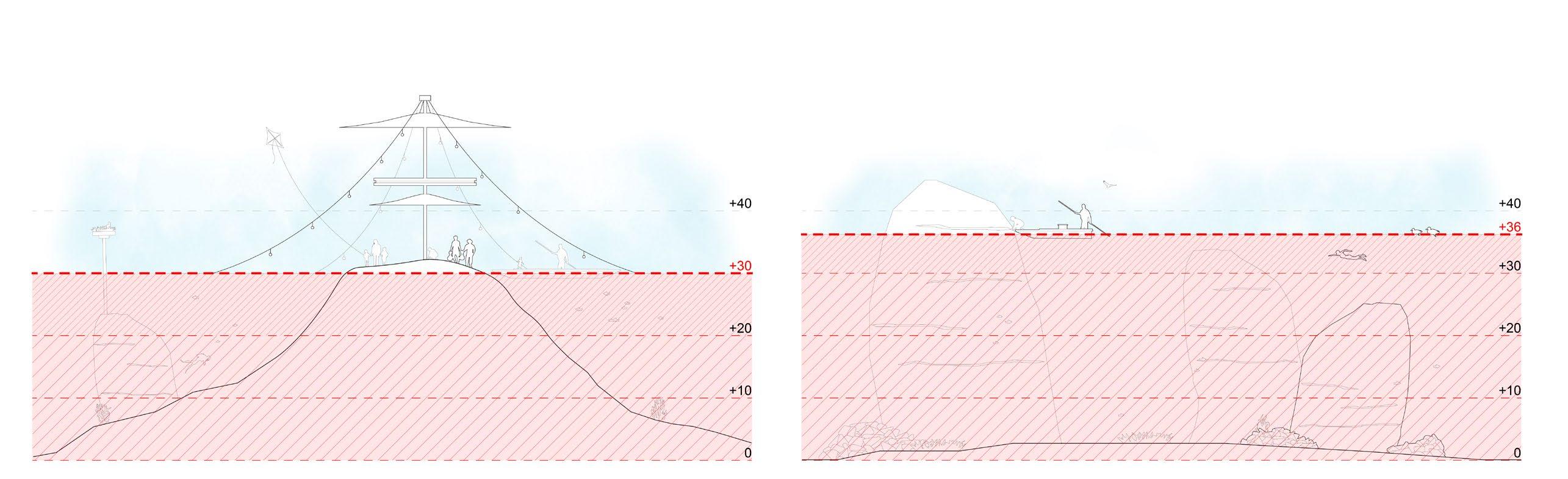
A. DIVING & SALVAGE
C. CELEBRATION
D. MEMORY & MARKERS
B. ANCHORING
FOX HALL COMMUNITY HEALTH CENTER
Northeastern University | Professor Jonathan Levine | In Collaboration with Nik Romano | Dorchester, MA
Fox Hall was constructed in 1890 and transformed over the following decades to a meeting place and music venue as the neighborhood grew. There are a longstanding recreational and community uses of the building as a billiards hall, candlepin bowling alley, and dance hall. The traces of past use within create an imperfect yet storied existing condition; embracing Fox Hall’s charm and irregularities for usable and valued space will uphold its legacy and look to the future.
This proposal restores and expands upon Fox Hall’s historic qualities as a lively center for community connection and local identity, while responding to needs of collective health and housing.

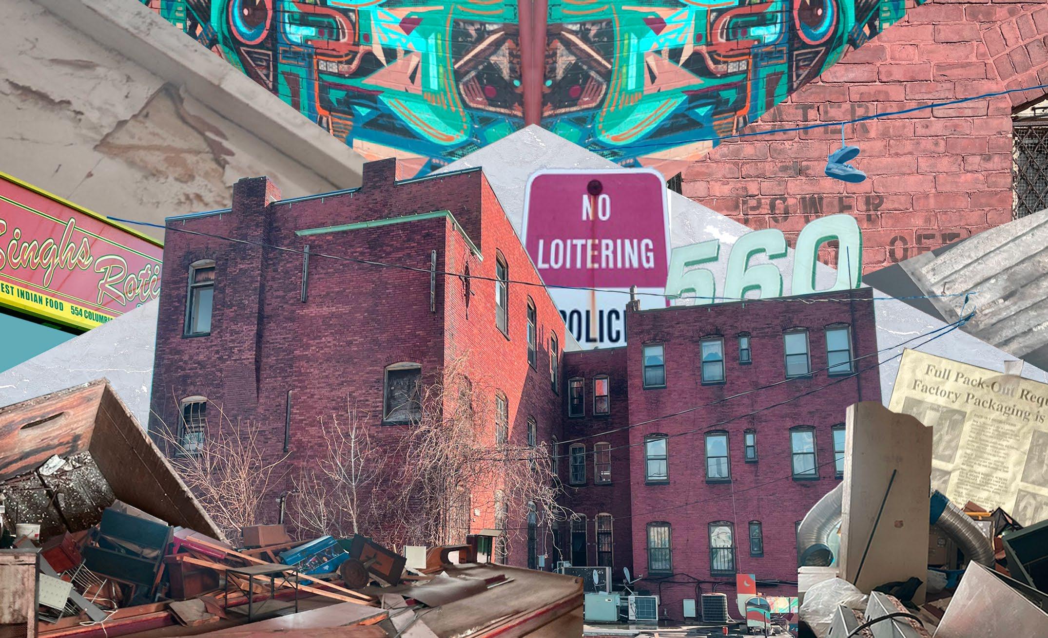
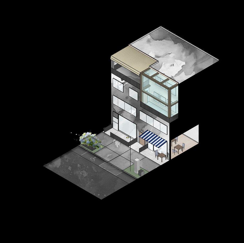
The existing street conditions are chaotic, inhospitable to pedestrians, and car-dominated. A large back parking lot is isolated from the main street. Interior rooms of the meeting hall, bowling alley, and single-room occupancy units reveal spaces that are vacant and in disrepair.
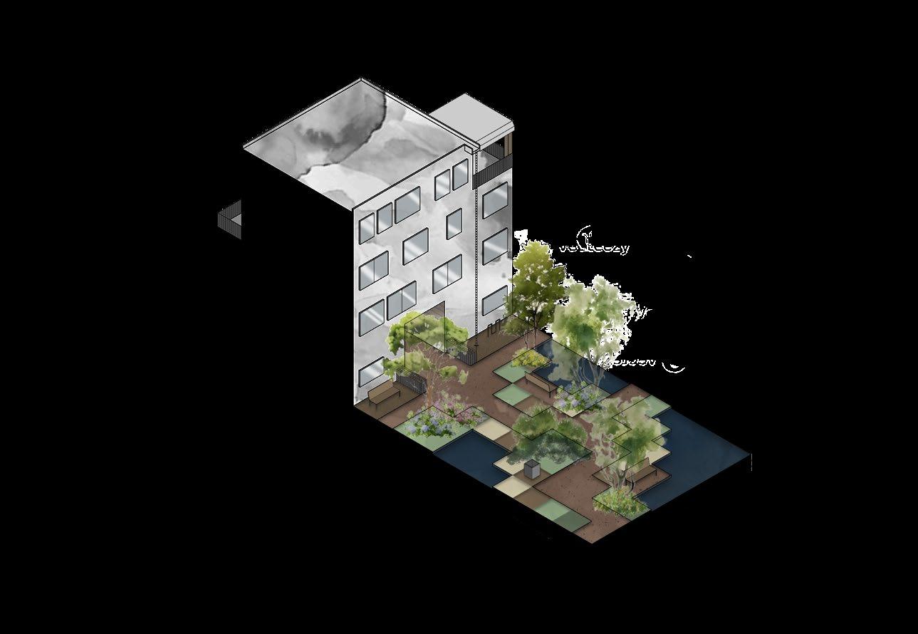
The proposal adds seven bedrooms by deconstructing the dilapidated side of Fox Hall and shifting residential program to the more private end of the site. This strategy creates a large open space for Upham’s Corner, with terraces and roof planes overlooking common outdoor areas.
RECREATION ROOM READING ROOM LAUNDRY ROOM
APARTMENTS

SEED LIBRARY
DAYCARE
LOBBY
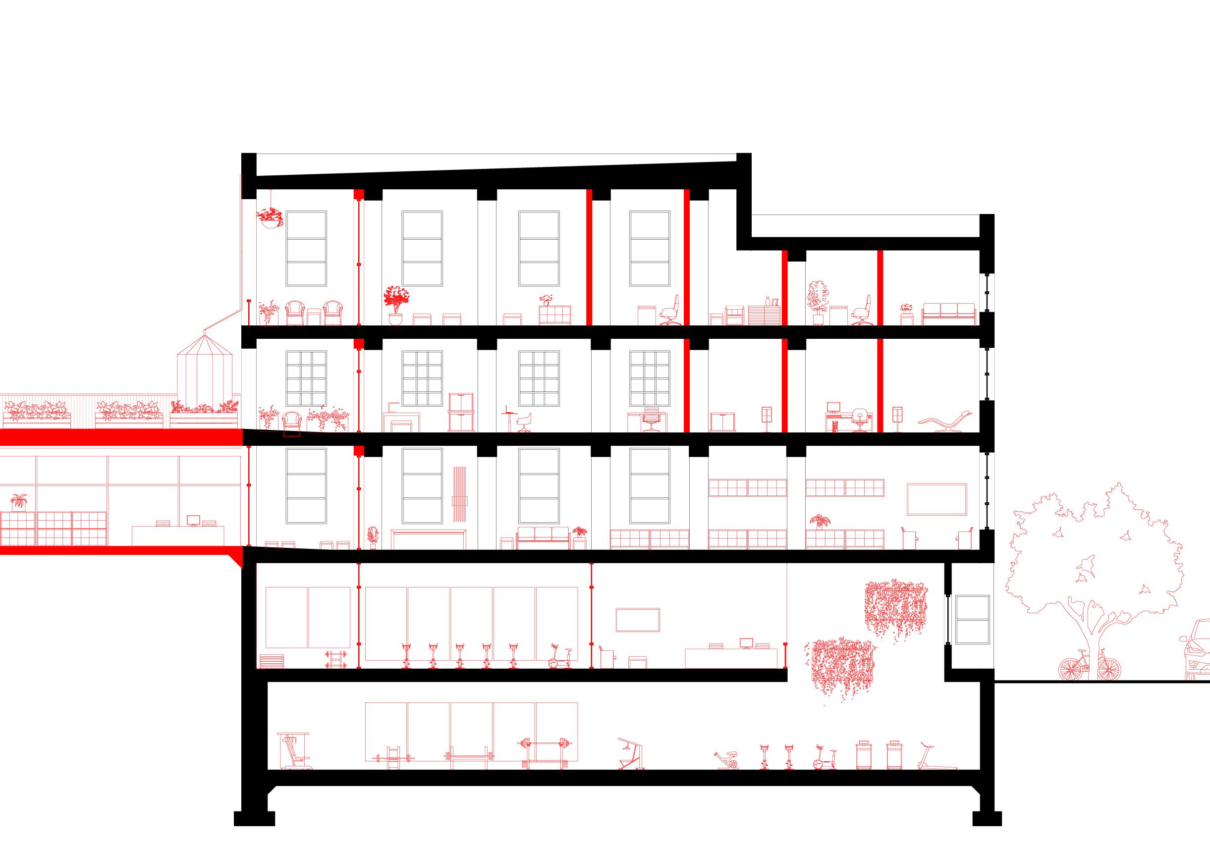

Fox Hall’s primary stair is enclosed by a chain link mesh to embrace the existing core with reappropriated, vernacular materials. Overgrown vines currently climbing the southern walls can thrive on this facade. The slope from the back to front of the site is mediated by multiple bioswales to manage all stormwater onsite, while water collection tanks on the roof garden capture runoff to be used in the adjacent gardens.
A colorful mural on the ground floor is preserved to frame the entrance to the park.
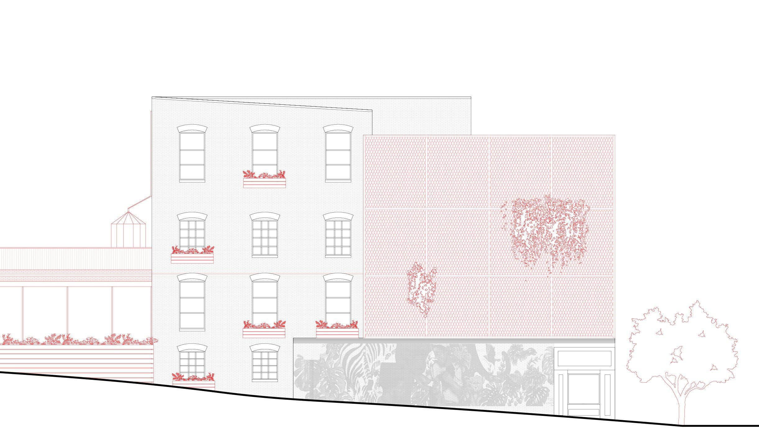

To manage the amount of new materials necessary to rebuild housing at the back of the site, bricks are salvaged from deconstruction and reused where possible in the new facade.
DRAWING BY NIK ROMANO

Enclosing the preserved stair in a porous material allows light and air into the health center. From the street elevation, Fox Hall’s cornice serves as an entry to the park.
CHINATOWN PUBLIC LIBRARY
Northeastern University | Professor Ang Li | Boston, MA
The Chinatown Public Library is designed for the present and future needs of a vibrant, underserved neighborhood. This project seeks to elevate the traditional library experience with new program, flexibility, and accessibility in a democratizing space that is free to all.
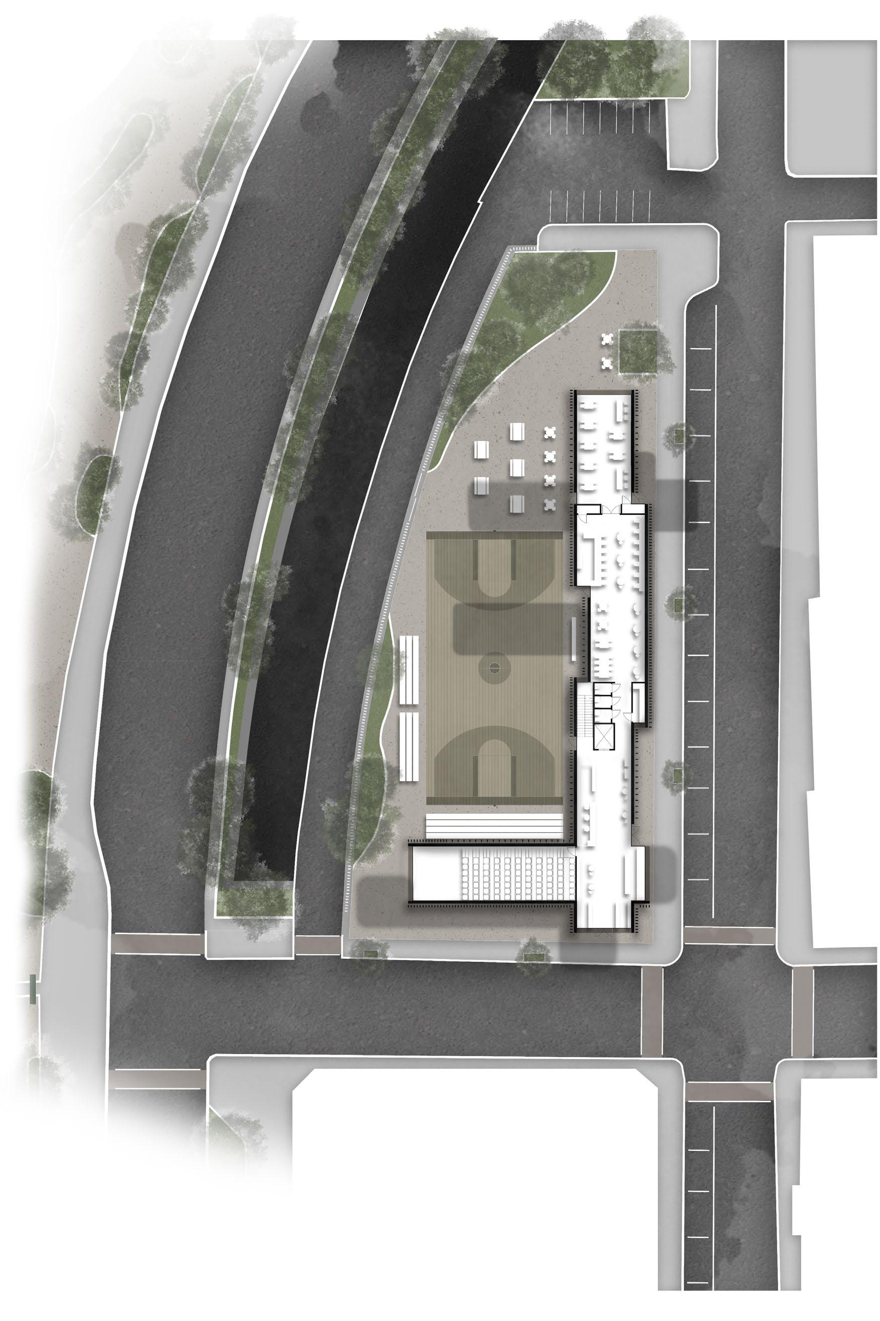
Inspired by the Reggie Wong Memorial Park to the south of the project site, a stacked form frames a basketball court from adjacent streets while maintaining visibility to the heart of Chinatown.
The plaza is open and adaptable for large events and viewable from almost anywhere in the library, with more public-facing spaces such as a lecture hall, community room, and cafe on the first floor.


DIGITAL MEDIA
GROUP STUDY
BASKETBALL COURT
STAFF OFFICES
CHILDREN’S

FITZGERALD SURFACE ROAD
LECTURE
BEACH STREET
LINCOLN STREET
O’NEIL TUNNEL
A 20’ x 70’ rectangle is the underlying module to fit both library program and circulation. Through a process of extrusion, weaving, stacking, and shifting, the bars sit closer to Lincoln and Beach Street to enclose the court and plaza. These moves create various viewing platforms on the upper levels and encourage spectatorship from the inside and out.
At the intersections of bars, different users collide and offer an opportunity for inventive program strategies. For example, a classroom brings together librarians and the public where the staff offices and general study space meet, and a storytime area joins the children’s and main collections.
TEEN’S
COLLECTION LOUNGE
CHILDREN’S
STORYTIME
CLASSROOM
The basketball court is an ideal module for flexible use and may be covered over or resurfaced for large gatherings and cultural events to serve the community. Overhanging bars look directly towards the Chinatown Gate, connecting the library across the Fitzgerald Surface Road.
Facade louver conditions are informed by interior activities with more visibility in public or noisy areas and increased coverage against glare and heat gain in private, sedentary areas. Terracotta fins attach to the main structure across ribbon windows, occasionally bypassing the floorplate to become railings at observation decks.

TERRACOTTA LOUVER
RIBBON WINDOWS
SOLID WALL
storage, circulation
24” SPACING
community room, group study, teen’s, children’s, reading
42” SPACING lobby, cafe, basketball court
LIGHTING
10” SPACING
Lincoln Street, lecture, collection, digital media, staff
RAIL


At the termination of the bar module, densely spaced louvers frame full-height glazing for views into the city. These points offer sightlines inside the building as well as out, reiterating the public-serving intention of the library. Windows glow at night and overhangs host individual lighting fixtures, contributing to a safe and comfortable atmosphere on the street.
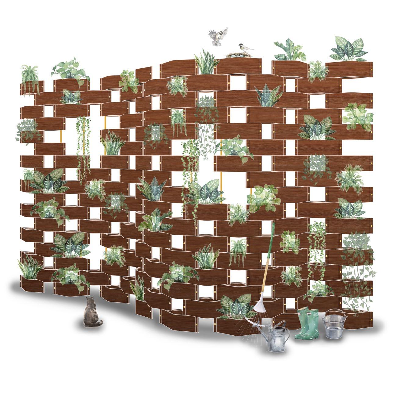
WOODSCAPE
Northeastern University | Professor Patrick
Kana
WoodScape is the product of an undergraduate woodworking studio embracing the fundamental qualities of wood as a resource for fabrication, exploration, and making. The final prototype employs various techniques of CNC routing, mould-making, veneer preparation, lamination, and finishing strategies to create a bent-wood object that may be reproduced as multiples.
The stacking planter took shape as a modular design that celebrates the aesthetic and reproducible nature of bent lamination in its form and function. By prioritizing simple manufacturing strategies, sustainable materials, and customizable modularity, WoodScape aims to inspire gardening practices that are accessible and adaptable to a variety of audiences.

LINER INSERT LINER
Early mockups explored teardrop and eye shapes that enclosed a printed liner. A single planter can be stacked and connected by a dowel, supporting their own weight through their aggregation.
The final prototype consists of two main parts, the liner and walls. Liners incorporate the dowel support and a thin lip to allow planters to stack without wood edges pivoting directly against each other when rotating.
3/8”BENT WOOD
Renderings exemplify how planters may be aggregated, from a small home system to a living wall. A hydroponic option with a hollow pipe and base reservoir would replace the dowel connection as the wall grows in height and watering becomes challenging.
Plant palettes can be assembled within, such as pollinator gardens or those that support insect habitats.

The maple dowel connection may exchanged for a matching wood or upgraded to a copper pipe outdoors.
The liner lip is held back from the wall edge to celebrate the laminated edges and poplar veneer layers within.

While these prototypes are intended for indoor use, alternative wood finishes such as epoxy-based resins or different materials such as extruded metals can improve the system’s resistance to weathering.
The eye-shape of each planter is best supported when rotated around the dowel to its neighbor, resulting in an undulating curve for structural integrity that creates a sheltered space within.
GENERATIONAL URBANISM
Northeastern University | Professor Marie Law Adams | Mission Hill, MA
This proposal is a neighborhood-scale urban design intervention located in Mission Hill, Boston. The previously industrial site is framed by residential fabric, including two city housing projects. The community has seen a history of urban renewal, political movements, and institutional encroachment by universities and hospitals that displaced many families and propagated gentrification. There is also a story of resilience and activism in Mission Hill that resisted highway expansion and retained residents in a rapidly changing neighborhood.
The project seeks to strengthen the existing Boston community and raise a new one. The plan connects the corridor park on the southeastern part of the site and builds densely with primarily double-loaded corridor bars, creating spacious courtyards for residents to engage with diverse gardens or a dense microforest. Community space, small businesses, and an elementary school supplement the new housing with an overall FAR of 1.8. CONTEXT & SITE PLAN
LONGWOOD MEDICAL CENTER
MISSION HILL
ROXBURY
WENTWORTH UNIVERSITY
RUGGLES CATHEDRAL
ALICE TAYLOR APARTMENTS
ALICE TAYLOR MONUMENTS
REGGIE LEWIS STATE TRACK
ISLAMIC CULTURAL CENTER
FIRST CHURCH
POLICE DEPARTMENT
MADISON PARK HIGH SCHOOL
ROXBURY CROSSING
SAINT ALPHONSUS HALL
ROXBURY COMMUNITY COLLEGE
MISSION CHURCH
BREWERY BUILDINGS
MISSION MAIN APARTMENTS
PRENTISSSTREET
TREMONTSTREET
TREMONT STREET
PARKER STREET
TREMONT STREET

PARKERSTREET
STREET residential
STRUCTURAL FRAMING GROUND
ENTRANCE


ONE YEAR

FIFTEEN YEARS

Transects and perspective views capture variations of transformation over time. As trees grow and community gardens are planted, terraces built out with framing can be filled in with coverings, enclosed gardens, or become new rooms. Small business or office layouts can be converted to housing, and entire upper levels can be added on the roof connecting to vertical circulation.
FIFTY YEARS
While the building footprints are fixed around their designated courtyards, the project is built for expansion to resist generational displacement and provide long-term, dense housing for residents to invest and thrive in for decades to come.
RIVERSIDE PARK
Envision Resilience | Professor Sara Carr | In Collaboration with Alexis Mazzatta, and Michael Rahtz, Valentina Riera | New Bedford, MA
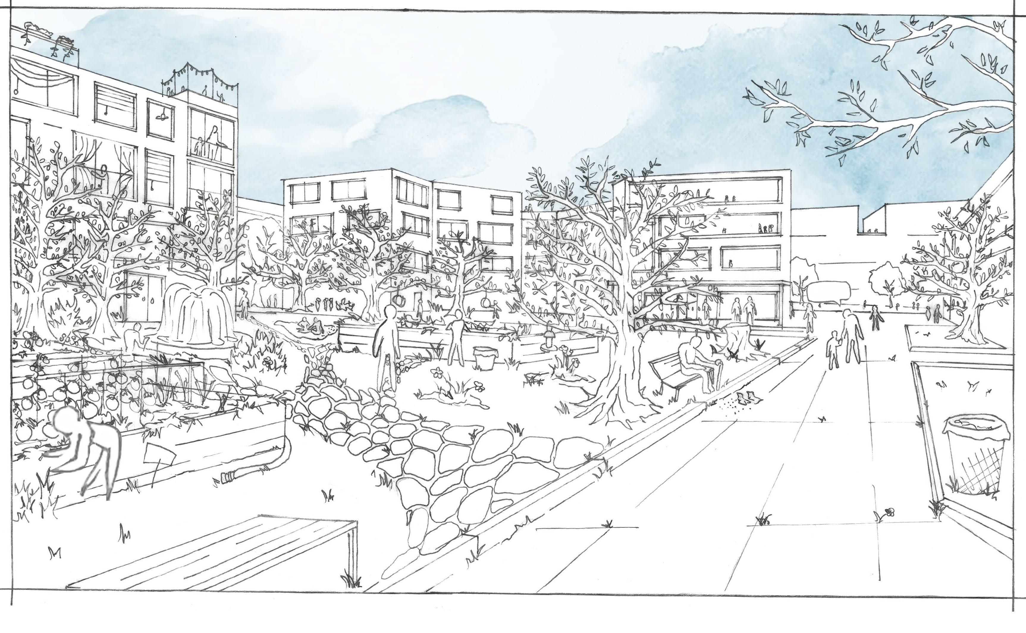
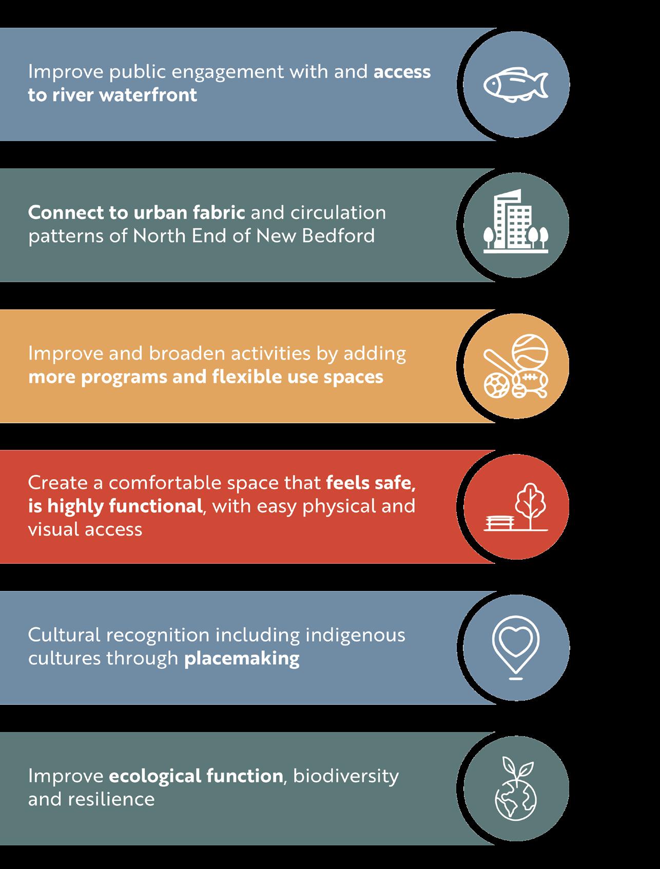
Riverside Park is located in a diverse and culturally active community in New Bedford, MA. The park currently includes an active soccer field, playground, and bustling community garden, but can serve many more uses programmatically and ecologically in the future.
New Bedford residents and representatives attended multiple meetings and design reviews to inform Riverside Park’s proposal. In concert with these community members including Groundwork Southcoast, the
National Parks Service, and the City of New Bedford, the project team created foundational goals related to social and ecological growth.
Proposed tactics such as relocating the playground and shoreline restoration have been implemented in ongoing plans for Riverside Park, and the project is a recipient of a BSLA Merit Award and Northeastern Design Excellence Award.

BIOSWALE
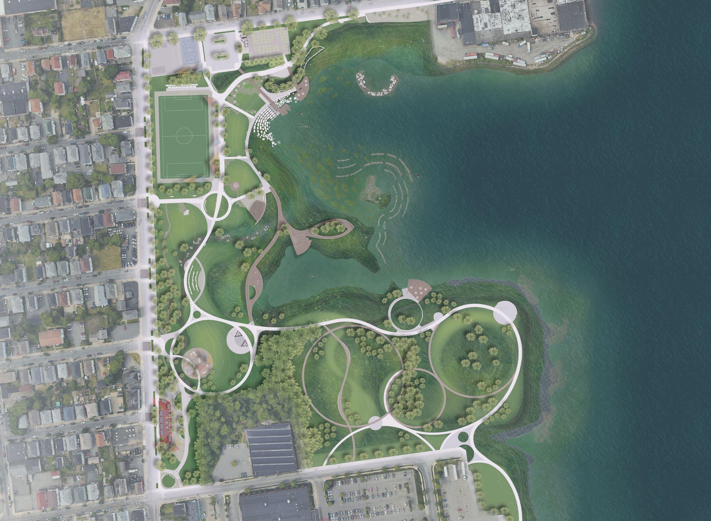
MURAL
SKATE PARK
BASKETBALL COURT
COMMUNITY GARDEN
WEIR
KAYAK LAUNCH
RIVERFRONT SEATING
FIELD
SIGNAGE
OYSTER REEF
OSPREY NEST
PAVILION
LINEAR SWALE
BOARDWALK
AMPITHEATER
MICROFOREST
NORTH END RESILIENCE DISTRICT
PLAYGROUND
RIVERWALK
OVERLOOK RESTORED GRASSLAND
RENDERED BY MICHAEL RAHTZ
PIERCE MILL COVE
ACUSHNET RIVER
SAWYER STREET SITE
FOOD TRUCK PLAZA STAGE

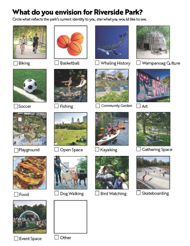
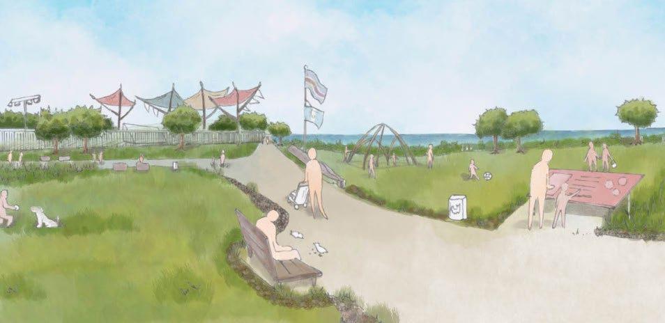
Throughout the design process, town representatives and community members offered feedback to envision a public space that is well designed, engaging, and resilient.
An interactive scale model, surveys, and signage mockups accompanied engagement sessions throughout the process. The model includes moveable pieces such as benches, shade sails, and planters to invite interaction, while questionnaires gather feedback on identity building and program design.
DRAWING BY ALEXIS MAZZATTA