Throughout my education, I learned that as a future architect I have the ability to use my empathy, cultivate community, and adjudicate culture. Understanding people is vital to creating good design. This empathy transforms when given the opportunity to intervene and interact with the built environment. The opportunity to create a sense of community with my skills and tools as an architect satisfies a piece of me that longs to improve and transform everyday lives of people through design. Deciding what is important within an area, creating a sense of community, and empathizing with others, have all contributed to the kind of designer I strive to be. These learned principles will continue to shape my future as a student and as a professional.
ROME’S REFUGE
A SAFE HAVEN AMIDST THE CITY
STITCHED TOGETHER
BRIDGING SAVANNAH’S PAST AND FUTURE
HOMESTEAD ON HIGHWATER
SELF-SUSTAINING BARRIER ISLANDS
CIRCUIT SECTOR
REVITALIZING PARRAMORE
TRAVEL SKETCHES
ANALYTICAL FIELD + THESIS SKETCHING
INVESTIGATIVE SYSTEMS
EXAMINING SYSTEMS OF CONSTRUCTION
ILLUMINATED PATH
A STUDY OF LIGHT AND SHADOW
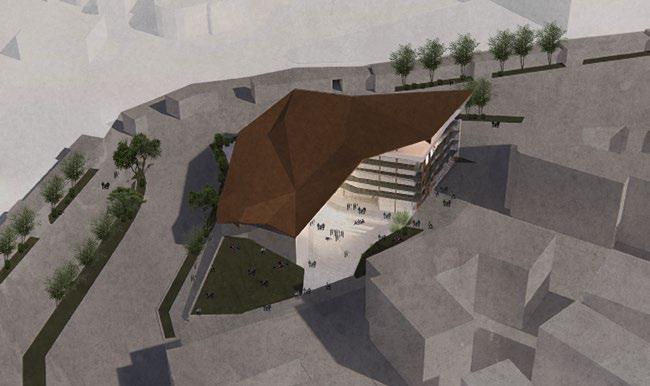
01. ROME’S REFUGE
A SAFE HAVEN AMIDST THE CITY
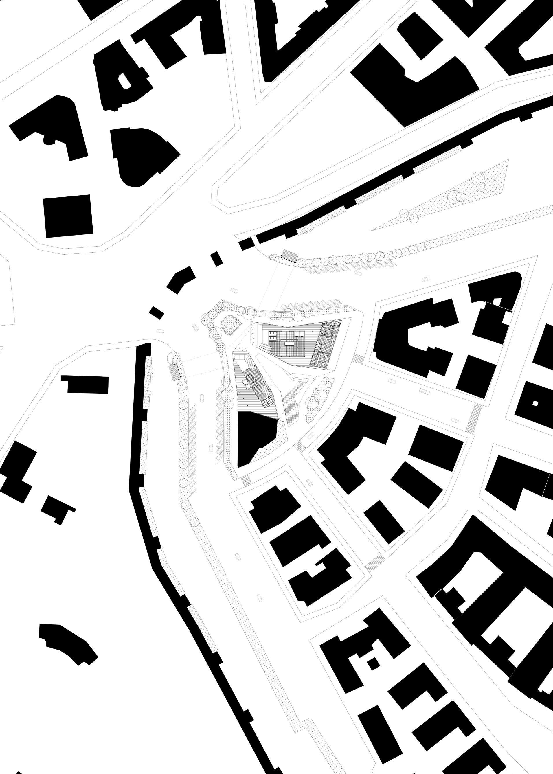
SITE ROME, ITALY
TYPE SOCIAL LIBRARY + APARTMENTS
YEAR FALL 2023 / DESIGN 7
PROF. PETER SPROWLS
COLLAB AMELIA KARADSHEH
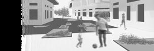
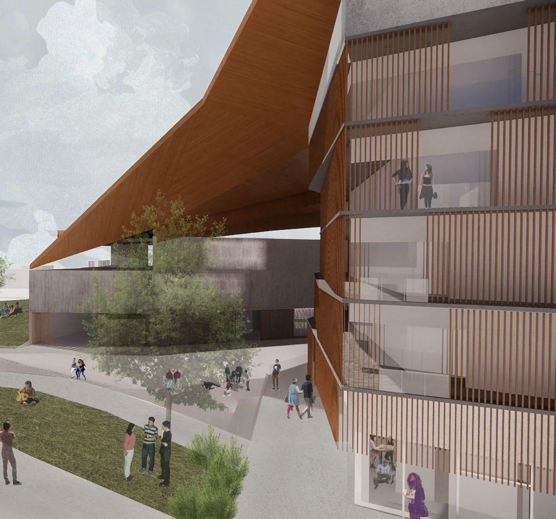
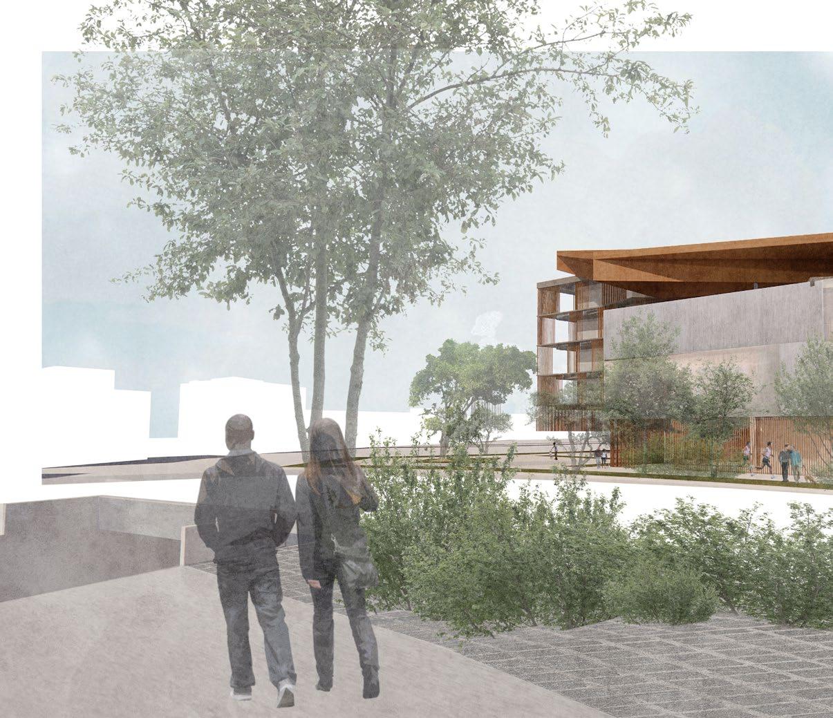
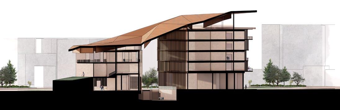
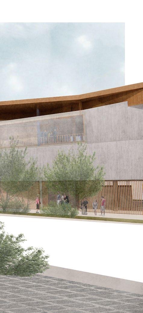
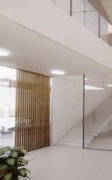
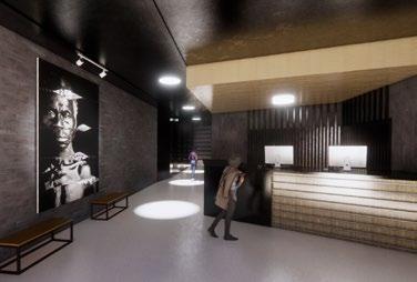
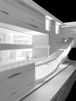
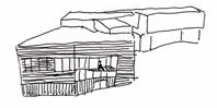
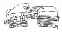
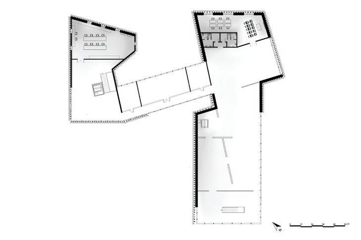
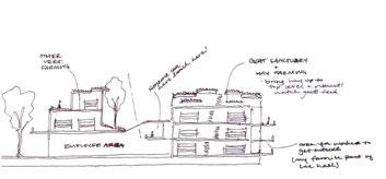
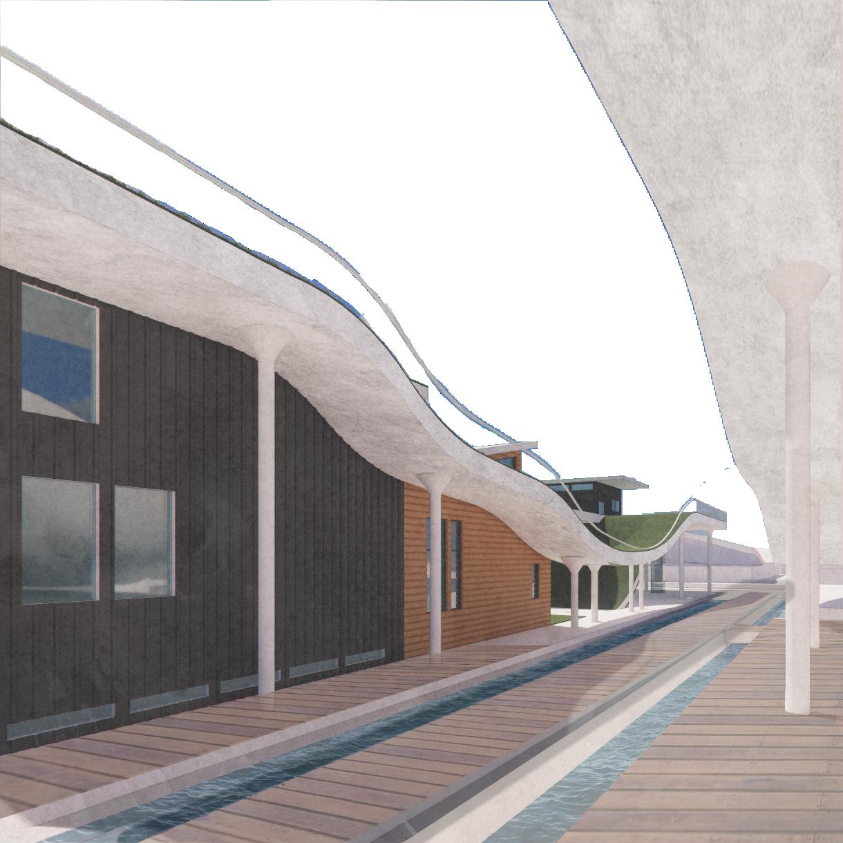
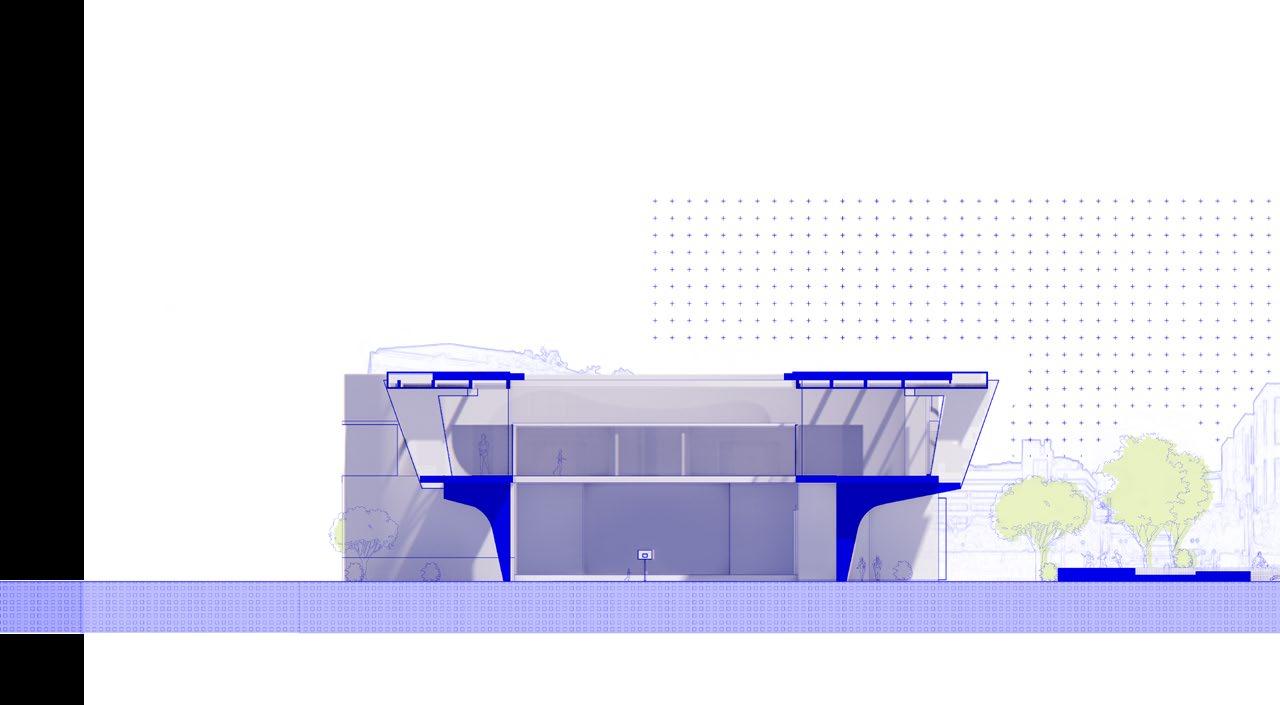
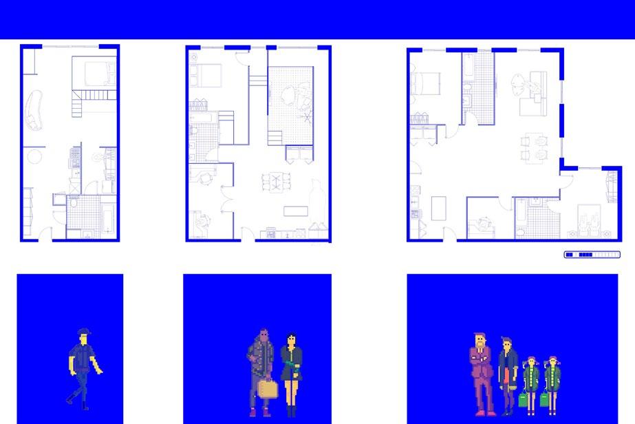
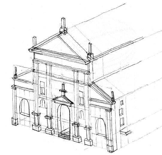
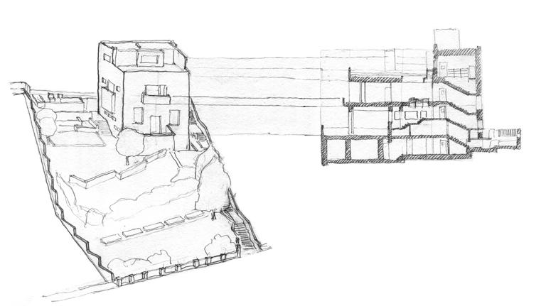
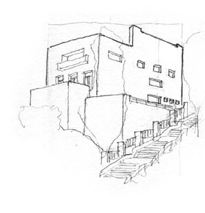
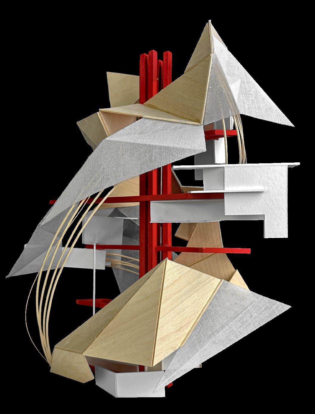
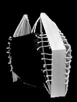
The business of Rome provided the ideal opportunity for pause, which takes form in this “social library”, public space, and residential building. The “social library” provides a way for the multi-generational demographic of this neighborhood to interact, reflect, and learn from one another through experiences rather than solely words on a page. The residential building sits opposite the library and in between the buildings forms a third public space. Each of these spaces is housed under one roof forming a cave-like appearance. Since humans have been attracted to caves since the beginning of time, we saw the opportunity to bring a cave to Rome – a place of safety, warmth, and a sense of home.
Concept design and plans were done collaboratively. My focus was on strategy, skin of the structure, and rendered views in Rhino and Photoshop.
STRATEGY
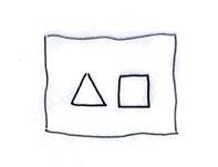
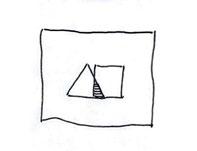
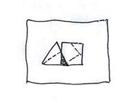
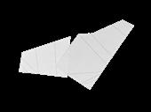
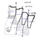
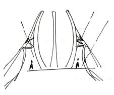
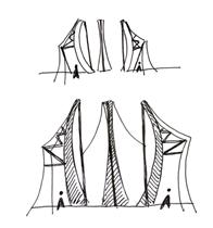
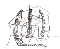
We knew we wanted to bring the safety and comfort of a cave to Rome, so we began to construct one by using a folding method. Starting with two shapes, they overlap, folds are formed, and then the third dimension is pushed to create a cave.
RENDERED VIEW FROM ACROSS THE STREET
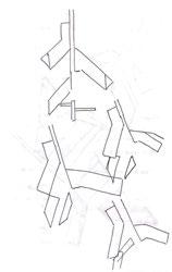
CONCEPT DIAGRAMS ink, paper
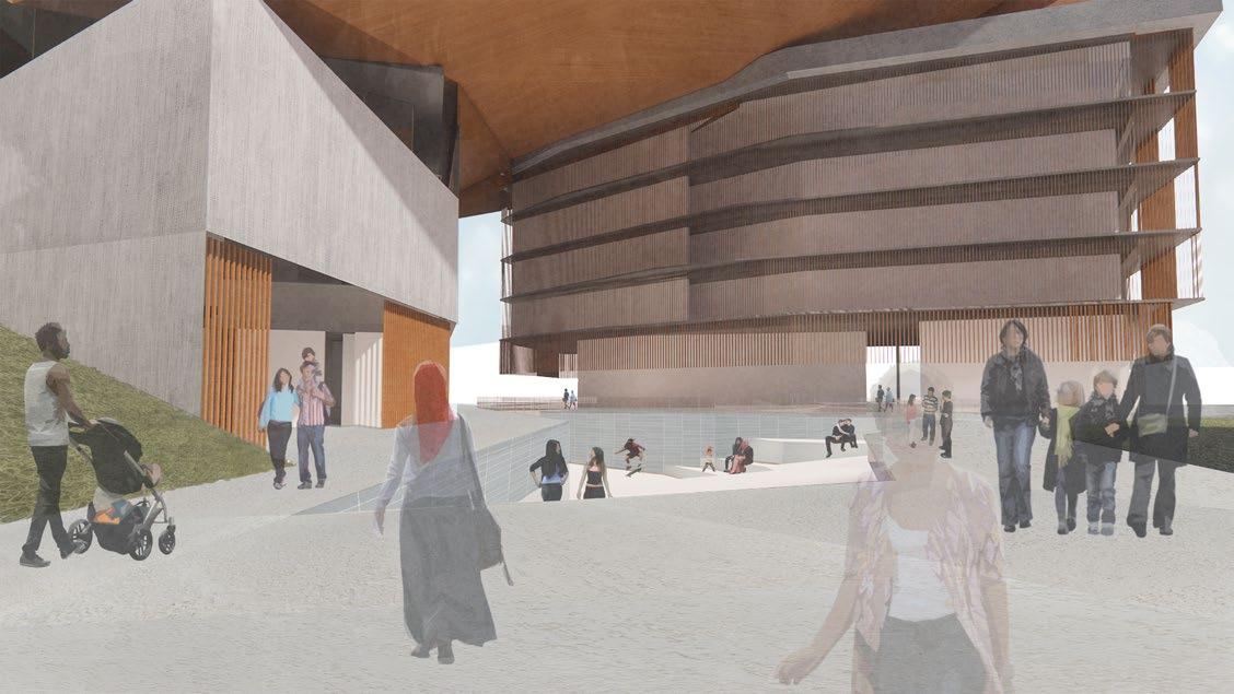
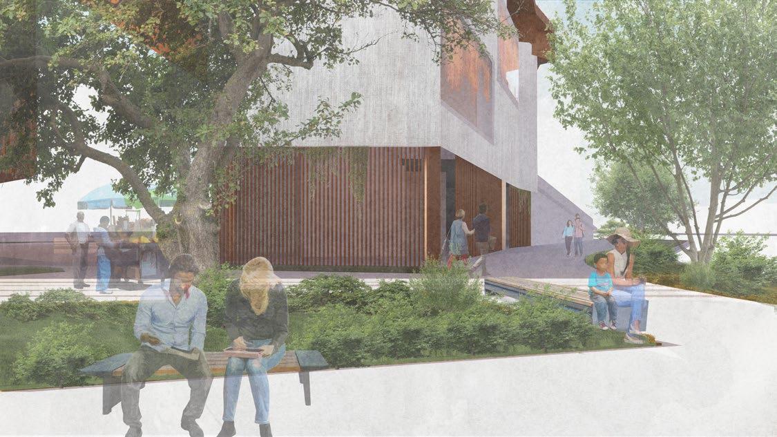
The Haven is the third public space in between the Social Library and The Habitat – the residences. It’s lined with shops and a park that faces the neighborhood. The Hideout is a more intimate space for conversation and reflection surrounded by greenery for privacy and an escape from the noise of the city.
5 HIDEOUT VIEW
2 HAVEN VIEW
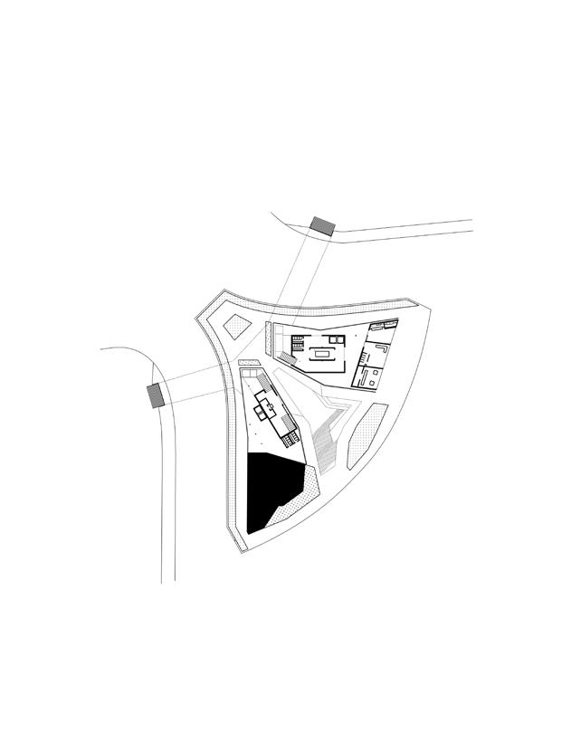
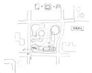
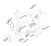
Nestled at the entrance of the neighborhood of Porta Metronia, Rome, lots of noise is created. Landscaping absorbs the sound of traffic while maintaining peace within the refuge. The site is tapered towards the northwest to create a separation of public and private.
1 STAIRWAY TO HAVEN VIEW
The third space created between buildings references the cave concept we wanted to prioritize. Against the background of the city, this refuge exists to let people pause and be comforted.
With the site situated at the entrance of Porta Metronia, heavy traffic posed an opportunity for underground entry. On either side of the site, a Stairway to Haven is located near the opening in the Aurelian Walls that cradle our intervention. Underground space is used for circulation and a directory to either building while creating a hangout space of The Haven.
DIAGRAM OF UNDERGROUND ENTRY POINTS
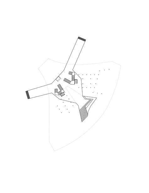
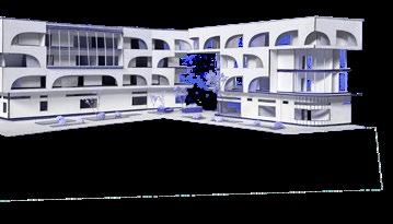
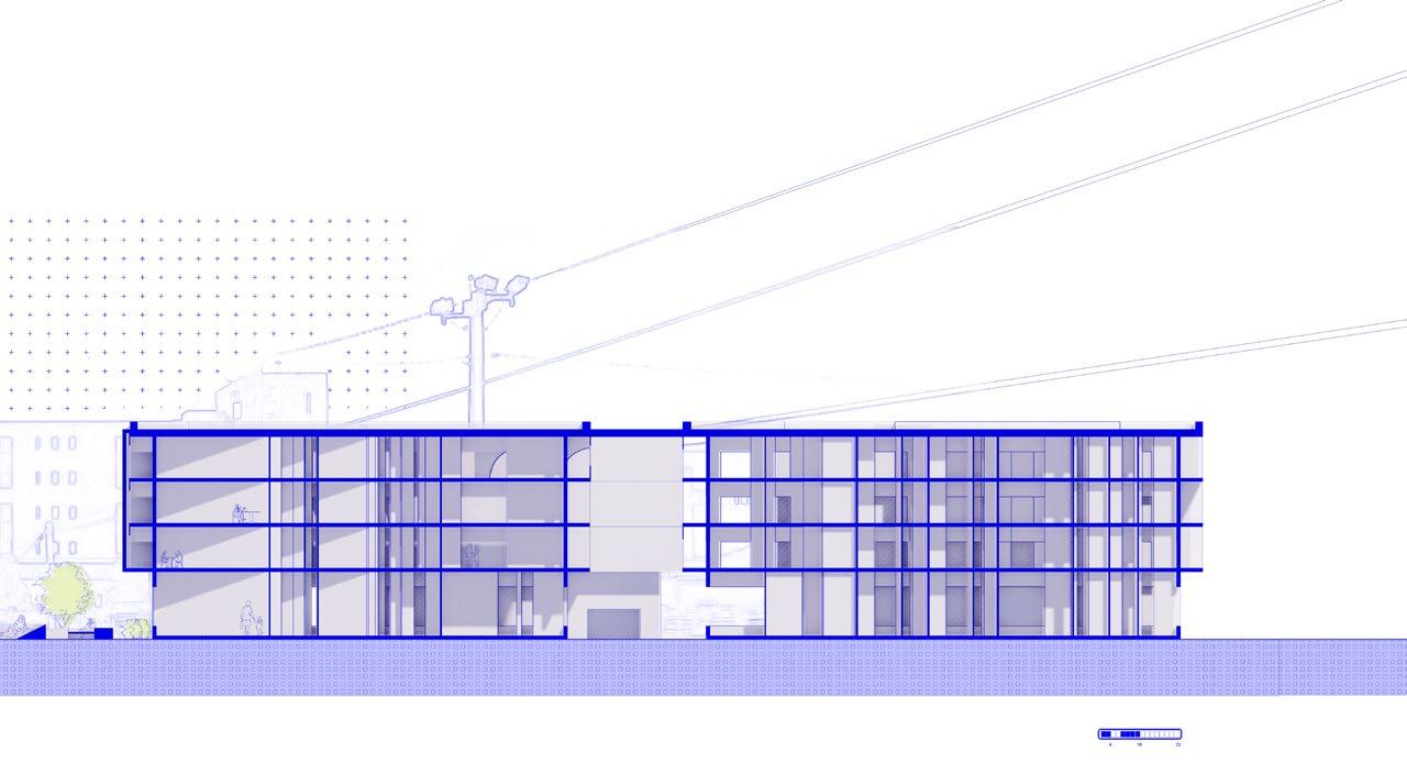
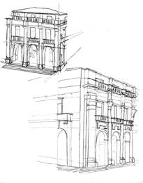
02. STITCHED TOGETHER
BRIDGING SAVANNAH’S PAST AND FUTURE
SITE SAVANNAH, GEORGIA
TYPE MUSEUM
YEAR SPRING 2023 / DESIGN 6
PROF. HERBERT JAMES
COLLAB JOSELYNE CHAVARRI
KIRIANNE NONG
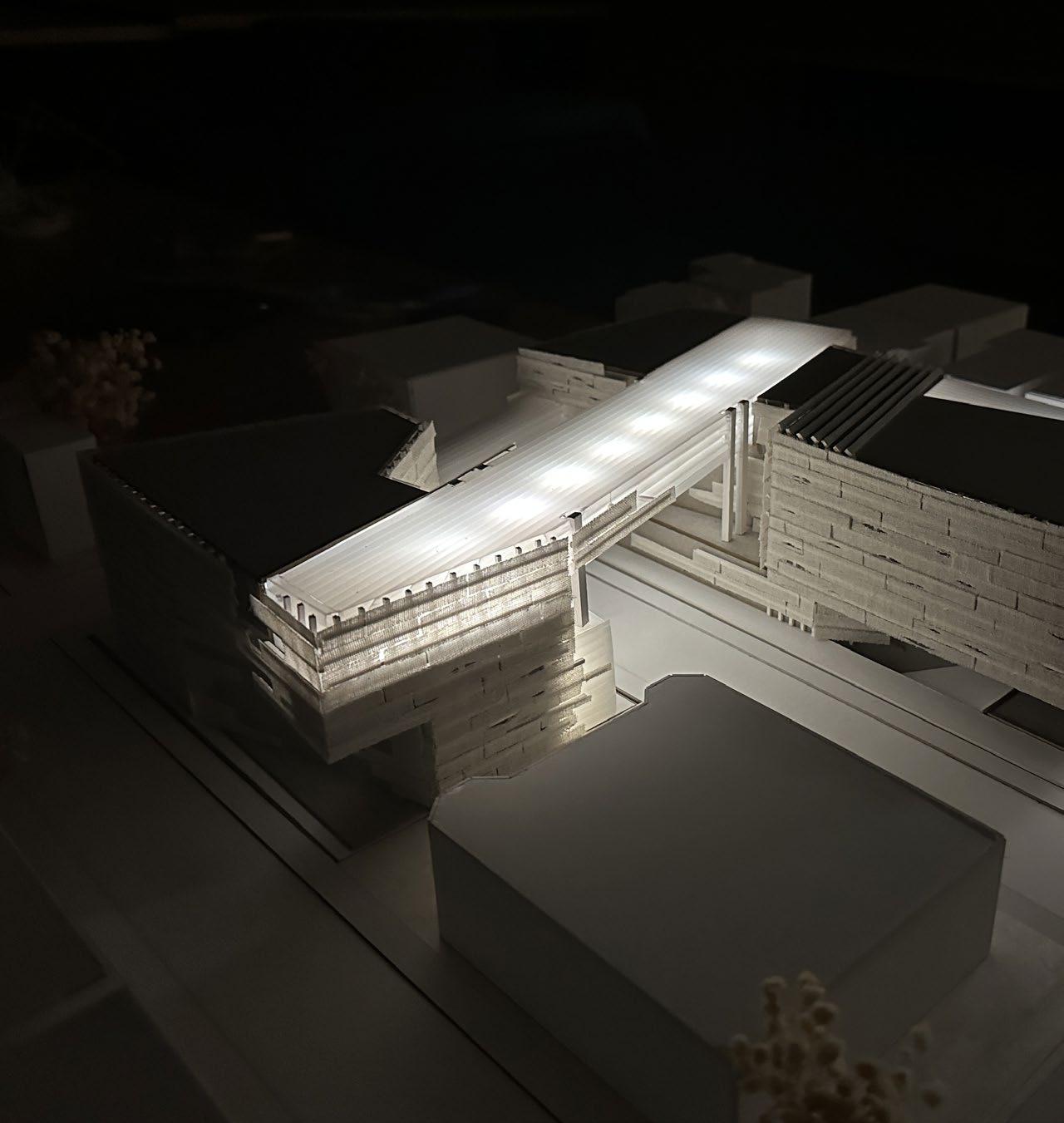
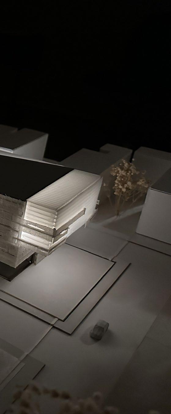
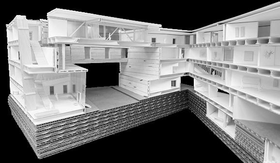
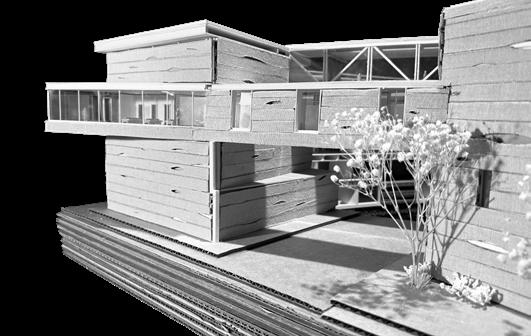
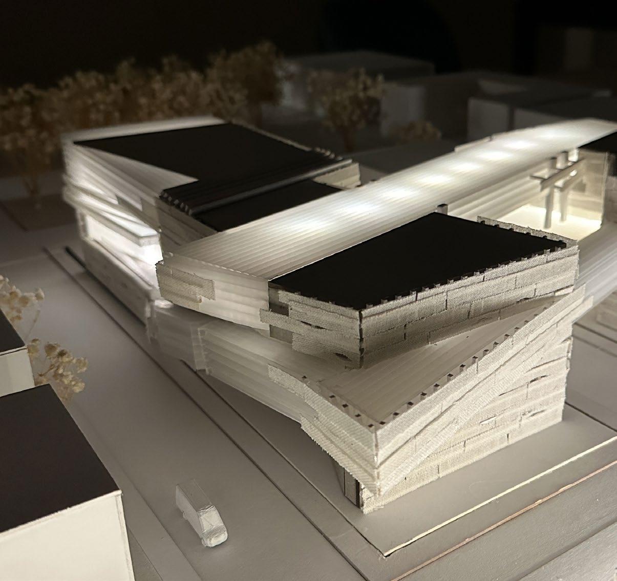
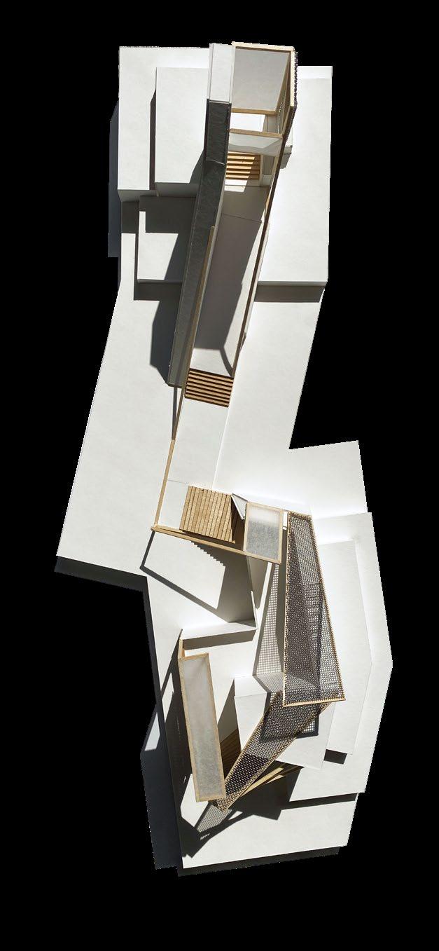
OVERALL MODEL IN SITE MODEL (1/16” : 1’ SCALE) museum board, basswood, corrugated plastic, cheese cloth
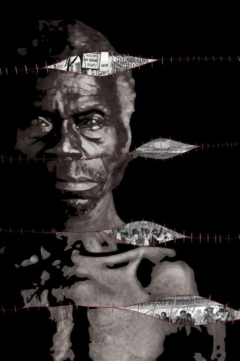
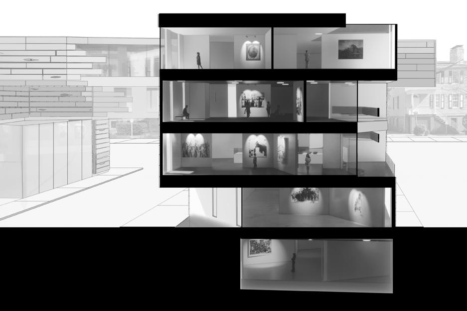
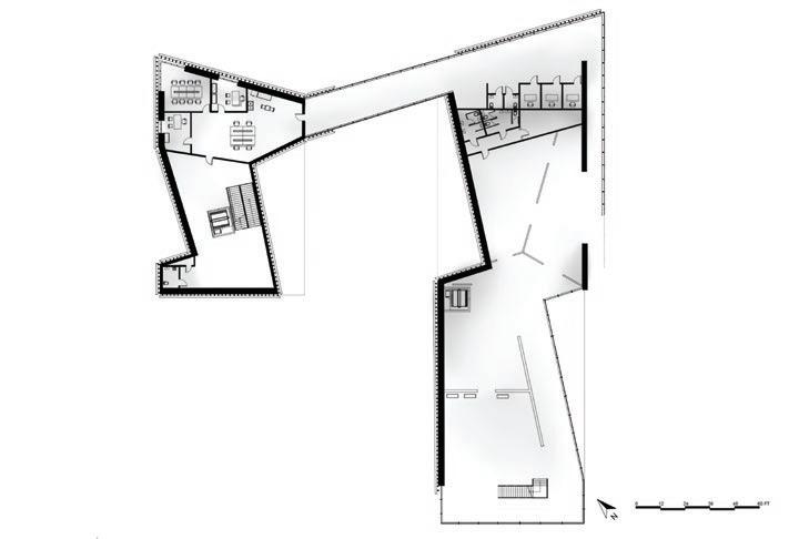
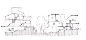
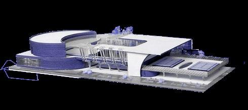
This museum in Oglethorpe Square, Downtown Savannah, Georgia, offers a powerful depiction of Savannah’s history through the lens of slavery. Visitors are led through an axis of plot points that depict the harsh realities of slavery and are enveloped in the emotions experienced by enslaved people. By stitching together moments from the past and present, we demonstrate how Savannah’s history is tied to the legacy of slavery. Our museum serves as a reminder to understand and reckon with the past for a more just future.
The movie poster above is derived from our research of Savannah’s history with slavery. A former slave, Renty, is being held together by bloody stitches. He’s slightly offset in each section to show how though holding it together, the scars of the history of slavery still affect people today.
Early design development, concept and narrative were done collaboratively. My focuses were model making, diagrams, and the movie poster.
MOVIE POSTER photoshop
PULSE OF THE PROJECT
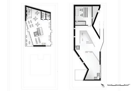
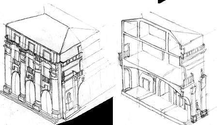
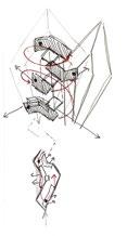
The narrative of this project focuses on a movie plot diagram. The exposition, rising action, climax, and resolution relate to Savannah’s past, present, as well as the generational lineage of former slaves. This plot diagram acts as the central axis of the museum. Other systems, skin and structure and circulation, react to the plot points.
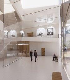
3. RESOLUTION - CLASSROOMS + ATRIUM
Classrooms are placed in the second building upon descension from the bridge to acknowledge that an education must continue so history does not repeat itself. A bright two story atrium concludes the journey through the museum.
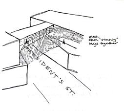
To accommodate for a square footage requirement, the site was extended across the street. The bridge was a solution to account for the change, but it also greatly enhanced the narrative of our project. Connecting Savannah’s past and future became clear as we used the bridge to stitch history to the present day.
MOVIE PLOT DIAGRAM RENDERED PERSPECTIVES
2. CLIMAX - BRIDGE + EVENT SPACE
After a long fight for justice, freedom is finally achieved. An event space full of light and an open floor plan make up the bridge between the two buildings of the museum.
1. EXPOSITION - LOBBY + FIRST FLOOR
A tight space resembling the horrific conditions of the process of transporting slaves to the Americas begins the journey of this museum. Specific circulation and little light are used to recreate a sense of lack of control and confusion.
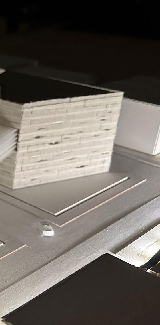
SECTION MODEL (1/8” : 1’ SCALE)
museum board, basswood, cheese cloth, plexi
The exterior ramp shows the rising action plot point of the movie plot diagram. The skin has gaping pieces and “stitching” to further the narrative of history and the present coming together.
The terrace on the second floor, bridge, and second building atrium are illuminated at night. Transparency at these points highlights the importance they have within the narrative of progress, celebration, and continued education of justice.
OUTSIDE TERRACE AND BRIDGE
AND FORM SKETCHES
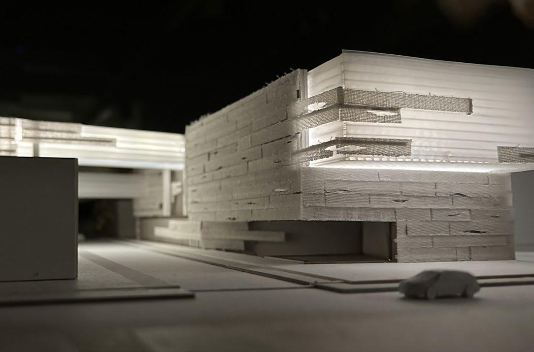
A view from across the street shows a perspective of the entry that pierces into the underground level. Illuminated above is the two story gallery that contributes to the rising action plot point.
Area of entry and two story gallery are highlighted.
SECTION MODEL (1/8” : 1’ SCALE) SKIN
VIEW OF ENTRY FROM ACROSS THE STREET
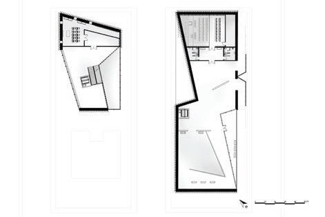
LEVEL 4
1 - Gallery
2 - Special Exhibit
3 - Bathroom
4 - Event Space
5 - Conservation
6 - Classrooms
LEVEL 3
1 - Gallery
2 - Special Exhibit
3 - Bathroom
4 - Offices
5 - Storage
The stitching action is best exemplified through the main bridge – the event space. This is the primary way to cross to the other side of the museum for the public. A smaller bridge on the floor below is for private use for the offices.
SELF SUSTAINING BARRIER ISLANDS HOMESTEAD ON HIGHWATER 03.
SITE
OCRACOKE, NORTH CAROLINA
PROGRAM AGRICULTURE + MULTI USE
YEAR FALL 2024 / G1 STUDIO
PROF. ULRIKE HEINE, RAYSHAD DORSEY, AMY TRICK
COLLAB MARIANA RAMIREZ
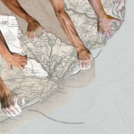
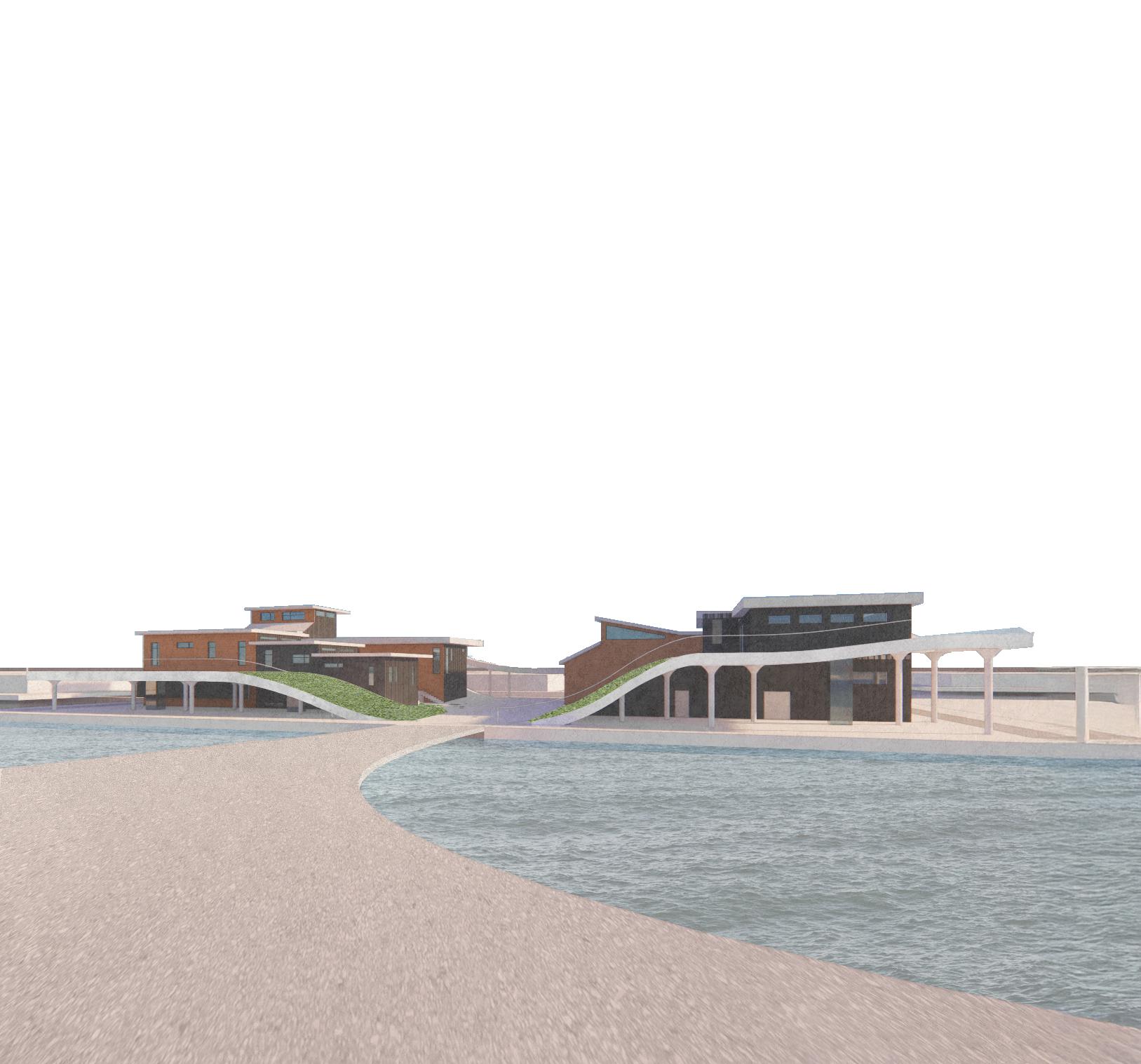
Ocracoke Island is a barrier island located on the outer banks of North Carolina facing the worst effects of climate change – rising sea levels, erosion, and a continuous dwindling of natural resources. The solution to a drowning Ocracoke is to revert to the island’s once self-sustaining culture. This project creates floating architecture that acts as a homestead – housing and agricultural programs.
While building off the coast in areas prone to high storm surges brings its own sets of challenges, the Ocracoke community has said “there is no other place they want to live, and if Ocracoke washes away, they want to go with it”. This project prevents Ocracokers from uprooting their lives to live on the mainland or washing away with their island. It incorporates agriculture and renewable energy to ensure Ocracoke’s resilience and self-sustaining heritage.
Local food is made using animal agriculture and vertical farming, beginning with goats and chickens, as well as a variety of crops. The initial island is only the first of what will become a network of interconnected modules that will provide the resources necessary for life on Ocracoke.
Commodification of the barrier islands as tourist destinations and economic ventures has caused the effects of climate change to rapidly increase.
DIGITAL COLLAGE
PAMLICO SOUND
ATLANTIC OCEAN
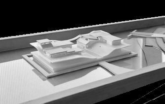
SITE MODEL (1:20 scale)
3D printing, chipboard, acrylic, whiteboard
The site is located off the coast of the Pamlico Sound, avoiding the Atlantic storm surges, is connected to the main road, Highway 12, and sits at one of the highest points of the island.
DESIGN FRAMEWORK
DESIGN FOR ENERGY
With self-sustainability being at the forefront of the design of this project, solar (panels/water heaters) and wave energy (point-absorber) are being used to fully power each island
SOLAR WATER HEATERS 2-3 person home 1.5 kW per day/panel POINT ABSORBERS produce 4800-9600 kWh per day efficiency of 30-40% per wave
PV CELLS save up to 50-80% of water heating costs annually
DESIGN FOR WATER seawater intake desalination fresh water storage hydroponics water recycling
Reverse osmosis purifies water for vertical farming by removing impurities, recirculating nutrients, and reducing water loss through transpiration as opposed to traditional farming
DESIGN FOR WELL-BEING
This project connects the people of Ocracoke with nature, offering fresh air, greenery, and engaging paths that promote mental and physical health while encouraging a healthy lifestyle
COMMUNITY CONNECTEDNESS
people who use parks and other green spaces regularly are 40% more likely to interact socially, which is directly tied to better mental health
DESIGN FOR ECOSYSTEMS
Underwater sea farms in the seams of each island allow for revitalization of underwater ecosystems. Seaweed naturally filters the water of the Pamlico Sound to create a cleaner area for fish
a single adult oyster can filter as much as 50 gallons of water a day
farming seaweed in less than 5% of US waters could absorb 10 million tons of nitrogen and 135 tons of carbon
The design of a green roof functions as a mini ecosystem, fostering biodiversity by growing pasture that supports grazing goats
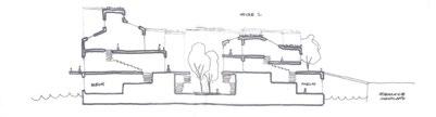
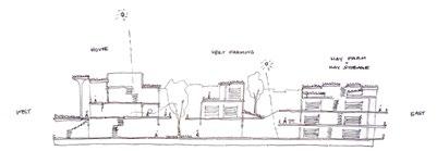
SECTION PROCESS SKETCHES
The housing is located on the west side of the homestead with sloped roofs to combat the summer sun. Vertical farming is directly below housing for easy accessibility to crops. Due to the need for a controlled environment, vertical farming is within the pontoon grid level to ensure controlled water and lighting. Maintenance, like water filtration and storage, mechanical and electrical space, and waste management, and hay production are also stored within the reinforced concrete pontoon system.
The complex process of agriculture was considered when making the highly efficient and self-sustaining system. Waste management is directly below the barn to gather future natural fertilizer for the crops and pasture. Adjacent is the hay production so it can be brought up to the barn and pasture. Animal and dairy products are made beside the barn to allow for a smooth transition.
DESIGN FOR CHANGE
The final piece of framework for this project is designing for change. The initial homestead is only the first of what will become a network of interconnected modules that will provide the resources necessary for life on Ocracoke. Since the main form of transportation around the island is boats, the modules adapt in a series of phasing to create channels for boats and the ferry.
As the phasing continues, water levels rise, by 2100 the majority of Ocracoke will be underwater while the selfsustaining homesteads hold all the resources already available on present day Ocracoke. Additional housing, agriculture, and boat docks will be added over time, as well as a medical services center, library school, and so on. The goal of this project is to adapt to climate changes if the net zero goal is not achieved.
We don’t want Ocracoke’s generations of permanent residents to have to choose between uprooting their lives or washing away with their island. This homestead provides a third option, an opportunity to maintain their community and and culture amidst the changing climate.
VIEW OF PASTURE ON TOP OF BARN
PATH CONNECTIONS DIAGRAM
To accommodate for later phasing, paths will be built with new modules to accommodate for transitions between homesteads and resources. Between blocks of phasing are the routes of channels for boats and the ferry in the future.
VIEW OF LATER PHASING
MODULE 1
MODULE 2
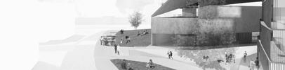
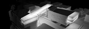
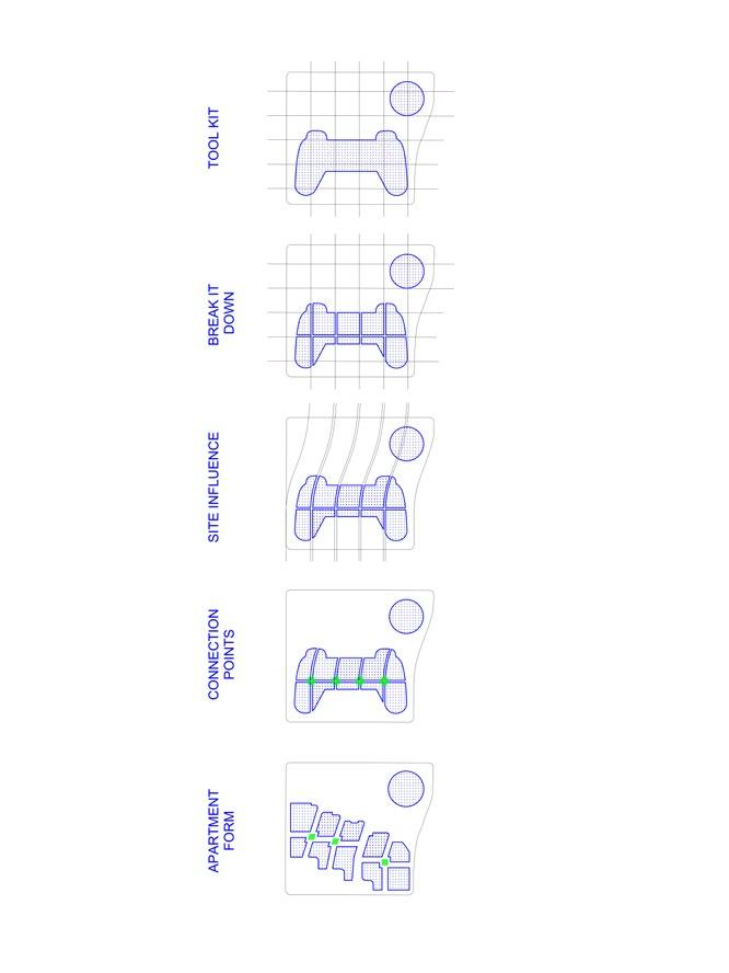
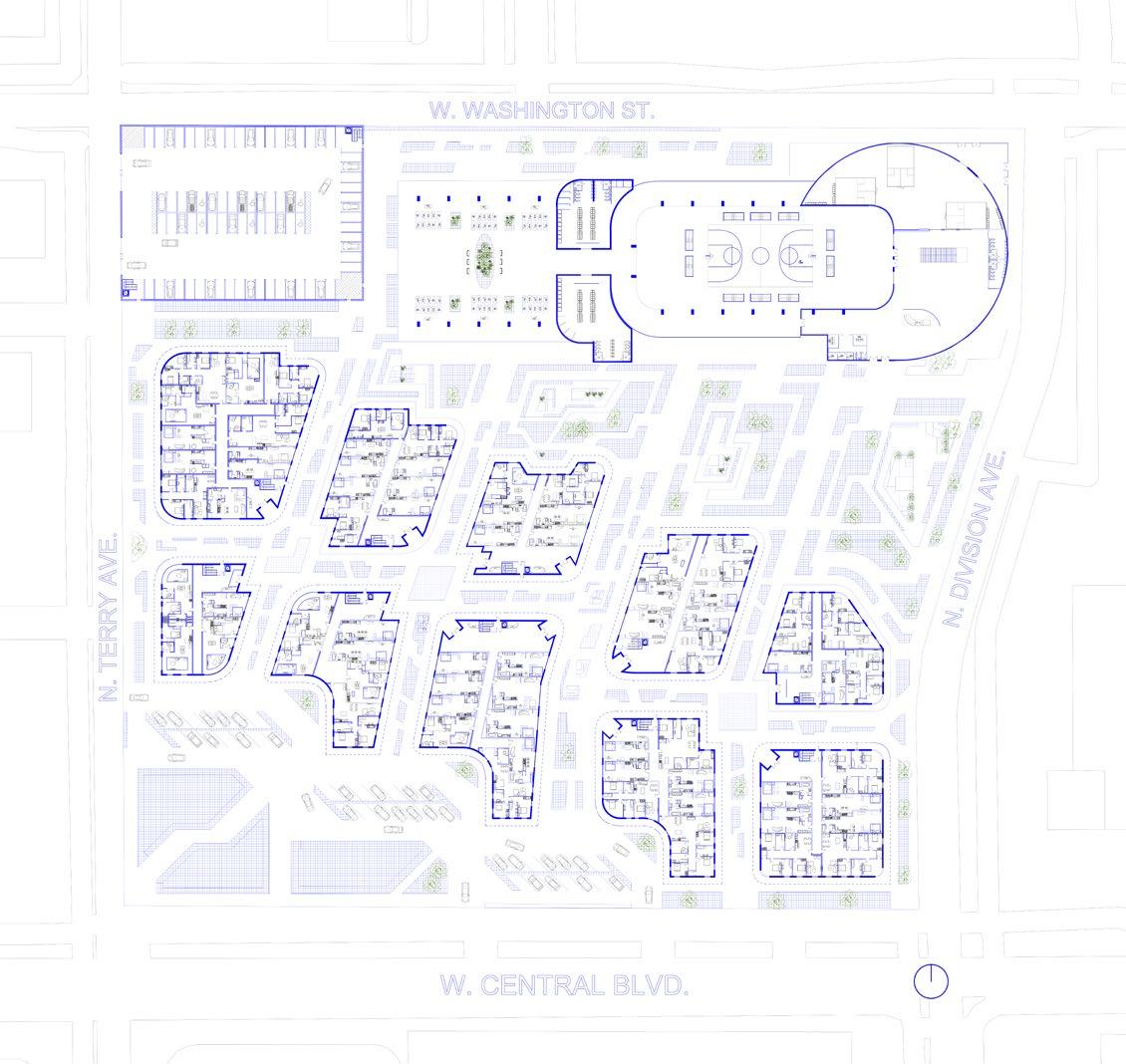
CIRCUIT SECTOR 04.
REVITALIZING PARRAMORE
SITE ORLANDO, FLORIDA
PROGRAM MASTER PLAN
YEAR SPRING 2024 / DESIGN 8
PROF. BRIANA JOHNSON COLLAB AMELIA KARADSHEH
SARAH LE
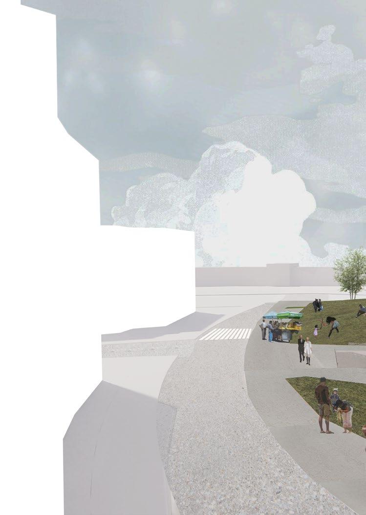
Interstate 4 cuts through chic, ever-growing Downtown Orlando, and the slower-paced, neglected Parramore Community. Circuit Sector to revitalize the west side of I-4 through a form of entertainment that transcends time, culture, and status: games. When charged with the task of planning a block of Parramore, it was vital that the program was affordable, intergenerational, and encouraged active participation.
Surrounded by stadiums, professional sports teams’ training facilities, Electronic Arts office buildings, and the local neighborhood center, the Parramore community is within the gaming realm, which is why this project seeks to integrate both communities.
SITE ADJACENCIES
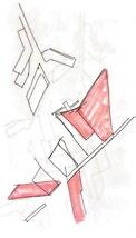
PROCESS SKETCHES
MODEL OF REC CENTER
MODEL OF EXTERIOR OF APARMENTS
Varying apartment unit layouts were inspired by video game game-modes – ‘Single Player’, ‘Co-op’ (cooperative), and ‘Multiplayer’ – which feature studio, one-bedroom, and two-bedroom apartment layouts. Residents are part of an activation and revitalization of the Parramore community.
SINGLE PLAYER
CO-OP
MULTIPLAYER
MASSING DIAGRAMS
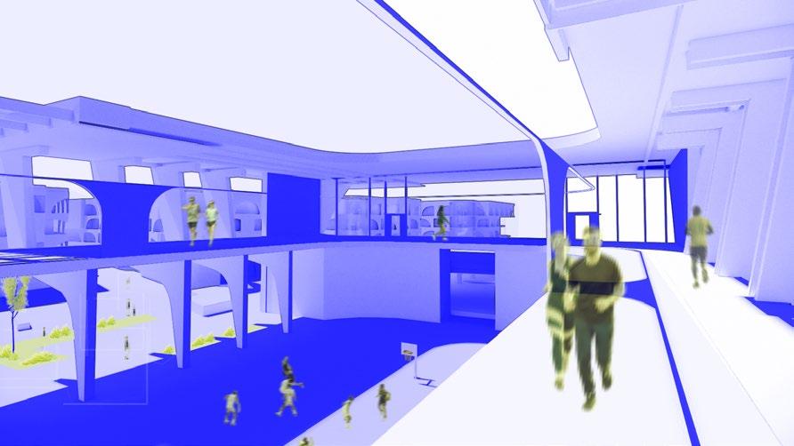
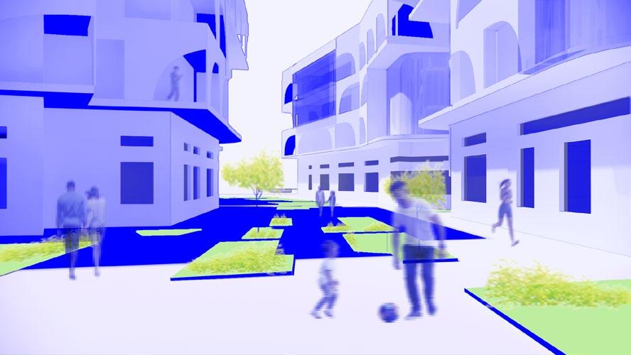
Originally inspired by the motherboard of a computer and a gaming toolkit, hence the name ‘Circuit Sector’, the programs of the architecture promote recreation and encourage interaction. People find outdoor interaction at ‘nodes’, which are outdoor connective spaces found in between apartment buildings and in the wide path between the residential area and rec center.
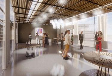
INTERIOR OF XP HUB (REC CENTER)
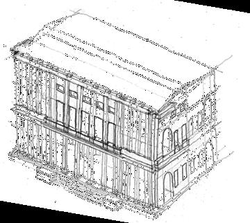
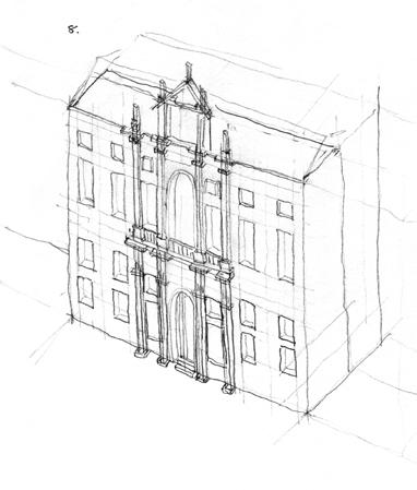
05. TRAVEL SKETCHES
ANALYTICAL FIELD + THESIS SKETCHING
YEAR ANALYTICAL SKETCHING - FALL 2023
PROF. ALFONSO PEREZ-MENDEZ
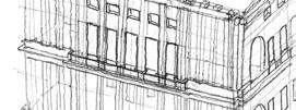
During the fall semester of 2023, I joined University of Florida’s Vicenza Institute of Architecture program abroad in Vicenza, Italy. I learned how to analyze quickly and sketch from the axonometric perspective. Analytical sketching leans away from the picturesque, capturing how one would model a building rather than including detailed ornamentation or greenery. Field sketching entailed travel to the site and sketching for a limited time, while sketches for my thesis were aided by photos to compose spreads for the final. All drawings are freehand using graphite.
PALACIO CHIERICATI (1680)
Andrea Palladio / Vicenza, Italy
ORDINE DEI DOTTORI COMMERCIALISTI Vicenza, Italy
LOGGIA DEL CAPITANIATO (1572) Andrea Palladio / Vicenza, Italy
PALACIO CHIERICATI (1680) Andrea Palladio / Vicenza, Italy
CHIESA DI SAN SIMEON PICCOLO (1738) Giovanni Antonio Scalfarotto / Venice, Italy
CASA BORGO (1979) Carlo Scarpa / Vicenza, Italy
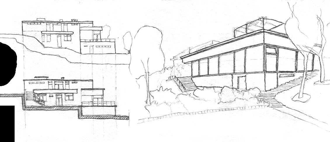
THE RELATIONSHIP BETWEEN HOUSE AND PLACE
My thesis explored the intricate and dynamic relationship between architectural design and the natural environment through case studies of single-family homes. The house and its context must respond and react to one another. The extent of their actions and reactions varies based on location, yet there are commonalities that begin to establish the harmonious relationships that must incur to create a project that is aware and appreciative of its environment. Views, orientation, landscaping, and innovative solutions to traditional methods are key elements that establish a strong relationship between house and place.
VILLA TUGENDHAT (1930)
Ludwig Mies Van der Rohe / Brno, Czechia
VILLA MÜLLER (1930)
Adolf Loos / Prague, Czechia
ZUMTHOR VACATION HOMES (2009)
Peter Zumthor / Vals, Switzerland
VILLA MALAPARTE (1963)
Adalberto Libera / Capri, Italy
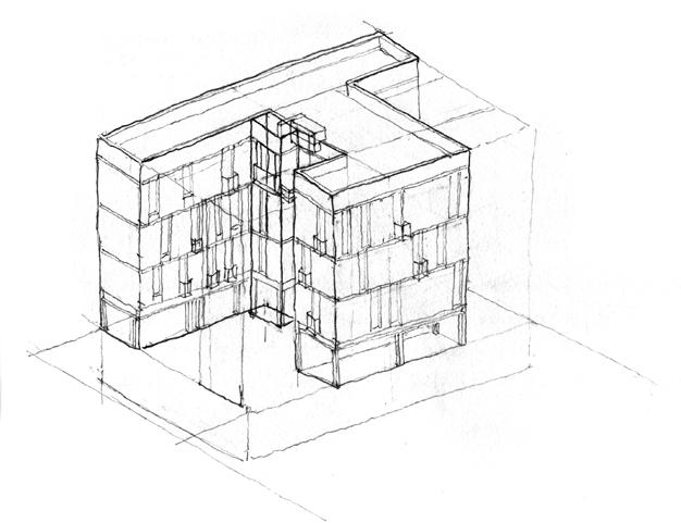
06. INVESTIGATIVE SYSTEMS
EXAMINING SYSTEMS OF CONSTRUCTION
YEAR SPRING 2023 / DESIGN 6
PROF. HERBERT JAMES
COLLAB JOSELYNE CHAVARRI KIRIANNE NONG
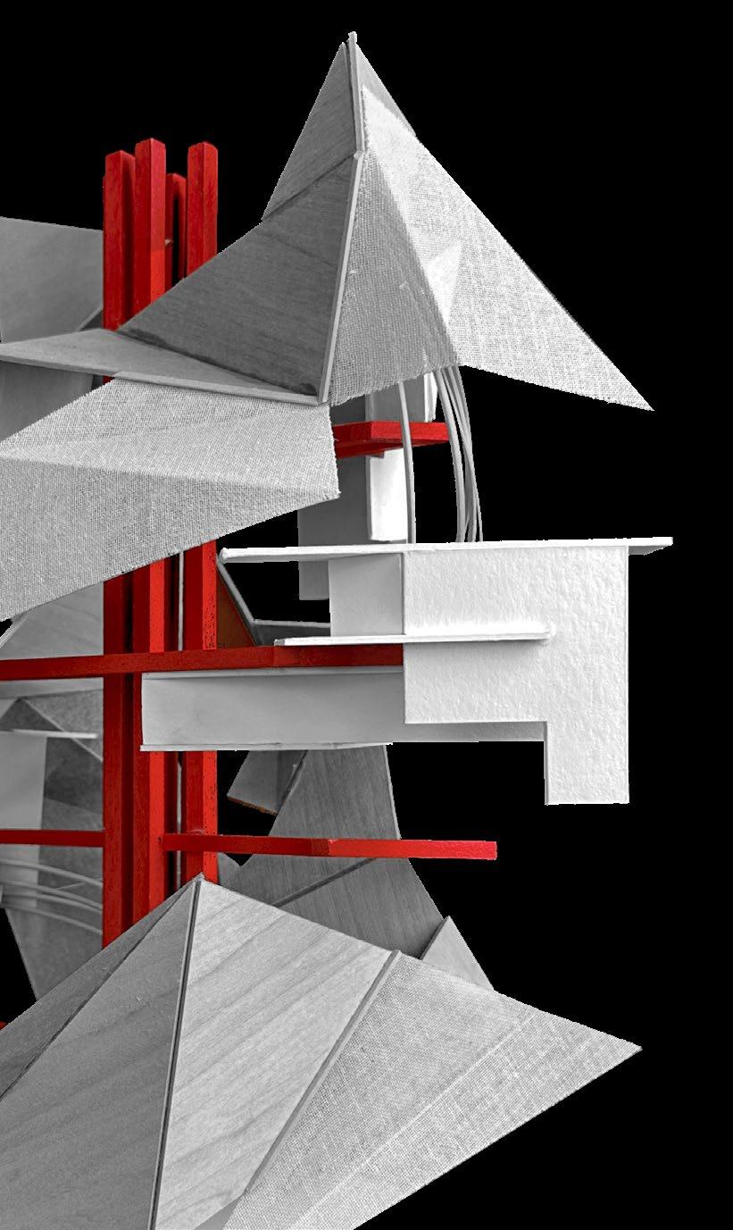
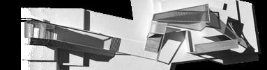
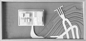
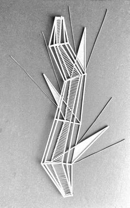
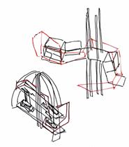
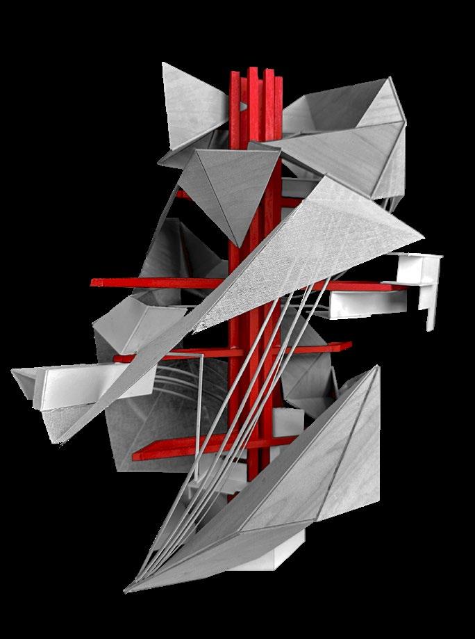
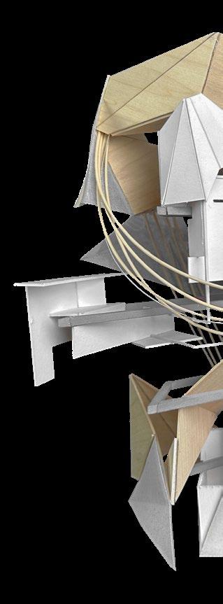
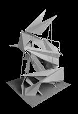
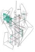
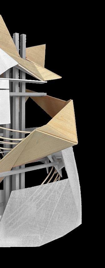
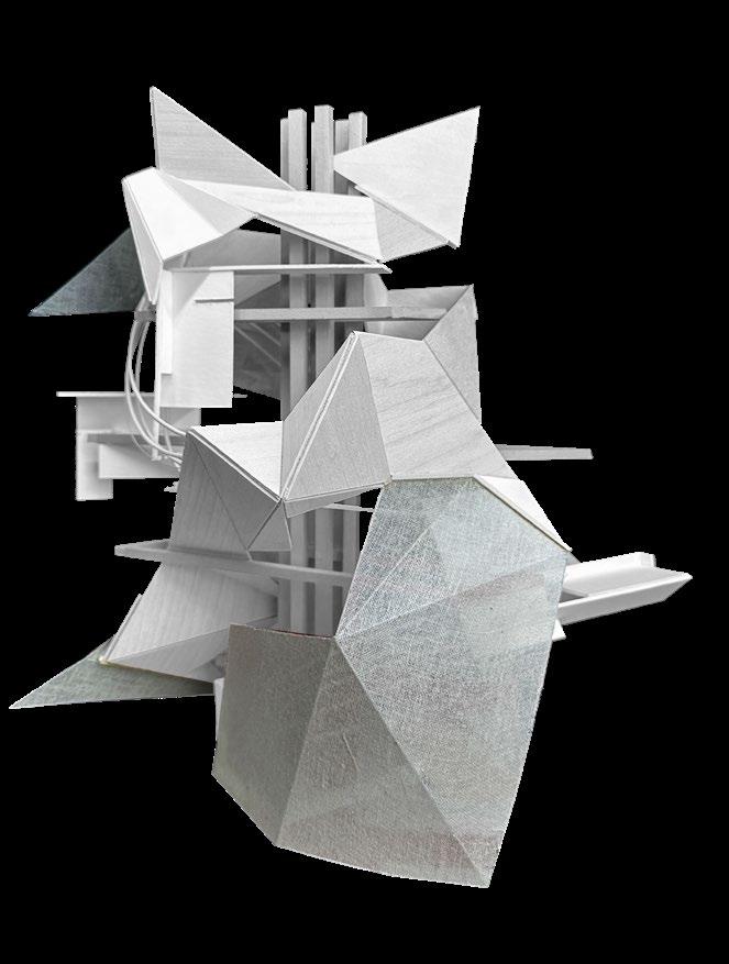
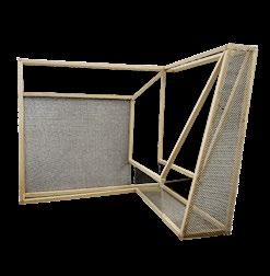
This project shows the process of considering and studying the functions of a building. To assist in the creative process, the words stitch, axial, and fold were assigned to three systems of construction, skin and structure, program, and circulation. The final model uses these words and systems to create a concept narrative portraying an analysis of the inner workings of a building.
The group collaborated on concept and early design. My focus was the system of axial program in diagrams and models.
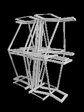
CONCEPT MODEL basswood, museum board, cheese cloth, round reed
STITCH
Tectonic systems protrude from the foundation emerging from points along the perimeter. Fabric is attached using tension and pulled taught at anchor points.
AXIAL
A central axis is formed by overlapping frames creating primary, secondary, and tertiary spaces. Additional space is created through leading lines stemming from the junction of frames and secondary space.
Folds create a threshold that leads into segments pivoting at four points. Spaces created by a central path further define the circulation.
Depicting the chosen words through the systems, then forming them into an egg-shaped structure was what our group was tasked with. Sets of diagrammatic models and sketches led us to our final concept model.
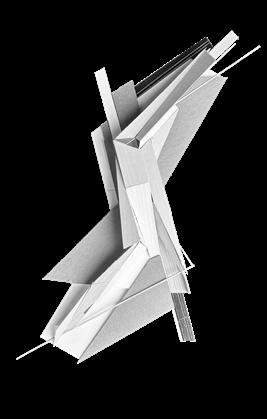
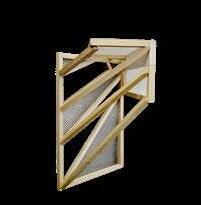
CONCEPT MODEL ROTATED
Program takes form in the central axis holding together the branches of frames protruding outwards. White elements stemming from the branches form secondary spaces and react to the geometry of the frame.
Just as the axis begins within circulation. The circular upwards is created by folds which come movement upwards.
within the foundation, so does the upwards movement of the basswood come to points and pivot guiding
STITCHED SKIN AND STRUCTURE
Tensile elements loosely follow the circulation to provide structure to the skin - more delicate elements that react to the folding of circulation and are supported by the organic basswood linear system.
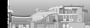
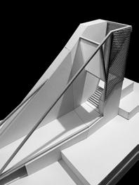
07. ILLUMINATED PATH
A STUDY OF LIGHT AND SHADOW
YEAR SPRING 2022 / DESIGN 4
PROF. CARLOS POMPEO-ARIAS
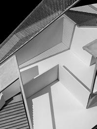
PROCESS MODELS
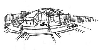
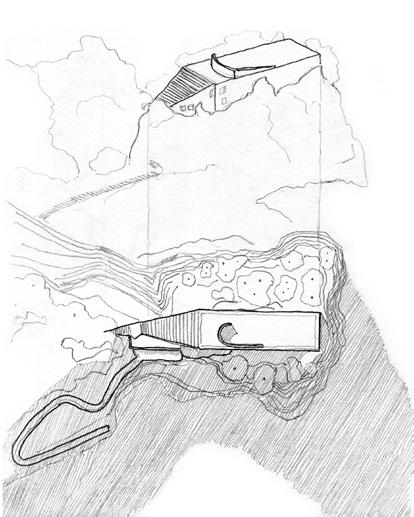
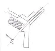
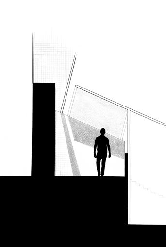
The strategy used to create a path directed by light and shadow was to embed models derived from light box studies. A single path of circulation is created dictated by the filtering and managing of light conditions.
Derivative models form the final path. A quick ascension begins the journey, followed by a major pivoting point directed by filtered light, finishing with a shaded overhang.
The process models are now rationalized by the process of embedding the light filters into the site. The site builds up to form a grand entry, then levels out in the middle to create opportunity for the major pivoting point marked by shadow play of geometries. The model finishes with a larger more organic descent.
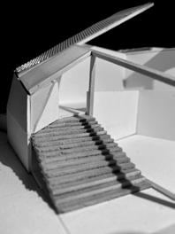
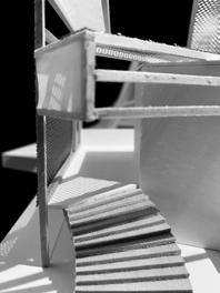
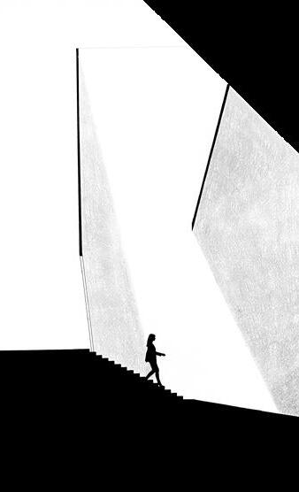
TWO SOURCES OF LIGHT
basswood, chicken wire, plexi
The slow descent of the grand entry shows the pace of the promenade created by shadows. A tighter, brighter space indicates a change of speed and direction.
Various uses of shadow were employed using transparent to opaque materials. Differences in opacity dictate speed throughout the model.