Portfolio
Alex Cohen

Alex Cohen
Higlighted Works
Jefferson Island Education Center
Fall 2022
THRESHOLDS Hostel
Spring 2024
Heritage Hub: A Cultural Learning Center of Los Angeles Fall 2023
The Big Shift Collective Housing Spring 2023
A New Front Spring 2025
Slow Movement
Fall 2024
Models and Fabrication
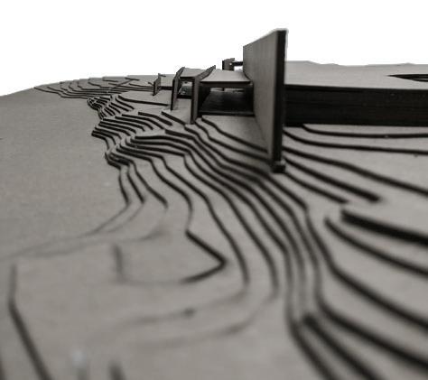
Placed on the site of a 1980 mining disaster in New Iberia, LA, this project seeks to inform visitors on the uniqueness of Jefferson Island and the mining disaster through the museum experience and its design.
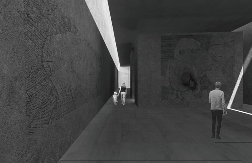
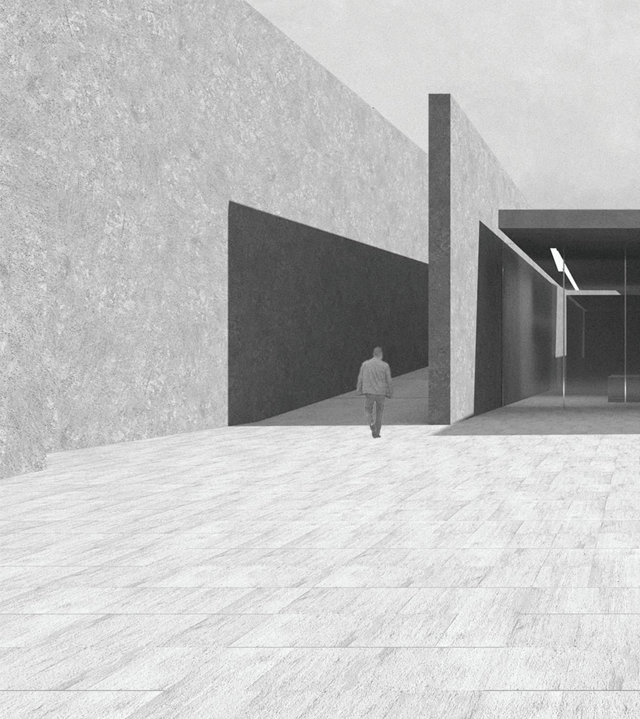
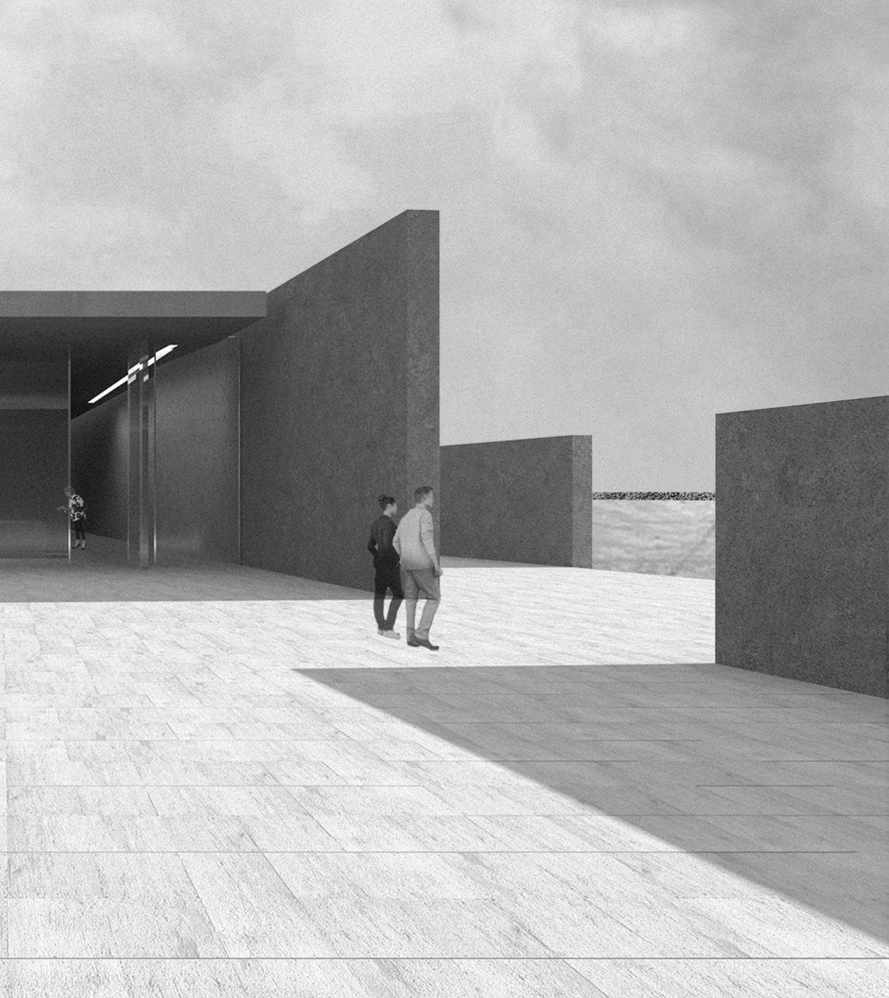
The entry sequence of the museum is situated on the aboveground footprint of the former mining operations. Arriving on to an expansive plaza memorializing the former mine building, visitors to get a sense of the scale of the mining operations, before descending into experience, walking along a retaing wall marking the datum between built and natural environment
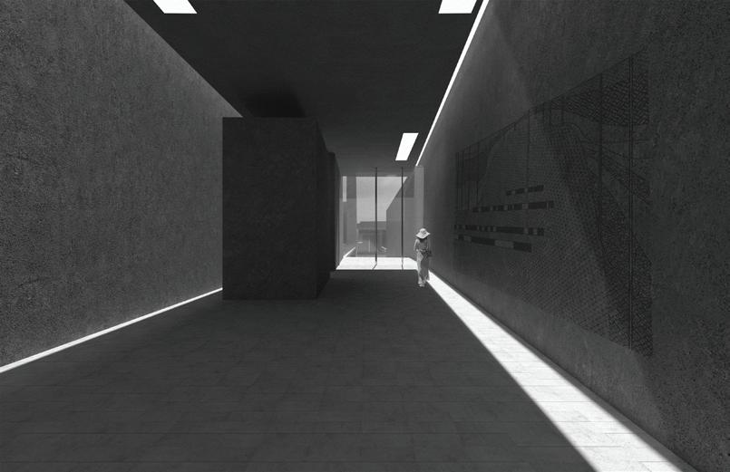
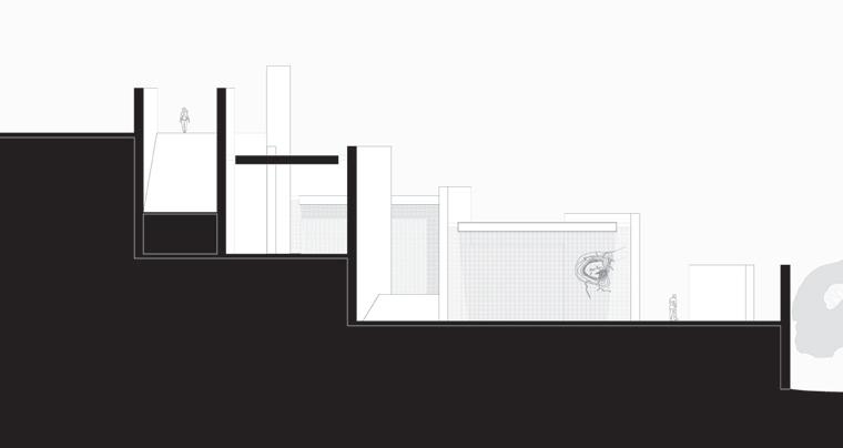
Visitors will circulate between a system of retaining walls that slowly disintegrate towards the water line, opening up at the end of the experience. These retaining walls dictate every aspect of the experience, from circulation to light permeation, and even interior vs. exterior space. As visitors descend, they are greeted by the first of three interior spaces - the lobby -
all of which are slotted between the retaining walls, and enclosed with glass planes on the ends. This allows the interior and exterior to blend, eliminating the presence of a threshold. As they exit the lobby, they once again go outside to ramp down to the main gallery and video room.
After going through the gallery, visitors descend through the walls one final time, bringing them to the social terrace, cafe and reading room. As the visitors near the end of their experience, the terrace opens up, allowing for views to the lake through the disintegrating walls.
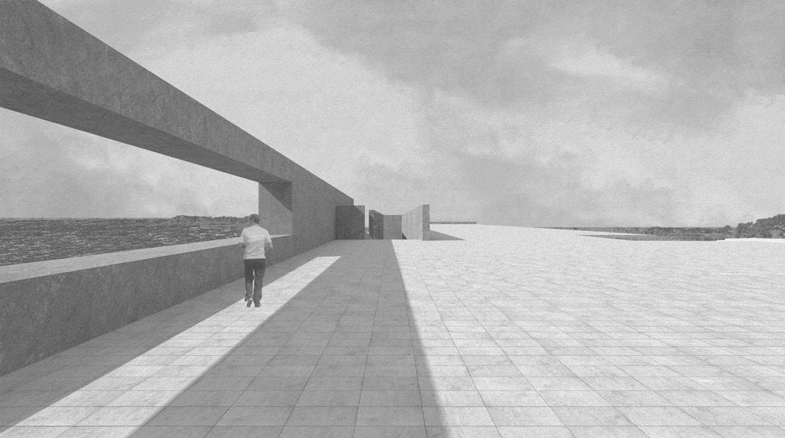
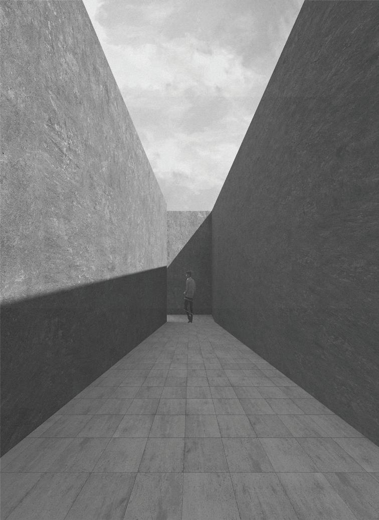
Ramping down into the experience


Community Culinary Hostel
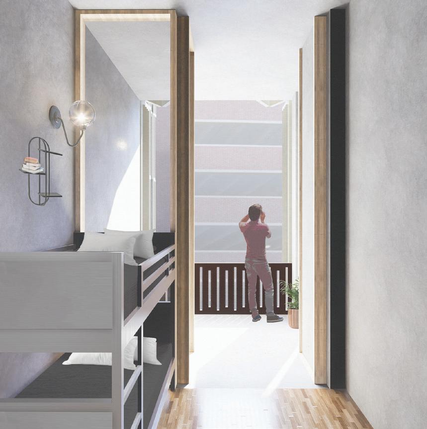
The porch is an architectural feature typical of the American South. It provides a cool, shaded outdoor space in the hot summer months and a shelter from rain in the wet season. The porch connects two spaces. A more private, mirco-community, and a more public, larger community. When placed in the right environment, a hostel also becomes a connector, in the same way a porch does, connecting the microcommunity staying inside with the larger community of the city the hostel is in.
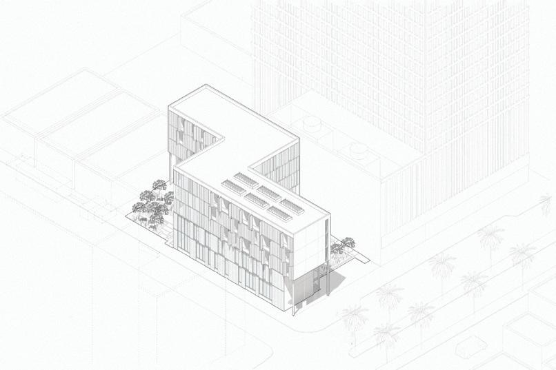
Located on a unique site in New Orleans, this hostel is straddled by two completely different urban conditions. In one direction, the French Quarter creates an experiential environment, while in the other, medical and municipal buildings create an institutional envionrment. With this, the hostel serves as a threshold, a space to guide the transition between two conditions, much like a porch does. The unique conditions also allow the hostel to cultivate new community within this threshold. By utilizing the public, communal nature of the culinary arts, this hostel becomes a place to foster its own microcommunity, while creating a new community in a transitional space of New Orleans.
To respond to the duality of the site, two plazas are placed on opposite corners of the site, creating an entry experience for each urban condition. The character of the plazas juxtaposes the character of the surroundings to create a new space within the site. The void left between the plazas becomes the building. From within the building, the one-way concrete structure acts as a frame extending out onto the plazas, creating a porch zone to blend the outside community with the micro-community. From the hostel rooms, a communal living area acts as a porch, transitioning between the public space and the private room. To accentuate this, the facade becomes operable with bifold shutters, allowing each guest to assign a role, whether it be public or private, to their porch space.


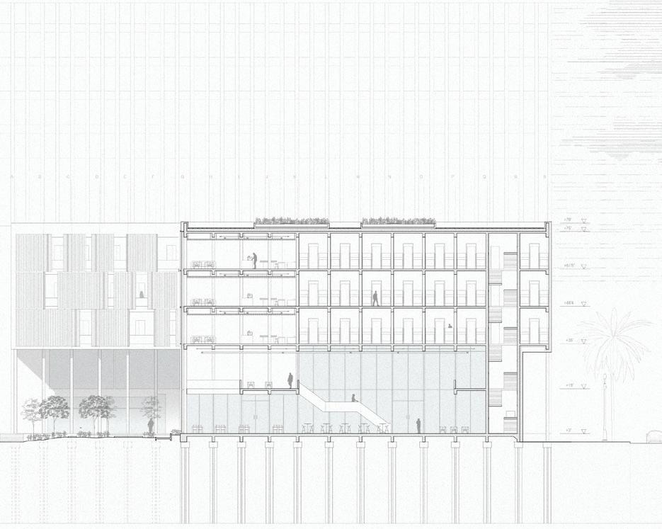


Section perspective through the dining room, Experiential plaza, and hostel rooms



A cultural learning center of Los Angeles
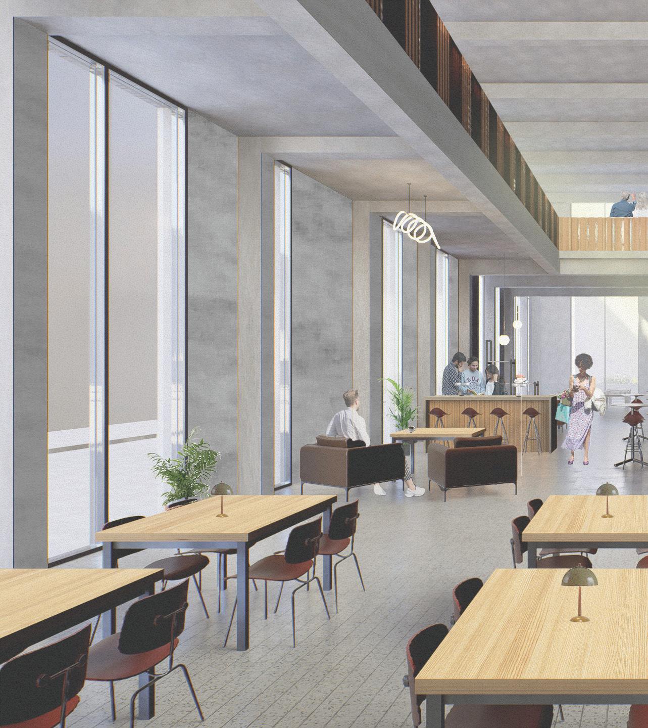
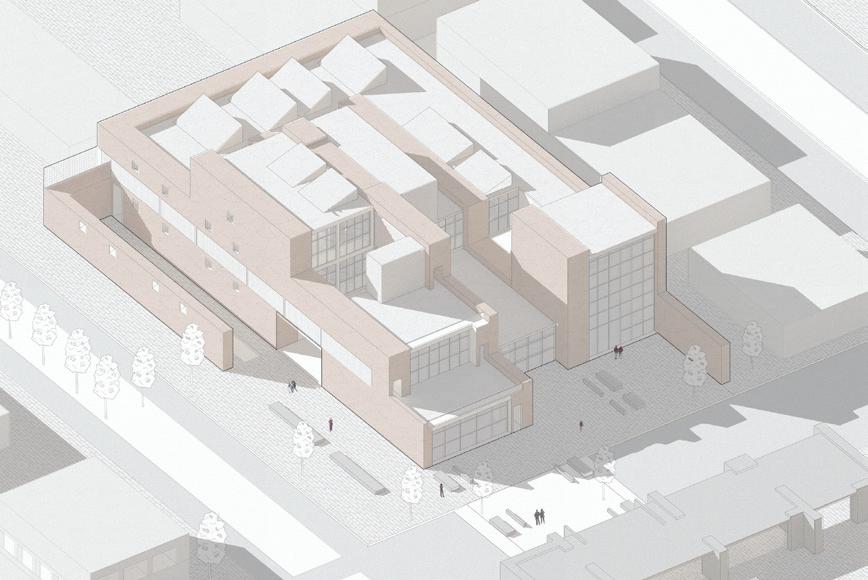
An urban catalyst strategically placed within a designed masterplan in downtown LA, this library aims to give a safe cultural learning and experience space for the people of Boyle Heights and downtown Los Angeles.
Reflecting on the important history and culture of the often overlooked Boyle Heights neighborhood, the initial concept of this library was to create a funnel; to bring people in directing them through the experience of a library and exhibition space via fingers of circulation.
These fingers become the main driver in lighting conditions, experience and programming within the catalyst as they become massive rammed-earth walls. These walls operate in three different ways: they frame the site and light, they create occupiable space, circulation bands, programming, and experience. Finally, they connect programs and experiences along themselves. Visitors will walk through these walls before breaking through them into large open spaces for reading, exhibition, or performance.
These massive walls also use light to create and differentiate experiences within the catalyst. By diffusing light in tapered “archer” style windows, filtering direct Southern light through a brick lattice double-facade, and flooding soft Eastern light through large curtain walls, different lighting conditions are created depending on the program inside.
Lastly, to encourage community engagement and interaction, the programming inside allows visitors to directly interact with the library as much as possible. The constantly visible elevated stacks make perusing information more inviting, along with large, easily accessible reading rooms that connect with community centered exhibition spaces


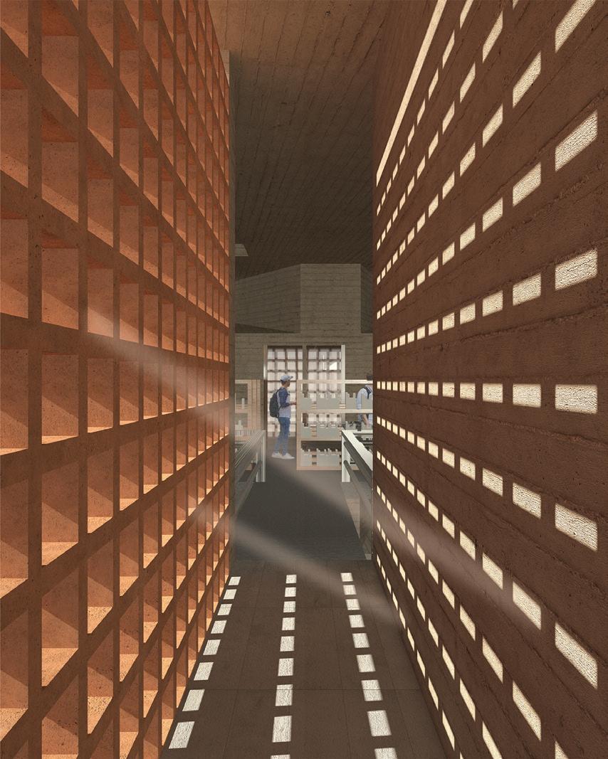


The various functions of occupiable walls: Create, Connect, Frame (top). Diffuse, filter, flood (bottom)


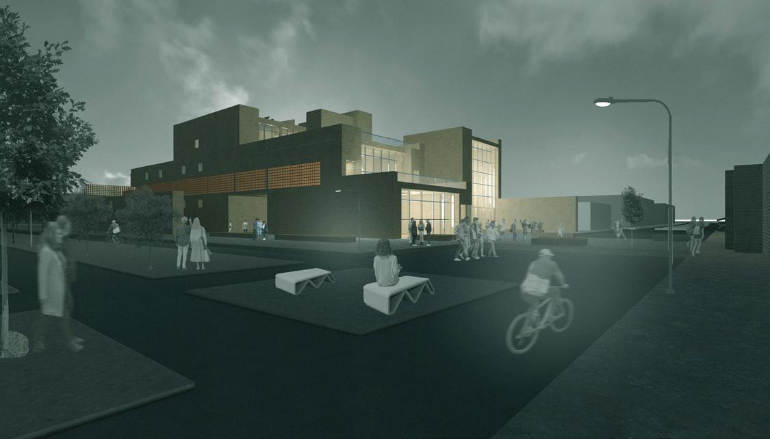


The reading room, community exhibition space, and elevated stacks in section perspective
Masterplan for a small town in Northern Chile
Characterized by extreme drought, unforgiving terrain, and mineral richness, the Atacama Desert has become a one of the most socially, economically, climatically, and geographically complex regions in the world. With water naturally scarce, people who live in this region face extreme difficulty getting basic human necessities, an exponentially growing issue with climate change intensifying droughts. This leaves few areas for urban or communal growth, pushing most towns into river valleys.
Particularly in the southern desert, these river valleys have seen rapid growth of informal settlements on fringes of towns as they try to find habitable places to live. While the towns in these valleys are more capable of providing necessities like water, they come with other life-threatening issues. Often accompanied by ravines carved by ‘silent rivers’ the geography along these river valleys is extremely inhospitable. The towns in these valleys are defined by dangerous ravines, and informal settlements are often forced into those ravines. These areas are prone to landslides, rockfalls, and flash flooding in rare rain events.
This project focuses on the fringes of one small town, Freirina, located along the Huasco River. This town struggles from the same difficulties as most others in river valleys in the Atacama. Built around steep ravines, the established urban fabric desintegrates near the dangerous areas, and mobility across the slopes is extremely difficult or impossible. This leaves segregated areas, especially between official urban development and informal settlements which have formed along the steepest areas of the ravines.
By creating a new corridor along the ravine, the edges of the fabric can become fortified. Added public space along this new corridor serve multiple purposes. First, the small plazas and terraces stabilize the terrain and mitigate landslides through their form and integration with the ravine. They also provide formal gathering space along the fringe developments and informal settlements, giving a sense of place for those sub-communities. The extension of the public space takes its shape in the form of ramps, which provide mobility across the ravine, while continuing to stabilize the landscape.
The culmination of this corridor is a children’s center placed at the edge of the existing established urban fabric, meant to serve as a further connector for those in informal settlements, while providing much needed educational and recreational infrastructure for families living in this area. This catalyst building continues with landslide mitigation by forming itself through a series of retaining walls, and creating plazas on the top of each level, helping to continue the language of the masterplan
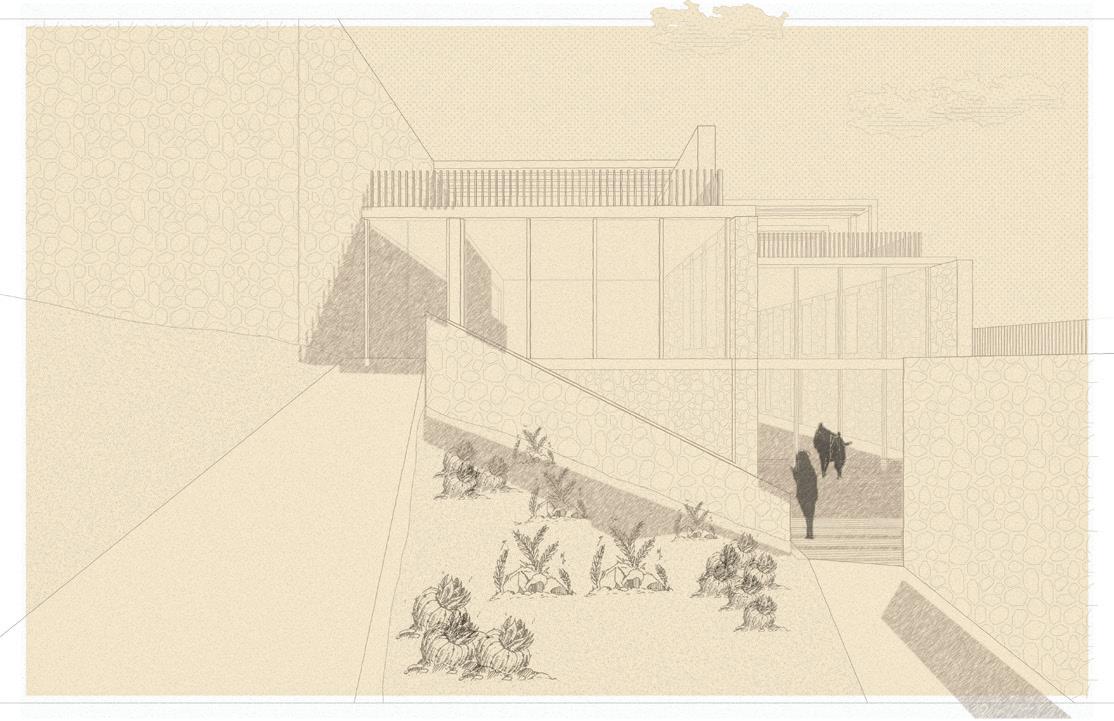
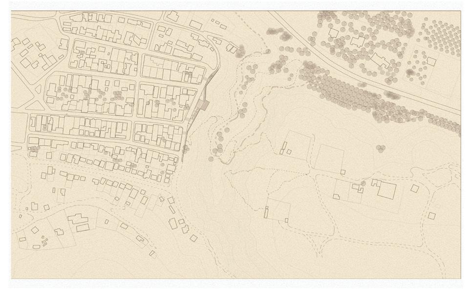
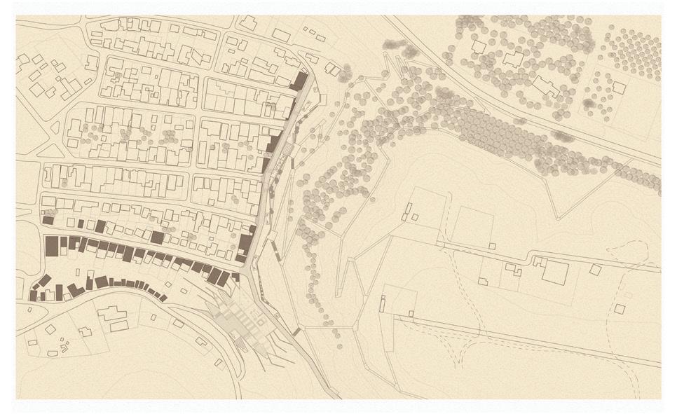
Top: The existing urban edge
Bottom: The proposed masterplan and development
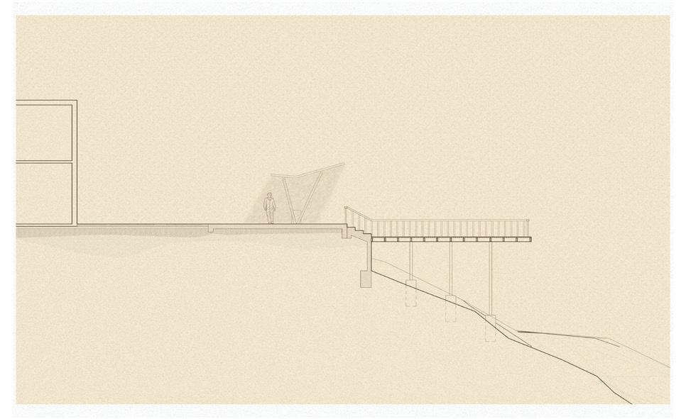
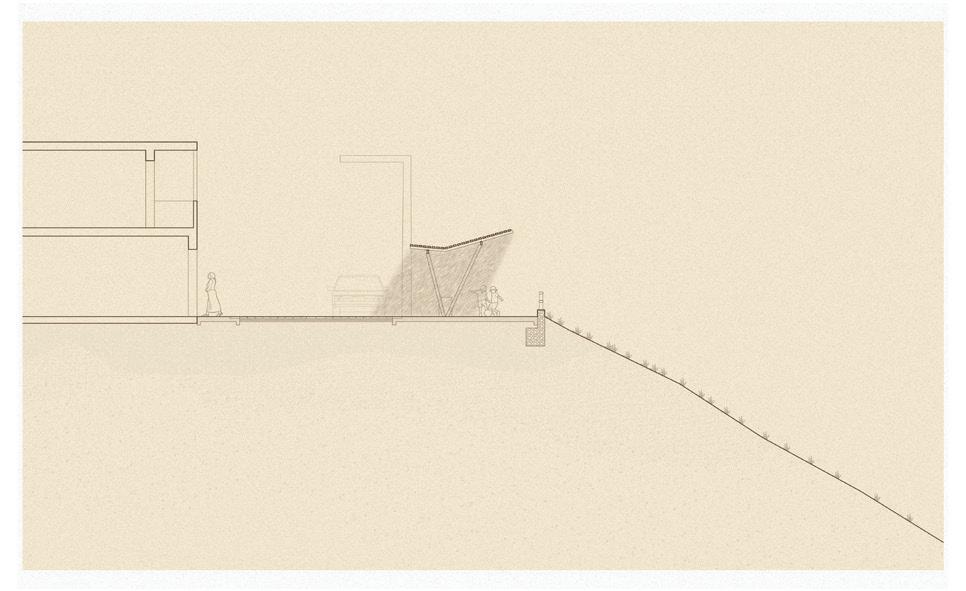
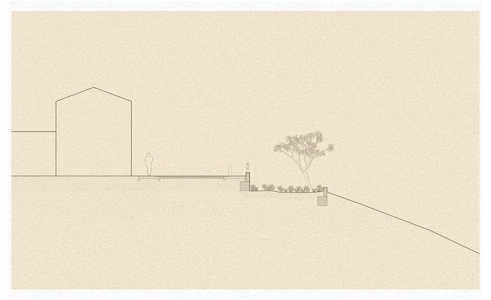
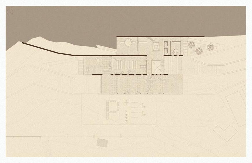


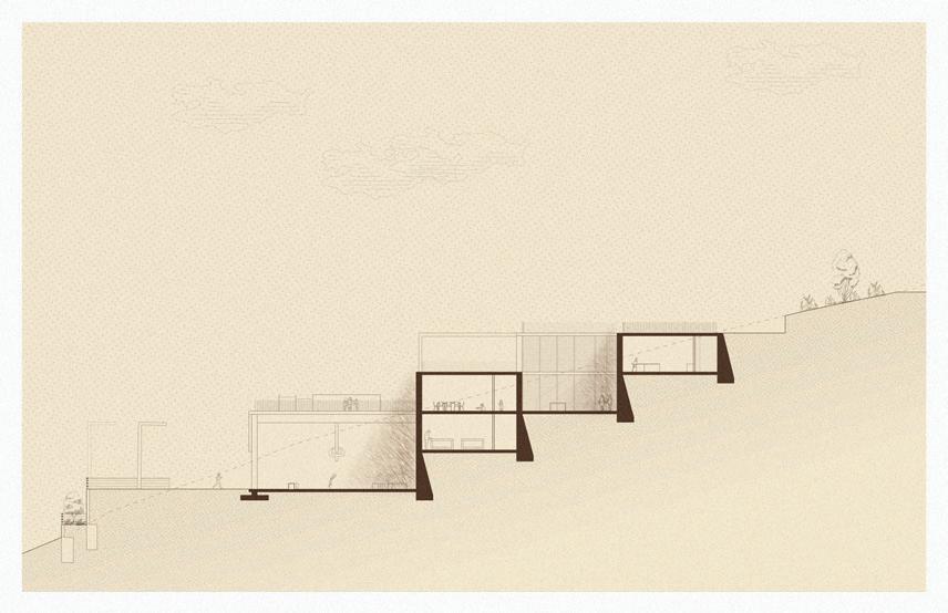


The masterplan and catalyst in the contesxt of Freirina’s edge
The bank of the Mississippi in New Orleans is, put simply, a controversial area. What was at one point the main connector of industry and goods has fallen into disrepair. However, with climate change threatening the entire New Orleans area, city officials have started planning a major shift in the city. Moving the port to a less central location, allowing the river bank to be revitalized as a park, simultaneously protecting the city environmentally and financially.
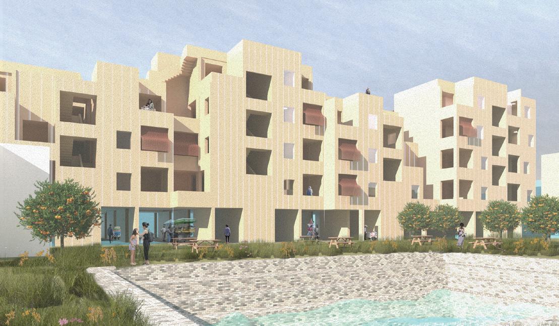
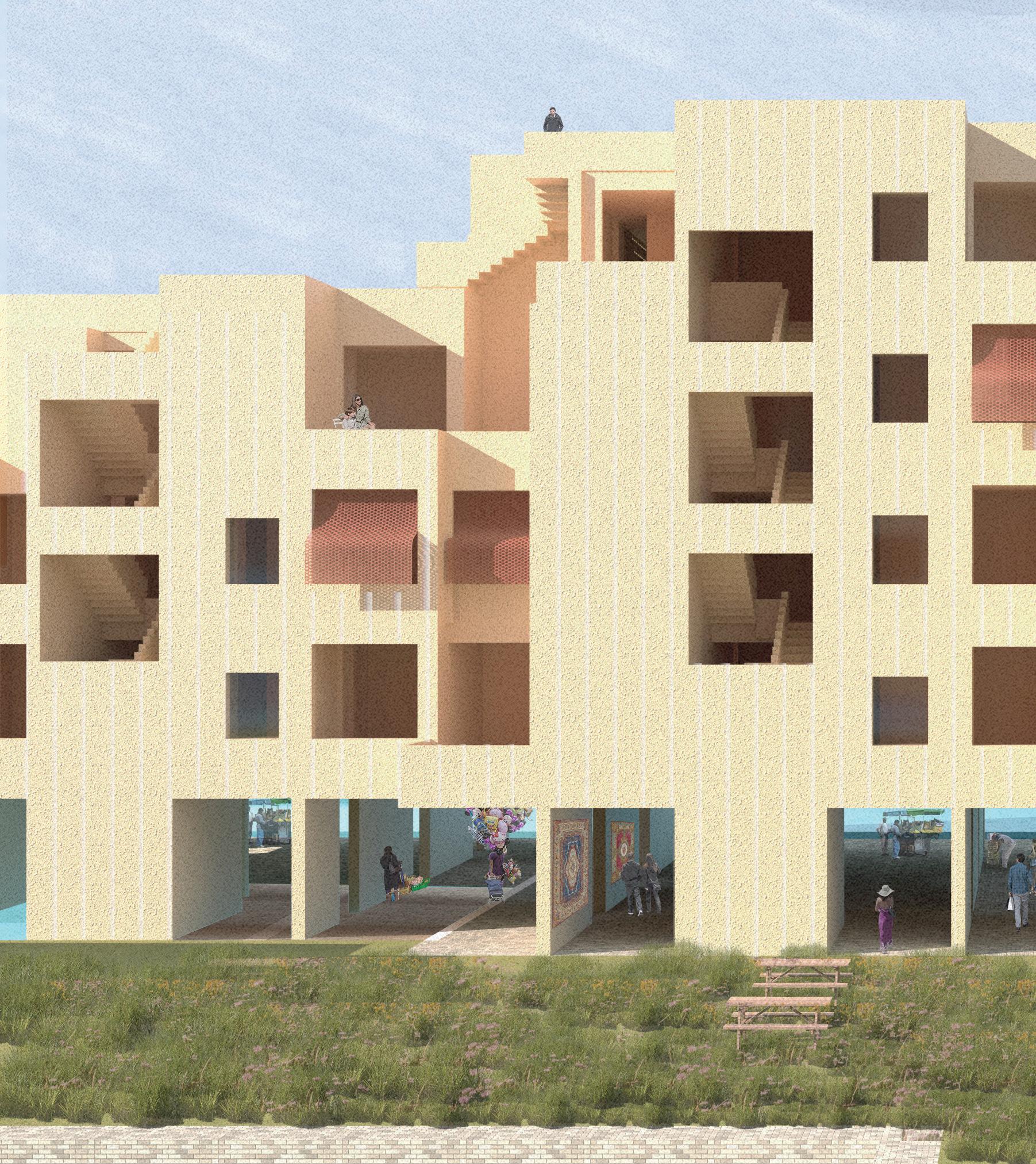
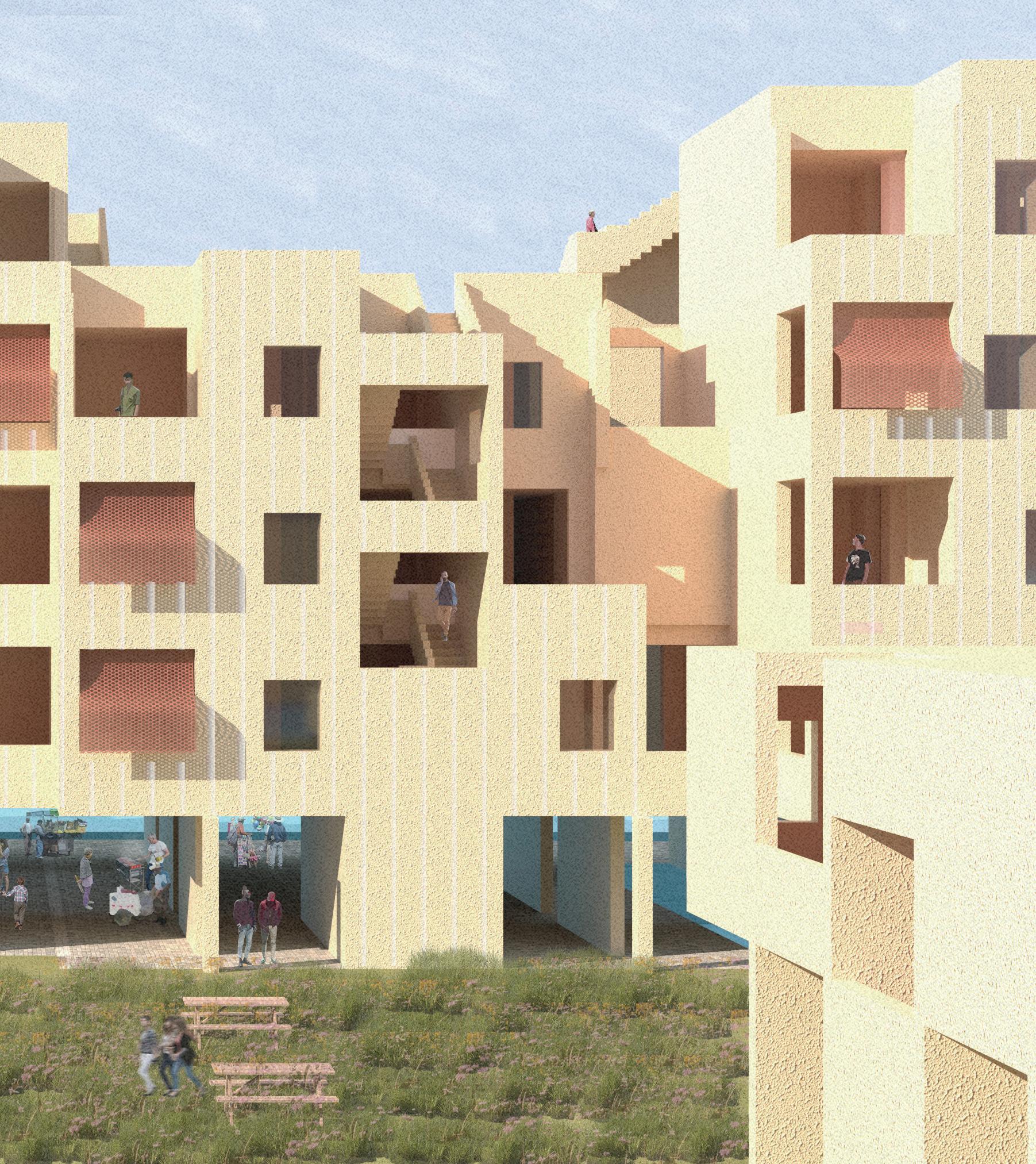
This housing block is a space that fosters community growth, through an open, permeable ground floor with community rooms, a local restaurant, and a covered market facing the new commercial corridor of Tchoupitoulas St. The patio culture of the South is extended to these apartments, with patios punching holes into the facades of the buildings, even in the stairs. This openness allows residents to interact with eachother, and with the community on the ground, creating a sustainably minded community geared towards contributing to the changing scope of New Orleans.
The permeable ground floor, which focuses on the community, houses the vibrant market, a local restaurant, and spaces for the neighborhood to gather and learn.
On the housing levels, each apartment is divided into a series of rooms starting at 9’x12’, slotting between the bearing walls. The homes start to break the divisions in bigger units, acting like tetris blocks sliding into place.
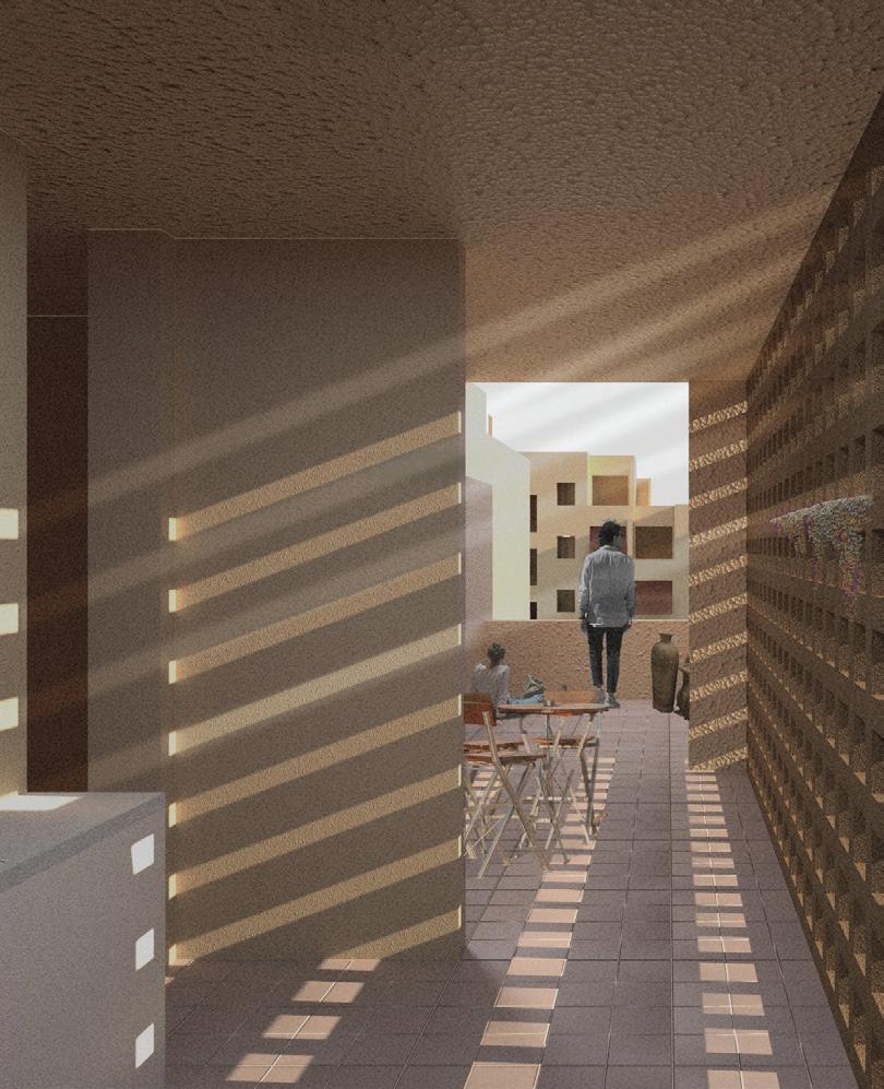
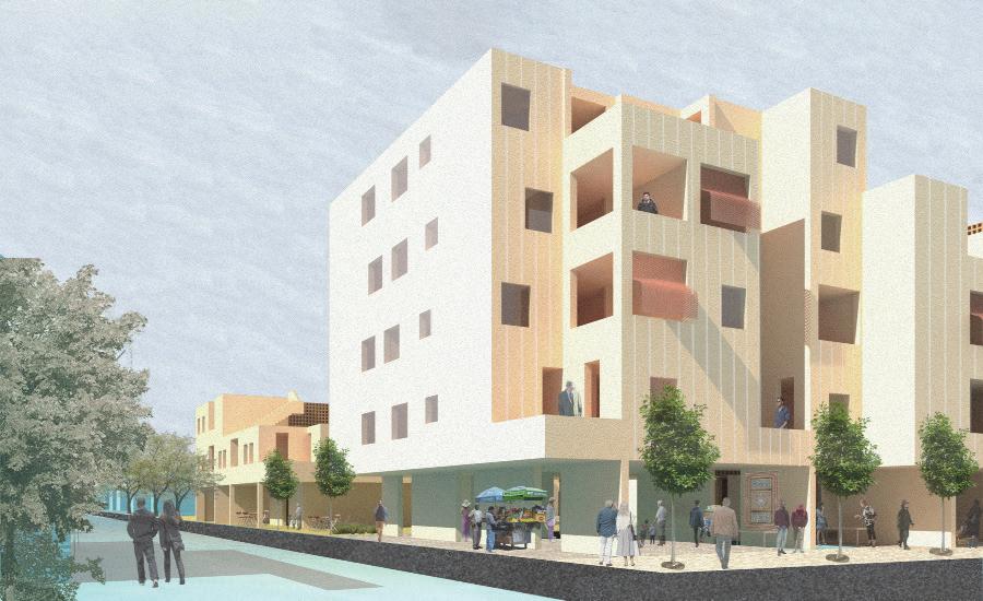
Implementation of a masterplan
Elysian Fields Avenue was New Orleans’ first continuous connection from residential neighborhoods near Lake Ponchartrain to the commercial districts on the banks of the Mississipi River. Initially built as a railroad, it brought (at the time) the newest development of the city closer to its historic center. Today, however, Elysian Fields Avenue acts as a datum. Its fast-moving, seemingly impassable 6 lanes of high speed traffic make it intimidating to cross, and the lack of services, density, and public transit along the corridor detract from development and activity.
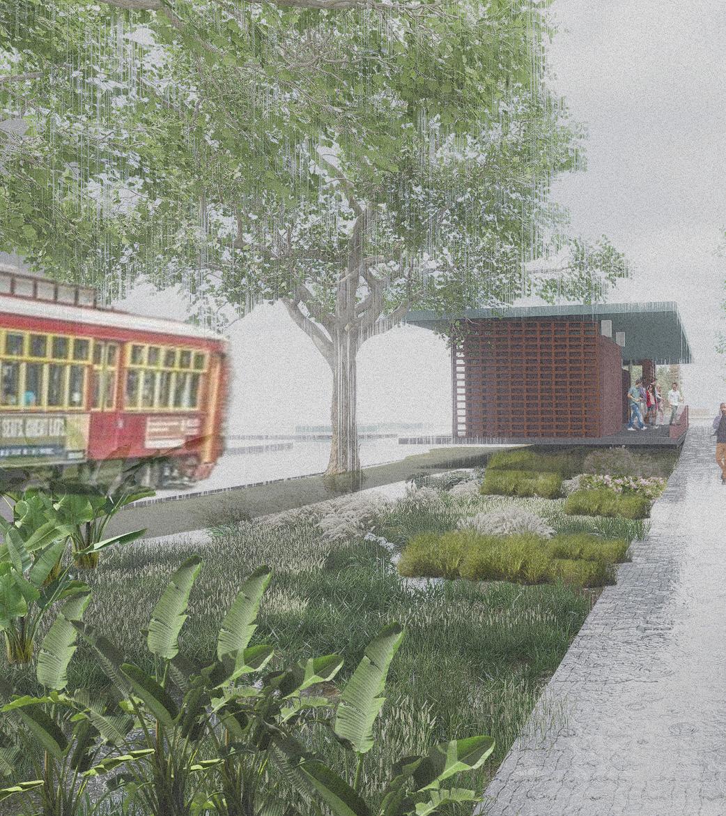
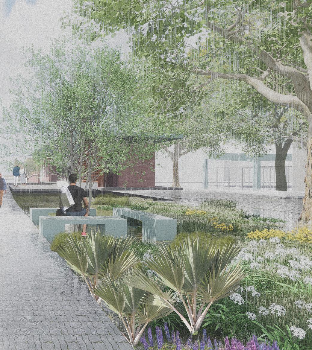
This urbanist proposal seeks to holistically and sustainably reinvigorate the Elysian Fields corridor, to serve the people that live near it, and to serve the city of New Orleans in creating a vibrant new corridor from the river to the lake. Through a kit of density-, mobility-, ecology-, water-, and community-based parts, action can be taken along the whole of the corridor. The particular intersection of Elysian Fields and Claiborne Ave serves as a case study of implementation. The intersection highlights what happens when two dying corridors meet. In order to reinvigorate the intersection interventions at 3 different scales must be made. Operating on an infrastructural scale, the integration of a streetcar line with formalized stops provides a space of refuge for public-transport users while encourging the growth of the system. The neighborhood-wide addition of cellular storage helps to mitigate the everpresence of flooding in New Orleans, and the local implementation of rain-gardens and bioswales help to revegetate the area and visualize water management. Local development in empty lots helps to densify the area and emphasize the intersection as one to be celebrated.
In recognizing the dire lack of grocery services in the area, one corner of the intersection was converted into an ‘urban room’ rather than an enclosed development. Acting as an extension of the typological Neutral Ground, this ‘room’ manifests itself as a flexible covered market, allowing the community to organize weekly markets and other events to foster a strong community connection. Increased density and activity near the street, along with a redesigned street that prioritizes the pedestrian help to make the area more accessible to cross, while allowing the Neutral Ground to once again take its role as a community space, serving as a linear park with intermittent plazas and gathering spaces.
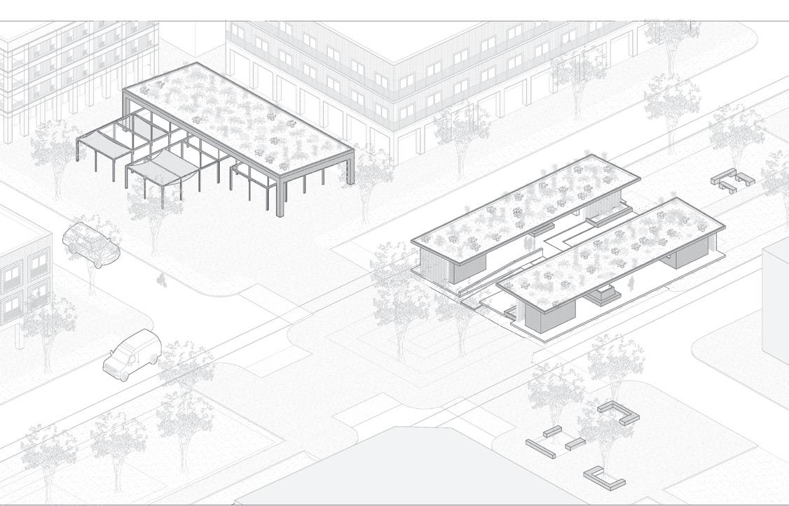
The intersection in axonometric
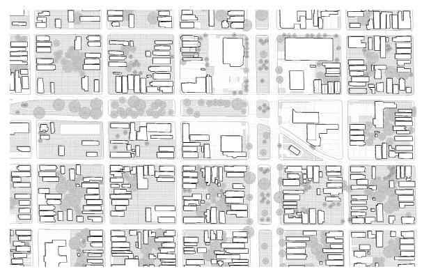
Bottom: The existing site
Top: Detailed proposed plan
Bottom: The proposed site
Top: Section through the covered market Bottom: Transverse section
Fall 2021 - Fall 2023
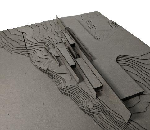

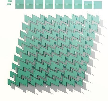
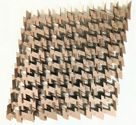
Parametric components and assemblies, Fall 2023

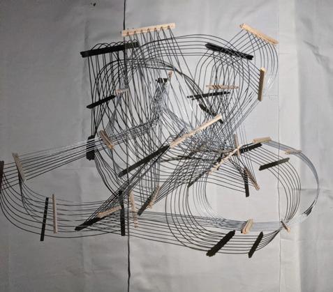
Abstract solder wire model, Fall 2021
