PORTFOLIO


2023
Created and edited graphic design illustrations, logos, flyers, posters, social media posts, and videos on Canva and Illustrator. Managed and designed weekly newsletters on Flodesk.
Held the position as the communications lead in the student design team.
Alerahager10@gmail.com
828-455-6127
linkedin.com/in/alera-hager-230584272
David Thaddeus
Professor of Structures and Architectural Design thaddeus@charlotte.edu
Deborah Ryan
Professor of Architecture and Urban Design deryan@charlotte.edu
Main tasks consist of using Dropbox and Micro soft Excel for documentation of franchise and territory agreements of current employees.
Other duties consisted of assisting employees with a variety of tasks such as data organization using Microsoft Excel, organizing office spaces, etc.
Assisted in installation and retrieval custom yard greeting signs.
Maintained organization of signs in storage area. Trained new hires after one month of starting.
Assisted engineers to design and create furniture using OpenStudio and AutoCAD.
Gained knowledge and exposure to AutoCAD software and design in a professional work environment.
University of North Carolina at Charlotte
Current GPA: 3.72
Bachelor of Arts, Architecture
Minor in Urban Studies
Expected Graduation: May 2024
Microsoft Office
Adobe Illustrator
Adobe InDesign
Adobe Photoshop
Vectorworks
Rhino 3D Modeling
Software
Rhino Grasshopper AutoCAD
Canva
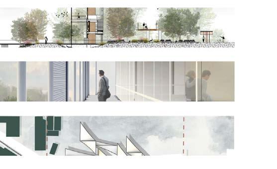
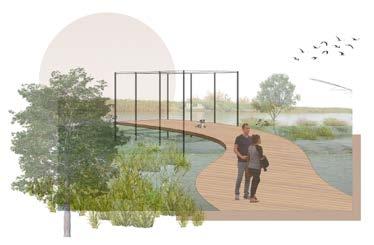
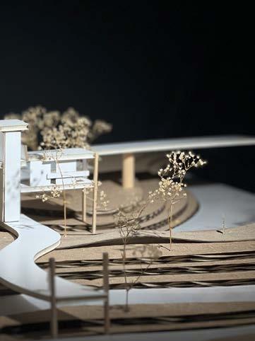
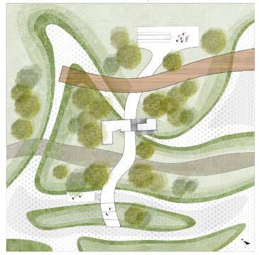
Branched beginnings explores the tree like aspect of branching. The connection of paths merge at one point - the research outpost but ultimately have different destinations. The goal was to provide the site with as natural of a river as possible. Natural rivers form and divide over time as the site would mimic. As you walk on the paths you get unique experiences. One is a direct link to the river from tu read, another is elevated above the site to place the person in the trees, the last is a natural path next to the river - The best place to see wildlife in this site.

“Regeneration means putting life at the center of every action and decision. It applies to all of creation--grass-lands, farms, people, forests, fish, wetlands, coastlands, and oceans--and it applies equally to families, communities, cities, schools, religions, cultures, commerce and governments. Nature and humanity are composed of exquisitely complex networks of relationships, without which forests, lands, oceans, peoples, countries and cultures perish.”
Paul Hawken, Re generation, Ending the climate crisis in one generation, 2021This project interrogates ways that architecture can responsibly address the climate crisis. With attention to architecture, site, ecology and biodiversity, water, renewable energy, and sustainable material systems in order to influence the building’s performance, its formal / spatial conditions, and its conceptual underpinnings. Phase 2 is the foundational step in creating this future park – the redevelopment of a small area is to serve as a demonstration project, characterized by a thoughtful fusion of architecture and landscape, guided by principles that rebuild ecologies and biodiversity, and balance complementary needs of humans and nature.


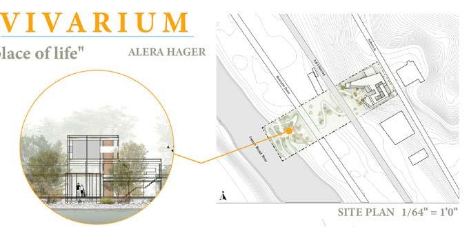
The project is located in the River Arts District of Asheville--a 1.5 mile stretch of riverfront lined with 19th- and early 20th-century warehouses, factories and industrial buildings; some of these have been reoccupied but some remain abandoned, and many are located in the 100 and 500-year flood plains. Within this larger district, the general / extended site area exists between two bridges–Haywood Road (SE) and Craven Street (NW)–with other major boundaries of Roberts Street (NE) at the top of the hillside and the French Broad River (SW) at the lowest point.

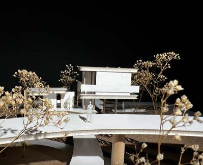


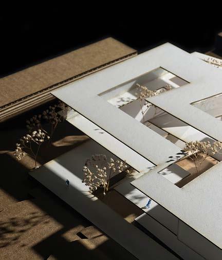

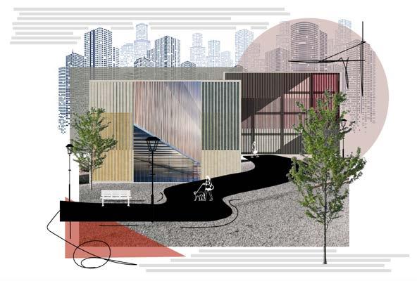
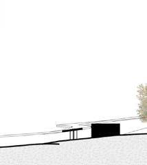
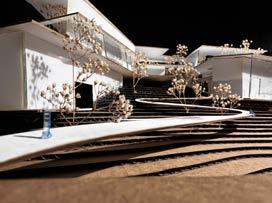
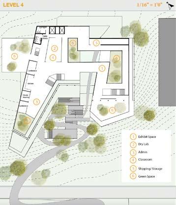
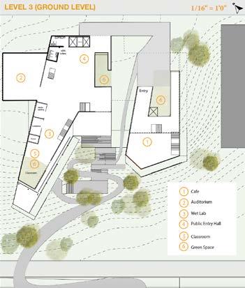
Vivarium is a journey through the trees. The origin of the word is Latin and means place of life for observation and research of ecology. The idea is to connect the surrounding ecology to the built environment as a way to address the disconnect between architecture and the landscape. The building itself is inherently different from that of the landscape bur uses the ecology to link them via garden/ interior green spaces. The shape of the building is based off wind patterns and sun paths. The main focus of the experience is to provide service to the community while experiencing a journey in the trees.
Phase 2 has pushed my thinking into what an environment does and how it interacts. Similar to phase1 I wanted to have the landscape and paths act organic while the building remains static yet still create a meaningful connection. I chose to include my design from phase 1 and link it via a path through the site.



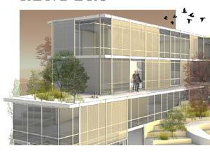

I decided to use passive systems such as green spaces as a way to create natural ventilation and vegetative cooling, the use of overhangs and double skin facade for shading, and in addition the use of active systems such as a geothermal heat pump for cooling and heating along with the use of LED lighting.
 LABORATORY EXTERIOR DIGITAL RENDER
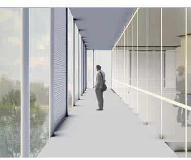
EXHIBITION INTERIOR DIGITAL RENDER


Our site is an enigma – it is gritty and energetic, often raw and occasionally refined, environmentally damaged but with significant natural potential for regeneration. You have experienced its current ecological realities – barren common turf grass, eroded river banks, and kudzu enveloped hillsides. But also evident are nascent signs of progress – riverway plans, community river cleaning days, scattered pollinator gardens and two small constructed wetland ponds. By embracing progressive, pro-environment design thinking, our architecture and landscapes can promote regenerated biotic health.



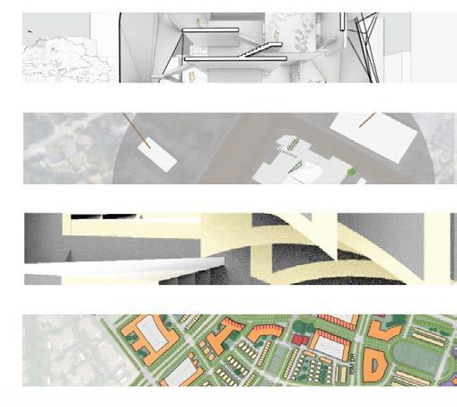
Water Passage allows Ballard’s local community to access the environment and water surroundings in unique and multiple ways. It permits residents and staff to follow the passage of life change similar to the neighborhood’s relationship with Seattle’s homeless population, businesses, social services, and maritime activities adjacent to Ballard locks and ship channel.
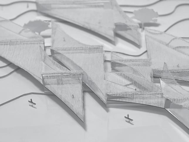
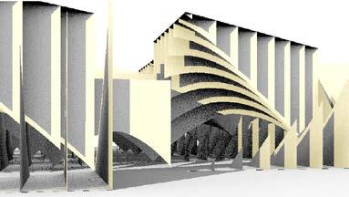
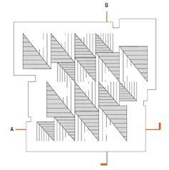
The design is structurally regulated by a series of vertical walls both in and out of the stream of the canal. Each wall supports a concaved and convexed sail-like roof that creates parallelogram spatial patterns across the site. Due to the orientation of these wall and roof structures, views to the water from the street are hidden while spaces parallel to the river are open to the water.

The glu-lam structure is used as a supporting element for the curved forms. Seattle is known for its production and sustainable use of CLT wood in projects and would present itself in this environment well.
The program consists of a temporary and free-access shelter program for the homeless. The movement of the interior conditions would allow for the structure to be reused in the future. The building would be equipped with restrooms, mechanical facilities, and on site job services. As architecture is forever changing, the spaces in which people occupy must also adapt to this change.
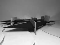
PHYSICAL STRUCTURAL MODEL PHOTOGRAPH 1/16" = 1’0” SCALE


The location of the building is on site C. This site is located in the industrial part of the surrounding site area. Most of the surrounding buildings are abandoned or storage locations for industrial work. The immediate site boundary is outlined in the site plan to the left.


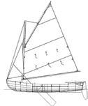

The design of the sail is an important part of the design process for the structure/plan. The triangular shape of the sail is the most efficient

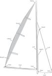

while in open water. The idea relates to the site location directly due to the surrounding shipping docks and connection to the existing waterway.
Curved Roof
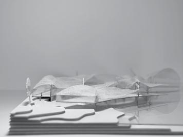
The two photographs below are study models of the structure and form. The photograph in the bottom left is a study model at a 1/60" = 1'0" scale of the relationship of spaces. It shows how the triangles could connect to one another while being lifted. The photograph in the bottom right is a study model at a 1/16" =1'0" scale of the wall to floor relationship in the context of the site.
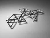
Roof Structure
Wall Structure
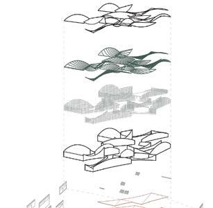
Supporting Walls
Walls
Floor Stairs
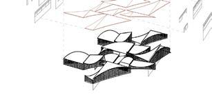
EXPLODED STRUCTURAL AXONOMETRIC
PHOTOGRAPH OF BUILDING STRUCTURAL MODEL 1/16" = 1'0"


The wall section shows the wall conditions for a waterfront bay, cut perpendicular to the center wall condition. The roof structure would be made of glu-lam beams that support the convexed and concaved roof. The floor would be made out of local Seattle CLT due to its sustainability and economic factors. The structure is lifted above the ground with concrete walls that are braced by concrete footings.

The render to the left is the view from the street looking out to the water. As you approach the building, the view to the water is obstructed by the building, roof structure, and walls. Once you enter, the views are again obstructed by the walls holding up the roof structure until you reach the social programming space. From there the next clear view to the water is located on the water’s edge side of the building. The sail-like roof structure allows for the eye to move across the building like waves in the ocean. This allows for the residents to follow the passage of change on the water.


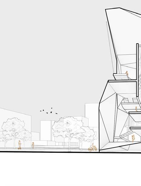

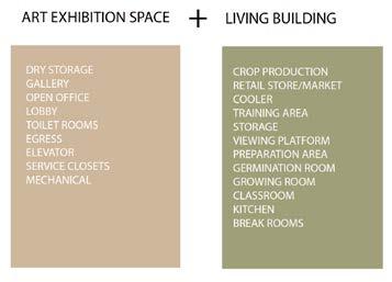
By exploring the needs, activities, purpose and rituals of the local community, the new living urban infill building expands its capacity of being just a building but a place for the neighborhood. The program consists of a living building and a art exhibition space. The goal is to combine locally produced crops with local artists. It is a way to tell the story of a lost community with artwork while providing money to sustain the community the crops serve.
The design of the revised urban Arts Center is located in Uptown Charlotte. The goal of the project is to augment and expand the capacities and visibility of the Brooklyn Collective while exploring the interactions between form and function.
The project continues to explore how program performs, or how the imaginative exploration of a buildings functional relationships can generate compelling architecture.


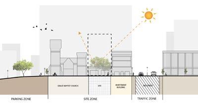
The Collective operates out of three historic buildings dating back to 1886 that were home to many “firsts” in Charlotte’s black community, including the first building financed, designed and built by black leaders exclusively for black professionals. The buildings are among the few to survive the 1960’s program of “urban renewal” that displaced nearly all of Uptown Charlotte’s Brooklyn Neighborhood.
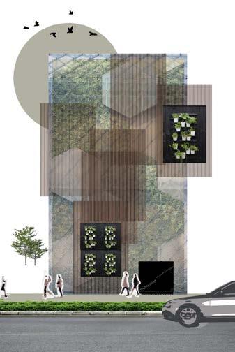

EXPLODED AXONOMETRIC

The final physical model is made out of foam core board, chipboard, and cork board. Since the building is an infill building, the class decided to create the site condition in the physical model using wood.
The concept of the design followed a regulation of lines cut through the site at various points. From those points connections were made into the triangular shell form. The idea was to contrast the exterior form to the interior one. The interior is made by a series of platforms to house the vertical garden and exhibition space. The exterior is a triangular shell with a glass frame around it.
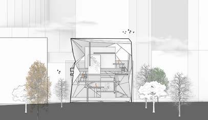 SECTION CUT 1/8" = 1'0" SCALE
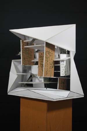
 PHYSICAL MODEL PHOTOGRAPH 1/8" = 1"0' SCALE
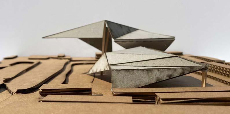
The contemporary fire station is unique because it houses both institutional and domestic functions: an extensive garage for the fire engines and equipment, offices, and living areas for fire fighters who stand vigilant around the clock. It is also a very legible building, you tend to know a fire station when you see one. As such, the fire station’s expression is entangled with its need to be at once efficient and iconic.
Fire stations have continuously accommodated diverse programmatic needs while evolving to respond to changing fire-fighting methods and technologies. The design challenge of Fire Station #45 is to speculate on the future of the fire station and its significance as a community institution and public amenity. The project follows the ideal of form and function in design.
Fire station #45 is located on N Tryon Street in Charlotte North Carolina. The location is surrounded by businesses and neighborhoods. The two connecting roads to the site are booming with traffic so it is important for the fire station to operate at its highest function. On site there is also a bus stop and a light rail stop for the public.
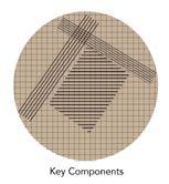

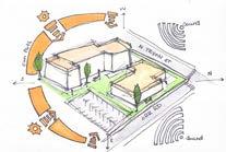
 NEIGHBORHOOD PLAN 1" = 100' -0”
PRELIMINARY INTERIOR SKETCH
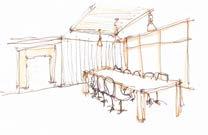
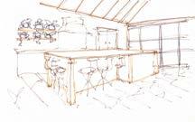
PRELIMINARY INTERIOR SKETCH
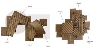
The initial designs of the project were created using a collage technique. This collage was created after researching fire station designs and atmosphere. It shows how important the connection of public and private space is to a building.
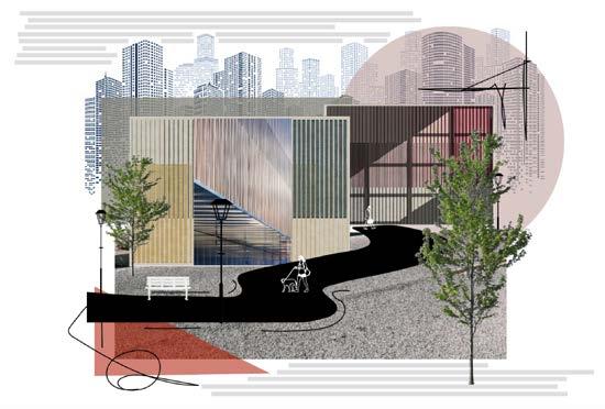

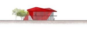


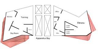
The apparatus bay is located in the center of the design because the apparatus bay is the heart of the fire station. It is were the fire-fighters work, relax, eat, and socialize. It is crucial that when the bell rings for a call that the fire-fighters can access their equipment when needed. In Charlotte North Carolina the response time for fire-fighters is very high, we need to design with the use in mind.


 FLOOR PLAN LEVEL 2
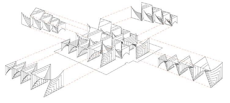
The experimentation through making has led to several ways structural systems can behave or interact with one another while creating dynamic spaces. The idea is to design structural systems that transform, mirror, metamorphosize, or move with one another. This experimentation is done by multiplying the process and incorporating spanning techniques that are commonly used in architectural practice.
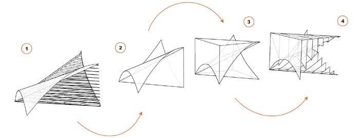
The idea is to create a recipe for making an aggregation that has one or more structural support systems. The drivers of this project are curvilinear and linear with the action verb being twisting. By letting the structure speak for itself, we do not have program but ideas of program. The idea of program in this project is a reflection space, while entering the structure one way a person might seem lost but from another they can see clearly.
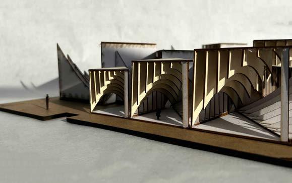

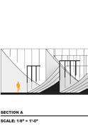


The concept was to take an earlier iteration of a twisting form and transform it to make a larger aggregation. The form is then scaled to various sizes and widths to create variation. The design is intended for reflection and therefore is also designed for sunlight to pass through the space.
The aggregation can have any site location, but the design must incorporate one or more of the following structural support systems: Hanging, overhanging, continuous, cantilevering.
The aggregation can have any site location, but the design must incorporate one or more of the following structural support systems: Hanging, overhanging, continuous, cantilevering.

ROOF PLAN 1/8” = 1’0” SCALE
It is predicted that a third or more of church-based properties will become vacant by 2030. If that prediction holds, there will be over 100,000 properties prime for redevelopment. Rather than simply sell to a developer to do with whatever s/he desires, many faith leaders are thinking about how to redevelop their property in such a way that it continues their Mission. Other faith-based organizations like the YMCA find themselves in a similar position. This year, the local Y sold the Johnston YMCA in Charlotte’s Noda neighborhood to a developer to shore up its balance sheet. We imagine other Y properties might have a similar fate. Consequently, our semester long project has been for the re-design of a 127-acre property including and surrounding the Keith Family YMCA that is located just off of Harris Blvd. in University City.
The Keith Family YMCA site is located within three miles of UNCC and University Hospital at the intersection of West W.T. Harris Boulevard and Mallard Creek Road, which inspired the name of our proposed new neighborhood: Mallard Crossings. The site is also located 2.3 miles from two light rail stations, bus service is provided to the site by routes 22 and 54, and micro transit in University City between the light rail and West Sugar Creek Road is now being explored. In addition, the site is 1.5 miles from an elementary, middle, and high school.
Per the Charlotte Future 2040 Plan, the City of Charlotte wants to promote the creation of 10-minute neighborhoods where “All Charlotte households should have access to essential amenities, goods, and services within a comfortable, tree-shaded 10-minute walk, bike, or transit trip.” To us, this means that the design of this site should be less auto-centric and focused more on the health and safety of pedestrians.
We were guided by Bishop Alexander’s writing in Necessary Christianity, that the life of a Christian MUST be about SOMETHING. Accordingly, we believe that the design for the study site MUST also be about SOMETHING: Something impactful, something specific, and something that will be felt for generations. We chose the word Shalom, to embody what the design of our site should be about.


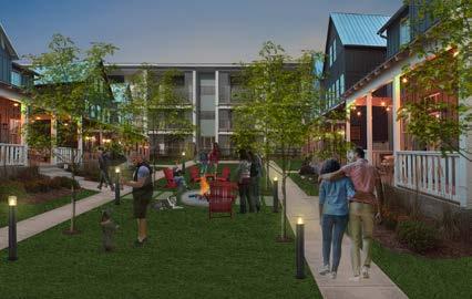
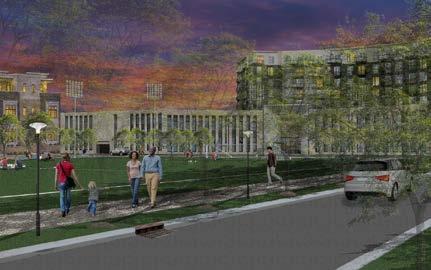


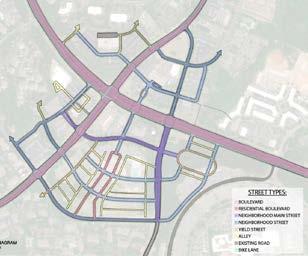
Our Vision Plan for Mallard Crossings is for a mixed-income, mixed-use pedestrian and bike-friendly community that embodies faith-based concepts. At a diagrammatic level, the plan addresses the Physical, Social, Mental, and Spiritual well-being by being built on the same sort of crossing as the Keith Family YMCA. The four points of the crossing contain what we perceived to be the land uses required to thrive. To the north we expanded the medical offices to create a healthcare campus, to the west we sited a grocery store to provide fresh food and nourishment, to the east we sited the new YMCA on an underused parking lot at the Wells Fargo Call Center, and to the south, we sited a new House of Worship where all faiths would all be welcome.
 EXISTING FIGURE GROUND MAP

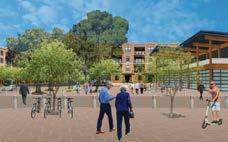
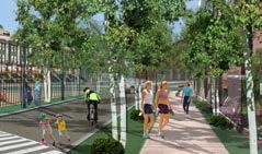
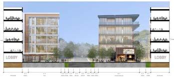
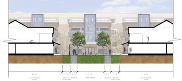
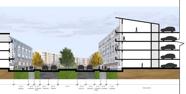 NEIGHBORHOOD MAIN STREET DIGITAL PERSPECTIVE MAIN STREET DIGITAL PERSPECTIVE
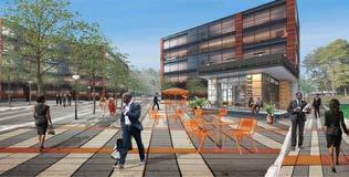
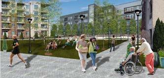


 OFFICE PARK DIGITAL PERSPECTIVE
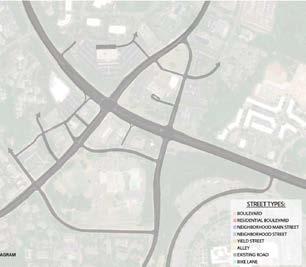
PROPOSED
 EXISTING CIRCULATION DIAGRAM MAP