LIVING WITH THE RISING SEAS
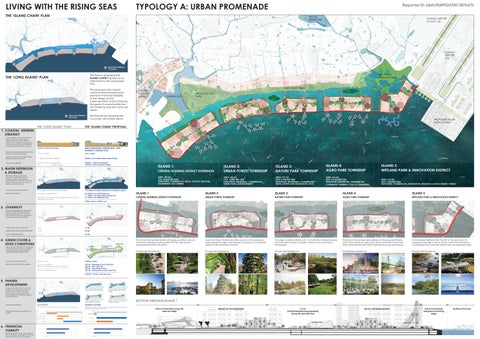
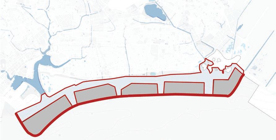
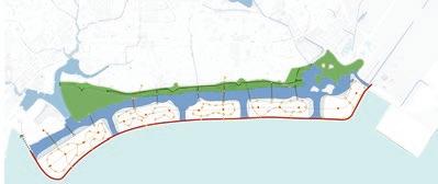
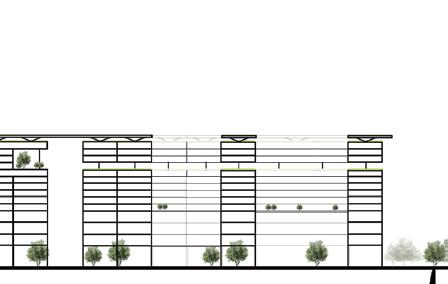
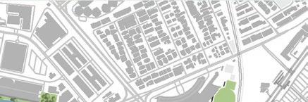
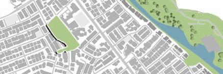
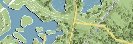
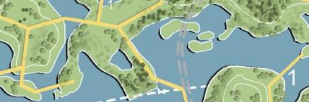
Island 1 is used here to illustrate the design ideas further
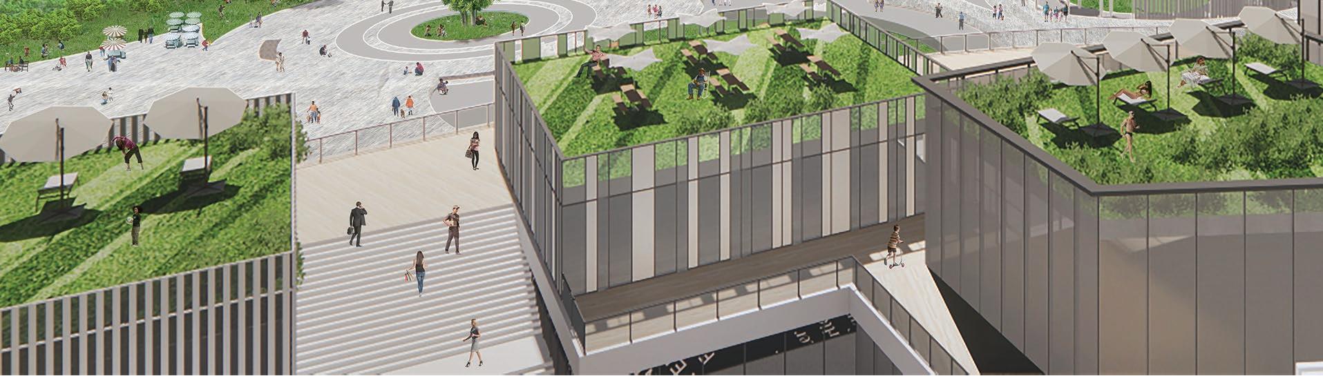
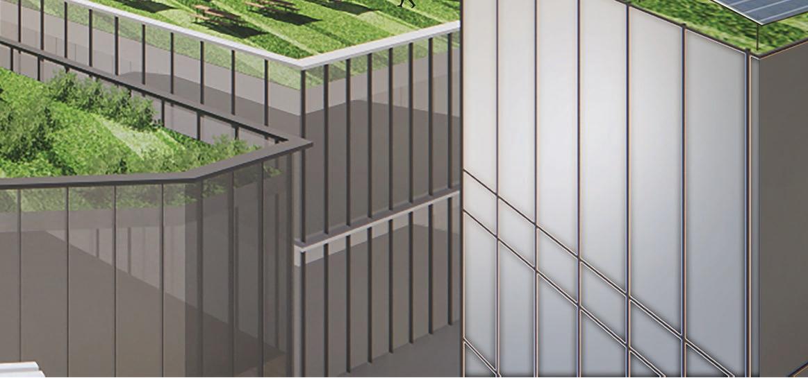
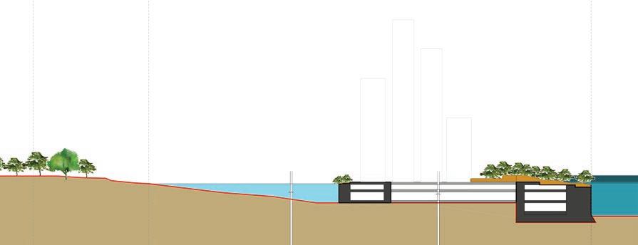
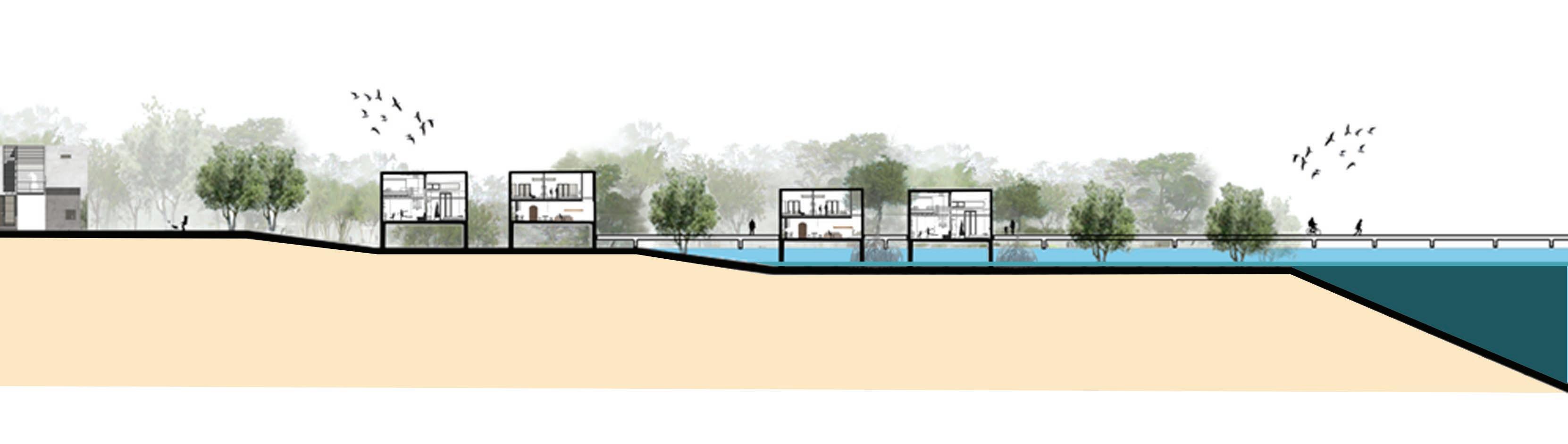
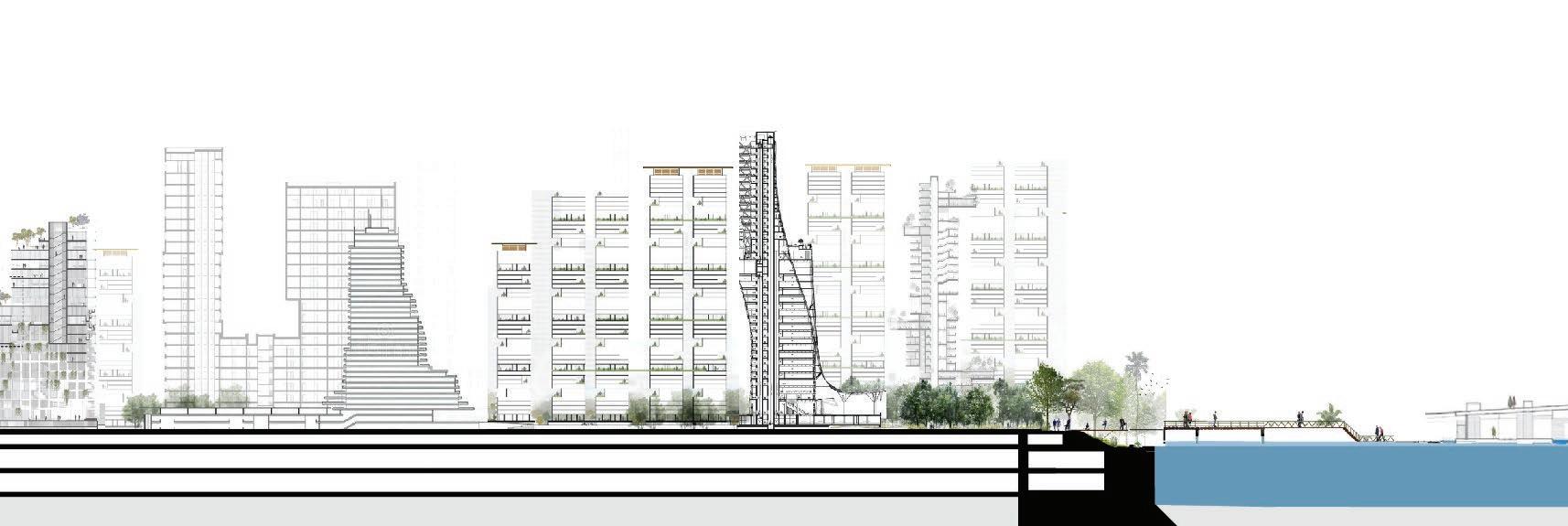
Each island is formed using caisson sections along the perimeter which secures anchors the boundary and creates the profile of the island. The space within is then built up using a basement construction.
The basements support multitude of uses and also house the services and circulation corridors supporting each island and connecting the islands.
The space on-grade is then completely freed up for use as promenades with different types of landscaping, activities, active
options etc.
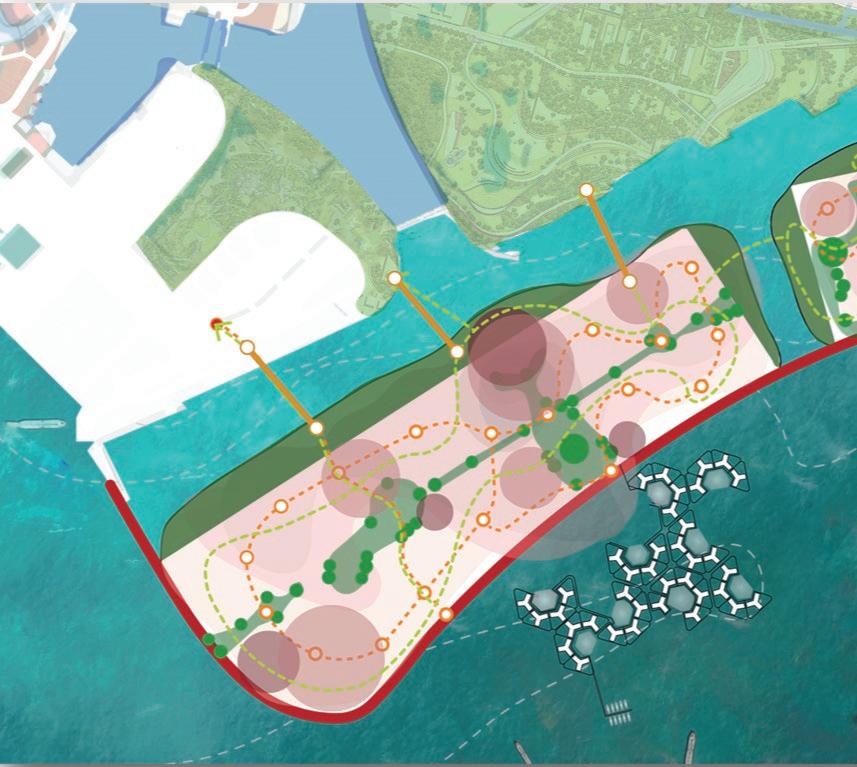
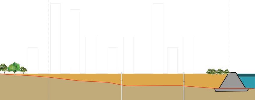
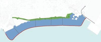
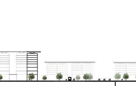
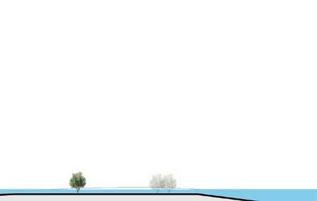
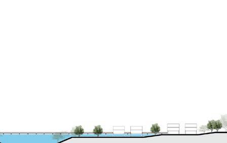
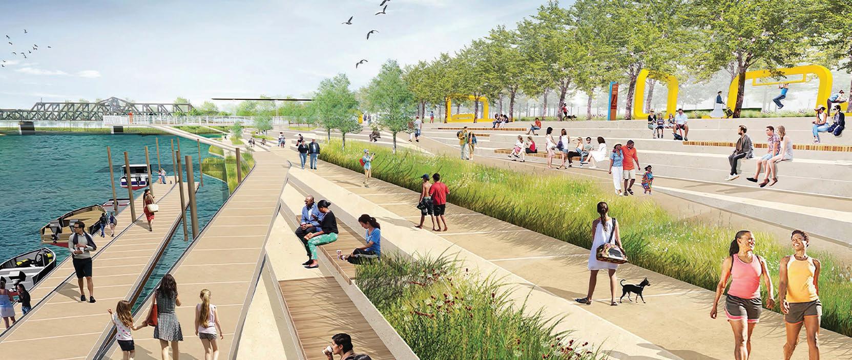
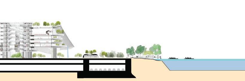
Section of the Promenade along the sea wall.
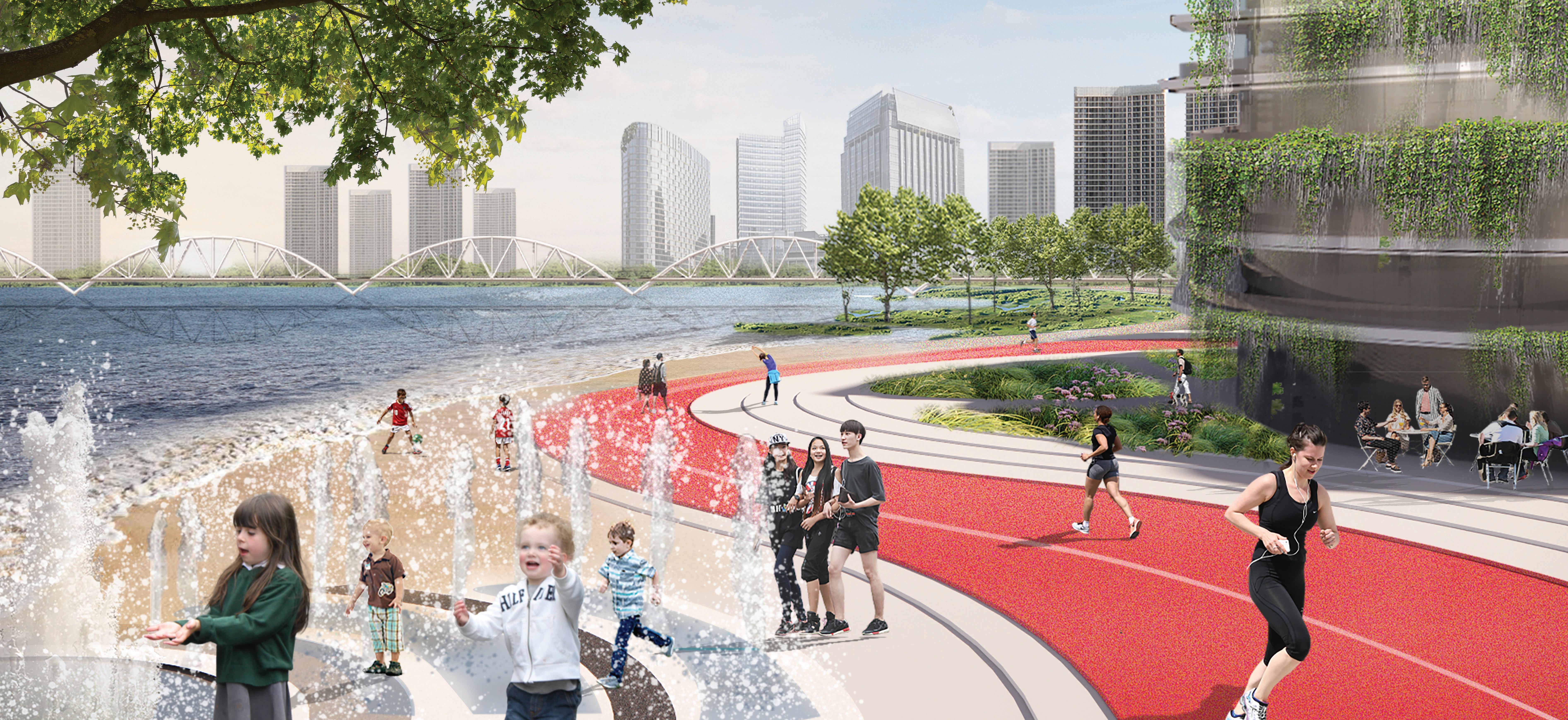
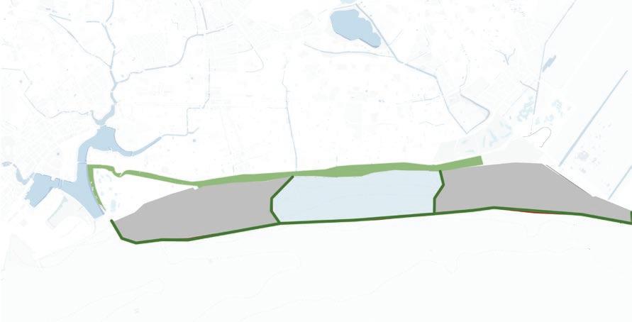
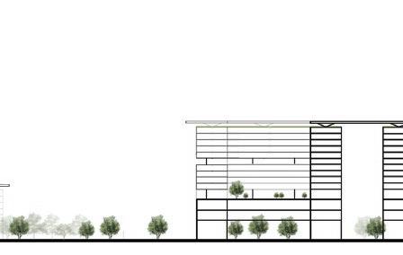
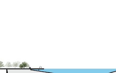
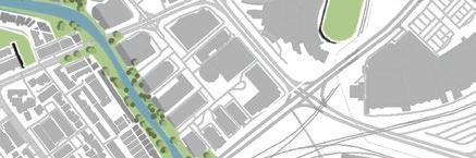
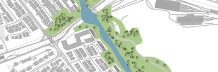
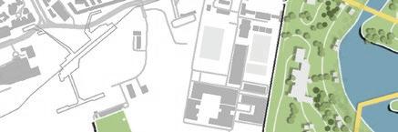
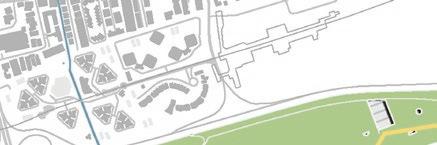
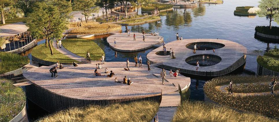
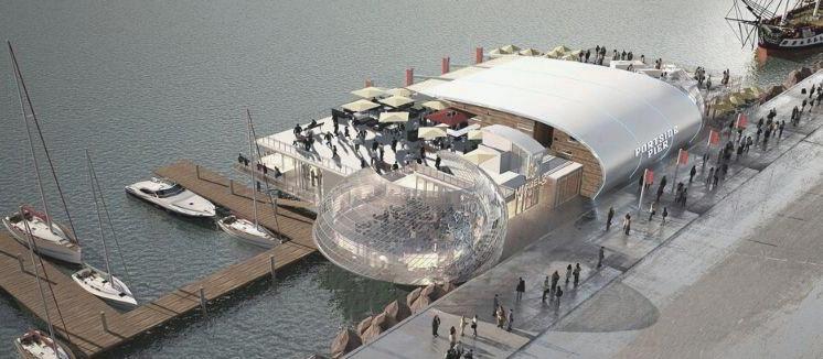
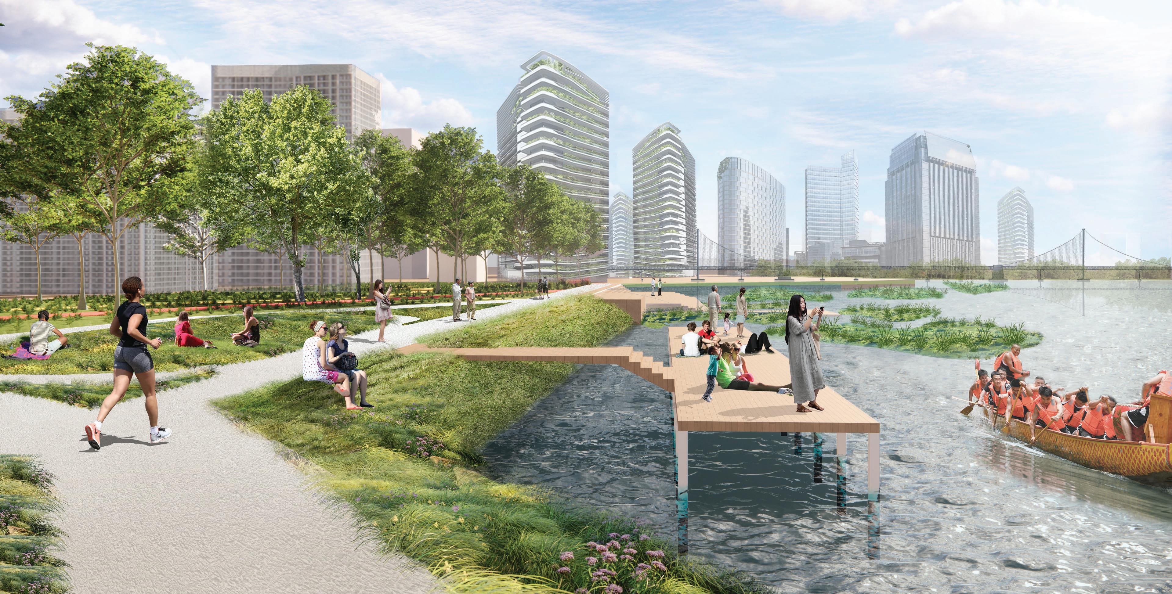
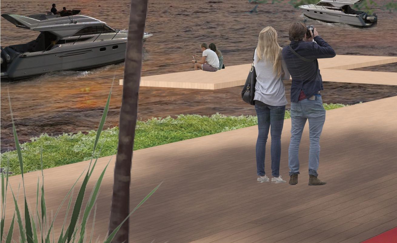
TYPOLOGY A: URBAN PROMENADE
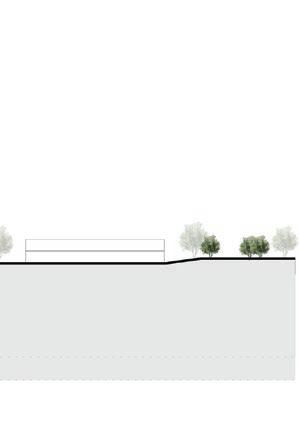
View showing the urban promenade along the southern edge of Island 1.
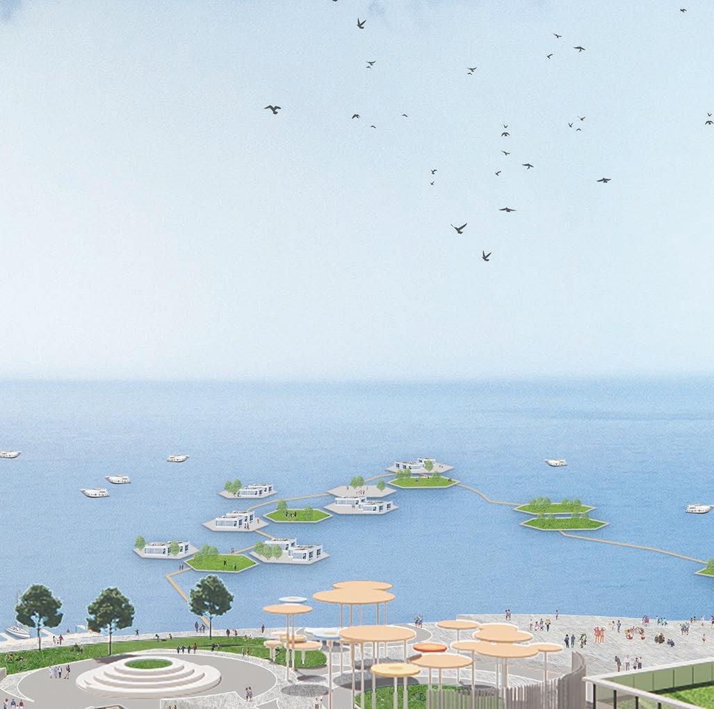
View along the promenade depicting the experience at the ground level.
Response ID: 63efc9b8ff02d7001287b57b
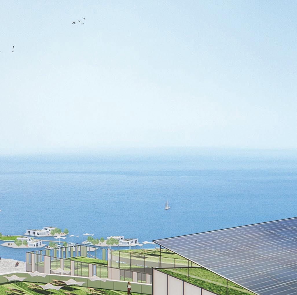
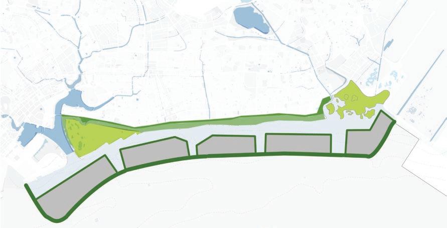
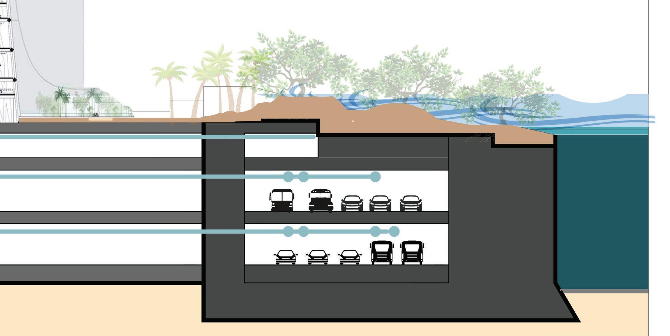
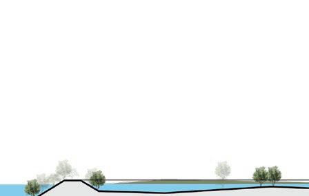
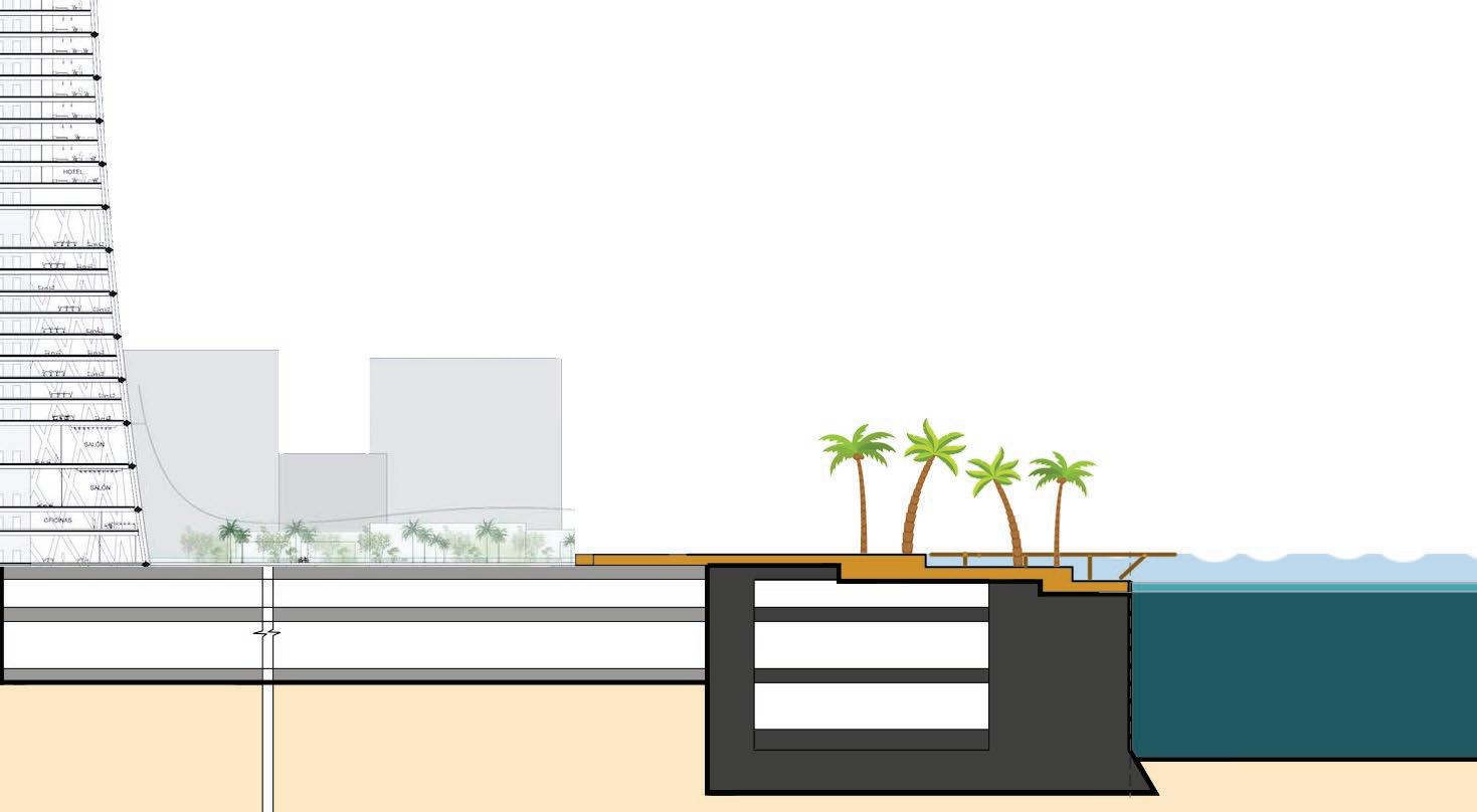
Basement 1: Used for services and circulation +5M (high tide & storm surge) +1M (sea level rise) 0 (current sea level) Basement 2: Space bank for farming, energy storage, data centre Basement 3: Space bank for water storage, food storage etc. The hollow void within the caisson sections is used to divert the ECP expressway + provide other circulation corridors. A stepped form above the caisson sections is instrumental in providing buffer against the 1m sea-level rise + 4m of tidal/ storm surges. It also provides an ideal environment for creating a new mangrove ecosystem. Promenade with various Types of Spaces and Functions An additional buffer space is left as part of the Urban Promenades. This will allow space for additional measures that may be needed if sea-level rise increases dramatically beyond current projections.
mobility
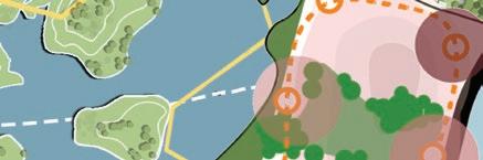
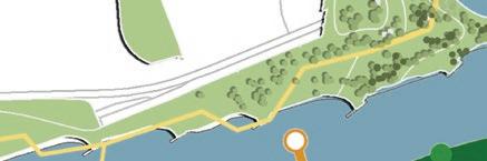
The coastal defense strategy utilizes a sea wall built using hollow caisson sections. The space within these hollow sections is used as circulation and service corridors. The surface/ top part of the caisson is staggered to house planting/ growth medium that can support various types of vegetation - especially mangroves. This stepped section together with the mangroves thus provides an ideal naturalized-cum-engineered buffer against varying sea levels as shown here. NaturalizedEdges Floating structures in the sea Activity mobility corridors and trams Parks and Green Corridors/ connectors Mangrovesalongthe sea-facingedge
LIVING WITH THE RISING SEAS TYPOLOGY B: NATURE CENTERED COASTLINE
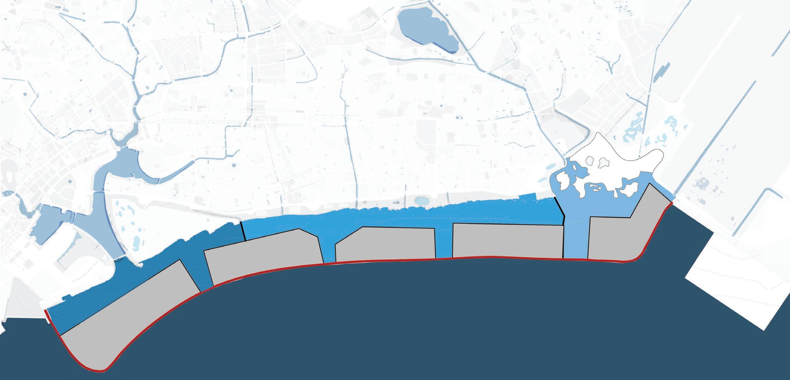


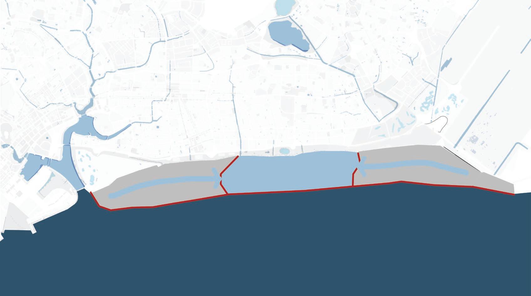


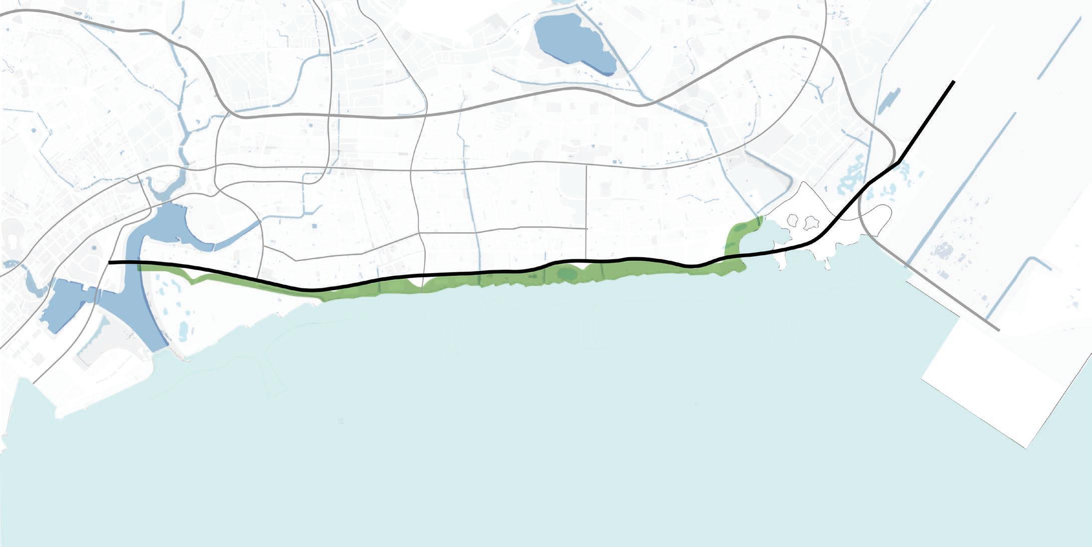
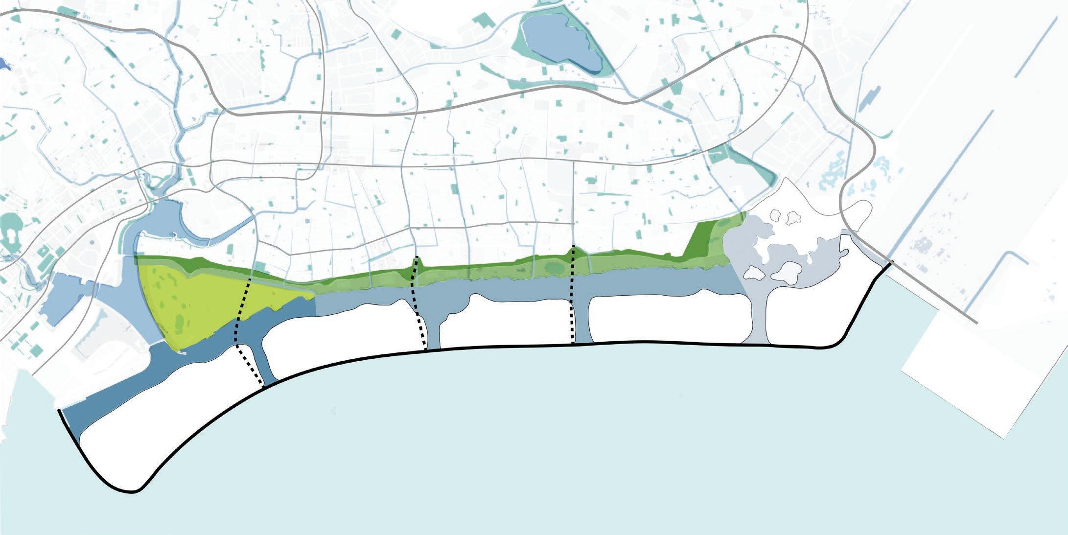


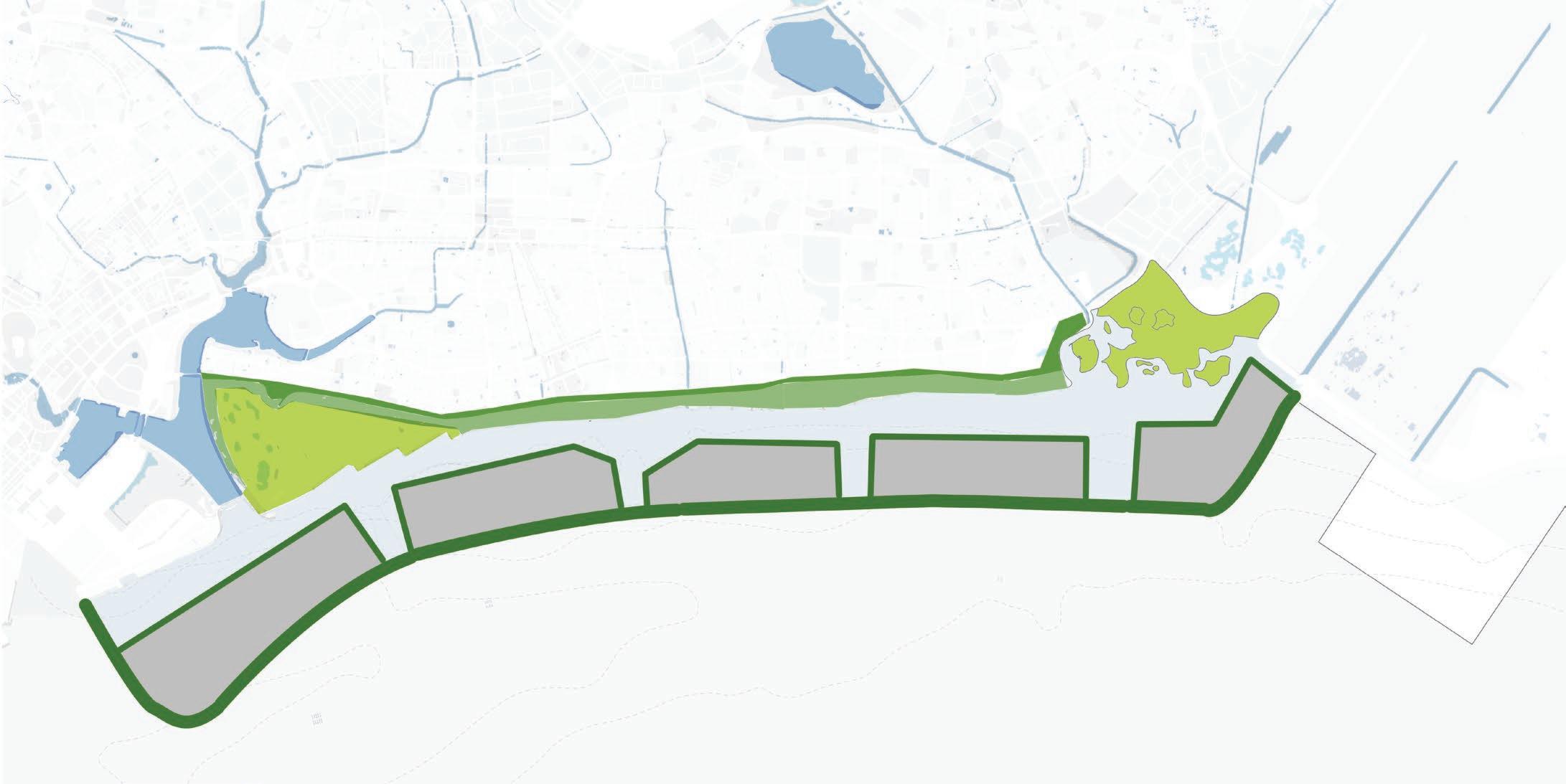


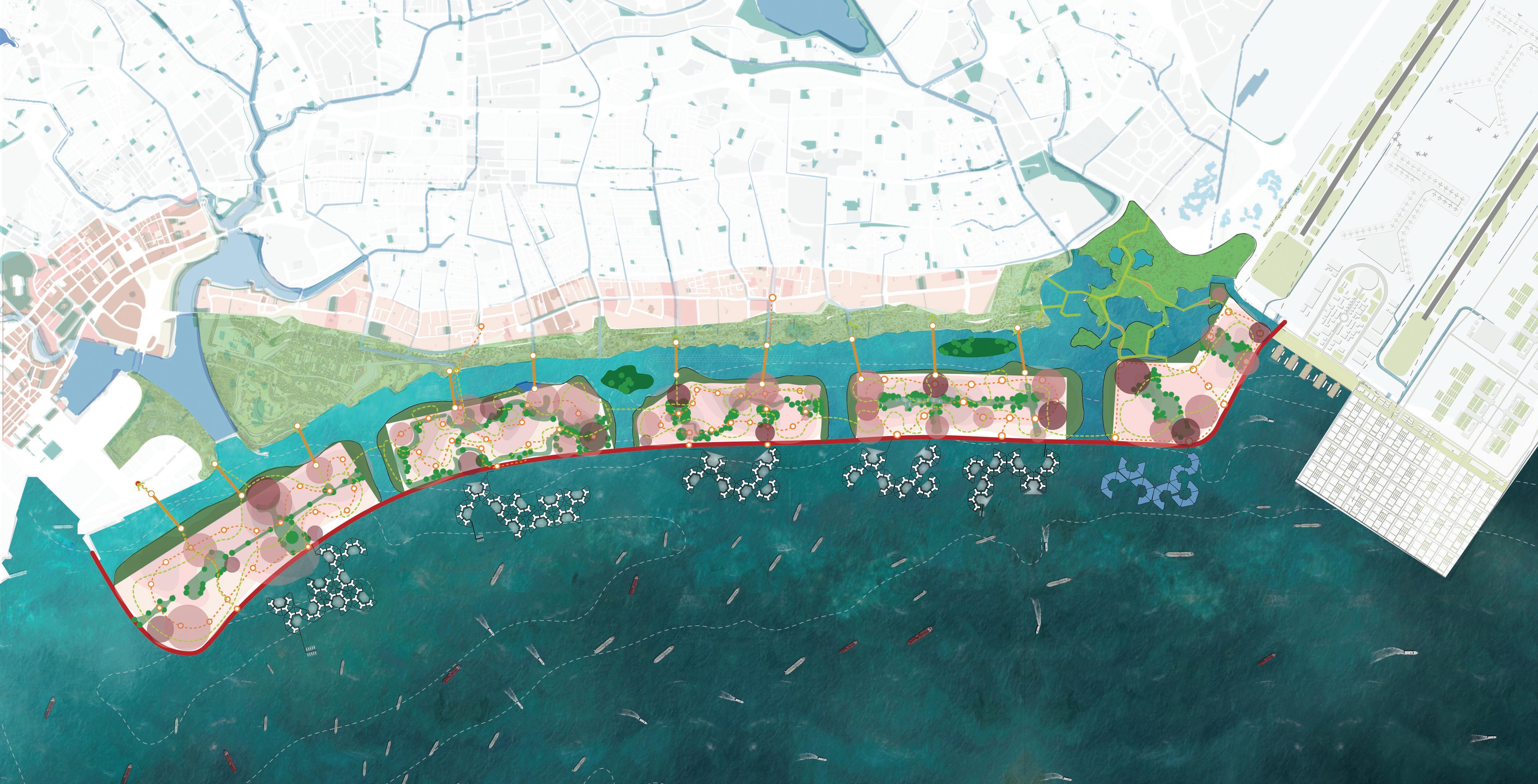
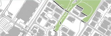


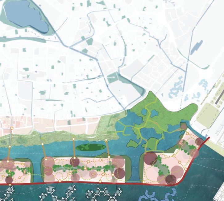
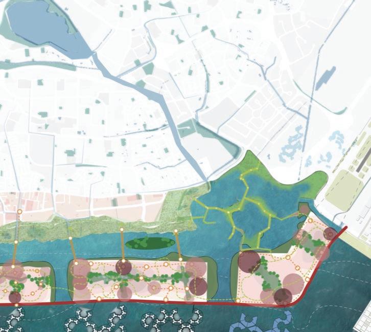
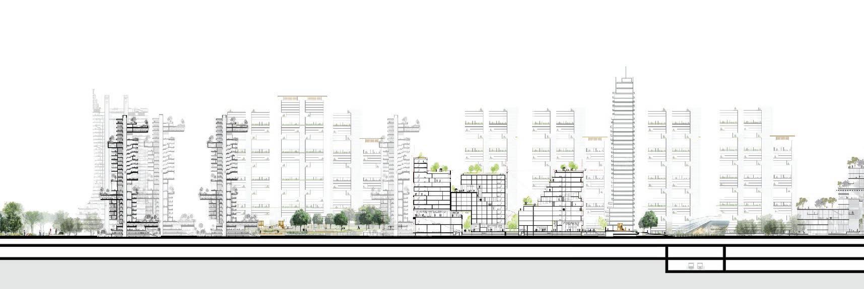
ENHANCING AND EXTENDING EAST COAST PARK ADDING A NEW COASTAL MANGROVE PARK ADDING A NEW WETLAND PARK PRESENT SCENARIO PRESENT SCENARIO PRESENT SCENARIO PROPOSED SCENARIO SECTION SHOWING INTEGRATION OF NEW MANGROVE FOREST INTO THE CAISSON SECTIONS PROPOSED SCENARIO - EAST COAST PARK (EXISTING) - DRAINAGE CANALS (EXISTING) - EAST COAST EXPRESSWAY - OTHER ROADS - EAST COAST PARK (EXISTING) - DRAINAGE CANALS (UPGRADED) - SEAWALL EXPRESSWAY - OTHER ROADS - EAST COAST PARK (ENHANCED) Response ID: 63efc9b8ff02d7001287b57b SECTION THROUGH ISLAND 5 & WETLAND PARK COASTAL MANGROVE PARK BEDOK RESERVOIR CHANGI AIRPORT (T5) CHANGI AIRPORT (T1,T2,T3, T4) PROPOSED SOLAR ENERGY FARM PROPOSED WETLAND PARK PROPOSED CITY PARK CENTRAL BUSINESS DISTRICT MARINA BAY EAST COAST PARK ISLAND 1: CENTRAL BUSINESS DISTRICT EXTENSION AREA: 387 HA GFA: 58,050,000 SQM FUNCTIONS: COMMERCIAL; RETAIL; OFFICES; SERVICED APARTMENTS; F&B; GREENS ISLAND 2: URBAN FOREST TOWNSHIP AREA: 276 HA GFA: 13,800,000 SQM FUNCTIONS: RESIDENTIAL; COMMERCIAL; THEME PARKS; ENTERTAINMENT ISLAND 3: NATURE PARK TOWNSHIP AREA: 197 HA GFA: 8,750,000 SQM FUNCTIONS: RESIDENTIAL; COMMERCIAL; RETAIL; SPORTS AND RECREATION; CIVIC ISLAND 4 AGRO PARK TOWNSHIP AREA: 263 HA GFA: 13,150,000 SQM FUNCTIONS: RESIDENTIAL; COMMERCIAL; COMMUNITY FARMING; CIVIC & COMMUNITY ISLAND 5 WETLAND PARK & INNOVATION DISTRICT AREA: 210 HA GFA: 7,350,000 SQM FUNCTIONS: COMMERCIAL; RECREATION; RESEARCH & DEVELOPMENT; GREENS other connectivity Coastal protection Development five islands Stabilisation reclamation The team is proposing the ISLAND CHAIN Proposal as an alternative to the Long Island Plan. This proposed plan adopts multi-functional infrastructure elements that lends flexibility to the design and its implementation whilst achieving the goals of coastal protection and meeting long-term land use needs. The reasons for adopting this novel plan are stated below: 1. COASTAL DEFENSE STRATEGY 2. WATER DETENTION & STORAGE MANAGING INLAND FLOODING: YES (using the reservoir and flood plain) LANDFILL WITH SEA BUND YES using two distinct reservoirs & a wetland system) MULTI-FUNCTIONAL CAISSON WALL WITH BASEMENT CONSTRUCTION 1.4 million cum (Reservoir) Flood Plain on two islands not assessed due to lack of sufficient information. 15 km APPROX 17 km NOT POSSIBLE. All works must be completed to provide protection from sea level rise 12 km NIL new additions 185 HA Existing area of East Coast Park 185 HA Total Park Area 27 km APPROX. 1200 HA on grade) NIL (below grade) 12 TO 15 YEARS 17 YEARS AFTER RECLAMATION 0.8 million cum (CBD Reservoir) 1.1 million cum (Recreational Reservoir) 5.1 million cum (Wetland Park) TOTAL: approx 7 million cum 17 KM APPROX. 34 KM POSSIBLE AS SHOWN. Infrastructure critical to protect against sea-level rise can be built upfront. The rest can be phased as needed. 42 KM 100 HA Widening of East Coast Park 250 HA New City Park 235 HA New Wetland Park 185 HA Existing area of East Coast Park APPROX. 770 HA - Total Park Area 59 KM APPROX. 1,330 HA (on grade) APPROX. 3,225 HA below grade) 4 TO 5 YEARS WITHIN 4 TO 5 YEARS AFTER CASSION WALL DETENTION CAPACITY: WATER FRONT EDGE FACING SEA: NEW COASTAL PARK (LENGHT) PHASED DEVELOPMENT: Phase 1: Sea Wall with underground road connections, reservoir formation. Phase 3: Formation of additional islands and their development. Phase 2: Formation of first island with intra island infrastructures, addition of parks Phase 4. Completion of all islands and installation of MRT line. PROJECTED TIMELINE & SEQUENCE OF WORKS: WATER FRONT EDGE FACING RESERVOIR: EXPANSION OF PARK SPACES (AREA): TOTAL WATERFRONT EDGE: ESTIMATED CONSTRUCTION DURATION TO SECURE COASTAL PROTECTION: Assessing the ability of each proposal to distribute construction works and incurred costs over time. This can reduce upfront capital expenditure whilst meeting the immediate needs for coastal protection. Estimating the Net Present Value (NPV) of the two schemes to gauage the financial viability over the terms of the projects. Measuring the potential of the proposals to add vital green spaces by creating new opportunities and expanding/ augmenting existing green areas. Water front edges provide ideal urban spaces that are desirable and offer superior experiences. The measure of such water front edges used here as a proxy representation of liveability. Estimating the capacity of the proposals to store fresh water to augment national demand and provide detention capacity to reduce inland flooding in the south-eastern & eastern parts of the island. Comparing the fundamental method used to protect the coast against rising sea level. The notion of time paramount as climate change related outcomes are becoming accelerated, more frequent and difficult to predict. MINIMUM PERIOD TO CONSTRUCT BUILT DEVELOPMENTS ON ISLANDS: TOTAL SPACE CREATED: 3. LIVEABILITY 4. GREEN COVER & EDGE CONDITIONS 5. PHASED DEVELOPMENT 6. FINANCIAL VIABILITY THE ‘LONG ISLAND’ PLAN THE ‘LONG ISLAND’ PLAN THE ‘ISLAND CHAIN’ PLAN THE ‘ISLAND CHAIN’ PROPOSAL INDICATIVE BARRAGE LOCATION. INDICATIVE BARRAGE LOCATION. CBDRESERVOIR RECREATIONAL RESERVOIR RESERVOIR FLOOD PLAN FLOOD PLAN WETLAND PARK Coastal Park Coastal Park Wetland Park City Park CBD Reservoir Recreational Reservoir Wetland Park Recreational East Coast Park Complete Development Islands Complete Development Islands PUB Plan (billions) (billions)
LIVING WITH THE RISING SEAS
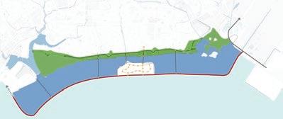
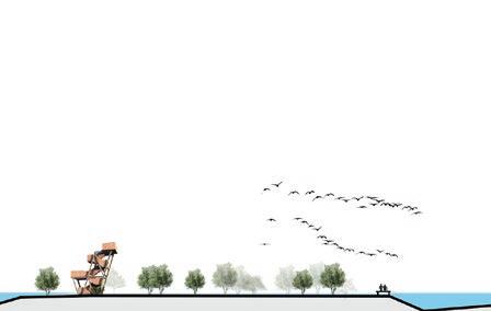
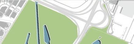
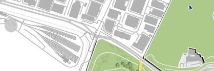
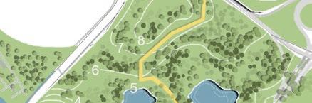
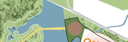
Island 5 and the Wetland Park is used here to illustrate the design ideas further:
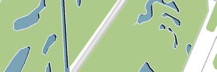
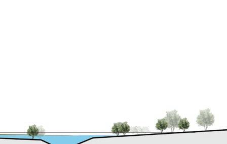
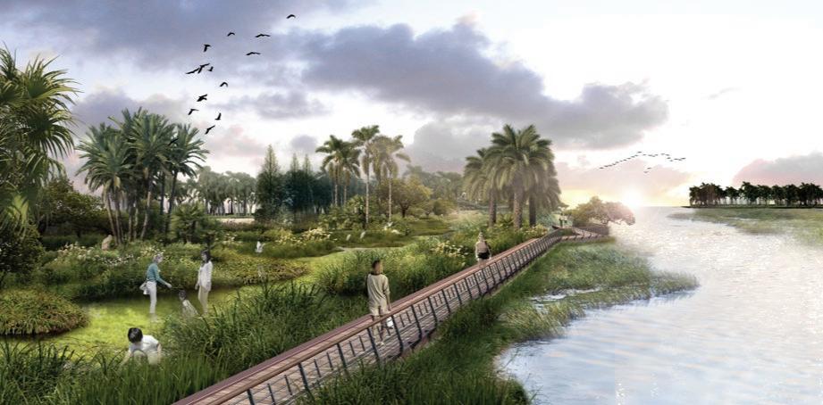
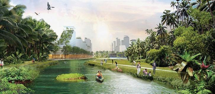
One of the key nature-centered components of this plan is the wetland park created near the eastern end of the stretch. This wetland park together with the Bedok Reservoir and Bedok River forms a large naturalized detention system that will alleviate all risks of inland flooding from the surrounding areas. It will also reduce the need for individual developments in the area to have grey infrastructure elements like detention tanks.
TYPOLOGY B: NATURE CENTERED COASTLINE
In
Water Level (Normal) Water Level (Wet)
Response ID: 63efc9b8ff02d7001287b57b
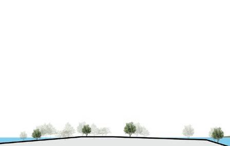
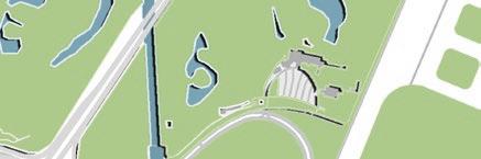
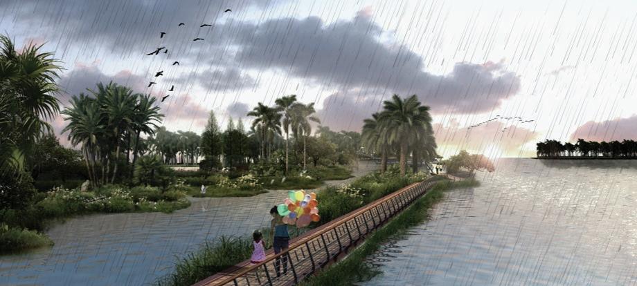
The built structures together with boardwalks are erected on stilts. This allows unimpeded functioning even when water levels rise during a wet period.
View of the Wetland Park during normal conditions. It is a vibrant natural ecosystem teeming with tropical life.
The Naturalized Bedok River and Wetland Park: Normal Condition
The Naturalized Bedok River and Wetland Park: Wet/ Rainy Condition
Section through Wetland Park
Bedok Reservoir Bedok Reservoir Wetland Park Wetland Park Barrage Bedok River with Naturalized Banks Bedok River with Naturalized Banks
wet/ rainy conditions, the wetland acts as a large scale detention system, whilst still retaining all functions.
WITH THE RISING SEAS
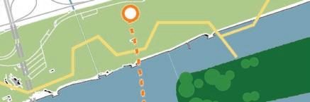
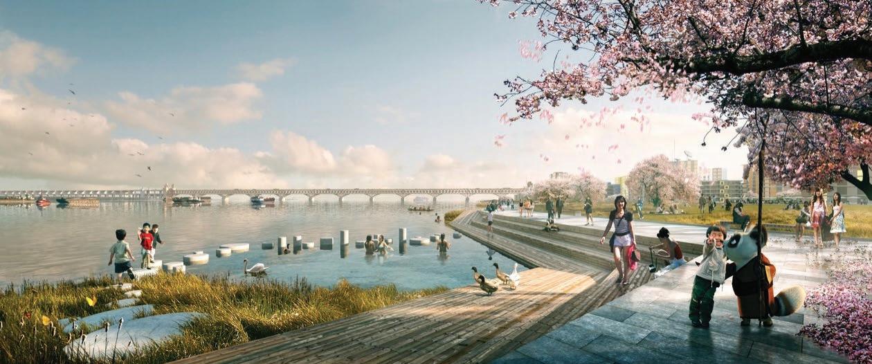
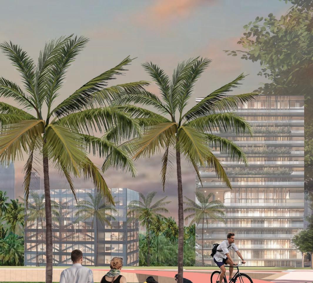
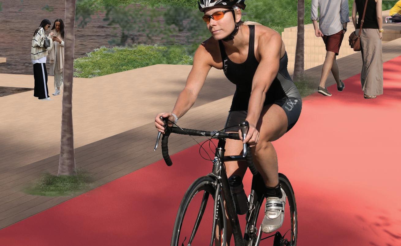
TYPOLOGY C: RECREATIONAL SEAFRONT
BEDOK RESERVOIR CHANGI AIRPORT (T5) CHANGI AIRPORT (T1,T2,T3, T4) PROPOSED SOLAR ENERGY FARM PROPOSED WETLAND PARK PROPOSED CITY PARK CENTRAL BUSINESS DISTRICT MARINA BAY EAST COAST PARK ISLAND 1: CENTRAL BUSINESS DISTRICT EXTENSION AREA: 387 HA GFA: 58,050,000 SQM FUNCTIONS: COMMERCIAL; RETAIL; OFFICES; SERVICED APARTMENTS; F&B; GREENS ISLAND 2: URBAN FOREST TOWNSHIP AREA: 276 HA GFA: 13,800,000 SQM FUNCTIONS: RESIDENTIAL; COMMERCIAL; THEME PARKS; ENTERTAINMENT ISLAND 3: NATURE PARK TOWNSHIP AREA: 197 HA GFA: 8,750,000 SQM FUNCTIONS: RESIDENTIAL; COMMERCIAL; RETAIL; SPORTS AND RECREATION; CIVIC ISLAND 4 AGRO PARK TOWNSHIP AREA: 263 HA GFA: 13,150,000 SQM FUNCTIONS: RESIDENTIAL; COMMERCIAL; COMMUNITY FARMING; CIVIC & COMMUNITY ISLAND 5 WETLAND PARK & INNOVATION DISTRICT AREA: 210 HA GFA: 7,350,000 SQM FUNCTIONS: COMMERCIAL; RECREATION; RESEARCH & DEVELOPMENT; GREENS ACTIVITIES ALONG THE RESERVOIR EDGE ACTIVITIES WITHIN THE CBD RESERVOIR ACTIVITIES WITHIN THE RECREATIONAL RESERVOIR ACTIVITIES WITHIN THE COASTAL EDGE
Response ID: 63efc9b8ff02d7001287b57b LIVING
RECREATIONAL RESERVOIR CBDRESERVOIR Recreational Activities within the Reservoir Naturalized Edge along the reservoir Board-walks/ decks etc extend the recreational domain into the sea. Recreational Activities along the water front facing the sea. Naturalized Edge along the reservoir SECTION THROUGH ISLAND 1 Recreational Experience: Recreational Experience: Recreational Experience: Recreational Experience: other connectivity Coastal protection Development five islands Stabilisation reclamation The team is proposing the ISLAND CHAIN Proposal as an alternative to the Long Island Plan. This proposed plan adopts multi-functional infrastructure elements that lends flexibility to the design and its implementation whilst achieving the goals of coastal protection and meeting long-term land use needs. The reasons for adopting this novel plan are stated below: 1. COASTAL DEFENSE STRATEGY 2. WATER DETENTION & STORAGE MANAGING INLAND FLOODING: YES (using the reservoir and flood plain) LANDFILL WITH SEA BUND YES using two distinct reservoirs & a wetland system) MULTI-FUNCTIONAL CAISSON WALL WITH BASEMENT CONSTRUCTION 1.4 million cum (Reservoir) Flood Plain on two islands not assessed due to lack of sufficient information. 15 km APPROX 17 km NOT POSSIBLE. All works must be completed to provide protection from sea level rise 12 km NIL new additions 185 HA Existing area of East Coast Park 185 HA Total Park Area 27 km APPROX. 1200 HA on grade) NIL (below grade) 12 TO 15 YEARS 17 YEARS AFTER RECLAMATION 0.8 million cum (CBD Reservoir) 1.1 million cum (Recreational Reservoir) 5.1 million cum (Wetland Park) TOTAL: approx 7 million cum 17 KM APPROX. 34 KM POSSIBLE AS SHOWN. Infrastructure critical to protect against sea-level rise can be built upfront. The rest can be phased as needed. 42 KM 100 HA Widening of East Coast Park 250 HA New City Park 235 HA New Wetland Park 185 HA Existing area of East Coast Park APPROX. 770 HA - Total Park Area 59 KM APPROX. 1,330 HA (on grade) APPROX. 3,225 HA below grade) 4 TO 5 YEARS WITHIN 4 TO 5 YEARS AFTER CASSION WALL DETENTION CAPACITY: WATER FRONT EDGE FACING SEA: NEW COASTAL PARK (LENGHT) PHASED DEVELOPMENT: Phase 1: Sea Wall with underground road connections, reservoir formation. Phase 3: Formation of additional islands and their development. Phase 2: Formation of first island with intra island infrastructures, addition of parks Phase 4. Completion of all islands and installation of MRT line. PROJECTED TIMELINE & SEQUENCE OF WORKS: WATER FRONT EDGE FACING RESERVOIR: EXPANSION OF PARK SPACES (AREA): TOTAL WATERFRONT EDGE: ESTIMATED CONSTRUCTION DURATION TO SECURE COASTAL PROTECTION: Assessing the ability of each proposal to distribute construction works and incurred costs over time. This can reduce upfront capital expenditure whilst meeting the immediate needs for coastal protection. Estimating the Net Present Value (NPV) of the two schemes to gauage the financial viability over the terms of the projects. Measuring the potential of the proposals to add vital green spaces by creating new opportunities and expanding/ augmenting existing green areas. Water front edges provide ideal urban spaces that are desirable and offer superior experiences. The measure of such water front edges used here as a proxy representation of liveability. Estimating the capacity of the proposals to store fresh water to augment national demand and provide detention capacity to reduce inland flooding in the south-eastern & eastern parts of the island. Comparing the fundamental method used to protect the coast against rising sea level. The notion of time paramount as climate change related outcomes are becoming accelerated, more frequent and difficult to predict. MINIMUM PERIOD TO CONSTRUCT BUILT DEVELOPMENTS ON ISLANDS: TOTAL SPACE CREATED: 3. LIVEABILITY 4. GREEN COVER & EDGE CONDITIONS 5. PHASED DEVELOPMENT 6. FINANCIAL VIABILITY THE ‘LONG ISLAND’ PLAN THE ‘LONG ISLAND’ PLAN THE ‘ISLAND CHAIN’ PLAN THE ‘ISLAND CHAIN’ PROPOSAL INDICATIVE BARRAGE LOCATION. INDICATIVE BARRAGE LOCATION. CBDRESERVOIR RECREATIONAL RESERVOIR RESERVOIR FLOOD PLAN FLOOD PLAN WETLAND PARK Coastal Park Coastal Park Wetland Park City Park CBD Reservoir Recreational Reservoir Wetland Park Recreational East Coast Park Complete Development Islands Complete Development Islands PUB Plan (billions) (billions)
LIVING WITH THE RISING SEAS
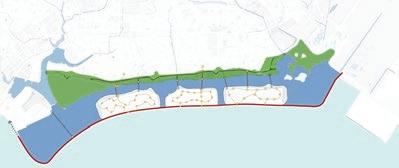
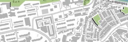
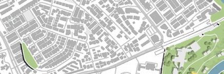
Island 3 is used here to illustrate the design ideas further
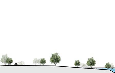
Each of the five islands are designed with two distinct edge conditions:
• Water front edge along the reservoir.
• Water front edge along the sea
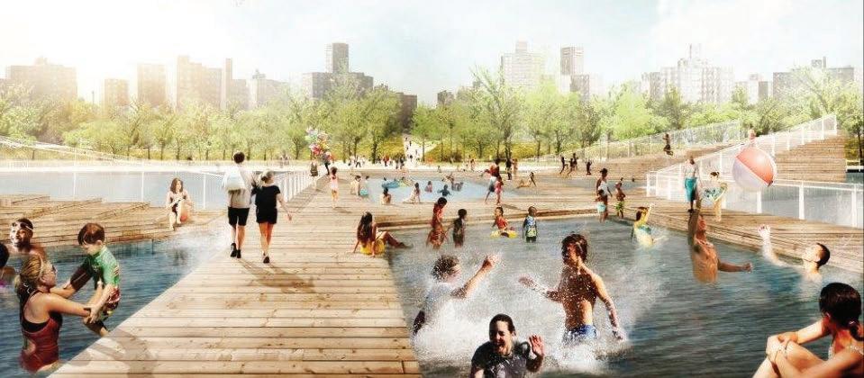
Both of these offer opportunities for a multitude of recreational activities to be incorporated into the design. These activities along the edges complement those that are planned and provided within the water body of the reservoir.
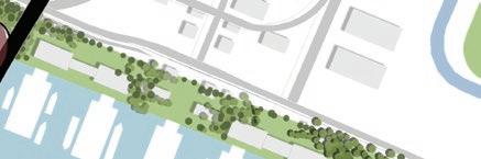
TYPOLOGY C: RECREATIONAL SEAFRONT
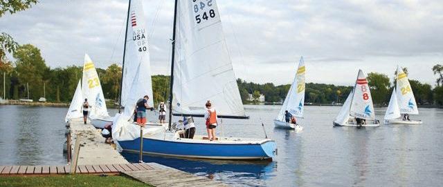
Vibrant spaces along the reservoir edge promote greater interactions with the reservoir water.

The coastal edge provides a variety of experential spaces for leisure and recreation.


Response ID: 63efc9b8ff02d7001287b57b
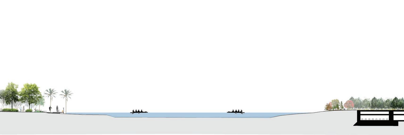
Water Level/ Detention Capacity (Wet) Water Level Normal/ Steady State The edge along the reservoirs presents a steady state water level with some fluctuations during wet-period when water level rises as the reservoirs receive runoff water. These edges present a naturalized biophilic conditions which encourage greater interaction between people and the water as well as supports thriving biota. The edge along the reservoir is stepped/ staggered to respond to predicted sealevel changes and the inherent uncertainty associated with this. This edge has several shared activity spaces that can also act as buffer and be inundated during extreme high-tides and storm surges without an disruptions to the overall functioning of the spaces and occupants. (+5m) Sea-Level during extreme high-tide & Storm Surges (+1m) Sea-Level Rise (0) Current sea-level
Section of Recreational Spaces along the Reservoir.
Section of Recreational Spaces along the Sea
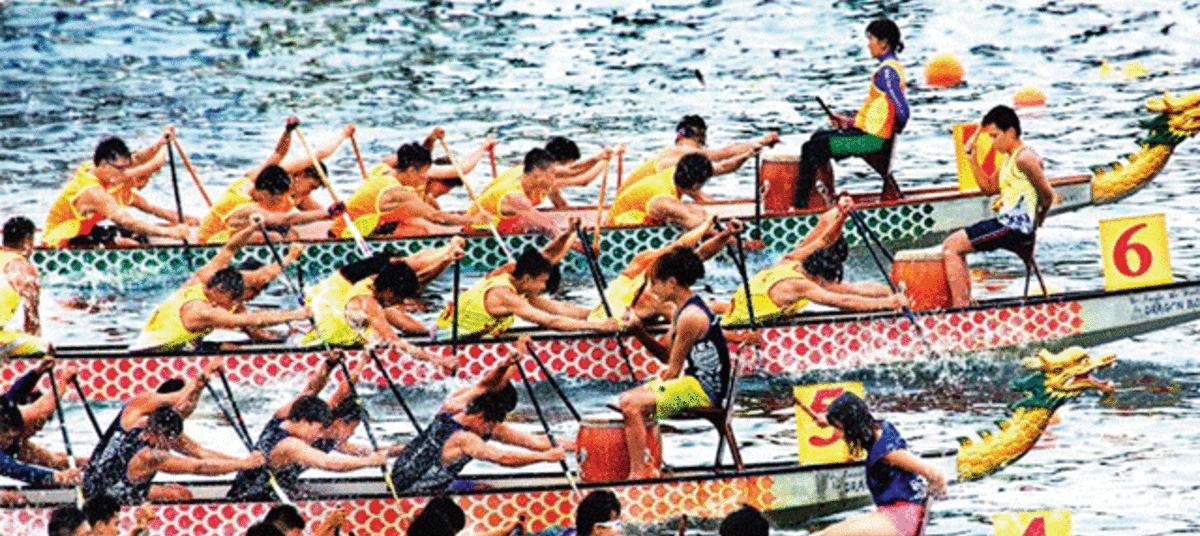
Reservoir Edge Reservoir Edge Picinic Island Dragon Boat Racing Sea/ Coastal Edge