“All the cities of the world are going to expand. We need to have a better understanding of what makes good urban habitat for home sapiens. We have an obligation to make the new places more livable, more sustainable, more healthy. We have the tools”
Jan Gehl
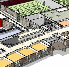
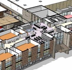
1 High Performance Sub(Urbanism)
2022 | Urban Design Studio
2 3 4
LAND+WATER+CITY
2021 | Urban Design Studio
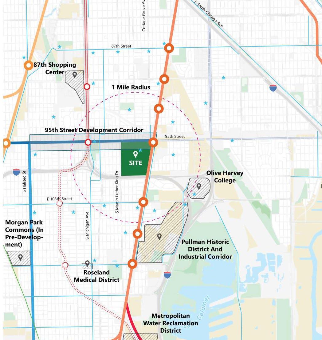
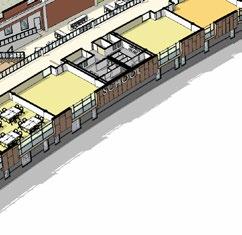
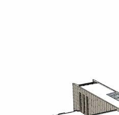
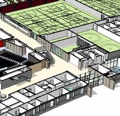
Chicago State University
2024 | Professional Work
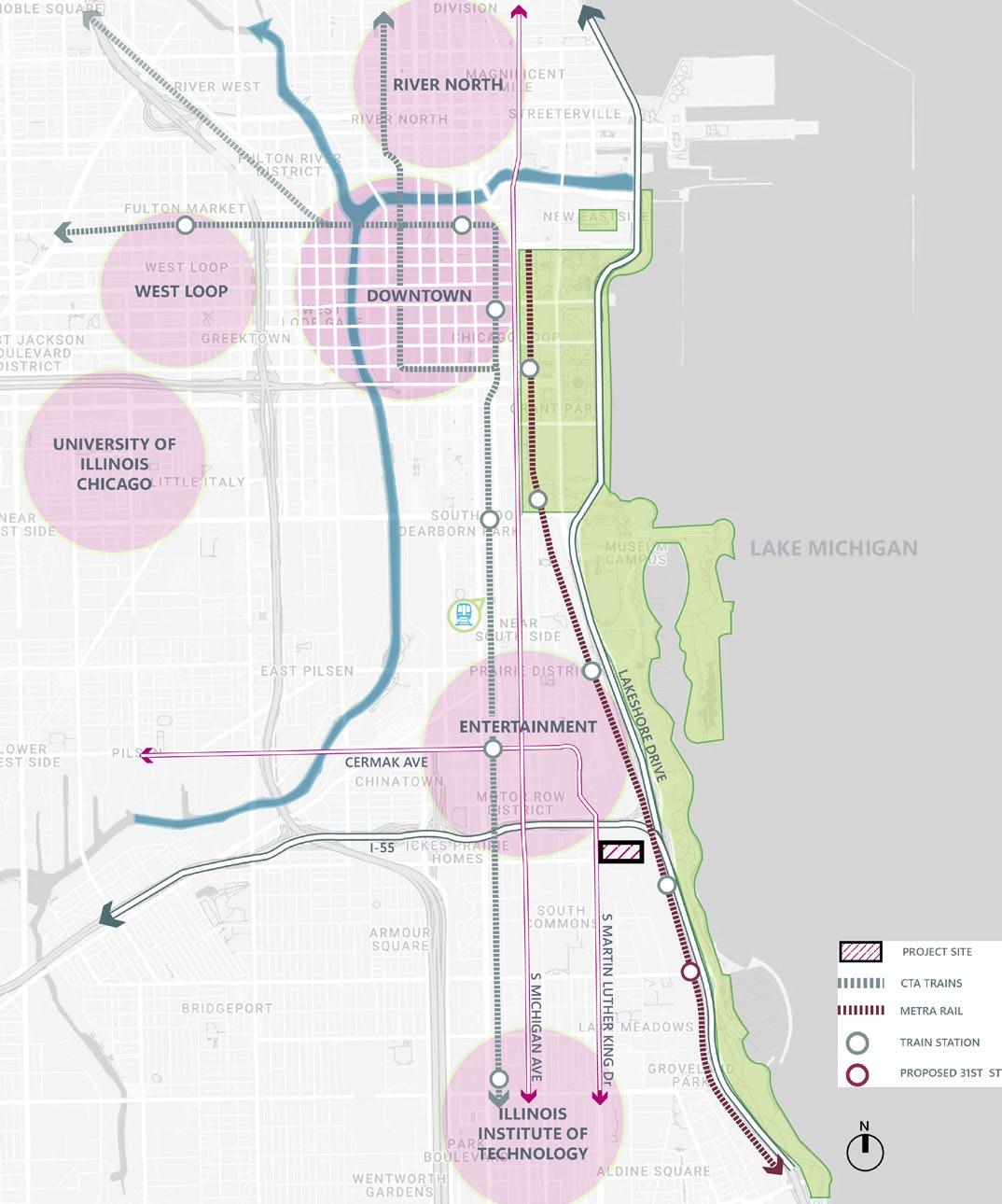
Mixed-Used Development - South Lakeshore Drive, Chicago
2024 | Professional Work
5 7
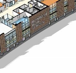
Montrose High School, Colorado
2024 | Professional Work
6
Mixed-Used Development - North Lawndale, Chicago
2023 | Professional Work
Characteristic of Transit Oriented Development
2022 | Urban Design Research Paper
8 9 10
Transit Oriented Development and Equity
2023 | Research using GIS
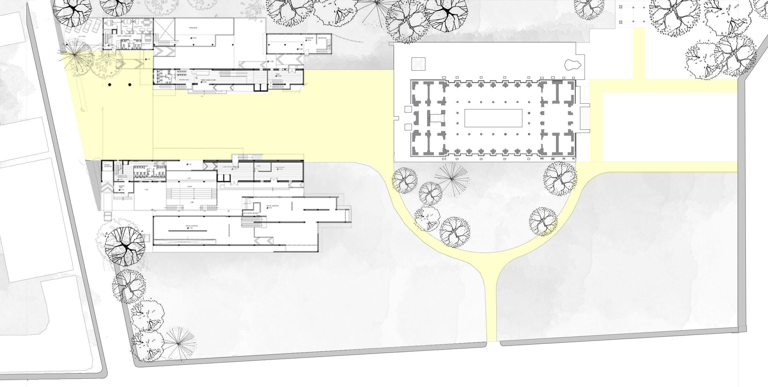
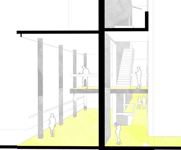
The City Museum
2014 | Architecture And Design Studio
The Vertical Community
2016 | Architecture and Design Studio
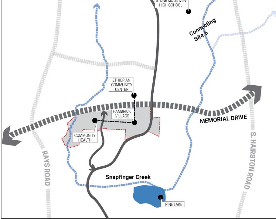
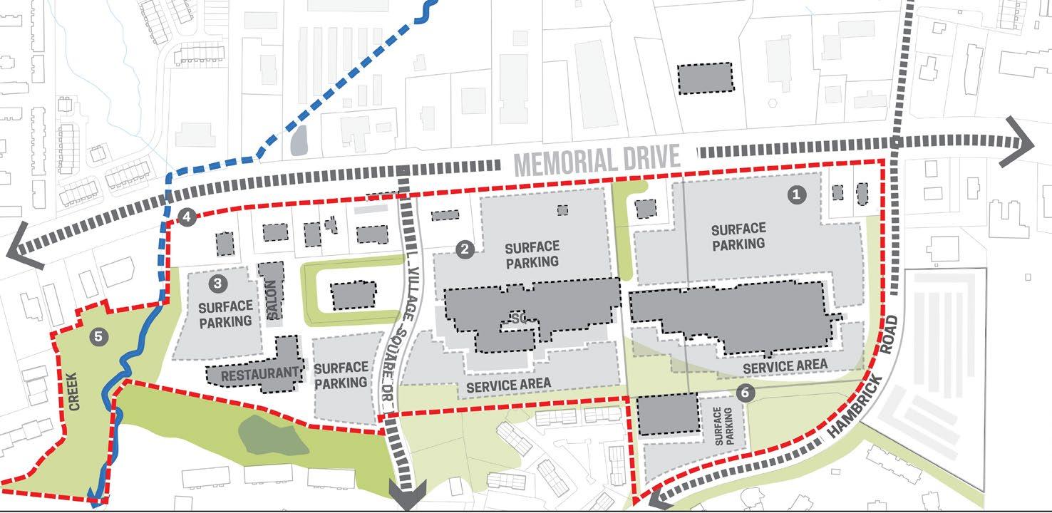
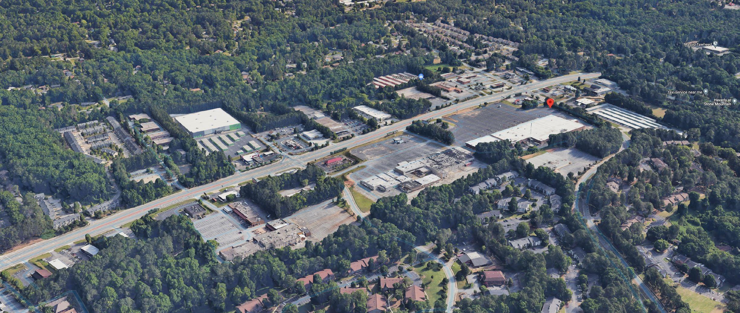
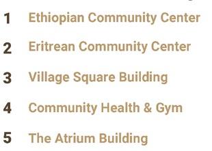
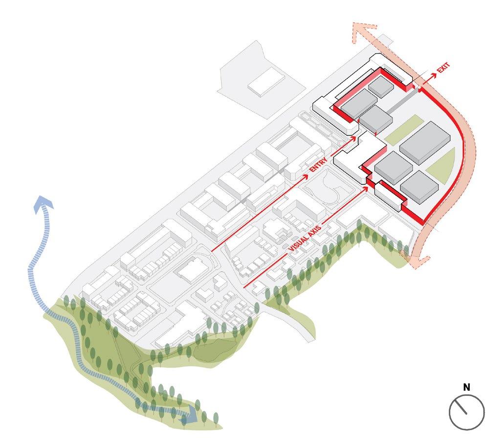
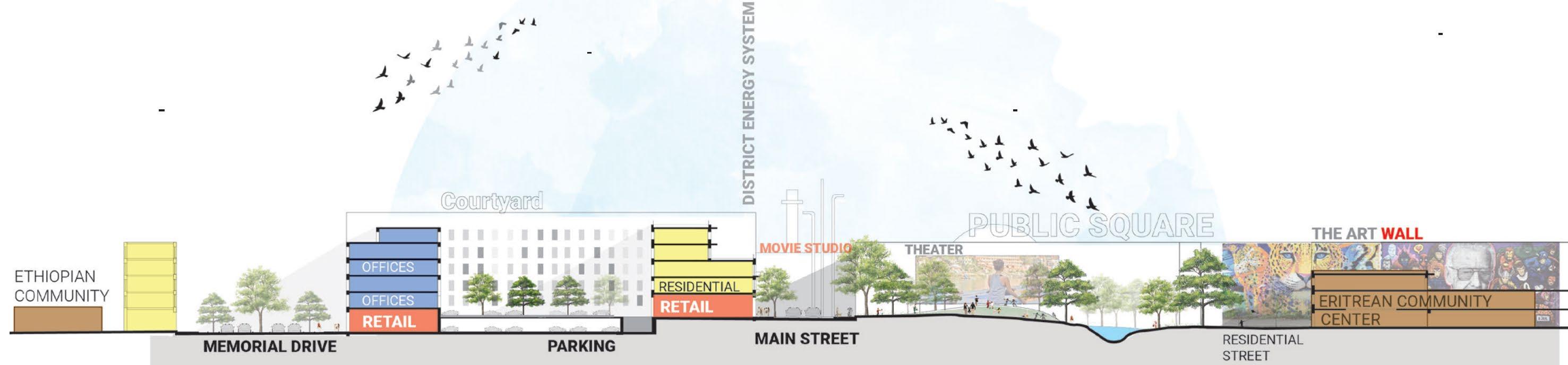
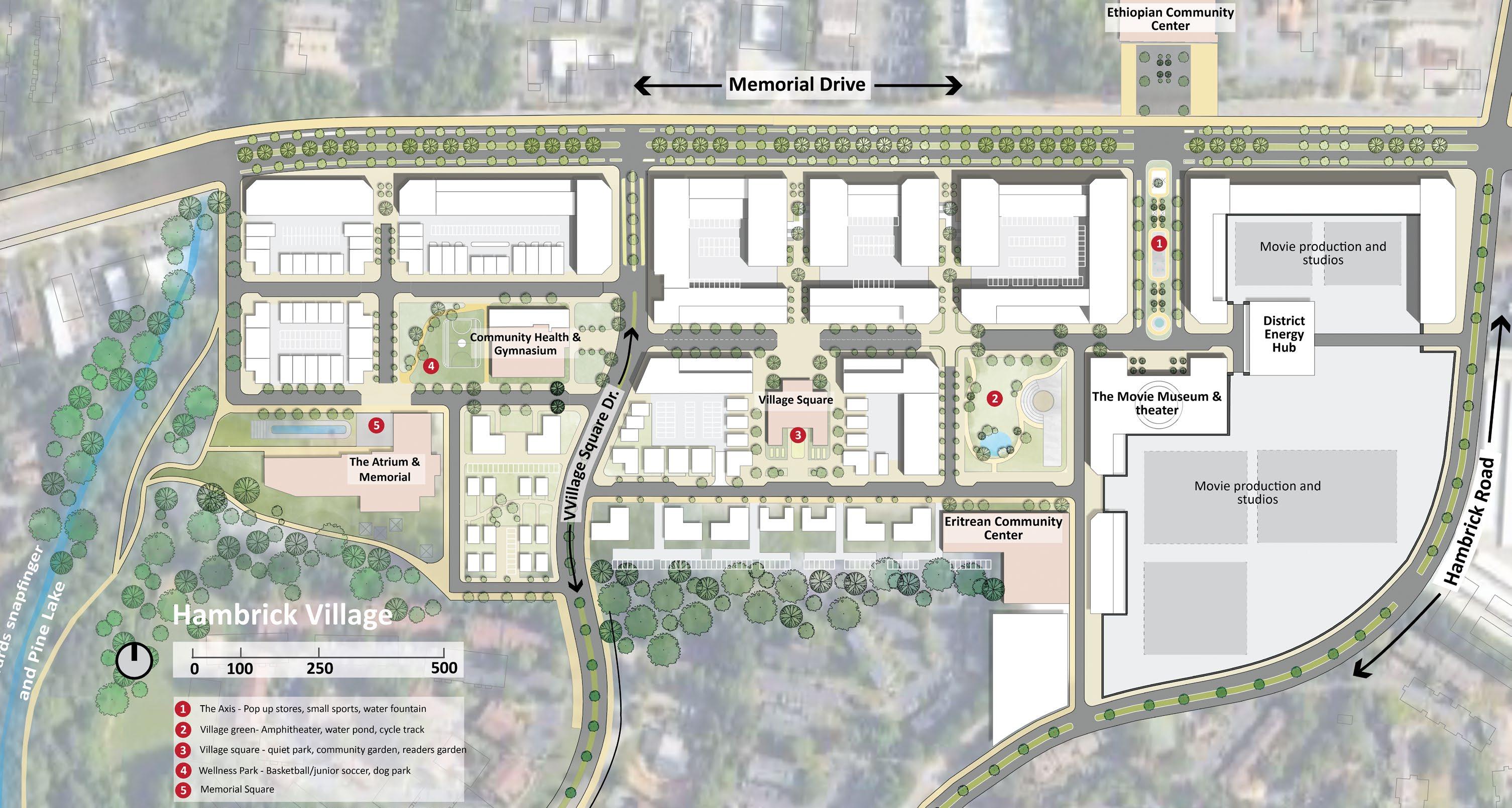
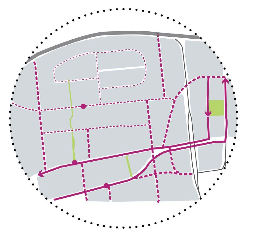
SITE CONTEXT
The 50 acre site is located 3 miles from stone mountain along the memorial drive, Atlanta, Georgia. The site has large surface parking lots with run down businesses. Along the west edge of the site, runs the snap-finger creek
Aerial View of Site High
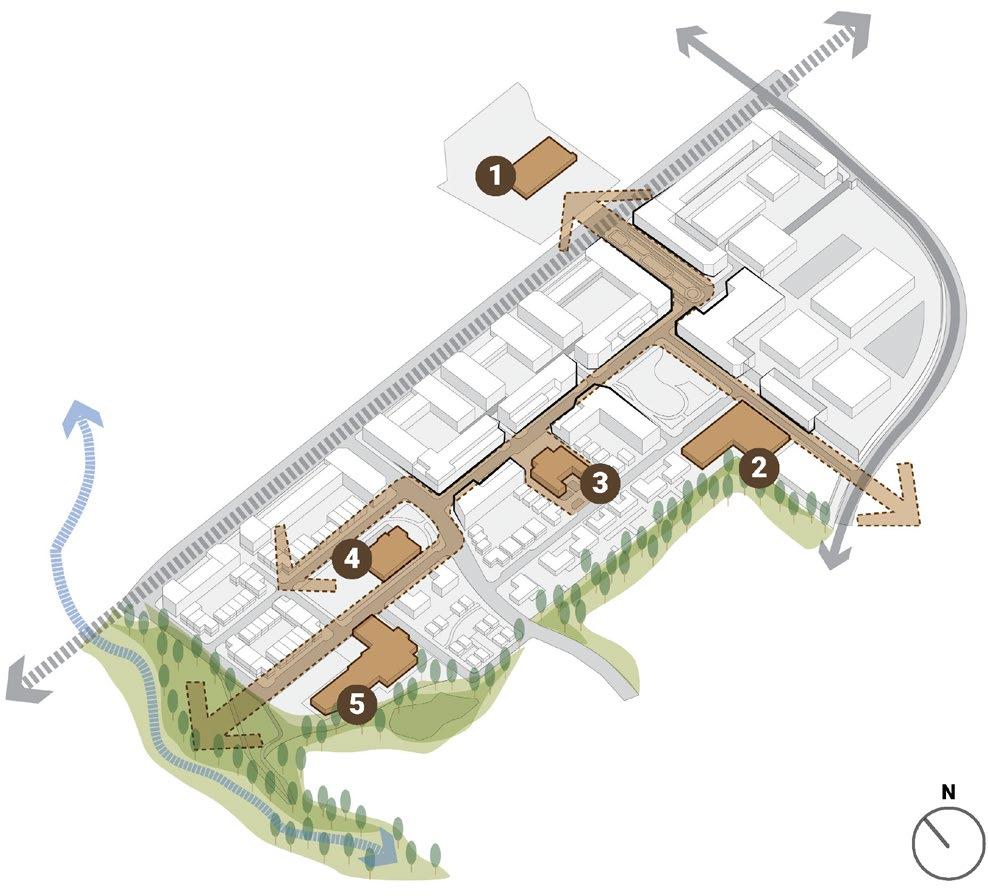
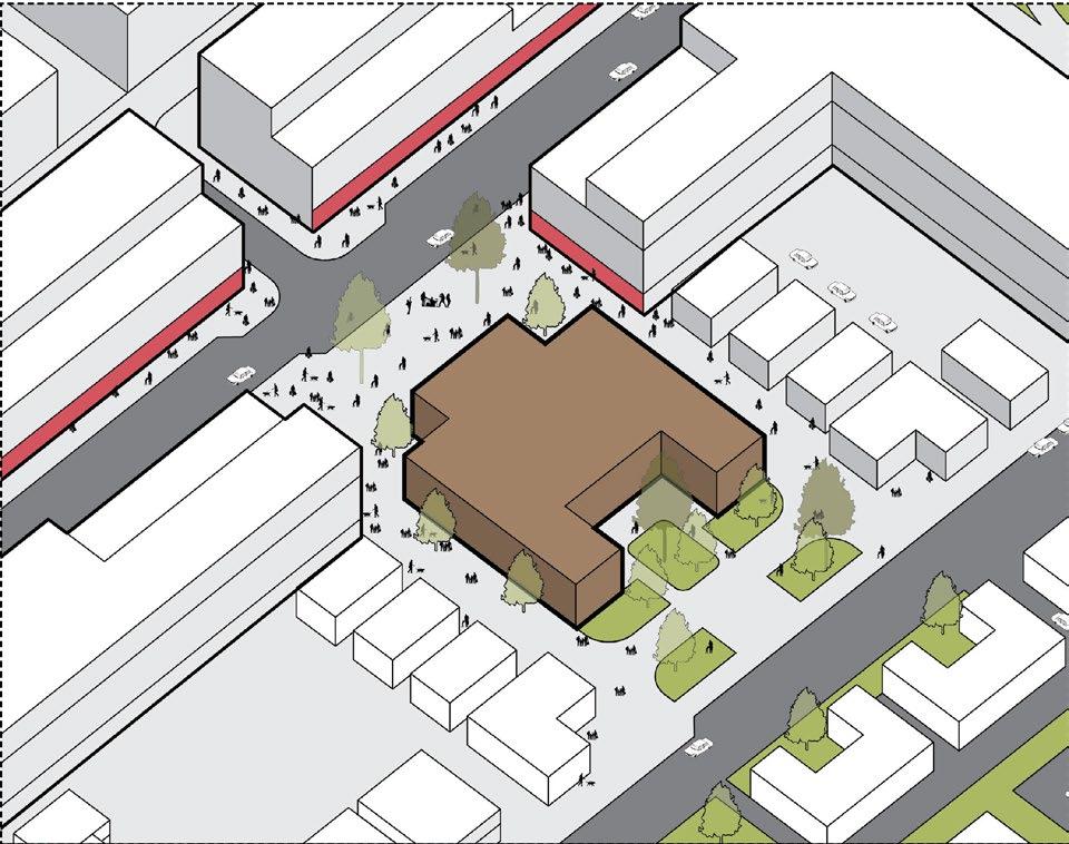
CORE STRATEGY :
BUILDING AROUND EXISTING COMMUNITY ASSET + INTRODUCING A MOVIE STUDIO AND CREATIVE JOBS
We propose using existing cultural links as prominent terminating vistas along an axial network. These are the existing asset on site that the neighborhood community connects with. Thus retaining these gems and building around it is the key concept
The booming movie industry brings in creative jobs and the privacy wall is the art feature for the community. As movie studios require a privacy wall, the design aimed to make this wall interactive wrapping around some buildings and being a part of an interactive infrastructure.
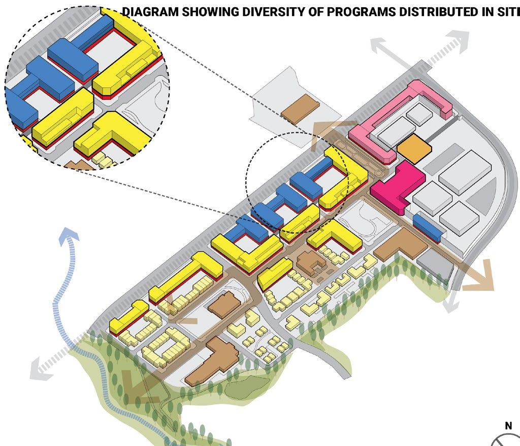
Building use indicates the diversity of function and building typologies. Along with multifamily housing, the project aims to have missing middle housing for the young and aging population in the suburbs.
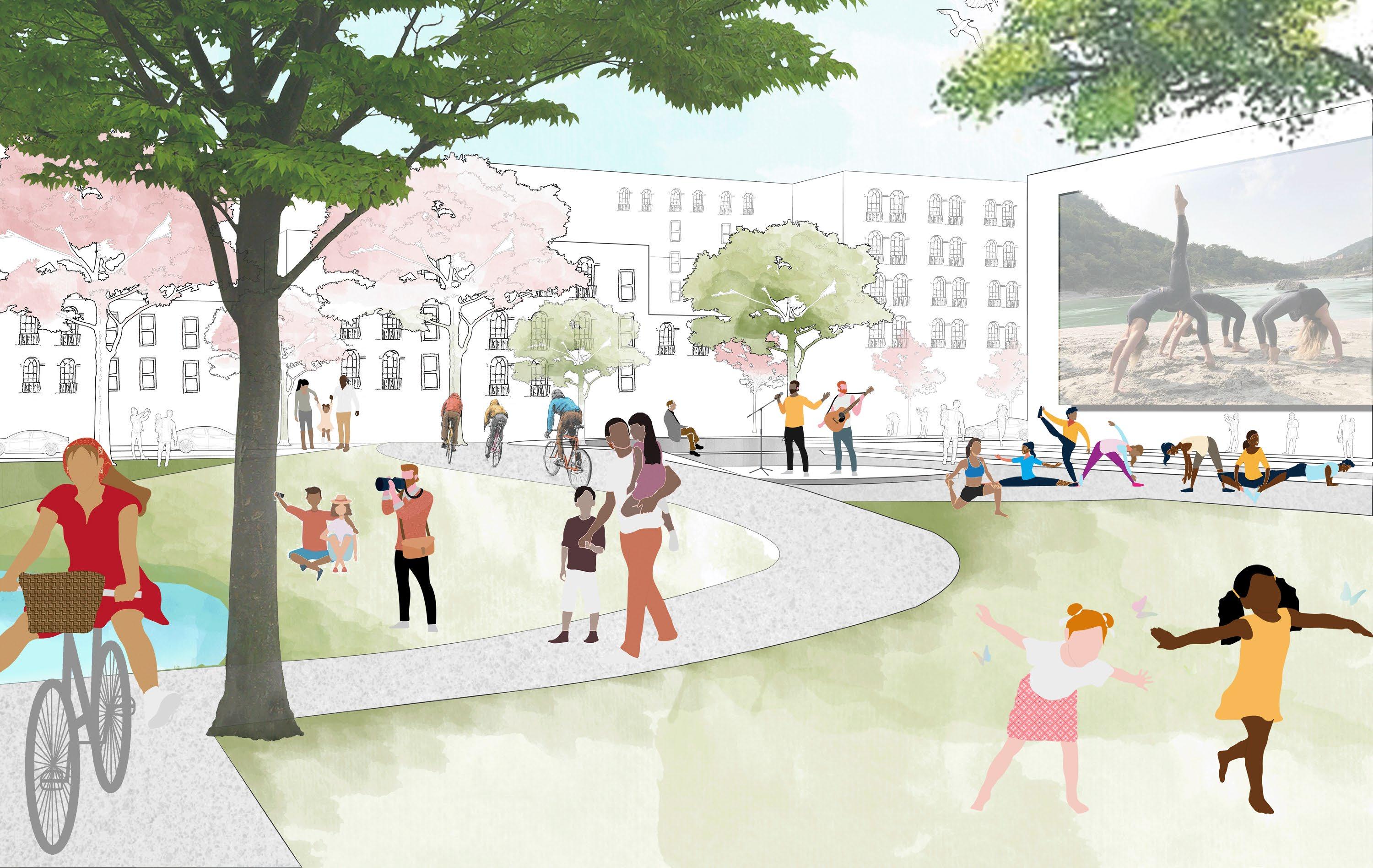
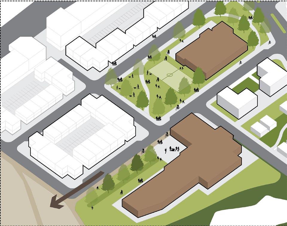
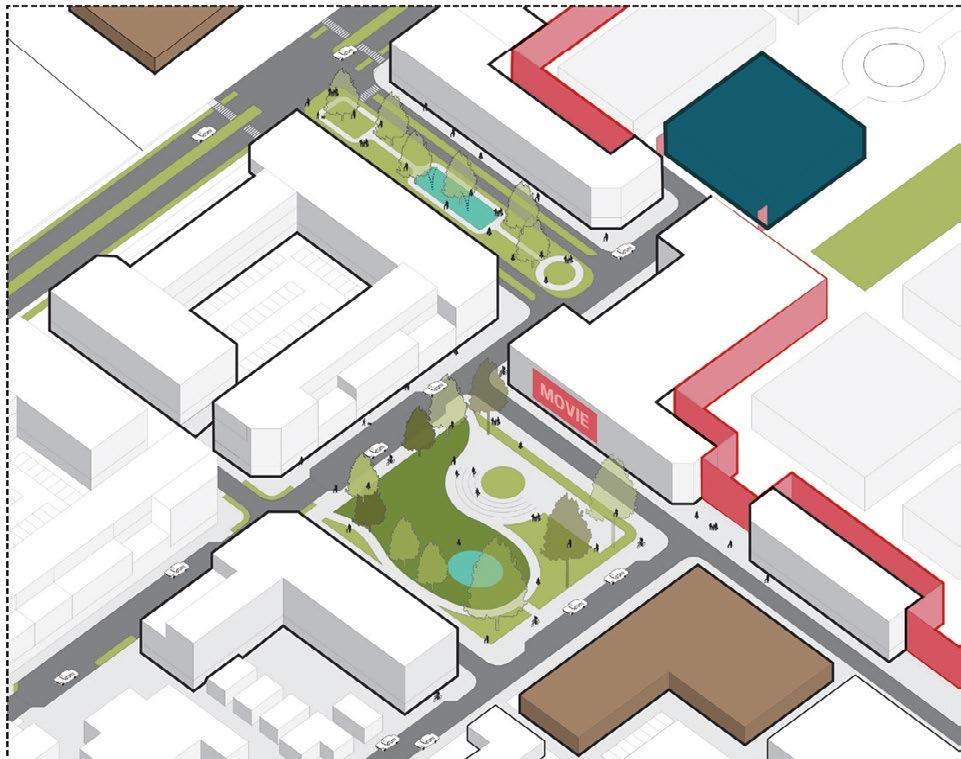
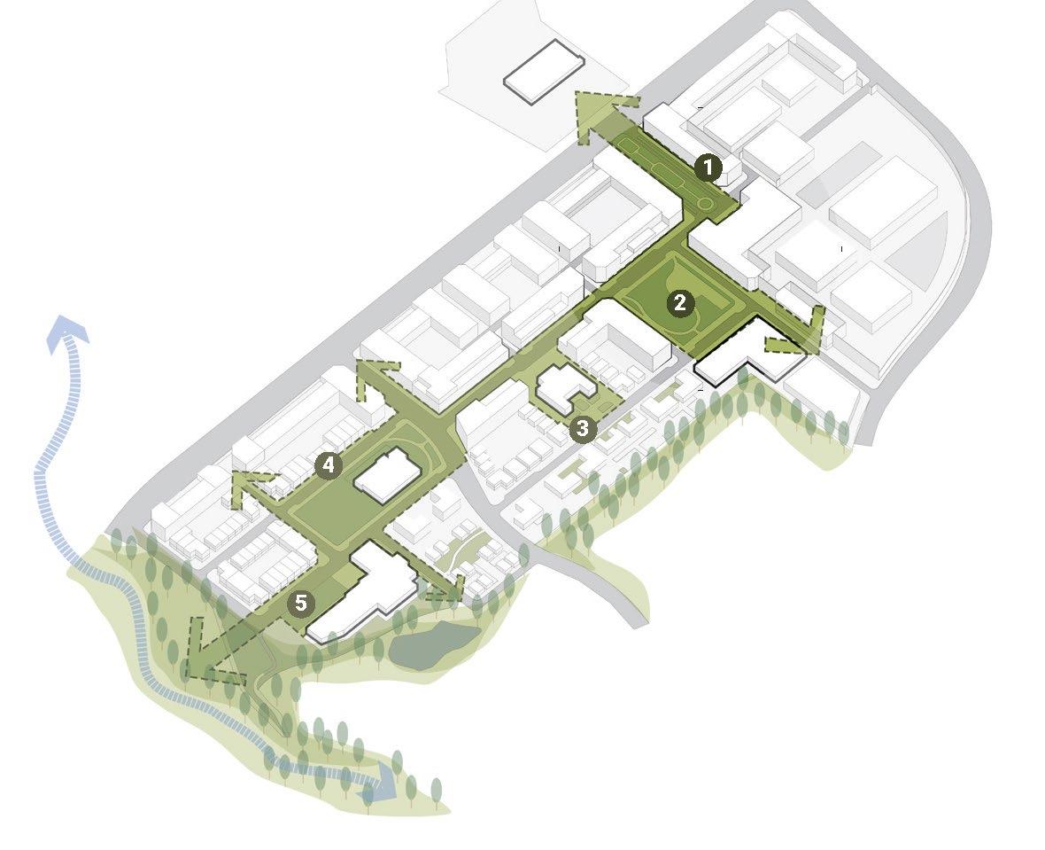
The Village Green
Existing healthcare clinic is expanded into community gymnasium with soccer field
4,5
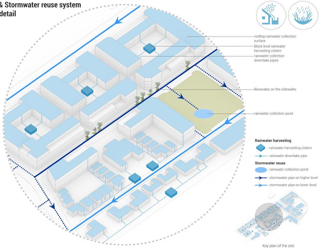
Stormwater filtration and retention strategy
A part of the existing structure is retained with into a community and language center with community garden and library
3
The public parks and plazas are strategically located on the site that soaks in the runoff and filtrates it before letting it into the creek. Thus, once a fleet of impermeable surface parking is now a sponge that soaks water.
The village green is the biggest park in the neighborhood that is an intersection between the existing community centers and the movie theater
1,2
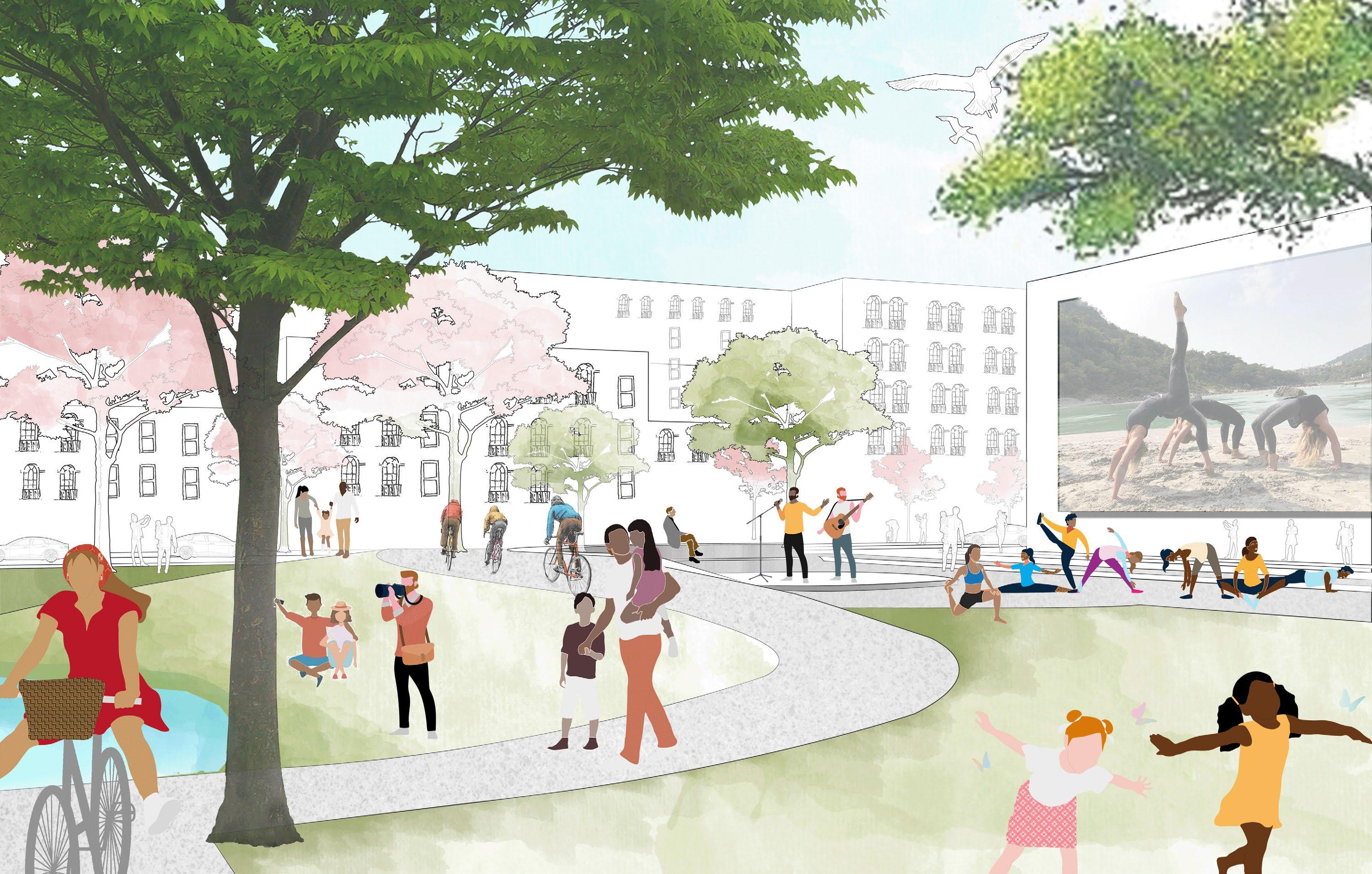
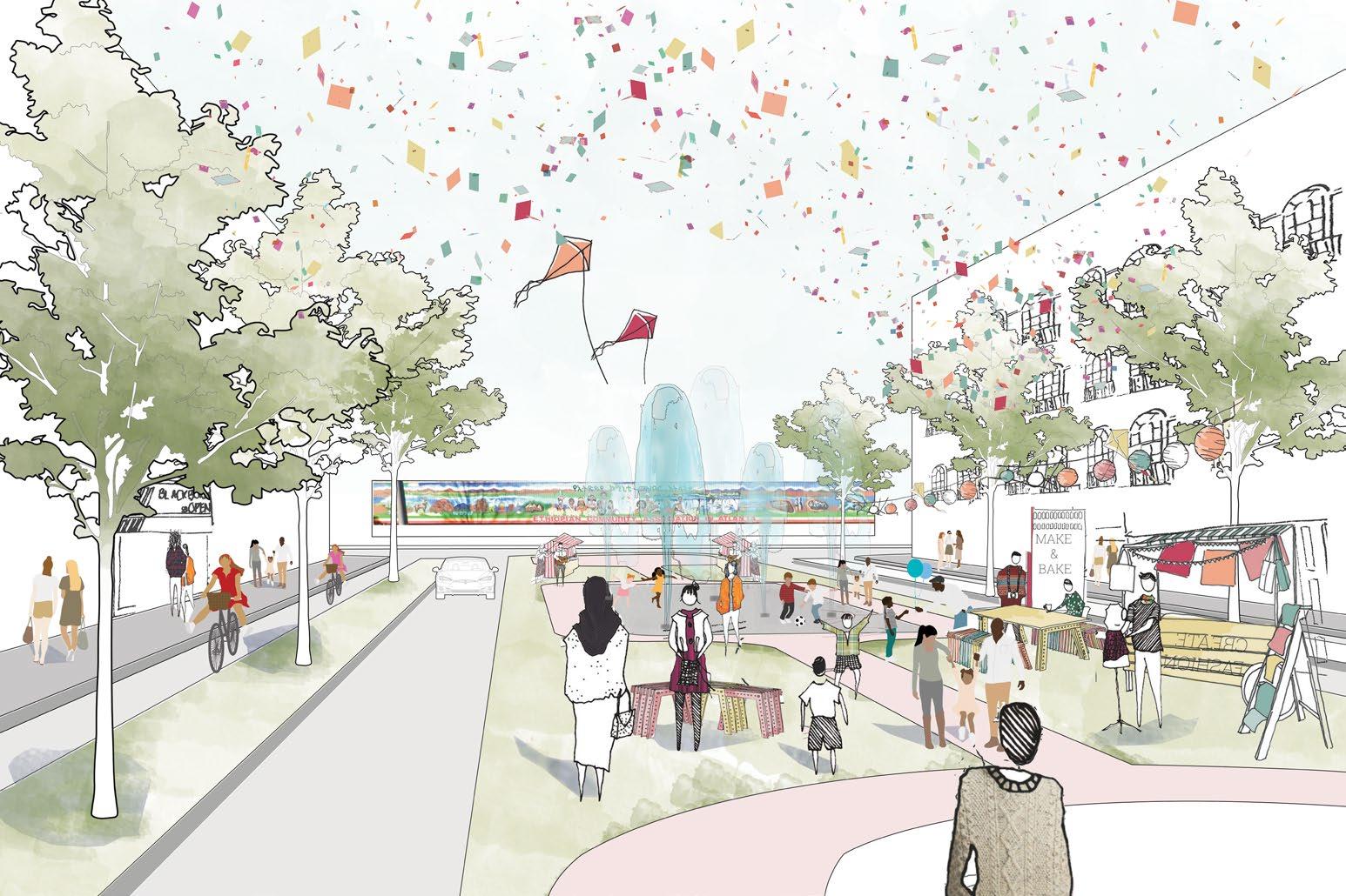
DUALITY OF PLAZA
DAY
Street plaza hosting community events and carnivals responding to the Ethiopian community center
NIGHT
Red carpet events, movie promotions and comic-cons responding to the New movie theater and the studio
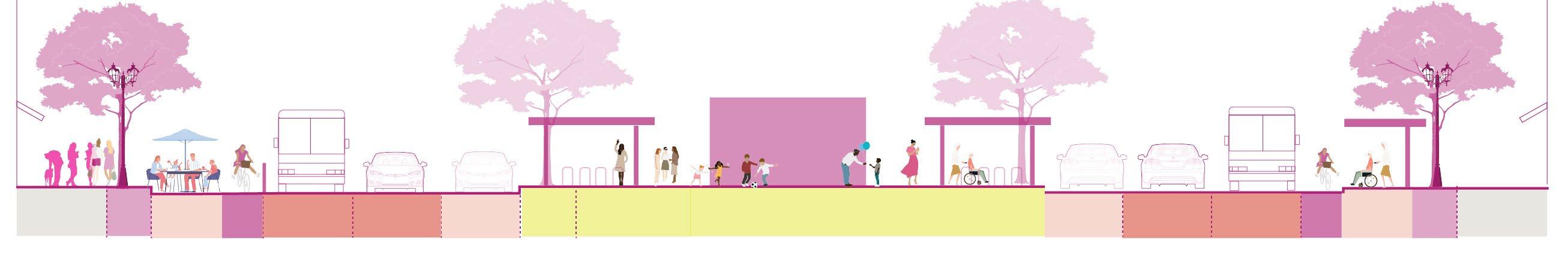
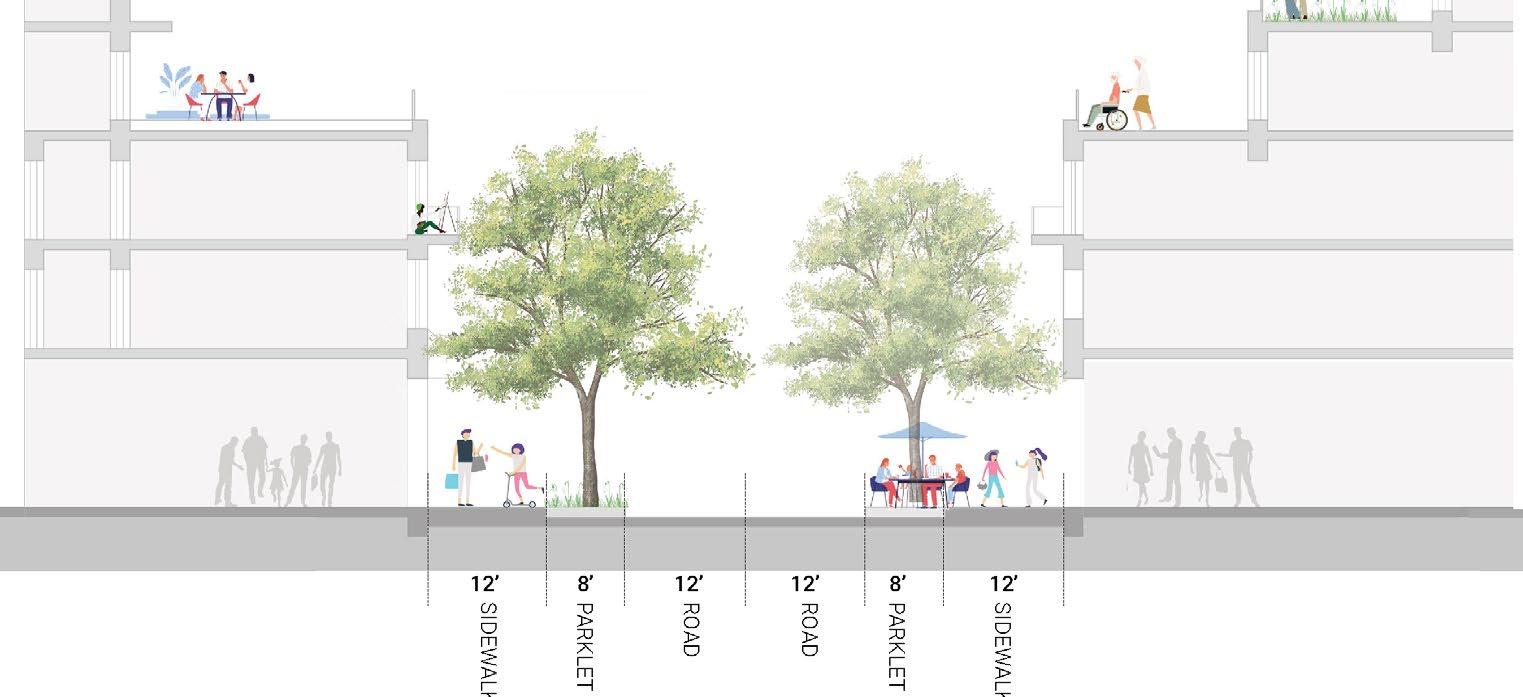
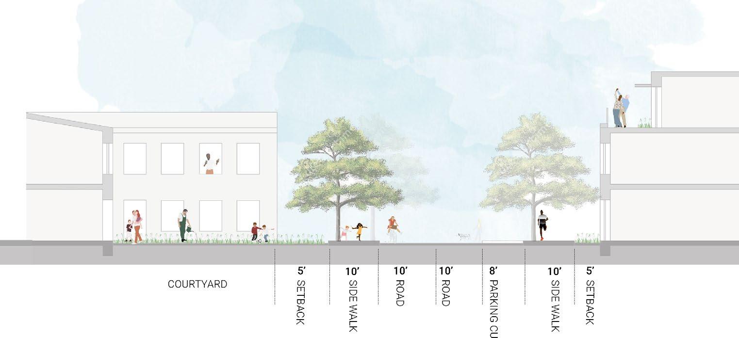
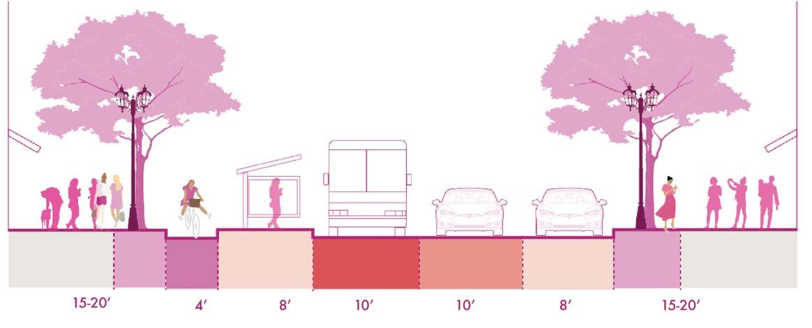
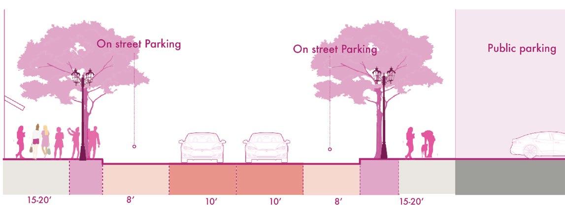
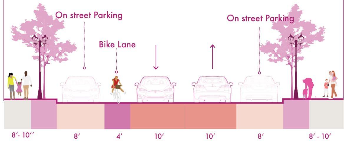
STREET SECTIONS
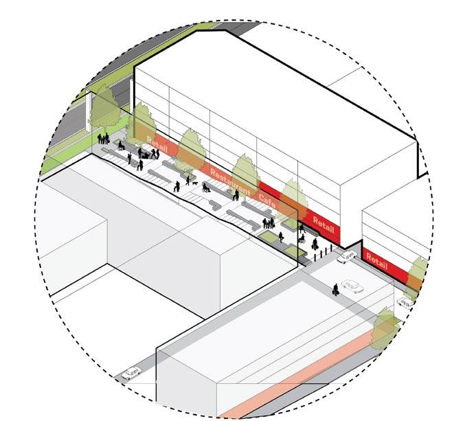
THE MAINSTREET
RESIDENTIAL STREETS
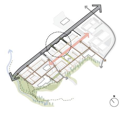
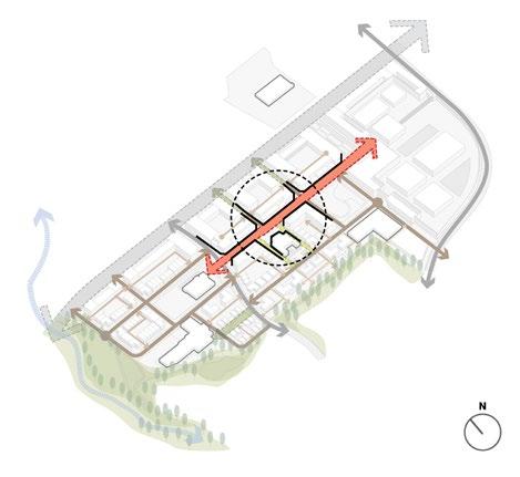
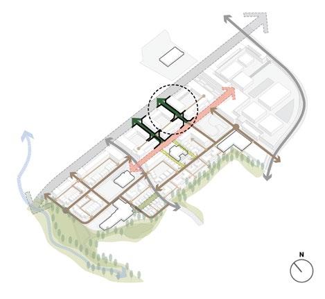
STREET HIERARCHY
MEMORIAL DRIVE
MAINSTREET
MEMORIAL-MAINSTREET
CONNECTOR
MAINSTREET
The Mainstreet
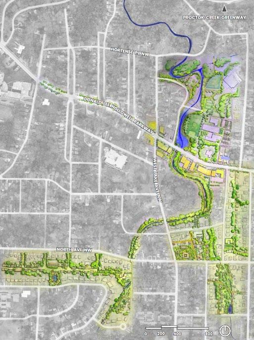
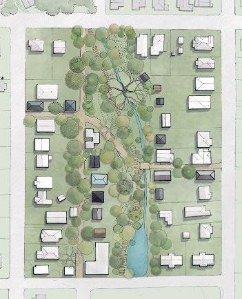
2. LAND+WATER+ CITY
Connecting Urban Neighborhood with Creek
Course : Urban Design Studio : Fall 2022
Software Used : Autocad, Revit, Sketchup, Adobe Creative Suite,
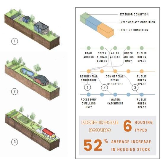
How can an urban ecological infrastructure framework expand the public domain and create opportunities for diverse housing sites and types, enable financial strategies for affordable housing and create a diverse neighborhood?
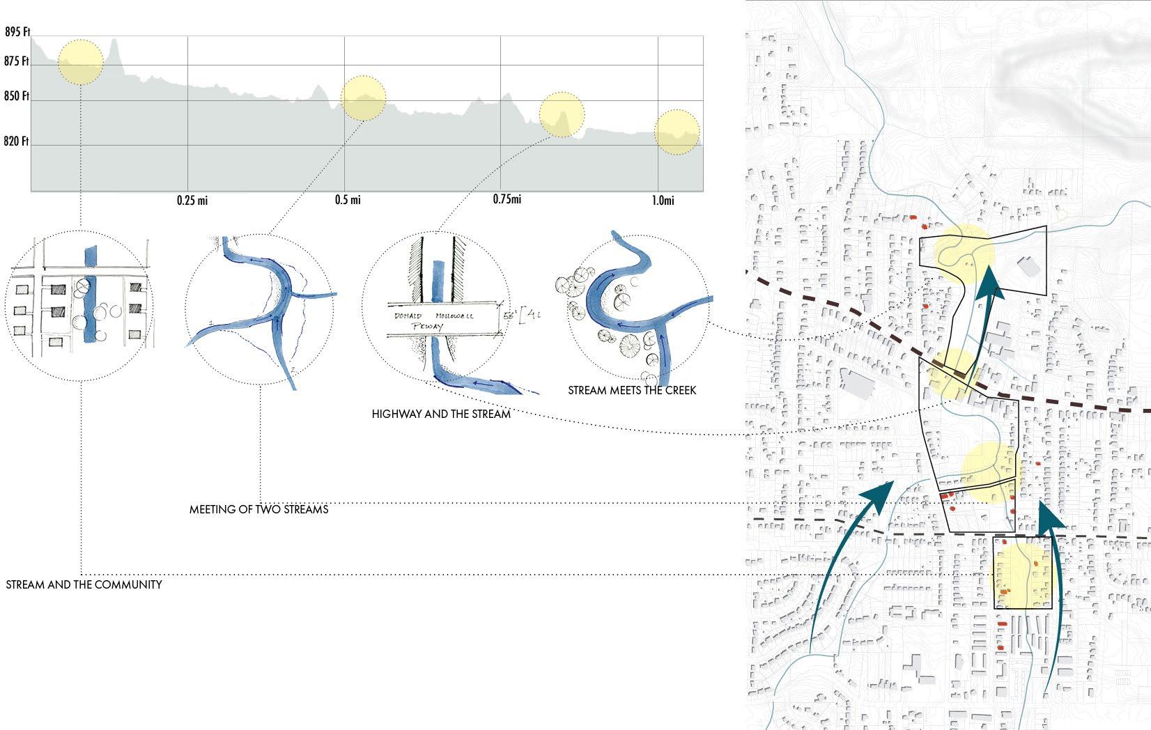
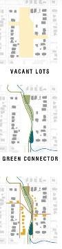
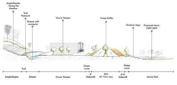
The project has 3 key entities, the connecting trail, transformation of Donald Lee Hollowel highway to Main street and mitigating flooding at Grove Park
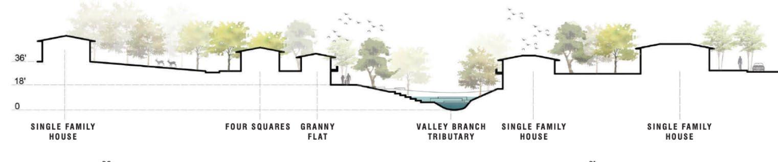
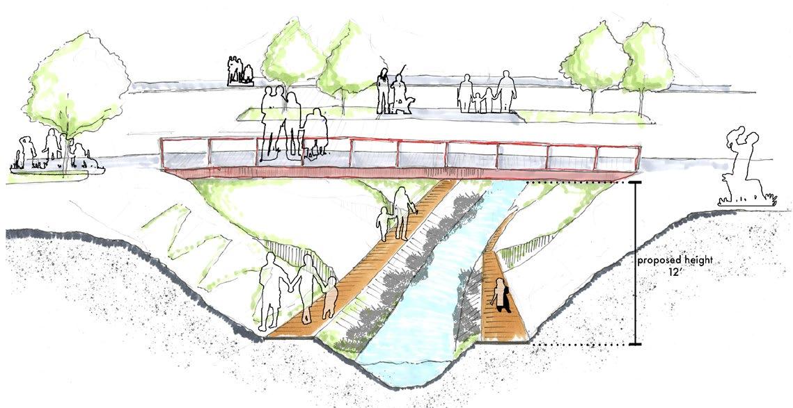
Studying the topography, the project adapts to the store, soak , slow strategy to mitigate flooding in the neighborhood and create opportunities for a connecting trail that weaves the disconnected neighborhood.
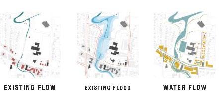
STORM WATER ANALYSIS
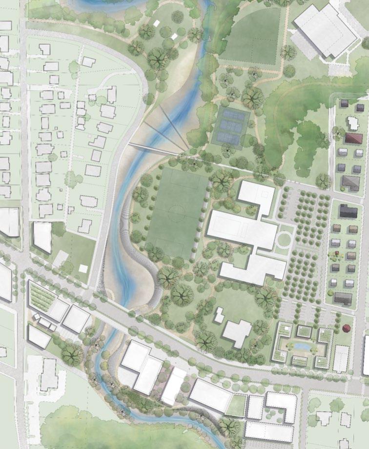
Typical block plan with soak and store strategies to mitigate flooding, create a trail and have diverse housing types.
Section through the block
Conceptual Sketch for creek-side trail below the freeway
Infrastructure along the DLH freeway (section)
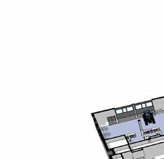
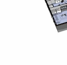
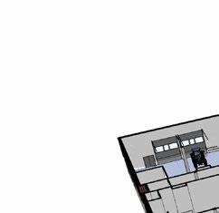
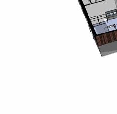
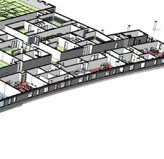
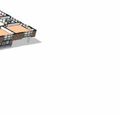
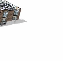
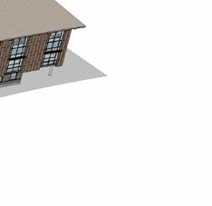
3. CHICAGO STATE UNIVERSITY
Professional Work, Wight & Company
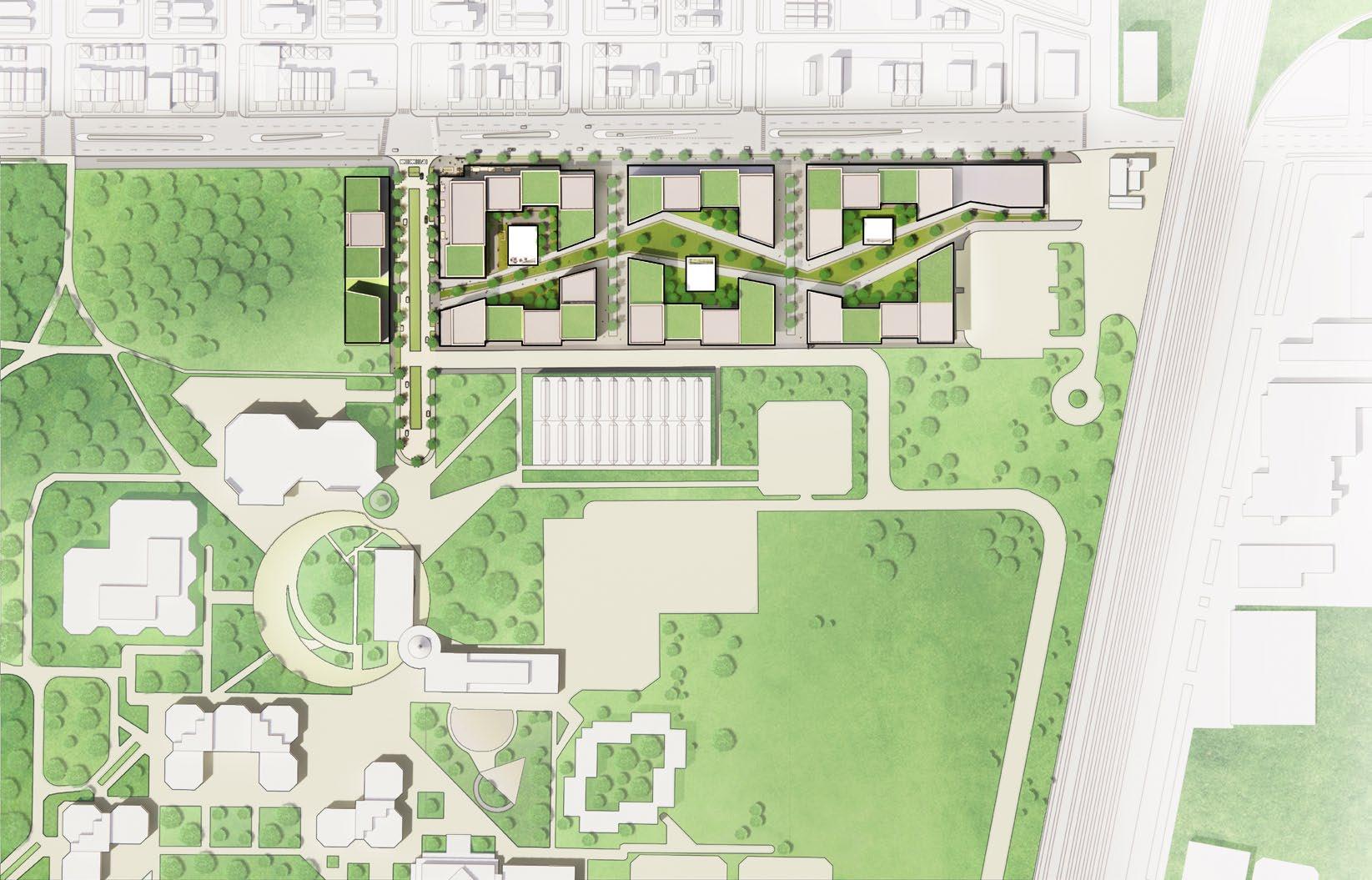
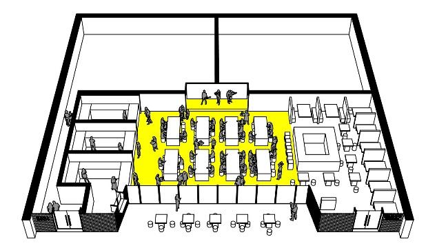
STUDENT HOUSING NEEDS
Minimum
It
additional financial support will likely be needed to offset the occupancy costs of any new housing facilities.
Easy Access Benefits Both Commuters and On-Campus Students
The proposed student campus offers an ideal living environment for students in South Side Chicago. Conveniently located, it provides easy access for both commuters and those living on campus. Moreover, this development helps activate the 95th Street corridor,an area with great potential that has long struggled with issues of accessibility, walkability, and overall desirability
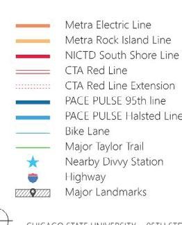
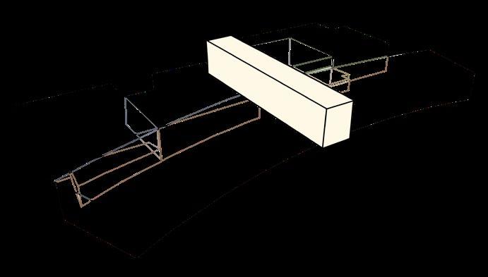
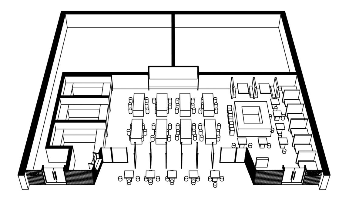
Site Plan
Phase 1A
Developing the corner plot to activate street front
Phase 1B
Completing the block to fullfill demands
Phase 1B
Completion of block paving way fro following development
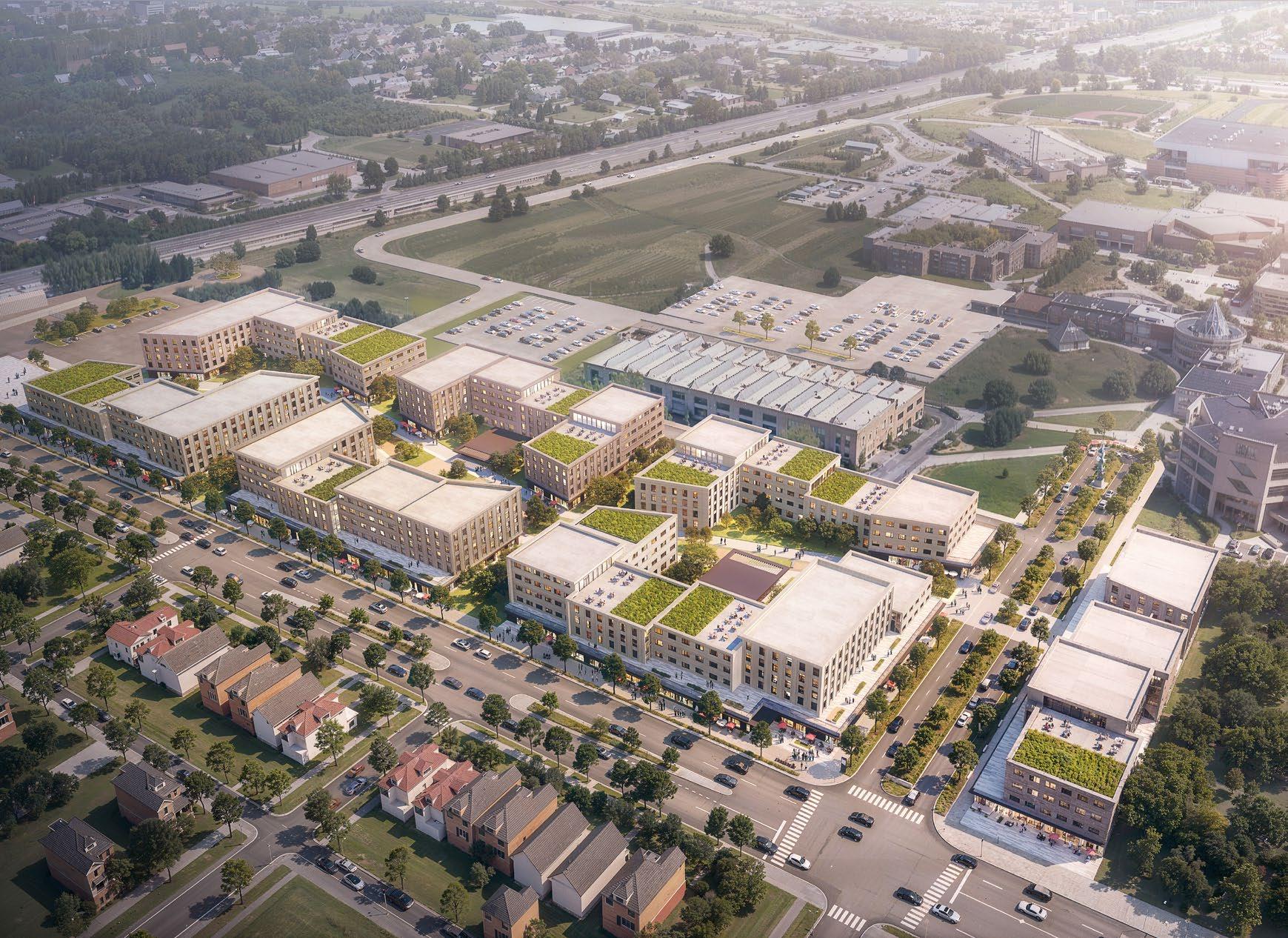
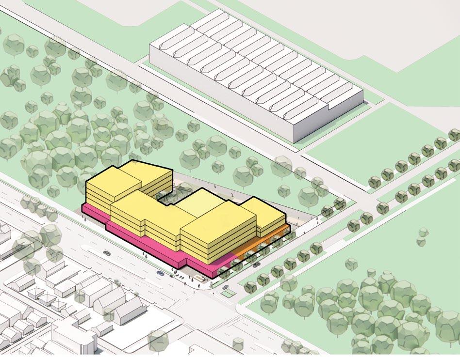
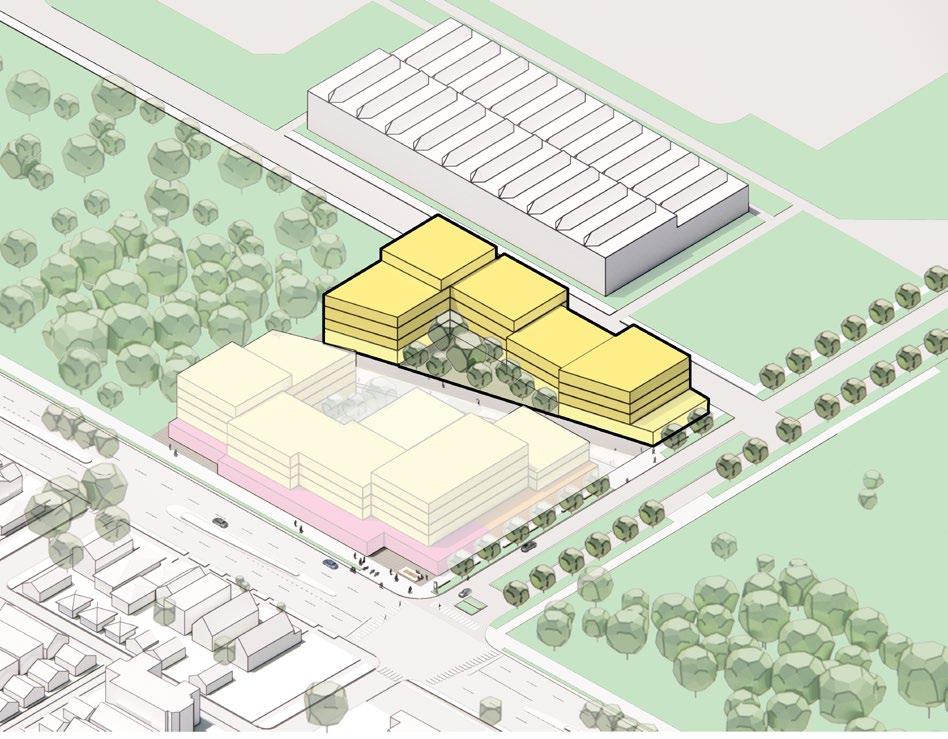
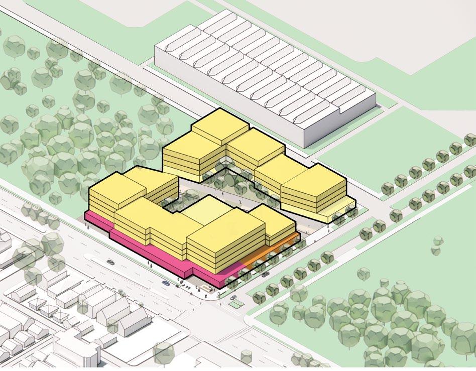
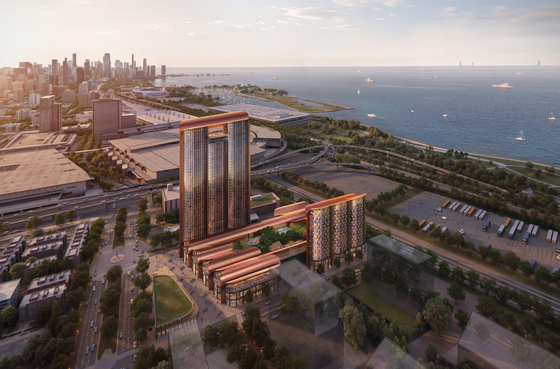
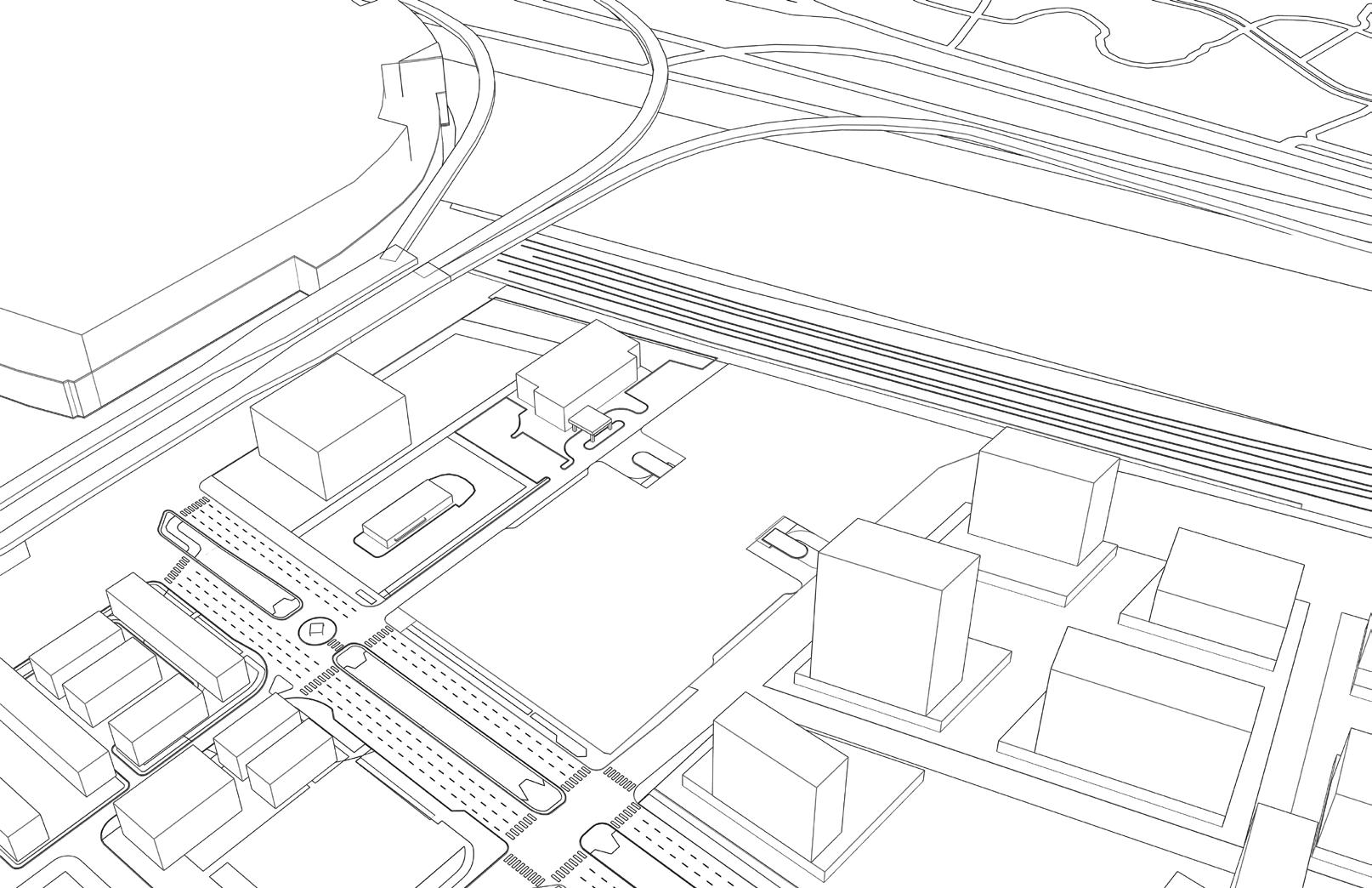
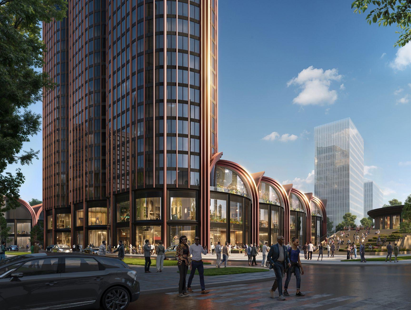
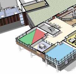
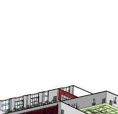
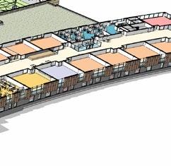
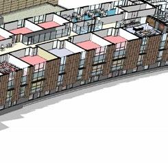
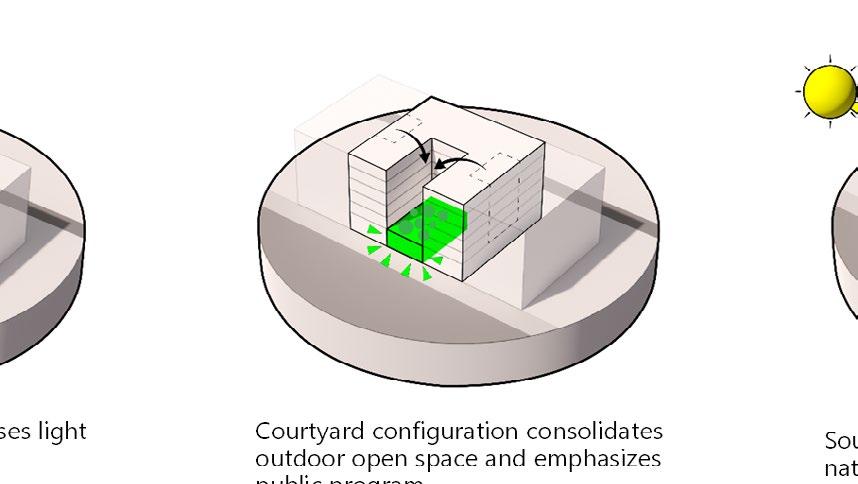
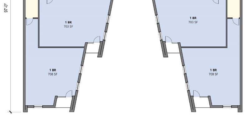
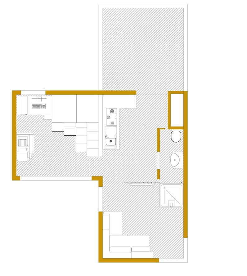
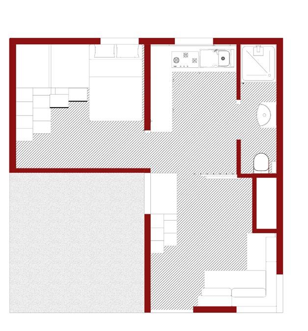
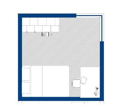
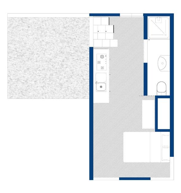
4. MIXED-USED DEVELOPMENT, CHICAGO
Metropolitan Pointe, South Lakeshore Drive
Professional Work, Wight & Company
A transformative asset for its neighborhood and community, Metropolis Pointe will provide abundant construction and full-time jobs across a spectrum of skills. Commercial spaces will provide retail and culturally conscious dining opportunities for residents and visitors.
By fostering connections, driving economic activity, and enriching the community’s vibrancy, Metropolis Pointe sets the stage for a transformative future in one of Chicago’s most storied neighborhoods.
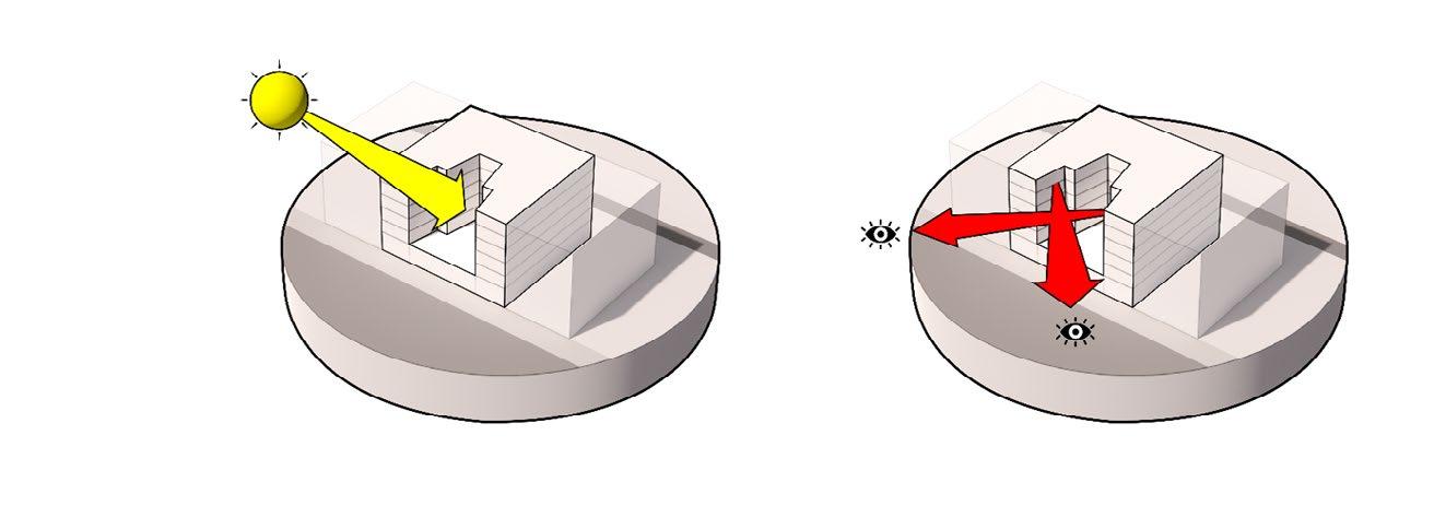
CONTEXT AND CONNECTIVITY
Extending Cottage green, a historical street into the development
Maximising the lakefront view
Sun Path for efficient exposure to sun, heat and glare
Public Realm
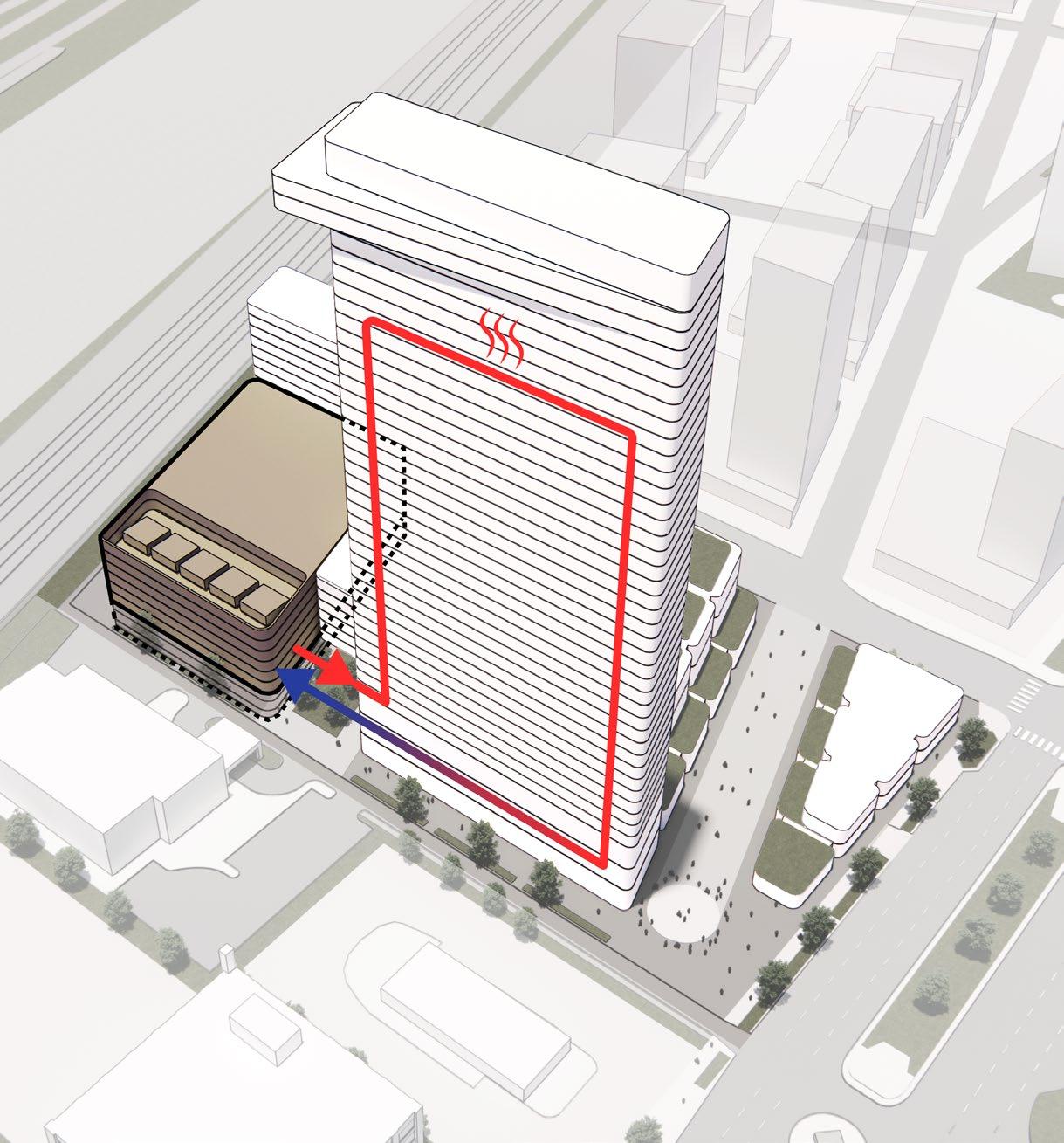
The development proposes integrating a nearby data center into its design, presenting an opportunity for innovative resource sharing. A key concern, data centers’ high water demand for cooling can be addressed by reclaiming wastewater from the building’s daily operations. This recycled water would be used to cool the data center, creating a closed-loop system. In turn, the heat generated during the cooling process could be harnessed to support the building’s heating and mechanical systems. This symbiotic approach not only reduces environmental impact but also enhances the project’s sustainability and operational efficiency
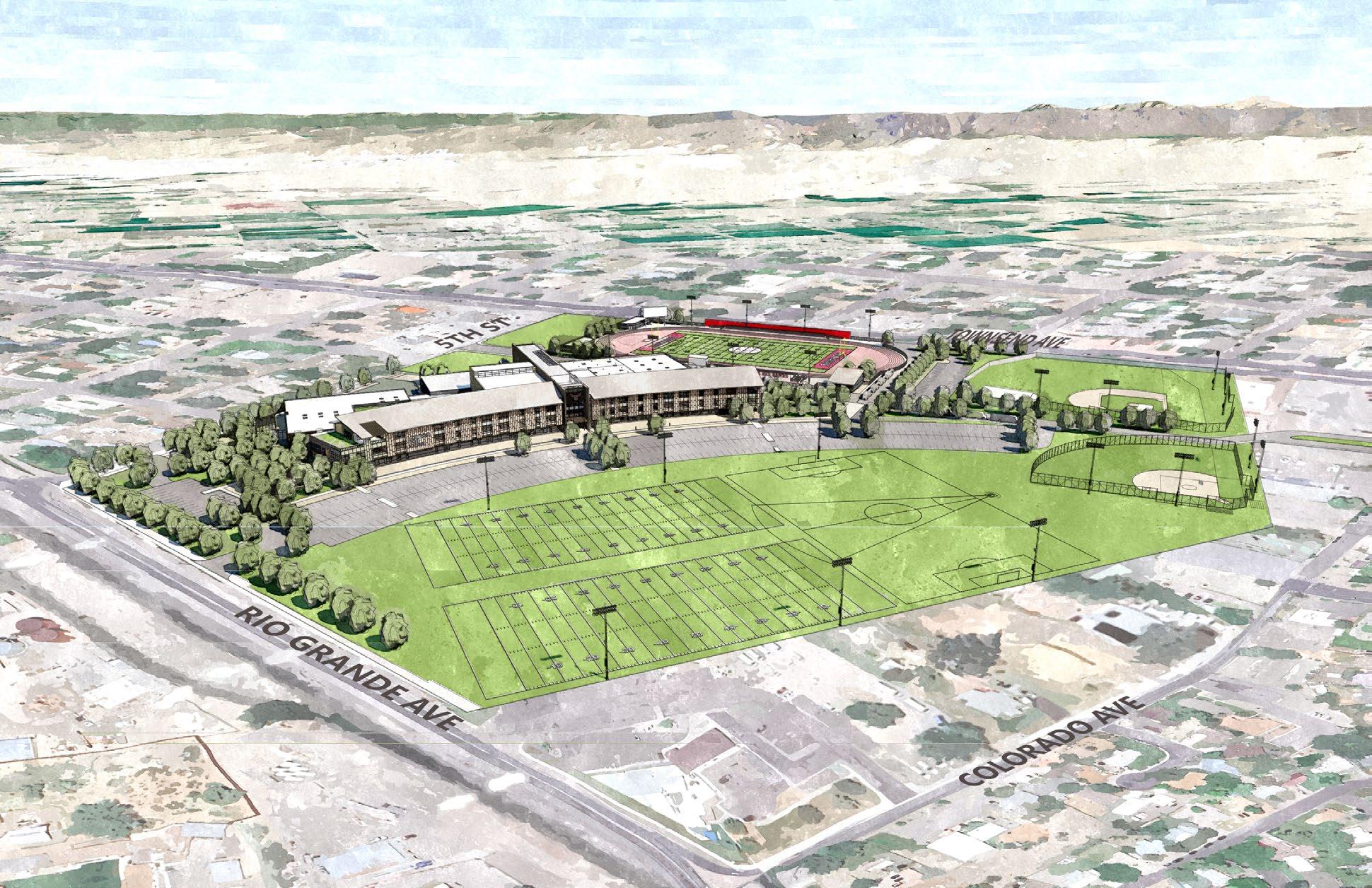
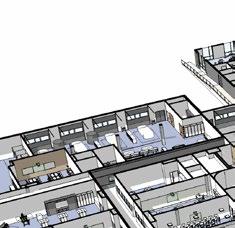
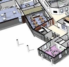
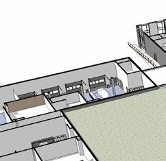
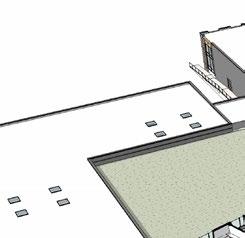
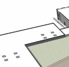
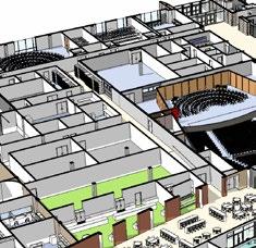
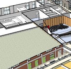
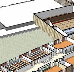
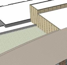
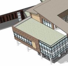
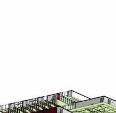
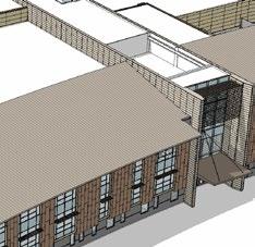
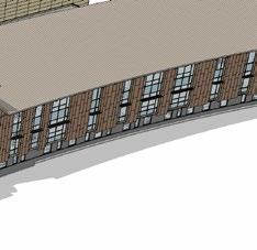
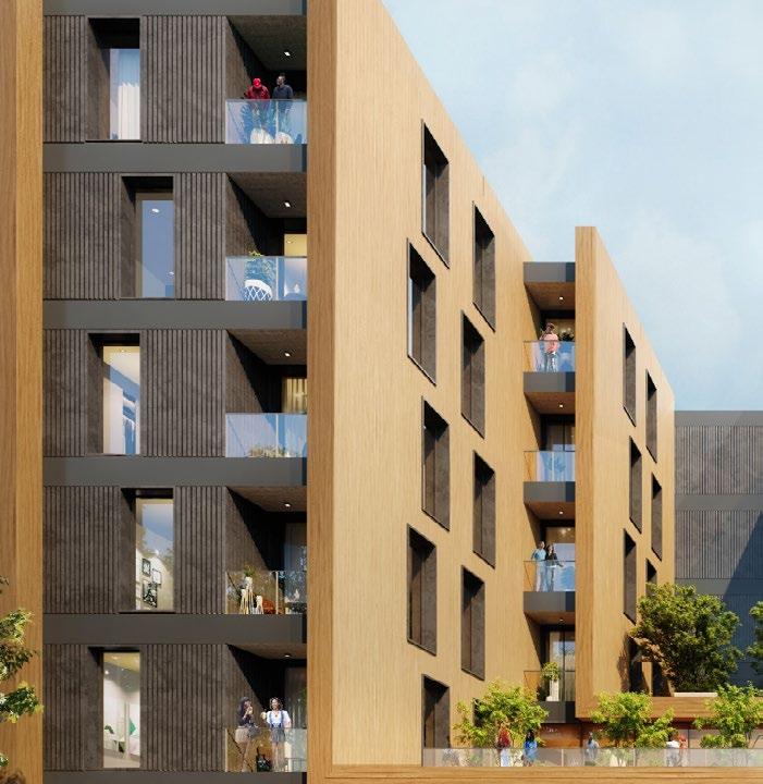
5. MONTROSE HIGH SCHOOL, COLORADO
Professional Work, Wight & Company
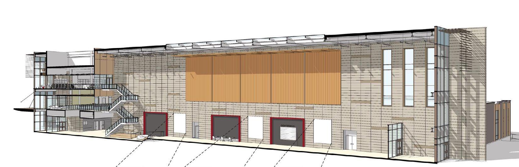
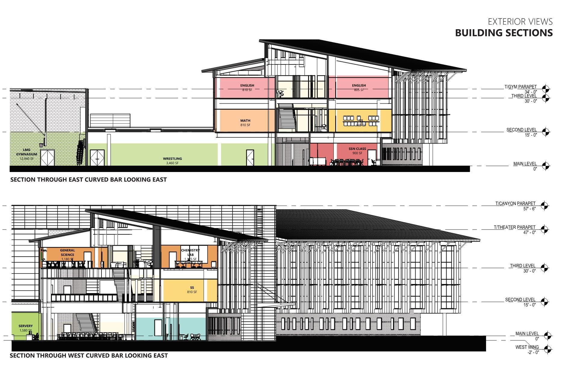
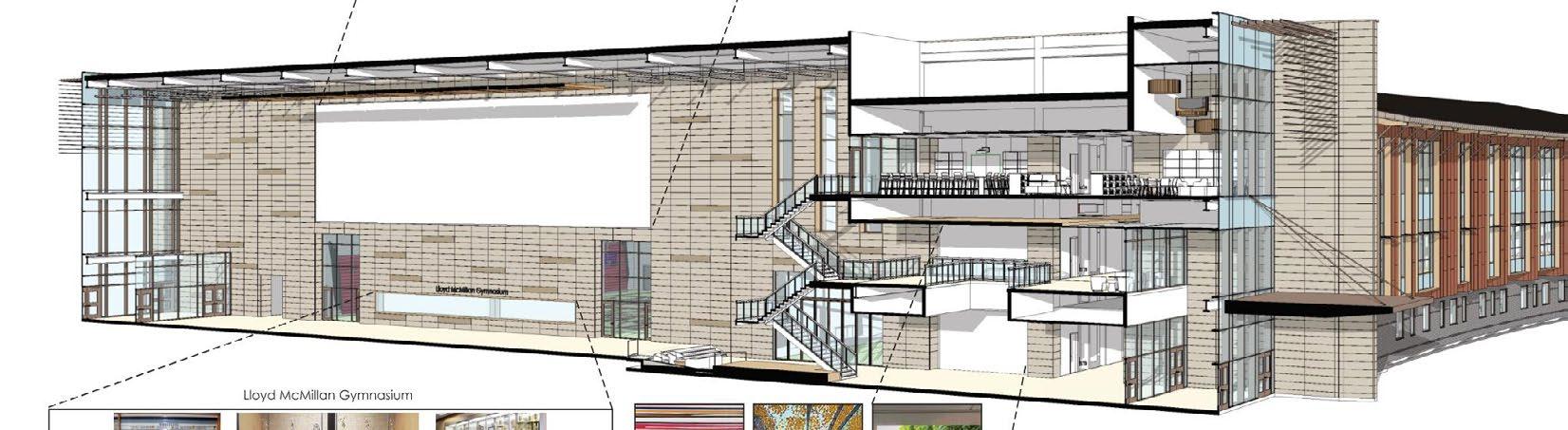
Montrose High School will be a newly constructed building completed in two phases. The design thoughtfully responds to the surrounding mountain ranges, with the southern façade featuring a curved geometry that allows all classrooms to maximize natural sunlight and scenic views. In contrast, the northern façade, which receives less direct sunlight, is dedicated to light-sensitive spaces such as science labs, teacher offices, theaters, CTE (Career and Technical Education) classrooms, and the indoor gymnasium. This strategic orientation makes full use of the site’s topography and contours. The new site plan integrates the surrounding streets with the internal circulation, efficiently subdividing the parcel to accommodate programs and the field house, thereby optimizing the land use
South Facade with Maximum Glass and transperency
Program Parts
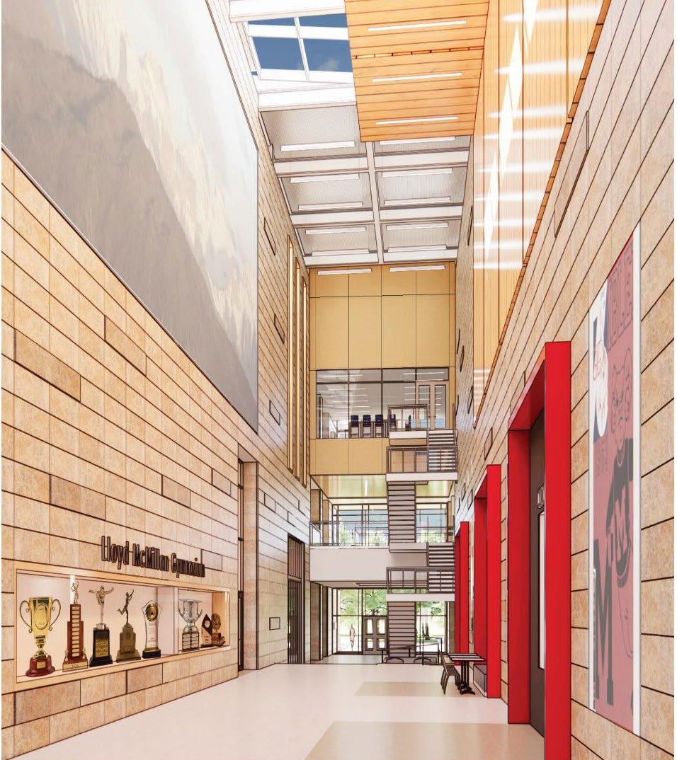
Lloyd McMillan Gym
The only remaining portion of the existing campus of which all new construction is built around
“The Canyon”
The organizing spine of the building that showcases school pride, celebrates student accomplishments and honors the history of Montrose
Career Pathways
A single suite of labs dedicated to hands-on instruction and training in a variety of skilled subjects
Academics
This three story “Heart of the School” is shaped to take advantage of the movement of the sun as well as frame views to the San Juan Mountains
Athletics
Wellness Space Consolidated on two floors with expanded program area and direct access to a new Football/Soccer/Lacross Field positioned along Townsend Ave.
Arts
Visual and Performing Arts Labs highlighted by a 900 seat, stat of the art Auditorium
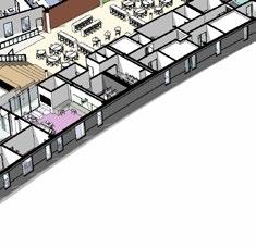
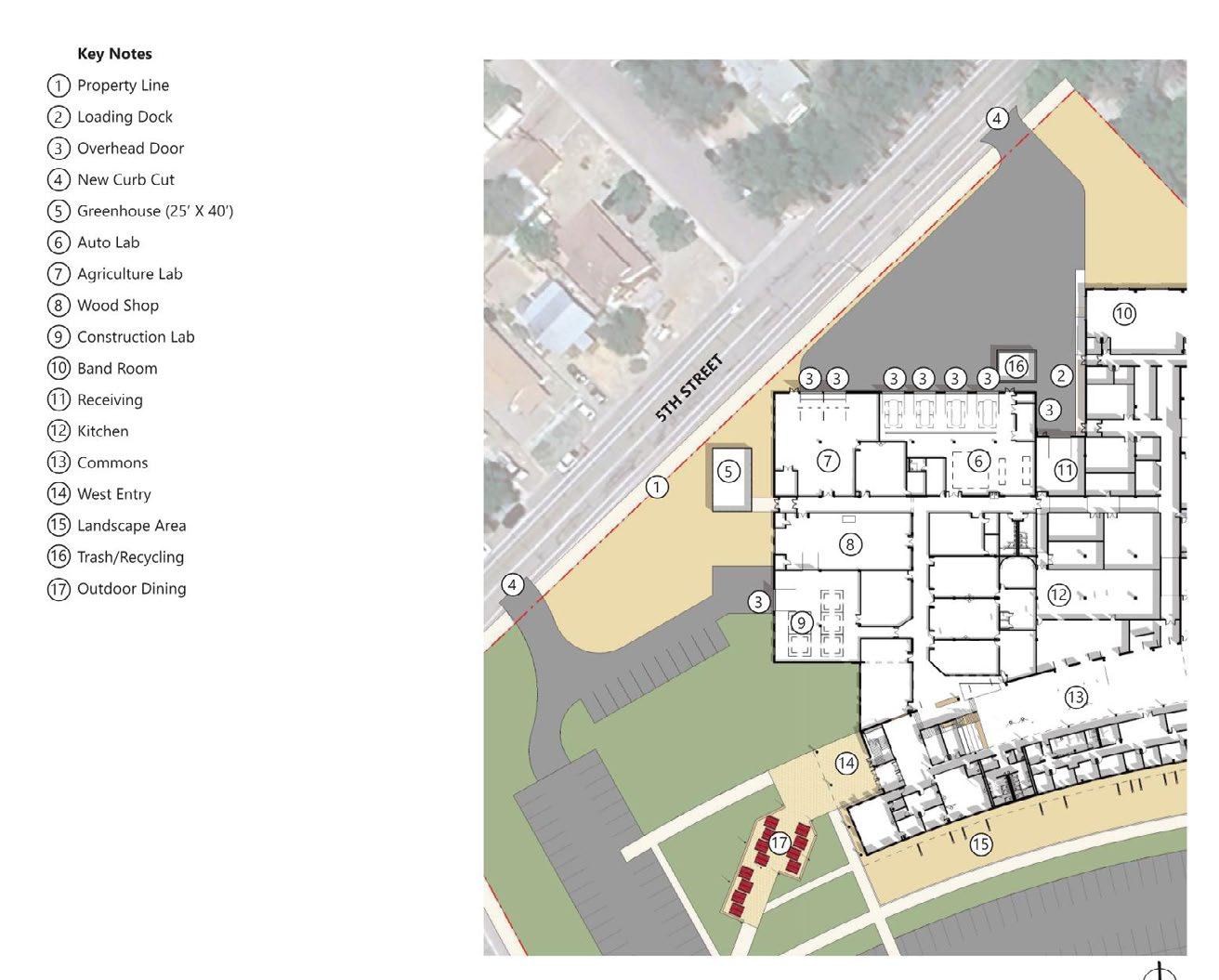
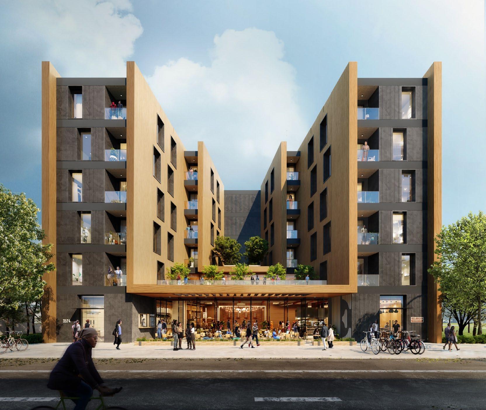
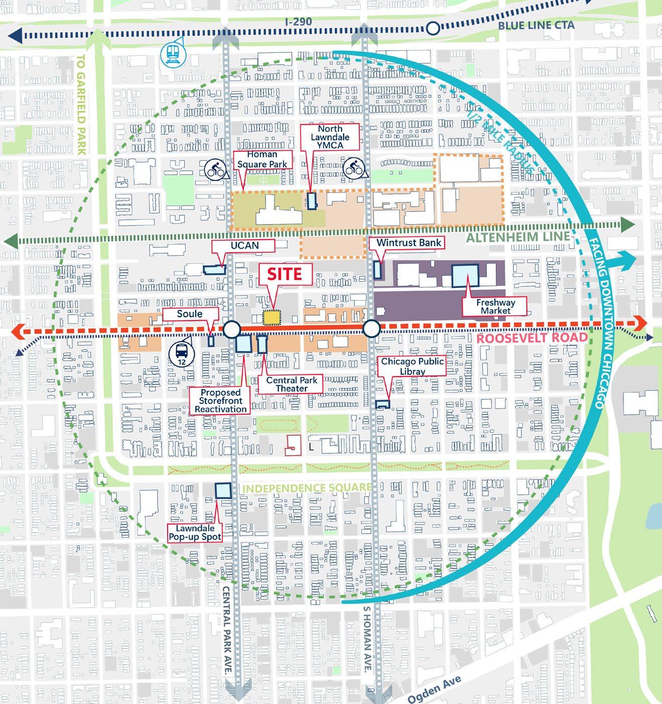
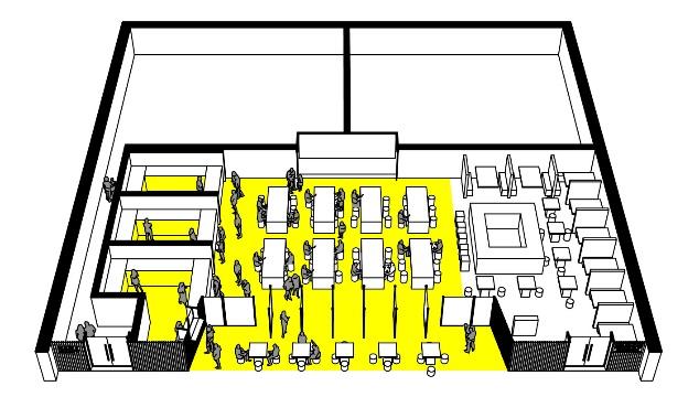
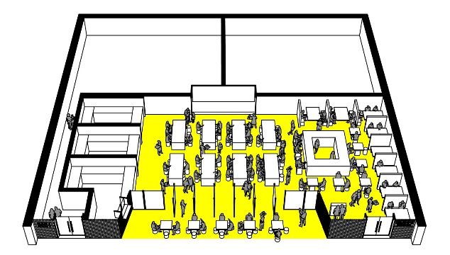
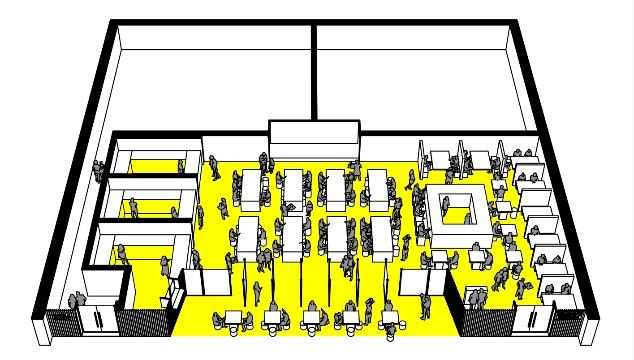
6. MIXED-USE DEVELOPMENT, CHICAGO
The New Normal, North Lawndale
Professional Work, Wight & Company
What does a thriving people-oriented development look like?
This Project, mirroring the community-centric approach of the plan, is poised to play a vital role in shaping the upcoming chapter of MOrth Lawndale’s development. It will be built upon the framework outlined in the Quality of Life Plan and reinforce a burgeoning development pattern as evidenced by the adjacent upcoming projects and initiatives in social service, arts culture, restaurants, and financial sectors
Space that changes from day to night- flexible, safe, inviting facing the street with
A New TakeOn an Old Idea
8 AM Residents and neighbors queue for coffee and conversations at the beginning of their day
Typical Floor Plan
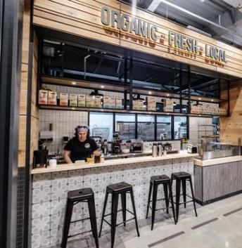
6 PM The restaurant hosts a family dinner, a first date, a get-together of friends. Dinner features locally grown food with exceptional service
12 PM A West Side–committed nonprofit hosts a monthly meeting in the courtyard. An artist sets up their work for an exhibit in the restaurant
9 PM Open-mic night begins in the courtyard. Neighbors gather to support their friends, enjoying refreshments from local vendors
Typical mid-block solution uses light wells to provides daylight public program
South facing courtyard provides good natural daylight
Stepped walls reduce overlooking views between units
North Lawndale
7. TRANSIT ORIENTED DEVELOP-
Distinguishing urban characteristics of a successful TOD
Independent Research
Advisor : Professor Ellen Dunham Jones,
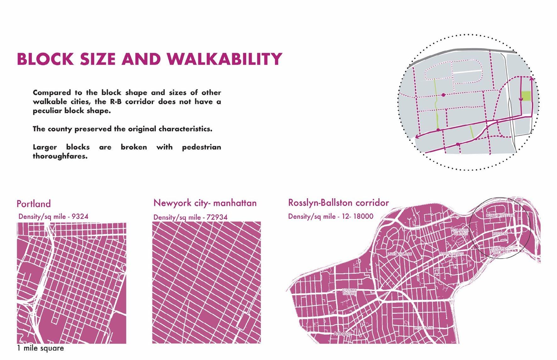
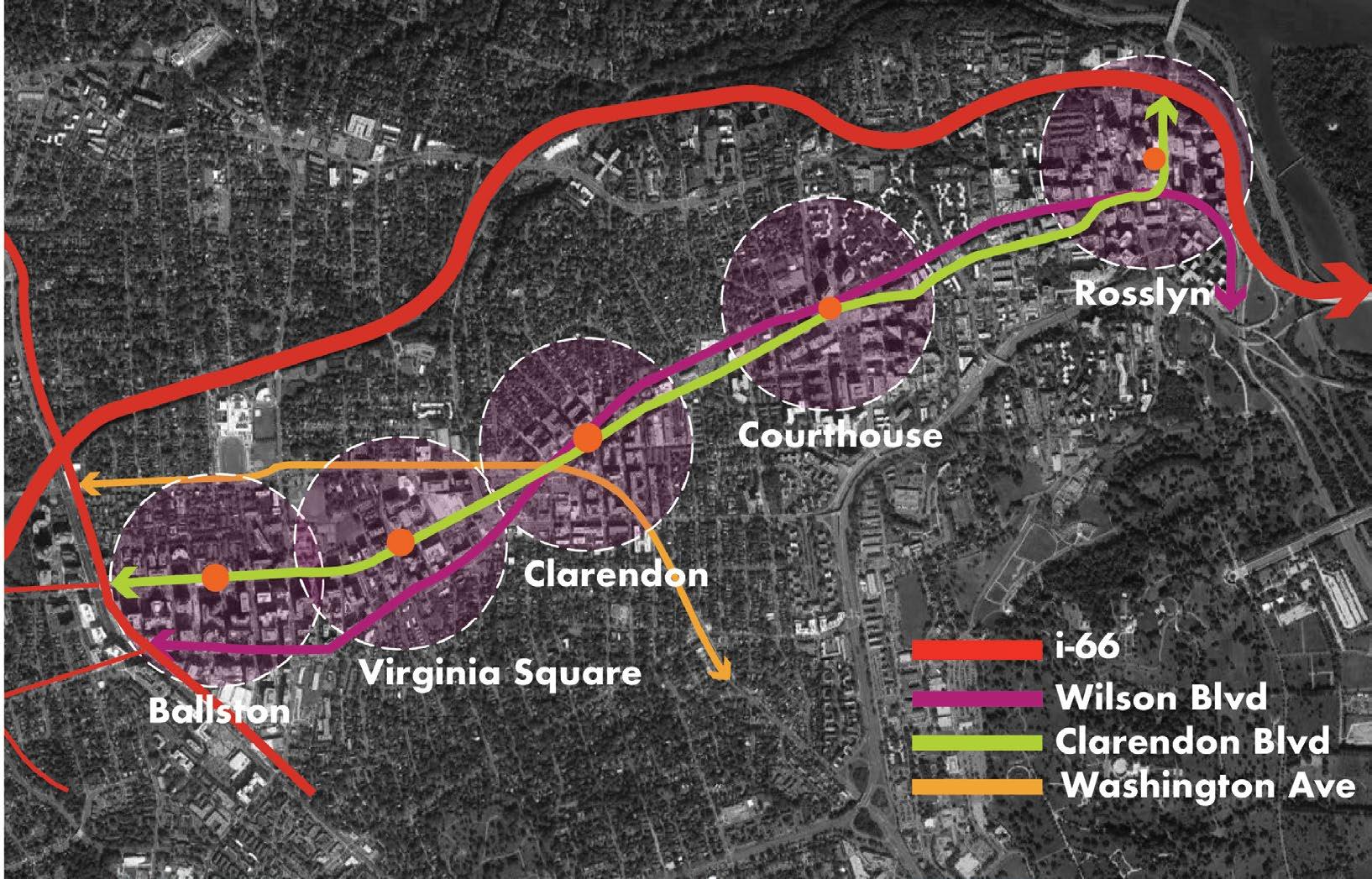
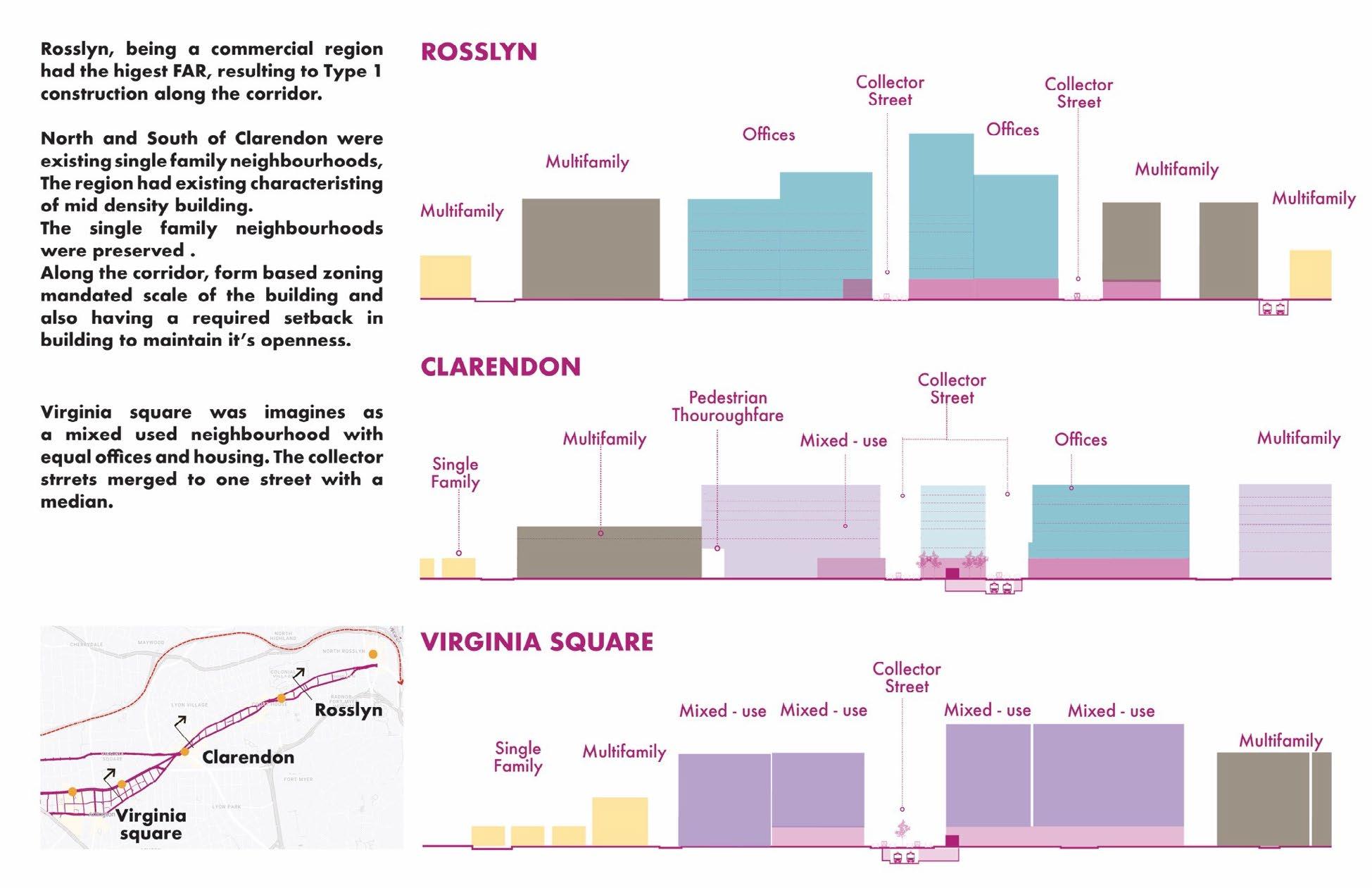
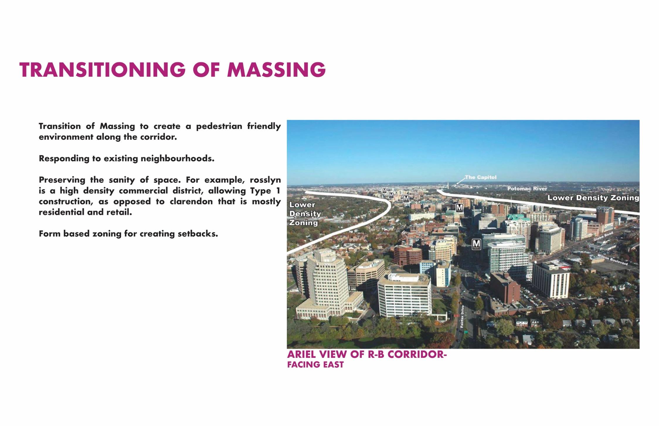
This research explores the urban characteristics that contribute to successful transit-oriented development. The findings suggest that intentional urban design along the corridor, coupled with a pedestrian-friendly approach, plays a crucial role in reducing congestion on the parallel I-66 and arterial roads throughout the Roslyn-Ballston corridor.
In contrast to transit-friendly cities like Portland and New York, the Roslyn-Ballston corridor features an organic street and block network. This unique framework presents an intriguing opportunity to examine how a transit route can effectively integrate within the existing
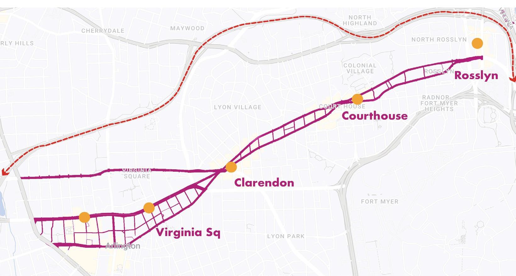
The Rosslyn- Ballston Transit Corridor (3-mile long)
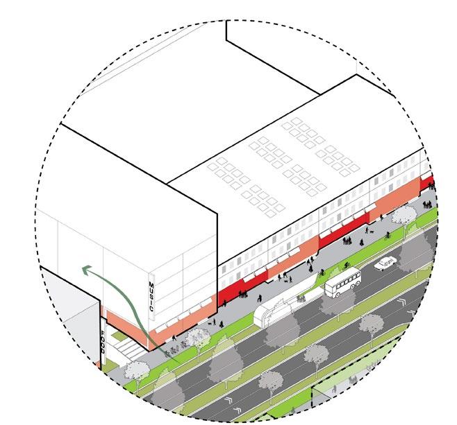
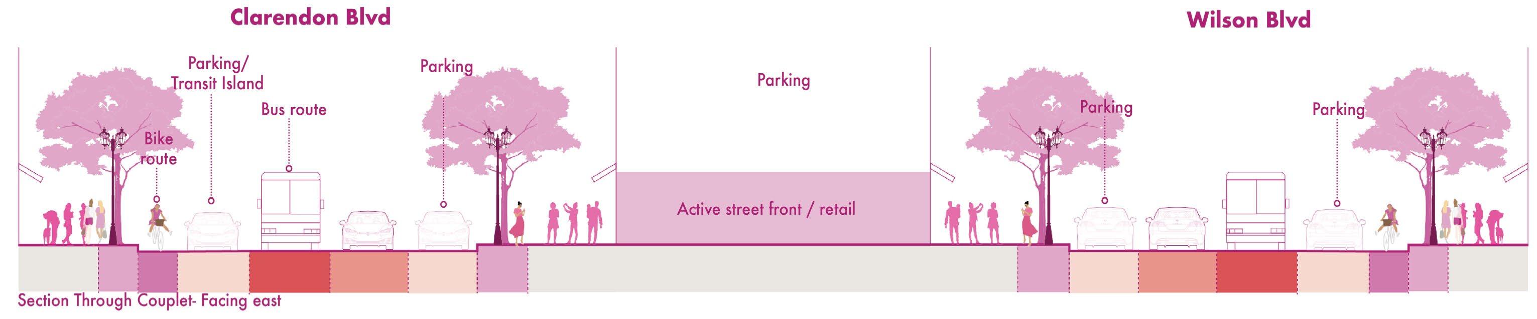
The couplet - clarendon and wilson avenue
• Wide sidewalks
• Active street front
• Trees for shading
• Parklets, dedicated bus lane, bike lanes
• Perpendicular to collector streets
• Entrance to public garage or parking
• Partially active street front
• Smaller side walks
• Dedicated bike lanes
• On street parking on both sides
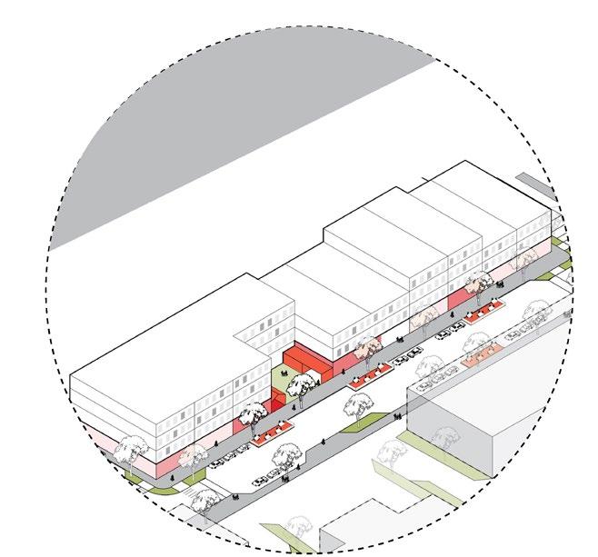
Residential Streets
Collector StreetsTransitionStreets
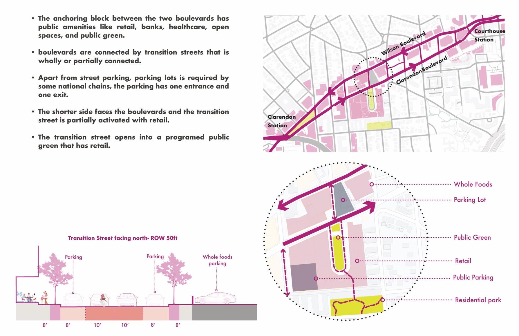
Each boulevard has on-street parking on both sides, increasing the parking surface while slowing the traffic. The highlighted blocks indicate the buildings with active retail along the corridor. The anchoring block between the two boulevards has public amenities like retail, banks, healthcare, open spaces, and public green
This transition street opens into a public green and is activated by several retail and further transitions into a quieter park surrounded by residential type
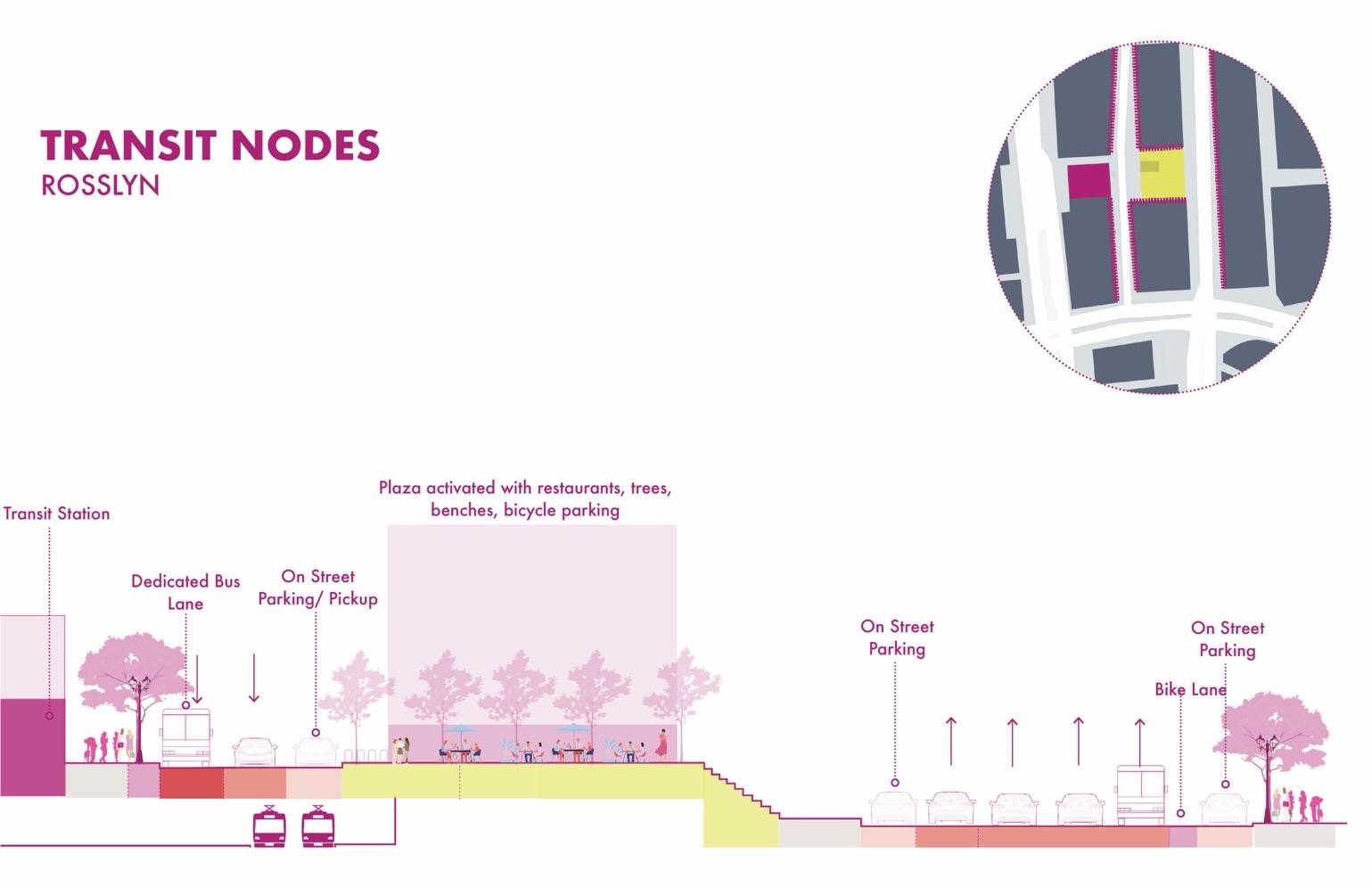
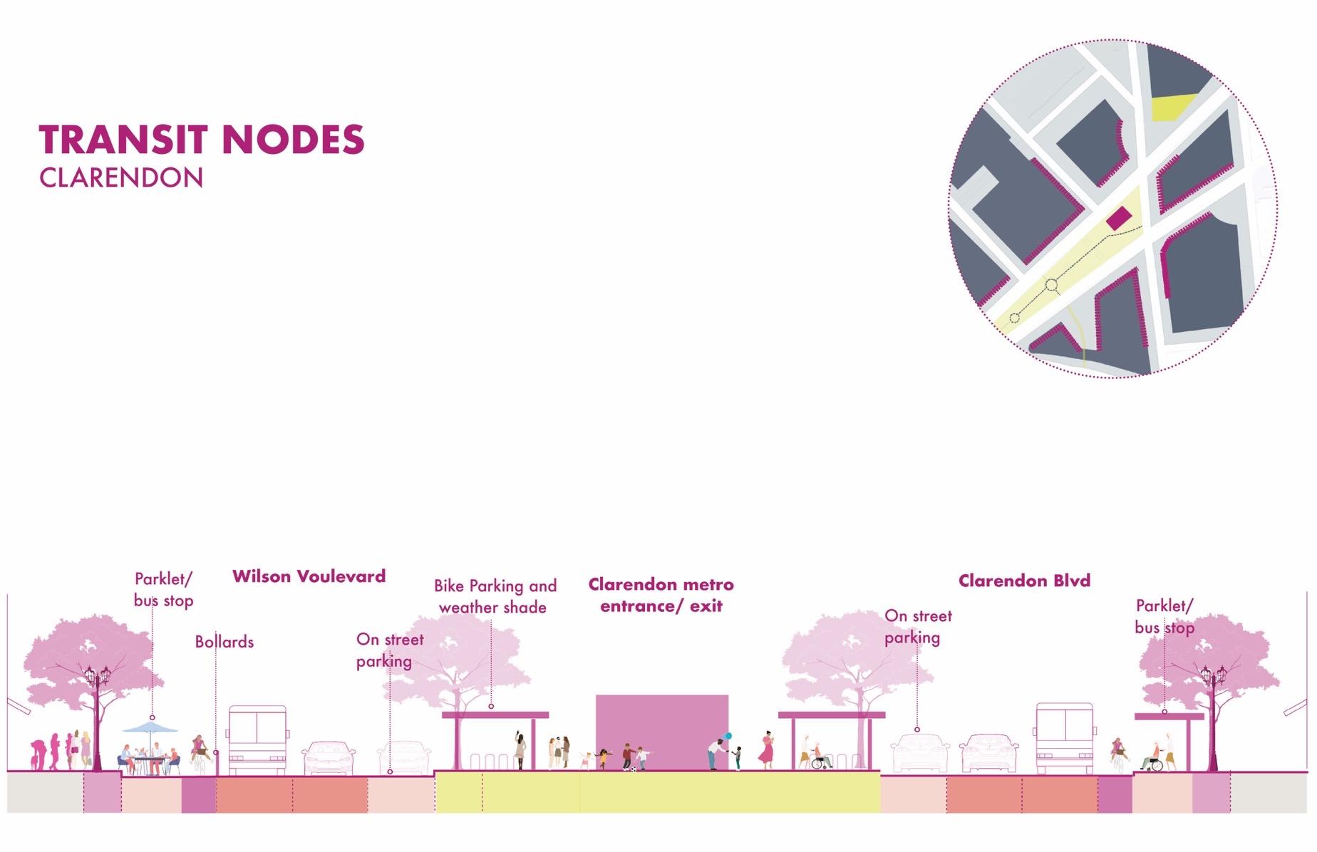
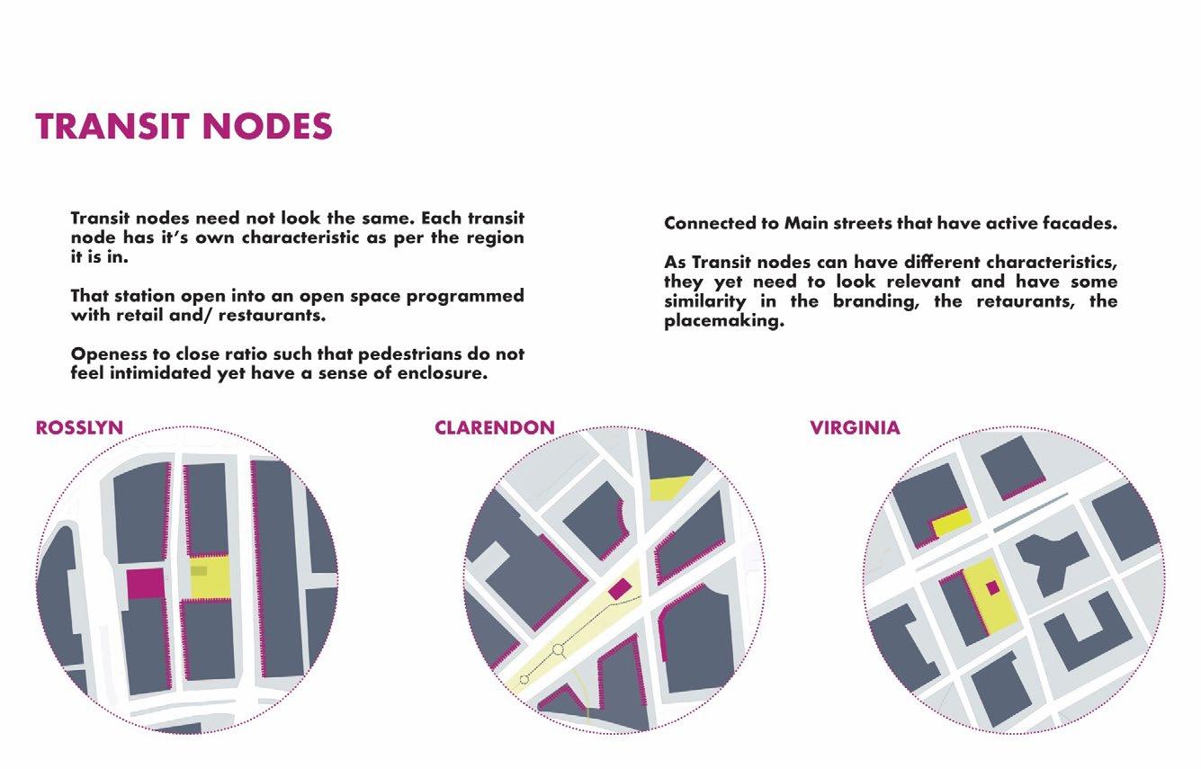
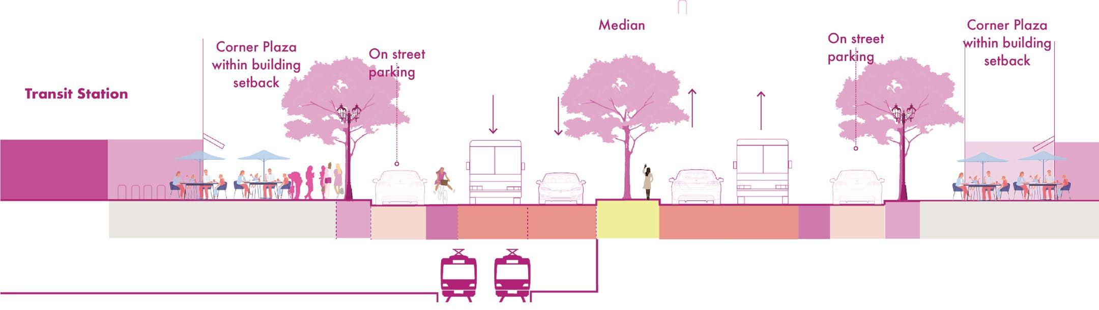
Transit nodes are essential in place making as they must be active, attractive, safe, and accessible. The plaza or the open space that the transit station in R-B opens into is an essential urban element that all the stations have along this corridor. This plaza must be connected by the main streets and has active facades.
The transit node at rosslyn opens into a plaza. The dedicated bus lane and pickup stops provides opportunity for alternative transit mode. The plaza is surrounded with retail in an office area and shaded with trees that makes it comfortable for pedestrians to meander.
The Clarendon transit stops opens in a plaza that is surrounded with a mixed-used neighborhood. The parklets allow for pop up seatings and transition into on street parking. The plaza caters to bike parking and playground for children
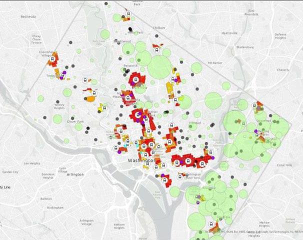
8. EQUITY IN TRANSIT ORIENTED DEVELOPMENT
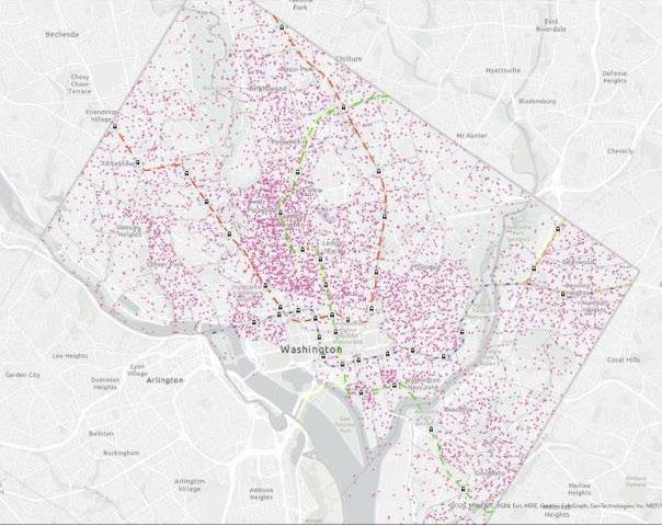
A case in Washington DC using GIS
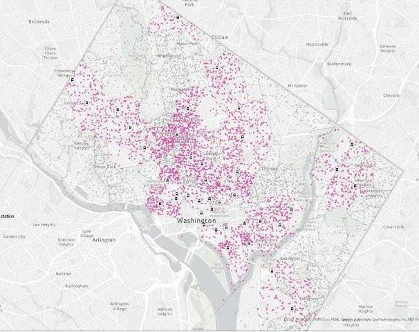
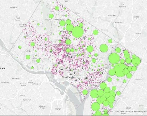
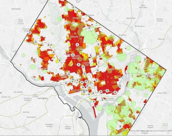
This study explores the intersection of transit access, walkability, and equity in Washington, DC. While the city boasts an extensive transit network, Figures 2 and 3 reveal that communities with limited access to transit often overlap with areas of higher poverty. Figures 4, 5, and 6 further illustrate that walkability in these neighborhoods, especially near transit stations, is significantly lower, raising the question: must residents rely on cars just to reach public transportation?
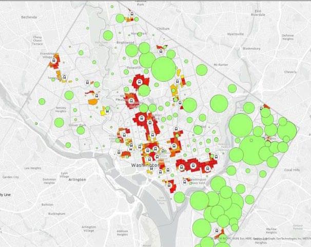
Figure 6 also shows that car ownership is higher in these same low-income areas, suggesting a financial burden from car-related expenses such as fuel, insurance, and maintenance, costs that disproportionately affect those already economically strained.
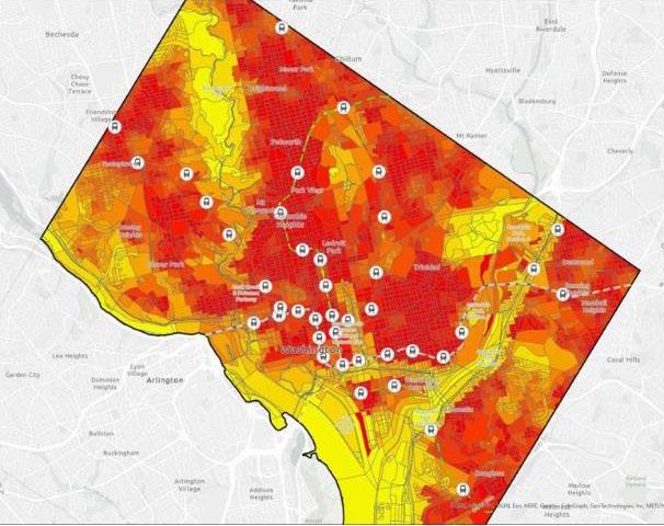
3) Population Access to Transit with poverty less than 185% 4) Map showing Walkability Index with Red being the most
1) Population Density in Washington Dc
2) Population Served withing quarter mile of metro station
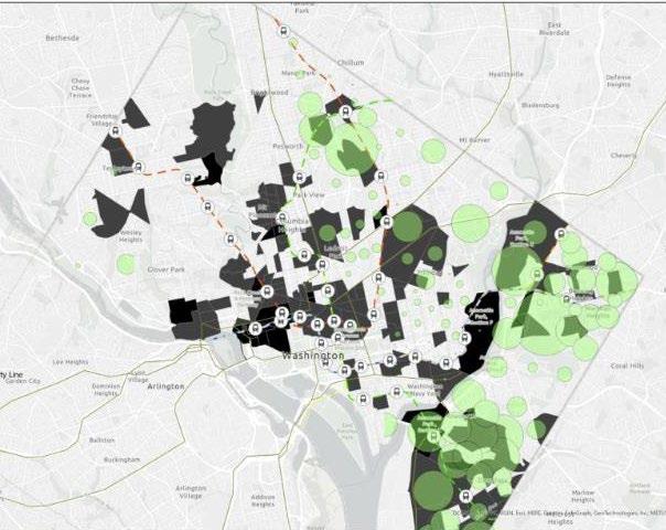
In Figure 8, public schools in the southeast show limited connectivity to transit, implying that even essential services like education may require car dependency.
The findings highlight that while a transit system may exist, its effectiveness is tied to how well it connects to the communities it aims to serve. For planners, this emphasizes the need to align transit infrastructure with equity goals, ensuring that lowincome communities are not left behind or burdened by the very systems meant to support them.
4) Map shows that area with more poverty are less walkable 5) Map showing walkable transit access to area with poverty
6)
Distribution of Car owners
8) Public schools with access to metro stations and walkable access with
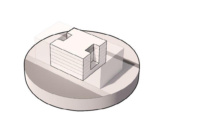
The new extension responds to the old structure by defining the open linear void (marked in yellow). This area becomes a space of events for the old and the new museum. The drastic contrast between the structure and building style of the buildings gives them both a unique identity and importance.
Cross section through the museum
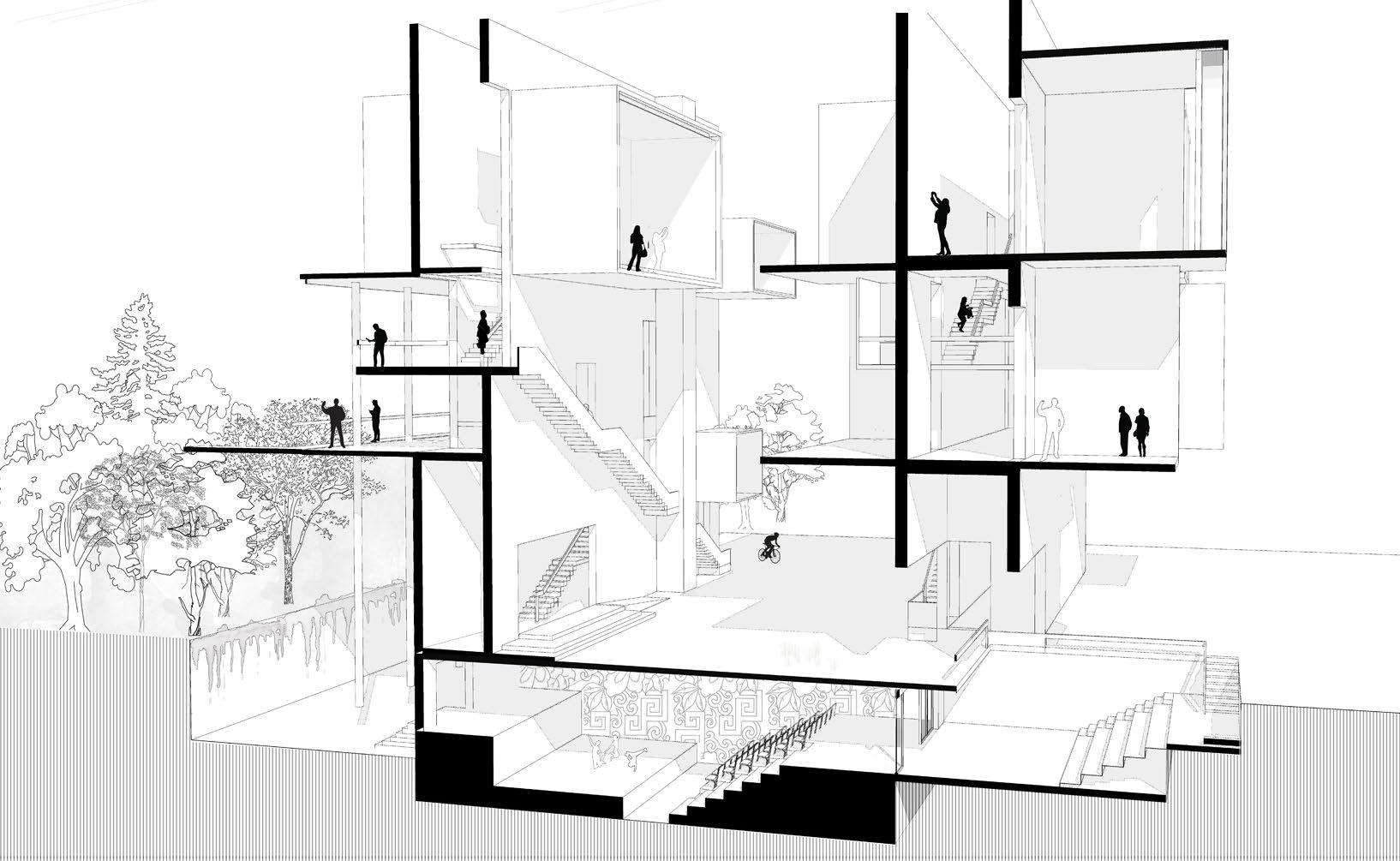
10. VERTICAL COMMUNITY
Re-imagining community housing, Dharavi,Mumbai
Course : Architecture And Design Studio
Autocad, Sketchup, Adobe Creative Suite,
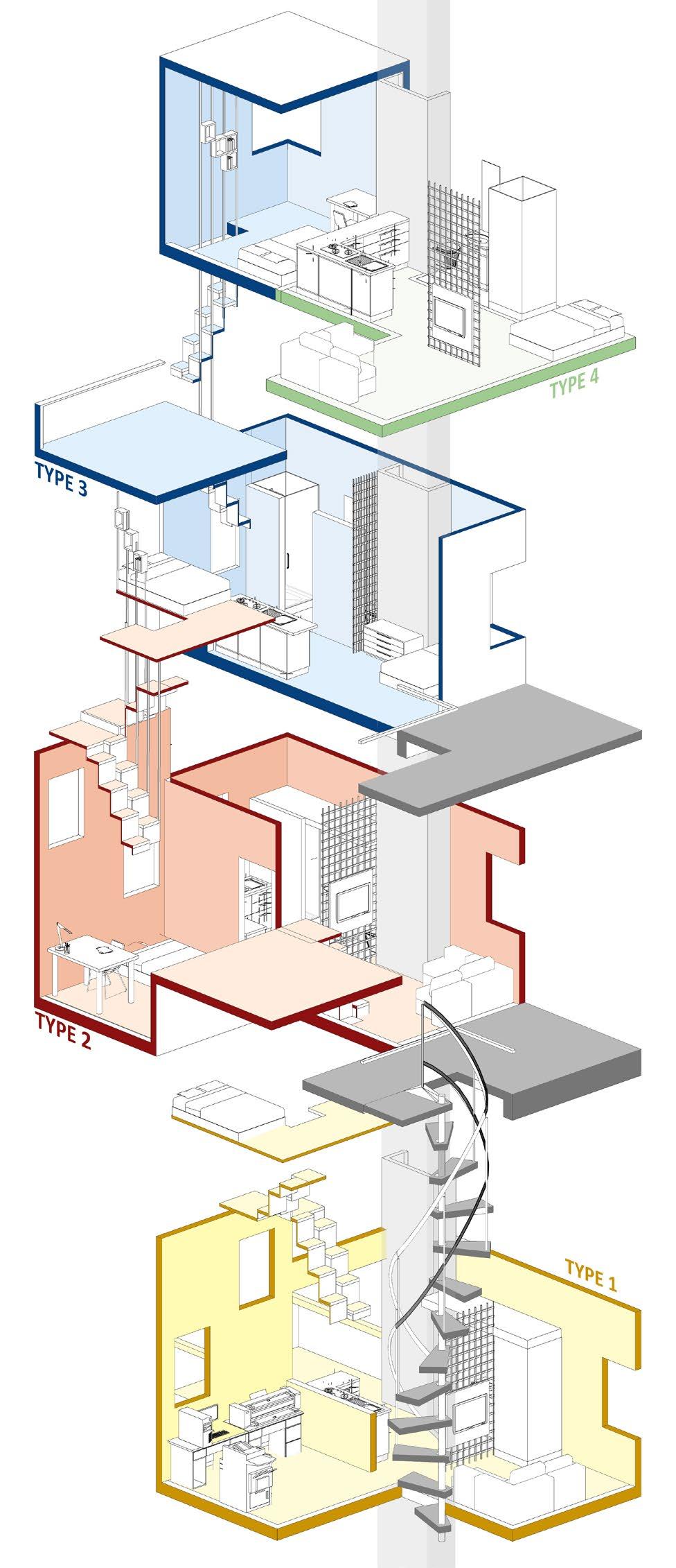
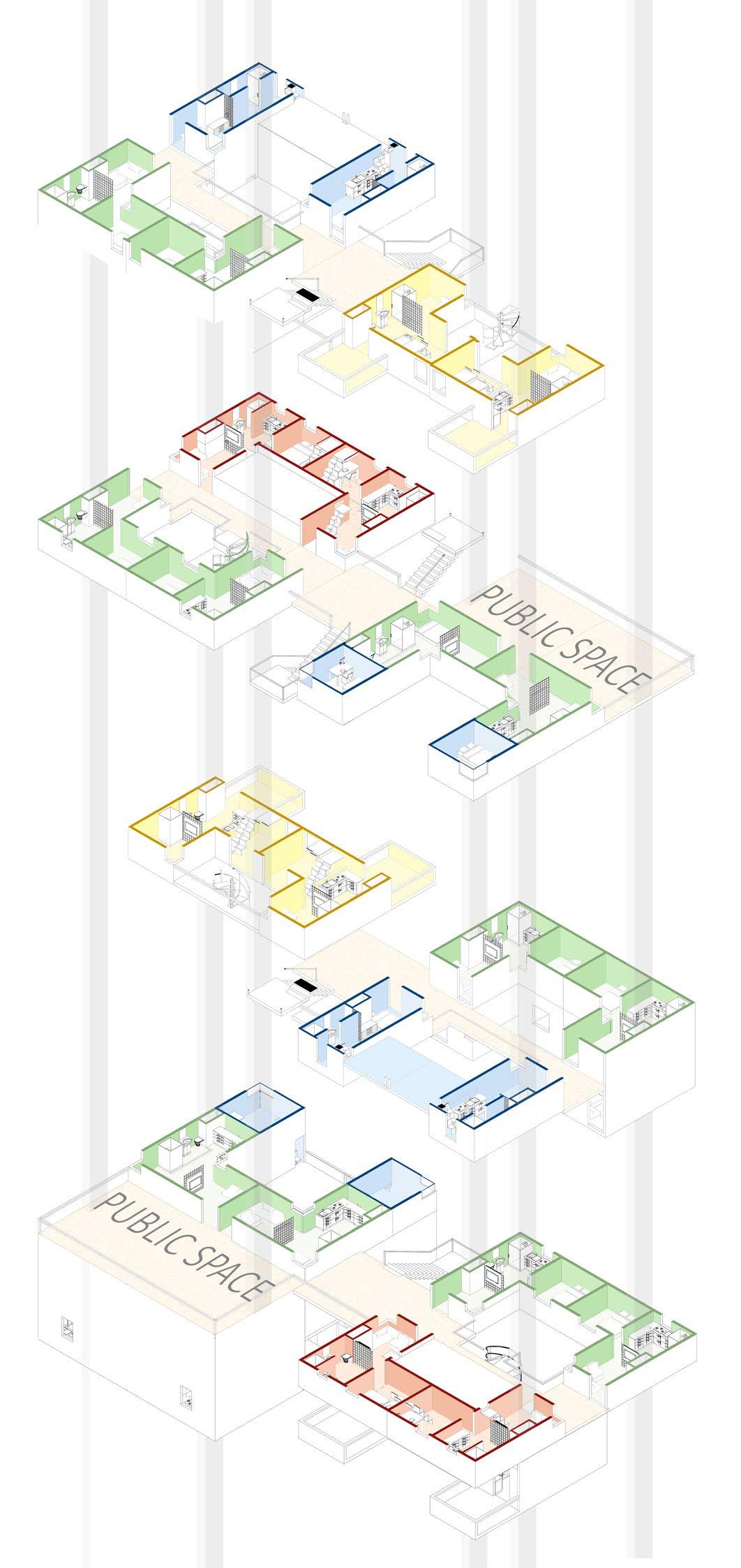
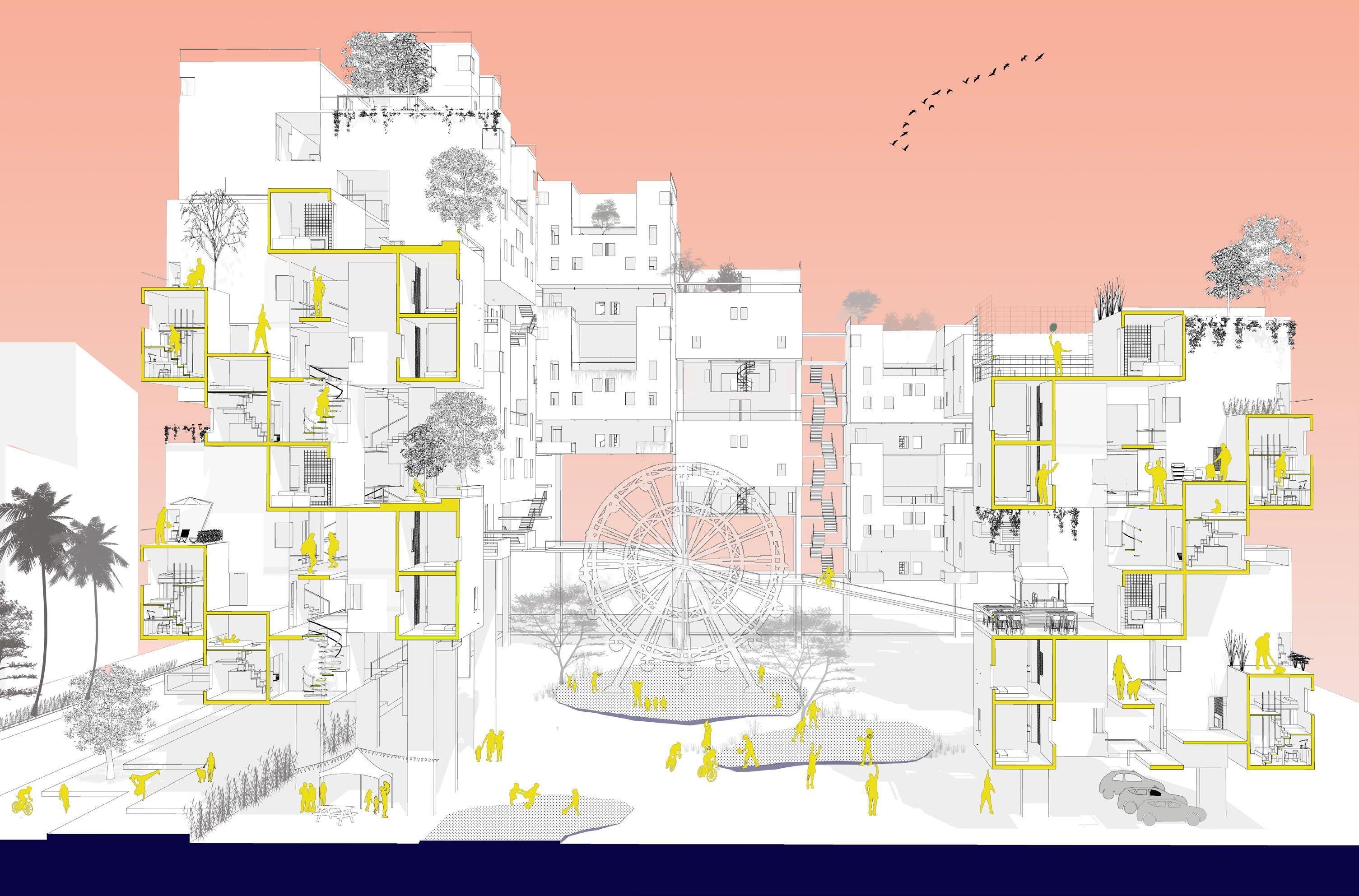
The project attempts to re-energize the idea of a working street vertically by resuscitating the work-live-rent conditions that is authentic to the current fabric of Dharavi by logically stacking new unit typologies. Public and private open spaces allow the residents to be in community spaces and create a sense of openness in the densely populated fabric.
TYPE 1
Living + small business
Suresh, 31
I was able to start my small wholesale print store and live in the same unit at an affordable rent
TYPE 2
Expandable Family unit
Rohan, 40
Vertical community allows me to live with my aging parents. The inward facing terrace is a great place for them to socialize
The units are designed to cater to the type of housing needs, family structure and ownership patterns.
Type 1- Family with a retail/small business
Type 2 - Family with mezzanine
Type 3 - Shared Flat with tenants
Type 4 - Family (Basic Unit)
2
TYPE 3
Co-living for two tenants
Riya, 20
Co-living for single women is safe and affordable while i study and work part-time in the neighborhood.
TYPE 4
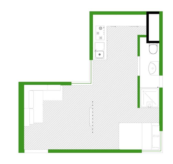
Typical family unit
Sima, 30
Vertical community is a good starter for me and my husband as the studio unit is just the right size for two people
The units are stacked logically in a way to create an outdoor enclosure even at higher storeys. Due to lack of ground space in Mumbai, going vertical is feasible.The stacking allows cross ventilation along with natural sunlight to all the units.The stacking also makes the building porous, thus it does not intimidate the pedestrians and the residents in the neighborhood
Section through the vertical community
THANK YOU
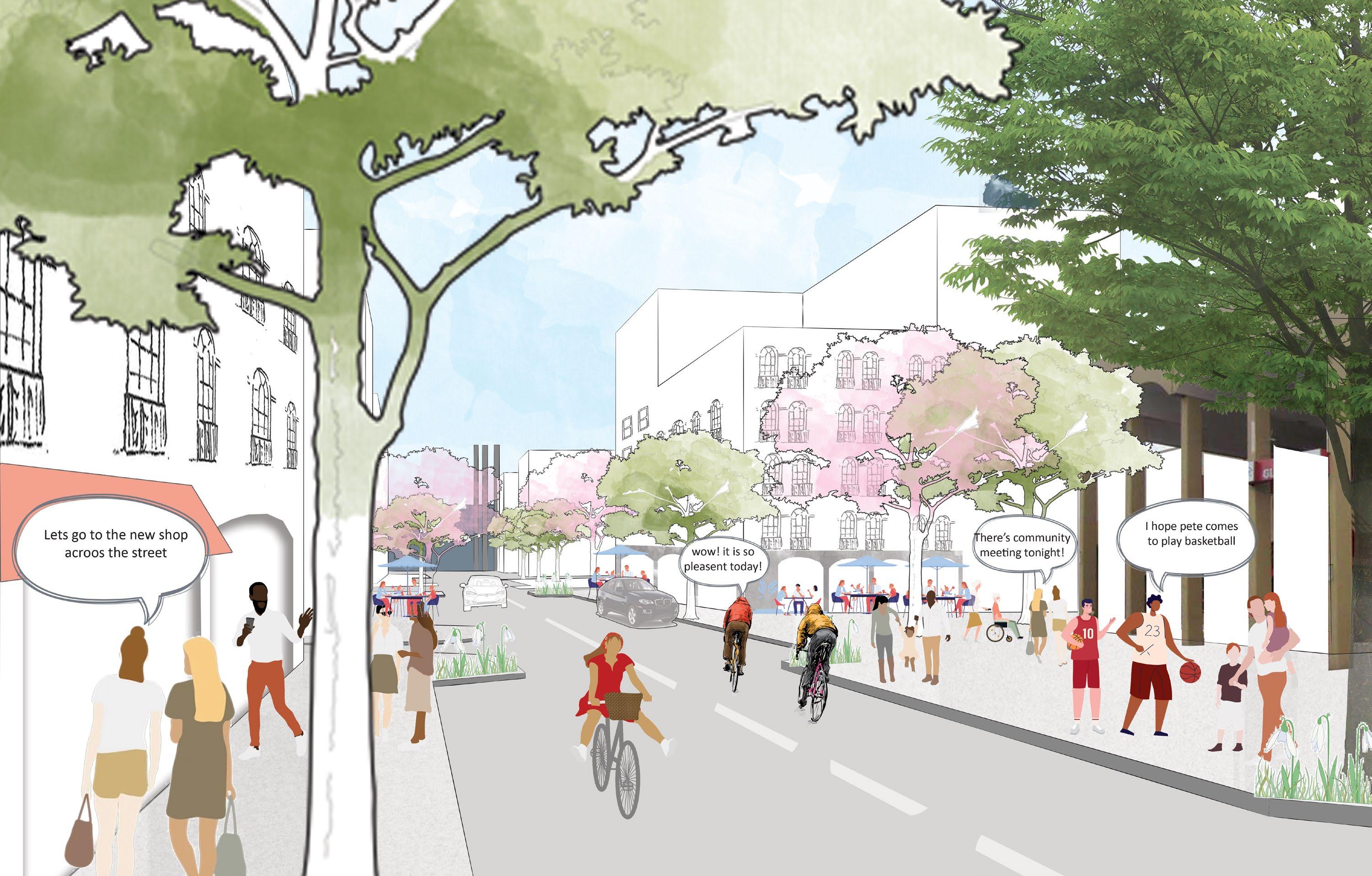
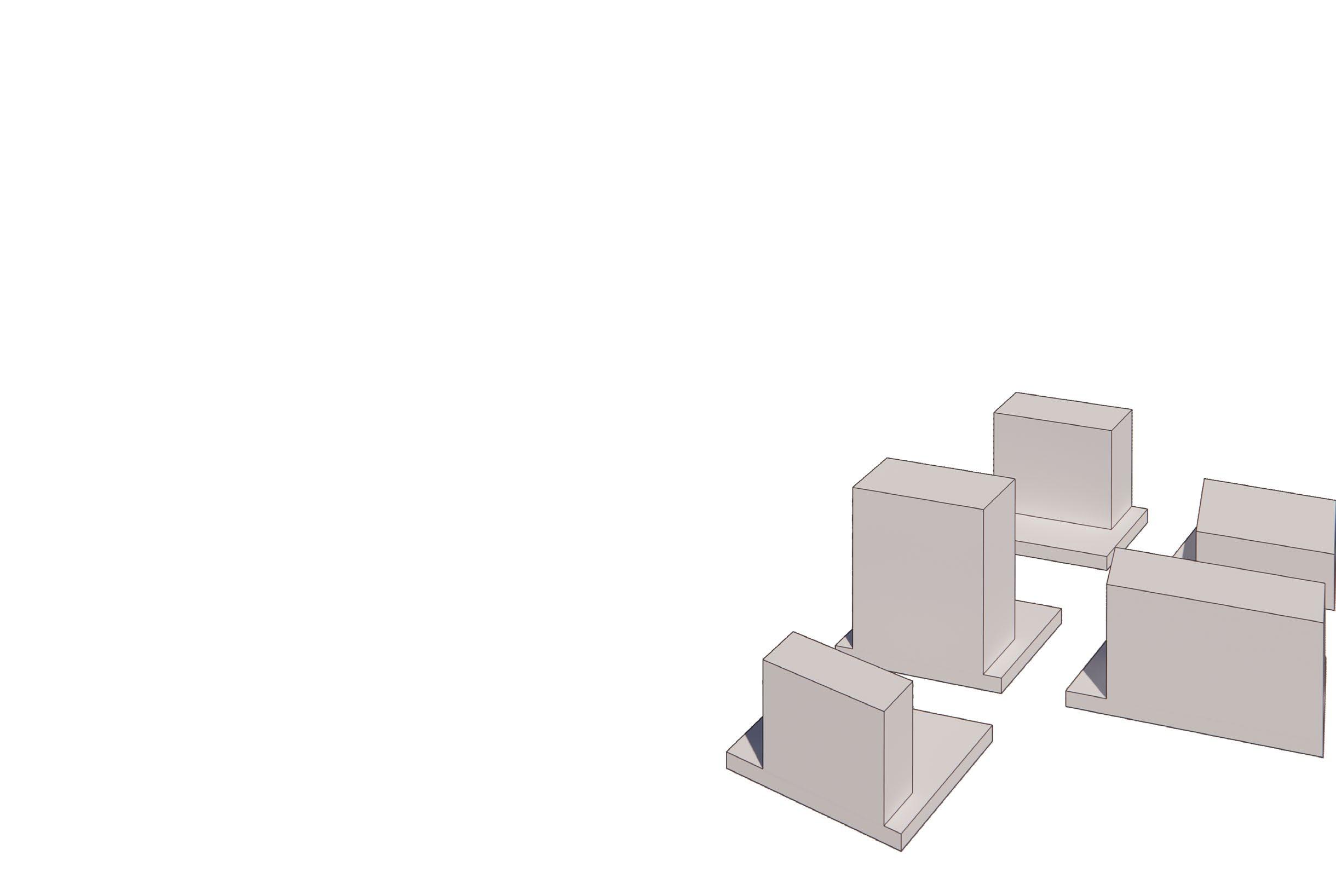
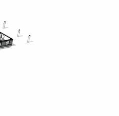
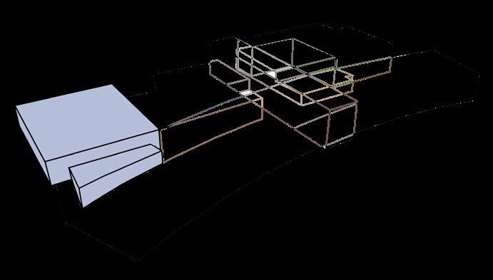
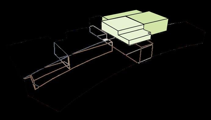
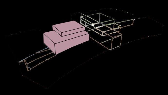
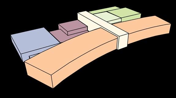
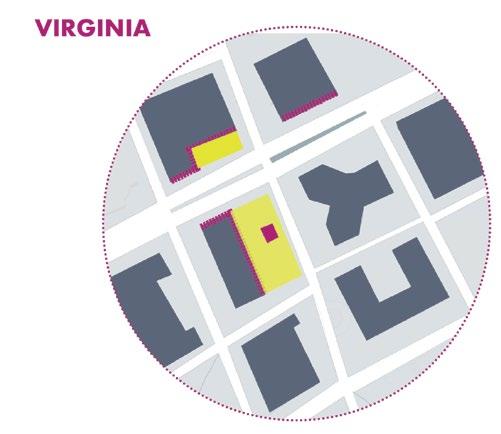
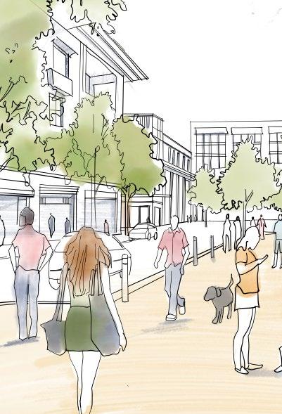
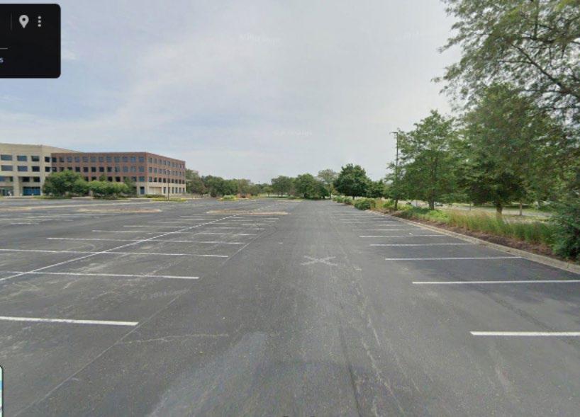
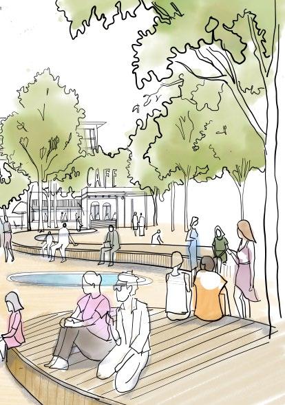
The above sketches drawn digitally shows the efficient use of an under-used parking lot of office park in the suburbs, created for visioning process for an upcoming project