District 8, Ho Chi Minh City

ARCHITECTURE SKILL
AUTOCAD
SKETCHUP
ENSCAPE
QGIS
0987717550
ainhattranhoang212@gmail.com
EDUCATION - OCCUPATION
UEH university
2021 - now | Student of architecture and smart urban design
2023 - 3/2024 | Teaching assistant of project basic 1
ISCM CLUB
2021 - 2023 | Board of directors
ELEGO
I am a third-year student of the Department of Architecture and Smart Urban Design, UEH University.
One thing I want to emphasize is that working on these projects often brings me various emotions, from fatigue to stress. Even though they are just small academic projects, both individual work and collaboration with friends are essential parts of the process from developing ideas to the final product. This has made my learning process special and enriching.
I really look forward to having the opportunity to meet and work in a dynamic specialized environment like the present, to gain even more valuable experiences for my future.
GRAPHIC DESIGN
ADOBE PHOTOSHOP CC
ADOBE INDESIGN
ADOE PREMERE
SOFT SKILLS
SKETCHING
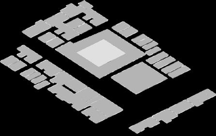
ARCHITECTURE MODEL
PHOTOGRAPHY
ENGLISH OFFICE TECHNOLOGY (IC3 GS5)
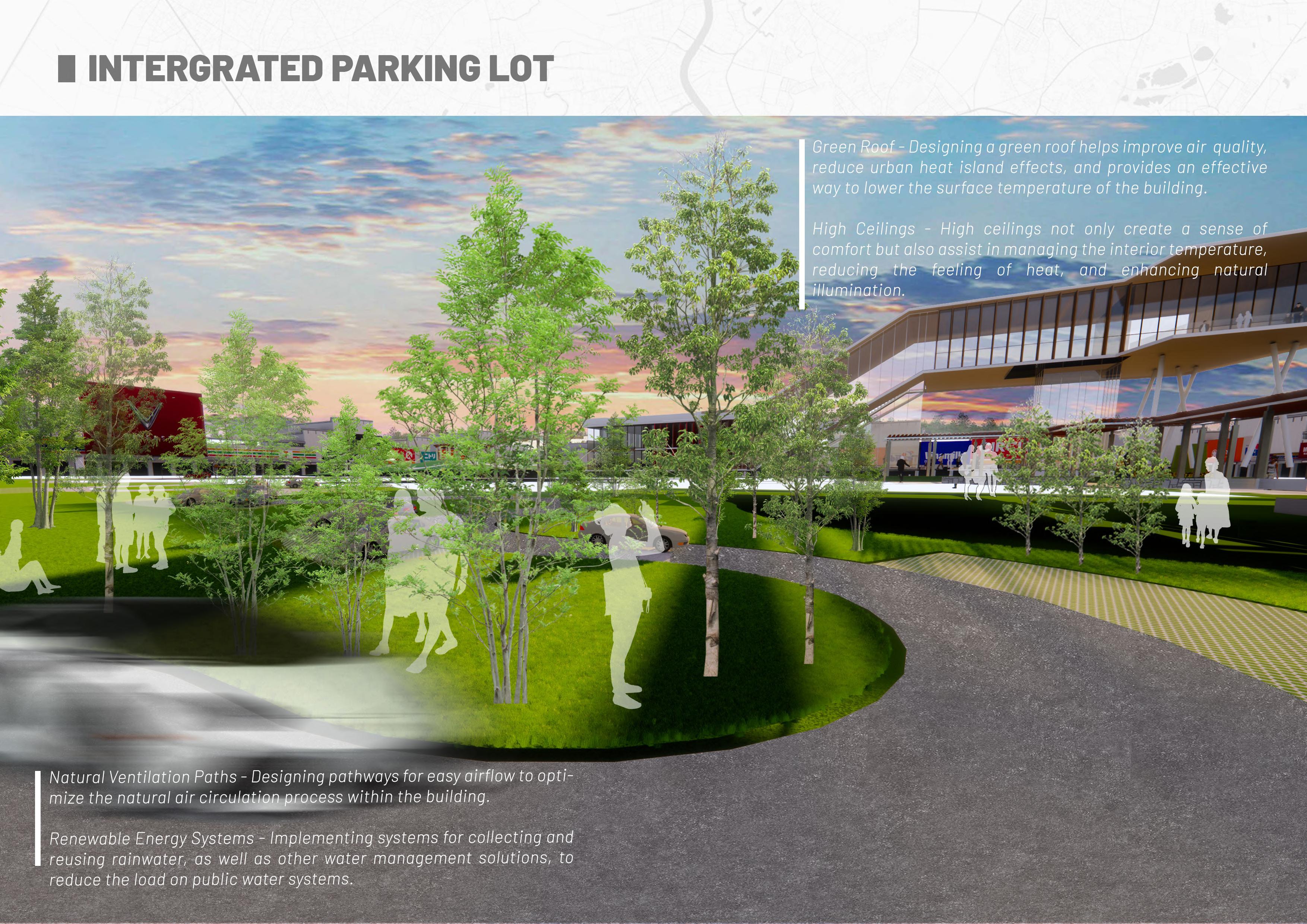
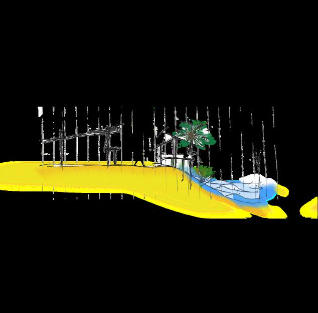
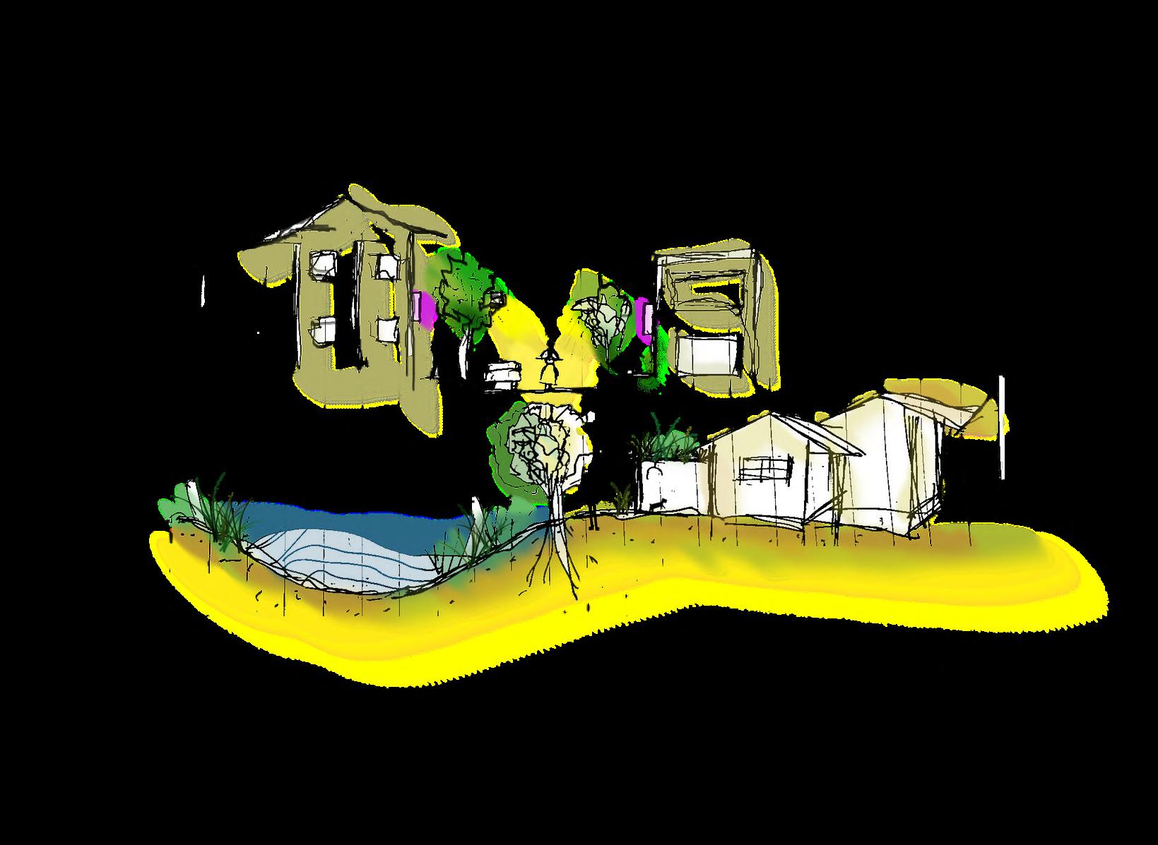
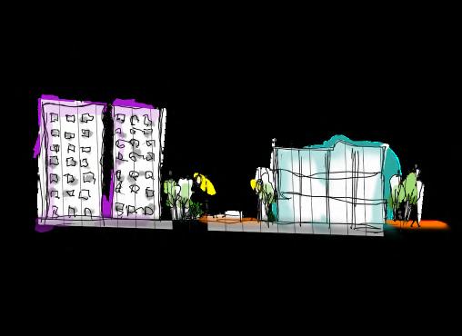
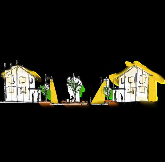
“WHEN YOU HAVE A LARGE SPACE TO CONQUER, CURVES ARE THE NATURAL SOLUTION “ – OSCAR NIEMEYER.
Curves are not only a natural solution but also an essential element to create softness and natural connection between different parts of space. For me, landscape architecture is not just about arranging natural elements but also about creatively crafting spaces for humans, whether it's living, working, or leisure spaces.
The most important aspect in this process is the ability to transform spaces and utilize them meaningfully and effectively. This requires applying creative thinking in space division and design, while integrating functional and aesthetic elements harmoniously. Spatial organization is the key to achieving harmony between natural elements and architecture, thus creating diverse and engaging living and working environments for the community."
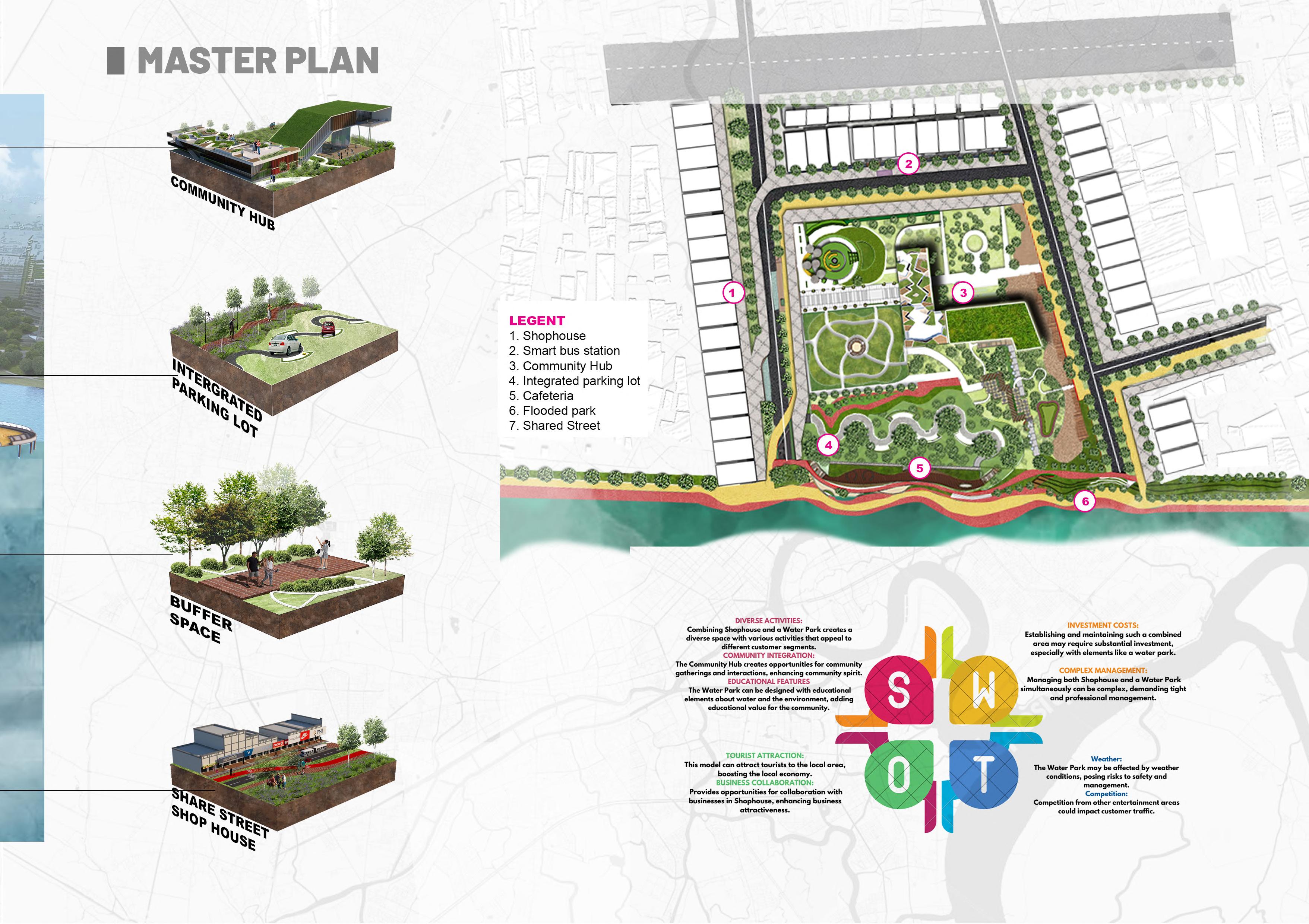
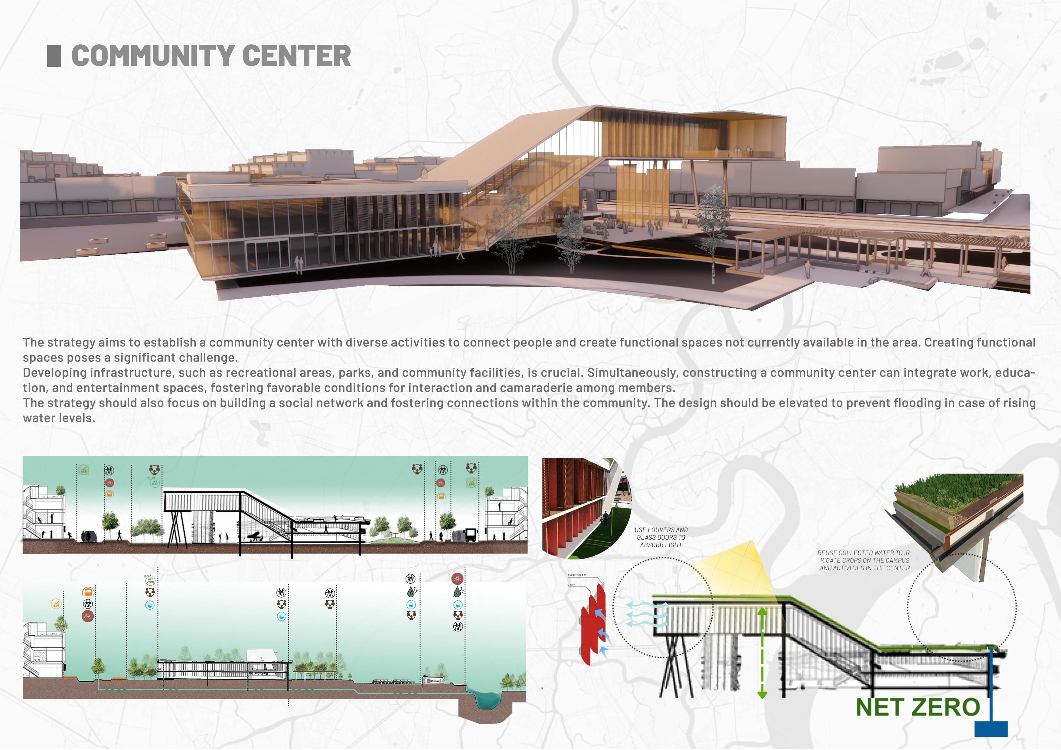
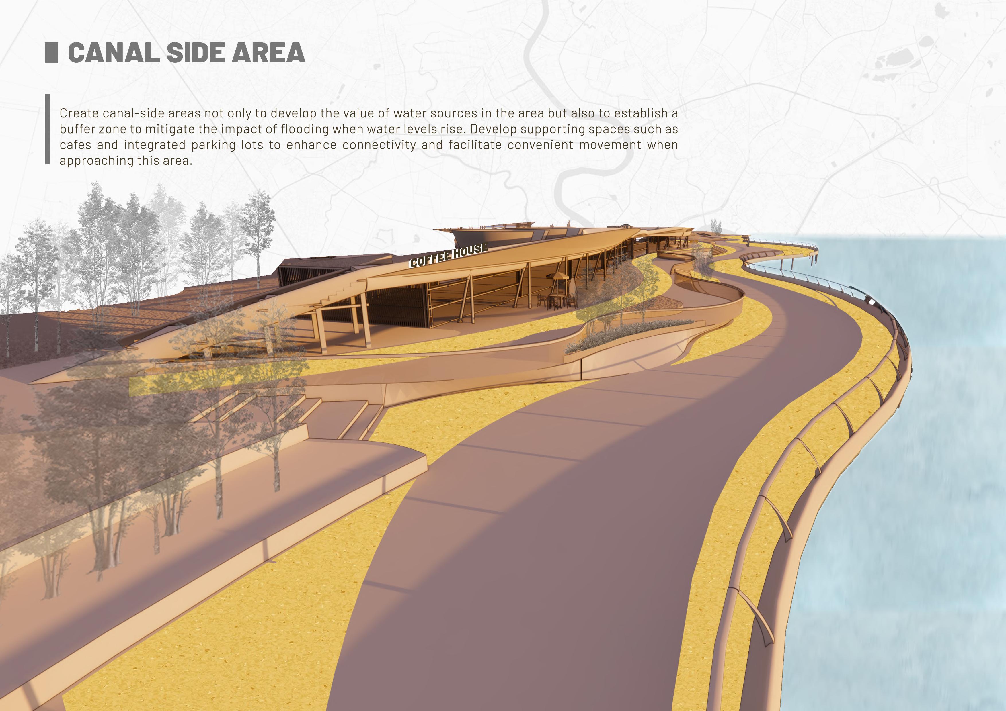
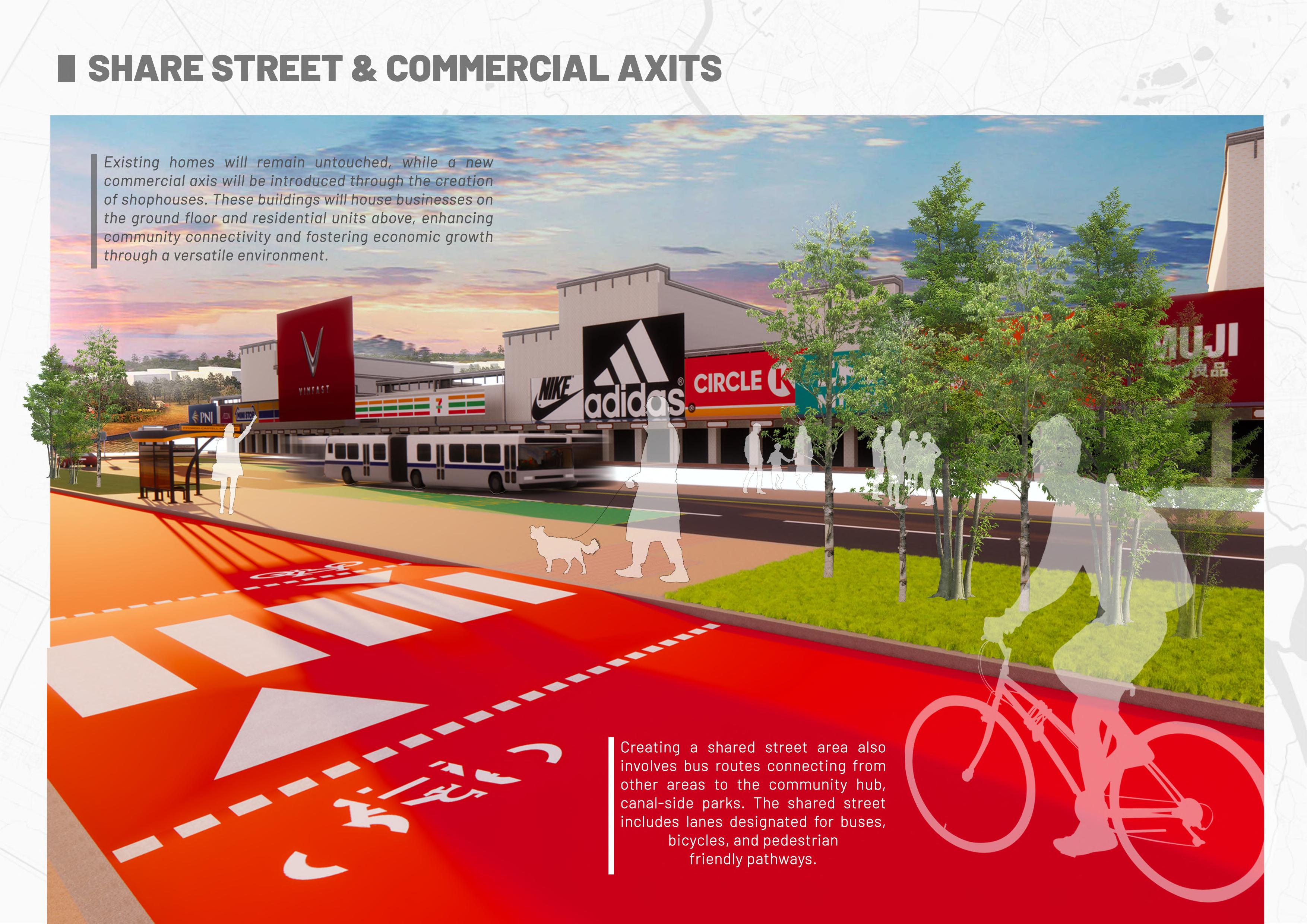
UEH UNIVERSITY | 3 YEARS STUDENT PROJECT | SMART URBAN PROJECT
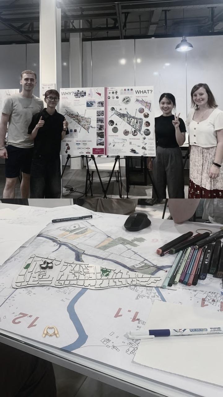
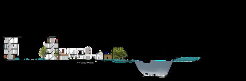
INTERNATIONAL WORKSHOP WITH AVANS HOGESCHOOL | DROWNING CITIES
WORKSHOP|
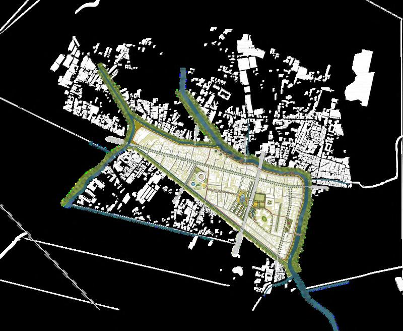
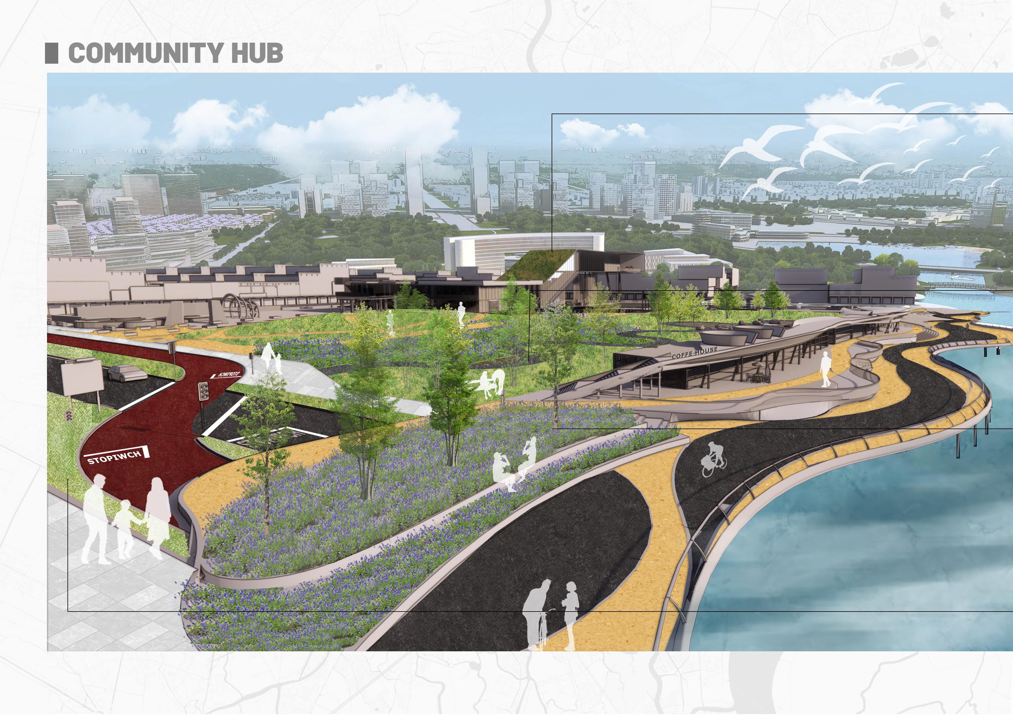
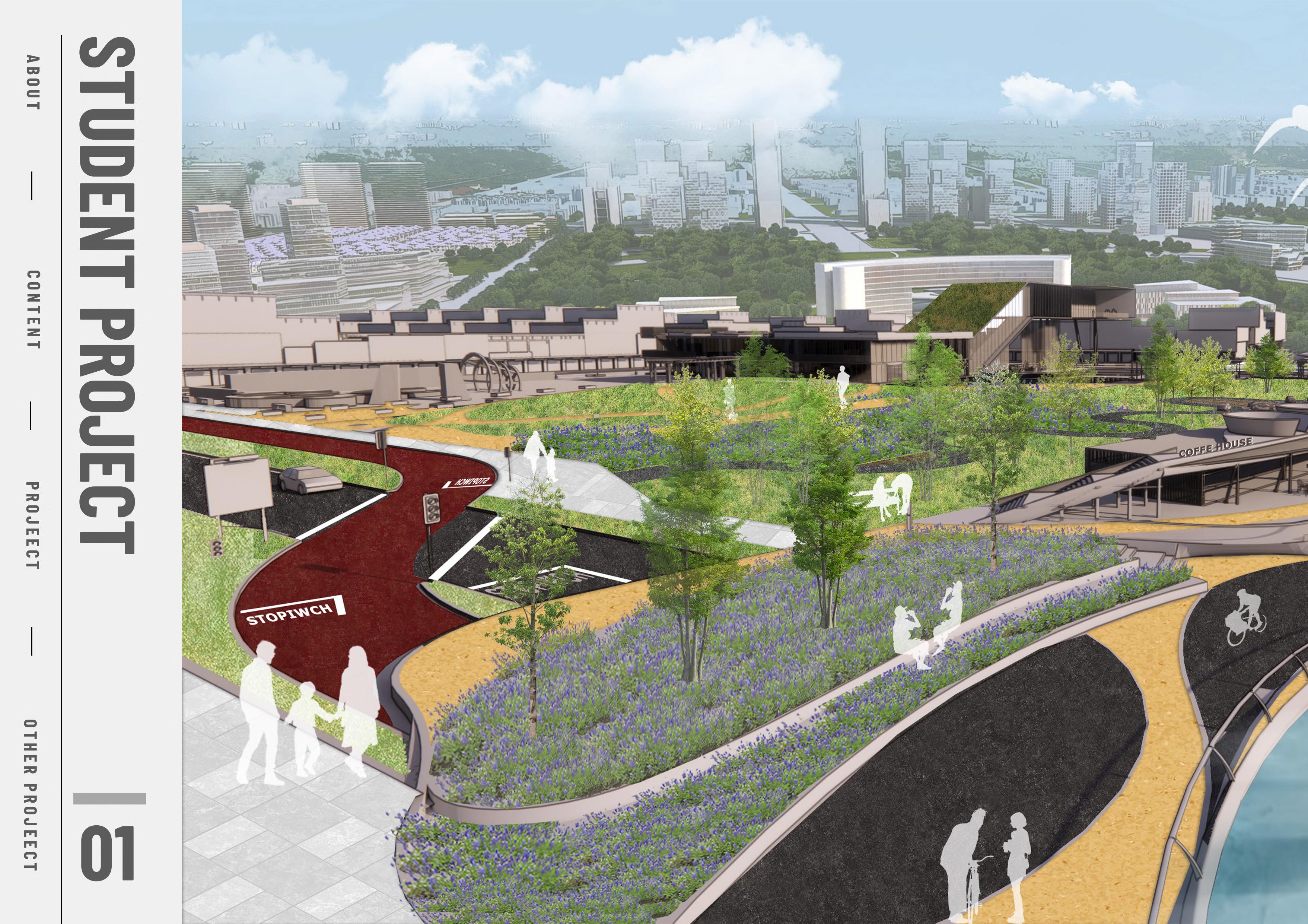
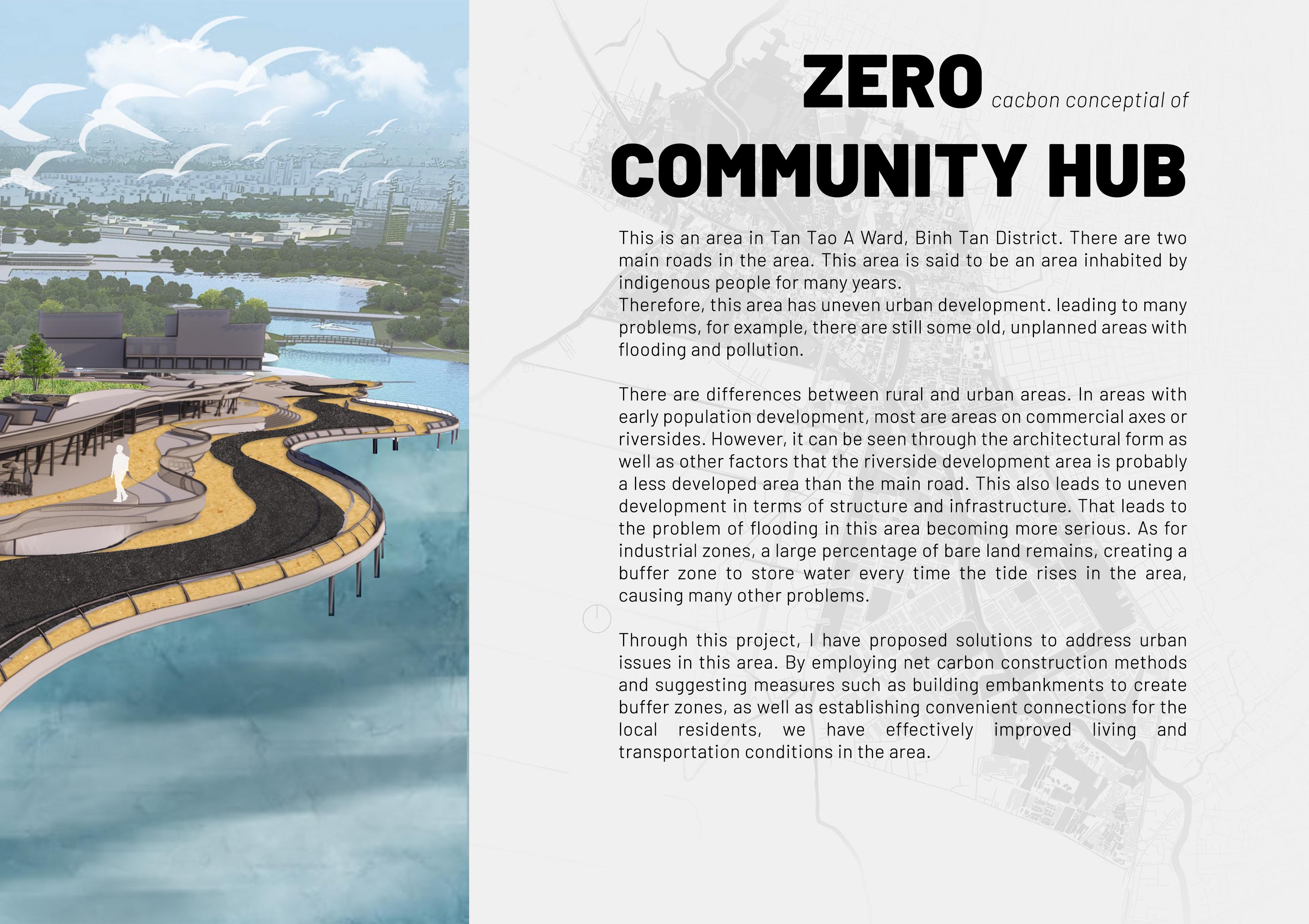
| URBANITY AND RURALITY - URBARCOMMUNITY HUB
BINH TAN DISTRICT
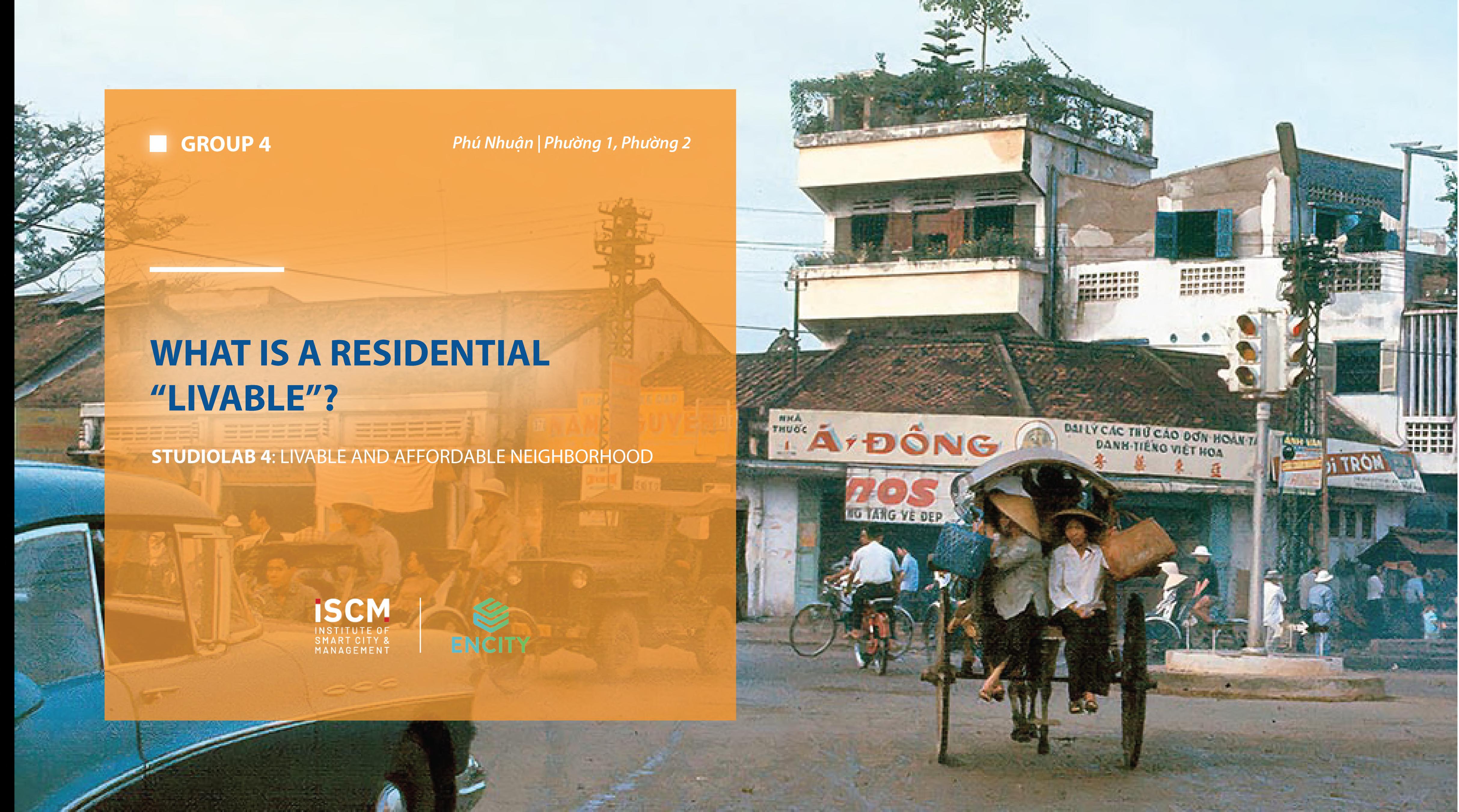
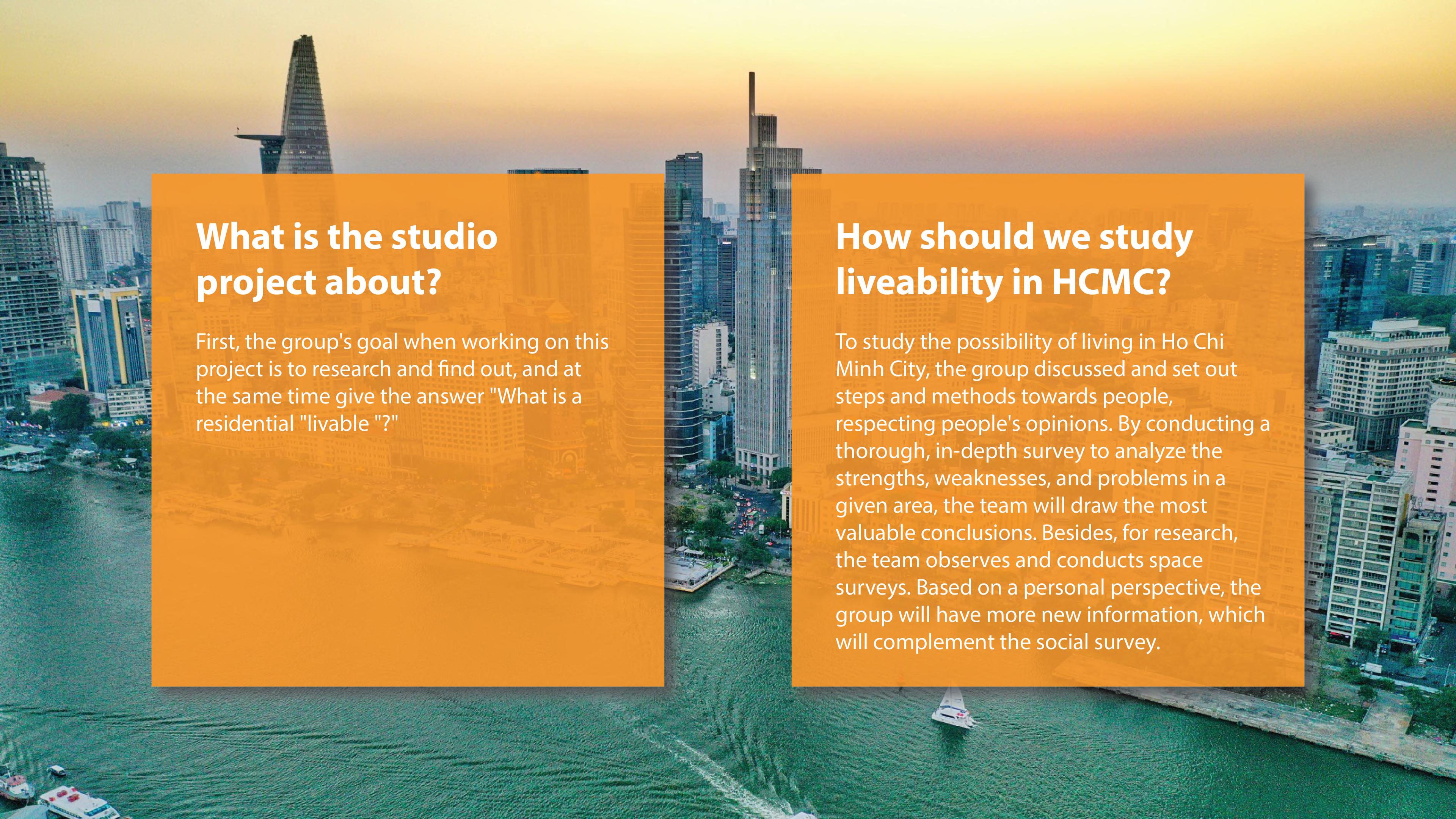
UEH UNIVERSITY | 2 YEARS STUDENT PROJECT | STUDIOLAB 4: LIVABLE AND AFFORDABLE NEIGHBORHOOD
WHAT IS A RESIDENTIAL "LIVABLE" ? - ENCITY
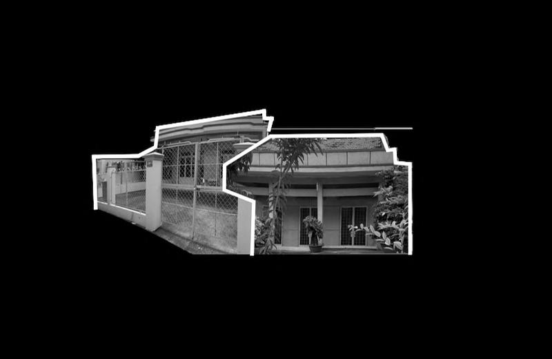
WARD 2, PHU NHUAN DISTRICT
UEH UNIVERSITY | 2 YEARS STUDENT PROJECT | SMART URBAN DESIGN
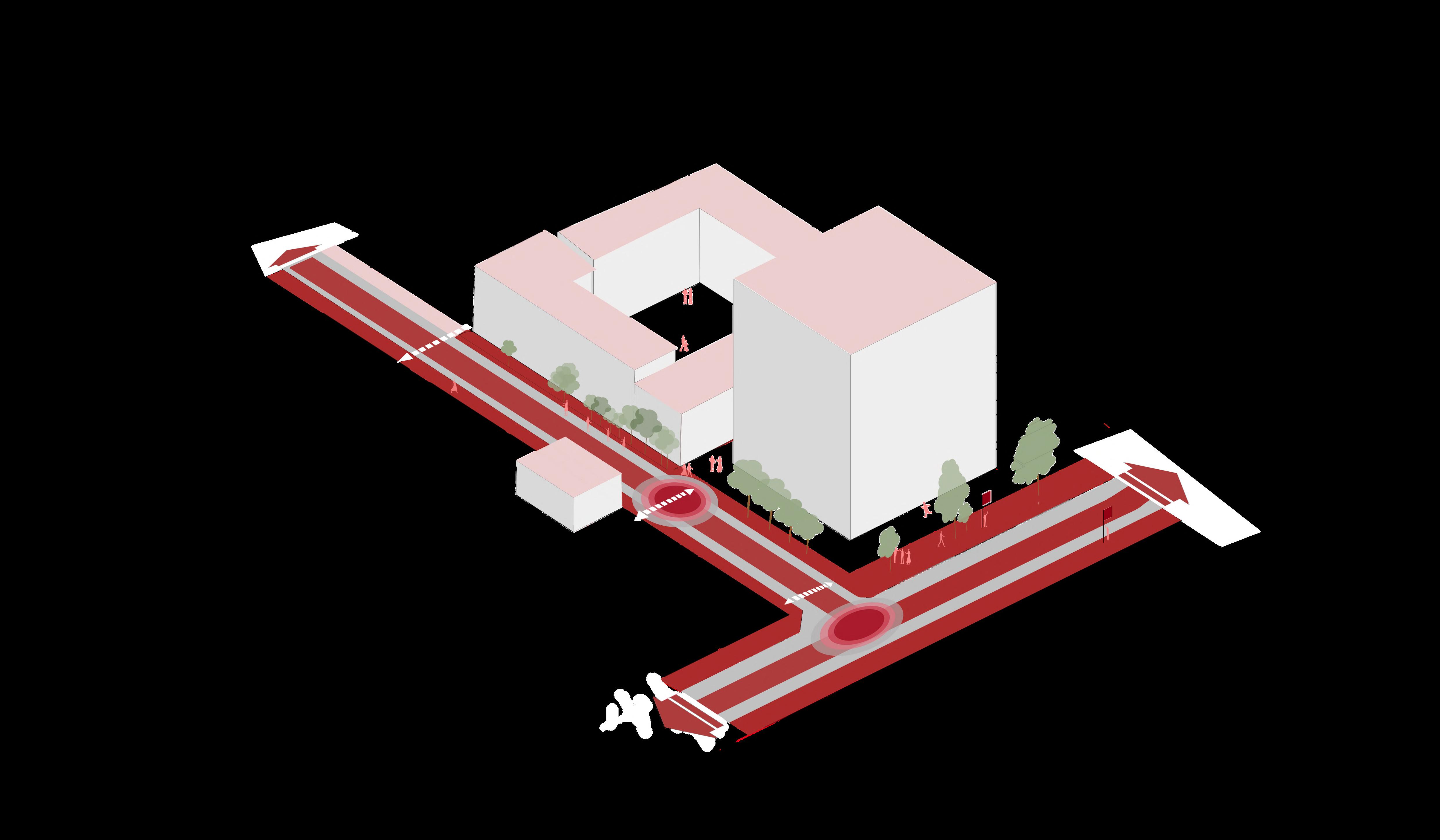
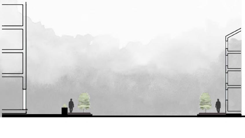
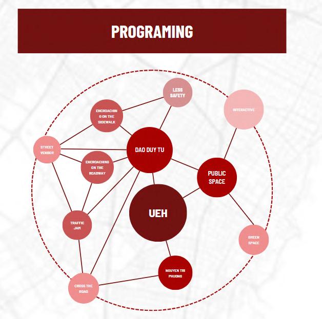
| QUICK URBAN DESIGN - CONNECTING SPACE AROUND UEH UNIVERSITY
AROUND UEH UNIVERSITY CAMPUS B, DISTRICT 10
ANOTHER PROJECT
UEH UNIVERSITY | 3 YEARS STUDENT PROJECT | DESIGN THINKING
| QUICK URBAN DESIGN - NEEDS FOR ACCESS AND USE OF COMMUNITY LIVING SPACE IN NGUYEN THIEN THUAT APARTMENT
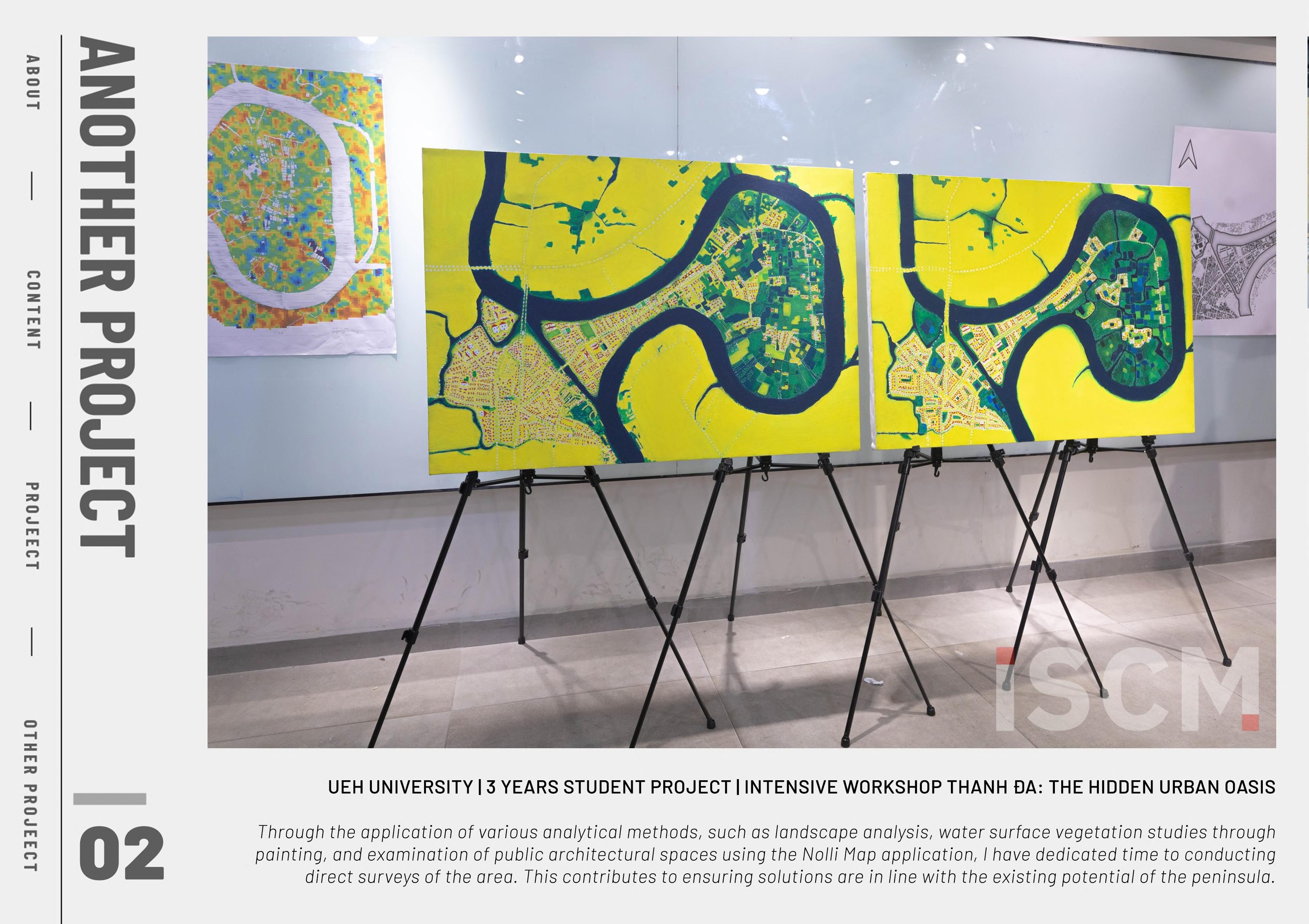
UEH UNIVERSITY | 3 YEARS STUDENT PROJECT | INTENSIVE WORKSHOP THANH ĐA: THE HIDDEN URBAN OASIS
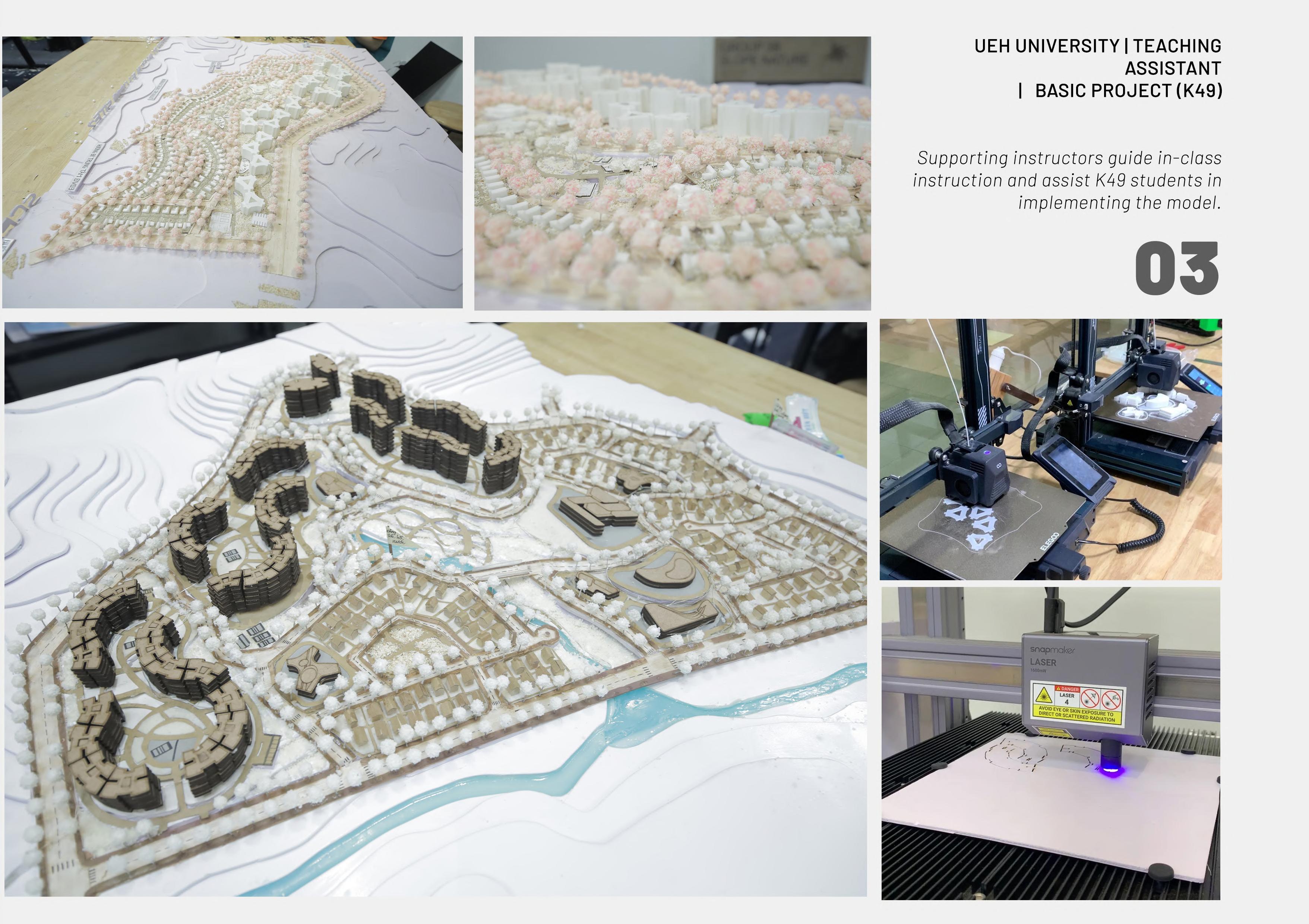
UEH UNIVERSITY | TEACHING ASSISTANT: BASIC PROJECT (K49)
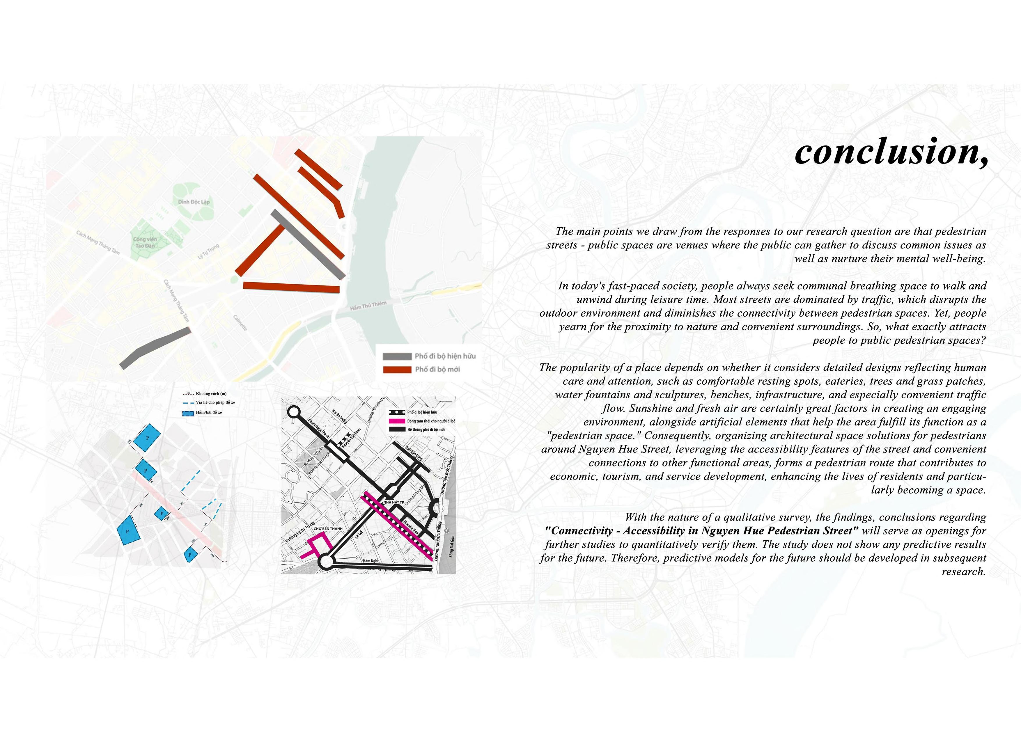
UEH UNIVERSITY | 2 YEARS STUDENT PROJECT | SCIENTIFIC RESEARCH
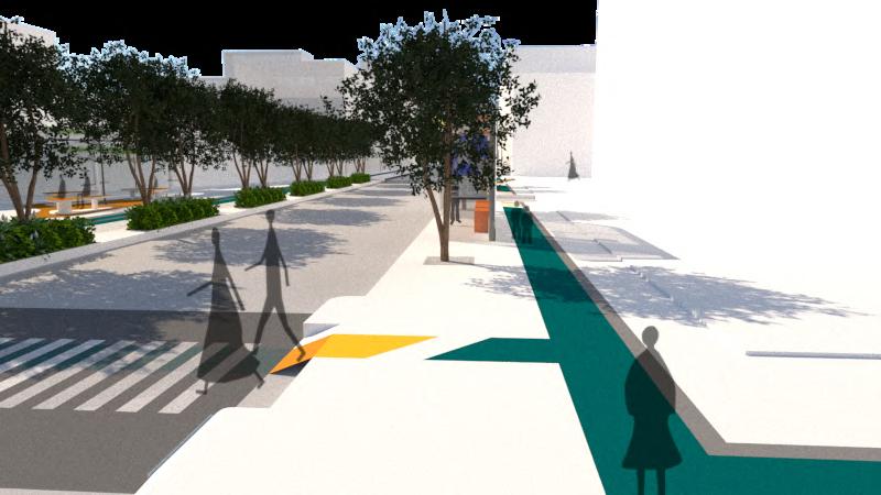
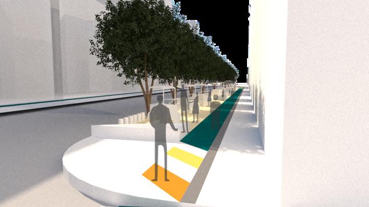
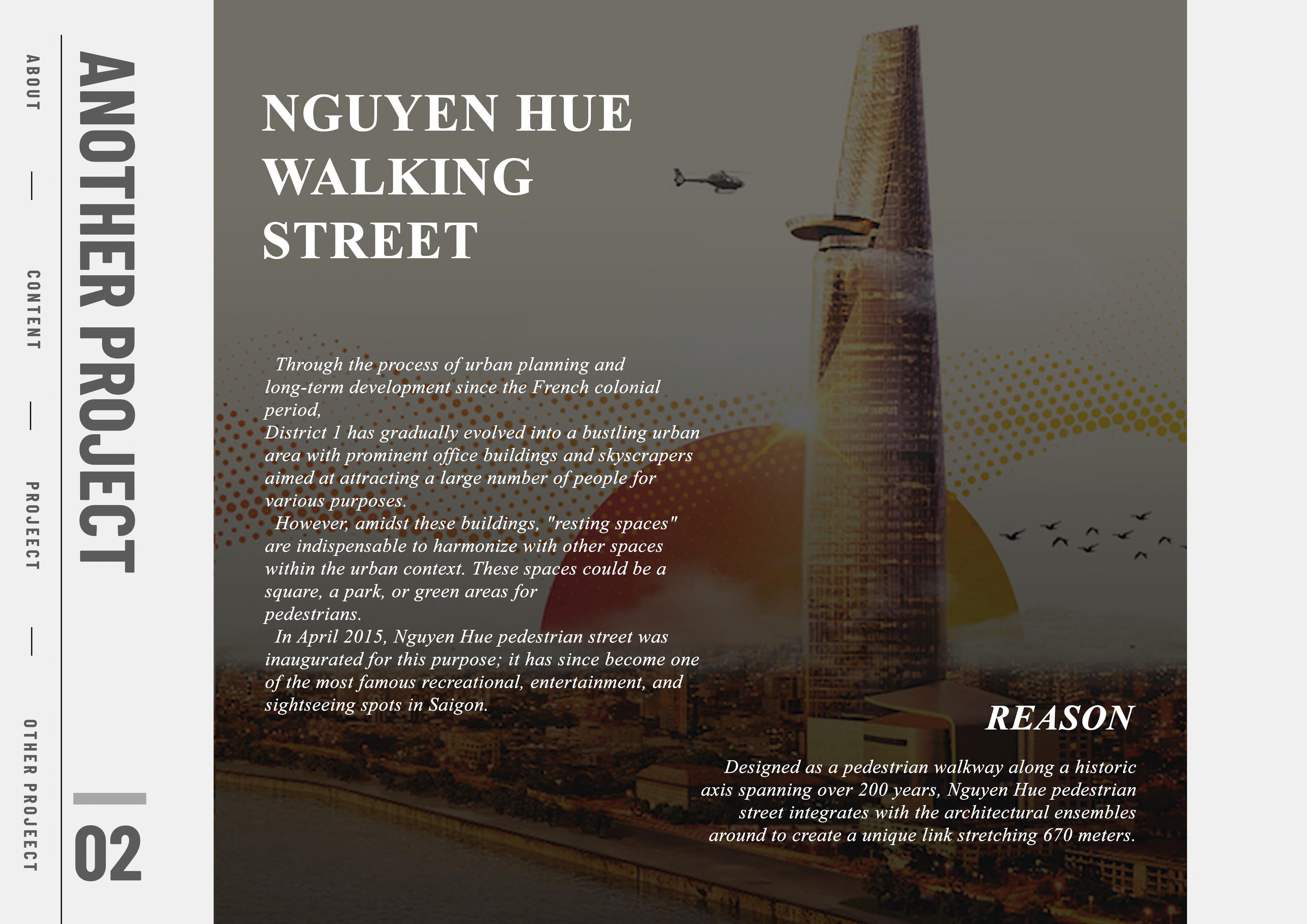
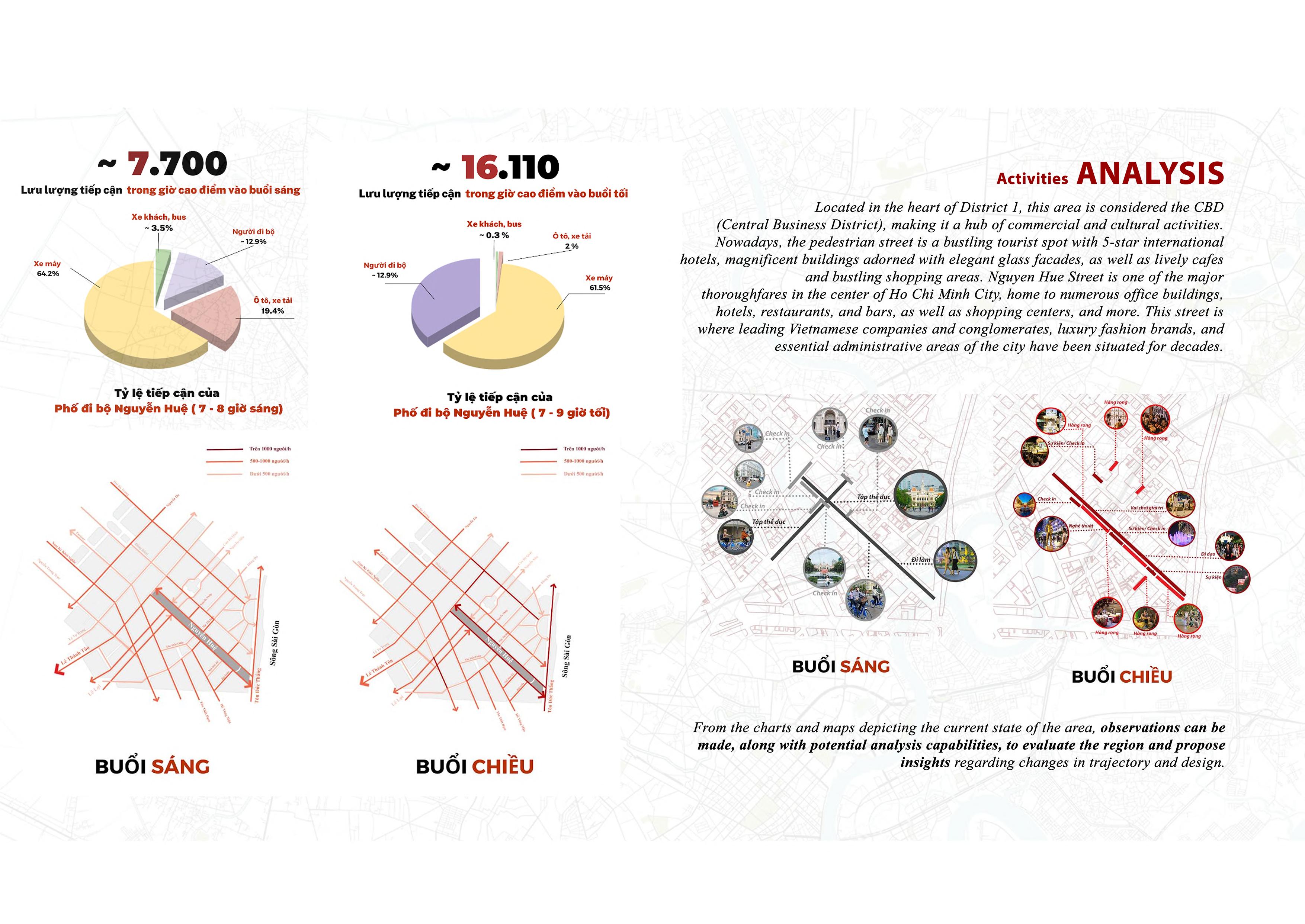
ACCESSING AND CONNECTING WALKING SPACE AROUND NGUYEN HUE WALKING STREET
| UEH YOUNG RESEARCHER COMPETITION C 2023
URBAN EVOLUTION
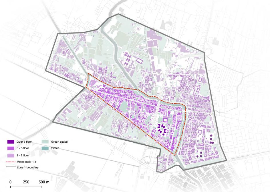
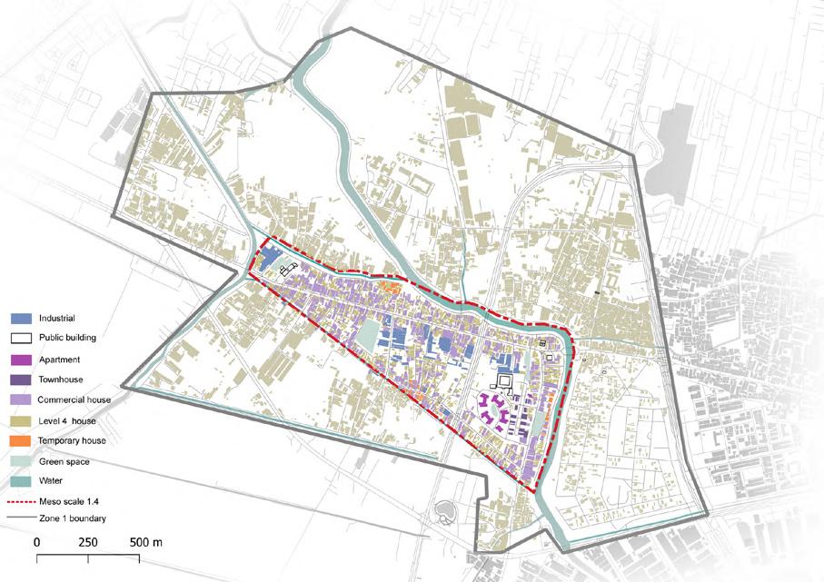
CITY SCALE
INFORMATION
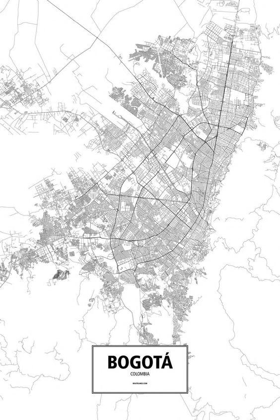
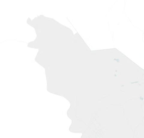
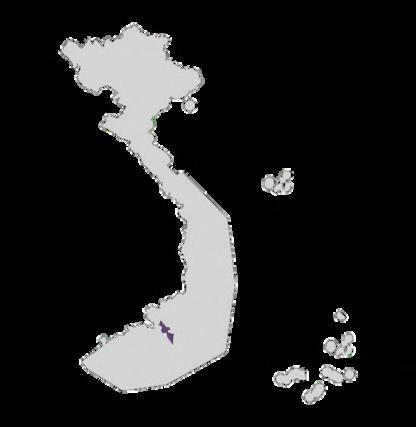
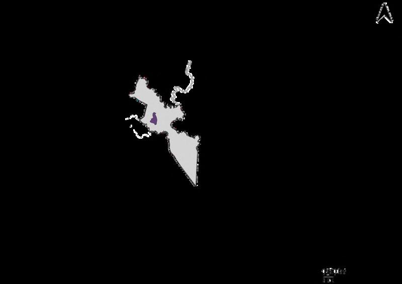
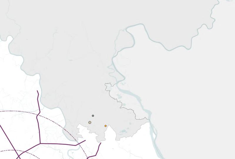
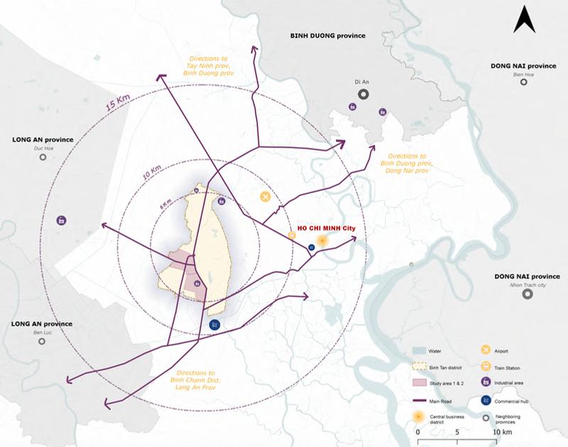
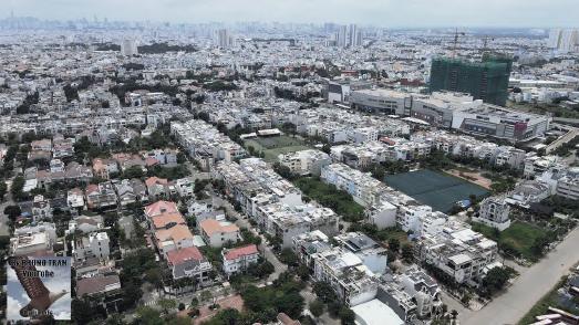
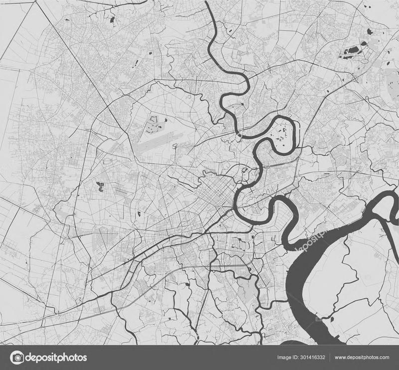
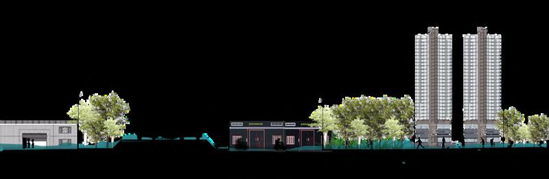
Binh Tan is a district located at the West of Ho Chi Minh, directly adjacent to Long An province.
Total Area: 52.02 km2
Population: 801,217 people
Binh Tan District is one of the important economic gateways of the southern region with abundant land fund and rapid urbanization, attracting residents from all over to live here This area plays an important role as a trade hub connecting the city center with the southwestern provinces
With a strategic destination, Binh Tan has an efficient transportation system to Ho Chi Minh city downtown and connect with surrounding provinces (Dong Nai, Long An, Binh Duong). Binh Tan district can connect with other areas with many highway like 1A, Sai Gon - Can Tho, HCM - Long Thành –Dau Giay, Vanh dai 2, Vanh dai 3.
In the future there will be also Metro line 3A connecting to HCM downtown and line 6, Sai Gon - Can Tho Railway
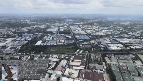
Territory City Distr ct

2.109 Ha
Area of urban and
3987 (>86%)

Land p ots under 10 000 m²
Project area:
52,02 km²
Number of near district
6 unit
Year of expansion: 1965

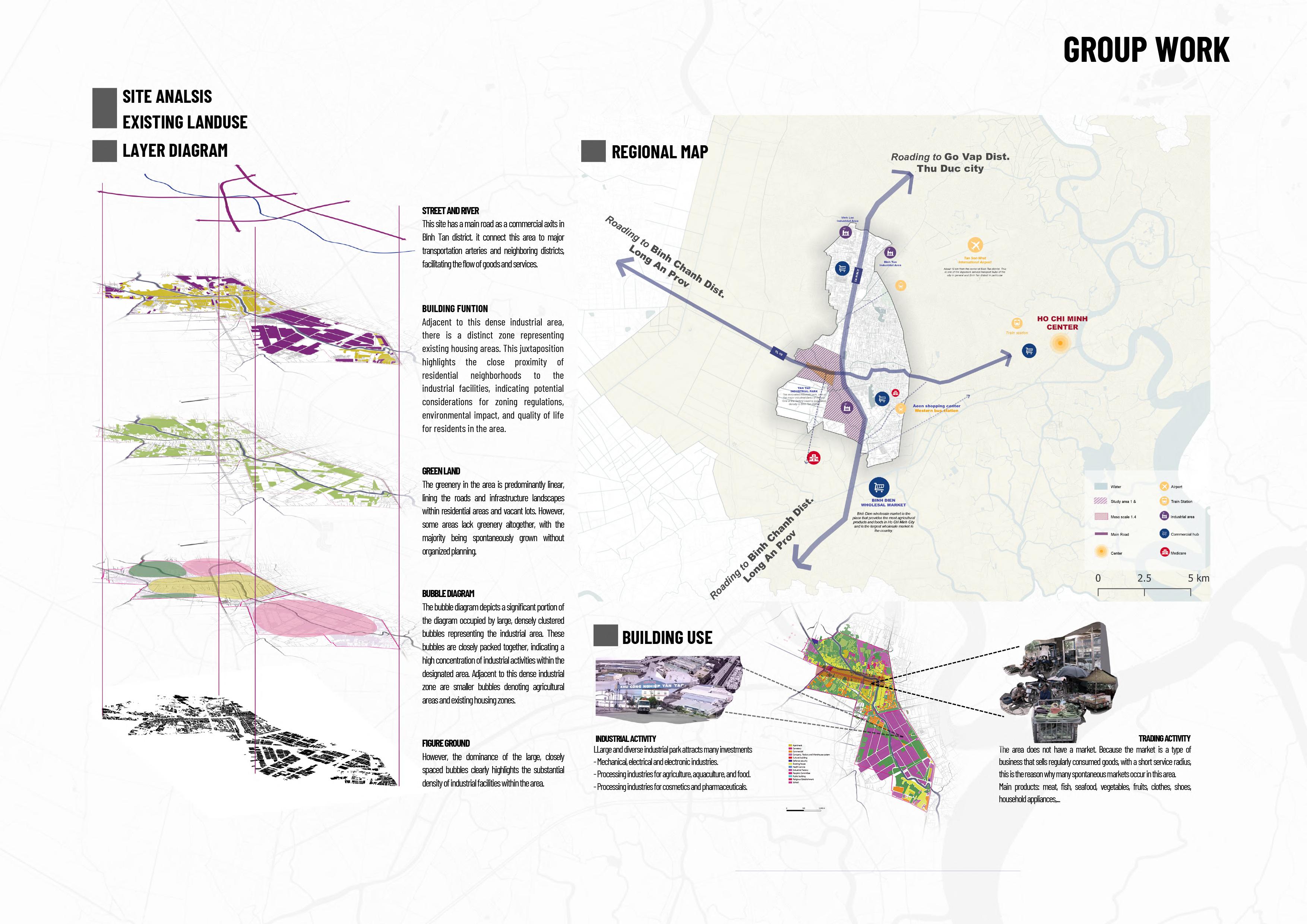

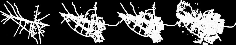
1965 THIS S A SPARELY POPULATED PLACE W TH MOSTLY BARE LAND AND PEOPLE MA NLY WORK IN AGRICULTURE THIS AREA STARTED TO CHANGE A LOT AFTER 2000, BECOMING VIBRANT MORE PEOPLE CAME TO L VE, AND INDUSTRIAL AREAS STARTED TO APPEAR.
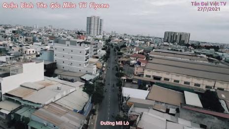


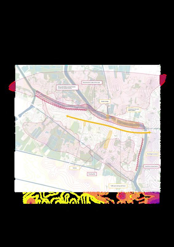
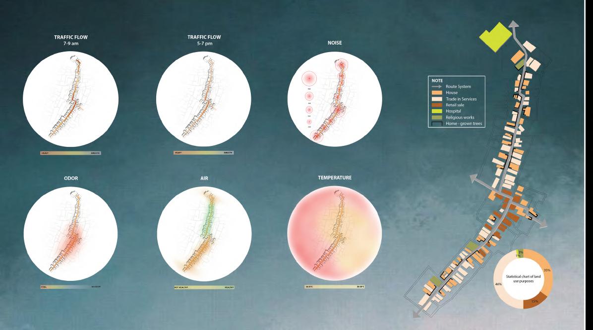
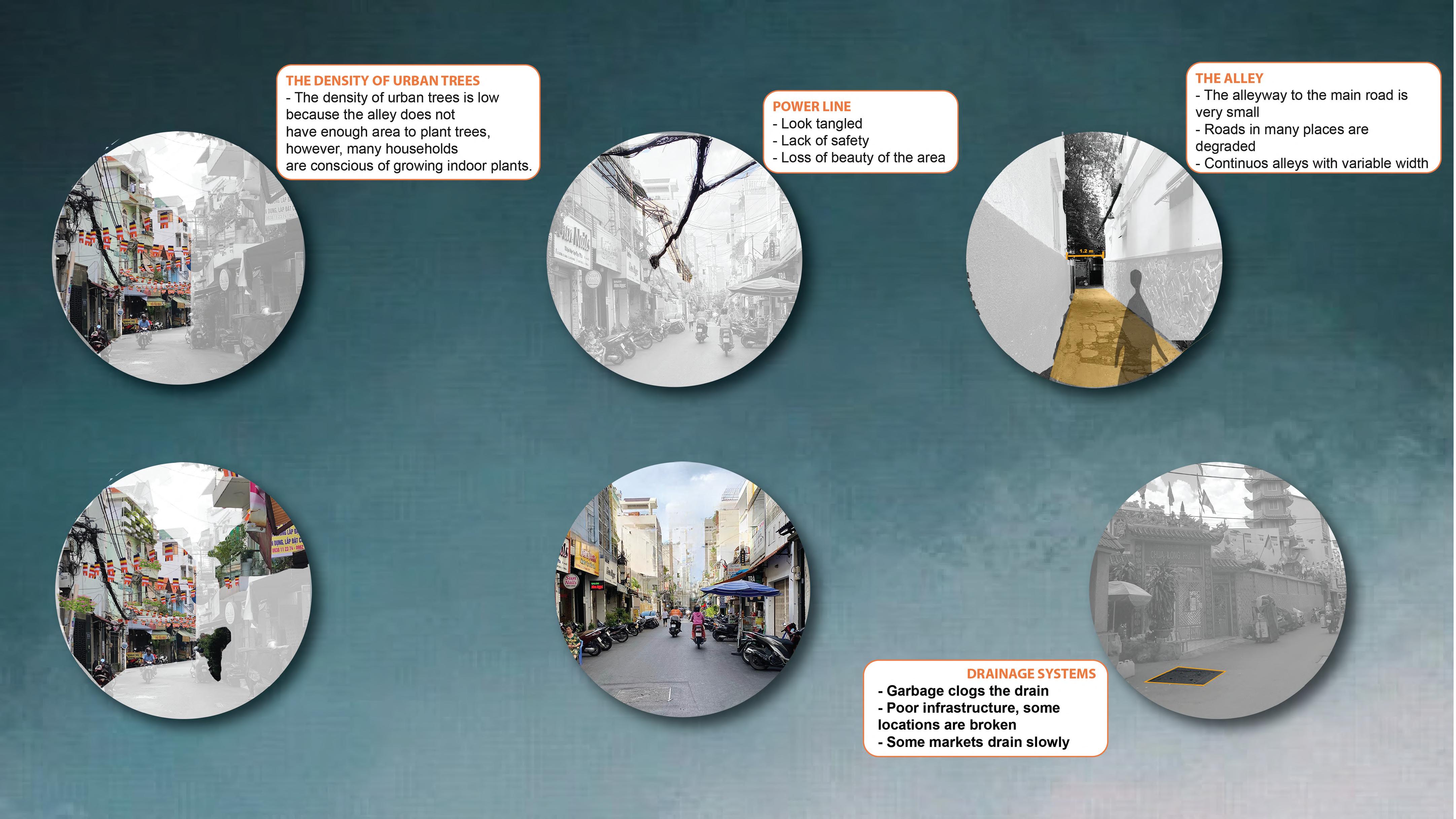
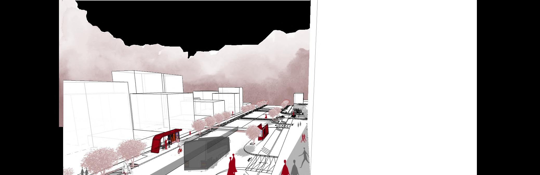
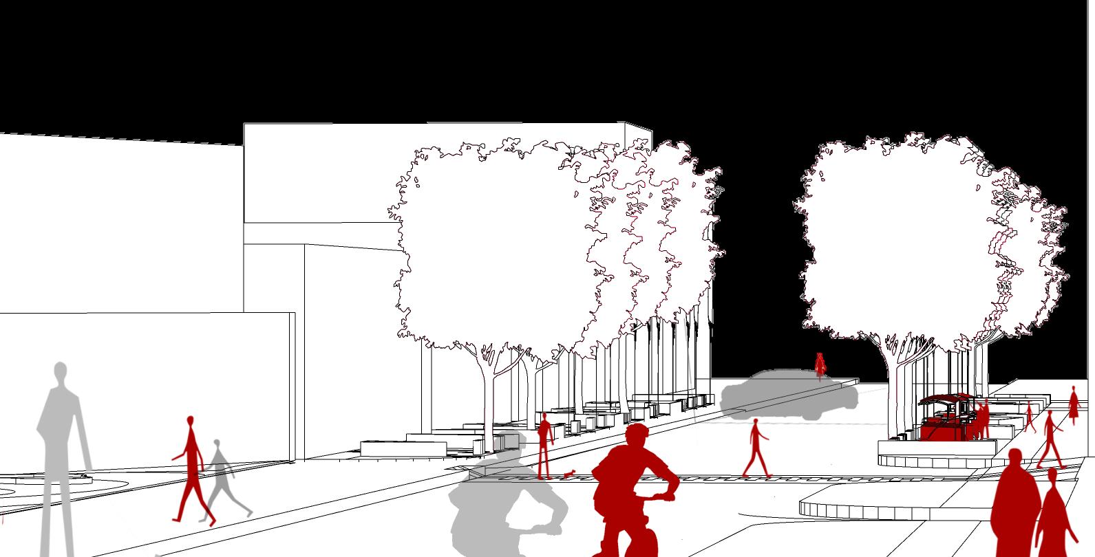
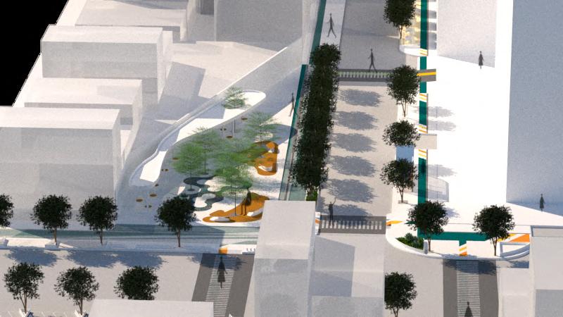
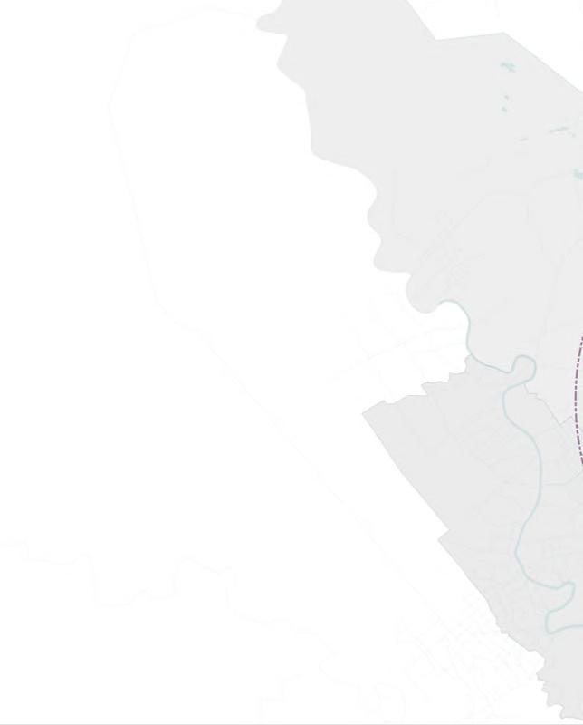
- Road TL10 serves as a corridor connecting Long An and Ho Chi Minh City, and is also a main route, where buses pass frequently.
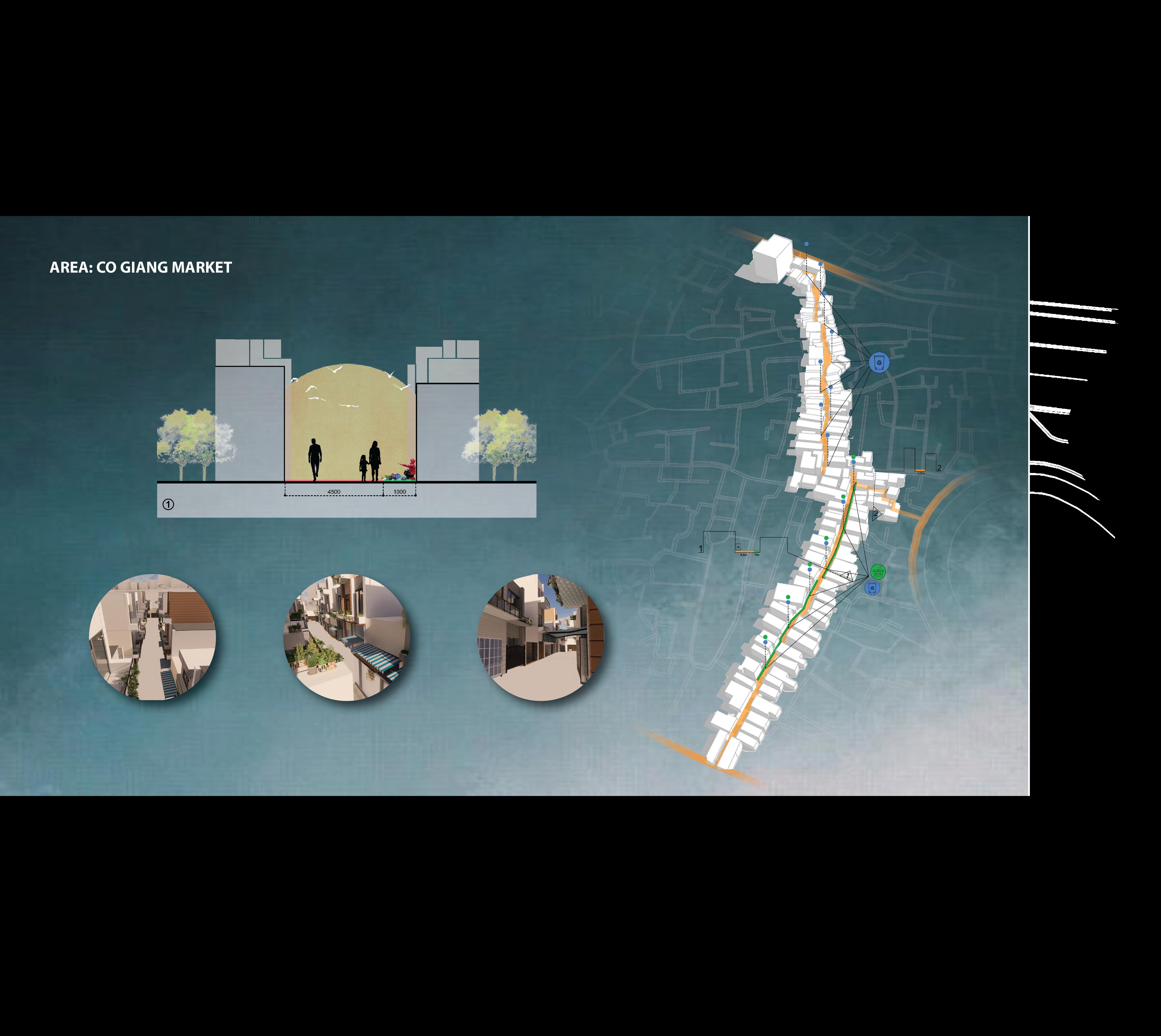
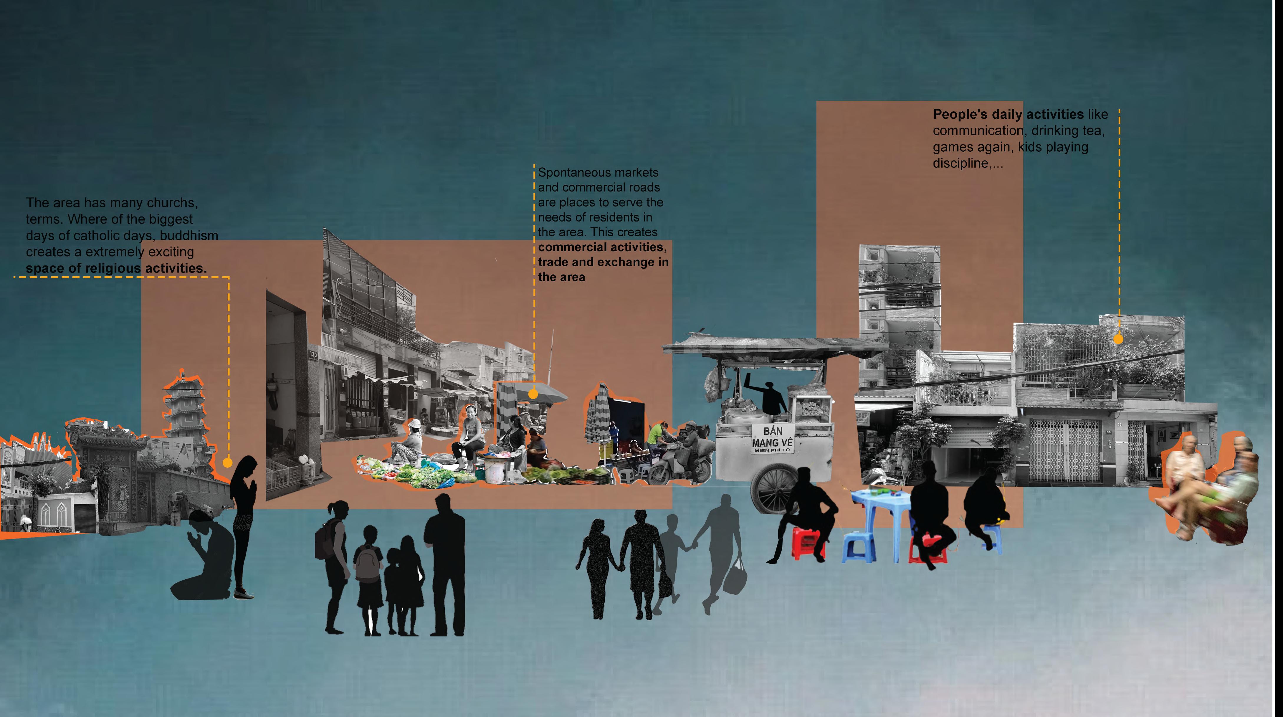
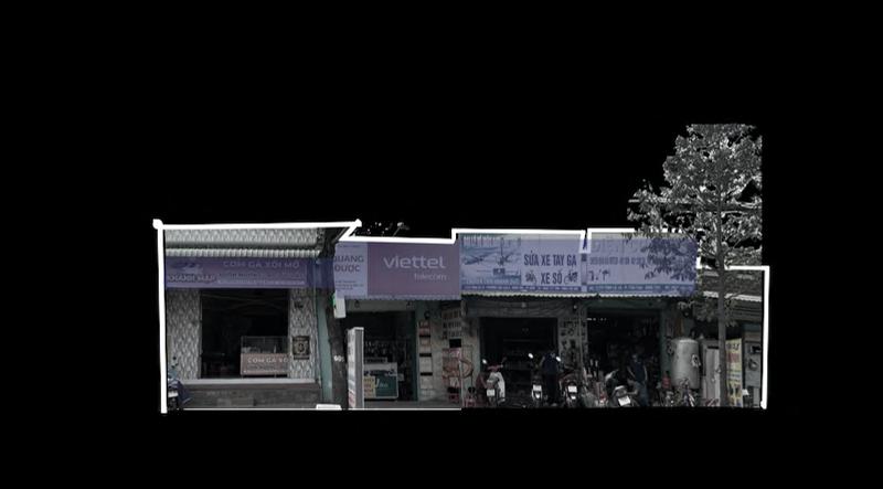
- Busy commercial streets, mostly commercial streets.
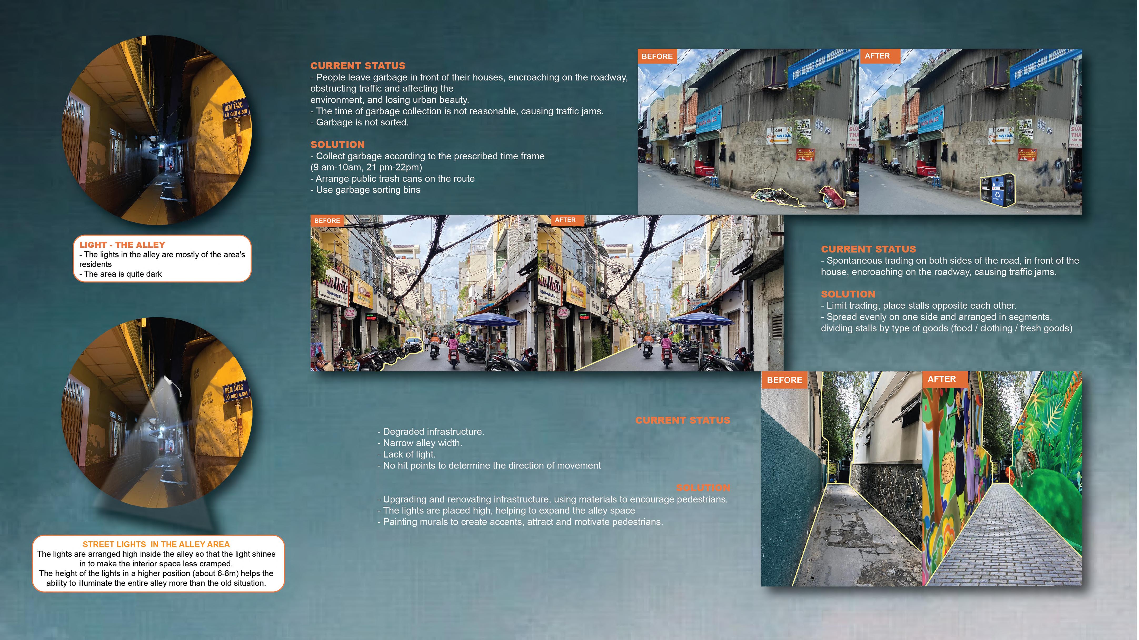
The traffic flow is high, causing traffic jams during peak hours Forms of informal trade appear (many spontaneous markets, sidewalk businesses, construction shop houses encroaching on sidewa ks).
- There is a difference between the main road and riverside areas, between the West and East areas
- The canal is seriously polluted and smelly, seriously affecting peop e s livelihoods and lives -> activities on the river and both banks are not developed.
- Connectivity:
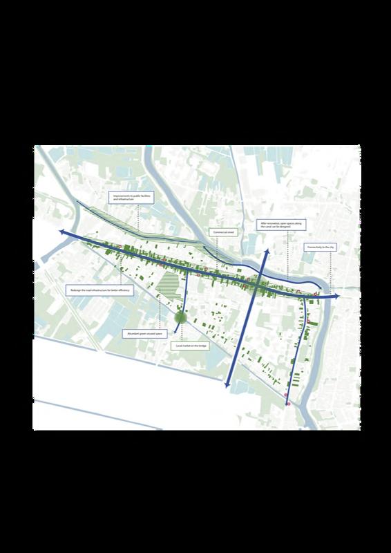
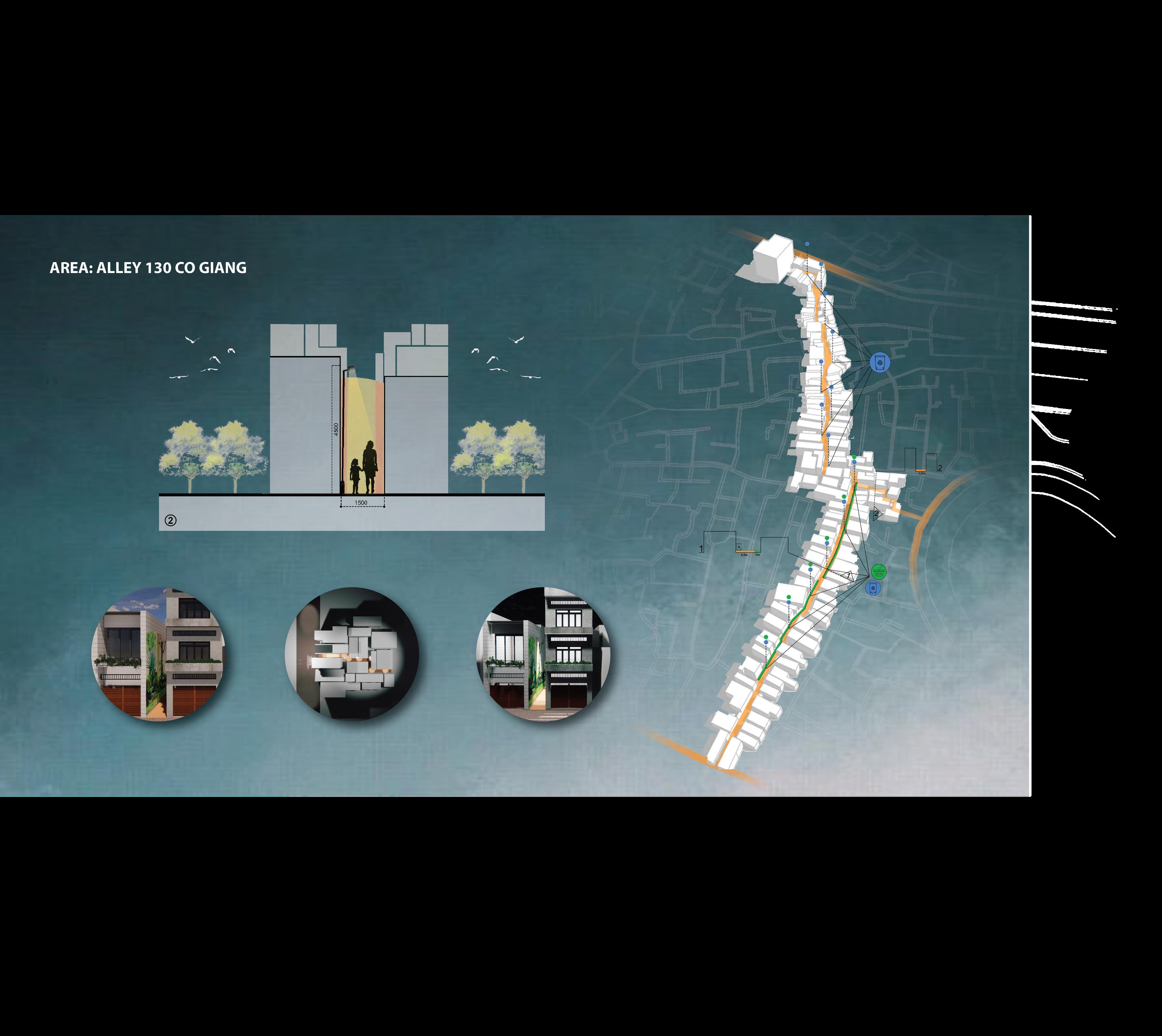
+The path from the main road to the river is small alleys or trails that have not been properly built
+ Trees along the shore are not cared for and are overgrown, b ocking visibility, reducing the connection between the two banks.
+Lack of space for young people and neighbors