En Route > A Public Art Project


 by Aileen Lambert
En Route > A Public
Art Project by Aileen Lambert

by Aileen Lambert
En Route is a Public Art Commission undertaken by artist Aileen Lambert based on the theme of old routes in the landscape. Following a number of meetings, interviews and rambles with people from Bekan, Ballindine and Tulrahan between September 2009 and October 2010, Aileen devised tours of sites related to old routes in these areas.
A tour of sites in the Bekan area took place on September 4th 2010, while Ballindine and Tulrahan were featured in a tour on September 18th 2010. Documentation of these bus and walking tours is featured throughout this publication.
The accompanying double audio CD features people speaking about the sites in question.

In addition, video documentation along with a pdf of this publication and sound files from the accompanying CDs are featured on the website www.enroute.ie
En Route was commissioned by Mayo County Council via the Percent for Art Scheme associated with the development of the Lough Mask Regional Water Scheme.
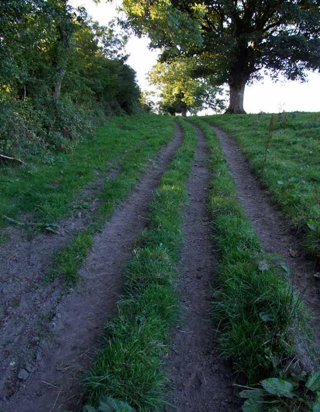
Image: Tour group referring to their maps on Bekan tour, 4th September 2010Quotes throughout the publication are regularly accredited to people using only their initials. The first time someone is quoted their full name is given, and in each subsequent quote their initials are used.
MS – Michael Sloyan
MH – Mickey Hopkins
GL - Geraldine Lyons
CJ – Christina Johnston
LL – Liam Lyons
TC – Tony Carney
MM – Matt Macken
JM – Jarlath Mullarkey
AG – Anthony Gallagher

The Mayo public art programme is recognised nationally and internationally for innovation and exploring the boundaries of what can be achieved through the Percent for Art Scheme. The scheme gives the county the opportunity to work with exceptional artists, in all artforms, to realise artistic outcomes that amaze, surprise, move and inspire people in many ways. The programme is devised, curated and carefully managed by our Public Art Co-ordinator, Gaynor Seville, based in the Arts Office of Mayo County Council. It aims to consistently provide arts development and arts activity of the highest quality, accessible and inclusive, with long term benefits to all in the county. This project by Aileen Lambert challenges assumptions of what art can be and what artists can do. The concept, exploring old routes, seems simple but without the personal knowledge of the many people who spoke to Aileen, and the outcomes of the organised events, this would simply be a publication of maps, and a pulling together of already documented information. It is the artist’s skill and motivation to explore those personal stories and bring to life those disused and forgotten roads and pathways that turns this into a creative and visionary project. Many people agreed to speak at the events, telling their own stories and sharing memories at specific points along the routes and many laughs and tales were shared during the community lunch breaks on the day trips. Happy memories from these days will remain with the participants,
and will no doubt be passed on to future generations in due course. All too often we spend our time racing from car to house to work, too busy to stop and think about where we are, what and who surrounds us, and what has gone before us in and around those same few fields, roads and pathways which define our special places.
It can’t have been easy for the artist, coming from Wexford, to actively engage so many people and encourage their participation in her project. That three bus loads of people gave up their Saturday to explore these routes on just one of the day trips with the artist says a lot about her, and the novel, intriguing concept she offered.
Seeds have been planted in the imaginations of those who attended and heard about the tours and research undertaken by Aileen. Indeed one enthusiastic group plan to further develop the idea, adding to the stories and discovered routes and conducting their own tours and events based on the En Route initiative. Mayo County Council would like to congratulate all involved in the process, especially Aileen Lambert for her hard work and dedication to the project and to all those people who offered stories and information and attended the events. This publication is much more than mere documentation, it constitutes an artwork in its own right which will be of great value to many people in County Mayo and beyond.
 Mr Peter Hynes, Mayo County Manager
Landscape is often perceived as a synonym for the natural environment, pristine and unchanging. In reality, however, the landscape is subject to a continuous process of alteration and development as successive ages and generations make their impressions on it.
In my artistic practice I frequently use video to record ephemeral gestures in the landscape. These have varied from recording a fleeting shadow in Frost Shadow (2006, video, 2 min loop) to the use of my warm breath to melt a hole in the snow in Snow Breath (2005, video, 2min 05sec). Using simple actions and interventions, I trace my body’s presence on the landscape, expressing and documenting a particular place and time.
These impressions do not leave a lasting physical trace. Instead the environment, which holds them momentarily, gently effaces them.
EN ROUTE was an attempt to consider on a larger scale how a community expresses its relationship with its environment by examining and reflecting upon the marks created on it in the form of routes.
As a complete stranger to the area of south-east Mayo, the process began with some visits to towns and villages in the area, as well as desk and internet research. I visited local libraries to scan content in relation to community organisations, local topography, Folklore Commission

material, sites and monuments etc, so beginning to get some feel for the place. Remotely, on the internet I began to familiarise myself with the area through the National Monuments Service website and the Ordnance Survey website as well as any content online connected with the area.
The use of local media to announce the project and put out a call for people to get in touch was important in raising awareness of the project - local notes in newspapers, parish newsletters and radio. School visits to fifth and sixth classes in a number of schools and presentations to active retirement groups led to a number of leads. A slow start suddenly gave way to a large number of contacts being referred to me and word of mouth became the means of broadcast.
I invited people to share their knowledge of these routes, of how they evolved and their experience of using them. The first stage began with phone conversations and chats over tea, which led quickly to guided excursions as people showed me the sites and routes with which they were familiar. Documenting with audio recordings and photographs I gradually began to build up a catalogue of sites and routes, many previously undocumented. While some routes such as the old railway line in Ballindine have a long and documented history as well as a strong physical presence, other routes exist purely in local memory, in the oral tradition, or were perhaps recorded on a map while they were in existence though little or no evidence exists now. Some routes which received
Image: Roadsign at Brickens, Co. Mayoattention are perhaps known only to a couple of families, with names so local that they may even be particular to just one family, such as Fordes’ name for the stile near the bonfire site in Reask: “Grandma’s Steps”.


Stage two featured organised group tours of the sites and routes. Initially I had conceived that this experience would involve a walk of one or two selected routes from beginning to end, but the fact that so many people had identified so many routes prompted a change of approach. Instead a bus tour, featuring a number of mini rambles, was co-ordinated. The people who had introduced me to the sites offered to share their knowledge and experience with others on the tour. However, the majority of the people on the tour were locals, which had the effect of having a large number of ‘guides’ on the tour. Being in a place reignited old memories and experiences and at many points numerous people offered contributions, as one account sparked another memory. Those parts of the tour that were literally ‘en route’, i.e. the travelling on the bus, or walking along a lane or into a field where someone was to point out something, were often the most interesting, with numerous and diverse conversations between people generating multiple narratives. Each person’s experience of the tour was different, depending on which bus they were on, who was in the seat next to them, who they spoke with, etc. In practice, mini tours were being conducted through the individual conversations between people.
This is a contemporary document, with photos that have been recorded in the last year or so. However, the accounts and descriptions delivered during research rambles and on the tours, and material that features on the CD, relates to experiences, knowledge and records dating back some couple of hundred years. We owe this largely to the participation of a number of the more senior members of the locality. Many accounts are first hand, offering intimate experiences and descriptions.
As the project developed I began to see that each route represented a different relationship that points to our dependence on each other and on the landscape which holds us. Relationships between families who have intermarried locally, the bond which people have with the church, the connection between the home and the bog for fuel, or the well for water, are all represented by different routes.
In rural areas these days walking is rarely undertaken for the simple purpose of getting from one place to another. A walk is more likely to be undertaken for purposes of leisure or exercise. The local network of shortcuts and rights of way has changed due to a number of events that loosely coincided and impacted upon one another: the advent of tap water, the popularity of the car, the revolution in telecommunications, the improvement of land and boundaries for farming and the issue of liability and insurance. Beyond the public roads, land is in private ownership.
This raises the question as to who has reason or indeed the
right to access or cross land. In the recent past, the local network of routes was a necessity and a respected and understood code of conduct regulated many rights of way. It was my intention with the EN ROUTE project to create an opportunity for people to access these routes again, and visit new ones.
In the rural landscape there are names for every lane, gap, stream, wall and bend in the road. In times past its inhabitants knew the landscape intimately and it was necessary to have a way to describe each feature because of their dependence on it and need to describe and identify it. As our relationship with the environment changes our familiarity with these names will decline. Many of the placenames which have been recorded in EN ROUTE have not been recorded elsewhere and will not be found on any another map. The term “en route” is defined as “on the way, in transit, during the journey, along/on the road, on the move”. It does not refer to an object or any singular point in time but the coming, going and being on the move. This refers to a state that is not fixed in time, not static but constantly changing, and that requires us to be present and aware of the moment.
Aileen Lambert Image: Aileen Lambert and Luke Murray descend to the shore of Mannin Lake Image: Aileen Lambert with Rose Duddy, Larganboy
Aileen Lambert breezed into our lives in the summer of 2010 and set us off exploring our own place. Down overgrown laneways and boreens we went, clambering over styles and retracing traditional shortcuts to school and church. We rambled along póirses1 leading to abandoned dwellings and sites of long-vanished clachans2. We crossed over keshes3 and heathery pathways deep into the heart of the bog. We pored over old maps and faded photographs while the older residents reminisced about days long ago when routes and modes of travel were different to those of today. We explored the local network of routes that we and our ancestors have been constructing since time immemorial. And we reflected on the evolving relationship between ourselves and the landscape which they can be seen to represent. Landscape is often characterised as a palimpsest with successive generations erasing and re-writing it. The routes network is a good example of this process at work. In the course of our group trips with Aileen it struck home to us that we were just the latest in a procession of people who have been through our landscape over the centuries, all contributing to the state in which we find it today. Broadly speaking, our routes are a product of geography, history and social patterns. Their evolution has been shaped by the nature of the topography, the available modes of transport and the socio-economic activities in the locality.
We ‘rediscovered’ many minor paths and shortcuts that are redundant today. Some were known only to the older generation, while a few had been completely forgotten and we had to rely on old maps for evidence of their existence. These act as a reminder of an earlier era of restricted communications, one without electricity, phones or cars (or even bicycles until the 1930s). With mixed farming the dominant economic activity, neighbours would co-operate in a group (the meitheal) to accomplish seasonal farm tasks such as turf-cutting and saving the hay. Because of restricted travel opportunities and limited contact with the wider world, people also tended to marry locally. In such a closelyknit and interdependent farming community, a complex web of footpaths developed across the fields: to the well, to the bog, to school and church, to neighbours and relatives.
The need to circumnavigate the many lakes, rivers and bogs in the locality has been an obvious factor in determining the course and direction of our routes. It was impossible, of course, for roads to avoid water obstacles altogether so culverts and bridges were constructed here and there. We came across several examples in the course of our rambles. These include ‘Christina’s Bridge4’ and ‘Rocks’ Bridge5’, both crossed on the day of the Ballindine tour. Water can, of course, facilitate travel too. Ancient dug-out canoes
have been recovered from Mannin Lake which were most likely used to reach the lake-dwellings knows as crannóga6. In Skehavaud too, near Ballindine, the use of a boat to cross the lake, which existed prior to the construction of a drain to reclaim the land, is apparent in the placename Sceach an Bháid, which refers to a boat and the bush to which it was tied up.
While most routes meandered according to the contours of the landscape, one exception was the railway line which cut a swathe straight through the landscape.
The route of the railway line was a matter of great interest to the big landowners of the day.

We know that Lord Dillon, an absentee landlord over extensive landholdings in this area, was kept informed by his local agent about the railway company’s plans, noting that the proposed line would enhance his estate.
Near Castlemacgarret we saw the influence of Lord Oranmore and Browne not only on the direction of the railway line but also on the routing of the main road to Claremorris. Near the entrance to his estate, at a place known locally as the ‘Double Bend’, a turn was put in the road so that his carriage could drive straight into the avenue leading to the big house while other road users had to turn the bend to continue on their journey.
While our main roads generally evaded the bogs as much as possible, it had equally been necessary to construct minor access roads right into them to
facilitate harvesting and retrieval of turf in the days when it was the sole source of fuel. We followed the old road penetrating into the heart of Tully bog, which was a hive of activity back in the 1940s with scores of men from Bekan and neighbouring parishes converging there to harvest turf in summer time. Today the situation is very different. The end of manual turfcutting, in Michael Viney’s phrase, ‘has cancelled a whole seasonal procession between the townlands and the bog’7
In our rambles, we also saw evidence of our ancestors’ efforts to re-route the flow of water across the landscape and to harness its power. Farmers have for centuries been modifying the natural watercourses and supplementing them with artificial drainage, channeling surface water from the fields into ditches and dykes by means of shores and dutch drains. Streams have also been dammed up to create a power supply for small corn mills, of which no less than thirteen had once operated within the confines of the parish of Bekan. In the Logboy area, we found traces of a canal built in the 19th century by a local landlord, Nolan Farrell, in an attempt to bring water to his residence, Logboy House, from Tulrahan stream a mile and a half away. Another canal was built by millers at Lissaniska to bring an alternative supply of water from Bekan to turn their mill-wheel because an earlier mill, slightly downstream, had prior rights to the water in the existing stream.
‘ We shall not cease from exploration And the end of all our exploring Will be to arrive where we started And know the place for the first time’ TS Eliot (‘Little Gidding’)
1 ‘Póirse (plural póirsí) is an Irish word in common use locally for a narrow laneway, usually fenced on both sides, leading to a dwellinghouse.
2 A ‘clachan’ (Irish clachán) was a group of farmhouses (also known as a baile or ‘village’) where land was organised communally under the ‘rundale’ system; there were often ties of kinship between the families involved.
3 A ‘kesh’ (from the Irish ceis meaning ‘basket’) is a local term for a small improvised bridge over a drain or boggy ground, of a type originally constructed using wickerwork. ‘Where kesh and loaning finger out to heather’ (Seamus Heaney).
4 ‘Christina’s Bridge’ bears the inscription ‘This bridge was built in memory of Christina Lady Oranmore and Browne who died in May 1st 1887’
5 James Rocks owned land in Castlemacgarret and Garryduff North in the mid-19th century.
6 Crannóga (derived from crann, the Irish word for ‘tree’) were artificial islands built in lakes as secure dwelling-places in prehistoric and medieval times.
7 Michael Viney, ‘Another Life’ in The Irish Times, 15 September 2001.
8 Pilgrims performed the ‘stations’ by praying and kneeling while making clockwise circuits of the holy well

The corn miller and the blacksmith were once community focal points. They provided services of such importance that their locations were pinpointed on the early Ordnance Survey maps. The well-worn paths to the miller and the blacksmith were the news networks of the day – the routes by which stories and gossip were disseminated throughout the community. Lissaniska formerly had two such corn mills and although the mills had ceased operation by the 1920s, the village in question is still known as ‘Milltown’. The blacksmith’s forge at Larganboy was on a well worn path which provided a shortcut from Erriff to Larganboy School.
Formerly, Bekan parish contained five national schools and, prior to that, several of the famous hedge schools. We can still see evidence of the shortcuts that the scholars took to school and Tony Carney pointed out the location of stiles that were specially built to facilitate this youthful traffic. The shortcuts which were taken by schoolchildren from Reask and Erriff to Larganboy school, and later by people in those communities to hear mass in the old school, were also pointed out on the tour. A common, well-trodden route very familiar to earlier generations was that leading to the spring well. Going to the well to fetch bucketfuls of water by hand was a daily chore. A farmer was considered quite privileged if he had a well on his own farm but often wells were communal,
serving the needs of several farm families, and some users might have to travel considerable distances to collect water. Some wells were quite old, like the communal one which served several generations up to the 1970s in the village of Tully, Tobar Mór, which is recorded on a map of 1835. A couple of wells in the parish of Bekan were also famous holy wells which local people used to visit, up to about 1900, to perform annual ‘stations’8. At ‘St Brigid’s well’ in Kildarra the stations were performed on St Brigid’s Day (1 February) an event which was infamous for the faction fights which followed it.
More of our routes have ancient historical associations. According to one theory, the ruined church that we saw in Bekan cemetery was once part of a monastic community, led by the eponymous Saint Béacán, that was part of a chain of ecclesiastical settlements positioned on an ancient route leading due west to the ‘holy mountain’ of Croagh Patrick. In Greenwood, we passed by the ancient roadside monument known as ‘Diarmaid and Gráinne’s bed’ just east of the crossroads. According to folklore, Diarmaid eloped with Fionn MacCumhaill’s woman, Gráinne, and Greenwood was one of their many resting places during their flight from the pursuing Fionn. Near Ballindine we inspected an underground route, an ancient passageway known as a ‘souterrain’, of which there are several other examples
in the district. They are usually associated with forts and various local explanations of their uses are given: as storage places for food and valuables, places of refuge and secret entrances to the forts.
In the townland of Carrickmacantire, we visited a strange dual carriageway known as ‘The Bishop’s Walk’. Locals will tell you that long ago this was the avenue to the residence of one Bishop McIntyre. However, it is probable that the bishop in question was actually Brian O’Gara who was Archbishop of Tuam 1724-40. That was at a time the Penal laws were in full force and it may have been prudent for him to keep a low profile away from Tuam. We know that Bishop O’Gara had family links with this area, that he preached at the nearby Tulrahan church in December 1737 and that he was buried in Ballyhaunis friary. More recent historical events were recalled during the Ballindine tour, including the blowing up of ‘Rocks’ Bridge’ and the derailment of a train at Cloonrane during the War of Independence.
It is a fact of modern life that our relationship with the landscape and our sense of place are being progressively eroded. The distinction between urban and rural living is being blurred by factors such as globalisation and the information super-highway. With door-to-door car journeys increasingly the norm in rural areas, we are losing our connection with the fields and laneways. All we need to know about a planned
route, thanks to the satnav, are the points of departure and destination. Moreover, with Google Street View we can now take a virtual tour, with 360 degree views, along the main roads of the locality without leaving the comfort of our homes. Aileen Lambert’s project proved to be a wake-up call to this process of change within our locality. It has been a catalyst for renewed interest in our local routes, our local landscape and our local history. Those who participated in the group tours led by Aileen readily acknowledge that the entire exercise has changed their perceptions of the local landscape. Moreover, the tours in themselves and the group interactions along the way have generated a new set of experiences and memories to be savoured and passed on.
Michael Kelly is a native of Lissaniska, BekanAileen Lambert’s EN ROUTE pushes new breath into the circulatory systems of the environs within Bekan and Ballindine in Southeast Mayo to reveal an evolving situation. This new breath becomes integral to its occupants whose senior and collective recall weaves vocal patterns for public interest.
In EN ROUTE, there is little to no physical evidence of an artwork. Unlike the English environmental sculptor Richard Long who perhaps coined the idea of art as walking and led a poetic yet formal trail from the gallery into nature, Lambert’s approach to walking in landscape is arguably more Duchampian, closer to reality inclusive of humankind. EN ROUTE itself has no physical output yet it is all about physical trace. It involves simply walking with all sense so that the artist in each of us is led, informally, and the artist is decentralised through participants who are at once subject and object of meaning.
Lambert and her collaborators draw us into a multiple inquiry by calling on the contributions of residents at the Crochán Rannach in Reask, the Claddagh and Annie Hynes’ stile at Larganboy, the Bog Road in Tully, the Bishop’s Road at Carrickmacantire, the Double Bend at Castlemagarret and underground tunnel at Cloonmore Church. Colour in the widest sense of meaning - history, memory, nature and humankind - are put at the service of the mind – we, audience, are threaded through landscape while local people provide the notes. There are no static expressions, no singular scene, no framed or
fixed viewpoint, instead a multiple perspective with multiple verifiers. In a way, EN ROUTE resonates with that of artist Alanna O’Kelly’s From Levelled Grounds: A Lullaby of Loss (2005). For instance in Bekan the unbaptised are buried in the Lisheen, horses refuse to pass part of a field, rights of way have been cut off by commercial enterprise, the past perilously trodden upon calls from below.
Lambert’s practice is informed and characterised by two traditions - traditional singing and performance art. Traditional singing in Ireland is characterised by its informality where people are gathered and from whence one song may lead to another and so the situation unfolds through time without any apparent destination. EN ROUTE was not choreographed, instead it unfolded as one person’s story sparked another, in a continuously meandering route through people, places, traditions and time.
Performance Art is best known through the work of individual artists in consciously live or sensory and shamanic action with a strong tradition in contemporary Ireland. By inviting us into the landscape to walk, Lambert does not privilege one sense, but situates us in a landscape that seeps into and heightens our senses. This performative aspect allows Lambert to take licence in doing things, in changing freely, being conscious of presence, accommodating the other.
EN ROUTE integrates that which is present with that which is past, in curvilinear response. It involves the active contribution of the participant audience in the

first instance providing guidance, memories and literal pathways, and in the second instance through their actual living participation, thereby validating the now. This multi-perspectival recall means that the text is not set and the mapping not complete unless people are simultaneously at the centre and periphery of the emerging discourse.
In Creative Experience (1924) Follett calls this a circular response. For her, the heart of integrating is the connection between the relating of two activities, their interactive influence and the values thereby created – progressive experience depends on the relating. In the Freudian wish subject and object are equally important and the reality is in the relating of these. EN ROUTE combines the experiential as progressive experience with the transformative through a shared walk. Any reaction to what is said is a reaction to a relating. The landscape may be significantly bereft of people and activity now yet its markings and names tell of previous busy activity. So in each story told by Michael Sloyan, Liam Lyons, Tony Carney, sisters Kathleen Hussey and Rose Duddy, Anthony Gallagher, Mike Kelly and Jarlath Mullarkey, there is an ‘I’ meeting the past through its absence plus the past re-meeting self in the present. This relating involves an increment that can be considered to be of compounding as distinct from simple interest. Something ‘new’ is being built, and this is not just a function of environment, but a function of the relation between oneself and the environment.
In fact the social situation that arises from EN ROUTE is a response not to a rigid, static environment, but a changing situation. This environment is changing because of the activity between it and self. Through the situation created by EN ROUTE we are invited to look for the plusvalents in the situation. Like the visit to the Larganboy School and the question as to why this has not been designated for architectural conservation. Or the fact that the road which crosses the Five Arches Bridge in Castlemagaret used to be a major road, but is now a cul de sac into a private entrance. Or the folklore surrounding the name of the Bishop’s Walk in Carrickmacantire. Or the route along Seamus Forde’s Ditcheen in Reask which people used to take to bury their unbaptised young in the Lisheen. When writing of ‘plus’ here, this term is preferred to ‘super’ which would give the notion of ‘over’. Such qualitative and creative experience gives an additional value, one more value, not necessarily a greater or super value. Rather than break things into subject/object, we can claim the rational interplay of forces as the functioning of a self-creating coherence, where curiousity and consciousness are the living interplay of a self-generating activity.
Circular response allows us to move within a larger life than we are directly cognizant of, allowing individual creativity without ‘transcendence’. Indeed circular response takes us beyond reciprocal relating. What is happening here is the recognition that ‘I can only free you and you
me’. In social situations such as EN ROUTE, you cannot compare what you bring and what you find because these have already influenced each other - you cannot see experience without being a part of it and so the perceptual and concrete meet in concrete activities. The idea of walking and the walk itself. Such concept-making is all life working ceaselessly on itself, building itself up. Lambert does not allow the conceptual complex to be separated from the concrete field of activity. She is as it were, ‘kneading’ a process by integrating percepts and concepts so that every single bit of life is part of experience.
Integration is the active principle process where differing and therefore potentially conflicting interests meet. These interests neither call for submission, victory, nor compromise. They are more the integration of absence with presence in our time breathing clarity into what is becoming a revisioning process.
Jenny Haughton is a writer and consultant in the contemporary arts.On Saturday the 4th of September 2010, over sixty people gathered outside Bekan Community Centre at 10am waiting to be ferried by minibus to the various sites throughout the area, from Larganboy to Lassanny to Lissaniska. With the assistance of local people, Aileen guided walkers through lanes, fields and paths rich in story. As a drizzly morning gave way to an afternoon of sunshine, old memories were reignited and conversation flowed en route from site to site. The day concluded with participants walking the last stretch of the old Lassanny to Bekan School route, through the spinning gate by the parochial house, just in time to hear the chime of the Angelus bell.
 Image: Heading for Cathairín Hill in Reask
TURLOUGH
1 > Tinker’s Road and The Low Road to Knock
REASK
2 > Crochán Rannach
3 > The Ceapach, Bonfire and Lime Kiln
4 > Waldron’s Well
5 > Seamus Forde’s Ditcheen, Gus’s Well, Prendergast’s Two Gates
6 > Cathairín Hill
7 > Lisheen
8 > Baile an Íochtair
9 > High Bog Road
10 > Greallagh
LARGANBOY
11 > The Claddagh
12 > Fiddaun Well
13 > Annie Hynes’ Stile
14 > Larganboy School
ISLAND
15 > Island Crossroads
16 > Path to Carrownedan
17 > Path to St Patrick’s Well
18 > Path to Nellie MacDermot’s
19 > Route by Martin Byrne’s house to well and Erriff East


ERRIFF
20 > Nellie’s Path to School
21 > Lyons' Well
22 > Ned’s Hill
GREENWOOD
23 > Rafferty’s Lane
24 > Leaba Diarmaid agus
Gráinne
LISSANISKA
25 > Bog Road
26 > An Tobar Mór
27 > Site of Old Clachan
28 > Sapper’s Mark
29 > Morley’s Mill and Finnegan’s Mill
LASSANNY
30 > Beginning of route to Bekan
31 > Fort
BEKAN (Liam Lyons')
32 > Porteen Gap
33 > Lime Kiln and Well
34 > The Trickle
BEKAN
“ That road - it used to be full with donkey carts, and walking to Knock from way back Williamstown, Galway and Roscommon. There was horses and traps and sidecars going as well.” Paddy

 Sloyan
“ This road here connects the main Ballyhaunis Road, just cuts a corner off, and it was really just a small shortcut but for generations and hundreds of years it was known as the Tinkers’ Road. Every itinerant that came round here pulled their caravans and their camps in there and stayed for weeks. And that was up to maybe thirty years ago.” Michael
Main image: The Tinkers’ Road Left: The Low Road to Knock Fanning
This road led to the Crochán Rannach. This name (“Crochán”, from the Irish cnochán, which means hill, and Rannach which means a divided commonage) is an accurate name for the piece of ground on the hill which was divided into three plots. The lane followed a route along Forde’s field, aross stepping stones and along the southbank of the river, to Derrykin lake and up across Lenihan’s, and into the townland of Cullentragh.


“ This was the other end of the path which connected Baile Úr and Baile Thall, two important sections of Reask. Initially the path went along the top of that fence but then the farmer said his cattle were breaking out so they moved the path down to Tom Cunnane’s… and they used to keep the path mowed. And that famous field was the fairy field where they used to get lost. And they used to come out here along this fence here (where there used to be a stile). One of the last people to use it was a grandmother of Bernadette Forde and they used to call it “Grandma’s Steps”.” MS

 Top left: Participants on the tour on Sept 4th
Top right: Aileen points to the site of “Grandmas steps”, the stile MIddle: View of lane standing on top of the fence where the stile used to be Bottom: Fence which people used to walk across, later the path was kept in the field beside the ditch. The field on the right is the fairy field
Top image: The Cróchán Rannach
Bottom three images: Participants on tour in Reask
Top left: Participants on the tour on Sept 4th
Top right: Aileen points to the site of “Grandmas steps”, the stile MIddle: View of lane standing on top of the fence where the stile used to be Bottom: Fence which people used to walk across, later the path was kept in the field beside the ditch. The field on the right is the fairy field
Top image: The Cróchán Rannach
Bottom three images: Participants on tour in Reask
“ On the eve of St John’s night, the 23rd of June, the bonfire is always held around here. That bonfire has been held there for at least a hundred years in that spot.” MS
“ And here…there’s a lime kiln there, just where that stake is. When they used to be taking the kids to the Lisheen, if they didn’t want anyone to see them, they used to cut in across here at the back of Forde’s house and make their way to the Lisheen… That way nobody would see them carrying the bag with the child in it.” MS


In days past it was a common practice to secretly bury unbaptised infants in Forts or Lisheens, as the Catholic Church did not permit them to be buried in consecrated ground.

“ This path here, which is fairly well defined, took people to Waldron’s well which is just up here one hundred yards. When we were young there was a proper sod fence on either side of it - you can still see the remnants of the fence here. And the path led to what is now no more than a swamp.”
We walk through the field of cattle alongside where the path used to be, until we reach the site of the well.

“ But there is a well underneath that grass there, a nicely built up well with stones. It’s no longer in use but at least it’s visible where it used to be. All the people from Baile Thall came to here in winter time for their water - they’d go both ways - they’d go to both wells (also Gus’s Well).” MS
 Top: Michael Sloyan points out route to Waldron’s Well
Middle: Remains of two sod fences which were on either side of the path
Bottom left: Gateway leading to path to well
Top: Tour walking along road in Reask
Above left: Bonfire site.
Above right: Remnants of the last bonfire
Bottom: Michael indicates the position of the old lime kiln.
Top: Michael Sloyan points out route to Waldron’s Well
Middle: Remains of two sod fences which were on either side of the path
Bottom left: Gateway leading to path to well
Top: Tour walking along road in Reask
Above left: Bonfire site.
Above right: Remnants of the last bonfire
Bottom: Michael indicates the position of the old lime kiln.
“ Seamus Forde’s Ditcheen this was known as here. It was the main artery between Baile Thall and Baile Íochtar. It was probably five foot wide, flat on the top… and the postman used to use it, he could actually walk along it with his bike.” MS

Seamus Forde’s Ditcheen used to bisect the field to the left of the image.

“ The two gates were the gates to the right of way to the well. They were there in the days when the old landlord’s agent, Red Mick Prendergast they used to call him, lived here in the house behind where we’re standing.” MS
Michael takes me through these gates along the route of the right of way to the well. We walk along a grassy field, but he tells me that when he was young and using it that there was a fence each side of it. This well was known as Gus’s Well.


From the vantage point of Cathairín Hill Michael points out the routes we’ve just seen and others we’ve yet to visit. We look down onto Gus’s Well, and Michael points out a shortcut from Reask to the village of Turlough which went out across the back of the Lisheen to the Lisbaun road. Facing west we look back at the fields through which people used to take the shortcut, with the corpse in the bag, to bury the unbaptised children in the Lisheen a short distance to the south of Cathairín Hill. We can see Fiddaun and the Hills of “Dine” off in the distance, which used to be reached by a shortcut across the High Bog Road. Facing southeast we see in the village of Erriff a hill on which we will later stand with Nellie McDermot as she points out her shortcut to Larganboy School.
 Top: Group taking in the view from Cathairín Hill
Middle left: Site of the Loughauneen, a small lake popular for hunting and playing Middle right and bottom right: Discussions on Cathairín Hill
Top: Group taking in the view from Cathairín Hill
Middle left: Site of the Loughauneen, a small lake popular for hunting and playing Middle right and bottom right: Discussions on Cathairín Hill


“ This was known always as the High Bog Road. And in the olden times it really was only a path for the ass and cleaves and then it progressed to a path for the donkey and cart. And the people over here in Fiddaun used to take a shortcut across where the forest is here now, pass by Derrykin Lake, across the “Dine” stream and up the hills of “Dine” to get to Reask. This would have been used for generations here, this High Bog Road, the people from Greenwood and Reask always cut their turf here, so this was a well worn path all the way out to the main Reask road. The last turf would have been cut here forty years ago. Then it went into disrepair until the forestry took it over and resold it.” MS
“ We’re standing here on the site of the Lisheen, you can roughly see the outline of it and you can even see some of the marker stones still here. When I showed you where the bonfire track was… and the old lime kiln, they used to cut in at the back of that and across to this hill here in front of us and straight up here so that nobody would see them coming with the bag with the child in it. There was one case where there were twelve from one house buried in it”. MS


“ It was always believed that this part of the road was haunted and some people had strange experiences here including my own father who was coming up here one night after shooting in the lake and a normally placid dog suddenly turned savage on him – would not let him pass this particular spot here.” MS
“ We used to come through this… this is called Finn’s, this field. Out the gap here and head down towards the river and there were little steps across the river, or a plank. And there’s a path down then, right down through - I think it was three fields, to the back of the school and out below.”
Bernadette Forde

“ And Bernadette would have been the last generation of school goers that would have used it because that school closed around 1969. They started their journey along Seamus Forde’s Ditcheen along this road here which is called Eascaí road, and across those fields here. Across the marsh there were stepping stones, you can see the division up through the forest where the old path was.” MS


 Top: Walking on lane in Baile an Íochtair
Middle: Looking down at route to Larganboy school with Finn’s field in the background
Bottom left: Michael Sloyan describes shortcut between Baile an Íochtair and Baile na Ceárta
Bottom right: Returning to bus
Top: Walking on lane in Baile an Íochtair
Middle: Looking down at route to Larganboy school with Finn’s field in the background
Bottom left: Michael Sloyan describes shortcut between Baile an Íochtair and Baile na Ceárta
Bottom right: Returning to bus
“ We’re standing now on what was known as the Claddagh….in Larganboy, Island and Coogue. It was a thoroughfare along the edge of the lake, outside the outermost limits of the farm. You’d frequently meet people here. It was almost as busy a route as the road up above in the village.” Luke Murray


 Main image: Luke Murray describes the Claddagh
From top left:
1. Walking along the Claddagh
2. Stone wall running along side the Claddagh
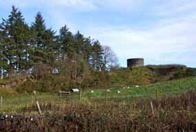
3. Old fort with resevoir on top
Main image: Luke Murray describes the Claddagh
From top left:
1. Walking along the Claddagh
2. Stone wall running along side the Claddagh
3. Old fort with resevoir on top
Annie
“ My Mother often talked about the path that they used through the village…She would go visiting to the neighbours. And she would use it regular, and all the people used it regular. She’d be one of the last of the generation to use it – that would be in the 1950s”.
Kathleen Hussey

“
If you look to the left of the stile the path goes all the way as far as Ballyhaunis through different farmers’ lands, and through a series of stiles. And if you go to my right you can go through a series of stiles as well to the village of Knock - the path would come out on the Kilgarriff road. The pilgrims from Roscommon, in the 1940s and 50s would use that path to get to Knock on the 15th of August.” Rose Duddy


 Sisters Kathleen Hussey and Rose Duddy
Top: Rose Duddy and Kathleen Hussey describe the stile and the path which stretched from Ballyhaunis to Kilgarriff
Above: Back to the bus in Larganboy
Sisters Kathleen Hussey and Rose Duddy
Top: Rose Duddy and Kathleen Hussey describe the stile and the path which stretched from Ballyhaunis to Kilgarriff
Above: Back to the bus in Larganboy
The people from Reask came across the little stream and came the fields…to Larganboy school. There was also an older school…so probably this school was here since the time of the hedge school. The little boreen was to the east side of the school there… we used to call it the Reask Road. And the pathway, the land belonged to a man called Walter Waldron at the time – ‘twas “Walter’s Gate” used be up at the end of it.” Mickey Hopkins


“ Then we come to Jack Kilduff’s, there is also a boreen where generations from Erriff - Nellie McDermot’s people, the Feeneys, Lyons all from there, generations back the years, I’m sure from the time of the hedge-school probably. There’s a little stream with a little plank going across it that they had to cross and even in long winter nights the journey was often done. It was a very busy thoroughfare.” MH

“ We’re here at the crossroads, we’ve the Bog Road and the road to Tooraree and the road to Larganboy and the road to Island Upper… Where we’re parked here now so many people from Island and Larganboy, and from Carrowneden which is across the lake and the bog and across the river from us… so many from each side married each other back the years. And they always visited from village to village, up and down.” MH
At Island Crossroads we park the car and Mike and I walk down the bog road towards the lake. From here Mike points out in the distance a small cluster of trees which indicates the destination for many pilgrims by foot.
“ The first church he (Saint Patrick) built was at the well in Carrownedan… Since Ireland went mobile they go around the road to it now, but in the old years they all went across, and across the Glore River… the day that Croagh Patrick is on.” MH
 Image: Island Crossroads
The old road came along by the lake, and by the ruins of Island House, Mickey Hopkins tells me. This route connected a number of big houses in Coogue, Island, Mannin, and on to Holywell.

“ … at the ruins of the old Landlord’s house in Martin Forde’s field and there’s traces of the carriageway…. that went all the way past here from Ballyhaunis to Coogue.…. but with land reclamation and progress a lot of those things have faded away. But there’s also another branch of it here going to Island Upper and probably going to Holywell or Tulrahan or to any of them other places in them days.”


Opposite
Middle
Top: Mickey Hopkins points towards Island House and the route of the old road page: Left: Ruins of Island house right: One of the houses built in Island by the Congested Districts Board Bottom right: Tour group standing in field which shows traces of old road This page: Above left: Tour group in Mickey Hopkins’ field Above right: Mickey Hopkins, Michael Sloyan and Aileen Lambert
“ I was born here. But the house now is gone. And I used to leave here and go down straight there – there was a well on the left, I’d turn to the right…. and turn to the left again. And it was a straight line then until I got to the other end which was Larganboy Road… and it was about a quarter of a mile over to the school then. Lovely in the summertime, but in the wintertime it was very cold and desolate and lonely. I was the last one from this village. All my neighbours and sisters and brothers were all much older than I was, so I had to go on my own every day down there.”


 Top: Nellie McDermot with Aileen Lambert describing the route to Larganboy
Middle: The well
Bottom: A fence at either side of the path between Feeny’s field and McDermot’s field clearly delineates the route from Erriff to Larganboy
Nellie McDermot Image: Field which shows traces of old road
Top: Nellie McDermot with Aileen Lambert describing the route to Larganboy
Middle: The well
Bottom: A fence at either side of the path between Feeny’s field and McDermot’s field clearly delineates the route from Erriff to Larganboy
Nellie McDermot Image: Field which shows traces of old road
Standing at the gate of Mickey Hopkins’ field, a gate they call Delaney’s Gate, we look south, up into the field where the old road used to run.
“
That was the fence on the right hand side, and over there you can see about twenty yards across from it would be the remains of the fence on the left hand side and the road came straight down here from Island road above down to the old house down here.” Martin Forde


 Main image: Tour group walking to top of Feeney’s field to see across to Larganboy school
Bottom left: Nellie McDermot with Aileen Lambert describing the route to Larganboy
Main image: Tour group walking to top of Feeney’s field to see across to Larganboy school
Bottom left: Nellie McDermot with Aileen Lambert describing the route to Larganboy
“ Young and old would walk to Knock so parents and children would go. And then when you were coming back you’d walk home with the same people, from your village… and then very often we’d see people going up to first mass in Bekan when we’d be on our journey home.” Geraldine Lyons
Speaking with Christina Johnston on the street near her house, she points to some large Sycamore trees in front of Lyons’.
“ We never used the road to go to our grandmother’s house in Greenwood. We went up by those two Sycamore trees, there was a ditch there. And we walked through about eight fields and it took us to Greenwood. And in one of those fields there was the ‘fóidín mearaí’, which if you stepped on it you could go astray and arrive very much off course.” Christina Johnston
Martin Lyons’ Well“ If you look over there directly opposite you, you’ll see a tree standing there and that tree is just at the side of the ditch where our well was. There was a tradition then in this area here, we’ll say the upper end of the village… people would go to the well. But when they’d go to the well they’d come here to the pond and there were about three steps there on the right-hand side of the pond, and people would climb the steps, and they would walk across the top of the ditch over to the well. Nobody ever walked in the field going to that well.” GL

 Opposite page Ned’s Hill Image Site of Lyons’ Well
“ We always called it Raftery’s Road because of the family that lived up at the top of the hill. And they always had a great horse and they’d go to Ballyhaunis for all the bagged stuff with a big black horse. And she’d one white eye and one brown eye…and she knew the way to Ballyhaunis herself.
This was a haven for nests and birds, and often we’d hear the cuckoo up there. And magpies used to build up there as well ‘cos the later stage of the Raftery family, they didn’t have children. So the magpie was always supposed to build where there was no children and no interruption.” CJ
In Irish mythology, Dolmens are frequently called ‘Leaba Dhiarmada agus Ghráinne’, which means ‘the bed of Diarmaid and Gráinne’. According to the legend, Diarmaid erected the constructions for the couple to sleep in while on the run.

“ When we were children going to school Diarmaid’s stone was a great landmark. They passed this route (Diarmaid and Gráinne) when they were travelling throughout the country. And he’s reputed to have carried that big stone up on his back up from the shore of Bekan Lake and placed it here.” CJ


Standing at Tully Crossroads Mike Kelly explains:


“ If you go back to the map of 1838 you’ll find that just a little bit east of here was the village of Tully and there were about fifteen houses. The access road from the main road here ran parallel to the existing road but a little east.” MK
 Top: Walking from site of Tully village to Tully Bog
Middle left: Mike Kelly and Seamus Morris at site of Tully Village
Middle right: Close up of sapper’s mark
Bottom left: Ditch containing a sapper’s mark, a benchmark indicating height above mean sea level which was placed there by the engineers and surveyors who first mapped the locality for the Ordnance Survey in the 1830s
Top image: Raftery’s Road
Bottom left: Bekan Lake
Top: Walking from site of Tully village to Tully Bog
Middle left: Mike Kelly and Seamus Morris at site of Tully Village
Middle right: Close up of sapper’s mark
Bottom left: Ditch containing a sapper’s mark, a benchmark indicating height above mean sea level which was placed there by the engineers and surveyors who first mapped the locality for the Ordnance Survey in the 1830s
Top image: Raftery’s Road
Bottom left: Bekan Lake
“ It’s obviously been several years since this thoroughfare was used by even people bringing turf from the bog, which I’d say would be the last time it was used.

So you can see Knock shrine there just off to your right, so obviously it would have been a much shorter cut for people living in this area here to come down and across here”.

 Vinny Kelly
Seamus Morris tells us that you could hear the mass in Knock while working in the bog.

 Main image: The Bog Road in Tully Bog
Left inset: Croghery Lake
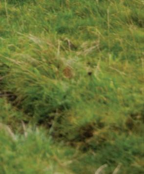
Right inset: Luke Murray points out where the group disturbed a hare sitting on her set as they crossed the field to take in the view across the bog to Knock
Main image: The Bog Road in Tully Bog
Left inset: Croghery Lake
Right inset: Luke Murray points out where the group disturbed a hare sitting on her set as they crossed the field to take in the view across the bog to Knock
“ Mayo County Council was responsible for encouraging turf production… it would have been a hive of activity, up to a hundred men at a time working on this bog, so the road was actually built to take out the turf.” MKTop: Taking in the view in field adjacent to the bog.
“ You see, the Finnegans (Mick’s family had a mill just downstream on the opposite side of the road) had the rights to the water, because it was even before this one (Morley’s Mill), and I’d an uncle that remembered when they were working like… and he used to say to me that he’d have to come down and tell them ‘Let the water go’. But this man then had a brainwave, and he dug a canal all the way… do you know Bekan Graveyard? And there’s a lake just the far side of that, and he dug what they call a canal, all the way over there and you see he had rights to the water then…. He could claim half the water then.” Mick
 Finnegan
Pat Flatley’s route to school took him up a lane almost opposite his house, known locally as “The Roadeen” out into the field on the left through a gate which is no longer there, and across by the fort in Culliney’s, which on the day of the tour we reached from Liam Lyons’ yard. Another who used this route was Mary Waldron, whose house is at the very end of the road which leads in through Knockroe and into Lasanny. Should her road continue through one more field it would reach the other road. To call the crossing of this field a shortcut is a massive understatement. It is clear from the map that to go by the road the journey would in fact be perhaps thirty times longer. The crossing of this field was the first part of the shortcut to Bekan school for Mary Waldron.


 Top image: Walking the lane which was the start of the shortcut from Pat Flatley’s house to Bekan
Bottom image: Aileen stands on the ditch where a gate used to open into the field and the shortcut continued in the direction of the fort
Main image: Ruins of old Mill at Lissaniska
Top image: Walking the lane which was the start of the shortcut from Pat Flatley’s house to Bekan
Bottom image: Aileen stands on the ditch where a gate used to open into the field and the shortcut continued in the direction of the fort
Main image: Ruins of old Mill at Lissaniska
Top: Aileen describing the shortcut as it was described to her with the help of those present


Middle: Pat Flatley points out the route towards the fort to Tony Carney

Bottom left: Row of trees which follow the path of the shortcut towards the fort
Bottom right: Waiting at Pat Flatley’s to join the tour
 Top image: Crossing the stile at Porteen Gap from Liam Lyons’ yard
Bottom image: Crossing the Porteen field to the stile which leads into Culliney’s Fort Field
Top image: Crossing the stile at Porteen Gap from Liam Lyons’ yard
Bottom image: Crossing the Porteen field to the stile which leads into Culliney’s Fort Field


“ There were three piers here… There was an eight foot gate there, and between those two piers there was a stile. This gateway was quite close to the road.


We’d cross the stile, come in the gravel street, by a range of buildings on that side where that huge building is now, and we’d come…right round by the back of this house”. TC
“ And can you imagine my Grandmother for instance, she used to travel this route and climb that step with two baskets of eggs and walk all the way to Ballyhaunis.” Liam Lyons

 Top left: The route to school went around the gable of Lyons’ old cottage
Top right: Walking through Lyons’ yard
Middle: Bus in Lyons’ yard
Bottom: Liam Lyons and Tony Carney discuss the site of the old piers and gate which is marked on the ground
Top: Crossing back into the Porteen Field after visiting the fort in Culliney’s field
Middle right: Christina Johnston and Nellie McDermot
Top left: The route to school went around the gable of Lyons’ old cottage
Top right: Walking through Lyons’ yard
Middle: Bus in Lyons’ yard
Bottom: Liam Lyons and Tony Carney discuss the site of the old piers and gate which is marked on the ground
Top: Crossing back into the Porteen Field after visiting the fort in Culliney’s field
Middle right: Christina Johnston and Nellie McDermot
“ Now this stile is overgrown… it’s right there in front of you now. That’s a watercourse, the water runs that way. And there’s one large stone here for a foothold to hop over the river. It’s only… less that a metre wide, maybe two foot.


And I could tell if my mate had gone to school before me, with his footprint, in the mud. And, do you know why? Because that time from early March until as long as you could put up with it…without shoes… ‘til the back end of September, maybe October. If he had gone before me, and I seen a print, I’d know whether it was his or not. And the reason for that was his second toe was longer than his big toe. And if he went there he’d leave the imprint and I’d say ‘ah, he’s gone’…” TC
“ Crossing the Trickle (so called because there was always a steady stream of water flowing) was probably the most challenging part of the journey. One morning I can remember letting the sod of turf I was carrying for the school fire fall into the stream, needless to say that sod of turf spent a while on the school hob drying before it achieved its original objective and much to the disgust of the teacher.” LL
Image: Tony Carney standing in the Far Cruchán pointing across The Trickle to the Priest’s Big Field“The Burkes of Bekan were the big landowners around here back in the 18th and 19th centuries. Right here beside Bekan Cemetery is the site of an old Burke House. This house and approximately 30 acres of the land became the property of the church in the early 1900s and the Burke house was used as a presbytery from then on.
The priests used the existing shortcut across the fields as they journeyed back and over from the church to the house. The path was widened and gravelled and regularly maintained for the priest’s convenience, and this proved equally convenient for the regular path goers.


It was, I am told, quiet an impressive place in those days with a very large house, out office, stables, and a coachouse surrounded by high stone walls and mature broadleaf trees.” LL
 Top: Bekan Graveyard
Bottom: Walking across field (site of old Burke House) beside Bekan graveyard towards the Leachtaí (or Páirc na Leachtaí)
Top: Bekan Graveyard
Bottom: Walking across field (site of old Burke House) beside Bekan graveyard towards the Leachtaí (or Páirc na Leachtaí)
“In former days now, you wouldn’t have to ask where was the right of way, because in fact it was worn down. There was never any grass in it, you know…


And down there was the priest’s house, that’s gone now. And what a pity because it was all cut stone, beautiful cut stone and flower gardens and everything… You can’t imagine now the beauty of that place seventy-five years ago. Anyway, we didn’t take much notice as children, we were worried about getting skelped when we got to school.” TC
Standing at the gateway into the next field: “This is what’s called a kesh – in other words it’s a crossing over a river… This is the river that comes out from Bekan Lake. It’s generally accepted that it’s the commencement of the Robe river.”

“ This is the step: one, two and out across… If you can imagine the Lassanny people…it was an awful long trudge for kids. At that time you didn’t have a big heavy bag of books like the kids have now… so you had your books under your arm, you know. You’d two or three books and a bit of twine around them, and you’d two sods of turf here if it was wintertime.” TC
“ The legend of St Béacán, if indeed he ever actually existed, goes back quite a way in local tradition. A local man, Willie Kelly, who I knew in my young days serving mass, was local church sacristan – according to him St Béacán did actually exist and was born in Crohery townland in Lissaniska…. The circular stone mound outside the cemetery wall with the remains of the old iron cross on top is generally believed to have been his last resting place.” VK
“ Isn’t it forced on us to believe what we’re told from the people that came before us…other than that it’s a guess. What I think about this if you look at it, it’s definitely put up to commemorate something – most likely a burial. The land has been elevated here somewhat, hasn’t it, which suggests that there could be chamber down here you know, and possibly a roof on it.” TC
“ Up along here, that was where the range of buildings was for the old house, the old buildings and he’d have his pony and stock tied in there. That was his private road out to the cemetery gate when he’d be going to mass with his pony and trap.


They demolished a building here, and he sowed a line of trees along here. And the children… in fact, everyone – more than children used to use this; people coming to mass and coming to confessions, coming to the shop, or wherever, they had to keep inside that line of trees. They extended all the way over to the church – but they’re gone now – this is just one of them”. TC
 Main image: Tree lined route by site of the old landlord’s outhouses
Top left: Gateway on route at the Kesh in Moloney’s land Centre left: Walking along by the line of trees
Bottom left: Arriving at the wicket gate, also known as the Fuirl-a-gig gate, at the priest’s house
Image: The mound of stones which is purported to be the grave of St Bekan or Béacán
Main image: Tree lined route by site of the old landlord’s outhouses
Top left: Gateway on route at the Kesh in Moloney’s land Centre left: Walking along by the line of trees
Bottom left: Arriving at the wicket gate, also known as the Fuirl-a-gig gate, at the priest’s house
Image: The mound of stones which is purported to be the grave of St Bekan or Béacán
Arriving in by the side of the current presbytery beside the church in the centre of Bekan Village. The old school building, which was the destination of so many journeys taken along this route is now the Community Centre opposite the Church.
Standing in the middle of the Sports Field, the last field to cross before reaching the current presbytery, Tony points to and describes the end of the route: “That’s the church spire there, can you see it? Well you see the continuation of this fence up there, can you see something white up there? Now that’s the exit point into the church grounds from the land. And there’s a little wicket gate there… in by the church then and down the steps, and into school.” TC
 Main image: Participants walk the last few steps of the old shortcut from Lassanny to Bekan.
Sites relating to old routes in the Ballindine and Tulrahan areas were visited in a two-part tour on Saturday 18th September. In Ballindine, a variety of sites, ranging from prehistoric forts and early Christian sites to the Castlemagarret Estate and the railway, provided the talking points of the tour.
 Image: The Double Bend in Garryduff

VILLAGE
1 > Old Road at back of Community Centre
2 > Disused Railway
CASTLEMAGARRET
3 > Walshes’ Old Farm
4 > Crossboyne Entrance
5 > Christina’s Bridge
6 > Bow Gate
7 > Five Arches Bridge
8 > The Double Bend
GARRYDUFF
9 > Rocks’ Bridge
10 > Old Church
1916 COTTAGE
11 > Drain
12 > Old N17 and Castlemagarret Entrance
SKEHAVAUD 13 > Fort
CLOONRANE 14 > Old Road, Railway, and Dolly Hopkin’s Cottage
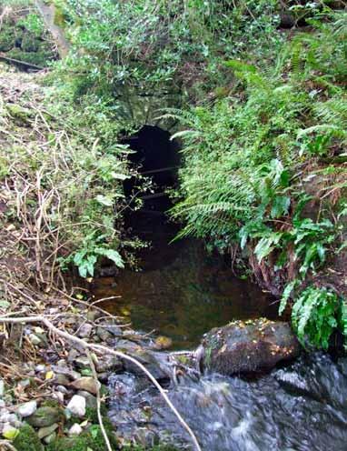
CLOONMORE 15 > Souterrain
 © Ordnance Survey Ireland. All rights reserved. Licence No. 2009/17 CCMA / Mayo County Council.

“
As we showed you, there is an old map of Ballindine which shows that there was a road actually running in where the old school is, or it is now known as the Community Centre. A road ran there in line with the Logalisheen - Ballyhaunis road, as we would know it, and then exited on the station road. It was short… about 150 –200 metres.” Anthony Gallagher. This old stone wall appears to run along the route of the old road as it is marked on the map, and was likely the original fence on one side of it.


Here the old railway runs parallel to the N17 and the village of Ballindine. Each time a test train does a run on the track the road must be dug up to allow the train to run on the tracks, and the road must be re-tarred again. This photo was taken close to where the old road used to join up with Station Road.
Image: The old railway crossing on the Station Road, Ballindine Opposite page: Old stone wall at back of Community Centre
This straight route leads to the ruins of an old farmstead, referred to as Walsh’s Old Farm. The Walsh family were herdsmen on the Castlemagarrett Estate. While the lane ends at the old buildings a trace of the route remains visible running further north. Formerly this joined up with an old route which used to come out at a point on the N17 beside the old football pitch.

 Image: Old route is visible in fields by Walsh’s farm
Castlemagarret
Entrance, Crossboyne


The current stone wall and pillars here are a recent construction, but Matt Macken describes the former entrance with the aid of an old photograph:
“I have a photograph here of what the entrance looked like. Fine stone pillars, well cut, and lovely railings and a very ornate gate, which I think came all the way from Italy”.
Matt Macken“
On the top of these two pillars on the left and right hand side of the main gate, there were, I think, two eagles, which must have been taken down for fear, I suppose… during the troubles in the 1920s … they appear to have been taken down at that particular time.” MM
“Christina’s Bridge is called after Christina Guthrie. And she was the wife of the second Lord Oranmore and Browne. The Guthries were a very well established Scottish family, with a lot of wealth – they owned coalmines in Scotland and further afield in South Africa as well.” MM

 Image: Ruins of the Old Castlemagarret Castle


“There’s just an ordinary iron gate there at the moment…That was the entrance to Castlemagarret from the Crossboyne side. It was a lovely gravel road with a lot of twists and turns… thinking back you can imagine the Lord and Lady and the coach and horses. Just a few yards in there’s a lovely waterfall. It must have been a beautiful scene of a lovely Spring morning”. MM
 Main image: The Five Arches Bridge
Top left: Walking toward Five Arches Bridge from the Bow Gate
Top right: Viewing The Five Arches Bridge. and the river Robe
Right: Plaque on Five Arches Bridge
Main image: Aileen Lambert, Mike Kelly and Ger Corr at the site of the Bow Gate, a formerly impressive entrance to Castlemagarret.
Main image: The Five Arches Bridge
Top left: Walking toward Five Arches Bridge from the Bow Gate
Top right: Viewing The Five Arches Bridge. and the river Robe
Right: Plaque on Five Arches Bridge
Main image: Aileen Lambert, Mike Kelly and Ger Corr at the site of the Bow Gate, a formerly impressive entrance to Castlemagarret.

“ Crossing the River Robe is the Five Arches Bridge, which has recently been refurbished by the Concannon family. That bridge was of major importance, say a hundred or a hundred and fifty years ago….It was the Claremorris - Dunmore - Tuam Road. It used to come out a few miles further toward Ballindine, out by the 1916 cottage.” MM


“ This was known as the Double Bend. And the reason for it was that Lord Oran was able to use influence to get a turn put in the road, so that when he would be entering his estate or coming out of his estate he would go straight through …whereas it would bend for everybody else.”
Jarlath Mullarkey
Top: The Double Bend, facing towards Garryduff Bottom: Section of the old road west of the Double Bend which now operates as a link road between the old Claremorris road and the N17 Top: View of the Five Arches Bridge with the Five Arches House in distanceMain Image: Rocks’ Bridge
Bottom Left: Old railway sleeper used as a fence, Garryduff


Middle: River Robe at Rocks’ Bridge
Bottom right: Railway crossing on River Robe, Garryduff


“ There were three main churches apparently in this area… Well, on the tour it was actually pointed out to us where there was a fourth church (by Ger Corr –Anthony and his daughter Patricia have since identified this on an old map). But the three main churches were Kilvine, supposedly St Patrick’s sister or follower founded that in St Patrick’s time, so that would obviously be the first. Then there was Cloonmore church, between Ballindine and Irishtown, and Kilcurnan, or Garryduff which we know it as. Folklore has it that the three of them were knocked on the one day by Cromwell.” Anthony Gallagher
“ We’re here on the old Claremorris Road between Ballindine and Claremorris. I call it the old road because it was the road which was in existence before the new road was made (the N17)… about twenty years ago now. This bridge was named Rocks’ Bridge. And the reason was… no great historical significance… right beside us here a family by the name of Rocks’ lived. It’s over the River Robe. It’s a concrete structure, I think it was erected in 1925. If I’m not mistaken, the original bridge, I think it was a timber structure but it had been destroyed during the War of Independence.” JM
This drain was constructed to drain the lake which existed in Skehavaud.
“ There is a map which shows that the lake was in existence around 1820. So, some time after that this underground drain was dug, and a manmade stone tunnel built and backfilled then over it. That would run for approximately 500 yards. It has been largely forgotten even though it’s very significant. Having viewed it after this trip and this tour… it would be nice to walk the length of it and see how well it is constructed inside.” AG


 Main image: PJ Barrett talks about old N17 and drain
Top left: Bus pulled in on old section of N17 which now lies to the west side of the current N17
Top right: Michael Lavin and PJ Barrett
Main image: PJ Barrett talks about old N17 and drain
Top left: Bus pulled in on old section of N17 which now lies to the west side of the current N17
Top right: Michael Lavin and PJ Barrett

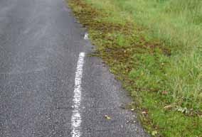


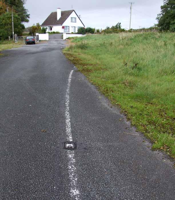
 Top image: White line of former N17 road
Main image: Standing on section of old N17, adjacent to current N17. This is now a cul de sac with private housing.
Main image: Sheep track in field where route to Castlemagarret ran
Top inset: Decorative pier at entrance to Castlemagarret adjacent to 1916 cottage
Middle inset: At entrance piers beside 1916 cottage
Top image: White line of former N17 road
Main image: Standing on section of old N17, adjacent to current N17. This is now a cul de sac with private housing.
Main image: Sheep track in field where route to Castlemagarret ran
Top inset: Decorative pier at entrance to Castlemagarret adjacent to 1916 cottage
Middle inset: At entrance piers beside 1916 cottage