


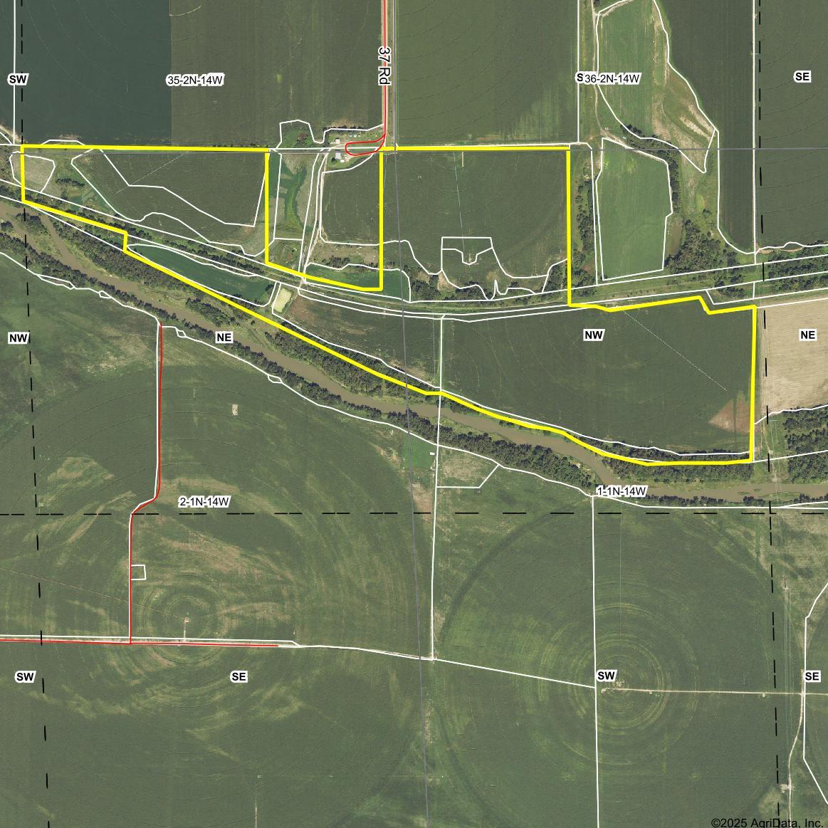
LEGAL DESCRIPTION:

LEGAL DESCRIPTION:
River Lots One (1) and Two (2) of Section Two (2), Township One (1) North, Range Fourteen (14) West of the 6th P.M., Franklin County, Nebraska, less 14 ± acre farmstead. And Part of River Lot Six (6) and River Lots Seven (7) and Eight (8) of Section One (1), Township One (1) North, Range Fourteen (14) West of the 6th P.M., Franklin County, Nebraska.
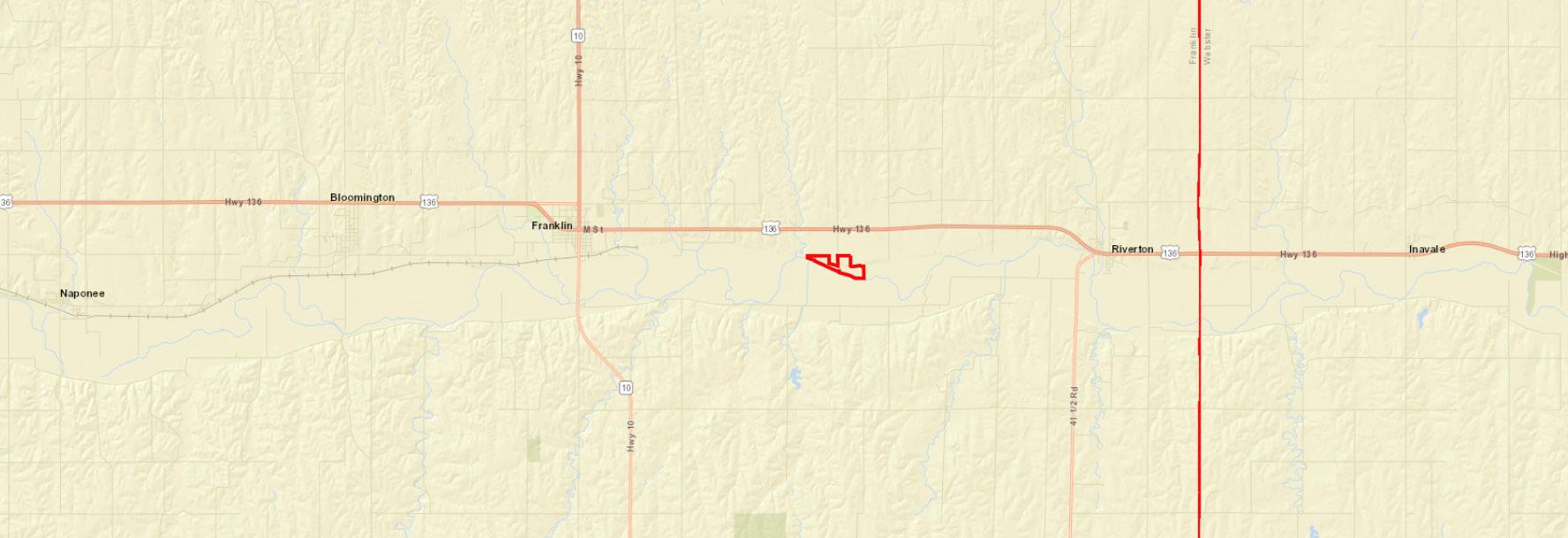
LOCATION: From Franklin, Nebraska: 4 1/2 miles east on Highway 136, then 1/2 mile south on 37th Road, to the northern middle portion of the property.
ACRES & TAXES:
Estimated Tax-assessed Acres | 133 ± acres
Estimated 2024 Real Estate Taxes | $3,340.00 *This property is subject to occupation tax.
LEASES: Farming and hunting rights are open for 2025.
SOILS:
Primary soils on the property consist of Hord silt loam and Coly-Uly silt loam with slopes ranging from 0-30%. The bottomground cropland is productive and nearly level.
NRD: Lower Republican Natural Resources District.
IRRIGATION WELL INFORMATION:
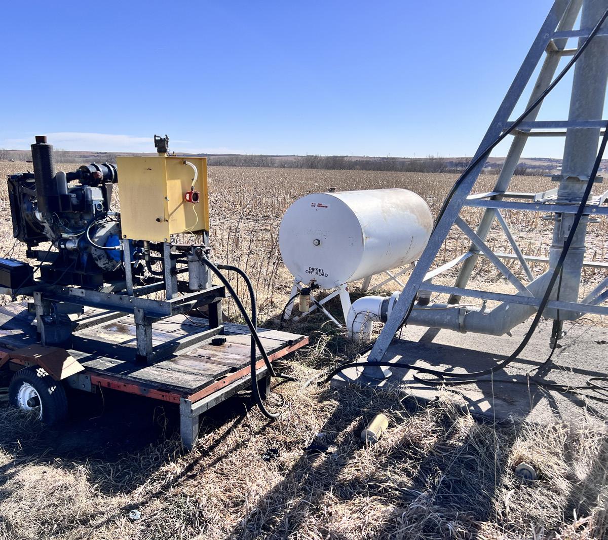
EQUIPMENT & WATER:
FSA INFORMATION:
Well Registration - G-146376 (spring-fed well)
● Completion Date - 1/01/1995
● Well Depth - 0 feet
● Static Water Level - 0 feet
● Pumping Level - 0 feet
● Column - 8 inches
● Gallons/Minute - 400 gpm
Well Registration - G-074884 (inactive)
● Completion Date - 6/04/1992
● Well Depth - 50 feet
● Static Water Level - 41 feet
● Pumping Level - 48 feet
● Column - 5 inches
● Gallons/Minute - 200 gpm
Center pivot irrigation systems. 62.1 certified irrigated acres through the Lower Republican Natural Resources District and 66.0 acres of Bostwick irrigated acres.


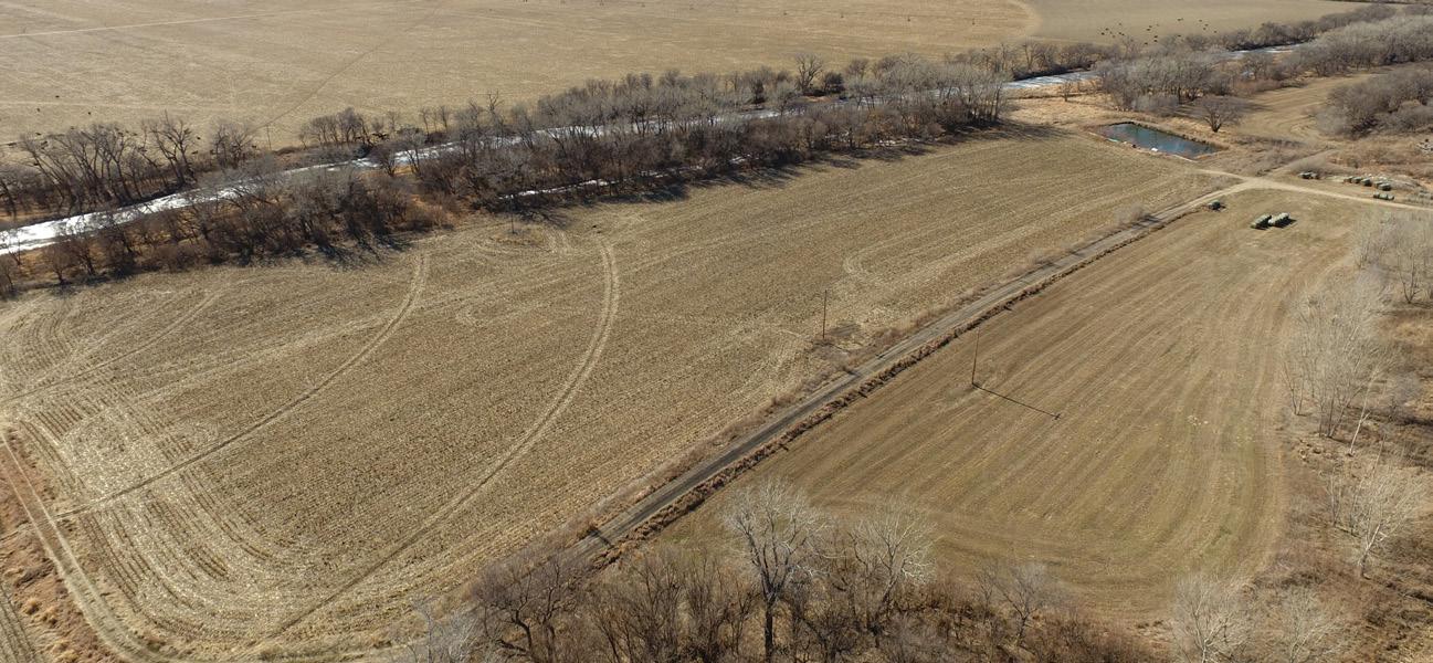
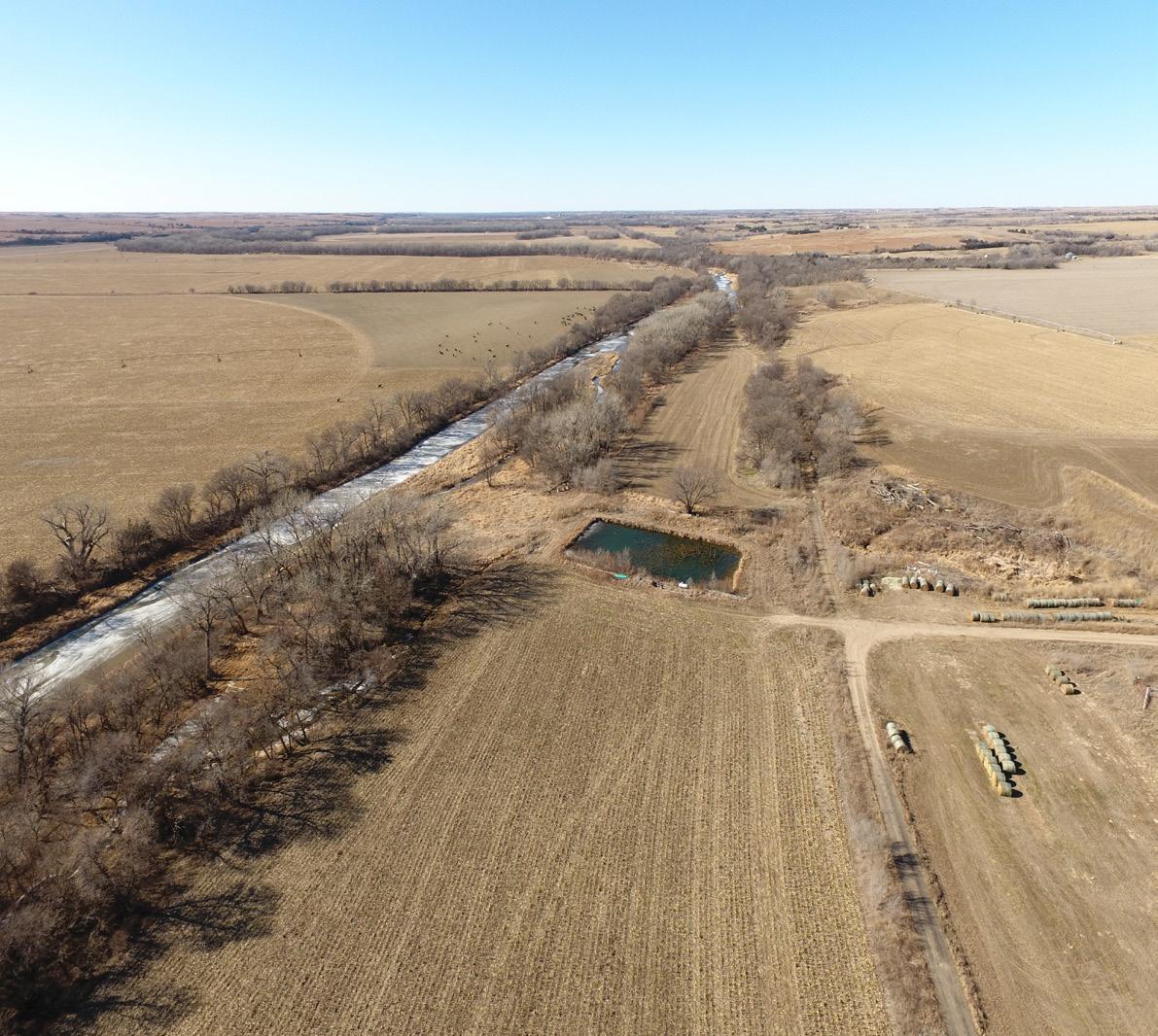

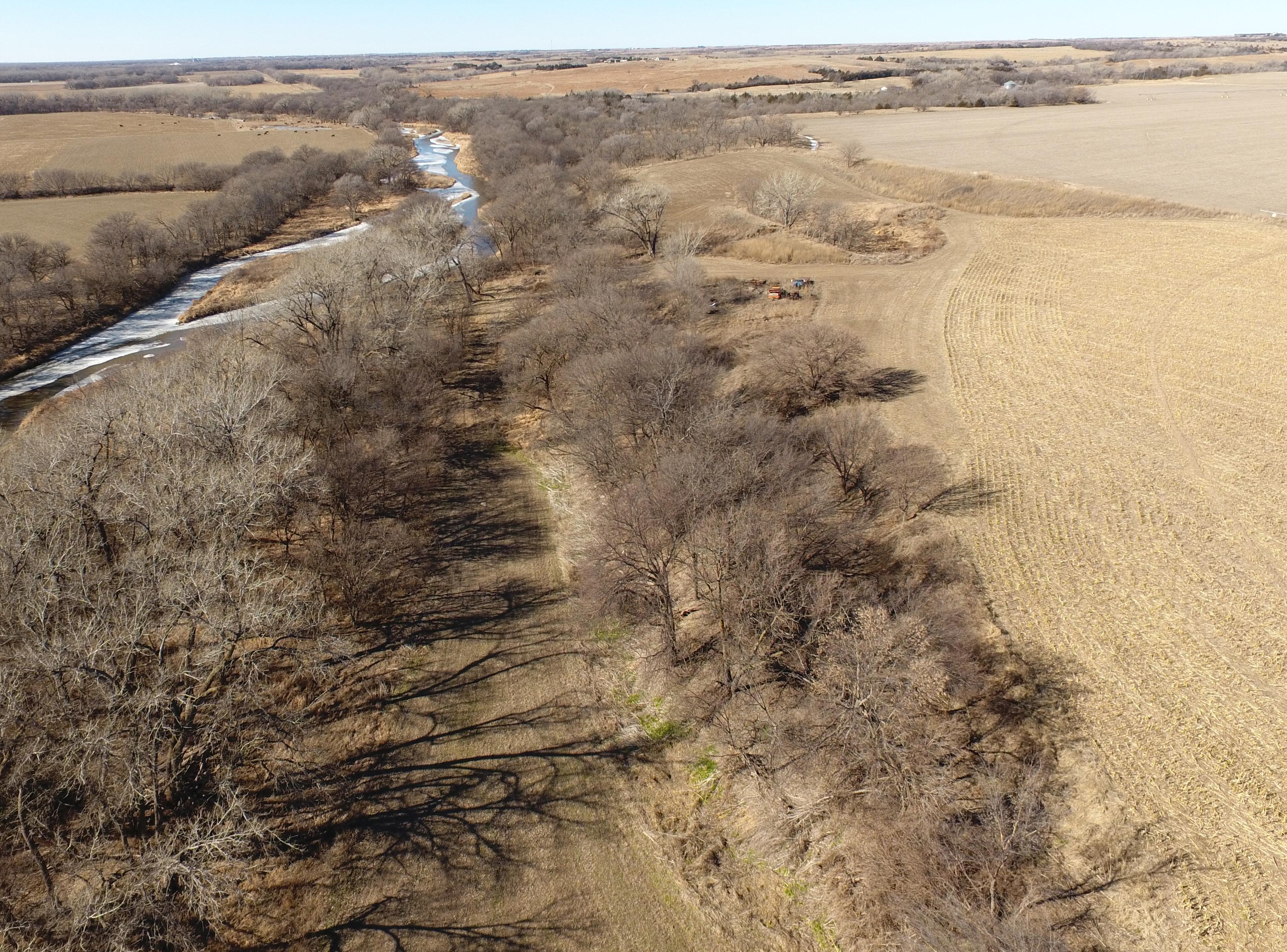
Direct Republican River access, only 1/2 of a mile off of Highway 136! Natural springs attract deer, turkey, predators, and a growing upland game population to this property. Great income possibilities come with its center-pivot irrigated cropland, with both Lower Republican Natural Resources District and Bostwick Water rights. Contact us today so you don't miss this once-in-a-lifetime offering!