


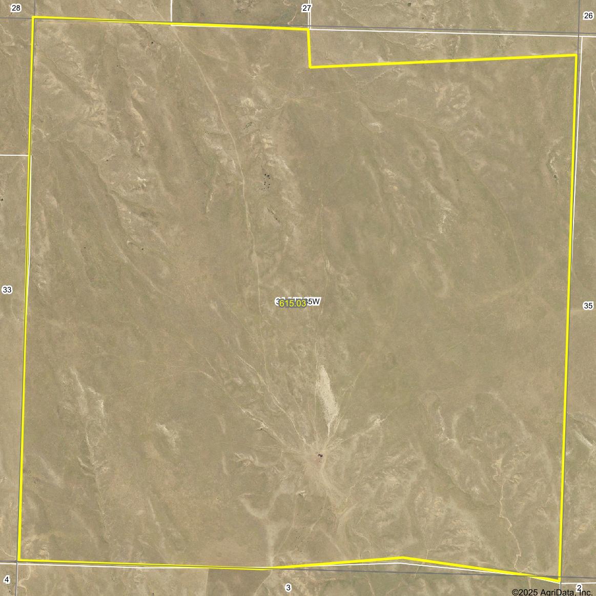

Fence line variances on the north and south sides of the property results in about a 23 acres reduction in the actual acres that are fenced within the property boundary. See map for details.
PROPERTY INFORMATION
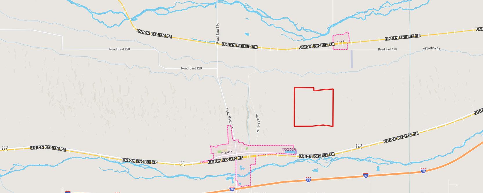
LOCATION & ACCESS: Located two miles east and one mile north of Paxton, NE. This location is between the North and South Platte rivers. Legal access is from Road East 120 going south following the route of a recorded permanent easement dated June 17th, 2014. A copy of the recorded easement is available upon request.
LEGAL DESCRIPTION: All of Section 34, Township 14 North, Range 35 West of the 6th P.M. in Keith County, Nebraska.
ACRES & TAXES: 637.5 Tax-assessed acres
2024 Real estate taxes due in 2025: $2,047.06
EQUIPMENT: Electric submersible well and tank that is the livestock water source for the section, One unregistered stockwell.
FENCING: The fencing is three-wire and some four-wire barbed wire that is in average condition.
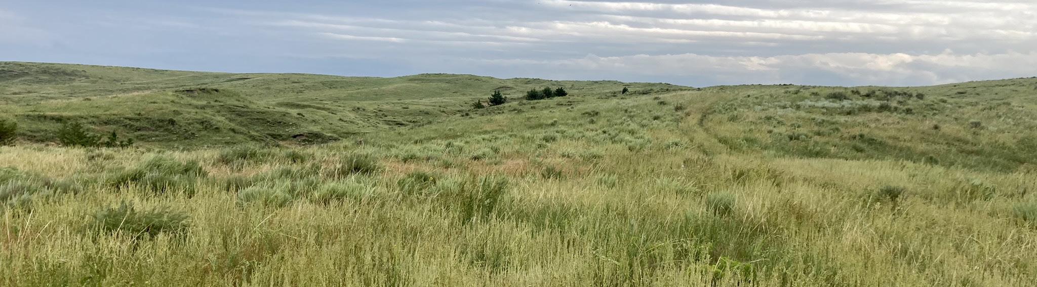
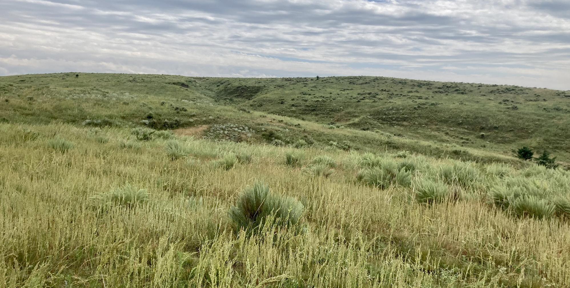
SOILS: Mix of Sarben, Dix-Sulco and Valent loamy and fine sands. The topography and terrain are rolling.
CURRENT LAND USE: 615 acres of fenced pastureland.
POSSESSION: Available for the 2025 grazing season with possession upon completion of closing.