


ABSOLUTE AUCTION Offered exclusively by: Information contained herein was obtained from sources deemed reliable. We have no reason to doubt the accuracy, but the information is not guaranteed. Prospective Buyers should verify all information. All maps provided by Agri Affiliates, Inc. are approximations only, to be used as a general guideline, and not intended as survey accurate. As with any agricultural land, this property may include noxious weeds. Agri Affiliates, Inc. and all agents are acting as Agent of the Seller. Hastings, NE • AgriAffiliates.com • 402.519.2777 120 TOTAL ACRES, OFFERED IN 2 PARCELS AND IN COMBINATION | COLFAX COUNTY, NEBR. Hamaker Land & Farmstead View Full Brochure & Listing 1:OO PM | Howells Community Center 128 3rd Street | Howells, NE (Alternate Weather Date: April 12, 2024) THURSDAY • APRIL 11, 2024 Adam D. Pavelka, JD Mike Polk ADAM D. PAVELKA, J.D. C: 402.984.7744 | E: Adam@AgriAffiliates.com MIKE POLK C. 308.539.4446 | E: Mike@AgriAffiliates.com CO-LISTING AGENTS:
AUCTION INFORMATION
SELLERS
Brant Hamaker & Jackie Hamaker
PROCEDURES
Absolute Real Estate Auction for Brant and Jackie Hamaker. Purchase agreement and title insurance commitment are available through Agri Affiliates, Inc., prior to the auction.
TERMS & CONDITIONS
TERMS: This cash sale requires a 15% earnest deposit at signing of the Purchase Agreement immediately following the auction. The balance of the purchase price is payable in certified funds at closing, on or before May 22, 2024 (cropland) and June 28, 2024 (farmstead). There is no contingency for financing. Sellers to convey title by warranty deed; with title insurance evidencing merchantable title. Cost of title insurance and an insured closing by the title company will be shared 50/50 by Seller and Buyer. Property sells subject to easements, rights-of-way, zoning, and restrictions of record; free and clear of all liens. The property sells in "as-is" condition. No warranty is expressed or implied as to the adequacy of any portion of the property.
POSSESSION: Full possession on Parcel 1 (cropland) granted upon the execution of purchase agreement and payment of earnest deposit. Full possession on Parcel 2 (farmstead) at closing.
MINERALS: All owned oil, gas, and minerals pass to Buyer.
TAXES: Seller to pay 2023 real estate taxes. Buyer to pay 2024 real estate taxes.
ACREAGES: Reported acreages were obtained from the County USDA-FSA office and County Assessor. The farm sells without regard to an exact number of acres. No warranty is expressed or implied as to exact acres. The legal descriptions are subject to existing fence/field boundaries. The property is being surveyed and this cost will be split equally between Seller and Buyer(s).
USDA-FSA: Historic base acres pass to the Buyer, subject to County FSA Committee approval.
NRD: The property is located in and subject to the rules and regulations of the Lower Elkhorn Natural Resources District.
INTERNET BIDDING: To qualify as a bidder, first complete a required phone interview with Agri Affiliates, then setup an account, username, and password in online bidder platform. Final approval as a bidder must be completed 48 hours prior to the auction. Anyone may view the auction at www.agriaffiliates.bidwrangler.com withouth registration.
AGRIAFFILIATES.COM

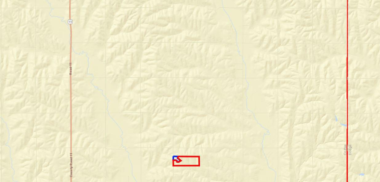


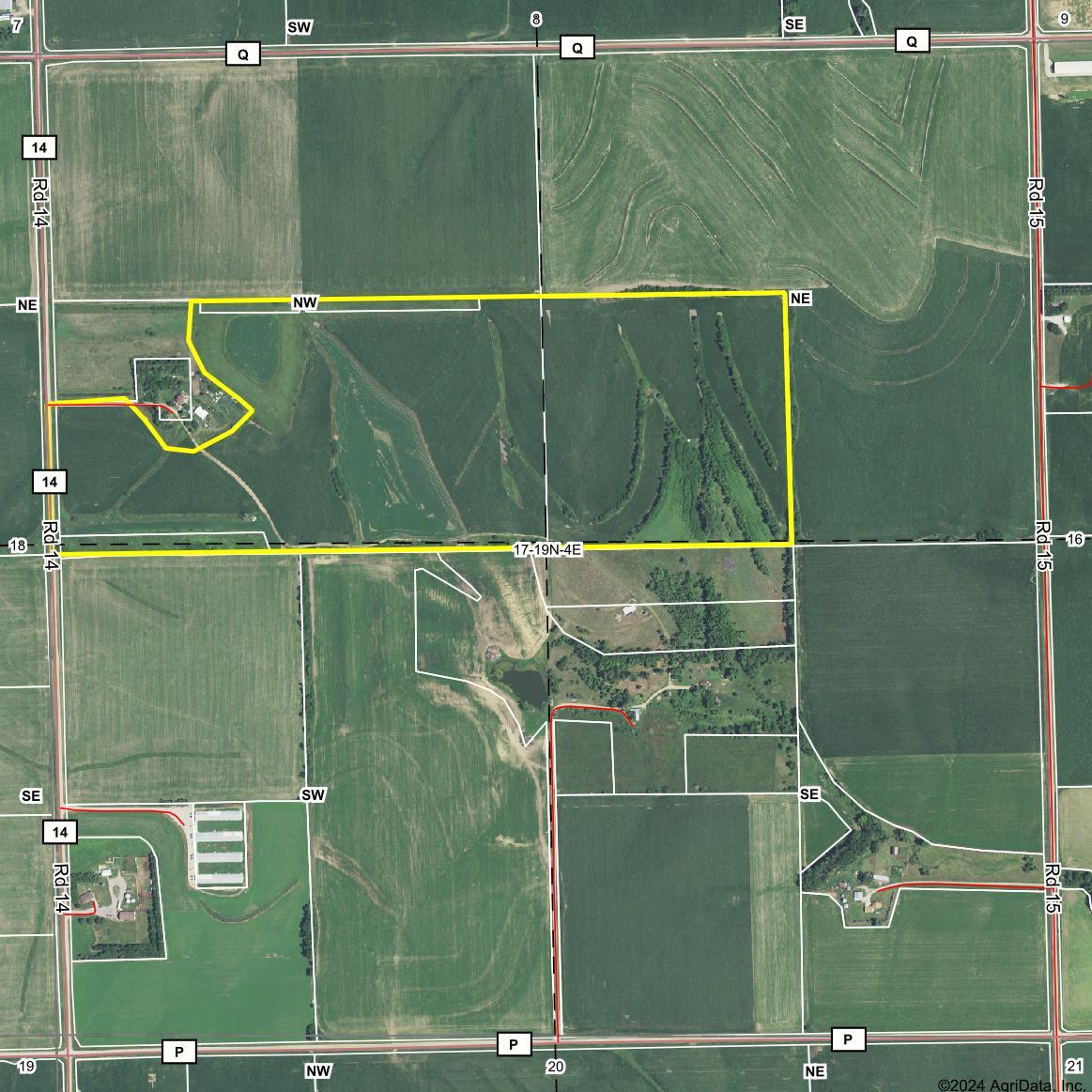


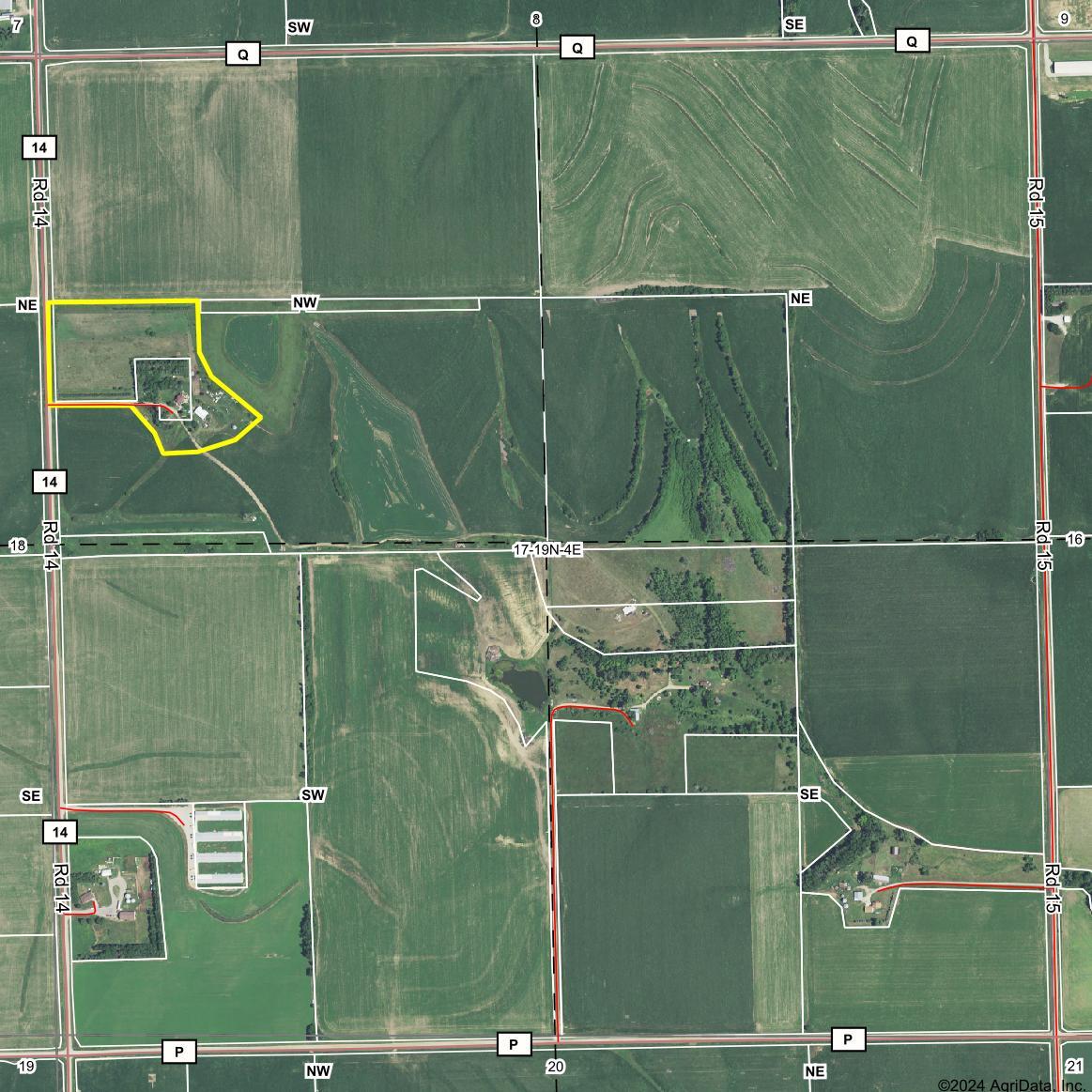

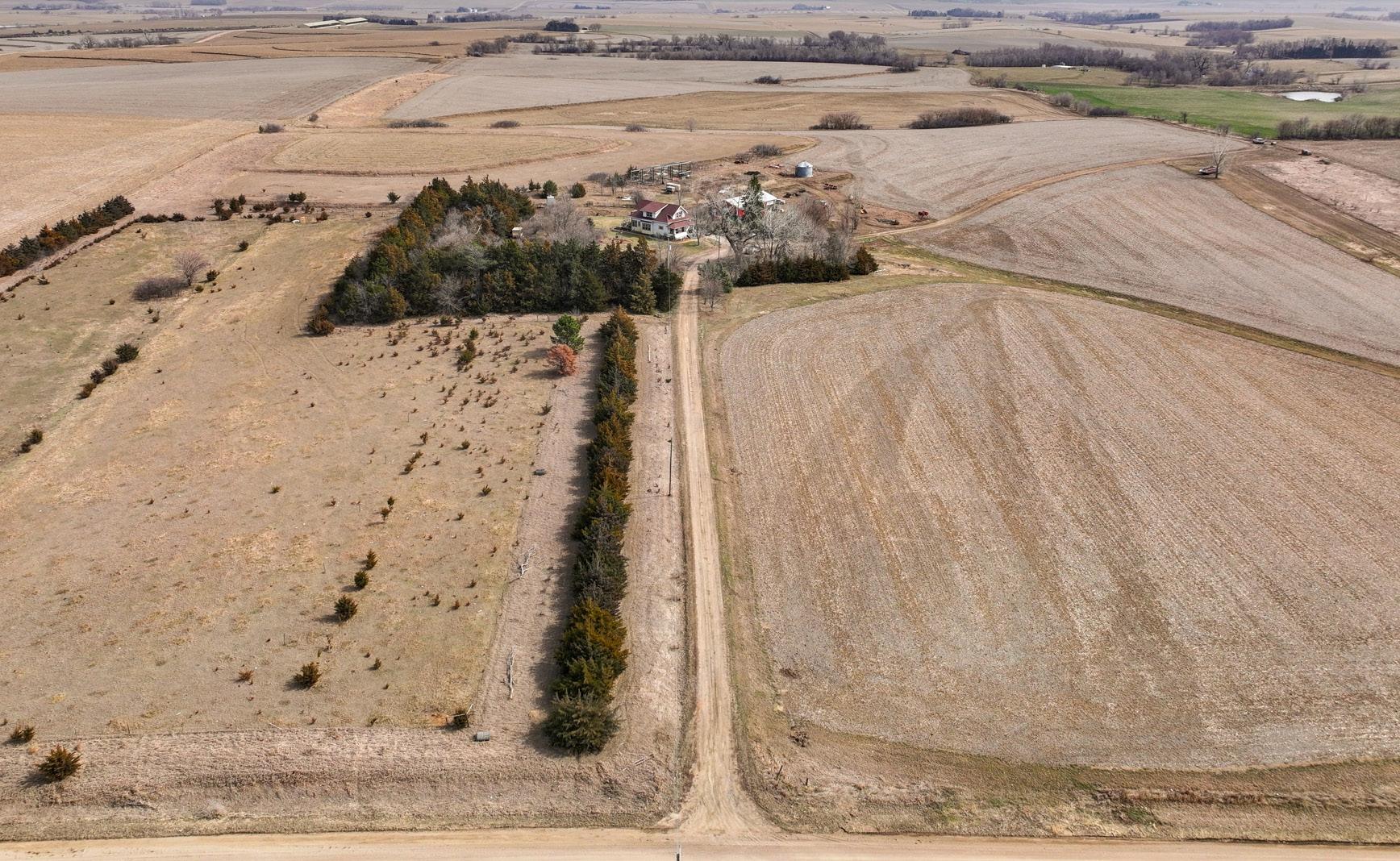
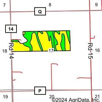
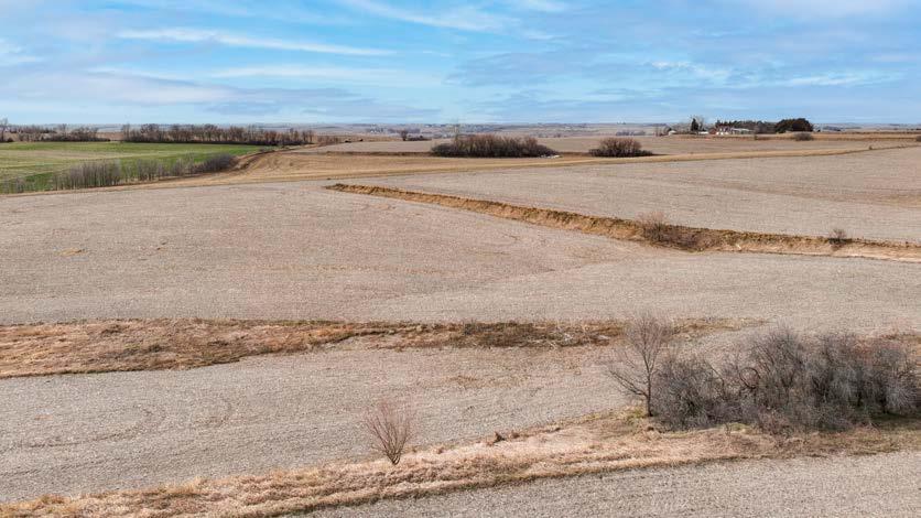
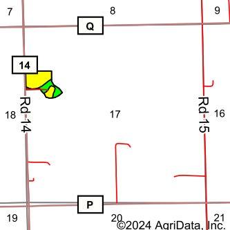
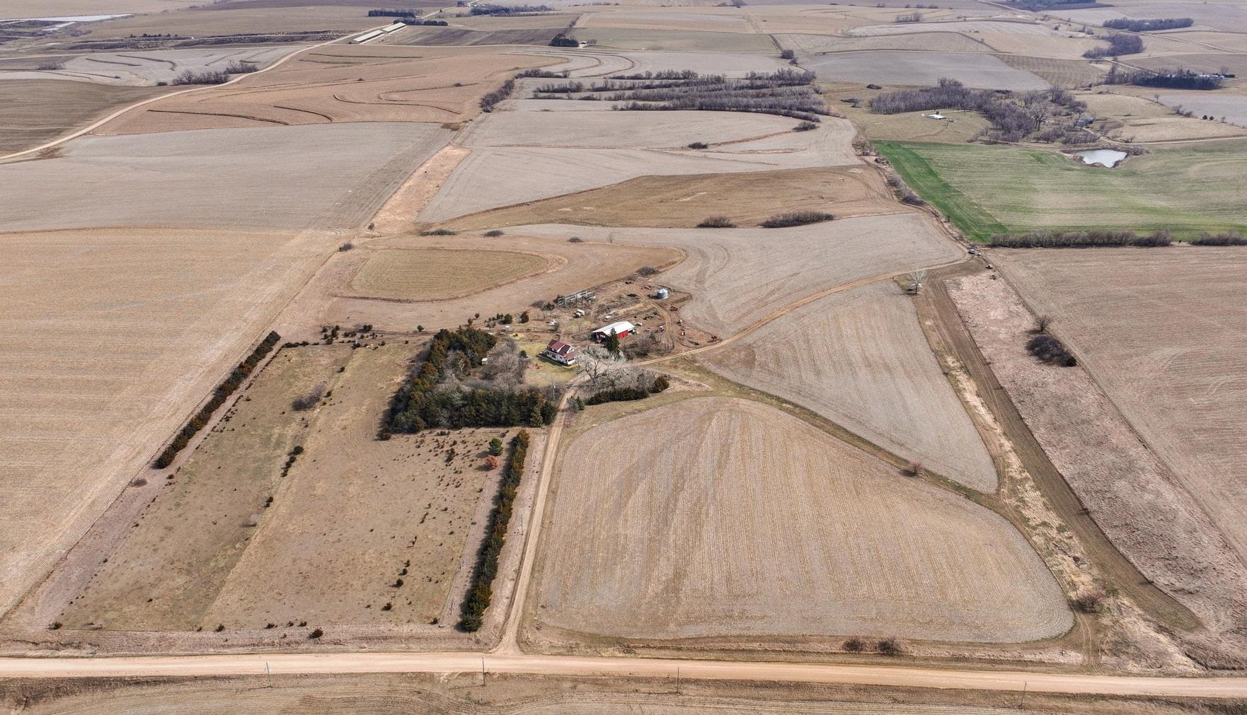
15 Road Q Colfax County Nebraska Boundary Center: 41.621184, -96.995465 Aerial Map 17-19N-4E 0ft Field borders provided by Farm Service Agency as of 5/21/2008. 15 HOWELLS ↑ Boundary Center: 41.621962, -97.000537 Aerial Map 17-19N-4E PARCEL 1 PARCEL 2 Road P Road 14 COLUMBUS FREMONT ← → NORFOLK← This farmstead provides a reasonable commute to Norfolk, Columbus, or Fremont!
PARCEL 1 INFORMATION
LEGAL
DESCRIPTION:
A tract in the South Half of the Northwest Quarter (S1/2NW1/4) and the Southwest Quarter of the Northeast Quarter (SW1/4NE1/4) of Section Seventeen (17), Township Nineteen (19) North, Range Four (4) East of the 6th P.M., Colfax County, Nebraska. (Full legal description to be determined by a survey).
LOCATION: From Howells, Nebraska: 6 1/2 miles south on Road 14, to the northwestern corner of the property.
ACRES & TAXES:
Estimated Tax-Assessed Acres | 107.00 acres
Estimated 2023 Real Estate Taxes | $5,740.00
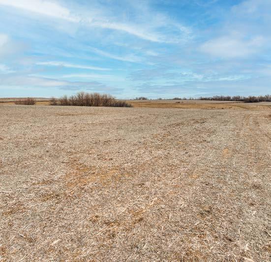
SOILS: Primary soils on this parcel consist of Nora-Crofton complex and Moody silty clay loam, with slopes ranging from 2-11%.
FSA INFORMATION:
Estimated Total Farmland: 112.00 acres Estimated Total Cropland: 110.00 acres
Government Base Acres: Corn - 50.65
Soybeans - 50.65
LEASE: Full possession granted after the auction!
NRD: Lower Elkhorn Natural Resources Distrct.
PLC Yields: Corn - 114 bu
Soybeans - 36 bu
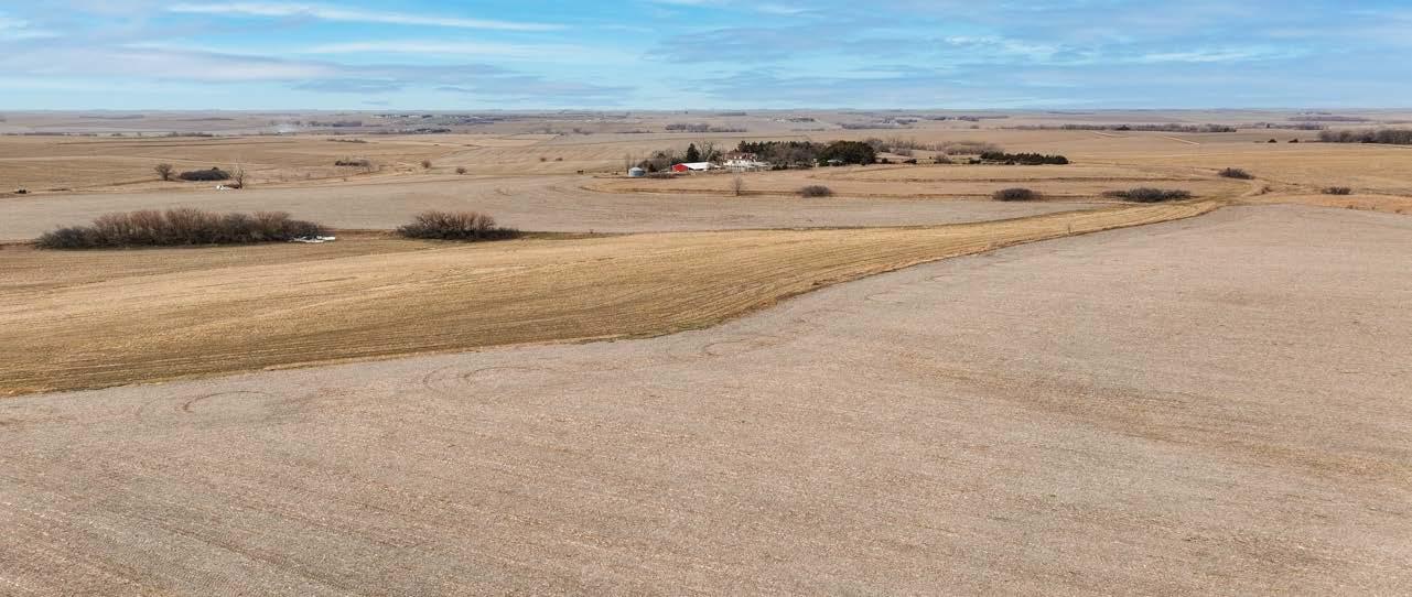
COMMENTS: This is a productive, non-irrigated row crop farm, located in a strong farming community near exceptional grain markets. Local sources of organic fertilizer are also a great plus! The farm also has an established stand of alfalfa on 13.21 acres. The CRP contract on 4.99 acres goes through September 30, 2028 and pays $244.55/acre.
AGRIAFFILIATES.COM
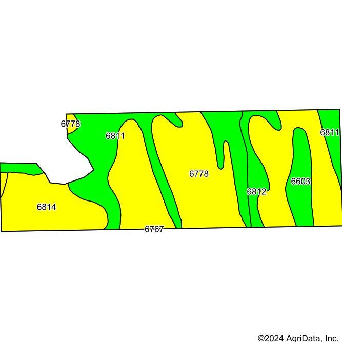

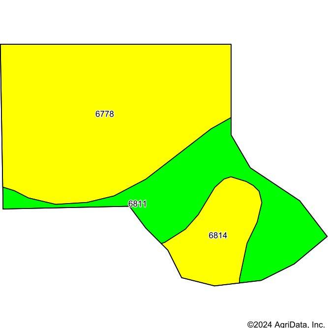
6778NoraCrofton complex, 6 to 11 percent slopes, eroded
6811Moody silty clay loam, 2 to 6 percent slopes
6814Moody silty clay loam, 6 to 11 percent slopes, eroded
6603Alcester silty clay loam, 2 to 6 percent slopes
6812Moody silty clay loam, 2 to 6 percent slopes, eroded
*n: The aggregation method is "Weighted Average using all components"
*c:Using Capabilities Class Dominant Condition Aggregation Method
Soils
Soils
Soils data provided
USDA and NRCS.
AcresPercent of fieldNonIrr Class LegendNonIrr Class *c Irr Class *c *n NCCPI Soybeans
PARCEL 1 MAPS & IMAGES
data provided by USDA and NRCS.
Map
by
Area Symbol: NE037, Soil Area Version: 22 CodeSoil Description
State: Nebraska Colfax County: 17-19N-4E Location: Township: Maple Creek Acres: 105.06 Date: 2/29/2024 Soils
Soils Map Soils data provided by USDA and NRCS. Area Symbol: NE037, Soil Area Version: 22 CodeSoil Description AcresPercent of fieldNonIrr Class LegendNonIrr Class *c Irr Class *c *n NCCPI Soybeans 6778NoraCrofton complex, 6 to 11 percent slopes, eroded 54.07 51.5% IIIeIVe 66 6811Moody silty clay loam, 2 to 6 percent slopes 26.36 25.1% IIeIIIe 74 6814Moody silty clay loam, 6 to 11 percent slopes, eroded 14.02 13.3% IIIeIVe 61 6603Alcester silty clay loam, 2 to 6 percent slopes 5.78 5.5% IIeIIIe 72 6812Moody silty clay loam, 2 to 6 percent slopes, eroded 4.83 4.6% IIeIIIe 64 Weighted Average 2.653.65 *n 67.6
Deer, pheasant, quail, and turkey frequent this property. Excellent hunting!
SOIL MAP
data provided by USDA and NRCS.
*n: The aggregation method is "Weighted Average using all components" *c:Using Capabilities Class Dominant Condition Aggregation Method
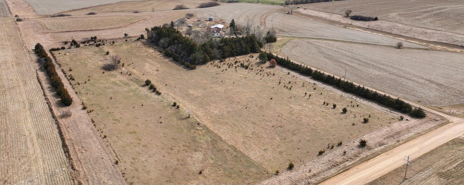
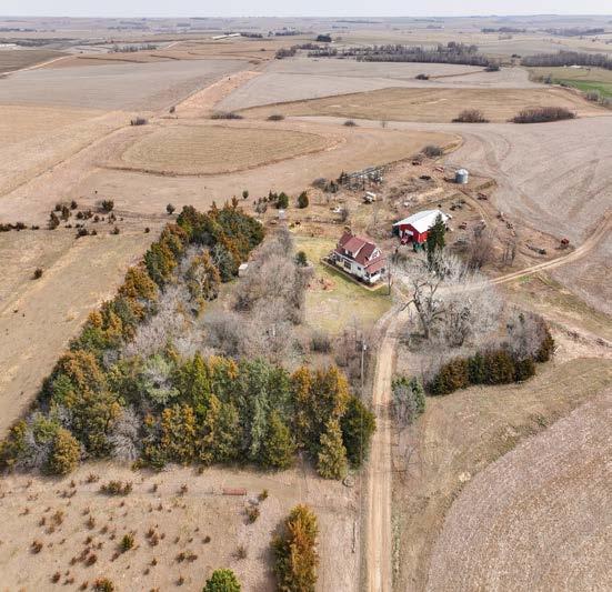
PARCEL 2 INFORMATION
LEGAL
DESCRIPTION:
LOCATION:
ACRES & TAXES:
SOILS:
Building site and pasture in the North Half of the Southwest Quarter of the Northwest Quarter (N1/2SW1/4NW1/4) of Section Seventeen (17), Township Nineteen (19) North, Range Four (4) East of the 6th P.M., Colfax County, Nebraska. (Full legal description to be deteremined by a survey). Also known as 1666 Road 14, Howells, NE 68641.
From Howells, Nebraska: 6 1/4 miles south on Road 14, to the northwestern corner of the property.
Estimated Tax-Assessed Acres | 13.00 acres
Estimated 2023 Real Estate Taxes | $2,725.00
Primary soils on this parcel consists of Nora-Crofton complex and Moody silty clay loam, with slopes ranging from 2-11%.
NRD: Lower Elkhorn Natural Resources District.
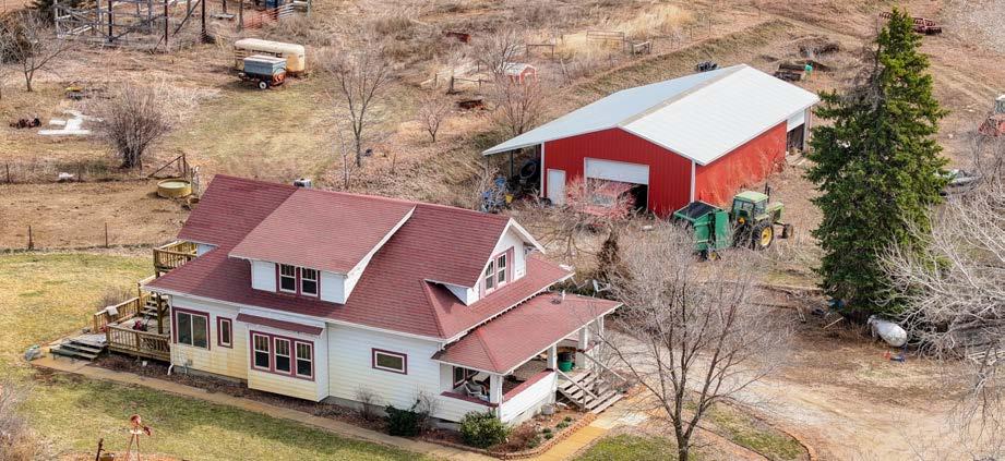
COMMENTS: A premier location for country living:
> 1,862 square foot, two story home
> Original trim and wood floors
> Attached deck area
> Established wind breaks and mature trees
> Exceptional area for livestock
> 1,680 square foot shop building, with cement floor and lean-to
> Chicken coop and other outbuildings
AGRIAFFILIATES.COM
PARCEL 2 MAPS & IMAGES
Soils data provided by USDA and NRCS. Soils Map Soils data provided by USDA and NRCS. Area Symbol: NE037, Soil Area Version: 22 CodeSoil Description AcresPercent of fieldNonIrr Class LegendNonIrr Class *c Irr Class *c *n NCCPI Soybeans 6778NoraCrofton complex, 6 to 11 percent slopes, eroded 7.72 60.8% IIIeIVe 66 6811Moody silty clay loam, 2 to 6 percent slopes 3.36 26.5% IIeIIIe 74 6814Moody silty clay loam, 6 to 11 percent slopes, eroded
State: Nebraska Colfax County: 17-19N-4E Location: Township: Maple Creek Acres: 12.7 Date: 2/29/2024 Soils data provided by USDA and NRCS. Soils Map Area Symbol: NE037, Soil Area Version: 22 CodeSoil Description AcresPercent of field NonIrr Class LegendNonIrr Class *c Irr Class *c *n NCCPI Soybeans 6778NoraCrofton complex, 6 to 11 percent slopes, eroded 7.72 60.8% IIIeIVe 66 6811Moody silty clay loam, 2 to 6 percent slopes 3.36 26.5% IIeIIIe 74 6814Moody silty clay loam, 6 to 11 percent slopes, eroded 1.62 12.8% IIIeIVe 61 Weighted Average 2.743.74 *n 67.5
The aggregation method is
Average using all components"
Capabilities Class Dominant Condition Aggregation Method
*n: The aggregation method is "Weighted Average using all components" *c:Using Capabilities Class Dominant Condition Aggregation Method SOIL MAP
*n:
"Weighted
*c:Using
Don't miss this opportunity to own well-located, productive cropland, or an impossible-to-find farmstead or both, at this absolute auction!
Hastings, NE • AgriAffiliates.com • 402.519.2777