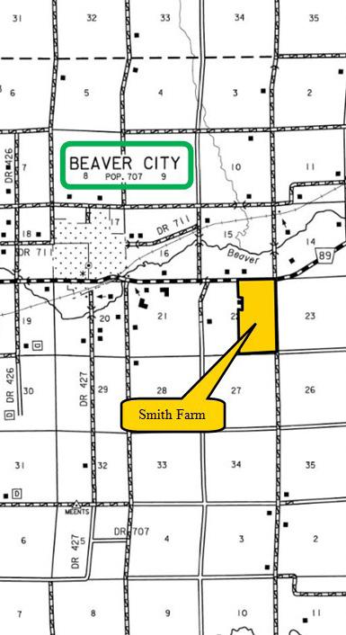
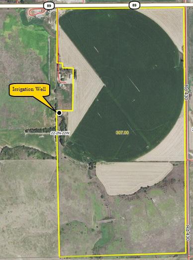
LOCATION: 1.5 miles east of Beaver City on State Highway 89. (Farm located on the corner of State Highway 89 and Road 430)
LEGAL DESCRIPTION: Part of the E1/2 Section 22, T2N-R22W of the 6th P.M., Furnas County, Nebraska. (Final legal description and acres to be determined by a survey.)
The farm
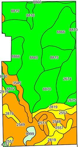
of approximately 307.00 acres of good quality pivot irrigated cropland with gravity irrigated and dry crop corners along with pasture.
Smith Farm - Furnas County, Nebraska
SOILS INFORMATION: Cropland soils consist of very productive Hall, Hord, Cozad, and Holdrege silt loams with slopes of 0-3%. Soils of the pasture consist of Coly, Nuckolls, Uly, and Hobbs silt loams with slopes of 0-30%.
FARM SERVICE
AGENCY
INFORMATION:
IRRIGATION INFORMATION:
Total Cropland: 238.43 acres
Base Acres: Wheat 17.12 acres, PLC Yield 55 bushels per acre; Corn 158.52 acres, PLC Yield 163 bushels per acre; Soybeans 41.66 acres, PLC Yield 54 bushels per acre.
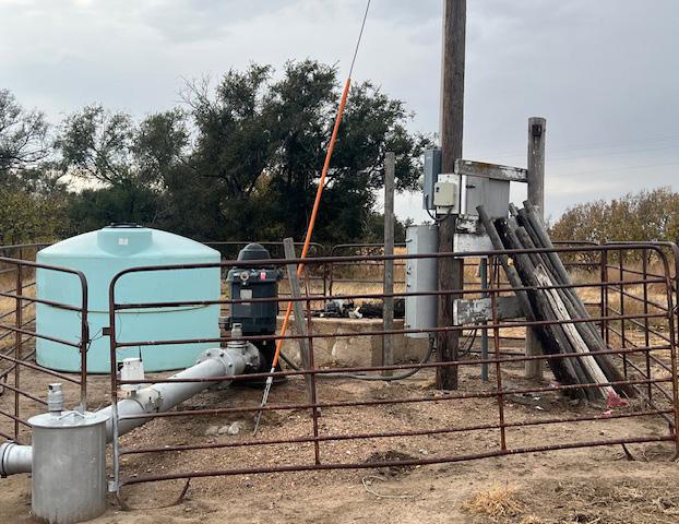
There are four wells whereby one is currently being utilized. The farm is located in the Lower Republican Natural Resources District and contains a total of 193.70 certified irrigated acres.
Well #1 - West
Well Registration: G-062144
Completion Date: 01/01/1957 @ 1,000gpm
Well Depth: 74’
Static Water Level: 35’
Pumping Level: 57’
Column: 8”
Pump – Western Land Roller Power Unit – US Electric, 50hp
Control – Allen Bradley
Pivot – Reinke, 8-tower (1996)
Additional Registered Wells (Currently Not In-Use): G-062133 (South), G-104987 (East), G-104986 (North)