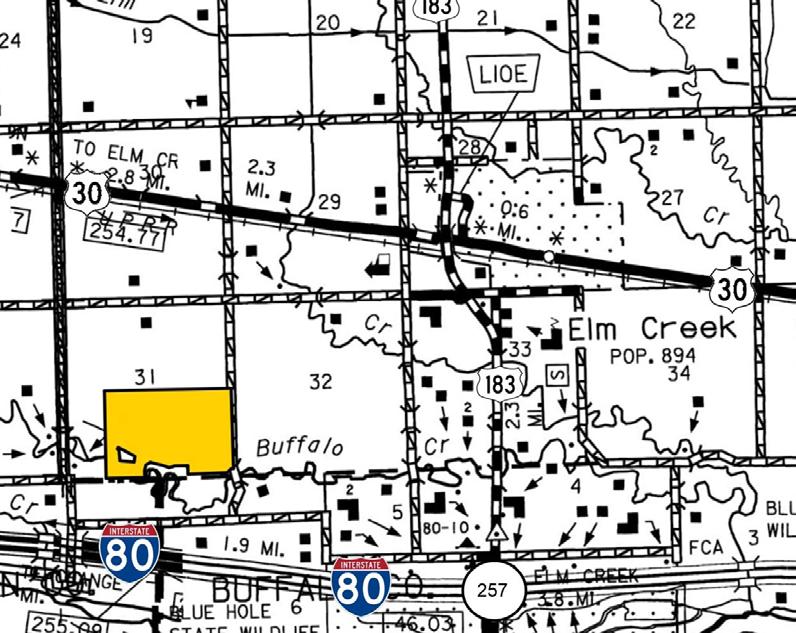
LOCATION: Approximately 3 miles southwest of Elm Creek Access is provided by Arrow Road which borders along the east.
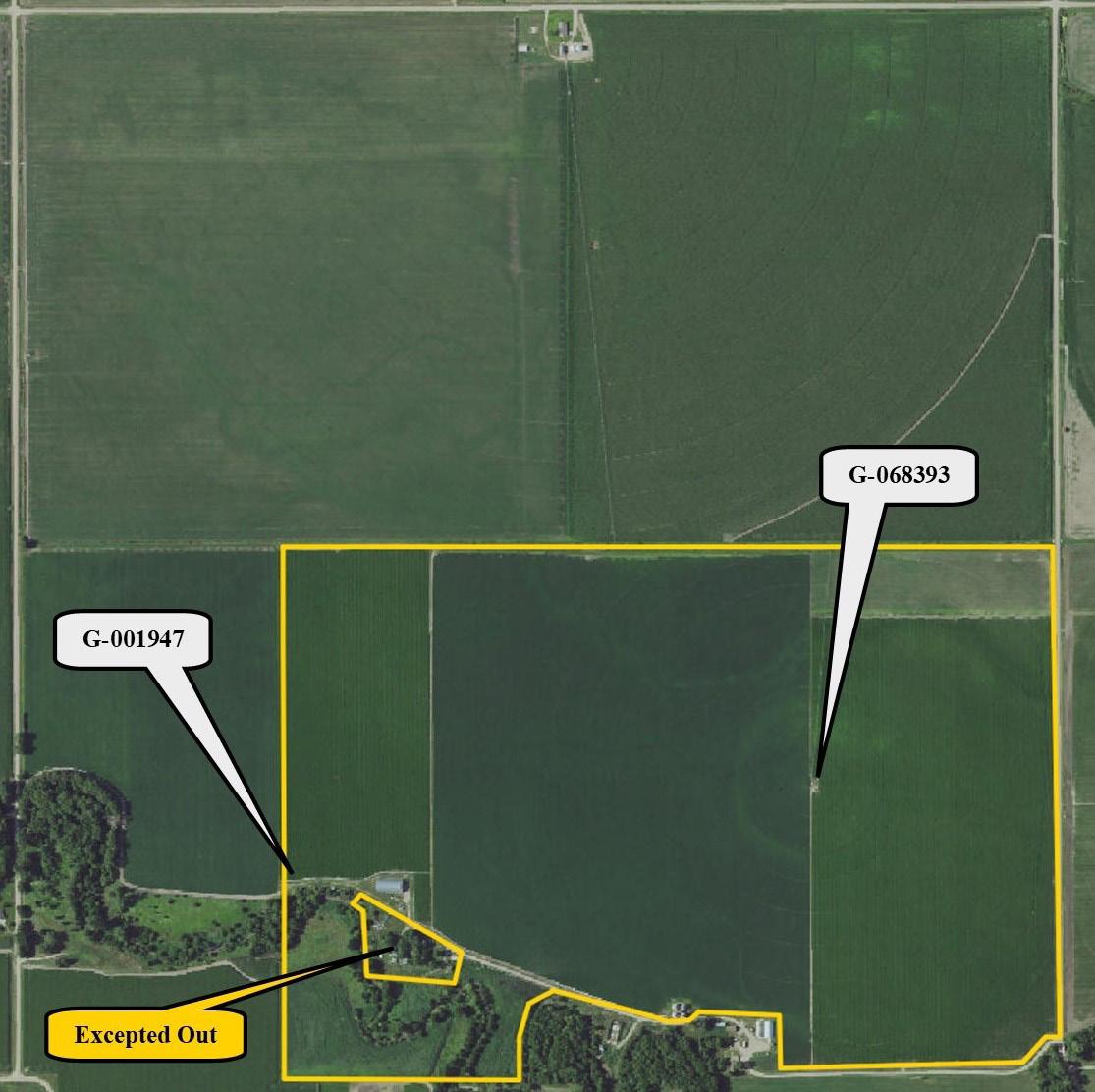
SE1/4 and E1/2 SW1/4 of Section 31, T9N-R18W of the 6th P.M., Buffalo County, Nebraska, except a 2.32-acre rural acreage containing
and acres to be determined by a survey.)
Else Farm Parcel #1
FARM SERVICE AGENCY INFORMATION:
SOILS INFORMATION:
BUILDING IMPROVEMENTS:
LIVESTOCK WATER:
IRRIGATION INFORMATION:
Total Cropland: 194.95 acres
Base Acres: Corn: 148.00 with PLC Yield of 199 bushels per acre
Soybeans: 28.60 with PLC Yield of 55 bushels per acre
Final base acreage contingent on Farm Service Agency approval. All cropland is considered non-highly erodible by the NRCS.
Soils consist Class I, II, and III Cozad, Hord, and Hobbs silt loams along with Wood River-Gayville Complex. Slopes range from 0-1%.
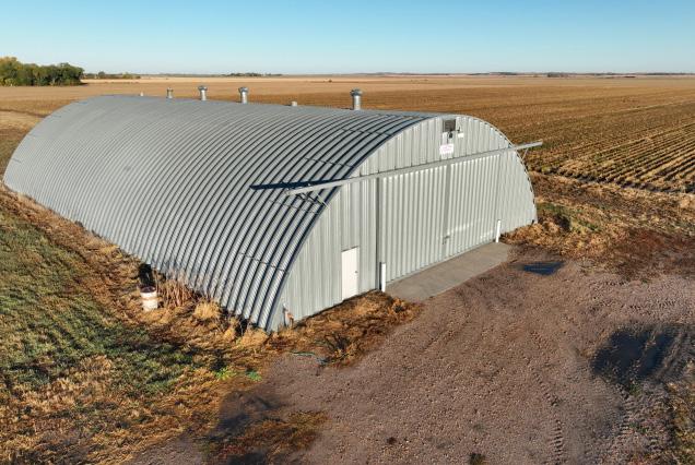
8,174 sq. ft. metal Quonset with 430 ft of portable concrete fenceline bunk and an older grain storage facility that includes four metal bins.
Provided by a well equipped with an electric submersible located adjacent to the Quonset.
West Well
Well Registration: G-001947
Completion Date: 6/12/2001 @ 750gpm
Well Depth: 32’
Static Water: 15’
Pumping Level: 78’
Column: 8.62”
Pump - Mid-America
Power Unit - 25hp US Electric motor
Control Panel - Cutler-Hammer
East Well
Well Registration: G-068393
Completion Date: 3/29/1982 @ 800gpm
Well Depth: 273'
Static Water: 12'
Pumping Level: 105’
Column: 8"
Pump - Aurora Verti-line
Gearhead - Amarillo 100hp
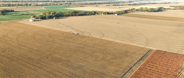
Pivot - Valley, 7-tower with cornering system (Base 1980, Corner 2011)
The farm contains four additional wells registered with the Nebraska Department of Natural Resources. These wells are not in use. Registration #s: G-001948, G-112213, G-002272, and G-002275.
Located in the Central Platte Natural Resources District, the farm contains a total of 190.71 certified irrigated acres.