

LEGAL
DESCRIPTION:
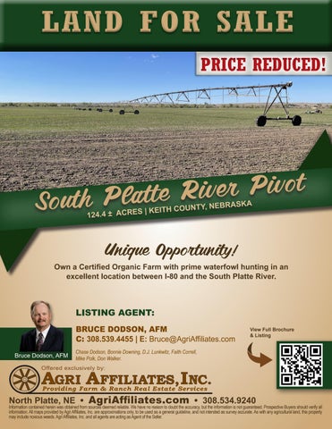
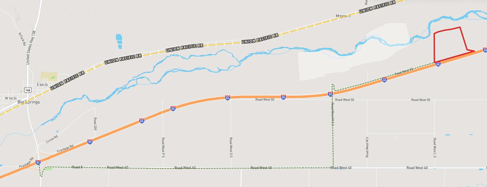
LOCATION
DIRECTIONS:
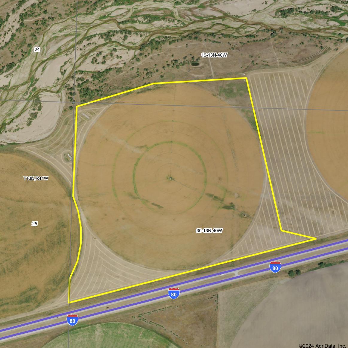
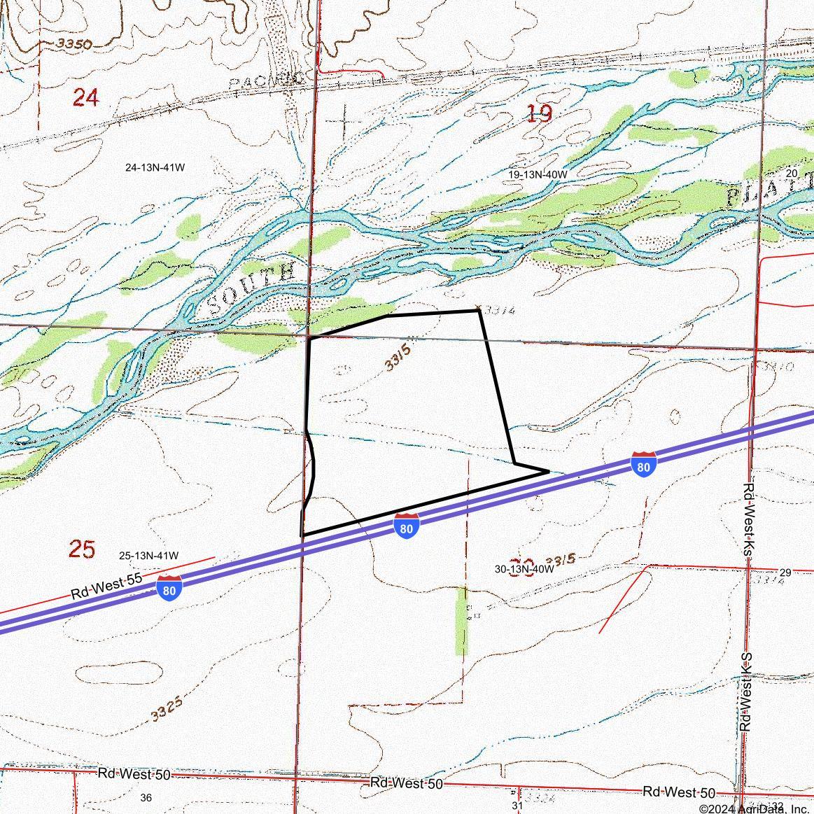
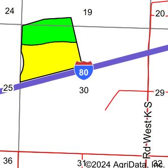
Keith County Assessor’s PID# 263313701, 263318501, and 263318700, A.K.A. a tract lying south of River in SW1/4 19-13-40 and a Tract in NW1/4 lying north of the south line of Theeaton & McGrath irrigation ditch in Section 30, Township 13N, Range 40, and a tract south of south line of Eaton-McGrath irrigation ditch and north of I-80 in Section 30, Township 13N, Range 40, all West of the 6th P.M. in Keith County, Nebraska.
From the I-80 Big Springs, Nebraska exit # 107, travel south on Link 25B for approximately ¼ mile and turn east on Road 8 (just befo re Big Springs Equipment). Travel down Road 8 (merges to Road West 40) for approximately 4.4 miles. Then, turn north on Road West M 5 S for approximately 1 ¼ miles as you travel over I-80 via viaduct. Turn east on Road West 55 for approximately 1.65 miles to the south west corner of the property.
ACRES & TAXES: 124.44 Tax Assessed Acres; 2023 Taxes Payable in 2024: $3,404
NRD: Twin Platte Natural Resources District
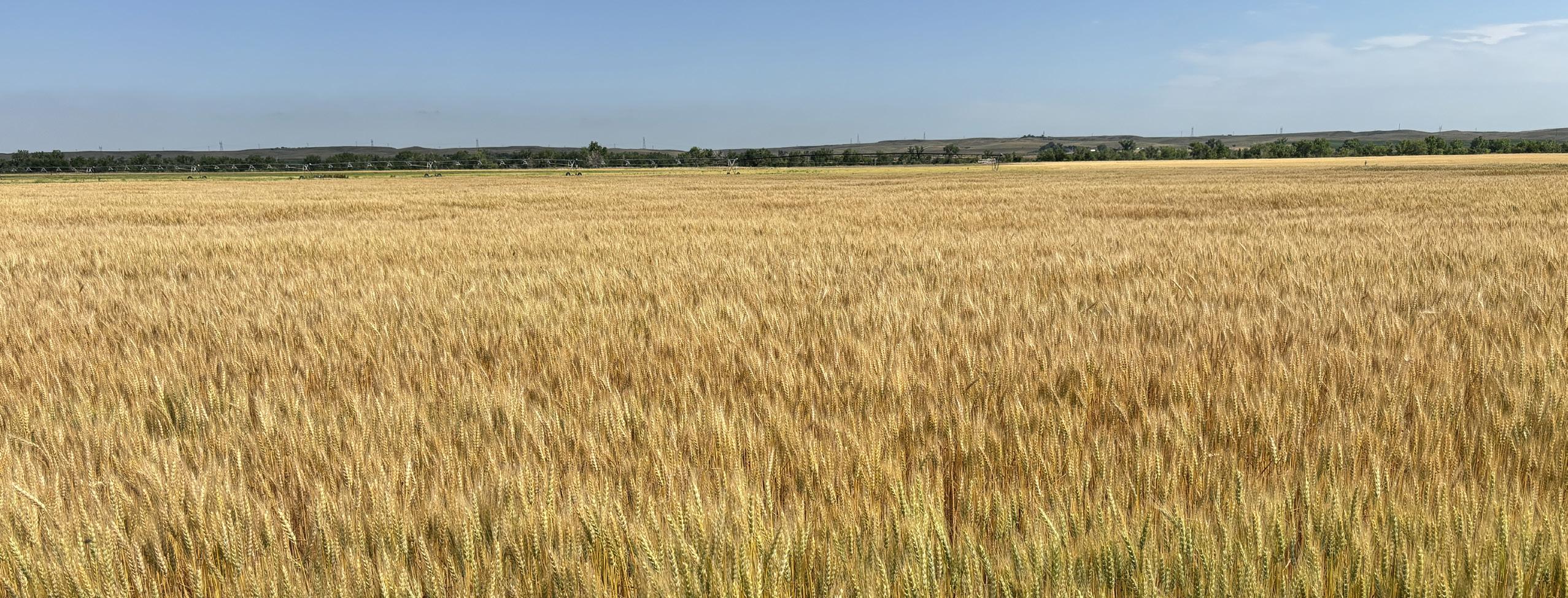
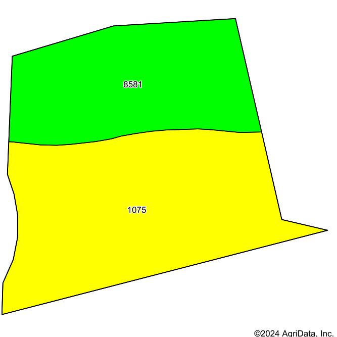
WATER RIGHTS: NE Reg: G-007346, test pumped at 1,000 gpm at 28', set at 500 gpm; 94.8 Certified Irrigated Acres with the Twin Platte NRD.
FSA: Pending Information
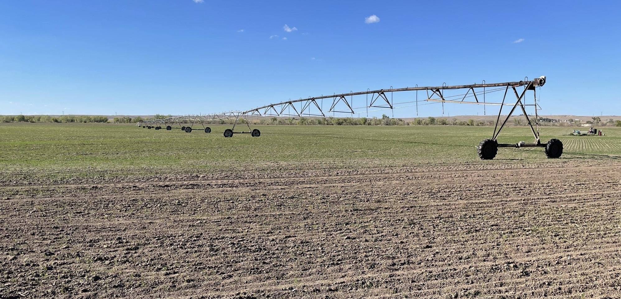
EQUIPMENT: 2-Electric center pivots, 1-10Kw generator, 1-Johnson 60 Hp gear head, and Sargent pump. There is no engine with this property.
POSSESSION: Possession of the property shall be delivered to purchaser at closing.
PRICE: $660,000


Soils data provided by USDA and NRCS.
Area Symbol: NE101, Soil Area Version: 23
Soils data provided by USDA and NRCS.
Area Symbol: NE101, Soil Area Version: 23
*c: Using Capabilities Class Dominant Condition Aggregation Method
Using
Soils data provided by USDA and NRCS.
Soils data provided by USDA and NRCS.
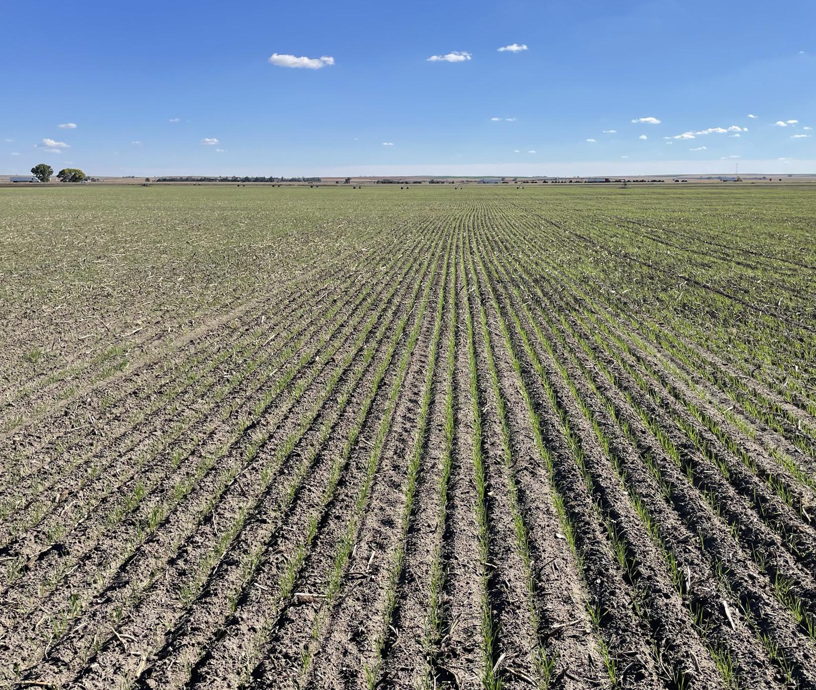
The organic cropland can serve a dual purpose of food plots for wildlife, especially goose hunting from pits.
State: Nebraska
Keith County: 30-13N-40W Location: Township: Brule Acres: 118.33