
PORTFOLIO R. K. ANANYA
SELECTED WORKS FROM 2013-2024

D.O.B : 12/09/1995
Email ID : ananyaagni9@gmail.com
EDUCATION
High School 2013
M.E.S Indian School, Doha, Qatar.
Under Graduation 2013-2018
Graduated with Honours in B. Arch from MIDAS, Anna University, Tamil Nadu, India.
Post Graduation 2022-2023
Graduated with Merit, Msc. Urban Design and International Planning
The University of Manchester, UK
SOFTWARE SKILLS
AutoCAD
Revit
Lumion
Rhinoceros
Grasshopper
Adobe Suits
Photoshop
InDesign
Illustrator
Lightroom
Microsoft Suits
CREATIVE SKILLS
Free Hand-Sketching
Computational Design
Content Writing
LANGUAGES
English - Fluent Hindi - Native
French - Intermediate Tamil - Native
Workshops
2013 Fractal Workshop by Takbir Fathima
2014 A.A London Visiting School, Hyperthreads Lectures
2013 ‘Unlearning Five Myths Jettisoned In Order to Practice
Architecture’ by Prem Chandavakar
2014 ‘Critical Thinking in Architecture’ by Martyn Hook ‘Incorporating Traditions in Architecture’ by Karan Grover
2015 ‘Advanced Design Methodologies’ by Shajay Bhooshan
Panel discussion by Peter Cook, Tezuka, Martyn Hook on Critical Thinking in Architecture
Part of Panel discussion by Christopher Charles Benninger
EXPERIENCE
2016 SYNERGY PROPERTY AND DEVELOPMENT - Bangalore, India
2017 QATAR DESIGN CONSORTIUM - Doha, Qatar
2018 SHILPA ARCHITECTS AND PLANNERS - Chennai, India
2019 ATKINS - Bangalore, India
2023 POPULOUS, London, UK - Present
ACHIEVEMENTS
2015 Won Second Prize South Zone, India-Society Interiors
Competition 2015 Won ‘Out of box thinking’ award Society Interiors Competition all India.
2016 Won First Prize South Zone,Society Interiors Design Competition.
2017 Award for Academic Excellence.
2018 35th University Rank, Anna University Merit’18.
2023 Post graduating with Merit at University of Manchester.
MUCcc ARENA, MUNICH
2024|POPULOUS|URBAN DESIGN
MASTERPLANNING
LOCATION
MUNICH, GERMANY

The project aims to create an environmentally sustainable arena with a Bavarian cultural flair, located adjacent to the LabCampus Technology and Innovation Centre at Munich Airport. Emphasizing accessibility and integration with the site’s masterplan, the design incorporates varied access routes across different levels to cater to diverse user groups. The primary objective involves developing design options that align with the client’s vision, while also ensuring compatibility with security measures and user group requirements. This approach seeks to reduce the arena’s carbon footprint through life-cycle planning and foster a climate-positive building strategy.
L00 FIELD OF PLAY


M00 MEZZANINE L01 PODIUM


SERVICES ARENA CAR PARK TAXI RANK HOTEL


CLAYTON ESPLANADE
2023|UOM|MASTER PLAN STUDIO
URBAN DESIGN
LOCATION
CLAYTON, MANCHESTER, UK


The master plan studio project focused on understanding the analysis level in order to create a master plan with key understanding of hierarchy of streets and blocks.
The site located to the east of Manchester city centre, within the Manchester council boundary. It occupies a site within a primarily residential area between the Ashton Canal and Ashton New Road and is directly to the east of the Etihad Campus and south-west of the National Cycling Centre. It is predominantly made up of cleared sites, but there are some low value industrial uses, poor quality green spaces and residential properties of limited value. The analysis focused on building a vision to address the following issues and activate the waterfront potential of the site.

Urban Design Program
The vision for Clayton from the analysis focused on building a strong sustainable network, that looks beyond the spectrum of a sports city using its key routes of movement to its maximum potential. Waterfront Potential Landmark Active Frontage Mixed-Use Natural Surveillance Green Corridor Sustainable Network Community Engagement Address Barriers (Tramlines) Actions & Vision Ashton New Road


Site Context and Proposal

The main theme of the framework ‘Sport City’ will be the economic, educational, and community driver for the Etihad Campus and surrounding area, also as the new economic focus for the city and north of England, attracting the best students and the best academic talent to the city.
Concept


The site has a lot of derelict spaces and industries with scattered low quality GI facing the Ashton New Road and the lack of an engaging corridor along the canal.
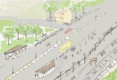
Considering the potential of existing tram stop that connects to the city centre and activating the canal as a sustainable Connecting corridor to the city centre.

The site is defined by poor GI and derelict spaces and few industrial buildings but the periphery is defined by high quality architectural residential buildings abutting the Ashton New Road.
city Sports Complex
City Academy Stadium
New Road
Stop Tram Station
New Road
Walkway

BUILDING HEIGHTS AND FRONTAGE

PUBIC REALM AND GI

ROUTE HIERARCHY

The priority being pedestrian and cyclist movement around the site in order to align with the vision of creating active movement around the site and provide emphasis to the potential of the canal. A green corridor that is well integrated from both ends of the site and creates an active public realm.
There is a variation in the residential housing type to attract diverse demography in order to create a balanced community space. Build a space for affordable homes, private accommodation and apartments. The focus on creating a sense of community by also providing shared activity spaces
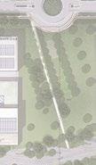
Tram Stop, Spill Out spaces opening the site to the central promenade through green corridor.
Restricting vehicular movement at the central zone of the site in order to create a sustainable network interfacing with the promenade.

A. EASTERN WATERFRONT PROMENADE
The narrow edge of the canal is integrated with the 30m wide terraced promenade abutting the food and beverage block, creating visual connectivity at varying levels.

MIRFA BAY, ABU DHABI
2021|ATKINS|ARCHITECT LOCATION
WATERFRONT DEVELOPMENT
MIRFA CAMPSITE, ABU DHABI

The Mangrove View development is intended to be a new beach front retail and F&B destination in the Western Region of Abu Dhabi called Mirfa. It intends to offer a unique blend of retail, F&B, entertainment and waterfront activities. The site is nestled between a commercial development to the north and the Mirfa Campsite to the site. It offers scenic views of the ocean and the protected mangroves
My major responsibilities focused on developing F&B facade design and presentation for client workshops, developing a facade palette ,cladding pattern based on the branding colours. The key concept iterations reflected the context by creating a surf and sunset palette.
The major requirement for all the F&B outlets included reflecting the branding colours through the use of fabric and slats and defining the base colours of the facade with the overall context.
Value engineering materials and retaining the overall look and feel of the development in comparison to the reference project, Marsana form using wooden cladding to metal cladding, developing design details for the facade cladding, fabric connection.

JUMEIRAH MARSA AL ARAB, DUBAI
2020|ATKINS|ARCHITECT
HOSPITALITY DESIGN
LOCATION
NEAR JUMEIRAH BEACH HOTEL, DUBAI

Jumeirah Marsa Al Arab is under construction close to Jumeirah Beach Hotel. The five-star luxury hotel will have 280 rooms. This Hospitality Project with its extreme fluid design was challenging learning Experience.
My major responsibilities included developing the façade model as per design proposals, changes and facade consultants details. The Project has complex façade geometry. Hence , there was a critical skill requirement to have a resource with hands on experience of using Rhinoceros. This project provided me an opportunity to exhibit my skill set in working with Rhino Modeling.
Working on design proposals and presentations to be shared with client for weekly meetings. Converting Model elements from Rhino to Revit. Working on Façade Package - detailed drawings as part of Submittal.

The entrance lobby vault has a complex geometry that had to be optimised and developed in order for the GRP panel grooves To connect with the vault pattern and create a sense of visual balance.
EKTHA AV ARENA
2019|SHILPA ARCHITECTS AND PLANNERS
MASTERPLANNING
LOCATION
HYDERBAD, INDIA

The Ekta Sports City project is a 64,000 sq. m masterplan development driven with sports in the forefront of its development. The site consisted of an existing cricket ground and the masterplan developed around it focus on providing clear zones of activities through the site to create an vibrant experience for all, the concept focused on sustainability and a good balance of active, leisure and rest spaces.
Major responsibilities on the project were driven by the vision of developing the masterplan for client presentations and following to develop the terrain of the site considering the contours and levels on site. Defining the flow of movement and circulation along different zones and developing site based analysis and conceptual design to align with the theme of the development.
Existing Topography

Proposed Masterplan

The Hive
Retail and F&B zone, draws attention to the development from the main access road. Active frontage.
Active Arena
Training arenas and Sports Complex, combination of outdoor and indoor activity spaces.
Spectator and Rest Spaces
Open Air theatre, central vista for the main cricket ground.
Refurbished with seating and pitch. Existing Cricket Ground.


TRACK


Total Walking/Jogging Track
A 80m (Car Drop off to Indoor Stadium North Gate)
B 90m (Indoor Stadium South Gate to OAT)
C 455m (Cricket Ground Periphery – Main Jogging Track)


Phase 1 : Activation
Phase 2 : Inclusion
Phase 3 : Integration
Axonometric Site Section
The learnings of the project are understanding the overall context of the site, defining the masterplan vision through phasing and urban studies working with contours on BIM to develop a smoother context.


FULCRUM FOR INNOVATION
2018|MIDAS|B. ARCH THESIS PROJECT
ARCHITECTURE HUB
LOCATION
TARAMANI, CHENNAI, TAMIL NADU

The graduation project deals with the Architectural Network and its development beyond the lines of the Institute. A place for holistic research and growth that is also catering to people beyond the profession as a center of knowledge.
The design intent is to bring the community closer and provide a platform for learning and growing and let the public get a glimpse of what all goes into the processing of efficient building designs. The design is supported by thorough study and analysis of the field and my own experience as a student of Architecture.
Design Intent
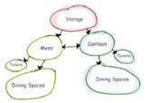
Functional Chart and Time Frame


Lectures Workshops Prototyping Networking


Architects Architecture Students Students Intellectuals


Material Expo Co-Working Spaces Convention Centre Exhibits
The Site Selection was based on the growing Architectural Institutes in and around India. Drawing Statistics from the rising number of Architecture Institutes in the Metropolitan Cities. Understanding the need to strike a balance between the Quality and Quantity Spectrum offered in the field and exploring options in regions with higher Quantity of Institutes, Maximum being in - Chennai, Tamil Nadu
Site Context and Inference

The site is located in the southern part of Chennai -Taramani. The two roads connecting the region- South - Taramani Road, North- CSIR road.
The factors that influence the urban demography of the South Corridor of Chennai is the presence of IIT - Madras and the Raj Bhavan along with the development of it as a SEZ region since 2005.

The site has the elevated railway line passing through it which provides a view point to the region and the massing of the buildings around the site to understand the context of the overall region.
The iterations were drawn out considering each factor of the site in order to consider the most suitable zoning requirements.

PHYSICAL FEATURES

SENSORY PERCEPTION

APPROACH AND
REFERENCE

CSIR ROAD
TARAMANI ROAD
SITE
MRTS
Wind channeling

Courtyard Space
Segregated Work Spaces

Main Entrance - Wider Frontage Cardinal Significance


Activity Mapping and Concept Evolution
The Activity Mapping is done for each of the spaces in order to Understand the preliminary planning of the spaces and how each sector is categorized based on the required amount of privacy and interaction.


Administration
Co-Working Lab
Abode
Canteen
Exhibit Centre


Design DevelopmentBridging + Concept
The paper folding technique is essential in form finding as it helps Understand the geometry of the spaces and visualize the 3D forms vividly.


The hub works on a holistic approach and that gives it the key essential of being interactive, The grammar of the buildings is traced through its outer shell design that works on providing alternative activity spaces by bridging the roof and the floor also derived from the study of origami in architecture.

PAVILION - SQUARE
SITE PLAN

MASSING - SPACE
GRAMMAR - SKIN
Co-Working Lab

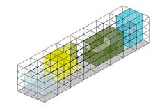
The Co-working lab is integrated into three quadrants, The Central being the resource station in order to build Interaction among the students who come to explore and research within the spaces. The right quadrant consists of the lecture rooms and workshops and the left quadrant is for co-working.
The Exhibition Centre has a Material Display Area and a Convention Centre. The Material Display is located on the First Floor in order to dissolve the narrowness of the entry to the building as it is located at one end of the site, closer the compound. The criteria being to create more access and visual points to the central Public Square. The center of the structure is supported by a Common Green Shell.


2018|MIDAS|URBAN DESIGN STUDIO
LOCATION
URBAN DESIGN - CHROMEPET
CHROMEPET STUDY AND PROPOSAL
CHROMEPET, CHENNAI, TAMIL NADU

The Studio was divided into groups and each group studied different aspects of the stretch of Chromepet’s development along the Grand Southern Trunk Road (GST) as it denotes the significant effects of Rapid Urban development over the years. Chromepet is known for its Leather Industry and how the Industrialization has led to the speedy commercial growth pattern within the region and it’s social problems and Indicators.
Imageability - Then vs. Now


Durgai Amman Temple Road
GST Road
CLC Road
The study of the time-line is focused on the Synchronic and Diachronic development in the region to understand the cities growth pattern based on three year frames 2004-2010-2017 noting the evident Physical changes that happened around that time.
Pattern Recognition - Liner Settlement
Theory of Change - Paddy Field-Leather Industry
Institutes - Settlement
Relation to Non-Formal - Ancestral Property-Political Influence
Conditions Religious Believes -Property Value

Landmark Typology
INDUSTRIES INSTITUTES
RELIGIOUS IMPORTANCE
RAILWAY STATION
COMMERCIAL/ ENTERTAINMENT

Income Study
ECONOMICALLY WEAKER SECTION < 100000 P.A
LOWER INCOME GROUP < 200000 P.A
LOWER MIDDLE CLASS < 300000 P.A
MIDDLE CLASS < 600000 P.A
RICH < 6000000 P.A
COMMERCIAL AND INSTITUTES

Socio-Cultural Fabric
POLITICAL GROWTH
RELIGIOUS STRUCTURE
SETTLEMENT AND ECONOMIC GROWTH
The Studio worked in groups to promote collective thinking, ours being the Social and Economic frame of the city and the consequences of development traced through these statistics.
Settlement Pattern Expansion around the region.

Settlement Growth Migrant Population Crime and Black Spot


INDIRA COTTON MILLS
LEATHER COMPANY
POLITICAL PROPERTY
GUINDY MACHINE TOOLS PROPERTY
Various proposals were worked out catering different percentages of the urban pyramid. The proposal in our interest catered to the 30% youth of the region and with the statistic study of lack of interactive amenities to build a interconnected social fabric with activity spaces being the target.
FORUM FOR INTERACTION | ADAPTIVE REUSE AND ENVISIONING URBAN SPACES
AIM
INSTITUTION GROWTH
COMMERCIAL STRETCH ENTERTAINMENT
The above study shows the development and expansion that happened over the region based on the dominant factors at different stages.
The focus is to work with urban spaces that have remained Static over tttime through over development and seeking a Feasible outcome in comparison to the drastic transition over Time.
OBJECTIVE
Process of reusing an old site or building for a purpose other than Which it was built or designed for. Identify the abandoned public space that has a potential to be a vibrant social space
CHROME
PRIMARY SECONDARY TERTIARY SARVANA STORES KALYAN JEWELERS INDRA COTTON MILLS CRIME PRONE AREA BLACK SPOT AREA
If you want to do something big start with something small..


Community Interaction Envision Barren Spaces


Encourage Green Spaces


Indra Cotton Mills Adaptive Reuse


Learn,Explore, Work
How does Adaptive Reuse play a role in Chromepet?
Indra Cotton Mills – 1946 signifies the Industrial development that was the transition from primary sectoral occupation to secondary sectoral occupation. Over the time with rise in cotton industries has led to the drastic competition leading to stagnation in their business.
A part of their infrastructure is a vast void space that could be put to better use as it has an essential connection and history to Chromepet. The ability to reuse that space in order to increase interaction and provide a space for learning, working and growth.
Site Context
- Chromepet is known for its rapid growth and agglomeration
- The few courses of the city that have its identity are losing Grip over its city
-The proposal works in creating nodes that helps sustain the city’s Character
Minor Intervention
Major Intervention
- SDNB Vaishnav College -Indra Cotton Mills
- Municipality Park
- Railway Junction Crossing

The minor intervention act as a trail to the major intervention through Interactive nodes and community spaces. The idea of conserving the regions identity is traced through a series of activities that brings the community together and further concluded at the Cotton Mills that signals the Industrial Development in the region. ADAPTIVE REUSE REDESIGN, REUSE


A Book Shelf around the green wall to serve the purpose of donating books that don’t serve the purpose for students anymore.

The Art Installation denotes the irony of progress based on the waste we accumulate. The tree is surrounded by a mesh frame with the upper case is netted with dry waste to signify that.

Redesign the municipality park into a place of community farming that promotes learning among children and adults
The site due to losses faced by company have a part of their space in ruins and this Space being old and hold history of the regions development could be restored for potential use.

Conceptual Form
Devise a flexible workspace that doesn’t hamper the building left overs and is supported by steel frame running 25 m stretch. The concept works on a Brutalist Architectural scope that fits well with the site.


ENERGY CENTRE, AL WAKHRA
2017|QDC|ACADEMIC INTERNSHIP
FACADE DESIGN
LOCATION
DOHA, QATAR

The project Energy Centre designed for the Al Wakhra Stadium FIFA 2022 World Cup, Qatar. The project was a good opportunity to Improve my software skills in BIM.
The following tasks given to me were to work on the external facade design of the energy center and the signage plans of the structure.


AL BAYT STADIUM
2017|QDC|ACADEMIC INTERNSHIP
STADIUM DESIGN
LOCATION
DOHA, QATAR

Al Bayt Stadium designed for the FIFA 2022 World Cup,Qatar. The project provided an opportunity to understand the amount of Details required in Stadium Design.
The following tasks assigned were to work on the good for construction drawings of this project which helped in understanding the overall Requirements of a Stadium Design.
HYPERTHREADS’14
2014|AAVS|VISITING SCHOOL
AA WORKSHOP
LOCATION
CHENNAI, INDIA

The workshop focused on the relations between contemporary design techniques, creative expression, software technology and its manifestation within India’s emergent economy and ancient traditions of building. It also sought to use production-proven design methods and software platforms in a judicious mix with innovative research.

PHYSICAL EXPLORATION
The physical explorations were done in paper to understand the different variations of ridge and valley. The different iterations were studied to digitally derive the same process on the modeling software (MAYA).


BOAT DESIGN - ITERATIONS
On identification of the needful criteria like balance, stability, buoyancy, floating properties etc: this curve fold was chosen as the base that furthered to form a usable boat.
This exercise is done in order to apply what we studied as practically as possible with the resources provided.
The basic properties to be considered:
-Balance - Float
-Weight - 100 kg - 1 man + goods
-Buoyancy
-Air tight
Added design parameters we set : Folded into a sheet
Easy transportability
Light weight
RESEARCH | APPLICATION
Team research regarding stability and usability of the forms and how it can be suitably applied.


INSTALLATION
The final installation worked out by the tutors and the design process from understanding its curves and defining its edges to forming separated interconnected pieces, to work with the helpers who taught us to create each piece and build the final structure.


