PORTFOLIO AFSAH ALI


afsah.ali@mail.utoronto.ca | 647-505-7931 | Toronto, ON
2020 - 2023
MASTERS OF LANDSCAPE ARCHITECTURE - UNIVERSITY OF TORONTO
• 2022-23 Charles and Doreen Lloyd-Duerdoth Scholarship Recipient
• 2023 University of Toronto Student Leadership Award Recipient
• CGPA: 4.0
2016 - 2020
HONOURS BACHELOR OF ARTS (ARCHITECTURAL STUDIES) - UNIVERSITY OF TORONTO
• Specialization in Technology and Minor in Visual Studies Received with High Distinction
• CGPA: 3.7 - Dean’s List for 3 consecutive years
RELEVANT EXPERIENCE
SEPT 2021PRESENT
HEAD TEACHING ASSISTANT – DFALD (UOFT DANIELS FACULTY)
• Collaborating with professors in both Graduate and Undergraduate level courses as a Head Teaching Assistant. Currently leading 12 TAs/ 500 undergraduate students and aiding with course content setup, communication, leading tutorials, and coordination with professor.
SEPT 2022PRESENT
GRADUATE RESEARCH ASSISTANT – JANE WOLFF X TLO
• Researching alongside Professor Jane Wolff on the progression of the Toronto Landscape Observatory (TLO) from its exhibition in the 2022 Toronto Biennial of Art to its current display at the Canadian Language Museum. Focusing on methods of art and activism through landscape literacy.
MAY 2022AUG 2022
WORK STUDY LANDSCAPE CONSULTANT – SOCA X BLACK LIVES MATTER CANADA
• Researching alongside Studio of Contemporary Architecture (SOCA) and their client, Black Lives Matter Canada, on the landscape design surrounding the Wildseed Arts and Activism Building in Toronto. Focusing on community garden design and BIPOC cultural histories.
JAN 2022APRIL 2022
DIGITAL DESIGN INSTRUCTOR – DFALD (UOFT DANIELS FACULTY)
• Instructing 12-14 year old students on the design process and walking them through creating their own designs through Adobe Creative Suite and CAD applications. Communicating with parents, students, and coordinators on student progress over the course of a 12 week program.
EXTRA-CURRICULAR
AUG 2022PRESENT
HEALTH & SUSTAINABILITY OFFICER – GALDSU (DFALD GRADUATE STUDENT UNION)
• Organizing and leading alongside executive Graduate Student Union Council to represent and establish events for Graduate cohorts. Emphasis on the mental and physical health of students and creating opportunities for sustainable and environmental practices through events, pulse check surveys, meetings with faculty, staff, and the cohort student representatives.
AUG 2018AUG 2020
JUN 2019/ JUN 2020
GRAPHIC DESIGN DIRECTOR – UOFT MSA (MUSLIM STUDENT ASSOCIATION)
• Leading a team of 8 graphic designers and teaching Adobe Creative Suite programs to create promotional and informational material for the MSA. Creating persuasive and innovative designs for over 50 events/ initiatives to reach larger audiences.
DESIGNER AND BUILDER – TSA (TORONTO SOCIETY OF ARCHITECTS)
• Collaborating with the TSA to prototype and design a Pride Float in 2019 and virtually with Blender in 2020. Preparing materials, sharing strategies, and assembling on site to represent the TSA.


02 01 05 06
04 07
teaching equilibrium
Design of Riverdale Park East through methods of Outdoor Education
bridging the gap
Large scaled strategy to connect communities along Allen Road
Minimal interventions educating on ecological necessity of flooding
lovells island
Retelling the story of Lover’s Rock that took place in Boston’s Harbour
exemplifying the existing
Searching for an inclusive van minh do thi/ urban civilization in HCMC
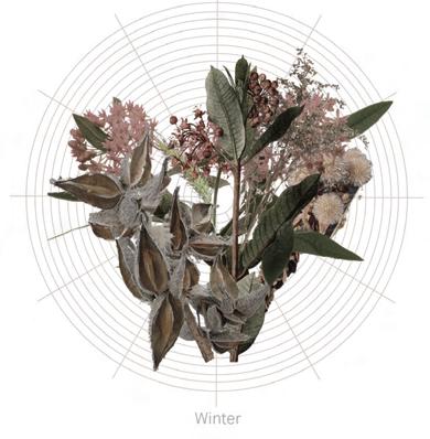
bloom
Exploration of Blooming forms in Lines, Planes and Volume
Phased redesign of UofT’s Wilcocks and Huron Street
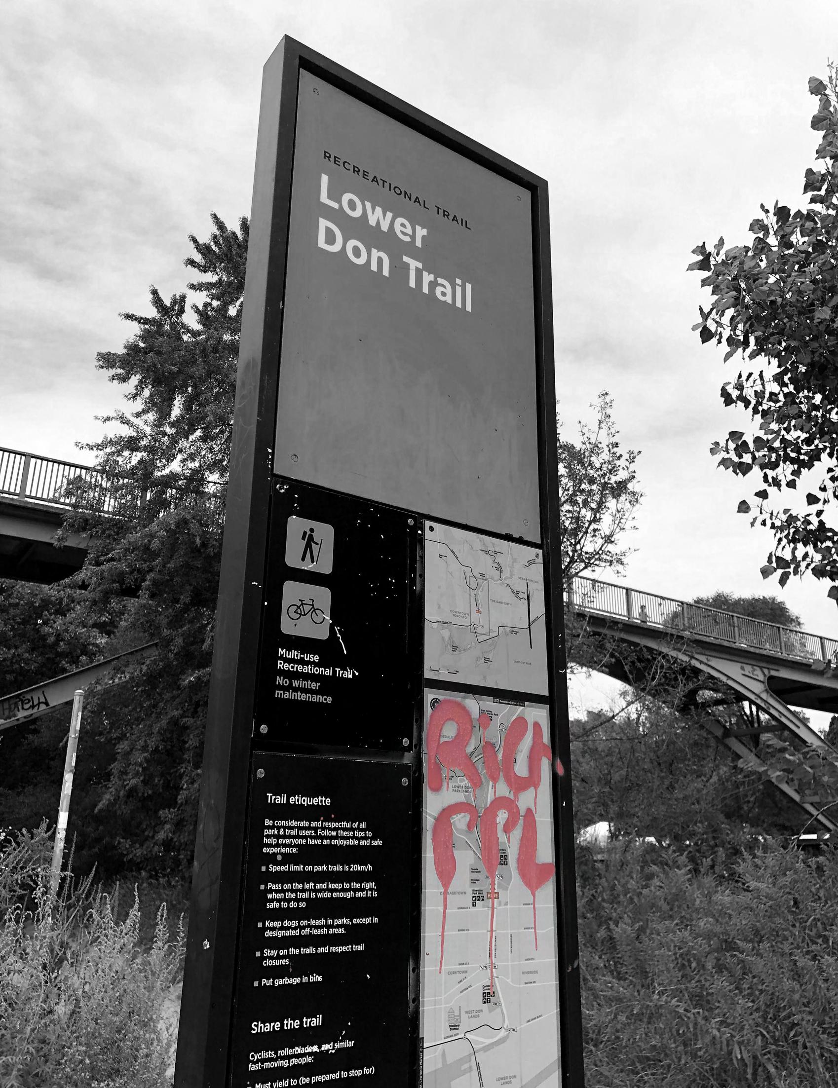
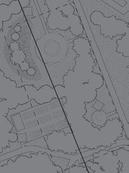
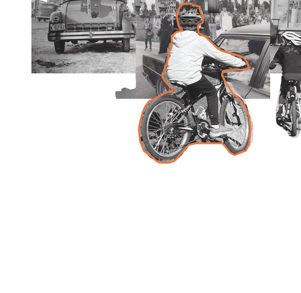
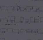
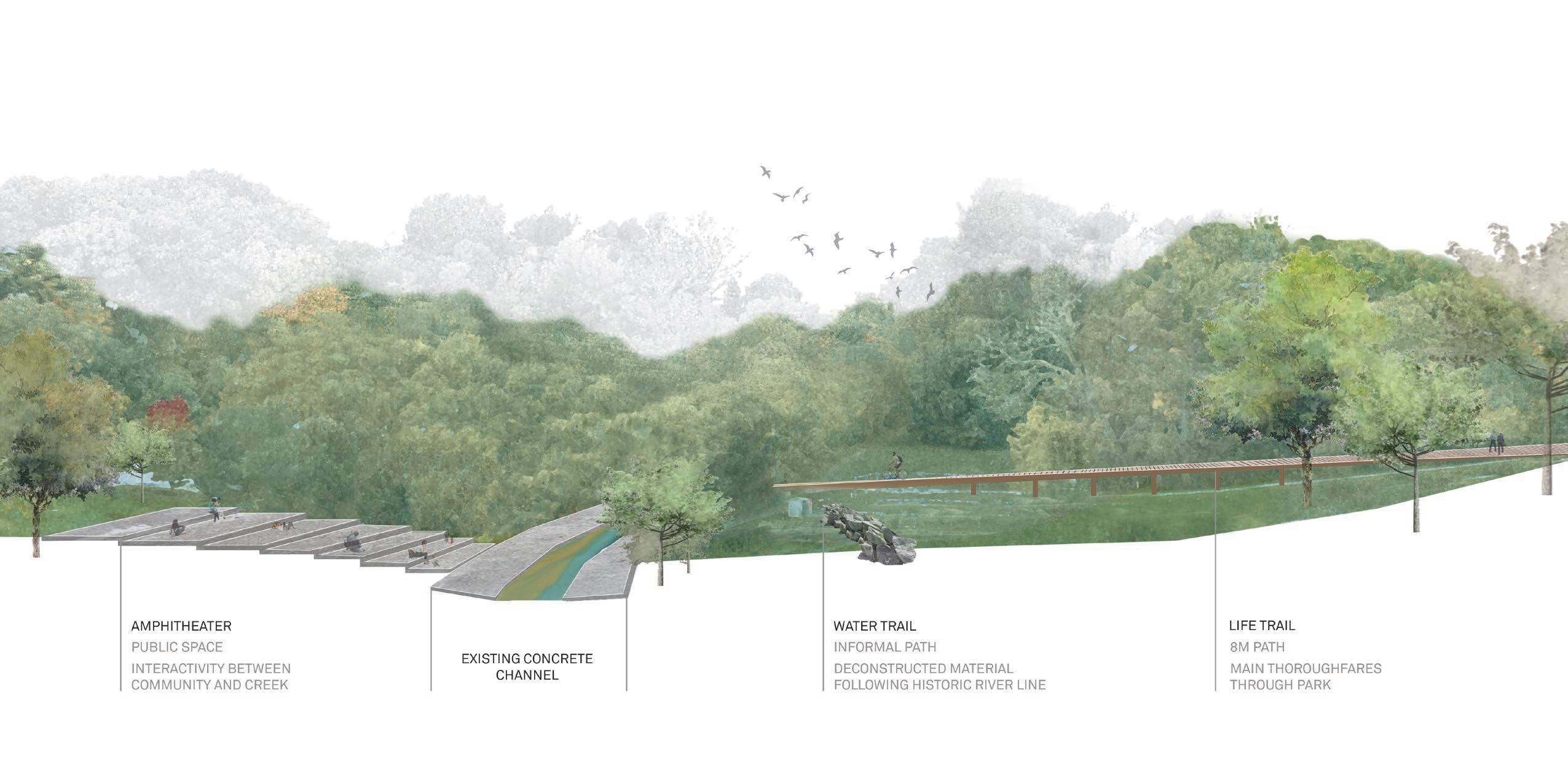
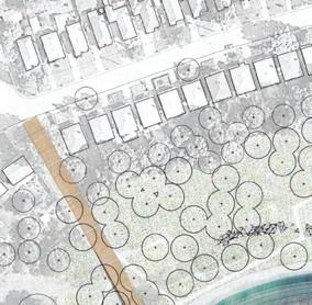
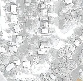
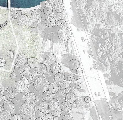
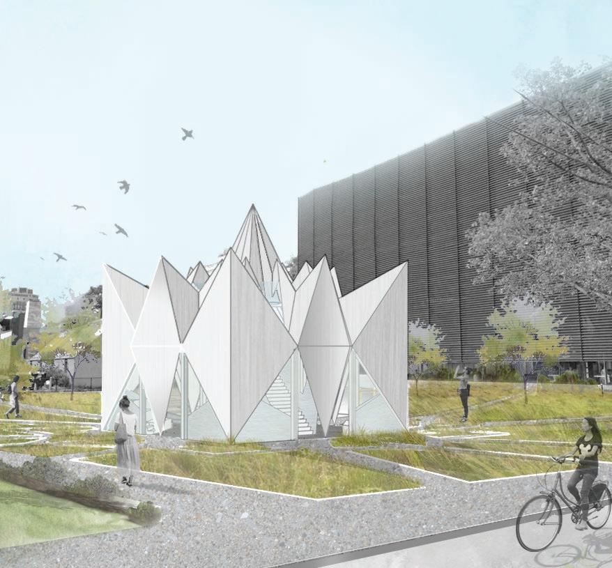
This project, set in Toronto’s Riverdale Park East, aims to elaborate on the existing conditions of the site and contribute to the space in a way that educates its users on how the park and its surrounding areas came to be. Utilizing methods of outdoor education, one can become aware of the imbalance that has and continues to exist throughout Riverdale Park, which stems from a history of neglect, undesirability, and a contradicting relationship between the ecological and demographic diversity of the Don Valley area. Much of these ideas stemmed from the image to the left, a sign from the Lower Don Trail with the words ‘Rich Ppl’ graffitied over the affluent Rosedale neighbourhood in Toronto. The sign stood as a reminder of the various divisions, perspectives, and experiences of Riverdale Park East that have accumulated over the years and that should be shared more openly with the public.
ACADEMIC | INDIVIDUAL
DATE COMPLETED | DECEMBER 2020
LENGTH | FOUR WEEKS
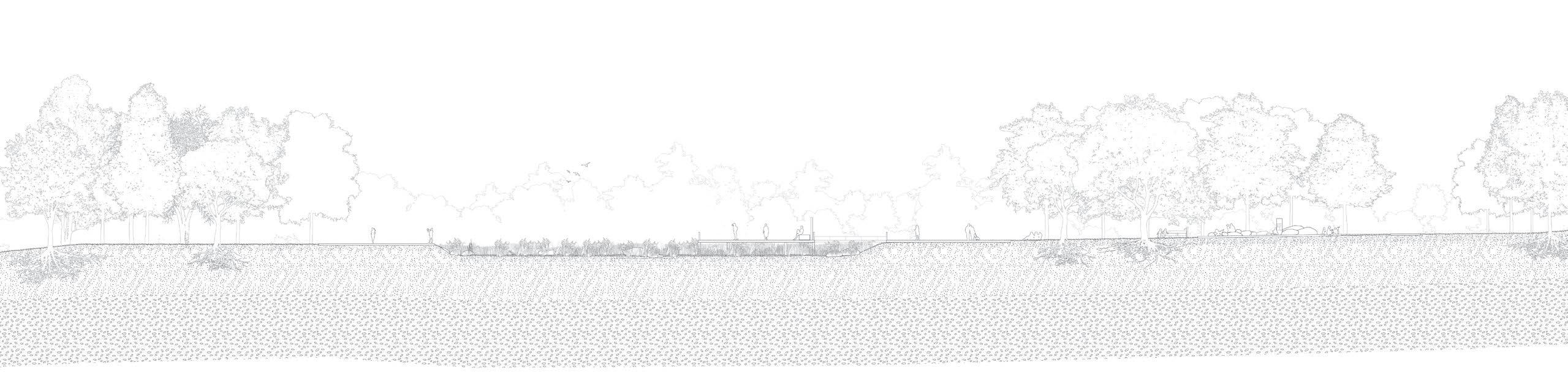
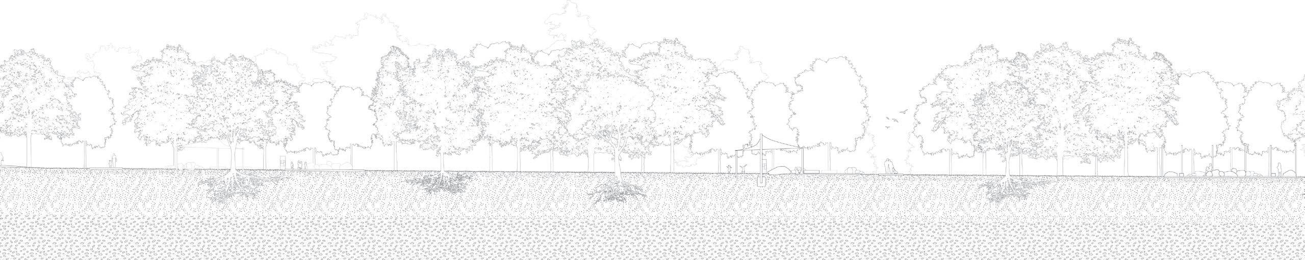
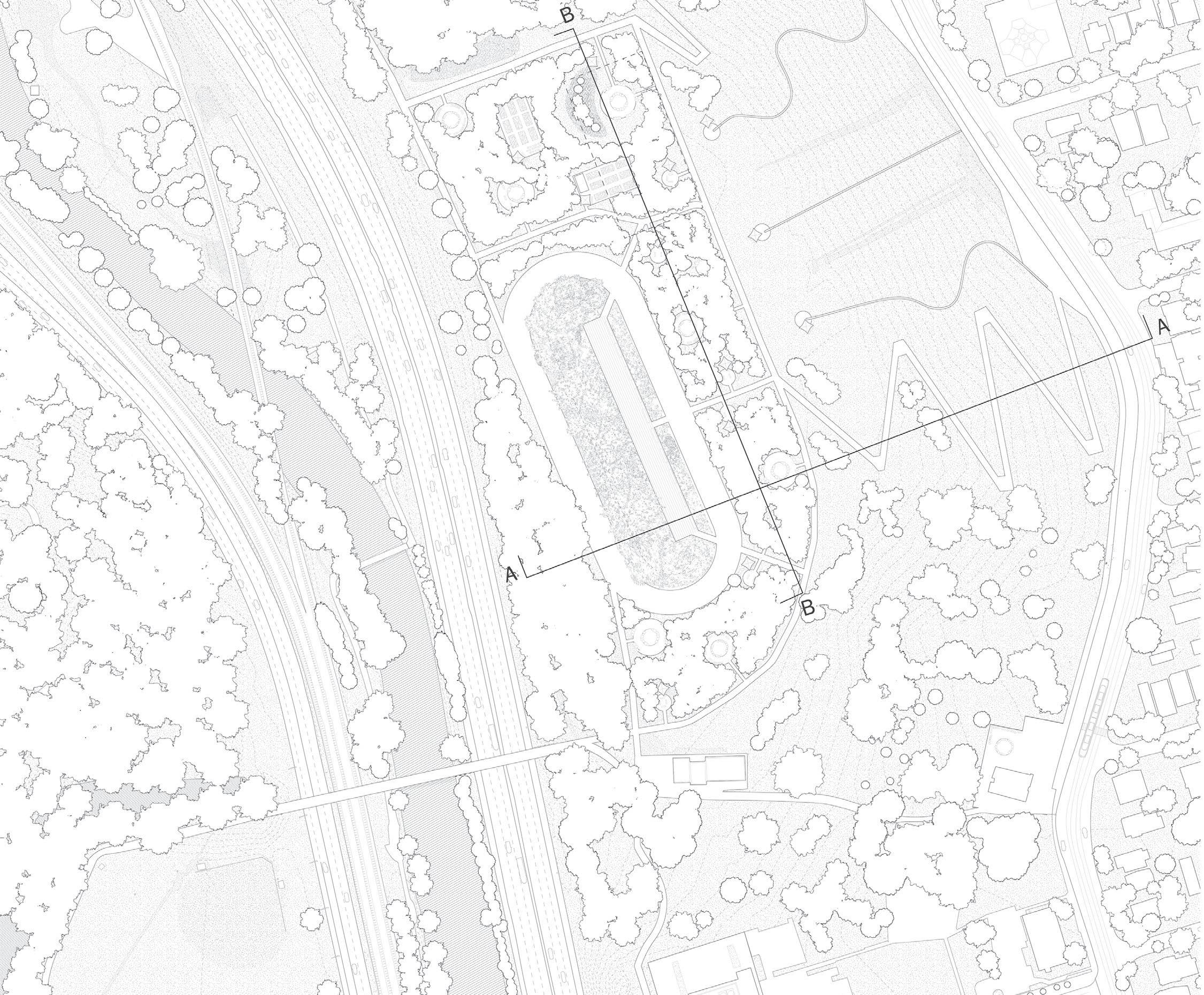
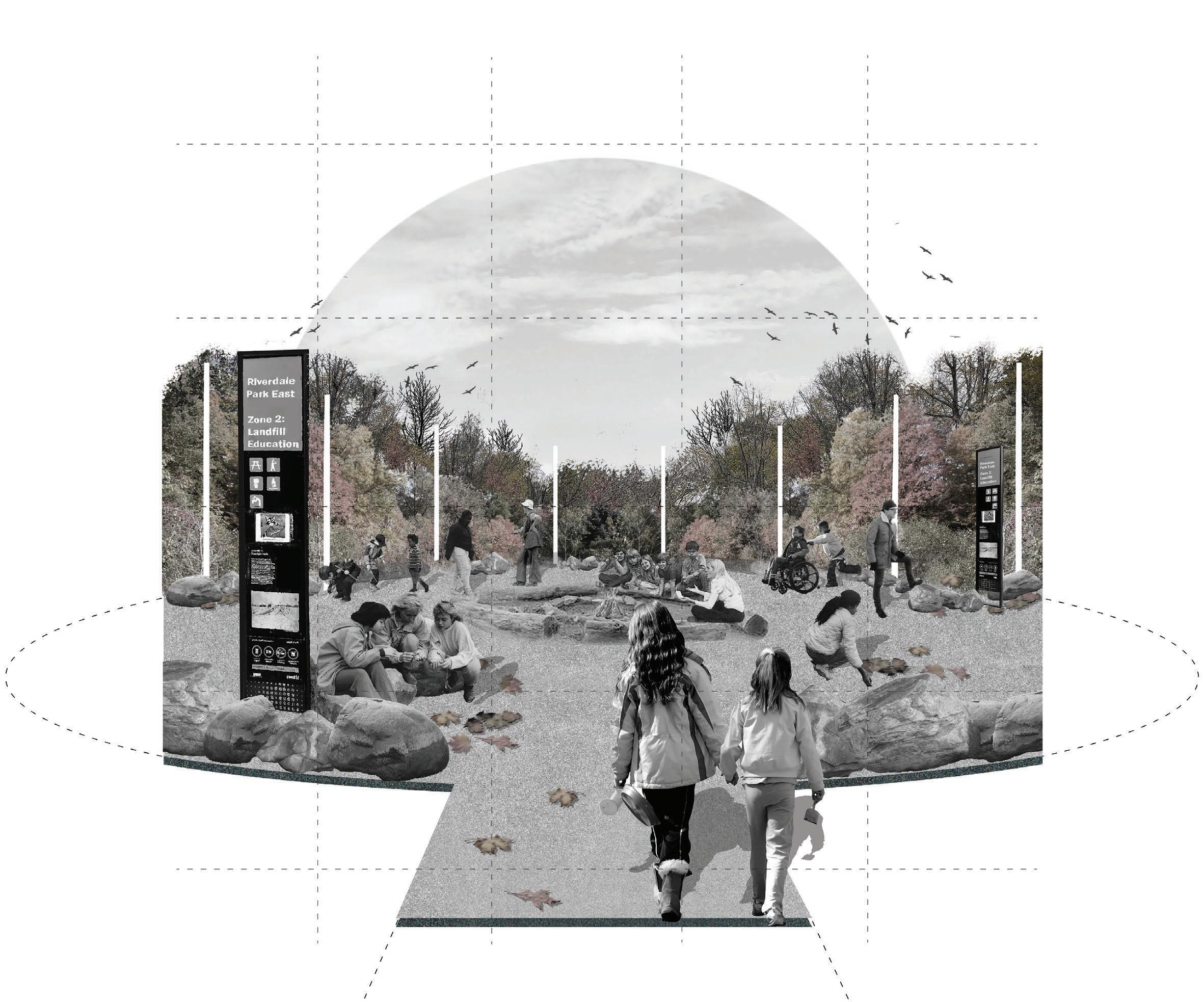
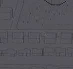
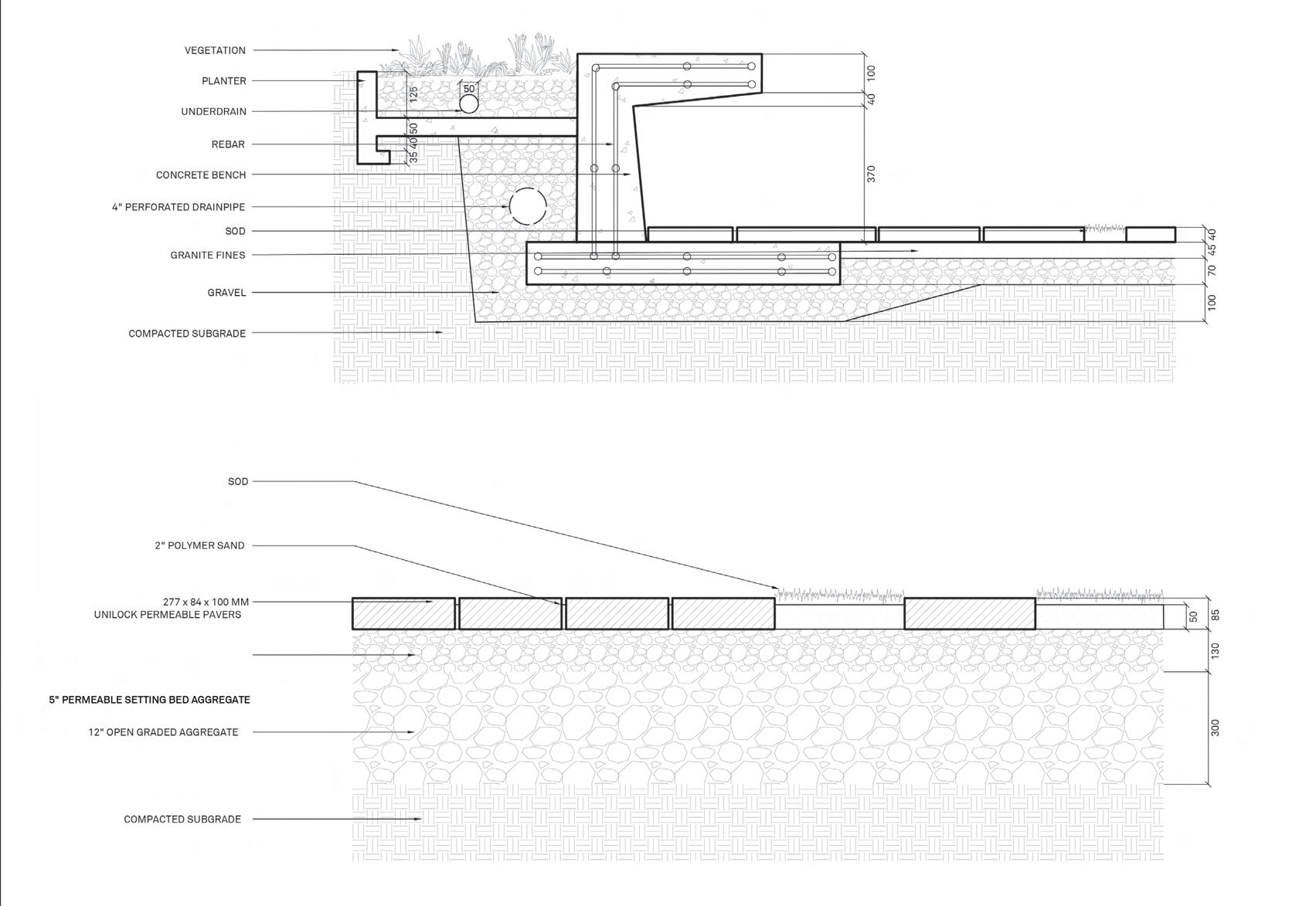
The final site plan utilized existing conditions such as the steep topography, wetlands, track, and surrounding context to be used as informative examples and topics for educational zones. From these zones, the circulation is created in attempts to reach and connect the spaces through accessible paths.
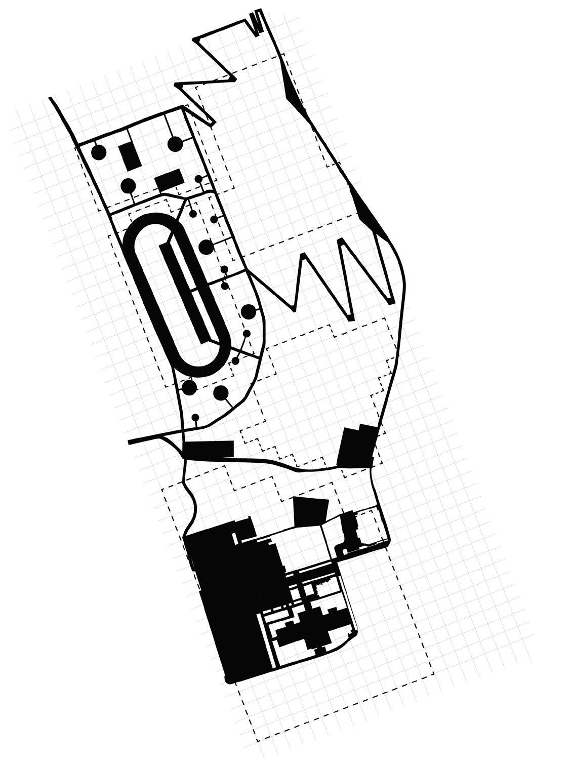
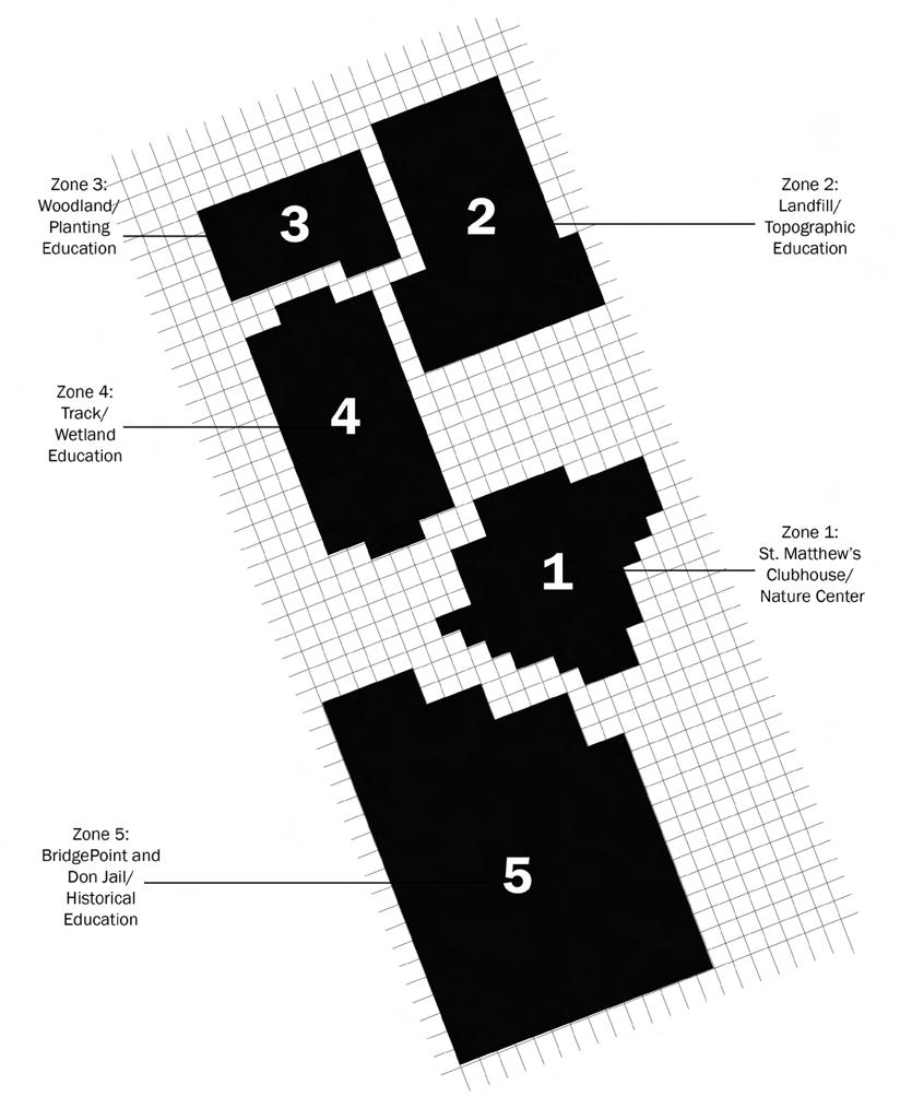
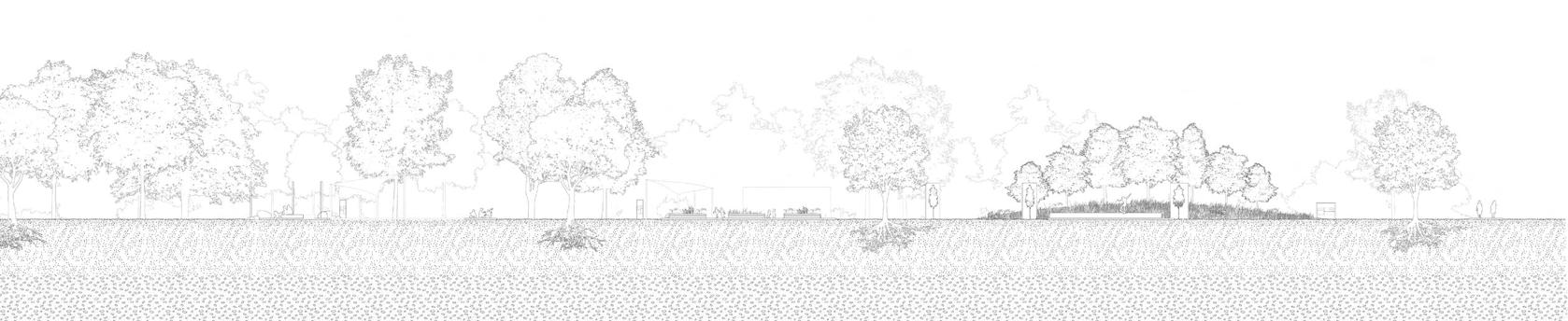
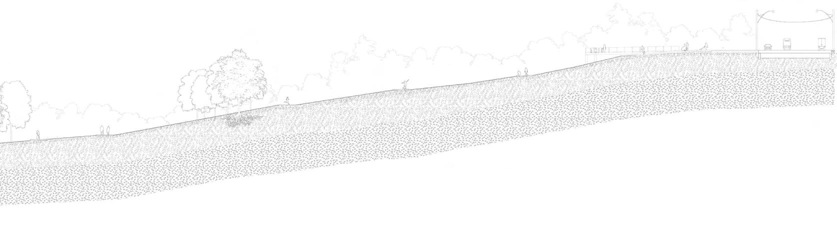
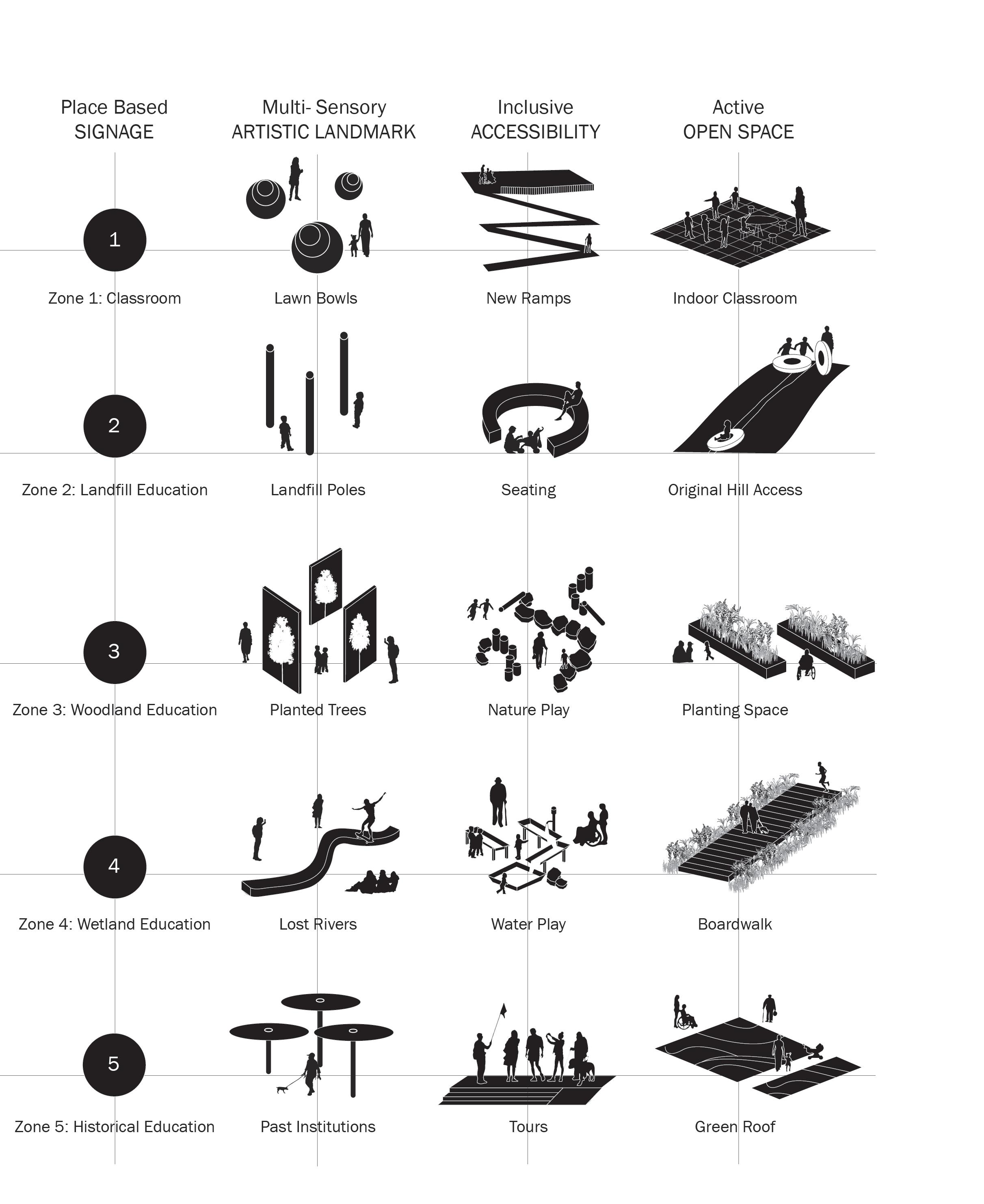
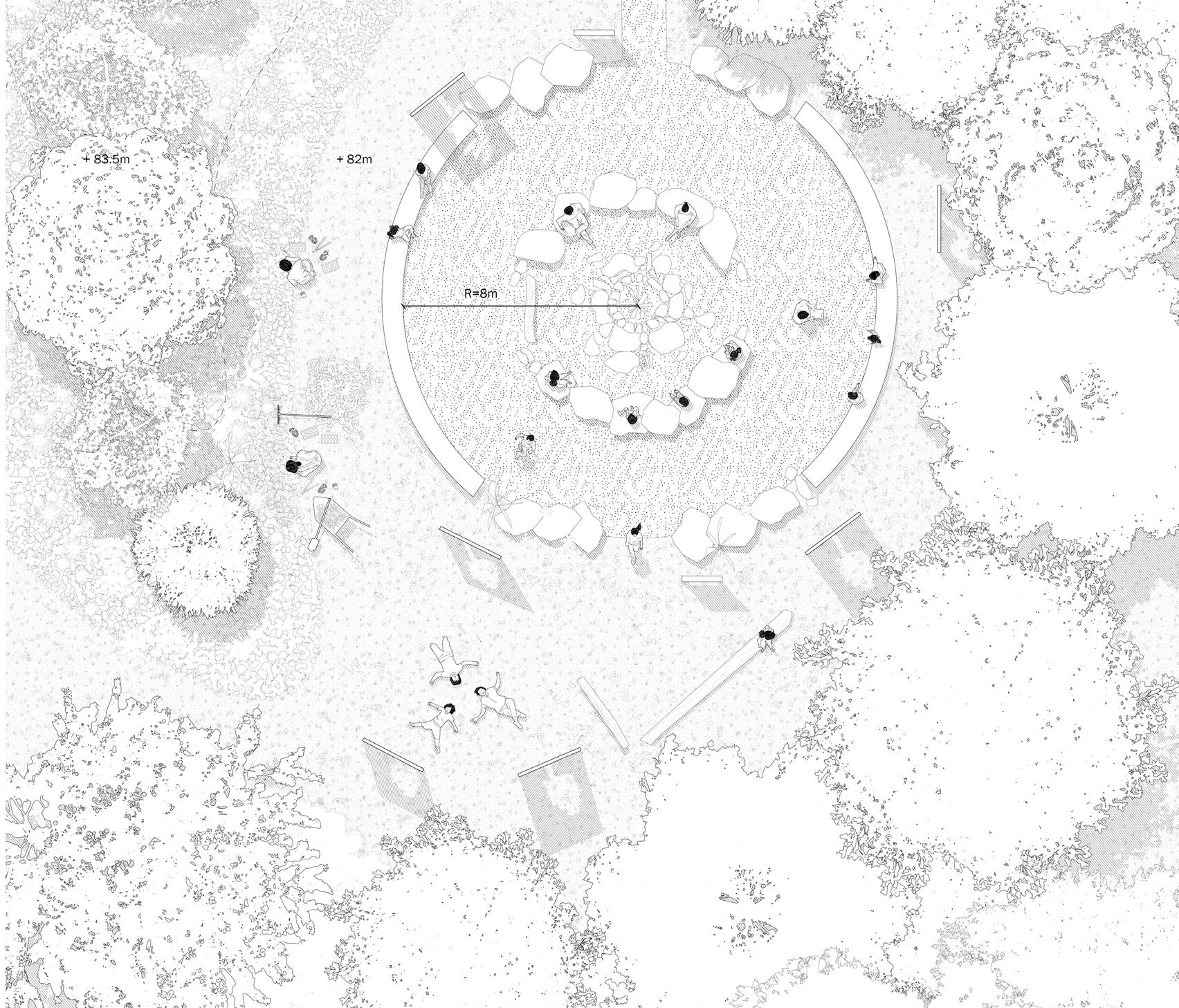
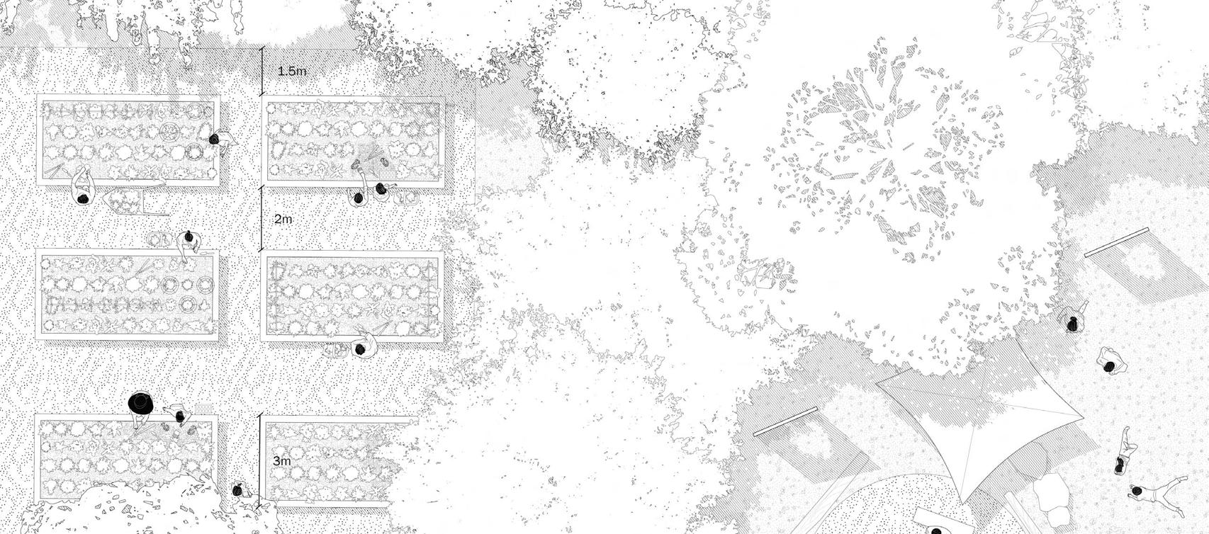
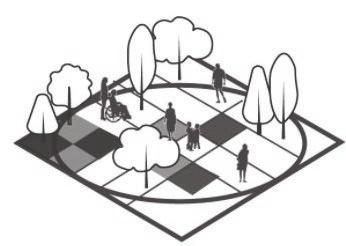
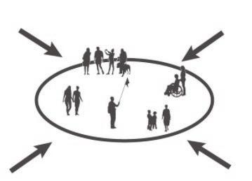
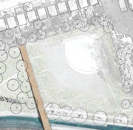
The outdoor education paces are templates for an adaptive environment that hopes to be an equitable and open space for all users to learn about the park. The requirements of Outdoor Education are illustrated above with importance in Place-based thinking, Activities, Multi-sensory experiences, Inclusiveness, and a Focus on ecology. Each of these principles are solved through the inclusion of signage, artistic landmarks, and accessible open spaces catered to each zone. The detailed site plan to the right highlights an example of a classroom in the woodland zone and its education around vegetation.
Much of the research for this project relates to the contradicting relationship between the ecological and demographic diversity within the Don Valley Area. Although located in the heart of Toronto, there is little to no connection to the significant ecological systems within the surrounding areas. As a result, there has historically been a lack of interest and social diversity within the area, especially in affluent neighbourhoods like Rosedale with high income white majorities.
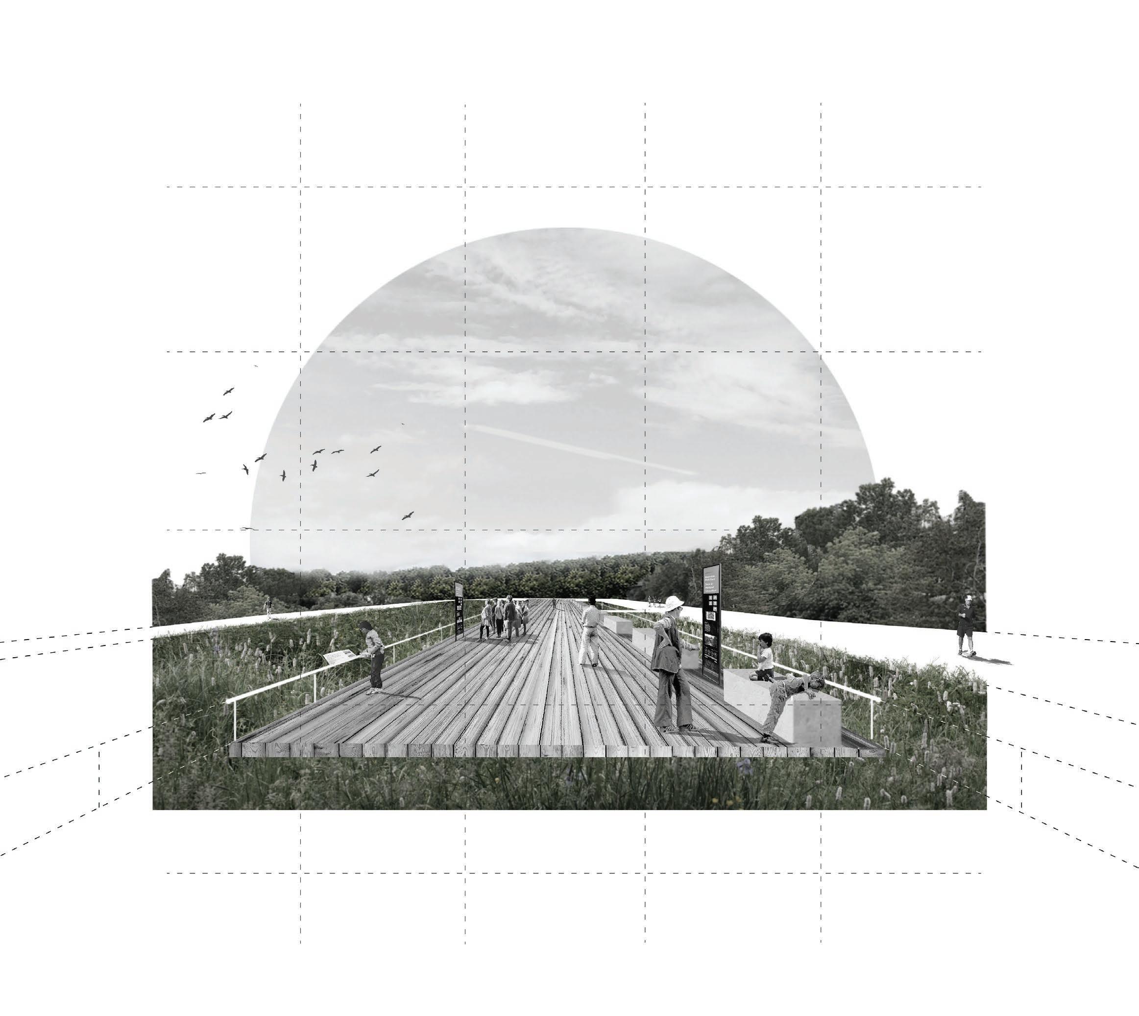
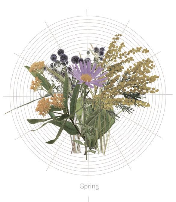
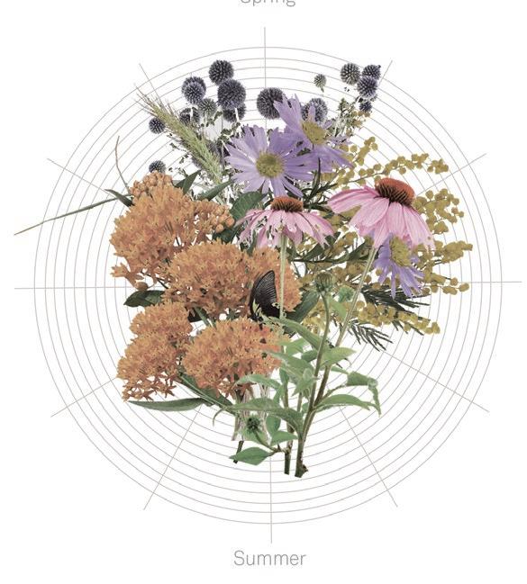
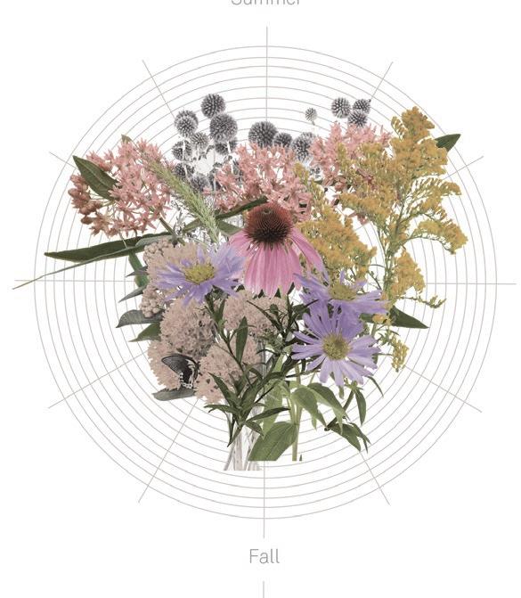
Whether it is during the summer walking along the boardwalk over the wet meadow, or in the fall collecting samples in one of the gathering spaces near the landfill zone, this project aims to teach visitors about this history in a way that brings about deeper connections and positive changes for the future. Essentially, it becomes a way for users to take the first step to making change, as the only true way to reach equilibrium is when one realizes there is an imbalance.

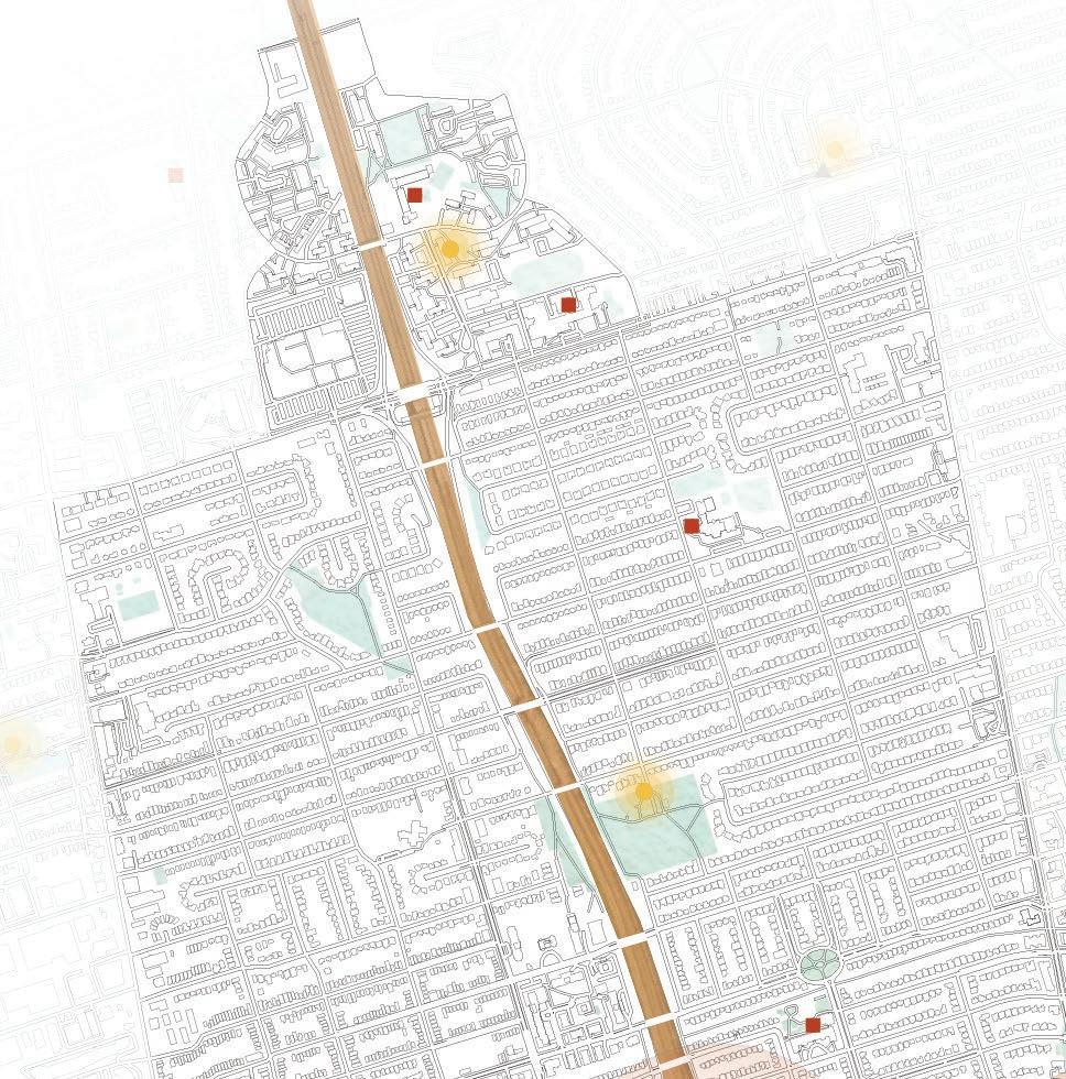

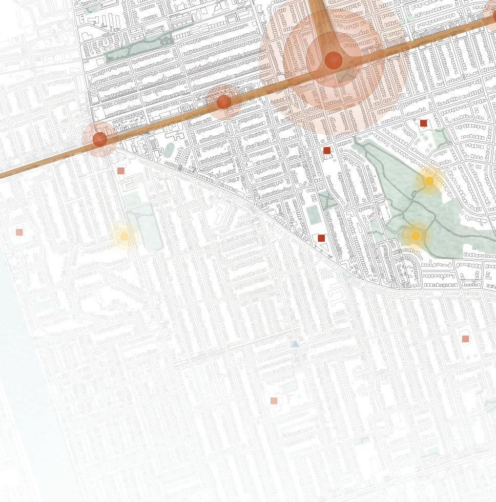


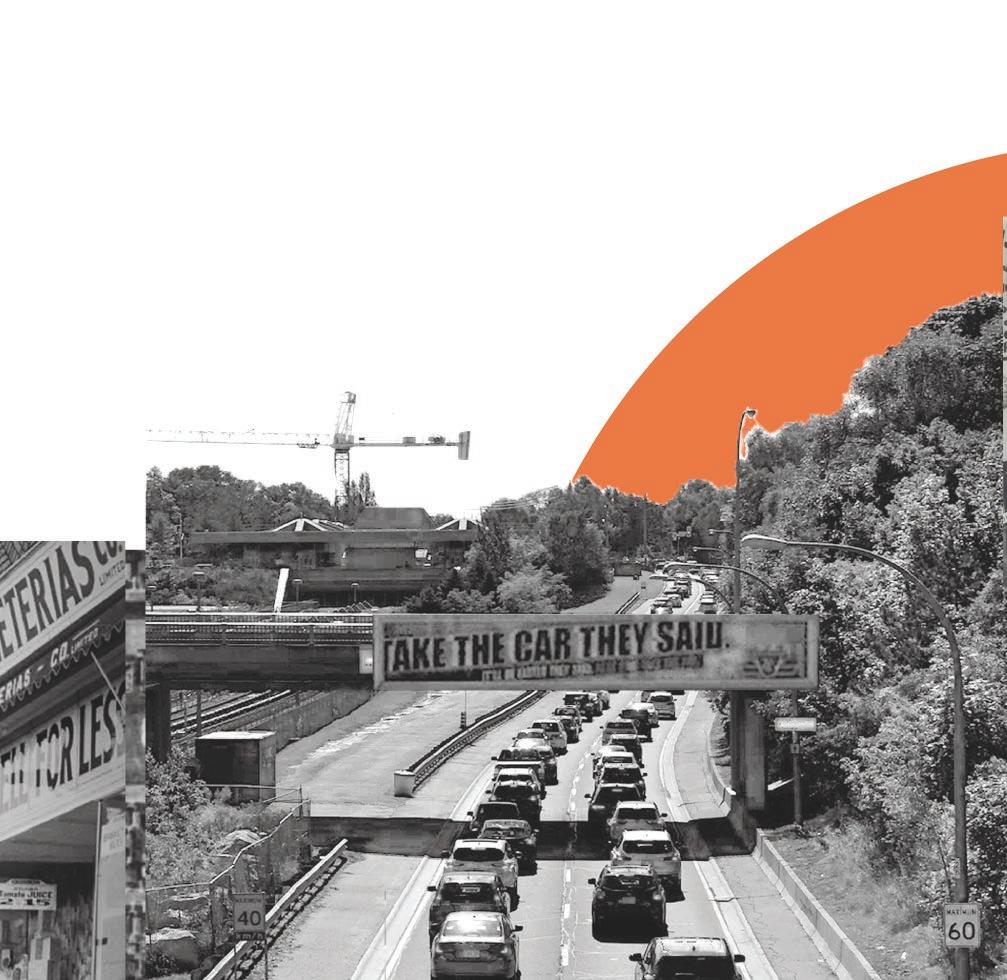
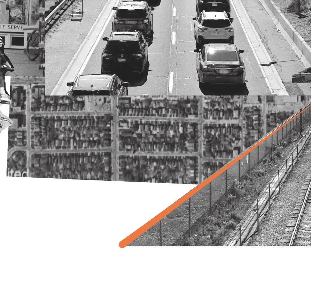
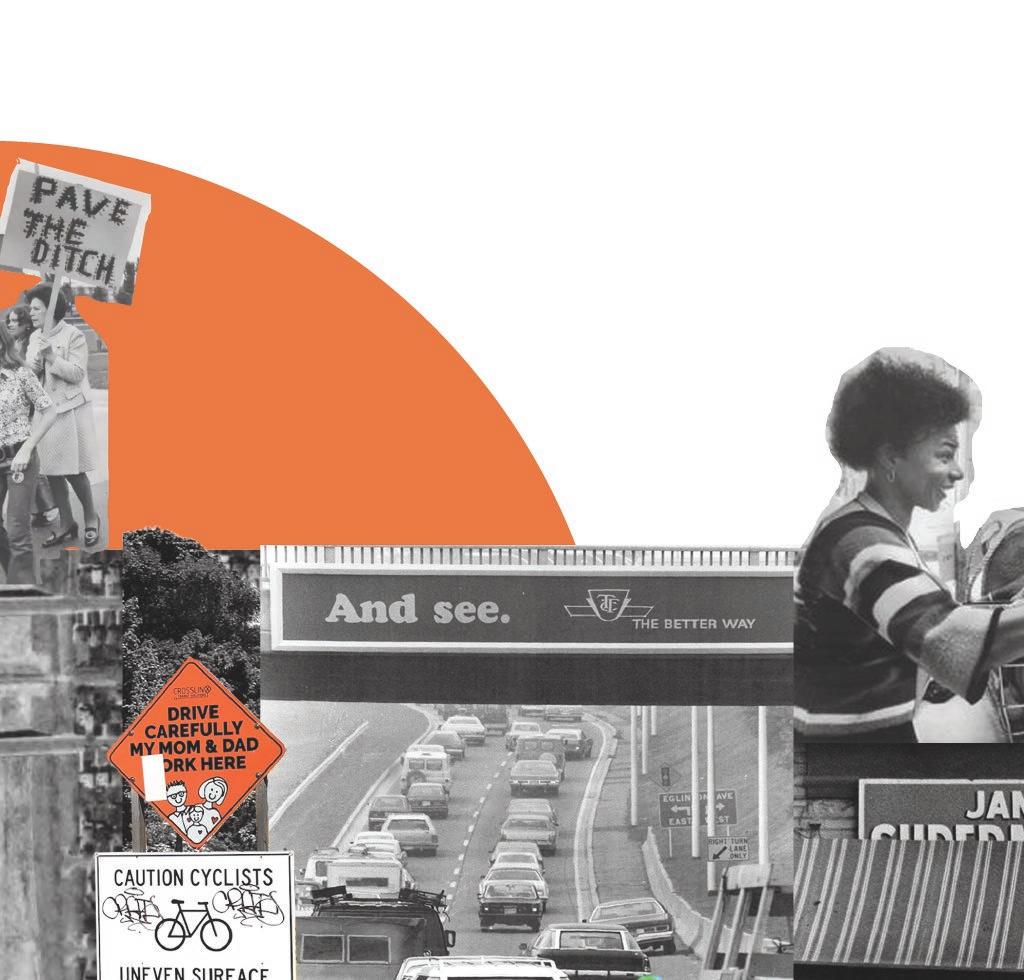
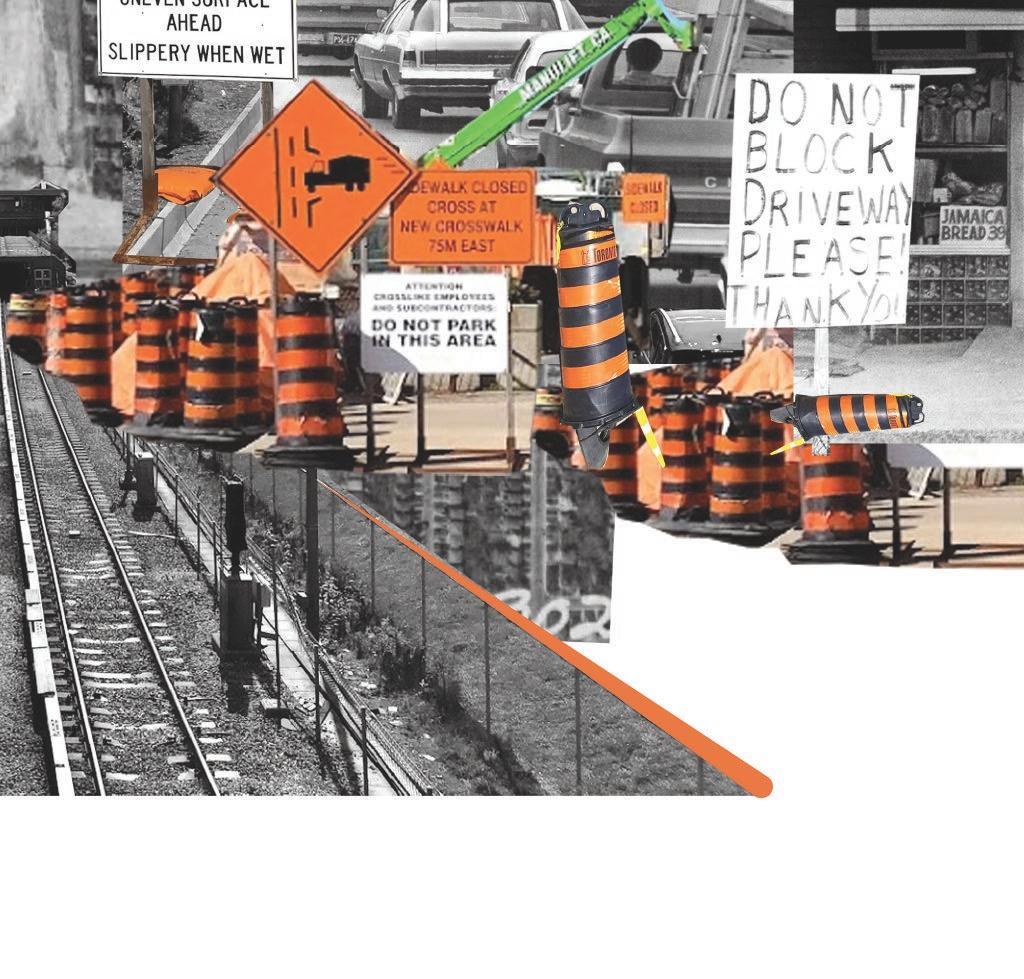
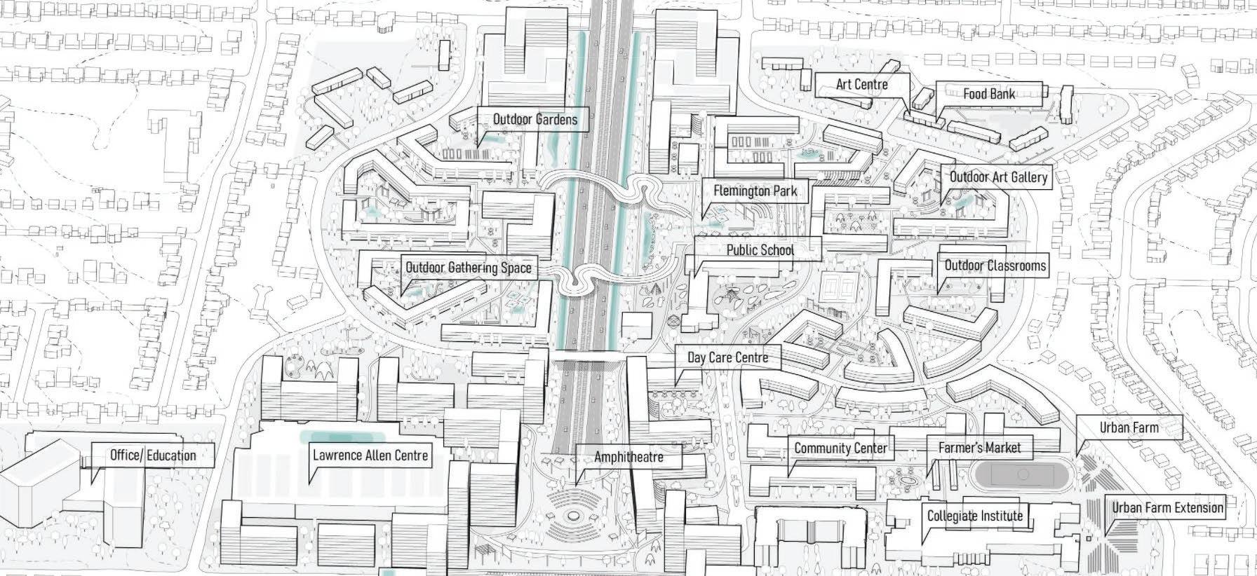
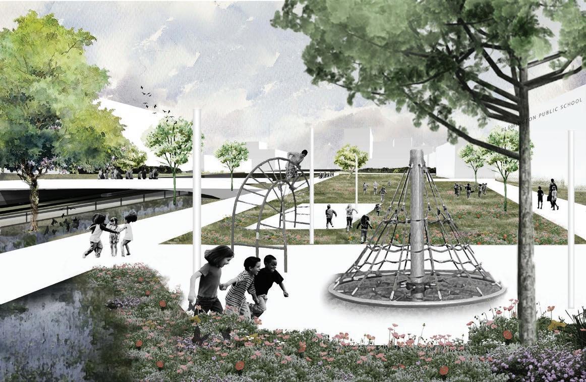
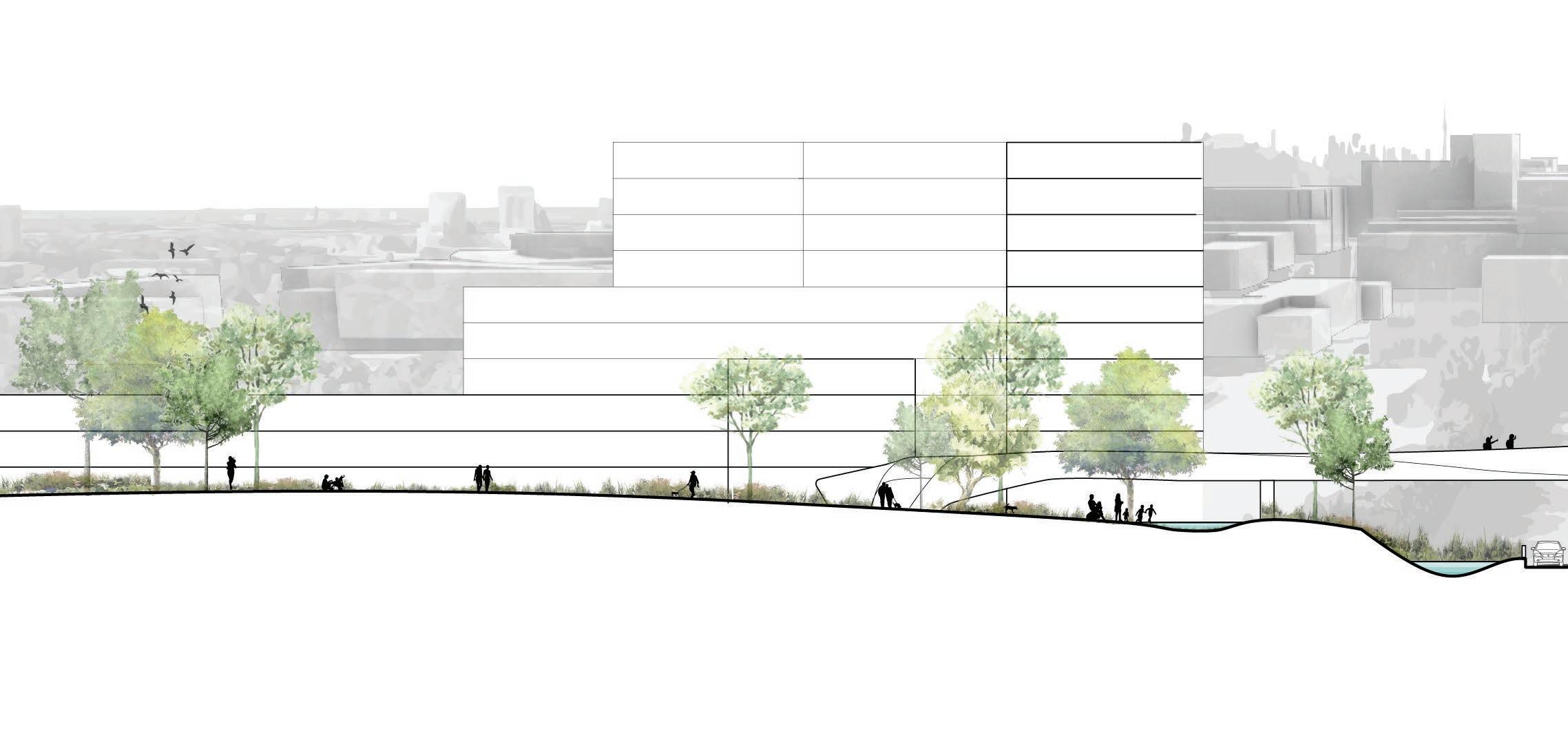
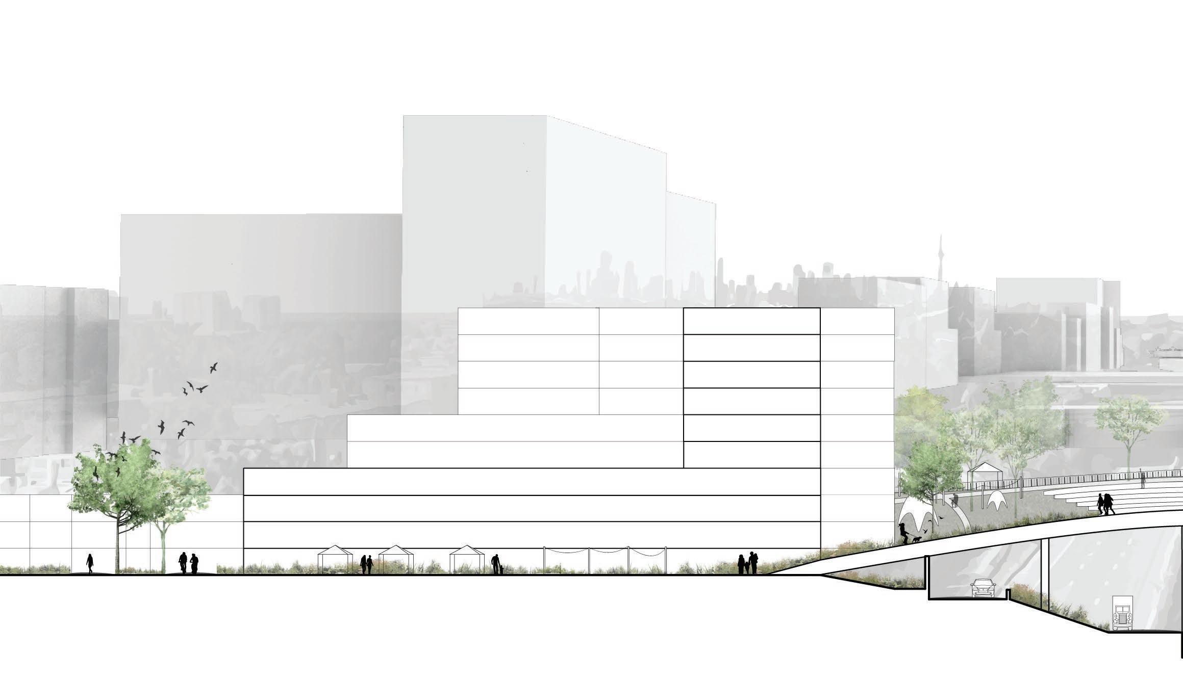
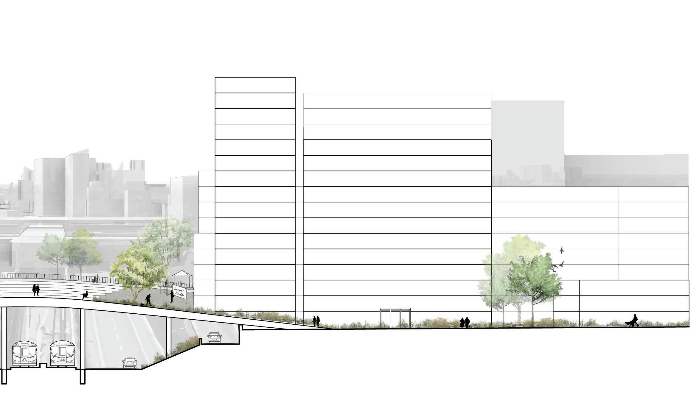
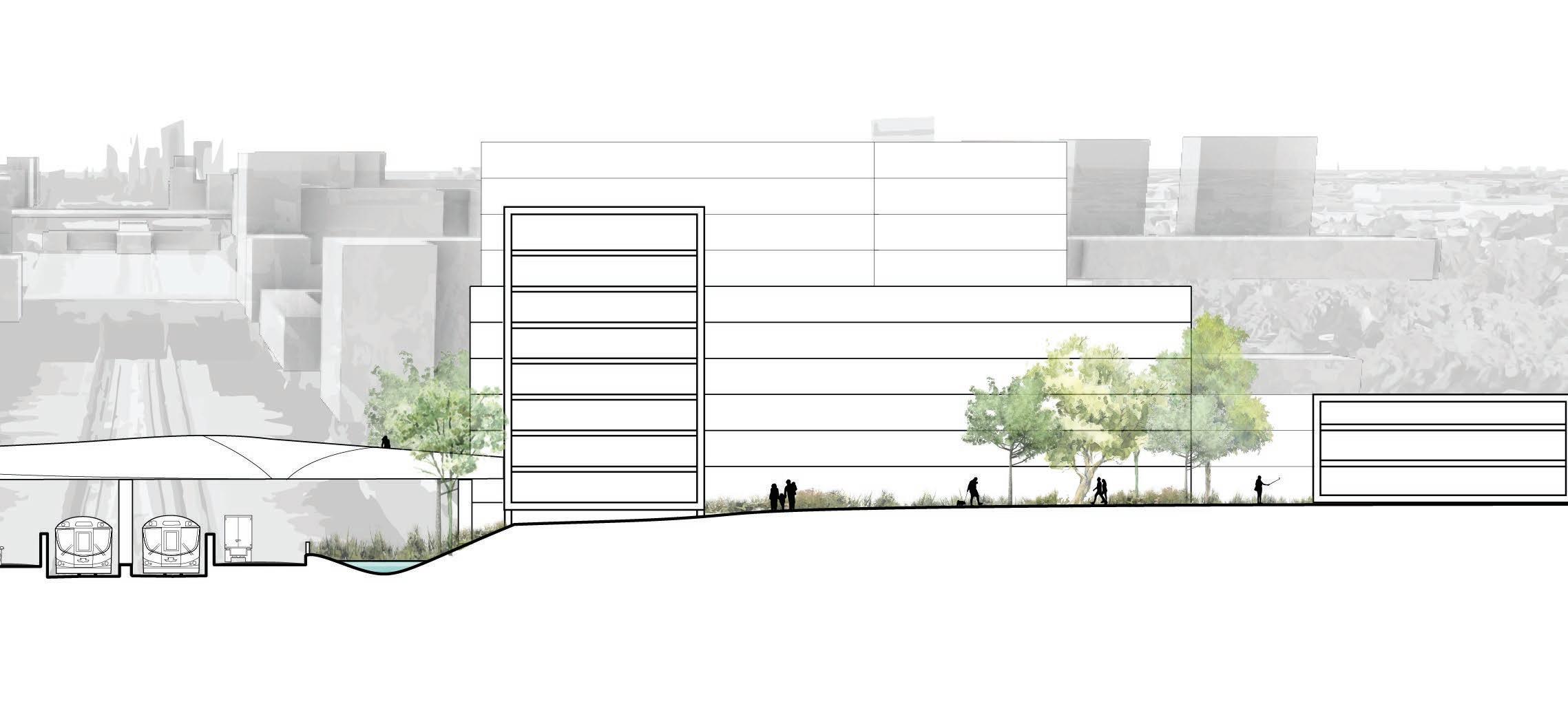
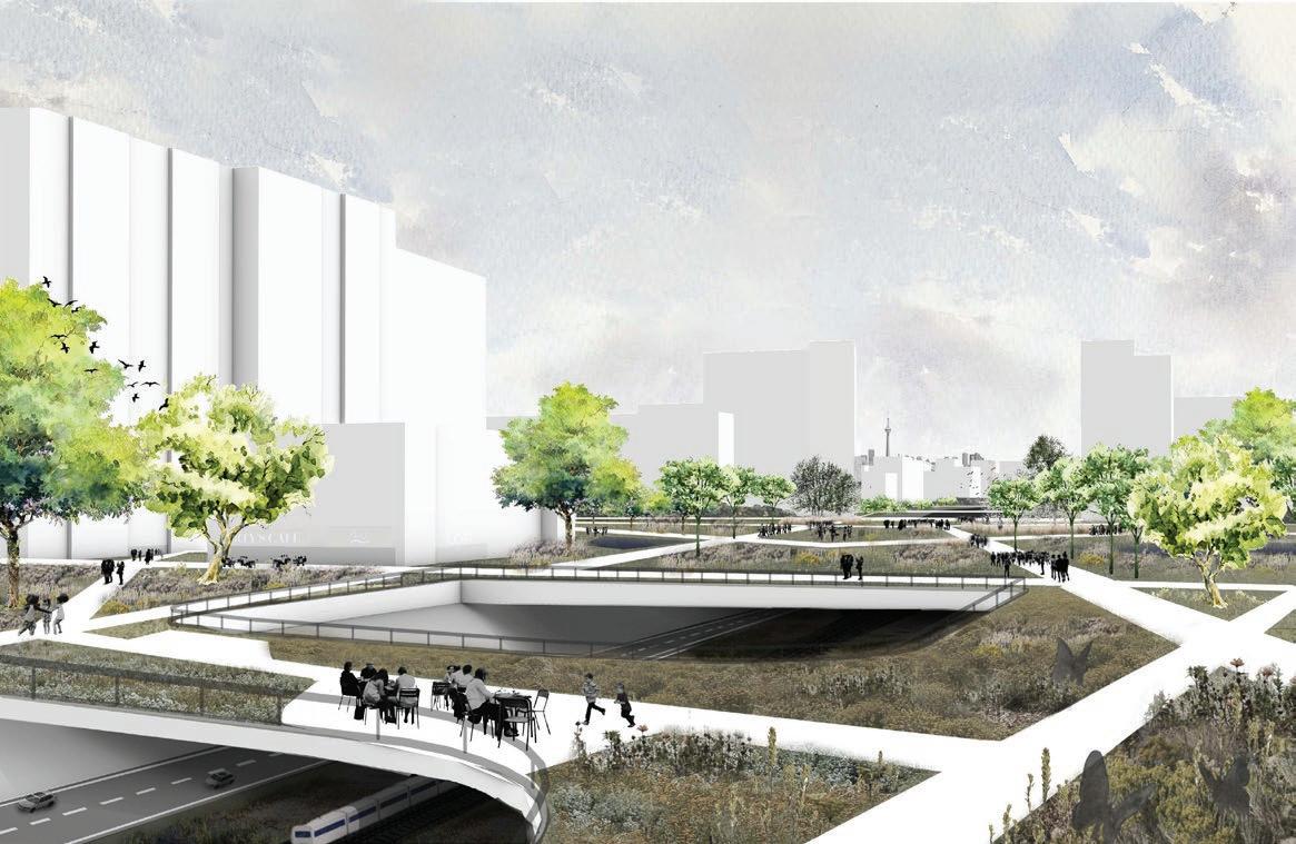
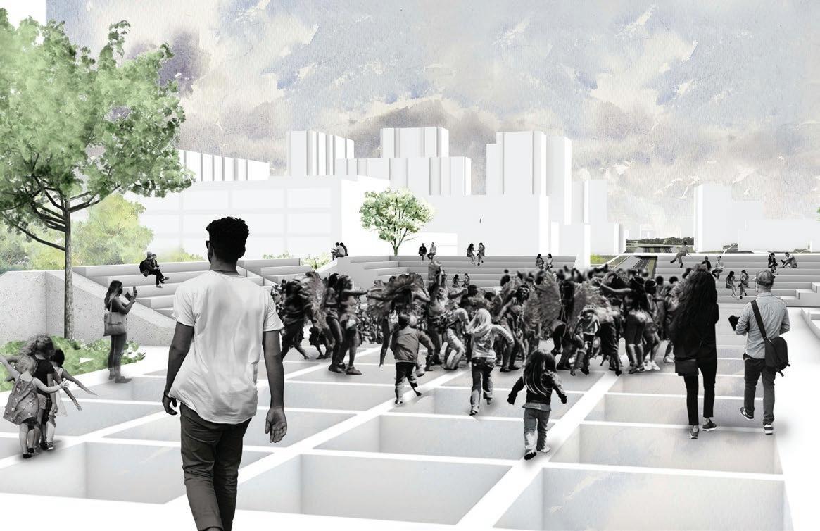
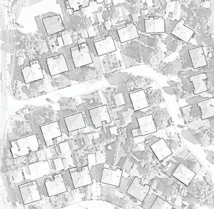
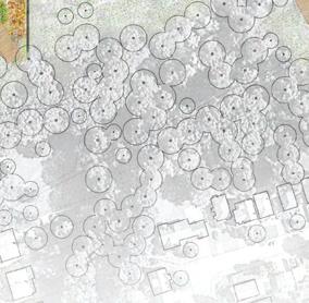
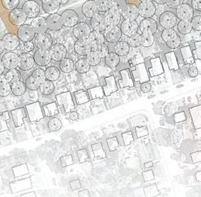
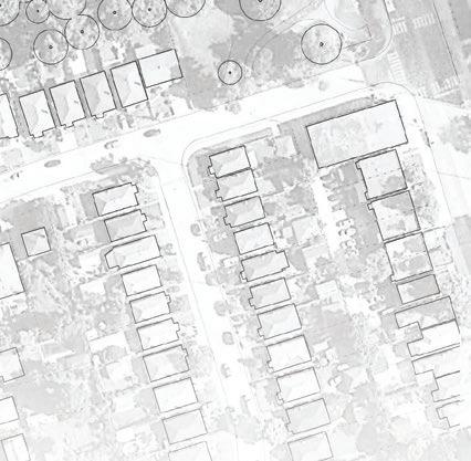
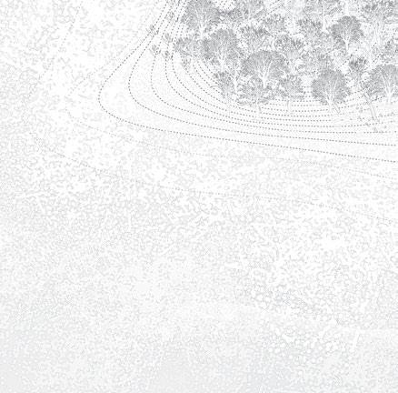
Highways have the ability to both connect and fragment communities. The burden of fragmentation caused by transportation infrastructure is unequally distributed within adjacent communities. Allen Road, located in Toronto, is one of the shortest Expressways in the city. It connects to Highway 401 and terminates to the south abruptly, at Eglinton. The Expressway still stands today fragmenting the communities of Lawrence Heights, Forest Hill, and Fairbank. Ultimately, this project stands as a case study or potential framework for how community-centralized landscape design can become the medium for bridging the gap, physically and metaphorically, in communities served or historically fragmented by highway infrastructure.
WEBSITE | BRIDGINGTHEGAP.CARGO.SITE
ACADEMIC |IN COLLABORATION WITH EMILEY
SWITZER-MARTELL & ATOUSA BLAIR
(ALL GRAPHICS INDEPENDENT)

DATE COMPLETED | DEC 2021
LENGTH | SEMESTER LONG

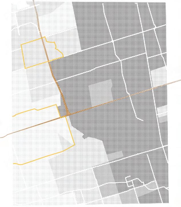
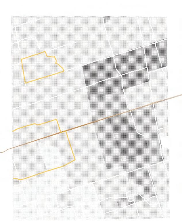
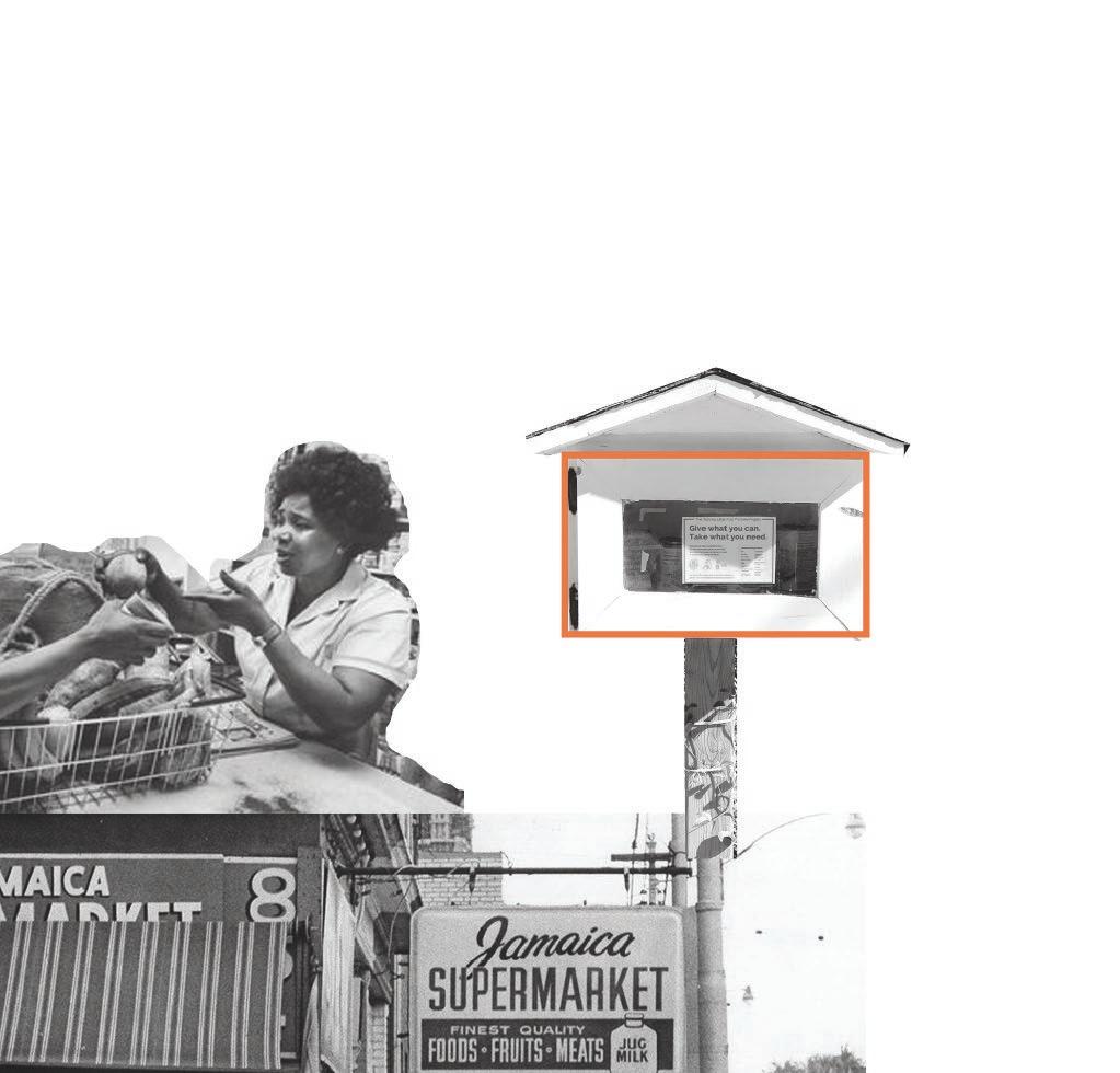
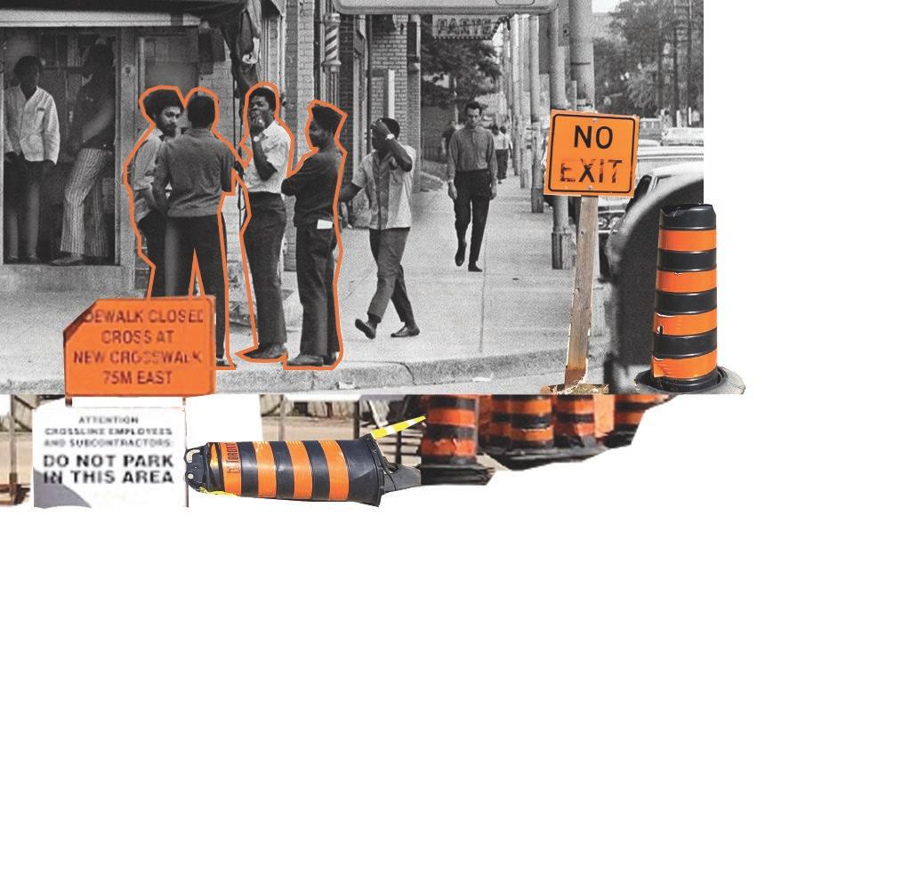
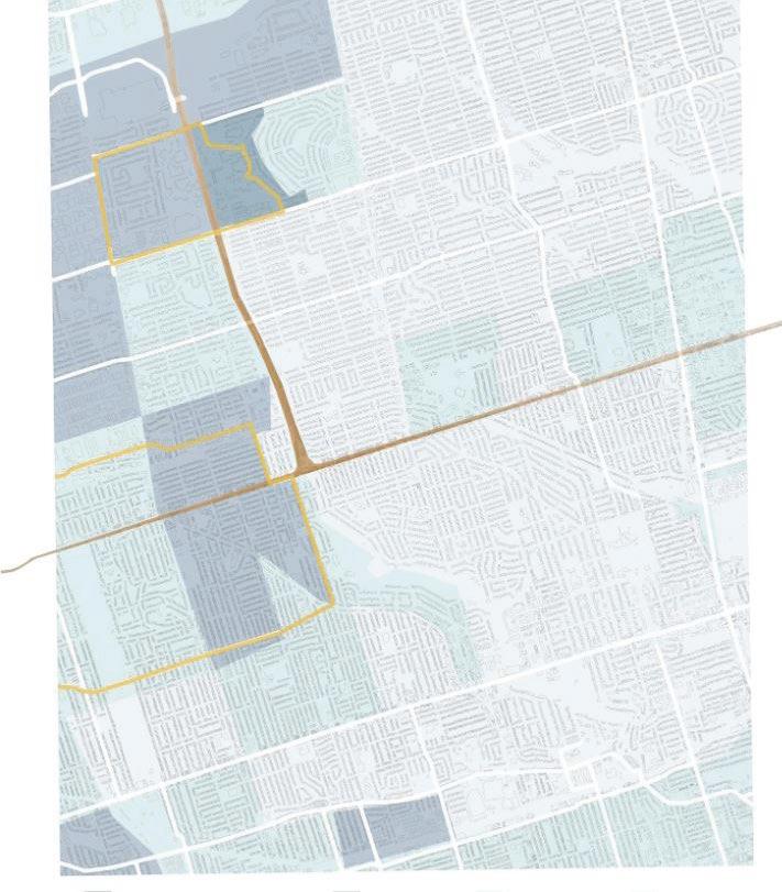
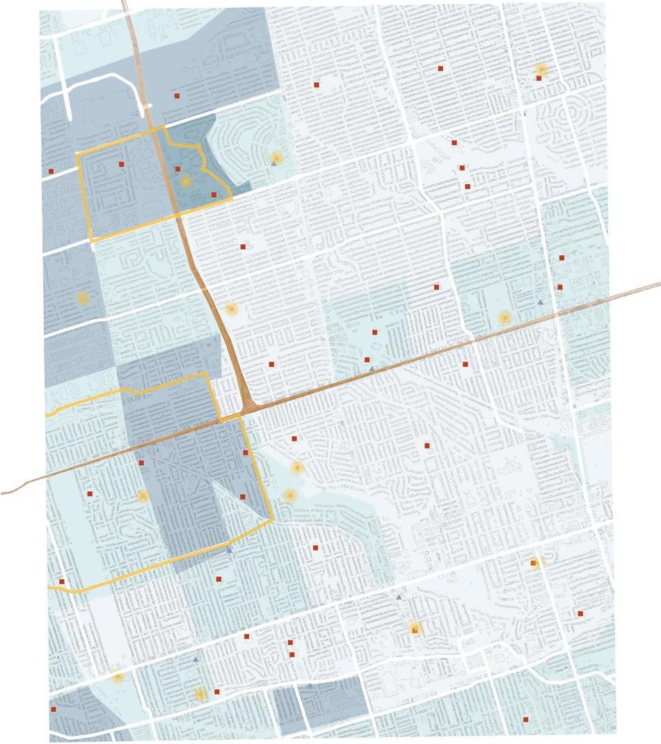
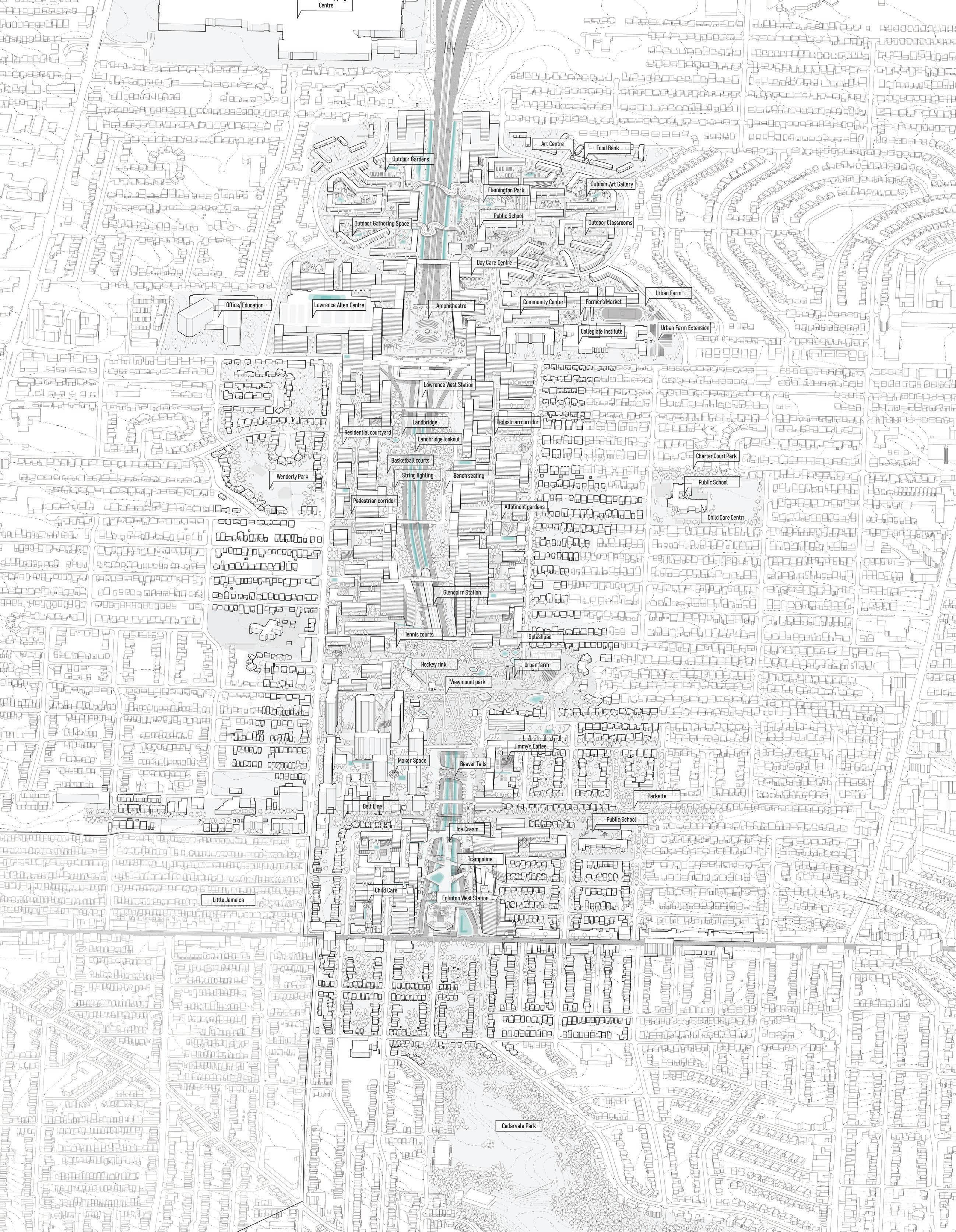

Community Land Trusts are encouraged in the process of redensification for this site. Additionally, the terms “Community”, “Land” and “Trust” provides a framework for each of the focus areas. Emphasizing the Community of the North node in Lawrence heights, the Land and existing conditions from Lawrence West to Viewmount Park, and the Trust that hopes to be re-established for Eglinton West and Little Jamaican residents.
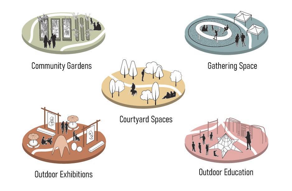
In the context of Lawrence Heights, there is a need for spaces that offer employment, education and connective infrastructure for residents. The spaces that are created in between newly consolidated residential and commercial buildings, can use this as a basis to create community gardens, outdoor exhibitions, outdoor classrooms and more accessible gathering spaces.
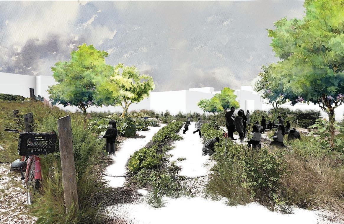
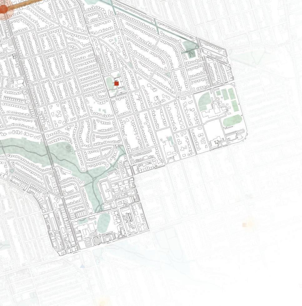
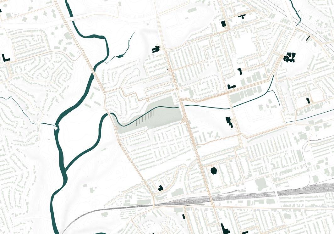
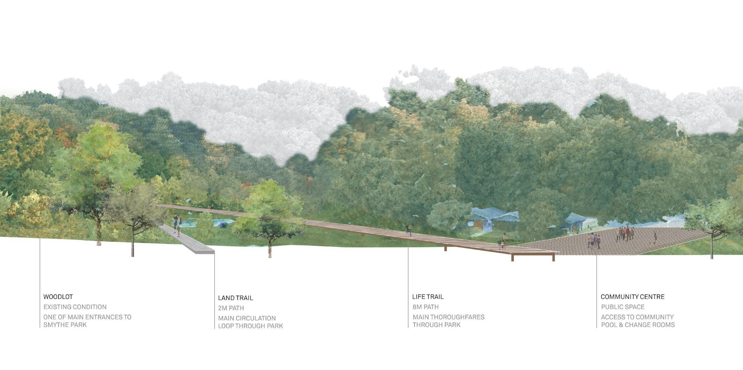
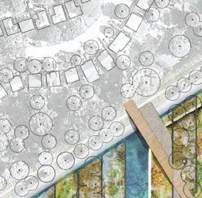
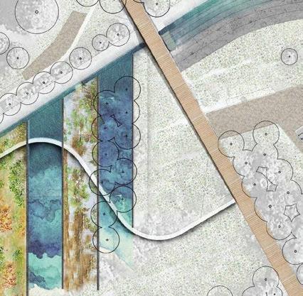
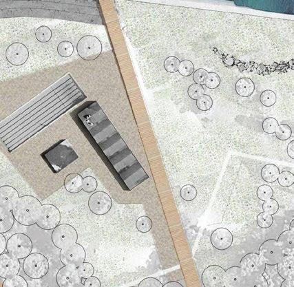
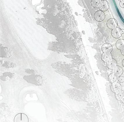
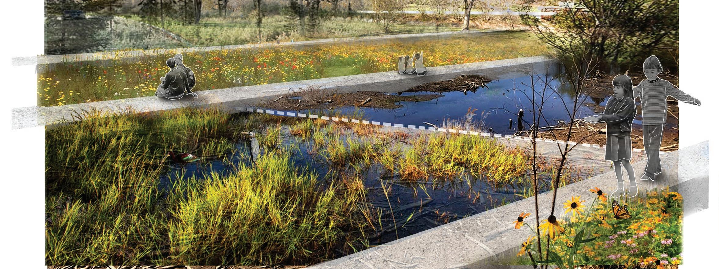
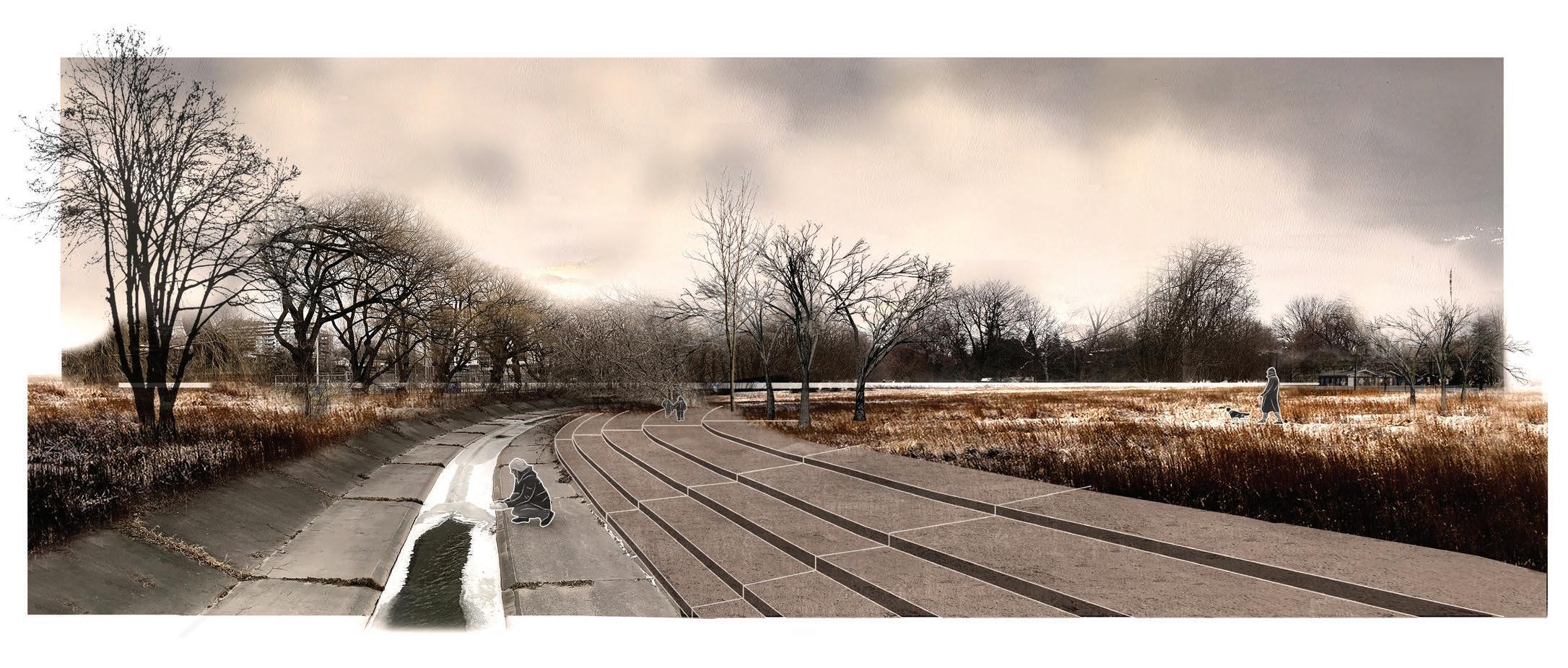
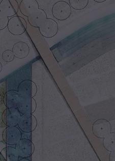
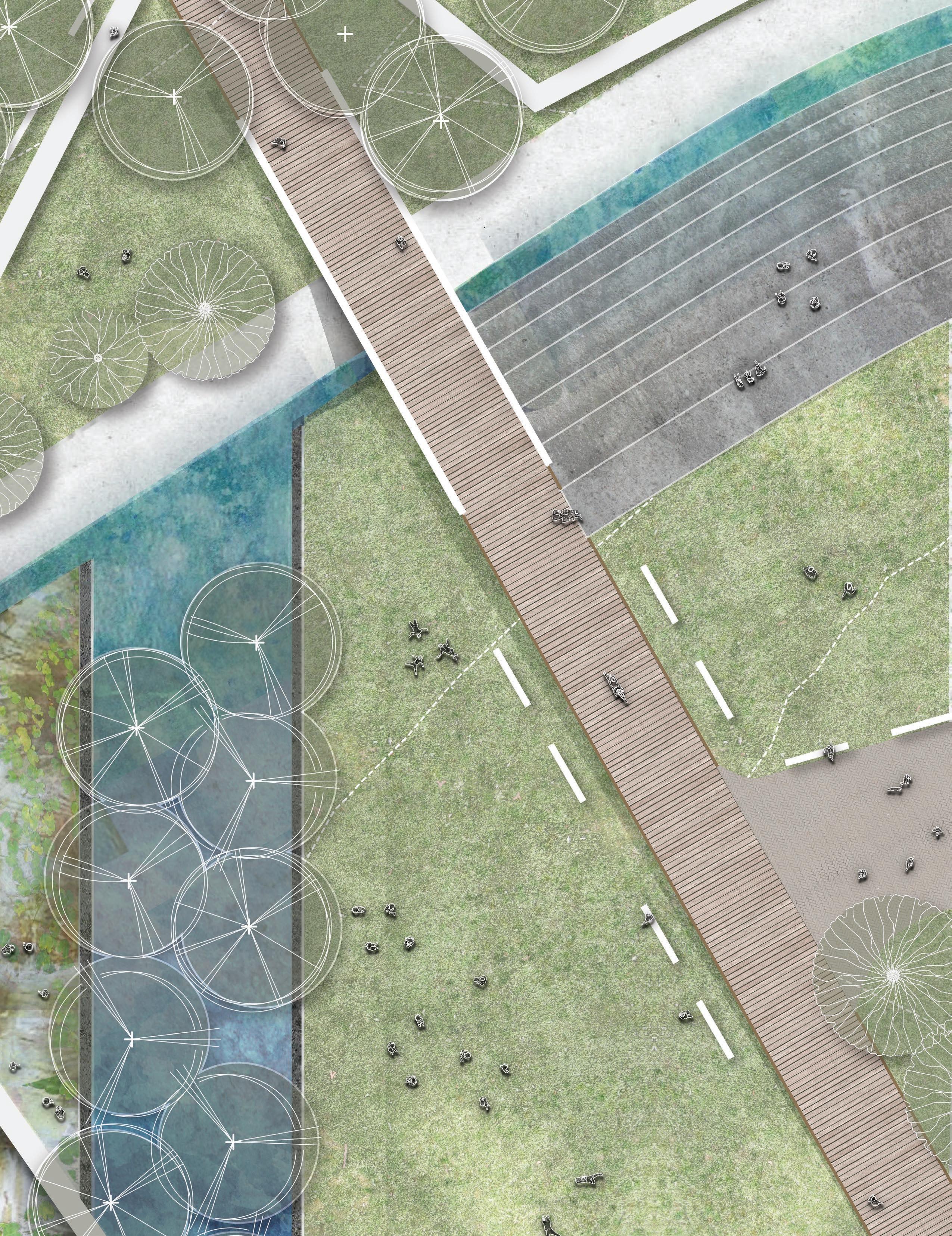
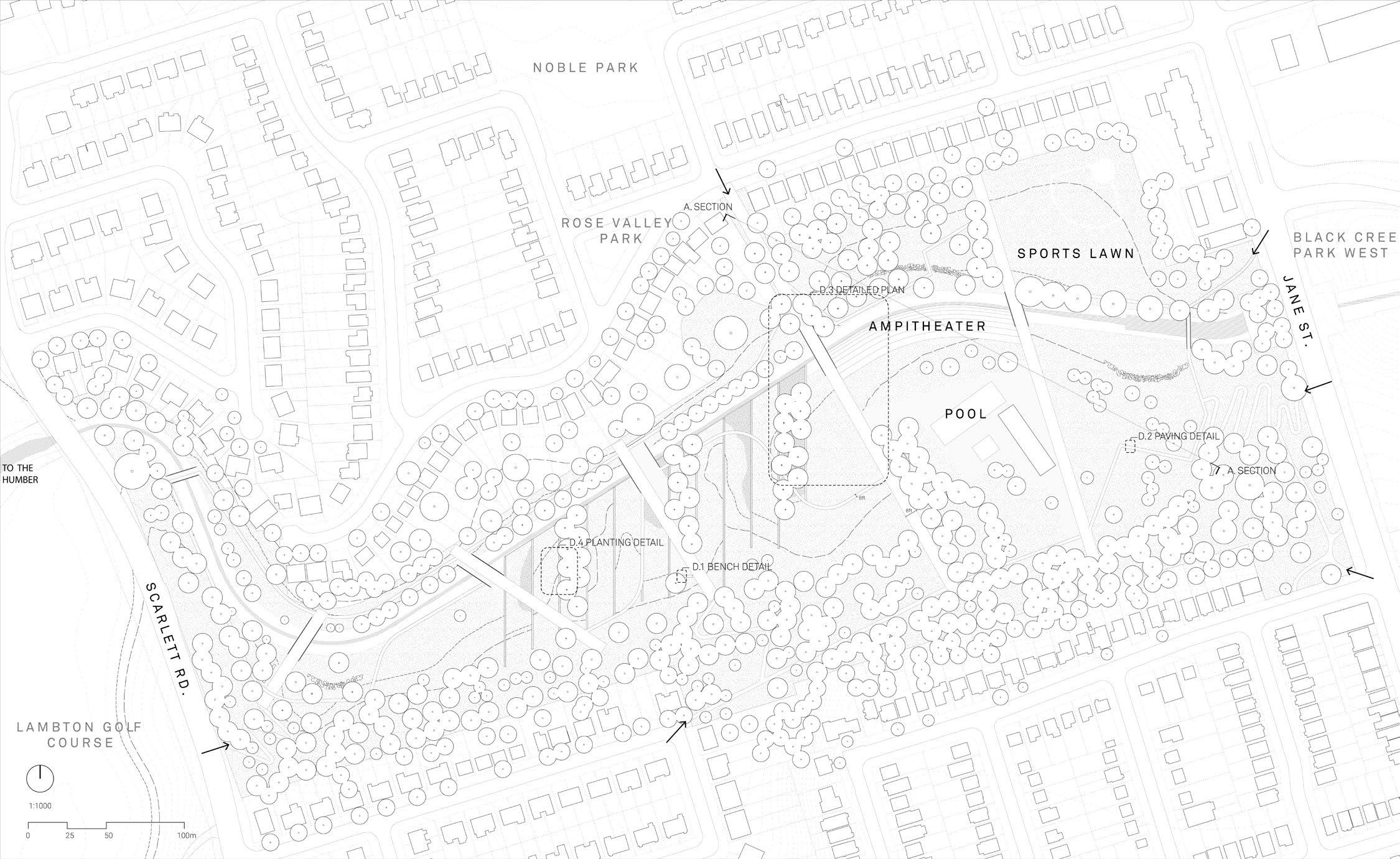
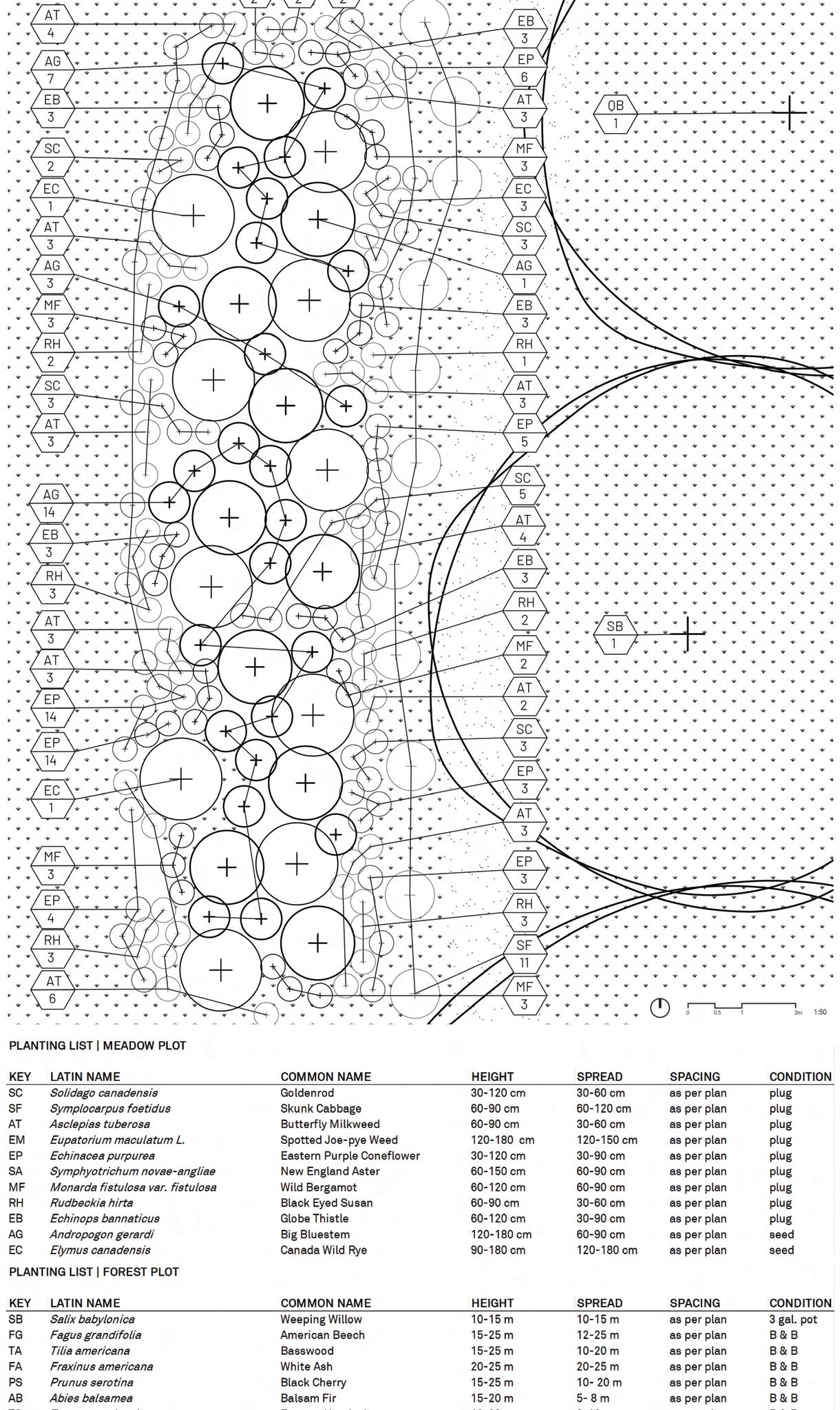
Inundating Learnscapes is a project that strives to articulate a framework for urban parks with minimal intervention to educate communities and younger generations on the beauty and ecological necessity of flooding. The design is located within Smythe Park, an area that undergoes extensive flooding events from the runoff of the impermeable Black Creek watershed leading towards the Humber River. Through the use of curriculum based trails emphasizing Life, Water and Land, as well as floodable garden plots, there becomes opportunity for students, spontaneous or longtime visitors to engage and learn from the park. The focus throughout the site is to create an ongoing connection not only through the pathways and circulation that lead to moments of interactivity, relearning, and discovery, but also through the network of education that can be formed from both existing and new visitors alike that can start to encourage this form of understanding an existing landscape through new experiences.
ACADEMIC | IN COLLABORATION WITH EMILEY SWITZER- MARTELL
DATE COMPLETED | APRIL 2022
LENGTH | SIX WEEKS
Initial research and diagramming indicated a network of schools adjacent to the park as well as the flood levels that dictated the height of boardwalks to ensure safe access to the park during larger storm events. Additionally, use of varying plant identifications were needed to create successional stages of floodable plots that ranged from annual species to more pronounced tree communities.
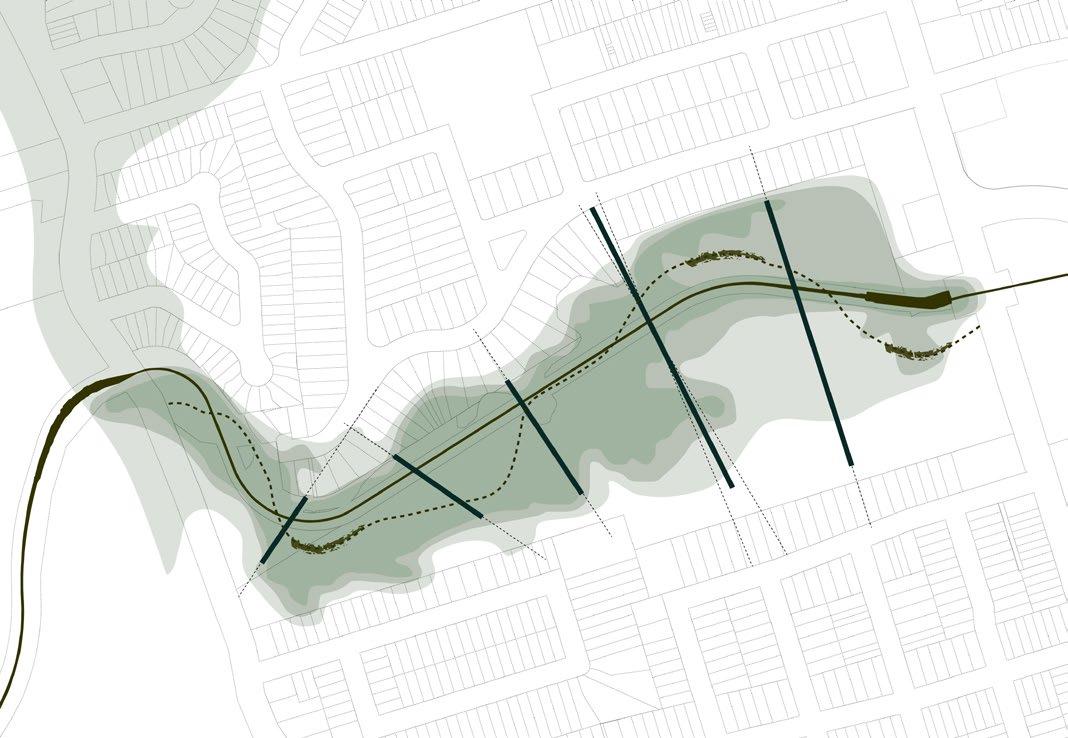
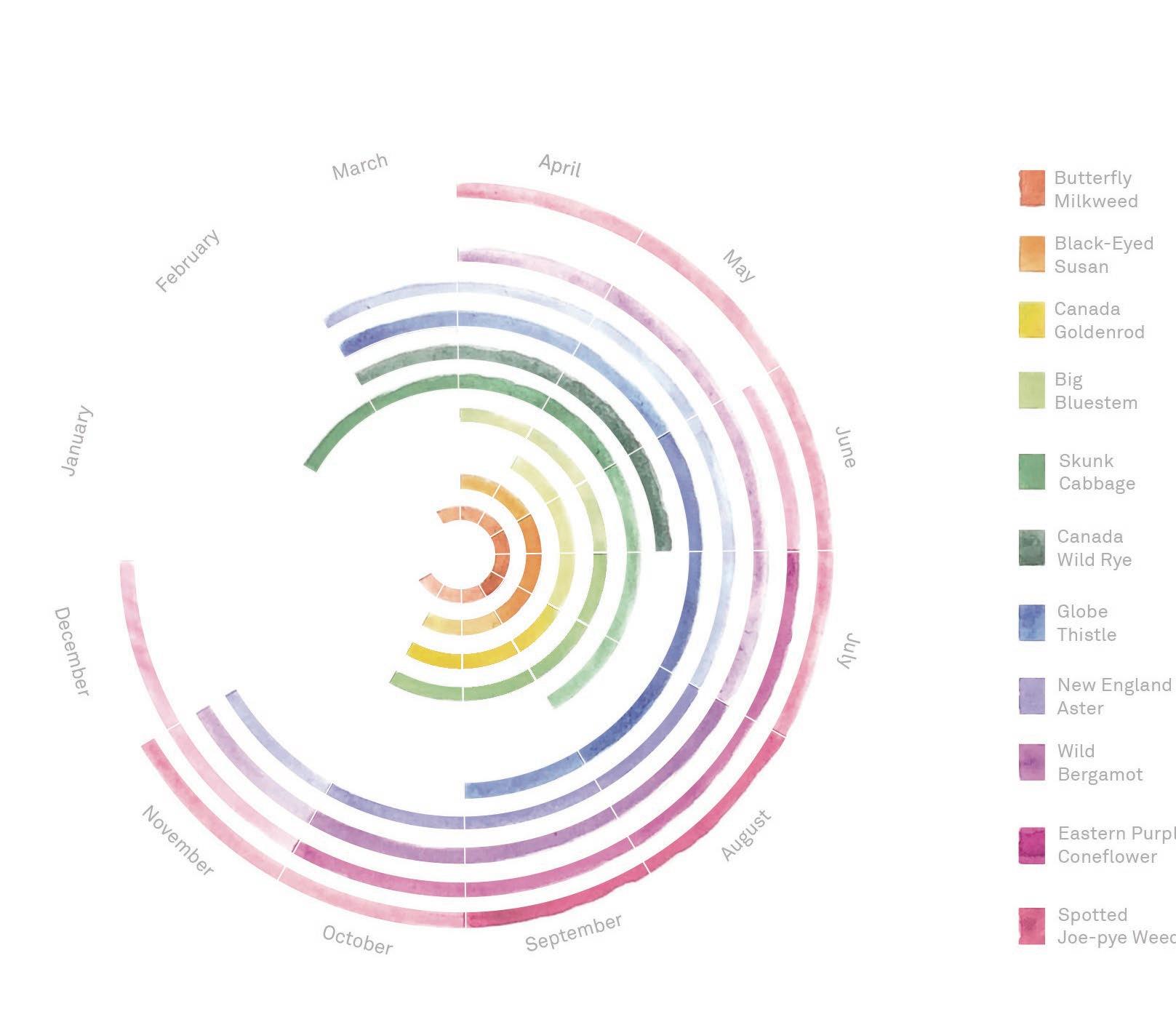
Although planted initially with a diverse set of native vegetation through community led initiatives, the flooding of black creek has the power to disturb plots and revert them to earlier successional stages for natural regeneration and continued community stewardship overtime.


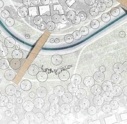

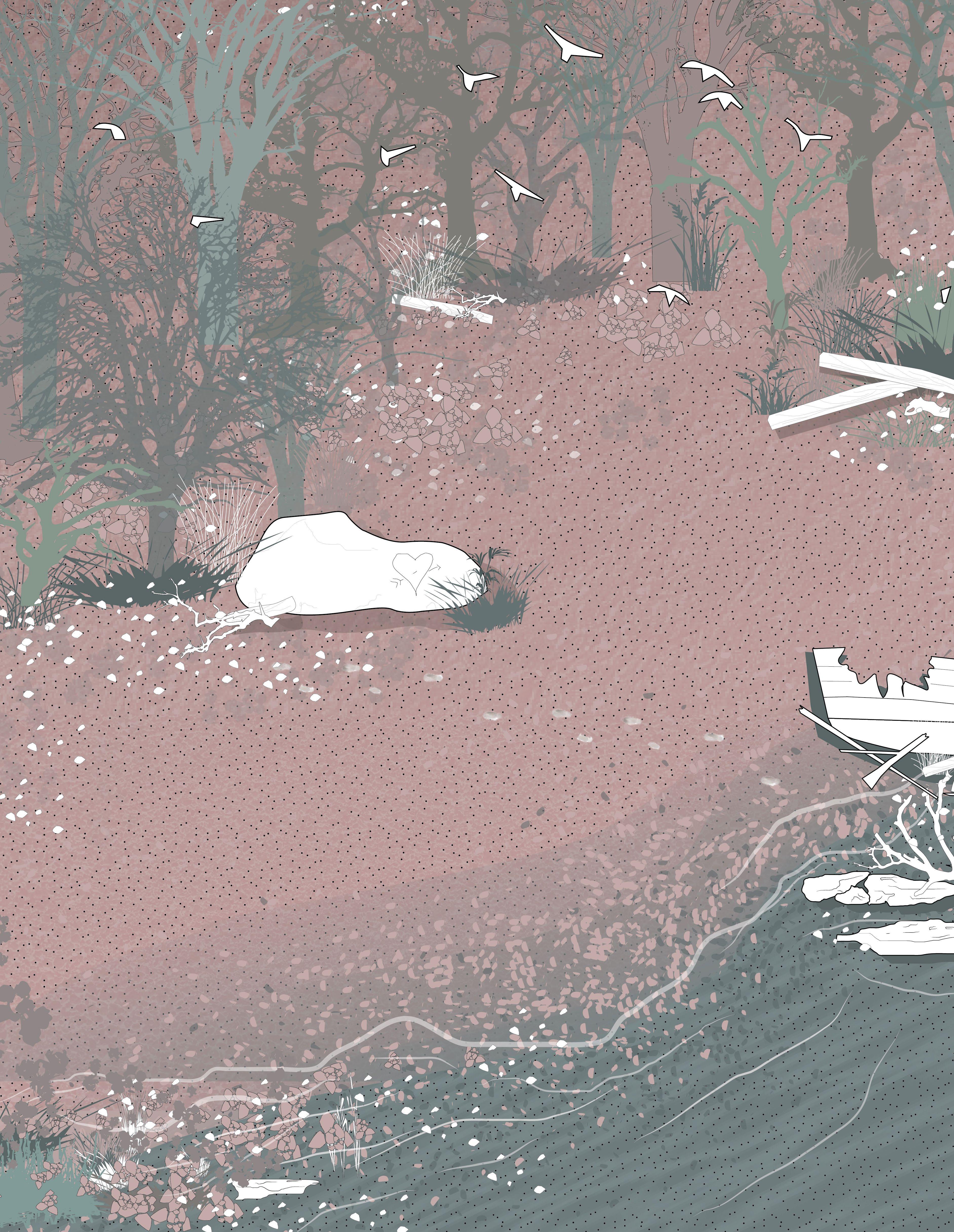
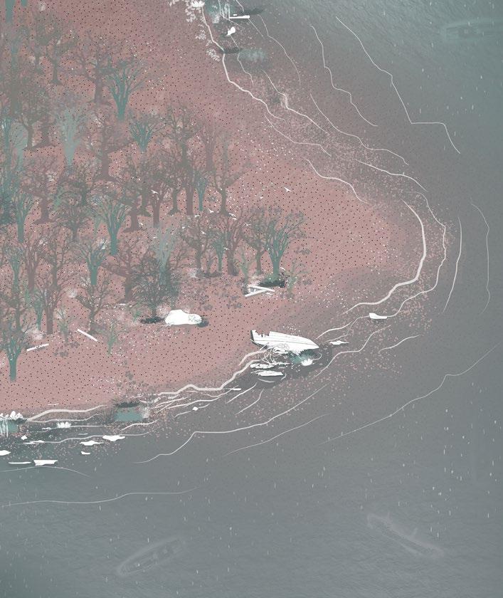
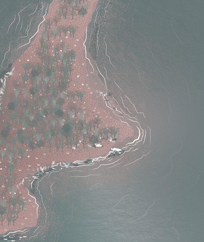
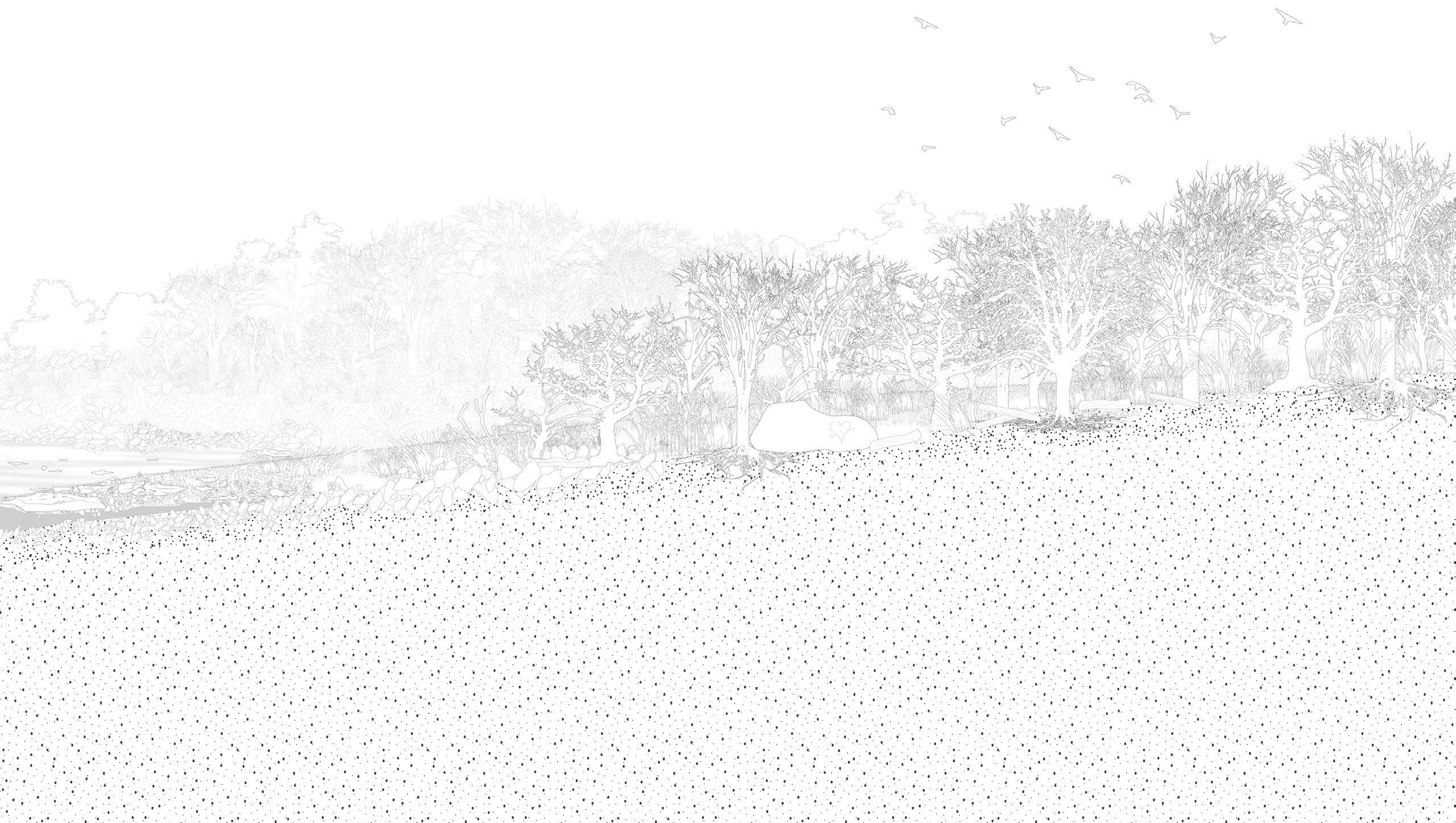
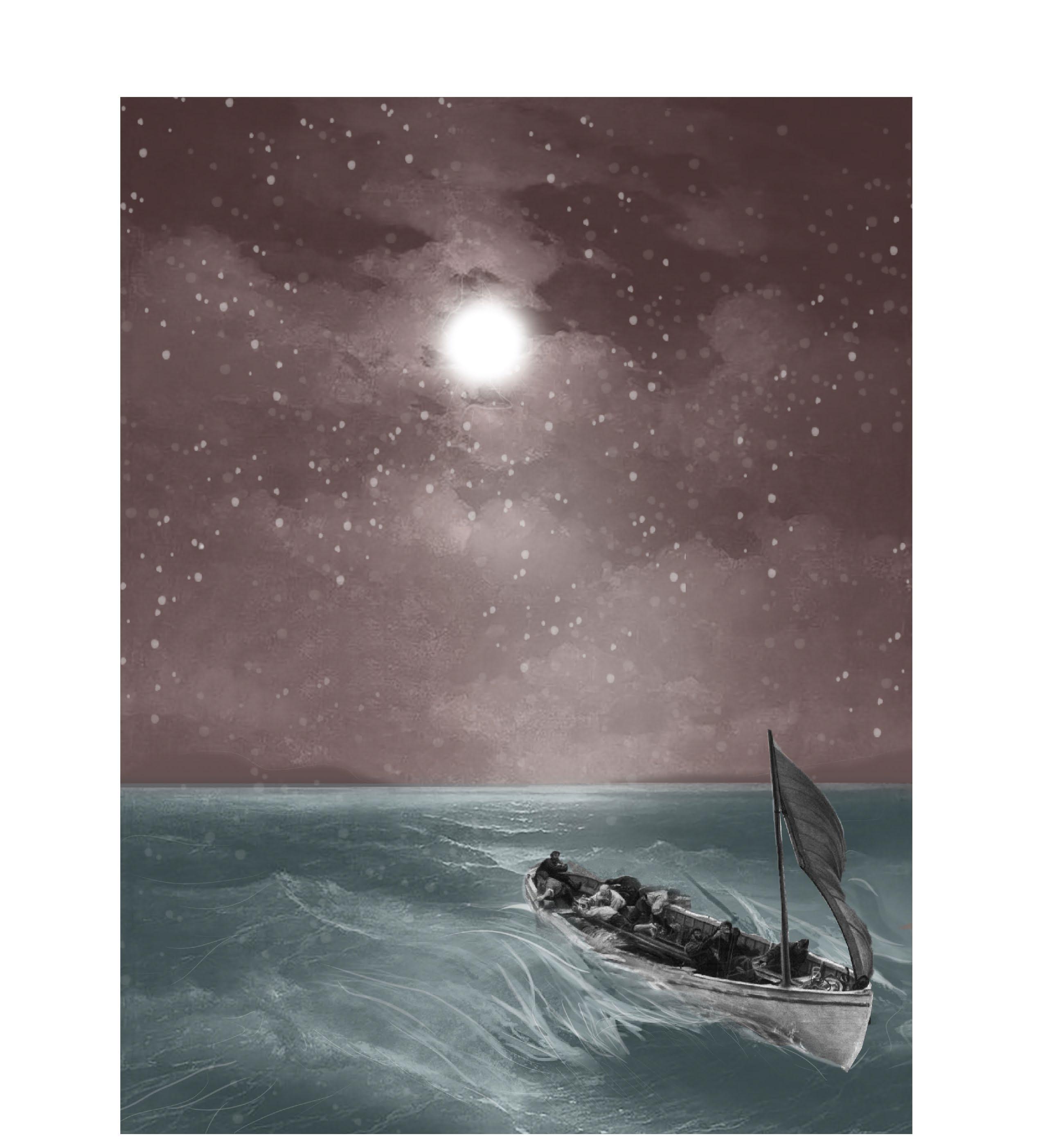
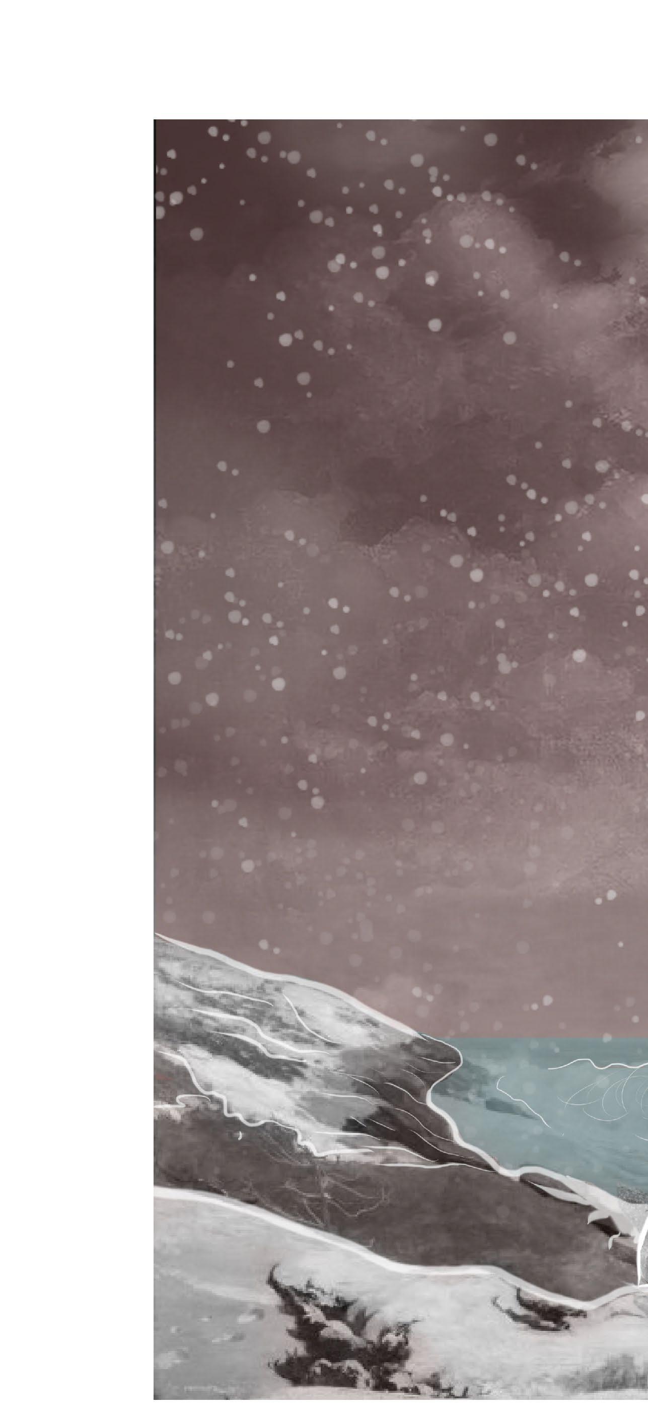
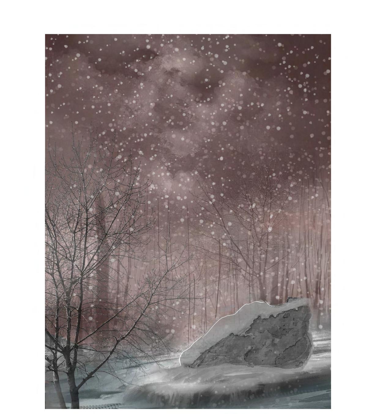
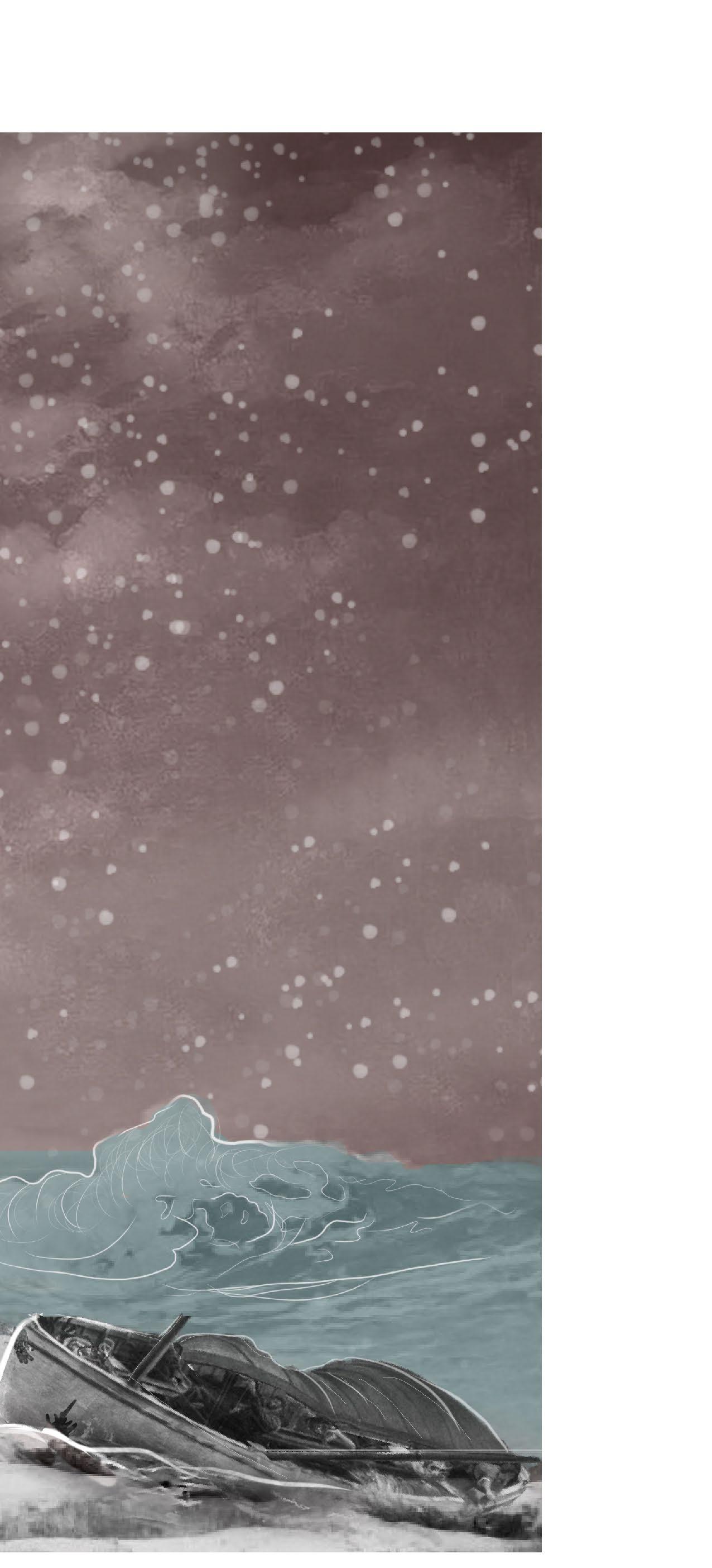
As part of the several Boston Harbour Islands formed by changing sea levels and glacial deposition, Lovells Island is a 62-acre landform some 7 miles offshore of downtown Boston. One of the most well-known stories of Lovells Island is that of Lovers Rock. Told by many to have occurred in 1786 on the 4th of December, a passenger boat carrying 13 people started to sink off the northern side of the island. As the shipwreck occurred within swimming distance of the harbour, all the passengers had made it to the shore. Unfortunately, the survivors were met with the vicious winds of a blizzard and no shelter or warmth. Among the victims on the island, there was a couple that was found in an embrace on top of what is now known to be “Lovers Rock”. The boulder where the lovers were found still stands today as a reminder of the tragic love story, and is one of the many remaining aspects that tell the rich history of the island. Ultimately, this project is a representational activity that enables new forms of thinking and illustrations of this narrative.
WEBSITE | LOVELLSISLAND.CARGO.SITE
DATE COMPLETED | APRIL 2021
LENGTH | SEMESTER LONG
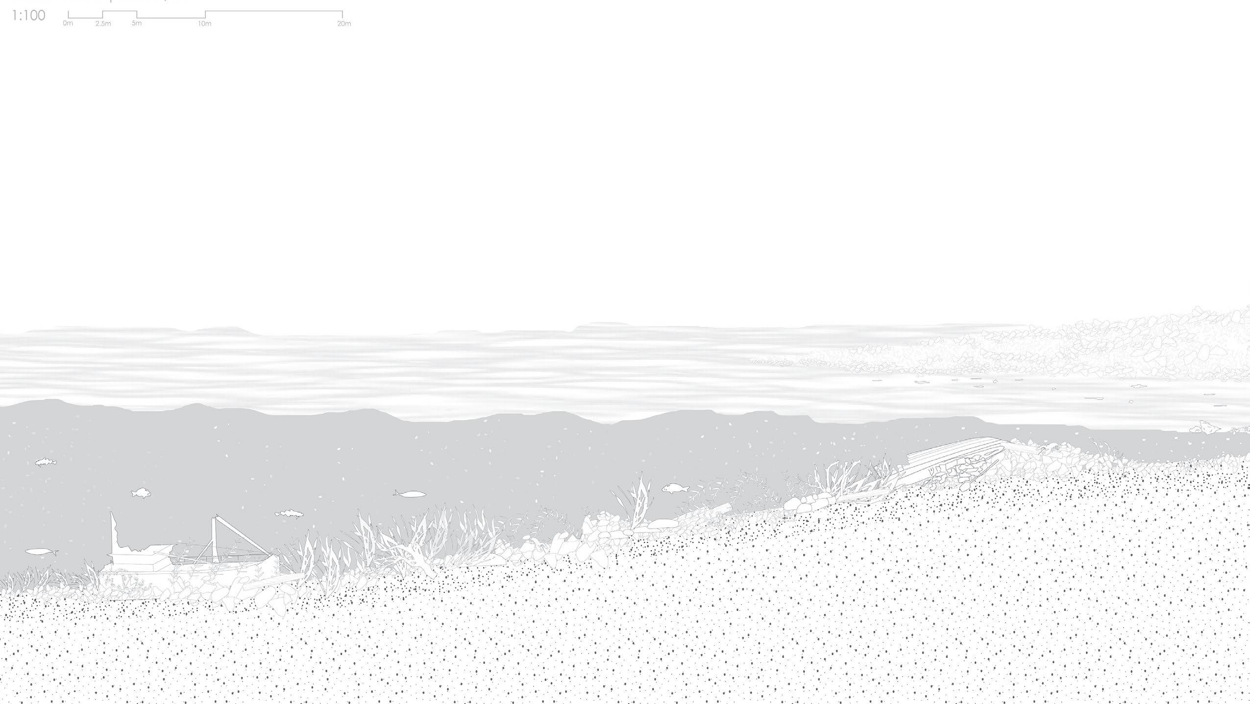


The map of Lovells Island showcases the proximity to the Narrow channels and the location of the shipwreck on the Northwest side. The section illustrates the presence of the site’s history leading one towards Lover’s Rock. As one approaches the site of the tragic incident, there is clear evidence of similar shipwrecks that have become mere additions to the graveyard of boats along Lovells shore.
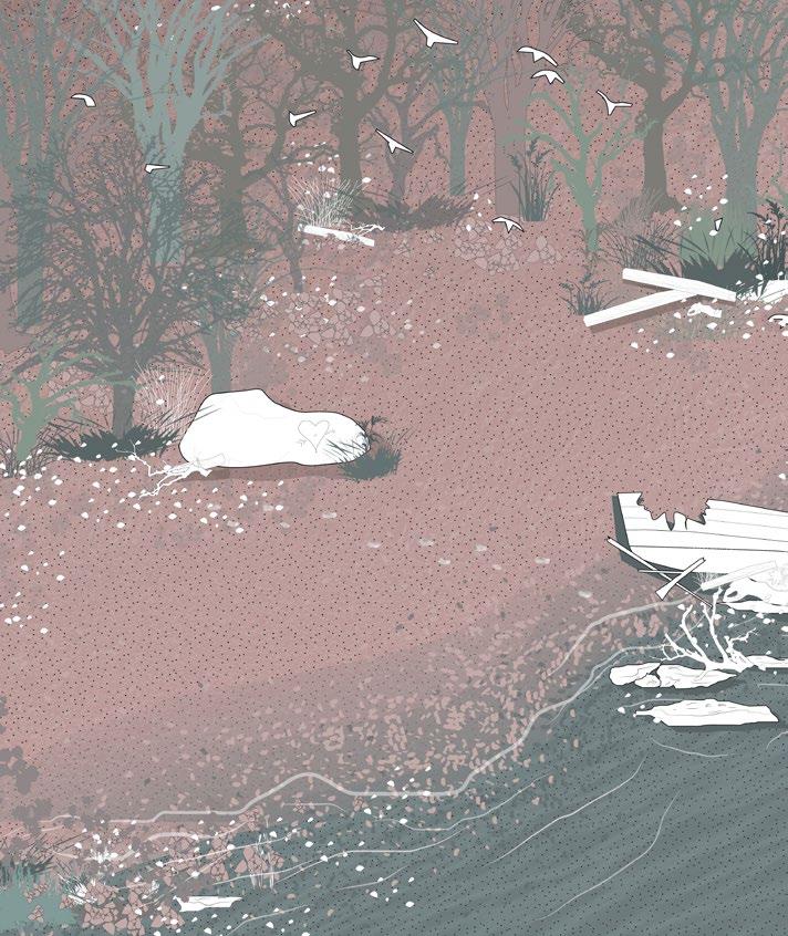
 By Edward Rowe Snow
The tempest hid the cheering Light, So thickly flew the snow;
Alas, what horror fill’d the night, With bitter, piercing woe.
At length they gained the sea-beat strand, And rescued from the waves; On Lovell’s Island only land, To find more decent graves.
Among the rest, a youthful pair, Who from their early youth;
Had felt of love an equal share, Adorn’ d with equal truth,
Lay prostrate mid the dire alarms, Had calm resign’d their breath; Fast lock‘d within each other’s arms, Together sunk to death.
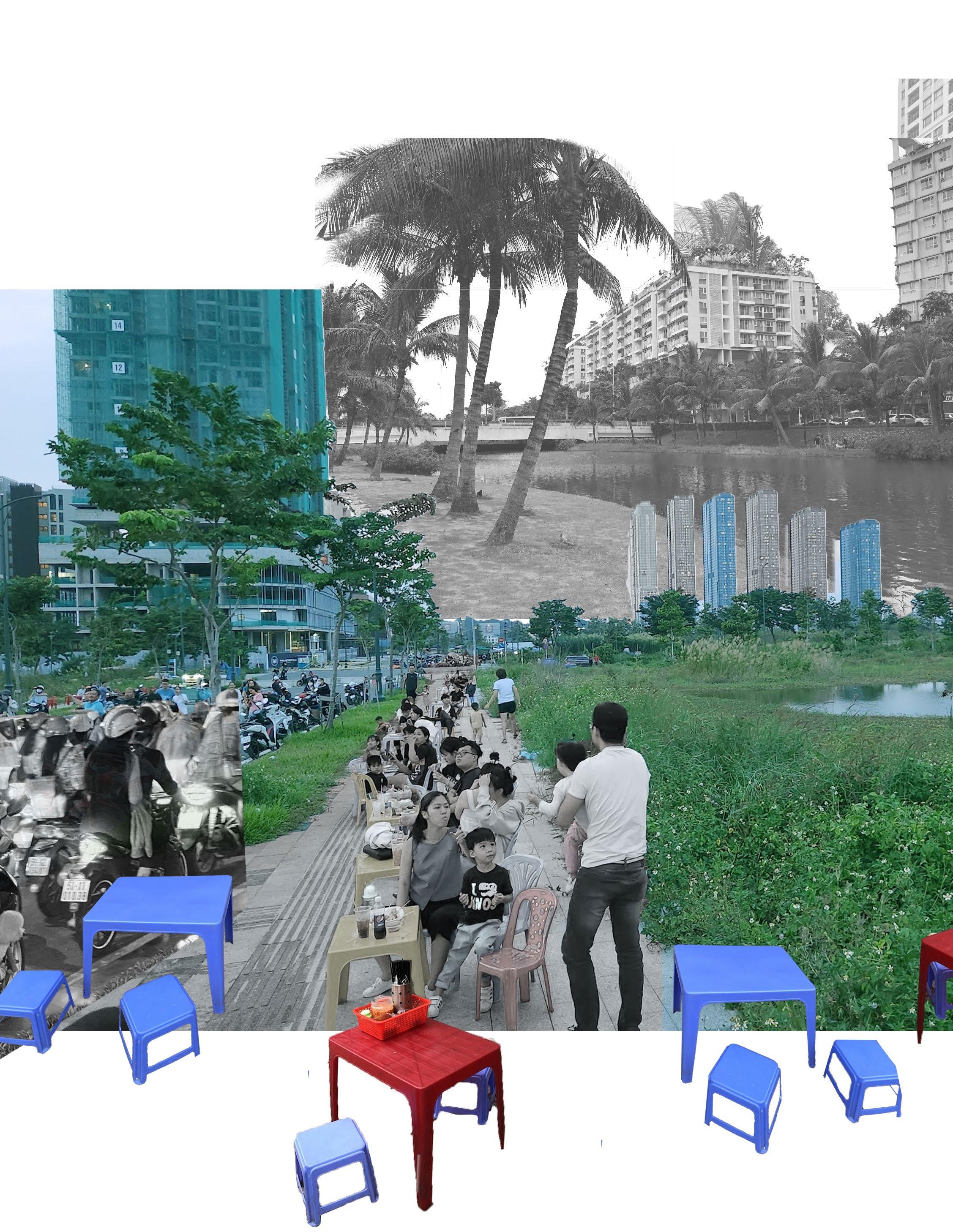
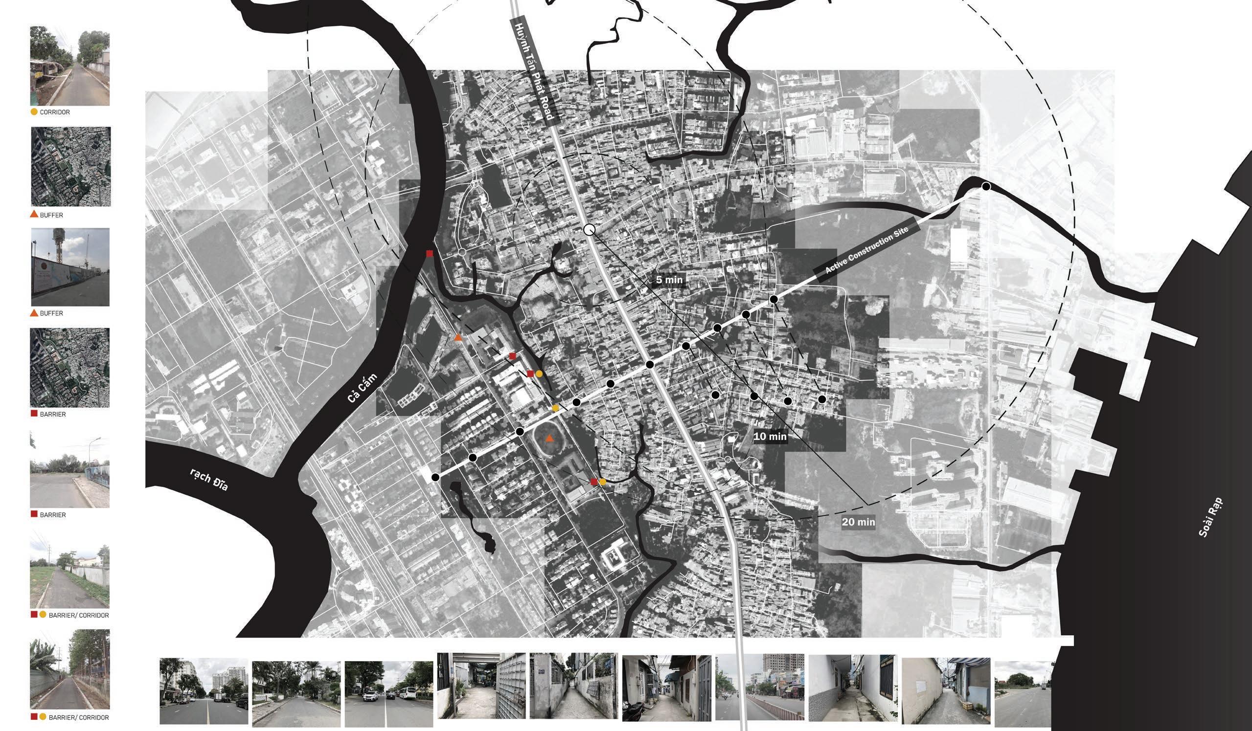
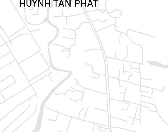
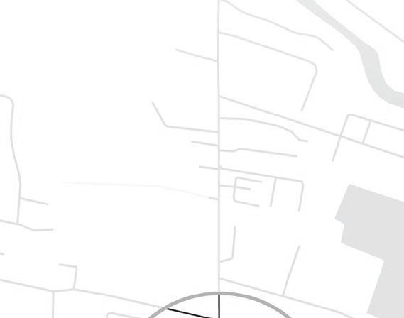
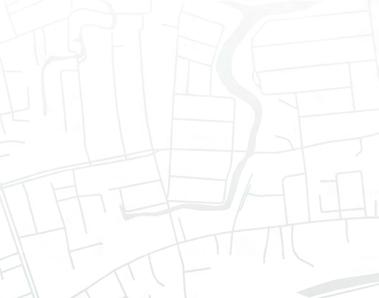
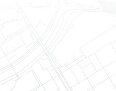
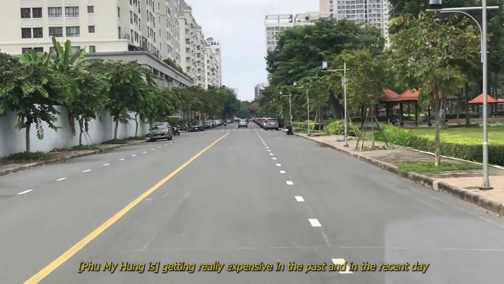
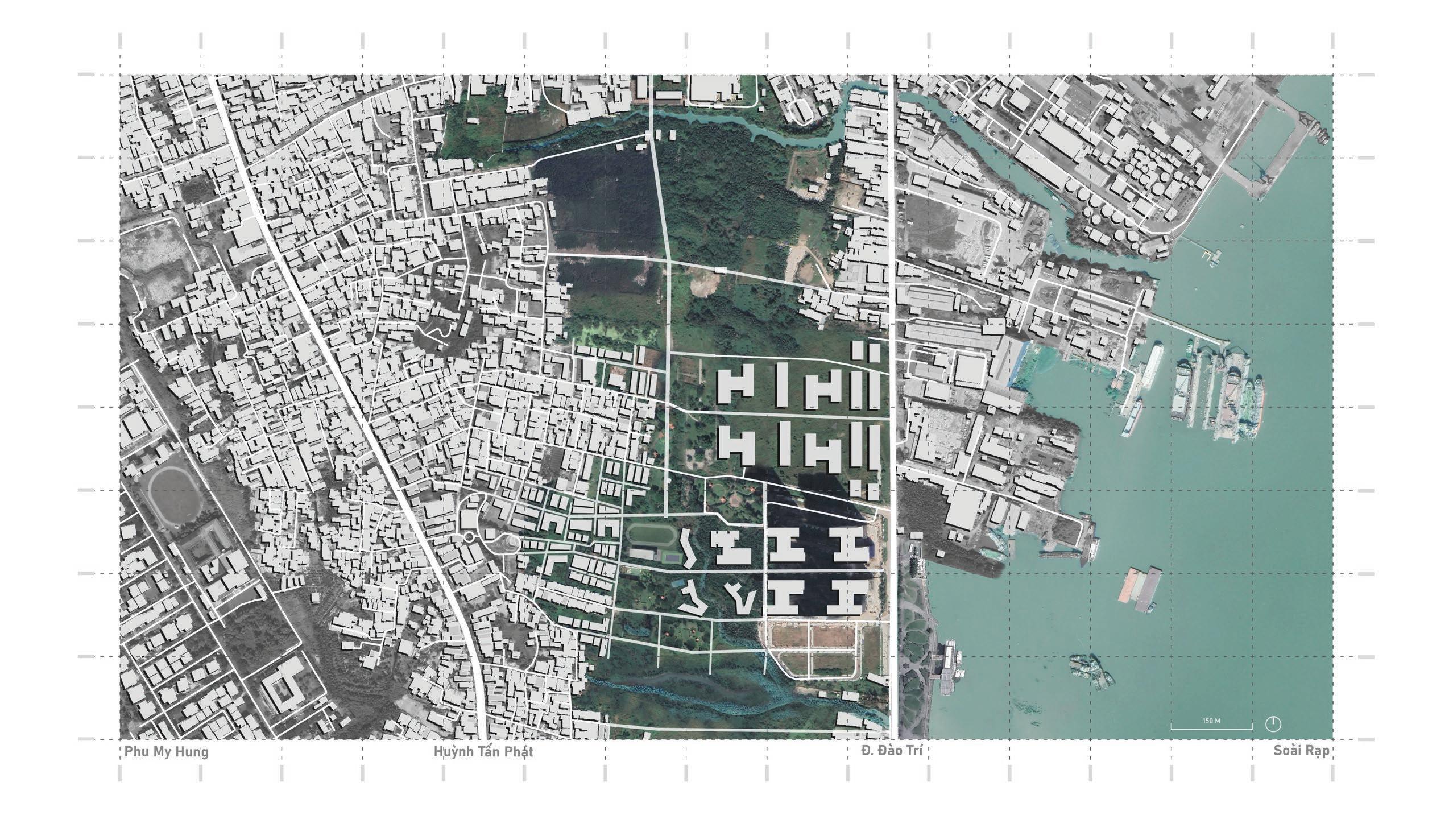
The search for an inclusive Van Minh Do Thi or urban civilization came to be within the context of District 7 in Ho Chi Minh City. The site encompasses the Phu My Hung Development Area which is one segment of the Saigon South masterplan and its interface with the Huynh Tan Phat Road commercial corridor, with connection to the current industrial corridor along the Saoi rap river to the east. ‘Exemplifying the Existing’ is a proposal that aims to integrate inclusive buffers, within an ongoing development project that has largely targeted and invited expat and western traditions. Through engagement with existing residents and locals, the project prioritizes using the existing forms of connection to aid community members that have currently and historically occupied the public spaces. It is through this that the nature and experiences of the district and HCMC as a whole can continue to exude the vibrancy, interactive and inviting nature of its existing conditions and culture.
WEBSITE |
ACADEMIC | INDIVIDUAL
DATE COMPLETED | DECEMBER 2022
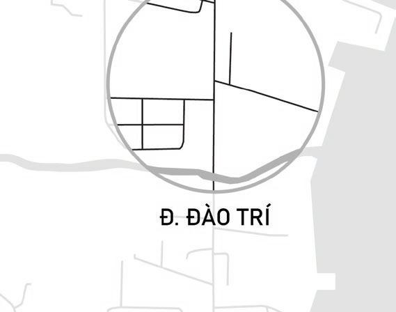
Initial site observations led to the concept of identifying spatial barriers, corridors, or buffers that existed and assumed to be an issue. The site visit and interviews with residents led to the understanding that this was not a problem for many. Much of what was actually emphasized was surrounding the variety of differences between Phu My Hung, Huyn Tan Phat and D Dao Tri’s roads, building footprints and densities.


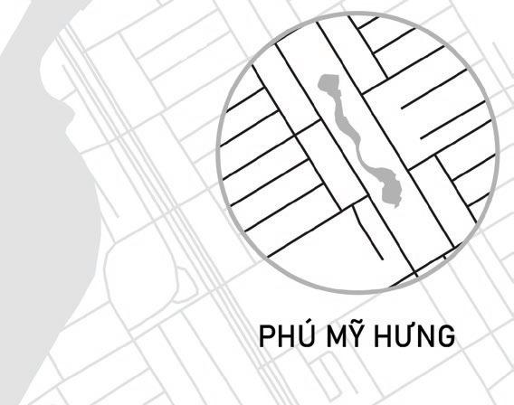
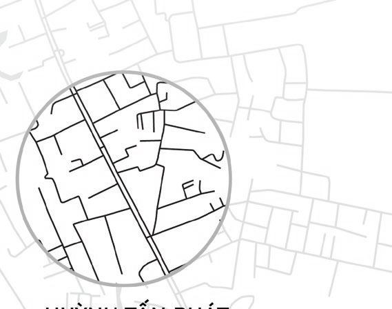


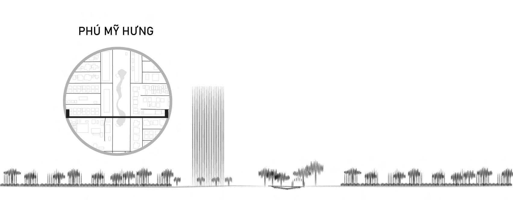

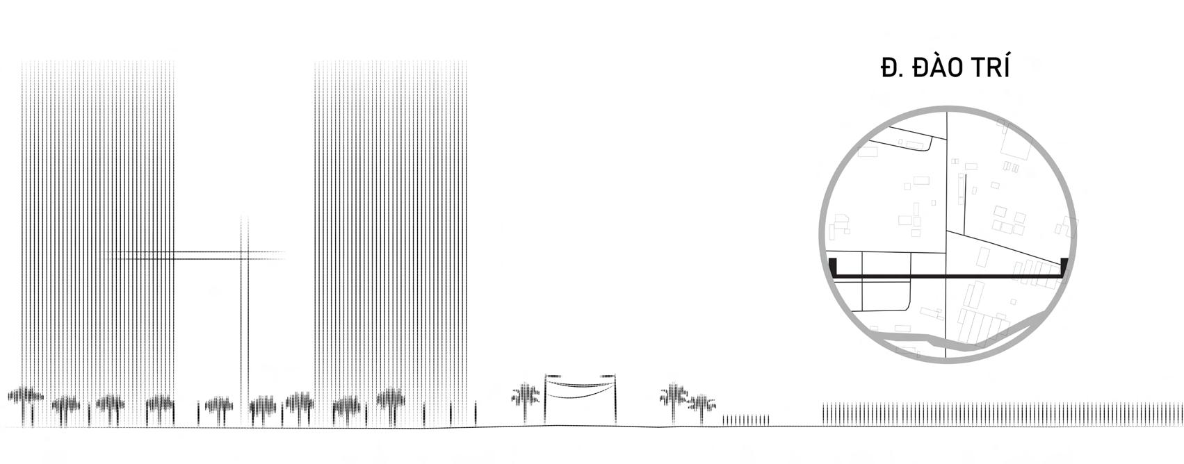
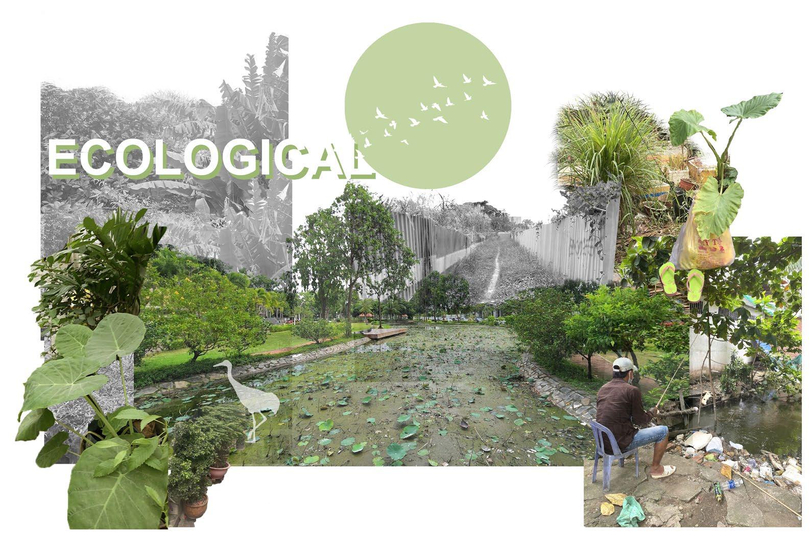
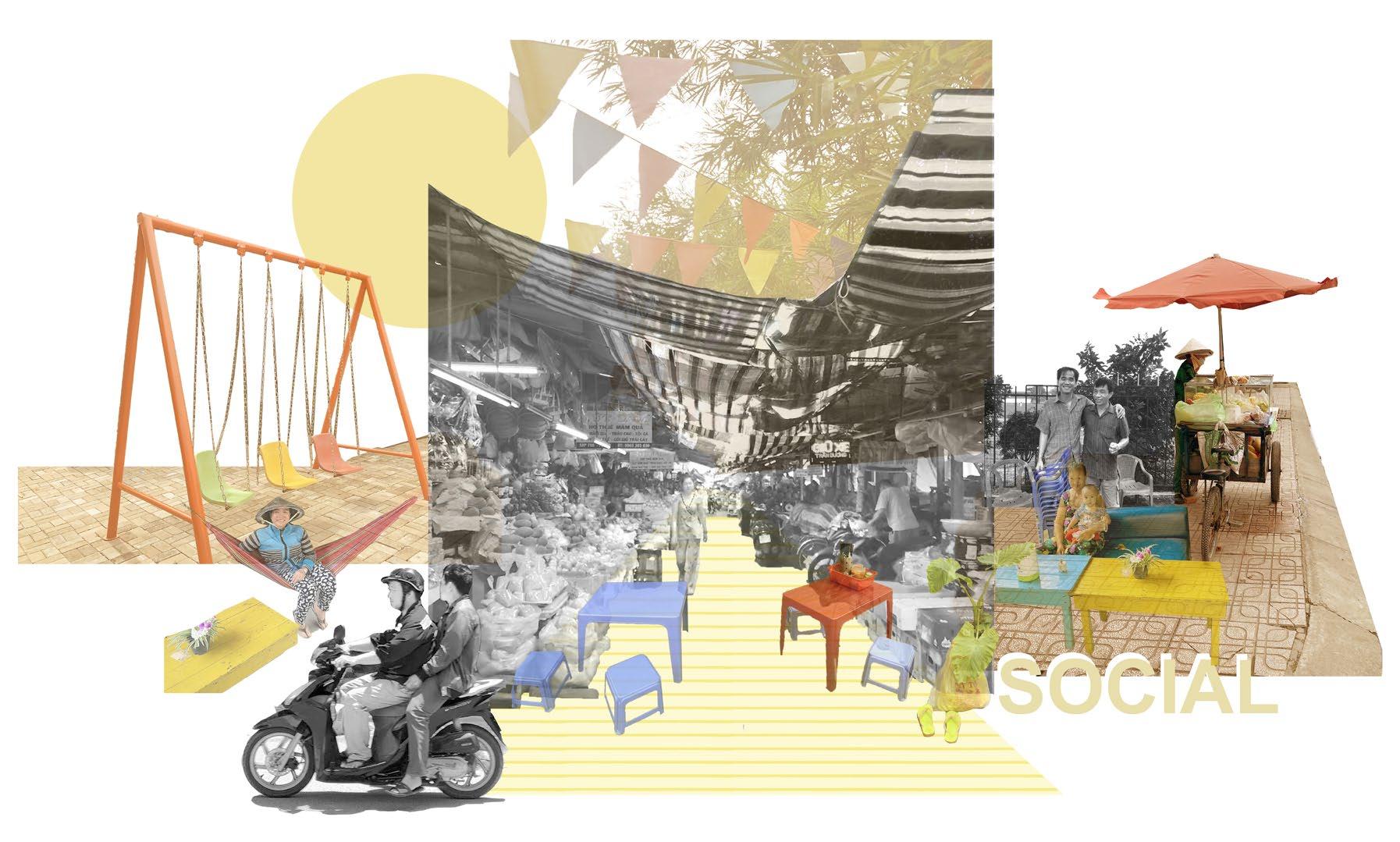
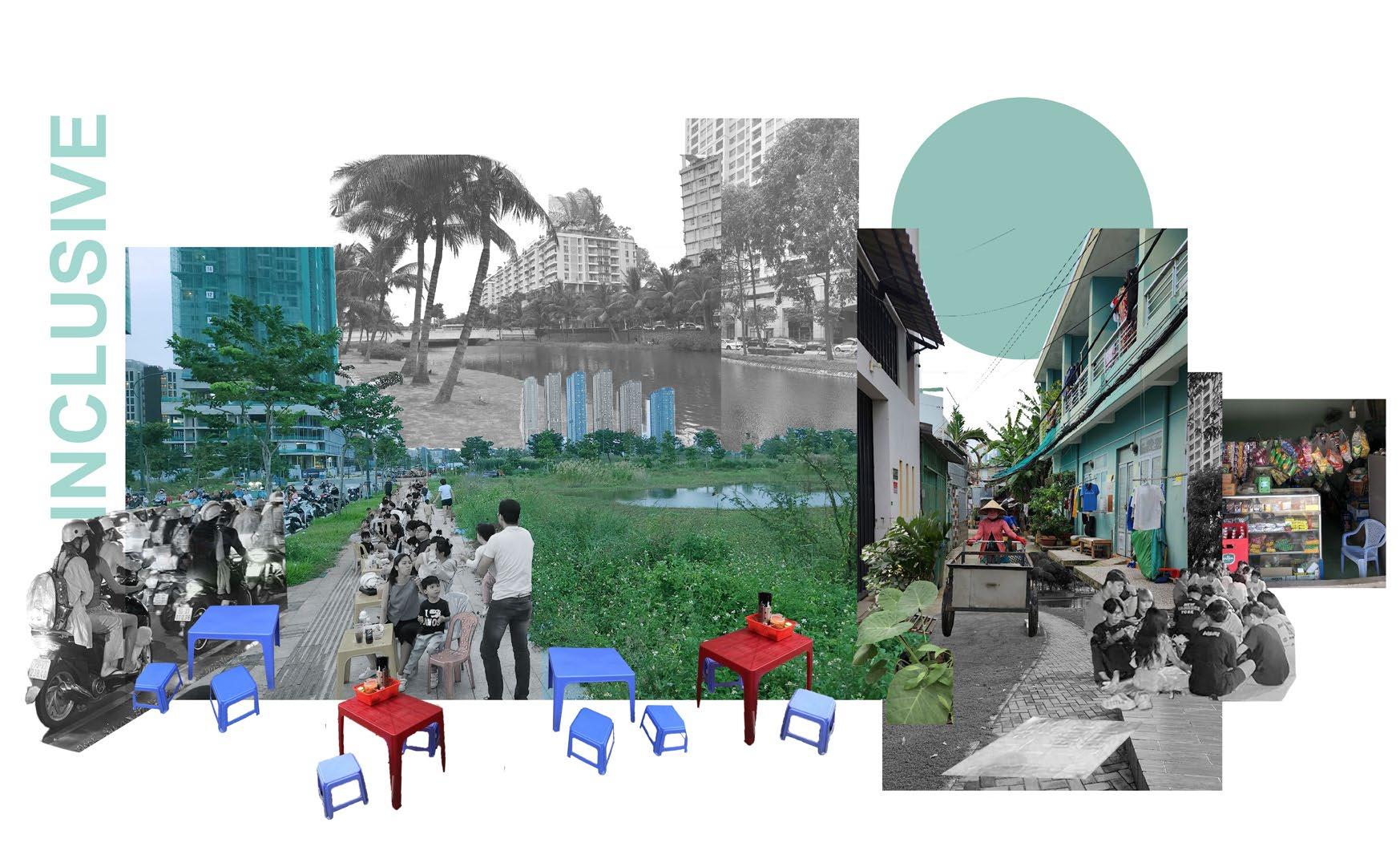
The focus site’s open greenspace flows both north and south, and gives way to integrate existing, successful and traditional typologies. These typologies rooted in social, ecological and inclusive interventions hope to create the inclusive van minh do thi/ urban civilization that enhances the humanistic and sincere interactions between residents that was so heavily felt during the site visit and lost within developments like Phu My Hung.


The word “bloom” is what inspired the following projects. It was used as a starting point to create spaces that could be seen in lines, planes, and volumes. This project takes a different approach to mimicking this act of nature, by straying away from curvilinear elements, and sticking to geometric lines to represent the differences between man-made and natural creations. Essentially, the word “bloom” plants the seed for a unique departure from its original meaning, while still connecting to its roots.
ACADEMIC | INDIVIDUAL
DATE COMPLETED | APRIL 2018
LENGTH | SEMESTER LONG


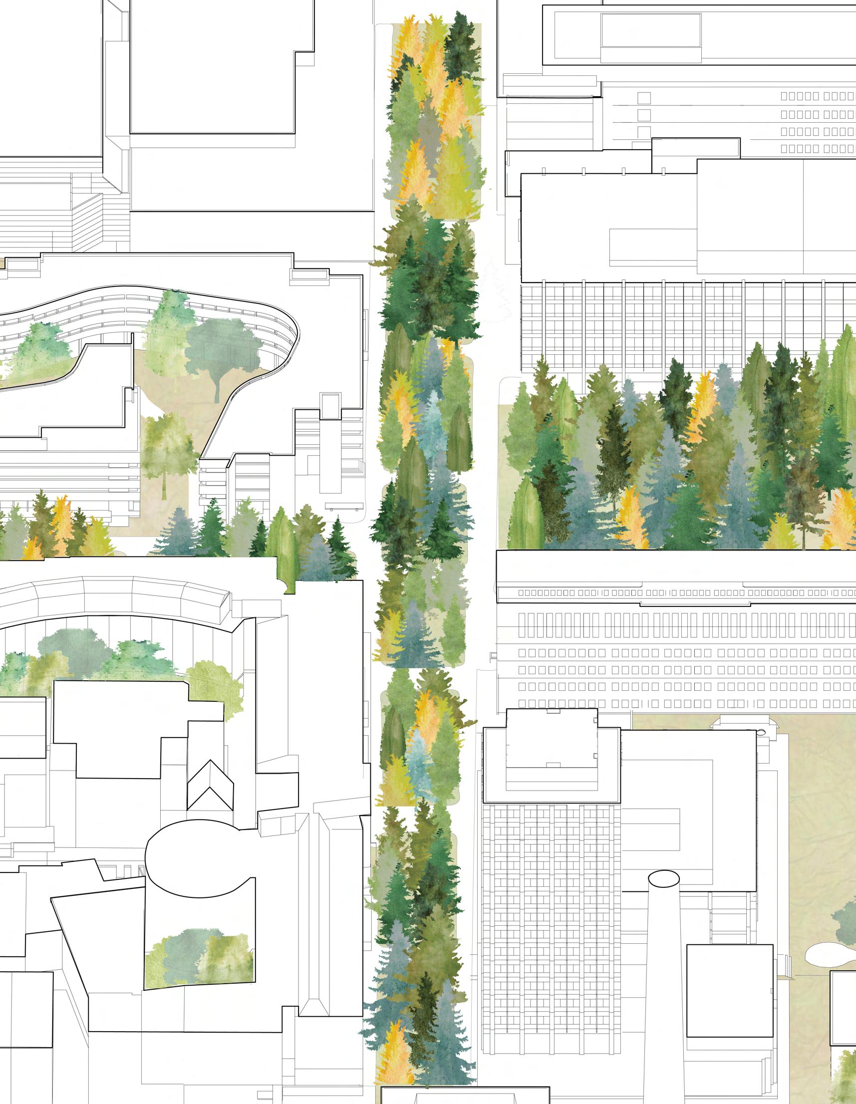
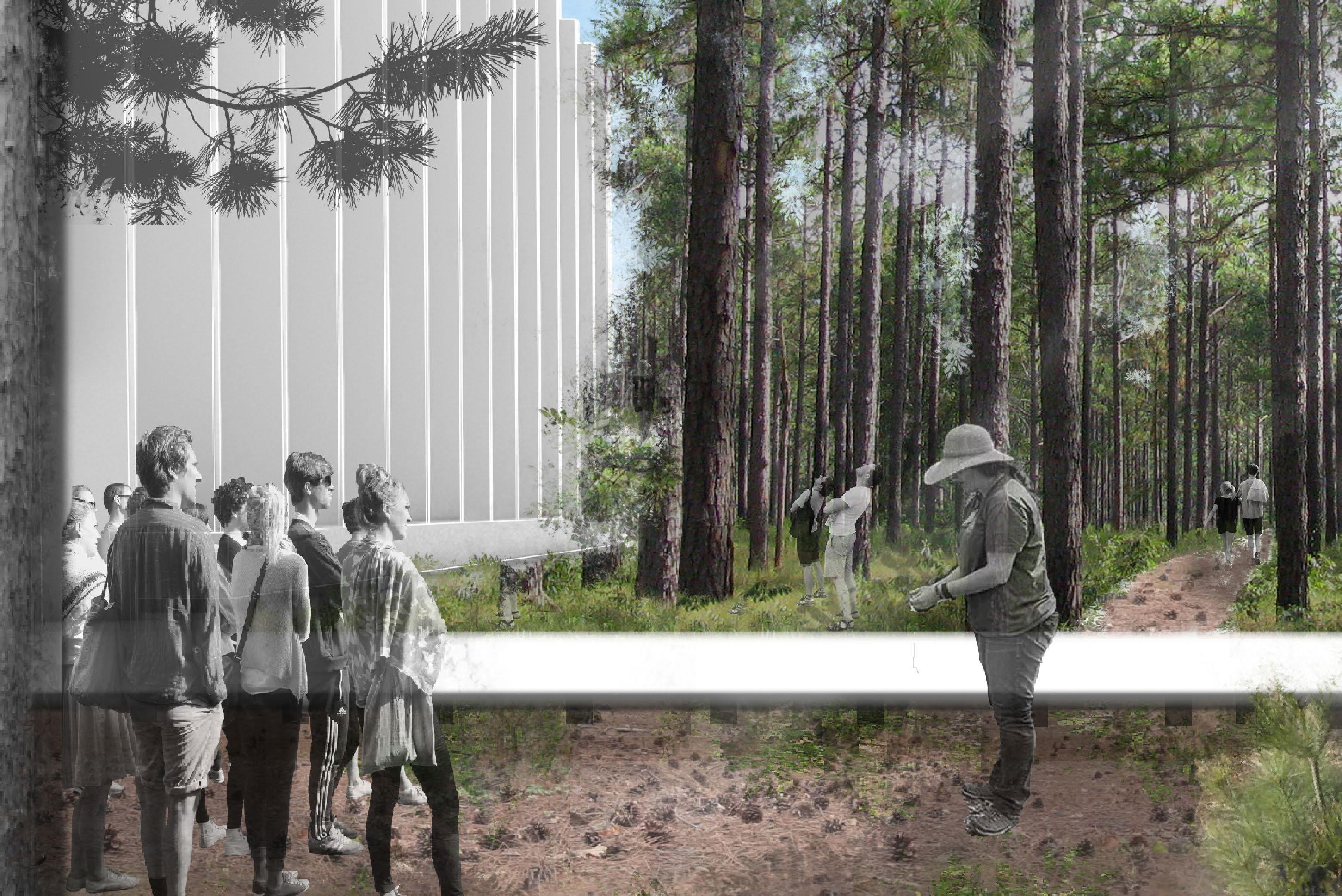
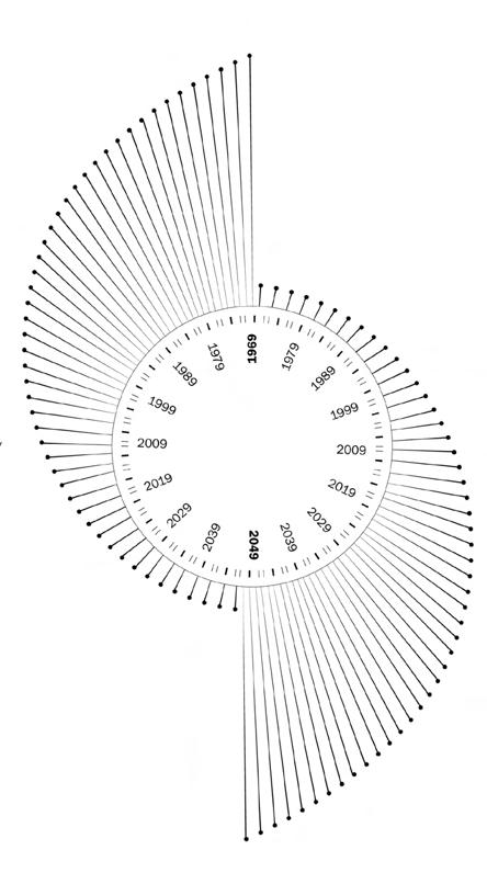
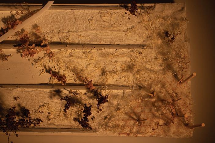
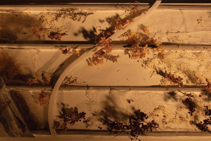
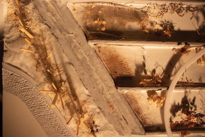
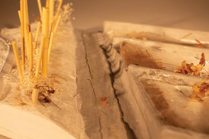
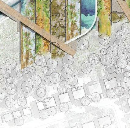
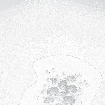
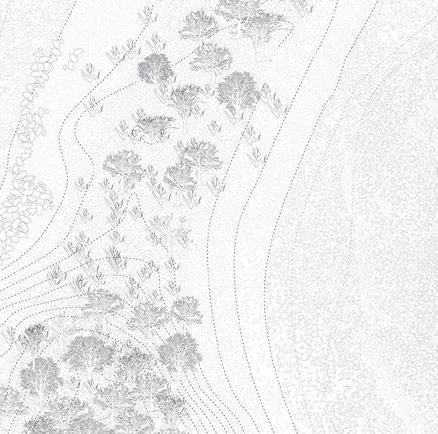
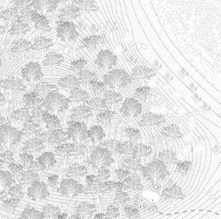
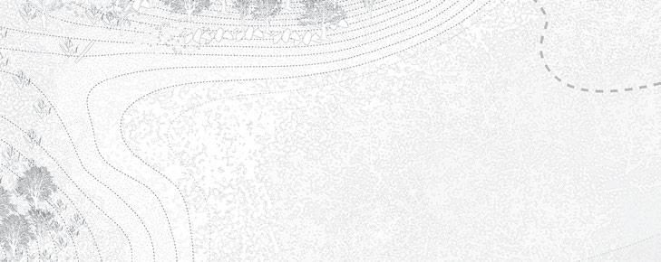
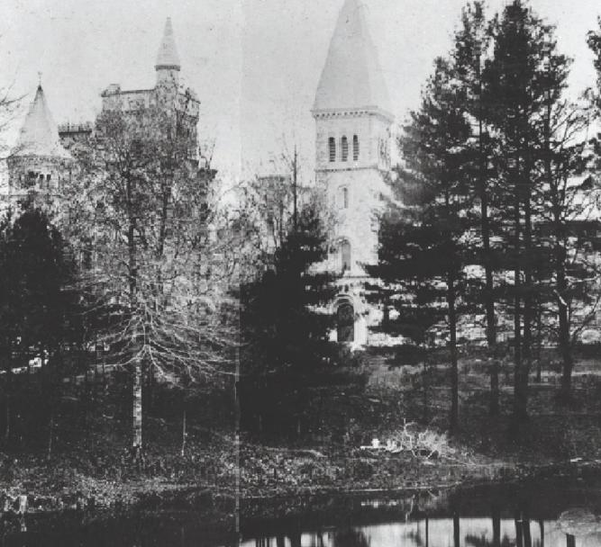
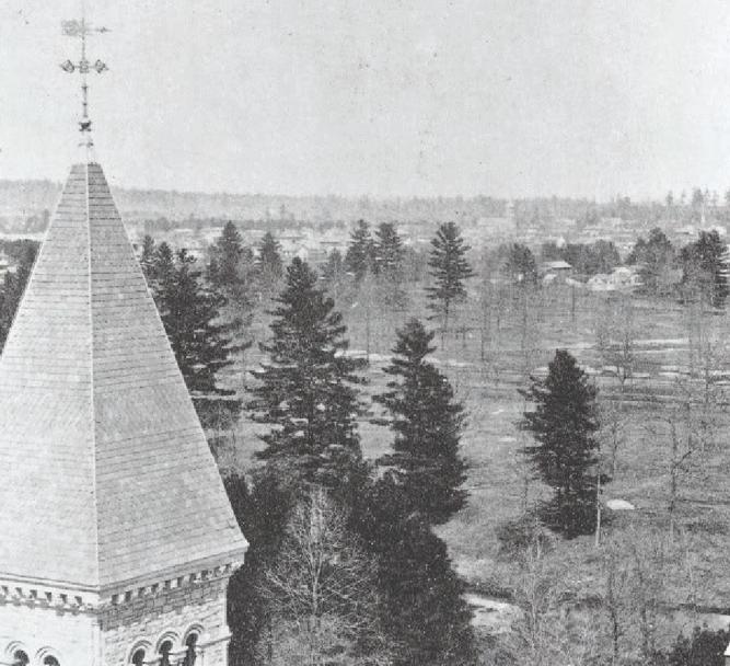
Of almost 4000 trees living in the UofT campus area, less than 4% are native conifers. This seemed to be a point of disconnection with indigenous botanical teachings that shared the significance of these species. This project attempts to reconcile the relationship that the Anishnaabe have historically had with coniferous trees by replanting native conifers to honour the past, and create spaces on West Campus that can facilitate a transforming relationship with the land through the presence of these trees and engagement with their teachings. The planting strategy responds to the gap in knowledge on how to introduce coniferous species to an urban context outside the bounds of ornamentation or Christmas tree nurseries. Ultimately, the project transforms UofT’s West Campus into testing grounds to inform how one can go about reintroducing native conifers , and to truly understand the cyclical nature of their planting/regeneration, growth, and maturity.
ACADEMIC | IN COLLABORATION WITH KIRAN KHURANA (ALL GRAPHICS INDEPENDENT)
DATE COMPLETED | APRIL 2021
LENGTH | SIX WEEKS
Through a phased approach spanning over the next century, there is a transformation that covers approximately 24,000 square meters of UofT’s campus, creating it into an evergreen grove and educational zone. By utilizing pedestrianized roadways and existing areas slated for demolition, the new spaces aim to bring back the conifers that were once abundant on UofT’s campus,
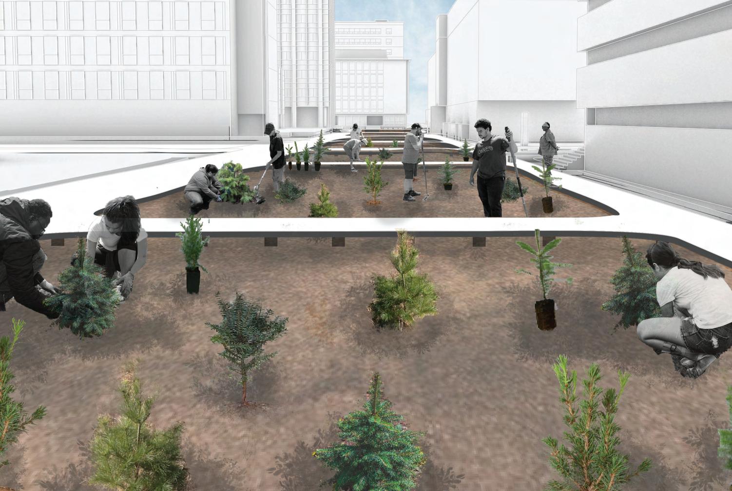
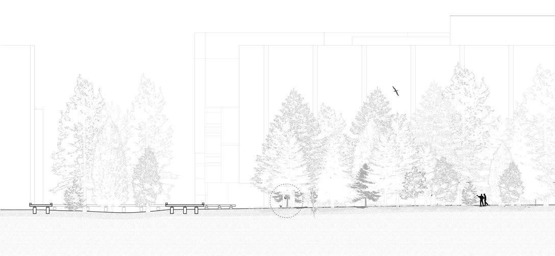
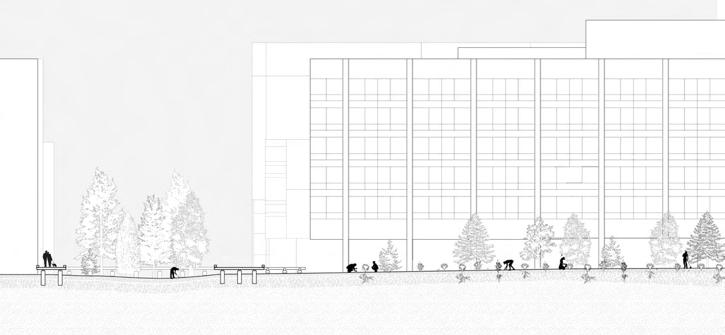
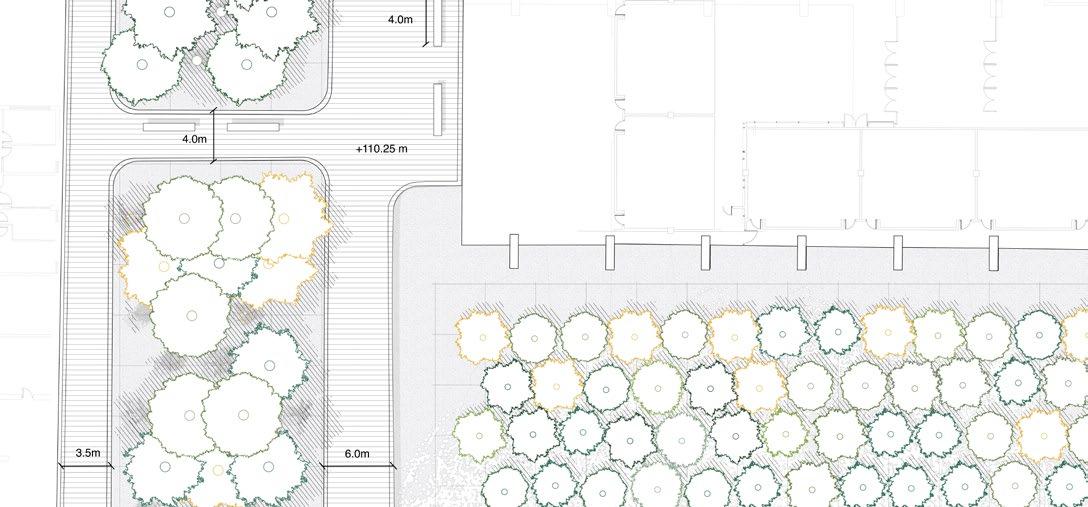

Communal plantings become the first format of learning. Over a longer period of time, the forest growth will be managed and studied, as the trees are left to establish themselves, encouraged to grow, and the natural processes of succession occur.