Unlocking valuable insights from above

MetroMap Insights is an innovative solution that leverages artificial intelligence and cloud computing to extract valuable insights from accurate, high-resolution aerial imagery. This solution was designed to enable businesses and organisations to make more informed decisions and take actions based on data-driven insights derived from aerial imagery.


From infrastructure development to changes in vegetation, if it has happened within our capture footprint, you have access to it. From an individual property location to a city wide area, MetroMap Insights product suite will support, assist and enhance your decision-making.
UNDERSTAND YOUR URBAN ENVIRONMENT
Access a range of features, automatically extracted from MetroMap aerial imagery, provided as:


• Property Analytics - CSV or Excel file designed to be imported into software such as PowerBI, Tableau, Excel and more.


• Area Insights - GIS-ready file in SHP, TAB or GeoJSON format suitable for integration into common GIS software such as QGIS, ArcGIS, MapInfo and more.
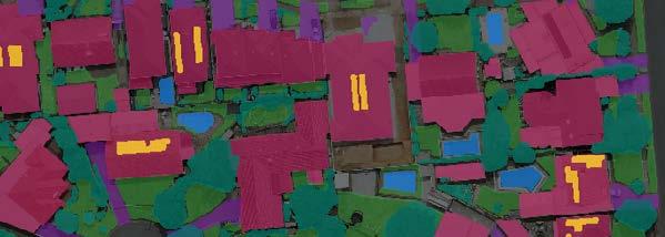
 Buildings Pools Grass Driveways Trees Solar Panels
SEE THE EVER CHANGING REAL ESTATE LANDSCAPE
MetroMap Insights empowers you to make informed decisions about your urban environment by leveraging the power of past and current aerial imagery. By analysing data from different points in time, our insights can help you better understand changes and trends in your area of interest.


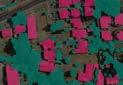
With these valuable insights, you can plan for the future, anticipate changes, and stay ahead of the competition. Whether you’re in GIS, asset management, infrastructure development, urban planning, or environmental management, MetroMap Insights can help you make data-driven decisions that lead to success.

COMPARE FEATURES OVER TIME
ACCESS INSIGHTS FROM PROPERTY LEVEL TO AN ENTIRE LGA
Whether you need data on a single property, LGA or even at a national level, MetroMap Insights provides the data you need, in a format you can access. At every stage, Metromap Insights ensures you can clearly see the trends and patterns that you need to improve your decision making.
• Property Analytics provides a range of property features and attributes associated to a specific address.
• Area Insights includes a range of spatial features and attributes over large areas such as suburbs, LGAs and more.
METROMAP INSIGHTS DELIVERS
IMPROVED EFFICIENCY IMPROVED ACCURACY ENHANCED INSIGHTS REDUCED COSTS
2019 2020 2021 2022 Tree Coverage 2022 2021 2020 2019 20% 21% 22% 23% 24% Building Extent
SEE HOW YOU CAN BENEFIT FROM METROMAP INSIGHTS
www.metromap.com.au
