SAILING CALIFORNIA


PUBLISHING + EDITORIAL
PUBLISHER
Cathy Claesson cathy@adventuresportsjournal.com
EDITOR-IN-CHIEF
Matt Niswonger matt@adventuresportsjournal.com
COPY EDITORS
Michele Lamelin & Jennifer Stein
CONTRIBUTING PHOTOGRAPHERS


Chuck Graham, Bob Wick / BLM, University of Southern California Libraries and California Historical Society, Taylor Mohr, Visit San Diego, Marcy Browe, Visit Carlsbad, Tyke Jones, Tom Beckering, Matt Johanson, Alicia Vennos / Mono County Tourism, Mick Haupt, Carl Hlavenka, California State Parks, Leonie Sherman, Dana Romanoff / OARS, Marty Schlein, Marissa Neely, Chris Neely
COVER DESIGN
Lauren Worth
INDUSTRY NEWS & SOCIAL MEDIA news@adventuresportsjournal.com
EVENTS MARKETING & DISTRIBUTION
Krista Houghton & Lee Houghton events@adventuresportsjournal.com
ADVERTISING
ACCOUNT EXECUTIVE
Cathy Claesson I 831.234.0351 cathy@adventuresportsjournal.com
DESTINATION MARKETING MANAGER
Pamela Coffey I 619.887.9937 pamela@adventuresportsjournal.com
LAND ACKNOWLEDGEMENT
Our office resides in Aulinta (‘place of the Red Abalone’) in the larger region called Popeloutchom (‘paradise’) by the Amah Mutsun Tribe.
ADVENTURE SPORTS JOURNAL
PO BOX 35, Santa Cruz, CA 95063 staff@adventuresportsjournal.com
Opinions expressed are those of the authors and not necessarily those of Adventure Sports Journal or our advertisers. We usually agree with our articles, but sometimes we don’t. We welcome all contributions.
All content © Adventure Sports Journal 2025. No part of this publication may be reproduced without permission of the editors.
PROUD MEMBER

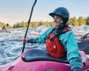
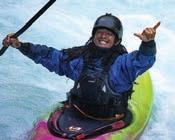
What’s your most memorable day on a river, lake, or ocean?
leoniesherman
My most memorable day on a body of water was a night! In August 2024 I paddled across Lake Tahoe under a full moon — spooky, surreal, gorgeous and felt like a major achievement!
kurtgensheimer

Sunset Cliffs near Point Loma on a huge winter swell when I caught one of the biggest waves of the day. Charging down that 15-foot face with everyone else caught inside paddling towards me was a moment I will never forget.
anthearaymond

Trick question as every day is a great day on the water. But what about those miserable days that become more and more epic in the retelling? They usually involve head winds and several surprises. Those are the ones that linger!
mattjohanson
I’ll never forget catching a 12-pound trout with my dad and brother at Lake Chabot. All three of us played a role: Dan hooked the fish, Dad reeled it in, and I netted it. That thrill made up for all the times we struck out fishing.
jamesmurren
Kayaking the Pejibaye River in Costa Rica. I was with friends/locals who were having a great time enjoying their home waters and seeing them being so stoked about it made me feel so damn good.
My favorite water memory is sailing into Refugio anchorage and meeting our friend Peter. We had dinner over a beach fire and watched the full moon rise over our boats. Picture perfect — and still my favorite memory.
Most memorable day on the ocean would be paddling from Santa Cruz Island to Santa Barbara Island, 50 miles and 18 hours in the kayak in open water.


IN THIS ISSUE

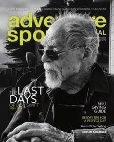
ON THE COVER:
Marissa and Chris Neely, the crew of the Avocet arriving in San Francisco after a threeday passage north from Ventura.
9 Editor’s Note Stream Entry // 10 Ear to the Ground Industry news & notes // 12 Earn Your Beer Paddling Carlsbad // 22 Destination Mono County // 35 Event Calendar Upcoming races and events // 38 Gear We Love Goodies for your active lifestyle

14 Chuckwalla National Monument California’s new monument and its uncertain future // 18 Trail Scout Chris McNamara’s Sierra Camino uncovers a new bike route// 24 Ahjumawi Lava Springs State Park California’s only boat-in state park // 26 Hugging the Big Sur Coast A paddling journey along California’s rugged shoreline // 30 Dories Iconic whitewater watercraft // 32 Sailing California From Sea Snarks to offshore adventures
CREDITS, CLOCKWISE FROM TOP: KURT GENSHEIMER
Photo: Chris Neely.
PHOTO
(18); MATT JOHANSON (22); MARTY SCHLEIN (30); CHUCK GRAHAM (26).
STREAM ENTRY
The irreversible journey towards liberation
There is a boldness to California’s water that mirrors the spirit of those who live and play here. From powerful Sierra rivers to thunderous Pacific surf, from the cold clarity of alpine lakes to the seasonal pulse of creeks in redwood canyons, California is a land shaped by movement — by the ceaseless carving of water through time and terrain. These waters do not just shape land; they shape people. And if we let them, they shape our destinies.
At Adventure Sports Journal, our mission has always been to inspire human-powered adventure in these wild places. For nearly 25 years, we’ve been hiking, climbing, paddling, riding, and running through California’s most beautiful and challenging terrain. And in doing so, we’ve discovered something profound: the outdoors is not just a playground, but a mirror. A proving ground. A place where we meet the parts of ourselves that the modern world too often buries.
In Buddhism, there is a term: “stream-enterer” — one who has entered the flow of the Dharma and begun the irreversible journey toward liberation. This isn’t a grand mystical title for the few; it’s a humble moment of choice that anyone can make. A decision to wade into the current of truth, to allow difficult emotions and deep questions to rise and be seen. In that sense, entering the stream is not an escape from struggle — it is a vow to face it honestly.
Here in California, where outdoor adventure is a form of devotion, we see stream entry quite literally. We immerse ourselves in swift rivers, cold lakes, wild surf. We go willingly into discomfort — not because we are fearless, but because we know fear has something to teach us. We seek out suffering in the elements not as martyrs, but as pilgrims. We hike steep trails, run whitewater, surf heavy waves, and confront the chaos within. This isn’t just recreation. It’s reclamation.
We speak of the daily Five Remembrances as a way to reflect on our mortality, the inevitability of aging and loss, the certainty of
death, and the fact that our only true possession is our actions. The Three Doors of Liberation — emptiness, signlessness, and aimlessness — teach us that we are not as fixed or as separate as we think. Together, these teachings remind us: we are not here to escape suffering, but to transcend it. Not to conquer nature, but to let it show us who we are.
That’s why, at Adventure Sports Journal, we see the stewardship of the self — our body, our mind, our spiritual questions — as a gift we can offer the world. Each time we choose to paddle through fear, climb through doubt, or hike through sorrow, we return transformed. We come back stronger, clearer, more openhearted. And in turn, we become better stewards of each other and this earth.
This magazine was founded nearly 25 years ago by three people who believed that outdoor adventure is a valid path to liberation. We started small — three friends with a dream, a few dollars, and a conviction that the mountains, rivers, and trails of California were more than playgrounds. They were temples. They still are. We are, and have always been, a humble, family-run labor of love operating in contrast to the alienation of digital platforms. And yet here we are, nearly a quartercentury later — still going, because of you.
To our readers, thank you. You have stood by us in an era when media outlets shutter and digital noise drowns out quiet truths. You’ve chosen to read stories that celebrate the raw, the wild, and the real. You’ve chosen Adventure Sports Journal not just for gear reviews or race
results, but because you sense, like we do, that adventure — when done with intention — is a sacred path. California, we believe, is the global epicenter of Deep Play, a term that speaks to risk, intensity, and the pursuit of meaning.
For us, Stream Entry is both a metaphor and a mission. It’s not a matter of being elite, enlightened, or extreme. It’s a choice — a way to begin again, again and again, as ordinary people committing to extraordinary presence. We walk, run, climb, ride, and paddle toward our own awakening — not because we’re special, but because we’re human. And to be fully human is to step into the stream of life with eyes open and heart bare.
This path is not easy. But it is beautiful. Thank you for walking it with us.
Thanks, and be safe. We hope you enjoy this issue and protect public lands!
— MattNiswonger matt@adventuresportsjournal.com


Adventure Sports Journal is one of the last independent outdoor magazines in the country, and we depend on the support of people like you. Please consider helping us continue our work by becoming a member today. DON’T MISS AN ISSUE! Have ASJ delivered to your home. Memberships as low as $5 per month

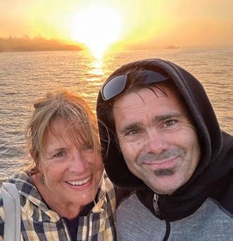
Matt Niswonger and Cathy Claesson, enjoying a sunset in Santa Cruz.
EAR TO THE GROUND
CHUCKWALLA NATIONAL MONUMENT FACES LEGAL CHALLENGE
A Texas-based conservative think tank, the Texas Public Policy Foundation (TPPF), filed a federal lawsuit in May aiming to dismantle California’s newly established Chuckwalla National Monument. Designated by President Biden in January 2025, the 624,000-acre monument spans the Mojave and Sonoran deserts, protecting critical habitats, Indigenous cultural sites, and historic military training grounds. TPPF argues that the designation exceeds presidential authority under the Antiquities Act, claiming it imposes undue restrictions on mining and motorized recreation. Supporters say the monument safeguards irreplaceable resources and reflects broad local and tribal support. For more on why Chuckwalla matters, see our feature on page 14.
TARIFFS COULD HURT OUTDOOR INDUSTRY
In February, Outdoor Industry Association (OIA) President Kent Ebersole issued a statement addressing recent trade policy changes. He warned that new tariffs on outdoor products could drive up costs for both businesses and consumers, potentially slowing job growth, stifling innovation, and forcing some companies to close. The tariffs pose a significant threat to an industry that fuels $1.2 trillion in consumer spending and supports five million jobs. Ebersole stressed that outdoor recreation is vital to the US economy and affirmed OIA’s commitment to working with policymakers to advocate for a balanced trade agenda.
REDWOOD RESTORATION SPURS ECONOMIC GROWTH
A new report from California State Parks and Save the Redwoods League highlights the economic benefits of large-scale restoration projects in the Redwood National and State Parks region. In 2024, the Redwoods Rising and ‘O Rew Redwoods Gateway programs supported 200 local jobs and generated nearly $31 million in economic output. These efforts not only restore critical habitat but also provide stable employment, especially in Humboldt and Del Norte counties. Over 90% of contractor hours were filled by regional workers, and revenue from biomass sales is reinvested into future restoration.
CALIFORNIA’S SALMON SEASON REMAINS LARGELY CLOSED
For the third consecutive year, California’s commercial salmon fishing season is closed, with only a brief recreational opener held June 7–8, limited to 7,000 Chinook statewide. A separate four-day fall season is planned for September 4–7 between Point Reyes and Point Sur, with a 7,500-fish quota. These restrictions reflect historically low Chinook salmon returns, driven by prolonged drought and water management challenges. While many readers may not fish, the closures signal deeper environmental concerns along the California coast. For updates, visit California Department of Fish and Wildlife.
PROTECTING SNOWY PLOVERS ON MONTEREY BAY BEACHES
California State Parks is urging visitors to Monterey Bay beaches to help protect the threatened western snowy plover during its nesting season, which runs through September 30. These small shorebirds nest directly on the sand and are vulnerable to disturbances. To safeguard their habitat, beachgoers are asked to stay on designated trails, keep dogs off the sand, avoid fenced areas, and refrain from disturbing driftwood or kelp. Maintaining clean beaches by properly disposing of trash also helps prevent attracting predators.
PUBLIC LAND SALE PROVISION DROPPED FROM HOUSE BILL
In a major win for conservationists and the outdoor recreation economy, a provision in the US House budget reconciliation bill that would have authorized the sale of more than 500,000 acres of public land in Nevada
and Utah has been removed. The decision followed bipartisan pushback from lawmakers including Rep. Ryan Zinke (R-MT) and Rep. Gabe Vasquez (D-NM), who argued the sale would undermine the integrity of America’s public lands. “America’s public lands are the engine of the $1.2 trillion outdoor economy and should be protected so future generations can continue hiking, climbing, and recreating,” said Outdoor Industry Association (OIA) President Kent Ebersole.
While the removal marks a step forward, other provisions in the bill continue to raise concerns. Proposed rollbacks to the National Environmental Policy Act (NEPA) and cuts to conservation funding could weaken longstanding environmental protections. As the bill heads to the Senate, outdoor advocates are watching closely.
TRESTLES TO HOST OLYMPIC SURFING IN 2028
Trestles Beach at San Onofre State Beach has been selected as the site of Olympic surfing for the 2028 Summer Games in Los Angeles. Known for its consistent, high-quality waves, Trestles has long been a favorite among professional and recreational surfers alike. Its selection is a fitting tribute to California’s deep-rooted surf culture and a rare opportunity to showcase the state’s natural beauty and public lands on the global stage. The beach also holds deep cultural significance for the Acjachemen people, whose ancestral village once occupied the area. California State Parks will work closely with LA28 organizers, tribal partners, and the surf community to prepare for this historic event.
NEW ONLINE MAP TRACKS CALIFORNIA’S COLLARED WOLVES
The California Department of Fish and Wildlife (CDFW) has launched an online mapping tool that displays the approximate locations of GPS-collared gray wolves across the state. Aimed at helping livestock producers mitigate potential conflicts, the map updates daily with data from 14 collared wolves, showing general areas without revealing exact positions to protect the endangered species. Each wolf’s location is represented by a hexagonal cell, providing information about the wolf’s pack, the general area they are
in, and the last transmission date. This initiative enhances transparency and supports ranchers in safeguarding their herds.
GOLDEN MUSSELS INTERCEPTED AT FOLSOM LAKES
California State Parks’ new inspection program at Folsom Lake has prevented a potential ecological threat by discovering invasive golden mussels on a boat at Beals Point. The vessel, recently from the Sacramento-San Joaquin Delta, was quarantined to stop the mussels from entering the lake. Golden mussels can damage infrastructure and ecosystems. Since April 14, nearly 5,000 vessels have been inspected under this program.
CARSON CITY TO CANADA QUEST
Two women have been selected for a new 1,600-mile hiking challenge from Carson City to the Canadian border, launched by Visit Carson City to spotlight the region’s growing reputation as an outdoor gateway. Julianne Mahoney, from Colorado, and Audrey Payne, based in Washington, D.C., were chosen from more than 350 applicants for their backcountry experience and storytelling skills. Starting this summer, they’ll follow the new Cap to Tahoe Trail from Nevada’s Capitol to the Tahoe Rim Trail, then head north on the Pacific Crest Trail. The trek is expected to take two to three months, with each hiker earning $5,000 upon completion and sharing of their journey.
SANTA CRUZ
FIRECRACKER TURNS 40
This 4th of July, the Santa Cruz Firecracker Race celebrates four decades of redwood trails, big climbs, and community spirit. Held at Harvey West Park, the 10K, 5K, and Kids 1K bring together runners, walkers, and families for one of Santa Cruz’s most iconic Independence Day traditions. Founded in 1985 with a focus on fun-first fitness, the Firecracker now supports local youth through the Santa Cruz Sunrise Rotary Foundation. Expect hills, burritos, and a whole lot of heart. visit santacruzfirecracker10k. org for more information.

Scan the QR code and keep up with the latest news and information from our industry partners.

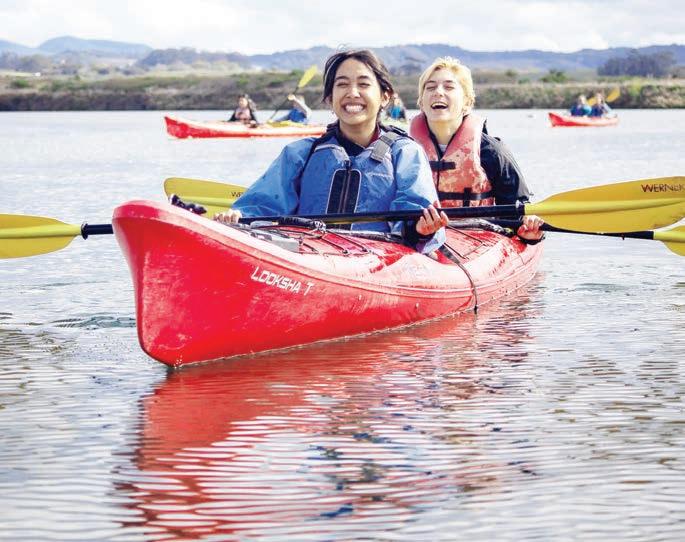
Paddles and Pints in Carlsbad
Where serene paddling meets bold brewing
By James Murren
THE EARNING
Carlsbad is more than just a hotspot for surfing and ocean sports — it also offers a tranquil escape for paddling in the serene backwaters of Agua Hedionda Lagoon. This 400-acre coastal wetland is a vital sanctuary for a diverse range of wildlife, including several endangered species.
The water here is brackish, a mix of salt from the sea and fresh water from local creeks, with tides influencing salt levels. This tidal action creates a foodrich environment, attracting a variety of birds, fish, and other wildlife. Mudflats along the edges shift with each tide, providing ideal feeding grounds for migratory birds.
For those interested in yoga, Agua Hedionda Lagoon is also one of the San Diego region’s favored spots for SUP yoga. The calm waters provide a perfect backdrop for this tranquil experience.
If you’re bringing your own equipment, a non-motorized launch area off Bayshore Drive offers a convenient spot to start your paddle.
Need to rent a kayak or paddleboard? California Watersports provides a wide array of rentals right on the shores of the lagoon. After launching, follow the buoy system to avoid motorized zones and paddle into the quieter reaches for some solitude. As you glide across the lagoon, keep an eye out for waterfowl, crabs, bat rays, and — if you’re lucky — a rare sighting of green sea turtles.


THE BEER
Carlsbad boasts a thriving craft beer scene, with several independent breweries to explore. While iconic names like Pizza Port Brewing Company and Karl Strauss Brewing Company are well-known, a short drive inland reveals hidden gems worth discovering.
Carlsbad Brewing Company offers a laid-back, no-frills vibe, with an atmosphere that says, “We make beer here.” The spacious, airy setup includes outdoor seating and a tap list featuring over 300 beers from around the world — specializing in European and Belgian styles. They also pour local favorites, including rotating regional brews and a reliably on-tap Pliny the Elder. carlsbadbrewingco.beer
Burgeon Beer Company is another local favorite, known for standout brews and a strong commitment to sustainability. A member of 1% for the Planet, Burgeon is the first brewery to earn SeaTrees’ Ocean+Positive certification and also holds The Climate Label certification, recognizing their efforts to put a price
on carbon emissions. The taproom features a regular food truck lineup. burgeonbeer.com
Sharing a similar commitment to sustainability, Pure Project holds The Climate Label certification and is a member of 1% for the Planet. They also support grassroots organizations like The Conservation Alliance, WILDCOAST, and Coastal Roots Farm.
Known for “murky” beers — their take on hazy IPAs — they’ve earned multiple Great American Beer Festival (GABF) awards and U.S. Open medals. Their crisp, floral pilsner Rain is another standout. All of their beers are brewed with a focus on sustainable and organic sourcing. purebrewing.org
Docent Brewing, a newer addition to the Carlsbad scene, has quickly made a name for itself. Originally founded in San Juan Capistrano, their Carlsbad outpost — near Pizza Port in Carlsbad Village — turns a converted cottage into a lively hub. Docent has earned multiple GABF awards, including two golds for its Super Tonic coffee stout. docentbrewing.com


Photo: Gibson Pictures
1.
Opposite page: From paddle boarding to kayaking, Agua Hedionda Lagoon has something for everyone (Visit San Diego); This page, clockwise from top: Pure Project pours passion and purpose into every beer at their Carlsbad taproom (Marcy Browe); Serene waters and scenic trails await at Agua Hedionda Lagoon (Visit Carlsbad); A colorful lineup of craft brews from Burgeon Beer Company; Old-school cool meets modern brewing at Carlsbad Brewing Company (Taylor Mohr).
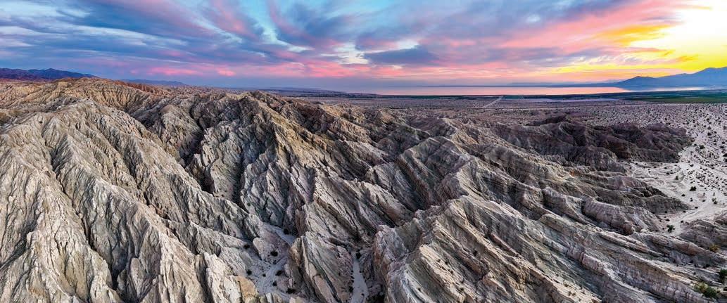
Chuckwalla National Monument
California’s new monument is a desert of wild beauty and an uncertain future
By Leonie Sherman
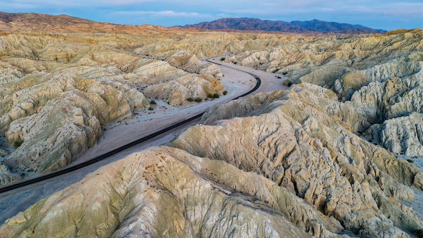
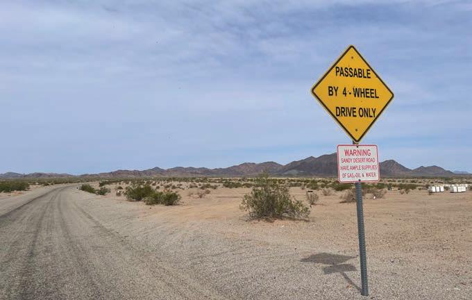
Everyone’s talking about it. The Los Angeles Times and Backpacker Magazine ran feature pieces on it. The lady in front of me at the grocery store protested to protect it. But nobody I spoke to had actually visited Chuckwalla National Monument. Biden used the 1906 Antiquities Act to create Chuckwalla National Monument on January 14, 2025, just days before he left office. In doing so he set aside over 700,000 acres of mountains, canyons and arroyos in southeastern California, an area only slightly smaller than Yosemite National Park.
The new monument spans the transition zone between the Mojave desert, our nation’s driest, and the Sonoran desert, North America’s lushest. Reaching from Joshua Tree National Park’s southern border east to the Colorado River, and west to the Coachella Valley on the edge of the Salton Sea, the newly protected lands feature stunning geology, sweeping vistas, incredible biodiversity, Indigenous petroglyphs and historic mining debris.
Internet information is sparse, and when I dialed a number for the monument I got a busy signal all day
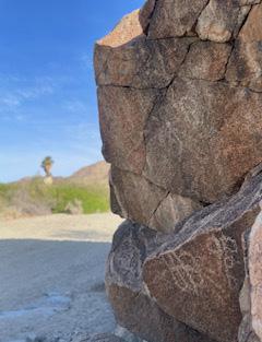
long. Email inquiries were useless; I was told there was nobody available to answer questions. So, armed with a vague plan, four gallons of water, a 4WD high clearance vehicle and a full tank of gas, a friend and I set out from Joshua Tree to check it out. Turns out our nation’s newest national monument is its own cautionary tale. Just eight miles south of I-10, along a graded dirt road, Corn Springs Campground features towering fan palms and a startling variety of desert flora, thanks to the springs which haven’t flowed above ground for over 50 years. The name comes from the
land management practices of the original stewards, who defied the binary categories of modern anthropologists by enjoying a nomadic lifestyle that also included growing corn. Indigenous people from the Iviatim (Cahuilla), Nüwü (Chemehuevi), Pipa Aha Macav (Mojave), Kwatsáan (Quechan), and Maara’yam and Marringayam (Serrano) groups continue to steward this oasis as their ancestors did for thousands of years. Petroglyph panels are prominent on boulders above the wash along a well maintained interpretive trail. We visited two months after designation, during spring break when
daytime temperatures were in the mid-70s and every campsite at Joshua Tree was booked out. At Corn Springs Campground we found only two other campers. The rumors of potable water turned out to be false but the pit toilets were among the cleanest I’ve ever seen.
Less than two miles beyond the campground we found John de la Garza’s remarkably well preserved cabin. Born in Texas, de la Garza walked from Moapa, Nevada to Needles, California, arriving in Corn Springs in 1930, at the age of 52. He spent the rest of his life there, as a prospector and
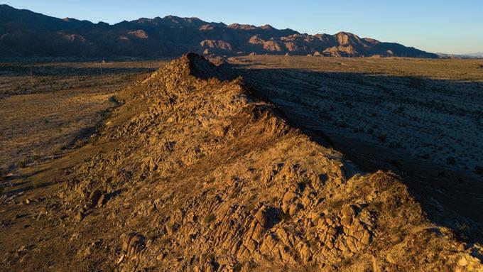
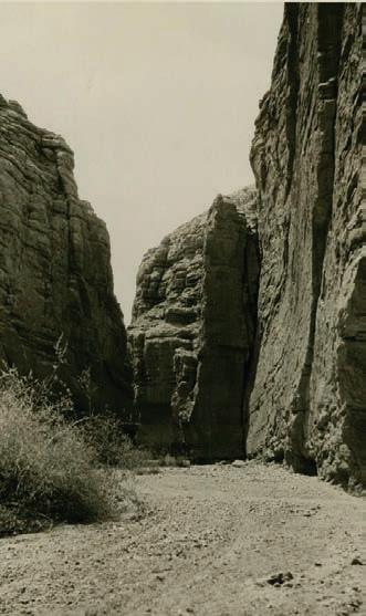
Opposite page: Road snaking through the Mecca Hills (Bob Wick / BLM); This page, clockwise from top: Sunset over the eroding Mecca Hills Wilderness (Bob Wick / BLM); Historical image of the Painted Canyon, seven miles from Mecca, ca.1903, where a dusty lane winds between the layered canyon walls (University of Southern California Libraries and California Historical Society); Diverse desert flora (Bob Wick / BLM); Rocky spine of the Chuckwalla mountains (Bob Wick / BLM).
one of the only year-round residents. His children have kept the cabin tidy, a quaint altar to the mining past, with dented rusted cans of food and a visitor log book.
Beyond de la Garza’s cabin, ocotillo loomed ten feet tall, crowned with brilliant orange blossoms. Cholla stems were surrounded by a glowing corona of thorns in the fading light. Chocolate
mountains loomed in the distance, with barren washes between.
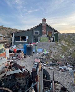
A 4WD vehicle became necessary as we approached the ruins of the Aztec Wells mining community just a few miles past de la Garza’s cabin. The desert preserves even while it destroys and we found a few well kept private homes with dire “No Trespassing” signs next to desiccated trailers ravaged by the desert wind and critters. Care and neglect are neighbors at Aztec Wells. We wandered deeper into the entropy of the abandoned mining town and found rooms full of dried droppings, piles of old shake shingles, plastic knives strewn about on the ground. It looked like an abandoned movie set from the 1950s, with cracked linoleum, ancient outlets, and exposed mattress springs. A crispy newspaper in one shack had screaming headlines about Israel, Gaza and Hamas dating from the mid 1990s. Rubbish overflowed from the open doors of one home, the yard a garbage heap of scattered debris. We
If you want to understand why Chuckwalla is worth protecting, you only need to witness what happened when it wasn’t.
found a magazine from 2019 and a sign that declared this was an Active Mining Site.
I always imagined the threats our public lands faced from mining involved industrial scale devastation. Aztec Wells revealed that BLM management allows wanton disregard for scenic splendors and history, in favor of people trashing a place one ATV load at a time. In order to preserve a semblance of the mining history of this area, we need to get rid of mountains of modern junk. If you want to understand why Chuckwalla is worth protecting you only need to witness what happened when it wasn’t.
The most popular attraction in the new monument is the ladder hike in the northwest corner. Painted Canyon in Mecca Hills features heavy erosion that looks like enormous dribble castles or a melting temple. There’s endless scrambling, exploration and adventure potential in these crumbling shallow canyons; desert rats have been flocking here for decades.
Dispersed camping in the Mecca Hills is easy and plentiful. I’ve enjoyed campfires with friends in these lonesome washes. I’ve also called in a fire started by an arsonist or careless camper that threatened to decimate the sparse habitat of the entire area. While libertarians complain about the hassles of overregulation, the consequences of poor management can be severe.
Almost half of our national parks began as national monuments. Eighteen of the past 21 presidents — nine Democrats and nine Republicans — have used the Antiquities Act to create 168 national monuments. And while locals occasionally object to the creation of these national monuments,
The Defend Our Parks apparel collection is a rallying call for everyone who values our public lands. With increasing threats of privatization and exploitation, these shirts, hats, and totes are more than just gear — they’re a statement.

Inspired by vintage conservation posters, the bold design reminds us to stand up for what matters: wild rivers, granite cliffs, ancient forests, and the freedom to roam. Whether you’re hiking a backcountry trail or grabbing coffee in town, your voice can be heard — loud and proud.
Every purchase supports preservation efforts. A portion of proceeds goes to the Yosemite Climbing Association, a nonprofit that protects Yosemite and other public lands in California.
Wear the Message Fuel the Movement

Blooming ocotillo,
they often come around. Every national park that started as a national monument received consent from the state’s two senators. Change is hard. What was once controversial becomes accepted and even venerated. The Antiquities Act is a powerful legislative tool.
So of course several bills that would eliminate or hamstring presidential creation of national monuments are winding their way through our hallowed legislative halls. Fighting to protect the Antiquities Act may be our best path forward if we want to continue to preserve huge swaths of land from extraction and exploitation.
But as the OG desert rat, author Edward Abbey reminds us, struggle is only part of the battle for wild lands. “Be as I am – a reluctant enthusiast … a part-time crusader, a half-hearted fanatic,” he wrote. “Save the other half of yourselves and your lives for pleasure and adventure. It is not enough to fight for the land; it is even more important to enjoy it.”


Clockwise from top left: Entrance to the 70-mile Bradshaw Trail National Scenic Byway which traverses most of Chuckwalla National Monument; Petroglyphs at Corn Springs Campground;
Chocolate Mountains in the background; Signage at Aztec Wells; Modern mining debris (Leonie Sherman).
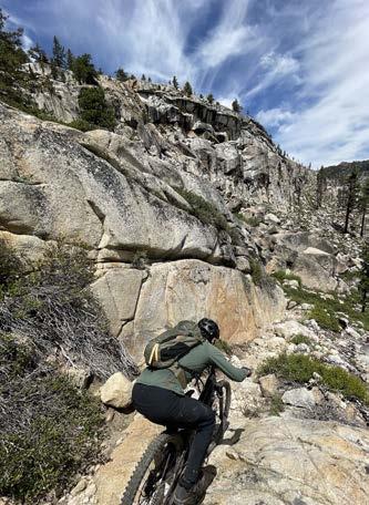
Trail Scout
In creating the Sierra Camino, Chris McNamara sees both the forest and the trees and a singletrack through them
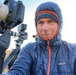
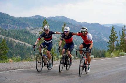
By Kurt Gensheimer
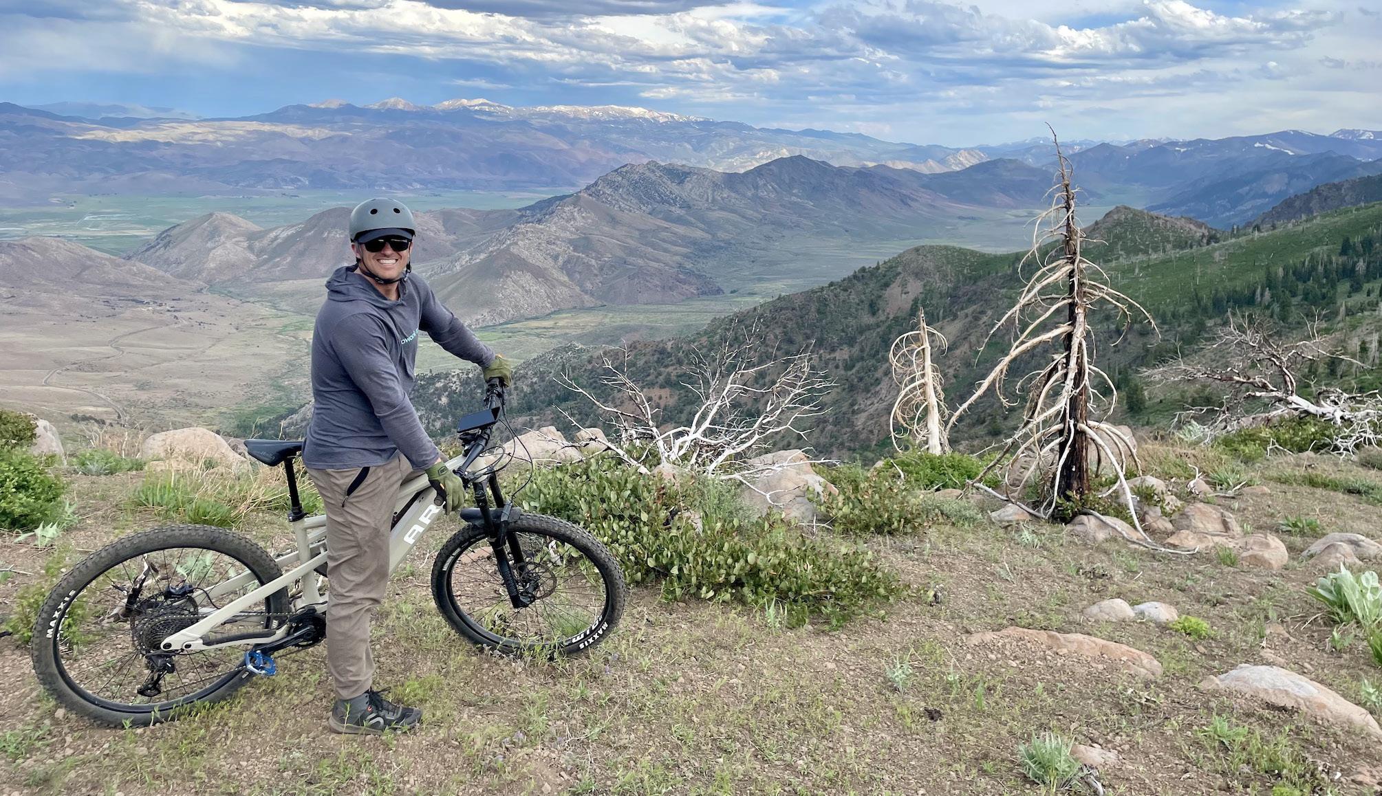
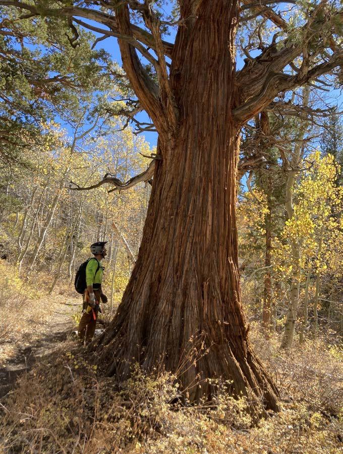
Stringy, inflexible sagebrush grabbed at the cranks of my mountain bike while getting gummed up in the rear derailleur, forcing me to stop every hundred feet so my chain didn’t end up going rogue, destroying my rear wheel. The wild rose thorns scratched at my shins as I barely maintained forward momentum. Gopher holes were peppered about, guaranteed to either swallow my foot and ankle whole or suck my front wheel into a rodent abyss. Chris McNamara was up ahead, just barely far enough away that he couldn’t hear my expletivelaced mutterings leading the way through a sea of sagebrush.
W“here the hell are we even going?” I pondered out loud after enduring a half hour of exploration. There was no trail. There wasn’t even a hint of one. I picked up my bike and just started walking, as I was making more progress with the bike on my shoulder than with its wheels on the ground, so long as I didn’t sink my foot into a gopher hole. This was a classic “Bushwhacknamara” — the
term McNamara’s wife Tor uses every time she’s goaded into a brush fiesta disguised as a mountain bike ride or a hike.
To be honest, I didn’t blame McNamara. It’s a classic strategy I’ve used more than a few times in the past on my signature gnarmega mountain bike rides. Stay just far enough ahead of your unwitting ride mates so that no matter how discouraged, angry or demoralized they are, they have to keep following you because they have no idea where they
are and turning around is not an option.
To McNamara, this was just another weekend adventure. Armed with a hand saw in a plastic sheath hanging from his khaki pants belt on his right side, a small pair of loppers in another holster on his left side, a hoodie pulled over his head with a sun hat over that and a bike helmet over both, zinc-oxide sunscreen slathered all over his face and a battery-powered hedge trimmer on his back, McNamara fancies his wardrobe a distinct “dad dork” look.
But to me McNamara looks like a mix between a super-hardcore arborist and a backcountry special ops commando. Ever since McNamara got bitten by the trails bug about a decade ago, he’s been obsessed with figuring out ways to connect one place to the next with trail. To borrow terminology from his past as a legendary climber, McNamara is in search of first ascents on trails, connecting places that have never been connected by trail before. And his main pet project is the Sierra Camino; a
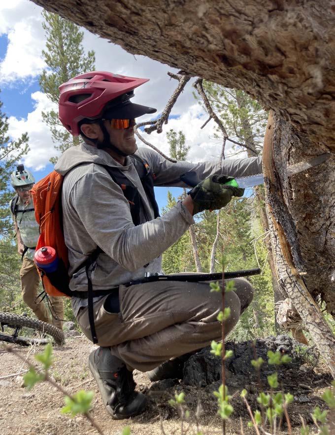
page: Chris McNamara overlooking the Slinkard Valley and dreaming of a future trail connection (Kurt Gensheimer). This page, clockwise from left: Always with a saw handy, McNamara goes to work clearing early season deadfall (Kurt Gensheimer); McNamara and Nick Bliss taking in the beautiful views of Lost Cannon Canyon (Kurt Gensheimer); A must for adventurous hikers and mountain bikers, the Charity Valley Trail offers both challenge and beauty (Tom Beckering); Granite slabs and intense burn scars define the dramatic terrain of Charity Valley (Tom Beckering).
multi-use trail open to wheeled traffic ultimately connecting Susanville on the northern end of the Sierra Nevada with Lone Pine on the southern end.
The Sierra Camino is a smaller component of the grand vision, the Orogenesis Trail; a mountain-bike legal alternative to the Pacific Crest Trail, enabling mountain bikers to ride from Canada to Mexico on trails. But unlike the PCT, Orogenesis also includes the Baja Divide, a route running from the American border south to the tip of Baja. It’s an ambitious, 4,000+ mile project dreamed up by its founder, Gabe Tiller, the man who also dreamed up the Oregon Timber Trail, a 670mile route through Oregon on a series of singletracks and dirt two-tracks. McNamara is a huge fan of Orogenesis, to the point that he led a $200,000 fundraising campaign so Orogenesis Collective could become a 501c3 nonprofit and hire Tiller as its Executive Director.
McNamara and Tiller met when Tiller was searching for regional resources
to help figure out what roads and trails already existed, the proverbial low hanging fruit of the trails world. McNamara immediately signed up as a scout in the Lake Tahoe region as he was already dialing in a route so he could ride from his home in South Lake Tahoe to Mammoth. The challenge blossomed into a full obsession for McNamara, leading him down the path of scouring maps day and night, discovering LiDAR technology to find old roadbeds and getting out in the field as much as possible to put the puzzle pieces into place.
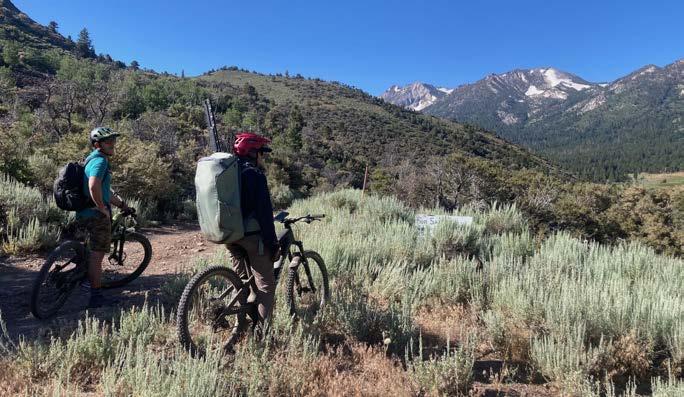
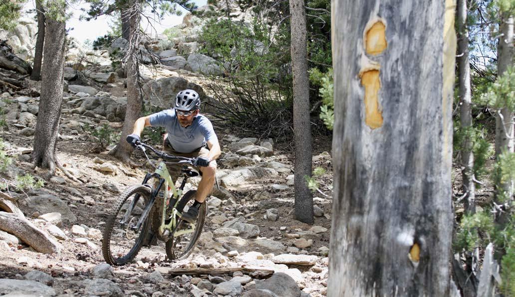
CHARITY VALLEY TRAIL
In the course of this exploration, McNamara uncovered a couple of gems. One of them is called Charity Valley. Connecting the Blue Lakes area near Hope Valley with the hamlet of Markleeville, Charity Valley Trail runs approximately seven miles from Blue Lakes Road down to Grover Hot Springs just west of Markleeville. Charity Valley is very rich in history, and for a long time it was seldom used by only a few hikers.
The trail was used by Kit Carson and John C. Fremont in 1844 to cross the Sierra Nevada. But to make it extra interesting, in classic Carson and Fremont fashion, they did it in a February blizzard and were almost forced to eat one of their horses to survive.
Charity Valley is anything but a casual cruise on a mountain bike. The 2,000 vertical feet of descent to Markleeville is raw, rugged and radical, filled with huge granite slabs, stair-stepped rocks and bouldery chunder, finishing with a loose, surfy and sandy couple miles to Grover Hot Springs State Park. The recent Tamarack fire that almost burned Markleeville to the ground devastated the lower couple miles of Charity Valley, mixing the ash with the sandy soil, making for some uniquely black clouds of dust when riding. If you have an appetite for technical trail, Charity Valley is a feast you must sample.
Charity Valley also happens to be the perfect addition to Sierra Camino and Orogenesis, because it connects Hope Valley to Markleeville, providing an
Ever since McNamara got bitten by the trails bug about a decade ago, he’s been obsessed with figuring out ways to connect one place to the next with trail.
ideal route for travelers between Lake Tahoe and the route to Mammoth. It also happens to be an ideal shuttle, considering you can drive from Markleeville to Blue Lakes Road in less than 30 minutes. When I first rode Charity Valley last summer with McNamara, finishing at the Cutthroat Tavern for a burger and beer, I realized Charity Valley could become Alpine County’s version of the Downieville Downhill, especially once a trail is connected from Carson Pass to Charity Valley, extending the ride into a 15-mile, 3,800 vertical foot descent.
I was one of the first to experience a classic McNamara mountain bike first descent. In five years from now, with
Opposite
a little more trail maintenance and dialing in of Charity Valley, I could see this becoming one of the most popular mountain bike shuttles in the region. But late last summer, Cutthroat closed its doors, leaving a huge void in the recipe of a classic mountain bike ride. As good as Charity Valley is, you have to have a great place of grub and grog at the finish.
McNamara recognized the threat to his Charity Valley discovery and rallied a group of investor friends to purchase the Cutthroat Tavern business and the building, the oldest building in Alpine County, built in 1862. Under new ownership, the Cutthroat is reopened for business, a must-stop at the end of a Charity Valley experience.
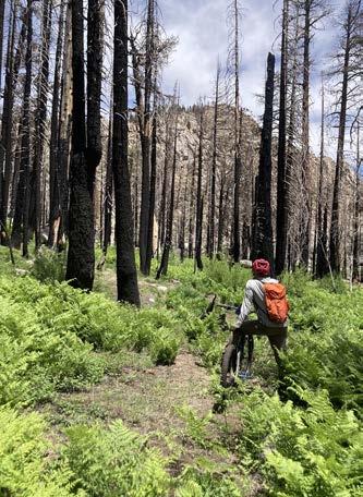
THE LOST CANNON LOOP
Another gem McNamara unearthed is the Lost Cannon loop, a 14-mile route with 2,500 feet of climbing and descending up against the mighty Eastern Sierra Nevada near the town of Walker. The mostly singletrack loop is visually stunning, and follows another fabled Carson and Fremont route where
The Charity Valley and Lost Cannon rides are prime examples of the efforts McNamara has put into finding the low-hanging fruit of old trails.
they somehow lost track of a cannon they were transporting, leading to the legend of the Lost Cannon. However, at last year’s Nevada Day Parade in Carson City, I visited the Nevada State Museum where an old cannon sat in the front lobby, the alleged lost cannon that is apparently no longer lost.
Riding in a counter-clockwise direction, the route ascends Lost Cannon Canyon in the shadow of the 11,000-foot Lost Cannon Peak. The trail is rich in massive granite boulders, towering evergreens and numerous aspen groves along Lost Cannon Creek, peaking out in the lush and wildflower-filled Summit Meadows at 9,000 feet elevation, before a fun, fast and flowing descent down Mill Creek Canyon alongside girthy juniper trees, completing the loop. The Lost Cannon
REDISCOVER THE MAGIC OF THE TRAIL
New Trail–Same Magic.
Canyon segment is another essential component to the Sierra Camino route thanks to the many days McNamara spent in search of it, an instant classic backcountry mountain bike ride with Walker Burger only a 20-minute drive back down Mill Canyon for post-ride refueling.
The Charity Valley and Lost Cannon rides are prime examples of the efforts McNamara has put into finding the low-hanging fruit of old trails. Despite his obligations of being a father and husband as well as being a part-owner of the online product review site
Opposite page: Kurt Gensheimer rips around a corner with a “tree blaze” in the foreground on the Lost Cannon loop (Tom Beckering). This page, top to bottom: Gabe Tiller of the Orogenesis Collective, finds one of many healthy juniper trees on Mill Creek Canyon trail (Kurt Gensheimer); When trail scouting, McNamara involves the whole family (Kurt Gensheimer).
GearLab, McNamara finds time even if it means waking up at 4am to drive an hour south, hike for two hours, then an hour back to be at work by 8pm. When it comes to McNamara and trails, there is both a will and a way.
After an hour of Bushwhacknamara through the sagebrush and wild rose, we finally reached a long-running bluff overlooking the expansive Slinkard Valley south of Monitor Pass. The view was remarkable, most definitely worth the sagebrush slog. McNamara pointed out the direction he’d like to see the Sierra Camino go, and as much as I was cursing his name while fighting through the brush, I knew there was a method to McNamara’s bushwhack madness. McNamara is a visionary, constantly imagining where the Sierra Camino might fit within the landscape, no matter how tall or thick the brush may be.
Lace up your shoes or saddle up and discover the magic of the new Capital to Tahoe Trail.
Hike or bike through breathtaking landscapes and create lasting memories.
This stunning trail offers a unique opportunity to explore the beauty of the region as Carson City’s first single-track connection to Lake Tahoe.
Explore Mono County
Where lakes meet peaks and trails beckon
By Matt Johanson
A late night road trip in the back of a pickup truck first introduced me to Mono County. After a day of rock climbing in Yosemite Valley, my buddy and I got invited on a hot spring jaunt. The only hitch was, the destination was three hours away, and we’d have to ride in the truck bed bundled up in our sleeping bags for warmth. But why not, when you’re 24 years old?
Arriving after midnight, we still enjoyed a hot spring soiree. When the day broke, and on many return trips, I realized Mono County offers much more than just hot springs.
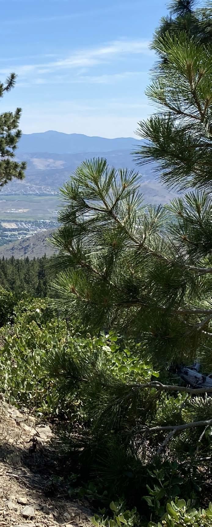
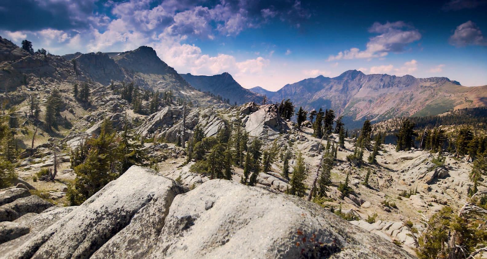
Among California’s largest and leastpopulated counties, Mono boasts the High Sierra mountains, sage-covered deserts, and hundreds of lakes, streams, and meadows. Spanning 3,030 square miles, it includes portions of Inyo and Humboldt-Toiyabe National Forests, as well as John Muir, Ansel Adams, and Hoover Wilderness areas.
HERE ARE A FEW SUGGESTED OUTINGS:
>> Convict Lake (the Paiute call it “Wutsunupa”) offers a pleasant 2.5mile loop hike rich in both geology and history. This basin, carved by glaciers, fills with turquoise-blue water beneath dramatic mountains. At 7,850 feet of elevation, Convict Lake also makes an inviting winter destination for cross country skiers and snowshoers. Both the lake and its neighboring peaks take their names from an 1871 incident, in which criminals escaped from a Carson City prison and fled
south from a posse. Convicts and lawmen exchanged gunfire near the lake. Among the slain were posse member Robert Morrison and a Paiute guide named Mono Jim, for whom the nearby peaks are named.

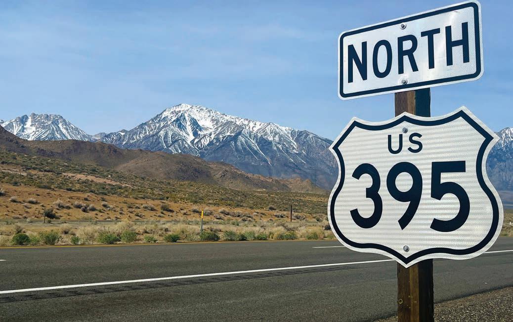
From Highway 395 south of Mammoth Lakes, take Convict Lake Road west for two miles.
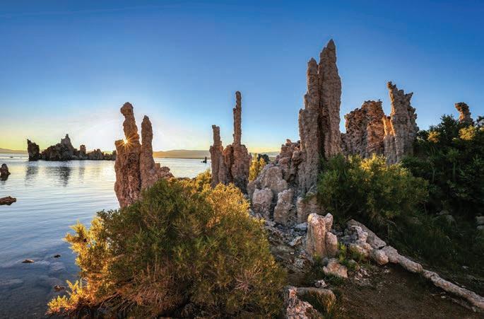
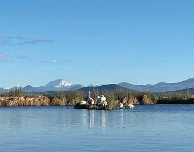
>> Mono Lake claims several distinctions. Columns of limestone called tufa border its shores, two million migratory birds visit annually, and the unending thirst of Los Angeles nearly drained its waters before the courts offered limited relief. Firsttime visitors to Mono County should certainly pay this gem a visit.
More seasoned travelers to the region might consider a nearby alternative. Just south of Mono Lake, Panum Crater is a volcanic cone with a lava dome at its center. Just 650 years old, this small peak is part of the youngest mountain range in North America. Hikers can circle the crater’s rim and visit the dome’s top on a two-mile trek.
From Highway 395 south of Lee Vining, turn east onto Highway 120, drive three miles and then turn left at the Panum Crater sign onto a dirt road.
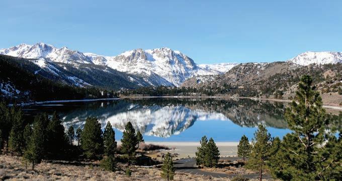
>> June Lake and Reversed Peak provides a scenic outing in the heart of the June Lake area. This beginnerfriendly mountain serves as a great warm-up and altitude acclimatization for more challenging climbs in the Eastern Sierra. There are several ways to achieve this summit and return, but this hiker suggests a six-mile loop hike which gains 1,782 feet. Your outing will deliver stunning views of Carson Peak, and June Lake features cool waters for a swim upon your return.
From June Lake Junction on Highway 395 (10 miles south of Lee Vining), drive southwest on Highway 158 for 3.7 miles to Northshore Drive. Turn right, drive another 0.4 miles to a dirt pullout on the west side of the road and park.
>> Virginia Lakes offers several options within a stone’s throw of the trailhead, and those willing to trek ten miles can visit a dozen of them. Take an out-and-back hike of any length, or make a multi-day backpacking trip. All choices offer grand views beneath Dunderberg Peak and Black Mountain.

From Highway 395 at Conway Summit, take Virginia Lakes Road west for six miles.

Lake
an inviting
loop hike (Alicia Vennos / Mono County
Opposite page, top to bottom: Limestone formations called tufa border Mono Lake (Mick Haupt / Unsplash); June Lake offers both adventure and tranquility (Mono County Tourism); A hiker takes in the stunning views of Virginia Lakes (Mono County Tourism).
>> 20 Lakes Basin Let’s hope you aren’t tired of pretty lakes because we’ve saved the best for last. From Saddlebag Lake near Yosemite’s Tioga Pass entrance, hikers can tour the 20 Lakes Basin of Hoover Wilderness. A four-mile loop circles Saddlebag Lake. Those looking for a longer day
This page, from top to bottom: Highway 395 leads to multiple adventures in Mono County (Matt Johanson); Convict
offers
2.5-mile
Tourism).
can take a ten-mile loop that includes Saddlebag and several smaller lakes to the northwest. Many other variations are possible and all of them lead to breathtaking terrain beneath Mount Conness, North Peak and Shepherd Crest. These waters and most lakes in this region (except Mono) offer excellent fishing.
From Highway 120 east of Yosemite, take Saddlebag Lake Road for 2.5 miles to its end. At 10,000
Among California’s largest and least-populated counties, Mono boasts the High Sierra mountains, sage-covered deserts, and hundreds of lakes, streams, and meadows.
feet, this is another high-elevation trailhead so plan accordingly.
With 94 percent of its land publicly owned, Mono County offers abundant opportunities for outdoor adventurers of all kinds. After hitting the trails, you can enjoy a dip in the abundant hot springs scattered throughout the county, as I did. Mono County creates magical memories, and those who plan well don’t need to drive three hours in a truck bed to reach it.

SUGGESTED HIKES FOR PEAK BAGGERS:
Mono County offers plenty of hiking for those looking to summit peaks. A few top suggestions include Tioga Peak (big payoff for moderate outing in Hoover Wilderness), Mammoth Mountain (hike four miles up, enjoy lunch at the summit cafe and ride the gondola down for free), and Mount Dana (an attainable “13er” near Tioga Pass). All are climbable without specialized gear in typical summer conditions.


Where the Waters Meet
Drifting into California’s only boat-in state park
By Leonie Sherman
If
you type “rat farm”
into the navigational aid of your choice, it will direct you to a parking lot in remote northeastern California that lacks rodents or agriculture. The muskrat farm that gives
the place its name closed almost a hundred years ago. This nondescript patch of
asphalt is the
gateway to Ahjumawi Lava Springs State Park, where
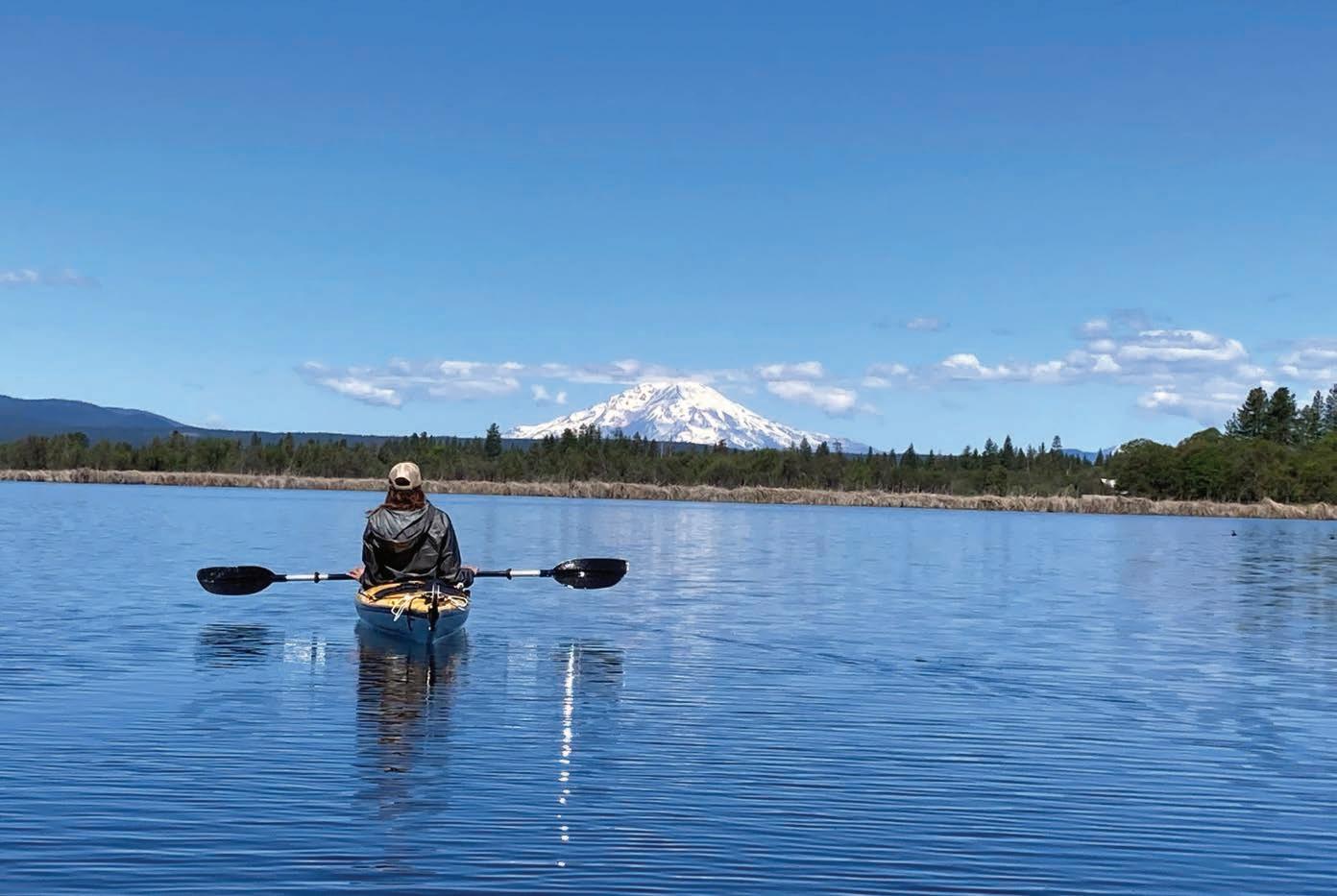
you can float on over a billion gallons of crystal clear spring water while gazing at the snowy bulk of Mt. Shasta.
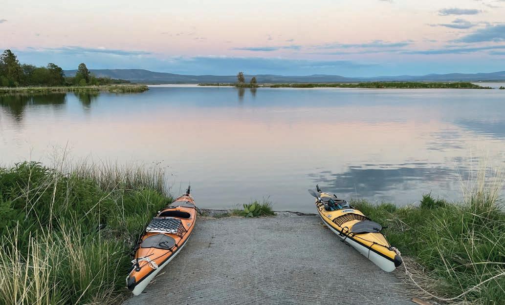
Even the most jaded city dweller or motivated kayaker will put their paddle down and stare in awe at the majesty of a snow capped volcano reflected in the glassy mirror of apricot and lavender hues spread over these lakes at sunrise. Drifting over the surface is like entering a mineral water commercial, just a five hour drive from the Bay Area. And while securing a camping reservation at other nearby parks requires intricate knowledge of each system’s regulations, and lightning computer skills, Ahjumawi offers three first-come, first-served campgrounds. I visited on a Friday night in late May and found only one other camper enjoying the entire park.
Located about 3,300 feet above sea level, summer temperatures average
in the high 80s with nights in the mid 40s. Winters see occasional snow. Spring and fall offer balmy days and crisp evenings. With about 280 sunny days and only 20 inches of rain each year, visitors often enjoy bluebird skies. There’s no entry fee and campsites are $15 a night.
This dreamy paradise of a state park is only accessible by water. That’s either a bonus or a hassle, depending on your perspective. But with no tides or waves, you could enjoy a day at Ahjumawi Lava Springs State Park using an inflatable pool toy for your watercraft.
Considered California’s most remote state park, private motor vehicles are banned, and there are no public roads to the place anyway. Of California’s 280 state parks, this is the only boat-in
one; it’s just under 6,000 acres, barely a mile across and four miles long. With 13 miles of shoreline and over 20 miles of trails, the park is a mosaic of lakes, marshlands and jagged black 3,0005,000 year old basaltic flows that invite exploration and contemplation.
English translations of Ahjumawi range from “people of the river” to “the place where the waters meet”. Big Lake, Tule River, Fall River, Ja She Creek, Horr Pond and Lava Creek all meet here in the Fall River Valley basin. Together they form one of the largest freshwater spring systems in the world.
And where there is water, there is life.
Birds traveling the Pacific Flyway often stop here, including snow geese and blue-winged teals. Northern pygmy owls and Lewis’s woodpeckers
make the park their home, along with bald eagles who feed on abundant Sacramento suckers, largemouth bass, rainbow and brown trout. The park hosts a dense concentration of ospreys and is the only place in the world where this fish-loving bird nests in juniper trees. The endangered Shasta crayfish, only three inches long, still ekes out a living in these crystal spring waters. Plant communities include western juniper, ponderosa, Jeffrey pine, Oregon white oak, mountain mahogany, bitter brush and Ceanothus. Black-tailed deer browse the understory during winter and coyotes skulk through grasslands all year round. I devoted part of a morning to watching two bears frolic in a meadow, blissfully oblivious to my presence as I gawked from my kayak.

Of California’s 280 state parks, this is the only boat-in one; it’s just under 6,000 acres, barely a mile across and four miles long.
American white pelicans crowd tiny islets.
Over two thirds of the park is covered in basalt flows from recent volcanic activity. Poorly maintained trails visit caves and lava tubes, and adventurous scrambling beckons. But the placid lake waters, gleaming bays and tiny islands are the main attraction in this compact park. This sacred site where the waters come together is a place to sit and stare, drifting on the surface of a dream, while the waters sing sweet songs to rock your soul.
I circumnavigated the entire lake system in a peaceful day, marveling at the patchwork of farmland and private property that creeps right to the park’s boundaries. Afterwards, sitting on a dock contemplating the vast expanse of water and tule shoreline, my thoughts drifted to the magical paradise of abundance and beauty this place must have been before ranching and privatization.
Ancestors of the area’s original inhabitants continue to steward the land. They still use boulder fish traps
constructed hundreds of years ago. These cultural heritage sites create shallow inlets on small creeks, allowing natives to harvest the fish they need and then provide safe spawning grounds for the rest. Modern visitors need to educate themselves about these fish traps so they can identify them and avoid pullig their crafts on top of them.
Several groups made up the Ahjumawi who called this place home. Pronounced “ah-choo-MAH-wee”, they are one of the 11 autonomous bands
that comprise the federally recognized Pit River Tribe. Based in what is now northeastern California, the Pit River people never signed a treaty with the US government; their territory was straight up stolen. In 1963 they were offered a pitiful 47 cents per acre for land that had been taken illegally, as part of a settlement between the US government and all California Natives. They rejected the settlement and refused to cash the meager checks. The Bureau of Indian Affairs later declared the settlement accepted anyway. Today the Pit River Tribe continues to fight for their land and tribal sovereignty. They also continue to hunt, fish and caretake the land as their ancestors did for thousands of years. If you choose to visit, carry their reverence with you, and leave the place a little better than you found it.
Opposite page: Author drifting beneath Mt. Shasta (Carl Hlavenka). This page, clockwise from left: Sunset at Ja She Creek Campground (Leonie Sherman); White pelicans roosting on a tiny islet (Leonie Sherman); A close-up of flowering milkweed at Ahjumawi Lava Springs State Park, providing nectar for local pollinators (Courtesy of California State Park, 2025); Prehistoric fish traps showcasing early fishing techniques (Courtesy of California State Parks, 2025); A patch of wild teasel by the calm waters of Ahjumawi Lava Springs SP (Courtesy of California State Parks, 2025).
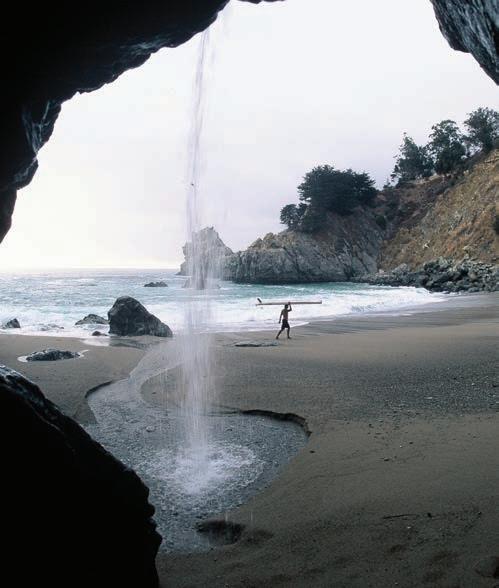
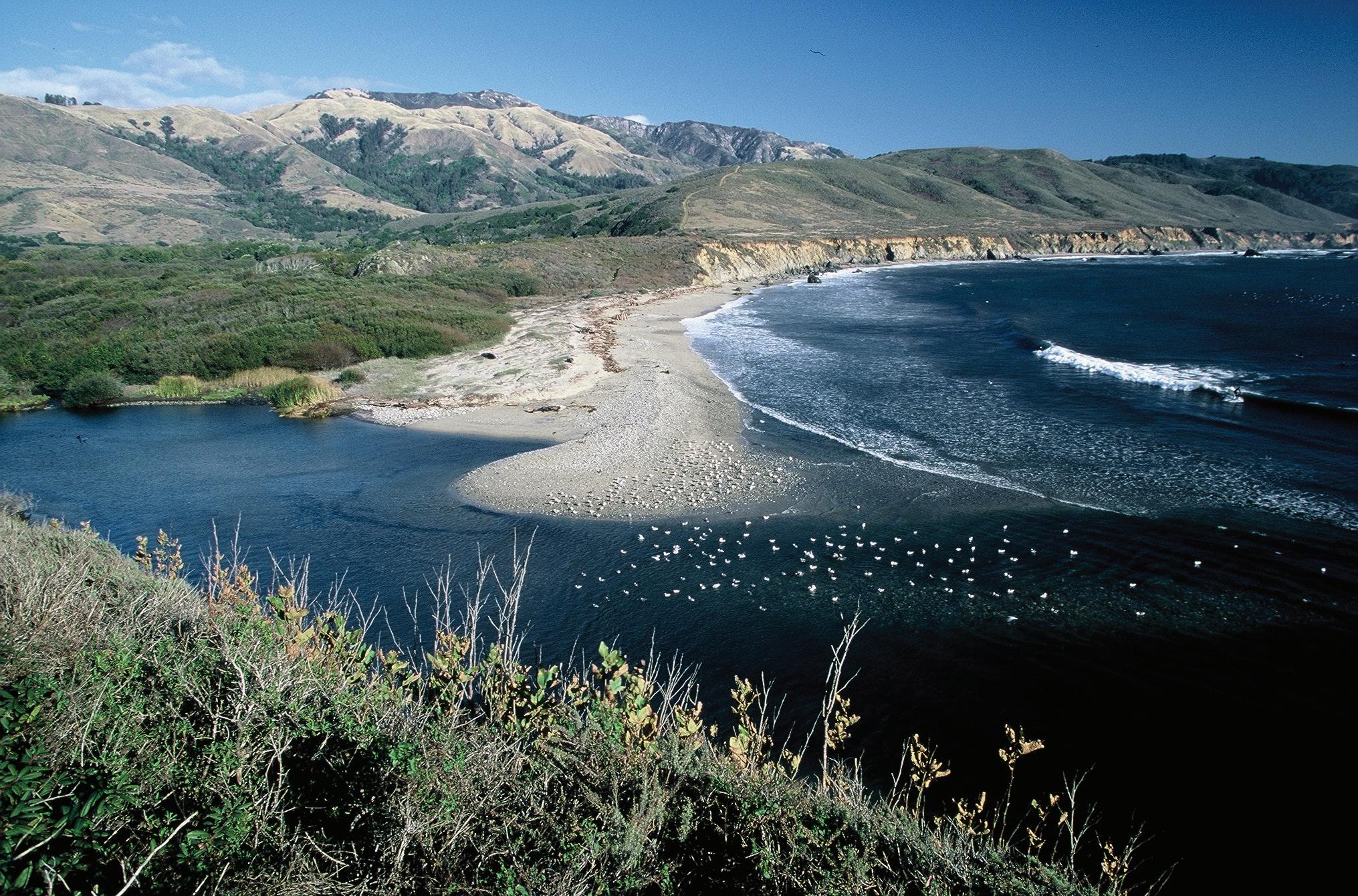
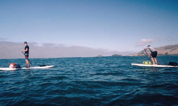
Hugging the Big Sur Coast
A paddling journey along California’s rugged shoreline
Story and photos by Chuck Graham
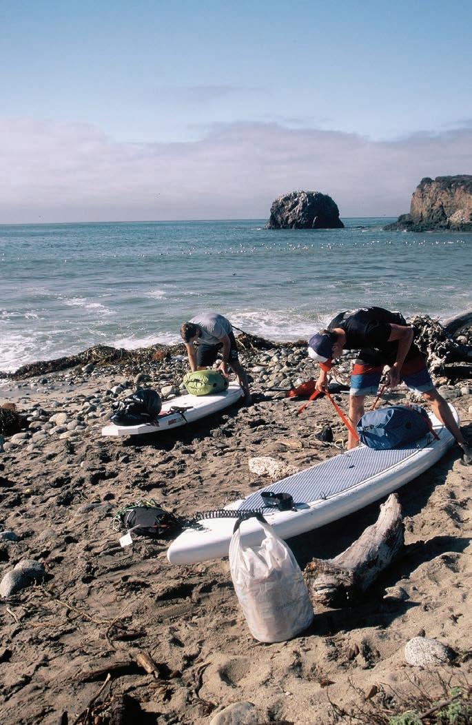
It was a wild start to our paddle along the Big Sur coast. Heavy rain and southeast winds battered the shoreline, the surf rising in confusion against the rugged cliffs. We could barely see beyond the rocks as we prepared to launch — me in my kayak, and former US Rowing team members Patrick O’Hea and Will Miller on standup paddleboards.
We had no choice but to go for it. The tide was surging in, the beach was disappearing fast, and the small pocket cove we found was churning with waves from three directions. I helped O’Hea and Miller get off cleanly, but when it was my turn, I mistimed it. A six-foot wave caught me just wrong, catapulting me
backward onto the sand in a full yard sale of gear.
Fortunately, aside from a wetsuit full of gritty sand and some scrambling to collect my camera equipment, there was no real damage. I regrouped, timed the next set better, and punched through the breaking surf.
When I finally made it beyond the shore break, there they were — O’Hea and Miller, standing tall beyond the chaos, rain pelting off their wetsuits.
We didn’t waste time. With each paddle stroke, we pulled farther away from the tempest behind us.
By the time we rounded the next headland, the clouds began to lift. Blue sky cracked open over the Pacific, and for the first time that day, we could see the full grandeur of Big Sur’s towering cliffs. The coastline glistened under a fresh-washed sun, and the water, no longer gray and angry, turned a deep cobalt blue.
It was exactly the wild, beautiful Big Sur I had hoped to experience — a rugged stretch of coast best understood from the sea.
BIG SUR BEGINNINGS
Since Pacific Coast Highway 1 (PCH) opened in 1937, the 75-mile stretch of winding Big Sur coastline has closed 55 times due to landslides. In 2022–23 alone, there were rapid-fire closures caused by back-to-back wet winters
and multiple slides. Since January 2023, it’s been impossible to drive end to end, from north of the Piedras Blancas Lighthouse to south of Carmel. Of the 656 miles of California coastline, the Big Sur coast is arguably some of its most breathtaking. When the road is passable, Big Sur receives more visitation than Yosemite National Park.
Every time I’ve driven the weaving route in the past, my curiosity overflowed with visions of living remotely along coastal California. Because of its daunting coastal topography and strict land use regulations, the Big Sur coast remains sparsely populated. Roughly 2,000 people eke out a life along its weather-beaten shores, on the edge of lofty cliffs and among the chaparralchoked Santa Lucia coastal mountains. It took a paddling trip to truly appreciate how remote and Mordor-
like those sheer cliffs are. There were plenty of precarious examples of how far people were willing to go to seek solitude. A few dilapidated dwellings clung to cliff faces, sagging toward the boulder-strewn shoreline below, looking as though they required BASE jump training — or a parachute — just to reach the front door. More than once, I wondered, “How does one sleep in those conditions?”
With a combination of steep scree slopes and crumbly rock, Big Sur is always susceptible to shifting earth. Increased wildfires don’t help either; burns followed by wet winters only
accelerate erosion. Between 2016 and 2023, Caltrans spent $315 million in emergency work to shore up the Big Sur region.
Even with Highway 1 closed for nearly two years, the rugged coast still beckoned. Most visitors who travel the curvy road never get the chance to see the stunning perspective from sea level — a view that was even more impressive from our kayaks and boards.
AFTER THE STORM
It’s amazing what blue skies, puffy white clouds, and sunshine can do to brighten the outlook of an excursion.
Nothing came easy while paddling the Big Sur coast – and that was exactly what made it unforgettable.
By the second day, we had ditched our wetsuits for board shorts, hats, sunglasses, and sunscreen, gliding south along the Big Sur coast under the
Highway 1: Between the mountains and the sea — More than just a scenic route, Highway 1 is a lifeline threading together Big Sur’s isolated communities. Carved into steep cliffs and battered by storms, the narrow road offers breathtaking views — but also demands caution. Rockfalls, closures, and shifting earth are part of its story and are reminders of nature’s power and the coast’s forbidding beauty.
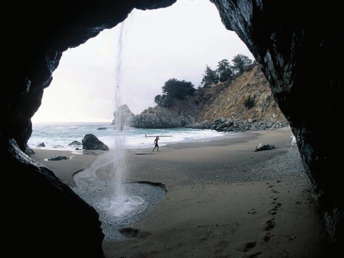
Opposite page: The tucked away cove at Andrew Molera State Park. This page, clockwise from left: With an approaching front, the author and crew gear up for the downcoast paddle along Big Sur; Big Sur through a waterfall; Patrick O’hea on the water while the storm cleared out.


warmth of the summer sun.
Still, there were other difficult landings in huge surf, moments of reflection beneath starry nights, and cool wildlife encounters, followed by challenging launches, all well below the sightlines of PCH.
From above, Big Sur has always appeared intimidating. But while paddling along its base, the three of us agreed — its rugged coastline was no joke.
Big Sur’s Wild Waters
During our last day on the water, the coastal mountains gradually trailed eastward as steady northwest winds propelled us toward the windswept beach just north of the Piedras Blancas Lighthouse. Another messy landing awaited us, but so did the comfort of solid ground.
Nothing came easy while paddling the Big Sur coast — and that was exactly what made it unforgettable.
With sheer cliffs, powerful surf, and very few safe landings, paddling the Big Sur coastline is for expert paddlers only. There are no kayak or SUP rental shops and only a handful of remote beaches accessible to skilled paddlers. For those seeking a true paddling experience in calmer waters, kayak and SUP rentals are available just north in Monterey Bay, where marine life and gentler seas provide a more approachable adventure.
Some beaches along the Big Sur coast, such as Sand Dollar Beach and Andrew Molera Beach, offer relatively easier access to the ocean for surfing or walking along the shore. However, no beaches in Big Sur are lifeguarded, and ocean conditions can change quickly. Strong surf, rip currents, and cold water temperatures are common even on calm looking days. Always check conditions.
For those looking to enjoy the water in a more controlled environment, river access offers a great alternative. At Andrew Molera State Park, visitors can wade, float, or relax along the gentle Big Sur River near the beach. Pfeiffer Big Sur State Park also offers access to the Big Sur River Gorge, a beautiful spot where you can swim, scramble over rocks, and cool off on warm days. Welcome to Clair Tappaan Lodge
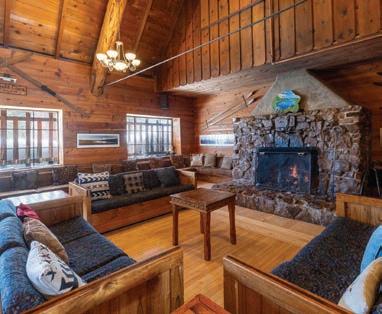
Venture out into nature and experience one of the most extraordinary stays in our mountain lodge.
We’re nestled amongst the trees with Donner Pass as a stunning backdrop to our mountain lodge, the Hutchinson Lodge, or one of our backcountry huts. With rustic accommodations, Clair Tappaan is the perfect place to stay for any traveler who wants to be close to nature.
Ideal for groups or single travelers, we have unique event spaces, a convenient location to Lake Tahoe, and a commitment to sustainability where we uphold the integrity of the natural environment around us.
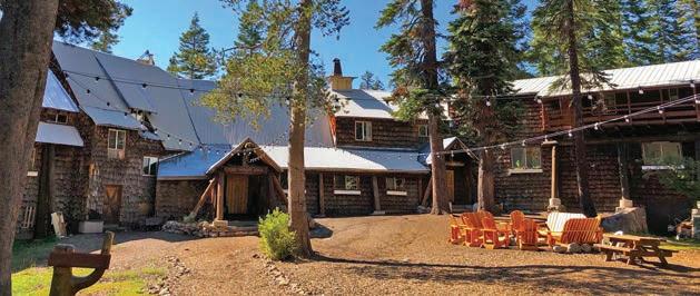

19940 Donner Pass Rd, Norden, CA 95724 (530) 426-3632 ClairTappaanLodge.com
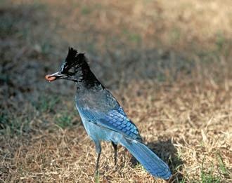
This page, clockwise from top: O’hea and Will Miller paddling south of the Point Sur Lighthouse; Stellar jays are abundant along the Big Sur Coast; Motion blur beneath the most southerly redwoods.
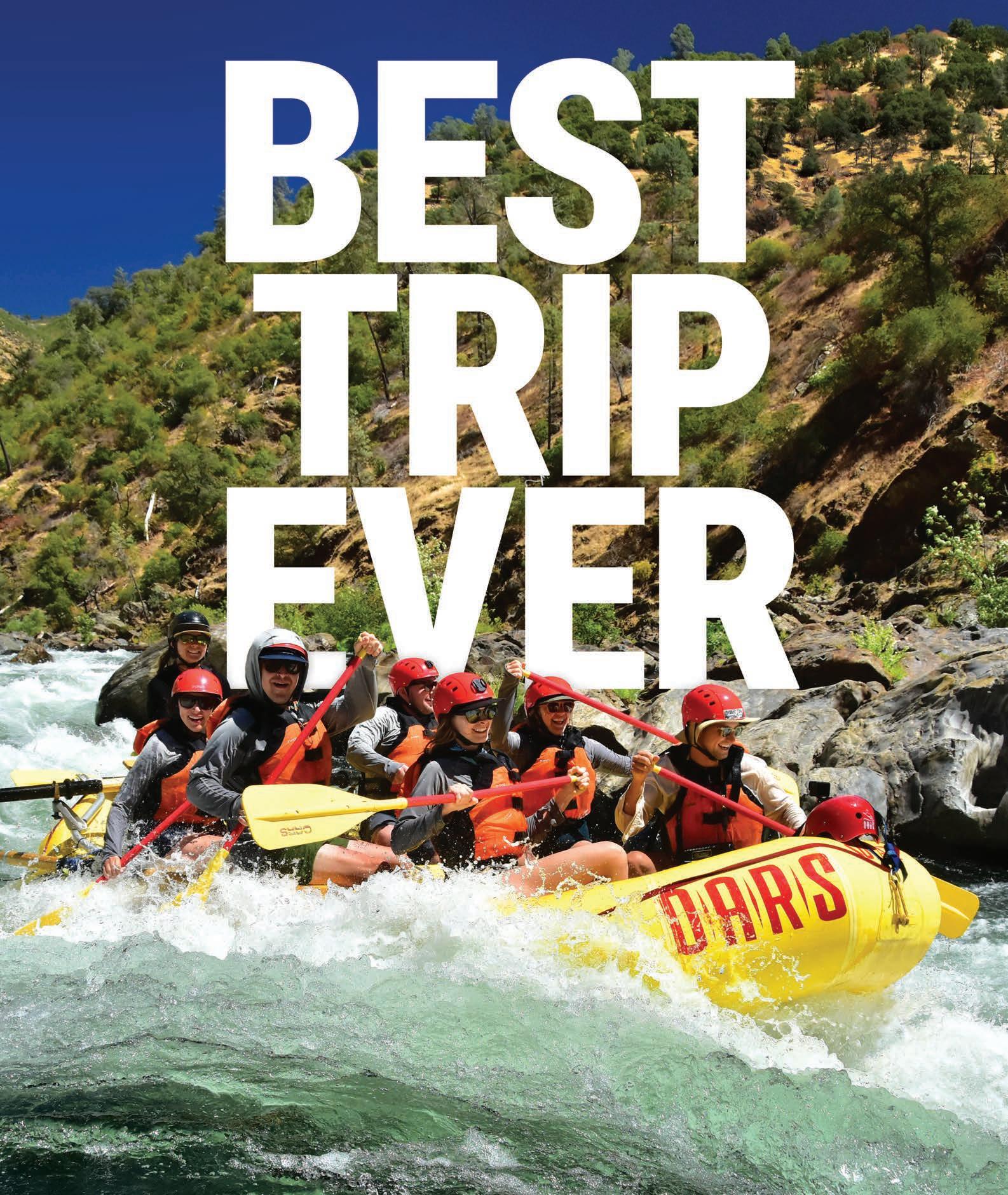
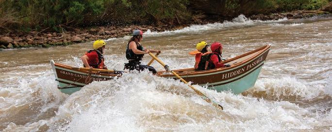
DORY BOATS
The iconic watercraft of the Grand Canyon and beyond
By Anthea Raymond
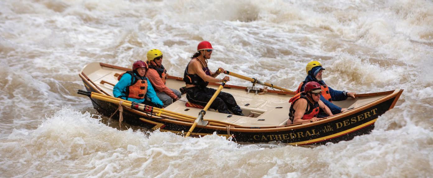
It’s been called the “ballerina of whitewater,” and the whitewater dory definitely can dance. Sleek, elegant, and nimble, these wooden boats are precise in a way rafts aren’t, especially in the big water of western rivers — in particular, the Colorado through the Grand Canyon.
“These boats represent the elegance of the river itself,” muses Cindell Dale in a new film about female dory guides. “You and the boat become one out there.”
Dories like big water because it protects them from rocks. At sixteen, eighteen, nineteen feet, they’re handcrafted from wood and their hulls break easily.
“Dories require us to be alert and always in-tune with the river, setting a careful and intentional line at all water levels,” says guide Mia Clyatt.
The river dory’s closed decks also have an elegance rafters in particular can celebrate — waterproof storage compartments. Food, clothing and equipment stay protected, without the need to strap down multiple dry bags every morning before launching.
Dories and dory-like boats have been used in North America for centuries, for exploration and for transportation especially up and down rivers like the McKenzie in Oregon and the Penobscot in Maine, where rapids and eddies required maneuvering while going both up and downstream. Beach lifeguards on
both coasts also still use a version of the dory for rescues and racing.
A defining characteristic of most dories is a flat bottom and construction that features hewn planks that run from fore to aft, making them relatively easy to build and repair. Some are pointed only at the front, while others, like the river runners we are concerned with here, have points at both ends.
Today, the OARS dory fleet continues to honor the tradition on iconic rivers like the Snake, Salmon, and Colorado, including Cataract Canyon. The outfitter also runs a dory rowing school on the Lower Salmon River, which begins this year on July 23. Participants’ ages will range from 22 to 81, with about half dory newbies.
OARS’ dory fleet is legend. Some vessels date from the early 1970s when famed environmentalist Martin Litton and designer Jerry Briggs first adapted the McKenzie Drift Boat — designed for fishing and eddy hopping — to conditions on the Grand Canyon.
Litton had gone down the newlydammed Colorado in a dory himself and
was charmed. He founded the outfitter Grand Canyon Dories to share wild places and educate guests about the need to protect them. He even named his boats after places lost or damaged due to human intervention — the Hetch Hetchy, the Dark Passage, and the Emerald Mile.
In 1983, three of Litton’s guides rowed the Emerald Mile, a famous stretch of the Colorado River through the Grand Canyon, to set a new speed record. This section of the river, known for its powerful rapids and vibrant green waters, has become legendary among river runners. The 277-mile journey was completed in just 36 hours and 38 minutes. This feat, which was only recently broken by kayakers, remains a significant moment in whitewater history.
The Emerald Mile is chronicled in Kevin Fedarko’s book The Emerald Mile, which tells the story of this record-setting run and the challenges of navigating one of the world’s most formidable rivers in a dory. It’s a must-read for anyone interested in the history of whitewater adventure.
On the Emerald Mile’s record run was Kenton Grua, who like many early dory
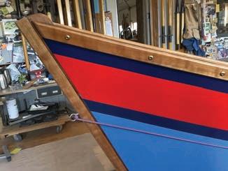
This page, top to bottom: Cathedral in the Desert was built by Sean Bothman in 2021 to honor OARS founder George Wendt (Dana Romanoff / OARS); Dory duo readies for launch at Lee’s Ferry on the Colorado (Marty Schlein). Opposite page, top to bottom: Hidden Passage was one of the originals in Martin Litton’s Grand Canyon Dories fleet and it is still going strong (Dana Romanoff / OARS); Clamping up a traditional Briggs Grand Canyon Dory, with the same hull as the Emerald Mile — one boat can take as long as 500 hours to build by hand (Marty Schlein); Bow detail on the Briggs dory featuring American cherry gunwales and a bow post on a boat measuring 16´9˝ long and 84˝ wide (Marty Schlein).
guides, worked at California’s Bear Valley Ski Resort. Curt Chang recruited him and others and came to inherit Litton’s fleet to create Northwest Dories, which later merged with OARS. You can still see the Emerald Mile in OARS’ Flagstaff warehouse.
Marty Schlein of Blue Sky Woodcraft, has built 16 dories using the original

Briggs designs. He says, “Dories are less likely to get damaged today than when they were used in exploration during the ‘70s and ‘80s. Routes are well known now, and you can use roofing adhesive as an emergency repair on the water.”
While dories may be less common on California’s rivers, their legacy remains a powerful symbol in the world of whitewater adventure. Whether navigating the Colorado River through the Grand Canyon or carving through the rapids of other iconic rivers, dories offer a unique and intimate experience that connects guides and adventurers to the natural world in a way few other vessels can. The men and women who row these boats don’t just paddle — they carry forward a tradition that honors both the river and its history.
The next time you find yourself by the riverbank, watching a dory glide through the rapids, know that it’s more than just a boat. It’s a legacy of elegance, adventure, and conservation, moving forward with each new generation of guides and explorers.

Want to learn more about dories?
For further reading, The Dory Book by John Gardner is a comprehensive guide to dory design and construction, making it a valuable resource for anyone looking to deepen their knowledge of these iconic boats.
For those interested in hands-on learning , The McKenzie River Discovery Center, located near Vida, Oregon, is a great place to start. They offer workshops where you can learn about the history and construction of dories, including the opportunity to build your own drift boat. Used dories also trade among individuals — usually by word of mouth — who also put together their own trips.
If you are in Southern California, the National Doryman’s Association puts on a series of summer races using surf dories favored by local lifeguards. They are a little longer and thinner than whitewater dories, but they also pack a punch cutting through waves. The longest race takes rowers all the way to Catalina.
To learn more about the legacy of female dory guides, OARS’ new 23-minute film, About Damn Time: The Dory Women of Grand Canyon, explores the challenges they’ve faced and is available online.
If you’re new to river running, starting with a traditional rafting trip on one of California’s iconic rivers is a great way to experience the thrill of the water before venturing into the world of dory boats.


Every Body Design reimagines how life jackets are made, making comfortable safety accessible to all.

learn more
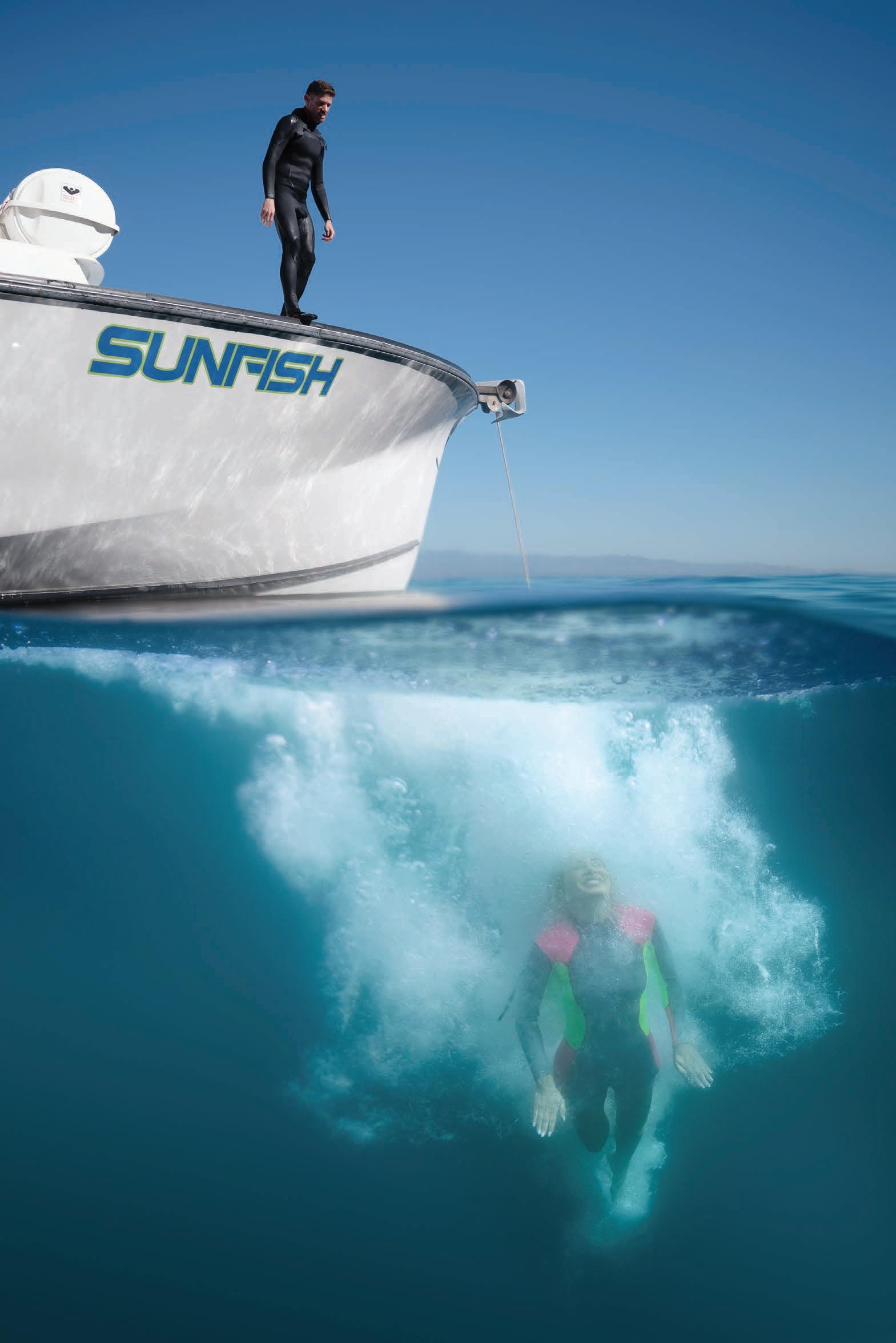
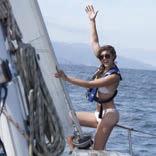
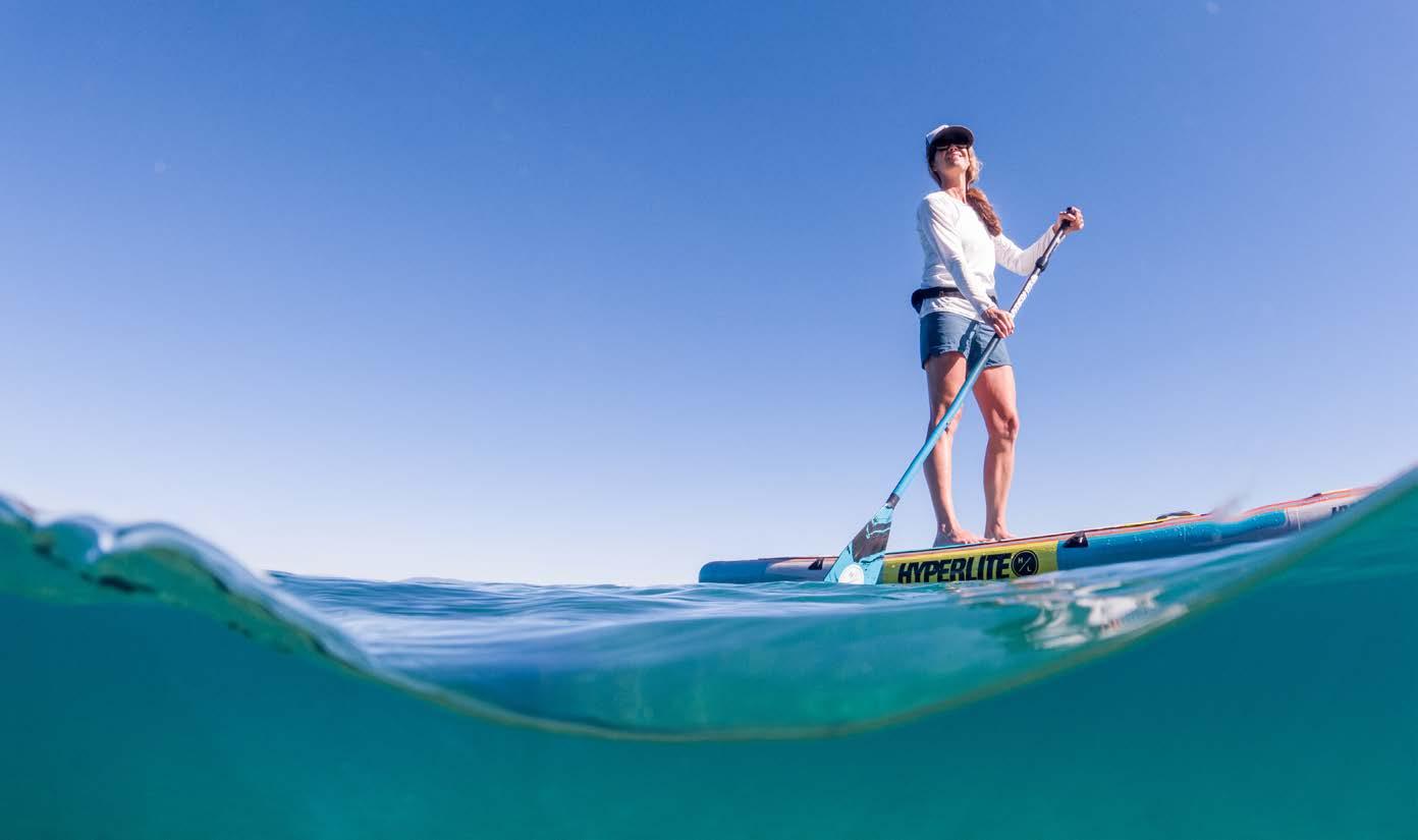
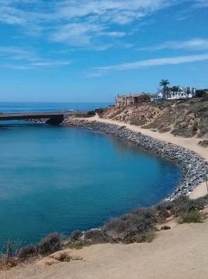
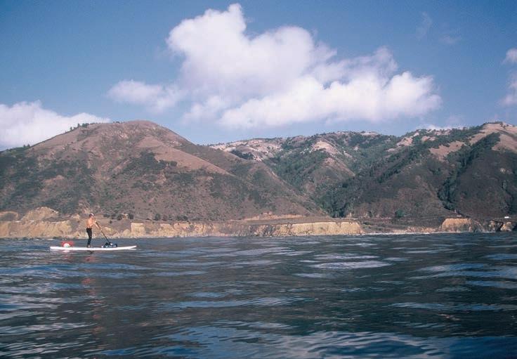
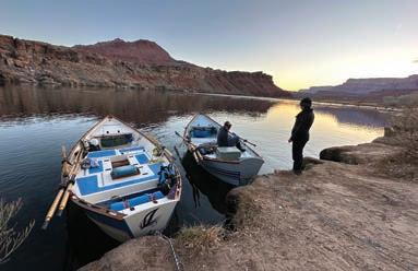
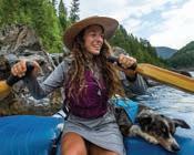
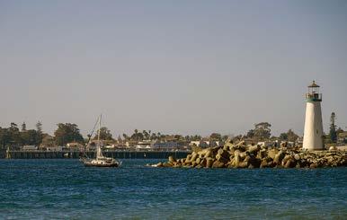
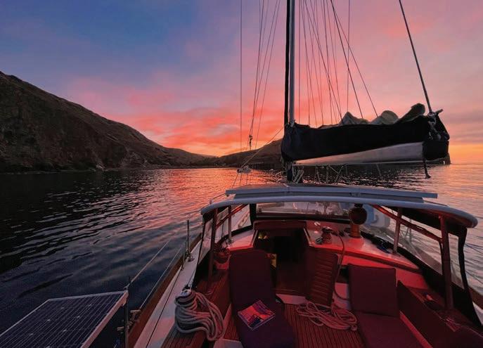
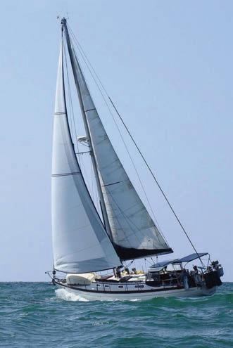
Sailing California
From Sea Snarks to off-shore adventures
By Marissa Neely
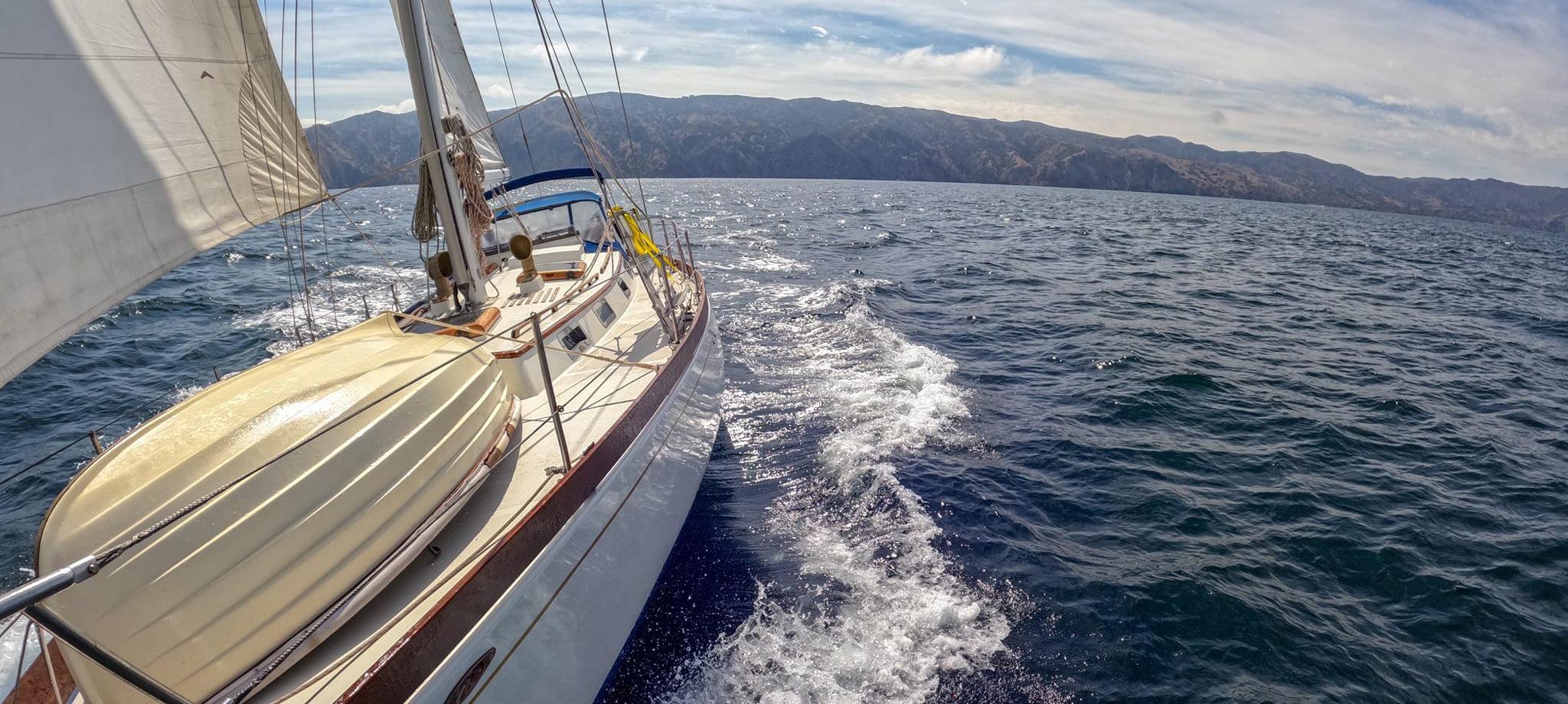
Sailing has a funny way of hooking you in. It starts innocently enough — maybe with a borrowed boat, a weekend lesson, or, in the case of our ASJ publisher Matt, a Sea Snark bobbing around the calm waters of Elkhorn Slough. He calls it “learning the ropes,” but we all know where this leads: late nights researching hull materials, a mysteriously growing collection of foulies, and eventually, dreams of casting off toward faraway shores. That’s what happened with us anyway, aboard our 1979 Cheoy Lee 41’ Avocet that we have lived aboard and cruised since 2018.
California offers the perfect backdrop for that progression, from your first tiller-steadying tacks and building to your first overnight offshore passage.
Here are three iconic California sailing adventures, each tailored to a different skill level. Whether you’re just getting your feet wet or ready to chase the horizon, there’s a windblown path to match your growing confidence.
BEGINNER: MONTEREY BAY
• Launch from: Santa Cruz, Monterey or Moss Landing
• Skill level: Beginner
• Best for: Basic seamanship, light-tomoderate wind sailing, and anchoring practice
• Distance: Day sails to overnights
Monterey Bay is where many sailors cut their teeth, and for good reason. The expansive, semi-protected bay serves up predictable breezes, playful marine life, and a variety of destinations within a forgiving range. From Moss Landing to Santa Cruz, the curve of the bay offers shelter with just enough challenge to keep you learning. You can practice tacking, reefing, and even light anchoring — all without straying too far from help.
It’s also where we spent a bit of time aboard Avocet on our journey south to Mexico. Our sail out of Santa Cruz Harbor felt monumental, even if it was just a loop around the kelp beds.
Humpbacks breached in the distance. Sea otters peeked up from the swells. We were just hopping from Santa Cruz to Monterey, but it was a truly magical 22-nautical-mile sail.
Highlights:
>> Dock-and-dine in Santa Cruz or Monterey
>> Day anchorage off Capitola Beach
>> Whale sightings and otter encounters
>> Beginner-friendly navigation and charts
Tips: Practice anchoring by the Santa Cruz Wharf or tie up in Monterey for an overnight marina stay. Pack layers — it gets chilly fast, even in summer.
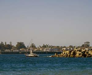
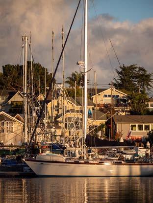
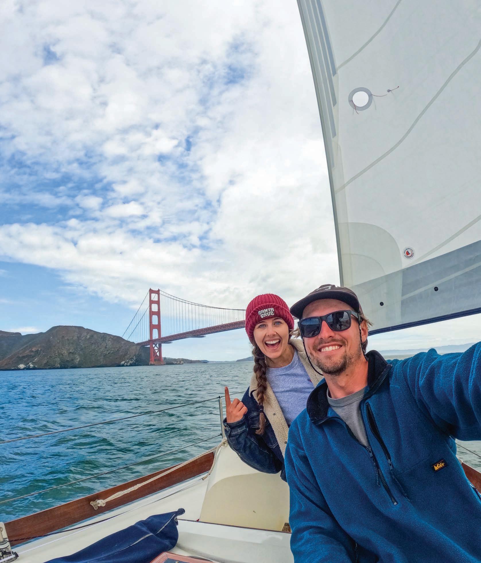
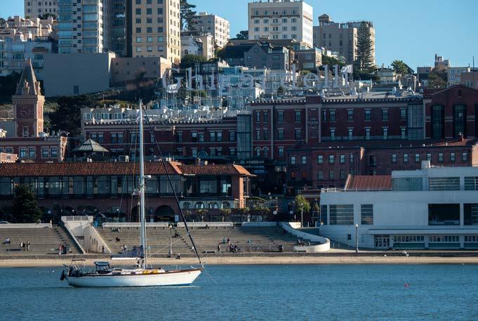
This page, top to bottom: The author’s sailboat, Avocet, departing Catalina Island (Chris Neely); Sails full and seas calm while passing the Santa Cruz Lighthouse, a coastal classic (Chris Neely); Avocet docked in Santa Cruz Harbor (Chris Neely). Opposite page, top to bottom: Chris and Marissa Neely anchored in Horseshoe Bay, near the Golden Gate Bridge (Chris Neely / self-timer); Avocet anchored in Aquatic Park, in front of Ghirardelli Square (Chris Neely).
alpinecounty.com


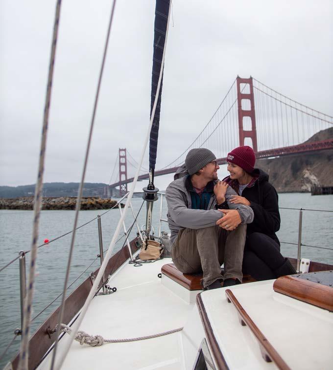
INTERMEDIATE: SAN FRANCISCO BAY
• Launch from: Berkeley, Alameda, Sausalito
• Skill level: Intermediate
• Best for: Current reading, navigation under pressure, and sail handling in variable winds
• Distance: 1–5 day itineraries
San Francisco Bay is both a sailor’s playground and proving ground. Shifty winds, strong currents, and microclimates demand respect — but the reward is immense. On a clear day, nothing beats sailing under the Golden Gate Bridge with your sails full and your adrenaline pumping. From Angel Island anchorages to the charming docks of Sausalito, the Bay Area serves up an incredible blend of urban and wild, challenge and charm.
Sailing here sharpens your instincts. You’ll learn to read water color for current clues, trim your sails with finesse, and time your crossings with the tides. It’s not easy — but it makes you a better sailor with every tack.
Highlights:
>> Sailing past Alcatraz and under the Golden Gate
>> Raft-ups at Angel Island or Clipper Cove
>> Sunset sails with city skyline views
>> Access to world-class sailing schools and races
Tips: Always check tide and wind forecasts before departing. Dress for wind chill, and brush up on VHF protocol — it’s a busy bay!

ADVANCED: CHANNEL ISLANDS NATIONAL PARK
• Launch from: Barbara
• Skill level:
• Best for: offshore anchoring, weather routing
• Distance: depending on destination

If Monterey Bay is the classroom and San Francisco Bay is the final exam,
make this a bucket-list destination for any sailor with salt in their blood.
even with years of sailing experience under our belt, it was humbling in the best possible way.
Highlights:
>> Anchoring off Santa Cruz Island’s Painted Cave
>> Snorkeling in kelp forests near Anacapa
>> Stargazing in complete solitude
>> Whale migrations in spring and fall
Tips: Watch for Santa Ana winds, and always double up your scope. Carry extra fuel and water — it’s remote for a reason. Bring your best anchor ... and a backup.
FROM HERE TO THE HORIZON
No matter where you start — be it aboard a Sea Snark or a 40-footblue-water-cruiser — sailing teaches you one lesson over and over again: you are capable of more than you think, and there is always something to learn. Each tack builds muscle memory. Each log entry adds to your sea sense. And eventually,
Soar to New Heights!


This page, top to bottom: Avocet anchored in Little Scorpion Anchorage, Santa Cruz Island (Chris Neely); Avocet sailing north from Ventura Harbor (Mitchel Andrus).
Go
Go
BIKING
JUNE
7 — Groveland Grind / Groveland / GrovelandTrailHeads.org
7 — LaGrange Classic / Weaverville / TrinityTrailAlliance.com
12-15 — Lost and Found Gravel Festival / Portola / LostAndFoundBikeRide.com
21 — Climb to Kaiser & Tollhouse Century / Clovis / FresnoCycling. com/Climb-to-Kaiser
28 — Lake Tahoe MTB Race / Tahoe / AdventureSportsWeekTahoe.com
28 — Rock the Ride / Napa Valley / RockTheRideusa.com
28 — Truckee Tahoe Gravel / Truckee / TruckeeGravel.com
JULY
5 — Watsonville Criterium / Watsonville / VeloPromo.com
12 — China Peak Enduro / Lakeshore / CaliforniaEnduroSeries.com
12 — Death Ride - Tour of the California Alps / Markleeville / DeathRide.com
12 — Giro Bello / Santa Rosa / GiroBello.com
13 — Butte County Gravel Ride / Forest Ranch / ChicoVelo.org
AUGUST
2 — The Great Gravel Ride / Tahoe City / TahoeXC.org
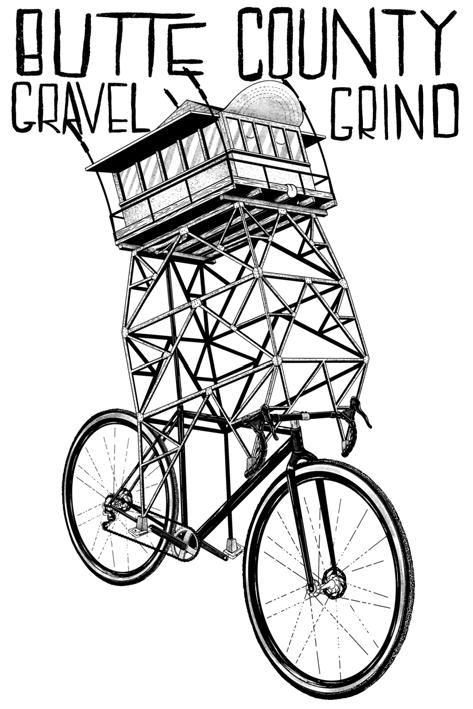
www.chicovelo.org/buttecountygravelgrind

2 — Dodge Ridge Enduro / Pinecrest / CaliforniaEnduroSeries.com
2 — Tour de Big Bear / Big Bear Lake / BigBearCycling.com
7-10 — Downieville Classic / Downieville / DownievilleClassic.com
9 — Leesville Gap Road Race / Williams / VeloPromo.com
16 — Cool Breeze Century / Ventura / CoolBreezeCentury.com
16 — San Ardo Road Race / San Ardo / VeloPromo.com
17 — University Road Race / Santa Cruz / VeloPromo.com
23 — Northstar Enduro / Truckee / CaliforniaEnduroSeries.com
24 — Winters Road Race / Winters / VeloPromo.com
30 — Tour de Fuzz / Santa Rosa / TourDeFuzz.org
SEPTEMBER
6 — The Lost Coast Hopper / Rockport / GrasshopperAdventureSeries.com
12-14 — Mountains to Meadows / Quincy / QuincyMountainsToMeadows.com
12-14 — Grinduro / Quincy / Grinduro.com
20 — Gold Rush Growler MTB / Granite Beach, Folsom Lake SRA / TotalBodyFitness.com
27 — Ashland Mountain Challenge / Ashland, OR / CaliforniaEnduroSeries.com
27 — The Great Trail Race / Tahoe City / GreatTrailRace.com

RACE & EVENT CALENDAR
Confirm dates and details with event producers
RUNNING
JUNE
14 — Olympic Valley Half & 8 Miler / Olympic Valley / OlympicValleyHalf.com
22 — Burton Creek Trail Run / Tahoe City / 6K, 12K, Half Marathon / TahoeTrailRunning.com
22 — Rock Tahoe Half Marathon / Lake Tahoe / RockTahoeHalf Marathon.com
28 — Rock the Ride / Napa Valley / RockTheRideusa.com
28-29 — Western States 100 / Olympic Valley / wser.org
29 — Awesome 80s Run / San Diego / Awesome80sRun.com
JULY
4 — Run to the Beach Lake Tahoe / Tahoe Vista / TahoeTrailRunning.com
4 — Santa Cruz Firecracker 10K, 5K, Kids 1K / Santa Cruz / SantaCruzFirecracker10k.org
7-9 — Badwater 135 / Furnace Creek & Lone Pine / Badwater.com
12 — San Lorenzo River Trail Run / Santa Cruz / CoastalTrailRuns.com
20 — Blood, Sweat & Beers / Auburn / BloodSweatBeers.com
27 — San Francisco Marathon / SF / TheSFMarathon.com
AUGUST
2 — Truckee Half Marathon & 5K / Truckee / BigBlueAdventure.com
2 — Strawberry Jam Fun Run / Watsonville / friendsofwatsonvillepcs.org
9 — Marlette 50K & 10 Miler / Tahoe / BigBlueAdventure.com
16 — Redwood (Summer) Trail Run / Oakland / CoastalTrailRuns.com
16 — Run with the Horses / Green River, Wyoming / Marathon, Half, 10K, 5K / RunWithTheHorsesMarathon.com
24 — Capitola 10K/6K / Capitola / RunSurfersPath.com
24 — Good Dog - Dirty Dog 5K/10K / Granite Beach, Folsom SRA / TotalBodyFitness.com
31 — SPASM Crystal Springs Trail Run / Woodside / CoastalTrailRuns.com
SEPTEMBER
6 — Emerald Bay Trail Run / Lake Tahoe / BigBlueAdventure.com
6 — She.Is.Beautiful 5K & 10K / Santa Barbara / RunSheIsBeautiful.com
7 — Diablo Trail Run / Clayton / CoastalTrailRuns.com
13 — XTERRA Lake Tahoe 5K and 10K / Incline Village / TahoeTrailRunning.com
14 — Buffalo Stampede / Sac / BuffaloStampedeRun.com
20 — Gold Rush Growler 10 Mile & 5K Trail Runs / Granite Beach, Folsom Lake SRA / TotalBodyFitness.com
20 — Lederhosen 5K / Tahoe City / TahoeTrailRunning.com
27 — The Great Trail Race / Truckee, Tahoe City / GreatTrailRace.com
27-28 — Urban Cow Half Marathon, 5K Run/Walk / Sacramento / UrbanCowHalf.com
JUNE
28 — Tahoe City Swim / Tahoe City / TahoeSwimming.com
JULY
27 — Alpine Fresh Water Swim / Truckee Donner Lake / TahoeSwimming.com
AUGUST
3 — Alcatraz Sharkfest Swim / San Francisco / 1.5mi from Alcatraz to Aquatic Park / SharkFestSwim.com
17 — Tahoe Sharkfest Swim / Incline Village, NV / SharkFestSwim.com
24 — Lake Tahoe Open Water Swim / Tahoe / TahoeSwimming.com
31 — Alcatraz Open Swim / San Francisco / SERC.com
SEPTEMBER
21 — San Francisco Open Water Swim / San Francisco / 1.5-mile point-topoint swim / Making waves to fight cancer / SwimAcrossAmerica.org
2025 RACE SCHEDULE
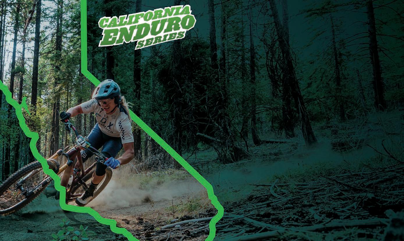
presented by
ASJ is proud to be a founding sponsor of the California Enduro
TRIATHLON/ DUATHLON
JUNE
1 — Menlo Park Kids Triathlon / Menlo Park / SierraCascades.com
7 — TRI for REAL Triathlon #1 / Herald / TotalBodyFitness.com
8 — Vi Tri / Visalia / SierraCascades.com
22 — Huntington Lake Triathlon / Lake Shore / SierraCascades.com
28 — Tahoe Off-Road Triathlon / Tahoe City / AdventureSportsWeekTahoe.com
JULY
19 — Great American Triathlon / Sacramento / Run, Cycle, Paddle / GreatAmericanTriathlon.com
26-27 — Donner Lake Triathlon / Truckee / DonnerLakeTri.com
AUGUST
9 — TRI for REAL Triathlon #3 / Herald / TotalBodyFitness.com
10 — TRI for FUN Triathlon #3 / Herald / TotalBodyFitness.com
10 — Tri Santa Cruz / Santa Cruz / TriSantaCruz.com
23 — Granite Bay Triathlon / Granite Beach, Folsom Lake SRA / TotalBodyFitness.com
23-24 — Lake Tahoe Triathlon / Lake Tahoe / BigBlueAdventure.com
24 — Millerton Madness / Friant / SierraCascades.com
SEPTEMBER
13 — XTERRA Lake Tahoe / Tahoe City, NV / BigBlueAdventure.com
14 — Shaver Lake Tri / Shaver Lake / SierraCascades.com
21 — Santa Cruz Triathlon / Santa Cruz / SantaCruzTriathlon.org
OCTOBER
4 — Mermaid Duathlon & Triathlon / Capitola / MermaidSeries.com
12 — Lake Evans Triathlon / Buena Vista / SierraCascades.com
19 — Ironman California / Sacramento / Ironman.com
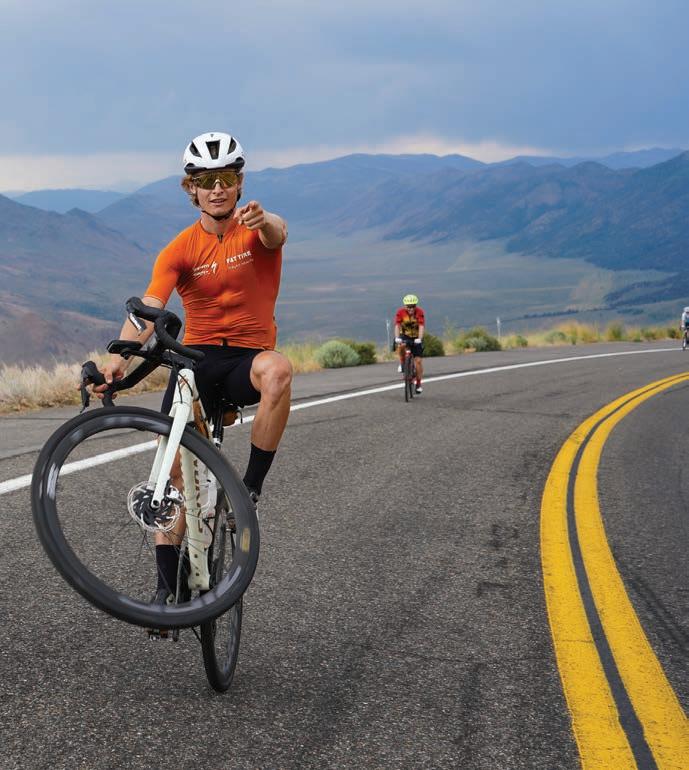


Photo Captivating Sports Photos
Gear We Love
Goodies for your active lifestyle

1 ARC’TERYX ATOM SL HOODY
In many parts of California, a good layering piece isn’t just for alpine missions — it’s something you’ll reach for on early trail starts, foggy coastal mornings, or when the breeze picks up on a ridge. The Arc’teryx Atom SL Hoody fits that role perfectly: lightweight, breathable, and compact enough to carry anytime the weather might shift.
Weighing just 9.5 ounces, the Atom SL is the lightest synthetic-insulated hoody Arc’teryx makes. It uses recycled Coreloft™ Compact insulation through the torso for a touch of warmth where it counts, while Octa™ fleece side panels allow for ventilation and easy movement. The shell fabric, Fortius™ Air 20, is wind-resistant with a durable waterrepellent finish — enough protection for light weather without feeling overbuilt.
The hoody’s trim profile, minimalist StormHood™, and uninsulated sleeves make it ideal for high-output days or shoulder-season layering. It tucks away neatly into a pack when not needed and layers well under a shell in cooler conditions.
With recycled materials and Fair Trade Certified construction, the Atom SL adds up to a versatile and responsibly made staple — equally suited for hikes, bike rides, or everyday use when conditions call for just a little more coverage.
MSRP: $280 • arcteryx.com
2 HEEL ROAM 350 VIRTUAL DOG LEASH™
For those of us who love hitting the trail with our dogs in tow — but not necessarily on a leash — the new Heel Roam 350 Virtual Dog Leash™ delivers an elegant solution. This innovative system creates a movable boundary that follows you as you hike, run, or explore, giving dogs more freedom while keeping them safely within range. Unlike GPS-based collars or virtual fences that rely on cellular signals or static locations, Heel’s proprietary AUTOPROX™ technology creates a “virtual leash” that adjusts in real-time, no matter where your adventure takes you. The system doesn’t require Wi-Fi, cell coverage, or a subscription — making it ideal for remote trails, campsites, and wide-open backcountry.
With proximity settings from 10 to 750 feet, you can set the virtual leash to suit your surroundings. When your dog nears the boundary, the collar provides a tone or vibration cue, guiding them back — making it not just a leash alternative, but also a training tool that helps reinforce recall and boundary awareness. It also doubles as a standard remote training collar with a 1000foot range.
We love that it works with up to three dogs at once, and that waterproof models are on the way — perfect for splash-prone pups who love a good beach romp or creek crossing. While the Roam 350 offers impressive off-leash control, it’s not a replacement for local leash laws — so always check regulations before unclipping.
MSRP: $399 • heel.dog

3 GSI OUTDOORS SELKIRK 270 BUTANE STOVE
For campers and outdoor enthusiasts seeking a reliable, compact stove, the GSI Outdoors Selkirk 270 Butane Stove offers a blend of portability and performance. Weighing just 2.8 pounds and measuring under 10 inches long, this single-burner stove is easy to stash in a gear box or picnic tote, making it a great companion for car camping, beach cookouts, or minimalist setups.
The Selkirk 270 features a stable die-cast metal base that can support larger pots — an upgrade from typical backpacking stoves — and a 5,300 BTU burner that delivers consistent heat for simmering, sautéing, or frying. The integrated piezo ignition makes lighting quick and fuss-free, no matches required.
Built from a mix of stainless steel, aluminum, and reinforced plastic, it’s made to handle rough use. While it performs well in calm conditions, there’s no built-in windscreen, so exposed cooking areas may call for a little extra shelter.
All in all, the Selkirk 270 hits a sweet spot between compact size and cooking capability — an easy choice for anyone who wants simple, reliable flame control on the go.
MSRP: $79.95 • gsioutdoors.com
4
XTRATUF WHEELHOUSE
The XTRATUF Wheelhouse Ankle Deck Boot is engineered for extended wear in wet, demanding environments, featuring reinforced toe and heel areas, slip-resistant soles, and a wider fit for all-day comfort. While originally designed with commercial

fishermen in mind, its rugged design and waterproof performance make it equally valuable for boaters, dockworkers, and outdoor enthusiasts. For those seeking a distinctive touch, the limited-edition COTTY Boot — developed in collaboration with big wave surfer Andrew Cotton — offers the same robust features with unique styling inspired by Cotton’s fearless approach to the ocean.
MSRP: $125 - $135 • xtratuf.com
5 DYNAFIT TRAIL RUNNING SHOE
Designed for runners who head out their front door and don’t stop when the pavement ends, Dynafit’s new Trail shoe bridges the gap between urban routes and rugged terrain. With a Vibram® XS Trek outsole, it grips confidently across surfaces, from city sidewalks to root-laced singletrack. The intelligent lug pattern balances traction with a lighter feel underfoot, while the SpeedLITE midsole delivers generous cushioning without the bulk.
A breathable jacquard mesh upper keeps things cool on warm days and adds just enough structure for stability on uneven ground. The 6mm drop and moderate reactivity support a natural stride, and the medium-volume fit feels secure without being restrictive. While protection is kept minimal to maintain a nimble ride, comfort is maximized with a cushioned footbed and smooth roll-through. Ideal for mid-distance runs on mixed terrain, it’s a versatile shoe built to keep you moving forward — wherever the trail leads.
MSRP: $149.95 • dynafit.com

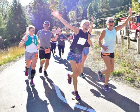

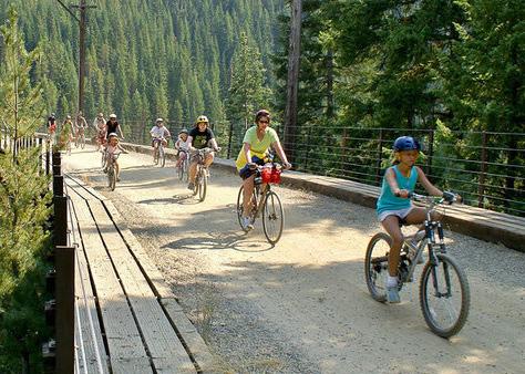
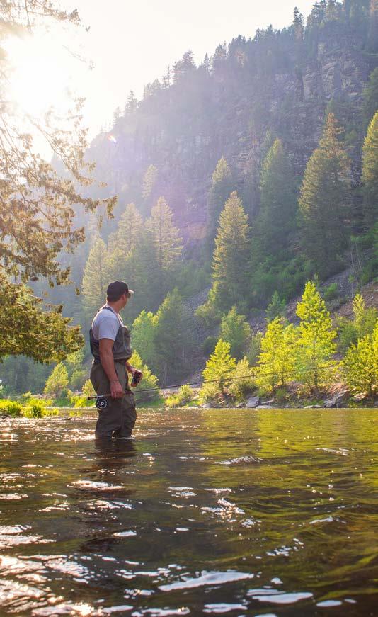

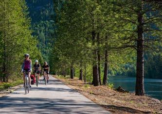

MARKS THE SPOT
MARKS THE SPOT
It’s the kind of adventure thrill-seekers crave. From Oxnard’s Channel Islands Harbor, set course for the wild beauty of Channel Islands National Park aboard The Sunfish with Channel Islands Expeditions. Kayak through towering sea caves, dive into vibrant marine life or witness whales breaching in the open Pacific. Set sail, explore and claim your next epic moment—because in Oxnard, OX marks the spot for adventure.
It’s the kind of adventure thrill-seekers crave. From Oxnard’s Channel Islands Harbor, set course for the wild beauty of Channel Islands National Park aboard The Sunfish with Channel Islands Expeditions. Kayak through towering sea caves, dive into vibrant marine life or witness whales breaching in the open Pacific. Set sail, explore and claim your next epic moment—because in Oxnard, OX marks the spot for adventure.