3 minute read
ROCK & ROLL

from Wild #188

GIRRAWEEN NATIONAL PARK’S AMAZING GRANITE WALKING
Not far from the NSW border, Southeast Queensland’s Girraween National Park offers walkers and adventurers a distinctive landscape to explore.
Advertisement
By RYAN HANSEN
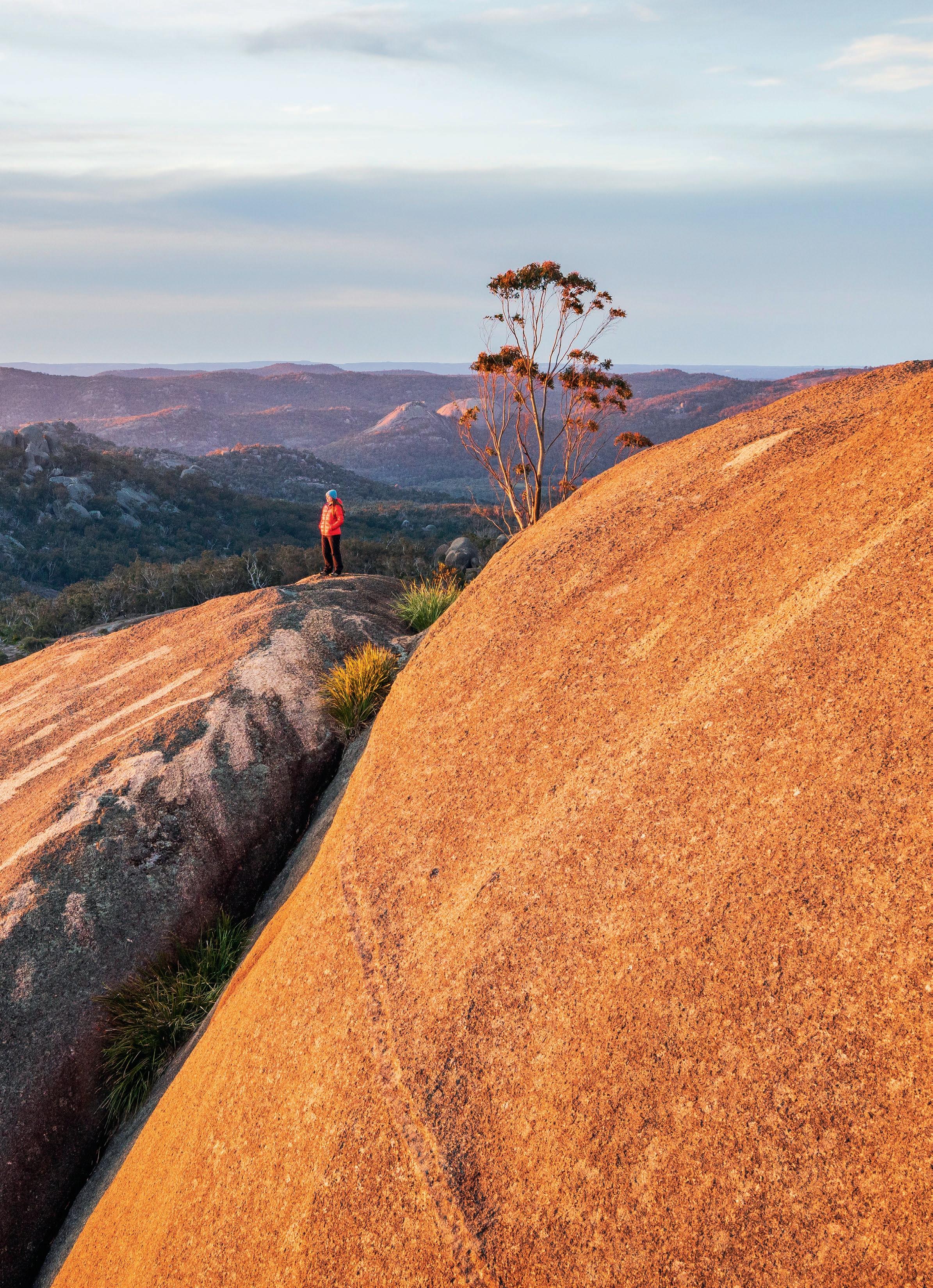
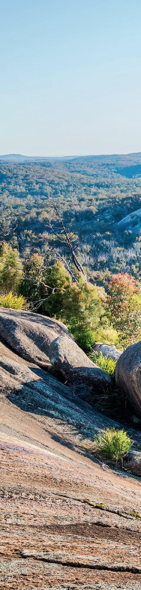
Martine taking in the sunset from a high point along Mallee Ridge, the Pyramids in the not-toodistant background. Many of Girraween’s rounded peaks feature impressive stain-like patterns like these that glow brightly at dawn and dusk
HALFWAY BETWEEN STANTHORPE AND TENTERFIELD, nestling against the NSW border, lies one of Queensland’s most spectacular reserves: Girraween National Park. Roughly 120,000 annual visitors come to experience the 12,000ha park’s vast expanses of impressive granite formations, which include football-field-length slabs, living-room-sized boulders and distinctively dome-shaped mountains.
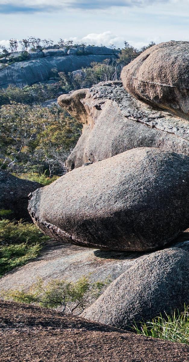
The granite was formed roughly 250 million years ago, when a major geological-compression event caused vast bodies of molten magma to rise through the Earth’s crust. While some broke the surface and erupted from volcanoes, much of the magma remained under the Earth’s surface, slowly cooling and solidifying to create granite intrusions. Erosive forces—which have worn away kilometres-thick upper layers of rock—and upwards expansion has since produced swathes of granite peaks. Complex forces associated with this expansion also caused vertical fractures in the granite, and continued erosion has resulted in large, rounded boulders, characteristic of Girraween’s mountains.
These granite formations aren’t just picturesque, though; they provide outstanding bushwalking opportunities. While most visitors frequent hotspots like the Pyramids, Castle Rock, the Sphinx and Turtle Rock, if you expend a little more energy, equally spectacular (if not more so) destinations lay in wait. West and South Bald Rocks, Middle Rock, the Twin Peaks and Billy Goat Hill are just some of the less visited peaks that are just as deserving of attention. A quick perusal of satellite imagery also reveals a wealth of unnamed ridges and mountains begging for exploration too.
In 2022, my wife and I explored Girraween across two four-day bushwalks. This is our testament to the exhilarating granite bushwalking that Girraween National Park has to offer.


IMAGES - CLOCKWISE FROM TOP
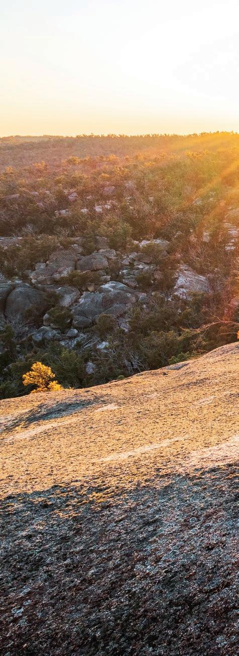
Sunset over Wallangarra Ridge, a granite wonderland

Wandering through a collection of monstrous granite boulders, many of which are precariously balanced. Some, like the high one to Martine’s right—with a bit of imagination—resemble dinosaur eggs
Martine on the most exposed part of the climb to the true summit of Mt Norman. While the scrambling isn’t technically difficult, there’s a good dose of exposure (in bushwalking terms) and some people will prefer the use of a rope. While the walking track contours below the true summit for this reason, the views from the summit are incredible and well worth the effort

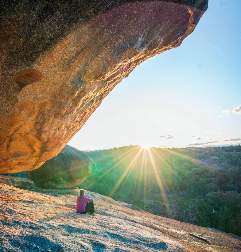
At the base of some of Girraween’s peaks, boulders have rolled down the mountains and become chockstones in large cracks, like the giant one above Martine’s head. For those willing to explore beneath, a cave-like world awaits

IMAGES - CLOCKWISE FROM TOP
On the next bit of the scramble up Mt Norman First-class sunsets were a feature of our second walk. We paused here to enjoy the last rays from South Bald Rock, next to yet another balancing boulder
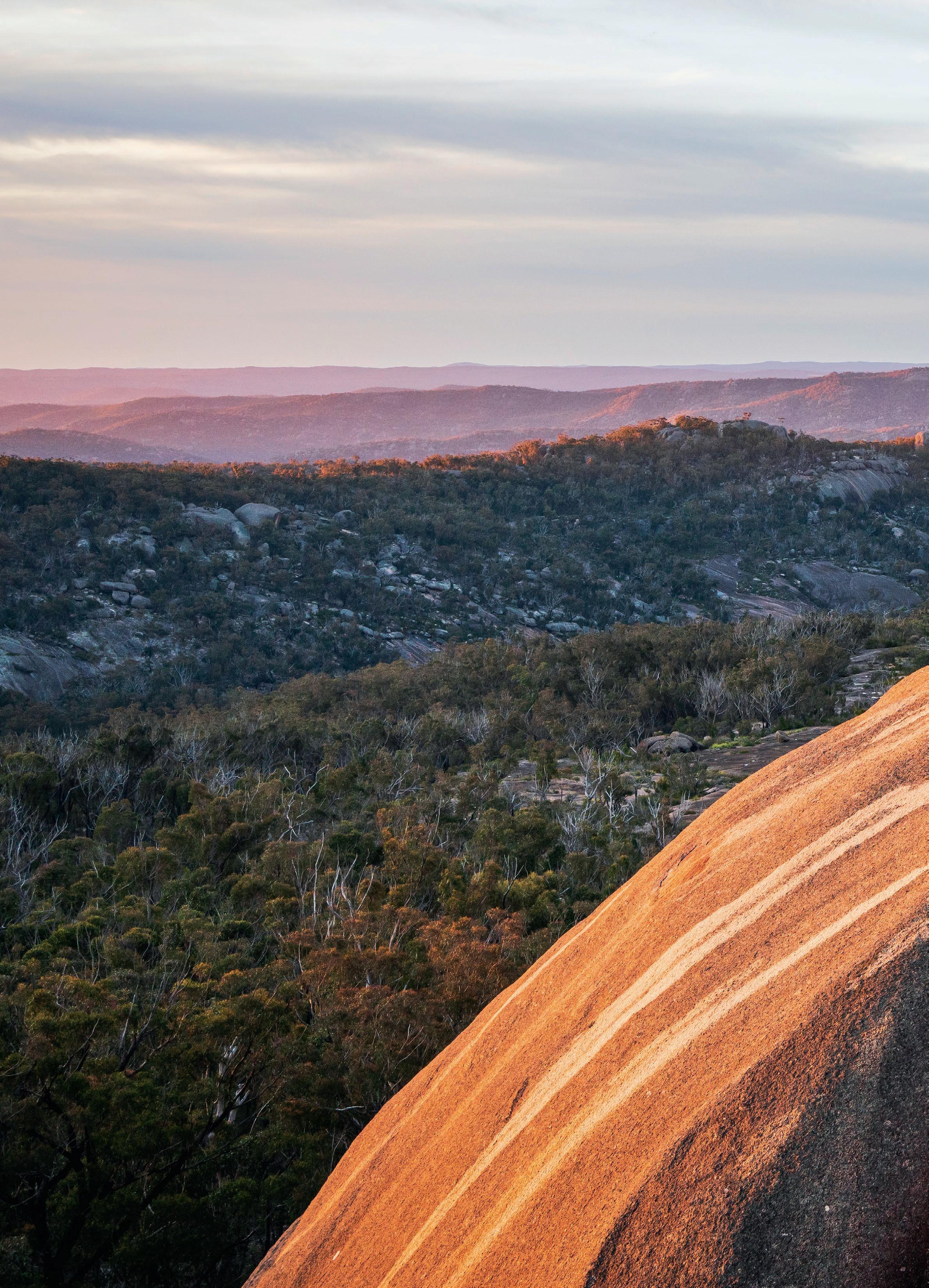
Emerging from a maze of boulders near Mallee Ridge. In this particular area, there are a profusion of aplite intrusions (the raised white bands noticeable to Martine’s left), which were formed from dregs of liquid when the magma was cooling. Feldspar and quartz are the constituents


Late-afternoon light on cascades near Underground Creek, before the water goes, well, underground


IMAGES - CLOCKWISE FROM TOP LEFT
A striking red-triangle slug (Triboniophorus graeffei) popping out for a visit after rain
Girraween is an Aboriginal word translating to “Place of flowers”. This pretty orange and yellow plant is a globe pea (Sphaerolobium sp.)
A beautiful native iris, most likely Patersonia fragilis
Martine scoping potential routes to the summit of Middle Rock, another of Girraween’s impressive mountain domes, at sunrise from West Bald Rock. Later that day, we’d attempt to summit Middle Rock

Granite camping atop West Bald Rock. We managed to find a site sheltered from the westerly winds that was flat enough to make do with. It was a special place to witness the start of a new day
Martine halfway up the final scramble to Middle Rock’s summit. It doesn’t look like much from this angle, but it was a mentally challenging climb of about 20m. The start wasn’t too bad, but the higher we went, it got steeper and the gap wider, though a nice crack provided great handholds. To the right of Martine was a deep cleft that we preferred not to look at


