
10 minute read
THE WALK IN SECTIONS

from Wild #188
DAY 1
Pretty Beach to Depot Beach
Advertisement
11km; 261m ascent/descent; approx 3-6 hours
The walk starts at Pretty Beach. Head towards the sand, past the impressive new sign announcing ‘Murramarang South Coast Walk’. As you head towards the beach, there are great views down the coast that extend not only as far as the stretch of coastline you’ll be walking, but all the way down to hulking Gulaga/ Mt Dromedary, more than 80km away as the sea eagle flies.
Pretty Beach lives up to its name. Blue waters and foaming surf meets a beautiful stretch of broad, white sand. The beach is short though, and after just a few hundred metres you cross a wide, flat wave-cut rock platform under a headland that may be covered at high tide. Island Beach quickly follows. It’s longer than Pretty Beach, and is roughly 500m to cross.
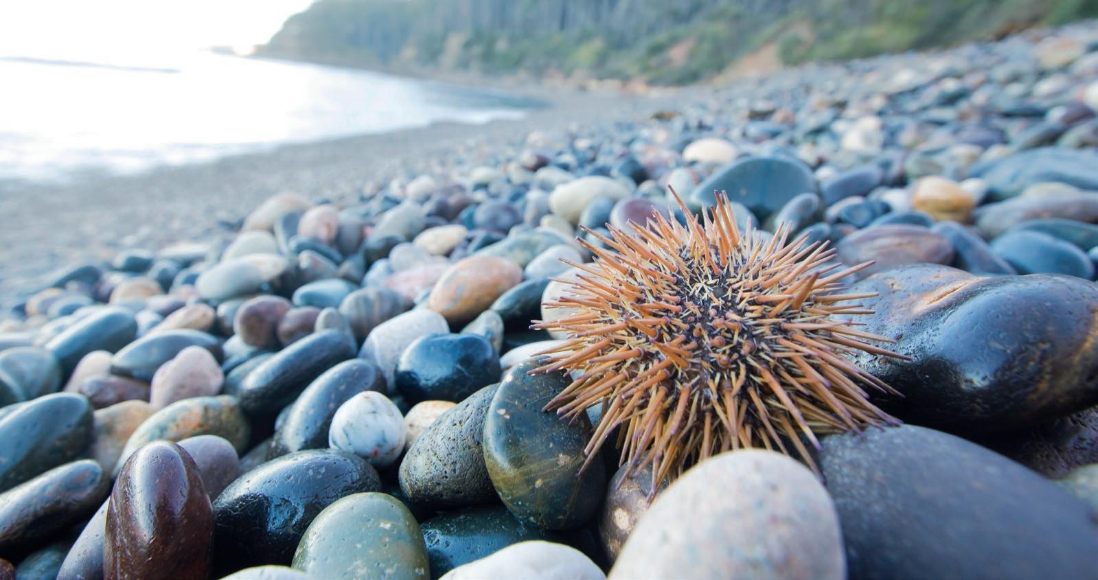
At the southern end of Island Beach, there’s a low, rocky headland, which you cross for 130m before looking for a sign that indicates the trail branches off to the right (the turnoff is just before the rocks narrow). You’re now following a track for a while, first on dirt, but then plastic boardwalk. Mercifully, the boardwalk in not just this section, but on the track in general, is rare, generally placed only where it’s needed. You soon pass the Singing Stones, a very small, semicircular cove where—when seas are big or the tides are right—the rounded, crystalline beach stones crash together and sing (or as my son remarked, play rock music), with the sound resonating off the amphitheatre-like cliffs.
After 400m of track, winding stairs deposit you on yet another beach, this one unnamed. Follow it, but stay high and to the right once you’re on the rock platform. You then climb into the hills, through low, fire-scarred heath. After roughly 400m, you descend to Dawsons Beach, broad and beautiful, with Dawson Island sitting just off its southern end. Another 400m of beach walking later, just before the rock platform, keep your eyes out for an exit; it’s all too easy on this walk to be so distracted by gorgeous views that, despite the signposting, you miss a beach exit.
You then head into forest for the first time, and trace around Snake Bay, through a section of rainforest—a lovely, shaded glade thick with cabbage tree palms. Then you’re back into the open, above a rocky promontory before soon finding yourself down near the water.
A short rock hop follows, after which you ascend a beautifully constructed, aesthetically serpentine set of stairs. You’re now 4.5km into the walk. Some wonderful views down the coast ensue, after which you enter forest; from this point on, most of—but not all of—the way to Pebbly Beach is in forest. Although you encounter the odd rainforest gully on the way, the forest is largely spotted gums, and you begin hitting sections where the understorey is thick with burrawangs, a cycad variety you’ll encounter increasingly as you head further south on the Murramarang SCW.
After 2.6km of forest walking, you’ll pass a turnoff down to nearby Stoneys Bay. Continue ahead, it’s another kilometre to Pebbly Beach. Pebbly Beach, unlike Pretty Beach, does not live up to its name at all. The beautiful beach is one of white sands, with not a pebble in sight, unlike many of the nearby purely pebbled beaches you’ll encounter. There’s a campground here at Pebbly (which also has drinking/tank water if you’re running low), and a few low-key cabins. There’s also, if you’re passing through between Friday and Sunday, a café if you need a caffeine fix.
Before continuing from Pebbly Beach to Depot Beach, you’ll want to check the tides. The entire route is by the water’s edge, and at high tide, there are a few spots where the water comes right up to the cliffs and you’re guaranteed to get wet. There is an alternative inland route via fire roads, but it’s a shame to take it when the coastal route—which has you rock hopping on lovely wave-cut platforms, and skipping across polished stone beaches—is so beautiful. We were able to get through without getting our feet wet right at high tide (albeit needing to occasionally time dashes between the waves), but at a high high tide, or a spring or king tide, you may want to wait until the water lowers before attempting the crossing.
Roughly 1.5km after leaving Pebbly Beach, you reach the start of Depot Beach. Walk most of its length until you see an impressive set of stone stairs that takes you up to the campground,

The broad, empty sands of Dawsons Beach
The Murramarang SCW’s distinctive signposting
You may be sharing the stairs on your way up to Depot Beach Campground

While Pebbly Beach is in actuality nothing but sand, just south of it you can find beaches that are nothing but pebbles. Well, nearly nothing but pebbles where you can take a shower in the fantastic new amenities block, or set up camp under the spotted gums and then head back to the beach for a swim. (Pro tip: There’s a small lagoon just before the stairs that often requires getting your feet wet. If this is the case, head a little further down the beach; you can often get through with dry feet.)
Day
2
Depot Beach to Oaky Beach 17km; 475m ascent/descent; approx 5-9 hours
Head uphill on the road out of the campground and take the first right (Carr St). You climb steeply for 200m before the road curves left; a short walk later finds you at the (signposted) trailhead of the Burrawang Track. Sure enough, the track immediately begins snaking up through a forest whose understorey is nothing but burrawangs. It’s the biggest climb of the entire walk, but it’s lovely and well-graded, and the vertical isn’t too great. One kilometre after starting the track, there’s a junction with a short side-track that leads to a lookout offering great views down the coast.
The descent to Durras Beach soon follows. The serpentine track offers increasingly beautiful views through the trees to the baby-blue waters of North Durras Beach, and the track’s meandering nature reminds you that the whole point of this walk is not simply to get from A to B, but instead to enjoy the journey.
After 1.7km of walking from the track’s start, you reach the beach. Walk along the sands, trying to resist the temptation to duck in for a swim. You have about a kay of beach walking here until you reach Durras Lake’s entrance.
Negotiate the crossing (see ‘Crossing Durras Lake’ section), then continue along beautiful South Durras Beach, potentially making a side trip to Lakesea Caravan Park to either get fresh water (see ‘Access to Water’ section), or a drink and snack from their shop. Be aware that, despite its size and proximity, you can’t actually see the caravan park from the beach; there are a couple of unmarked tracks through the dunes about 800-900m after the lake entrance crossing that will take you to it.
South Durras Beach is the longest beach of the walk, so enjoy its sandy expanses. Keep your eyes out for dolphins and seals (we saw both here). Roughly 40m before the beach’s end, and just before Durras Creek, look for a small, unmarked track through the dunes. Take it, and head up to the road before turning left. Walk along the road for a few hundred metres. Then, 50m after passing the T-intersection with Allambie St, look for an unmarked track down to Cookies Beach. Walk for about 500m to a low, rocky headland, and then round it to get onto Mill Beach. The NRMA Murramarang Resort runs almost the length of the beach; if you feel like a meal, a coffee, or a beer, you can get one here.
At the end of Mill Beach, there are some stone stairs that take you up into a casuarina forest. The track meanders through it vaguely east-north-easterly, until 400m in you come to a lookout to Wasp Island. You now swing SW, and after another 400m, arrive at a car park, where there is a prominent sign for the Emily Miller Beach Walking Trail. That’s the track you want. (Be aware that, at the time of writing, there are no Murramarang SCW signs in this area). There are a few junctions on the Emily Miller Beach Trail, but they’re either clearly signposted or the correct track is obvious.

After a few hundred metres, you hit Emily Miller Beach, but you’re only on the sand for 60m before you head up a series of old stairs. Another 150m after leaving the beach, you reach a car park; take the clearly signposted track to the left that takes you down to Dark Beach. The forest here is beautiful, writhing angophora with a burrawang understorey; it’s an ecosystem you’ll become increasingly familiar with over the next two days.
Roughly 1.2km after leaving the last car park, you reach a turnoff to Dark Beach which is, unsurprisingly, dark. You access the beach via a side track, and it’s up to you whether you head down to this pretty cove nestled into a section of wave-lashed, crinkle-cut coastline. Soon after, you reach the car park for Dark Beach; take the clearly signposted route to Myrtle Beach. It’s 400m down to the beach, which is bisected (depending on the tide) by a headland. At very high and king tides, you’re likely going to have to bush bash inland around the headland. If you have to do so, don’t aim to get straight back on the beach; there are cliffs blocking the way. Instead, stay inland, and aim for the southern tip of Myrtle Beach; you’ll either hit the track or the Myrtle Beach Road. Presuming you stay on the beach the whole way, look for the exit track about 50m before the end of the sand.
Just 30m along that track, turn left, taking the clearly signposted track to Richmond Beach. You climb gently on a winding track through forest, then onto a headland where there are views through the trees to the beach and beautiful coastline. It’s a pattern that repeats almost all the way down to North Head, which you’ll reach tomorrow: beach; gentle, meandering climb through spotted gum and burrawang forest; headland; view through the trees of the bright blue coast; descent to a beach; then repeat. And repeat. And repeat. It’s absolutely fantastic.
After two kays, you reach a dirt road; turn left, walk 100m to the car park, then walk down to Richmond Beach, with the final section of track to the beach being indistinct. (If you’re doing the walk south to north, this is an exit to be careful of, as there’s no real track; look for a small creek about 60m before the end of Richmond Beach, then wade through the dune grasses for 30-40m on the north side of the creek until you see some stairs).

After exiting Richmond Beach, you enter some of the most beautiful forest of the walk, and trace some headlands as well. Nearly 2.5km after leaving Richmond Beach, you reach some boardwalk, indicating Oaky Beach is nearby. Once you hit the sand, walk 50m down the beach before turning inland. The campground is a short distance away, with the walkers’ tent platforms—which are separated from the car-camping area—being up the hill to the right.
Day 3
Oaky Beach to Maloneys Beach

7.9km; 258m ascent/descent; approx 2-4 hours
Head back down towards Oaky Beach, but at the junction before it, veer right. As with yesterday, you walk on pleasantly winding track through forest with views through the trees to the ocean. After 1.9km, you reach the black sands of Honeysuckle Beach. You’re only on it briefly, though, just 20m or so, before you head inland and soon reach a car park. Turn left here. After one kilometre, you reach a junction where there’s a short walk to a lookout platform. The views here are impressive, but they’re better yet still if you continue on just a little further to the trig point at North Head (see image on P129). To get there, walk 100m past the lookout junction to where the track seems to do a hard 90-degree right; the SCW actually heads left instead here. At the time of writing, however, this junction was unsignposted. (In fact, much of the route from this point until the end at Maloneys Beach was devoid of signs). Head east then southeast for 100m up some indistinct tracks near an area being revegetated, before the land drops away and you’re presented with one of the finest views of the walk. Behind you should be the North Head trig point.
You now continue south towards North Head proper. The forest here is a bit scrubby compared to before, but after looping around, it’s only 650m until you exit onto a dirt road that accesses the North Head Campground. Turn left, then left again, before making your way down to North Head Beach. Make your way down the beach before exiting via some stone stairs. While there’s been no arduous walking on the track thus far, it becomes even more mellow still; the hills are really gentle from here until the walk’s end.
After 1.3km, you reach some open flats, with two NPWS cabins nearby (Judges House and Yellow Rock Beach House; they’re both available for booking). Head past them down to Yellow Rock Beach and walk its length. About 150m up the exit track, you hit an unmarked T-intersection. Turn right. You then curl around the headland, and after 500m come to a confluence of tracks; take the one which has a grassy understorey through the trees, down to Quirriga Beach. You have a choice here: Either walk along the sand, or take an inland track that’s about 10m into the dunes. Either way, at the end of the beach, you hit a lovely, curved set of stone steps.
You quickly hit another unmarked junction; turn left. Two hundred meters later, you hit some unsignposted crossroads; turn right. Basically, you’re roughly paralleling the coast, and avoiding tracks that clearly look like they’ll take you to a point. The track is now flat and easy. About 900m after leaving Quirriga Beach, you reach a long, elevated 140-step staircase. Descend it to the trailhead at Maloneys Beach, where there should be dozens, if not hundreds, of kangaroos waiting to congratulate you on the walk you’ve just completed. W
Much of the walk sees you travelling through beautiful spotted gum and burrawang forest Pack ya cozzies! Or not
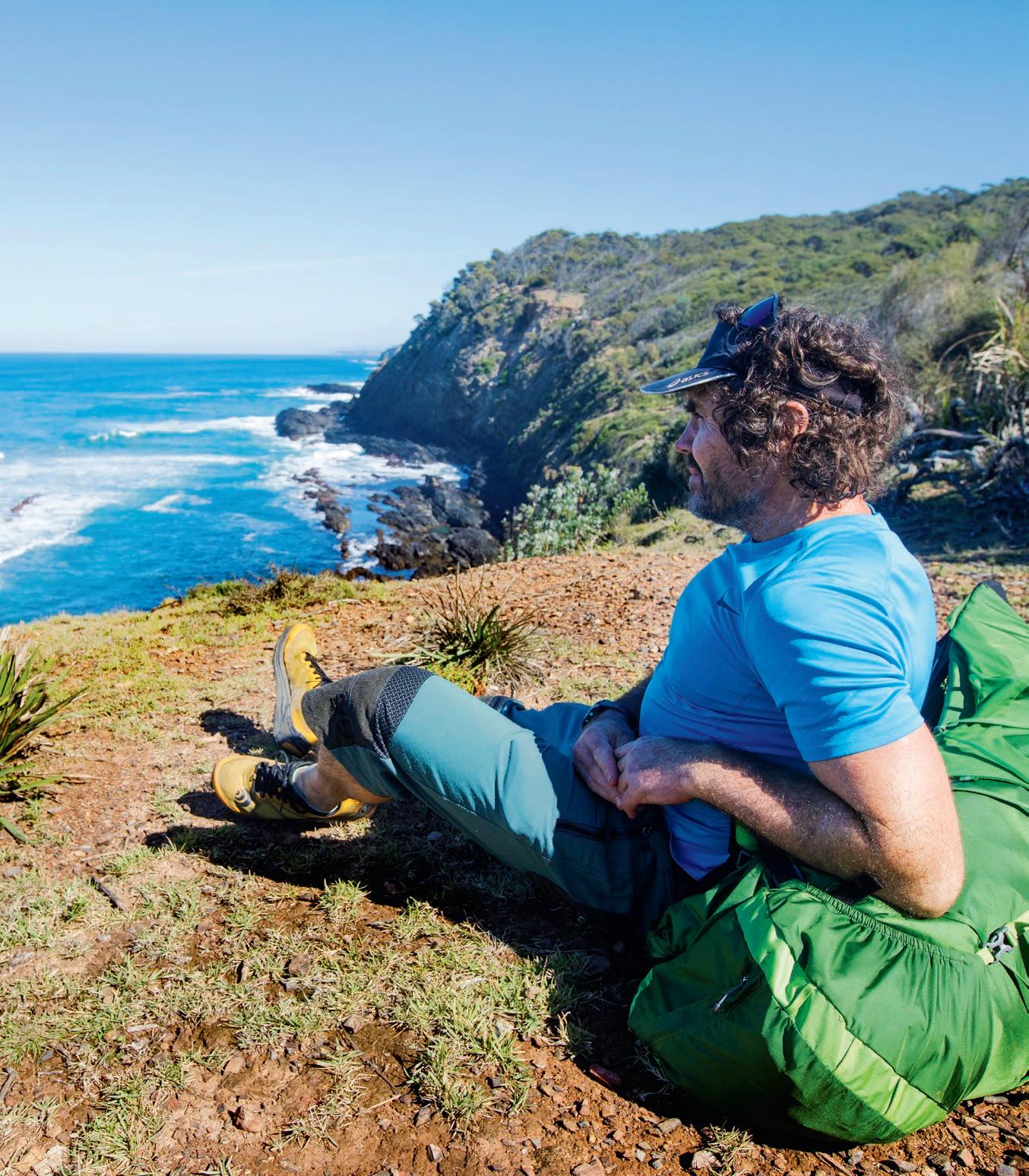
Sometimes the views make it hard to keep walking
There’s often a sizeable party of roos waiting to congratulate you at the walk’s end at Maloneys Beach

Starting off on the crossing of Durras Lake’s sometimes open/sometimes closed entrance
CONTRIBUTORS: James McCormack is the editor of Wild. Quincy McCormack is his 9yo long-suffering son who was glad to get revenge on his father on this walk by forcing him to pose endlessly for photos.

