
10 minute read
THE WAY BACK HOME

from Wild #188
Reflections on solo hiking through Far North Queensland’s Misty Mountains.
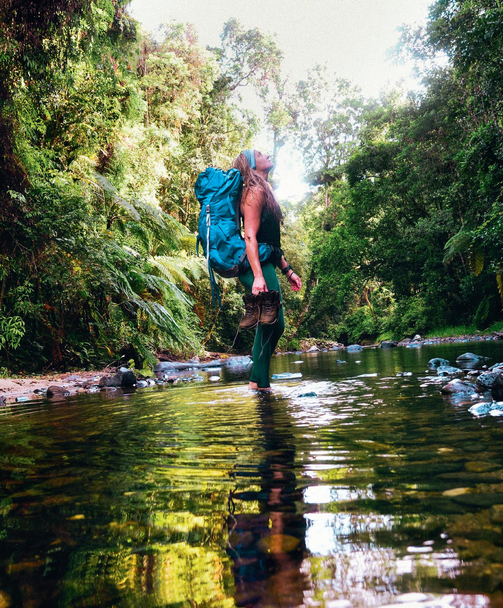
By Rachel Schmidt
Advertisement
If you look after this place, this place will look after you. The words of the Ma:Mu, whispering its Jujaba (creation) stories along the contour lines of rainforest country in Queensland’s Far North. Firefly studded understories, grumbling skies, lightning sheets, crystal creeks, old-growth forests, walls of rain. The place of the Jirrbal, Gulngay, and Ma:Mu. Welcome to the Gambil Yalgay—the Misty Mountains—the last remaining connection of the juboonbarra to the gambilbarra, of the coastal plains to the rocky country of the tablelands.
From the lowlands of the eastern tropical borders of Tully, to the upper reaches of the sub-tropical rainforests and dry woodlands of Ravenshoe, this expanse of land becomes grounded in lessons of focus under heavy rainforest canopies and a history buried under lawyer vine.
Encompassing the Djilgarrin, Cannabullen, Koolmoon, Cardwell Range, Gorrell, and Bally Knob Tracks, the Misty Mountains wilderness trail network brings you into the terrain of Tully Falls and Tully Gorge National Parks, alongside the southern section of Wooroonooran National Park—the wettest place in Australia, now protected under the legislative label of World Heritage Area.
But this story doesn’t start there. Instead, eighty kilometres southeast as the crow flies, you drive under the notorious overhang of loaded clouds into the early hours of the morning in your tenth year as a paramedic. The night dumps its own uncertainty across those far northern hills that drop into the upper reaches of the Murray River. Home to Guyurru (Murray Falls), and the small community of Jumbun. The place where the words of one man stop you in your tracks.
Bordering on the traditional boundaries of the Gulngay and the Girramay, you make your way down into the lower floodplains where little history remains of its brutal history of colonial Australia. You cross the Henry Bridge and she stares at you. A look of vacancy as tears well. She is young, vibrant, smiling behind the torn story of the land and its people. It wasn’t that long ago, she says, my grandfather ... this is his place. Hardly any of us mob left, it has changed, we have changed. She waves her hand off into the hills of the Misties as the windscreen wipers pelt full speed. Hours later, the sun beams through the morning deluge, waking up the forested slopes of Bulleroo/Mt Tyson.
Back in Tully, an Elder stands at the ward door and tells you this: “You better share those stories of this place girl, because nobody else will.”

Gorrell Track
Large rainforest trees are down. Emerald-green doves hip-hop through the understorey looking for their next meal. As they take flight, fluorescent-green feathers flicker through light. Patches of broken canopy are littered with red belly blacks banking their next dose of sunshine. Humidity is edging on unbearable.
Exposed and prone to the cyclic nature of the tropics, the old fire trail brings you through the Ma:Mu speaking clan of Wabubarra Country. Bring the coffee, you’ve been told, I will bring the cake. The senior officer heads up by vehicle; you head down by foot. Walking solo has always been your way of connecting, but today is a little different. With a percolator in one hand and high expectations in the other, you begin from the higher elevation trailhead. If somebody says they are bringing cake, it better happen.


Descending into the valley of Downey Creek, you pass the red mud-clay patch of flat that’s covered in ten years’ worth of leaf litter—the designated campsite of the Downey Plateau. Facilities: none. On the border of the Military Area, there is a rusty, half-standing sign: “Scientific Area,” it proclaims. “...[For] bona fide scientific study only.” You haven’t seen a human, and you ponder the point of its existence. It’s well past the halfway mark, with four hours of daylight pending. He isn’t coming; the troopie mustn’t be able to get through. Now covered in over-it feelings, you make the brew and head back up the range. Cake-free.
RHYOLITE PINNACLE & KOOLMOON TRACK
The gayambula flies overheard, screeching anxious warnings to his mates of your presence. You glare into the canopy and tell him to calm down—just passing through. Now you’re talking to cockatoos, mitigating reality without an app and minus the ticks of tocks. The camera is full of plant life and obscure-looking bugs. If you walk any slower, your Garmin will stop.
Granite and rhyolite outcrops peek through the vegetation, offering expansive views of the park. That’s on a good day. The place of yabulmbara, of traditional tree markings, follows the old Jirrbal route that crosses the Koolmoon—an option of multiple trailheads infested with leeches and overgrowth.
You reach the pinnacle during the height of garrimal—the wet season. Midnight hits. Somewhere up there sits the waning crescent moon as a rainforest scorpion stares into your face questioning your life goals. You haven’t seen one of these since you were a kid, when you were addicted to Home and Away, when one crawled up your arm from the pile of firewood straight onto your childhood-sized rissole. Leeches start to infiltrate the tent, gaining access without permission. It’s going to be a long night.
DJILGARRIN TRACK (& BACK INTO THE KOOLMOON)
As you catch your reflection, 110mm fall. Six hours prior, you considered this a good idea. You ignore the silent calls to turn back. The rain jacket has been forgotten. The forecast wasn’t revised. Enthusiasm is waning. Seven kilometres in, and the vine is tearing at skin, entangled in hair.
The pack is dumped. You treat it like a dirtbag and pretend this is going to be easy. Something is crawling around in your eye, but you can’t see the problem. Two leeches roll out of their own accord, full and lethargic from life-is-good feelings. Too difficult to grasp, one remains.
Of all the things you should carry, normal saline comes to mind. A piece of fifty-cent first aid that would save an eyesore of a problem. Sclera fills with blood. Hopeful thoughts consume your mind to beat time back before the swelling starts. It’s four hours to the front door, and at least two of those are by foot.
Geez, what beat you up? And where are your clothes? Dressed in linen without the soggy attire, you reconsider the definition of fun as your sister gawks at your face, as colleagues gift you with a set of leech goggles, and as a pharmacist questions you with not one but two raised eyebrows while she pumps out antihistamines and three days of maybestay-at-home advice.
But you don’t do maybes.
IMAGES - CLOCKWISE FROM TOP
Taking in the view of Elizabeth Grant Falls
Decaying leaf litter


Black Jezebel butterfly

A king fern frond about to unfurl

Foliage growing over fig tree roots on the Gorrell Track
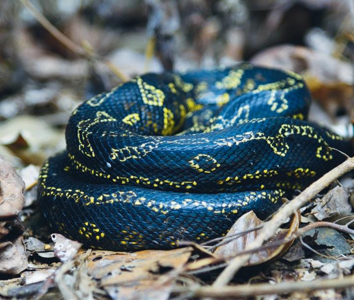
Jungle python

When one functional eye becomes two, you head to the eastern trailhead. The ranger tells you it’s too wild, too overgrown, too time consuming: Look lady, five people probably walk that track per year; we can’t maintain it anymore. Lady?
The old Jirrbal trade and migration route from the Balan Jaban (Tully River) to the tablelands crosses a ridgeline of traditional tree-lines, unmarked camps, and unheard-of massacre sites. A place that teaches you to walk in the right direction in order to respect Law.
It’s rough going. A kind of bootcamp short of unnecessary yelling and screaming with nobody to high five. Koolmoon Creek is waist deep and flowing steadily. Elizabeth Grant Falls blasts its 300m presence over the cliffs. A lone boar bolts through the scrub at the last second.
The place has been assaulted by multiple tropical lows and cyclones. The sign still stands. Just. Triangular markers are few and far between, most of them consumed by hungry tree trunks. It’s an overwhelming maze of finding your way flagged with pink tape. Two hours for every kilometre. Dismal but rewarding. Not even the march flies are interested in the buzz.
Things are going well. Until they aren’t. Something doesn’t feel right. The view of tree roots and mud becomes interrupted by a face-to-face experience that isn’t in any brochure. The sighting of the lone heavyweight champion of the forest. The silent wanderer.


The stand-out feature. The great southern cassowary. Time stops. This is not a good scenario. Danger couldn’t be any more obvious. The cassowary is the world’s third-largest bird, compensating for its incredibly short wings by being gifted with an impressive casque and two nasty-looking foot claws capable of disembowelment. At 75kg and 170cm tall, this shaggy animal that loves a good walk in the rainforest can be unpredictable, moody, daunting, and just plain old bloody scary.


Adrenaline and fear have abandoned you. You’re now left with a strange sense of calm, one where the fight-or-flight response has somehow evaporated into a dysfunctional stand-thereand-do-nothing.
You swear into the humid air and reverse, climb a few metres up a vine-engulfed tree and hope he walks away. He doesn’t.

IMAGES - CLOCKWISE FROM TOP LEFT
Quandong berries with forest flowers, Gorrell Track on the Downey Creek Plateau
At McNamee Creek
Southern cassowary on the Koolmoon Track

A trail marker being consumed by a hungry tree
Forest fungi
Take care: The world’s most dangerous bird is prowling nearby
If you could offer the bloke a fruit salad, you would. It’s a long twenty minutes while your backside moulds into a branch, daydreaming of more padding and ten beers.
It’s 16:30hrs and sunlight is fading, with another three kilometres to the car. You’re disappointed the camera is too hard to reach, and quietly wish you could go hide in an eight-metrehigh golden gumboot away from this reality. Yeah, the gumboot. Tully’s totem. Back in the ‘70s, ABC rural reporter David Howard coined the term ‘Golden Gumboot’ to signify which of three neighbouring towns up here—Tully, Innisfail or Babinda—won the annual bragging rights to being the wettest town of the year. But the wettest of wet years came all the way back in 1950, when 7,900mm hit the ground. To celebrate that record drenching, in 2003 Tully built a 7.9m golden gumboot in the middle of town.
But the ginormous gumboot is miles away, so instead you sit there, close your eyes, and learn to listen. The cassowary remains a standing statue below you, waiting for your undivided attention. You quietly ask him to let you pass. He cocks his helmet head up, blinks twice, and walks away. Pretending the last half hour of your existence didn’t exist. Then you sit there for even longer, wondering if that was just a weird coincidence in timing.
You’ve aged ten years in ten hours. Worse than the face of a night shift. But better than any zoo visit.
CARDWELL RANGE, CANNABULLEN CREEK AND BALLY KNOB TRACKS
Oh, it’s raining. Who’d have thought? Here’s ya sanga, luv. She passes you breakfast while the local cop spots you, taking a cheap shot at your bushies arm. He’s wearing a wry smile. I’ve been up that track, he says. Bloody awful. Got smashed by that lawyer cane looking for a lost mountain biker. Silly bugger got choppered out.
You swallow your salad and pretend you don’t know what he’s talking about.
Pack your prunes and hommus, we’re going on an adventure. Eco friendly with a day spa. Basaltic soils. Top-of-the-range rainforest species. Notophyll and microphyll vine forests. Bush tucker and toxic nuts. Birds and bugs that deserve a place on any Aussie coin face.
The Cannabullen Plateau—the superlative phenomena currently graded as ‘A Bit Hairy’. Home to over forty delicate ecosystems, with nineteen of them endangered. When they say tread lightly, tread so lightly your existence isn’t felt.
Wispy Falls is suited for fit kids and workmates who hate hiking. Further on, it’s more for the bored and the breathless, where tourists are obsolete and tropical butterflies break the monotony. It’s 16km before the track reaches the junction to the granite spur that forms the 70m waterfall. Cannabullen Falls.
My trusty percolator

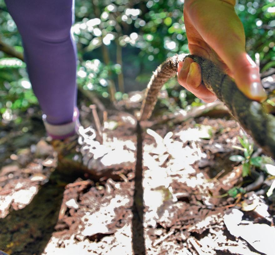
Finding a discarded bit of clothing on the trail - the skin of a red belly black Cannabullen Falls
Look carefully, and you’ll see it; an orange marker. This is what passes for a trail in the Misty Mountains
Descending into Wispy Falls
I. Was. A. Bit. Of An. Idiot. These are the first words you hear from the first human you’ve seen out here in a while. No plan. No contact. No beacon. No map. No water. No food. This guy is nuts. You smile awkwardly and agree with the title of his story while you dish out morning tea. Well, morning coffee—as usual, you are carrying your mini hiking percolator. In the world of instant, coffee should never be a part of it. The beans you carry cost $44 a kilo, no Blend 43 for you. No way. And this stuff will get you through anything. Even for I Was A Bit Of An Idiot Guy. Later, you decide his story would be better called ‘Mountain Men and Short Blacks’.
It’s a steep slippery side down into Cannabullen Creek. The ridge is dodgy. It’s easier to slide down, and with undies now full of rocks, you realise the hardest part isn’t over. Look up. It’s here. Everywhere. Right above your head as you wade along the creek’s edge: gympie-gympie (AKA stinging tree). One of the world’s most poisonous plants, it packs a painful punch of tiny silicon hairs that, when touched, fill your skin with a neurotoxin you quickly regret making contact with. And while the pain can last months, out here it takes just a split-second lack of concentration to brush up against it. And it grows wild with fury.
You head onto the Cardwell Range Track. The temperatures here will overheat your engine during any season. The welcome sight of a creek is hard to describe as you lounge around in the stagnant water while the local towns hit Level 3 water restrictions. It’s a scary change when one of Australia’s largest water supplies hits super low.
CONTRIBUTOR: Rachel is a senior paramedic who works on the Cassowary Coast. She goes hiking sometimes and functions off too much coffee, and can’t see the forest for the trees.


Transforming from dense rainforest to dry overgrown fern gullies and eucalypt ridges, this track is an old forestry trail that leads you straight onto the Bally Knob Ridge. Snake country. The place is scattered with pythons and eastern browns. Equipped with gaiters and a lacklustre mindset, you walk slowly through knee-high grass. As you head up over the ridge, this is what you wanted to call home. And your way back to it. W


