ADIT’S WORKs ARROUND INDONESIA
From 2015, and still counting…
Adit has professionally completed various type of projects, including: Urban and Regional Planning, Urban Design, Master Planning, and Landscape Architecture competition designs in many regions in Indonesia. Name me: DKI Jakarta, Banten, West Java, Central Java, Jogjakarta, East Java, Riau Islands, South Kalimantan and South Sumatra.
Adit is ready to go on further adventures to work on your strategic projects!

OUTLINE
Lae Lae Island Design Based on Coastal Tourism (2021)
New Town and Residential Masterplan
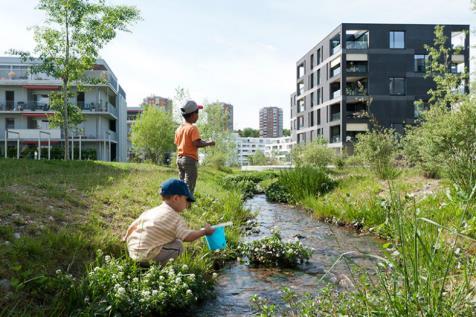
Visioning, Rorotan, Jakarta (2022)
Conceptual Masterplan for ± 200 Ha of Land at Bukit Baruga, Makassar, South Sulawesi, Indonesia (2023)
+ 3D ArchViz Projects (2021 – 2022)
1 7 23 12
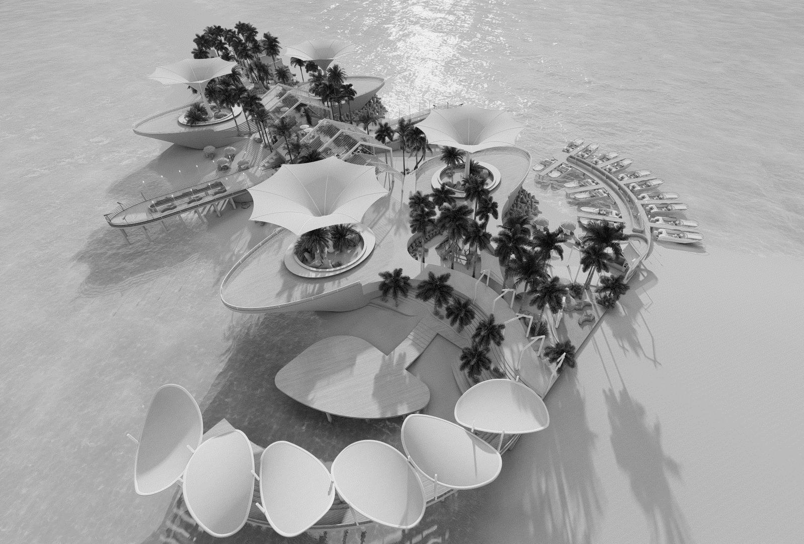
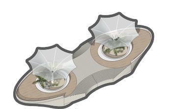
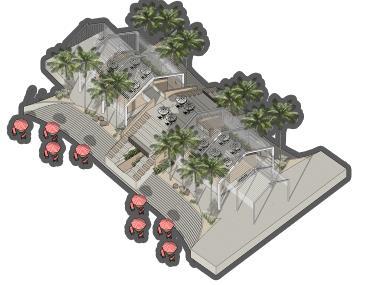
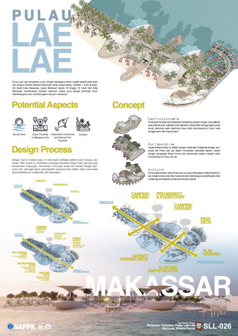
Lae Lae Island Design Based on Coastal Tourism (national design competition)
Year : 2021
Type : Design Competition
Status : Done / 2nd Winner
Organizer : SAPPD ITB
Roles : Team Leader, Urban Designer
Concept : Coastal Tourism Design
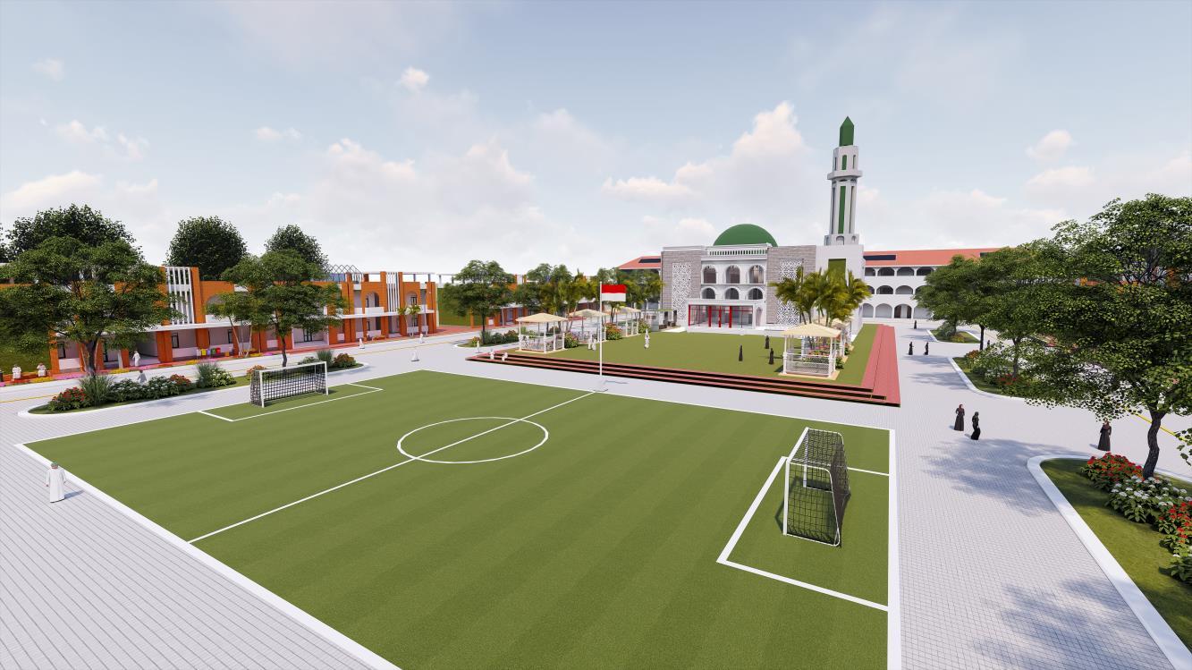
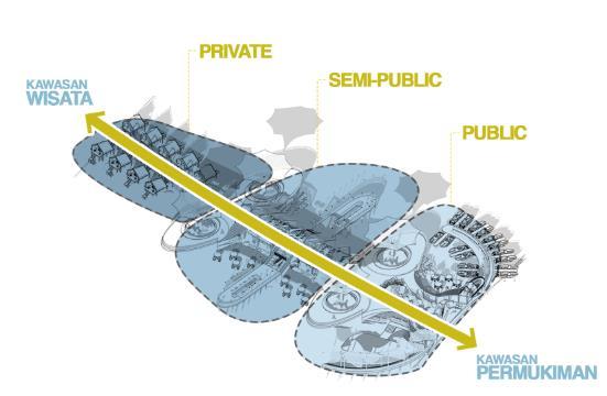
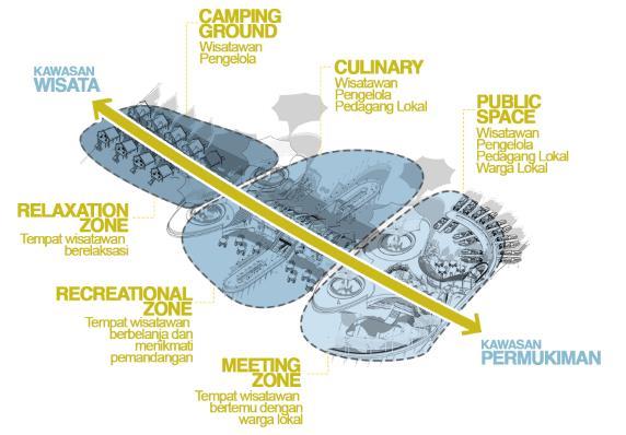
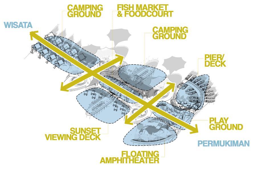
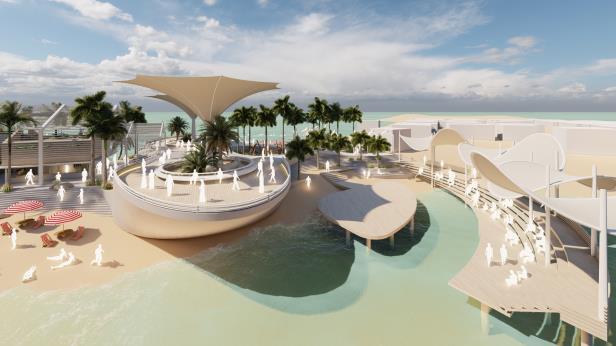
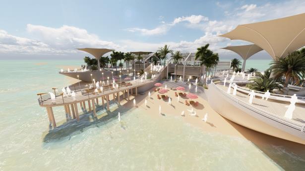
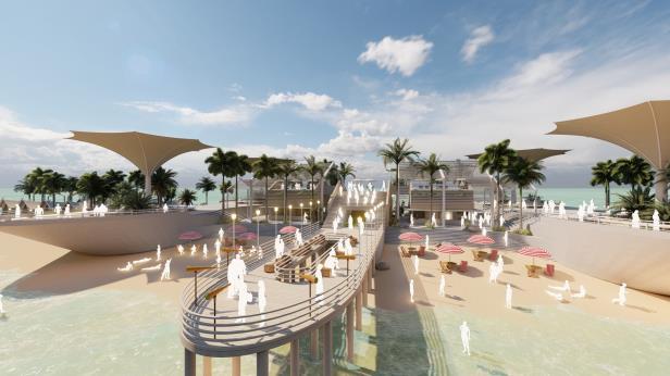
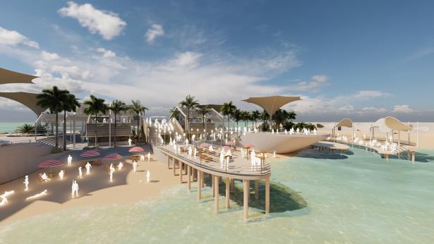
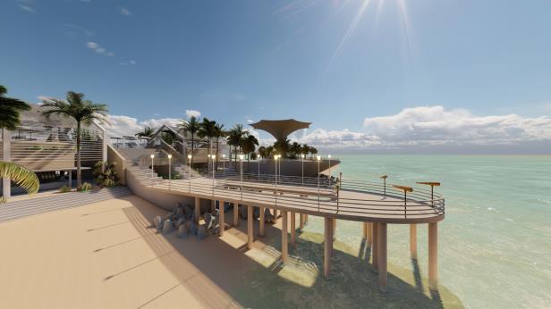
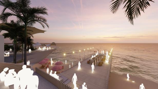
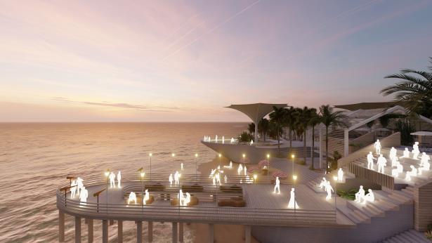
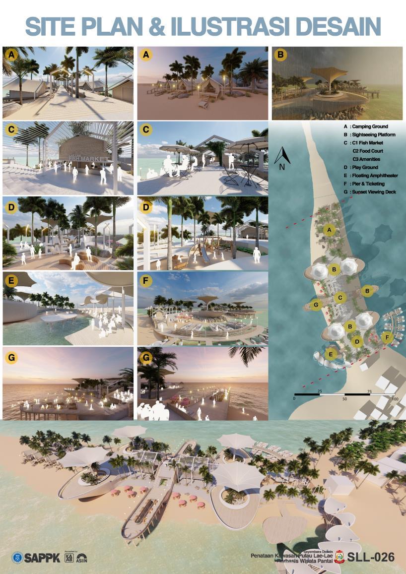
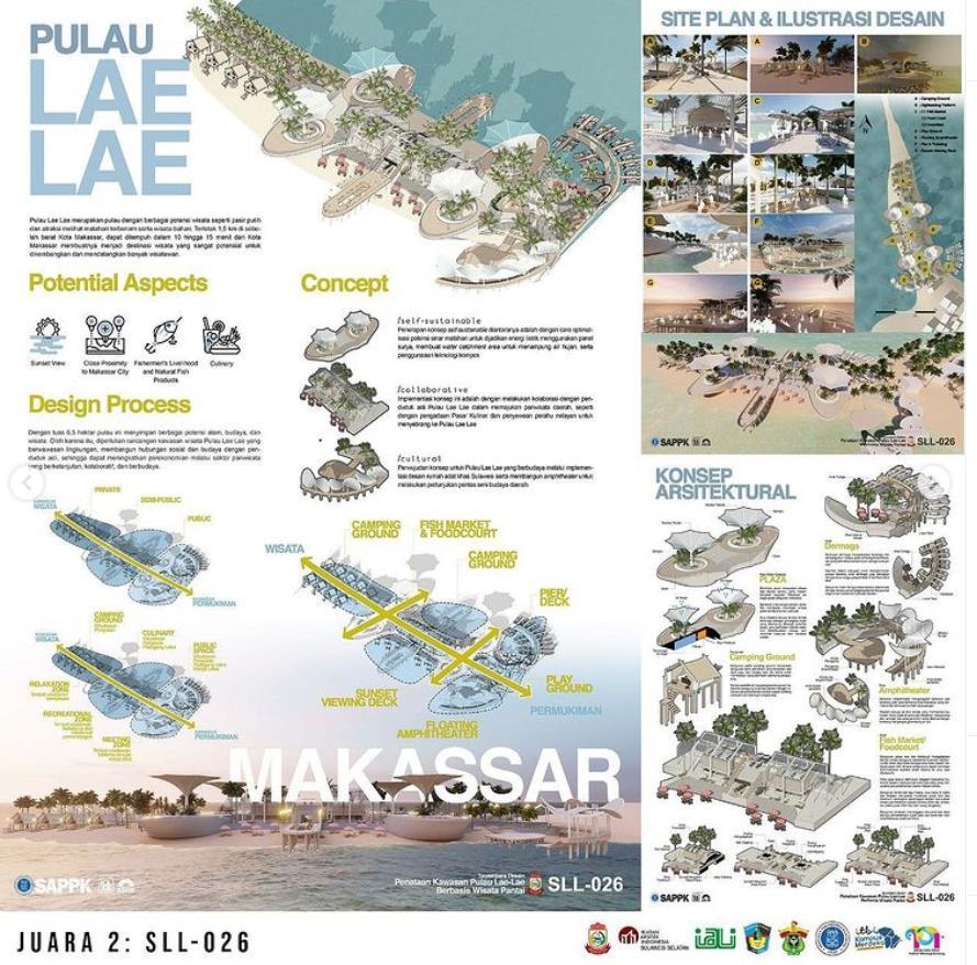
Lae-lae Island has a lot of tourism potential that can be developed. Besides being easy accessible because of its very close distance to the city of Makassar, and it has several attractions. Another thing is that this island has white sand beaches, clear sea water, views of the open sea of Makassar Strait with large ships and fishing boats passing by, as well as interesting to enjoy the beauty of the sea and sunset in full. Along the northern peninsula of the island of Lae-lae, local residents also provide gazebos or huts for visitors to enjoy sea views and Lae-lae specialties. In addition, there is also an open area on the beach which is usually used for camping. Lae-lae Island has been visited by many local tourists from Makassar and its surroundings as well as from outside the city of Makassar. However, the tourism potential that exists is not yet developed and fully utilized so that the tourist attraction on the island of Lae-lae did not increase significantly.
1
POTENTIAL ASPECTS

Design Concepts
GENERAL CONCEPTS
Self-sustainable
The application of the selfsustainable concept includes optimizing the potential of sunlight to be used as electrical energy using solar panels, creating a water catchment area to accommodate rainwater, and using compost technology.
Collaborative
The implementation of this concept is to collaborate with the local people of Lae Lae Island in promoting local tourism, such as by procuring Culinary Markets and renting fishing boats to cross to Lae Lae Island.
Cultural
The embodiment of the concept for the cultured Lae Lae Island through the implementation of traditional Sulawesi house designs and building an amphitheater to perform regional cultural arts performances
 Sunset View Close Proximity to Makassar Fishermen’s Livelihood and Natural Fish Products Culinary
2
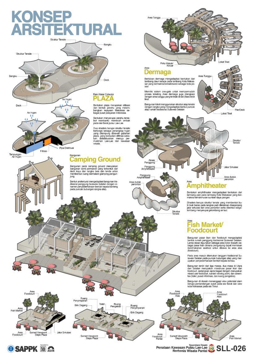
Architectural concepts
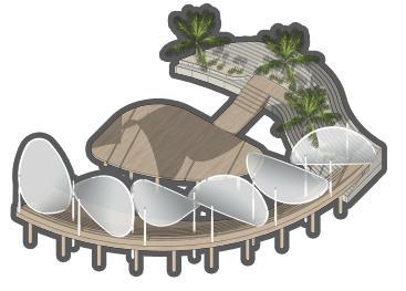
Fish Market / Foodcourt / Sunset View Point
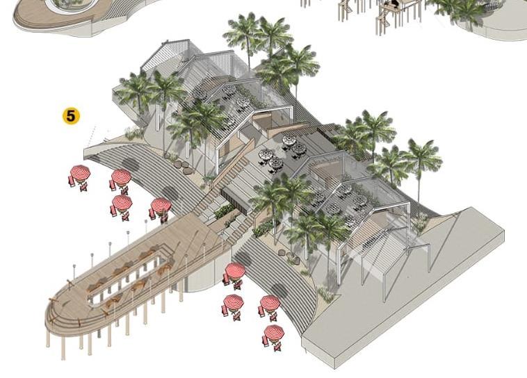
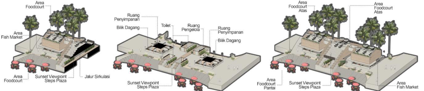
The fish market and food court building adapts the shape of a traditional South Sulawesi house on stilts. The ground floor is used as a dirty (wet) area as a fish market where visitors can order fish/seafood to be brought to the upper area (foodcourt). In the entrance area, traditional South Sulawesi styles are found at the top of the roof ridge which is a simplification of the shape of a buffalo head. The building consists of three masses, two areas in the north and south are mixed-use fish markets and food courts, while in the middle part is a mixed-use food court, sunset viewing point, and amenity (toilet, information center, and management room). The building is designed to respond to the potential natural view in the form of a sunset view on the west side and Makassar city view on the east side.
3

4
DESIGN ILLUSTRATIONS
5
SUBMITTED POSTERS
WINNER ANNOUNCEMENT RUNNER UP CERTIFICATE
6
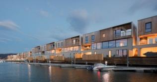
New Town and Residential Masterplan Visioning, ROROTAN, Jakarta
Year : 2022
Type : Masterplan Visioning
Status : Done
Client : PT. Nusa Kirana
Consultant : PT. Karangluhur Lima Pilar
Roles : Team Leader, Jr. Urban Designer
Concept : Forest City, Smart City, Township, Residential
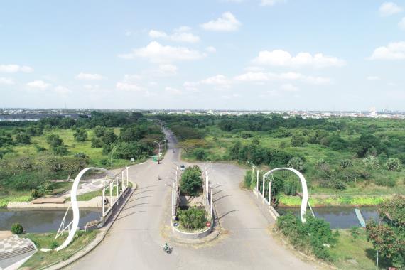
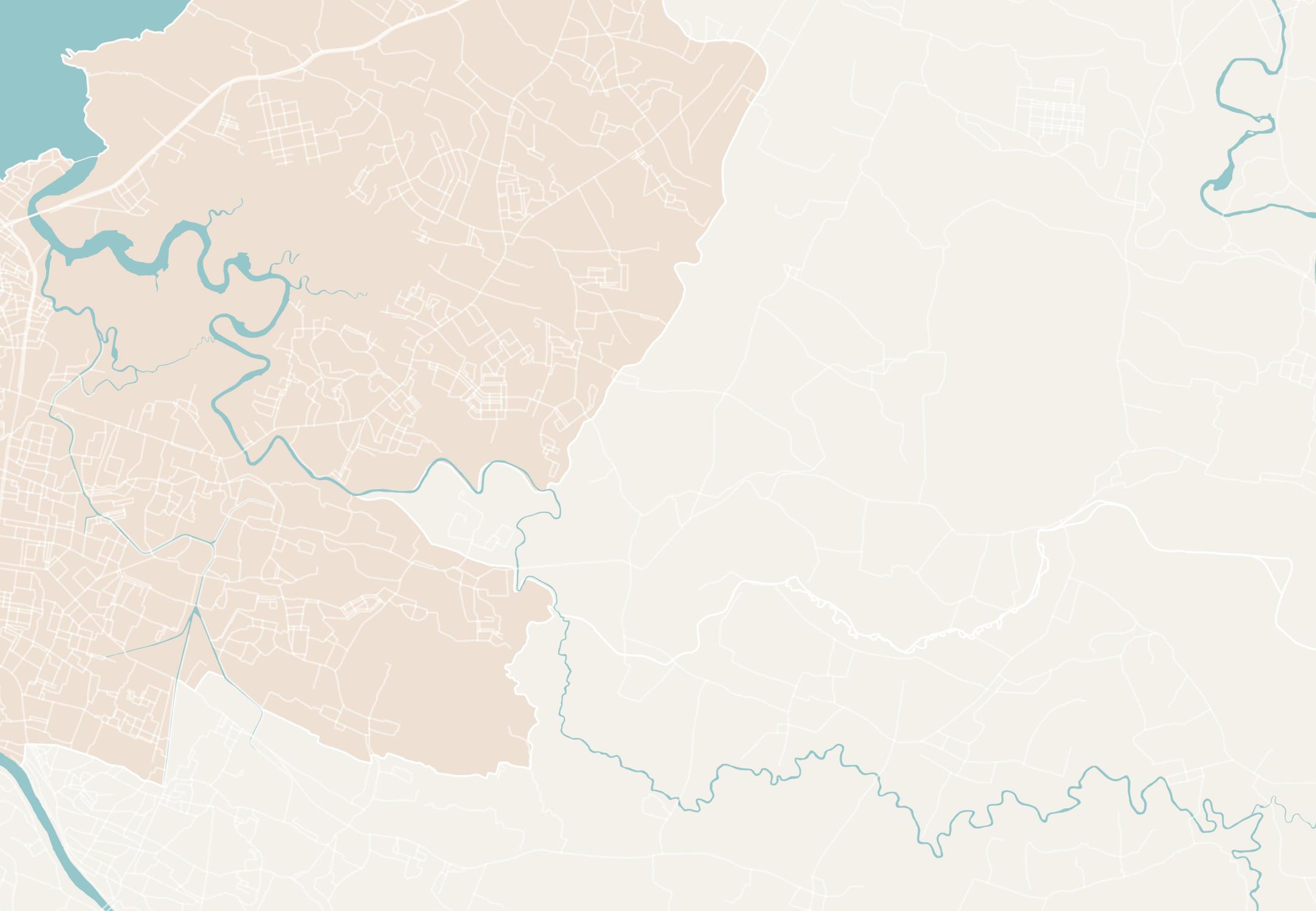
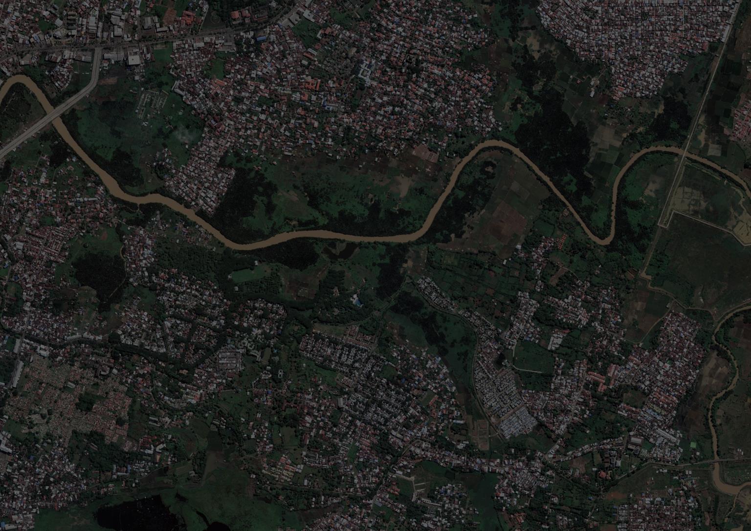
The New Kirana Urban Area is an area that is planned to become a new urban area which is located close to the Nusantara Bonded Industrial Zone (KBN). This area is quite accessible to various regional infrastructure developments such as the Jakarta Cikampek Toll Road and the JORR-Tanjung Priok Toll Road. The planning area hassnot yet been developed, and only a few clusters have been built. Therefore, this area has the potential to be developed into a new urban area with various functions and facilities.
7
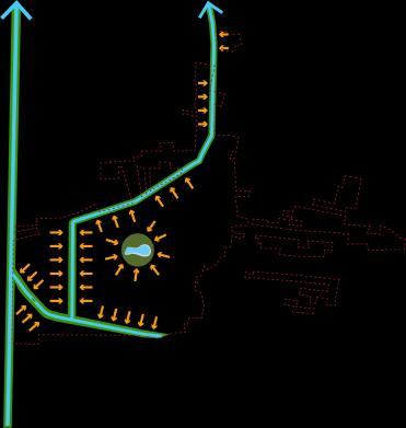
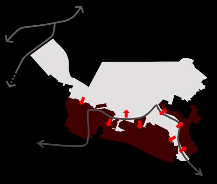
EXISTING CONDITION
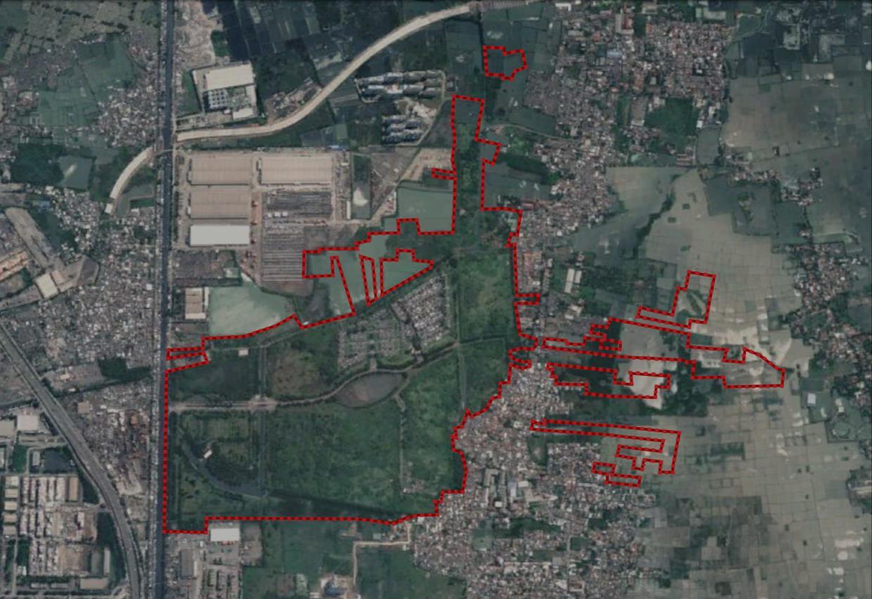
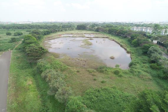
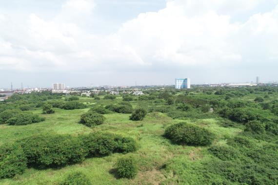
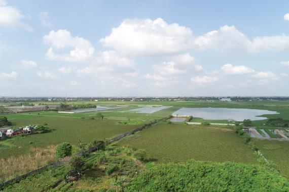
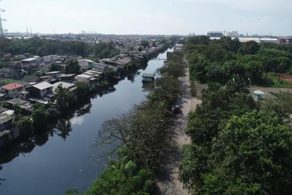
The team made observations on Monday, June 27, 2022. Some of the observation points include Gate Post 2, Norfolk Cluster, Vacant Land located to the east, Post Gate 5, and Royal Pine Cluster. Based on several points, it can be concluded that the planning area has not yet been developed, and only a few clusters have been built. Therefore, this area has the potential to be developed into a new urban area with various functions and facilities.

DRONE PILOTING IMAGES

SITE FEATUREs
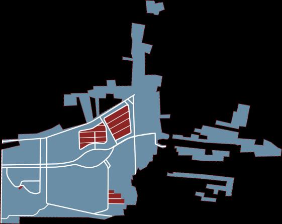
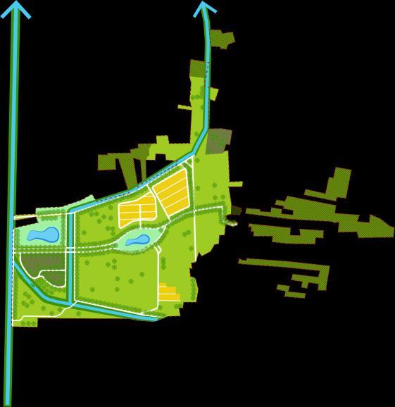
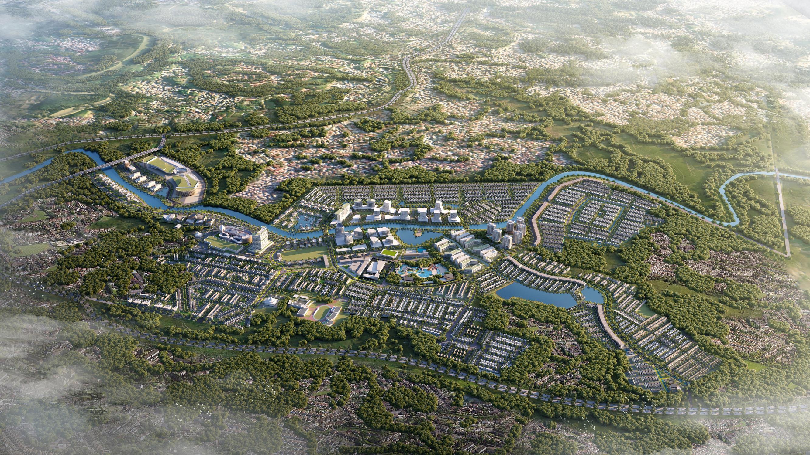
1 3 4 8 6 5 7 9 2 10 11 12 13 1. Entrance gate 2. River 3. Landmark 4. Ricefield 5. Cinamon Cluster 6. Norfolk Cluster 7. Swamp 8. Plantation 9. Unused land 10. Royal pines cluster 11. Post 5 gate 12. Scattered area/Ricefield Keyplan: Entrance gate Swamp lake Green space Norfolk and Cinamon Cluster Scatter Area Outer residential and river
8
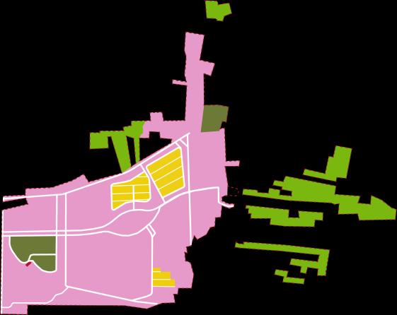
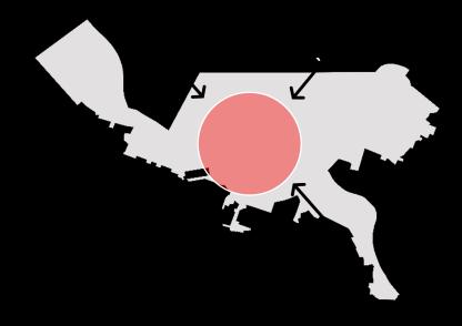
SITE ANALYSIS


DESIGN PRINCIPLES
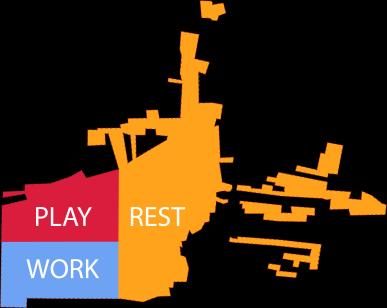
Various Activities
Various activities in the concept of “Work – Rest –Play”

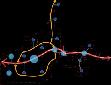
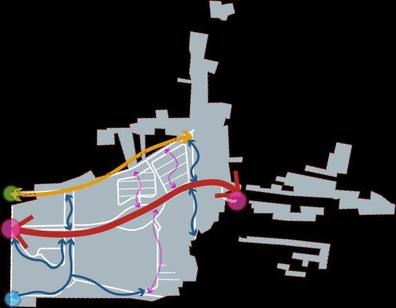
Regional connectivity that is able to integrate between activity centers
Connecting People and Places Green And Blue Network
A town that is oriented and maximizes the presence of natural features
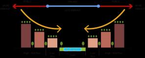
Nature Oriented Inverted Skyline
Green and blue open spaces are connected to each other
The skyline of the building is made inverse, to maximize the potential of the view towards the oasis.
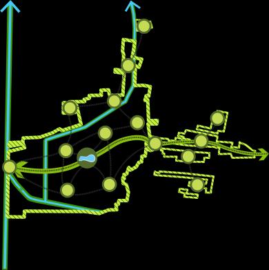
Accessibility Green & Blue Space Developed Area Land-Use
9
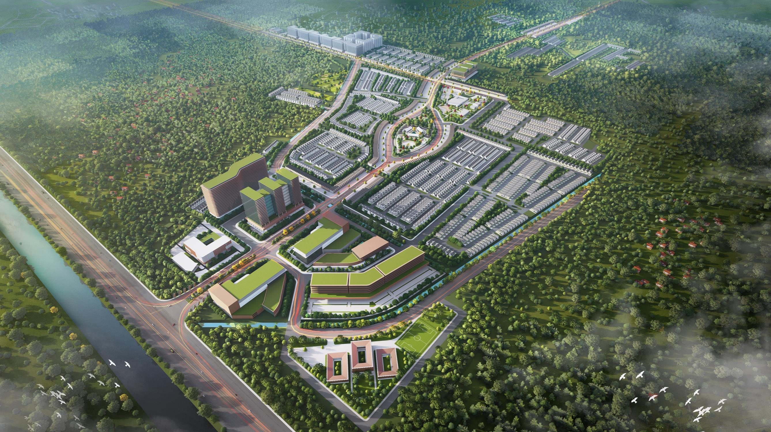
AERIAL VIEW 1. Main entrance gate 2. Mall 3. Appartment 4. Hotel 5. Healthcare facility 6. Modern market 7. Office building 1 8. Office building 2 9. School 10. Central park 11. Community hub 12. Gold course 13. Mix use building (Residential and Commercial) 14. Riverwalk 15. Main road shops 16. Scatter acrea shops 17. Leuser residential cluster 18. Sungai Wain residential cluster 19. Daintree residential cluster 20. Arfak residential cluster 21. Cinamon residential cluster 22. Norfolk residential cluster 23. Otzarreta residential cluster 24. Halimun residential cluster 25. Sagano residential cluster 26. Alam Pananjung residential cluster 27. Royal Pine residential cluster 28. Wahea residential cluster 29. Kayan residential cluster 30. Sequoia residential cluster 31. Karimun residential cluster 10 1 2 3 4 8 5 6 7 9 10 11 12 13 13 14 14 15 15 16 17 18 19 20 21 23 24 26 25 28 27 29 30 31 22
MASTERPLAN
DEVELOPMENT PRODUCT
One stop living application
The One Stop Living App is an application made specifically for the resident community. Various features are provided for comfort, security, and support the welfare of the community. Integrated with all regional activities, you can use the balance from the waste bank to pay taxes, security, order food, and so on.
Services:


Display Illustrations:
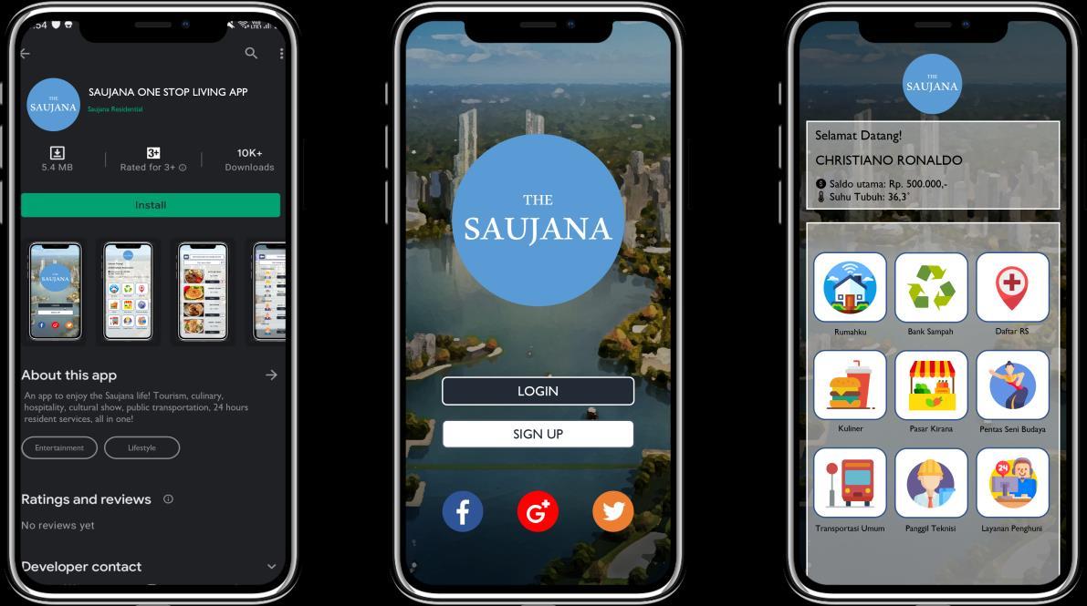
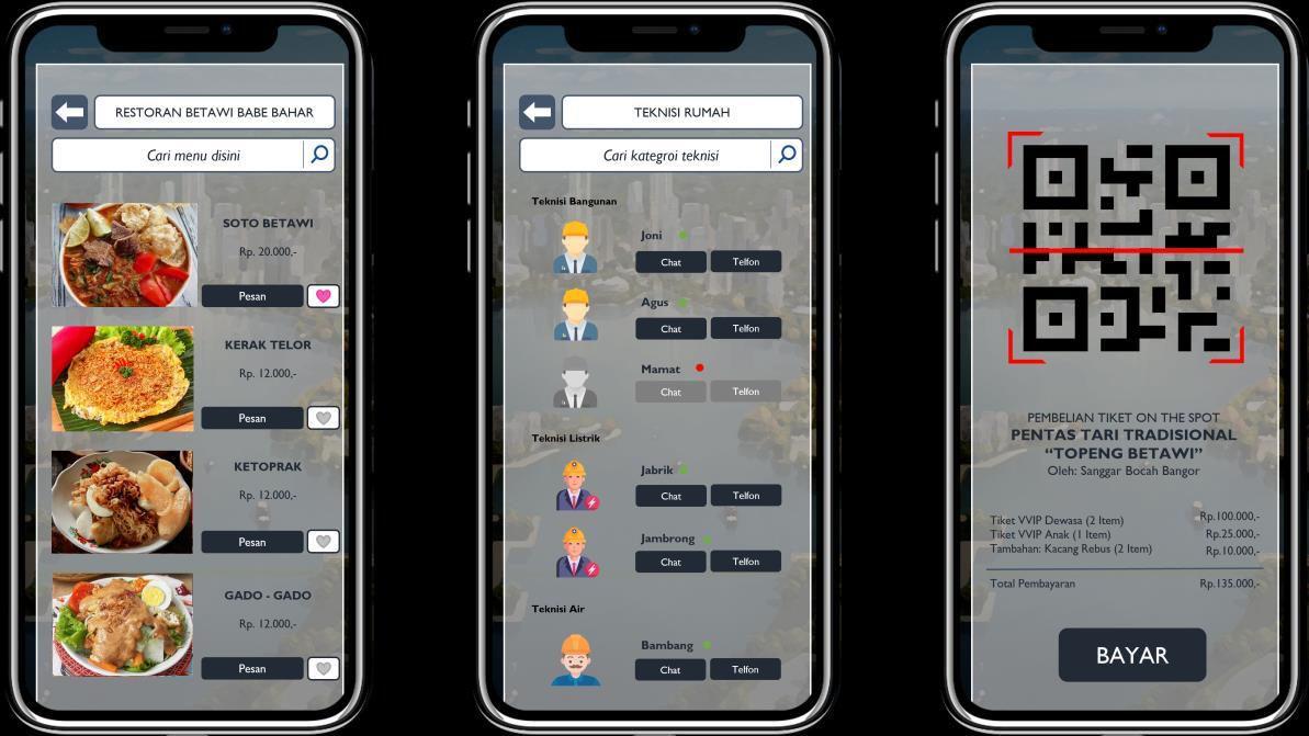
Display on Playstore Homepage Main menu Order food Call technician Ticket purchase Waste Bank Smart House Healthcare Public Transport Call Technician Customer Care Home Shopping Order Foods Art and Culture
11
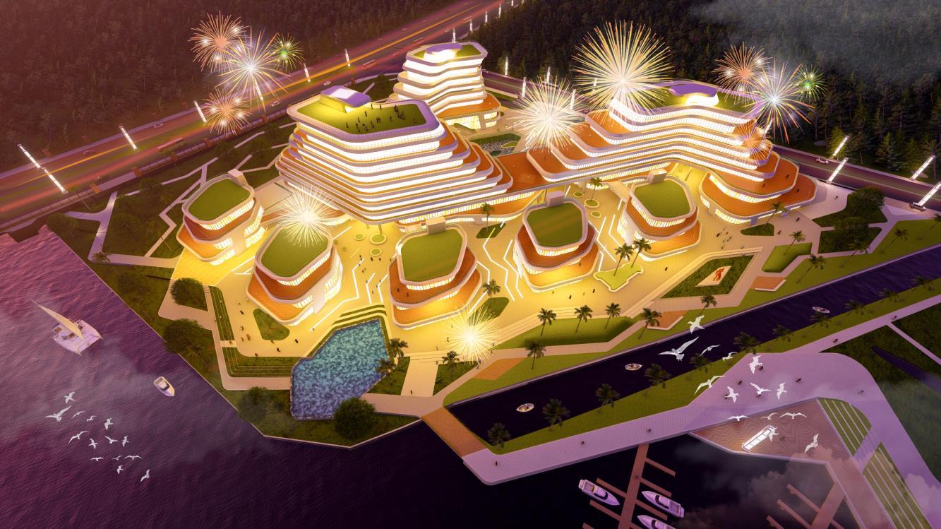
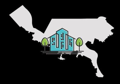
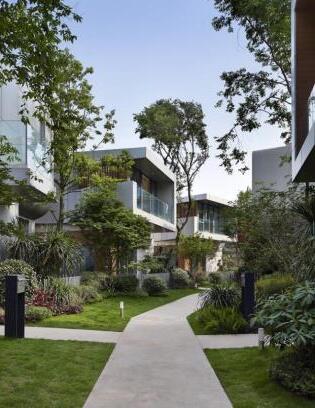
Conceptual Master Plan for 200 Ha of Land at Bukit Baruga, Makassar, South Sulawesi, Indonesia
Year : 2023
Type : Conceptual Masterplan
Status : Done
Client : PT. Baruga Asri Nusa
(Subsidiary of KALLA Group)
Consultant : PT. Townland International
Roles : Urban Designer / Project Manager
Concept : Waterfront City, Residential, Mix-Used Development
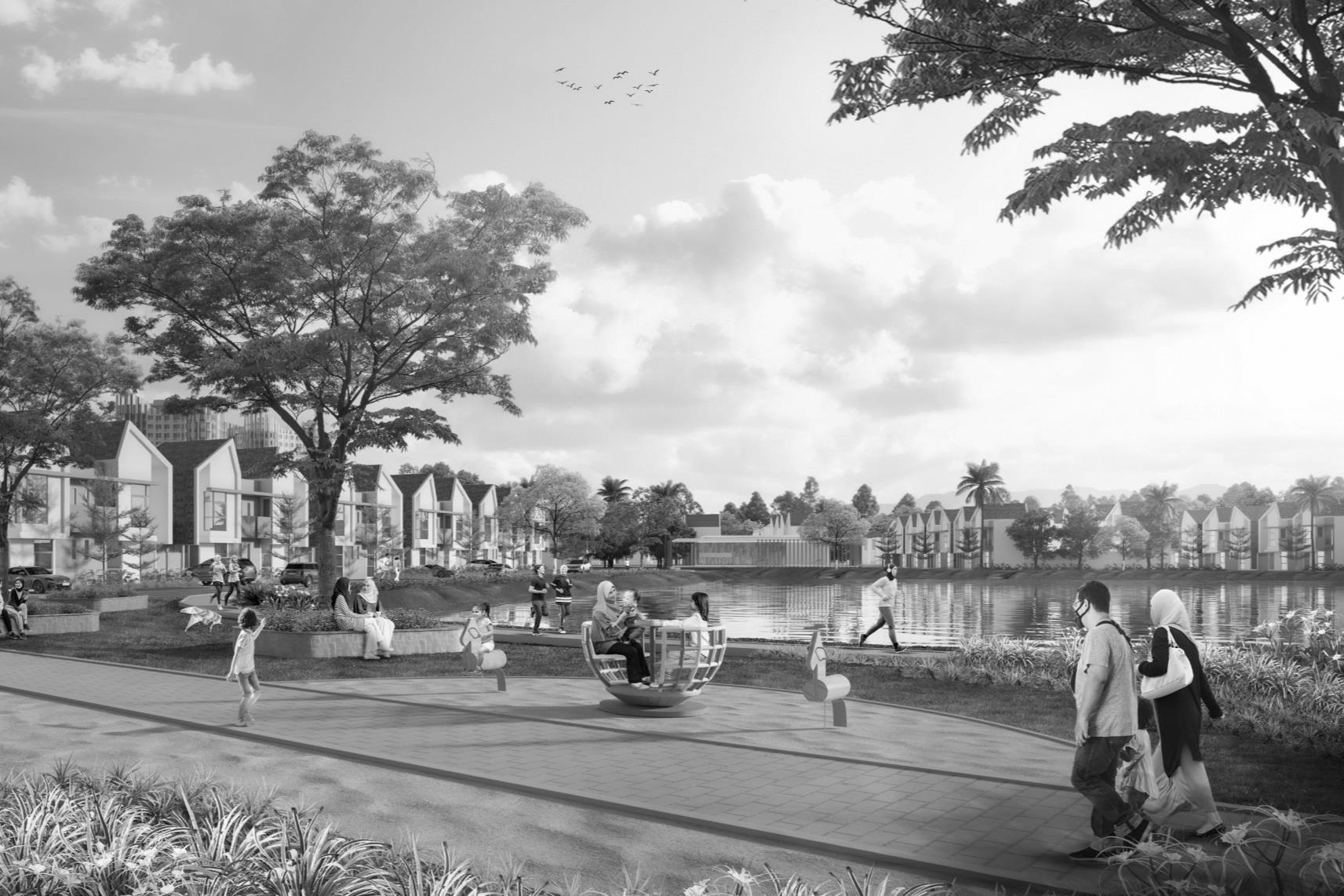
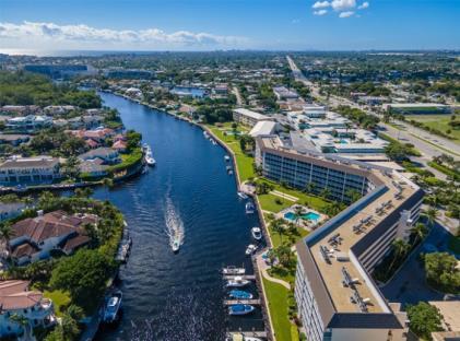
‘Kalla Galla’ is a Vision for the extension of the ±200 Ha Bukit Baruga Residential-Township. It integrates an extensive green and blue network with eco-friendly infrastructure to create an instant attraction, featuring lively neighborhoods, and attractive new urban developments along the riverfront promenade, which is surrounded by a preserved mangrove ecosystem. The Project aspires to be a World- class urban oasis, supporting a healthy lifestyle, a technology-driven ecosystem and featuring environmental friendliness. Aditya acted as Project Manager.
12


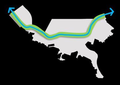
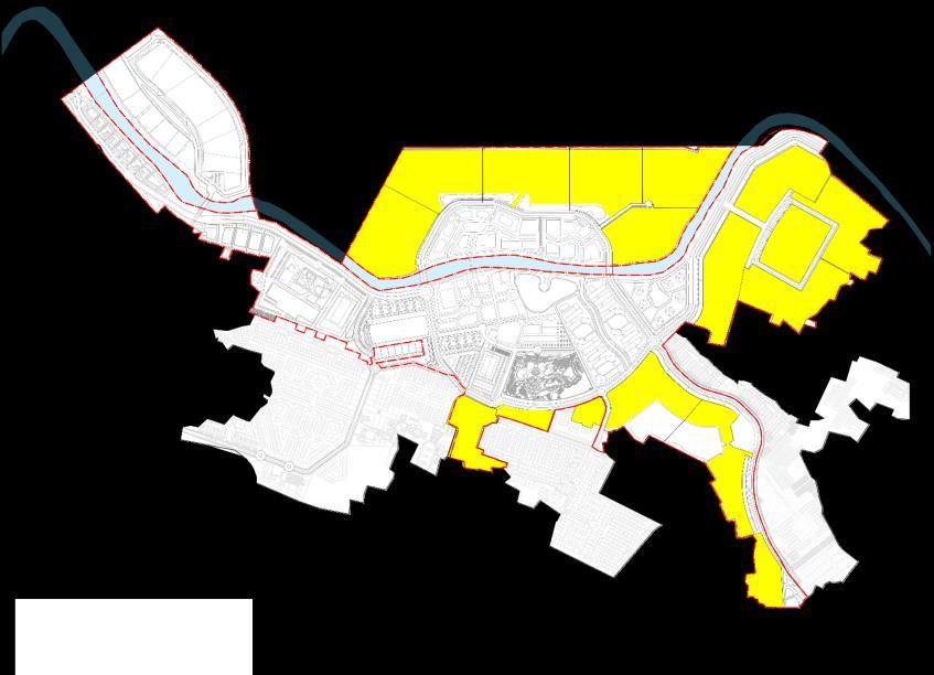
CONTEXT 13 5 Km 10 Km Soekarno-Hatta Seaport Sultan Hassanudin International Airport Makassar Regional Daya Bus Station Hassanudin University Bus Station Todopoli Bus Station
CONTEXT
REGIONAL
REGIONAL
GOWA
LEGENDS: Planning Site Citraland Losari Makassar City Area Makassar City Center Planned Reclamation Area Airport Seaport Bus Station Toll Road Planned Toll Road Main Road Local Road Waterbody 0 0.5 1.0 1.5 2.5km
MAKASSAR MAKASSAR SRAIT
KALLA GALA
To celebrate a world-class community that expands a smart ecosystem, enhances the living experience, and embraces a harmony of living with nature as a NewVibrant Heart of Makassar’s eco-township.
VISIONING 14
Development ideas
Smart & Sustainable Ecosystem
Mixed-Use areas that are integrated with modern infrastructure standards are ready to become Smart City.
New Eco-District
A network of city parks and green corridors integrated with pedestrian bridges as open spaces to encourage and facilitate outdoor activities.
Active & Attractive Area Utilization
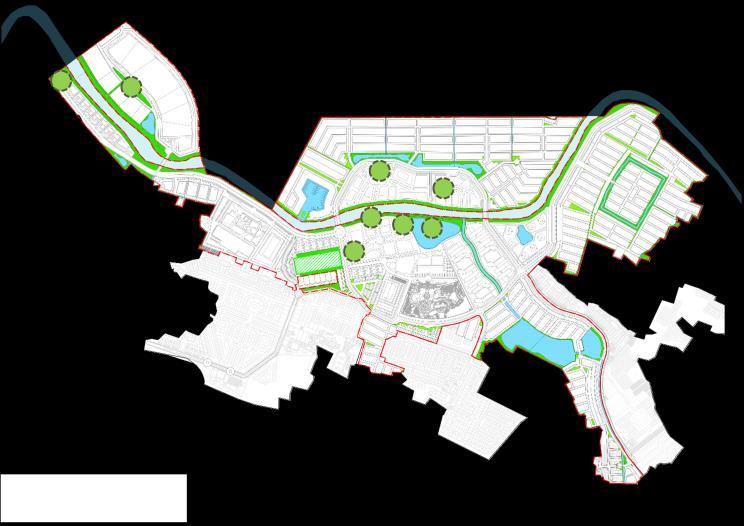
Tallo River with existing palm and green networks to provide added value as well as regional attraction and identity.
Diverse
Offers a diversity of development products, from mid-to-high and high-end residential typologies, apartments, commercial, entertainment, and a number of other facilities.
Design principles
Natural Feature
To optimize and direct development oriented towards river areas and green borders as site features.

Connectivity
Establish connections to the surrounding city network with main road connectivity to increase/optimize commercial opportunities along the corridor.
Eco-District
Nature-based development with a compact & preserve strategy, creating a lowdensity environment that is comfortable for mobility.
Integrated
New development that is in harmony with the existing area (Housing and Facilities), and avoids destroying existing structures.
CBD Core
The Showcase Group is formed from office, shopping, facilities and recreation areas with the Tallo River as the spine of the area.
District Gate
The new entrance gate as a Grand Entrance Statement, is equipped with 4 secondary accesses.
15
MASTERPLAN
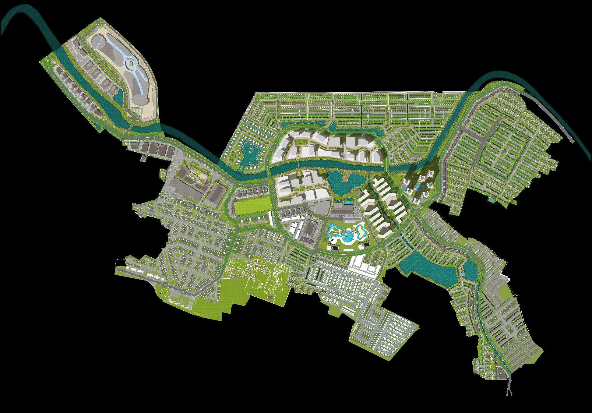
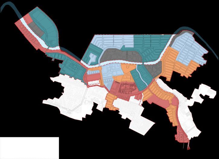
Legend 1. Commercial Lot (Big Box) 2. Commercial Promenade 3. Sports Mall / Home Furnishing 4. Marketing Gallery, Site Office, Driving Range 5. South Kalla CBD 6. North Kalla CBD 7. Hotel/Office Park 8. Low-Rise Apartments 9. Mid-Rise Apartment 10. Bugis Water Park (BWP) 11. Transit Hub 12. Central Clubhouse 13. Centralized Parking; 14. Modern market 15. Shophouse 16. Hospital 17. MICE 18. Marina Cluster 19. Residential Cluster 20. Athirah School 21. Gateway/Access: 22. Main (Bypass) • Secondary (MICE) • Secondary (Raya Baruga) • Secondary (Nipa-Nipa) • Secondary (BTP) E Existing Development D Retention Lake 1 21a 21b 21d 21e 2 21c 1 3 1 4 5 6 7 8 9 10 11 12 13 14 15 1 2 1 16 17 18 19 19 19 19 19 20 E E E D D D D D 15 15 15 16
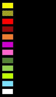


Land Use
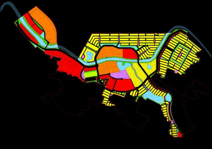
ROW Network Road Hierarchy Pedestrian Network 17
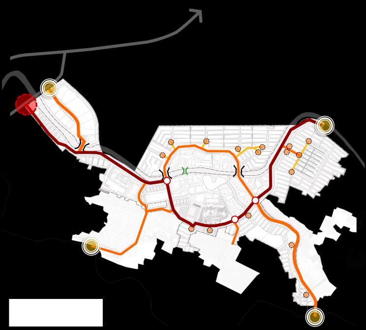
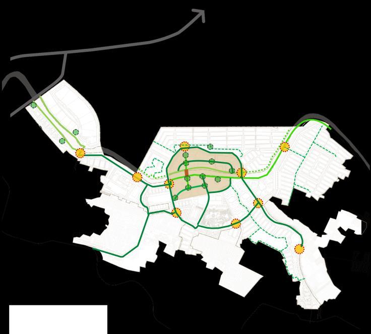
SITE ANALYSIS
Bicycle Network

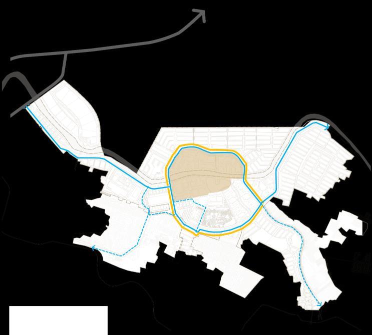
Green and Blue Network Public Transportation Development Phasing


SITE ANALYSIS
18
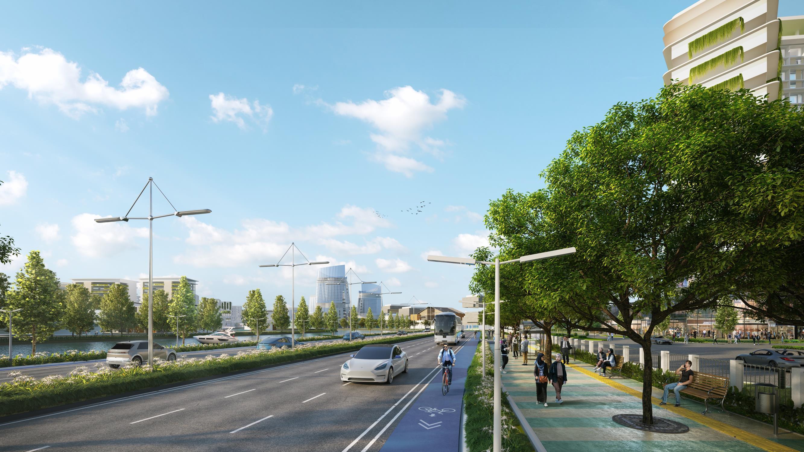
Experience seamless connectivity like never before with our city-linking network, bridging distances and bringing communities closer together
19
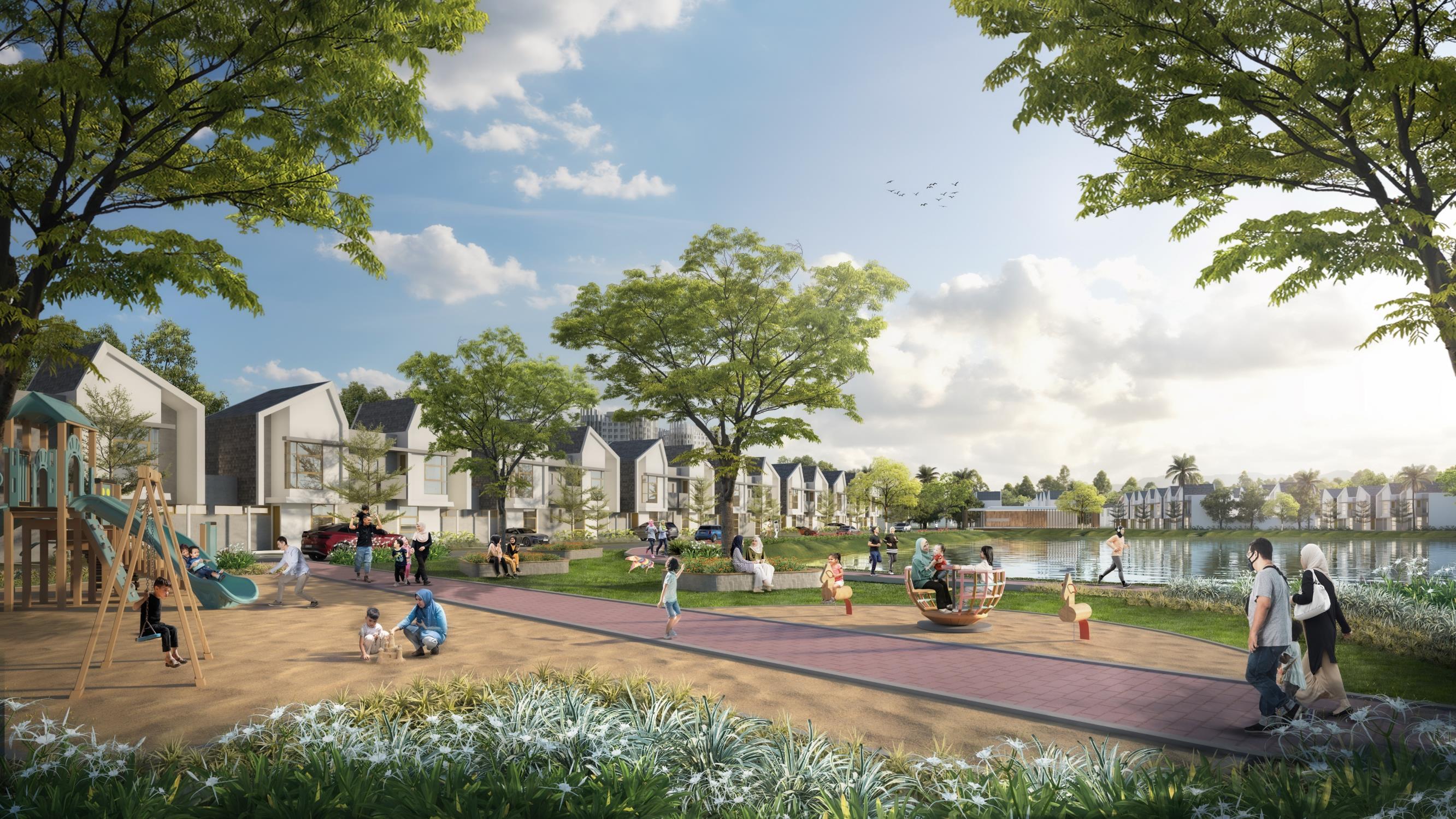
Discover a vibrant residential community seamlessly integrated with lush green-blue networks, creating an enjoyable and sustainable living environment
20
Development Products
Design Principles

Clustering System
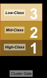
One cluster, one gateway, with shared facilities. Cluster Area Cluster area development variant with an average area of 4-6ha. Housing Composition
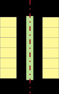
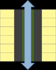
The closer to the main road of the cluster, the larger the house size. Meeting Spine Cluster Meetings in the form of a green spine, as a separation and development feature. Green/Blue Network There is a continuous canal/park, connecting one cluster to another.
PLANNING Cluster ID Area (ha) Saleable Total % Marina Suites (M) 6.60 50% 41 Northern Cluster 1 5.64 62% 359 2 5.50 63% 355 3 5.43 62% 339 4 5.36 61% 328 5 4.80 59% 256 26.73 62% 1,637 Eastern Cluster 6 5.70 58% 322 7 5.01 59% 288 8 5.27 61% 288 9 4.12 61% 206 10 5.32 62% 312 25.42 60% 1,416 Southern Cluster 11 4.36 58% 219 12 4.29 61% 169 13 3.20 59% 167 11.86 59% 555 Existing Clusters Bali Bagus (BB) 2.26 61% 114 Andalas Extention (AX) 0.90 70% 43 Tanadatar (TD) 1.07 49% 44 4.23 60% 201 TOTAL 74.8 60% 3,850
RESIDENTIAL
M 1 2 3 4 5 6 7 8 10 9 11 12 BB 13 TD AX 21 Cluster
Marina
Housing
Housing Green Corridor
Explore Makassar's first smart CBD, integrating nature, residential living, and walkable accessibility for a vibrant and professional urban experience.
22


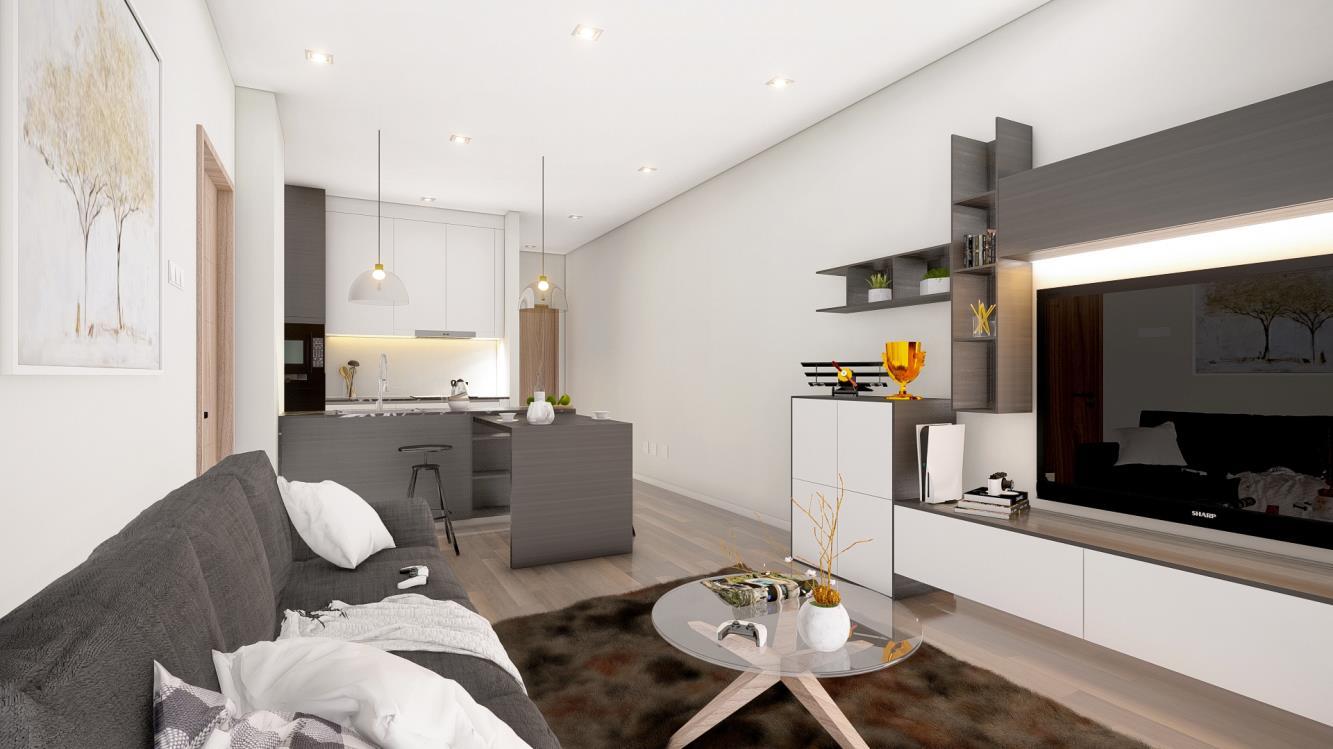
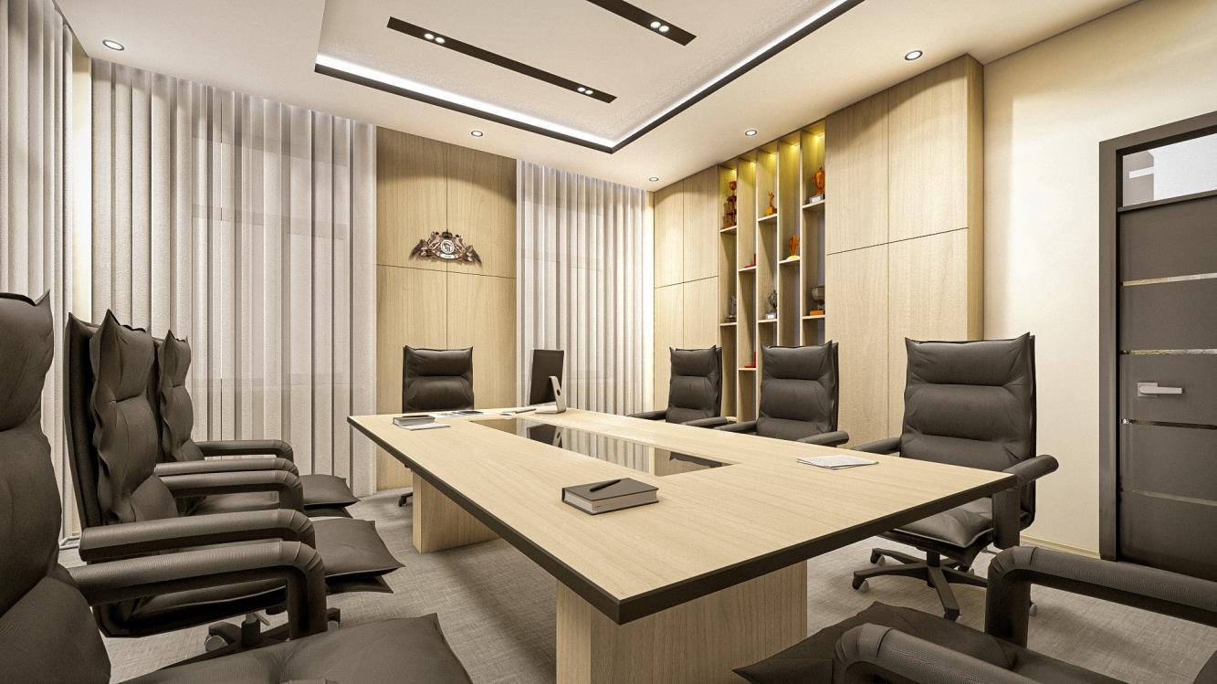
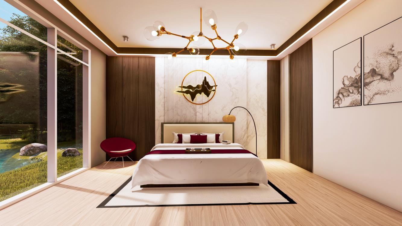
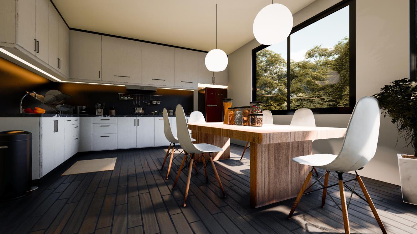
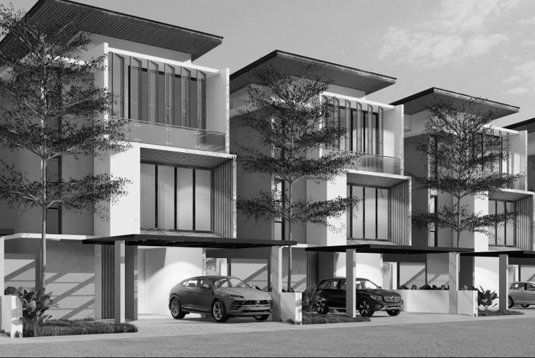
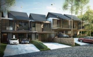
 Modern house
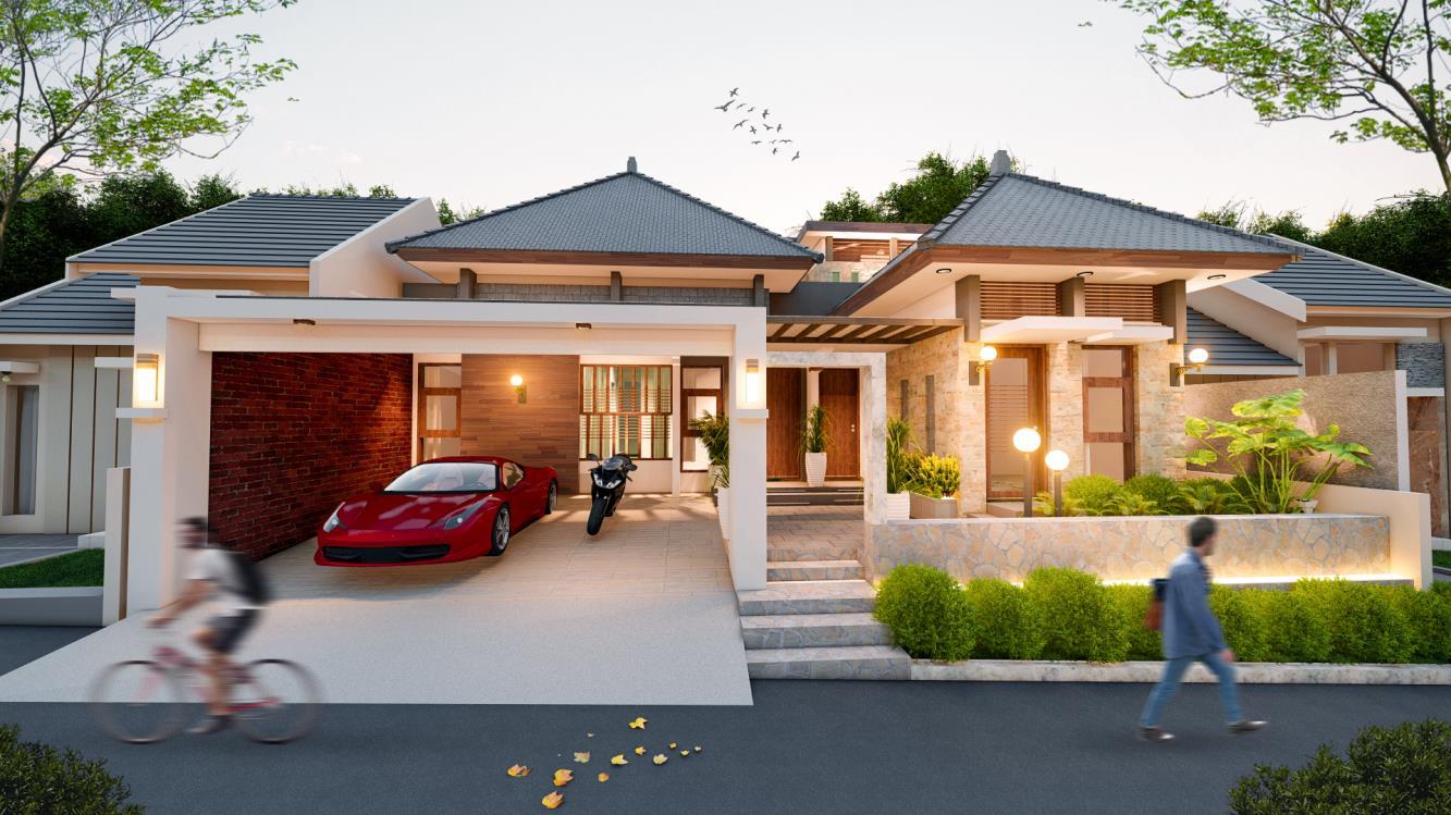
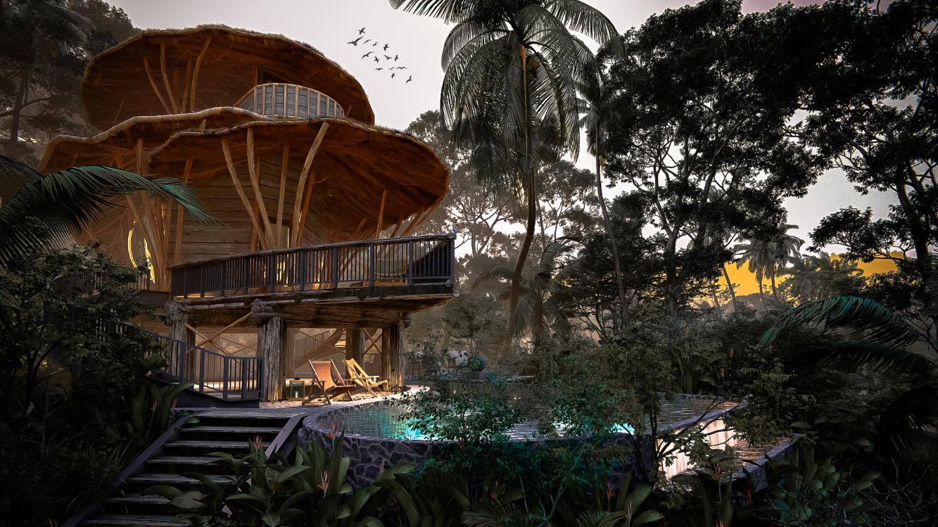
Mountain cabin
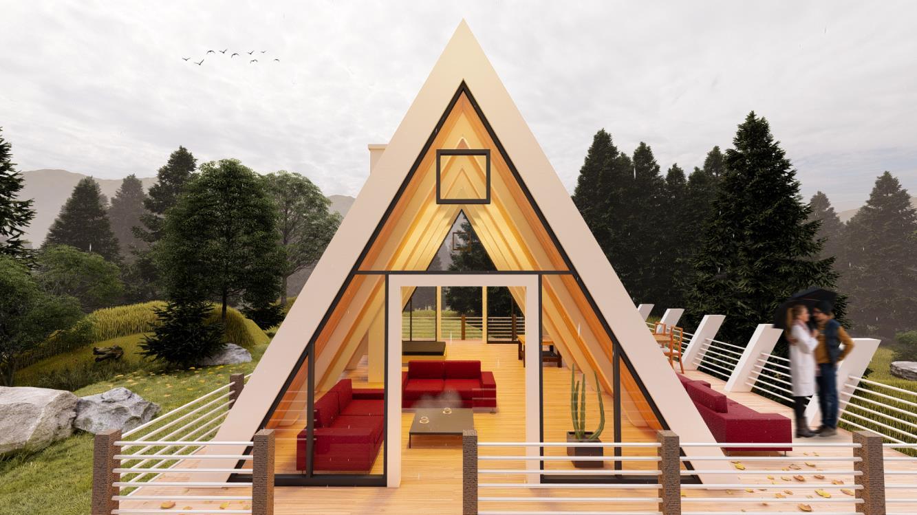
Minimalist house
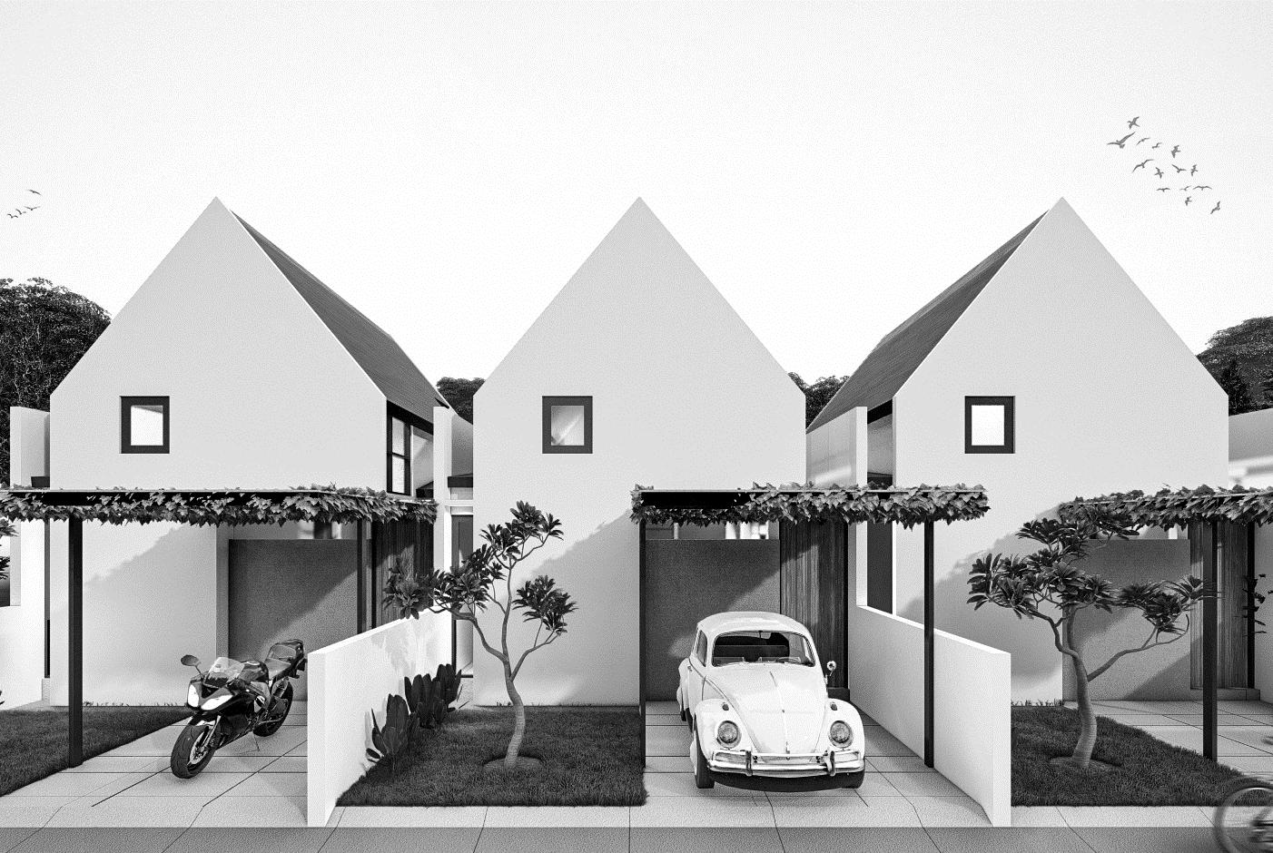
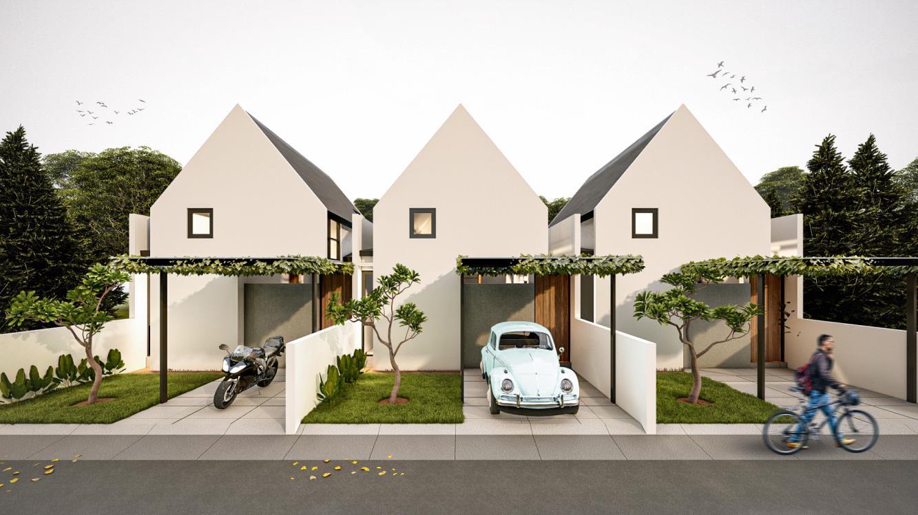
Modern house
Mountain cabin
Minimalist house