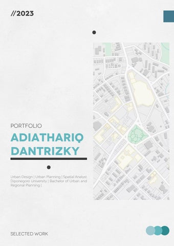

Portfolio
adiathariq DANTRIZKY
.
Urban Design | Urban Planning | Spatial Analyst
Diponegoro University | Bachelor of Urban and Regional Planning | SELECTED WORK
ADIATHARIQ DANTRIZKY
URBAN PLANNING | URBAN DESIGN | SPATIAL ANALYST
Graduated from Urban and Regional Planning Diponegoro University with education record 3.73 GPA and solid experience. Had a best opportunity to intern in Citi Asia International, which learn more about urban planning, smart city issue, regional planning and development, and masterplan. Proficient and familiar with ArcGIS Product for spatial planning and analysis, Sketch Up and Enscape application for urban design, and Microsoft product (Word, Power Point, and Excel).
Contact detail


Tebet Dalam 3A (41), West Tebet, Tebet, South Jakarta
+62-821-1408-5865
adiathariqdantrizky@gmail.com
linkedin.com/in/adiathariq-dantrizky-0881031b5
instagram.com/adiathariqdtrzz/
Academic highlight
DIPONEGORO UNIVERSITY
Bach.UrbanandRegionalPlanning(B.URP),GPA3.73/4.00
organizational experience
ASOSIASI PRAKARSA INDONESIA CERDAS (APIC)
Event Associate
SOCIETY OF RENEWABLE ENERGY (SRE)
SecretaryofFundraisingandSponsorship
Aug 2019 - Aug 2023
Apr 2021 - Dec 2021
Sep 2020 - Apr 2021
work experience
CITI ASIA INTERNATIONAL (CITIASIA.INC)
SmartCityAnalyst Jun 2022 - Sep 2022
PROFESSIONAL TRAINING
1. PROFESSIONAL SEMINAR AND WORKSHOP “CITY PUBLIC SPACE #1”
AssociationofIndonesianLandscapeArchitects(2023)
2. YOUNG EXPERT OF URBAN AND REGIONAL PLANNING
DirectorateGeneralofContruction,MinistryofPublicWorksandHousing(2022)
3. KMMI COURSE PROGRAM: 3D SKETCHUP FOR ENGINEERING
TheMinistryofEducation,Culture,Research,andTechnology(2021)
KEY ACHIEVEMENt
1. ONE OF THE OUTSTANDING URBAN AND REGIONAL PLANNING STUDENTS
GRADUATION PERIOD 172
URPDIPONEGOROUNIVERSITY(2023)
2. FINALIST OF CAKRAWALA ILMIAH COMPETITION BEMFTIRS(2021)
3. 2ND WINNER OF PLANOINACTION XI PHOTOGRAPHY COMPETITION HMPWKUNS(2021)
4. 1ST WINNER OF NEW NORMAL PHOTOGRAPHY COMPETITION HMIKDIPONEGOROUNIVERSITY(2020)
SOFTWARE PROFICIENCY
• Adobe InDesign
• Adobe Illustrator
• Adobe Premiere Pro
• ArcGIS
• SketchUp
• Enscape
• Microsoft Product (Office, Power Point, Excel)
• Canva
02. 01.
/Urban Preservation Study (2022)
urban design & development
Ringin Anom & Pakelan sub-district........12
/Urban Design and Development Studio (2022)
03.
solar panel optimal location
Kediri City............................................................18
04.
smart city implementation dki jakarta.........................................................24
/Undergraduate Thesis (2023)
/Cakrawala Ilmiah BEMFT ITS Competition (2021) miscellaneous others product................................................30
05. /Selected Work (2021-2023)
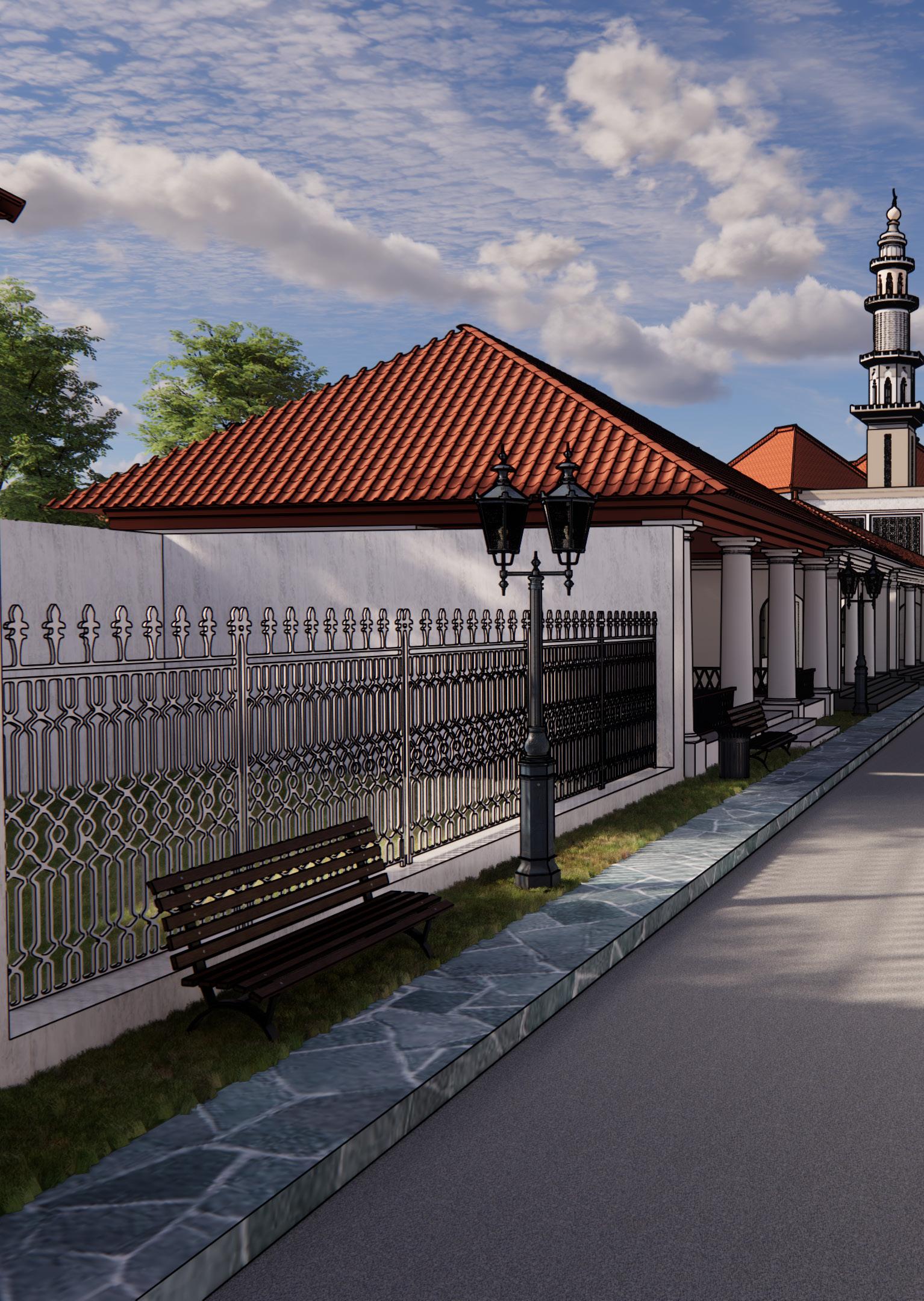
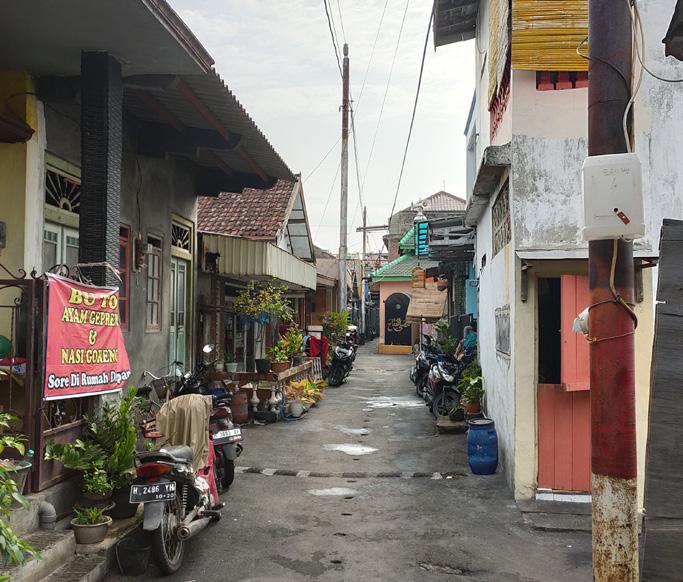
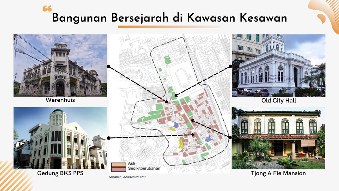
PRESERVATION STRATEGIES KAMPUNG KULITAN
Preservation is an effort to protect and save buildings, monuments and environments that have historical and cultural value from current damage and prevent the process of damage in the future. With preservation efforts in a historical area, it is hope that it can maintain the historical meaning of the area itself. The forms of preservation that can be carry out include restoration, reconstruction, renovation and rehabilitation.
about the site
Kampung Kulitan or Kulitan Village is one of The Cultural Heritage Site that located in Semarang City, Central Java Province. The existence of Kampung Kulitan as one of The Cultural Heritage Site in Semarang City is regulated in Peraturan Walikota Semarang No 22 tahun 2018 concerning instruction for Thematic Village Implementation.
As time went by, changes in Kampung Kulitan began to be seen, such as the presence of new residential buildings and the emergence of slum settlements. Therefore, in an effort to maintain historical value and optimize the potential that exists in Kampung Kulitan so that it can be beneficial.
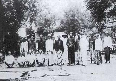
The choice of Kampung Kulitan as a study area was driven by the conservation potential of this village. Kampung Kulitan is a city village that has historical value in Semarang City, where the development of these villages cannot be separated from the role of a successful indigenous entrepreneur in Semarang City named Tasripin during the Dutch colonial period.
site history
Kampung Kulitan known where Tasripin, succesfull merchant & landlord lived /1800-era
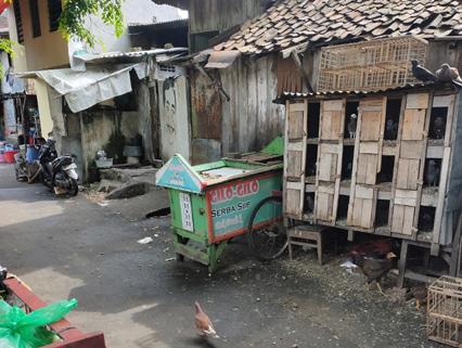
Kampung Kulitan known again since it started being filled with gilo-gilo merchant

Since Tasripin died, the glory of Kampung Kulitan slowly faded. /1932
/1980-era /1997
/2018
Kampung Kulitan is designated as one of thematic village
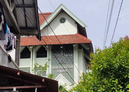
At-Taqwa Mosque rebuilt since the condition was damaged


core zone
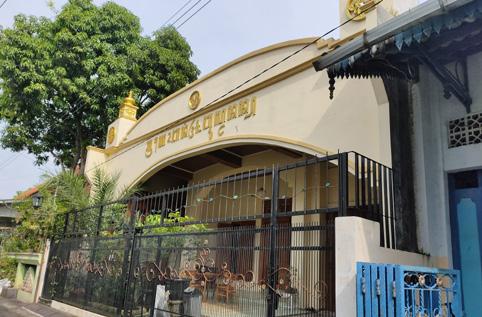
This zone is the area that protects the most important part of the Cultural Heritage. The core zone is the houses inherited from the Tasripin family

CORE ZONE
DEVELOPMENT ZONE BUFFER ZONE
development zone buffer zone
This zone will be developed into two focuses, an area for the development of cultural heritage potential and recreation commercial area
This zone is the area that protects the core zone. The buffer zone in Kampung Kulitan is in the settlements located around the Tasripin heritage houses
detailed design


02.
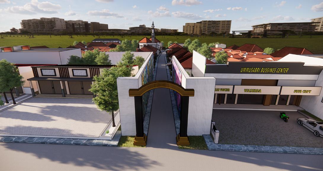
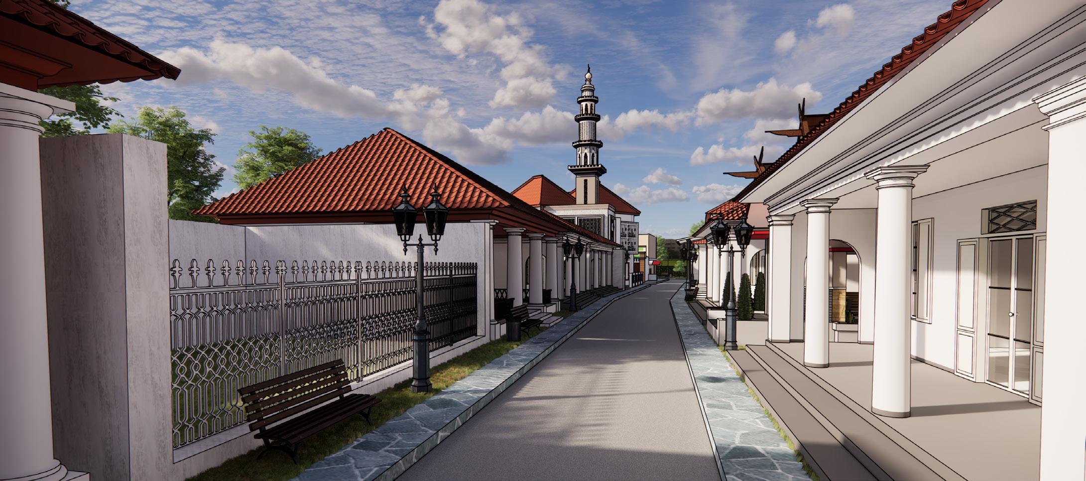
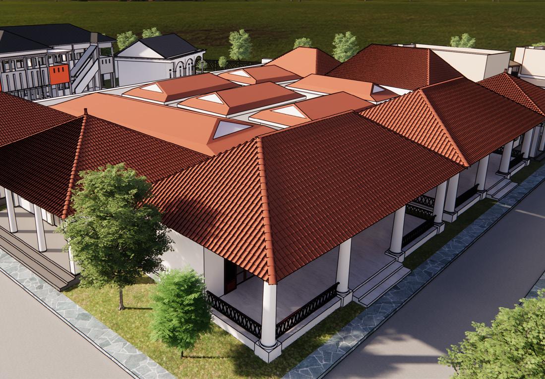
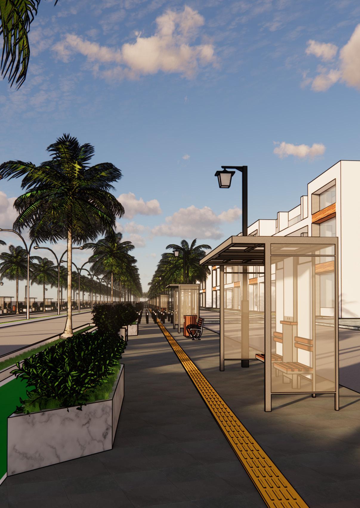
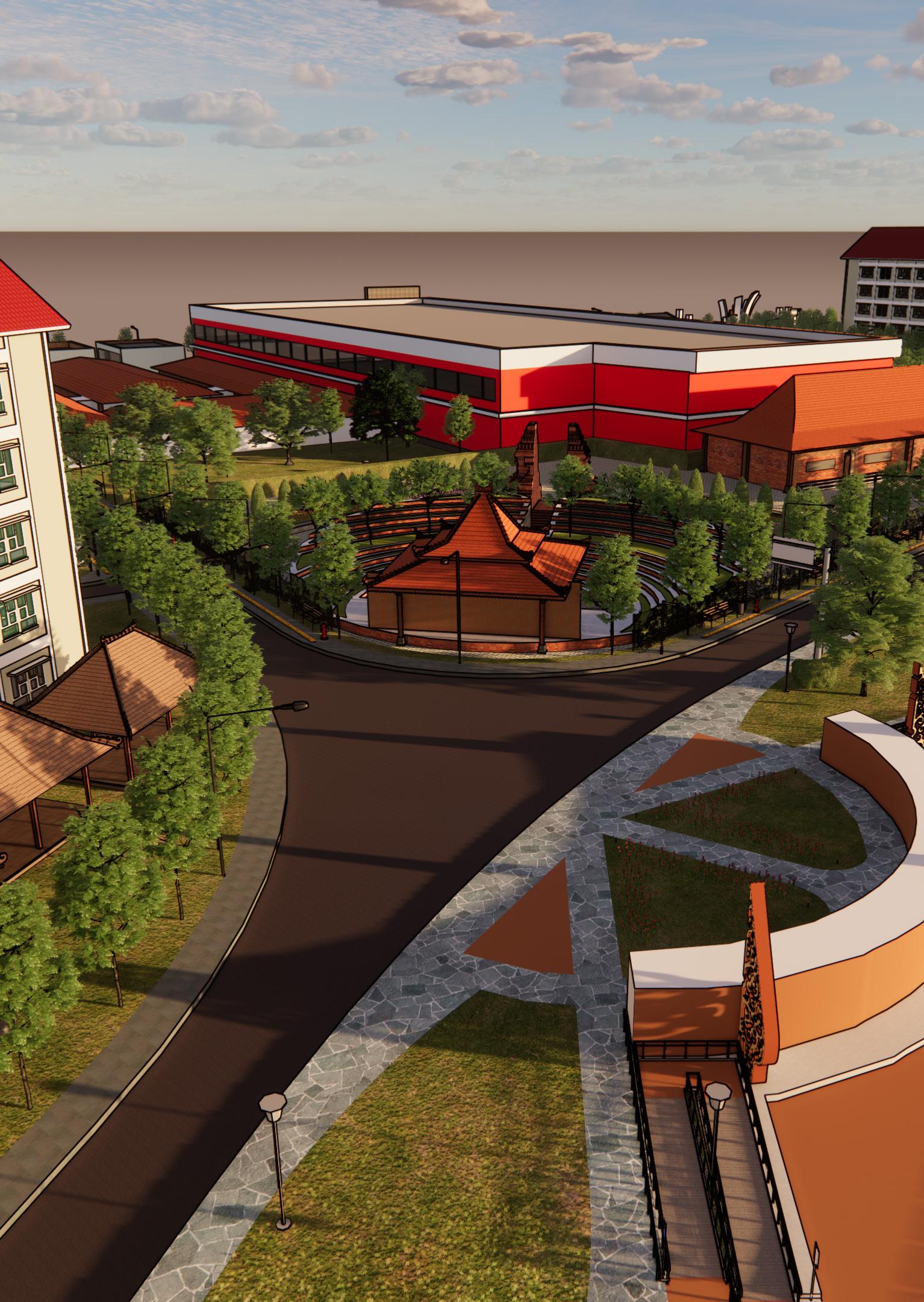
URBAN DESIGN & DEVELOPMENT RINGIN ANOM & PAKELAN
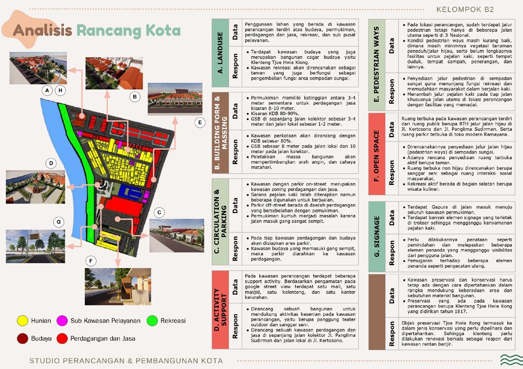
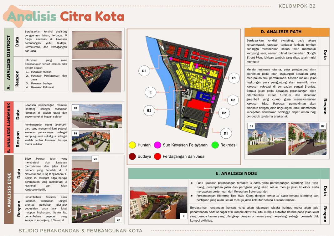
Urban design & development is one from three studio subject in Urban and Regional Planning Diponegoro University. This studio explores further about design and planning of an area with a more detailed scope. For this urban design studio, the study area took place in two sub-districts in the city of Kediri, Jawa Timur Province, which is Ringin Anom & Pakelan sub-district.
about the site
Kediri City is one of the most important city in The East Java Province. It is known that Kediri city is a part of the Selingkar Wilis priority area in the context of accelerating economic development. Apart from that, the city of Kediri is the center of the development area in East Java Province based on the Regional Spatial Planning or Rencana Tata Ruang Wilayah (RTRW) Jawa Timur Province 2011-2031.
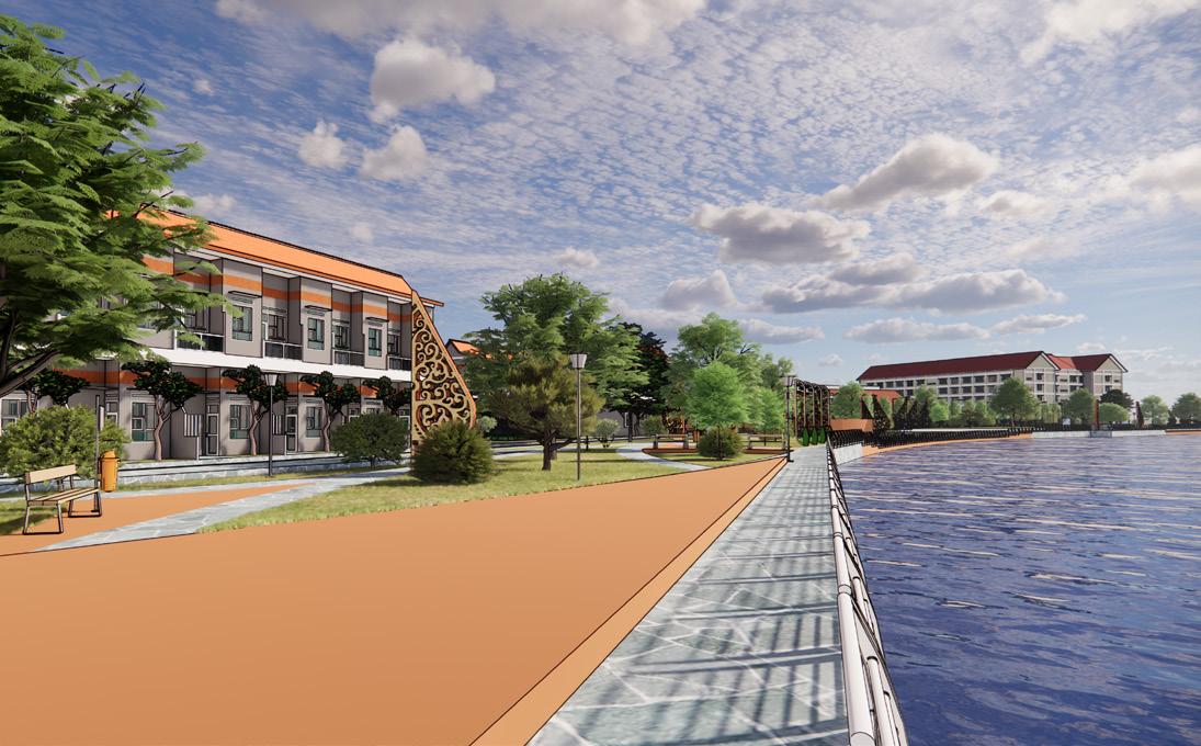
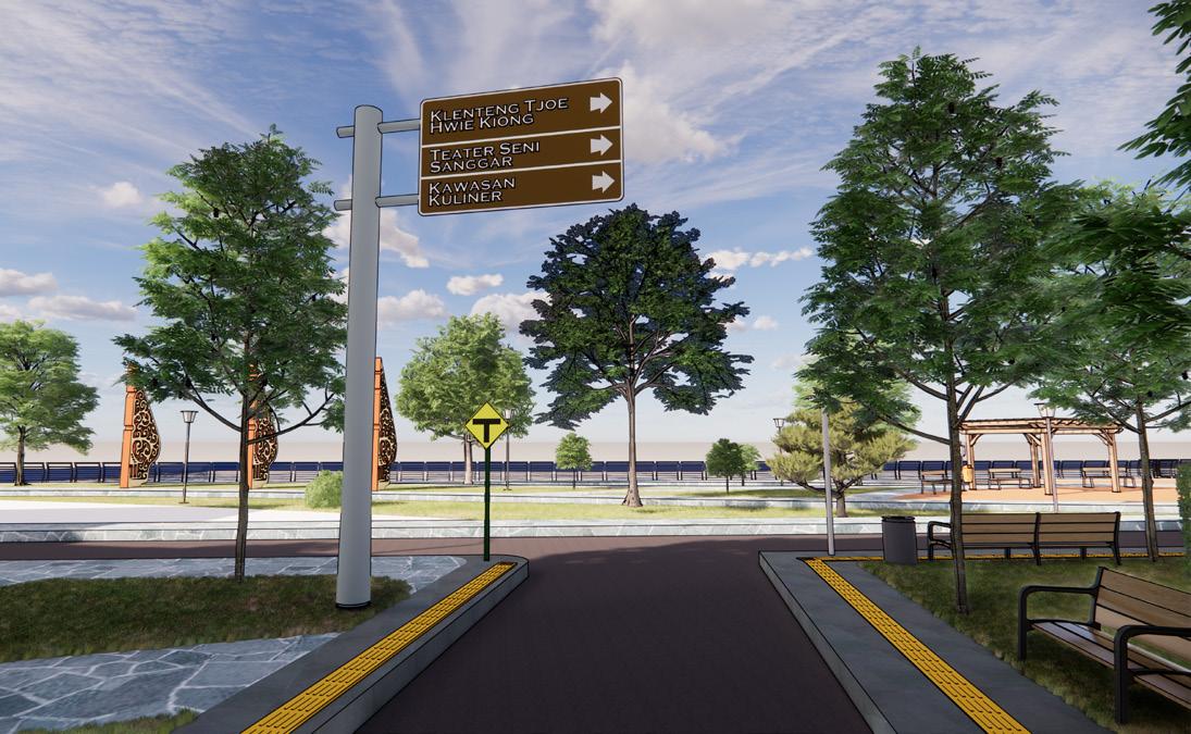
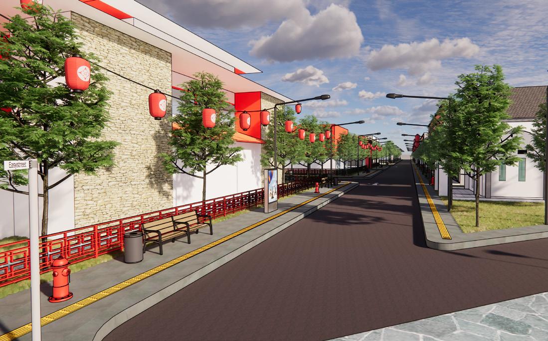
The site location of this project is located in the middle of Kediri City, Kota District, precisely in Ringin Anom and Pakelan Sub-District. This location has an area of 8,38 Ha and directly borders with Brantas River. This site determination is based on several considerations, such as the physical and non-physical conditions of the area, government regulations, and potential and problems of the area.


Tourism Object
Tjoe Hwie Kiong Temple
Cultural and Culinary Known for Jaranan culture
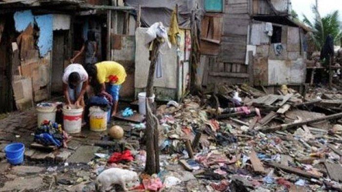
Slum Area
Recorded for 0,7 Ha
Ringin Anom & Pakelan
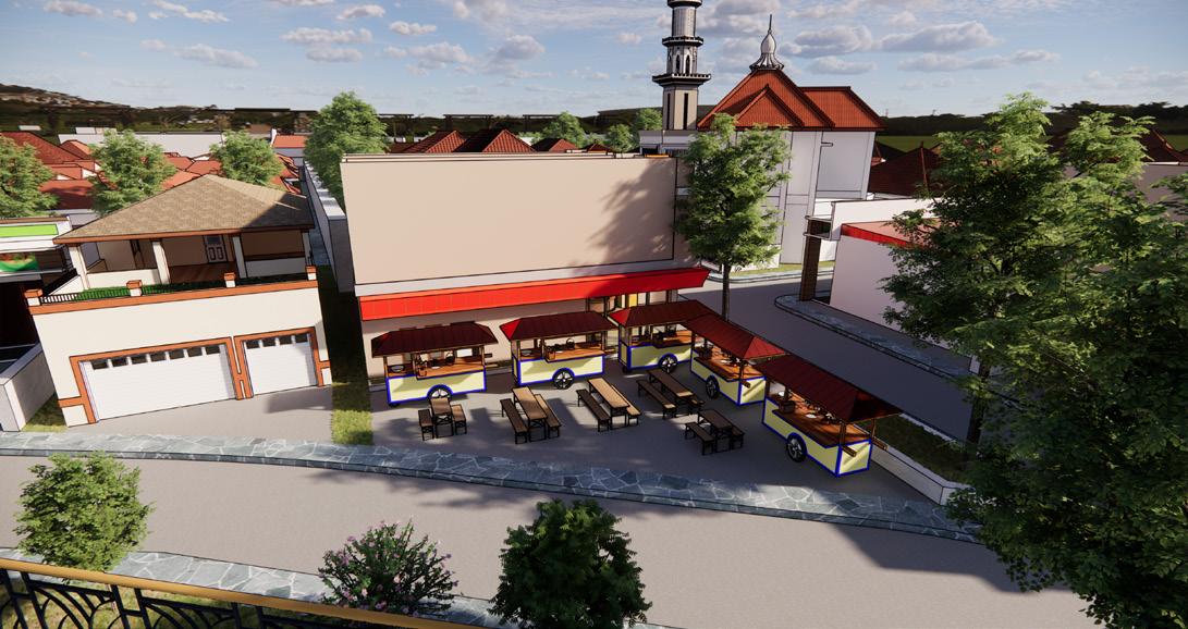
concept design & planning
CULTURAL & LIVABLE COMMUNITY”
The design and planning concept in this area carries the concept of cultural and livable community to make the residential area a more comfortable and safe environment. This concept focuses on developing and utilizing local community potential and maintaining sustainable traditional culture.
urban design analysis

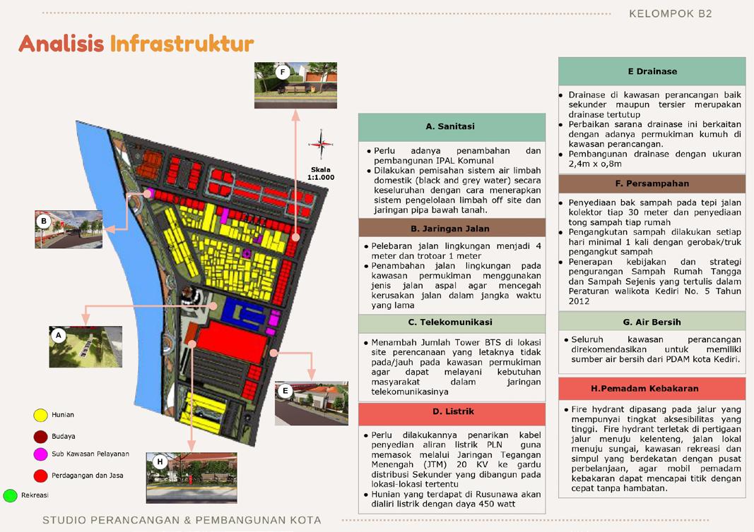

1. LANDED HOUSING
2. VERTICAL HOUSING
3. KINDERGARTEN
4. MOSQUE
5. CHURCH
6. SUB-DISTRICT OFFICE
7. CLINIC
8. SUPERMARKET
9. CONTRACTOR OFFICE
10. MATERIAL WAREHOUSE
11. OUTDOOR THEATER STAGE
12. ART GALLERY
13. TEMPLE
14. RECREATION PARK
15. CULINARY SHOP
16. CHINESSE KAPITEN HOUSE
17. ANTIQUE SHOP 18. SHOPS
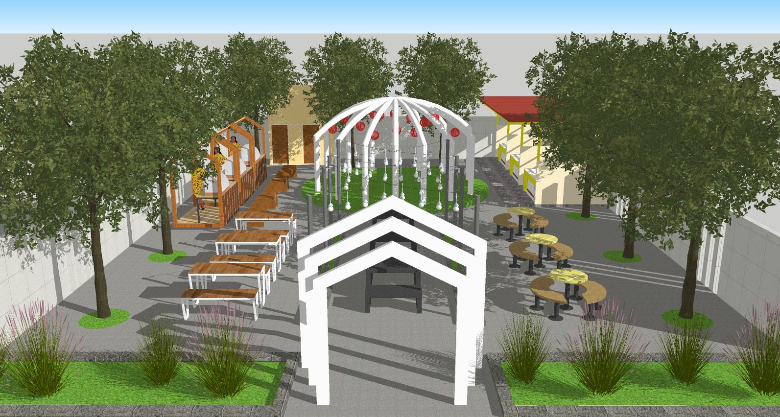
design contribution


03. SOLAR PANEL OPTIMAL LOCATION KEDIRI CITY
Cakrawala Ilmiah is a competition that organized by BEMFT IRS with theme ““Sustainable Living Through Eco Friendly Innovation for Indonesia”. The competition held was to write scientific papers by selecting one from six sub-themes, there are environment, industry, economy, technology, energy, health. Together with fellow teammates, Otniel Farrel Purba and M. Iqbal Maulana, we formed a team called “URBANIZER” with energy sub-theme to determine the optimal location for solar panel in Kediri City.
The Covid-19 pandemic has had a significant impact on human survival. This leads to an increase in energy consumption, especially electrical energy. Electrical energy itself is a basic need for all living creatures, especially for humans, which is one of the benchmarks for whether human life is feasible or not. This condition must be considered so that electricity needs remain well served. One way is to utilize solar energy or what is often called solar panels. Solar panels are an electricity generator that utilizes sunlight so that its use is able to reduce dependence on conventional energy which generally still uses fossil energy.
This research aims to determine the optimal location for building solar panels in Kediri City as an electricity distributor supply based on geographical characteristics and regional conditions. The city of Kediri is the study area because it is close to the strategic area for the construction of Surya Dhoho Airport, this has an impact on a significant increase in the number of residents and immigrants, so there is a need to be prepared to provide sufficient electrical energy supply.
The method used is a spatial approach with the application of Geographic Information System (GIS) in determining the optimal location for the construction and development of solar panels. The research results show that there are several optimal locations to build solar panel land that is beneficial for the people of Kediri City. In other words, solar panels are an alternative choice for increasing the supply of electricity networks in an area and are renewable energy, where in the case of the Kediri City study area itself, there is quite a lot of land that is the optimal location for the development of New Renewable Energy (EBT) resources.

Theoritical framework

spatial analysis
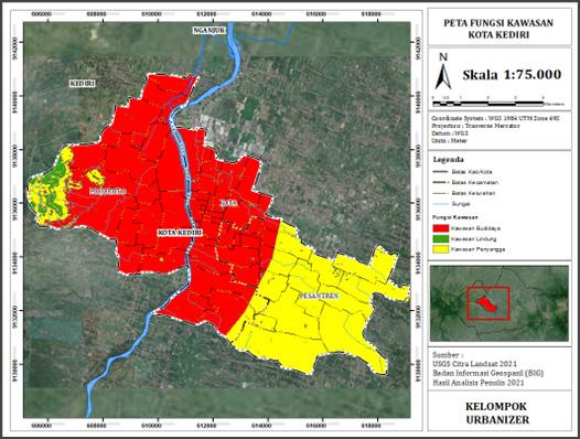

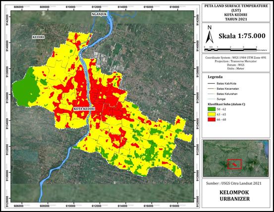
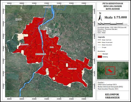
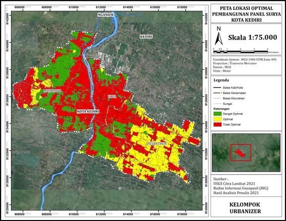
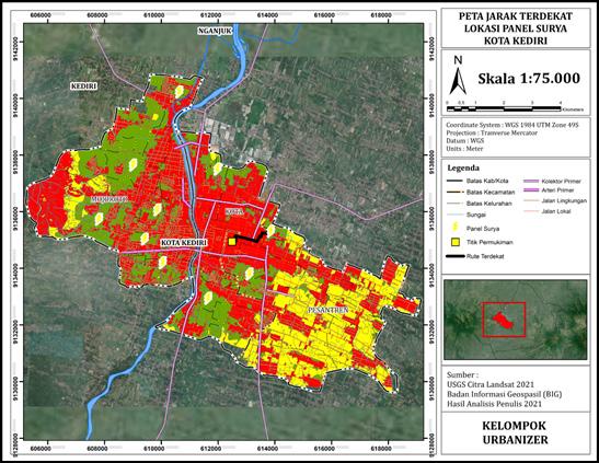
Based on maps and analysis tables, the optimal location for solar panel construction is in the Islamic Boarding School District, precisely in Burengan Village. The optimal location is produced from scoring of four indicators, including regional function indicators, land use indicators, flood hazard indicators, and land surface temperature indicators.
After the four indicators have been scored and overlaid, then the location points are determined via route analyst by placing several sample points for the construction of solar panels. Determination of this point is seen from the location closest to the settlement and has a very optimal land category so as to produce the optimal location point for that area.
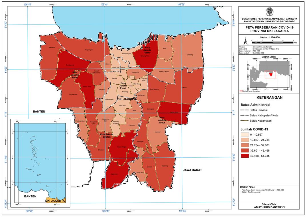
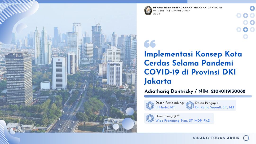
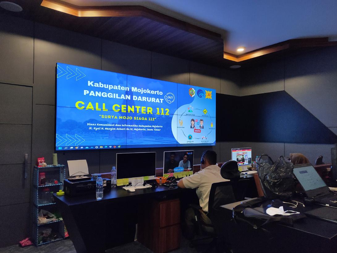
04. SMART CITY IMPLEMENTATION DKI JAKARTA
Implementation of The Smart City Concept During COVID-19 Pandemic in DKI Jakarta Province is the title of undergraduate thesis. This research focuses on the extent of implementation of the smart city concept in DKI Jakarta Province during the COVID-19 Pandemic using content analysis and quantitative descriptive. There are several variables, namely the six dimensions of smart cities. These six dimensions are smart living, smart society, smart governance, smart economy, smart environment, and smart branding.
theoritical framework

analytical framework

implementation of smart city concept
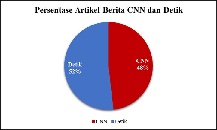
There were 44 news articles obtained from the Detik news media and 41 media articles obtained from the CNN news media with a total of 85 news articles obtained. The news articles used are news articles that appeared within a three year period, from 2020 to 2022
The important words that are grouped come from all news articles that have been collected and analyzed through the Nvivo application. In this research, the categories are the six smart city indicators. Based on the analysis results, there are at least 419 important words that are closely related to the six smart city dimension indicators and the number of articles is 85 news articles.


implementation of smart city concept during pandemic covid-19

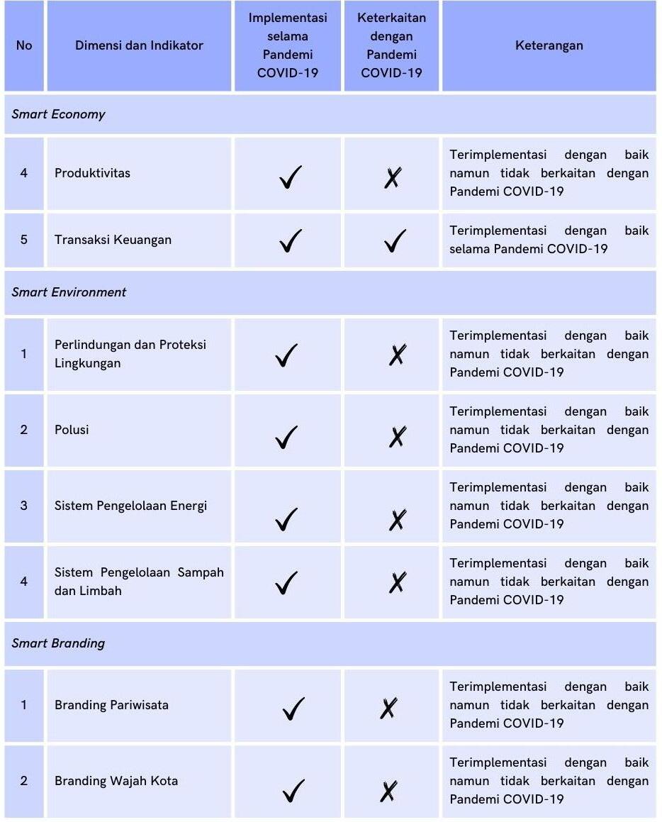
From 19 indicators of the dimensions of the smart city concept that have been implemented in DKI Jakarta Province, not all of these indicators intersect or are related to the COVID-19 pandemic. Indicators that relate to the COVID-19 pandemic tend to be in the dimensions of the smart city concept, the dimensions of smart living, smart society, smart governance and smart economy. Meanwhile, the other two dimensions of the smart city concept, smart environment and smart branding, are not related to the COVID-19 pandemic.
implementation of smart city concept during pandemic covid-19

conclusion
In general, the smart city concept in DKI Jakarta Province during the COVID-19 pandemic, namely from March 2020 to December 2022, has been implemented well. It can be said that DKI Jakarta Province in general has created a smart city ecosystem that is well integrated with each other, both between parties and between systems. However, the smart city concept that has been implemented is not fully related and intersects with the COVID-19 pandemic in DKI Jakarta Province, especially in the dimensions of smart environment and smart branding.
05. MISCELLANEOUS OTHERS PROJECT
KMMI Course program

mapping & Layouting
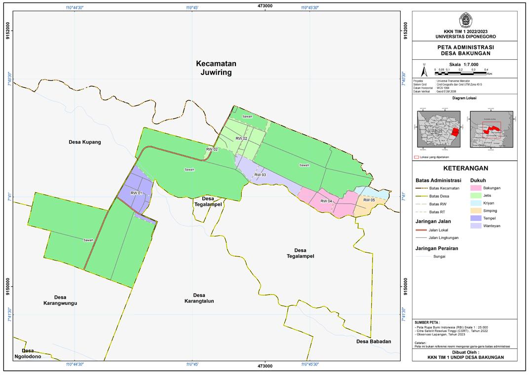
Community Service Programs (2023)
Undergraduate Thesis (2023)
webgis
Community Service Programs (2023)

*Link: desabakungan-karangdowo.gis.co.id
cover & slide editing
Smart City Study (2022)

Undergraduate Thesis (2023)
Urban Preservation Study 2022)
Urban Morfology Study (2020)
video editing
bit.ly/FilmStudioB2CultureAndLivableCommunity

bit.ly/InclusiveUrbanDesign_VideoKKL_KelompokB2
Urban Design & Development Studio (2022)
Practical Field Work (2022)
work documentation


PT Citi Asia International (2022)