

11 F OR ew OR d
15 Int RO d UC t IO n
17 t w O S C h O la RS a Cent UR y a pa R t
26 O ve R v I ew OF the R OS e Red C I ty
33 The Grand Entrance: Al-Khazneh and the Greater Siq Region
57 Eastern Highlands: Royal Tombs, Nasara Ridge, and Jabal Khubtha
81 Center of It All: Qasr al-Bint, al-Habis, and Wadi Turkmaniya
101 Top of the World: Deir Plateau and the Northwest Ridges
121 Trail to the Heavens: Wadi Farasa, Obelisk Ridge, and the High Place of Sacrifice
141 Outer Fringes: Jabal Harun, Bayda, Wadi Mousa, and the Southern Tombs
160 p et R a’ S e nd URI n G l e G a C y
170 a CK n O wled G ment S
172 a b OU t Kael I n G ROO m
174 Sele C t bI bl IOGR aphy and F UR the R Read I n GS
Side view of the impressive Deir Monument.
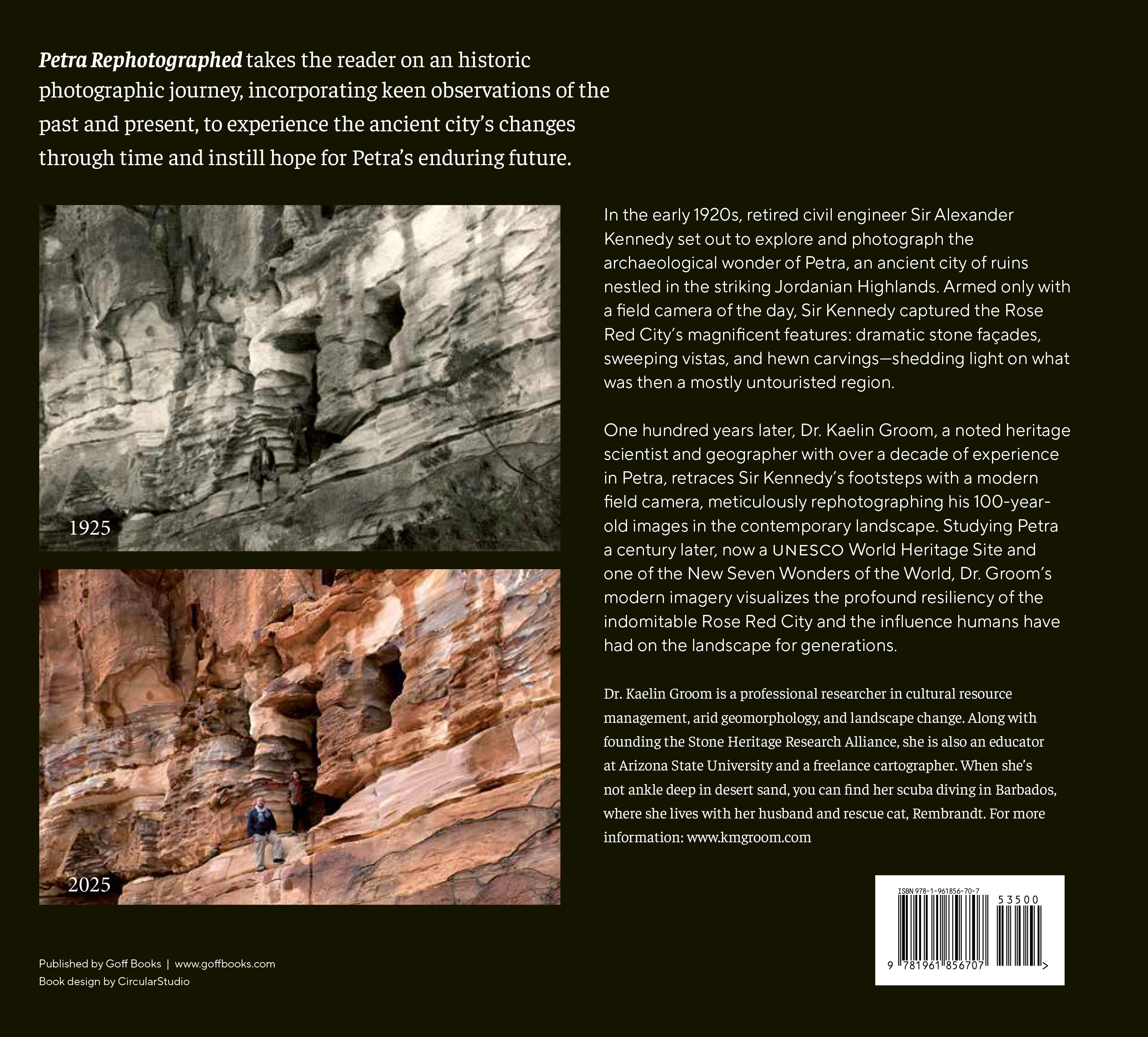
and duplicated photography is used commonly in several scientific disciplines, including archaeology, biology, ecology, environmental science, geography, geology, and history—or in this case, a little bit of each.
For practicality and brevity, I have curated Sir Kennedy’s original 200-plus photographs into a representative collection for this book. In the following pages, you will see the century-old differences in Petra’s most iconic landscapes, monuments, buildings, tombs, and façades exemplifying the Rose Red City’s various regions. May these photos continue to inspire the magic of Petra for generations to come.
AUTHOR’S NOTE:
In Arabic language, there are several letters not present in English, resulting in a variety of different possible spellings for the same word, and, as seen in many of the historic quotes, they are not always consistent. For example, both “Bab al-Siq” and “Bab as-Siq” are considered grammatically correct but “Bab as-Siq” is more linguistically accurate and used in my modern transliterations. Out of respect for my Jordanian friends, all place names and transliterations in the new text are based solely on input from Jordanian regional experts and local preferences. When quoting Sir Kennedy and his contemporaries, all British spelling is reprinted as originally written, and place names are listed as they were known at the time. Also, unless otherwise specified, all historic photographs and their descriptions presented in the following pages were taken directly from Sir Kennedy’s 1923 and 1924 expeditions as published in his seminal book Petra: Its History and Monuments (1925).
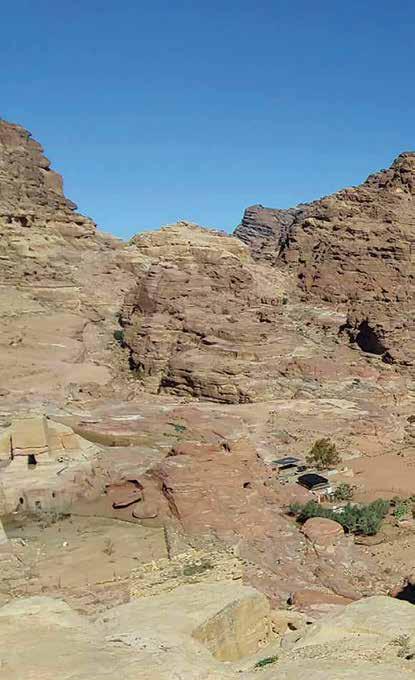
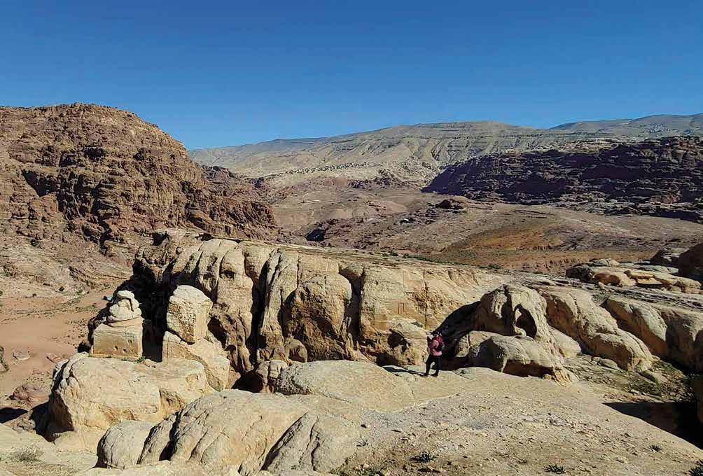
View of Petra from the Southern Tombs. Notice the difference between the rounded creamy Disi stone outcrops in the foreground and the ragged red Umm Ishrin cliffs in the distance. Author Kaelin Groom is seen standing on the lower edge for scale.
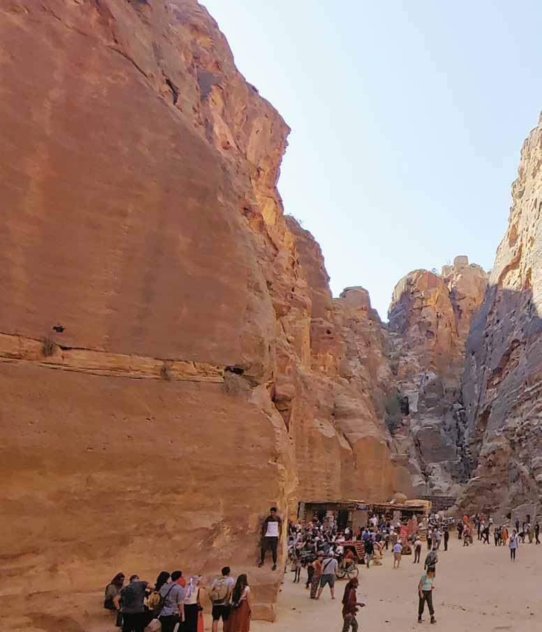
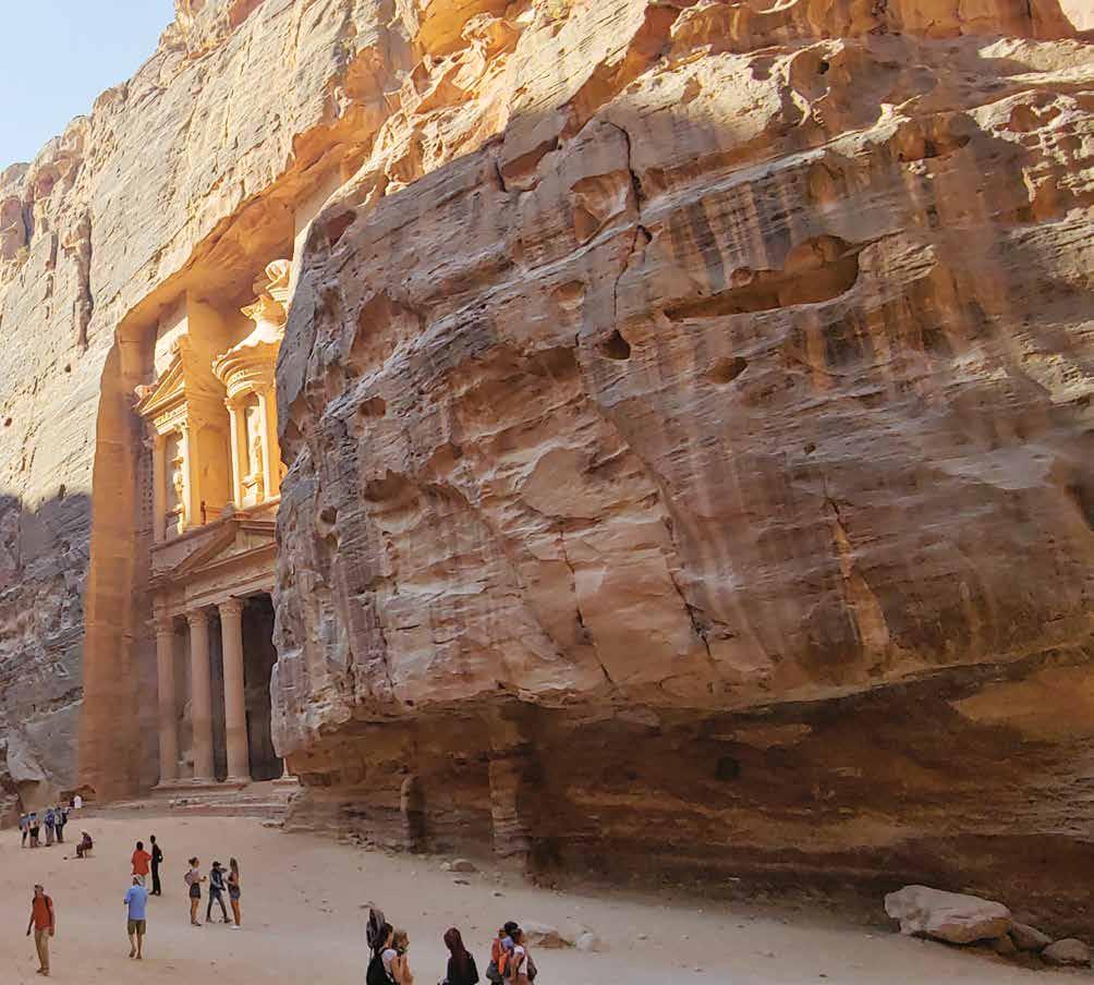
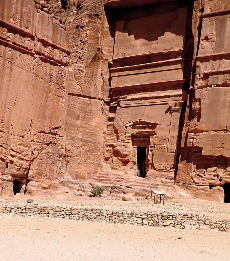
Tom B 825

“[This monument] is quite unique in its internal arrangement. It contains a large chamber, on the floor of which are fourteen graves, very irregularly disposed… On one side-wall a group of five obelisks has been scratched, and a single obelisk on the other wall… On the bases of two of the obelisks are scratched short inscriptions naming a son and a grandson of one Iakum, but no indication as to their date.” — s ir Kennedy (1925, pgs. 48, 49)
The once rocky streambed in the foreground has been cleared and smoothed, creating the primary walking path leading visitors towards Petra’ sprawling city center. The striking monument on the far wall carries the designation BD Tomb 825, in reference to the extensive archeological taxonomy developed by early archaeologists Rudolf Brünnow and Afred von Domaszewski, the first survey of its kind in Petra. The interior of the tomb is equally impressive, as noted by Sir Kennedy, but is now gated to protect the intricate carvings and alcoves within from humanrelated deterioration. The uniquely shaped entrance on the monument next door has since been exposed––either by excavation or by the periodic floods that surge through the outer Siq. An interpretive sign was erected to provide more information about the monument, but it has since been cut off by the entrenched ravine (seen running through the center of the image) engineered to capture and contain the seasonal flood waters.
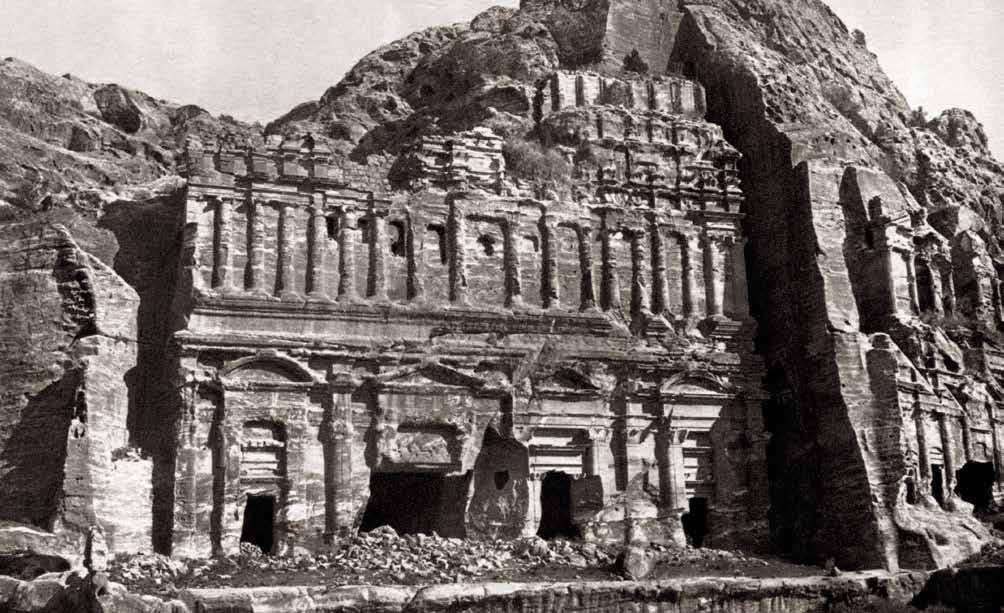
“In the wall of al-Khubdha [al-Khubtha], stands a very badly weathered monument, generally called the ‘Corinthian’ tomb from the fact that the capitals of its columns are––or supposed to have been––of the Corinthian order. Next to this, northwards, stands an immense façade, unique in its design as regards Petra, which is a copy, in arrangement,
of the front of a Roman palace, and which it will be convenient to refer to simply as ‘the Palace’.”
— s ir Kennedy (1925, pg. 51)

While both the Corinthian (right) and Palace (center) Tombs can be seen in this photo, the Palace Tomb’s towering mass of columns, cornices, and friezes dominates the image. Even with the cleared debris, the scale of the photograph makes it difficult to convey the sheer size of this monumental façade. It is truly enormous, and it is crumbling. Many of
the upper decorations have required modern stabilization and reconstruction—some as recent as 2022. Sir Kennedy did include in his tome another image focused on the Corinthian Tomb, but its inferior quality and awkward lighting negated its viability for replication. Capturing the entire façade of the monolithic Palace for this repeat
image required placing the camera in the middle of a large, unshaded boulder field, a situation made far more delightful with the company of a young Bedouin child bringing tea from her mother’s nearby stall and helping to “stabilize” the camera tripod by stacking loose pebbles around its feet.

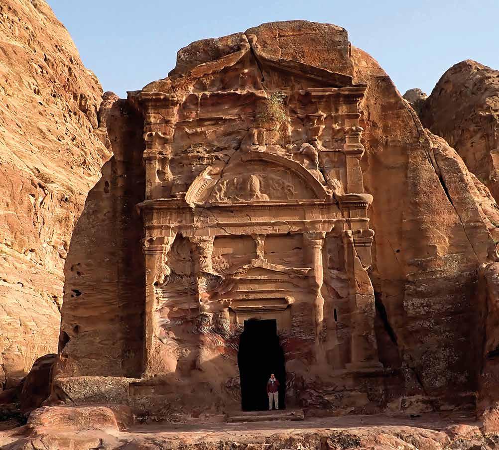
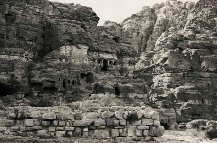
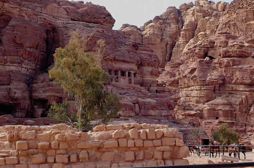
“The tomb of Florentinus has been made at the end of a somewhat narrow promontory projecting from the west face of al-Khubdha. The photograph shows the ornate nature of the façade as well as its ruined condition allows.” — s ir Kennedy (1925, pg. 56)
Returning to the Royals from the Nasara Ridge brings visitors past this remarkable hidden gem. The large Latin inscription across its upper cornice makes it one of the few tombs in Petra containing a written record of its original patron: in this case a second century Roman officer by the name of Sextius Florentinus. Providing a sense of scale and occupying the place of Sir Kennedy’s Arab guide in the tomb’s doorway is field assistant Casey Allen. Initially, this position was attempted by an older Bedouin woman who came by with her goat herd while we were waiting for the correct shadows to appear on the tomb’s façade. She reminisced on how her grandfather used to live in this monument and pointed out the caves on a nearby cliff where her family has housed their goats for generations, reaffirmed by their bleating calls echoing through the canyon. Unfortunately, her traditional black abaya (dress) and hijab (head scarf) were too dark within the shaded doorway to clearly show in the repeat photograph, and Dr. Allen graciously replaced her.
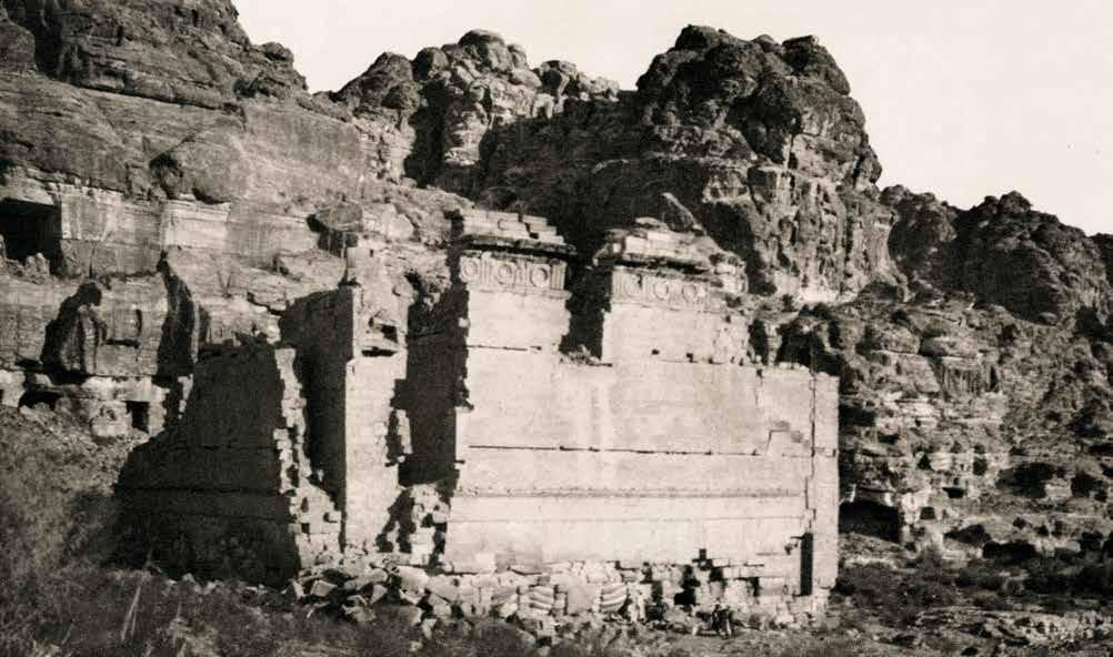
“The only building left standing, or partially standing, is that known as the Qasr al-Bint, or Qasr Bint Fir’un (the palace of the daughter of Pharaoh). It stands near the entrance to the Siyagh, and under the rock of al-Habis, the so-called ‘Acropolis.’ It has been frequently suggested that the existence of the upper storeys favours the idea that
the building was rather a dwelling-place than a temple, but the reasoning seems inconclusive.” — s ir Kennedy (1925, pg. 60)
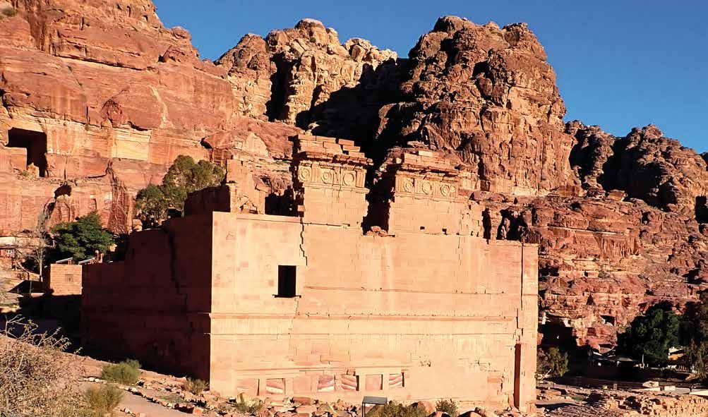
The lonely figure of the Qasr al-Bint still punctuates the western end of the Roman street, seen here from a trail leading above the Great Temple to the Wadi Farasa.
The most obvious change between the photographs is the southwestern corner’s significant restoration, completed by the Jordanian Department of Antiquities in
1985, highlighted in the repeated image by the bright early morning sun. Less obvious in the images are the changes surrounding the solitary building. Directly to the west (left), the historic Nazal Camp dig house and its shade trees peek out from behind the solitary monument. This building was renovated in 1995 and still hosts visiting
archaeology teams conducting research in Petra. Across the valley (bottom right), the Basin Restaurant offers visitors traditional Jordanian meals or respite on their large veranda, whose copious voluminous trees provide an unexpected, but much appreciated, oasis from the harsh desert sun.
Bas E of al- h a B is an D o l D pET ra m us E um
“At a slightly lower level than the [Qasr al-Bint] Temple, and between it and the riverbed, stands the large masonry altar… Almost immediately beyond the temple there is visible somewhat high up on the east wall of al-Habis a large cave with a squared entrance, but without any façade… Below this cave there starts a long ramp running up the face of the wall northwards, a ledge
partially natural and partially artificial…
A little higher up, just before the ledge rounds the northern corner of the rock, it passes below the remarkable chamber or hall, with its doorway and four windows making it like the front of a house.”
— s ir Kennedy (1925, pg. 60, 62)
In 1963, the three small chambers within Sir Kennedy’s “house” were enclosed and converted into an archeological museum to shelter and display artifacts from Petra’s Edomite, Nabataean, Roman, and Byzantine eras. However, with the 2014 construction of the beautiful new Petra Nabataean Museum located outside Petra’s front gate near the visitor center, the “Old Petra Museum”
has been locked and remains closed to the public. In the foreground, the black metal fence erected to protect the curious stone platform protruding from the Qasr al-Bint has become a popular gathering place for donkeys and electric carts ready to escort visitors up the strenuous Deir trail or back to the Khazneh and entrance gate, respectively.
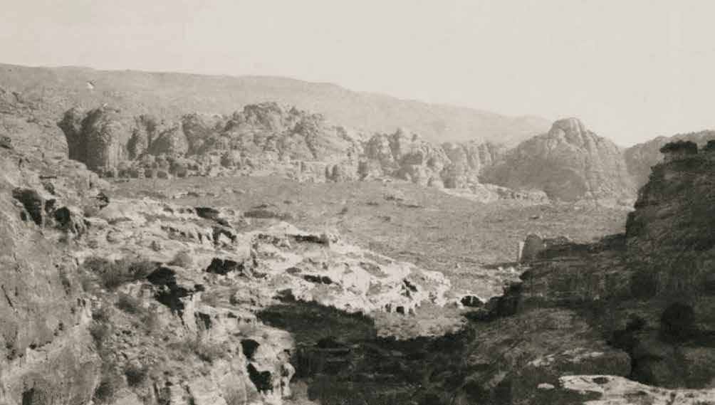
“The city area [seen from Wadi ad-Deir above the Lion Triclinium] is roughly bisected from east to west by the channel of Wadi Musa itself, on either side of which the alluvial debris of the surrounding hill, brough down year after year by the seasonal torrents, is piled up in tumbled, undulating
masses, whose natural eminences were used by the lords of Petra to form the points d’appui (points of support) of its circuit wall.”
— s ir Kennedy (1925, pg. 7)
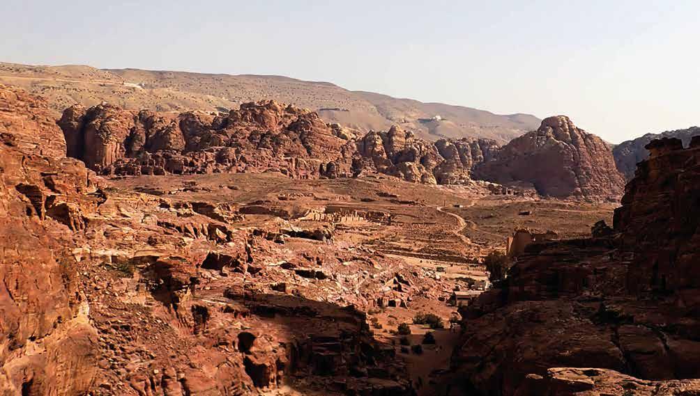
One of the only surviving photographs Sir Kennedy took of the entire central valley, this view looking back from the Wadi ad-Deir perfectly captures the grandeur of Petra’s dramatic craggy setting, as well as showcases ways in which modern development has shaped the landscape. Large swaths
of Sir Kennedy’s “undulating masses” have been excavated to expose the Grand Temple and the adjacent Bath Complex (center), plus new trails and dirt roads now crisscross the hillside beyond, punctuated with the indominable Qasr al-Bint. The rear of the Basin Restaurant and modern toilet facilities
are seen at the trailhead of Wadi ad-Deir.
Farther in the foreground, the well-trod trail itself has been worn to a fine sandy path. Even with all this development, the overall view remains a wild chasm of sand and stone.
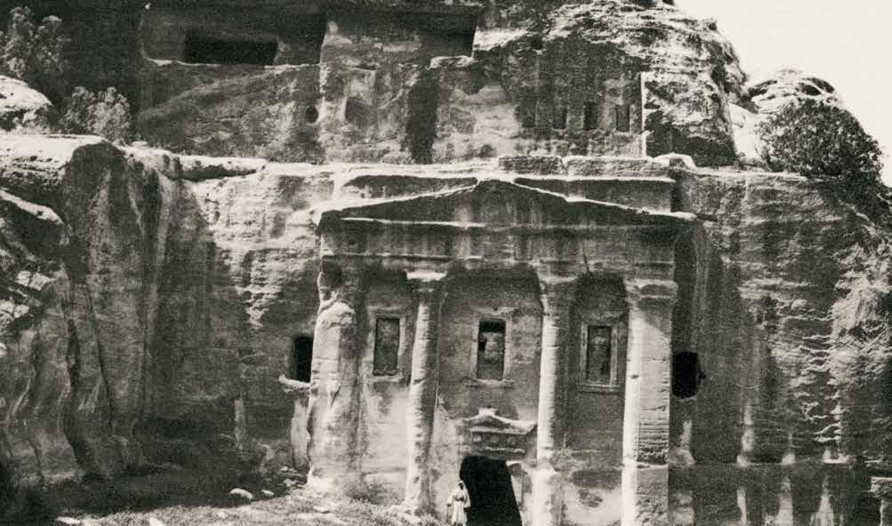
“It is of quite straightforward classical design, with four pilasters and a plain frieze and pediment. In the three bays into with the columns divide the front are niches with statues, but the nature of the figures represented is not very certain… The monument contains two chambers, in one
of which are four arch-topped niches, probably for burials.” — s ir Kennedy (1925, pg. 59)
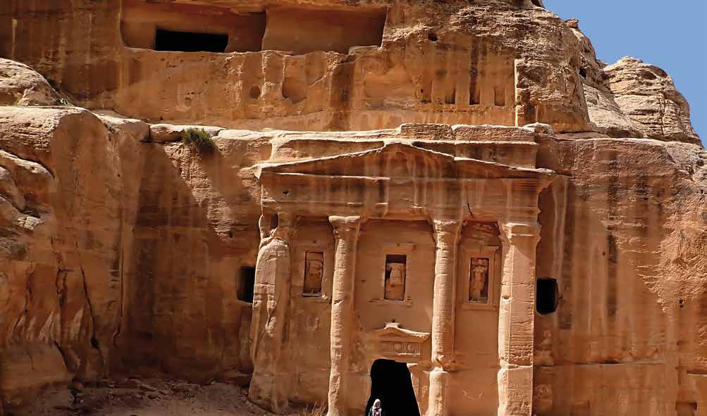
It is unfortunate Sir Kennedy’s photograph is so spatially constricted, as some of the most dramatic changes at this location are in the courtyard just beyond the scope of the images. (A wider view of this monument is featured in the seasonal shadows example in the opening chapter.) Readers can get
a semblance of how much the ground has receded—perhaps from either excavation or seasonal stormwaters, or a combination— by how much lower field assistant Dr. Casey Allen is standing in the monument’s doorway compared to Sir Kennedy’s companion. On the monument itself, trees and brush that
once perched along the upper ledge have since died (or been removed) and a plucky new scrub has taken residence in the deep crag in the upper left, casting a new shadow across the resolute façade, which has since earned the name “Soldier Tomb.”
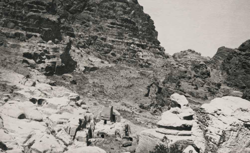
“The Snake Monument itself is unique among Petraean carvings. The coils of the serpent winds round a central block on the top of a plain four-square block. I know of nothing that can be said as to its probable use or significance.”
— s ir Kennedy (1925, pg. 70)
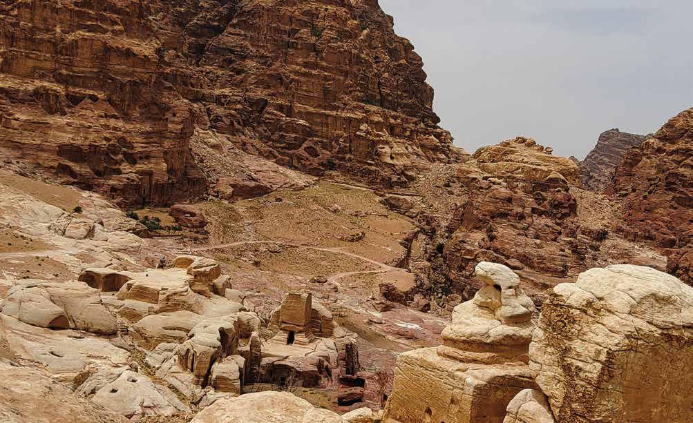
Taken from above looking across the southern tombs, the coiled “snake” is seen in the bottom right corner, though it takes a certain amount of imagination to see a serpent in the bulbous mass of carved stone. Landscape change appears to be relatively limited to differences in vegetation directly behind the stone serpent and in the
courtyard of the block tomb below, as well as the addition of the winding gravel road in the background. Stalwart tourists can navigate this gravel road to Jabal Harun by foot, but a Bedouin escort by truck is much preferred, especially when nearing the end of the trail where the path steepens considerably.
