ORO Editions



FORT MASON AND THE FORT MASON COMMUNITY GARDEN Golden Gate National Recreation Area Headquarters Bay Street and Laguna Ave San Francisco, CA
Right page: Walls of the community garden built from recycled concrete sidewalks contain an eclectic mix of plants. 2021. JNRA.
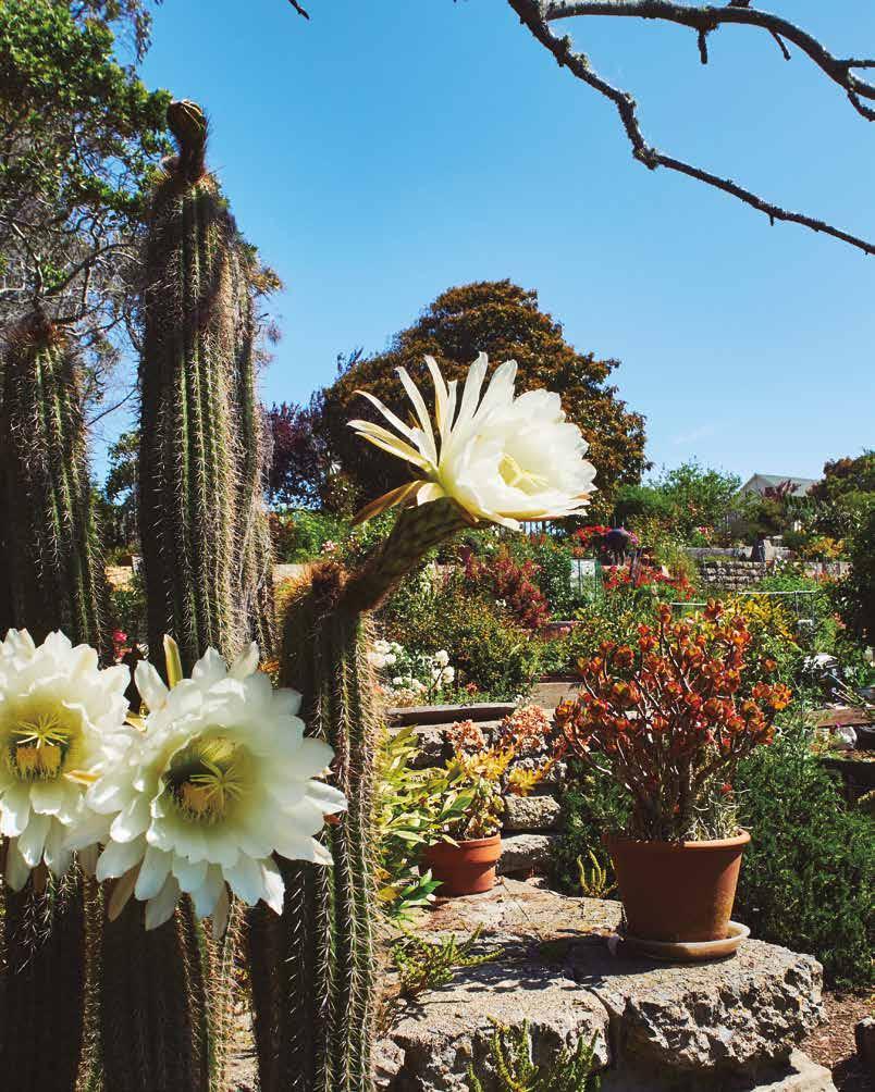
The work at Fort Mason and the GGNRA…taught me about the power of individuals and communities to orchestrate change to the physical environment.
In the late 1960s, the federal government determined that many of the nation’s military bases were no longer needed and that they should be sold off for development. The old military reservations in San Francisco and Marin Counties on the list included not only coastal open spaces important to adjacent communities but also irreplaceable historic cultural resources. Local activists were incensed that these places might be sold off so that private interests could profit by building housing developments or office parks. They and most of the rest of the public believed these lands should instead be converted to public parks or adapted for use by other public institutions.
Led by Amy Meyer and Dr. Edgar Wayburn of People for a Golden Gate National Recreation Area (PFGGNRA), local citizens mobilized and pulled off a monumental political coup. Capitalizing on the emerging environmental-protection movement of the early 1970s, they convinced the U.S. Congress to create the Golden Gate National Recreation Area (GGNRA) out of the former military lands in the two counties. As the first such federal preserve in an urban area, the GGNRA would create a new national park where people lived — not in a remote, largely inaccessible area. And, as imagined, this new 100,000-acre park would serve a broad spectrum of human needs while supporting the natural and cultural heritage of the place — a radical new and uncharted direction for the National Park Service. The former Fort Mason in San Francisco was to serve as its headquarters.
My first job after graduating from UC Berkeley’s Masters of Landscape Architecture program was with Royston, Hanamoto, Beck, and Abey, a landscape architecture firm awarded the National Park Service contract to plan the San Francisco components of the GGNRA. My first assignment there was the GGNRA, a project that consumed my considerable energies for the following five years. Eventually, as I took on more responsibilities, I became the project manager for the transition of Fort Mason from a military installation to the national park headquarters.
Fort Mason had been intensively developed by the U.S. Army, and its conversion to a public park required selective removal of old structures to create an open-space network that would complement the remaining historic buildings and planned new uses while revealing the extraordinary landscape setting. Initially built in the mid-1850s for coastal defense on a strategic promontory overlooking the entry to San Francisco Bay, Fort Mason had later served as the primary point of embarkation for U.S. servicemen leaving for the Pacific Theater during World War II. As a consequence of that use, it had become cluttered with densely packed administrative buildings, barracks, a hospital, warehouses, roads, and ancillary structures. Clearing out the old, derelict structures while retaining the historically important ones — the warehouse buildings, the hospital, residences, and unique site features — would allow creation of a grand-scale open space worthy of the one-of-a-kind vista it offered of the ocean gateway to San Francisco Bay.
Presidio of San Francisco 50 Moraga Ave San Francisco, CA
Right page: Gardens compatible with the historic building grace the entry and interior courtyards of the Presidio Officer’s Club. 2014. Hanh Nguyen.
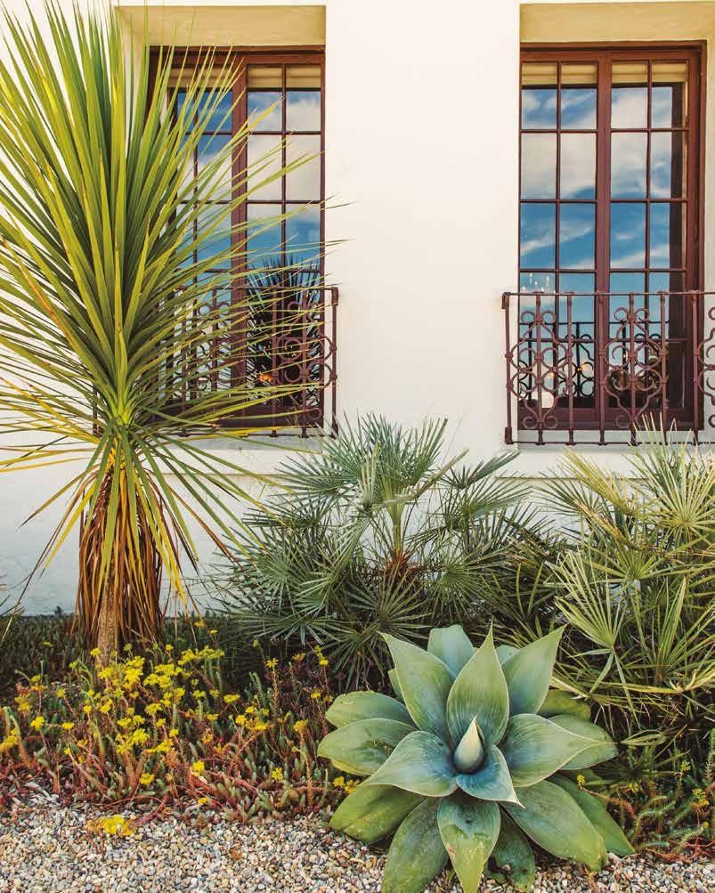
The building and courtyards were adapted to allow full accessibility – a unique challenge for an historic building constructed centuries before modern building codes. The historic integrity of the old building was intact, adapted for new uses, not simply a snapshot of a past moment in time.
The first European settlement in San Francisco was El Presidio, created in 1776 to overlook and defend the entry to the estuary that became known as San Francisco Bay. Located strategically on high ground, the first buildings at the Presidio (the Spanish word for a fortified military outpost) were made of adobe from the clay soils found just beneath the sand dunes there. The original adobe buildings were subsequently modified many times as the Presidio expanded. It was transferred from the Spanish to the Mexican to the American army, and the city of San Francisco grew around it. But a portion of that first building and its stone foundations still remain as integral parts of the structure that presently occupies the site. That building, in its prominent location at the top of a parade ground overlooking San Francisco Bay, still commands all that lies before it. Through the eighteenth and nineteenth centuries, adobe and wood additions gave it an impressive stature, and it became the Presidio Officers’ Club — the center of social life at the military base. In the mid-to-late twentieth century, however, to capture views from a new bar and ballroom on the upper floor new additions in a modern architectural style were tacked onto its rear in such a way that they loomed awkwardly over the handsome old structure.
When the Presidio was folded into the Golden Gate National Recreation Area at the end of the twentieth century, the U.S. Army moved out. With no more officers in residence, the Officers’ Club ceased to exist, and the Presidio Trust, which was overseeing the transformation of the base as a major component of a self-sustaining national park, needed to establish a new vision for the old building. We were hired as part of the larger Perkins + Will design team entrusted with restoring the historic building and its grounds while renovating it as a living museum, educational and cultural resource, and primary visitor destination in the park. A top priority for the renovation was to detach the awkward, nonhistoric additions from the old structure so its handsome profile could be enjoyed from all sides. The 1970s-era addition to the rear was separated from the historic building by the width of a roadway that had once run through the site. This space was then transformed into a linear garden courtyard that could be used for special events, and that would bring light and air to those sides of the old and modern structures that opened onto it. The new courtyard is today contained at its northern end by a stunning Andy Goldsworthy sculpture, commissioned specifically for it, which is mounted on a tall wall screening the service yard. On its southern end it opens to an educational courtyard/archeology lab for the Presidio’s archeology programs. Another awkward, nonhistoric addition at the north end of the building was also removed, allowing construction of a walled courtyard to serve as an outdoor extension of a new restaurant in the building’s historic Arguello Room. Linked to the new interior garden courts, the Arguello courtyard has now become one of the most sought-after outdoor patios in San Francisco. It offers exceptional food and drink in a sunny location, protected from the winds, with stunning views of San Francisco Bay across the
By participating in its creation, the residents would be more invested in the place and inclined to take responsibility for it once completed.
We were creating homes for real people and helping to build a community, not just a housing development.
Poco Way was a place where you lived only if you had no other options. It was a block and a half of constant gang activity, gunfire, drug dealing, prostitution, and street violence near downtown San Jose. Outsiders rarely visited, and then only if they were looking for trouble or dope. Its smelly, decrepit, rat-infested, and burnt-out two-story buildings were home to the poorest of the poor immigrants hoping for a better life in California. Vietnamese, Cambodian, and Central and South American families were the principal tenants, with as many as twenty people sometimes living in a single apartment next door to gang members and drug dealers. Easy direct access from Poco Way, a semi-secluded side street with fast getaway routes to either of two freeways, served the drug trade well as a place of business. At the time we became involved in a project there it had become a magnet for violence, being the site of more drive-by shootings than any other place in California.
These conditions all changed in the early 1990s when, in a coordinated, community-driven effort, local housing officials, educators, community groups, police, firefighters, elected officials, and recreation managers all committed themselves and their institutions to transform the place. They organized and collectively forced out the dangerous criminal activities while framing a vision of a future built around community protection, a rejuvenated physical environment, and pride of place.
Once committed to transforming the Poco Way neighborhood, with financing in hand, the city began to search for a design team that could envision how its badly deteriorated built environment could be reconceived. I was hired by the San Jose Housing Authority as part of a team led by Herman Stoller Coliver Architects that was ultimately charged with redesigning the place. The work would require reenvisioning buildings and outdoor spaces, as both were contributors to the inhumane living conditions. Yet we also understood that, while physical changes were essential, the real long-term success of the project would depend upon the ongoing support of a variety of government agencies and a commitment by the community to take control of its own destiny. But an improved built environment could provide a critical foundation for the families who would be living there while creating a proud symbol of hard-won changes underway.
One of our first acts of placemaking was to conduct a series of workshops with the people who lived at Poco Way to determine how they thought about the place and what they would like to see in their newly conceived homes. It was important to us as a design team, and to the San Jose Housing Authority as the owner of the facility, to create an entirely new place that reflected the values of the people who would be living there. By participating in its creation, the residents would become more invested in it and more inclined to take responsibility for it once completed. We saw our role as creating homes for real people and helping to build a community, not just producing another subsidized housing environment.
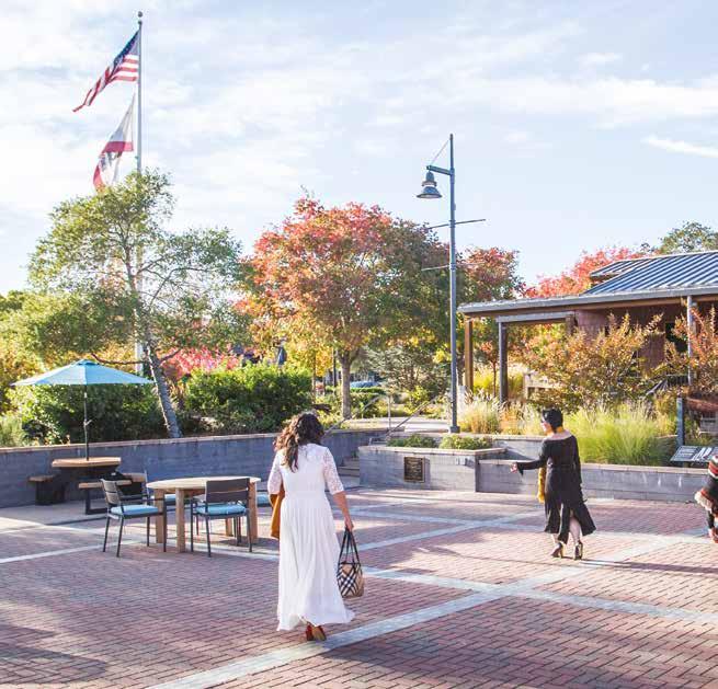
The Town Square formed by the Community Hall, the Post Office, and the new Community Center is the center of the small town’s public life. 2018. Jose Luis Aranda.
recognition for its environmental sustainability, ecologically based design, and steadfast reflection of local community values in changing times.
Over the long period of planning and design, the community changed dramatically. A community of working families who tended and picked the crops in nearby fields, repaired machinery, shopped in local markets, and made wine from grapes they had grown came
increasingly to reflect the values of more affluent, ex-urban society. Many new residents were interested in small-town rural life. But others were disconnected from the soil — more interested in drinking fine wines rather than making them, in dining in fine restaurants rather than attending community clam bakes. The conversations about the new town center changed with this new mix of residents.
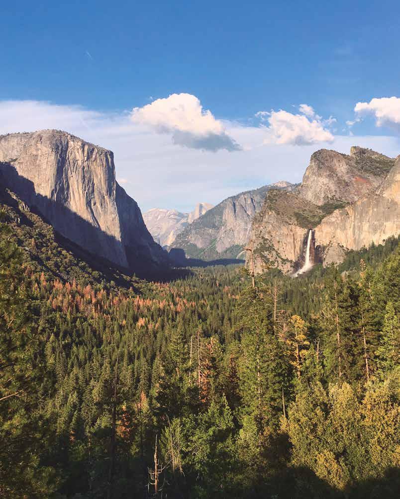
Yosemite Valley is a natural wonderland carved from the mountains by ancient glaciers and enclosed by sheer, 3,000-foot-high granite walls. Spectacular waterfalls cascade from the Sierra Nevada high country to fill a river that meanders over the valley floor through grand wet meadows, dense conifer forests, and ancient oak woodlands with abundant wildlife. The breathtaking beauty of the place is the result of eons of geologic activity locked in a dramatic, never-ending dance with water, in all its forms. Its result has been the sculpting of the fire-hardened rock into a series of iconic forms, including Half Dome, El Capitan, and Glacier Point, modern names ascribed within the last +/- 150 years. All mountain ranges are similarly formed, but few offer such picturesque and multilayered expressions of ecological forces. And the valley’s remarkable vistas are but the opening expression of what many people — from early First Nation visitors to generations of naturalists and outdoor enthusiasts — have described as the far more profound experience embedded in the sensual and spiritual qualities of place.
Yosemite Valley was preserved for public use in 1864, years before the National Park Service (NPS) was created. But after 1890, when Yosemite National Park formally entered the U.S. park system, Yosemite Valley quickly became one of the most popular
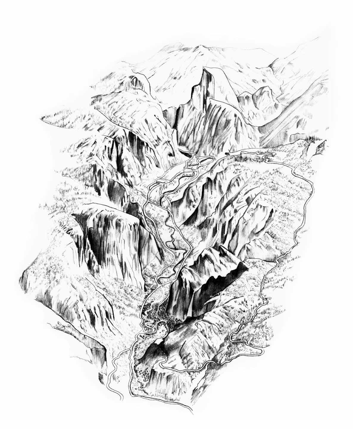
Right page: Sketch of Yosemite Valley. 2021. Daniela P. Corvillon.
tourist destinations in the world. Yet, from the beginning as a park, people have been encouraged to visit, and the need to accommodate millions of visitors each year has resulted in an extensive built environment to support overnight and day use, a variety of recreational activities, and park operations and maintenance. Protecting the gift of the park itself while balancing visitor needs is an ongoing and complex urban/wildland management challenge. Despite valiant efforts by NPS staff over the years, the problems of overcrowding, traffic jams, sprawling development, and overwhelmed infrastructure have for years been undermining the experience of this magical setting. Anyone who has sat through hours-long traffic jams at Yosemite Village and Yosemite Falls trying to leave the valley on a Sunday afternoon, or who has battled the crowds on the steep, narrow trails to the falls, or who has endured the noxious odors and long lines at the poorly ventilated, overused vault toilets has had to wonder what happened to the Eden-like qualities they expected to experience in the valley.
The devastating 1997 flood of the Merced River provided a dramatic wakeup call. Large portions of Yosemite Lodge, much of the roadway through the valley, and other developments within the floodplain were wiped out. Emergency repairs followed, but long-overdue infrastructure improvements to help manage the hordes of people and their vehicles coming to the valley year-round were also critical. Those improvements, however, could not be made until an acceptable Park Management Plan was adopted. Empowered by environmental legislation and an increased ecological consciousness in the culture, interested citizens, environmental organizations, people of the First Nations, and others had been pressuring the NPS to develop an ecologically and culturally responsive plan that would shift park priorities to more stringent environmental protections. Institutional change was slow and difficult, but it was gradually being realized.
Left page: Yosemite Valley from Tunnel View with Bridalveil Fall on the right, Half Dome in the center distance, and El Capitan on the left. 2015. JNRA.
The breathtaking natural beauty is a result of eons of geologic activity locked in a dramatic never-ending dance with water, in all its forms, sculpting the fire-hardened earth to create an ecological wonderland.

