Introduction
Autonomous vehicles (AVs) are beginning to appear on our roads. It is only a matter of time until the remaining technological challenges they face will be solved, and the transportation planning and urban form impacts they spark will become front and center. Today, the media coverage and public debate around AVs centers on short-term technological and safety issues. However, their long-term effects on our built environments and mobility systems remain largely underestimated.
1 A mono-functional infrastructure is one that prioritizes a single (or mono) use (or function) above all others. Highways are a textbook example of such an infrastructure.
2 Traffic Safety Facts, National Highway Traffic Safety Administration, 2018.
3 A t ransit desert describes an area with limited access to transportation options. These areas tend to occur largely in socioeconomically disadvantaged areas of cities.
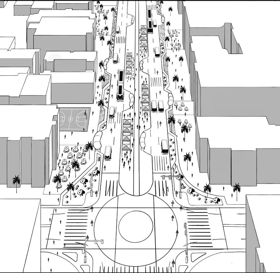
AVs have the potential to become major catalysts for future urban transformation of our cities in both negative and positive ways. This future could evolve into many extremes. If left unregulated, AVs have the potential to exacerbate the worst tendencies of automobile-enabled city-building. These well-documented tendencies—urban sprawl, traffic congestion, and the proliferation of mono-functional mobility infrastructures—have led to a shrunken public realm, the degradation of our built and natural environments, and transportation inequities in our cities. 1 However, if implemented correctly, AVs have the latent potential to unlock human-centric urban models that prioritize vibrant, livable, and sustainable design principles. In addition to saving lives (more than 40,000 U.S. roadway deaths happen each year) and reducing traffic fatalities (94% of serious crashes are due to human error), they have the potential to reduce environmental emissions, traffic congestion, and travel time.2 Furthermore, AVs could significantly reduce urban demand for street and lot parking, freeing up real-estate for densification and mixed land uses. The design of auto-oriented building, block, street, and highway typologies that proliferate in our cities could be transformed, while new AV-enabled urban forms could emerge. AVs will impact the ways we move around our cities, and the mobility modes, methods, and service models that we use to do so. They could improve transportation access for seniors, people with disabilities, and those who live in transit deserts. 3
This book illustrates a vision of this potential future city and outlines the foundational steps in guiding us to achieve it. Embedded in this vision is an explicit set of core values and principles. The book argues for a future city that is not dictated by technology but rather one where technology is strategically deployed as a tool to tackle the urban issues that cities universally face today. It argues that autonomous vehicles, like automobiles and locomotives before them, need to be considered not just as technological innovations but as important infrastructural change-agents that shape urban growth patterns. It argues that how we choose to move around a city has vast implications on how that city is designed and will evolve at local and regional scales. It argues for automation to complement and enhance, rather than replace or compete with, existing transit and transportation systems. It argues for AVs to fill mobility gaps and for our mobility to be consumed as a service, rather than through private ownership models. Using the city of Los Angeles as a testbed, this book speculates on how an existing transportation model can incorporate shared, multi-modal AVs as a blueprint for a transportation paradigm shift. In doing so, the book endeavors to push our cities away from a future in which the worst tendencies of automobile-dependency become exacerbated, and towards

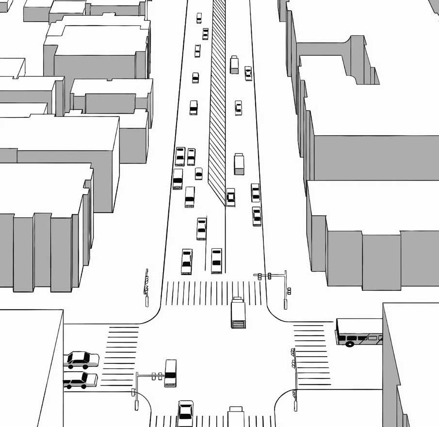
The Age of the Automobile: Negative Urban Externalities
2
A Historically-Informed Transportation Trajectory
Without understanding its context and history, any projective act of visioning risks the potential for utopic naivety or even worse, the chance that mistakes from the past are repeated. In order to design a transformative future enabled by mobility technologies, it is critical to understand the history that conditioned their inventions. As such, let’s take a look back at the last transportation revolution that widely transformed our urban environments, brought on by yet another technological impetus: the combustion-engine automobile. It could be argued that no invention affected society in the 20th century more than the automobile itself. While driverless technology has advanced quickly in our recent history, it pales in comparison to the technological and societal changes brought on by the automobile in the 20th century. In the early 1900s, horse-drawn carriages, trolleys, and locomotive travel were the primary means of transportation. The few automobiles that did exist then were steam-powered, since gasoline was still considered a waste product of the kerosene industry. Then, in 1916, Henry Ford revolutionized the mass produc-

tion of the automobile and the economies of scale that came with it. From that point on, the automobile industry exploded in growth. The automobile transformed from an almost non-existent product to one that was accessible, affordable, and ubiquitous to the majority of consumers. By the end of the 1920s, there were an estimated 23 million automobiles on the road, adopted by, developing with, and integrating into our society at a ferocious pace.
Since the history of the automobile is extensively well-documented in considerable literature elsewhere, let’s focus on the spatial impacts of its invention on our built environments so thatparallels may be drawn to driverless vehicles today. The automobile transformed not only the means and methods of moving from one point to the next but it also transformed the experience of, behaviors around, and cultural identities associated with this new form of mobility. Many

of these transformations benefited society greatly, expanding travel efficiencies and distances through comfort and convenience previously unheard of. The automobile gave people more personal freedom, access to jobs and services, and contributed greatly to the rise of leisure activities. Fueled in part by persuasive marketing, the automobile became inextricably linked with American cultural notions of freedom, flexibility, and self-determination while also aligning itself intimately to social class, privilege, and notions of home ownership. It promised and delivered to the post-war burgeoning middle class the ability to work, shop, and play almost anywhere at any time. The automobile also dramatically changed the economy of our society, sparking an industry that has become one of the largest in the world. It has contributed to the rise of the industries that fuel it, including gas and oil, and largely advanced the standardization of production assembly lines, manufacturing, and the construction of asphalted roads that it travels on. The automobile also inherently transformed the very fabric of our urban and suburban spaces, the infrastructure that facilitated its movement, and the urban form that evolved around it.
But what also came hand-in-hand with the economy and convenience of the personal automobile, were the root causes of the many cultural, physical, economic, and environmental issues we face in our cities today. The personal automobile directly imposed extensive negative externalities on the built environments it was introduced into. A negative externality is defined as the imposition of an indirect cost on a group or population as a derivative byproduct of actions of another group in a negative way. Driving and owning a personal automobile produces a wide expanse of unintended but devastating externalities that cities grapple with today on a daily basis.
Negative externalities from the age of the automobile:
Economic (time-spent in traffic congestion)

Environmental (vehicular emissions)

Cultural (auto-fueled suburban sprawl)

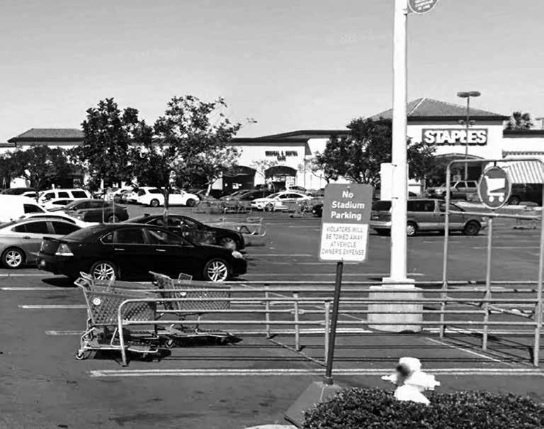
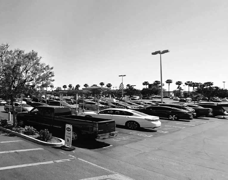
Spatial (street right-of-way and parking allocations)


Los Angeles as a Testbed City
Many of the discussions and concepts explored so far in this book have been done so in broad strokes. The impacts of driverless technologies will be distinctly felt in all cities at large and require these conceptual frameworks and transportation policies to guide their deployment. However, it is equally important to explore what happens when we land these ideas in the specificities of real lived cities—cities that, by their very nature, have their own cultural peculiarities, transportation histories, regulatory contexts, mobility services, and local inhabitants that use these existing systems and services. By testing these concepts in a real city, we are forced to grapple with the urban environments, built forms, transportation systems, and mobility infrastructures of that specific locale, contextualizing how driverless technologies will be deployed and absorbed. Confronting a real city also forces one to wrestle with the diverse populations who occupy it, and whose travel behaviors and urban experiences will be distinctly impacted by new technologies landing in their lives.
A Prototype City: Los Angeles
Situating itself in a real city, as the latter part of this book and as Book 2 (The Experience) does, also allows the design visioning that takes place in both to explore the spatial and formal impacts of new driverless technologies on real contexts and neighborhoods. Rather than hover in contextless “ideal space,” these design implications on the future urban environment of our cities could very well take place. In parallel, the typological nature of many of the spaces and systems explored also act as a blueprint for other cities grappling with the arrival of new mobility technologies on their own city streets.
1 Banham, Los Angeles: The Architecture of Four Ecologies, 1971.
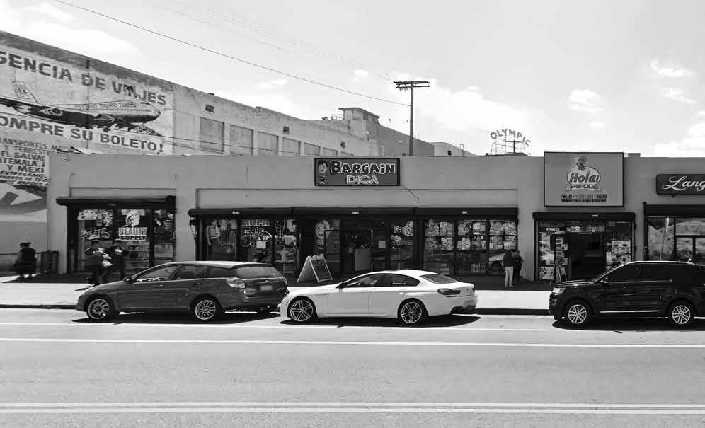
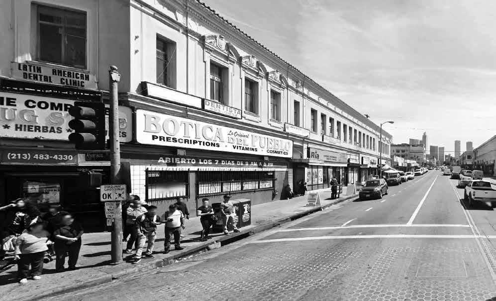
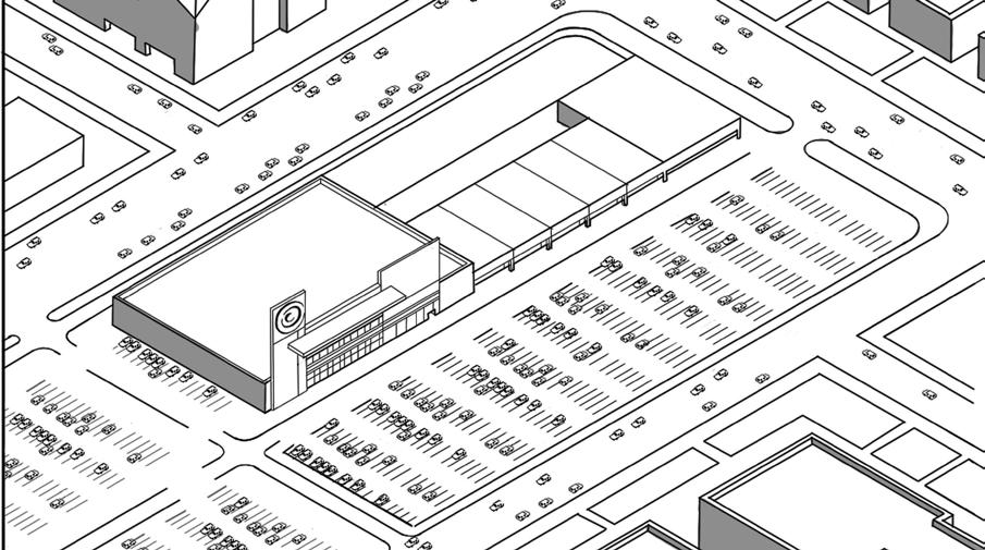
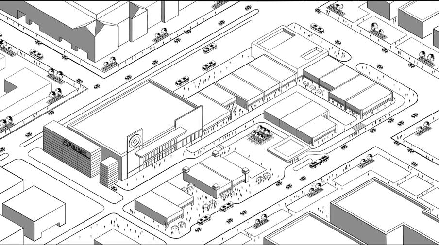
The city of Los Angeles is chosen as this prototype city for several important reasons. Firstly, the city has in its recent history, been known for its love affair with the automobile. This recent attachment to and subsequent reliance on the car, has been a fundamental shaper of the city’s built environment and urban structure. It has fueled Los Angeles’ urban expansion, functional segregation of land uses, redistribution of land values and real estate, and the demographic segregation of race and class groups. In recent eras, it has also given rise to a whole suite of building and infrastructure typologies: drive-through businesses and strip malls that have retreated from the street wall, residential forms calibrated to parking requirements, and expansive street widths and highway infrastructures dedicating generous space to the car. It is hard to think of another city in which the influence of the car has led to such a broad transformation of its built environment than in the city of Los Angeles. According to influential architecture critic Reyner Banham, “the less densely built-up urban structure of the Los Angeles basin has permitted more conspicuous adaptations to be made for motor transport than would be possible elsewhere without wrecking the city.”1 Additionally, the media and entertainment industry of the city has, in its recent history, further fueled the city’s association with the automobile over other mobility modes through Hollywood movies and advertisements that have proliferated and been embraced world-wide. Exploring a future mobility paradigm for the city—one that incorporates driverless technologies to expand its transit systems and multi-modal transportation—offers an opportunity to not


only question historical status quos but also shape the evolution of its culture and identity. The city also offers an important context that frames the design-visioning medium and world-building method that Book 2 undertakes. Deployed through the format of an architectural graphic novel, the book utilizes these novel representation tools with the understanding that language and media choices critically shape the acceptance and proliferation of new technologies in the urban imaginary.
Secondly, Los Angeles is emblematic of larger cultural shifts and mobility trends in cities today. It is a city that, in its modern rendition, is undergoing rapid urban change in its mobility systems and infrastructures. It is a city that is confronting how its own transportation history has shaped the evolution of its urban structure and fabric. It is a city that is investing heavily into expanding its transit system in recent years, in recognition of the fraught externalities that the automobile has levied. It is a city in which its own residents, frustrated by decades spent in worsening traffic, pollution, and freeway expansions have begun clamoring for alternative ways to move around. As a result of decades of urban expansion fueled by the automobile, it is a city like many others, that is grappling with inward densification rather than the outward sprawl that marked its previous eras. It is a city whose newer generation of inhabitants increasingly prefer more urban lifestyles in higher-density, mixed-use built environments—rather than the single-family, suburban lifestyles that characterized the second half of the 20th century American city. These larger cultural and demographic shifts demand cities to re-examine their frameworks for future growth and the transportation decisions that they are inextricably tied to.
Lastly, Los Angeles has a robust legacy of transit-oriented development in its DNA to build upon, a history that will be briefly unearthed in the next section of this chapter. This historical DNA provides a blueprint for the city to reflect and build on as it charts a path forward in light of new mobility technologies landing quickly
on its city streets. It is a city that has become a hot battleground in recent years for private-sector mobility technologies, including ride-hailing apps and on-demand micro-transit services like electric, dock-less, scooter- and bike-sharing companies. It is a city whose cultural appetite and public demand for alternative and new ways of moving around the city apart from the private automobile, is increasingly substantial.
Altogether, these various reasons and recent trends make Los Angeles ripe for examination as a prototype city that has the cultural context and public appetite to incorporate driverless vehicles into its transit systems and urban structure. Given all of this, if there were to be a model city able to pioneer such a transportation paradigm shift, and one that urgently needed such a paradigm shift, Los Angeles would be the ideal candidate. While certainly unique in its history and culture, the city is one in which its lessons can be extracted and applied to many cities grappling with similar transportation challenges and technological impetuses. In the end, if it can be done in city like Los Angeles—known historically for its love affair with the car—it can very possibly be done in other cities as well.
1992 Metro Rail map, 30-year projected buildout plan.

2024 Current Metro Rail and BRT service map.

2057 Projected Measure M Metro Rail and BRT buildout.

2090 Speculative (concept) future Metro Rail and BRT expansion.

However, significant challenges remain in the way of Los Angeles becoming a transit-oriented city once again. This is a transformation that will be and has been contentious, as changes to the city’s infrastructure and mobility cultures meets resistance by Motordom and those whose love of automobiles is intractable. This is a city that in the years since implementing Measures R and M, have had to contend with a continual battle over it’s street right-of-ways. It is a city where recent bus and rail expansions, many of them at surface-grade, have had to grapple with sharing street lanes with the automobile. For example, the recent expansion of the majority at-grade Metro Exposition Line (the E Line) that runs all the way westward from East L.A. to Santa Monica, does not receive signal priority when approaching certain major intersections. This means that when traffic lights are red, one will


13 T he Jeffersonian grid is a land surveying system based on an unrelenting grid-acre system that is laid out over a territory independent of topography or terrain, with its conceptual origins traced back to Thomas Jefferson’s Land Ordinance of 1785.
often see a multi-cabin subway carriage capable of carrying hundreds of passengers, waiting its turn to cross an intersection while single-occupancy vehicles zoom across. This is certainly an unusual sight for those from transit-rich cities accustomed to high-speed rail lines that receive hierarchical preference in the mobility pecking order. Other anecdotes include the fact that many of the high-occupancy vehicle or carpool lanes—meant to incentivize multi-occupancy vehicle use in the city’s freeway network by providing dedicated fast-speed, low-traffic lanes—are often congested during rush hours. The few bus rapid transit lines that are allowed to run on Angeleno freeways must often contend with this congestion, and one often witnesses both express and local buses stuck in automobile traffic. Dedicated bus-only priority lanes on local streets are far and few, not to mention the lack of a robust and continuous network of bike lanes, bikeways, and even pedestrian sidewalks in some cases around the city.
Other challenges pertain to the unique geographic structure and sprawl of the city’s metro region, as well as cultural and perceptual challenges to incentivizing modal shifts towards mass transit. When examining L.A. Metro’s current rail transit network, one can clearly see that it is mono-centric in configuration, focused around its historic downtown core with the majority of its lines sprawling outward from this center towards the outer reaches of the city’s peripheries. These mono-centric rail lines have been overlaid on the unrelenting Jeffersonian gridiron structure that underlies the city’s street network.13 This gridiron is primarily serviced by a network of local buses that crisscross the region in continuous linear routes. This means that often, transfers between lines are frequent when traversing from destination to destination. With the city’s Measure M planned rail line expansions, one can see that future rail lines have been designed to expand from a mono-centric orientation towards a more democratic grid that follows the underlying structure of its street network. However, as we discussed in the previous section of this chapter, Los Angeles is a distinctly poly-centric city, featuring upwards of 17 different urban centers around its metropolitan area. The evolution of these poly-nucleated centers do not lie neatly on the structural grid of the city—a grid which has historically in Los Angeles been unable to sustain concentrated urban densities at a measure commensurate with its more transit-oriented counterparts. Therefore, it is fair to question whether Measure M’s expansion of Metro’s light rail network into this existing gridiron paradigm will provide comprehensive transit service that works to support the poly-centric urban densities unique to the city of Los Angeles and its diverse employment centers. Are there alternative transportation paradigms that can negotiate the city’s poly-nucleated centers, gridiron structure, and existing mono-centric network while incorporating automation in transit? This alternative structural paradigm will be explored in the following chapter.
Furthermore, while Metro’s Measure M plans are highly focused in both messaging and budgeting on expanding the city’s rail and subway system, the city’s bus network remains in reality the current backbone of Angeleno transit in both use and reach. According to the latest statistics, of the subset of Angelenos that use the city’s public transit system, only 12% use the city’s light rail system while
Rail/Subway Fixed-Route
Bus Rapid Transit (BRT) Automated, Fixed-Route
Local Bus Automated + Existing, Fixed-Route
District Local Shuttle Automated, Fixed-Route
On-Demand Mini-Shuttle Automated, Flex-Route
Zone A: Existing District Core
Zone B: Expanded First/Last Mile
Zone C: Transport Zone Boundary