Impact of Water Resources on Objects and Lines of the Railway in Mountain and Foothill Places of Uzbekistan
Oripov Sokhibjon Gayratjon ugli
3rd year student of Tashkent State Transport University
Abdazimov Shavkat Khakimovich
Ph.D. tech. Sciences Tashkent State Transport University
Shamsiddin Xujakulovich Djabborov
Head of the Military Training Center of the National University of Uzbekistan
Named after Mirzo Ulugbek
Voxidjon Erkinovich Shaxobidinov
Senior lecturer at the Military Training Center of the National University of Uzbekistan
Named after Mirzo Ulugbek
Abstract: The article deals with the issue of the influence of water resources on the railway line, the influence of water resources on the climate of the area, and the influence of the spring season, which leads to salt mudflows. These mudflow phenomena lead to landslides in mountainous places. Such cases lead to a train delay, and a train delay is not economically profitable for JSC Uzbek Railways.
Keywords: damage, monitoring, accident, bridge theory, object, initial situation, event, incident, probability, emergency, danger, threat, preventive, measure.
According to the results of long term observations of flood activity on the territory of Uzbekistan and their spatial and temporal variability (UzGMITI, Uzhydromet), it can be concluded that the total number of active floods in the country is 709, their basin (territory) covers an area of 53,770 square kilometers (12% of total area) and 858 household and other important facilities are located in areas prone to flooding [1].
The frequency of floods in the country is uneven, the frequency of floods in mountainous and foothill areas is very high and they are much more likely to pose a threat to various objects in these areas, including critical objects of railway infrastructure.
It is known, that over the years of independence, the development of railway transport has been given great attention and a large amount of investment has been attracted, a number of projects have been implemented. As a result, the total length of the country's railways reached 6,500 kilometers, and they were able to cover all regions of the country [2].
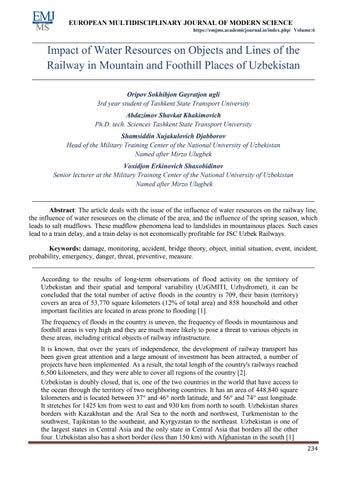
Uzbekistan is doubly closed, that is, one of the two countries in the world that have access to the ocean through the territory of two neighboring countries. It has an area of 448,840 square kilometers and is located between 37° and 46° north latitude, and 56° and 74° east longitude. It stretches for 1425 km from west to east and 930 km from north to south. Uzbekistan shares borders with Kazakhstan and the Aral Sea to the north and northwest, Turkmenistan to the southwest, Tajikistan to the southeast, and Kyrgyzstan to the northeast. Uzbekistan is one of the largest states in Central Asia and the only state in Central Asia that borders all the other four. Uzbekistan also has a short border (less than 150 km) with Afghanistan in the south [1]
Pic 1. The map of Uzbekistan
Uzbekistan is the most populous country in Central Asia. Its population is about 35 million people (2021), which is almost half of the total population of Central Asia. Of the total population, 51% live in urban areas and 49% in rural areas. The population of Uzbekistan is very young: 34.1% are people under the age of 14. According to official sources, Uzbeks make up the majority (80%) of the total population. Other ethnic groups include Russians 5.5%, Tajiks 5.0%, Kazakhs 3%, Karakalpaks 2.5%, Tatars 1.5%, about 1% ethnic Koreans, and about 1.5% other nationalities [1].
The Republic of Uzbekistan is administratively subdivided into the Republic of Karakalpakstan, 12 regions, 159 districts (rural areas), 119 large and medium cities, 114 urban type settlements and 1472 villages. The major cities are Andijan, Bukhara, Samarkand, Namangan and Tashkent.

Most of the territory of Uzbekistan has a continental, dry (arid) climate, with a small amount of annual precipitation (200 300 mm). The average high temperature in summer is usually around 40°C, while the average winter temperature is around 23°C. Less than 10% of the territory is suitable for cultivation in river valleys and oases. The rest of the territory is a vast desert (Kyzylkum) and mountains.
The available water resources of Uzbekistan consist of renewable surface and ground waters, as well as return waters from anthropogenic use (waste and drainage waters). Water resources are mainly formed in transboundary river basins [2].
A feature of Central Asia is the division of its territory into three main zones of surface runoff: (a) the zone of runoff formation (upper catchment in mountainous areas), (b) the zone of transit flow and its dispersion, and (c) the zone of deltas. In the runoff formation zone, the level of anthropogenic change is insignificant, but due to the construction of large dams and reservoirs on the border of this zone, the runoff regime in the lower reaches changes significantly. In the zone of transit and dispersion of runoff, the flow and the entire hydrological cycle change because of the interaction between the rivers and the territory. This interaction is characterized by the withdrawal of water from rivers to irrigated areas and the loading of the return flow into the river with salt and agricultural chemicals.
There are 17,777 natural watercourses on the territory of Uzbekistan, of which 9,930 are in the Amudarya basin and 4,926 are in the Syrdarya basin. More than 500 lakes are located in mountain river valleys, and the largest is the Aidar Arnasay lake system. Glaciers are located in the upper reaches of individual rivers, mainly in the basin of the river Pskem, with an average area of one glacier 0.29 km2 .
The water resources of Uzbekistan are formed mainly due to 60% melt water, both in the Syrdarya river basin and in the Amudarya river basin. Additional feeding of water resources due to rain and glacial in the river basins differs in the basin of the Syrdarya river, glacial nutrition is 15% and rain 25%; in the Amudarya river basin, glacial is 25% and rain is 15%.
The main factors influencing the change in river flow are increased variability of precipitation; rise in air temperature; degradation of glaciation, reduction of snow reserves; increase in evaporation in river basins.
The Amu Darya is the largest river in Central Asia. Its length from the sources of the Pyanj to the Aral Sea is 2,540 km, and the catchment area is 309,000 km2. It is called the Amu Darya from the point where the Panj joins the Vakhsh. Three large right tributaries (Kafirnigan, Surkhandarya and Sherabad) and one left tributary (Kunduz) flow into the Amu Darya River in the middle reaches. Further to the Aral Sea, it has no tributaries. The maximum discharge is observed in summer, and the minimum in January February [1].
Such a presence of flow throughout the year is very favorable for the use of river water for irrigation. When crossing the plain, from Kerka to Nukus, the Amu Darya loses most of its flow due to evaporation, infiltration and irrigation. The Amu Darya contains sediment more than all the rivers in Central Asia, and its composition is one of the highest in the world. The main flow of the Amu Darya originates in the territory of Tajikistan. Then the river flows along the border of Afghanistan with Uzbekistan, crosses Turkmenistan and again returns to Uzbekistan and flows into the Aral Sea.
In terms of water availability, the Syr Darya is the second most important river in Central Asia, but it is longer in length. From the sources of the Naryn, its length is 3019 km, with a catchment area of 219,000 km2. Its origins lie deep in the Central Tien Shan. The river is called the Syrdarya after the point where the Naryn joins the Kara Darya. The river is fed by ice and snow, with the latter predominating. The water regime is characterized by spring summer high water, which begins in April. The largest reset is in June. The main part of the Syrdarya river flow is formed in the Kyrgyz Republic. The Syr Darya flows through Uzbekistan and Tajikistan and empties into the Aral Sea in Kazakhstan. [1].
Table 1. Natural runoff of the Amudarya basin
River basin River flow formatted within the country Total for the basin river Amudarya
Republic of Kyrgyzstan Tajikistan Uzbekistan Turkmenistan Afghanistan and Iran
Panj 31.089 3.200 34.289 Vakhsh 1.604 18.400 20.004 Kafirnigan 5.452 5.452 Surkhandarya 0.320 3.004 3.324 Kashkadarya 1.232 1.232
Zerafshan - 4.637 0.500 - - 5.137
Murghab 0.868 0.868 1.736 Tejen 0.560 0.561 1.121 Atrek 0.121 0.121 0.242
Rivers of Afghanistan 6.743 6.743
Total for the Aral Sea basin
(km3) 1.604 59.898 4.736 1.549 11.593 79.280 (%) 2.0 75.6 6.0 1.9 14.6 100
An estimate of the average long term runoff for each basin was made on the basis of the arithmetic mean of the series corresponding to 4 or 5 complete cycles of water content fluctuations. This allows us to consider all the characteristic years low water and high water years. Based on this, we took data for the Syr Darya for the period from 1951 till 1999 and the Amu Darya 1934 2011. The assessment of the runoff rate is presented in Tables 1 and 2. Thus, the long term average for the Syrdarya is 37203 million m3/year and 79280 million m 3/year for the Amudarya, and the total river flow was 116483 million m3/year.

https://emjms.academicjournal.io/index.php/
Table 2. Natural runoff of the Syrdarya basin
River basin River flow formatted within the country Total for the basin Syrdarya river
Republic of Kyrgyzstan Kazakhstan Tajikistan Uzbekistan
Naryn 14.544 14.544 Karadarya 3.921 3.921 Rivers between Naryn and Karadarya 1.760 0.312 2.072
Right bank of the Ferghana Valley 0.780 0.408 1.188
Left bank of the Ferghana Valley 3.500 0.855 0.190 4.545
Middle course rivers 0.150 0.145 0.295 Chirchik 3.100 0.749 4.100 7.949
Akhangaran 0.659 0.659 Keles 0.247 0.247 Arys and Bugun 1.183 1.183
Downstream rivers 0.600 0.600
Total for the basin (km3) 27.605 2.426 1.005 6.167 37.203
Syrdarya river (%) 74.2 6.5 2.7 16.6 100
Annual water resources, in accordance with fluctuations in water content, vary from dry years (95% probability) to high water years (5% probability) within the following limits: for the Amudarya 58.6 109.9 km3 and the Syrdarya 23.6 51.1 km3 [ 2].
According to the data of SIC ICWC, the distribution of runoff by formation zones in the states was carried out using GIS technologies. The presented data show (Table 3) that 25.1% is formed in the Kyrgyz Republic, 52% in Tajikistan, 9.6% in Uzbekistan, 2.1% in Kazakhstan, 1.2% in Turkmenistan, Afghanistan and Iran10% of total surface resources.
Table 3. Total natural flow of the river by sources in the Aral Sea basin (long term runoff, km3/year)
River basin
The country
Aral Sea Basin Syrdarya Amudarya km3 % Kazakhstan 2.426 2.426 2.1 Republic of Kyrgyzstan 27.605 1.604 29.209 25.1 Tajikistan 1.005 59.578 60.583 52.0 Turkmenistan 1.549 1.549 1.2 Uzbekistan 6.167 5.056 11.223 9.6 Afghanistan and Iran 11.593 11.593 10.0
Total for the Aral Sea Basin 37.203 79.280 116.483 100
(Source SIC ICWC)
In general, 357 deposits have been explored on the territory of Uzbekistan and 267 deposits have been approved for the use of water. The total regional groundwater reserves in
Uzbekistan are estimated at 24 km3. Most groundwater deposits have a fairly strong hydraulic relationship with surface runoff. This is manifested through a decrease in surface runoff with excessive withdrawal of groundwater. With this in mind, and also on the basis of the capacity of equipped wells for each field, the state commissions approved the reserves allowed for extraction. The total amount of approved reserves is 7.8 km3 per year.
Return waters are an additional source of resources, but due to the relatively high salinity, they are also a source of environmental pollution. Today, about 93% of this water is sewage and the rest is agricultural and industrial wastewater. It is known, that along with the development of irrigation, the volume of return waters increases; the most intensive growth was in 1960 1990. But, due to the decrease in water intake since 2000, the formed volume of return water began to decrease, and some of its suitable part is used again in agriculture for irrigation. The conditions for the use and management of renewable water is a priority issue, which has recently been within the scope of activities of national water management organizations [4].
the area of responsibility of Uzhydromet there are hydrometric stations with long term observations of the formation of water resources. Uzhydromet is a specially authorized state body for solving problems in the field of hydrometeorology in the republic.
1
2. Terry Berro B., Rodriguez Salva A.A. Primary healthcare strategy in disaster situation // Gas. Sanit. 2005. Vol.
П.А., Разиков Р.С. Чрезвычайные ситуации и гражданская защита на железнодорожномтранспорте. Т. 2018 г.
http://www ais ru. журнал «Чрезвычайныеситуации.
5. www. vaziyat.uz газета « Вазият»
6. Shahobiddinov, V. E., Khodjayev, O. S., & Oripov, S. G. (2021). TEMIR YO ‘L TRANSPORTIDA SODIR BO ‘LGAN TABIIY VA TEXNOGEN TUSDAGI FAVQULODDA VAZIYATLAR OQIBATLARINI BARTARAF ETISHDA AVARIYA QUTQARUV ISHLARINI TAKOMILLASHTIRISH. Oriental renaissance: Innovative, educational, natural and social sciences, 1(9), 987 994.
7. Abdazimov, S., Amanlikova, N. R., & Adylhodzhaev, I. (2020). KEY ACTIONS TO IMPROVE SUSTAINABILITY OBJECTS OF RAILWAY TRANSPORT. Theoretical & Applied Science, (2), 728 732.
8. Abdazimov, S., Mekhmonboev, U., Yakhshiqulova, M., & Soliyev, T. (2021). ON PROVISION OF TRANSPORT COMMUNICATION IN MOUNTAIN AND SUBURBAN AREAS OF THE REPUBLIC OF UZBEKISTAN. Теория и практика современной науки, (6), 3 5.
9. Abdazimov, S., Mekhmonboev, U., Yakhshiqulova, M., & Soliyev, T. (2021). CONSEQUENCES OF AN EMERGENCY TECHNOGENIC CHARACTER ON RAILWAY TRANSPORT. Мироваянаука, (6), 3 6.
10. Abdazimov, S., & Roziqov, R. S. (2020). NATURAL DISASTERS AFFECTING THE CONSTRUCTION OF TEXTILE ENTERPRISES IN RAILWAY TRANSPORT, METHODS OF PROTECTION FROM THEM. Экономика и социум, (11), 3 11.
https://emjms.academicjournal.io/index.php/
11. Muratova, D. A., & Abdazimov, S. X. (2019). TECHNOLOGICALOGEN STRUCTURAL ELEMENTS AND FUNCTIONAL CONNECTIONS THAT DETERMINE THE TRANSFORMATION OF HUMAN CONSCIOUSNESS IN CIVILIZATION Экономика и социум, (11), 78 82.
12. ABDAZIMOV, S. X. Protection of Transport Facilities Under the Effects of Natural Emergencies. International Journal of Innovations in Engineering Research and Technology, 7(10), 39 43.