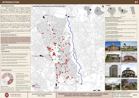
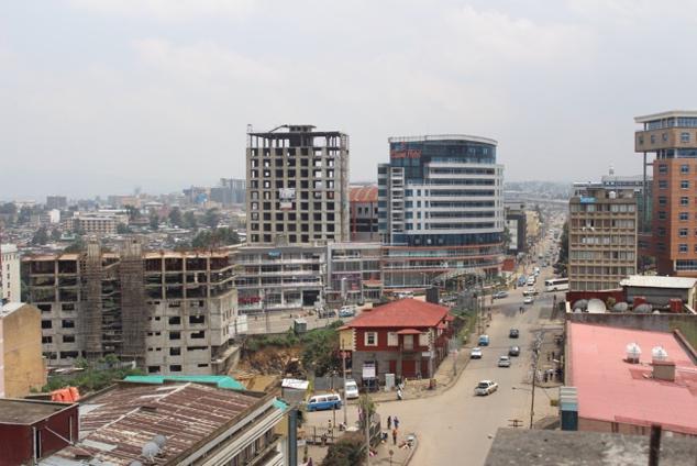
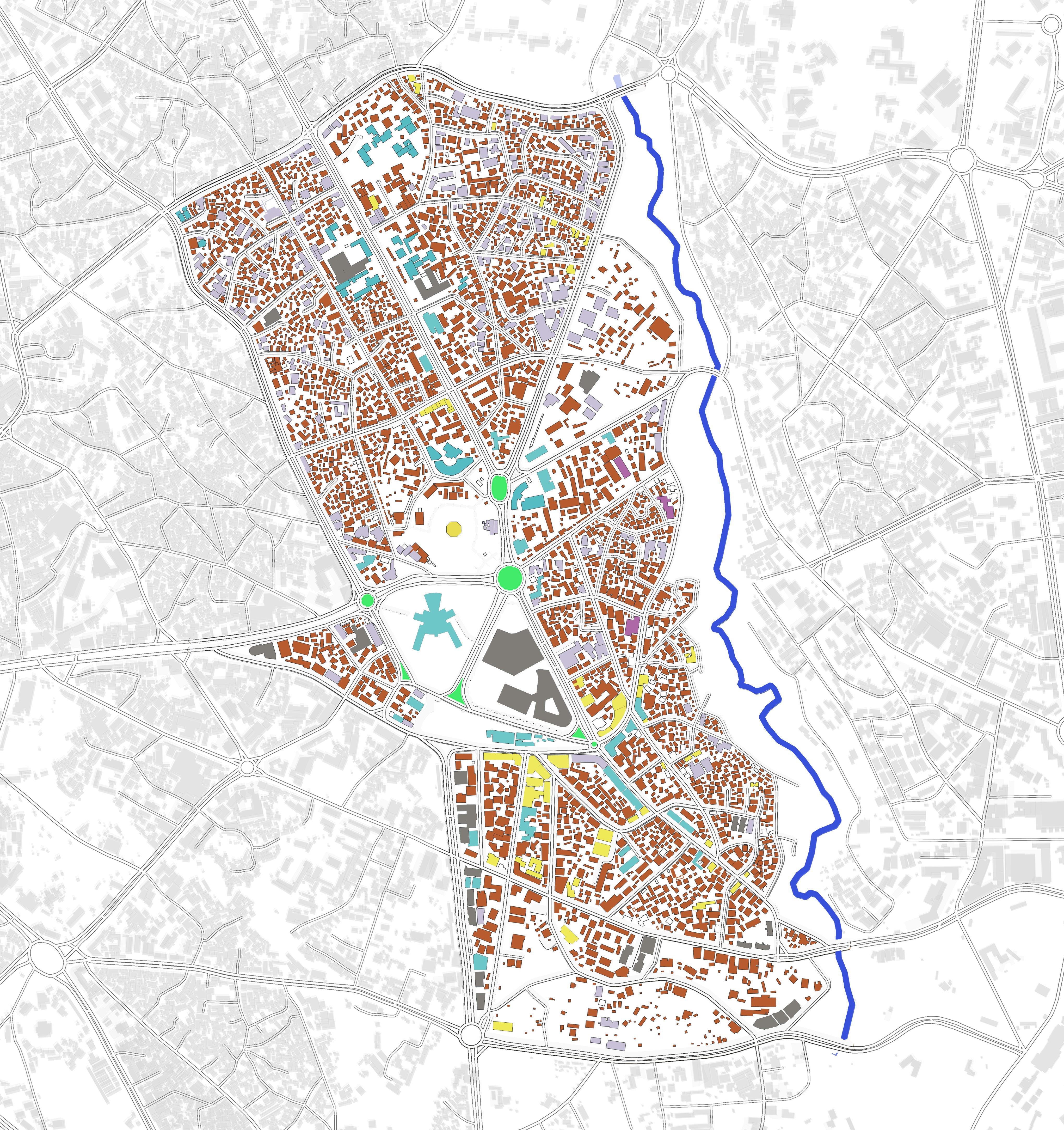
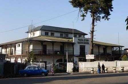
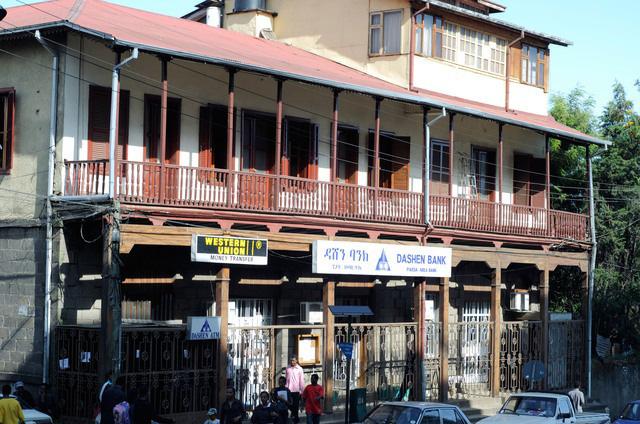
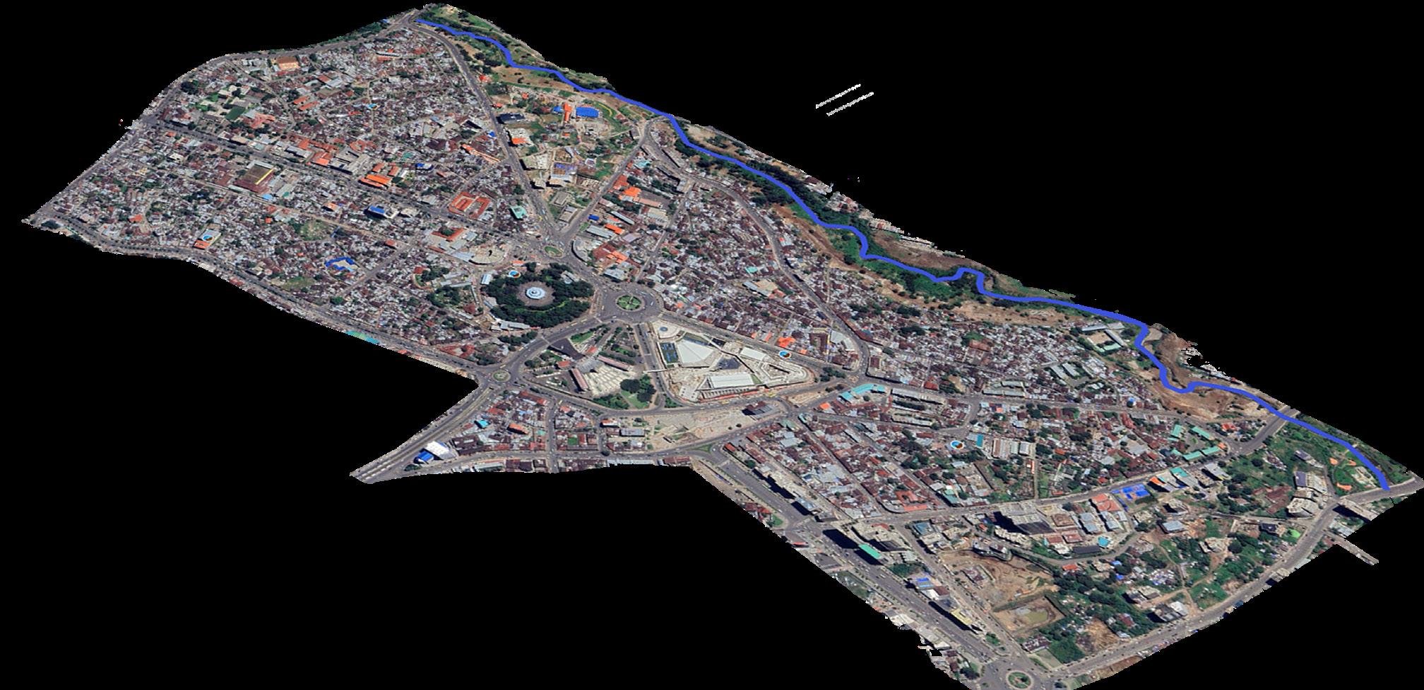
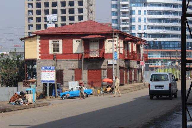
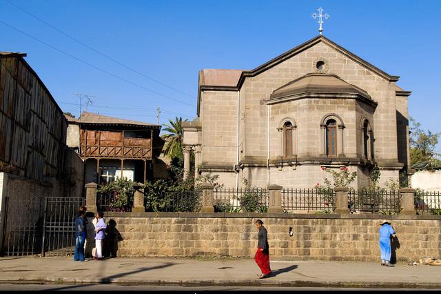
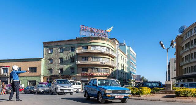
Piazza, also known as Arada is one of the oldest and most historically significant districts in Addis Ababa the capital city of Ethiopia. Located at the city’s geographic and symbolic core, Piazza lies roughly north of Churchill Avenue and extends toward Menelik II Square St. George’s Cathedral, and Taitu Hotel landmarks that trace the birth and evolution of the modern city.
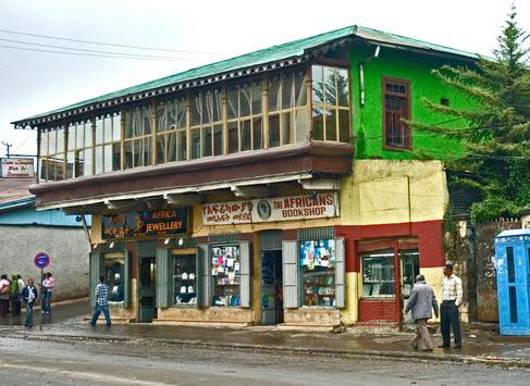
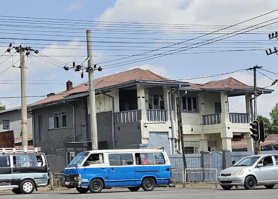
Established during the late 19th and early 20th centuries under the reign of Emperor Menelik II Piazza developed as the commercial and administrative heart of Addis Ababa. Its urban fabric reflects a fusion of Ethiopian, Italian colonial and later modernist influences, visible in the narrow streets, mixed-use buildings, and human scale public spaces. The area was historically home to banks cafés, artisan workshops, and social gathering spots that shaped Addis Ababa’s civic identity.
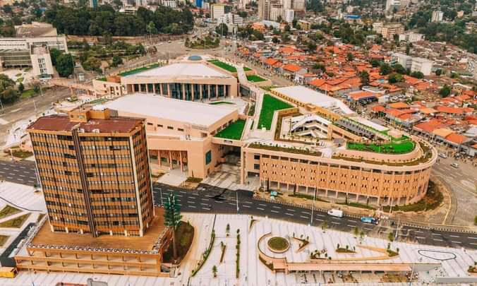
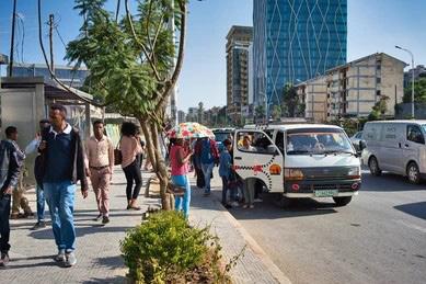
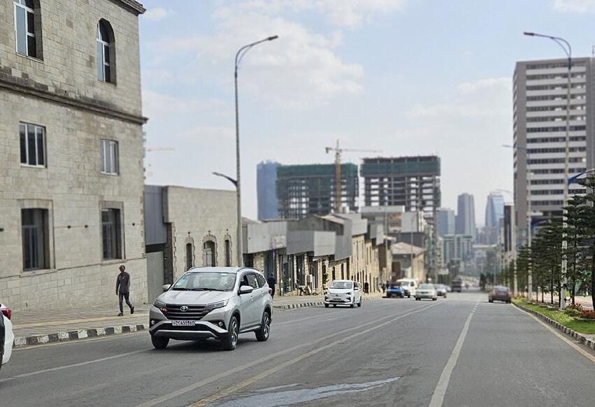
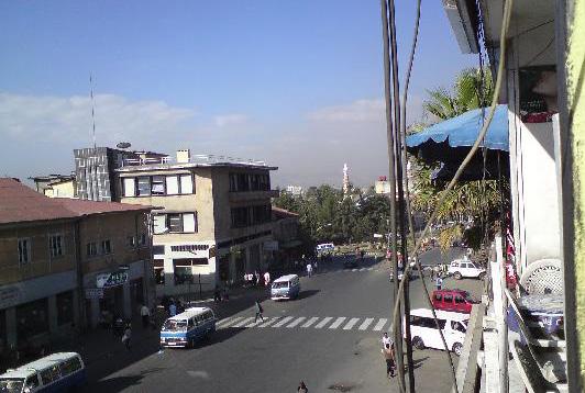
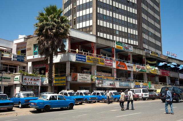
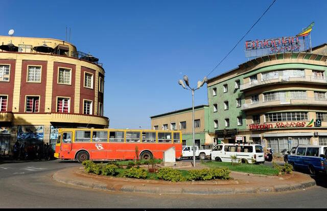
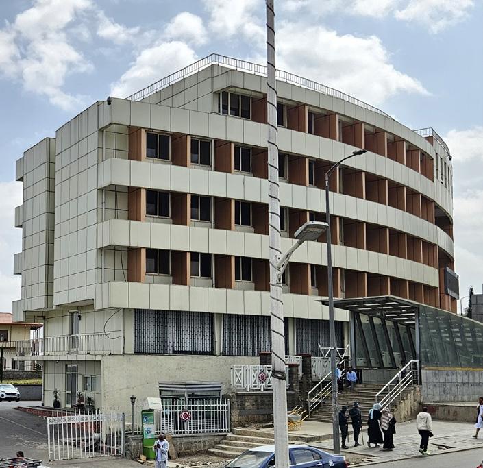
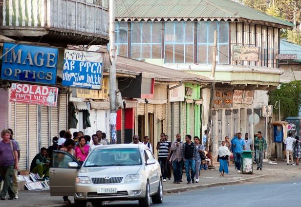
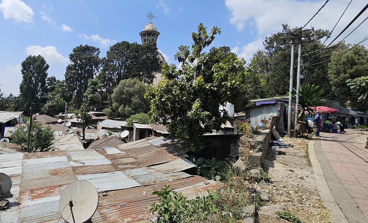
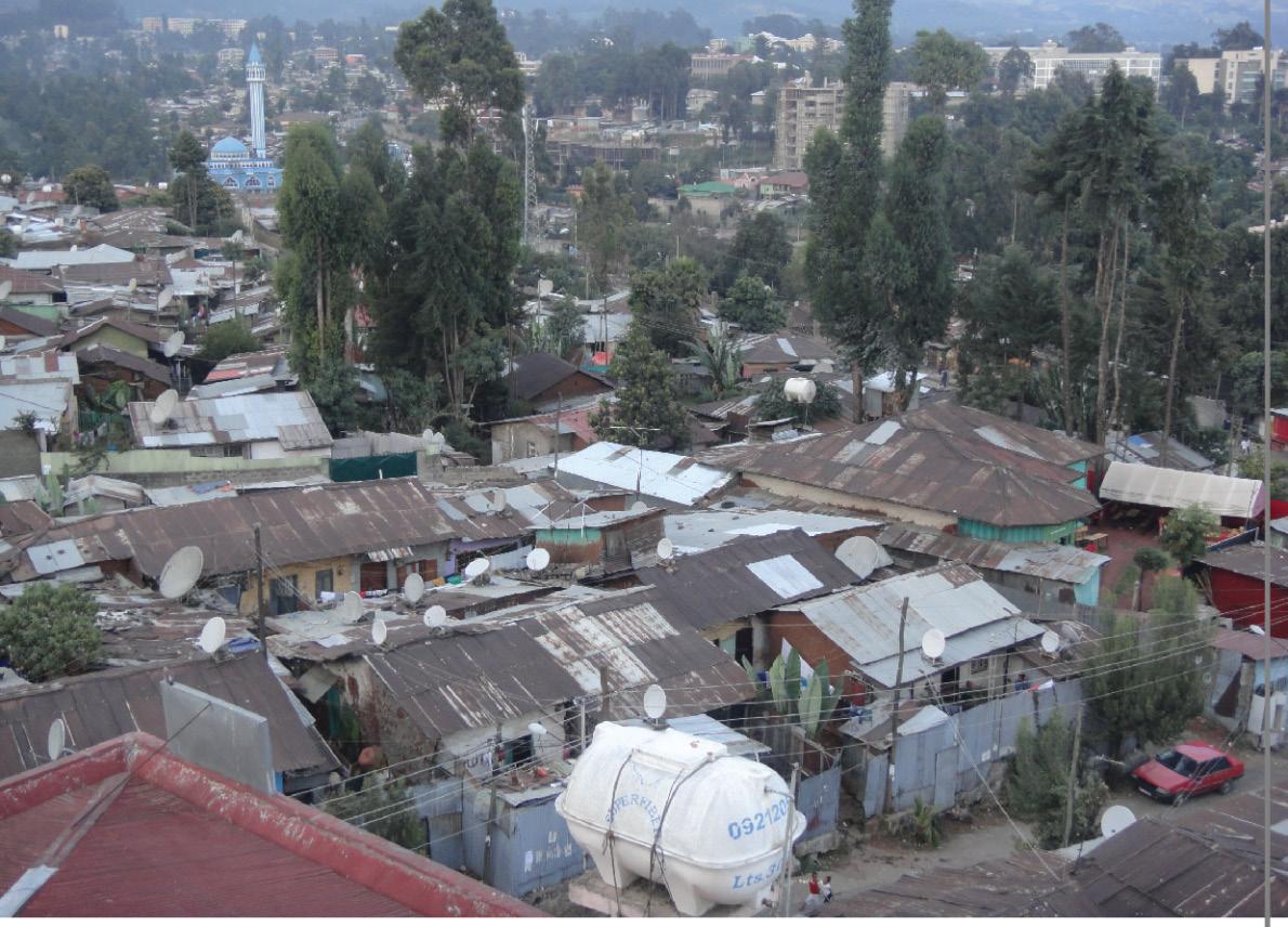
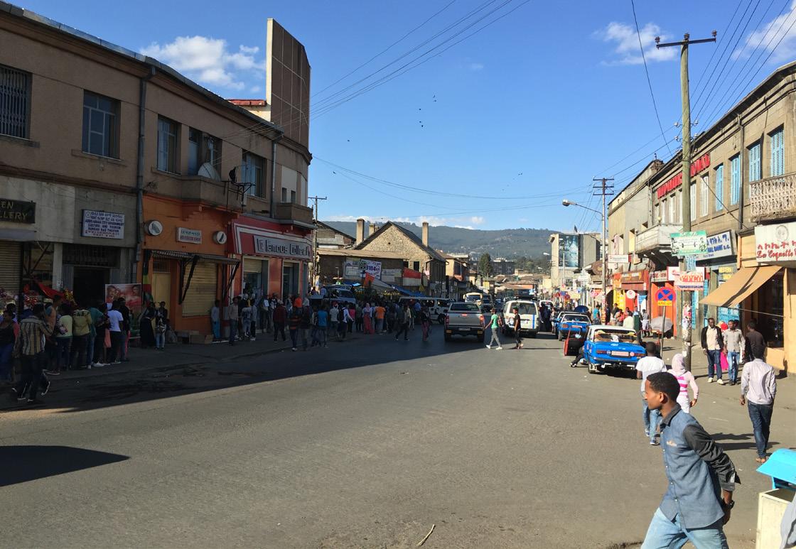
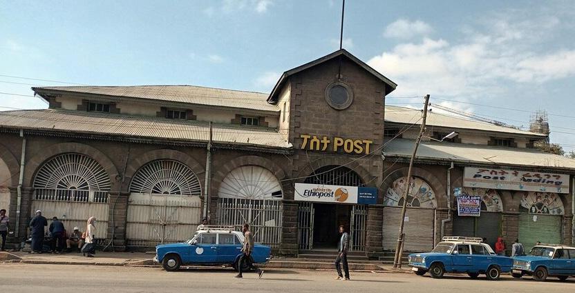
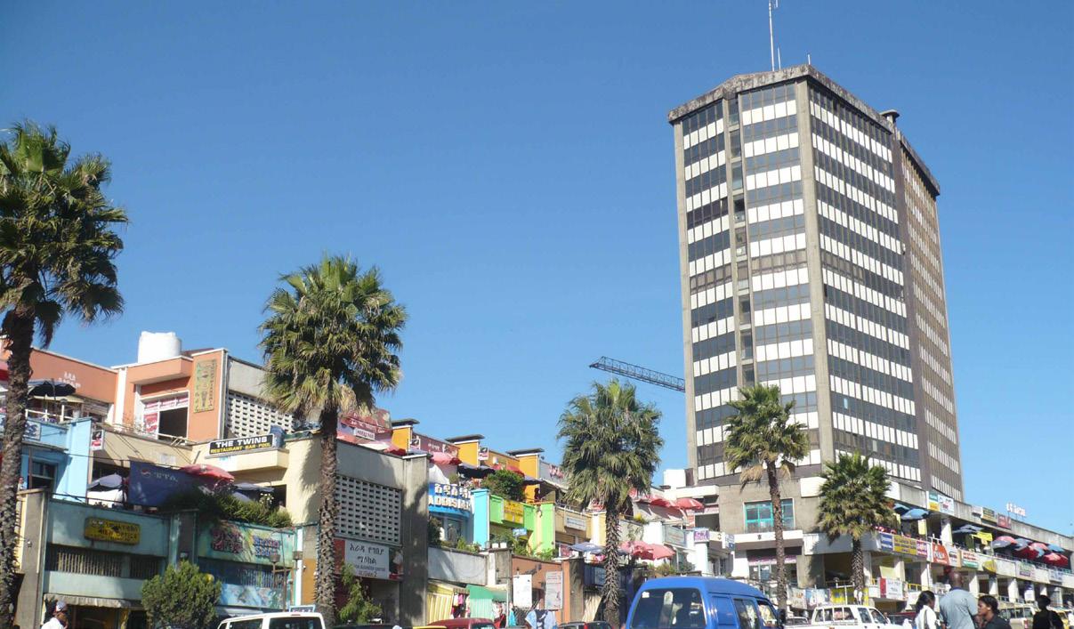
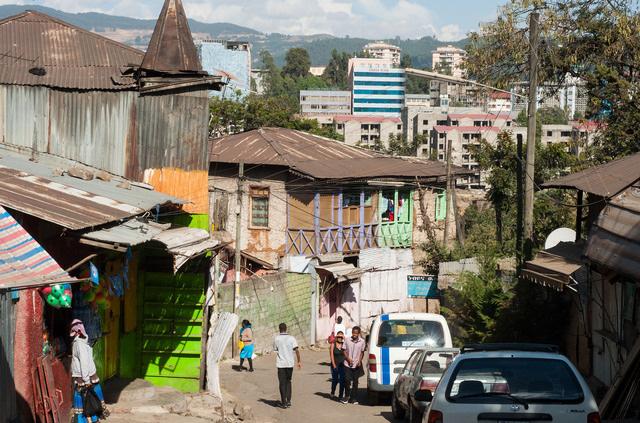
Today, Piazza remains a dense and vibrant urban quarter, characterized by high pedestrian activity, traditional markets, and historic architecture alongside new developments. However, it faces growing challenges from traffic congestion informal expansion loss of heritage buildings, and pressure from x projects.
Its central location and layered history make Piazza a vital area for studying urban transformation, heritage conservation, and community identity within the broader regeneration of Addis Ababa
General Objective and Background
The Piazza district in Addis Ababa represents a unique urban characterwhere Ethiopian, Italian, and French architectural influences converge to create a distinctive cultural landscape. As rapid urbanization threatens this irreplaceable heritage, this research proposes a conservation-driven approach that respects historic fabric while accommodating contemporary needs.
Research Goal
To develop an integrated urban conservation strategy that preserves the spatial, Architectural, and Cultural Identity of Piazza While Accommodatinag future urban demands.
- To define the key spatial, architectural, and socio-cultural characteristics that establish Piazza’s identity as a historic and symbolic urban core for present and future generations.
- To identify and prioritize heritage assets and vulnerable areas requiring protection, enhancement, or adaptive reuse to ensure continuous vitality and relevance.
- To establish principles and criteria for integrating future urban growth with heritage conservation in a balanced and sustainable manner.
- To develop an urban design and planning framework that enhances cultural continuity, livability, and contemporary functionality within Piazza.
- To propose community-based strategies and governance approaches that ensure long-term stewardship and coordinated conservation of Piazza’s evolving urban environment.
Historical and Archival Analysis
Historical and Archival Analysis
Historical and Archival Analysis
Examination of historical maps, photographs, and planning documents from historical periods,
Examination of historical maps, photographs, and planning documents from historical periods
Examination of historical maps, photographs, and planning documents from historical periods,
Historical and Archival Analysis
Examination of historical maps, photographs, and planning documents from historical periods
Urban Morphological Analysis
Urban Morphological Analysis
Methodology and Research Approach
Urban Morphological Analysis
Historical and Archival Analysis
Mapping street patterns, typologies, and spatial relations to define Piazza’s distinctive urban character
Comparative Case Studies
Historical and Archival Analysis
Mapping street patterns, typologies, and spatial relations to define Piazza’s distinctive urban character
Examination of historical maps, photographs, and planning documents from historical periods,
Mapping street patterns, typologies, and spatial relations to define Piazza’s distinctive urban character
Examination of historical maps, photographs, and planning documents to trace the spatial and architectural evolution of Piazza through different periods.
Field Survey and Documentation
Urban Morphological Analysis
Field Survey and Documentation
Field Survey and Documentation
Mapping and interpretation of street patterns, building typologies, and urban form using existing data and secondary spatial sources.
Survey and Data Collection
On-site analysis of buildings, materials, public spaces, and cultural landmarks through detailed spatial documentation
Urban Morphological Analysis
On-site analysis of buildings, materials, public spaces, and cultural landmarks through detailed spatial documentation
On-site analysis of buildings, materials, public spaces, and cultural landmarks through detailed spatial documentation
Gathering information from academic studies, planning reports, and perspectives to understand social, economic, and cultural dimensions of Piazza.
Policy Review
Policy Review
Mapping street patterns, typologies, and spatial relations to define Piazza’s distinctive urban character
Policy Review
Cultural and Heritage Mapping
Critical review of existing planning regulations and heritage policies,
Field Survey and Documentation
Identification of tangible and intangible heritage elements, symbolic landmarks, and cultural narratives that define Piazza’s identity.
Critical review of existing planning regulations and heritage policies,
Critical review of existing planning regulations and heritage policies,
Comparative Case Studies
Comparative Case Studies
Comparative Case Studies
Design Synthesis and Strategic Framework
Integration of analytical findings into a heritage-based urban design strategy promoting conservation and adaptive urban growth.
Analysis of heritage-integrated urban strategies in comparable contexts.
On-site analysis of buildings, materials, public spaces, and cultural landmarks through detailed spatial documentation
Analysis of heritage-integrated urban strategies in comparable contexts.
Analysis of heritage-integrated urban strategies in comparable contexts.
Policy Review planning
Name: Gebrehiwot, Abenezer Birhanu Super visor : Prof Mario Cerasoli Co- advisor : Prof Aliana Rosendo Veliz
Ethiopia Africa
Arada sub city Addis Ababa
Piazza
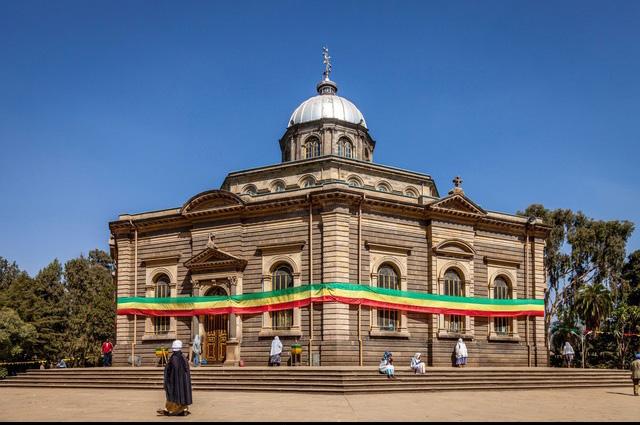
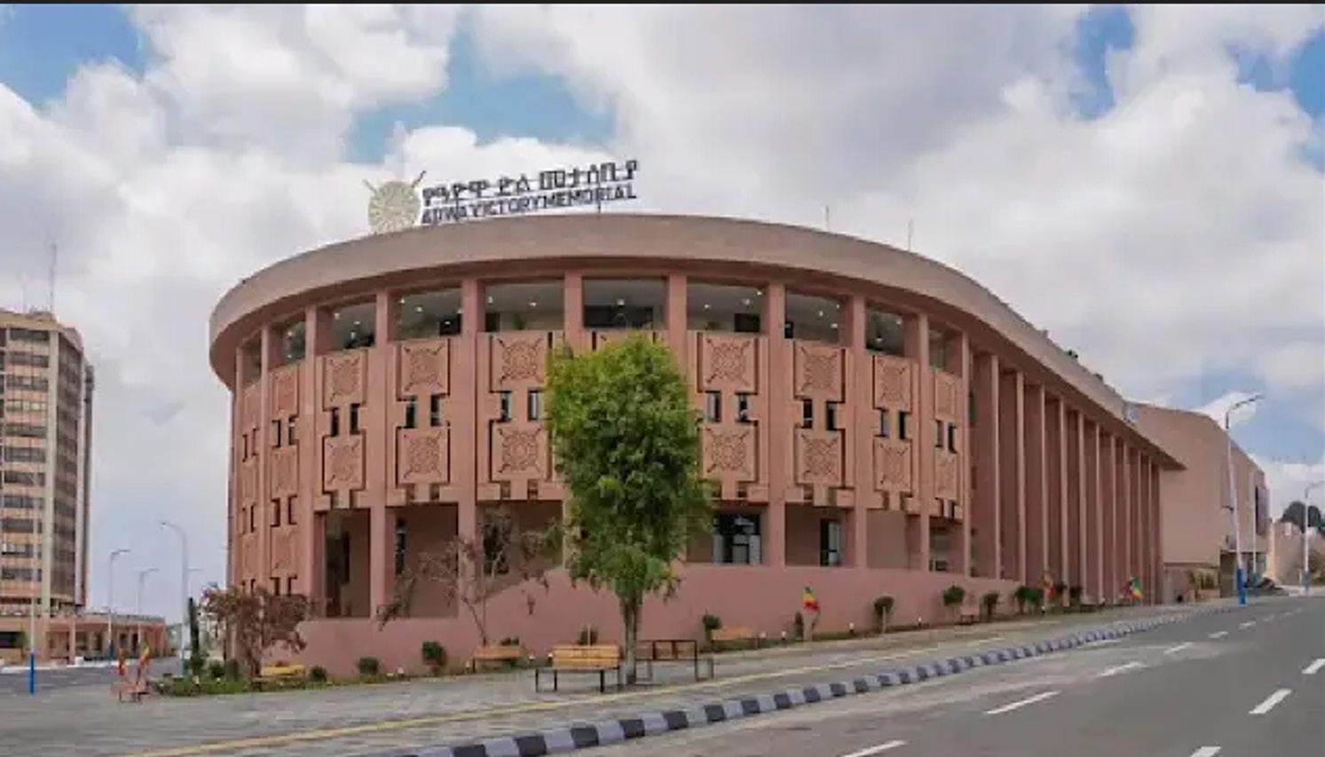
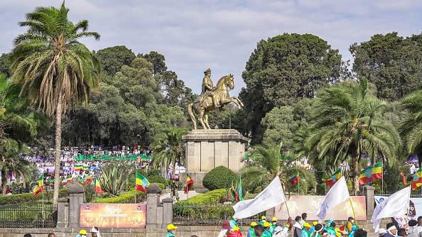
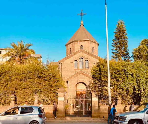
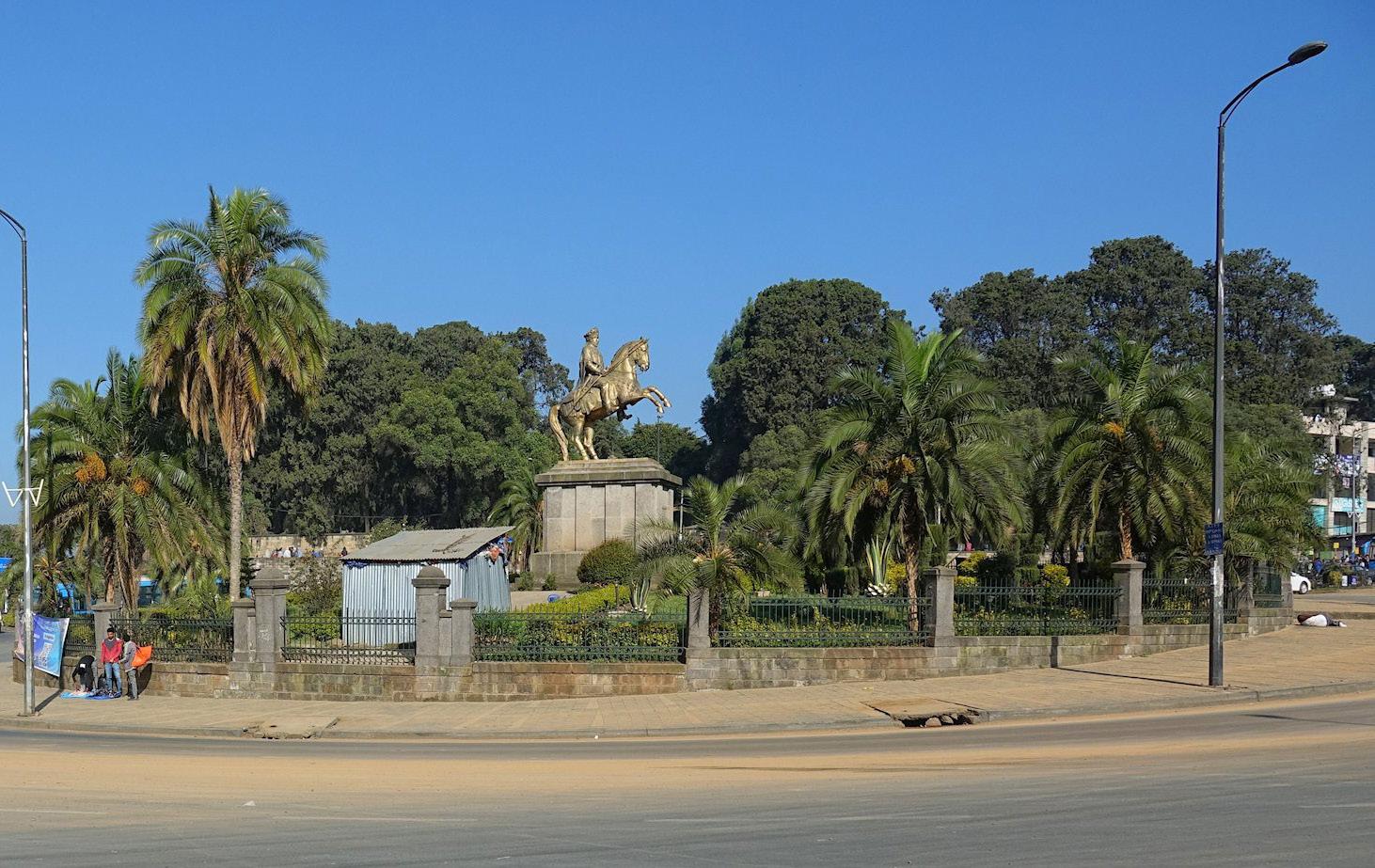
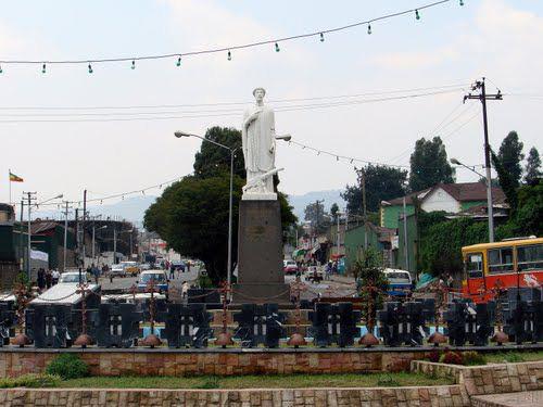
St. George’s Cathedral Statue of Menelik II Square
Prominent
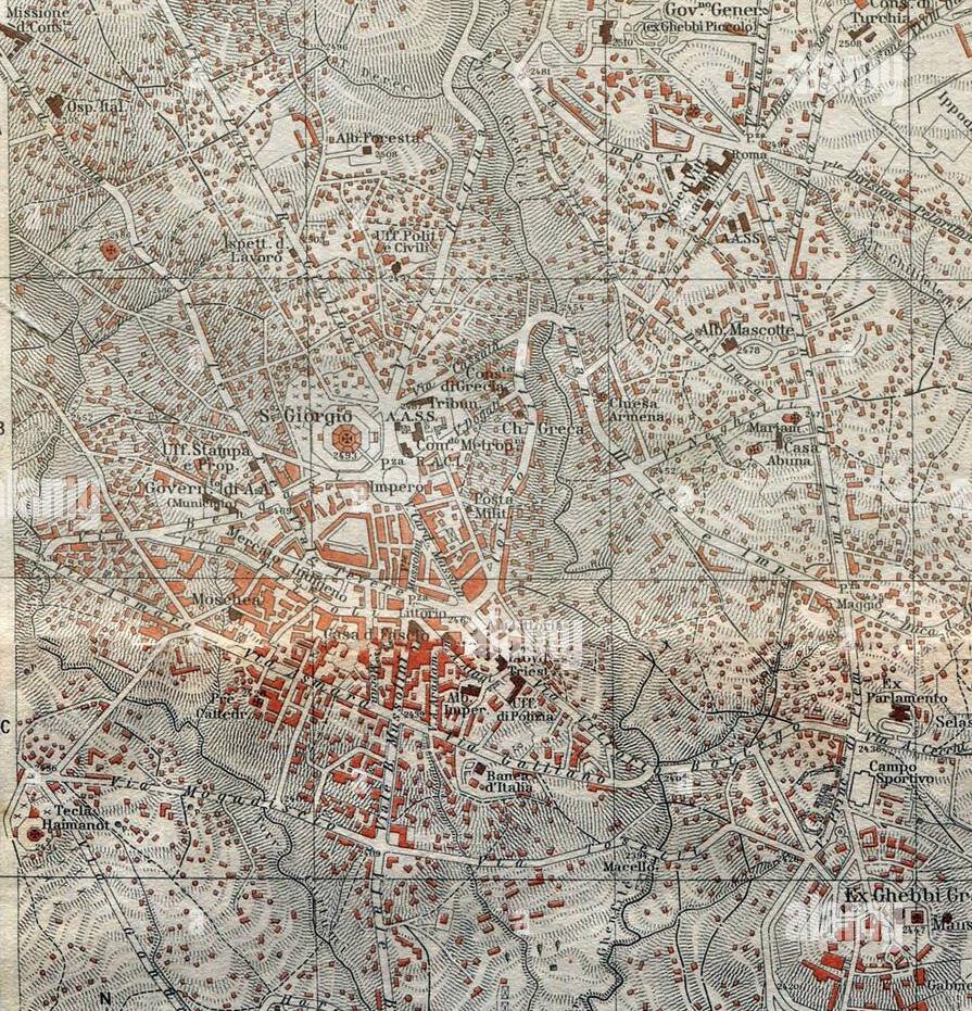
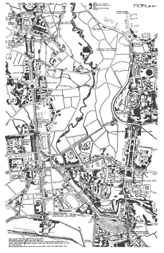
HISTORICAL RESEARCH (ADDIS ABABA CITY)
by
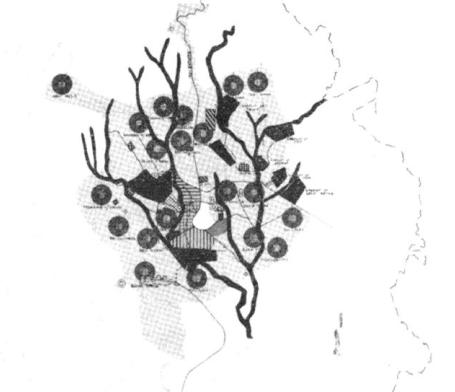
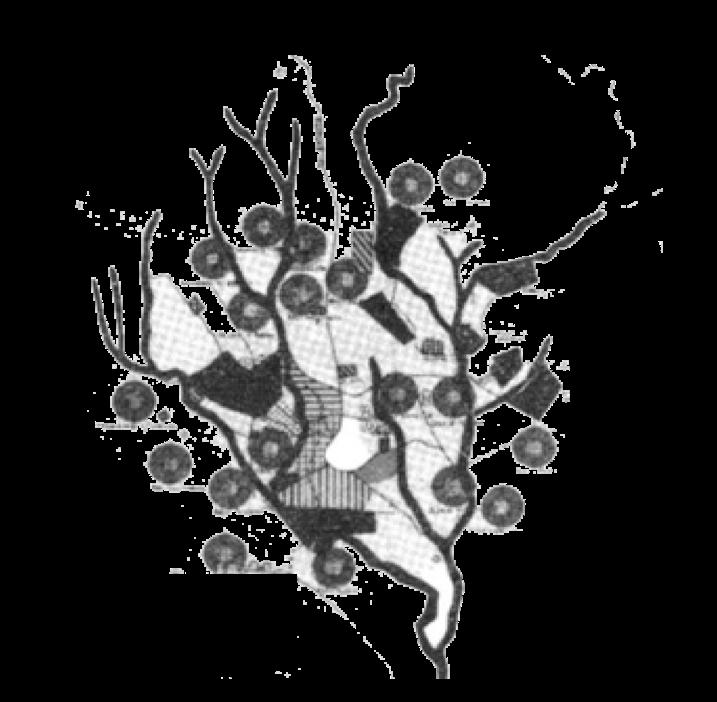
and connected by radial paths leading to churches and markets Each sefer functioned as a self-contained community, creating a polycentric urban form that followed the natural terrain and laid the basis for areas like Arada and Piazza
commerce, and cultural
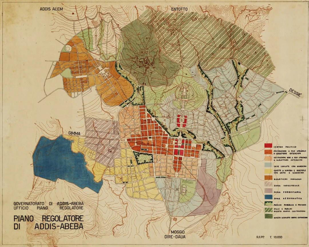
Ing. C. Valle, Arch. I. Guidi, and A. Bianchi were Italian engineers and architects who contributed to urban planning and architectural projects in Addis Ababa during the Italian occupation (1936–1941). They proposed modernist interventions, including planned streets, civic squares, and public
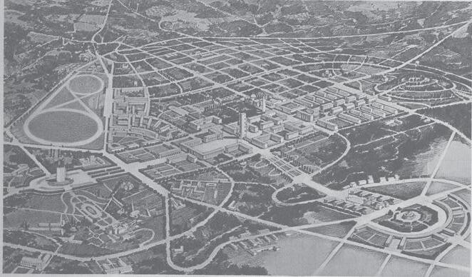
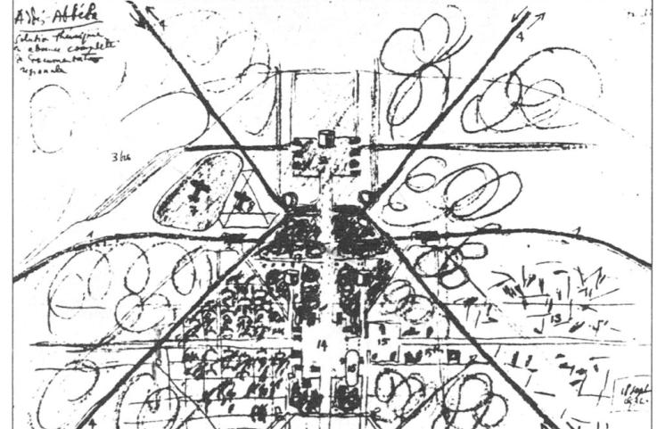
Le Corbusier’s theoretical proposal for Addis Ababa 1936 envisioned a modern geometrically ordered city contrasting its organic growth. He proposed zoned functional areas, wide boulevards, and monumental axes reflecting European modernist ideals. The plan aimed to symbolize authority and modernization, but it was never implemented due to political and contextual limitations.
Sir Patrick Abercrombie’s plan for Addis Ababa proposed a structured, gardencity model that balanced expansion with open spaces and neighborhood units His vision aimed to organize growth while preserving the city’s natural topography and central hierarchy
Luis de Hoÿm de Marien, a French architect, developed a 1965 master plan for Addis Ababa to guide its rapid urban growth, proposing a monumental north south civic axis connecting administrative and cultural centers and a linear industrial zone in the south to separate industry from residential areas, influencing later urban development despite limited implementation.
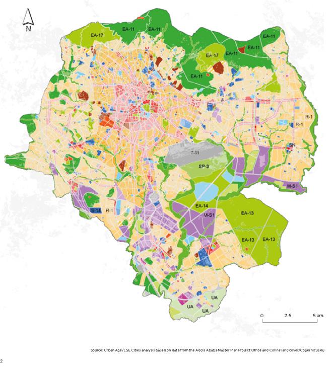
The Addis Ababa Master Plan (1983–1985), prepared by AAMPPO, aimed to guide the city’s rapid expansion under socialist policies. It emphasized zoning for residential, industrial and administrative areas, with satellite neighborhoods to reduce central congestion. The plan promoted major road networks and infrastructure improvements to enhance mobility and connectivity
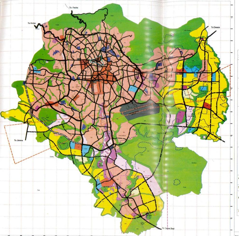
The 2003 Addis Ababa Master Plan provided a framework for comprehensive urban growth and land-use management aligning with national development policies. It introduced zoned functional areas for residential, commercial, industrial, and green spaces, aiming to structure city expansion. The plan prioritized infrastructure development, including road networks, utilities, and service provision, to support increasing urban demand. It proposed metropolitan integration incorporating surrounding towns and rural peripheries to create a unified urban region.
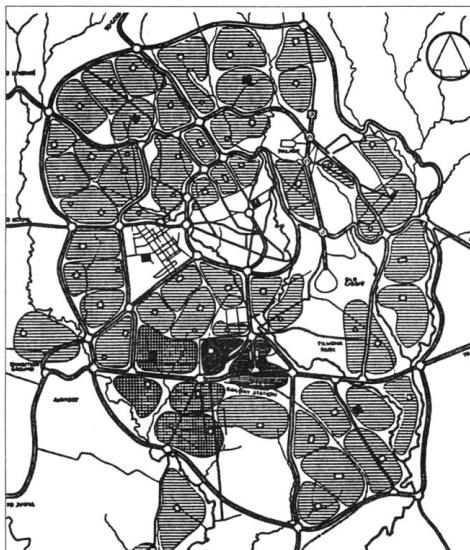
The Addis Ababa City Structure Plan (2017–2027), developed by AACPPO, provides a framework to guide the city’s growth sustainably over 15 years It focuses on urban intensification, promoting higher-density development to reduce sprawl. The plan emphasizes infrastructure upgrades including transport, utilities, and public services, to support a growing population. It incorporates zoning and land-use policies for mixed-use and affordable housing. Environmental sustainability is prioritized through green spaces and energyefficient development. Additionally, the plan aims to preserve historical and cultural landmarks, ensuring urban growth respects the city’s heritage.
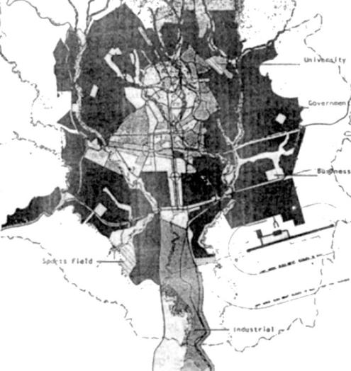
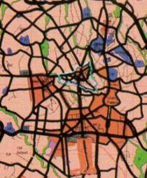
map of
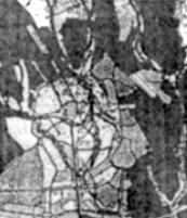
Addis Ababa master plan of 1936 - 1939
Corbusier
C. Valle, Arch. I. Guidi, A. Bianchi
Sir Patrick Abercrombie
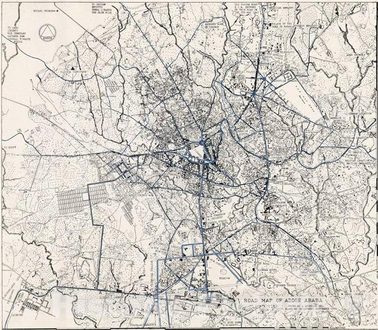
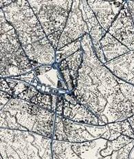
A map of the Addis Ababa master plan of 1968
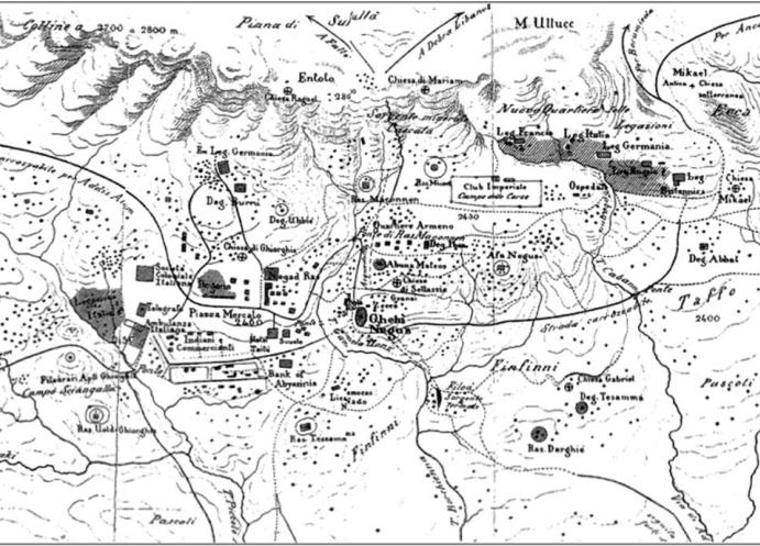
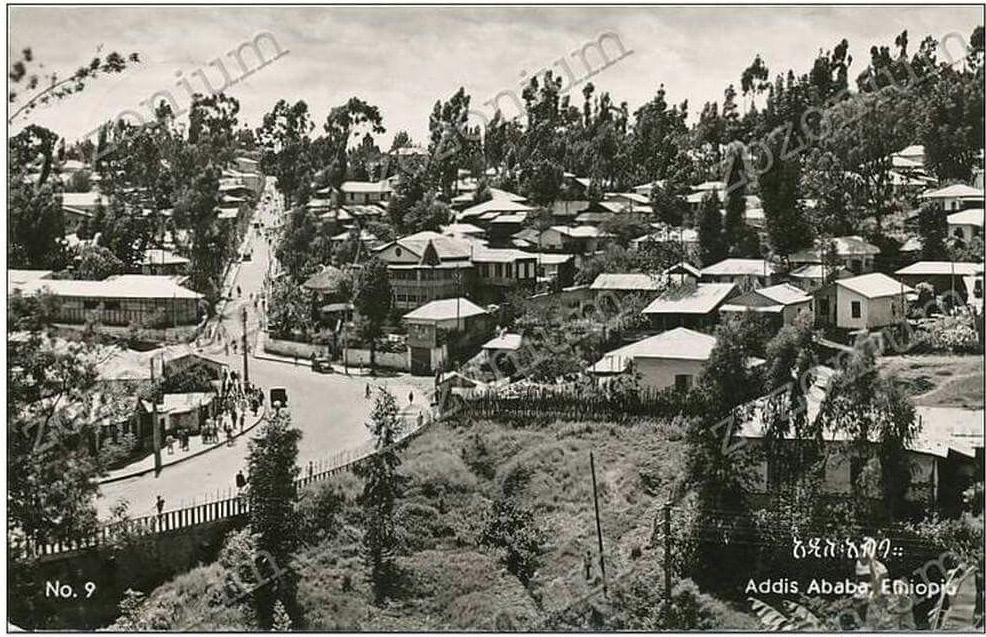
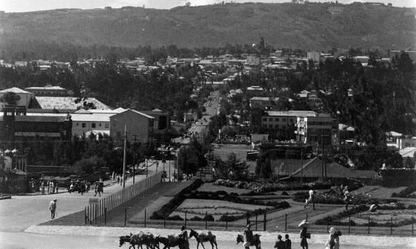
Addis Ababa During The reign of menilik, 1886
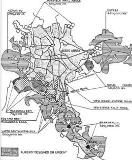
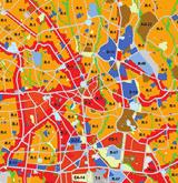
A map of the Addis Ababa master plan of 2003
A map of the Addis Ababa master plan of
Growth of the city in the period of 1890 -
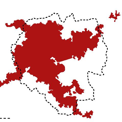
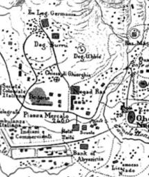
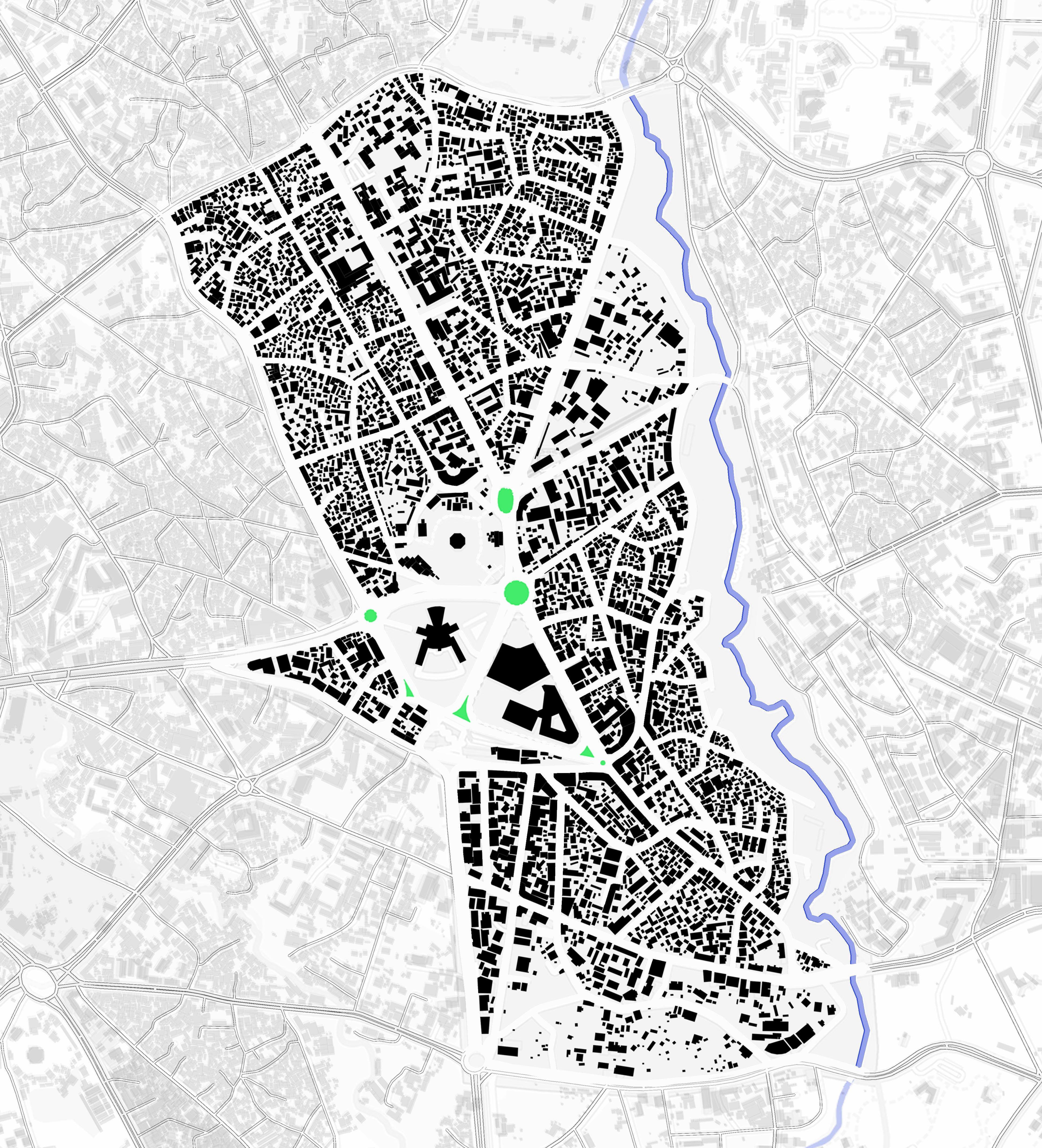
FORMATION OF PIAZZA DISTRICT
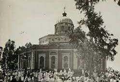
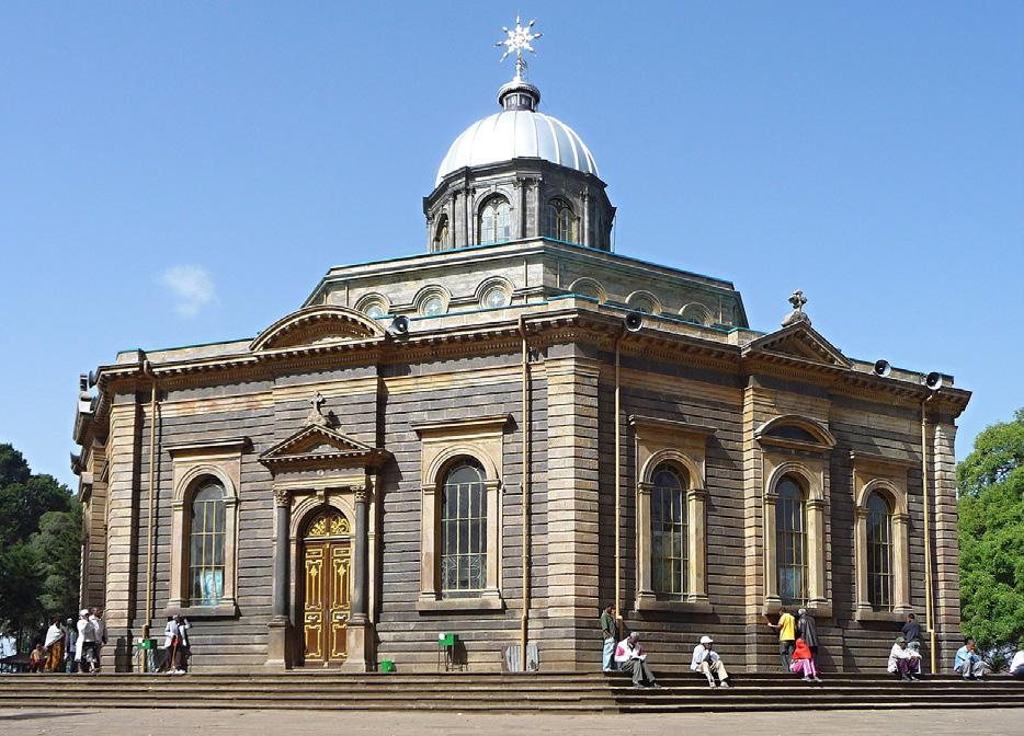
1, St George church (1896)
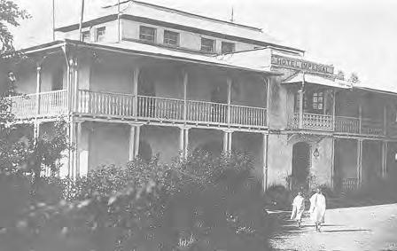
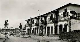
2,Itegue Taitu Hotel (1898)
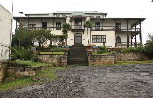
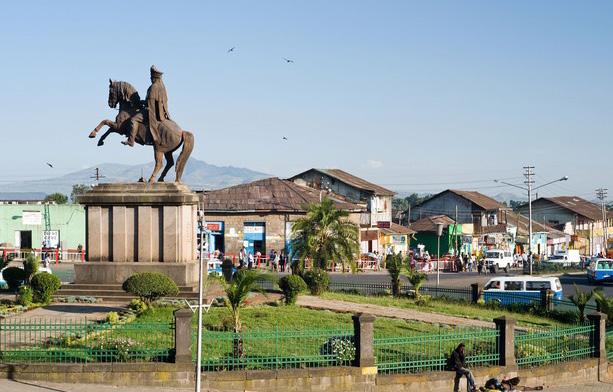
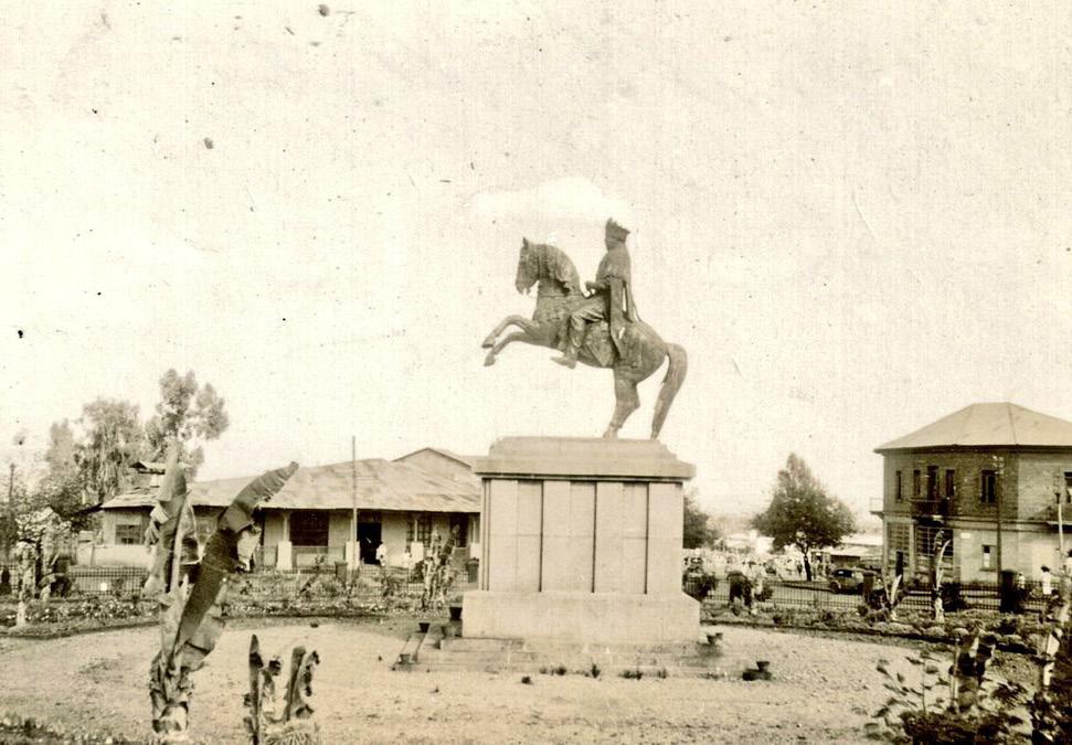
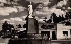
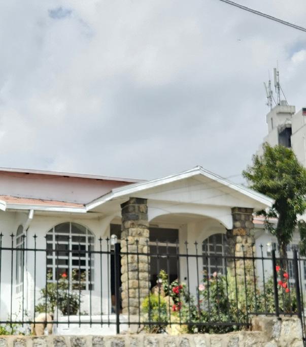
3, Statue of Menelik II (1930) 4,F.residence of greek prof. papadopaulos (1920)
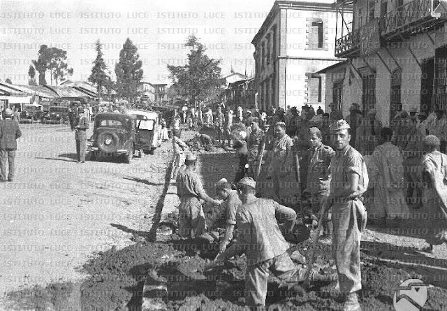
2. Italian occupation (1935 - 1941)
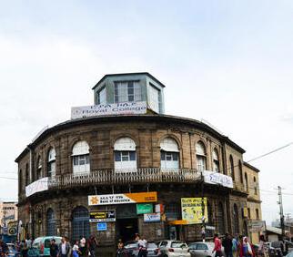
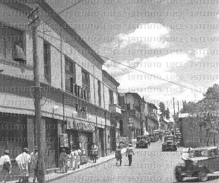
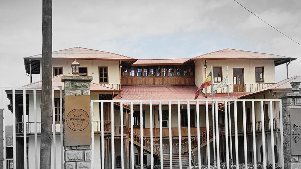
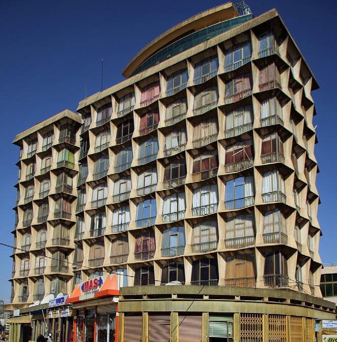
Italian architecture in Piazza, Addis Ababa, introduced modernist and rationalist styles emphasizing symmetry, stone façades, and arcaded streets.The occupation reshaped the
layout with
5,Cinema impero(1938)
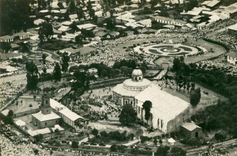
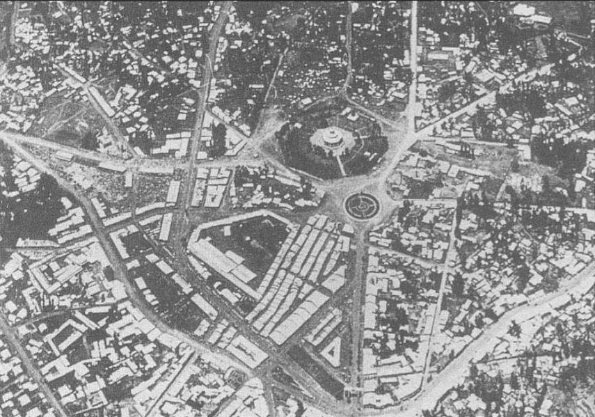
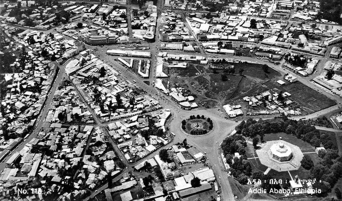
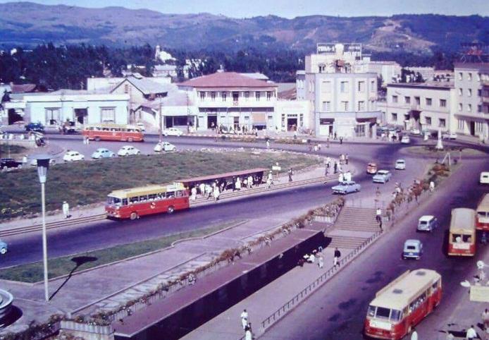
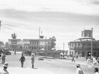
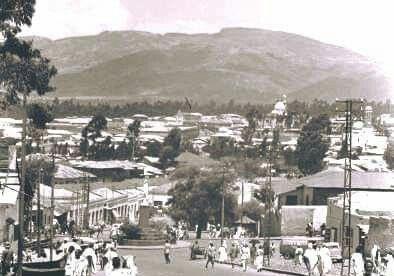
6,aeriel view of piasa(1940)
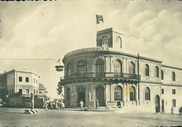
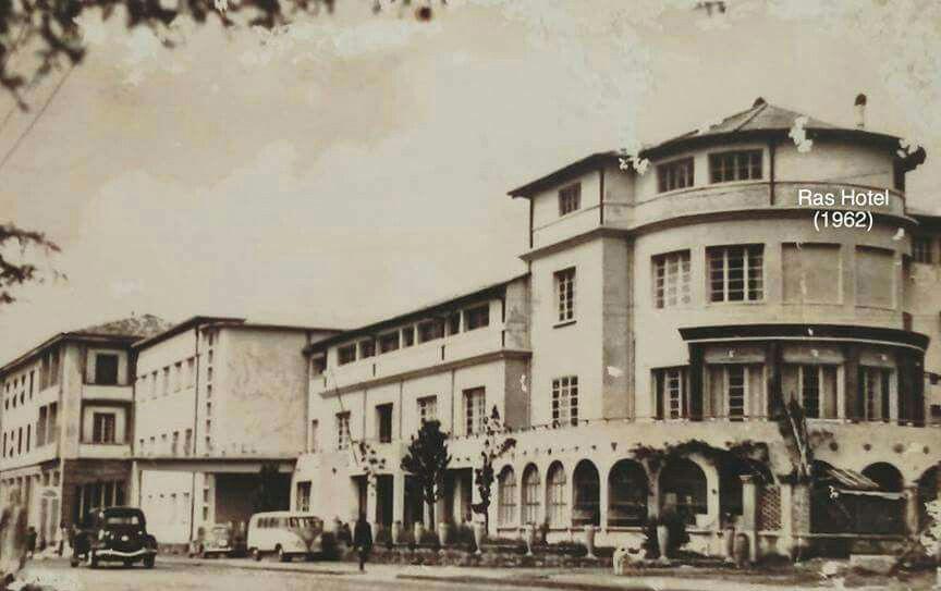
7, Ras Hotel 8,Italian Police Station (1938)
Aerial view of piazza before Italian conquest.
Aerial view of piazza after Italian conquest.
Piazza
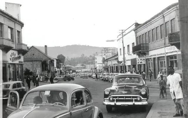
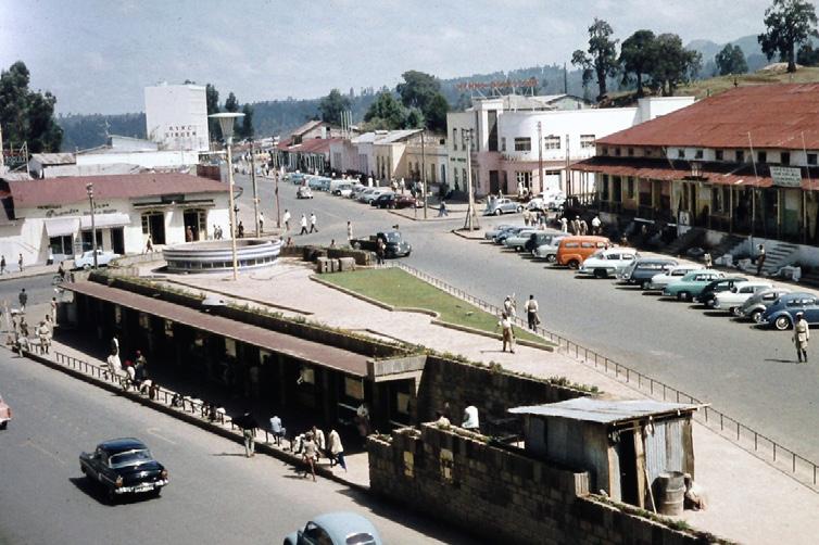
3,Post Italian occupation(1941 - 1974)
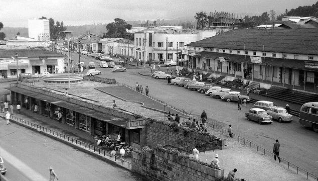
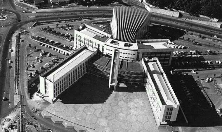
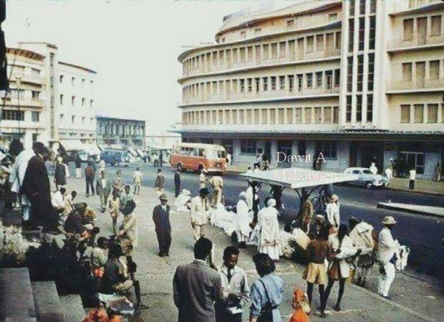
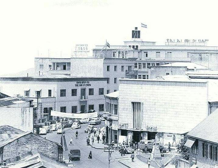
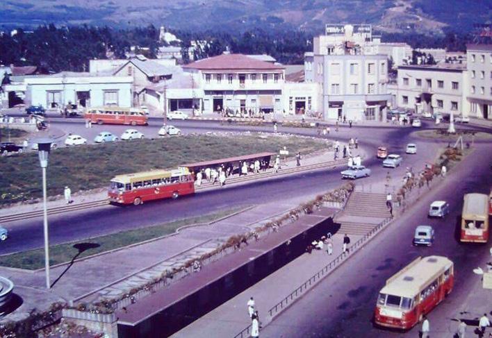
9, aeriel view of piazza square 10,Ethiopian electric building
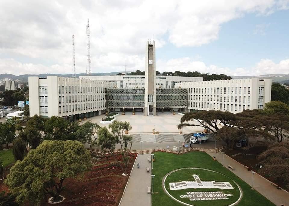
11,Addis Ababa City Administraion (1964) 12, Statue of St. Abune Petros (1941)
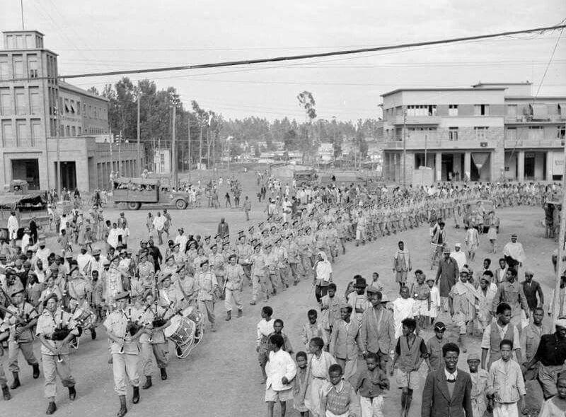
4,The Derg Era (1974 - 1991)
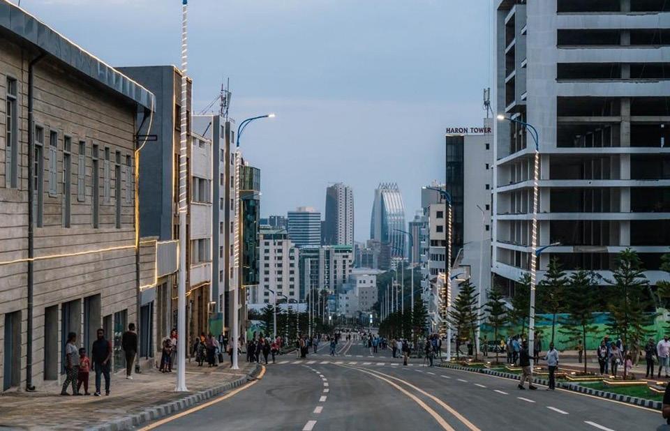
5 ,The Post Derg Era (1991 - 2024) Ariel view of piazza during Italian and post Italian occupatons
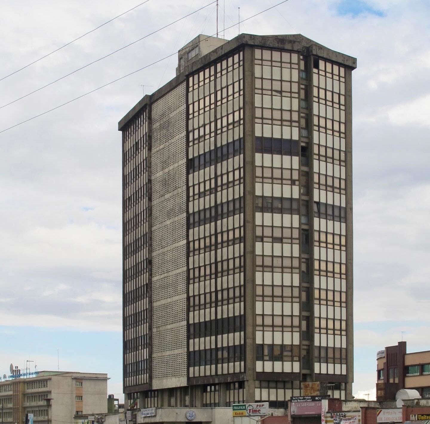
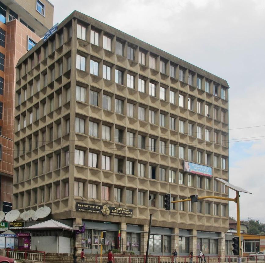
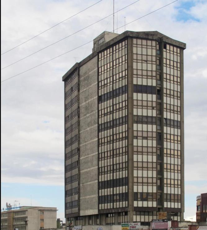
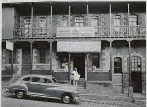
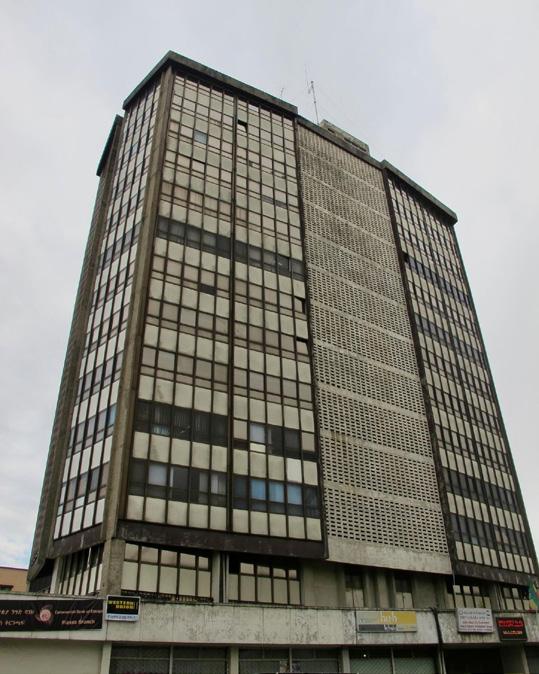
13, Head Office of the Banco di Roma (1964) 14, Arada Building
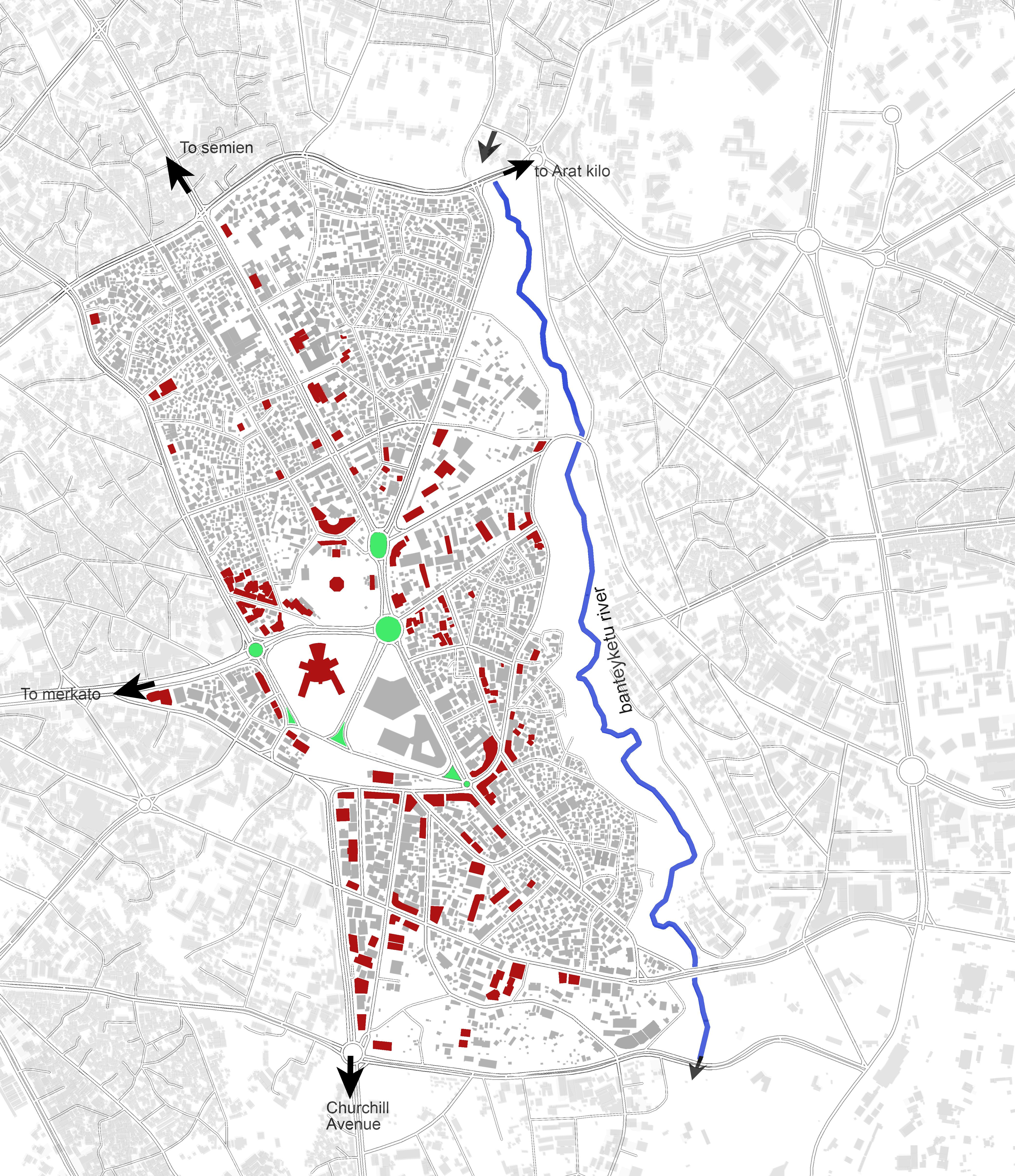
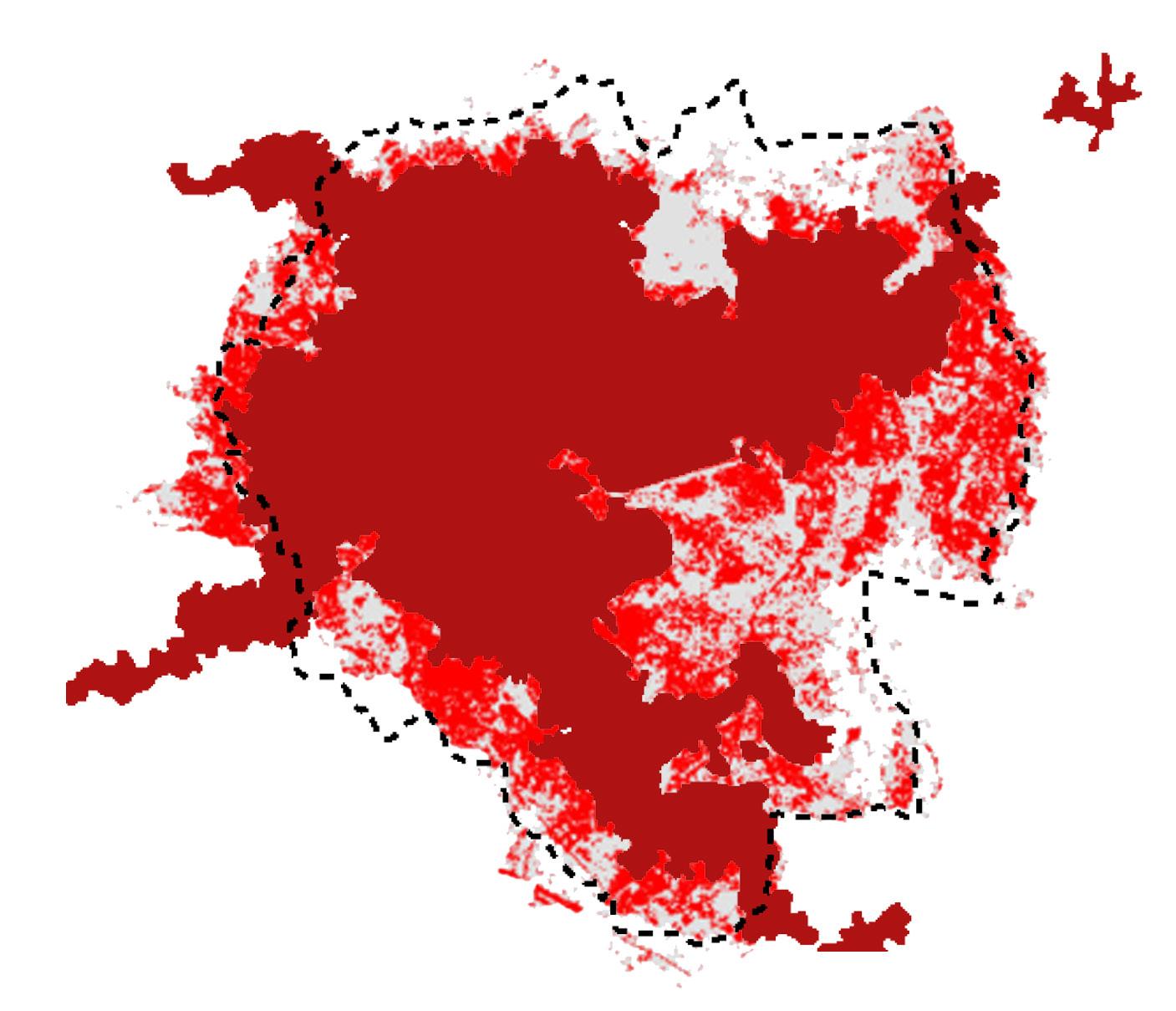
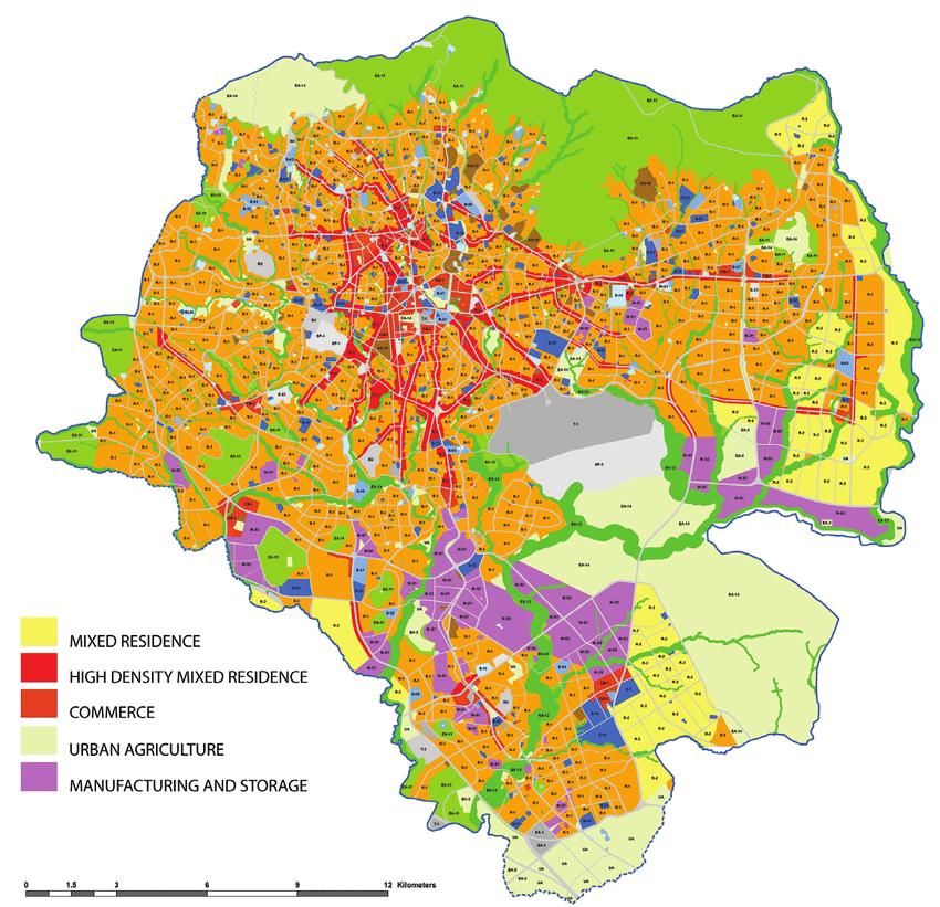
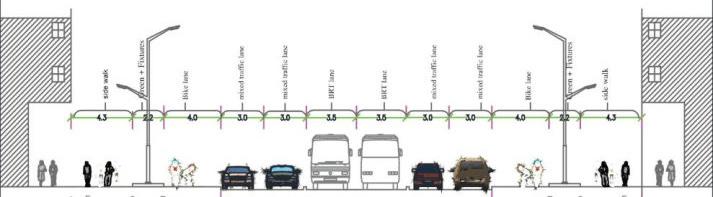
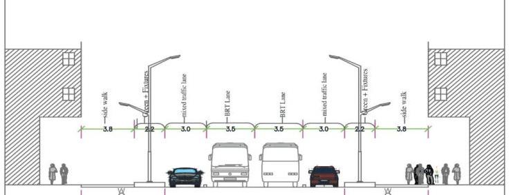
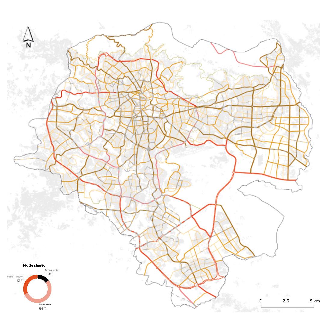
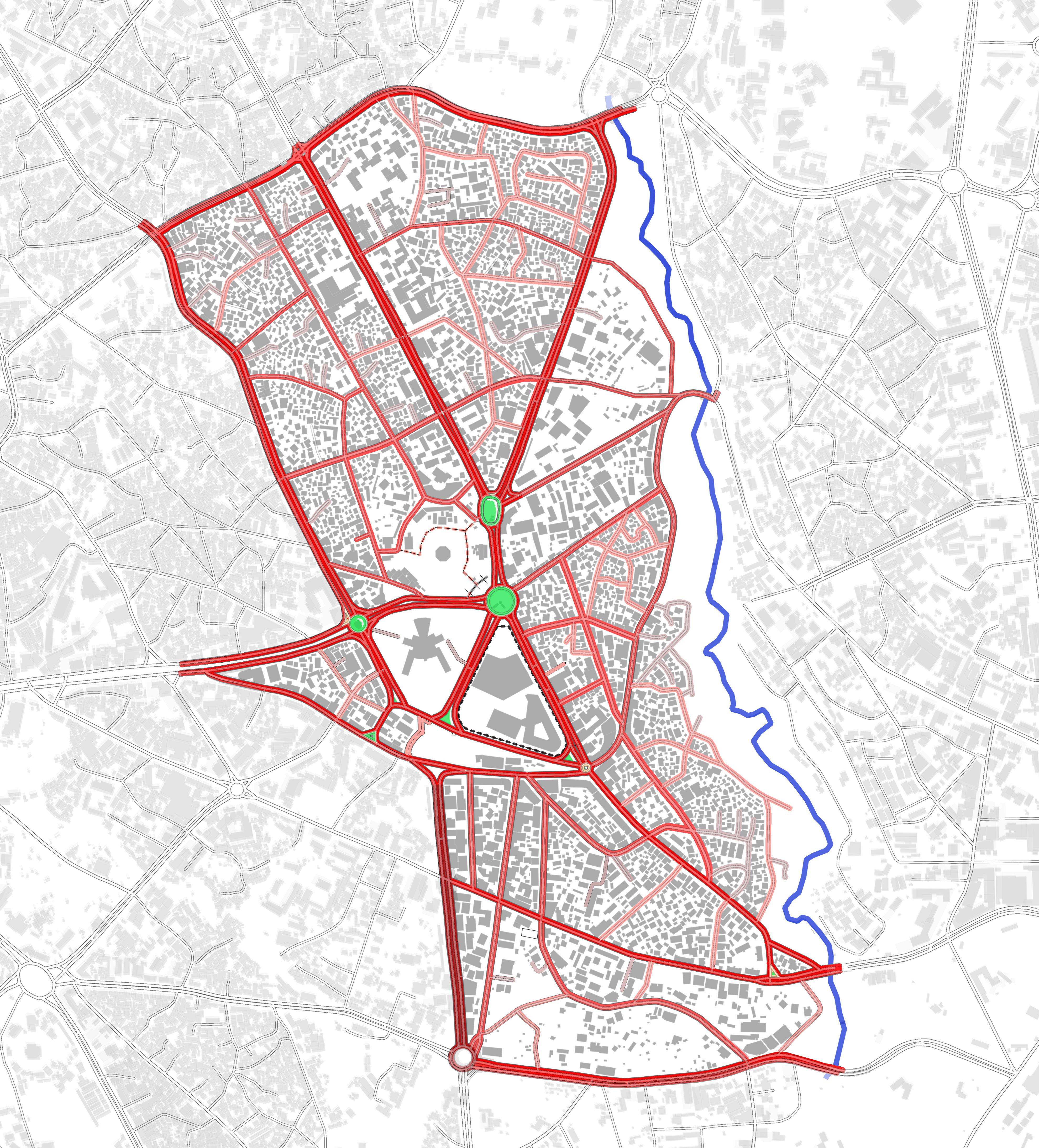
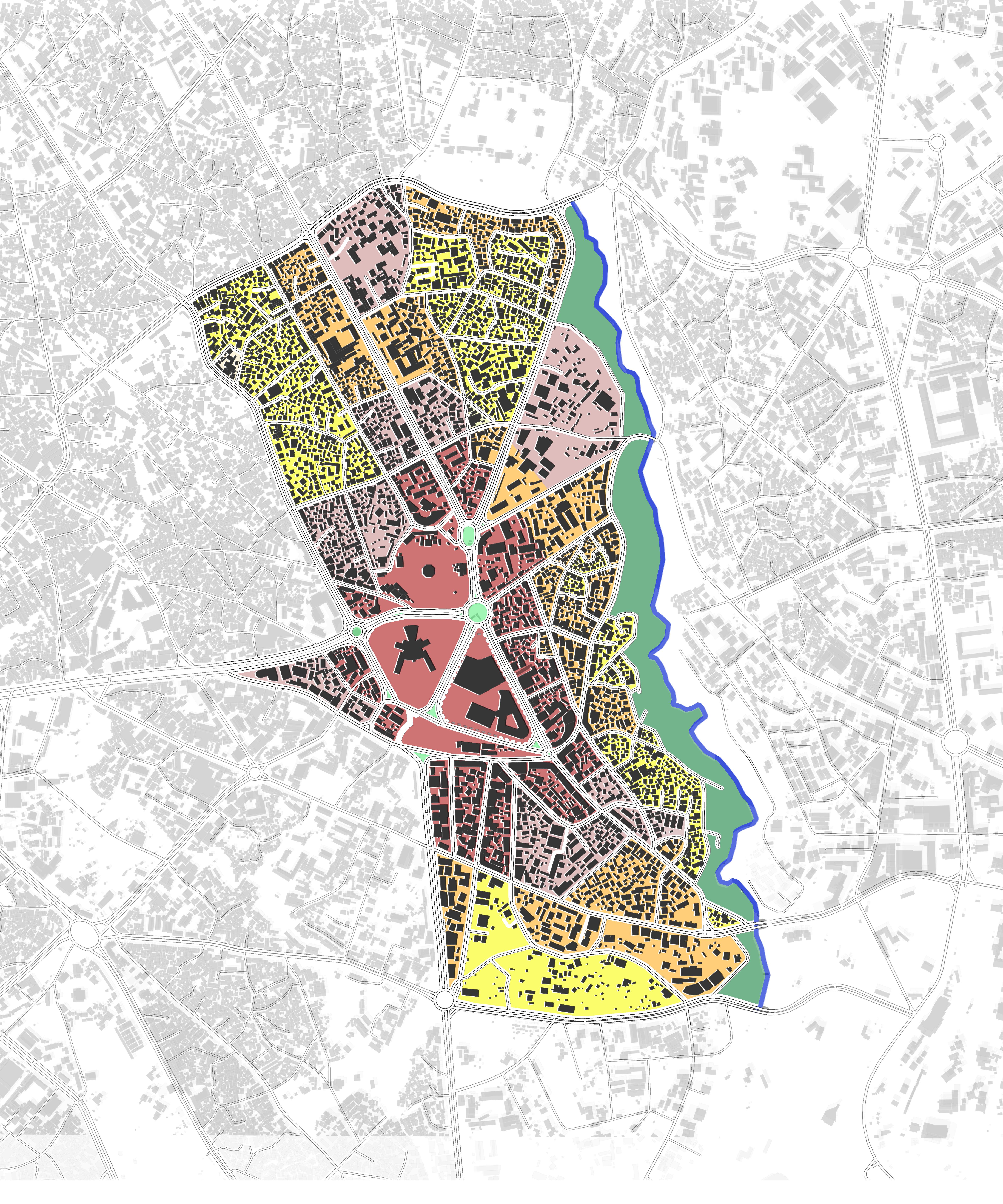
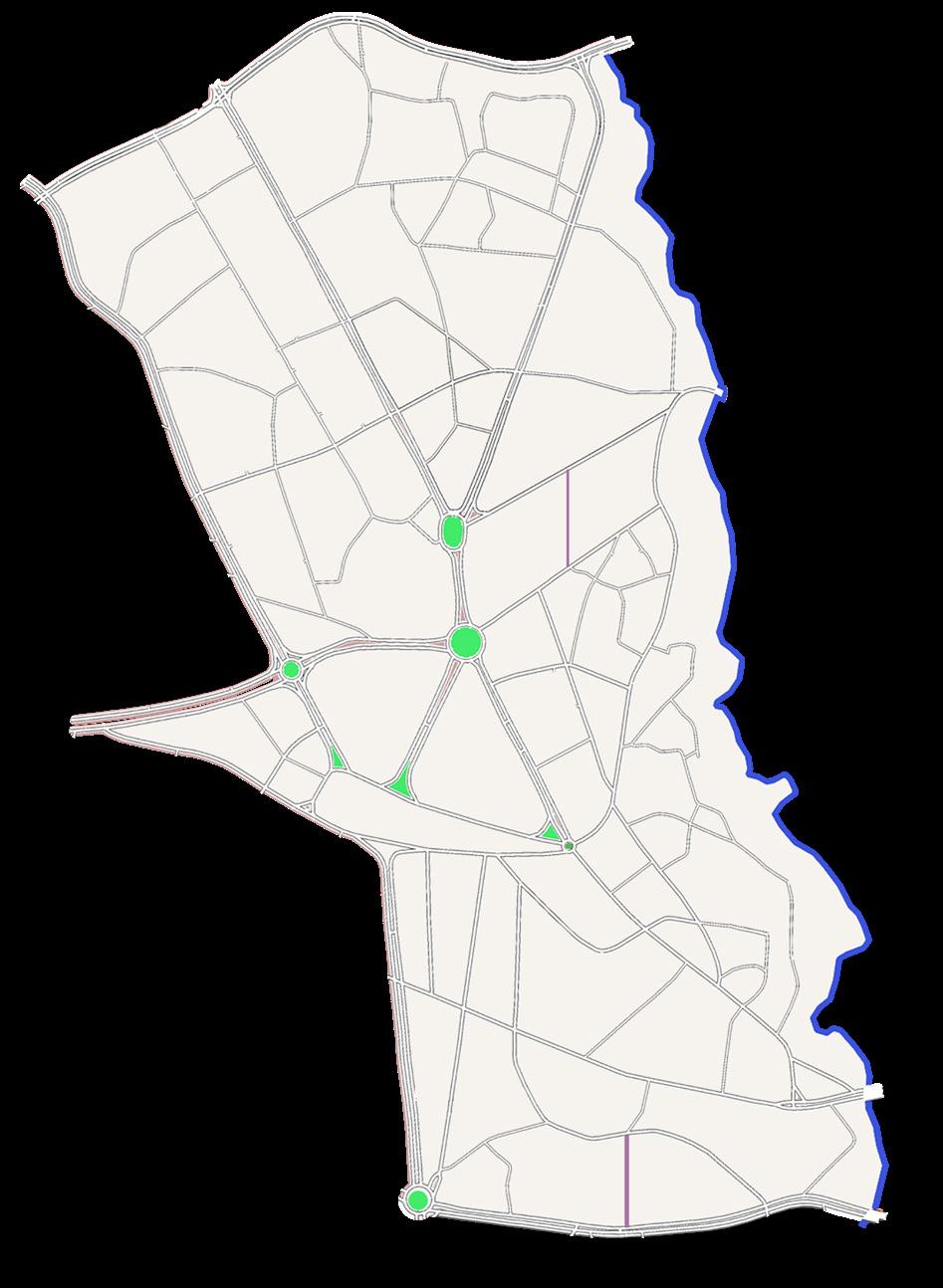
INFRASTRUCTURE AND MOBILITY ANALAYSIS( ADDIS ABABA CITY)
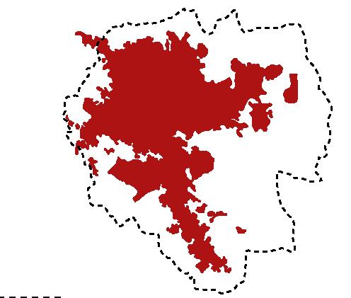
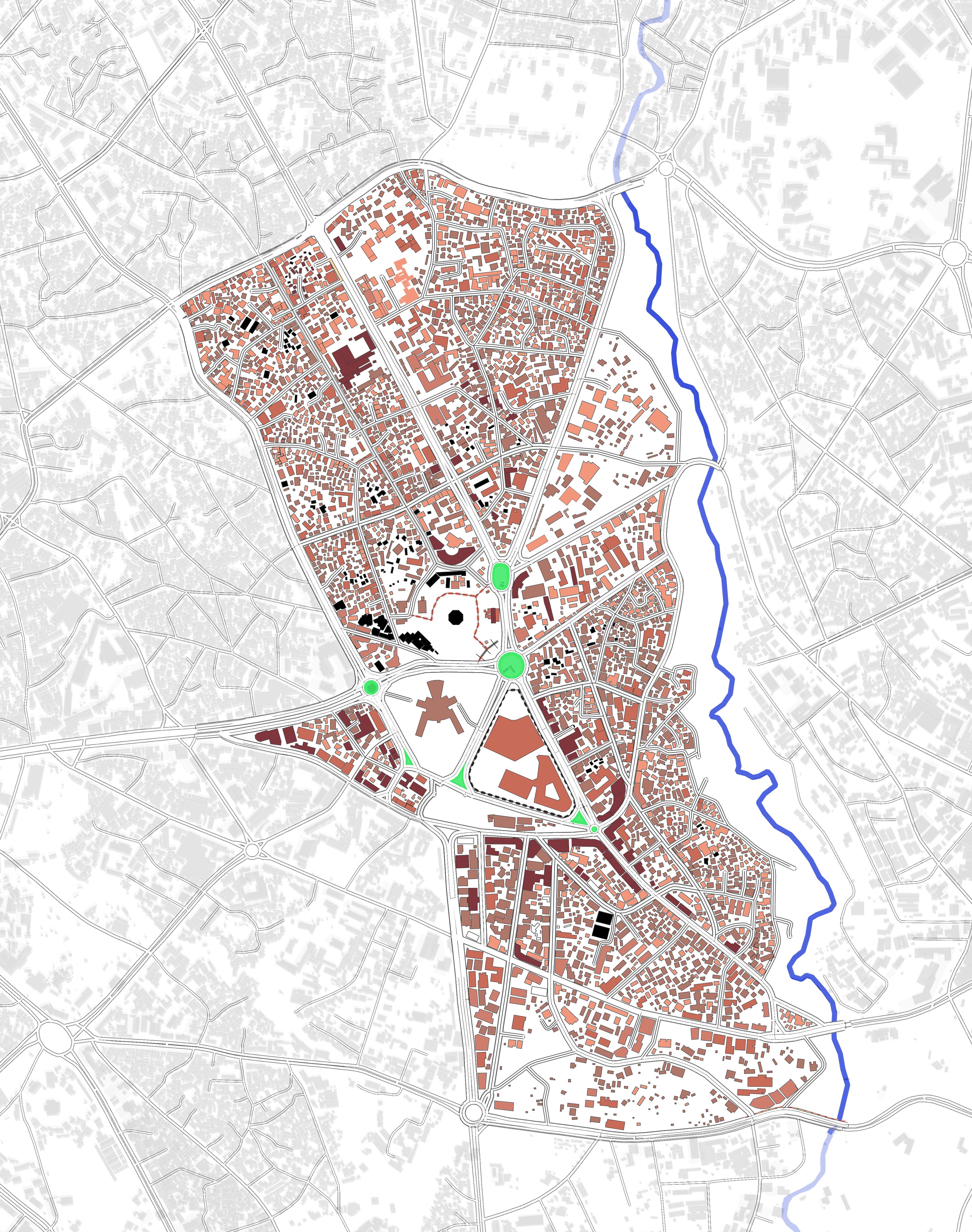
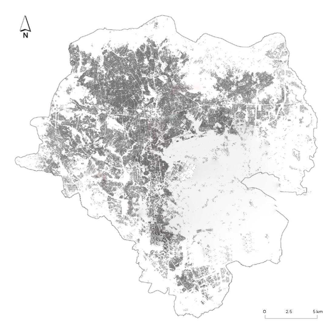
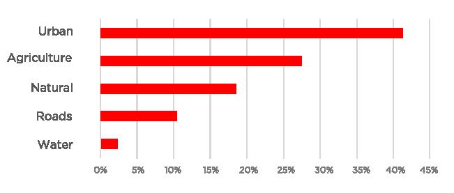
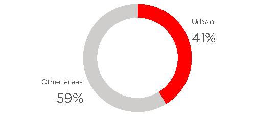
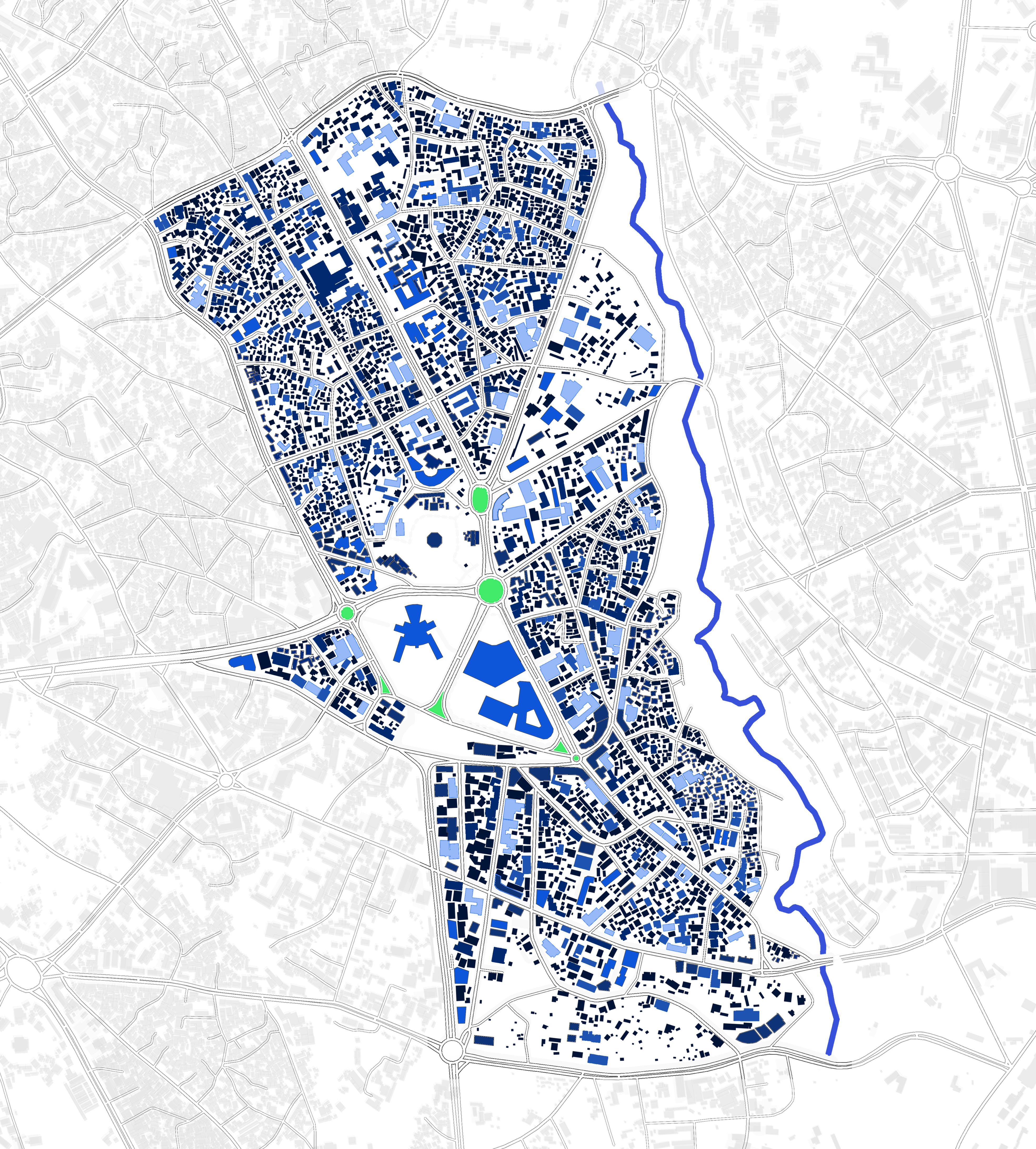
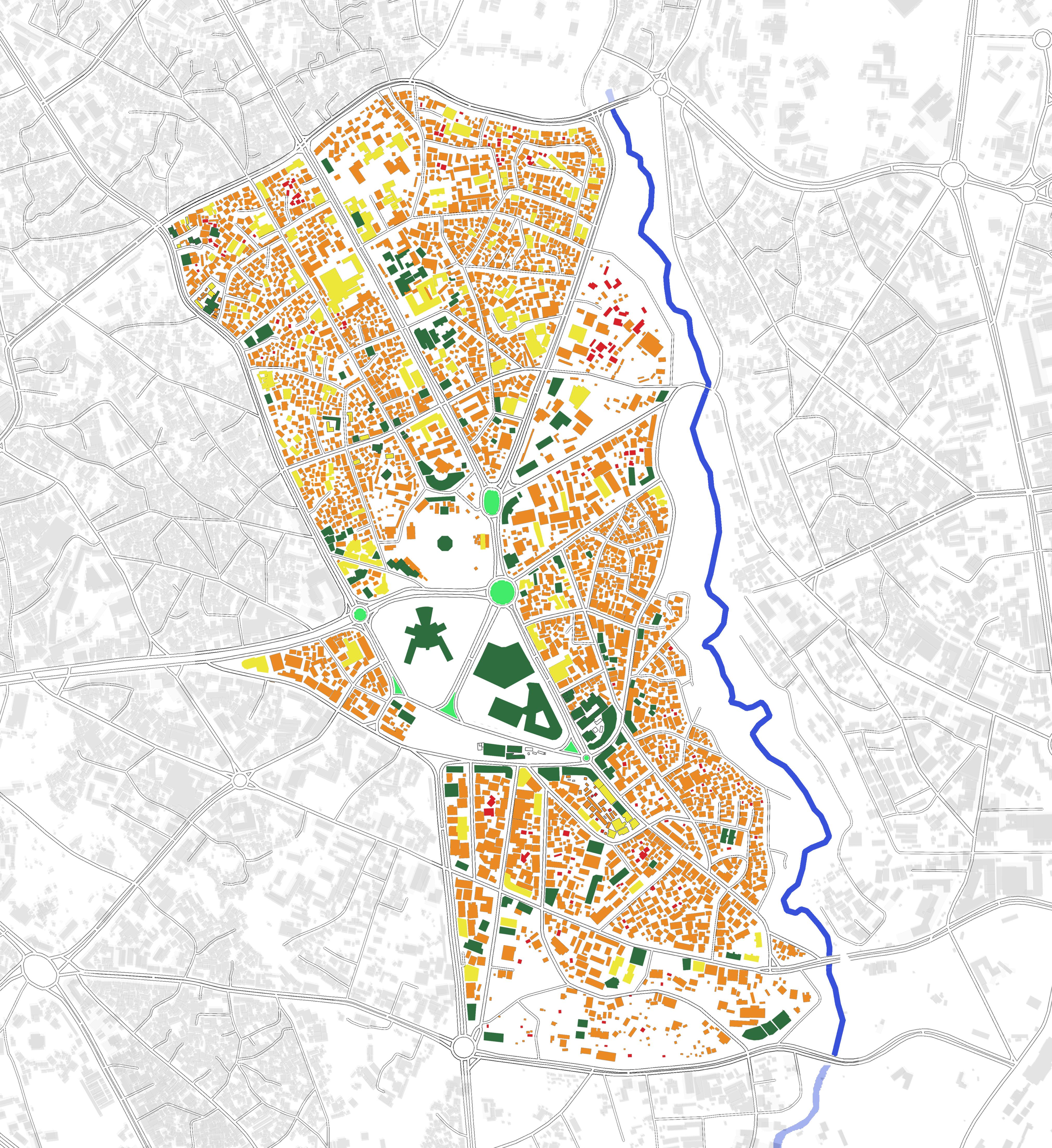
Open & BuiltUp Area Piazza
Section Key Findings and Characteristics
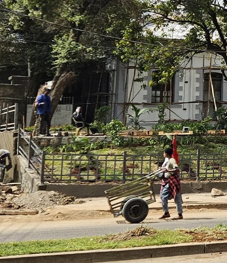
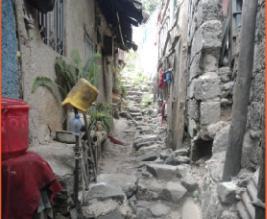
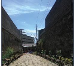
providing direct access to homes, workshops, and inner courtyards. Their narrow, winding form reflects the organic growth of the old city They encourage walkability and social interaction but suffer from lack of maintenance, lighting, and clear boundaries
Name: Gebrehiwot, Abenezer Birhanu
Mario Cerasoli
Rosendo Veliz
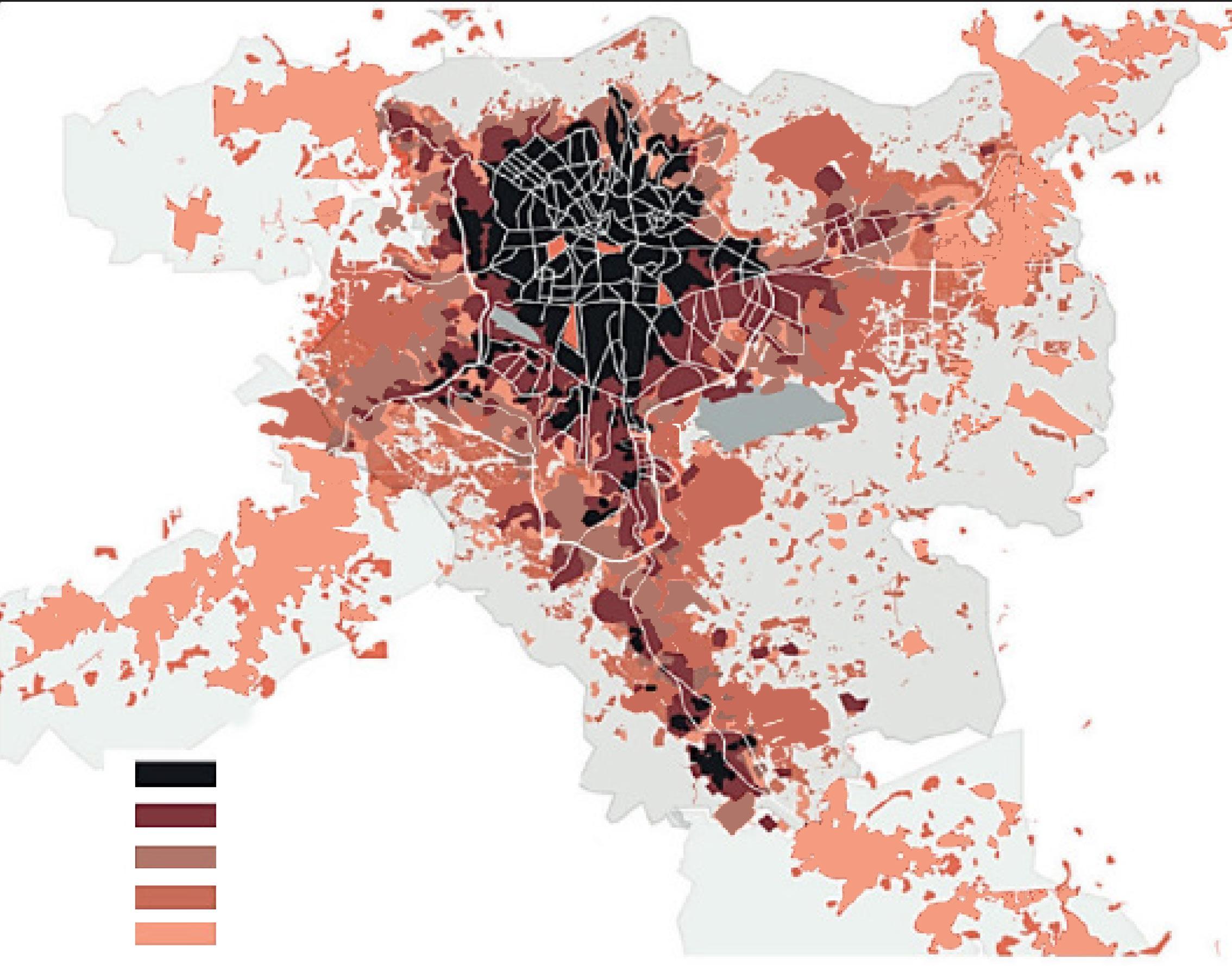
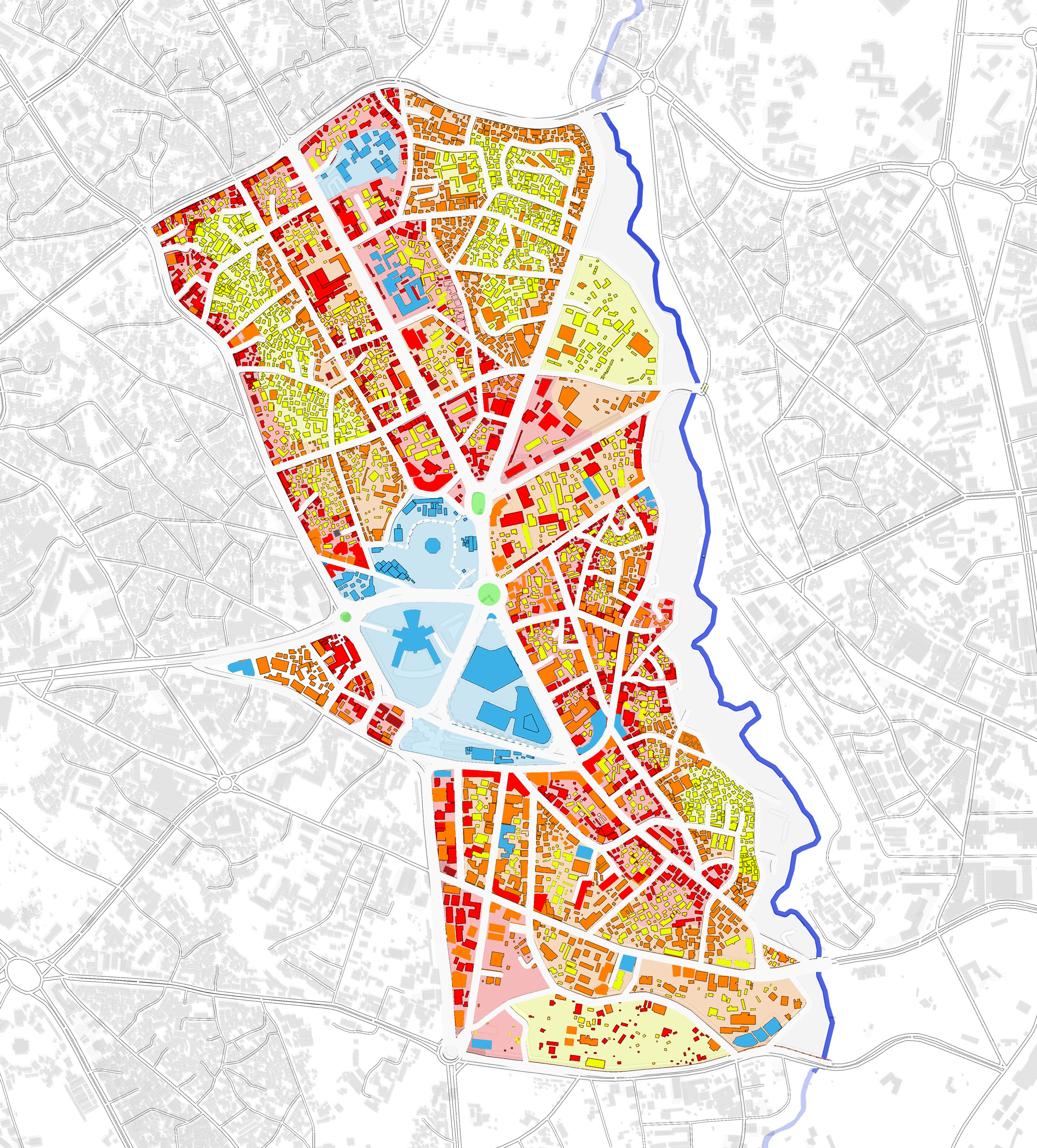
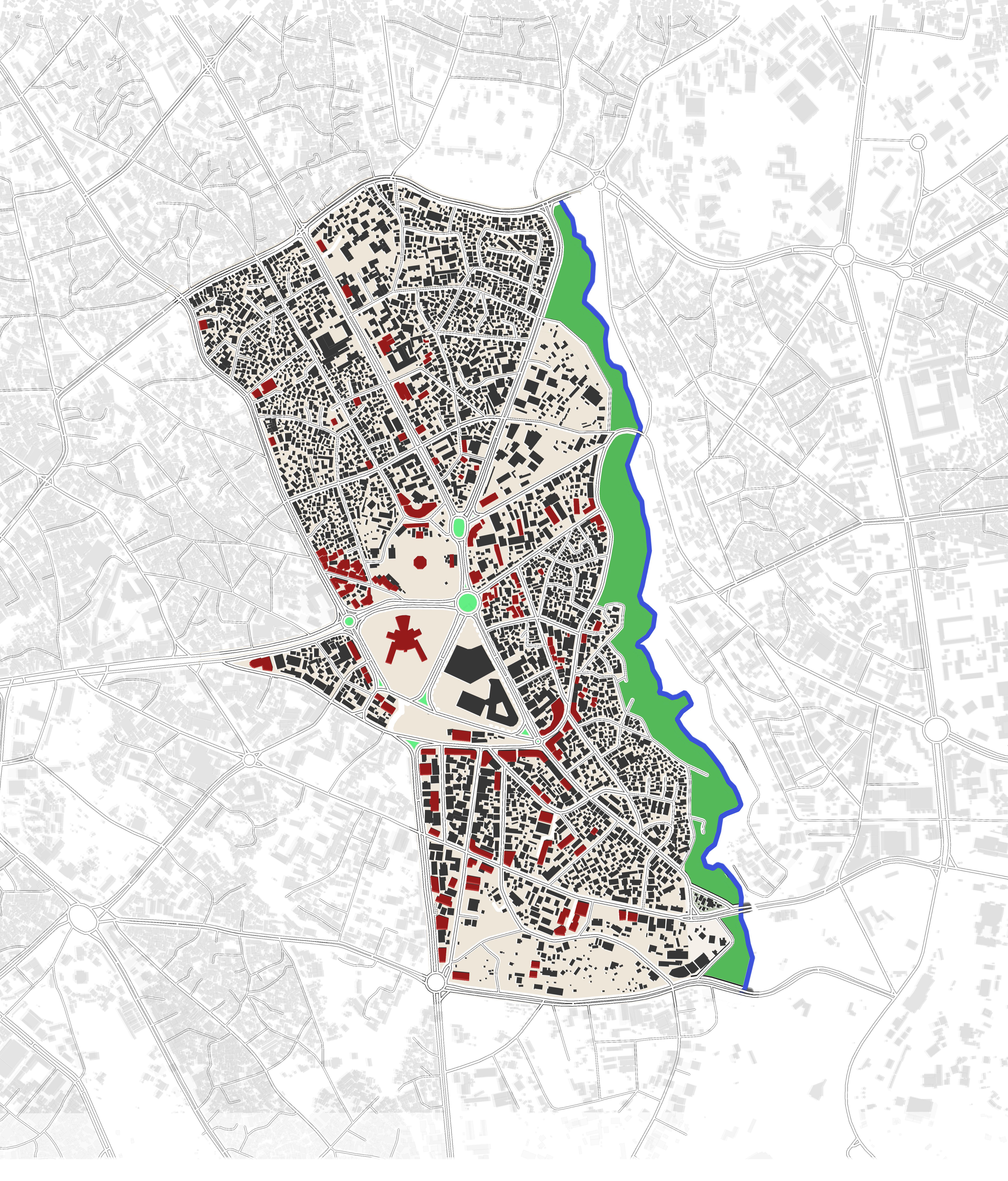
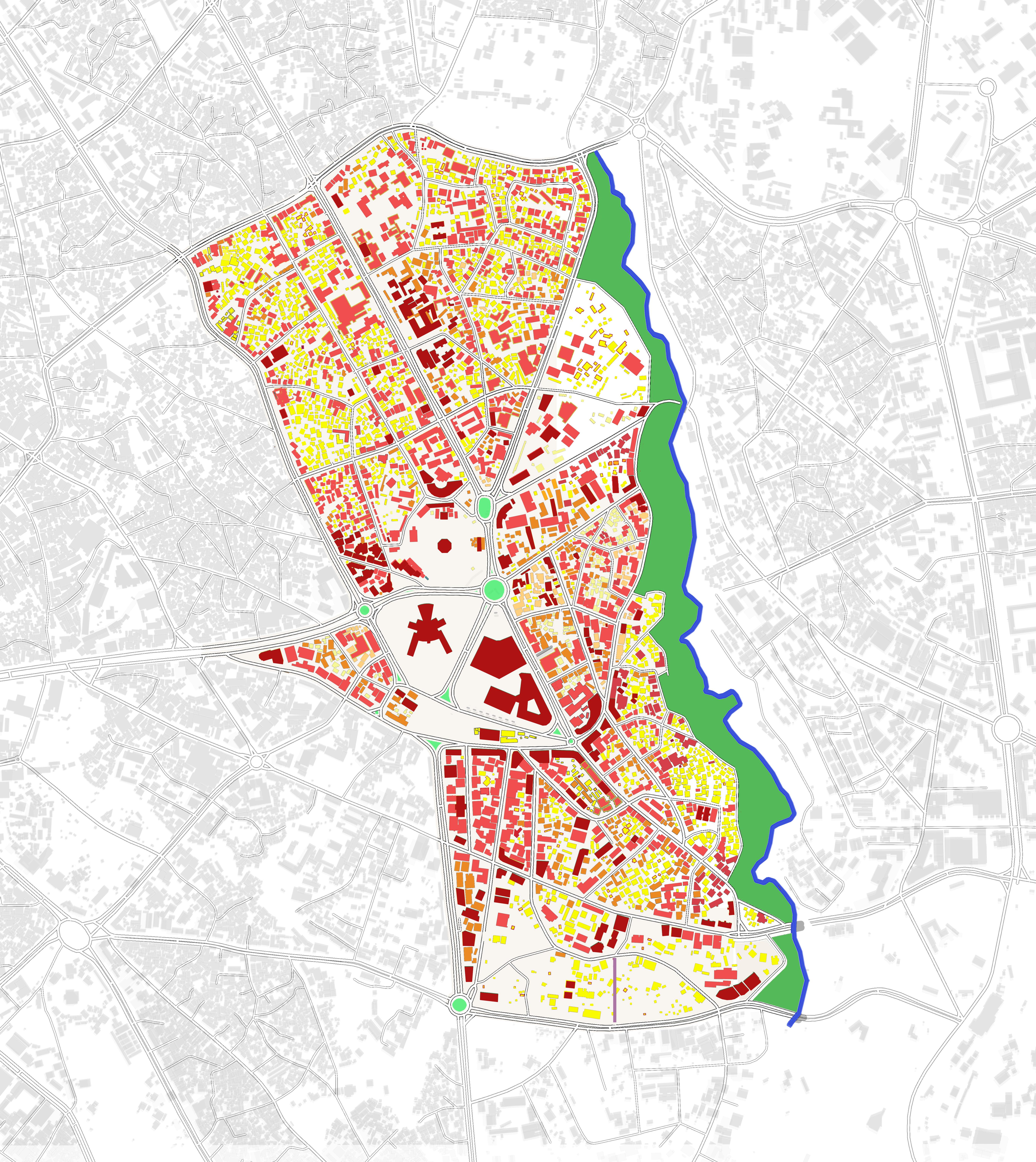
BUILDING CONDITION MAP
Heritage & Architectural Integrity
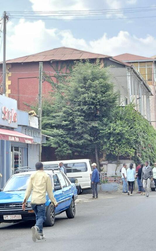
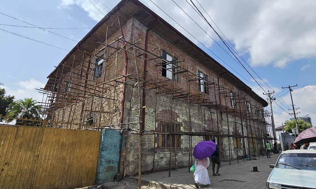
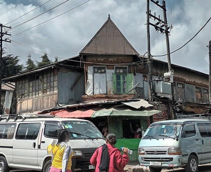
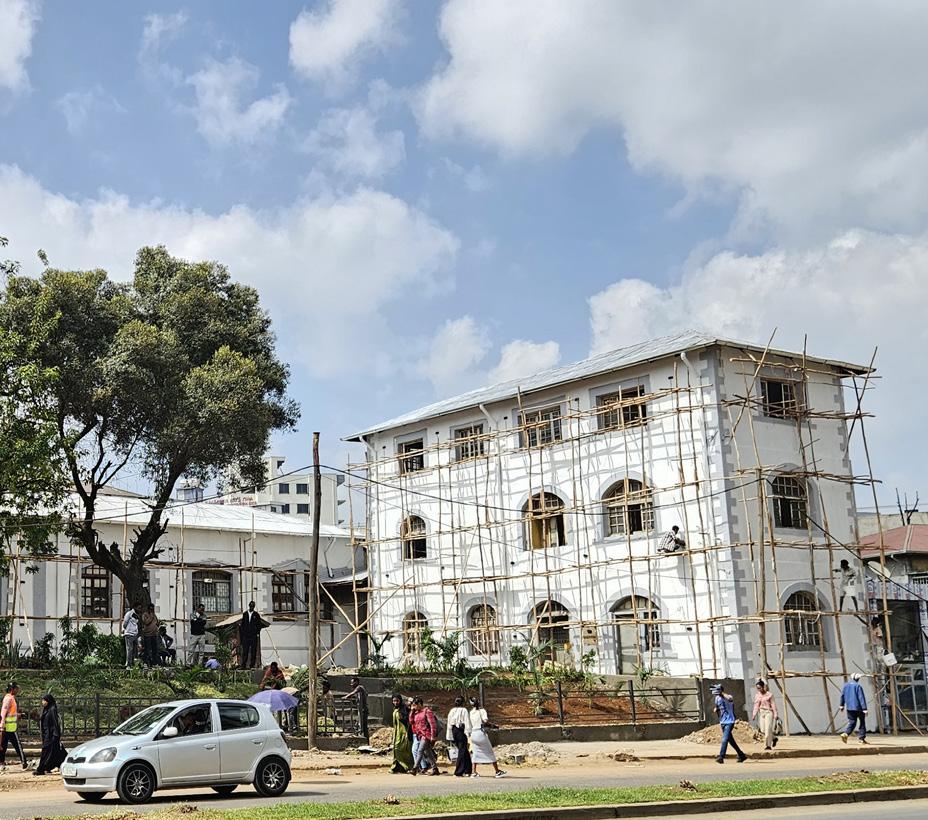
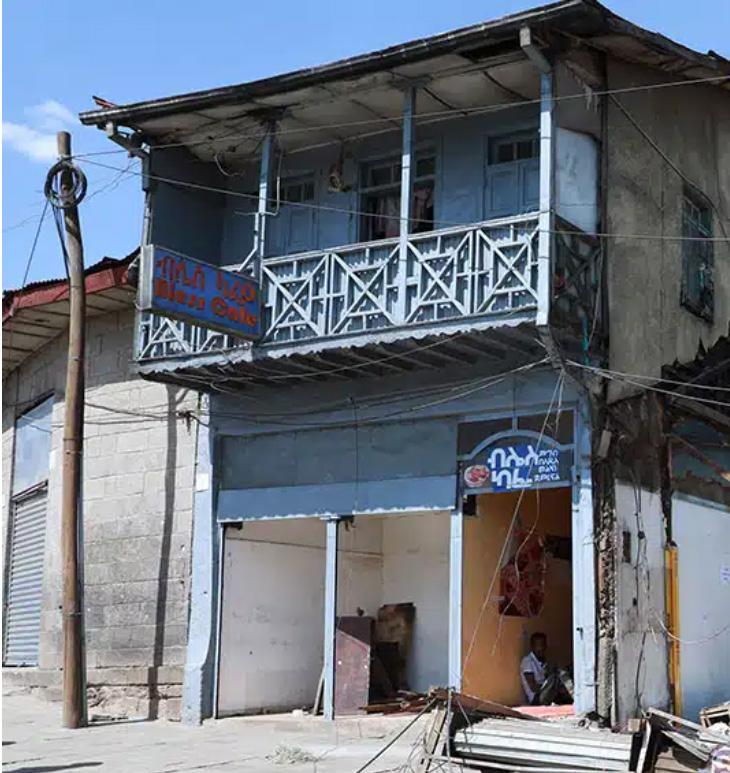
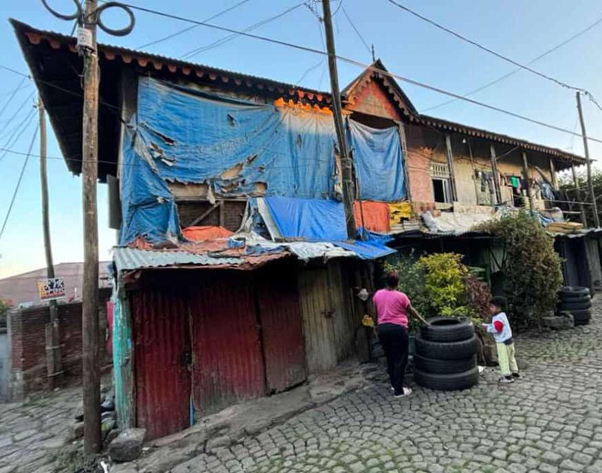
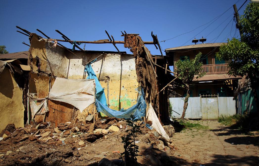
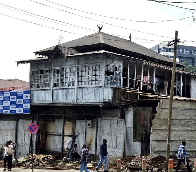
Challenge: Fragmentation, neglect, and typological decay are weakening Piazza’s unique architectural identity, where early Ethiopian forms coexist with Italian Rationalist buildings. Discontinuous façades, deteriorated materials, and incompatible alterations obscure the district’s historic character and break the visual unity of key streets and plazas.
Strategy Enforce Maximum Protection Zoning with mandatory restoration and adaptive reuse standards.
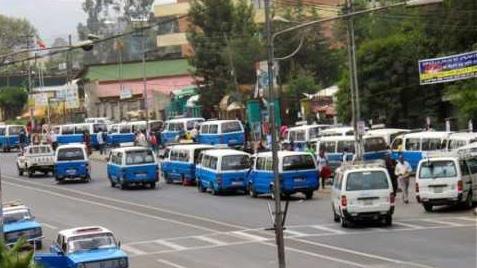
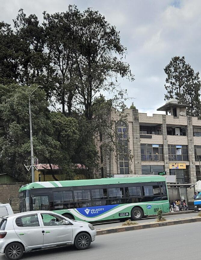
Mobility & Congestion Crisis
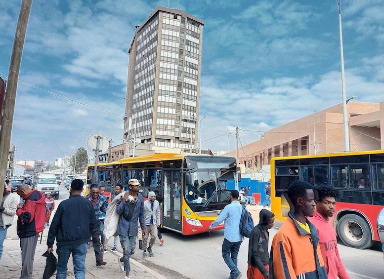
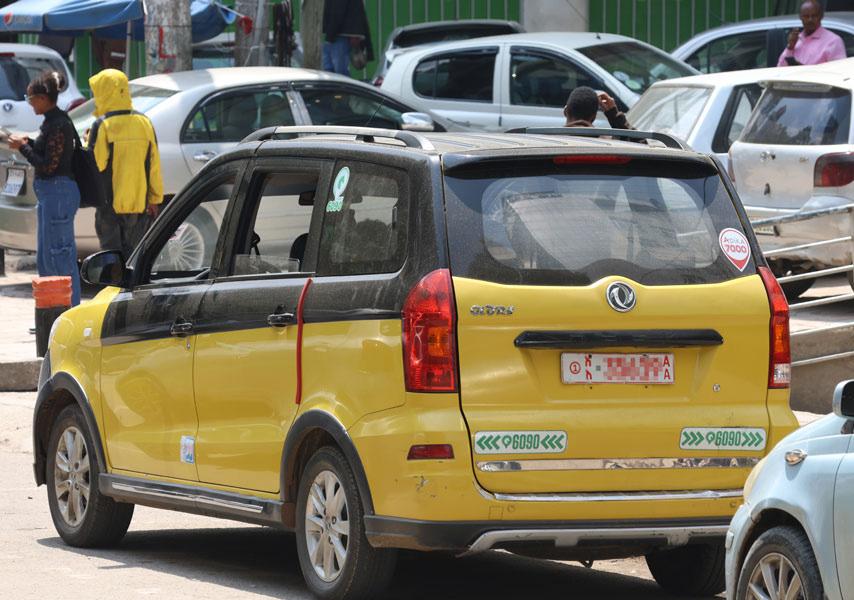
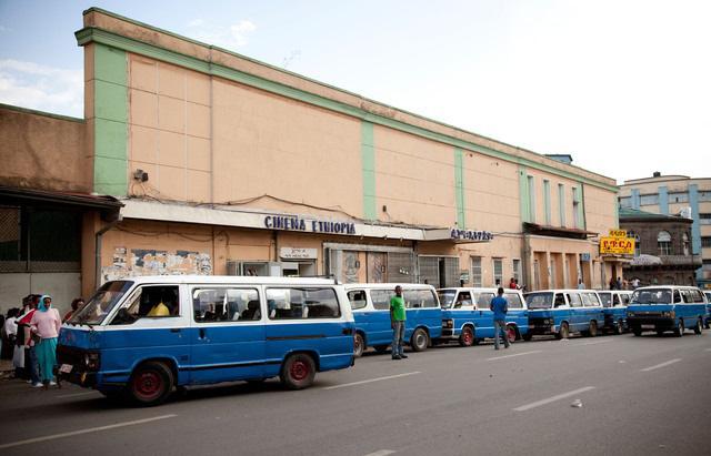
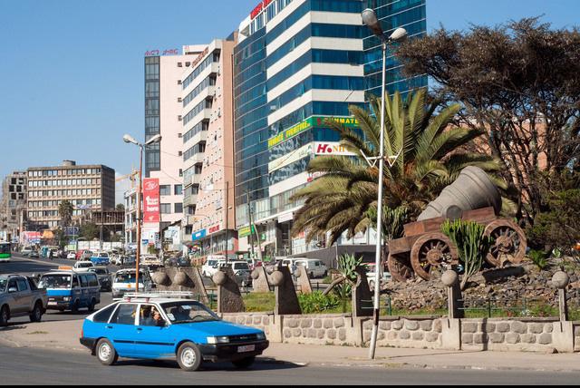
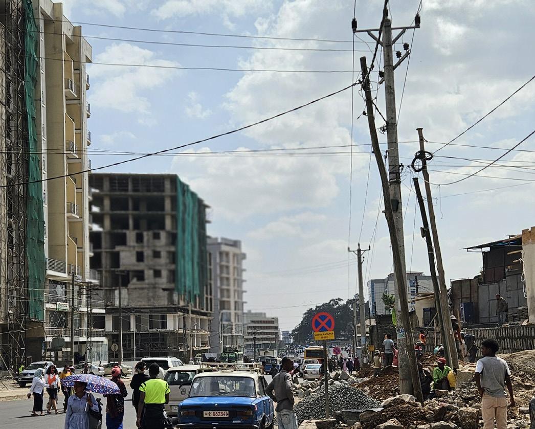
Challenge: Piazza’s compact, organically evolved street network is overwhelmed by growing vehicular traffic, creating persistent congestion, pedestrian vehicle conflict, and visual clutter. Narrow passages, informal parking, and limited walkable space reduce safety, accessibility, and the overall urban quality of the historic core.
Strategy: Reorganize circulation through pedestrian in and green corridors to enhance walkability.
Public Space & Environmental Deficit
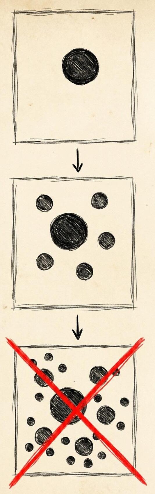
Challenge: Piazza’s public spaces are fragmented, underutilized, and dominated by hard surfaces that worsen heat, limit comfort, and reduce opportunities for social interaction.
The lack of greenery, shading, and continuous pedestrian zones weakens the district’s microclimate and diminishes the quality of urban life.
Strategy: Transform underused land into accessible parks and establish connected green systems.
Architectural Design Control Vacuum
Challenge: The absence of coherent architectural design guidelines in Piazza has led to uncontrolled commercialization, inconsistent signage, and ad hoc alterations that disrupt façade continuity and weaken the district’s historic character. Incompatible materials, irregular heights, and unregulated shopfront modifications contribute to visual clutter and architectural disharmony.
Strategy: Establish mandatory review process with detailed façade, material, and height guidelines.
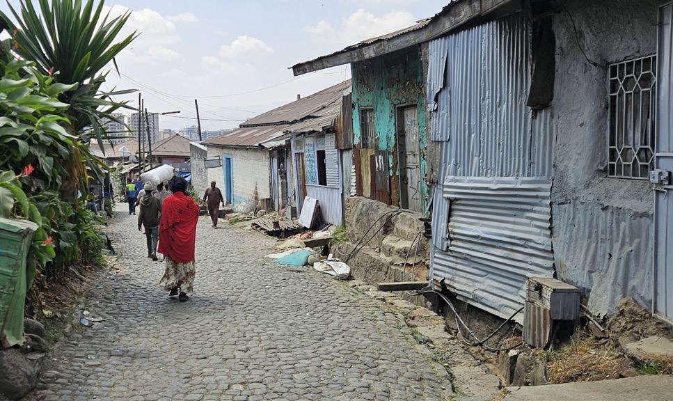
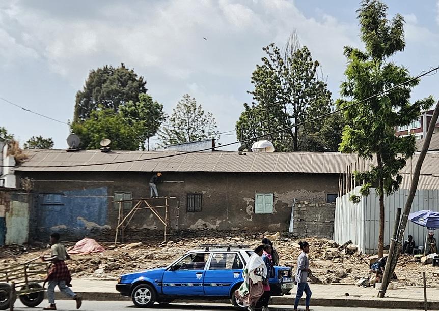
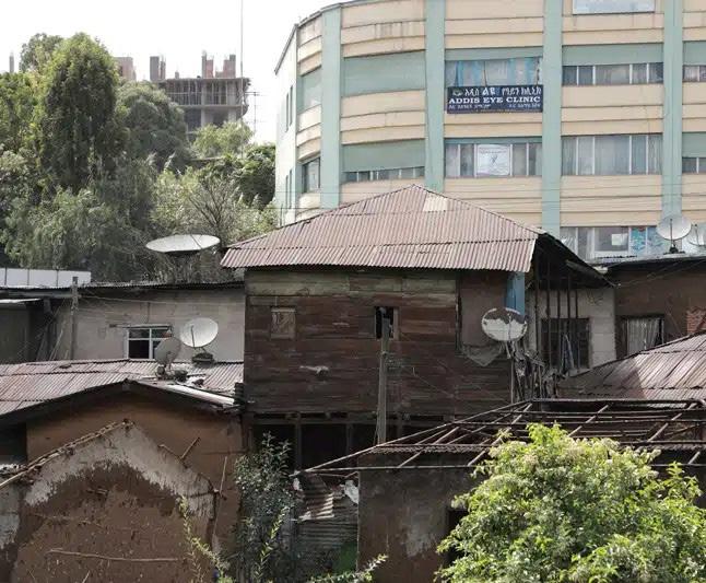
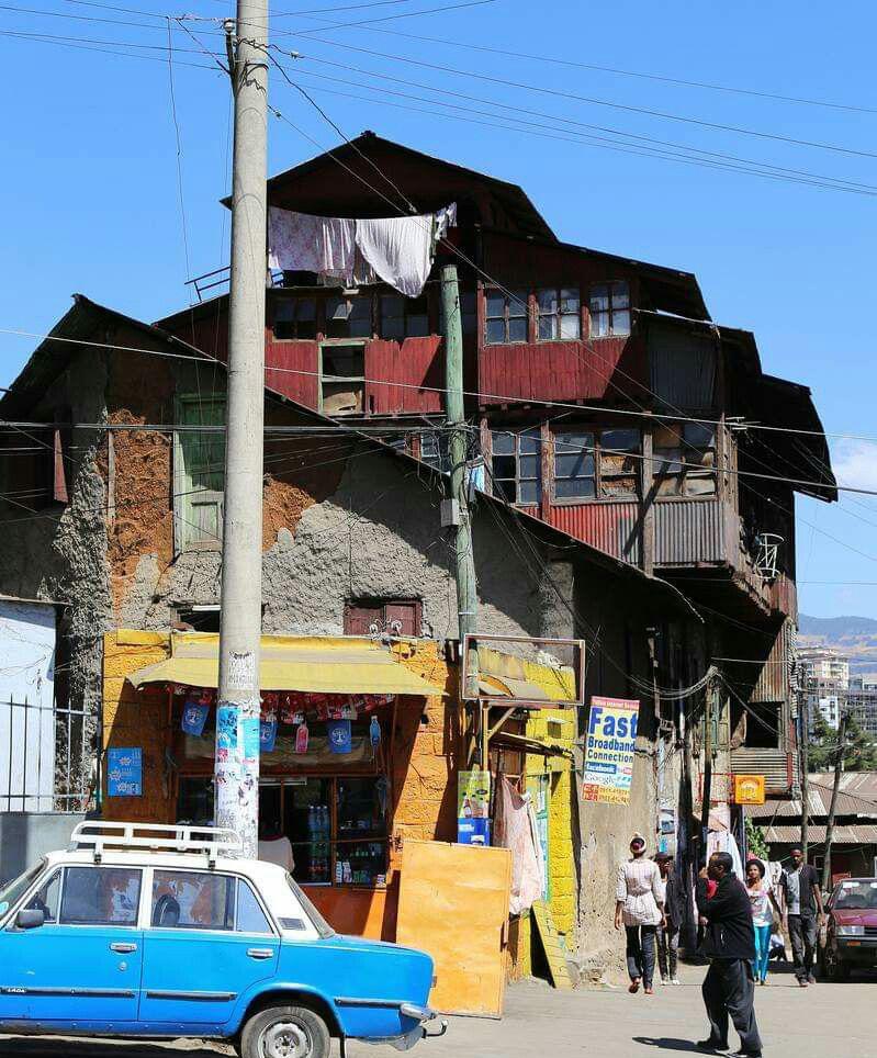
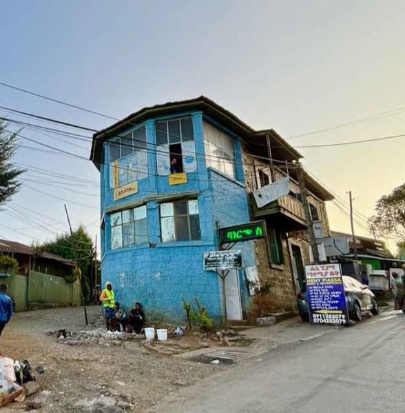
The area’s overcrowded, substandard structures and lack of basic services (sanitation, drainage, daylight and ventilation) create serious health and safety risks. Redevelopment is needed to replace unsafe housing with dignified, mixed-income units and shared open spaces that meet minimum living and environmental standards.
The central Piazza square, including the Giorgis area and city administration surroundings, is heavily crowded with traffic and commercial activity, creating pressure on historic buildings and reducing their visibility and cultural presence.
Churchill Road is wide and vehicle-oriented, creating a strong physical barrier between Piazza’s historic core and the surrounding districts. Its high-speed movement reduces walkability and weakens the spatial and visual continuity needed to support heritage-led regeneration.
he Dejach Wube neighborhood is an older inner block residential cluster characterized by dense, aging structures and irregular pathways
mixed-use renewal.
Structural Decay & Vulnerability
Challenge: Neglected inner residential blocks in Piazza face accelerated structural deterioration, moisture damage, and material fatigue due to age, overcrowding, and lack of maintenance. These compromised conditions reduce safety, livability, and overall resilience, making many blocks unable to support current demands or future adaptation.
Strategy: Prioritize transformation of poor-condition blocks with human-scale mixed-use infill (G+1 to G+4).
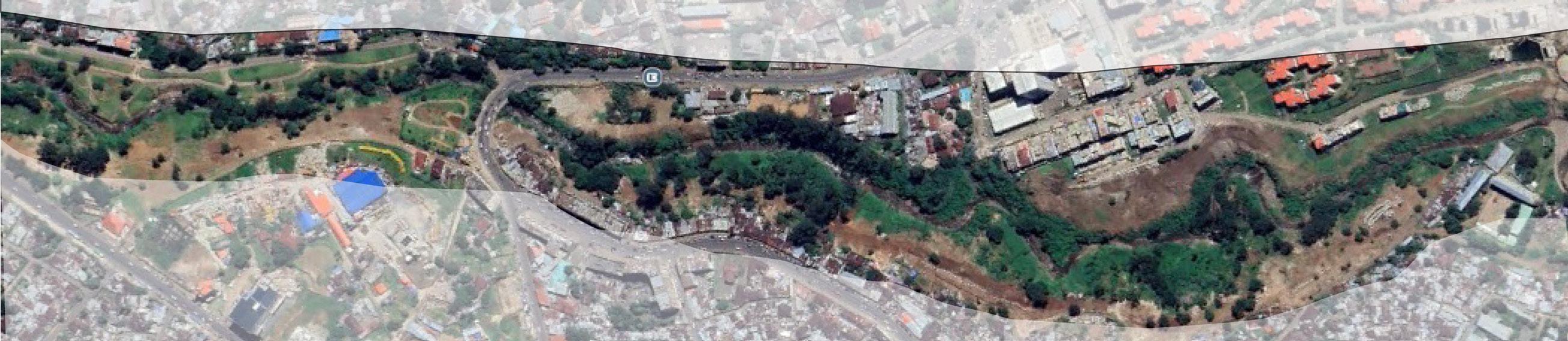
Ras Mekonnen Bridge zone This area lies along the riverside edge of the Piazza district, where construction activity, fragmented plots, and aging low-rise houses create a transitional zone between the historic core and new urban development
Building Height & Scale Conflict
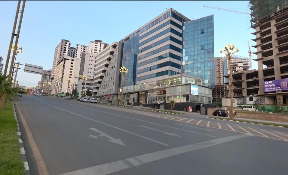
Challenge: Recent G+6 and higher constructions
& Typological Mismatch
Name: Gebrehiwot, Abenezer Birhanu Super visor : Prof Mario Cerasoli
Aliana Rosendo Veliz
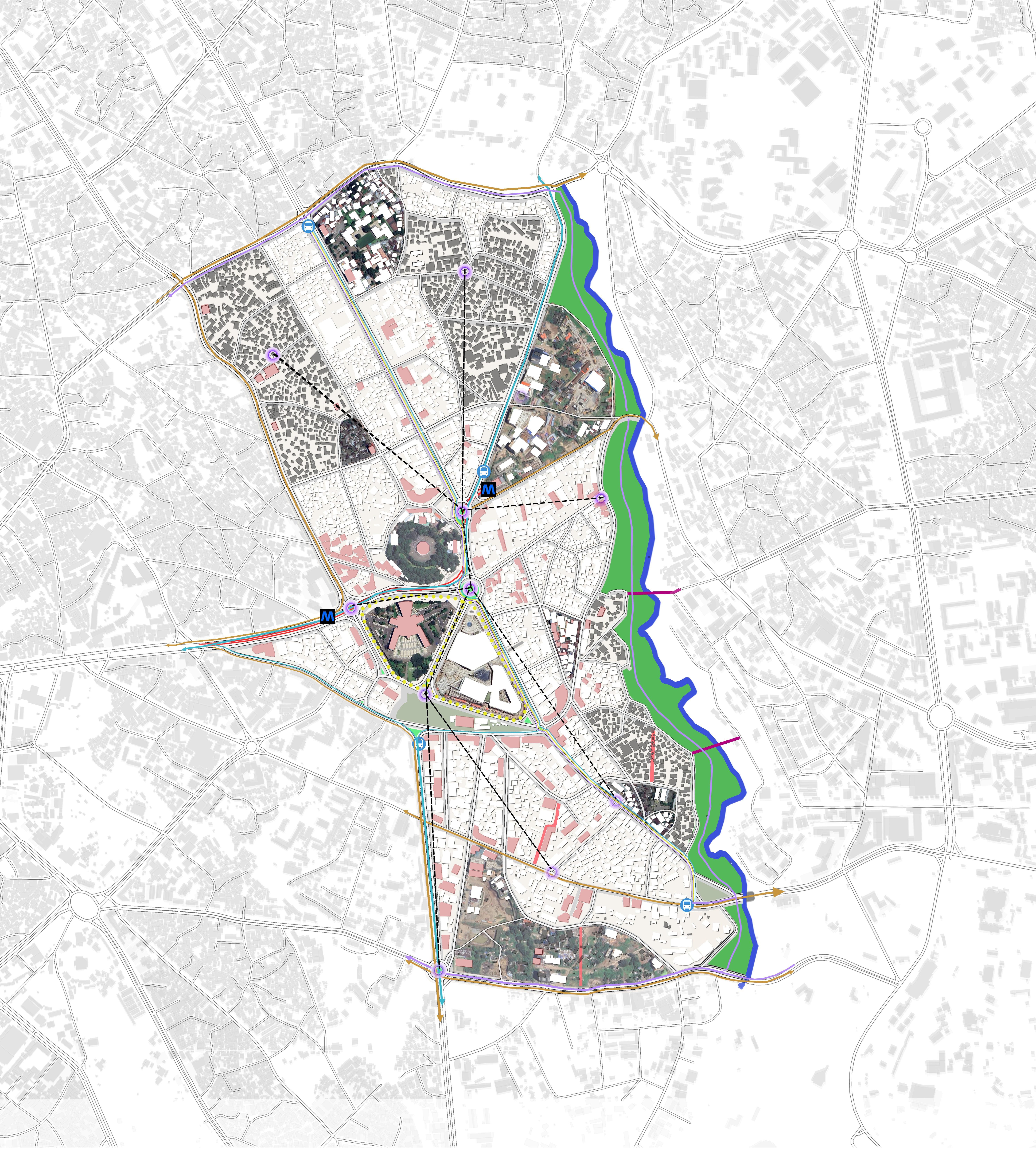
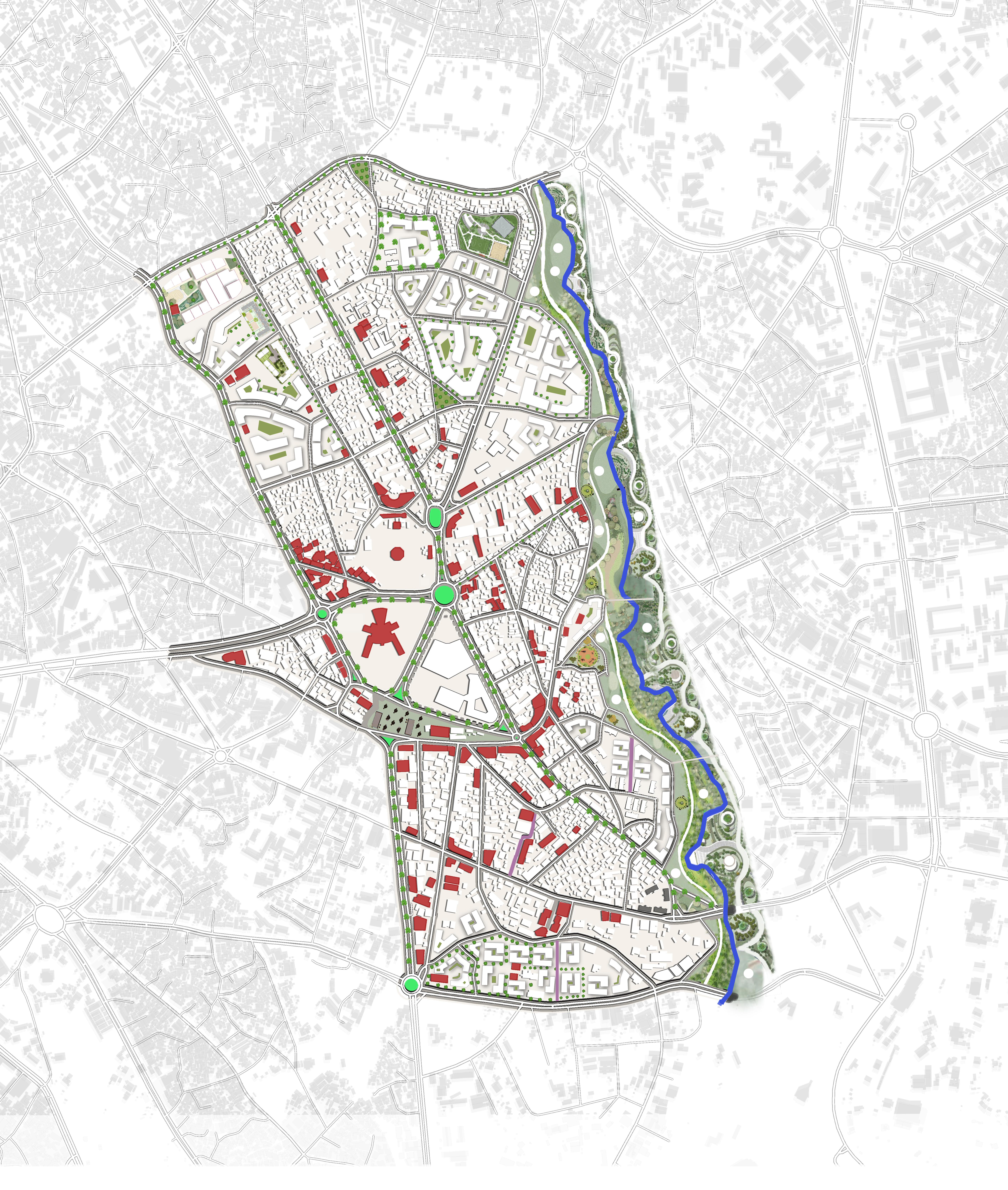
PROPOSAL ( MASTER PLAN
The urban proposal envisions Piazza as
bility, and public life reinforce one another. Building on the area’s
layers and key findings of fragmentation, blocked circulation, and neglected cultural assets, the strategy proposes a heritage-led regeneration model that strengthens
Piazza into a living cultural spineone that preserves memory, supports adaptive development, and enhances the district’s long-term resilience and livability
MAJOR FRAMEWORK OF THE PROPOSAL
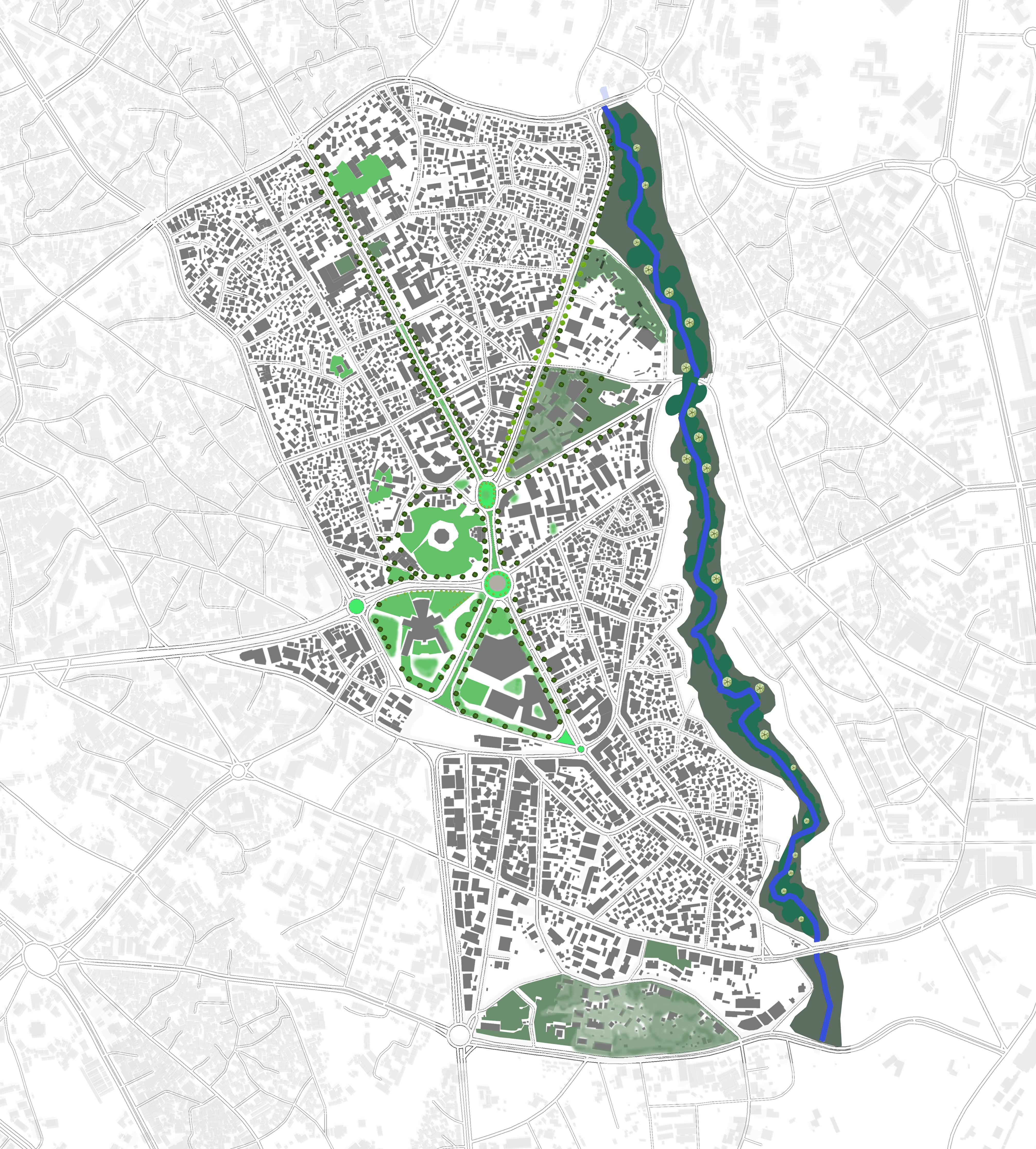
A comprehensive urban planning strategy that balances preservation, adaptation, and sustainable development through four distinct protection zones and an integrated riverside development approach.
1.Maximum Protection Zone
Includes:
• Major historic churches (St.
•
•
•
2.
3.
Includes:
•
•
•
4.
CONCEPT
"Make
A historic institutional zone with Italian-era school and administrative buildings, defined by courtyards, mature trees, and masonry architecture, serving as a key civic and educational anchor..
This
urban life.
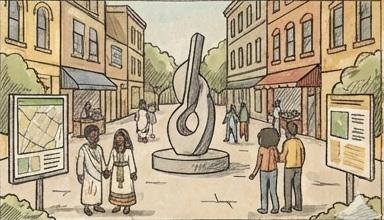
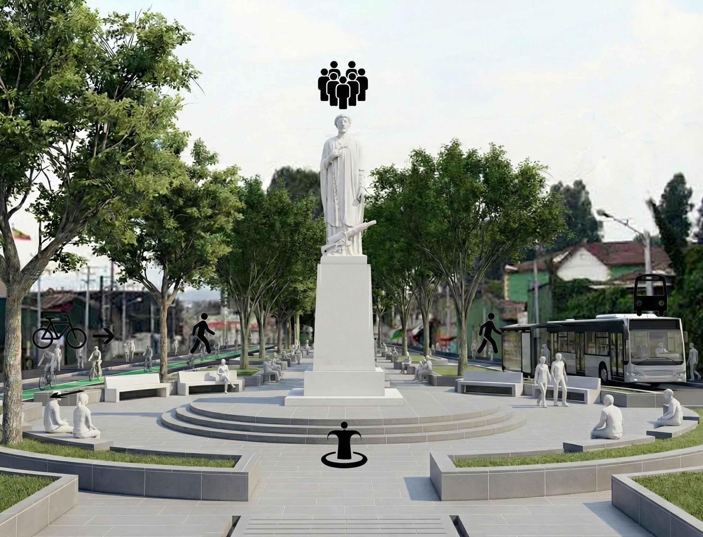
Arada square contains Piazza’s most valuable heritage assets, including landmark churches, key Italian-era civic builings, early commercial arcades, and culturally significant stairways and plazas. It represents the historic core of the ditrict, requiring strict conservation, minimal physical alteration, and careful management to preserve its architectural character and urban memory.
MASTER PLAN STRATEGY
Road rationalization through the removal of unnecessary streets to restore a coherent urban fabric.”
Dejach Wube area shows signs of aging infrastructure, dense inner-block settlements, limited accessibility, and deteriorated housing conditions
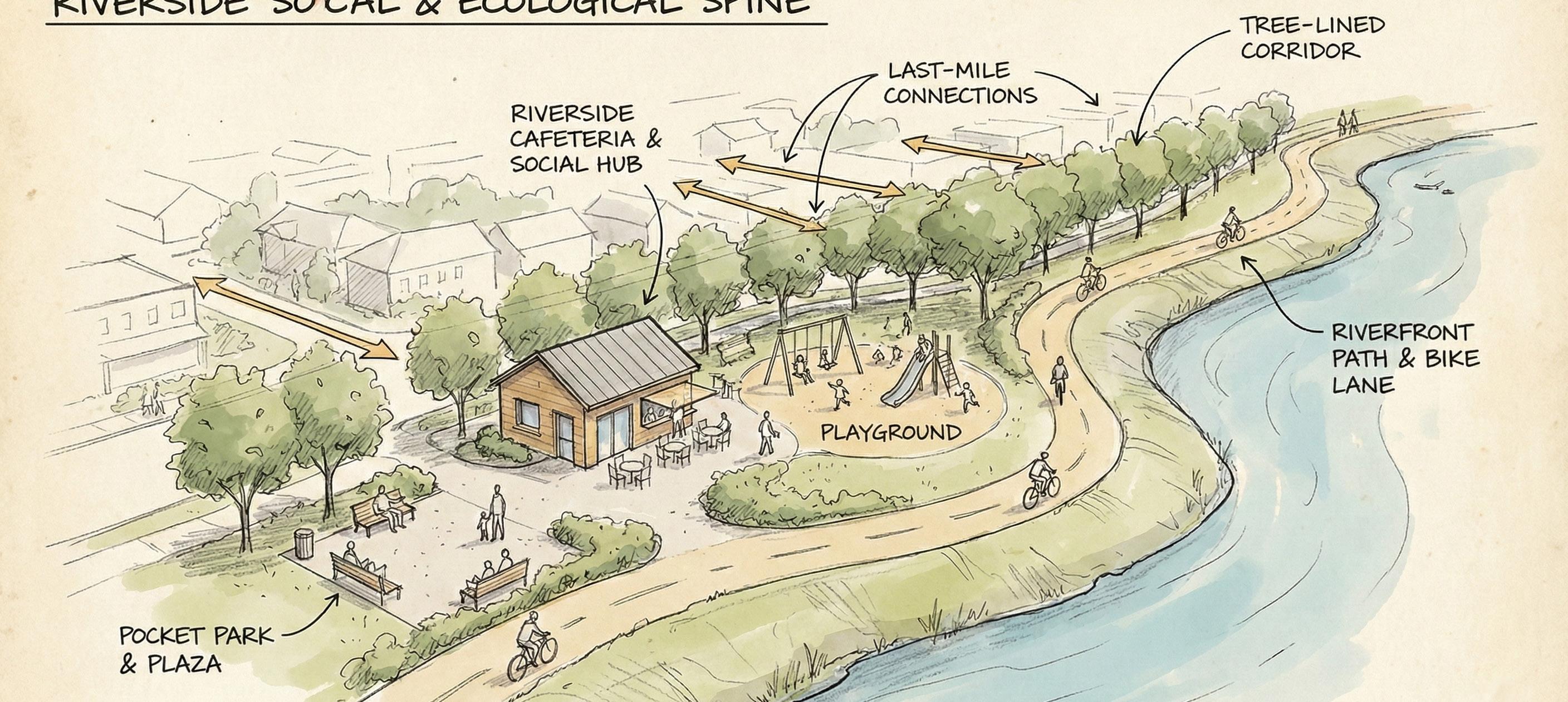
Creates a green public corridor that connects neighborhoods and links directly to Piazza’s historic buildings.
Adds walkways, bridges, and shaded paths to integrate the river with key pedestrian routes.
Supports sustainability through ecological restoration, improved access, and vibrant community spaces.
. The redevelopment of this area creates a balanced counterweight to Piazza’s dense heritage core absorbing new growth while maintaining architectural harmony, improving mobility, expanding green and public spaces, and strengthening the district’s longterm sustainability. It becomes a modern yet culturally grounded extension that enhances the identity, accessibility, and livability of the broader Piazza area.
RIVERSIDE STRATEGY
PROPOSAL ( MOBILITY PLAN )
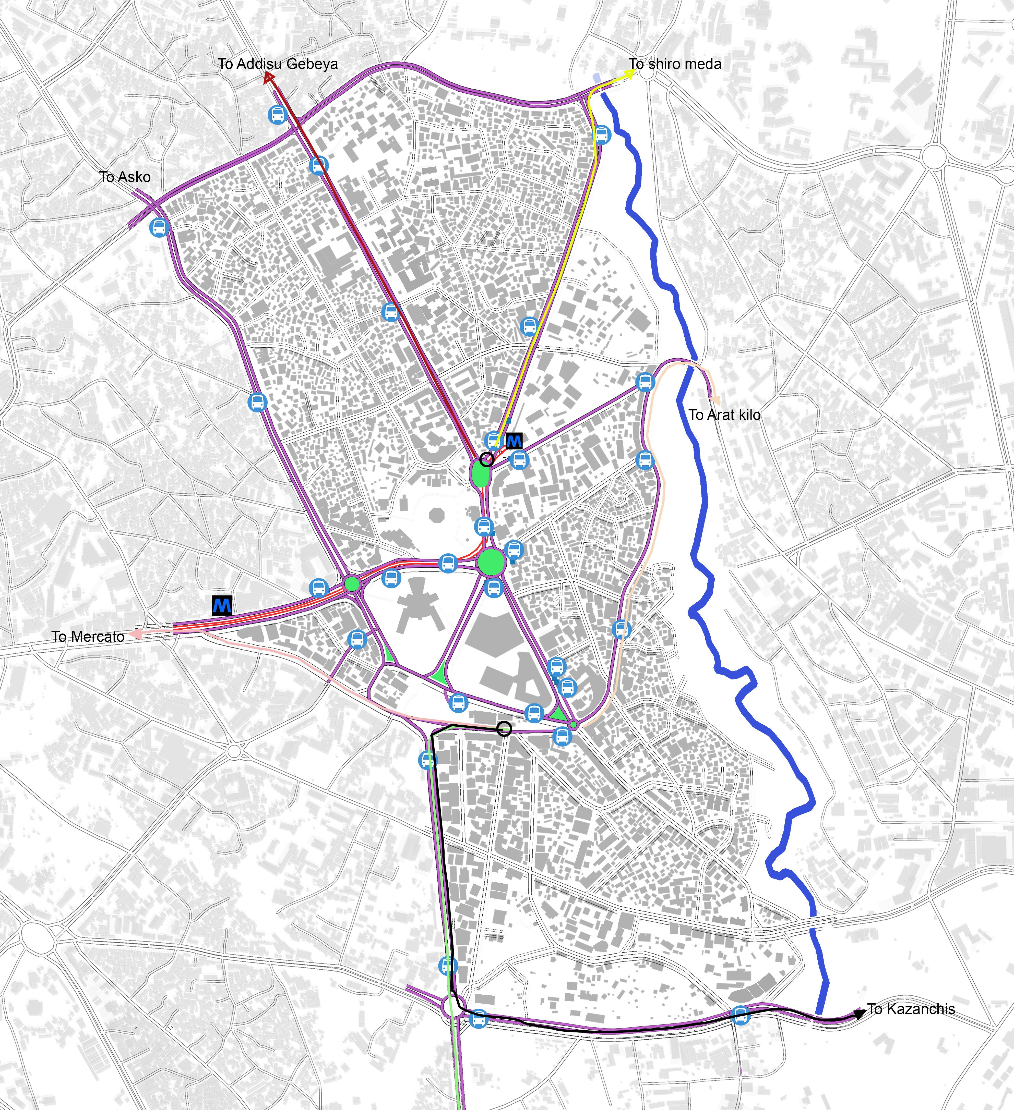
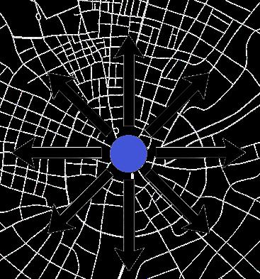
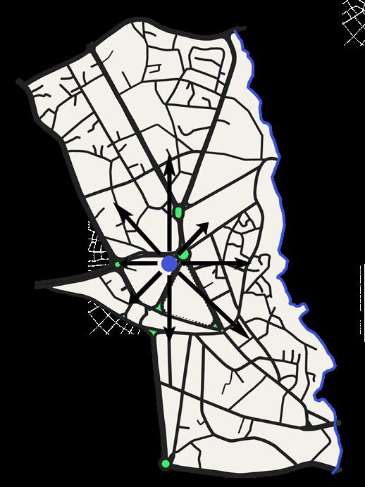
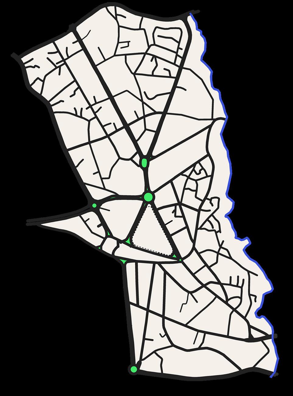
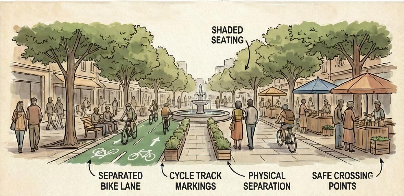
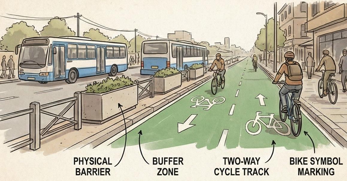
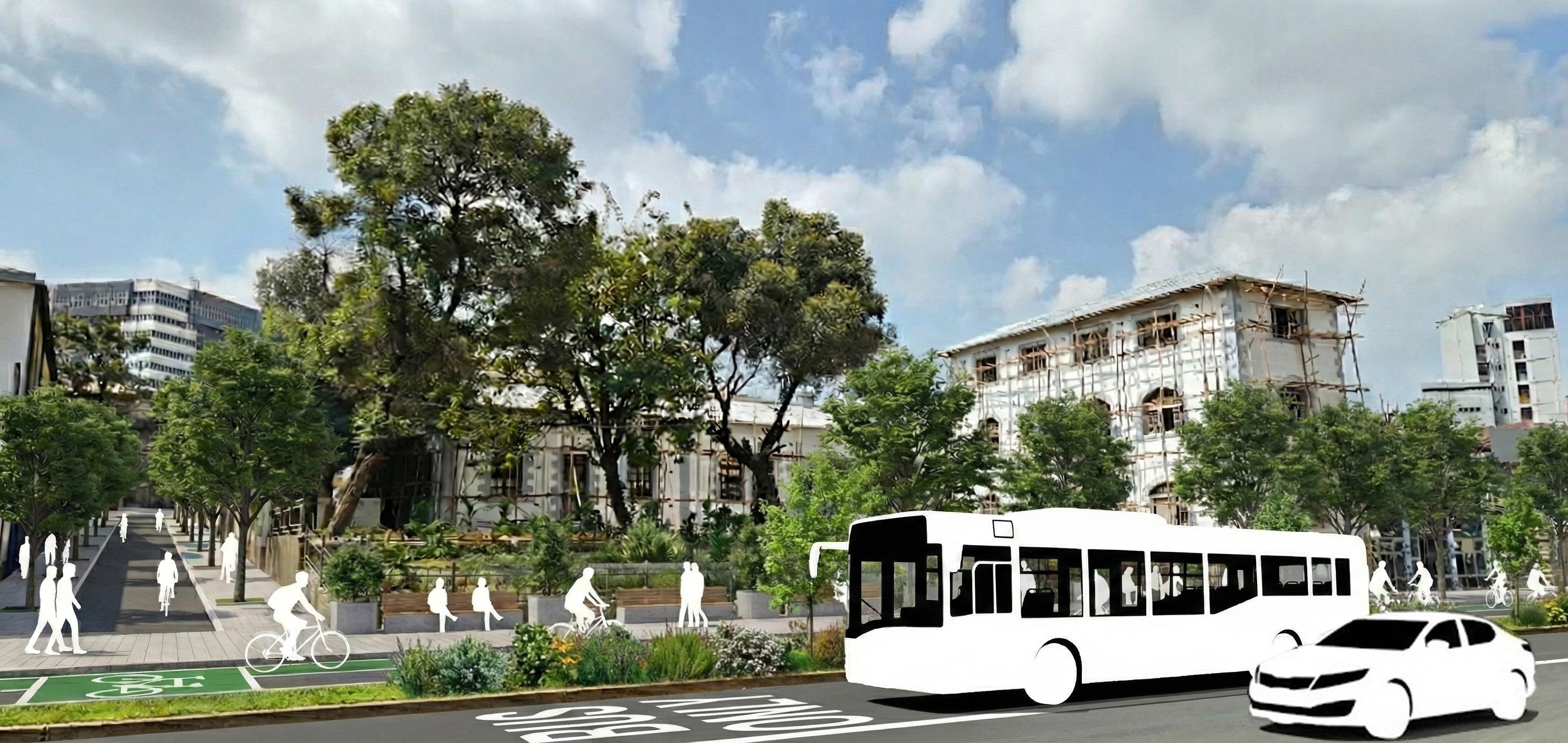
1. Connectivity Strategy – Rebuilding the Historic Urban Spine Piazza’s early radial growth produced natural vectors of movement that have been weakened by congestion, blockages, and unplanned infill. The connectivity strategy restores these original alignments and enhances them to support a legible, walkable, and inclusive district.
Core Actions
• Reinforce historic radial axes linking St. George Cathedral, Churchill Avenue, Dejach Wube, and La Gare, restoring the district’s cultural and spatial hierarchy.
• Open blocked alleys and inner-block passages (UNLOCK) to improve permeability and create a fine-grained pedestrian network.
• Prioritize pedestrian and public-transport-oriented circulation, reducing traffic dominance in the narrow core.
• Introduce a clear street hierarchy distinguishing pedestrian spines, shared streets, and limited-access vehicular routes.
• Remove unnecessary or redundant roads to restore coherent urban form and enhance public space.
• Connect heritage nodes (St. George, Taitu Hotel, Italian-era civic buildings) through continuous cultural and commercial walking routes.
Outcome
A walkable, legible, human-scale Piazza where movement supports heritage, public life, and environmental performance.
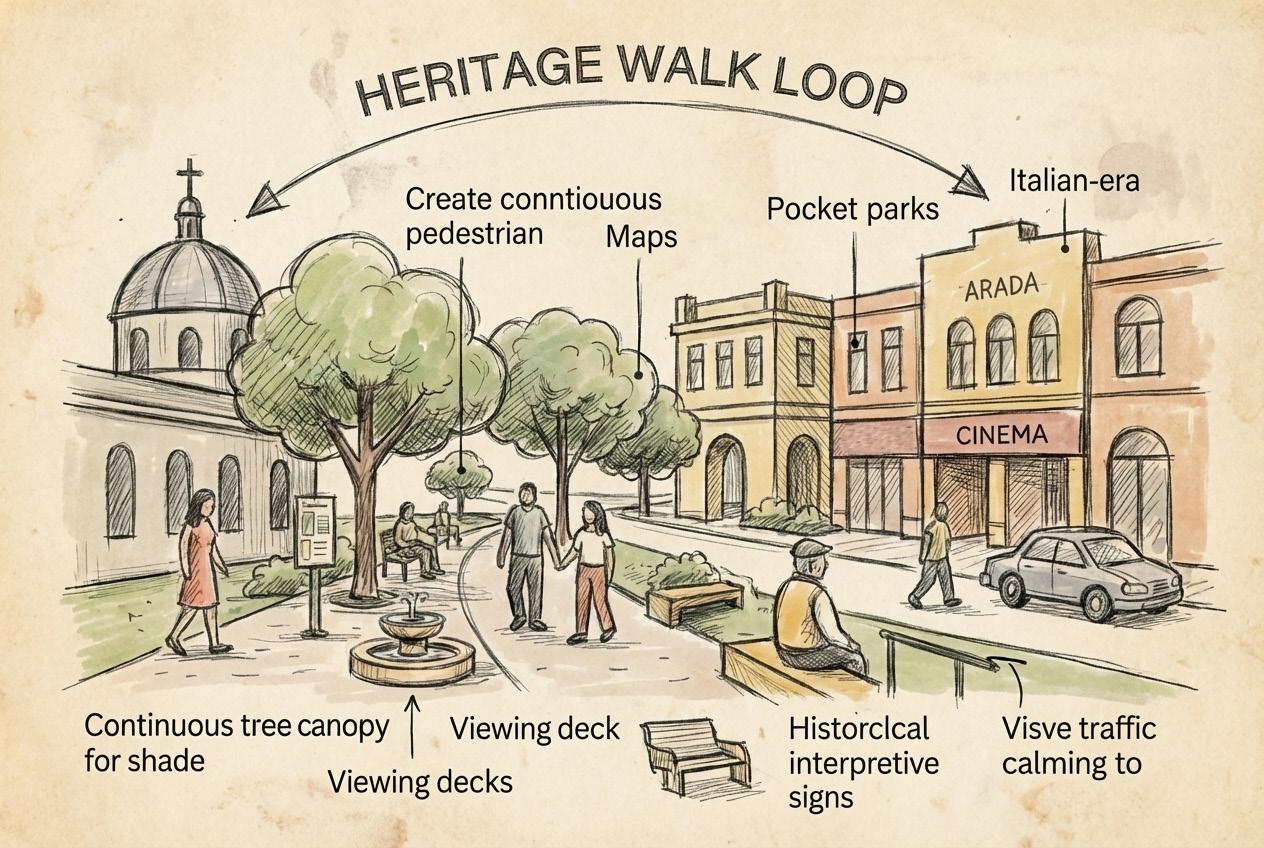
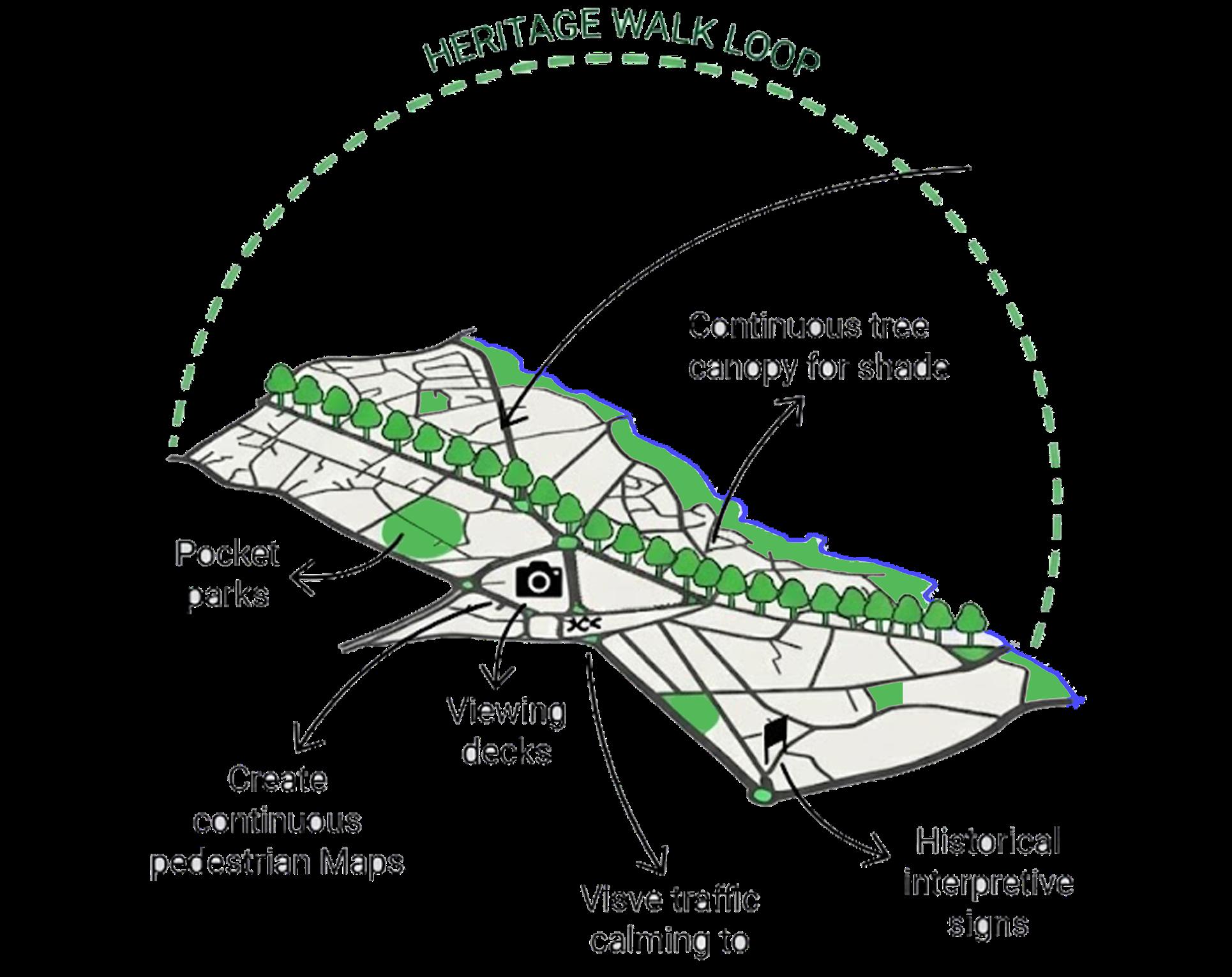
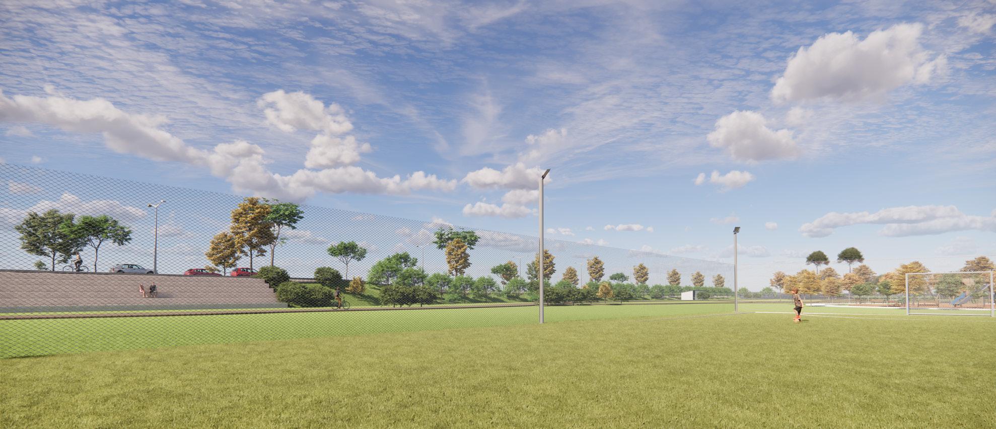
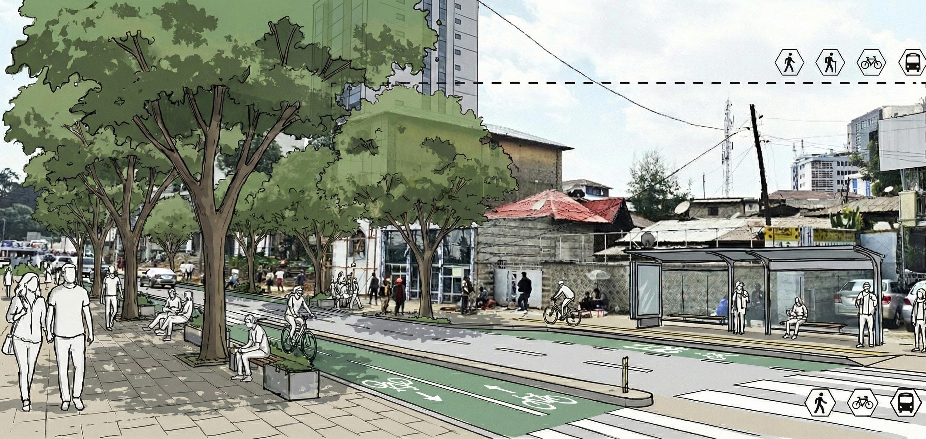
2. Green Infrastructure Strategy – A Connected Urban Landscape Piazza currently suffers from fragmented, hard-surfaced open spaces with limited ecological value. The strategy introduces an integrated green system improving microclimate, comfort, and environmental resilience.
Core Actions
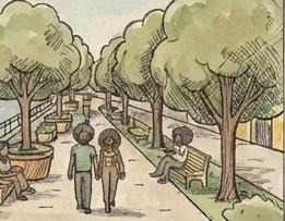
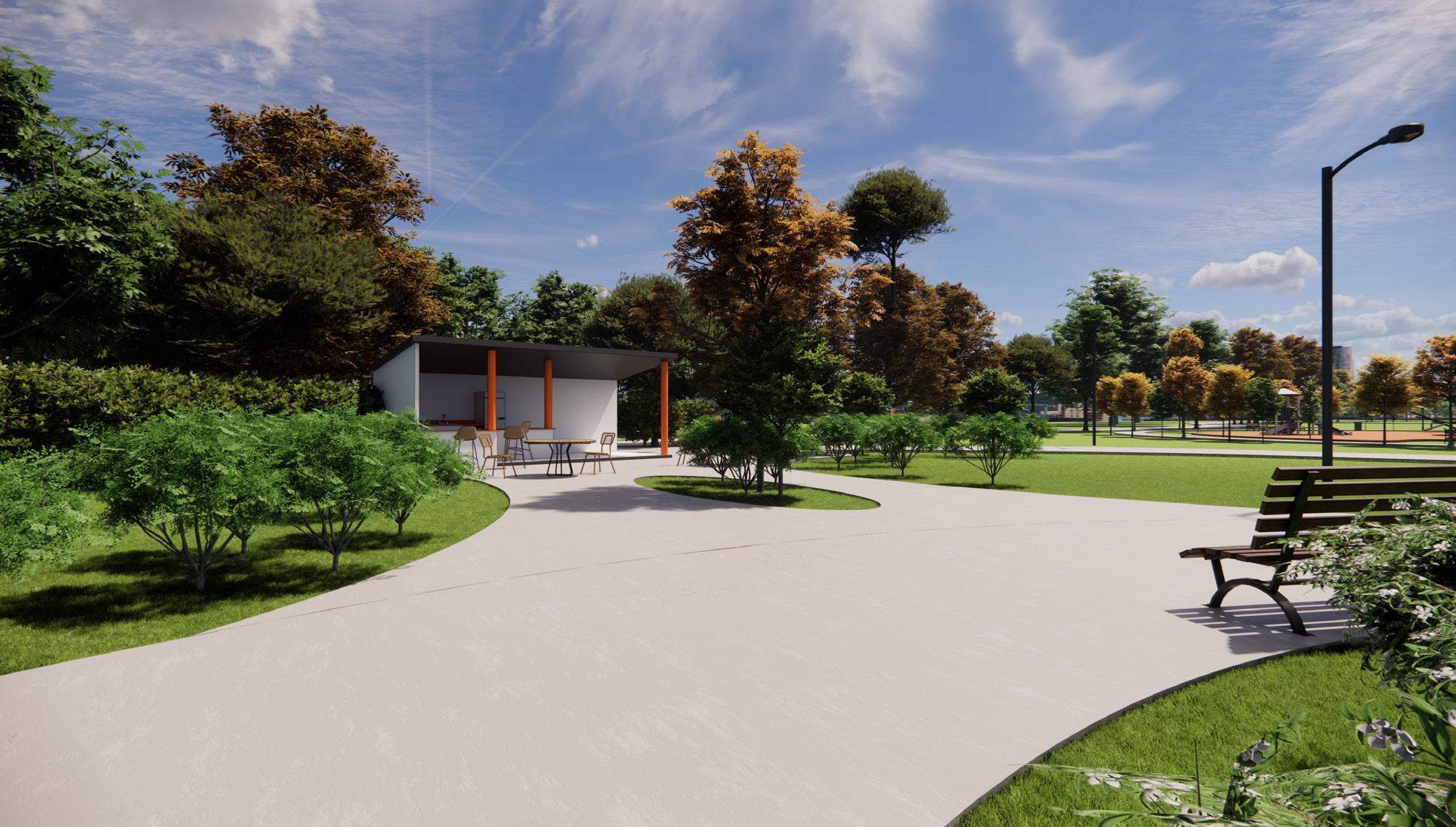
• Transform underused and leftover spaces into pocket parks, shaded plazas, and green resting areas.
• Create a continuous “Green Loop” connecting heritage landmarks, pedestrian corridors, and public spaces.
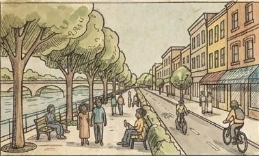
• Integrate the riverside as a green ecological spine with walkways, landscaping, bridges, and shaded paths that connect the district to wider natural systems.
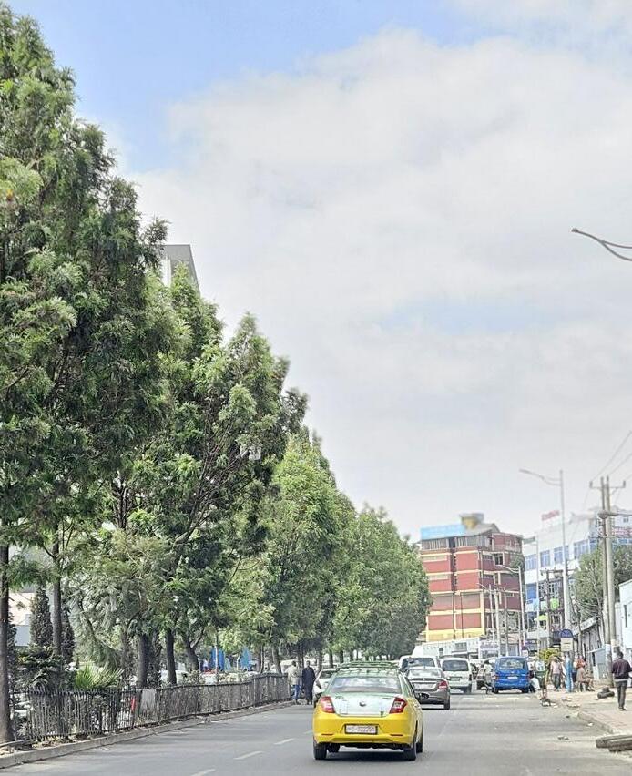
• Introduce tree-lined pedestrian streets, increasing shading and reducing heat in dense commercial zones.
• Implement green buffers around Maximum and Medium Protection Zones to protect heritage setting and enhance visual quality.
• Activate the riverfront as a social and ecological corridor, linking neighborhoods while improving stormwater management and climate resilience.
Outcome
A cooler, greener, environmentally responsive Piazza, where ecological networks enhance public life, comfort, and heritage experience.
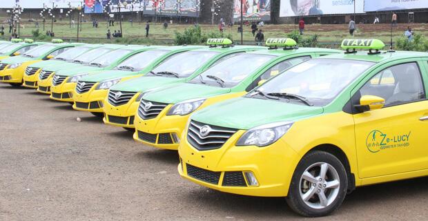
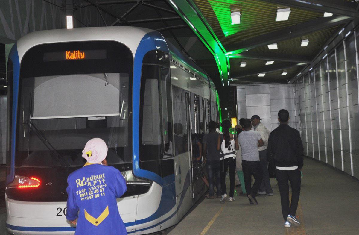
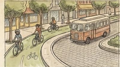
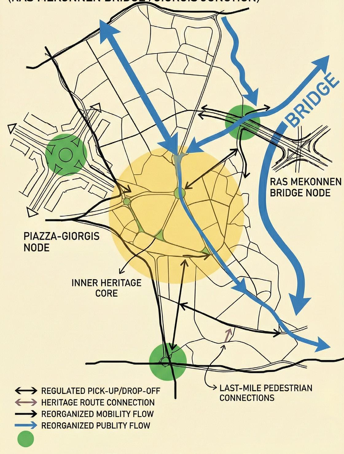
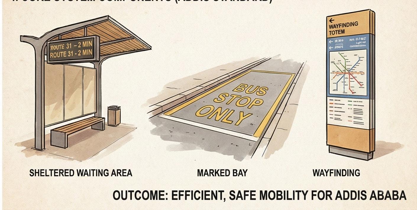
3.Integrated Public Transport Nodes (Ras Mekonnen Bridge / Giorgis Junction)
Develop two coordinated and well-managed transport hubs around Piazza to replace scattered roadside stops and reorganize overall mobility flow.
Why
•Minibuses, taxis, and ride-hailing services currently stop randomly, creating congestion, pedestrian conflict, and visual disorder.
• Lack of designated pick-up/drop-off points forces pedestrians to cross unpredictably and blocks vehicles on narrow streets.
Core Actions
•Convert chaotic junctions into structured transport nodes, each equipped with:clearly marked loading/unloading bays sheltered waiting areas
• ticketing and wayfinding systems
• posted route information
• last-mile pedestrian connections integrated with heritage routes
•Locate and differentiate the hubs:
• Piazza–Giorgis Node → serves the inner heritage core with controlled access.
• Ras Mekonnen Bridge Node → functions as the outer interchange connecting major radial routes.
•Introduce regulated pick-up/drop-off areas to eliminate random stopping and ensure safe pedestrian movement.
Outcome
A clear, efficient, and safer public transport system that reduces congestion, strengthens walkability, and supports Piazza’s heritage-sensitive mobility strategy.
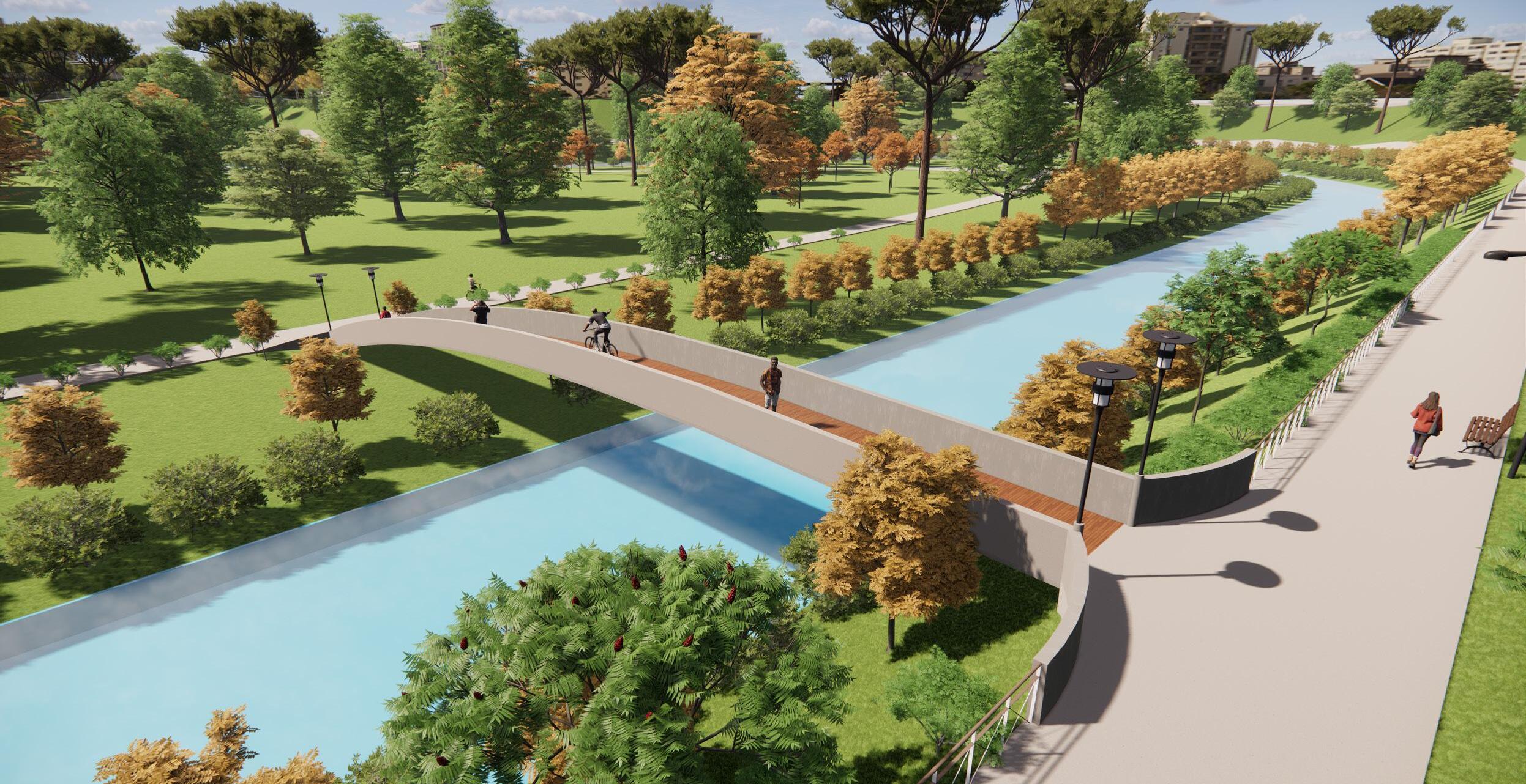
4.Integrate the Riverside as an Ecological Spine Piazza’s river edge is currently underused, disconnected, and environmentally degraded.
Transforming it into an ecological spine creates a continuous natural corridor that improves climate comfort, restores connectivity, and strengthens urban resilience.
Core Actions
• Establish a continuous ecological and social corridor
Convert the river edge into a landscaped greenway with walkways, shaded paths, and rest points that reconnect the Piazza core with its natural landscape.
• Link the historic core to the river
Introduce green walkways, planted edges, and pedestrian bridges that integrate the river into everyday movement patterns and enhance accessibility.
• Improve climate and environmental performance
Use the river corridor as a natural cooling and airflow spine, providing shaded microclimates and improving comfort in the dense urban fabric.
• Enhance stormwater and ecological management
Upgrade riverbanks with permeable surfaces, planted buffers, and improved drainage to support stormwater control, reduce flooding, and strengthen biodiversity.
• Activate the riverfront as a public realm
Add pathways, lighting, seating, and community spaces to turn the formerly neglected edge into a vibrant public space that complements Piazza’s heritage and daily life.
Outcome
A revitalized, accessible, and climate-responsive riverfront that becomes both an ecological engine and a social connector enriching public life, improving environmental
Name: Gebrehiwot, Abenezer Birhanu
Mario Cerasoli
Rosendo Veliz
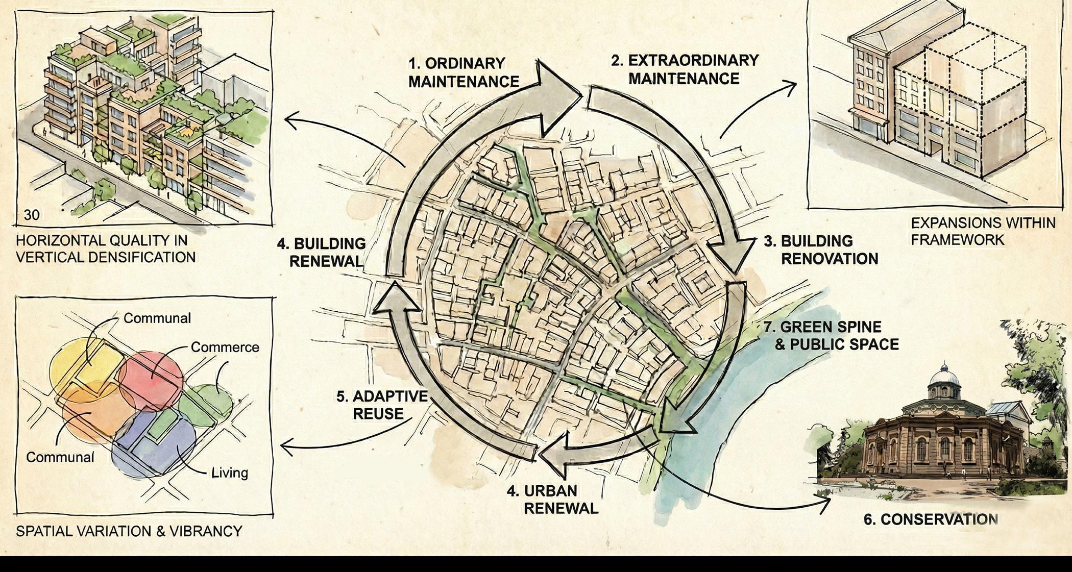
2. Ordinary Maintenance
Building Renovation
Adaptive Reuse
Urban Renewal
3. Extraordinary Maintenance
PROPOSAL( ENVIRONMENTAL PLAN)
The master plan for Piazza proposes a heritage-based regeneration framework that preserves the district’s historic core while restructuring mobility, public space, and housing to meet contemporary needs. It organizes the area into differentiated protection and transformation zones Maximum Protection, Medium Protection & Adaptation, Adaptation, Redevelopment, and Riverside Development so that landmark churches, Italian-era civic buildings, and historic commercial streets are strictly conserved, while mid 20th century fabric is upgraded and deteriorated inner blocks are renewed with mixed-income housing and community facilities.
At the same time, a new connectivity structure composed of a green cultural loop a pedestrian-only core around St. George and Piazza Square, pedestrian priority corridors, integrated public transport nodes, and a continuous riverside park rebalances movement in favor of walking, transit, and ecological continuity Through coordinated recovery actions (maintenance, conservation, renovation, urban renewal, and adaptive reuse), the plan aims to unveil hidden heritage, unlock inaccessible spaces, and unify fragmented neighborhoods ensuring that Piazza remains Addis Ababa’s living cultural core while evolving as a more accessible, sustainable, and inclusive urban district.
“TRACING TIME THROUGH PIAZZA”
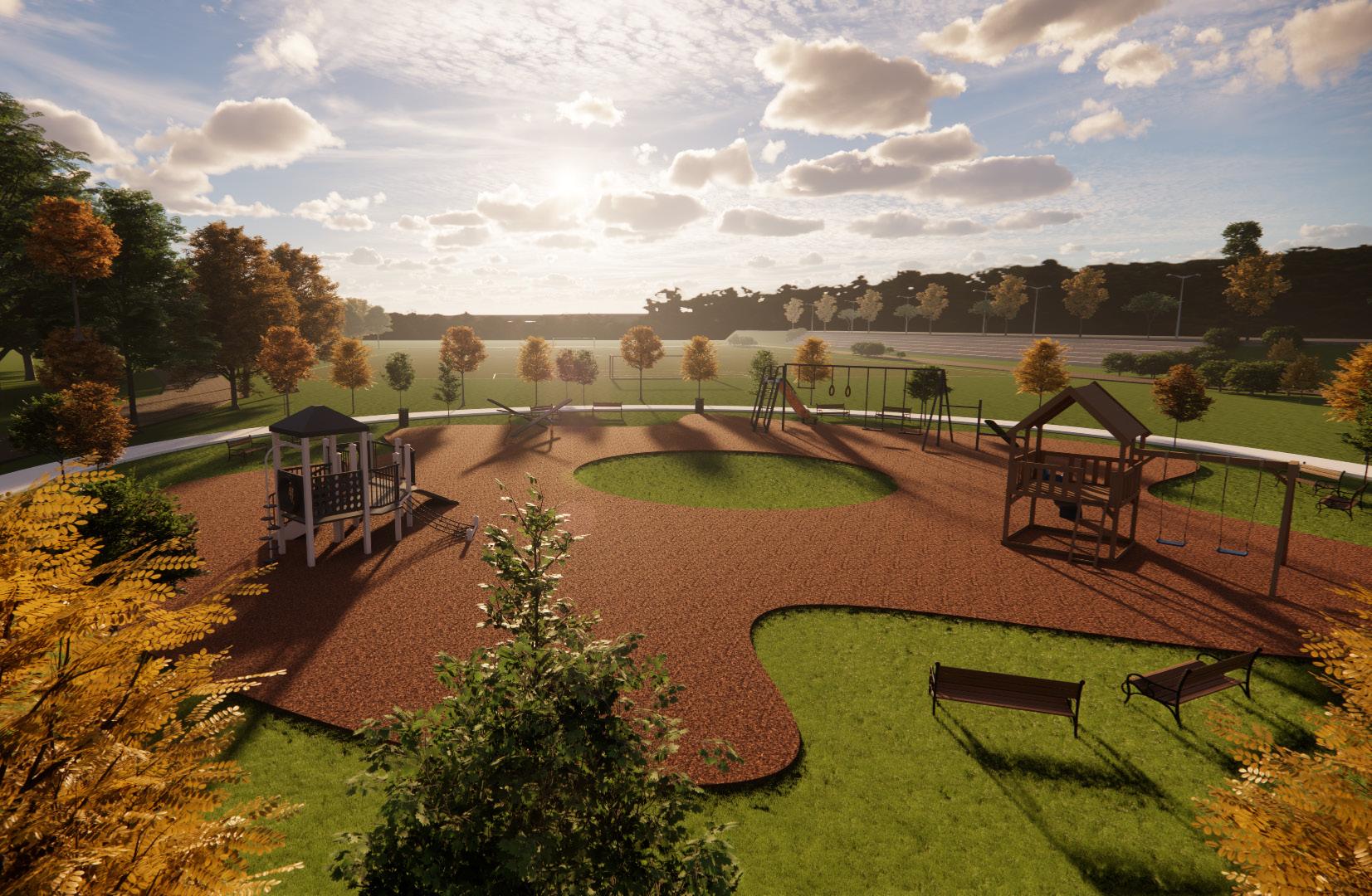
vibrant community spaces that enhance microclimate, promote active lifestyles, and reconnect residents with the natural landscape.
“Preserving identity is not resistance to a change, but a bridge between memory and modernity.”