credits: Lightstyle Photography, Brodie Knox, Brendan Alborn, Johny O’Donnell, NZCYA Book Awards Design and artwork: Mat Tait
mattait.com. Contributors: Johny O’Donnell, Brendan Alborn, Glen Stringer, Jade Alborn. Produced and published by: Alborn Enterprises Ltd, 8 Franklin Street, Marahau 7197, RD2 Motueka, New Zealand. Email: feedback@abeltasman.com Tel: 03 527 8559
Photography
mattait@
the uno cial guide to the national park
EDITORS’ INTRODUCTION
Welcome to the fifth edition of Abel Tasman Magazine. It’s been a hell of a ride for us tourism types over the last five years, but I’m thrilled to say that the 2023-24 summer season saw our business put the days of COVID further into our rear vision mirror.
Our mix of domestic and international visitors, which has always been close to a 50/50 split, has returned to what it was before the pandemic. It has been great to see the international visitors and the energy they bring return to Mārahau and to look out the office window to see all our kayaks in the park rather than in the storage sheds.
Ahead of the 2022-23 season, we didn’t have much clue what visitor numbers would look like and believed it would be a few more years before things returned to pre-2020 numbers. This meant we were reasonably conservative in terms of our resourcing for the first season after our international borders reopened, and we were therefore caught a bit short in terms of water taxi skippers and kayak guides.
When we were planning for the 2023-24 season, we decided to take a punt and do everything we could to get enough people in place to meet what we hoped would be a bumper season. For example, back when our borders were closed, Mārahau Sea Kayaks’ business dropped back to a level where we only needed three staff in total. Last season, we employed a full contingent of nine guides. It was such a relief to see the gamble pay off, and I was overjoyed to see the off-peak months also set new records.
Although global events over the past few years have reinforced just how rapidly things can go south, it feels like we’re back to full strength and that means we are able to start planning some exciting things for the future. Local designer Dave Gunter of Coastal Designs has developed a fantastic design for the refurbishment and expansion of the Abel Tasman Centre, a project we hope to complete during the winter of 2025. We have some very rough plans for a block of land we’ve just purchased in Mārahau, too, but at this stage, planning is only in the very early stages. Hopefully, we’ll have some news on that in the next edition of this magazine.
The other thing I wanted to share with you is the progress we’ve made with the Mārahau Pledge, the environmental trust we established alongside the other activities operators here in Mārahau two years ago. I’m immensely proud
to say that we have collected more than $200,000 in contributions from our water taxi and kayaking customers so far which has been then donated to the Mārahau Environmental Trust. Along with the donations from the other Mārahau-based operators, the Trust is now in a position to support some significant environmental and access-related projects in and around this magical little village.
We are really hoping to see this fund projects that lead directly to improvements that benefit both the environment and the local Mārahau community. After all, that’s the whole point of the Trust. As a tourism operator, I’m accurately aware that without the social licence and support of the people who live in Mārahau, we simply wouldn’t be able to do what we do.
Thanks for picking up our magazine and sharing our stories. We love putting this publication together every year and hope you enjoy reading it.
Kia ora anō! We’ve made it to our fifth edition of Abel Tasman Magazine!
I’m as surprised as anyone, to be honest. When we first kicked this thing off, I thought we were biting off more than we could chew. Then COVID hit, the borders closed, and I was sure we were stuffed. But here we are.
Turns out that producing a magazine is heaps of work. It’s a labour of love that involves countless hours of brainstorming, writing, interviewing, photographing, editing, and design. Magazines are not cheap to make either. There’s a reason you’re seeing magazines shrink, recycle content, or morph into thinly disguised advertorials. Gone are the days when you could grab a quality read for the price of a coffee.
This magazine is different. It features completely original content, doesn’t have any advertisements and still makes its way to you for free. That’s why I can’t acknowledge the Alborn family, who fund and produce this magazine each year, enough. The Alborns recognise the value of having a platform like this to not only educate visitors but also connect the local community, and to me, even though the accountants might not agree, that is gold.
One of the highlights of this edition is the feature on Mat Tait. Mat’s award-winning design and illustration skills have been the secret sauce of this magazine since day one. His reluctance to be in the limelight only adds to his charm, but we think it’s high time we celebrated his brilliance. I’m chuffed that Brendan put together his story for you.
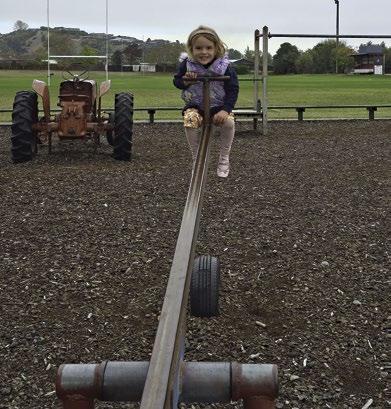
From my side, we’ve got a rather unconventional playground guide co-produced with my daughter. I also managed to find it in myself to spend more time eating and drinking my way around the region for your benefit. I’ve taken the opportunity to share and reflect a bit more on the Mārahau Pledge initiative, too, as I’m full of praise for the operators who have come together to do things differently and contribute back to the community.
So here we have it, the fifth edition of Abel Tasman Magazine. Whether you’re picking up our magazine for the first time or you’ve been with us from the start, we hope these pages inspire you to peel back the layers, to explore, to connect, and to be reminded again of what a special corner of Aotearoa this is.
Finally, I want to acknowledge those who have contributed to the magazine over the past five years. There have been so many great stories told and there are so many more to tell. Here’s to five years of storytelling and to many more to come!
Ngā mihi mahana
JOD Johny O’Donnell.
THE ABEL TASMAN COASTAL TRACK WALKING GUIDE
Words: Brendan Alborn.
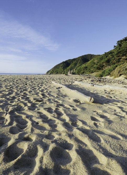
The Abel Tasman Coast Track is roughly 60 kilometres long, winding its way from Mārahau in the south up to Wainui to the north.
Te Pukatea Bay.
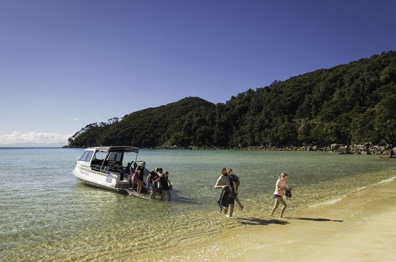
The track can be loosely divided into sections between the different bays or the six Coastal Access Points (CAPs) where water taxis are permitted to drop and pick up passengers.
The idea of these CAPs is to provide visitors with options to complete a small section of the track by taking a water taxi to one bay before walking through to the next bay to be collected and dropped back at your original departure point. Another option is for walkers to either get dropped at a CAP and then walk back to Mārahau, or alternatively, people can start their walk in Mārahau and then get picked up wherever they chose to end their walk, whether that’s a three-hour walk to Anchorage or a three-day walk to Tōtaranui.
The track sections between the bays are all different distances, have a variety of terrain profiles and their own unique characteristics, views and highlights. This all makes it perfect for a great number of half-day, full-day and multi-day adventures, depending on your energy level and specific interests. However, it does mean visitors need to choose between the gazillion options available and this is enough to furrow the brow of even the hardiest of souls accustomed to making a good choice when presented with an array of options.
Adding another layer of complexity are the various sections of the Coast Track where there are both low and high tide routes with the low tide routes typically being shorter than the high tide options, so this impacts walk distances/ times. It should be noted that by necessity, the walking times below and on the DOC signs through the Abel Tasman can be indicative only, as they depend entirely on your walking speed and your propensity to stop and take in the sights. In my experience walkers can be loosely divided into two types: the head down, “let’s get this done” walker who thinks of the destination and then attempts to break the current record getting there; and the “stop and smell the roses” walker who wants to whip down to every bay, to feel the sand on their feet, ensure they can identify each subvariety of fauna at that bay and maybe even have a little sit down.
Luckily for you, dear reader, we have finally succeeded in designing and building a supercomputer here at AbelTasman.com Global Headquarters on which we are running possibly the world’s most sophisticated multivariable-regression-analysis-model to create this: THE definitive walking and location guide for the Abel Tasman. We’ve done all the heavy lifting so you can easily pick the perfect walk for you. You’re welcome. (contd)
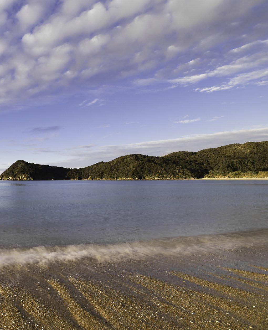
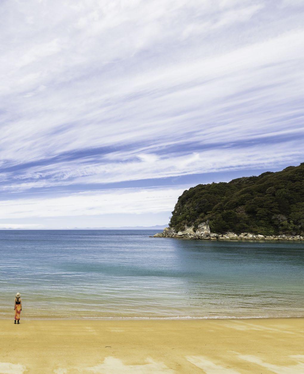
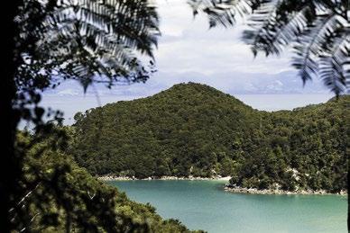
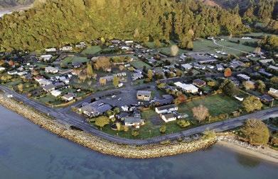
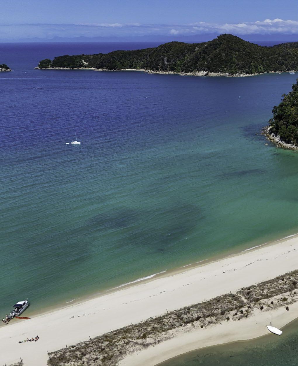
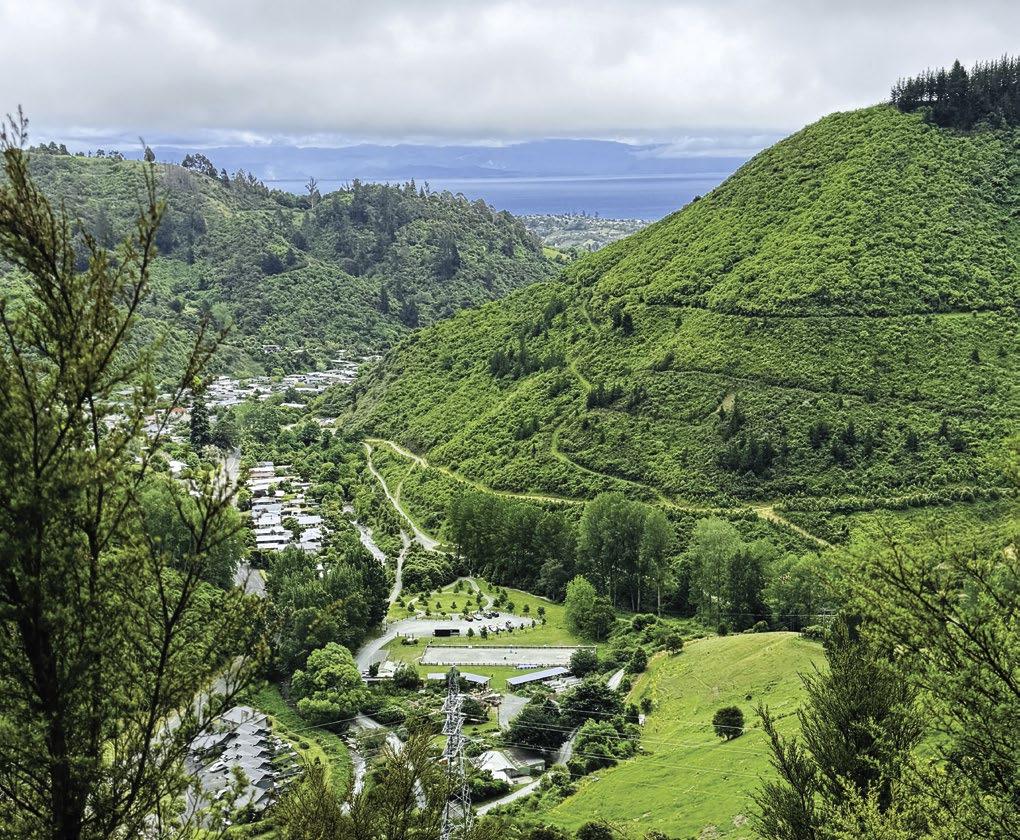
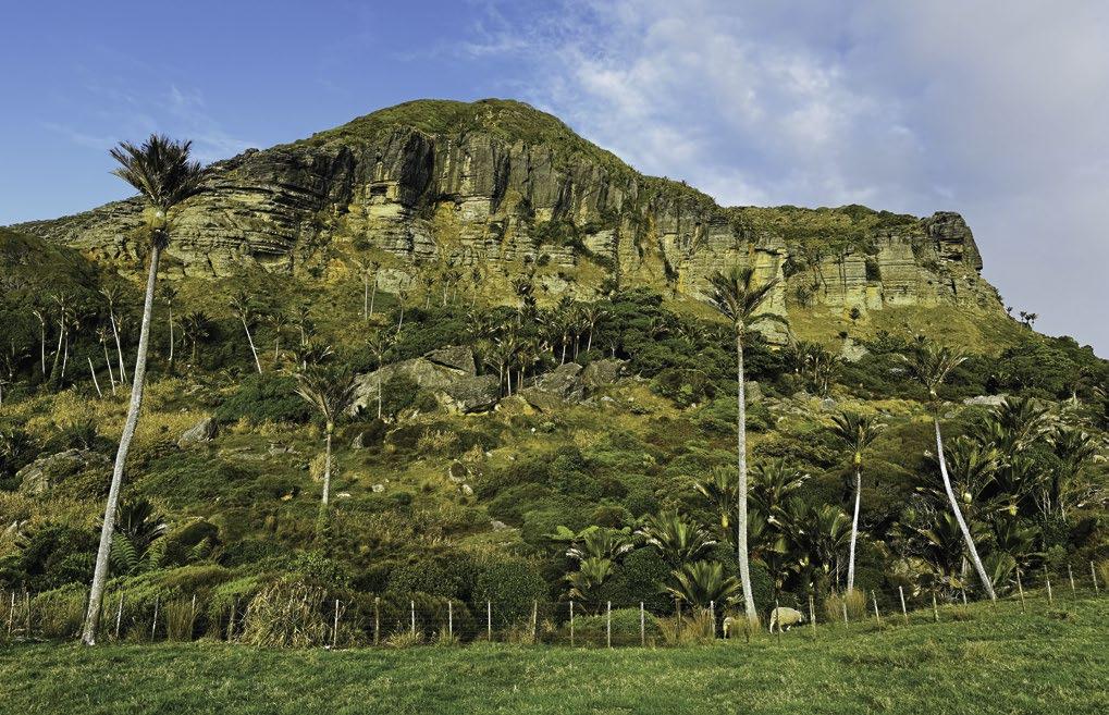
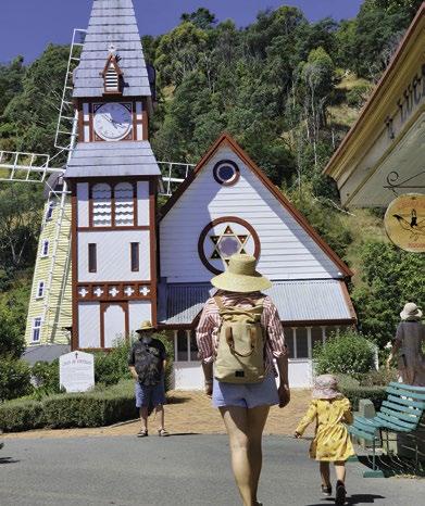
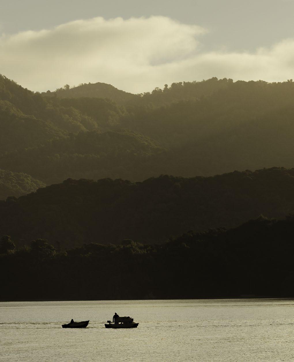
The village of Mārahau is located at the southern entrance to the Abel Tasman National Park. For any visitor travelling into Mārahau, the charm and tranquillity of the place will probably hit as soon as the road begins to wind past the Otūwhero Inlet.
The view across the expansive tidal estuary, and then out to Tasman Bay as the islands in the Astrolabe Roadstead come into view is breathtaking. Having witnessed this grand ‘unveiling,’ you could be excused for thinking you’re about to turn the corner and encounter a built-up, highly developed tourism hotspot. But this is where Mārahau and the Abel Tasman differ from many of the other locations in Aotearoa where visitors flock to. Despite its increase in popularity and visitor numbers over many years, Mārahau is still an unpretentious, authentic seaside village. Although Mārahau is indeed the gateway to New Zealand’s most visited national park, which hosts as many as 300,000 visitors a year, it has not sold its soul. You may see people in bare feet, walking or swimming with their free-ranging dogs and acting in a friendly, carefree manner that suggests it is still 1980.
The Mārahau waterfront is lined with a mix of permanent
and holiday homes, all of which are modest buildings that are in keeping with the environment around them. There is a lovely walkway along the waterfront, a wide, grassy road-reserve along the main access road, Sandy BayMārahau Road, and an abundance of open space, particularly when the tide is out and the foreshore stretches for hundreds of metres.
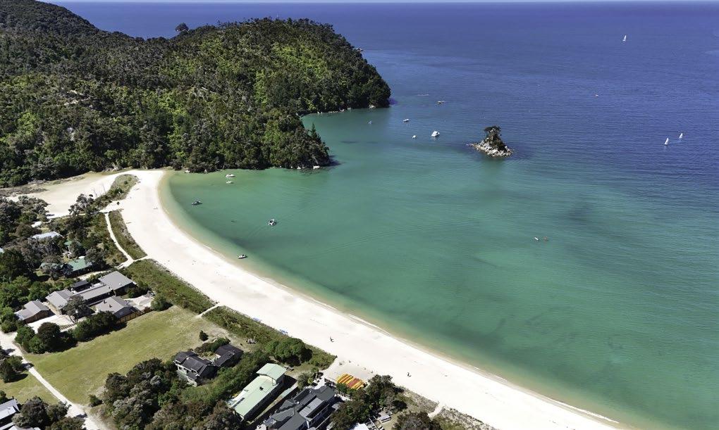
Mārahau is the location where the majority of the commercial operators servicing the Abel Tasman have their bases and where kayaking and water taxi trips depart from and return to. The village is also well serviced with a variety of accommodation options, a general store plus two café/ restaurants, a couple of containerised style food/coffee/ ice cream carts and pretty much anything else you might need. But all of this ‘infrastructure’ is very much Mārahau style, and the whole vibe of the place swings between a sleepy seaside village during the winter to higher, but still pretty chilled-out, energy levels in the summer months.
While all of the activities operators in Mārahau have ample parking for their customers, there is also a large public car park right at the entrance to the Abel Tasman Coast Track.
MĀRAHAU TO TINLINE
Distance: 3km
Walk Time: 1 hour
Difficulty: Easy
This southern entrance to the park is marked with an intricately carved waharoa (entranceway) which leads to a long raised wooden boardwalk over the tidal inlet.
Depending on the tidal conditions when you walk under the waharoa and then across the raised walkway, you’ll either have water on either side of you, or be surrounded by sand with the sea out to your right several hundred metres. Either way, it’s a nice way to begin, or end your walk in the Abel Tasman.
The bush on the inland side of the track in this most southern part of the park has improved markedly in recent times after the wonderful volunteers of the Abel Tasman Birdsong Trust took it upon themselves to eradicate much of the bracken and scrubby stuff and then replant the area in natives.
After a bit over 1km, there is a sign to Stu’s Lookout, a high point located on a side track a few metres on the sea side of the track, providing perhaps the best views back towards Mārahau and also the beginning of the Astrolabe Roadstead to the north. The Astrolabe is the stretch of water between the mainland and the Fisherman and Adele Islands. A roadstead is an old nautical term for a body of
MĀRAHAU
water sheltered from ocean swells where ships can sail reasonably safely. The Astrolabe was named by Frenchman Jules Dumont d’Urville during his visit to the area in January 1827. D’Urville named the area after his vessel, the one previously called La Coquille, Adele Island after his wife and Fisherman Island after observing Māori fishing there.
The first campsite you’ll come to is Tinline Bay. If you are trying to book a campsite or hut in the park during the summer peak season you might find that Tinline is the only location with any availability showing on the DOC booking site. Firstly, Tinline is only a short walk from the entrance to the park so, for just about anybody setting off from the south, not far enough into the Coast Track to stop for the night. For anyone walking from the north, Tinline is agonisingly close to Mārahau where the coffee will be hot and the beer suitably cold. The Tinline campsite is also one of the few in the park not located right on the beach, being situated instead, up the track a bit. But it is still an ideal
spot for families with young children, being only a short walk from the Mārahau trailhead but still with some nice views along the way. It also has a nice little nature walk perfect for the wee ones, another area that has recently been vastly improved by those good buggers at the Abel Tasman Birdsong Trust. The campsites are located on a gently sloping grassy area with room for 30 people.
Tinline was named after John Tinline, a local man who acquired a block of land from Mārahau to the stream in 1857. Tinline, a much respected local figure who devoted his life to government service, farming and philanthropy, was commonly known as ‘Old Fizzlebilly’ because of his flowing beard. John Tinline learned to speak te reo Māori which led him to the position of interpreter for the Nelson magistrate in 1844. The prominent point above Tinline is the site of a former pā that was occupied when Jules Dumont d’Urville visited the area in 1827.*
*Source: Down The Bay, Philip Simpson
MĀRAHAU TO COQUILLE BAY
Distance: 3.5km
Walk Time: 1-1.5 hours
Difficulty: Moderate
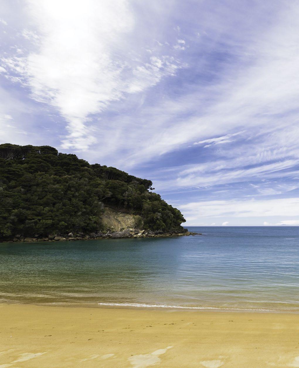
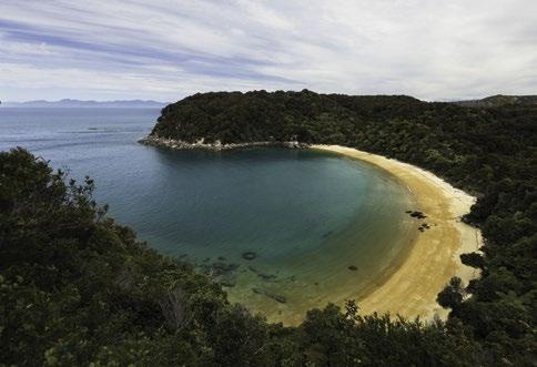
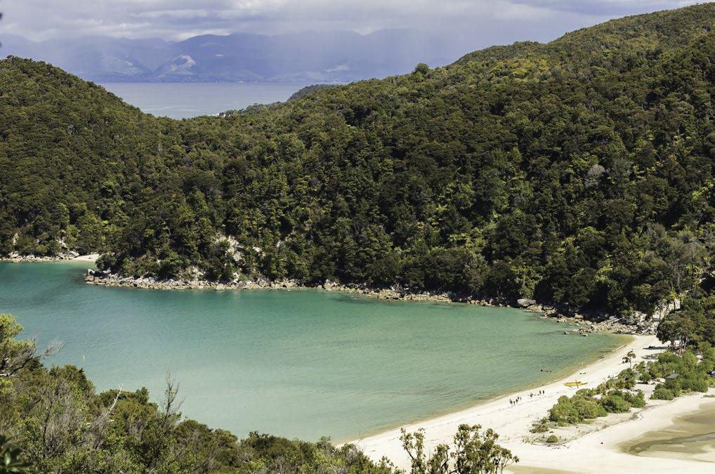
After a short 10-minute uphill walk from Tinline you’ll find yourself looking down at a little beach called Coquille Bay, the first of the park’s classic, Abel Tasman-esque, crescent-shaped, golden-sand beaches. Coquille is fringed with native bush including some punga ferns so it looks rather magical from the lookout on the track above. It is also the first beach in the Abel Tasman that has deep water during all tidal conditions. The Coquille Bay campsites are right beside the beach with room for 12 people. The bay is named after d’Urville’s vessel La Coquille, the original name for what was to be renamed the Astrolabe.
MĀRAHAU TO APPLE TREE BAY
Distance: 6km
Walk Time: 2-2.5 hours
Difficulty: Moderate
Just north of Coquille you’ll find a newer section of track that deviates inland a short way, up a steep but short
rise before it rejoins the older track. This is one of a few new deviations you will encounter along the length of the Coast Track, all of which were put in when a weather event caused sections of the track to slip and become unstable. The track is still well-formed and pleasant to walk on, but these unexpected climbs, even if they are short, can be sharper than what you may have been expecting moments before you encounter them.
Apple Tree Bay is the first of the longer beaches in the park that has a tidal estuary behind it. This means you can camp on the beach with water on both sides of your tent. This is also the first bay in the park with a privately owned bach. You’ll find either single baches or collections of them further north as you travel through the park. These small parcels of land were privately owned before the Abel Tasman became a national park in 1946 so were not handed over to the Crown. Apple Tree has campsites to accommodate 30 people. Originally named La Grande Plage by d’Urville, the name was changed to Apple Tree Bay presumably around 1928 when Lionel (Leo) Manoy bought four acres of land there for his family to camp for a few weeks every year before they built a bach*.
*Reference: Abel Tasman Area History by Dawn Smith - DOC
STILLWELL BAY, AKERSTEN BAY, CYATHEA AND WATERING COVE
All of these delightful beaches are an easy walk further along the Coast Track from Apple Tree Bay and all have a variation of the magnificent view across the Astrolabe Roadstead to the islands. The Adele and Fisherman islands provide some protection from the ocean currents and also a rather wonderful backdrop as you gaze out to sea. In the summer, these beaches do receive a good amount of day visitors on kayaking trips from Mārahau, others walking this southern end of the Coast Track or locals having boated in to spend the day in the park with their friends and family. Of these five beaches, only three have campsites and toilets: Akersten has room for six campers, Observation has spots for 12 and Watering Cove has facilities for 10 people. These bays are among the most picturesque in the entire park and a great spot to camp if you’re travelling by kayak.
Stilwell is named after Welby Stilwell who purchased 2 acres there in 1926 and had camping holidays there before building a cottage. Stilwell took visitors on excursions along the coast in his launch Terepa around the same time that Newt Nalder was doing the same in the Kotare. Akersten Bay was presumably named after William Akersten who came to the Nelson area in 1855 where he set up a ship chandlery and built wharves which include what is, in present day, Nelson’s Main Wharf. Durmont d’Urville named Cyathea Cove because he found an abundance of the gully fern trees there. The bay is now more famous as part of the area leased by Pérrine Moncreiff, who played a crucial role in the establishment of the the Abel Tasman as a national park in 1942*. The bach built by the Moncreiffs is located in the Moncrieff Private Scenic Reserve. D’Urville also named Observation Beach, where an observatory was set up to view the transit of Venus across the sun, as well as Watering Cove where his crew replenished their fresh water supplies.
*Sources: Abel Tasman Area History by Dawn Smith - DOC, http://www.theprow.org.nz/places/streets-and-quays-of-portnelson/ and Down The Bay, Philip Simpson.
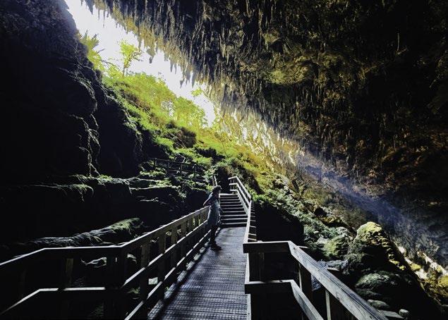
often where people walking the entire Coast Track spend their first night. The campsites are situated among trees and are mostly on grass. This is also the first campsite in the Abel Tasman where you can have an outdoor fire, surely one of the highlights of any overnight camping trip. Another highlight for anybody staying the night at Anchorage should be a visit to the caves at the northern end of the beach to see the glowworms. Just be warned that along with glowworms you will also need to be mindful of the small but still scary looking cave weta.
As the first major Coastal Access Point in the park, Anchorage is the Abel Tasman’s most popular beach for people doing day trips. The most economical, yet still quite wonderful day trip in the Abel Tasman involves parking your car in Mārahau, catching a morning water taxi to Anchorage and then taking the rest of the day to walk back to Mārahau, stopping off at any of the beaches that take your fancy along the way.
Anchorage is well protected from the weather so is where a lot of boaties anchor up their sailboats and launches, hence the name. During the Christmas period there will be a flotilla of boats in the bay of all shapes and varieties.
Anchorage - Te Pukatea - Pitt Head - Anchorage
Distance: 12.4km
Walk Time: 3-4 hours
Difficulty: Medium
The first major Coastal Access Point for water taxis in the park is The Anchorage, or just Anchorage to the locals. It is also the first of the larger campsites with room for 100 campers, and also the first DOC hut with bunks for 34 trampers. Located 12.4km from Mārahau, Anchorage is
Distance: 3.4km
Walk Time: 1-1.5 hours
Difficulty: Easy
Pitt Head
For anybody who doesn’t fancy a longer walk, but still wants some wonderful elevated views and to get in among nice native bush, the Pitt Head loop track is ideal. The idea is to catch a morning water taxi from Mārahau to Anchor-
MĀRAHAU TO THE ANCHORAGE
PITT HEAD LOOP AND TE PUKATEA
age, to spend the day meandering around the loop track, perhaps picnicking at Te Pukatea on the way back to Anchorage for a swim before returning on an afternoon water taxi. This is the ideal Abel Tasman adventure for families with small children or anybody who wants to spend a day at the beach, rather than the day walking.
The whole Pitt Head area has been extensively trapped for predators by the Abel Tasman Birdsong Trust so features some of the best birdsong in the park. The elevated views looking across the bay to Torrent Bay and back to Anchorage are stunning.
Te Pukatea
Te Pukatea is a short, 20-minute walk from the southern end of Anchorage. It is your classic Abel Tasman-esqe bay; golden-sanded, crescent-shaped bay with rocky headlands at either end. It’s off the main track but is well worth the little side trip if you are either staying at Anchorage or walking the Abel Tasman Coast Track. There is a viewing platform located a short climb up the track to the north of the beach which makes the perfect place for a photo. Te Pukatea is an excellent place to camp with capacity for 14 people. Like many of the beachside campsites in the park, if you pitch your tent just right you’ll open the door flap in the morning to get the sunrise straight in your face.
Cleopatra’s Pool.
ANCHORAGE TO TORRENT BAY
Low tide route: 20 min, 0.9km
High tide route: 1-1.5 hours, 4km
Difficulty: Moderate
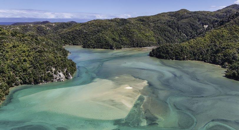
The low tide route to Torrent Bay scoots directly across the estuary from the northern end of the Anchorage beach. It’s only 900m but is only crossable, without the necessity to swim, during low tides. This is the shortest, most efficient way to continue north, but the walk around the Torrent Bay estuary on any tide is worth the extra walk-time.
The high tide track climbs out of Anchorage, either via the track that starts in the middle of the beach, or up to the ridgeline on a different track that starts at the northern end of the beach. Either way, once you’ve done the climbing, the track drops down to a winding track beside the Torrent Bay river and estuary. The track around the estuary is rocky in parts but only rugged enough to be vaguely adventurous for just about anybody.
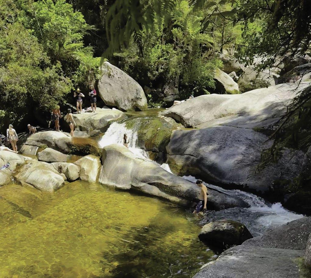
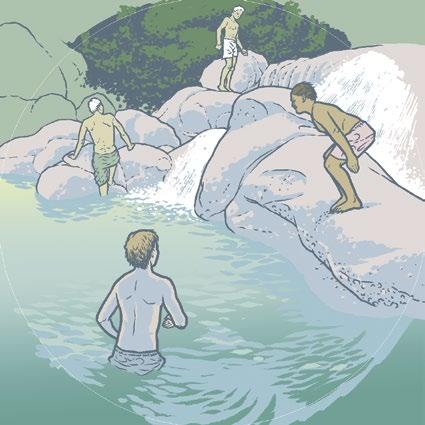
Cleopatra’s Pool
Located about halfway between Anchorage and Torrent Bay is a short side track that takes you to Cleopatra’s Pool, an incredible fresh water swimming hole with a natural waterslide that runs between smooth rocks. This is another great option for a day trip by taking a morning AquaTaxi to Torrent Bay, a 30-minute walk around the estuary to Cleopatra’s Pool for a leisurely freshwater swim and waterslide, then another 30-minute walk back around to Anchorage to meet your afternoon water taxi back to Mārahau.
Cascade Falls
Further around the estuary towards Torrent Bay you will find a track off to the left that leads up to Cascade Falls. This track is longer than the one to Cleopatra’s Pool, and a whole lot steeper, so it doesn’t get nearly as many visitors. The 45 minute walk, each way, is well worth it though, particularly if you’re after a refreshing freshwater dunk.
MĀRAHAU TO TORRENT BAY
Low tide route: 3 hours, 20 min to 4 hours, 20 min
Distance: 13.3km
High tide route: 4-5.5 hours
Distance: 16.4km
Difficulty: Medium
Torrent Bay features the largest collection of privately owned holiday homes in the park. Water taxis are only permitted to drop off passengers until noon each day and no pickups are allowed unless those passengers are bach owners or the guests of those owners. This was the deal local authorities negotiated with the local landowners in return for allowing the public to walk through their little slice of paradise. Some of the baches here are available for rent at certain times of the year and Torrent makes an absolutely wonderful place for a family holiday. The Torrent Bay Estuary is magical on a full tide and the perfect place to sail, paddle board, kayak or just for a swim. There is also a small, 20-person capacity campsite at the southern end of the village. The campsite is quite shaded by trees and
Torrent Bay.
the sites are mostly set back a little from the estuary, but it does provide some protection from the sun and the sea breeze.
Originally owned by Dr Ralph Richardson of Nelson, who bought some 800 acres in the area between 1854 and 1857, granite was quarried from the area in the 1870s. There was also once a tramline up the valley to haul out posts and firewood. Torrent Bay was one of the first places people from the area headed to for recreational trips in the early 1900s. Back in those days a New Year sailing regatta was held each year as well as activities on shore such as running races, sack and three-legged races. The races and other festivities are still held on New Year’s Day each year at the public park located on a grassed area in the middle of the village, adjacent to the waterfront.
*Source: Abel Tasman Area History by Dawn Smith - DOC
TORRENT BAY TO BARK BAY
2-3 hours, 7.8km
Difficulty: Medium
Sandfly Bay and Medlands Bay
The 7.8km track from Torrent Bay to Bark Bay is another popular section of the Coast Track for day visitors. As the track is mostly along a ridgeline there are wonderful views looking down to bays along the coast, particularly Frenchman Bay with its picturesque lagoon below. If you’re walking or even running this section of the track in the summer, Halfway Pool, a small creek located - you guessed it - halfway between Torrent and Bark Bay, is a great spot for a fresh water dunk in the small swimming hole next to the track. From here the trail drops down to another of the major attractions, the newly upgraded Falls River Swingbridge
from which there are magnificent views down the river and out to the open sea. A short distance after the swingbridge is a side track that takes you down to Sandfly Bay, a narrow beach and large tidal estuary from which Falls River flows to the sea. The outlet of the river has a habit of switching from one end of the beach to the other, depending on where the tide and weather conditions shift the sand to. There is a little bit of rock-hopping required to get right down to Sandfly, but it’s worth it. Don’t let the name put you off, there is no evidence that anybody has ever been eaten alive by the sandflies from which it takes its name.
Medlands is the next beach viewable from the track after Sandfly Bay. Meddy’s is another natural, dark green marvel lined with native bush and another great place for a picnic. The trail from here also provides elevated views across to Bark Bay which is only a few hundred metres further along the track.
Bark Bay
Bark Bay has both a 80-person capacity campsite and the second of the DOC huts in the park with bunk-beds for 34 trampers. The campsites line the main beach and the hut is set back around the estuary a short distance. Bark Bay is a mid-sized, sweeping bay with the inlet behind it which can make it feel like you are camping on a tropical island. The walk around the estuary and further to the north is one of the most underrated sections of the track, particularly on a full tide. Bark Bay is also where Project Janszoon, in partnership with DOC, have introduced kākā back into the park. If you wander out on the estuary at the right time you might spot kākā returning for a feed at the aviary where they were first housed when relocated to the park.
Bark Bay was owned by the Huffam family who settled there in 1870 before they moved away in 1890. The Huffams engaged in subsistence farming as well as milling timber for firewood, hop poles and shipbuilding. The gathering of bark from the black beech trees by the Huffam brothers, used in the tanning process, gave Bark Bay its name. The Huffams also sold smoked-cured barracouta and hunted pigs.
The Māori name for Bark Bay is Wairima. Wai means water and rima signifies either five or hand. Small streams flow into the estuary so this is presumably the original of the name.
BARK BAY TO ONETAHUTI
*Sources: Abel Tasman Area History by Dawn Smith - DOC and Down The Bay, Philip Simpson 2 hours, 6.1km Difficulty: Medium
The low tide track from Bark Bay takes you directly across the estuary to the north in a few minutes while the high tide track takes you around the back of the picturesque inlet. To me, the high tide track is a short but wonderful highlight of the walk regardless of whether the tide is high, with water lapping the edges of the track, or not.
The track from Bark Bay through to Onetahuti is sometimes gently and sometimes not so gently undulating. Before you know it though, you’ll descend and pop out at
Tonga Quarry. As the name suggests, this little area was once the site of a quarry, the remains of which can still be found today. This includes the winch block, discarded granite blocks and the remains of the old wharf from the early 1900s. Building-grade stones were cut from both ends of the beach and were shipped by scow to Wellington for the old parliament building and to Nelson for the steps that lead up the Cathedral. It’s a pleasant little beach and perfect for a rest before you press on with your walk. Once a DOC campsite, this is now only a picnic spot after a weather event damaged the campsite a few years back.
After another short climb and walk along a ridgeline, the long crescent-shaped Onetahuti Beach comes into view. As you descend into Onetathuti, stop for a moment and take in the view. With the punga ferns in the foreground, and the curve of the beach in the background, this is also an ideal photo op.
Onetahuti
Tonga Island sits proudly and prominently directly out from Onetahuti beach, and who doesn’t love gazing out from a wonderful beach at a tropical island? Onetahuti has 20 campsites, all located at the northern end of the beach.
Bark Bay.
There is much speculation as to the meaning of Onetahuti. The name has been analysed to mean “to run hurriedly (tahuti) along the beach (one)”. However, it seems more likely to be a composite of one-tahu-ti. Tahu means to burn or cook, and ‘ti’ is the cabbage tree. One of the potential meanings is that cabbage trees were burnt on the beach as signals or as food. However, the problem is that there are no cabbage trees (ti kouka) present anywhere in the eastern part of the park.*
Source: Down The Bay, Philip Simpson
ONETAHUTI TO AWAROA
2.5 hours, 7.1km
Difficultly: Medium
It takes about 15 minutes to get from the southern end of Onetahuti to the walkway that takes you over the wetlands and on to the north. Years ago, getting to the Coast Track to the north involved an estuary crossing so was only doable at low tides. However, a raised wooden track was constructed a few years back so the track north is now passage on any tide. Having said this, depending on the
status of the tide when you are walking along the beach you may have to either wade through Venture Creek or revisit your days as the Junior Long Jump Champ of your youth.
Once you’re across the wonderful little walkway and bridge there is a short climb up to the ridgeline. Make sure you don’t just blast this out without stopping along the way to look back over your shoulder at the beach below. If this little climb does make you a bit custardy-tired, there is a seat towards the top for a rest. Once you’re on top of the ridgeline however, it’s an easy walk to Awaroa and before long you’ll get a great view of the Awaroa Lodge when you do pop out of the bush.
Awaroa
Once the sight of a farm, a small community and even a school house, Awaroa is the second area of the park with a concentration of privately owned holiday homes. These baches are located beside the Awaroa Estuary, the largest tidal inlet in the whole Abel Tasman. It is also home to Awaroa Lodge, a sprawling luxury lodge with a nice outdoor dining area. It has a second more casual outdoor eatery where you can eat gourmet pizza and drink fantastic locally brewed craft beer while sitting on a soft grassy lawn.
Awaroa.
Located a short walk from the front beach, the lodge is only open during the summer months.
To the north of the main beach is the area that made headlines all over the world in 2016 when a couple of Kiwis decided to mount a crowdfunding campaign to buy a stretch of Awaroa beach that was put up for sale by its private owner. The fear was that any new owners could deny access to the beach for the New Zealand public. In a major triumph for people power, the New Zealand public donated over $2 million, purchased the beach and ceded it into the national park.
Awaroa has a 36-person campsite and 26-person hut, both of which are located a surprisingly long walk around the estuary from the main beach. Many people are caught out when they arrive by water taxi at Awaroa’s front beach only to find they are still a brisk 20-minute walk from where they are staying. If you keep walking past the campsite and hut you will eventually come to an old steam engine and the other remains of the old farm and milling operation that was once on the site. The Hadfield family were the first to farm sheep and cattle here from 1863.
2.5-3 hours, 7.1km
Difficulty: Medium
Waiharakeke Bay
Directly across the estuary from the Awaroa DOC hut and campsite, signalled by a round orange track marker, is where the track continues north. The walk across the estuary is only possible 1.5 to 2 hours either side of low tide and there is no way to cross the estuary outside of this timing unless you have a boat at your disposal.
The section of track on the Tōtaranui side of the estuary starts with a wonderful section through wetlands featuring large ferns and other light green foliage. The Waiharakeke Bay campsite located a little along the track is one of the most underrated spots in the entire park so worth a look around, even if you are not staying there. Waiharakeke has room for 20 campers.
Goat Bay
Goat Bay is another lesser-known and under-rated beach in the northern part of the park. It makes a pleasant destination for a walk from Awaroa to the south and Tōtaranui
AWAROA TO TŌTARANUI
Tōtaranui.
from the north. The track from the north once siddled pleasantly around the coast but this was destroyed over 10 years ago and was replaced with a route that goes up and over the hill instead. This is perhaps one of the steepest sections of the whole track and it has been known to surprise some walkers with its intensity, but when you do eventually descend on the other side of the hill you’ll get incredible views along the wide expanse of beach that is Tōtaranui.
Tōtaranui
Like Awaroa, Tōtaranui encompasses a reasonably large geographical area and was once a farm. Tōtaranui is another long, golden-sand beach, and the only part of the Abel Tasman Coast Track that is accessible by road. There are tent sites on the beach side of the gravel road dedicated to the use of people walking the Coast Track, with enough capacity for 40 people. But the much, much larger part of Tōtaranui is the enormous 250-site, 850-person capacity campground which attracts thousands of campers every year, particularly around Christmas.
In 1856, William Gibbs purchased 1,000 acres of land between Tōtaranui and Wainui where he built a house
and two cottages for his large family and visiting friends. The majestic tree lined avenue that leads into Tōtaranui was planted with alternating plane and macrocarpa trees by William Gibbs’ daughter, Hannah, and Jimmy Perrot in 1856. The Pratt family purchased land from Gibbs in 1892 to farm the area and built the Ngarata homestead in 1914 from locally milled timber. In the 1920s Charles Pestall Harries and then John Cameron attempted to farm the area but a bunch of factors including difficult access and poor soil quality combined to make farming at Tōtaranui a marginal proposition. The property was sold to the government in 1948 to be incorporated into the national park.*
The old homestead at Tōtaranui, Ngarata, has been converted into accommodation suitable for large groups for events like school camps and groups of friends. It’s a fantastic facility with a variety of bunk rooms, a large communal space and a big kitchen. Ngarata is also extremely well priced for groups and large family events.
One of the main appeals of Tōtaranui as a camping spot is its proximity to fantastic walks both to the south and to the north. A great full-day walk of around 21km is the loop track which goes up Gibbs Hill, around to Whawharangi and then back to Tōtaranui along the Coast Track.
*Reference: Abel Tasman Area History by Dawn Smith - DOC
TŌTARANUI TO WHARIWHARANGI
3.15 hours, 9.8km
Difficulty: Medium
For anybody looking for some more remote places to camp or for a picnic, then the bays in the very north of the park are the places to head. As part of the DOC concessions for water transport, commercial operators are only permitted to run scheduled services as far north as Tōtaranui. This reduces the number of visitors to those beaches so even in the height of the summer season, you will be sharing the beaches with only a handful of people. The weather in this northern part of the park tends to be a bit harsher too so all of these factors combine to give beaches like Anapai and Mutton Cove a remote, west-coast type of vibe.
TŌTARANUI TO ANAPAI
1.5 hours, 3.5km
Difficulty: Medium
Whariwharangi.
The roadway that leads along the tree-lined gravel road into Tōtaranui also turns off at the northern end where the walking track starts off through some grassy flat land. The initial climb after the grassy bit is steep but mercifully
short before the track descends into a gully which drops gently down to the beach.
Anapai is a mid-size crescent-shaped beach with rocky headlands at either end. At the northern end you’ll find some interesting granite boulders sticking vertically out of the sand, one of which, if viewed from the side, looks like a human face. The campsite, located in the middle of the beach, has a 12-person capacity. Like many of the bays at the northern end of the park, the Coast Track goes along the beach before ducking back into the bush at the other end. There is another climb here so the track offers elevated views of Anapai back to the south and then across to Mutton Cove once you are around the corner to the north.
1.15 hours, 2.5km
Difficulty: Medium
After a scramble over some rocks you’ll find yourself at Mutton Cove, another wonderfully remote and often windswept beach. The campsite here is larger, with room for 40 people. Mutton Cove is thought to have been named from the practice of vessels carrying mutton sheltering in westerly weather when the area was farmed in the early 1900s.
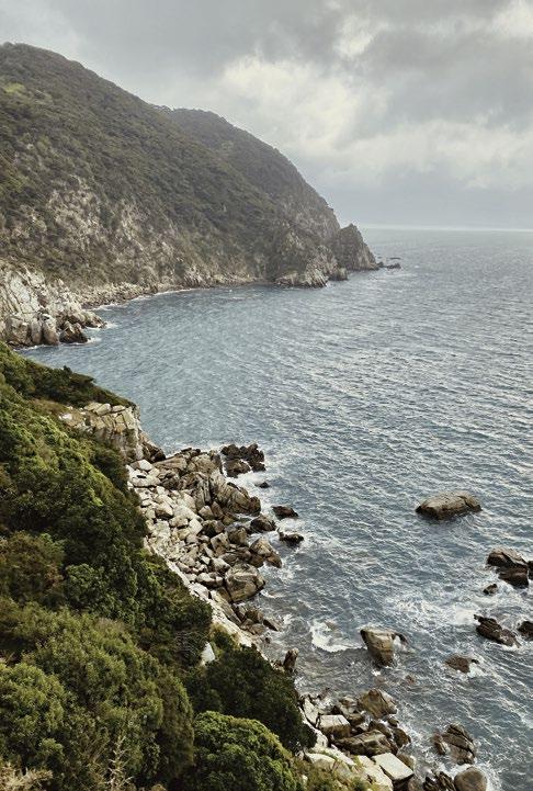
As you continue north towards Whariwharangi you will find the track splits at the top of a short climb and you can either walk directly through to Whariwharangi or take a loop track to check out Separation Point. The extra distance to Separation Point is well worth it.
ANAPAI TO MUTTON COVE
Anapai Rocks.
1 hour, 2.2km
Difficulty: Medium
So named because it marks the geographical boundary between Tasman and Golden Bays, Separation Point is a place of rugged, steep-cliffed beauty. From the track once you reach the point, you look down on a rocky outcrop where seals and seabirds hang out. A few years back one international visitor decided, against some good advice, to go for a swim at Separation Point with some of the local seals. His reward was a nasty bite on the backside from a bull seal which is potentially the best example of the saying that your own silly decisions can bite you on the bum.
SEPARATION POINT TO WHARIWHARANGI
1 hour, 2.4km
Difficulty: Medium
North of Separation Point. MUTTON COVE TO SEPARATION POINT
Whariwharangi is the site of another farming effort in the Park with the old homestead having been converted to a DOC hut with room for 20 trampers. There is also a lovely grassed area around the hut with room for 40 people to camp.
John Handcock built the house at Whariwharangi about 1897 and farmed there for 15 years before the land was bought by George Manson in 1914 . Whariwharangi continued to be farmed until 1972, but the homestead was unoccupied after 1926. After being used as a stockman’s hut, it became derelict, but was restored to become the DOC hut in 1980.*
The Abel Tasman’s northern roadhead is the Wainui Car Park located at the rather remote and wonderful Wainui Bay.
*Reference: Abel Tasman Area History by Dawn Smith - DOC
WHARIWHARANGI TO WAINUI
2 hours, 5.7km Difficulty: Medium
From Whariwharangi Hut you’ll follow a small stream, then climb out of the bay and on to a saddle overlooking the large and stunning Wainui Inlet. At a junction you can either continue your walk down to the Wainui car park or hook a left to take you onto the Gibbs Hill Track which will take you back to Tōtaranui. There is no scheduled transport out of Wainui so you either need to have arranged something in advance or you can walk back to Tōtaranui to get a water taxi back to Mārahau.
OTHER NOTEWORTHY LOCATIONS
Adele Island
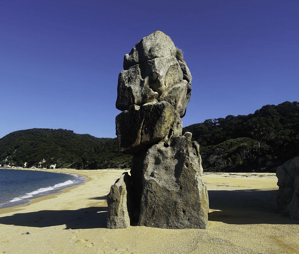
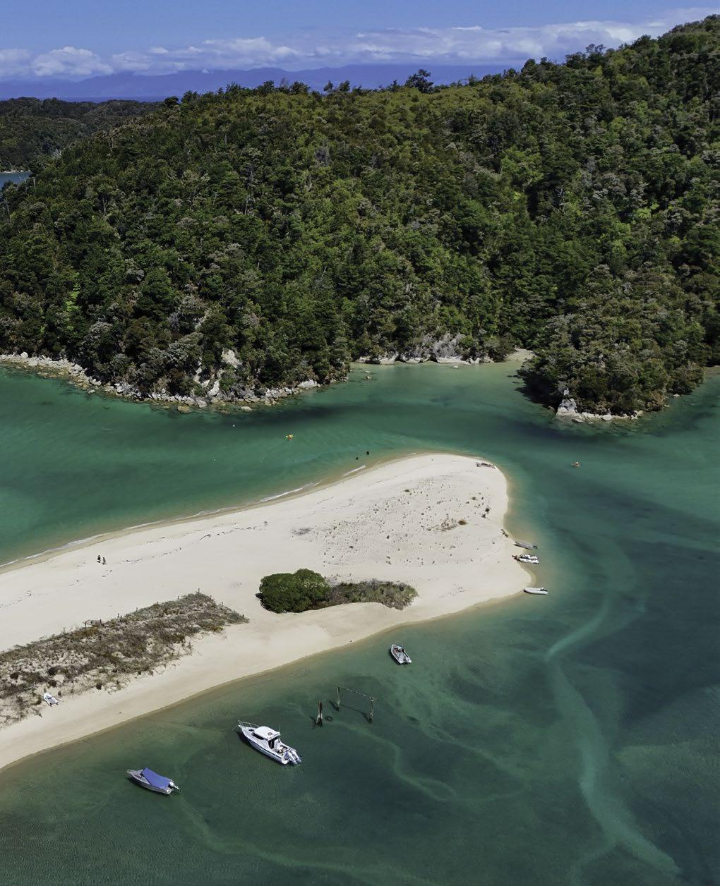
Firstly, let’s get the important housekeeping stuff out of the way: If you are going to land on Adele Island then please make sure your vessel is rodent free. Adele is a predator-free offshore haven and it needs to stay that way for our native birds like the South Island Saddleback/Tīeke to continue to thrive there. Adele is the larger of the two islands in the Astrolabe at the southern end of the Abel Tasman. During low tide conditions a wonderful sandspit forms on the inland/west side of Adele. There is a seal colony at the northern tip of the island, and nice little beaches on both the eastern and southern sides of the island.
The ideal way to enjoy Adele Island is to paddle around it in a kayak, checking out the seals at the northern end - with at least 20 metres between your kayak and the seals to avoid breaking the marine mammal viewing rules - and
then continuing slowly along the coastline, listening to the amazing birdsong on the island.
Shag Harbour
Located between Awaroa and Bark Bay is a narrow, rocky opening that leads to a shallow tidal, bush-lined, inlet. Unless you already knew it was there, you could easily miss it as you sped past it in a boat or were even paddling past in a kayak. Shag Harbour is only accessible in a kayak or in a small boat, so you won’t find any of the bigger ferry style water taxis in there. It’s a seal nursery so the curious seal pups will come up to investigate your arrival at certain times of the year, before they grow up and become more wary of strangers. They are clearly visible in the clear, shallow water of the inlet as they zoom around at amazing speeds.
Mosquito Bay
Mosquito Bay is another place only accessible by water, making it the perfect camping spot when you’re doing a multi-day kayaking trip. The campsite itself is rather wonderful and the bay has a rocky little islet in the middle which makes a lovely backdrop and also offers some protection from the sea breeze. The area up behind the beach has a freshwater creek with water that is the perfect temperature
to cool your beer, or a nice bottle of rosé.
The Abel Tasman Inland Track
Almost every visitor to the Abel Tasman spends all of their time on the coast, and for very good reason. After all, the beaches and granite coastline are the features that make the Abel Tasman so special and different from New Zealand’s other national parks. As one of DOC’s Great Walks, the Coast Track must meet certain standards such as being 1.2m wide and graded in a way that makes it accessible to anybody with a halfway reasonable level of fitness. The Inland Track, by comparison, is a genuine backcountry tramping track. It’s a well-marked and well-formed track rather than the type of more difficult marked-trail you’ll find in our remote backcountry areas, but it will still raise a seasoned tramper’s heart rate and has tree roots and some steep-ish uphill sections to navigate. The huts are also genuine backcountry huts rather than the ones on the Coast Track, which again, must meet Great Walk standards. There are two wonderful, totally charming backcountry huts, Castle Rock and Awapoto and two shelters, Holyoake Clearing and Moa Park. Access to the Inland track is via Mārahau and then a couple points along the Coast Track, as well as via the trailheads at Canaan Downs at the top of Tākākā Hill and Pigeon Saddle at the northern end of the Abel Tasman in Golden Bay.
Adele Island
SMALL VILLAGE, BIG IMPACT
How Mārahau is quietly leading the way.
Words: Johny O’Donnell
Pop into Mārahau on any given day in summer and you’ll witness firsthand the hum of the place heaving with visitors from every corner of the world, enjoying the spoils of paradise. But it’s also a place that’s been grappling with the pressures of its own popularity, trying to balance the economic and social benefits of tourism with the need to protect and regenerate the very environment that draws people here.
That is where the Mārahau Pledge emerged from - an attempt to reimagine what responsible tourism can look like. It’s an initiative I’ve been deeply involved with from the start, and while it’s not perfect, it represents a new way of thinking about how we can make tourism work for everyone – visitors, locals, and the environment alike.
At the time the Pledge was launched we were watching yet another ‘tourism transformation’ or ‘think tank’ roll out nationally to provide a nationwide response to an issue that is only really felt and understood in the places that absorb the intense popularity of New Zealand’s tourism. It was satisfying and rewarding to know that rather than attempting an academic or hypothetical exercise in regenerative tourism, Mārahau businesses were keen to put real money and commitment on the table, then figure it out as we went.
Now, I’ve been around the visitor sector long enough to know that getting competitors to collaborate is no mean feat. But something special happened in Mārahau. Maybe it was the shared love for this place, or maybe it was the realisation that we were all in the same boat (sometimes
literally). Whatever the reason, we managed to get every single tourism operator in Mārahau to sign up to the Pledge, a position that remains today.
The core of the Pledge is simple: every experience from Mārahau is certified zero-carbon, we share knowledge on sustainability practices, and a portion of every ticket goes directly into local projects. We introduced an Environmental Access Fee (EAF) to capture the raft of concession fees and tariffs that are included in paid experiences into the park and made this contribution transparent to visitors, something every operator in the wider Abel Tasman visitor sector has implemented together.
Last season, the Pledge raised around $190,000 to invest into further development and local projects. That’s not pocket change for a small village. The Pledge has the privilege of supporting several seriously epic local initiatives including trapping and pest eradication, track enhancement and signage, wetlands restoration and native plantings, establishing kai gardens and a native nursery, funding practical local improvements, and backing a local sculptural project. And we’re really just getting started. (cont’d)
An olive branch to the skeptics
It’s easy to be cynical. After all, we’ve seen plenty of well-intentioned environmental initiatives come and go, leaving little more than glossy brochures in their wake.
Some might argue that the Mārahau Pledge is just another way for tourism operators to ease their consciences without making meaningful changes. Moreover, the claim of ‘zero-carbon’ experiences understandably raises eyebrows. In a world where true carbon neutrality is fiendishly difficult to achieve, are we oversimplifying a complex issue? Is offsetting really a viable alternative right now?
While these concerns are valid and deserve attention, they also miss a crucial point: The Pledge is not claiming to be a perfect solution, but a starting point for change. For those quick to dismiss it as mere PR, I’d argue that the Pledge deserves a closer look. It’s easy to be cynical, much harder to roll up your sleeves and try to make a difference.
Let’s consider the Pledge fee. Yes, it’s a small contribution in the grand scheme of things. But it’s also a tangible way to connect visitors with the impact of their travels. It starts
a conversation, it makes the invisible visible. And those small contributions add up – supporting zero-carbon operations and providing meaningful funds to local projects that are otherwise overlooked. That’s real money going into real projects on the ground.
Zero-carbon is indeed an over-simplification and one that is constantly being interrogated around the table, but it remains one of the better tools we’ve got right now. It pushes operators to continuously assess and improve their practices as it provides a financial incentive to do so. Meanwhile, it flexes the tools of the market (I know, I know!) to make planting and maintaining carbon sinks a financially viable option for landowners. We’re open to ideas and keen to hear about alternatives.
Perhaps the most powerful aspect of the Mārahau Pledge is the least quantifiable: The shift in mindset it represents. By bringing competing operators together around a shared goal, it’s creating a new model of collaboration in an industry often characterised by fierce competition. It puts contribution back to the local community into the spotlight.
The Pledge is still in its early days, and like any young
initiative, it faces challenges. There’s a need for more operational capacity, more community outreach, more structure and process. But these challenges also represent opportunities.
The Pledge’s local and nimble approach means it can evolve in response to criticism and new information. This allows for quick adjustments and innovations that might be impossible in more rigid, top-down structures. Put simply – it can be what locals determine it should be – all you have to do is participate in the conversation.
As we look ahead, there’s a real sense of possibility and potential.
So, is the Mārahau Pledge all promise and potential, or just PR and pitfalls? The truth, as often, lies somewhere in between. It’s an imperfect initiative in an imperfect world. And in a world where the perfect often becomes the enemy of the good, initiatives like the Mārahau Pledge show us that starting somewhere is better than not starting at all.
Where to from here?
As we look ahead, there’s a real sense of possibility and potential. We’re exploring ways to make this initiative work even harder for our community and our visitors.
One idea is a long-term investment fund. It’s not just about splashing cash around now, but rather tucking a bit away for the future. Think of it as a collective piggy bank. By setting aside a portion of the Pledge funds each year, we could build up a tidy sum that gives future generations more options and more say in shaping Mārahau into the future.
We’re also toying with the idea of a seasonal event that really gets visitors stuck in. Imagine a week where folks come not just to admire Mārahau, but to roll up their sleeves and contribute. It could be anything from planting trees to sprucing up tracks. We reckon it’d be a great way for visitors to connect more deeply with this place, and maybe leave with a bit more than just sand between their toes.
But we’re also aware of the need to walk before we run. Our immediate focus is on strengthening the foundations - improving our governance structures, making the Pledge more accessible and visible, enhancing our communication with visitors and the community, and continually refining our approach based on what we learn and hear.
But here’s the thing - we need you. Yes, you. Don’t stop reading now. The Pledge has got off to a good start, but it’s not set in stone. It’s meant to be flexible, responsive, and most importantly, it’s meant to reflect what the community wants and needs.
We need fresh ideas and passionate people to really make the most of what has been started here. Our approach is lean and light. We’re not here to take over or complicate things – we’re allergic to too much paperwork or endless meetings - we’re here to enable and to give that extra push that turns “maybe someday” into “let’s do this today”.
So, here’s our pitch to you:
Got a project that could make Mārahau even better? Bring it on.
Spotted a problem that needs sorting? Let’s hear your solution.
Head to marahaupledge.nz to engage with the Pledge and seek support.
Snapshot of Local Investments
• Mārahau Halo Project for new traps
• Otuwhero WetlandsTrust for native plantings and equipment
• Wakatū Incorporation for establishing Maara kai and nursery
• Local Artist Tim Wraight for completing the Sealevel sculpture
• Mārahau Residents Association for place-making improvements
• Abel Tasman Birdsong Trust for signage and the Tinline Track restoration
THE WHINGERS GUIDE TO THE ABEL TASMAN
Words: Brendan Alborn
Armed with nothing more than a pen and the back of an envelope, I have calculated that each year in total our businesses servicing Mārahau and the Abel Tasman have interactions with about 200,000 people.
This includes passengers travelling on our water taxis, going on our kayaking trips, staying at our holiday park, and stopping into the general store for supplies. When you deal with this many members of the public you can expect to get at least some bad reviews and/or direct complaints.
When we do get a less than glowing review or a formal complaint does come in, I am the person from within our business who investigates the incident and replies to the customer. It shouldn’t really be a surprise to anyone,
but we actually want every single one of our customers to have a wonderful experience with us, so when that doesn’t happen we want to know why, and if possible, prevent it from happening again.
My philosophy when I’m carrying out this process is relatively simple. I want to get to the bottom of the issue by listening carefully and with an open mind to the person making the complaint, and then to investigate the incident by talking to any of our people who have been involved with the customer until I feel like I have an
understanding of what has actually gone on.
I am pleased to say that you can count the number of complaints and bad reviews we get each year, across all of our businesses, on one hand. After I have made my enquiries and done my best to take an objective look at all of the variables, I will decide whether I think we have actually let ourselves down, or if the customer is simply being unreasonable. If we are the ones who I think should bear the responsibility for the customer being upset, then I will sincerely apologise and try my best to make it up to them, including offering a refund if this is the right thing to do. If I think it is the customer who has been rude or unreasonable, I tell them exactly that. Many things have changed over the years both in the way people write reviews of their experiences, the platform they use (remember when TripAdvisor was a big thing?) but also the way in which
business owners respond to those reviews. Several years ago, I think business owners were expected to respond to even the most unreasonable and irrational reviews and feedback in a conciliatory manner, to be very gentle and basically to fall on their swords. But this seems to have changed with many business owners actually being a lot more upfront in their responses and often turning the criticism back on the reviewers. Basically, it feels OK for us to be reviewing the reviewer. These days the general consensus seems to be that it is acceptable to push back at the many keyboard-warrior types who have filled the internet with aggressive and often irrational verbiage.
Generally, the most common complaints we receive relate to the weather. My response to this is to suggest they direct their negative review to the weather gods, not to our service. We also receive a couple of reviews (cont’d)
or complaints a year that a customer has either got their feet, or another part of their body wet while out in the Abel Tasman. Often, the complaint is that the customer did not feel suitably warned they might get part of their body wet to which I always reply that we outdoor-types, by virtue of being outdoors every day, are used to being wet so we wouldn’t think to warn somebody this might happen. We wear wet weather gear during, yes, wet weather and we don’t actually think having wet feet or even our footwear wet is unusual. In fact, on hot days we sometimes get our entire bodies wet, and the technical term for this activity is “swimming”.
Some people are so miserable they should not be allowed to go on holiday...
Another recurring theme over the years is people who do not believe they have been adequately warned about a specific part of their trip during the booking or check-in process. The interesting part is the diverse nature of the specific details of what it is exactly they feel they should have pre-warned about. Furthermore, these details are so important that surely they should be posted to the homepage of our websites or explicitly explained by our booking team. This includes things such as the sea conditions were not exactly as they had expected, the sand stuck to their feet in an expected way, the section of the Coast Track they walked took them longer than they had thought, that sort of thing. When responding to this type of comment I begin by apologising that their experience with us was not a good one, and then I’ll attempt to gently remind them that perhaps it would have been better if they had read the details in their booking confirmation email. Sometimes it is simply a case of not being able to squeeze in every detail in the limited time we have when taking a booking over the phone or in person.
The below are my top, all-time, favourite customer complaints.
One person, using Google Reviews as their platform, rather tellingly wrote “**READ THIS**” as the opening title of their review for AquaTaxi. The review included statements such as “it should be called “AquaRideshare” or “Aquabus”. We stopped five times to drop people off, and it took 92 minutes to get to our destination.” I wondered at this point, how much fun it would be to travel with somebody who got their stopwatch out to time their activities to the minute?
The review went on to say we mentioned nowhere on our website that the boat would stop at different bays along the way to their destination and that surely, there was a better way that didn’t involve so much boating. The last sentence of the review was particularly interesting: “I know that it’s a complex operation, but I’m confident if you put your heads together you could deliver a higher quality experience that doesn’t eat 5-6 hours of customers days where only 90 minutes of it is enjoyable.” I had the idea of asking this customer if they would mind coming into one of the Ops meetings so she could sit down with the salty dogs who have been running the daily operations for AquaTaxi for three or even four decades to explain their ideas on the finer points of water transport in the Abel Tasman.
I have made a couple of attempts to respond to that specific review but just couldn’t write anything without being so sarcastic it made me feel like a bad person.
The most memorable complaint I ever dealt with was well over 10 years ago now, but is firmly lodged in my memory. A European gentleman and his partner booked an AquaTaxi to Onetahuti where they were to walk to Bark Bay for their return water taxi back to Mārahau. When the customer was dropped at Onetahuti, it was at the full height of a king tide so the water was lapping right up the edge of the
Excellent weather for whingers.
bush which meant there wasn’t really any dry sand. The water taxi skipper told the people getting off the boat they would need to wade in the water for a few metres to make their way along to the track at the end of the beach. Rather than getting his feet wet the gentleman decided to charge straight through the scrub, taking the most direct route to dry land. The problem was that the scrub contained some gorse bushes so he ended up getting quite a few scratches and prickles. Now, if this was what I had done myself my attitude would be that I’ve clearly made a bad decision, I haven’t followed what was clearly sound advice and now I was paying the price for my own actions. This is just how the universe works in my world. The customer however, saw things differently. He immediately emailed our office, placing the blame for his arms and legs now being covered in prickles with Abel Tasman AquaTaxi.
He stated in his email he was going to simultaneously take legal action, report us to the police and, because he worked as a web developer, was going to initiate a holy digital war on our business unless we refunded his fare immediately. After receiving these emails our ops team ensured the same skipper who had dropped this passenger off in the morning also picked him up in the afternoon. The theory being that in this case, the passenger could communicate directly with the skipper about his complaint.
I also emailed the customer back to ask him to come into our base when he was dropped back at Mārahau so we could discuss things in person. When he didn’t say anything to the water taxi skipper or come into the base I assumed he had calmed down and over the course of the day had even decided to take some responsibility for his own actions.
I was wrong. Within an hour the guy emailed me saying he was going to Nelson Hospital to get all of the ‘black prickles’ removed from his body, that we had ruined his entire holiday in New Zealand. He restated that unless we refunded his fare and paid for his medical treatment and “other compensations” as he put it, he would give us a bad TripAdvisor review. And although he did fill our TripAdvisor profile with some very weird pictures of the gorse prickles in his bare legs, I managed to get his review and the pictures removed on the basis he was attempting to blackmail us.
My late father, Peter Alborn, had a philosophy about habitual whingers. Roughly 30 years ago he was asked by a reporter from the Nelson Mail how he responded to the criticism of some people about their experiences with our business. Dad responded by saying that some people are so miserable they should not be allowed to go on holiday.
Still more misery.
MORE HUNTING
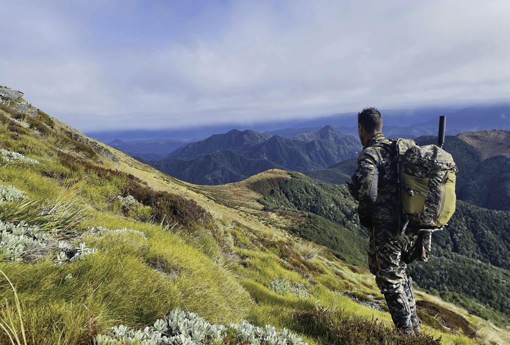
Words and Photography: Brendan Alborn.
Since the last edition of this magazine, in which I wrote about how much I love being in the great outdoors while heavily armed and in pursuit of wild critters, I’ve managed to get out into the hills for some exciting hunts. But before I get to any of that, this is the bit where I would like to warn readers that this part of the magazine requires some discretion and should not be read by anybody who objects to the killing of wild animals.
I’m confident that any of my fellow hunters would agree that while some hunts turn out wonderfully with plenty of animals sighted and a couple successfully on the ground, there are a lot more missions and time in the hills spent trying to locate the elusive critters.
In recent times I’ve managed to shoot enough red deer and wild pigs to keep the family walk-in freezer well stocked and to keep our purchase of meat from stores
to the bare minimum. I’ve also doubled down on efforts to fill myself and my mates with enough protein each week to ensure our collective iron levels are within recommended limits for good health. My immediate family is not hugely enthusiastic about eating venison regularly but luckily I have a group of mates who seem keen to partake, or at least are polite enough to keep eating what I cook and even say nice things about how it tastes.
Through a friend of friend, I have managed to get access to a large farm in the Hurunui area in North Canterbury. Right at the back of the farm is a pine plantation and the farmer is not really keen on having red deer wreak havoc with the pines, or anywhere else on the farm for that matter. A mate, Roids, and I have hunted down there a few times, and the first
AND GATHERING
time happened to be in the middle of the winter and in the midst of a long period of heavy rain. I had arranged the visit weeks in advance and while we would have liked to call the trip off we didn’t want the farmer to think we were powderpuffs, so we travelled down despite the less than ideal weather. The farm was wet and muddy, but we headed out on the 4WD mule on the first evening and while we spotted a couple of deer, those sightings were at a great distance and the deer were all moving even further away from us. On the second day, after an unsuccessful tour of the farm the weather turned even worse. We spent most of that day back in the hut, which to be truthful is pretty luxurious as hunter’s lodgings go, wrapped up in our clothes and sleeping bags, watching movies.
On the final morning before we were due to bug out we set out for the back of the farm again. While the rain had finally subsided for a period, there was plenty of misty clag around the hills and everything was shades of grey and brown. I was using thermal binoculars to glass the hill faces and that was the only reason I could see three distinct heat signatures on the hillside opposite us, and even though they were a long distance away, the more I looked, the more deer-shaped they appeared. My hunting mate, Roids, was carrying what he rather fondly refers to as his ‘cannon’, a 7mm REM Mag which he had successfully been hitting targets out to +500 yards on his family farm. After a few moments he was able to see the deer through his scope and we used our rangefinders to peg the hostiles at 556 yards. Unlike me,
who tends to take my shots quickly as a subscriber to the ‘where there is lead there is hope’ philosophy, Roids tends to take his sweet time.
The farm was wet and muddy, but we headed out on the 4WD mule on the first evening and while we spotted a couple of deer, those sightings were at a great distance
Firstly, he uses an app on his phone to calculate the M.O.A. (Minutes of Angle) to the target and then estimates the wind speed before dialling both of these factors up the ballistic turret on his fancy Leupold scope. Then he puts his ear muffs on because the cannon has a muzzle-brake rather than a suppressor, making it rather loud. Roids gets himself comfortable and his breathing just right, and then finally, he takes the shot.
I was standing well behind him and had been tempted to get a cup of tea underway, or even to use the time to learn a new language whilst waiting for this process to eventually come to an end, but I was eventually back on the job of (contd)
looking at the deer through the thermals. It’s always handy to have one shooter and one spotter in these situations as the spotter can then keep an eye on whether the shot finds its mark and if it does, where the animal falls, particularly if it drops into thick bush. Eventually, Roids did take the shot and I saw the heat signature located highest on the hill drop while the other two paused for a moment before running off at high speed. We were both happy to have put at least deer out of the business of damaging the farmer’s trees and also felt like we’d proved we were not weather-pansies.
On a later trip to the same farm we had spent hours driving the mule out to the back of the farm on the first evening, and wandering around on foot glassing the country without spotting a single animal. As we were pulling up to open the gate back to the hut, located right back down at the road, about 11pm we were both stunned to see a red deer in the mule’s headlights. We were no more than 300 yards from the hut. So, while we had been piss-farting around driving and walking the most remote part of the farm for hours we would have been better off sitting outside the hut waiting for them to come to us. We dutifully shot that deer
and then did manage to get two more the next morning back up where we had been the night before.
Now, I don’t want to be one of those hunters who only talks about the successful missions in the manner an habitual gambler will only ever talk about the times they won, and will never mention the times they did not. I have been extremely fortunate to get some access to a private block of land on d’Urville Island where I’ve had some great success over the years. On one recent occasion however, I had a rather spectacularly unsuccessful evening while out hunting with a rifle equipped with a thermal scope. I’d been out on the same block just at dusk and hadn’t managed to spot a single hostile, so I waited and went back out just before midnight. A short way up the track I almost dropped the thermal binos when I spotted the head of a red hind as it wandered over the hill just above me. It was so close I could see its ears twitching. It spotted me at the same time so moved away with two other hinds and was about to drop into a bushed gully below the track where I was standing. I managed to quickly get a solid rest for my rifle on a fence post and managed to get a shot off before the last of the hinds, who was stationary at the time,
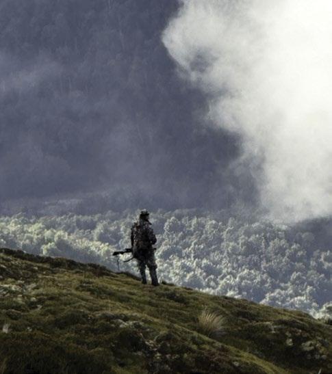
Nelson Lakes National Park.
walked down into the gully. The deer was only about 150 yards away, and although the shot felt great, the deer just seemed to smirk at me as it ran down into the gully.
A short while later I was lining up on two deer that were out in the open and to which I had managed to commando crawl to within 160 yards of. I was lying prone with the rifle resting securely on its bipod and I had all the time I needed to take the shot. I fired at the first hind and was so sure of the shot I reloaded immediately and got a bead on the second hind, only to notice that the hind I had just shot at was still on its feet. I took aim again and fired four more shots only to watch both deer scarper off completely unharmed. I lay there for a while wondering how it was that my shooting had deteriorated to the point where I literally could not hit a barn door. After a while I had located two more red deer and managed to again get within a few hundred yards of them as they grazed contentedly in a gully below me. I lined up my shot, took it, but registered yet another clean miss. The rifle has an excellent suppressor on it so the deer often can’t tell where the danger is coming from and instead, tend to stand still for a while. This allowed me to fire repeatedly, but to no avail. By this time I was reasonably confident that the issue was gear related, rather than my ability to shoot, but the next morning I felt like I was making excuses as I told my mates I had seen plenty of deer and had used an entire box of ammo but had nothing but a damaged ego to show for it.
Itook aim again and fired four more shots only to watch both deer scarper off completely unharmed.
A few days after I returned from the hunt I took the rifle up to my mate, Tim’s range to test whether it was correctly zeroed. Although I’ve never managed to work out how the rifle had dropped its zero, it was shooting seven inches low and six inches to the right even from 100 yards. I used two full boxes of ammo getting it re-sighted but am hoping the next time I get a chance, whatever I’m shooting at finds itself in some danger.
In May 2024 I was fortunate enough to be successful in a New Zealand Deerstalkers Association (NZDA) ballot for a management hunt in Nelson Lakes National Park. In an effort to control deer numbers in the area the NZDA were able to get permission to transport, by helicopter, nine groups of four hunters into pre-designated blocks in the Matakitaki area of Nelson Lakes National Park. The objective was to cull animal numbers down to a more sus
tainable level to avoid ongoing damage to the bush. The chopper transport meant the groups could easily access areas, particularly on the tops, that would otherwise take many hours or even days to get to on foot. It also meant hunters could take a lot more gear and food than would be possible to carry in.
Our group was lucky enough to nab a big block of open country area on the tops in an area called Nardoo, a short flight from Mt Ella Station, or what would have been a seven-hour walk including 1500m of elevation.
On the morning we set off, it was still dark when we arrived at the chopper take-off point but it was still abundantly clear that we wouldn’t be flying anywhere until the clag lifted. At noon we were loading up the machine with our gear and were on our way to the campsite at Nardoo. As we approached the spot we had chosen and confirmed with Rob Hunt the chief pilot for Murchison Heli Tours, we spooked a mob of about eight red deer, so we were even more excited to be there and now had some lofty expectations in terms of animal numbers. There is nothing quite like being on the top of a mountain range and at 1500m the views were absolutely breathtaking.
After setting up our camp, which consisted of three tents and a fly between the tents to provide a common area that we could sit or lie under to get out of the wind and particularly the dew that would cover every surface in the morning. The minimum temperature during the night was forecast to be around -3 deg Celsius so we knew we’d need to bunker down to keep warm at some point.
We split into two groups of two and set off in different directions, and while both parties saw some deer that evening, and a couple of chamois, not a single shot was fired in anger. Things got more interesting in the morning when Tim and I spied a group of five hinds at a distance (contd)
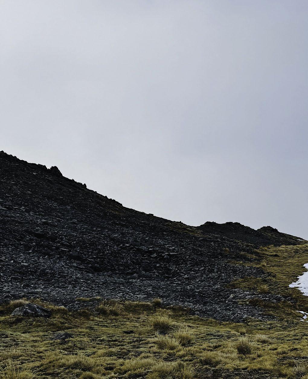
Scree slopes, Nelson Lakes National Park.
of about 400 yards after a commando crawl up onto a high point. It looked like we could retreat back the way we had come and would have the cover of another high point to take at least 100 yards off the distance, but when we did make it to the top of that second vantage point, the deer were nowhere to be seen. We walked in their general direction as we felt we had a good idea on where they may have gone. Sure enough, when we poked our heads over into the next basin, on the far side of a small tarn we got within 160 yards of the hostiles. A couple of hinds must have spotted us at the same time as they began to move away. We both took hurried shots but both missed so ended up running after them hoping they would stop again and perhaps ponder what all the noise was about. They didn’t stop, and we were feeling quite disappointed in ourselves.
We’d been walking up and down hills for a fair while by this time so I suggested we head back to camp, but Tim suggested we continue on as we would be able to get eyes on a large basin from a sawtooth ridge just ahead. While Tim was using his binoculars to do the same thing I scanned the large expanse with thermals. I spotted a large heat signature that I presumed was a rock that had warmed up in the sun, so I scanned past it. I did look at it again on my second pass and decided to confirm it was a rock with my binoculars, which I almost dropped in surprise when I saw a large pair of antlers attached to an even larger red stag across the basin on a rocky knoll. We ranged the stag at 456 yards, and with it oblivious to our presence at that distance, could take our time with our shots this time around, which successfully found their mark. Once we worked out
where it was safest to get down from the sawtooth ridge and across a scree slope, it took us about 20 minutes to reach the downed animal. To our surprise it was a nicely balanced 12 point stag in excellent condition.
The next day, I teamed up with Alex, who, at 17 was the youngest of our group by roughly a 100 years. While glassing the same country where we’d shot the stag the day before a chamois buck walked out and across a scree slope just below us which Alex duly shot straight through the ticker. We wandered on and covered a fair amount of country before we spotted two red deer about 250 yards below us in another basin and with the wind blowing in our favour, Alex duly dropped both of those as well, including his very first stag; a nice even eight pointer. After boning out both deer, carrying the meat from two animals up the side of the basin was one of the most physically demanding things I have ever attempted in my life. Luckily, we had been in radio contact with our hunting mates, and they came to the rescue. I was so exhausted having made it roughly two thirds up the hill with half of the meat in a drybag clutched to my chest I was about ready to give up.
The next day, I teamed up with Alex, who, at 17 was the youngest of our group by roughly a 100 years.
We were due to be collected after noon on the third and final day but crawled out of our tents to find we were completely clagged in with visibility at about 100 yards. This made a final morning hunt impossible so we packed up our camp and sat around waiting in the hope it would clear enough for the helicopter to fly. The alternative was setting up our camp again and waiting until the cloud cleared, which could take days. So, it was such a relief to finally hear the machine fly past on its way further up the valley to begin the sequence of picking up each group.
In the final tally up, 229 animals had been spotted collectively by all of the groups and 65 animals killed. This resulted in the recovery of approximately 440kg of meat with 100kg of that venison being processed and then donated to the local food bank. The management hunt was a fantastic illustration of how the NZDA and DOC can work together for positive conservation outcomes. It also reinforced my opinion that game animals are a valuable food resource in the country during a time when a lot of people are struggling to put high quality food on the table for their families.
A view from the tops.
Abel Tasman summers.
THRILLS SEEKING
Words: Jade Alborn.
Strolling along an iconic golden beach, sipping a refreshing beverage while basking in the sun, a relaxing kayak in the Astrolabe or ... hurtling through the air at 200kmh, leaping off rocks into crystal-clear creeks and zipping down one of the world’s longest flying foxes?
The Nelson-Tasman district has a relaxed reputation and laid-back vibe, but it is also home to a range of activities that will make your heart race. These adrenaline spiking adventures on our doorstep draw in adventurous locals and visitors alike.
I spoke to some local experts, who gave me the rundown on what these activities entail. Are you brave enough to take on the challenge?
Damien Ettema
Skydive Abel Tasman
www.skydive.co.nz/abel-tasman
How long have you been involved in the skydiving industry? What got you interested?
I’ve been skydiving for just over 11 years. I started in the same way many New Zealand skydivers start because we are fortunate enough to have this thing called the New Zealand Skydiving School. Somehow the New Zealand government got it approved that you could complete a university degree, and get a diploma in commercial skydiving. There is nowhere else that has this sort of thing. I also used to be in the Air Force for six years, and I did my first ever skydive out of a military plane. So I did my first 40 skydives in the Air Force then very shortly after that realised that it was something I wanted to do full time. So I applied for a year of unpaid leave from the military and joined the New Zealand Skydive School. I left New Zealand with around 200 skydives, and have been overseas in the United States. I came back to New Zealand last December with 11,000 skydives.
What can people expect their experience to be like?
Most people are really scared of skydiving, so I think one of the biggest things is just getting here and meeting your instructor. I think a lot of people paint a picture of skydiving in their heads long before they step foot in a dropzone. You’re welcome to visit the base, just to see how it all works, see how the instructors operate, and have a yarn to us. It instils a lot more confidence in people. A lot of people will come here really nervous and scared and maybe they are on the fence about doing it or not doing it. Then they end up booking in and doing it, and I would say 75% of people will land in that field out there and then will want to go up again straight away.
On the day of your booking you will meet our front-ofhouse people. We have a bunch of different options in terms of how high you can jump. If you want to have someone jump with you to film a video; I always think that adds to the experience, and also having that documentation of your very first jump is cool. You will then
sign a waiver and let us know about any medical conditions. Then you are in the line. We usually ask people to allow 1.5-3 hours depending on the weather and how busy it is. But you might come in at 9am to check in and then we will have you on the plane by 9.45am. You will meet your instructor and you can ask all those questions that you have been worrying about. We have a hugely experienced crew. They explain how the harness works, and get you all geared up in your suit, hat, gloves, and goggles.
75% of people will land in that field out there and then will want to go up again straight away.
Then you go for a quick briefing, and I always tell people after the briefing because it is a lot of information. If you forget everything I’ve just told you, you will still be fine.
The plane will taxi up, people get into the plane, and the plane takes off. It is going to take 12-15 minutes to get up to 13,000 feet. If you go higher to 18,000 then around 1520 minutes. We will open up the plane door and that will be the most intense part for sure. It’s windy, and it’s loud. That’s when we go back to our breathing, deep breaths in and out, and you just gotta trust your instructor. No countdown from me, and then we are out in freefall. You are just blissed out dude, there is no going back at that point. The parachute opens up at 5,000 feet. We can talk again then, maybe even let you fly the parachute. Finally, we land back at the dropzone, give you a big hug, and ask if you want to go back up again!
What makes it unique compared with other tourist activities in the area?
I think what makes it unique is that it’s kind of scary. I think fear is not necessarily a bad thing. When you get that nervous butterfly feeling, a lot of the times in my life that’s been a sign to go for it. That’s something to push past and challenge yourself and get outside your comfort zone. I think with other tourist activities they try to make you comfortable, and we sort of go the other way. It’s not about making you uncomfortable but instead pushing past a bit of a fear boundary. A nice meal, a trip to a winery, or the beach are all things I love but your first skydive will get you, it will make you think about things differently. If you can throw yourself out of an aeroplane you can do anything, so it’s empowering.
What makes a skydive in the Abel Tasman special?
The scenery is phenomenal. You see the Marlborough Sounds, you see the Wellington Heads wrapping around, you see the Cook Strait, Mount Ruapehu, Mount Taranaki. You can see the North Island and you can see the South Island. A lot of people who come here will have some interaction with the Abel Tasman. So if you skydive before you have gone out on the trail you get to see where you are headed from above.
Do you have any words of encouragement for those who are a bit tentative to try skydiving?
It’s OK to be scared of this activity. As everyone says, “Why on Earth would I want to jump out of a perfectly good plane?” and I always reply,“Because it’s really fun.” You are supposed to be a bit nervous. Just come down to the dropzone; being here will make you feel a bit more at ease. You will see how natural the instructors are, how seamless it all is, and how it’s fun. We love it and that is infectious. If you can get down here, have a yarn, see some people land, and chances are I can convince you to jump.
In three words can you describe what free falling feels like?
Breathtaking. Exhilarating. Windy.
Toine Houtenbos and Eva Maureau Abel Tasman Canyons www.abeltasmancanyons.co.nz
How long have you been involved in the canyoning industry? What got you interested?
Toine: I got into canyoning in 2003 in the North Island and at that time in New Zealand, they didn’t even call it canyoning. Then I went back to Europe to work as a general outdoor instructor, and everyone was going on and on about canyoning. So I got some in-house training at the company in Italy I was working for. I got pretty hooked on it from there on. So we came back over to New Zealand in 2008. Toured our way around the country, moving from Twizel to Queenstown and then to Christchurch. When in Christchurch I would go on road trips around the South Island with a good friend of mine Daniel Clearwater, who
is the president of the Canyoning Association. On one trip we went up the West Coast over Arthur’s Pass making our way to Nelson Lakes National Park, we were planning on doing the first descent of a canyon there. Unfortunately, it was bucketing with rain and everything started to flood. So we bailed on that but it looked like the rain had missed the Abel Tasman.
Canyoning is perceived to be a bit more fullon than what it is. A good thing for people to know is that all jumps and slides are optional.
We didn’t expect anything particularly good but we had no other place to go. We went up to the Torrent River, and it was cool, really beautiful. Back in Christchurch when looking at the photos of the trip I thought that would be a really good trip for people who have never done it before. I did
a few other canyons around the area and that’s when we came up with the plan to apply for a concession from DOC to set up a canyoning business in the area. We teamed up with AquaTaxi to get us into the park and it’s been awesome ever since, and it’s been 12 years now.
Eva: So I’m the person in the office. I will come along on a trip, but as a customer just having fun! I don’t have those technical skills. I help out on the administrative side of things. Organising the bookings, co-ordinating the staff, marketing. That’s where I come in. So having that combo of skills between us works well.
What can people expect their experience to be like?
Toine: I think a lot of people are a bit nervous when they book because they might not know what canyoning is. If you don’t know what it is it makes you nervous straight away, right? Canyoning is perceived to be a bit more full-on than what it is. A good thing for people to know is that all jumps and slides are optional. There is no getting to the side of a cliff and someone yelling, “You have to jump off!”
If you book onto our Torrent River trip we will meet at the AquaTaxi based in Mārahau. We will have a chat about safety and then get you ready to get on the boat. Then we will take a beautiful water taxi ride into the park. In Anchor-
age, we reorganise our gear to get ready for the walk up to the top of the canyon, telling some stories on the way about the history of the park, culture, and flora and fauna. At the top of the canyon, we will have some lunch. Then get into our wetsuits and have a full safety briefing. Then it’s jumping, sliding, abseiling, ziplines, walking, scrambling and swimming. It’s about 3 ½ hours and we finish up at Cleopatra’s Pool. Then we walk back down to Anchorage, get changed and back on the water taxi with big smiles on our faces!
Eva: It does take a full day but once we are in that canyon there is something fun around every corner. There is a cool feature, a cool challenge. Torrent River also builds up beautifully. Your first abseil is small and the next one is bigger, the first zipline is small and the second one is bigger. People gain confidence during the trip. They end up doing stuff that beforehand they never thought they would do. There is room to make it extra challenging and room to make it a bit easier for those who are a bit nervous, all within the same trip.
What makes it unique compared with other tourist activities in the area?
Toine: The terrain we take people into. There isn’t any other way to see that sort of landscape. The Abel Tasman has so many amazing views, it doesn’t matter where you are. When canyoning, you are taking in this beautiful scenery, but you are also interacting with it, too. When challenging yourself your adrenaline is elevated, and everything is quite enhanced. We also see people who are quite nervous at first becoming more and more empowered along the way.
Eva: I think we see the biggest growth in people who were nervous at the start. To find themselves doing it. We also see wonderful connections between families, and teams that come for staff parties. Cheering each other on and seeing someone do something they didn’t think they were going to do.
Toine: We also have groups of random people going on trips together who don’t know each other, but the adventure connects people. At the start, there is not a lot of conversation going on, but by the end, people are hugging and exchanging email addresses. They have been through something quite intense together.
What makes canyoning in the Abel Tasman special?
Toine: The unique thing about canyoning in the Abel Tasman is that it’s pretty much at sea level. Most canyoning in the world is high up in the mountains. The fact that you can be on a water taxi going on a canyoning trip, maybe seeing dolphins along the way, and spending time at the islands with the seal pups. That is unique. Guides, when they
come over from Europe, we tell them that their commute to work is a water taxi ride but sometimes you get stuck in traffic behind a pod of dolphins. The granite canyons are beautifully sculpted so it’s all very flowy. It is a lot more open than other canyons because the rock type is quite hard, so we get sunlight beaming in making it a bit warmer.
Do you have any words of encouragement to those who are a bit tentative to try canyoning?
Toine: Just do it eh! I can understand that it’s something new, just have faith in yourself and the guides. We are not there to scare people, we are there to help people challenge themselves. The more scared you are at the start, the more satisfied and proud you are going to be at the end.
Eva: You won’t regret it!
In three words how it feels to jump off a rock into beautiful water?
Toine: Oh my god!
Eva: I did that!
If you are keen on the most action-packed day possible you can do both these activities on the same day in the “Guts and Glory” trip. Finish up your action-packed Torrent River canyoning trip with a 16,000ft skydive for the ultimate heart-racing combo.
Richard Ussher
Cable Bay Adventure Park www.cablebayadventurepark.com
How did you get involved with Cable Bay Adventure Park? What got you interested?
We bought the Adventure Park at the end of 2017 - we’d been looking for business opportunities to keep us in Nelson and had never heard of the business prior, this struck us as a huge opportunity if we could make people aware of the Skywire especially. When we looked at the business, it felt like there was a lot of untapped potential as well as opportunities to expand into new areas like mountain biking.
What can people expect their day to be like when they come to visit you guys?
People can really make up their day to suit - the Skywire flying is our most popular attraction but the quad bikes, paintball and mountain biking are all great options. You can also spend the day here easily with the onsite licensed café and also pet farm animals; there are eels for the kids to feed. There are opportunities for people to split up into groups focused on their particular interest and then meet back up at the café.
What makes Cable Bay as a location so special?
The property is mostly covered in stunning native forest, as well as having some magnificent views towards Cable and Delaware Bays and the distant Kahurangi National Park. There is a significant pest control operation in place
and a wide variety of trails to bike or walk. On the Skywire you fly high above the forest and get stunning views of the property and wider area. Many of the 4x4 roads the quad bikes travel on are also through the forest and the tours stop at multiple viewpoints.
The Skywire especially makes people a bit nervous - especially those who don’t like heights so much!
Do you have any words of encouragement for those who are a bit tentative to try some of your more scary activities?
The Skywire especially makes people a bit nervous - especially those who don’t like heights so much! But the vast majority of people arrive back stoked that they took up the challenge, and it’s also great being able to have someone next to you on the ride for a bit of moral support.
In three words can you describe a day at Cable Bay Adventure Park?
Fun. Scenic. Exciting
SPOTLIGHT ON:
TORRENT BAY
Words: Brendan Alborn.
Located about 14 kilometres from Mārahau at the southern entrance to the Abel Tasman, Torrent Bay is a village of holiday houses on privately owned land within the National Park. There is no road access to Torrent, electricity supply or permanent residents so it is largely a place for wonderful, classic Kiwi summer holidays.
My personal relationship with Torrent Bay has been somewhat complex, has involved some conflicted thinking and it has changed over time. If you will allow me to draw a comparison with a relationship to a person it would be like meeting somebody and thinking they are both attractive and nice, but after a while I feel like the person is indeed still attractive but isn’t as nice as I previously thought, and then once I’ve got to know and understand that person a bit better, my opinion has softened. Now, I’m probably just confusing you at this point, but please do stick with me.
The first time I ever visited (met) Torrent Bay was in the summer of 1998 when I was visiting from my home base in Shanghai, China. I was dropped by one of our water taxis at Bark Bay, and ran the 7 kilometres through to Torrent Bay. I remember reaching Torrent Bay a lot quicker than I had been expecting and feeling like I had only really warmed up. Now, there are two possibilities with this memory. Firstly, I was simply young and fit and the steep climb from Falls River up the top of the ridge line was nothing for me back in those days. Secondly, I now view this memory through rose-tinted glasses, and the zig-zagging
track up from the Falls River Swing Bridge was just brutal as it always has been. I have simply blocked the pain and suffering from my memory. Whatever the case, I ran down the hill into Torrent and found my aunty and uncle, Christine and Bud Nalder who were staying there, something they did often. I spent my day with them and one of their kind friends who gave me a wonderful sailing lesson in the estuary. In stark contrast to the mean streets of Shanghai, and the bitter winter I had jetting in from, Torrent Bay was heaven on earth. The sun was shining and almost every person I saw was in bare feet, a practice that would shock the local people of Shanghai to their core if they were to see this at any time of the year. The contrast in lifestyles was so jarring, and it reminded me intensely of the wonderful times I had spent at the beaches in Hawke’s Bay as a child and much younger adult.
(cont’d)
Fast forward to about 2012 and I had some reasonably robust debates with the representatives of the Torrent Bay Ratepayers Association. While I totally agreed something needed to be done to mitigate the effects of so many day visitors being dropped off and picked up at Torrent Bay, and commercial operators had failed to moderate the impact on private landowners there voluntarily, some of the attitudes I encountered were manifestly unjust.
Things tend to blur into one long, lazy day of sitting on the beach reading...
When we moved to this area at the end of 2010, many of the locals I met would tell me they had a bach ‘up the bay’, which generally meant Torrent Bay. In fact, so many people told me about their bach at Torrent I began to wonder just how many baches were actually there, and perhaps there was another part of the village that I didn’t know about. It took me a few years to realise that many of those baches are shared by multiple generations of the same large local family and have been owned by those families for generations.
Over the past several years we’ve spent a few weekends staying in a bach at Torrent during the winter, and we’ve practically had the place to ourselves. This makes it great for family time, free of the distractions present in everyday life. More recently we’ve been incredibly lucky to be able to rent a bach over the new year period when every bach is full to the gunnels. Twice now, for a bit over a week we have been able to live the dream of an old-school, Kiwi summer holiday at the beach, and it has been magical. The bach has plenty of beds so we’ve been joined by different friends who come up and stay for a few nights at a time. The weather has been spectacular both years so things tend to blur into one long, lazy day of sitting on the beach reading, swimming and then a big BBQ during which we tend to engage in more rehydration than is strictly necessary. Then we wake the next day and do it all again.
I am an active relaxer so I need to at least go for a run to feel like I’ve actually done something every day. So I usually head around the Torrent estuary and up to the ridge line above Anchorage before returning to jump straight into the sea to cool off. We took our inflatable standup paddle board last time so I was also able to paddle up the estuary to the mouth of the Torrent River, where I beached the SUP and wandered up to Cleopatra’s Pool for a freshwater swim before paddling back.
Many of the baches at Torrent Bay have been in families for generations.
The bach we’ve rented overlooks the jetty around the back of the main beach in the estuary, so we’ve spent many hours sitting up on the deck watching the ebb and flow of both the tide and the day overall. There is no shortage of things to look at as the boats come in and out from the jetty, ferrying people with their supplies. Walkers pass through and can be seen wandering across the estuary coming from or heading towards Anchorage. People are out in sailing dinghies and all other manner of watercraft either heading out for a fish or just cruising around passing the time.
On New Year’s Eve every year there is an extremely impressive fireworks display, the launch point of which is a barge placed out in the middle of the bay. It is a surreal experience, with everybody down on the main beach enjoying themselves, watching a world-class fireworks display in this remote location. Then on New Year’s Day itself the locals hold a sports day on the grassed reserve in the middle of the beach, a tradition that has been running for many decades.
On
New Year’s Eve every year there is an extremely impressive fireworks display...
Watching people enjoy their time with their families while I am doing exactly that with my own family, I have grown to understand why people love the place so much and were reasonably militant as they sought to protect the place from being overrun by visitors all of those years ago. And the balance seems to be about right too. There is a small DOC campsite so the general public can stay there too, and as commercial operators, we have adapted to the restrictions for the drop-off only of passengers until noon each day. Now, and with the benefit of hindsight, I see Torrent Bay as an example of how we as commercial operators need to work proactively to protect the park from over-visitation before, not after it creates problems.
OFF THE LEASH (EVEN FURTHER)
Words
and
Photography: Brendan Alborn.
It has been customary that I begin this column by listing the alignments, accidents and incidents that have befallen myself and Maggie since our last edition of this magazine. As well as being epileptic and incontinent, Maggie, my now 8-year-old Border Collie, seems determined to single handedly keep our local vet clinic on the north side of profitability.
Since the last column Maggie has stabbed herself in the mouth while running with a stick, a little incident that resulted in a large amount of blood gushing out and a high-speed trip from Mārahau to Motueka, but luckily, nothing more serious. About a week after that she pulled up lame and appeared to have finally, at her third attempt, succeeded in rupturing her cruciate ligament.
Mercifully this turned out to be a tear, rather than a rapture, so we avoided the +$5,000 operation to have it reattached. One week after that she managed to find, at the back of a cupboard in a sealed cake container, some of my Mum’s legendary Christmas Cake which is chock-full of raisins, a fruit that is potentially lethal to dogs. Before we discovered what she was up to Maggie had eaten a corner off the cake and as the incident took place in the evening, it resulted in another rapid, and expensive, after-hours visit to the vet.
All of this is not to say Maggie is the only member
of our running partnership who has been in the wars. I went through a period in the final quarter of 2023 during which I suffered from repeated tears to both of my calf muscles. It felt like my body was trying to tell me that my long-distance running days were over and this is something I have been doing since I started running cross country as a 14 year old. I pulled my calf the first time in October, and it wasn’t until Nick Fritz, the wizard physio of Riwaka had treated it, I had stretched, iced, warmed, rested and strengthened both calves over several weeks, that I was finally back to normal in January 2024. This all meant that our total run kilometres for 2023 were down to a bit under 1,300, a decrease from my annual average over the past five years of 1,866km. I was recently telling somebody that I’ve tracked and logged every run and cycle in a spreadsheet since 2003, and it wasn’t until I was saying it aloud that it suddenly became clear to me that perhaps this isn’t normal behaviour, and that just maybe, I need to add OCD to my long list of physiologic quirks.
MĀRAHAU BEACH - RIVER WALK
On the right-hand side just before you cross the bridge on the corner of Sandy Bay - Mārahau Road and Mārahau Valley Roads, as you are heading north towards the start of the Abel Tasman Coast Track, there is a rather delightful and until now, secret little track. My Mum calls this Neve’s Walk because my youngest daughter, her granddaughter, loved walking through there when she was little.
There are usually some resident weka at the beginning of the track so you’ll need to make sure your hound is under control as you enter the track as it follows the true right of the Mārahau River down to the beach. The track itself is pretty easy going but it can be a little bit muddy in the winter and it does become sandy and slightly rougher as it traverses the wetlands as you get close to the beach. When you do reach the beach, it is only crossable during low tide conditions without getting your feet wet. From the beach, once we’ve stopped to admire the view across to the beaches at the very beginning of the Coast Track, we head back along Mārahau’s main beach. Our local hapū, Wakatū, have riparian rights to this beach so please use it respectfully and send some good vibes their way for allowing this access.
CODGERS - THE COPPERMINE TRAIL
It remains an absolute marvel to me that Codgers Trails is so close to the Nelson CBD, that there are so many tracks, the trail network connects via the Coppermine Trail all the way through to Maitai and furthermore, it is dog friendly. I make this last point because there are various other places that are fiercely anti-dog, such as Kaiteriteri, that I have grown to deeply appreciate the spots where my dog is welcome.
Starting at the Codgers Recreation Hub in the Brook, this is where I set off on my mountain bike. I’m more comfortable riding uphill than I am as a powder-puff downhiller, so we typically head straight up the climb that is the Coppermine Trail for as far as time allows. Maggie is faster than I am on the uphill, so tends to leer at me as I pedal frantically to keep up with her. In general, I aim to reach Cummins Spur at 425m before biking back down to the hub, during which time I get my revenge on Maggie who’s turn it is to lag behind. I find this section of the track features enough variation in terms of foliage and awesome views that it keeps me pressing forward, and I know that the exercise is certain to wear Maggie out for the day.
MĀRAHAU HILL - RIMU VALLEY WALKING TRACK
On the southern side of Mārahau Hill, about a quarter of the way up the hill on the right-hand side is a short walk that is another hidden gem for local dog owners.
The walk takes you through a small strand of native bush fringed by what was a pine forest until it was logged recently. The path starts with a sharp descent down some steps to a creek and then forms a circuit that only takes about 20 minutes to complete at a steady walk. There is a nice spot to stop beside the creek to the left of the circuit junction, but the whole track, including that picnic area, is shrouded in bush. The track is well formed and maintained but the one time I did complete it in my jandals I ended up on my backside when I tried to get down to the creek. This could be due more to my distinct lack of coordination more than anything to do with the track itself.
STEPHENS BAY TO LITTLE KAITERITERI
While Kaiteriteri and Little Kaiteriteri are bursting at the seams with visitors over the summer you’ll find locals, or anybody else in-the-know, hanging out at Stephens Bay instead.
At the northern end of the beach is a raised boardwalk that leads up and over a small hill to Dummy Bay, another lovely, even more secluded gem of a beach. Once you’ve dropped down to Dummy Bay the track rises again and winds its way around to a lookout where you get a spectacular view of Little Kaiteriteri and across to the main Kaiteriteri beach. Although this may change when the Tasman Dog Control Bylaw is reviewed this year, at the time of writing dogs are allowed on the beach at Little Kaiteriteri From December 1 to February 28, between 5am and 9am. From March 1 to November 30, you can exercise your dog at any time. Like much of the coastline in this area, little blue penguins nest here so you’ll need to have your dog under effective control at all times.
The rugged Te Hapu coastline.
GOOD AS GOLD
Words and Photography: Brendan Alborn.
While I seem to return to many of my favourite places each time I visit Golden Bay I also manage to discover something completely new almost every time I’m over there. Driving from our home in Riwaka I can be in Tākaka within an hour, and although only a short drive from my house, it always feels like I have traversed my way onto another celestial plane. There is something uniquely Golden Bay about Golden Bay. I’ve heard people say it has a similar vibe to what California was in the 1970s, and although I spent the 70s living in Murchison and not in the United States, I still like the comparison.
When I do head over the hill we will either take our trusty campervan, Queenie, or more recently have taken to renting one of the many great value holiday homes available throughout Golden Bay. Most recently, I’ve been hitting some of the spots where I haven’t spent a lot of time before. I’ve read all three of Onekakā local, Gerard Hindmarsh’s, Kahurangi Calling books, and have found these to be an absolutely delightful source of stories and knowledge about many places I have visited in the area, and a whole lot more I haven’t.
We have a new culinary tradition whenever we drive over the Tākaka Hill, stopping at the Woolshed, the café at Canaan, for a coffee and bite. Kath Kelly, formerly the owner/barrister at Kelly’s Coffee Cart in the middle of Motueka,
is now running The Woolshed, serving up awesome baked goods and toasties from Thursday to Sunday. Inside, you’ll find a wonderful collection of wool and woollen items for sale and outside, an eclectic menagerie of animals.
Prior to my first recent stay at Te Hapu Coastal Cottages I had only been to the western side of Golden Bay a handful of times. On two of those occasions we only drove as far as the Whanganui Inlet where we had launched our boat, a water taxi we repurposed for the day, before crossing the bar and then heading south down the rugged coastline in search of crayfish, blue cod, snapper and hāpuka. I would hazard the guess that the reason the fishing is so good in that area is due to the fact it is such a remote and weather-beaten part of the country that it doesn’t get a lot of fishing pressure. Whatever the reason, the fishing on both missions was some of the best I have ever done. (cont’d)
The style of fishing during which you drop your line and feel a strike the moment it hits the bottom. You do that until you’ve caught as many fish as you can eat, the legal quota for the species, or whichever comes first. Then you crack a cold one and silently wonder if you should consider going pro with this fishing thing.
I had been looking for opportunities to get back to do more exploring in the area so jumped at the chance to head to Te Hapu, in what I believe is loosely termed the Westhaven area, for a couple of days. It wasn’t long into the drive from the Pākawau turnoff to the west when things started to feel remote and although the road is largely unsealed and narrow, it is well formed and easy to navigate. Te Hapu is a privately owned, working farm with a couple of options for cottages to rent. We had the repurposed shearing shed/ quarters, a wonderful cottage with a wood stove which heats the water both for use inside and an outdoor bath. Having an outdoor bath, in the clear sky conditions with no light pollution, was one of the highlights of the stay with the stars even brighter and more visible than I see at home in Riwaka. We spent the days exploring the farm, and with a number of track options, I found the terrain more suited to walking rather than running, but I mostly just relaxed by reading my book and playing my guitar. It just seemed like
the perfect location and opportunity to do very little. The rugged coastline here, with its huge palms, dense bush and rocky outcrops is breathtaking and the private beach just down from the cottage is postcard perfect.
We had decided to contrast the stay at remote Te Hapu by spending a couple of nights in Pōhaha, arguably the most developed and suburban-esk part of Golden Bay. Having turned my nose up at Pōhara in the past, I’ve grown to enjoy the place in more recent times, particularly being able to run along the sand on the long beach and then undo all of the health benefits of running by drinking a few craft beers in the sunny beer garden at Molly B’s.
We stayed at the Ratanui Lodge, my very first visit, and we found both our room and the restaurant to be excellent. Jude, an old work colleague and friend of mine had mentioned the Rawhiti caves were worth a visit and as we had never been there before we headed back to Motupipi and drove straight through, rather than taking the turn towards Tākaka, and found the DOC car park easily. Just as we got out of my truck a couple returned to the car park and they were both wearing helmets. We asked if helmets were a necessary safety precaution for the caves but they replied that they had been mistaken and Rawhiti wasn’t a cave
The bluffs at Te Hapu.
where cavers do their caving thing, wearing their caving helmets. I was tempted here to launch into a tirade about how weird I find the concept of crawling through caves as a hobby, but in the nick of time I remembered many people could potentially find my idea that running up hills is a fun activity equally as weird.
The track up to the caves is reasonably easy but it does climb for a bit and was a bit slippery when we did it, but the caves are absolutely stunning, largely due to the huge amount of stalagmites that line the entrance. Reading the information signage at the cave entrance I learned Rawhiti Cave is a nationally significant phytokarst. What’s a phytokarst? A phytokarst is a phenomenon where plants and calcium work together to grow stalagmites. These actively growing stalactites are festooned with mosses and algae, and as the calcium carbonate is deposited constantly over this growth, the plants are incorporated into the structure of the stalactites. The plants grow towards the light and grow faster on the sunlit side causing the stalactites to grow towards the light.
family members in attendance, something that has become a rarity, as our kids have grown up and moved away from the area, and is therefore increasingly precious time together.
The rugged coastline (at Te Hapu), with its huge palms, dense bush and rocky outcrops, is breathtaking...
The other short walk we did while staying in Pōhara was from the Wainui car park at the northern entrance to the Abel Tasman Coast Track as far as Uarau Point. We took the high track up and over the small hill on the way to the beach and then walked around the headland over the rocks and sand on our return, a round trip of just under an hour. I am semi-ashamed to admit this is the first time I had actually been to the northern trailhead of the Abel Tasman. This visit, however fleeting, had only reinforced my opinion that Wainui Bay is yet another magical part of Golden Bay.
On two other visits to Golden Bay, both in the middle of winter, we rented a bach at Paton’s Rock, another area where I hadn’t previously spent much time. On the most recent visit we managed to have all five of my immediate
On both occasions Paton’s Rock has been perfect for a couple of days of pure relaxation. The bach has a wood fire, a prerequisite for any winter accommodation in my view, and it is also able to accommodate my dog, Maggie, another massive tick for me. With an elevated outlook across the beach and over Golden Bay, the view in general, but particularly the sunsets are stunning. Paton’s Rock ticks yet another box for me personally with the beach being long enough for my daily run with Maggie.
Located roughly halfway between Tākaka and Collingwood, Paton’s Rock is no more than a 15-minute drive from many of the places in Golden Bay on my must-do list. This includes a coffee and bite at the consistently excellent Courthouse Café in Collingwood, a pint of Captain Cooker malt beer at the legendary Mussel Inn and a beer sitting in the sun at Tinky’s, aka the Collingwood Tavern, on the lawn beside the lapping waters of the Ruataniwha Inlet.
I would suggest Tākaka provides a wider range of culinary varieties than any other small town in New Zealand. My personal favourites are the burgers at Root Bars, pizza from Dangerous Kitchen, the brunch options at Wholemeal Café, Thai from O’Sha, also located on the main drag or the wonderful bread from Bacca Bakery. This list only scratches the surface in terms of the food and beverage options, but just like Golden Bay in general, I feel like I have so much more to discover there, and I’m already looking forward to getting back over the hill whenever the opportunity arises.
The many stalagmites that line the entrance to Rāwhiti caves are absolutely spectacular.
Shags, or Cormorants?
NELSON-TASMAN EATS A BITE-SIZE TOUR
Words: Johny O’Donnell.
NELSON-TASMAN TOUR OF
If you’re a return reader then buckle up buttercup, because this year, I’m venturing beyond my usual haunts to bring you a fresh platter of culinary treasures.
You see, whilst few have disputed my credibility when it comes to hospitality, it has been suggested (more than once) that I may need to stray a little further from home and take a few culinary risks to generate some original content for this annual publication.
I take great offense at the suggestion that there aren’t more love songs to be written about the established heroes of the Nelson food scene. But I take the point that whilst my ability to articulate the ecstasy inducing experience of good tucker may be intact, my regular folks will forgive me for spreading the love around, even during a recession.
Please consider this not so much a comprehensive guide, but rather further fodder to the archives of culinary delights that we’ve celebrated in five editions of this magazine.
They include the just discovered and the rediscovered (along with one or two that should have been there all along!).
It
takes a village
The Village Cafe, Motueka 194 High Street, Motueka
I wasn’t enamoured with the name ‘The Village’ when this café first opened in Motueka but having seen the evolution of the place unfold, it now makes complete sense. The Village is a real hub for whānau and strongly embedded in the Motueka community, with all the upside and sophistication of being a well-established café and eatery as well.
The Village is owned and operated by Hineora Mcleod Bennett (Ngāti Rārua, Te Ātiawa, Te Arawa) and her whānau. The Mcleod Bennett’s are well-known in the area and have long been involved in the development of arts, culture, and community in and around Motueka. Hineora has extended this philosophy into her work in hospitality, creating an environment that is a sanctuary for whānau and conduit for community connection.
They’ve also put the spotlight on te reo Māori by integrating it into their everyday service, developing resources to support customers on their reo journey, and even hosting classes for those who would otherwise struggle to engage with the conventional learning spaces such as mums with babies. Growing up in Motueka, I can’t ever recall (cont’d)
hearing te reo being spoken at a café, so it’s pretty cool to now think that tamariki are enjoying outings where te reo is not just normalised but celebrated and revered too.
As for the café itself, the raving reviews speak for themselves with locals and visitors alike offering universal applause for the kai offerings and giving the coffee ‘best in town’ status. They’ve become well-known for their housemade bagels but the most doting outpouring of praise is found in the fluffy buttermilk pancakes with all the trimmings.
The royal treatment
The Prince Albert 113 Nile Street, Nelson
I’m not sure how or why I have slept on this one for so long. I had barely stepped foot here until recently and now I am finding it difficult to stay away. The Prince Albert has gone from relative unknown to hero in a rapidly short space of time.
This place is like the perfect hug – warm, comforting, genuinely relaxed, not forced or trying too hard, and always there when you need it most. It’s this beautiful blend of nostalgia for the pub culture that once was without feeling tired or dated whatsoever.
The food is absolutely banging and includes all your classic pub grub such as a hearty roast, fish and chips, and burgers to name a few. But they also branch out on special dishes that keep things interesting if you’re a repeat visitor. If you’re a discerning foodie but always find it hard to please the whole family, The Prince Albert has you covered.
If you’ve made it this far and remain unconvinced, I pity you. The best feature of The Prince Albert is the people. Cliche I know but I’ve never encountered such consistent levels of service. I suspect they might dose the staff on oxytocin as they are always delighted to see you. This one reinforces the value of a decent neighbourhood pub!
Seas the day
Ruby’s Espresso Akersten Street, Port Nelson
There’s no question that everything feels a little more glamorous situated by the sea and Ruby’s is no exception. Nelson is bloody fortunate to enjoy such strong access to the water but it’s embarrassingly under-utilised and void of any meaningful activation.
Ruby’s Espresso is the exception to all of that – open a remarkable seven days a week (what a concept) and heaving with locals whenever the suns out or the tides in. This open-air coastal café punches well above its weight and has gone from strength to strength since entering the scene in a small ‘silver bullet’ airstream caravan they quickly outgrew.
The location is the obvious hero in the story but the coffee is always on point and there’s always a steady stream of happy customers acquiring baking and sweet treats. For the savoury-orientated among us, they do great little homemade pies and are one of the few places you can enjoy the under-stated culinary giant that is a Southland cheese roll.
To soften my criticism of the public amenity of the marina, I ought to alert readers that the marina promenade is in for a grand makeover (Nelson edition) and ripe for growth piggybacking off Ruby’s success. Regardless, this humble yet humming establishment is part of the furniture and embedded in the DNA of a relaxed weekend in Nelson.
Fresh grounds for excitement
Tern Coffee House
5 Church Street, Nelson
When long-standing Nelson institution Kush unexpectedly closed last year, I grieved a little for what remained of our coffee culture and the lovely cluster of businesses that gave Church Street such a uniquely bohemian vibe.
Sweet escape
Tahuna Breakfast Club
Fortunately, local entrepreneurs Mel and Clive recognised the significance of the void that was left by the closure and opened a new chapter in the much-loved space that Kush occupied. I can’t impress enough the gap left by the departure of Kush and the morale boost of a new kid on the block with a well-overdue fresh lick of paint.
Fortunately, despite the renewal and more contemporary take on the concept, the ethical philosophy behind Kush is stronger than ever under the newly branded Tern Coffee House, with sustainable, ethically grown and roasted coffee being served up in new and exciting variations.
Tern is a free house style concept rotating flavours and keeping things fresh by not being tied to any particular coffee brand. A rarity in the age of brand saturation. It’s a family-run, fiercely independent, and downright delightful new addition to Nelson’s hospitality scene.
37 Tāhunanui Drive, Tāhunanui, Nelson
Owners Samantha Malekar and Mike McLaughlin ventured the well-trodden path of an exodus from the pace and stress of Auckland life for the calmer pace of the Nelson existence. But far from slowing down, the couple now own and operate the hugely successful Tahuna Breakfast Club.
This place is an absolute delight and one I am ashamed to have omitted from previous editions of the magazine. It’s located in the immediately recognisable art-deco building on Tāhunanui Drive, that I’ve recently discovered made its way there from its original location in Collingwood Street, an impressive but rather pointless fact to share with you.
Let’s cut to the chase – this place has a lot going for it; the staff are lovely and the coffee is real good. But the undisputable headline act is the sweet treats. These are works
The view at Ruby’s Espresso, Port Nelson.
of art produced by Samantha herself, a pastry chef with over 20 years experience including with Daily Bread, the bakery Aucklanders don’t mind getting stuck in traffic for.
Now that I’ve put the pastries front and centre of the breaky club story, I must tell you that the breakfast butty is off the hook and worth the drive by itself. This tidy little number is the perfect morning fuel and provides just enough wiggle room to back it up with one of their donuts. You can thank me later.
The revolution we didn’t know we needed Rust Kitchen
228 Rutherford Street, Nelson
Firstly a confession, I wasn’t anticipating including Rust Kitchen in this year’s celebratory notes despite it being my closest neighbourhood café and a rather obvious choice, as I assumed that when the wonderful French couple behind the original concept sold up and left town, things would quickly go south as they often do in those instances.
I couldn’t have been more wrong. The new owners got to work quickly on refreshing and enhancing the concept by maintaining the core of really decent galettes and crepes
but expanding the offering to include a range of bagels that have become an absolute hit with the locals. So many good things roll out from the kitchen now I can barely keep up.
The culinary delights of Rust Kitchen have stiff competition though. I am going to argue the Havana coffee expertly brewed by barista Pablo Salas is the ineffable quality of the place. I was alarmed to see the Nelson mayor on the tools recently but soon discovered Pablo is also a trainer and was merely humouring the man to promote reusable cups.
Not to detract whatsoever from the importance of food and coffee (both of which they’re nailing) but my pet peeve is outlets that don’t value ease of experience. Rust is leading the way with a digital loyalty card, online ordering, and app delivery. It’s a breeze to enjoy the goodness of Rust and there is something to be said for that in my opinion!
It’s not you, it’s me
Well, folks, there you have it - a whirlwind tour of some of Nelson’s hidden (and not-so-hidden) gems that have captured my heart and stomach in recent months. While I may have ventured beyond my usual stomping grounds this time, rest assured that my love for our established culinary icons burns as bright as ever.
To Lisa, Logan, and the good folks at Arden offering dishes we can’t pronounce and big city level hospo experiences we don’t deserve, you’re looking hotter than ever.
To our Italian familia at Babagatto for the most deliciously under-stated authentic cuisine only improved by the outpouring of love and red wine, please never leave us.
To James and the amazing team at Hardy Street Eatery
for always hitting the right notes and offering the comforts of consistency and quality every time, we raise a glass to you.
To Nick, Beth and the team at Victus Coffee & Eatery, please stop invalidating my claim I am not a sweet tooth and more importantly know that, we love your work.
To Zoe and the team at Hooked on Mārahau who bring the people of Mārahau out of a deep hibernation with the return of happy hour each year, we think you’re amazing.
To Ange and the TOAD Hall whānau who nourish the community in so many ways and hold a place in the hearts of people from every corner of the world, we adore you.
To Nick, Kimberly, and co at Kismet Bar who run a damn fine establishment and have outrageously good taste and superior knowledge of all things boozy, we slur for you.
To hospitality heroes who have stared down the last four years of fuckery, we salute you!
To those of us who couldn’t go without, show some love for your local, they need you!
Rust Kitchen & Eatery.
Clear night skies above the Abel Tasman.
THE RISE AND RISE OF MAT TAIT
Words: Brendan Alborn.
Mat Tait is a fulltime artist and an award-winning author, a fluent speaker and teacher of te reo Māori and a long-time Mārahau resident. For the sake of full disclosure, I wanted to start by admitting that I’m a big fan of Mat Tait’s art and the man himself. There is something in Mat’s art that hits me right in the chest.
Iam the proud owner of a number of his original artworks and have simply badgered the hell out of him over many years until he has agreed to design and draw images for my office, my band and even my skin. After my most recent purchase of his drawings we joked that I may now have to add a Mat Tait Wing to our house to display the collection. I love how Mat’s art can often convey a quintessential New Zealand-ness and particularly our pre and post colonial times as I imagine they were.
Mat has also designed just about every brochure and other piece of marketing collateral and merchandise for our businesses for the past 20-odd years and is even the design editor of this very magazine. I can only imagine how odd he might be feeling as he is laying out a feature about himself. The truth of it is that the only way I could get him to agree to the interview and feature was by letting him know that my mother, who can be somewhat terrifying when she choses, had insisted the story be included in this magazine. She said something along the lines of “You tell that Mat Tait he’s going to be featured in the magazine or I’ll have his guts for garters.”
I sat down for a chat with Mat in late July and despite having known him for a good few years and having worked with him on countless projects, I learnt many new things about him and his work.
Mat was born in Ōtautahi Christchurch where he lived until he was around 11 years old, then moved to Hamilton for around three years before shifting again, this time to Napier where he started at Colenso College part way through his second year at high school. Mat’s Dad is a well-known and highly regarded educator and administrator, so the moves were necessitated by him taking up new positions at different schools.
The shifting between schools was tough, says Mat: “I never found moving schools a particularly enjoyable experience”. To complicate matters further, Colenso was what could
be uncharitably referred to as a ‘tough school’ in 1984 and at 14 years old, it would be a difficult phase of life to fit in at a new school, particularly when your dad is the deputy principal. Mat reckons he managed to keep that last fact on the downlow but does recall some dicey moments. “Well, it was a big school so my friends knew, but yeah, it wasn’t widely known. Luckily, Dad was really well liked. So, thank goodness for that. There were a couple of incidents where I thought I might be about to get a pummeling here. But it actually turned out that the person who I thought was stalking across the quad to pummel me, was actually coming across to say that they thought Dad was alright.”
Mat studied art throughout high school and at some point, decided that is what he wanted to pursue as his career. “I’m not sure exactly when, but I was like: OK, I’m going to be an artist, and not just any old artist. I was going to be a capital-A fine artist. A painter or whatever. And so my goal was to get into art school.”
Mat says his acceptance to study for a four-year Bachelor of Fine Arts at Ilam, part of Canterbury University, was due to his “slightly better than average marks”. “I only squeaked in because of people dropping out. So yeah, I think I was quite lucky to make it in.” However, once he was at university he found the entire approach challenging, “I don’t know how things are done now, but back then it was absolutely ruthless. They made this very up-front, that you’re not here to muck around. At the end of the year, we’re cutting probably about half of you. So, the pressure was on kind of immediately,” he remembers.
However, Mat did make it through the first year and when it came to choosing his studio or specialisation, he went for painting, the most competitive of the studios. “There was an element of competition, even though you’d made it through, there was competition to get into the (cont’d)
Right: Mat stands in the doorway of his new studio located in Mārahau, just down the road from his home.
studio that you wanted to get into. Painting was the most desirable one, so it’s the toughest one to get into. Anyway, I got good marks that first year so I was able to get into painting, which was great. But I was also ready to quit. The teaching method was sort of bootcamp style. Like, break you down to build you up. And I mean break you down, like emotionally at times. It was absolutely brutal,” says Mat.
Throughout this process however, Mat did develop his craft and find his own style. Although he felt the tutors favoured “fairly cool abstractions” they were also looking for “consistency” and students who “were developing it in a clear and cohesive way”. He didn’t think he was doing particularly well in these terms: “There wasn’t really anyone there, at least none of the teachers, that really had much time for my, well, let’s face it, fairly callow expressionism. Oh, my poor tortured soul kind of thing. Which I’ve actually never got over. But maybe I express it a bit better these days. I maybe could have done better had there been anybody there that was a bit more in sympathy with that sort of work, perhaps. But either way, I didn’t really do particularly well, I kind of just snuck through. But a lot of that was on me, too and I was starting to develop some quite serious mental health issues too which didn’t help.” he recounts. In fact, Mat had decided to leave at the end of his third year but credits his uncle with convincing him to
finish the degree, which he did. At the same time however, Mat didn’t really see a future for himself in that world. “But I still didn’t know what I wanted to do at that point.”
While Mat had been studying in Christchurch his family moved to the Tasman district where his father took up the position of principal at Motueka High School. Mat started coming back to the area for his university holidays, doing a number of seasonal horticulture jobs, and he really started to take a shine to the area.
Having graduated with his Bachelor of Fine Arts, Mat says he still wanted to be doing art of some kind, but had no idea what that might be. “I was still kind of flailing, as I guess a lot of young people do at whatever age that was.” Mat travelled to Connecticut in the United States to stay with his aunty where he worked in her husband’s landscaping business for about six months before travelling through to London for about a year and a half, doing various jobs. While in the US, Mat did some painting in his aunty’s basement but in London, not so much. “There was too much partying, it was sort of the tail-end of that, of the heyday of the rave scene, which was all pretty exciting, and exhausting. The party would start Friday, it would end
Above: Mat’s Mārahau work space is off-grid and self sufficient.
sometime Sunday and then you’d struggle through the week until the next Friday.”
After working as a kitchen hand in London, Mat decided to do a little bike tour in Scotland. “I’ve got a fair bit of Scottish ancestry, so I was like, ‘I’ve definitely got to go and check it out, go around Scotland then.’ So I bought a really shitty bike and kind of got fit, but not fit enough as it became abundantly obvious on the very first day.” After a short time though he built up some bike fitness and cycled for close to two months. “And so I got very fit, and when I came back I was like, ‘well, I’m not going back to that shitty minimum wage thing so maybe I’ll be a bike courier’. It probably took me two weeks to get over just being absolutely terrified the whole time but compared to my other job it was good money. I was making maybe three times as much. You get paid by the job, and if you’re fit and quick and willing to take ridiculous risks, you can make good money.”
It was during this time that Mat did pretty much “any job that came along” and because none of these jobs were permanent ... Mat says he had a lot of time, living cheaply, to put into art.
However the London winter eventually got the better of him, “And the cumulative effects of the non-stop partying, it got to me. I was like, I’ve got to go home. I’ve got to leave.” This was a decision he grew to regret as he moved back to New Zealand at the end of the northern hemisphere winter
just in time for the beginning of the New Zealand winter.
After a spell living in Dunedin and then Wellington with his partner at the time he moved back to Tasman. “That’s when all of this mental health stuff that had been accumulating for some time kind of, the bomb went off. And that’s when I moved back here. And that was the end of that relationship, and the end of a lot of things, actually. But being back here was really good for me, and it dawned on me at some point, well, why would I leave?”
It was during this time that Mat did pretty much “any job that came along” and because none of these jobs were permanent or went throughout the entire year, Mat says he had a lot of time, living cheaply, to put into art. “But I’d decided to give up on painting at that point. Weirdly, at a point at which I actually felt that I was starting to find my feet.”
While living in Wellington he had started doing some commercial illustration. “I was trying to find my way into that, and find my way around Photoshop and that. All of that was very new to me and relatively new just in general. But I was still painting at the time and it was then that I sort of thought I was actually getting somewhere with my painting. Not in a career way at all, but just personally.” But he had also decided to move on artistically and with hindsight says of his paintings at the time, “I have a weird relationship with it, because it was at that time that my mental health was worsening rapidly. And I think the culmination of that and the need to start again had something to do with leaving that behind. I’d also started doing comics as well, which is something that I’ve always loved as a kid, it’s how I learned to draw. And there were a lot of great comics at that time that were coming out that were, well, at the time they were called alternative comics. But they were the 90s version of the underground comics of the 60s. But there was an idea that was coming to the fore that comics could be literature. They could be art. And there were a lot of very inspiring comics artists who were, I don’t know, sort of auteurs, I guess. Because they were writing and illustrating their own stuff.”
All of this, Mat says, was happening for him at the advent of what was later referred to as the graphic novel. Mat sums it up by saying, “You can see the ambitions in that, just in that kind of title. It’s not a comic, it’s a novel. It’s not a term that I think any of the artists working at that time who were producing these graphic novels actually liked because it was too pretentious. But they were making comics, and so was I.” However Mat says this process, for him, was a long one. “I produced a lot of stuff that I just threw away. I remember at one point, getting to nearly 60 pages into a longform graphic novel. It was going to end up being probably around (cont’d)
Left: Mat stands with a mural painted for Mārahau Sea Kayaks.
200 pages, so I got quite a long way into it, then decided, this is rubbish, and I binned it. It took me a long time to actually feel that, like, oh yup, maybe some of this comic stuff that I’m doing is not too bad.”
There were many peaks and troughs through the years but Mat says there were “a couple of little breakthrough moments”. “One was when I was still living in Wellington, before I’d come back here. I had a short wordless short story accepted by a well respected French comics publisher L’Association.” A few years later he says, “I’d been tutu-ing away doing little short things that would get published here and there, and just self-published anthologies and stuff that hardly anyone would see. But I self-published a collection of those, and at least amongst the comics aficionados and fellow creators here, in this country, got a bit of notice, so I thought, “OK there’s something here.”
Then in 2015 Mat teamed up with a university friend, Mike Brown, to create his first widely published book The Heading Dog Who Split in Half. Says Mat, “I think it just came out of conversations that we were having. He was very interested, both personally and academically in what we would have called the New Zealand vernacular folk stories. By that I mean not so much pūrākau, pakiwaitara or those sorts of Māori stories, but postcolonial stories, where sometimes the two worlds, Te Ao Māori and Te Ao Pākeha
Below: A spread from the book “Te Wehenga: The Separation of Ranginui and Papatūānuku.”
would overlap. But they were very much post-contact, not so much postcolonial stories.”
There were many peaks and troughs through the years but Mat says there were “a couple of little breakthrough moments”.
The stars must have aligned during this period. “It was just one of those slightly lucky things. It just started out initially as us just mucking around together. I think the very first story that we did was the Heading Dog Who Split in Half, then I think we did another couple just for no other reason than it thrilled us. And then I think the idea came to one or other of us, probably Mike, that maybe we could do a book of these. I can’t remember exactly what the process was, but anyway eventually Potton & Burton agreed to publish it, and we managed to get, after several attempts, a very small amount of money from Creative New Zealand, but it was enough to get us cracking. And we finished the book, and both personally and professionally it was definitely a turning point because I had this thing out there in the world that was quite widely seen. And, well, it sold out.”
For a good chunk of time after the Heading Dog Who Split in Half came out, Mat continued to do some seasonal work and some design work while he also continued to make comics. But in the last while Mat has been able to survive wholly off his art. “That’s only really come in the last six to 10 years or so. Maybe I shouldn’t say this and put off any budding artists, but the only reason that I’m able to actually live off what I’m doing is because I’m very willing and able, because of my circumstances, to live on very little. I don’t know what is considered the poverty line in New Zealand, but I dare say most years I’m below that. If I was living in a city, well I don’t think I could. I don’t think it would actually be financially possible.”
Mat’s second widely published book was The Adventures of Tupaia with writer Courtney Sina Meredith. Mat recounts: “This book got partly funded because it was the 250th commemoration of the arrival of Cook and the Endeavour. There was a lot of controversy about it, which is why I call it a commemoration and not a celebration, and part of the kaupapa of this book was to put a bit of a spotlight on some of the very important but forgotten figures of that history, one of whom was Tupaia, a Tahitian navigator, sort of an ariki, or arioi I think is the Tahitian word. He was a very important man in his home and he jumped on board the Endeavour when it visited Tahiti. When they got to Aotearoa they discovered, much to everyone’s surprise, including his own, that he was able to talk, reasonably freely, with Iwi Māori here. He became, as the Endeavour travelled around the country, a very important figure here, in this country. He was clearly an intelligent, charismatic, interesting and good-looking man.”
The Adventures of Tupaia “got a bit of attention”. “I was asked by the publisher, Allen & Unwin, what I wanted to do next. And the thing that immediately leapt to mind was the creation story. In other words, the separation of Ranginui and Papatūānuku. But before that, the development from te kore, or nothingness, through the various stages of te Pō, or the night, to te Ao Mārama, or the world of light.” Te Wehenga, was published in 2023. He sums up the conception of his third widely published book by saying, ”I had been, for a number of years, learning te reo Māori, and by that stage I was reasonably fluent. I’d also been learning a little bit more about my whakapapa Māori, some things about that were becoming a little clearer, through my father. And just him talking to the elderly, now departed, members of the whānau.”
Mat says the concept for this third book was ambitious. “But it was the story that leapt to mind immediately because it was the story that had made a huge impression on me when I was a kid. I’d made an attempt in comic form to tell it in a more vernacular way, somewhere between really seriously trying to get at what it meant to me, but also with some kind of humour. So I had attempted to tell the story before, but this time I knew a little bit more. However, later on I was
struck with exactly how much I had taken on and what a huge weight the story had. So it was a difficult process, and I realised that my previous attempt wasn’t done correctly and if I was going to do it, I needed to do it in a way that felt tika to me. It was incredibly difficult. It kind of did me in, actually. But it’s the thing that I’ve done that I’m most proud of. I really feel that I put everything into it.”
It turned out Mat wasn’t the only person who felt Te Wehenga was a work of significance. In 2023, it won the Margaret Mahy Book of the Year at the New Zealand Book Awards for Children and Young Adults, the supreme award, the gold medal of childrens’ literature in this country if you will. Te Wehenga also won the Elsie Locke Award for Non-Fiction. These accolades, at least to Mat himself, came out of the blue: “It was more than a surprise, it was a complete shock, actually.”
For many of Mat’s friends and the admirers of his work, this award felt like long overdue recognition for the outstanding qualities of his art, and an official place among the world of New Zealand literary superstars. Nothing summed up both Mat’s genuine surprise, the magnitude of the achievement and the modesty of the man himself than the video interview he did on breakfast TV the morning after the awards night. I asked Mat why he looked like somebody had hit him in the head with a hammer. “Yeah, well, I hadn’t slept. Well, I don’t know. It was a complete surprise. And, yeah, there was a photo taken by a photographer there. And I thought that they must have known in advance who was winning what, because they captured the exact moment when I found out. My older sister came with me to hold my hand and at the exact moment where they say who’d won, well I said, ‘fuck’ very loudly. And that’s what I’m doing right when the photo was taken, and my sister’s basically leaping out of her seat with joy. And it was one of those moments that, I don’t know, that very rarely gets captured. So I thought they must have surely known who to have the cameras on. But apparently not, apparently it was just total luck.”
The moment Mat found out he’d won the Margaret Mahy Award at the NZ Book Awards for Children and Young Adults 2023.
THE SUPERNATURAL TANIWHA HOLDS A SPECIAL PLACE IN AOTEAROA MYTH AND LEGEND. ONE SUCH TANIWHA, NGARARA HUARAU, IS WELL KNOWN IN TRIBAL TRADITIONS THROUGHOUT POLYNESIA AND AOTEAROA. THREE VERSIONS HAVE BEEN RECORDED FROM DIFFERENT regions IN TE TAU IHU (THE TOP OF THE SOUTH ISLAND) ALONE, with stories coming from RANGITOTO (D’URVILLE ISALND) , PUKETeA (WHITE’S BAY) AND WAiNUI BAY IN MOHUA (GOLDEN BAY)*
NGARARA HUARAU
THE DREADED TANIWHA OF WAINUI BAY
IN WAINUI BAY, MOHUA (GOLDEN BAY), NGARARA HUARAU the giant, half man half lizard, lurked. He loved attacking and devouring passing travellers. HE KIDNAPPED a BEAUTIFUL girl named RURU AND TETHERED her TO HIM USING A LONG FLAX ROPE. with WIT AND CUNNING RURU ESCAPED, THEN TRICKED THE TANIWHA INTO VISITING HER VILLAGE TO ATTEND A GRAND FEAST IN HIS HONOUR. WHILST NGARARA HUARAU SLUMBERED IN HIS GUEST HOUSE before the feast, THE VILLAGERS SET IT ALIGHT AND ATTACKED WITH LONG SPEARS, ending the taniwha’s reign of terror.
IN HIS DEATH THROES, AND TRUE TO HIS LIZARD NATURE, NGARARA HUARAU’S TAIL DETACHED AND WAS FLUNG INTO A POOL AT WAINUI FALLS. SOME OF HIS SCALES LANDED IN A NEARBY LAKE AND TRANSFORMED INTO FISH. MOHUA LOCALS POINT OUT THE CHARRED AND BLACKENED SCALES SCATTERED ON TāKAKA HILL IN THE FORM OF SHARP AND EXPOSED MARBLE ROCKS. MEANWHILE THE WANUI RIVER STILL RUNS BRACKISH RED TO THIS DAY...BEECH FOREST RUN OFF?... OR BLOOD still seeping from the TANIWHA’s wounded TAIL!
* Sources: Te Tau Ihu O Te Waka Volume1. H & J Mitchell Words and Artwork by Glen Stringer
SWINGS, SLIDES, & SURPRISES!
NAVIGATING NELSONTASMAN’S PLAYGROUNDS
The Mission
Evaluate a range of playgrounds to uncover the region’s best. The quest for a perfect playground may be a never-ending journey but we’re looking for consensus, not unanimous agreement.
Meet the Judges
Māia Mahana O’Donnell
Māia is a 4-(and a half!)year-old self-appointed playground critic. She loves unicorns, nature, and her favourite butterfly dress. She is at home on any playground, on any given day, in any weather conditions. You’ll often find her campaigning for another visit to the playground or insisting we stop at the one we just went past.
Mission Control
To ensure fair play (and keep everyone safe) Libby is overseeing this mission. Unlike her husband, Libby is a patient and fair-minded navigator of playgrounds, typically favouring decision over detail and progress over perfection. She’s an advocate for Māia and her belligerent calls to be taken to the playground at all hours of the day.
Libby is the referee as she’s less likely to weigh in on the debate but never shy of an eye roll when things have gone off track. Fortunately, she’s also on hand for the inevitable moment where Johny loses interest and starts answering emails from the bench seat (a critical playground feature). She will ensure the mission actually gets completed.
The Criteria
All playgrounds are good playgrounds. A miserable solo swing in a deserted concrete jungle (this actually exists in Nelson) is still a worthwhile adventure. But that doesn’t mean she’s not discerning. Māia knows a good playground from a lame one. She appreciates the amenity of a good café nearby that can provide sustenance in the form of a decent fluffy with chocolate sprinkles and a minimum of two marshmallows.
Johny O’Donnell
Johny likes to think of himself as a patient and understanding parent that embraces a child-led and nature-centric play philosophy that values the learning development that occurs through frequent engagement with a diverse range of challenging environments.
Trouble is, Johny is also severely ADHD and can make the attention span of a goldfish seem impressive at times. The lens in which he navigates the agony of playground choice is different to that of Māia Mahana and he finds himself typically assessing the risks and searching for a delicate balance of factors to make the experience enjoyable for all.
Playgrounds have been ranked from 0 to 10 ice creams for each, with more ice creams being better, clearly. Five criteria guide the baseline assessment, providing a score out of 50, followed by a marking out of 25 each for the respective X-Factor assessment.
The Unicorn Factor: How magical or whimsical is the playground? Are there any fantastical elements that spark imagination?
Fluffy-o-metre: Proximity and quality of nearby cafés that serve good fluffies (for Māia) and strong coffee (for Johny and Libby).
Puddle Potential: How well does the playground accommodate rainy day play? Are there good puddle-forming areas for splashing?
Social Media Worthiness: How Instagram-able is the playground? Are there unique features that make for great photo opportunities?
Time Warp Factor: How easily does time fly by at this playground? Does it have that ‘where did the afternoon go?’ quality?
Followed by the X-Factor for each of the judges.
Johny’s X-Factor: The All-Important Seating
This criterion evaluates the quality, comfort, and strategic placement of seating areas for parents. Are there enough
benches or seating options? Are they positioned to allow good visibility of the play areas? Do they offer a mix of sun and shade options?
Māia’s X-Factor
The Parent Participation Metre
This criterion assesses how well the playground encourages (or forces) parents to get involved in the play. Does it have equipment that requires adult assistance or participation? Are there elements that are irresistibly fun for all ages? Does the layout promote family interaction?
On your marks, get set, go!!!
The Results
Ten playgrounds were assessed during the mission, with a geographical spread and diversity matrix applied to cover (the admittedly bleak) play landscape of the region.
TIROHANGA WHĀNUI PARK
120 Bay View Road, Atawhai, Nelson
The Unicorn Factor: 8/10
Fluffy-o-Meter: 0/10
Puddle Potential: 5/10
Social Media Worthiness: 10/10
Time-Warp Factor: 8/10
The All-Important Seating (Johny): 25/25
The Parent Participation Metre (Māia): 23/25
Judges’ comments:
Māia: I love the playground up in the sky! It’s not that it forces parent participation, so much as the play features encourage it and adults seem to quite like them, win/win!
Johny: The seating at this playground is exemplary. All seating options provide clear vantage points of both the child at play and of the most stunning views out to the bay.
Total Score: 79/100
FOUNDERS CAFÉ
87 Atawhai Drive, The Wood, Nelson
The Unicorn Factor: 8/10
Fluffy-o-Meter: 10/10
Puddle Potential: 3/10
Social Media Worthiness: 6/10
Time-Warp Factor: 10/10
The All-Important Seating (Johny): 20/25
The Parent Participation Metre (Māia): 10/25
Judges’ comments:
Māia: I enjoy this playground because it’s always busy and the café tends to keep the parents occupied, which means we get to play for much longer and with other kids.
Johny: Recently refurbished, well-fenced and lots to explore around it. Critically – you can achieve both ‘pub’ and
‘playground’ on a Sunday afternoon which is huge.
Total Score: 67/100
TOAD HALL
502 High Street South, Motueka
The Unicorn Factor: 8/10
Fluffy-o-Meter: 8/10
Puddle Potential: 8/10
Social Media Worthiness: 8/10
Time-Warp Factor: 10/10
The All-Important Seating (Johny): 20/25
The Parent Participation Metre (Māia): 20/25
Judges’ comments:
Māia: TOAD Hall is the best! I always get an ice cream and the food is really good too. There’s so much to do and there’s no plastic so it’s better for Papatūānuku.
Johny: An undisputed hero of the play scene. The only downfall is limited view of the playground resulting in frequent awkward “checks” for the anxious parents among us.
Total Score: 82/100
KAITERITERI RESERVE
5 Kaiteriteri-Sandy Bay Road, Kaiteriteri
The Unicorn Factor: 8/10
Fluffy-o-Meter: 5/10
Puddle Potential: 5/10
Social Media Worthiness: 8/10
Time-Warp Factor: 10/10
The All-Important Seating (Johny): 20/25
The Parent Participation Metre (Māia): 25/25
Judges’ comments:
Māia: The flying fox is the best because I can ride it on my own but Pāpā still seems to run next to me while I’m doing it which means he can then walk it back to the top for me.
Johny: I was delighted to discover I’m neither too old nor too heavy for the flying fox. Strong amenities close by. Best enjoyed outside of peak season, like Kaiteriteri itself.
Total Score: 81/100
TE PĀ HARAKEKE
Tāhunanui, Nelson
The Unicorn Factor: 10/10
Fluffy-o-Meter: 3/10
Puddle Potential: 10/10
Social Media Worthiness: 10/10
Time-Warp Factor: 8/10
The All Important Seating (Johny): 20/25
The Parent Participation Metre (Māia): 20/25
Judges’ comments:
Māia: I’m not sure why Pāpā doesn’t take me here more as it’s really fun. Maybe it’s too far from the café. But did you know when the tide is high it fills this playground?
Johny: This one is an acquired taste and rarely my first port of call but it’s a stunning concept that brings play back to the fundamentals and lets their imaginations run wild.
Total Score: 81/100
CONNINGS
151 McShane Road, Appleby
The Unicorn Factor: 5/10
Fluffy-o-Meter: 8/10
Puddle Potential: 5/10
Social Media Worthiness: 7/10
Time-Warp Factor: 6/10
The All-Important Seating (Johny): 25/25
The Parent Participation Metre (Māia): 20/25
Judges’ comments:
Māia: One of my regular haunts. They do a decent fluffy but we never seem to stay long, unless Koro comes, then him and Pāpā chat while I play. Great mince and cheese pie!
Johny: I agree with Māia’s assessment that we always feel on the go here but the convenience is unmistakable. Sometimes amenity beats fancy play equipment.
Total Score: 76/100
BERRYFIELDS CROSSING
405 Lower Queen Street, Richmond
The Unicorn Factor: 5/10
Fluffy-o-Meter: 8/10
Puddle Potential: 6/10
Social Media Worthiness: 6/10
Time-Warp Factor: 7/10
The All-Important Seating (Johny): 25/25
The Parent Participation Metre (Māia): 15/25
Judges’ comments:
Māia: My most frequented play destination. They know my order at the café, I get a fluffy with one pink and one white marshmallow served upon entry, delightful service.
Johny: Once my idea of suburban hell, Berryfields has grown on me over time. The café keeps things simple but delivers consistently. Again, convenience wins the day here.
Total Score: 72/100
MOTUEKA BEACH RESERVE
17 North Street, Motueka
The Unicorn Factor: 7/10
Fluffy-o-Meter: 4/10
Puddle Potential: 8/10
Social Media Worthiness: 8/10
Time-Warp Factor: 8/10
The All-Important Seating (Johny): 20/25
The Parent Participation Metre (Māia): 20/25
Judges’ comments:
Māia: I never know we’re going here until we’re there. Pāpā then shares boring stories about how things were when he was a child and how we all used to live here. Yawn.
Johny: My childhood was spent here so I’ve got a sentimental bias. But it’s got a lot going for it with the beach, saltwater baths, and easy parking and access to toilets.
Total Score: 75/100
TĀHUNANUI BEACH PLAYGROUND
Bisley Walk, Tāhunanui
The Unicorn Factor: 10/10
Fluffy-o-Meter: 6/10
Puddle Potential: 7/10
Social Media Worthiness: 8/10
Time-Warp Factor: 8/10
The All-Important Seating (Johny): 20/25
The Parent Participation Metre (Māia): 22/25
Judges’ comments:
Māia: I rate this playground for the diversity of equipment and space. Pāpā is always a bit slow to keep up and then a bit quick to leave. Added bonus – real fruit ice creams.
Johny: Good range of equipment here. Tāhunanui in general is pretty top notch for families. But it is so spread out that it’s hard to stick together. Added bonus – KFC for dinner.
Total Score: 81/100
SOMEWHERE IN BRIGHTWATER
The Unicorn Factor: 3/10
Fluffy-o-Meter: 0/10
Puddle Potential: 3/10
Social Media Worthiness: 3/10
Time-Warp Factor: 2/10
The All-Important Seating (Johny): 25/25
The Parent Participation Metre (Māia): 15/25
Judges’s comments:
Māia: I am confused why Pāpā made the effort to drive us out then didn’t stop complaining. Admittedly, I was finding it hard to defend and I got real thirsty and hungry.
Johny: Sometimes I enjoy an impromptu drive into unchartered territory, other times I question my tendency for punishment. It’s fair to say, this one was the latter.
Total Score: 51/100
The Awards
Commiserations Everyone in Brightwater
Judges noted that the intent was to explore a whole range of rural playgrounds as part of diversity efforts but they only managed to get as far as Brightwater. Libby would like it noted that she always knew it was a bad call.
Convenience is King Connings
It was noteworthy that a secondary playground option exists onsite with the Grape Escape. With three different
shops located here, you can get a lot done while the children play and wrap things up with a half decent coffee.
The Parents Preference TOAD Hall and Founders
It’s no secret why these two top the parents preference list. You don’t have to pack a lunch, there are toilets onsite, enough kids to keep yours entertained and when all else fails – they serve beer and wine.
The Best All Rounders Kaiteriteri and Tāhunanui Reserves
These playgrounds pack a lot of punch and have all the amenities onsite. Proximity to toilets is an under-stated feature. These are hardworking regional play assets and absolutely worthy of recognition.
The Surprise Factor Te Pā Harakeke and Tirohanga Whānui
Te Pā Harakeke copped flak from the unimaginative among us but is a genuinely impressive feat. Tirohanga Whānui is a great option for those of us who can’t afford the bay view but wish to indulge it for the afternoon.
The Overall Winner TOAD Hall
This place has won so many awards that it’s starting to become a cliché. But you just can’t argue against its credentials – a destination that delights all ages, opens every day, serves genuinely good kai, and serves (and brews!) beer.
The Wildcard
Just when you thought it was over or you had noticed that we’d gifted a parents preference award but remained silent on the children’s choice, enter the wildcard wrapped up in a valuable lesson for us all.
Every weekend we pressure ourselves to get Māia to playgrounds, buying into the idea that kids need stimulation to play and that good parenting is having them run off their feet with activity. There is no question Māia takes advantage of this position and is a well-seasoned playground connoisseur.
But we missed a crucial criteria in the assessment. The sheer joy factor. And we found it in the most obvious yet overlooked place – in nature itself.
Yes it’s true, even with the pitfalls of a monkey brain holding far too much information, one thing you never forget as a parent is the instinctive judgement of how happy your child was at any given moment. While at the playground Pāpā needs a long black in hand and is never too far from his emails, at the beach and in the bush things change rapidly.
There’s no question that fluffies, unicorns, fancy play equipment, and modern amenities play an important role in accessibility, convenience, and the easily achievable release of a child’s seemingly limitless energy.
But the moments where Māia displayed sheer joy weren’t actually on the swings or the climbing walls but rather shrieking with laughter and skipping along the beach in the Abel Tasman. Or purposefully preparing a sand castle adorned with shells and feathers on Kaiteriteri beach. That kind of joy is infectious food for the soul and the stuff memories are made of.
The region may be a little light on decent playgrounds or destination play spaces but we are indisputably rich when it comes to access to the outdoors, stunning natural landscapes, and a diversity of raw wilderness.
So ignoring the rules we established and the comprehensive assessment we undertook, I must announce that without a doubt the ‘wild’ card pristine beaches and lush bush on our doorstep was indeed, the ultimate winner.
LOCAL KNOWLEDGE QUIZ
The Māori name for the area known as the “top of the South Island” is Te Tauihu o Te Waka-a-Māui.
Motueka was once the main growing centre for tobacco in
BIRD OF THE MOMENT
KŌTARE KINGFISHER
The striking, iridescent plumage of the vigilant kōtare, or kingfisher, can be seen throughout the Tasman region, as it perches high, scoping for its next meal.
Halcyon Sanctus Vagans otherwise known as the sacred kingfisher, kingfisher or kōtare is the only species of kingfisher that is native to Aotearoa of the 84 species worldwide.
These diminutive hunters live in a wide range of habitats with water sources and elevated perches including estuaries, coast lands, lakes, rivers and forests.
They have striking plumage with blue green backs and caps, cream to orange underparts and collar and a distinctive black eye stripe. Females tend to be more green than blue in colour. Breeding is from September to February and young are raised in nest cavities that the kōtare chisel out of banks, cliffs, logs and trees with their strong beaks.
They are prodigious hunters, swooping down on prey from trees, powerlines, rocks or other high perches. Their diet includes mainly crabs in estuarine areas but also fish, tadpoles, freshwater crayfish, lizards, mice, cicadas, weta and other insects inland.
Kōtare were admired by Māori for their patience and diligence. An alert sentry likened to a kōtare was being paid a compliment. The elevated platform in a pā where sentries stood was known as a kōtare. It comes as little surprise that the collective noun for a group of kingfishers is “a concerntration of kingfishers”.
In myth it is said the kingfisher had the power to calm the sea, and was a symbol of peace and tranquility - evident in its scientifc name “Halcyon”.
Sources: www.nzbirdsonline.org.nz and www.kakariki.org.nz
10 MORE FREE THINGS TO
1 FISH FROM THE MOTUEKA WHARF
Located just around from Talley’s at Port Motueka this publicly accessible wharf is a popular spot for people to fish from. Small fish such as sprats and yellow-eye mullet are reasonably easy to catch, so this makes it a great place to introduce small children to fishing. But it’s also a good spot for larger fish such as snapper and even the odd kingfish.
2 SWIM IN CLEOPATRA’S POOL
Located halfway between Anchorage and Torrent Bay in the Abel Tasman and a short way up the Torrent River, is a beautiful little swimming hole, Cleopatra’s Pool. Here, you will find a completely natural rock water slide and a whole lot of free fun.
3 COLLECT SHELLFISH ON THE MĀRAHAU FORESHORE
At low tide, walk out to the water’s edge and wiggle your toes in the sand. When you feel something hard just under the sand, it’ll either be an inedible sand dollar, a delicious tuatua (long shell) or a cockle (triangle shell). Just make sure you soak the tuatua in salt water for at least 24 hours to purge the sand out. Steam the cockles (called clams in some parts of the world) or tuatua and eat them from the shell. Yum!
4 SLIDE DOWN THE SAND DUNES AT WHARARIKI
Wharariki beach is a short walk across farmland from the DOC car park. Take some sheets of cardboard and slide down the steep dunes for hours of fun!
5 RIDE THE KAITERITERI MOUNTAIN BIKE PARK
Provided you have access to a mountain bike, the Kaiteriteri Mountain Bike Park is a seemingly endless collection of trails for riders of all levels. Stick to the Easy Rider Track if you’re a novice or ride down an expert track like Kamikaze.
DO IN NELSON TASMAN
6 JUMP OFF THE ROCKS AT PAINE’S FORD OR TOP ROCK
Paine’s Ford is a popular swimming spot located a short distance out of Tākaka in Golden Bay. In summer, combine some bouldering and tight-rope walking with swimming, and for the brave, jump into the deep pools. If you find Paine’s Ford crowded, on the other side of the bridge is Top Rock, with an even higher jump to the deep pool below.
7 SKIM STONES AT SALISBURY FALLS
If there was a world championship for skimming stones it would undoubtedly be held at Salisbury Falls, located around Bainham in Golden Bay. The river bank is thick with perfectly formed, flat and thin stones perfect for skimming. The challenge is to skim a rock all the way across the pool to the opposite bank.
8
HAVE A BBQ ON RABBIT ISLAND
This is a popular activity for family groups in the summer. Bring your own food and have a BBQ on the beach. Too easy!
9 HAVE A SNOWBALL FIGHT ON MOUNT ARTHUR
Drive up the Graham Valley South Branch Road to the Flora Carpark as soon as possible after a dump of fresh snow. You won’t need to walk far along the Lodestone Track before you find a perfect spot for a snowball fight.
The views from the Cable Bay Lookout are stunning. Yes, you have to climb up a steep hill through farmland, but the view is worth the effort. For a start, you look back down to the rocky beach of Cable Bay, but if you keep walking right to the top you’ll get an amazing view all the way across Tasman Bay.
PACKING LIST
You don’t need a lot of gear to enjoy the Park, and what you don’t have can be rented from the Abel Tasman Centre in Mārahau.
If you’re going anywhere at all in the great New Zealand outdoors, take a warm outer layer. Our weather gods just love messing with people. There are no pharmacies in the park so you need to take your own personal medication if required. There is only one café in the Park, at Awaroa, and that is only open during the summer, so you need to take your own food. There is fresh water available at various spots along the Coastal Track but you shouldn’t count on this being available. Much of the water available needs to be boiled before it is safe to drink so you should take your own water for the day.
DAY TRIPS
If you’re on a day trip, your gear check list is as follows...
* Shoes or open-toed shoes (we call ‘em jandals)
* Hat
* Sunscreen
* Insect repellent
* Water bottle
* A warmer outer layer and/or a raincoat
MULTI-DAY TRIPS
If you’re on a multi-day trip that includes overnight stays at camp sites, your gear should include:
* The stuff you’ll be wearing: sturdy shoes or tramping boots, shorts and a t-shirt
* Long pants
* Tramping pack (50-70lt)
* Pack liner (to stop your gear from getting wet if it rains)
Medium size dry bag for sleeping bags & things
Sleeping bag
Bowl
Spoon
Cup
Camp shoes - jandals - optional
Spare pair of socks
Polypropylene or wool base layer, short or long sleeved
Fleece or woollen pullover
Bullet-proof rain jacket
Woolly hat
Sun hat/cap
Gloves/mittens - wool or fleece
Sunglasses - optional
Torch or headlamp
Toiletries
Water bottle - at least 1lt
Cooker, fuel and something to light it with Food
Insect repellent
Sunscreen
If you’re not staying in a hut you’ll also need:
A sleeping mat (huts have mattresses)
A tent
Carrying a 20kg pack is quite tolerable for most people, although it will tire you out eventually. But if your pack weighs more than that, start taking stuff out! If you haven’t got your own outdoor gear then you can rent gear from the Abel Tasman Centre which is located at the start of the Park, on the Mārahau waterfront. They have:
Sleeping bags * Tents
Sleeping mats * Gas cookers
COASTAL TRACK INFORMATION
TIDAL CROSSINGS
Tide times at Awaroa Inlet must be checked carefully. The inlet may only be crossed within 1hr 30mins before and 2hrs after low tide so please make careful note of these times. Outside of these times the crossing is dangerous. There are other tidal crossings in the Park (Torrent Bay, Bark Bay) but all have alternate high tide routes.
WALKING TIMES
Mārahau - Anchorage Hut
Anchorage Hut - Torrent Bay
High tide route
Low tide route
Torrent Bay - Bark Bay Hut
Bark Bay Hut - Onetahuti
Onetahuti - Awaroa Hut
Awaroa Hut - Tōtaranui
Tōtaranui - Whariwharangi Hut
Whariwharangi Hut - Wainui Car Park
SIDE TRIPS
Tinline Nature Walk (Tinline Bay)
Pitt Head
Cleopatra’s Pool
Falls River Falls
Separation Point (from Coastal Track)
Tōtaranui to Whariwharangi (Gibbs Hill Track)
7.1km 2.5-3hrs 7.1km 3.5hrs 9.8 km 2hrs 5.7km
KAYAKING TIMES
Mārahau - Observation
Mārahau to Anchorage Anchorage to Bark Bay Bark Bay - Onetahuti
- campsite - hut
- water taxi pick-up/drop-off
- kayak retrieval point - drinking water - telephone