ABDULLAH ALBSAILI
24.05.1997
ARCHITECT/ARTIST
CONTACT
Yarmouk, Kuwait City
aja.albsaili@nccal.gov.kw abdullahalbosaili@gmail.com
+965 55133455
LANGUAGES
English
Arabic
French
SOFTWARES Rhino
V -
Revit Photoshop
Illustrator
InDesign
2012 2015 / KUW
American Creativity
Academy (ACA) - PRIVATE
Highschool
EXPERIENCE
2019 2020 / USA
Intern in an Architectural FirmCommercial Design (IFA)
2021 2023 / KUW
Architect - Dep. of Design & Project Planning (NCCAL)
2020 2021 / KUW
Freelance Architect - Commercial Design
2023 2025 / KUW
Architect - Dep. of Restoration & Conservation of Historical Buildings
ACHIEVEMENTS & CERTIFICATIONS
2011 / USA
RISD Youth Courses - Participant
2013 2015 / KUW, UAE, & ITA
Model United Nations - Delegate & Chair
2014 2017 / KUW, IRL, CZ, & GER
The Protégés Program - Protégé, Photographer, & Chancellor
2015 / KUW
ARCHICAMP - Participant 2022 / KUW
British Council & Royal College of Art’s Creative Policy Program - Participant
2023 / KUW & ITA
Venice Biennale of Architecture: Re:thinking
Kuwait - Curatorial Team Member & Contributor
2024 / BH
ARC-WH’s Fundamentals of Conservation of Built Heritage Workshop - Participant
2024 / KUW
CEFREPA & ARCHAIOS’s Intensive Training Course In Building Archaeology - Participant
2025 / USA & KUW
WMF sign MoU for enlsiting Failaka Island in the UNESCO World Heritage List - Lead Architect
2024 / IN
UNESCO’s World Heritage Committee 46th Session in New Delhi, India - Heritage Expert
2015 2020 / USA
Newschool of Architecture & Design (NSAD) - PRIVATE
B.Arch
EXPERTISE
Restoration & Conservation
Arch.
Neuroscience in Arch. (ANFA)
Rendering - Graphic Design
INTERESTS
2025 / FRA
UNESCO’s World Heritage Committee 47th Session in Paris, France - Heritage Expert
SKILLS
Professional:
•Project Management
•Public Relations
•Conceptualization
•Surveying
•Public Speaking
•Documentation
•Team Leadership
Personal:
•Creative
•Adaptive
•Fast Learner
•Positive
•Solution-oriented
•Team Play
•Organized
Academic
RE:THINKING KUWAIT
Professional
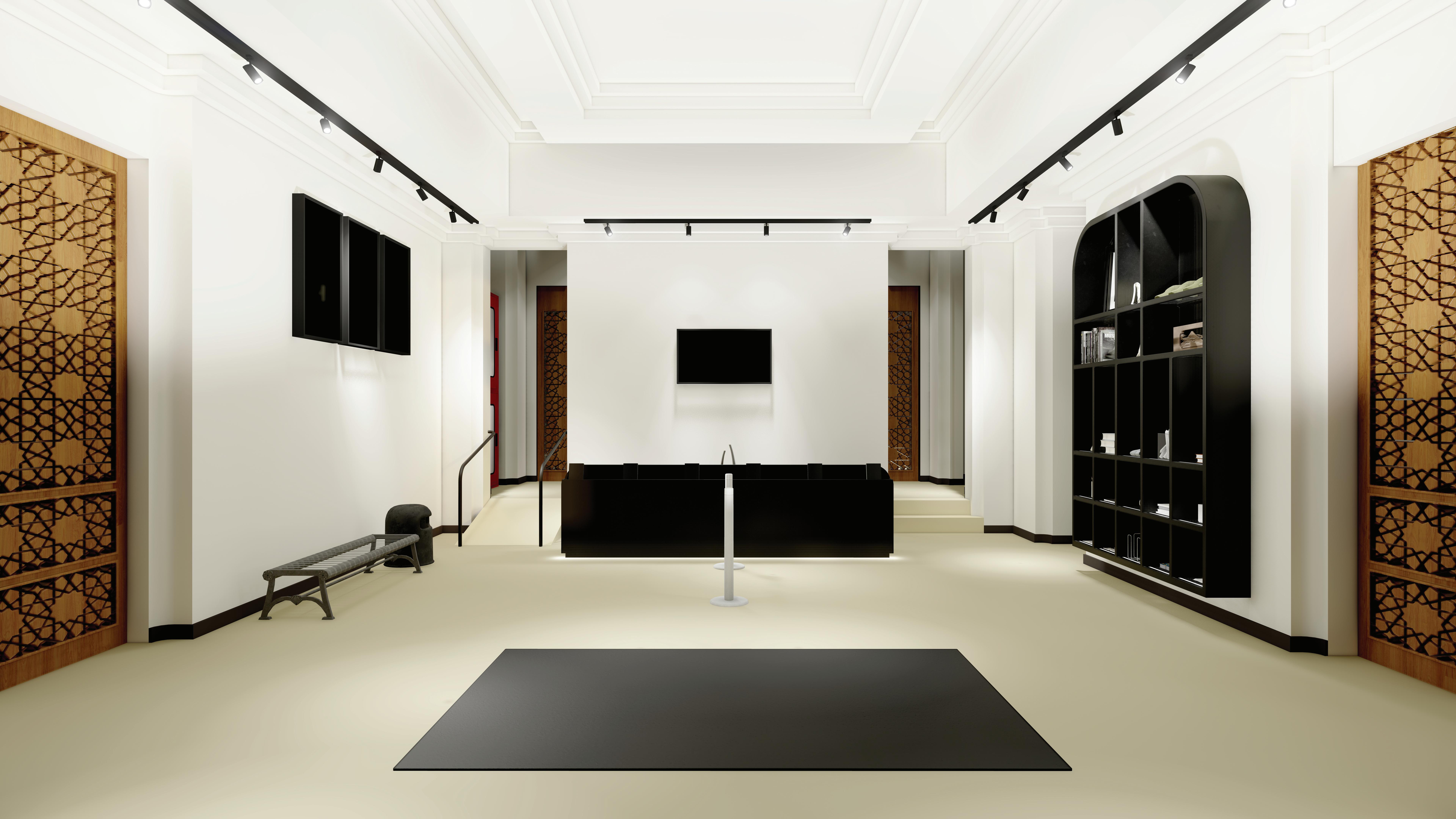
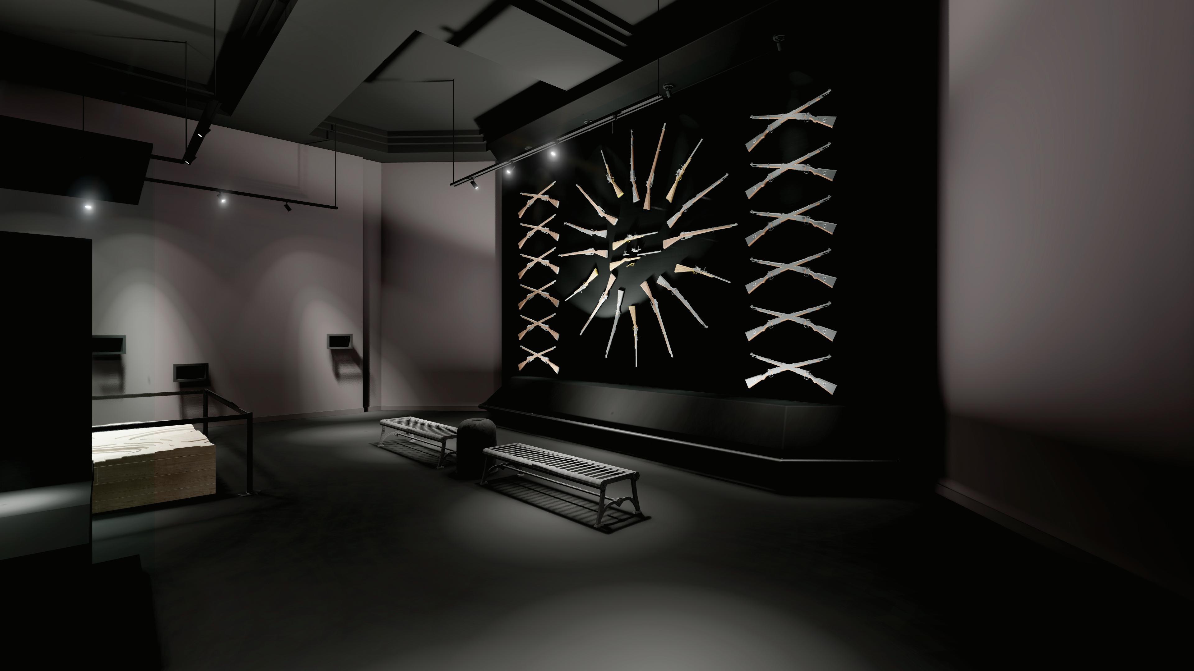
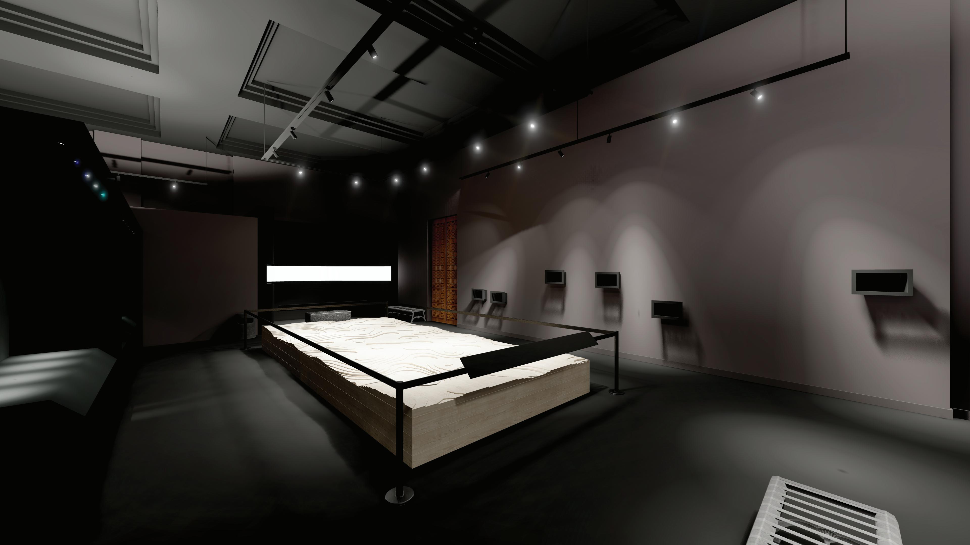
The Red Fort / Arms & Armory Museum
Professional
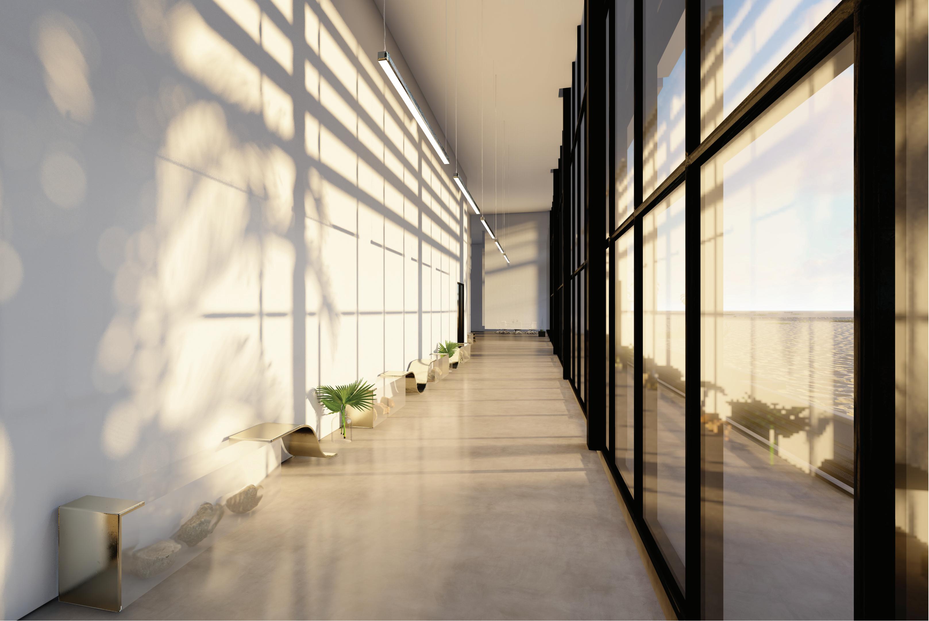
Failaka Excavation and Research Lab Headquarters
Professional
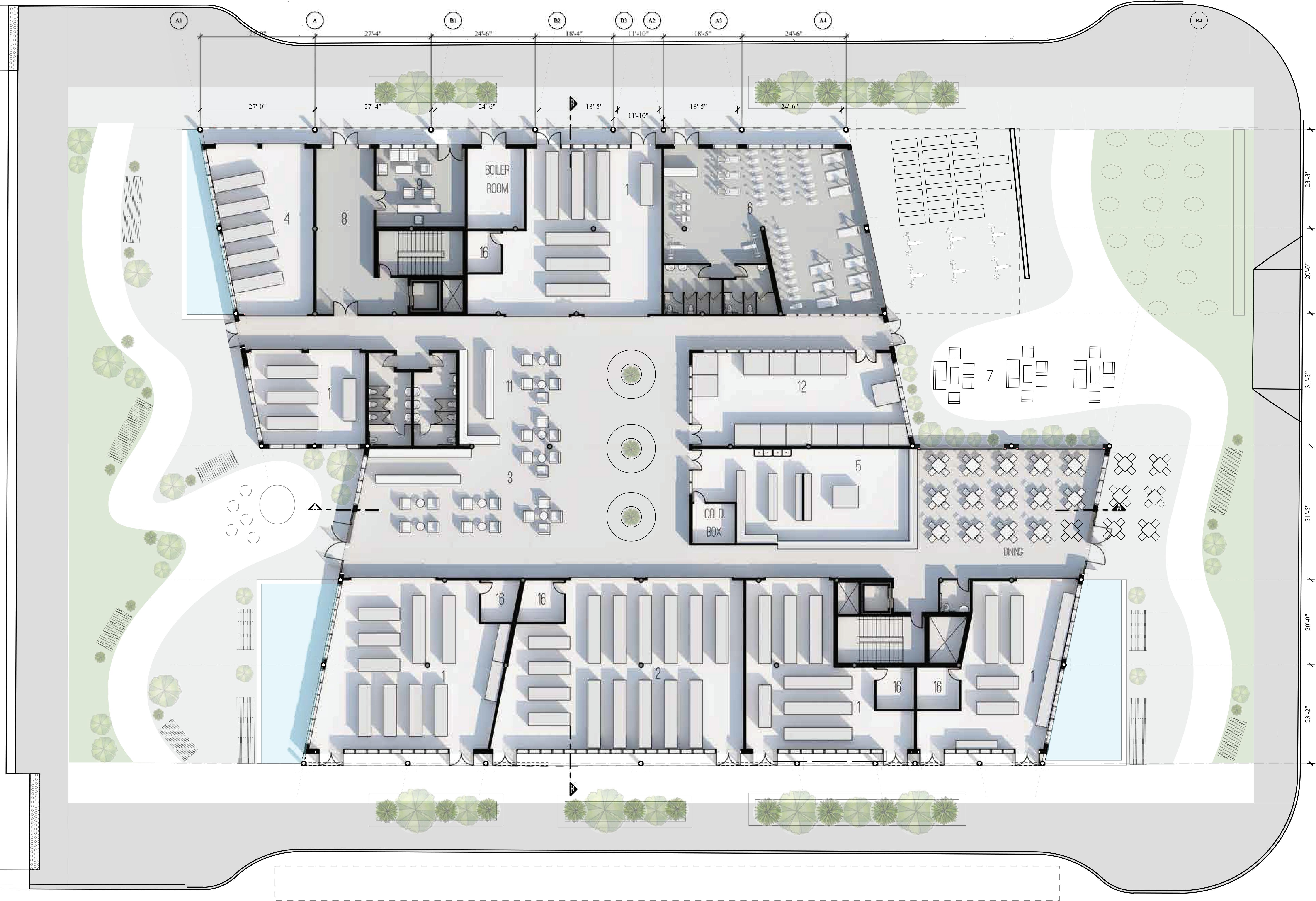
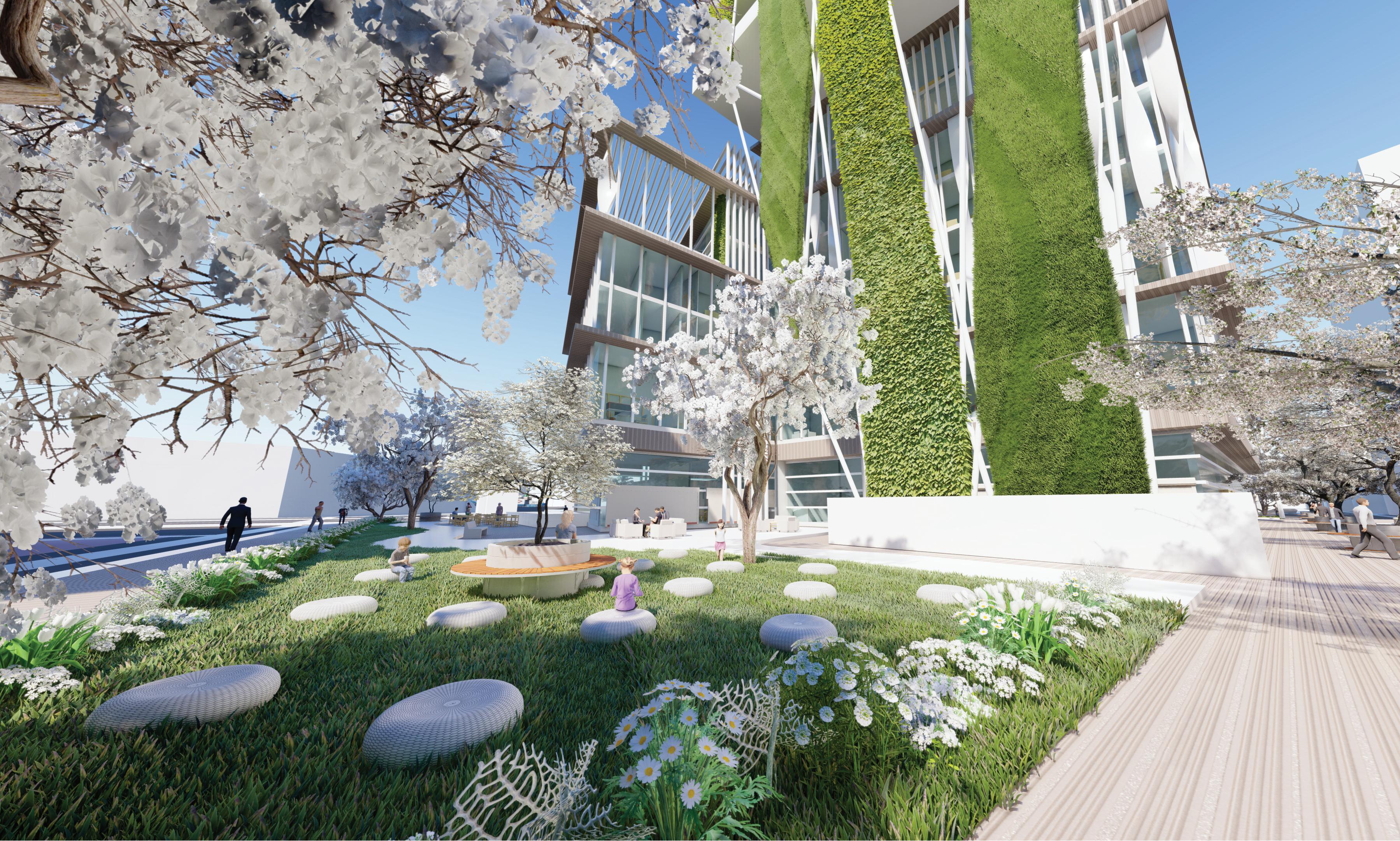
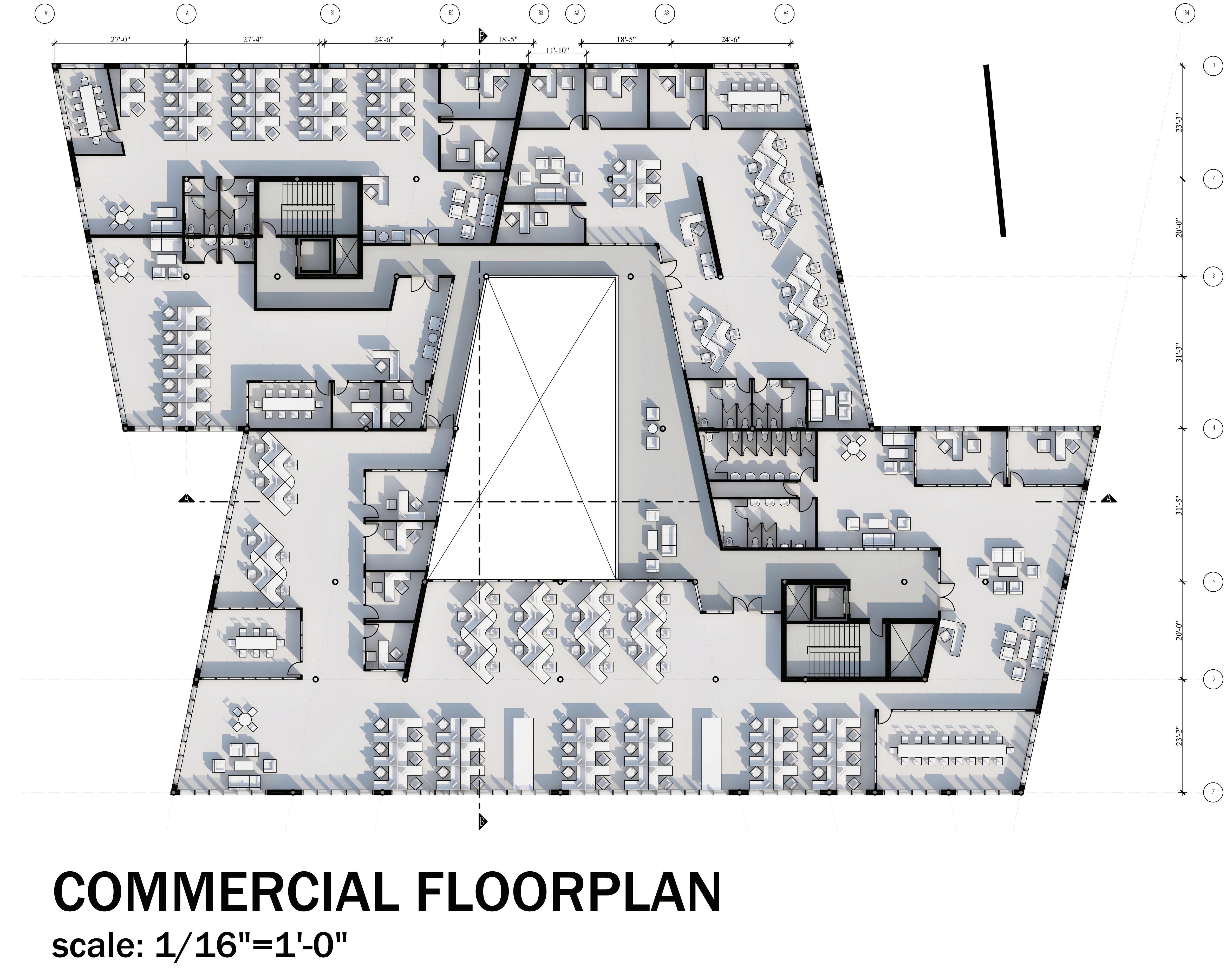
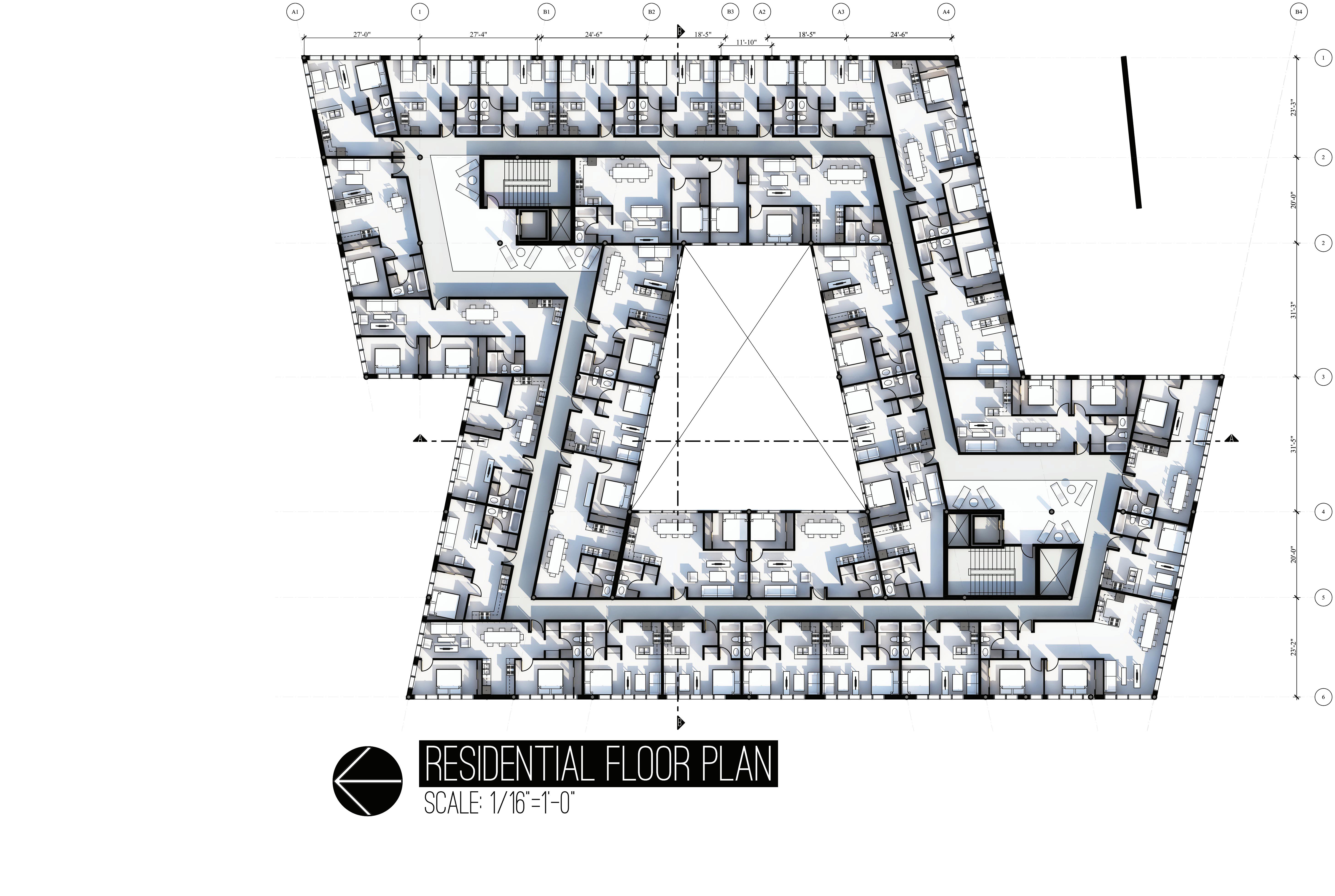
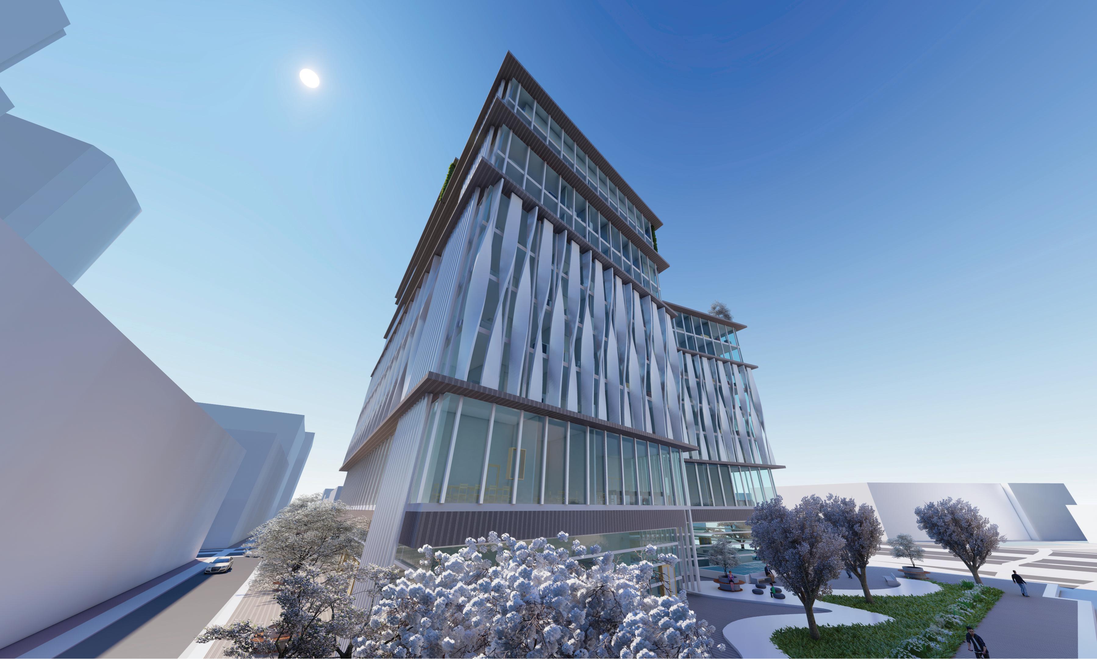
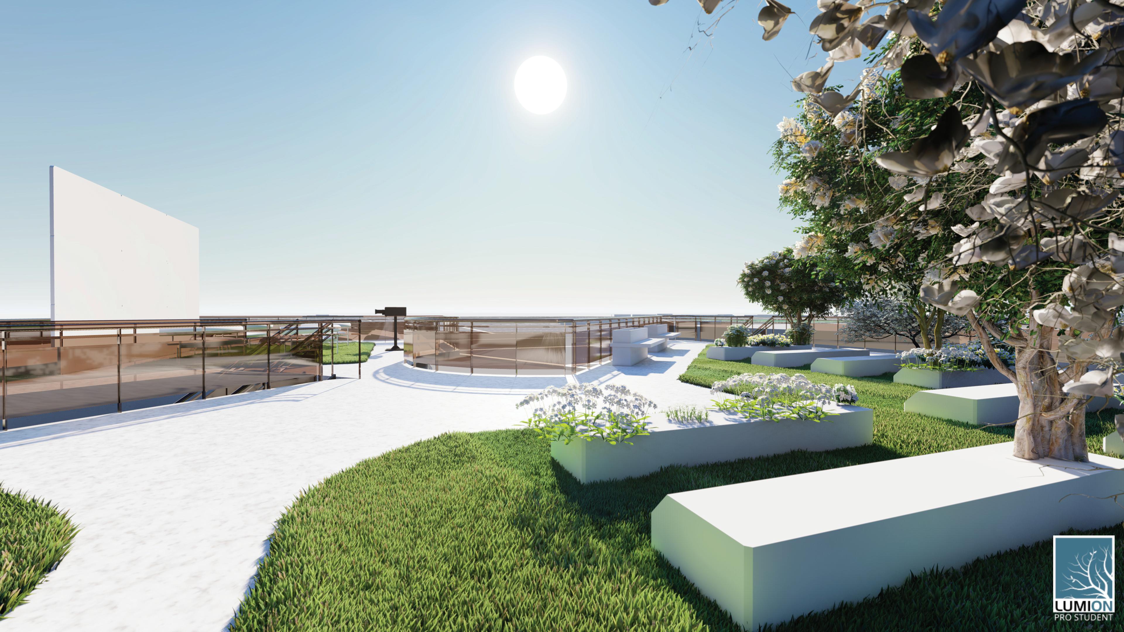
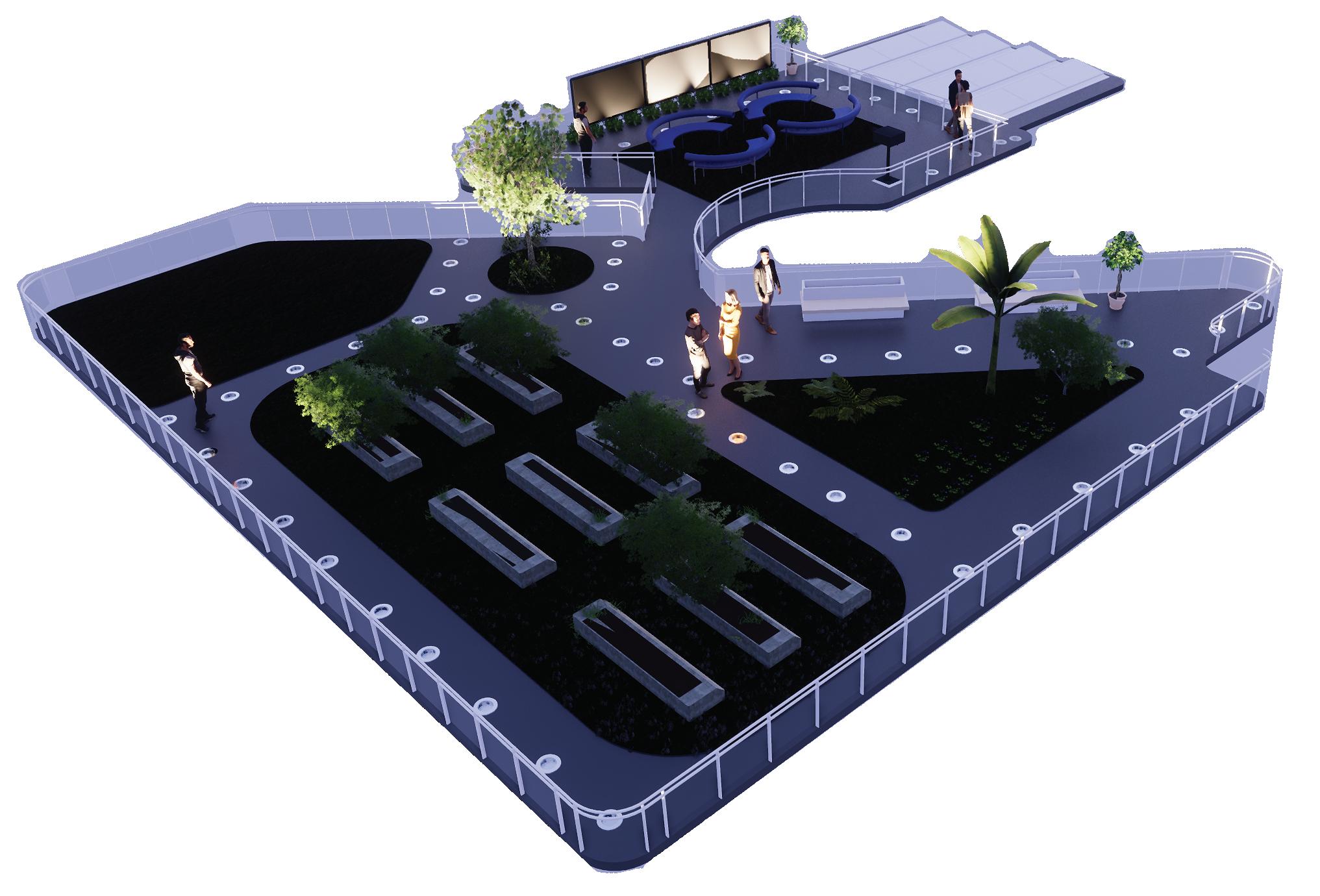
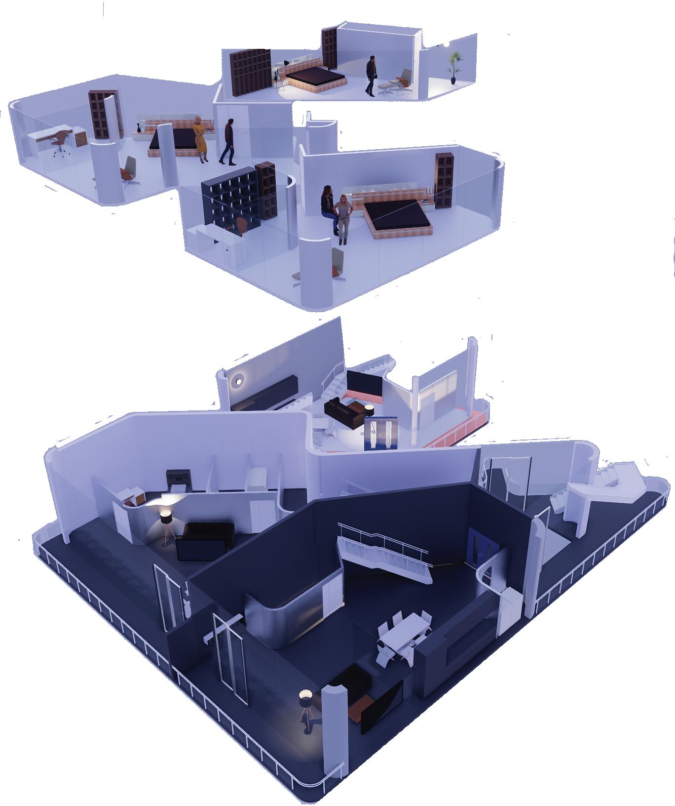
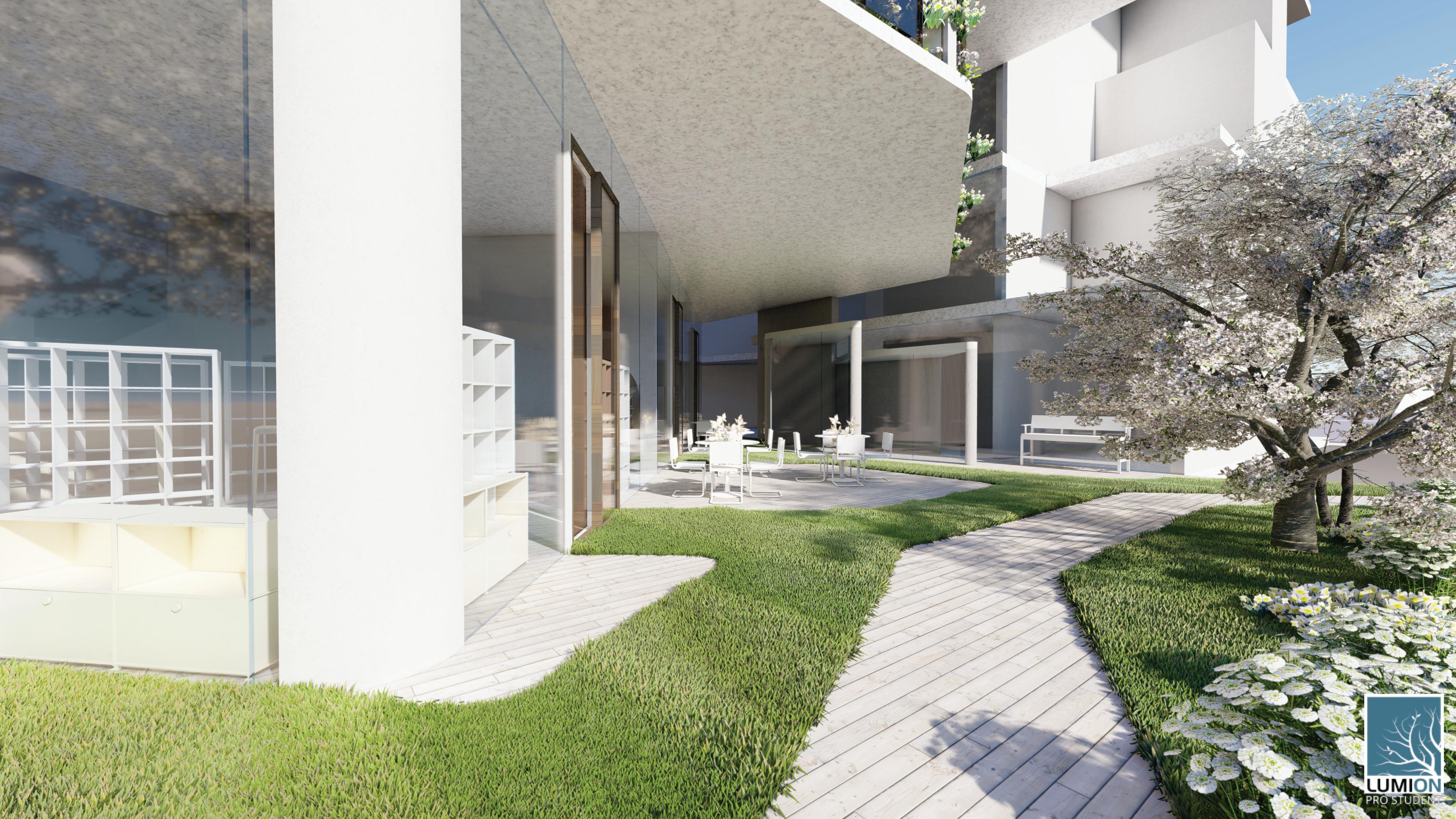
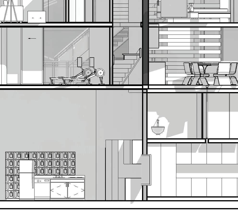
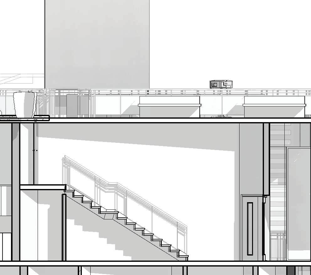
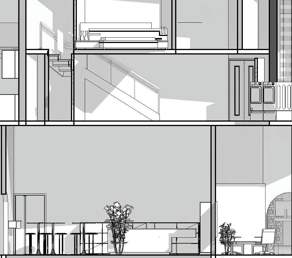
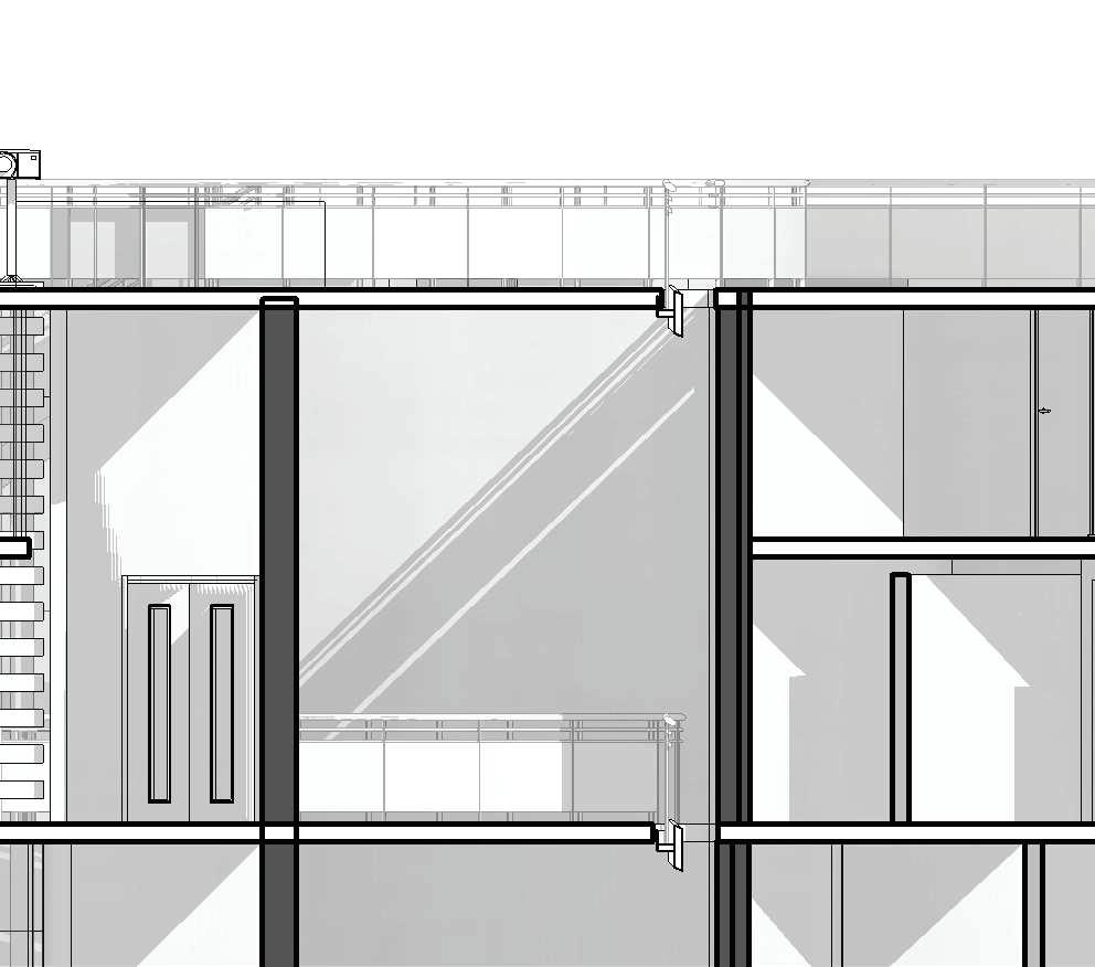
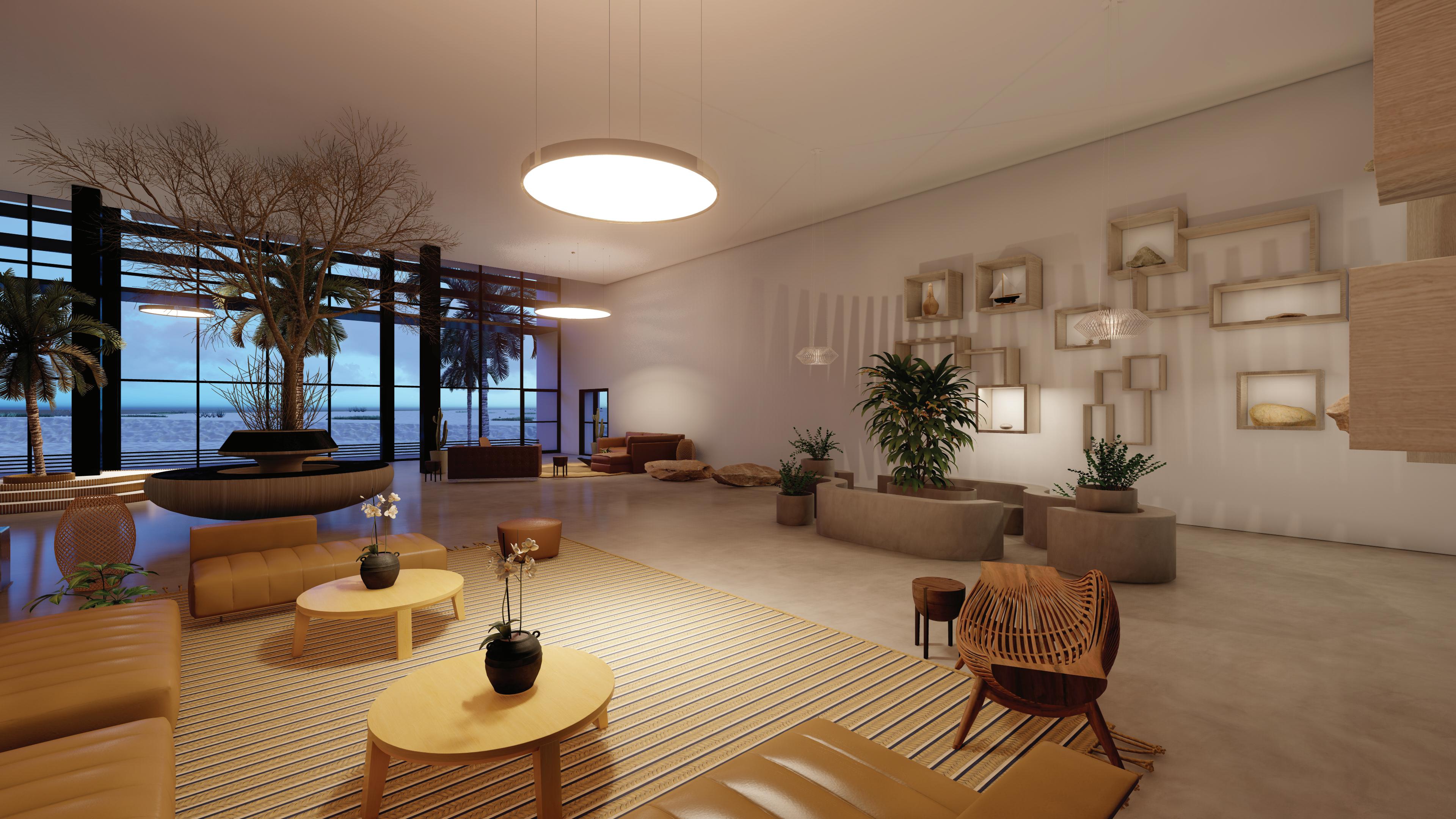
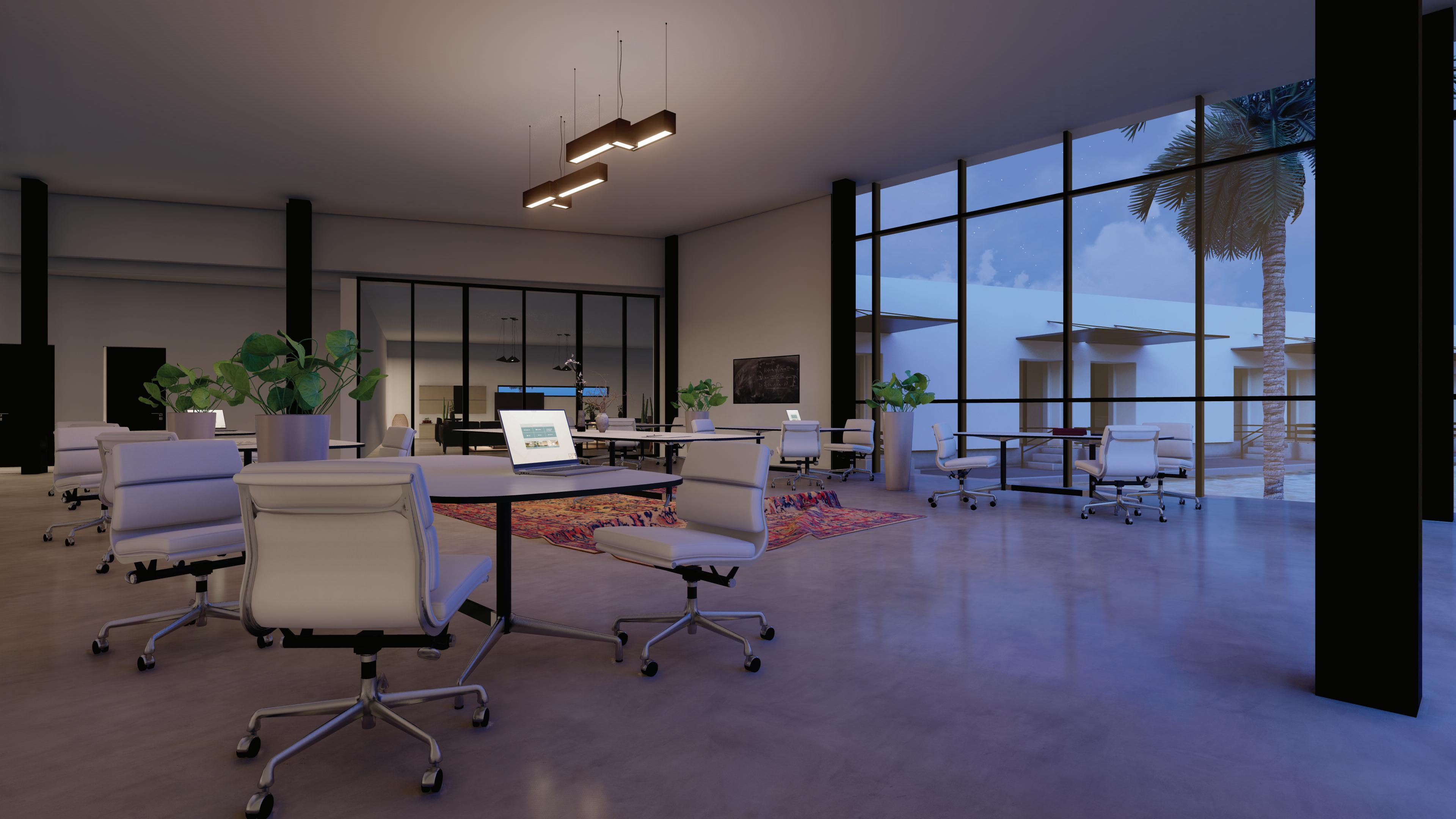
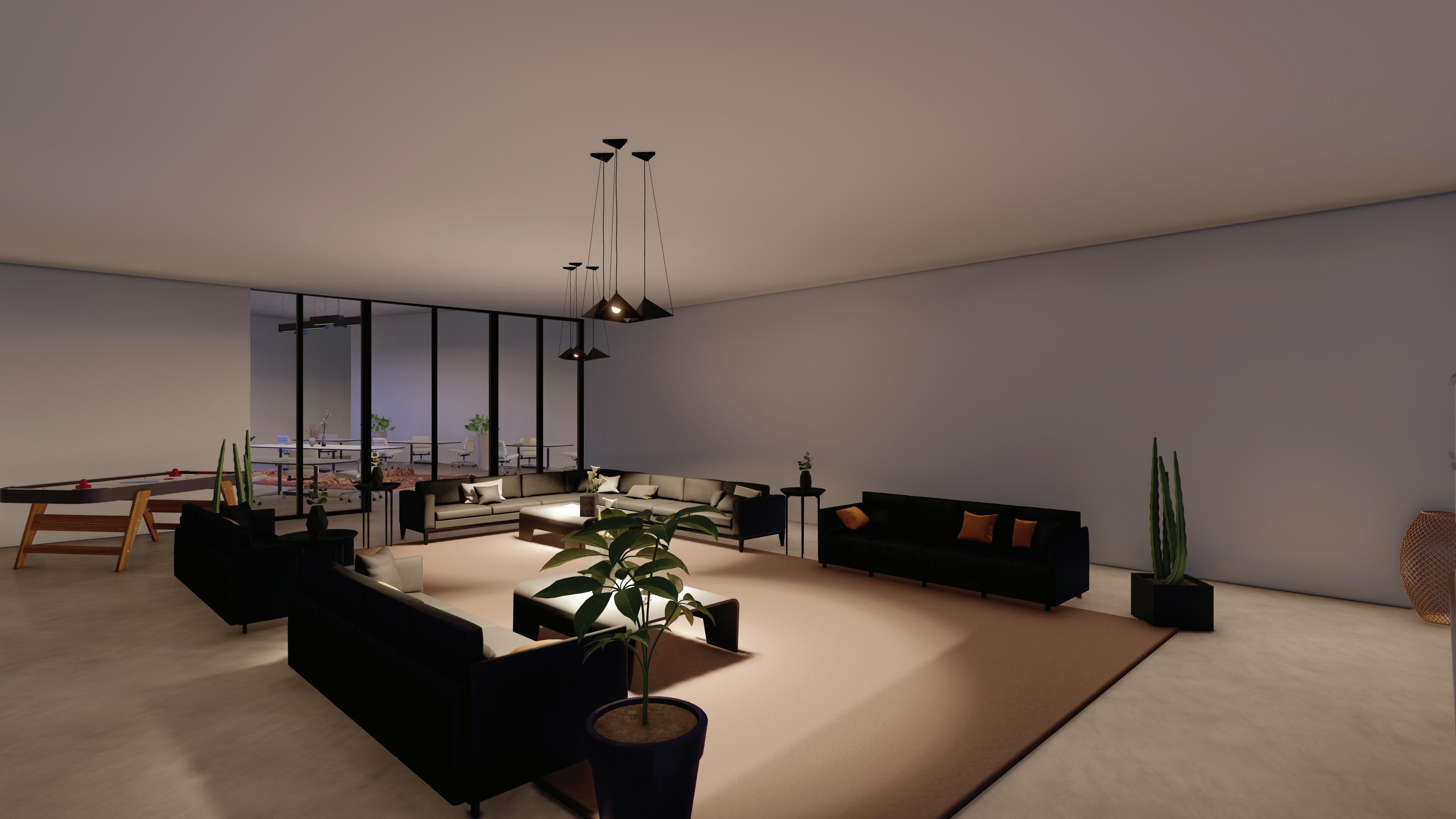
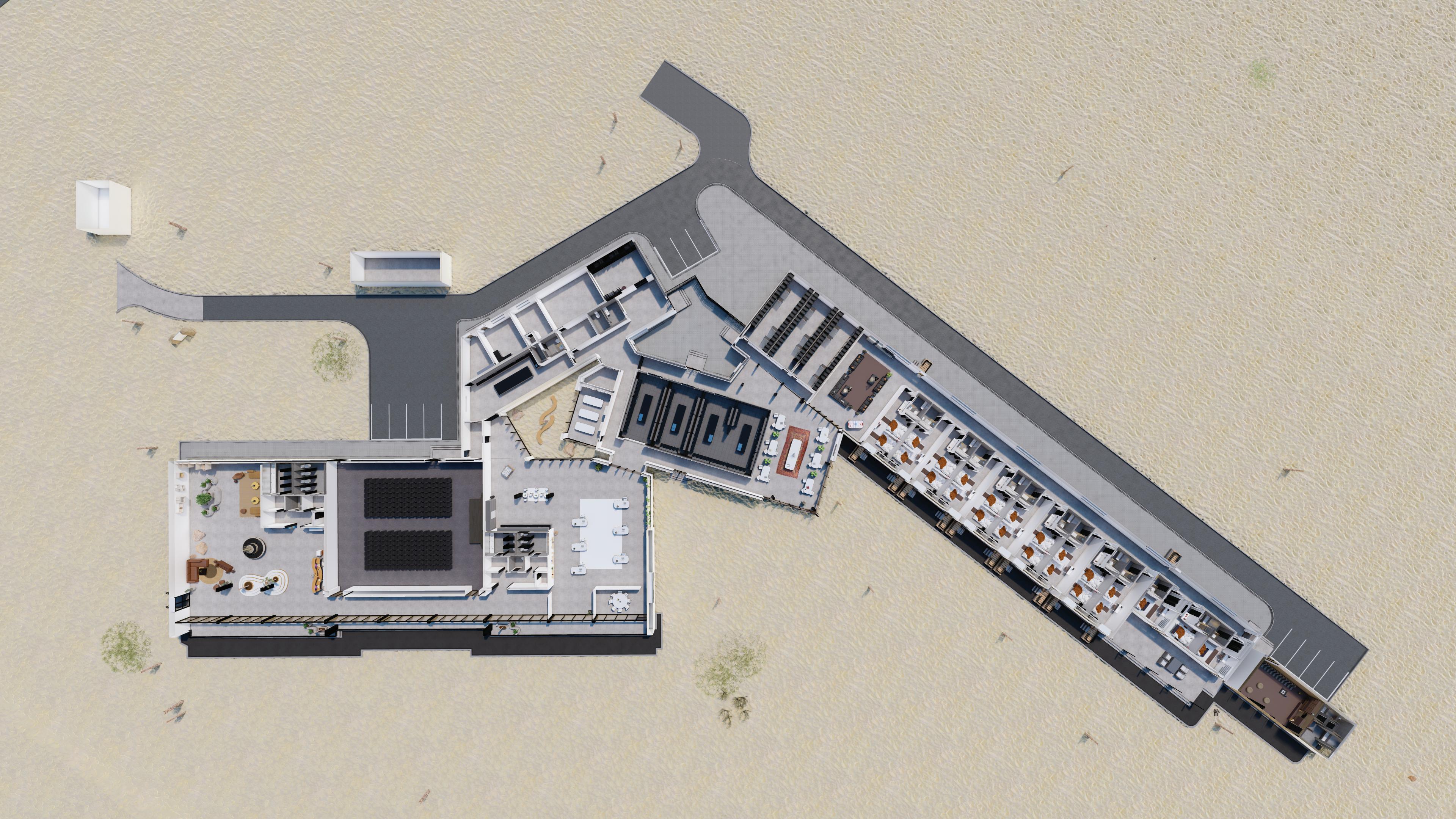
01 LEVELS by the Waterfront
Academic
Typology: Retail 14,000 ft², Commercial 19,000 ft², Residential 180,000 ft²
Category: Undergrad Studio 3 Final
Year: Spring 2018
Tools: Rhino, 3ds Max, Lumion, V-Ray, Illustrator
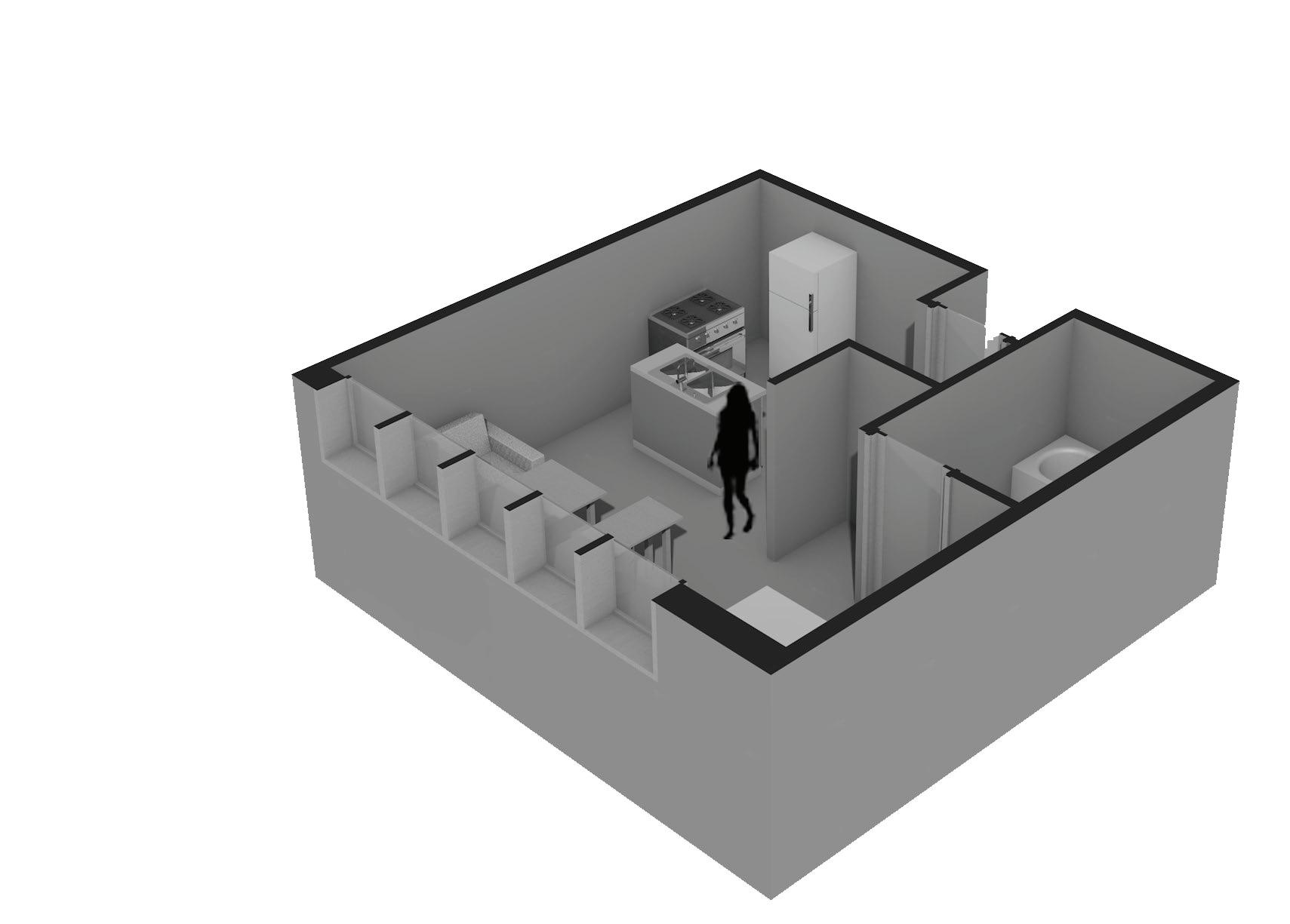
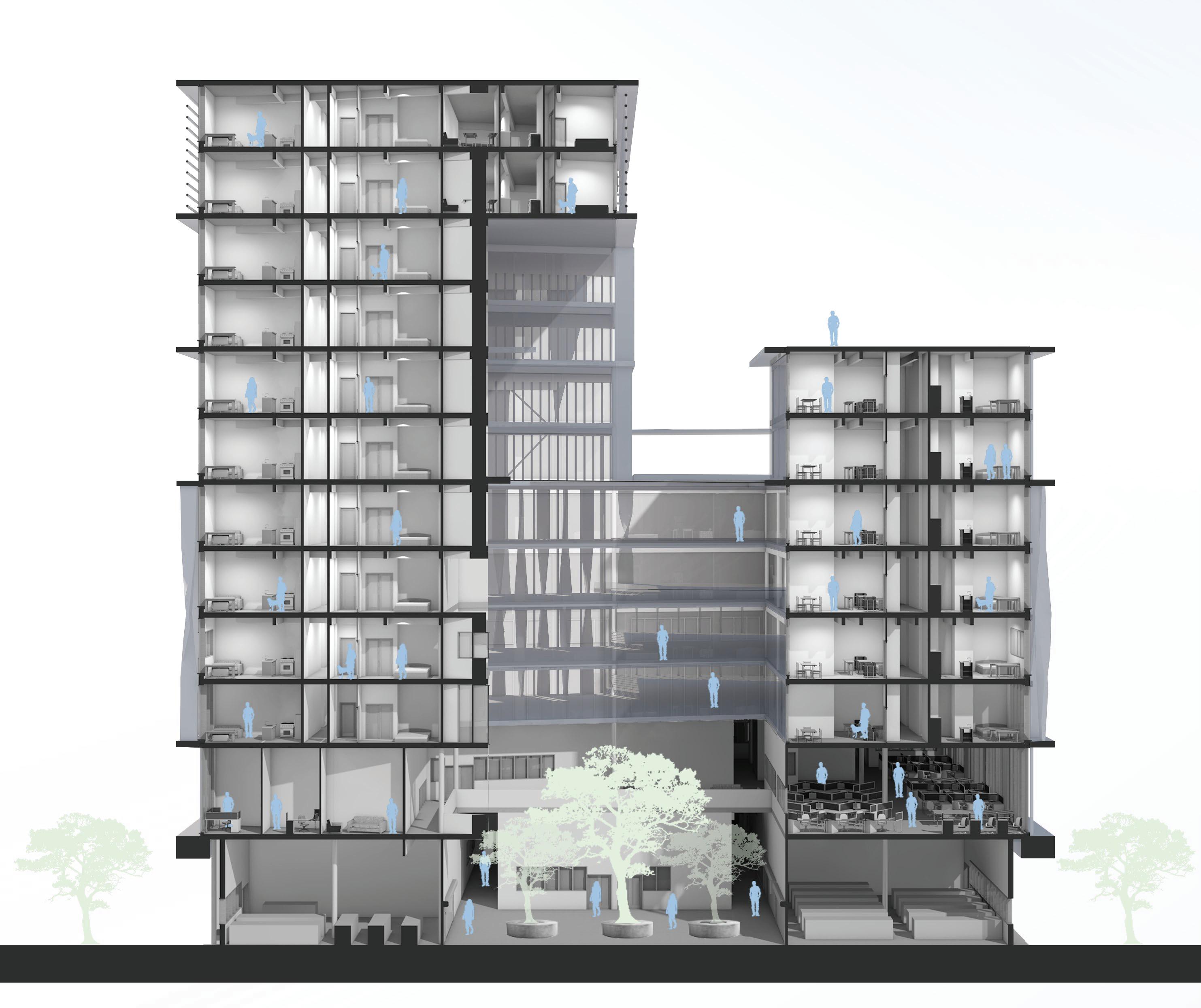
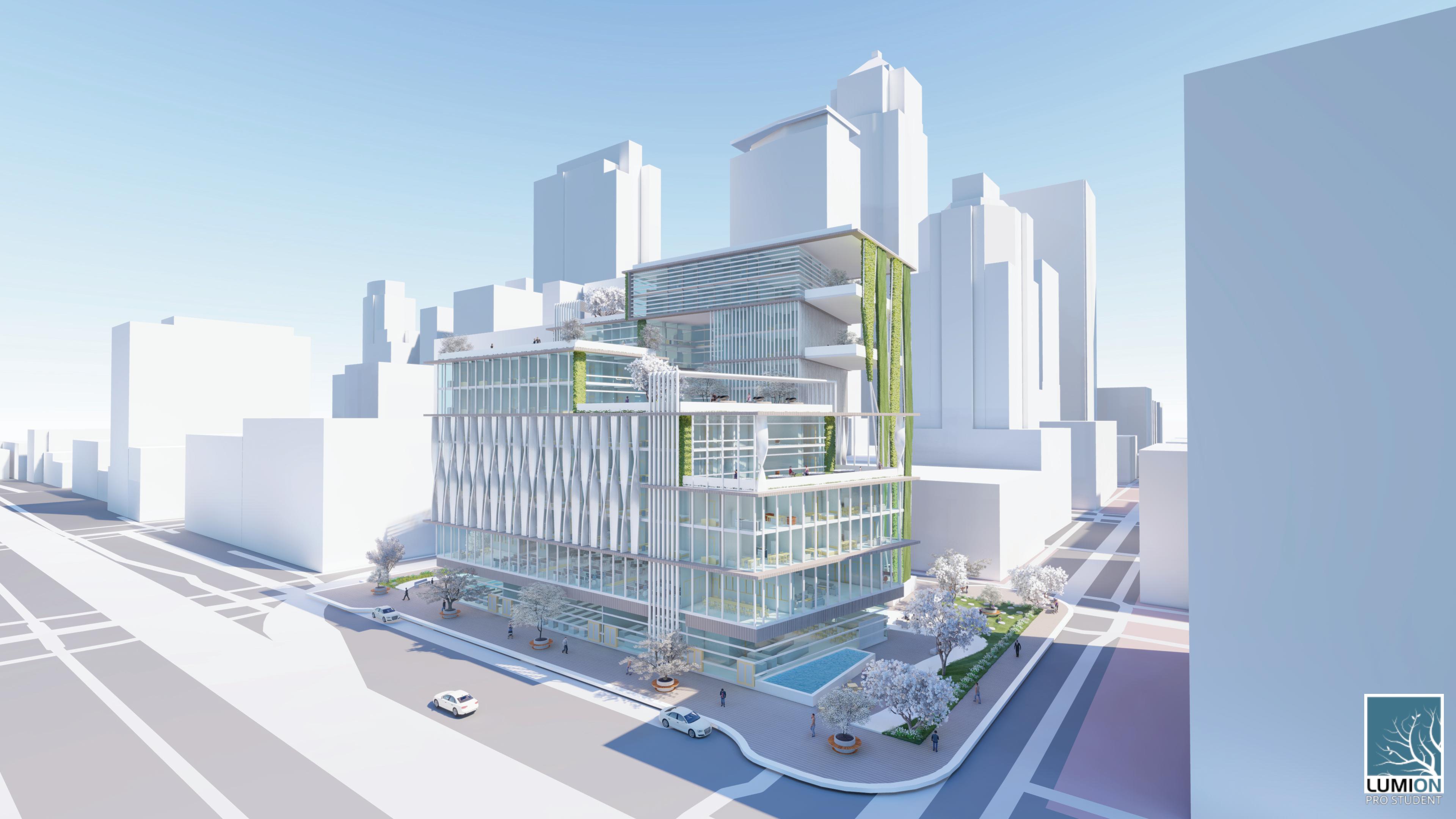
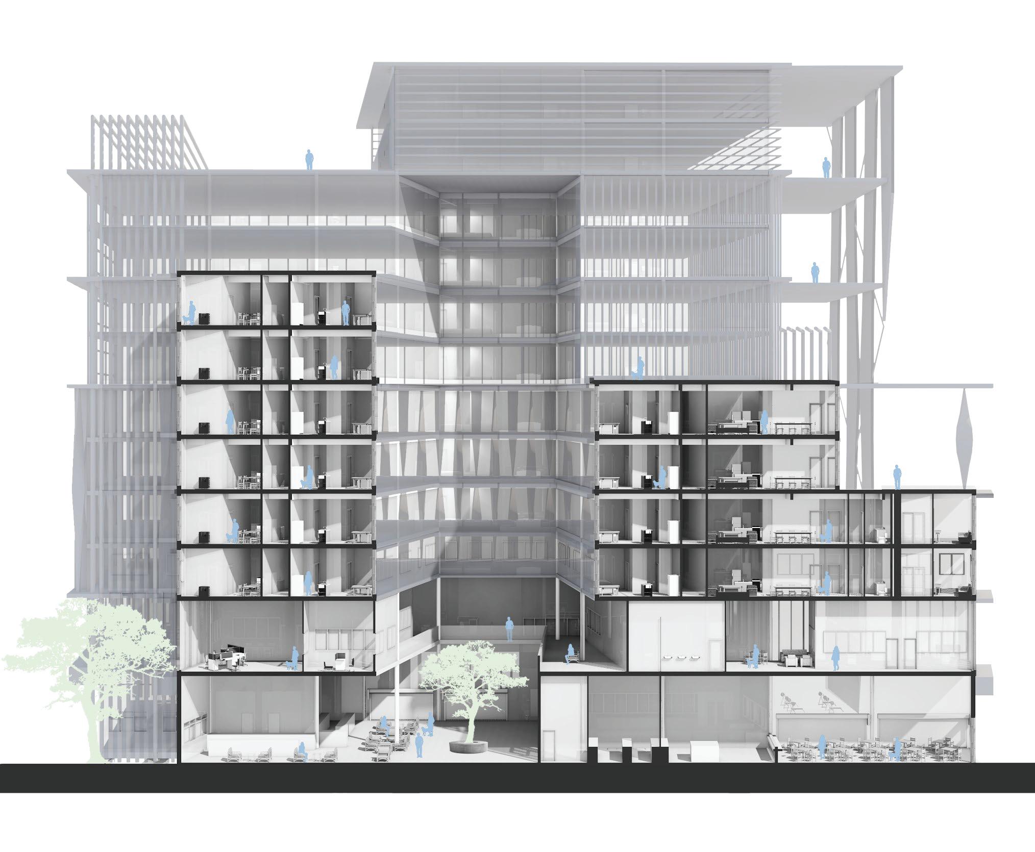
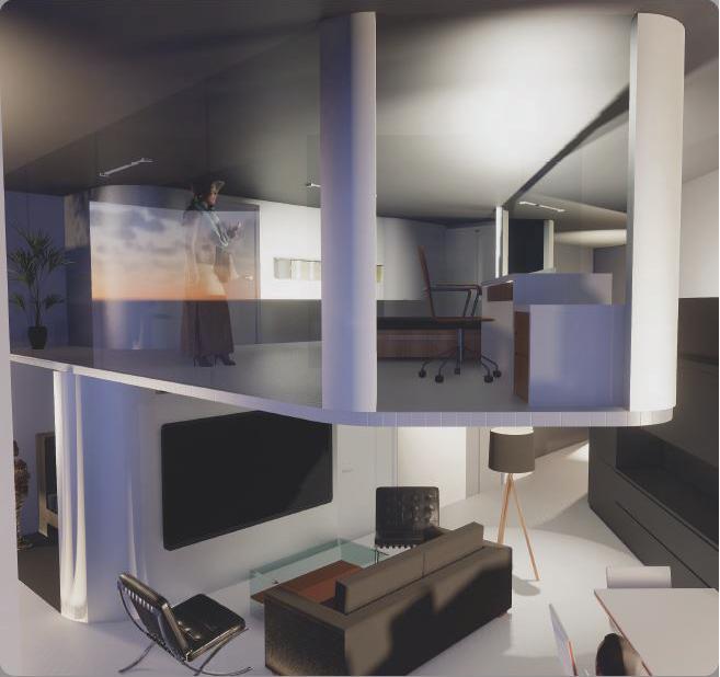
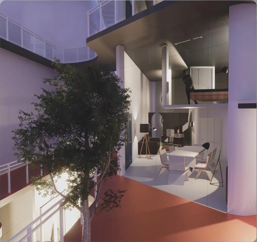
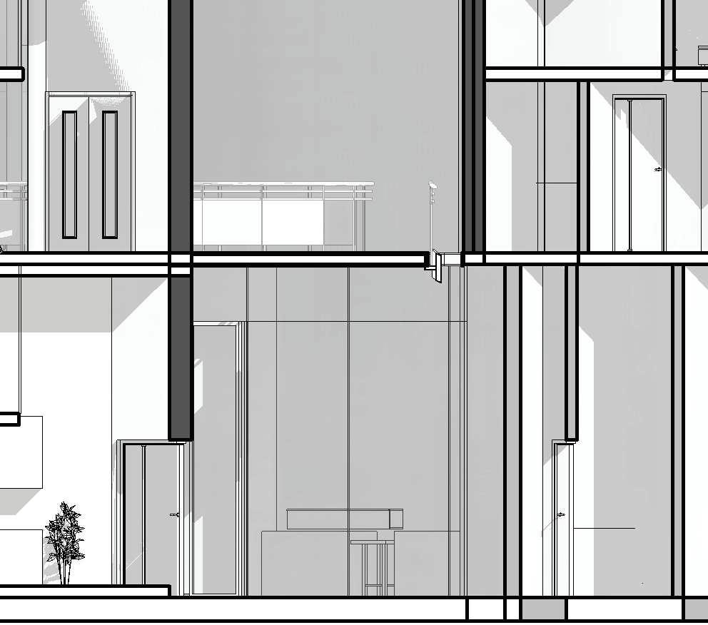
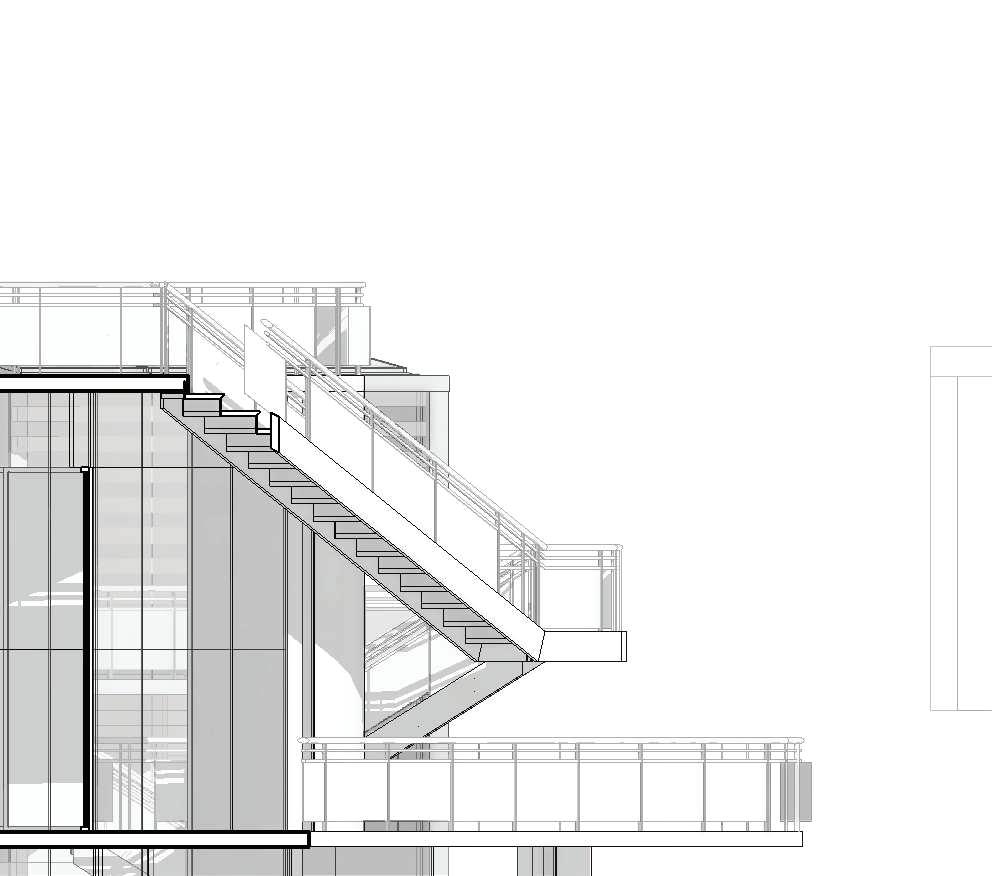
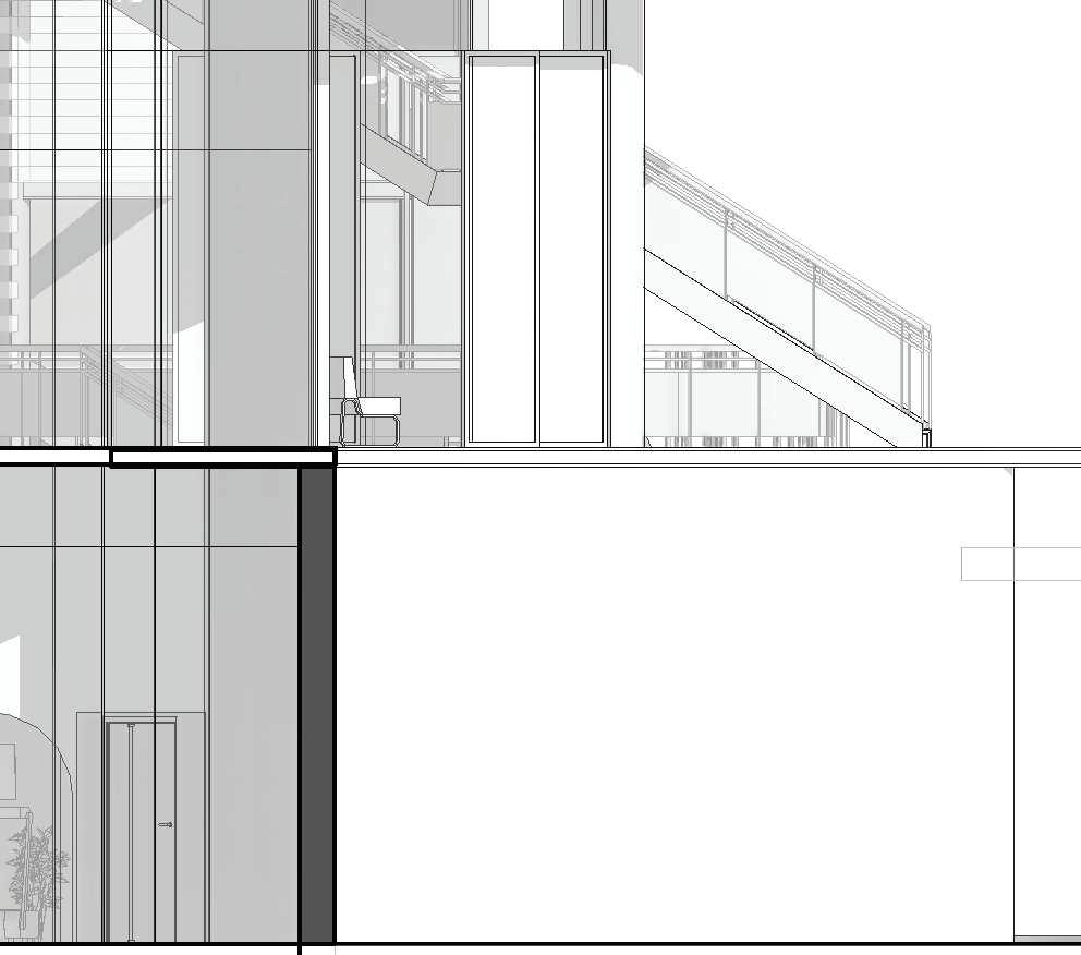
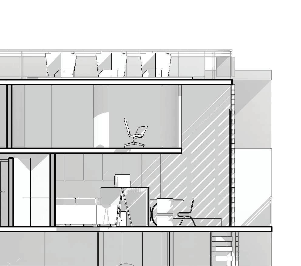
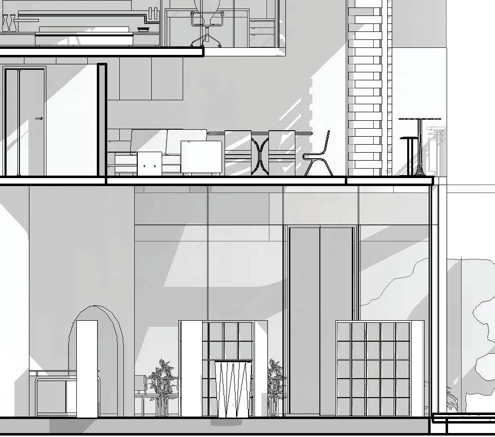
Levels by the Waterfront is located at 1149 Western Ave, Seattle, WA, and is a mixed use building which encompasses a site adjacent to the waterfront. The building contains three different uses. The ground floor contains the retail portion, the first floor is entirely commercial, and the remaining nine floors contain the residential component. The ultimate goal is to connect the building to the waterfront, as well as maximizing the views since the location is prime, and views sell. Another major goal is creating this sense of community within our building, since the building contains all needs such as recreation spaces, restaurants, a gym, and a market. Sustainability is another goal at Levels by the Waterfront. The main demographic is college students, and business men, so another goal is creating the ideal space for them.
The most significant features of Levels by the Waterfront are the orientation of the building which allows maximum sun exposure and views. The platforms are public spaces to allow everyone to experience the view. There are two platforms and the views to the water is completely unobstructed, and the platforms provide a different experience in comparison to the rooftops. Another key element to the building is the level of interactivness it allows. At Levels, the building experience is crucial, that is made possible by the interactive features on the ground floor, around the building, and on the rooftops as well. The green wall and its platforms is the signature feature of the building. The final feature that is most significant is the core, which allows for daylight to entire the apartments surrounding the core, as well as increased ventilation and circulation.
The building functions in harmony with the site, the waterfront, as well as the people who live there, and passer by’s. The change in height allows for better views and more sunlight into the structure. It creates a space that allows for the exterior and interior interaction, and creates a space that connects with the waterfront and draws it in. Levels by the Waterfront follows a sustainable and practical design that helps promote a better future for Seattle, Levels by the waterfront frames the future of the waterfront.
ALASKAN WAY S.
STUDENTS
BUSINESSMEN/WOMEN
UNIT CONFIGURATIONS FAMILIES
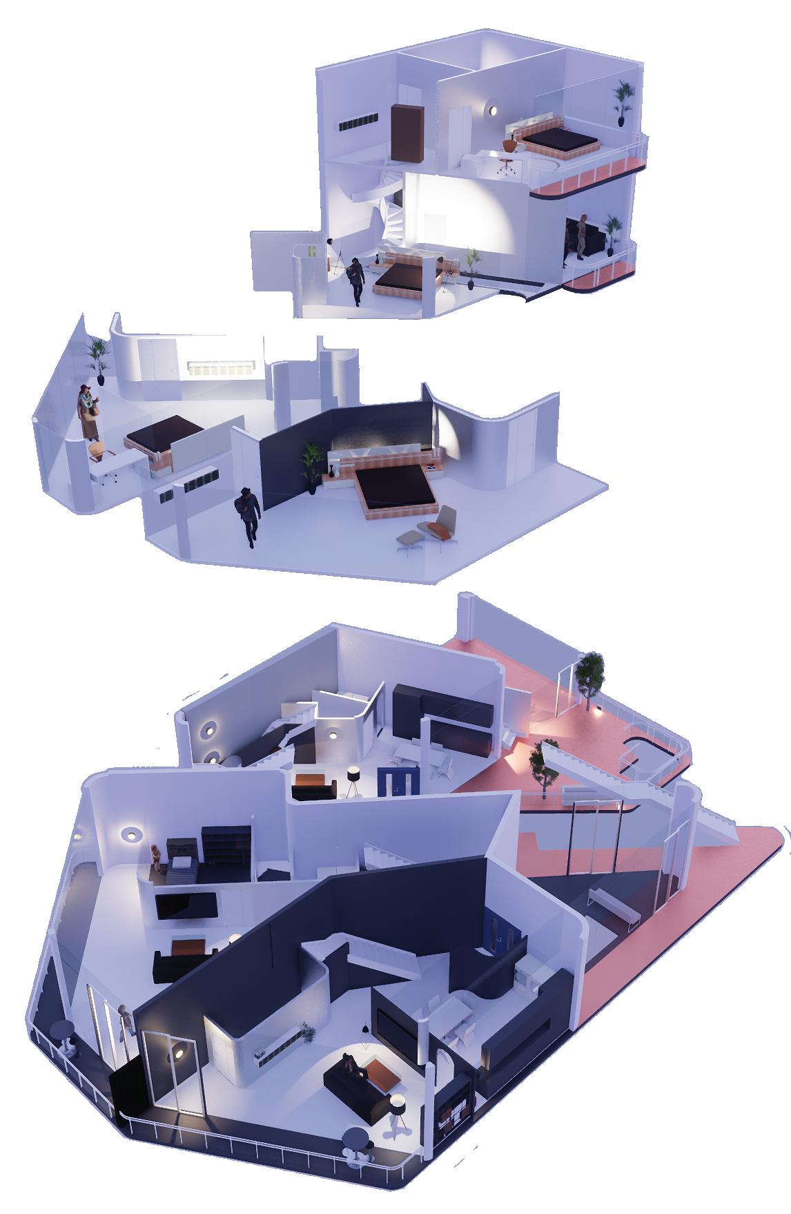
STUDIO/ 1 BATH SCALE: 1/32’’ = 1’-0 1 BEDROOM/ 1 BATH SCALE: 1/32’’ = 1’-0 2 BEDROOM/ 1 BATH SCALE: 1/32’’ = 1’-0
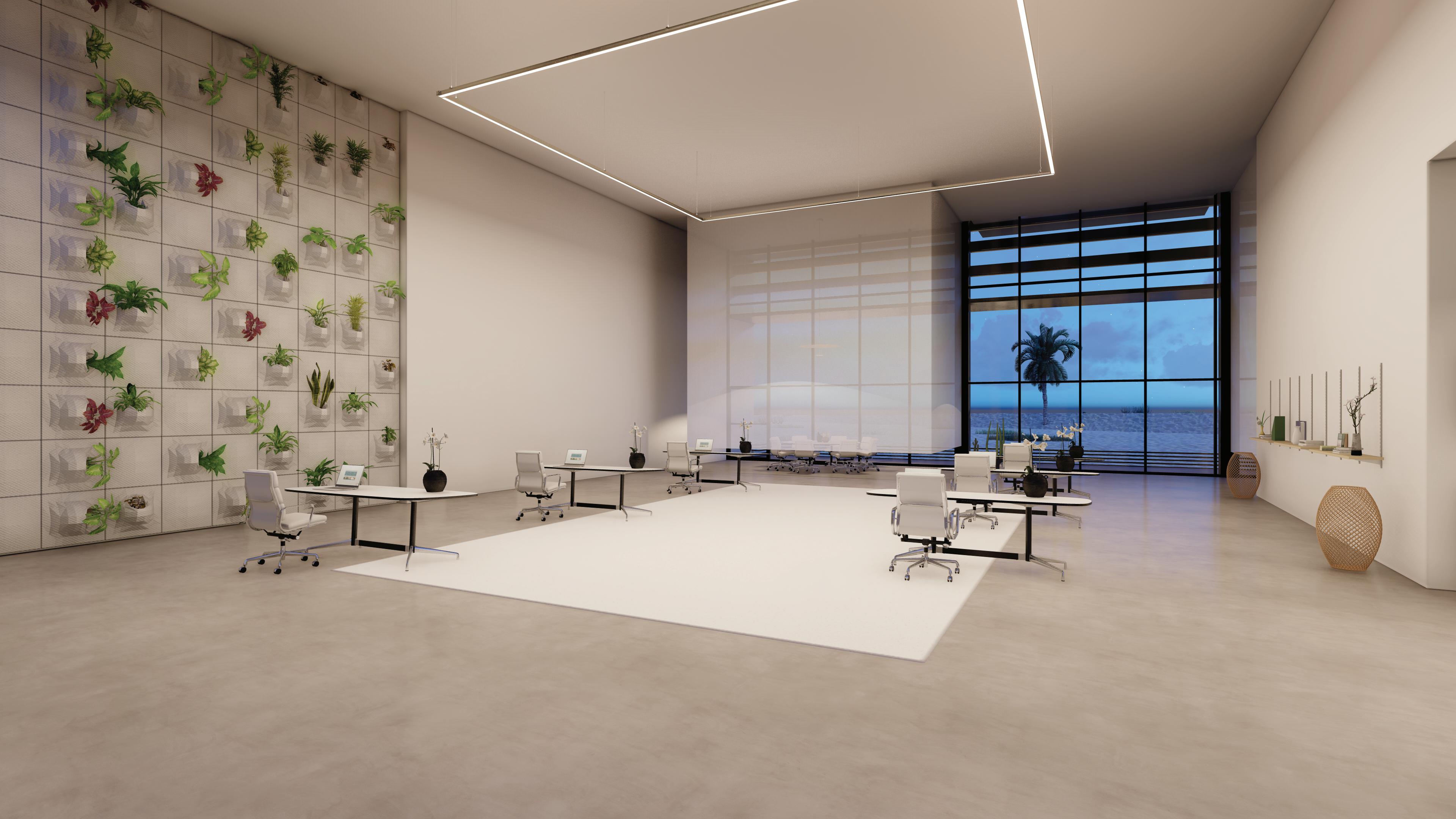
Academic
Typology: Commercial 3,000 ft², Residential 9,000 ft², Communal 4,000 ft²
Category: Undergrad Studio 4 Final
Year: Spring 2019
Tools: Rhino, Revit, Lumion, Enscape, V-Ray, Illustrator, Indesign, Photoshop
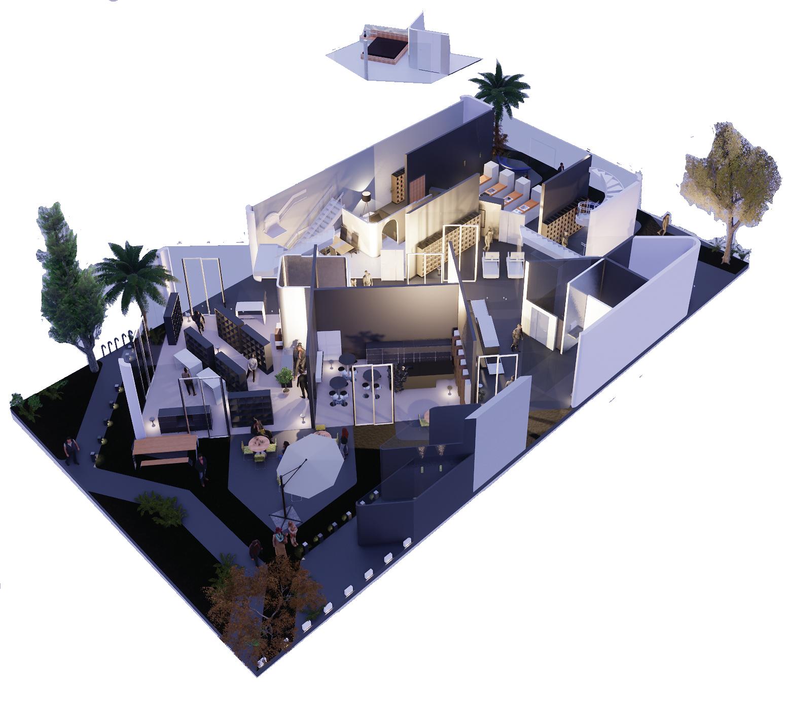
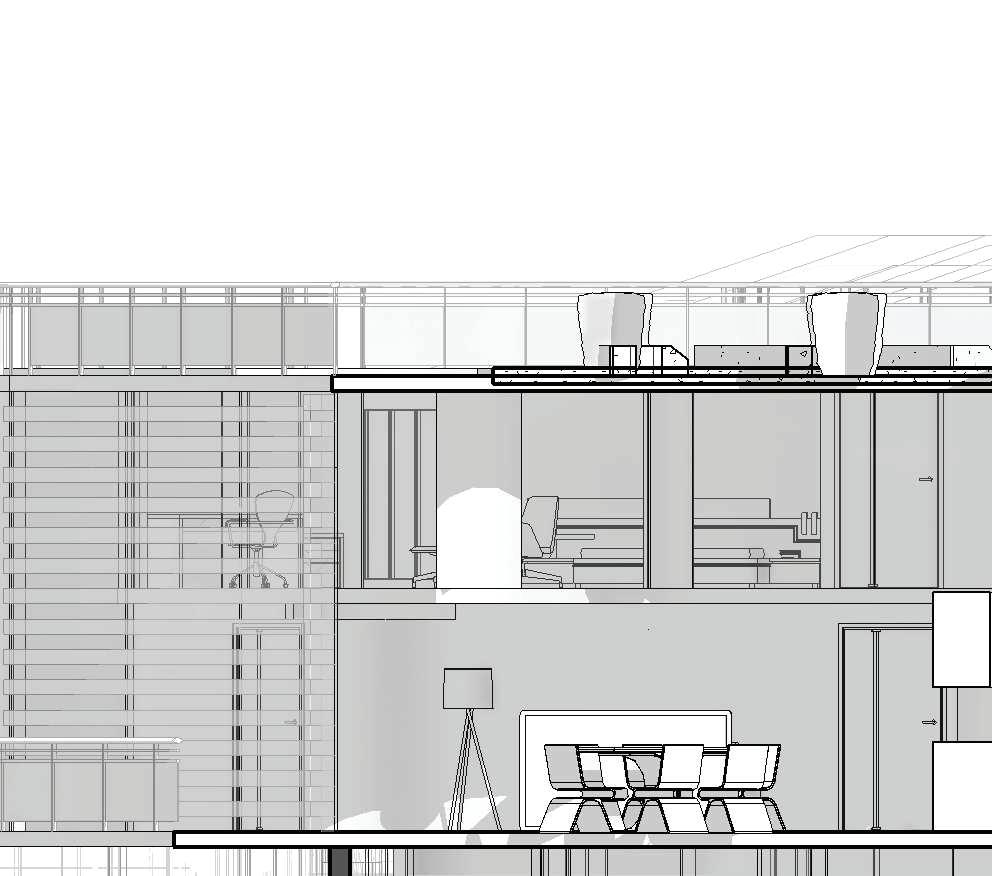
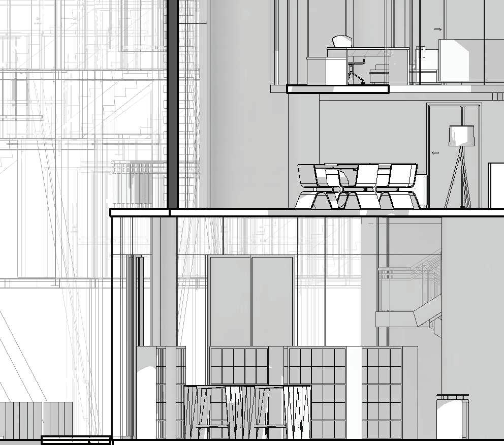
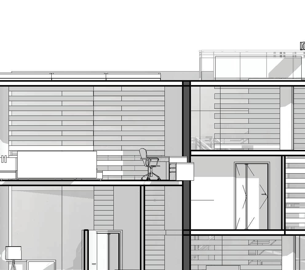
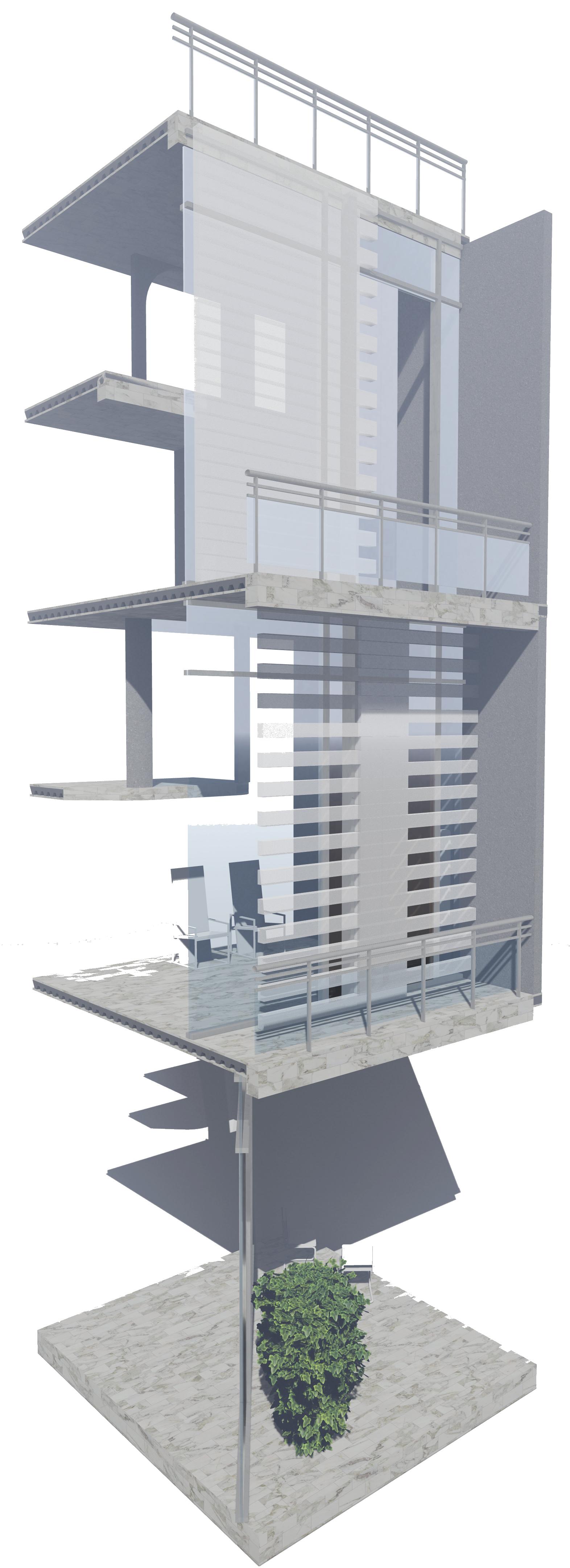
"Off-grid-niche" derives from the idea of morena's creators' original concepts which is "the village within a city" and their planning grid system following nature's scenic views. We created off-grid niche with the vision of a modern, vibrant and an improved way of living which is a self-sufficient building by integrating light-agriculture, rich sense of community, and full of energy spaces. The building not only supports physical wellness but also mental wellness for its users and residents.
In 1950-1960, Carlos Tavares and Lou Burgener developed what became San Diego’s largest post-war subdivision. Originally dubbed “The Village within a City”, people started living in Claremont in May 1951. The design of this new subdivision represented a new concept in community living because it did not incorporate the traditional grid system of uniform blocks and streets. Instead, winding streets and scenic view lots took advantage of the canons and bluffs overlooking Mission Bay.
Interior spaces are shaped by the core concept while responding to users' needs and optimizing spatial use. The design aims to foster a sense of security and comfort throughout the building experience. The circulation is efficient, and the universal design principles are prioritized to ensure accessibility and inclusivity, all while maintaining the off-grid-niche approach to sustainable and community-driven living.
The material palette combines sustainability, performance, and aesthetic integrity. Surestep Decibel flooring ensures safety with R10 slip resistance while offering acoustic comfort through a 17dB impact sound reduction. Acoustic panels, composed of wool felt-covered fiber composites, use an interlocking modular system with magnetic attachments for quick, tool-free installation. Rammed earth walls provide thermal mass, fire resistance, and a natural texture, though they require careful water protection and are labor-intensive without machinery. The ventilated exterior panels feature a through-colored, uncoated surface with hydrophobic treatment, celebrating material honesty while ensuring moisture resistance and durability.
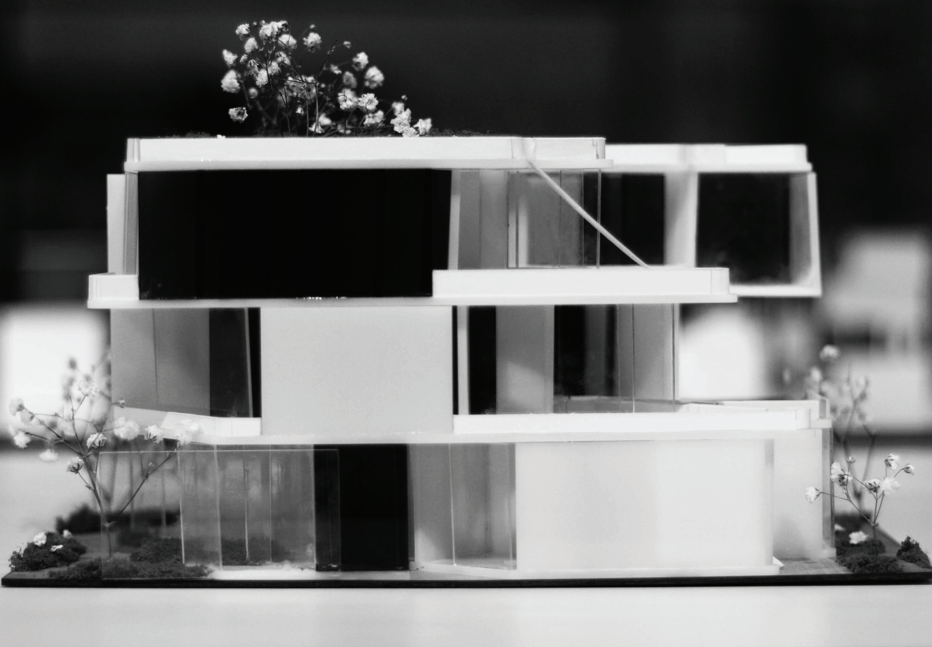
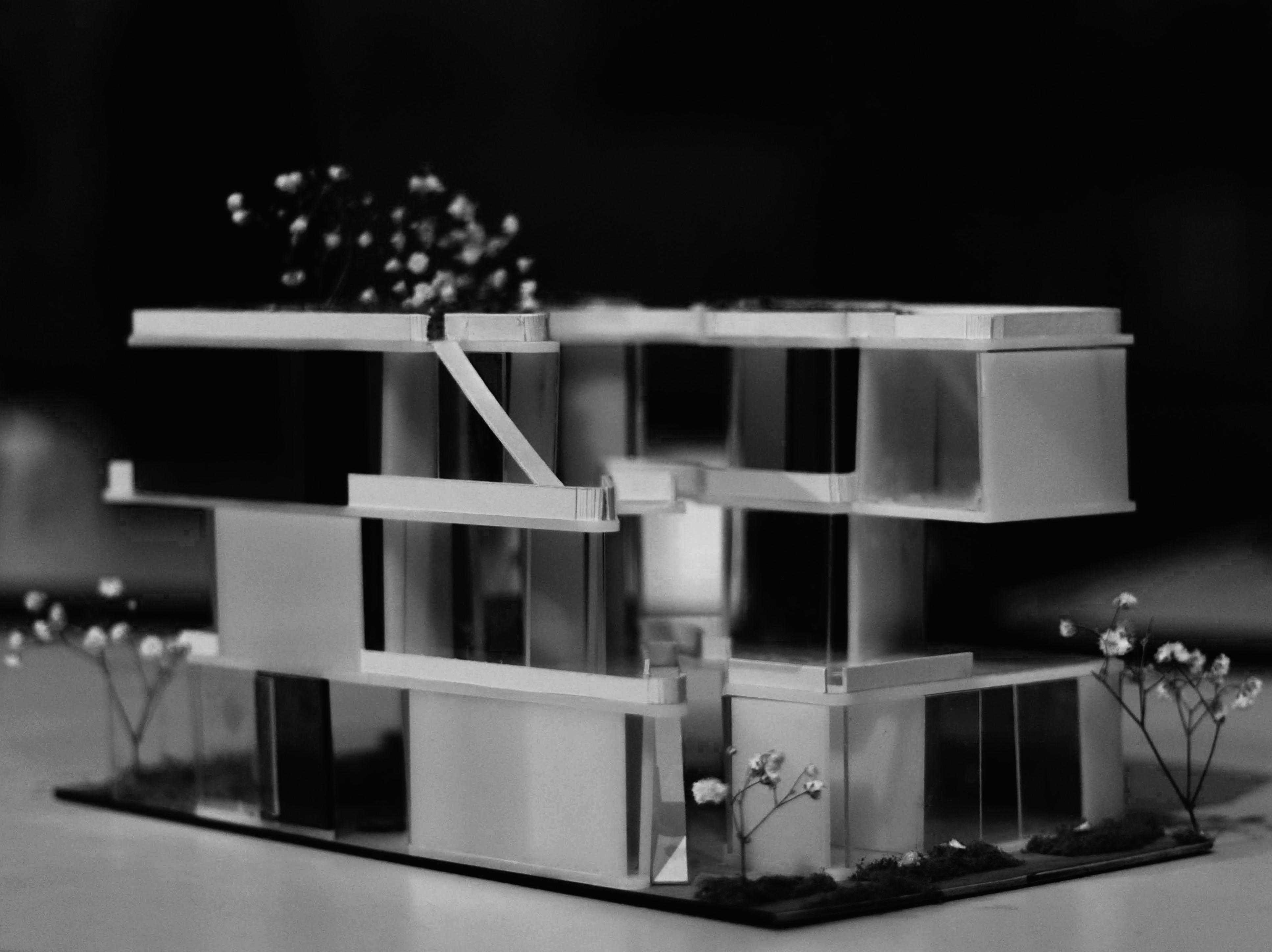
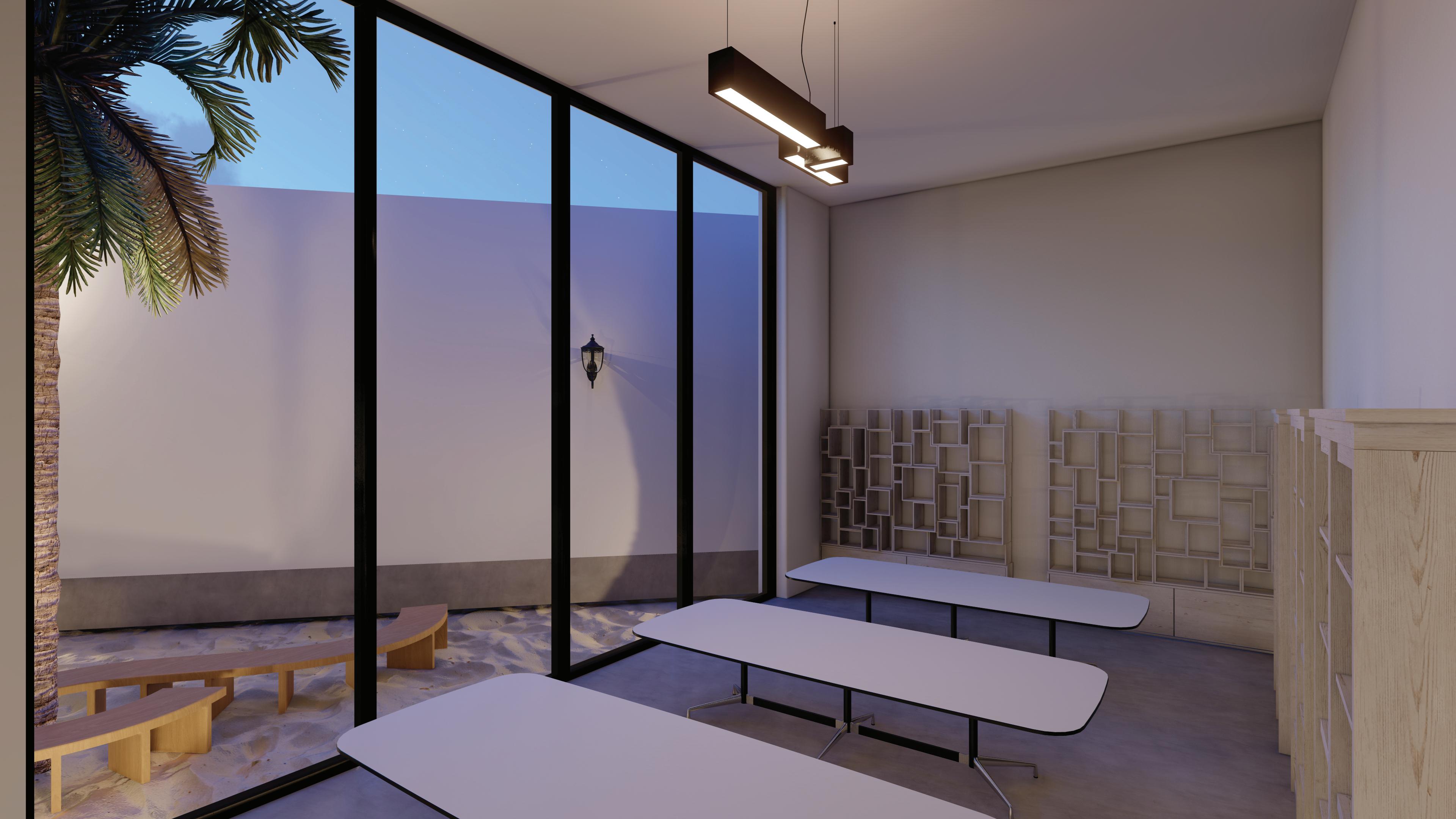
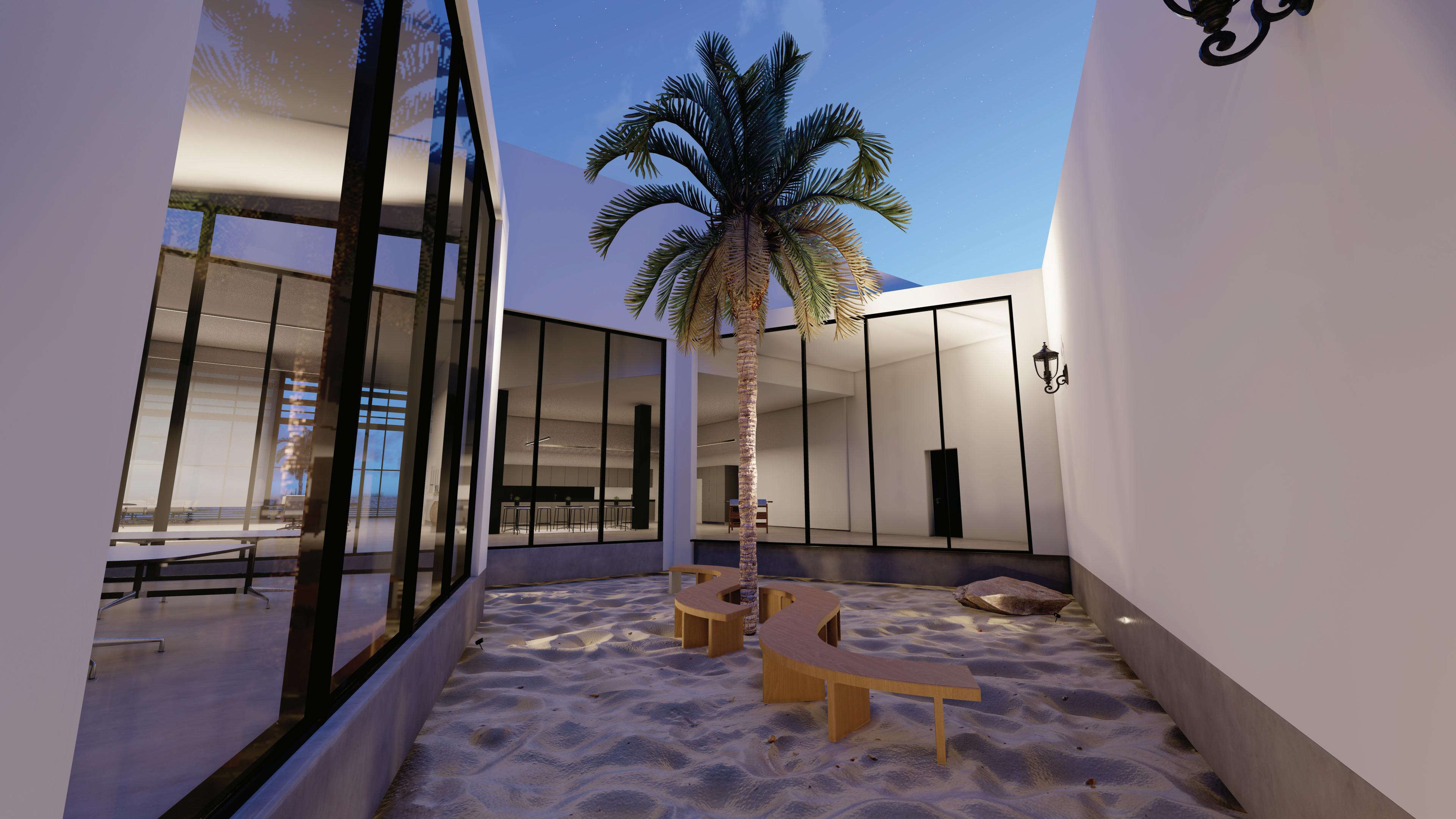
Typology: Educational, Cultural/Exhibition (Conceptual)
Category: Undergrad Studio Thesis Final Year: Spring 2020
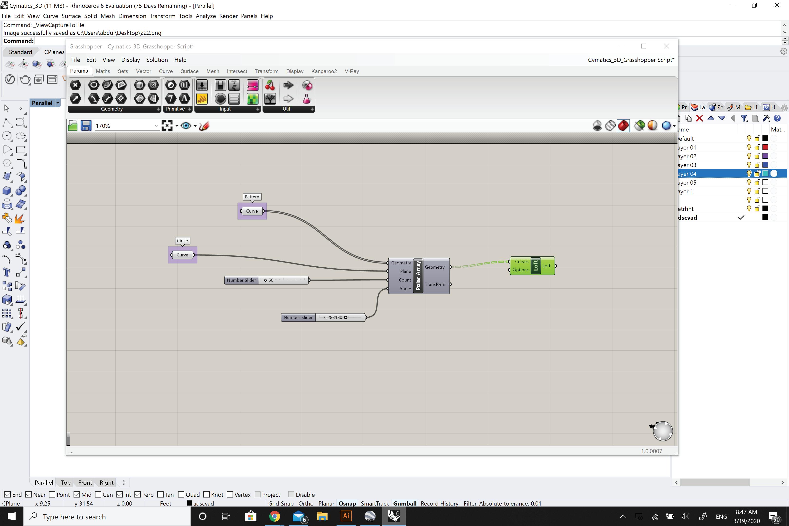
Tools: Rhino, 3ds Max, Lumion, V-Ray, Illustrator
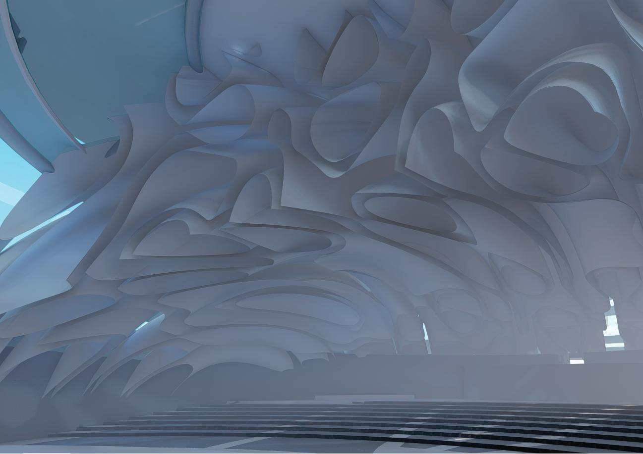
The Thesis explores the auditory sensory system to enhance the aural and acoustical qualities of architecture, through the means of space design manipulation, responsive systems, cymatics, and materiality. Architecture is often speculated through the visual senses, despite that the auditory senses are crucial to the experience of form and space.
The premise of this thesis is to establish an educational sonic center, which initiate the aural and acoustical qualities of our architectural enviorment that can affect people and their experience of space. The form and structure is inspired by the branch of physics called cymatics. The internal operation of the project contain performative acoustical panels forming a kinetic ceiling dynamically responsive to the acoustical signature of the interior space.
The centre serves as a place of retreat from the consequences of noisy, unhealthy, and uninspiring aural enviorment with in the overpopulated urban area. Visitors will be more aware of their surroundings and how the auditory aspect enhances the enviorment, thus the they are reminded and urged to convey a lively positive aural soundscape in their homes, neighborhoods, workspace, and the life-style in general.
Ta KYMATICA (Greek): The study of wave phenomena.
BINOURAL: Relating to, or used with both ears.
SOUND effects a person physiologically, psychologically, cognitively, and behaviourally.
The AURAL sense have become a secondary concern when designing architectural experiences.
Sounds are created by VIBRATIONS or pressure changes through an elastic medium, which the ear detect and passes along the brain to decode.
Sound BOUNDARY is when a sound wave travel through a medium, it will often reach the end of a medium to reach obsticles or perhaps another medium. When one medium end, another one begins. And so on...
RESONANCE is the the quality in a sound of being deep, full, and reverberating.
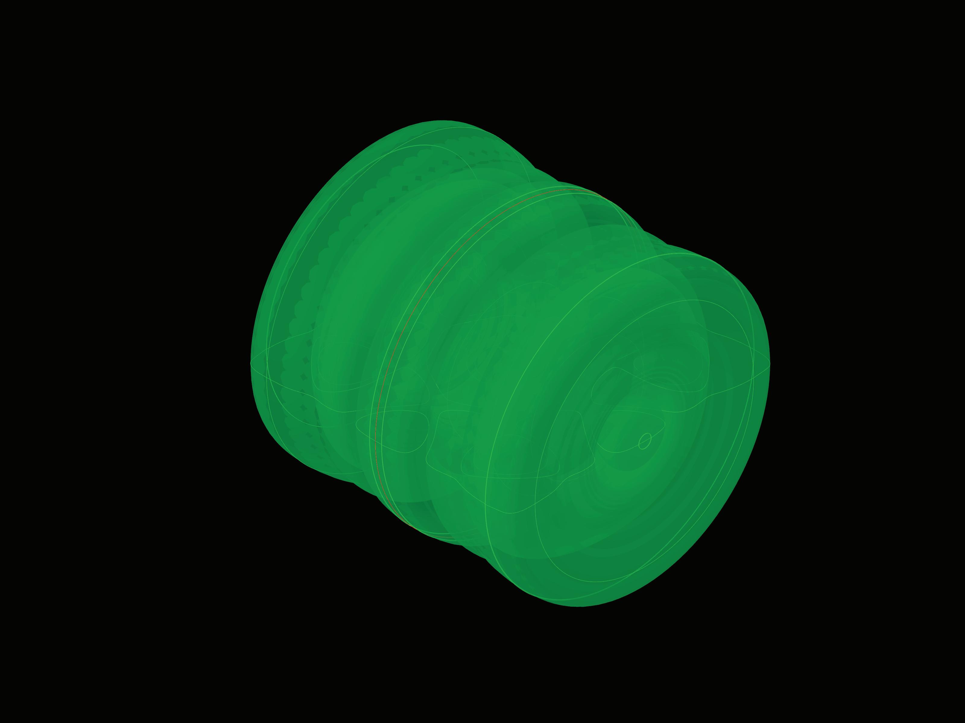
The design focused predominantly on the iterative development of formal possibilites for the SONIC CHAMBER. The process sought to use sound as a generative element within the deign process.
Drawing inspiration from the branch of physics known as CYMATICS, the mathematical rules which govern wave interaction phenomena.
The four selected cymatic patterns for the project are:
Building on the SYMMETRICAL NATURE of the cymatic patterns, surface forms were created through a process of rotating about the natural axes. This produced a variety of formal explorations, each associated with a particular sonic frequency. These forms were then brought into a variety of acoustic analysis software to begin understanding the properties inherent in each iteration.
The 3d sonic fingerprints have been titled NODAL STRUCTURES. This is derived from the 2d cymatic formations represent the nodal points of the formula, and each line represents the moment at which the energy in the sound wave equals zero, crossing the plane of reference. In this way, the Nodal Structures are an embodiment of the movement of sound, with walls which bloom within the moments of calm inside a field of vibrating sonic energy.
York
SECTION PERSPECTIVE B NO SCALE
SECTION PERSPECTIVE A NO SCALE
SONIC CHAMBER SECTION + ENTRANCE
SOUND DISTRIBUTION DIAGRAM
90 Hz
ELEVATOR
SONIC CHAMBER
Professional - Project Progression: Accomplished
Typology: Transit Station (Conceptual)
Category: Biennale Architettura
Year: Summer 2023
Tools: Rhino, Lumion, V-Ray, Illustrator, Indesign, Photoshop
The fabric of Kuwait City was once a field of organically aggregating structures interlaced with various scales of openness. Courtyard houses were connected by a network of paths with public courts that disrupted their density, creating platforms for cultural, political, and economic exchange. Once the home of numerous aspects of Kuwaiti civil life, the walled city was mostly eradicated to make way for modernization. A new heritage was born, creating a new landscape of modern structures designed by significant international and regional architects of that era dissociated from its indigenous origins.
The Kuwait Pavilion is rethinking urban planning processes through rethinking transportation, walkability, and accessibility. The experiment started as a response to various foreign master planning efforts for Kuwait. The project's focus is to improve the human scale of the city by enhancing urban transitional and interstitial spaces as well as prioritizing mass transit over individual vehicular modes of travel. The process looks at an approach to urban planning that explores a top-down macroscale simultaneously with a bottom-up microscale keeping the human experience and scale critical for the new plan. The interconnectivity of the city's historic fabric is revisited through various scales of urban interventions, resulting in a new network of connectivity that forms multiple modes of transportation that culminate on the human scale.
The project's title reflects the process of rethinking as an effort to decolonize architectural discourse; "rethinking rethinking" emerges as a process for reevaluating existing processes while moving beyond the colonialist principles and values typically driving the development of architectural projects. The approach examines existing conventions and precedents while allowing room for local forces to generate a new process. History is treated as a spiral rather than a linear timeline, looking for moments of precedent that can inform future development that is otherwise disjointed in a conventional linear workflow.
1951 Map of Kuwait 1951 Map of KuwaitBuilt Environment
Map of Kwait +
Map of KuwaitWalkability
1951 Map of KuwaitWalkability
Wasil is an Arabic word for linkage - in this instance, it's a point in which things join and transmit. This project, Wasil, aims to revitalize Kuwait City's workability by linking pathways from the dismantled historic city into the existing urban landscape.
Through the revival of Kuwait's lost walkways, Wasil aims to breathe new life into the heart of the city and enhance the overall pedestrian experience, minimizing the recurring issue of the lack of transportation in Kuwait. The following paragraphs will demonstrate the project's overview, design process, site, and graphic representa tion.
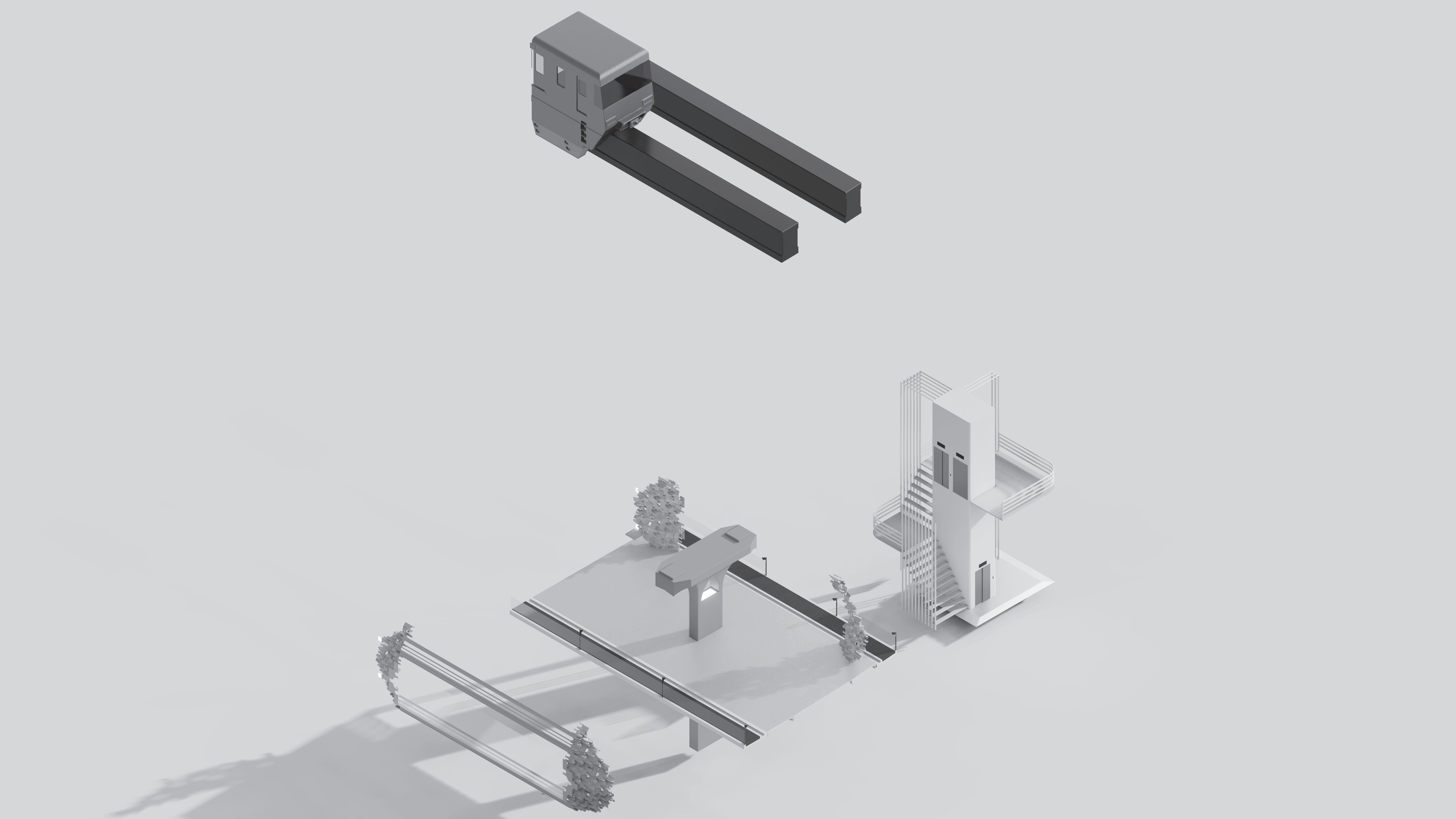
Wasil is located at the Shamiya Gate Station, bridging pedestrians from the tram station to all the existing, built environ ments. The pathways are constructed to be elevated and they vary in scale depending on the human density and the tramline locations. Wide elevated walkways are established under the tram line to grant easy access to the tram transportation system, which also includes bicycle lanes to allow and raise awareness of different means of transportation. Narrow elevated walkways weave through the built environment to allow easy and direct transitions from one building to another. Multiple strategically positioned staircases and elevators are placed to guide pedestrians from the ground level to the elevated walkways and to the tram. Other amenities such as tram ticket vendors, washrooms, bike racks, benches, etc., are also included.

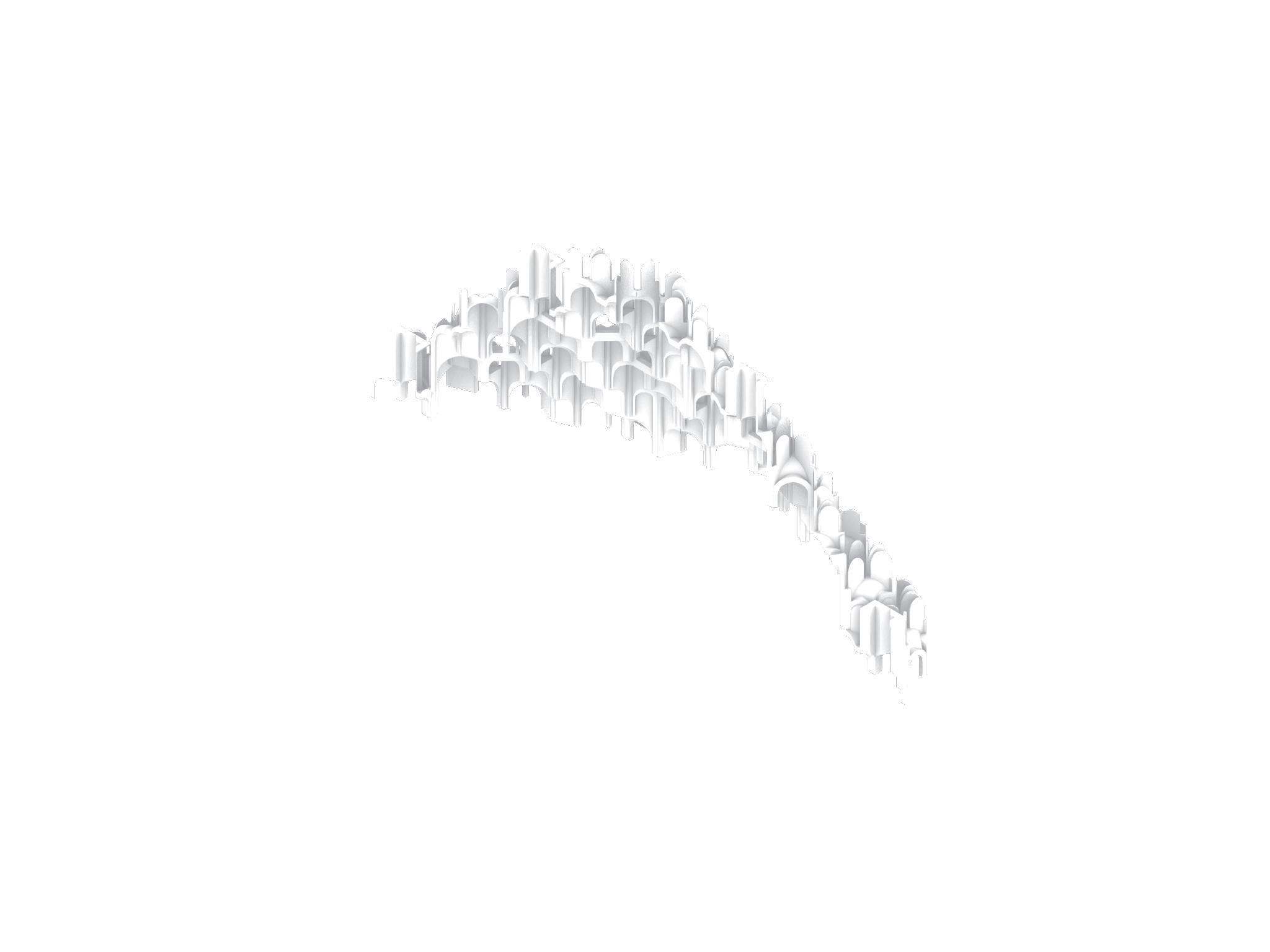
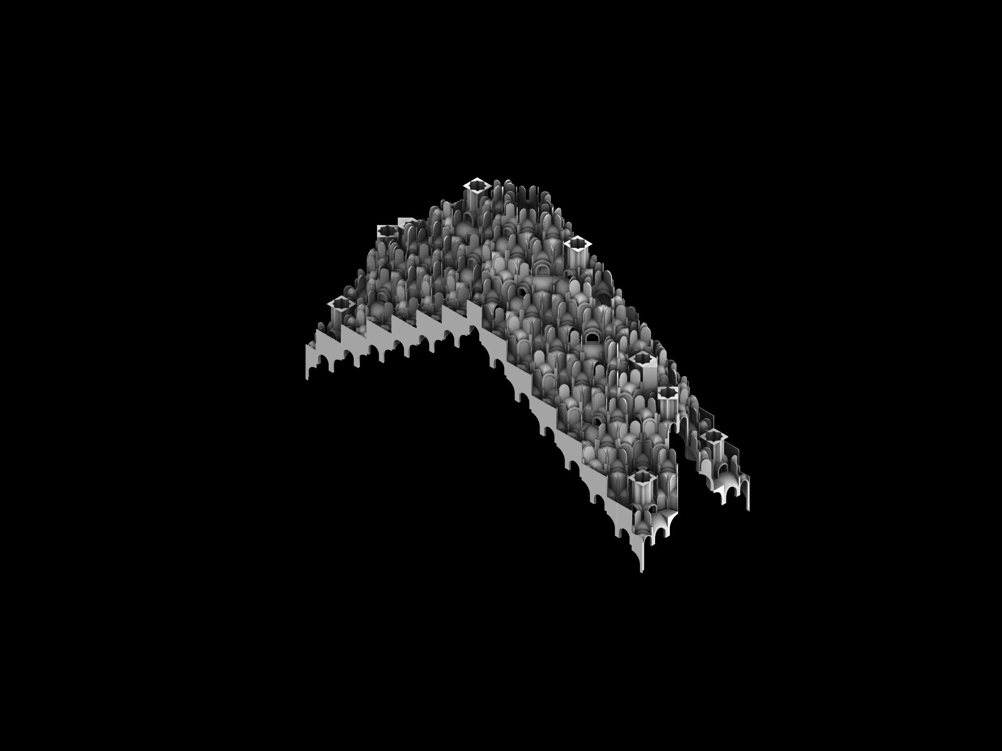
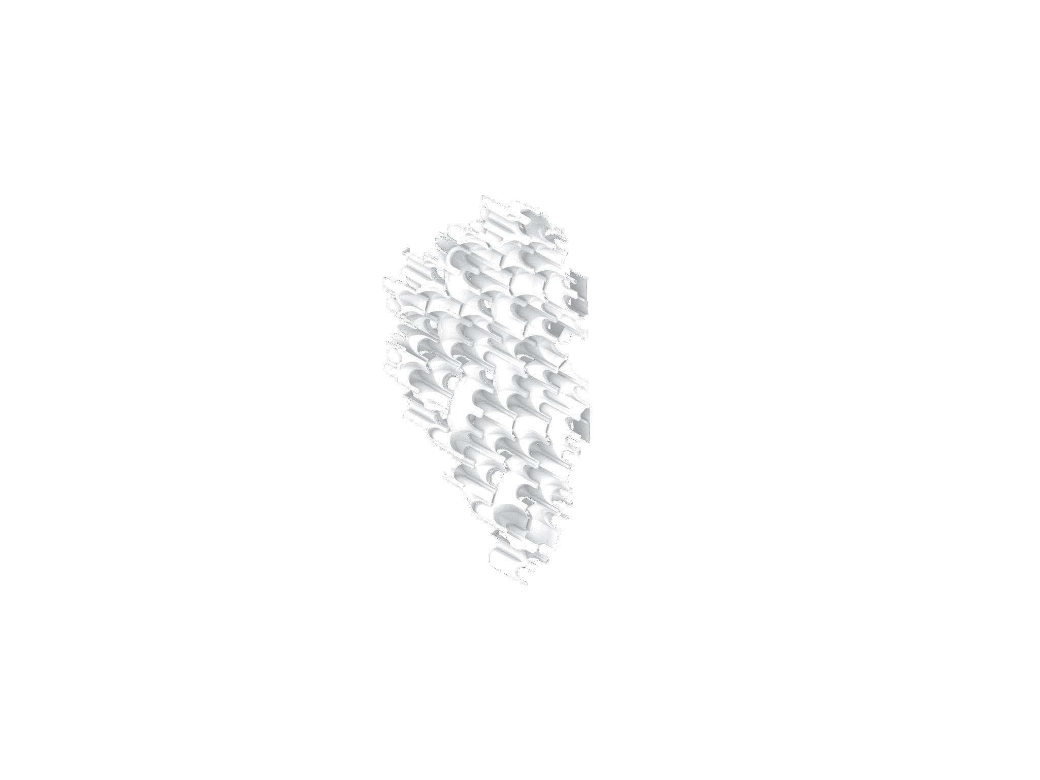
The inspiration behind the design of this project is derived from the form of the ornamented vaulting structures in Islamic architecture called Mugarnahs. The structures are articulated in modular geometric shapes that efficiently envelop the built environment and can simply be adjusted for the future development of the city. The structure is created using recycled materials such as mud sludge and construction remains. Each shape is designed to adapt to the hot climate by incorporating scattered openings, allowing optimal ventilation and measured sun exposure.
Despite the modular geometric shapes, Mugarnahs form a raw and visually eccentric pattern that resembles the pathways of the dismantled historic cityscape of Kuwait City.
The rendered images represent a general and in-depth perspective of the chosen site at the Shamiya Gate Station. A diagram of the Mugarnahs design process is illustrated to better understand the modular concept of the structure. The plan and drawing identifies the connections and relationships between the existing environment and the elevated walkways. The isometric drawing identifies the human and vehicular flow and density at the given site.
An exploded section drawing of the pathways illustrates the structure and design of the project in relation to the pedestrians and the numerous means of transportation. A set of close-up renders illustrates the details of the site.
From the design process of the Mugarnah's modular geometric shapes to the pedestrian flow throughout the city, Wasil strives to incorporate the lost identity of the public transportation system of Kuwait and raise awareness of that matter. Wasil creates a journey of bridging the past to the present and the future.