URBAN PLANNING PORTFOLIO
Aaralyn Gross
Urban Planning + Design Student 2021- 2025
Aaralyn Gross
Urban Planning + Design Student 2021- 2025

Aaralyn Gross
Cincinnati, OH
grossa5@mail.uc.edu
(614)-477-2322
www.linkedin.com/in/ aaralyn-gross2a5208226
I am currently a fourth-year student in the Urban Planning Program at the University of Cincinnati, and am originally from Columbus, Ohio.
My primary interests in Urban Planning include Urban Design, Community Development, Historic Preservation, Sustainability, and Placemaking. Through various job opportunities, I aim to develop my skills and expand my knowledge in these areas. I remain open to learning new things and gaining new passions with each experience. My motivation lies in the belief that I can make a genuine difference in people's lives in my future career, by striving to enhance the quality of life through intentional design in every community.
KU Leuven
Brussels, Belgium September 2024- December 2024
University of Cincinnati
Bachelor of Urban Planning Class of 2026
2020 2016
Upper Arlington High School Columbus, OH
Class of 2020
Soft Skills
Communication
Organization
Punctual
Teamwork +
Collaboration
Empathy
Listening
Interests
Drawing Physical Fitness Cooking Writing Design
Delta Delta Delta, Zeta Chapter September 2020- April 2024
Director of Administration
Spring of 2022- 2023
• Took minutes at the weekly Chapter meetings and bi-weekly Officer Council Meetings.
• Called the roll at the beginning of every Chapter meeting and Officer council meeting.
• Was responsible for keeping track of every members attendance throughout the year.
Served on Selection Committee
• Worked alongside the seven other women selected by their classmates to interview the women in our chapter and select people for positions for the 2022-2023 Officer Slate.
Served as a Rho Gamma
• Was co- responsible for mentoring a group of 12 girls and helping guide them through the recruitment process for a week.
Deans List 2020- 2025
Analyst Intern January 2025- May 2025
Landrum & Brown- Cincinnati, OH
• Created and continuously revised Land Use Alternatives for an Airport Site Plan using Adobe Illustrator.
• Assisted in the creation and revisement of alternatives for Airport Master Plans using AutoCAD.
• Worked on editing and revising Airport Layout Plans for projects in Charlotte and Houston.
• Researched, organized, and created forecasting charts for different data using Microsoft Office.
Planning Intern
Planning NEXT- Columbus, OH
May 2024- September 2024
• Created and maintained databases to keep track of different rounds of engagement data for multiple projects.
• Assisted on document design and formatting for different engagement sheets and final plan documents using Adobe InDesign.
• Gathered demographic data for various projects and assisted in creating visual elements to display the demographics for the final plans using Adobe Illustrator.
• Assisted on creating feature layers for different streets and corridors for multiple projects using ArcGIS Pro.
Community Development Co-Op
College Hill CURC- Cincinnati, OH
August 2023- December 2023
• Co-led the OurShop Program, providing small businesses six months of rent-free exposure in a brickand-mortar storefront. Involved in all stages: crafted press releases, evaluated 40+ applications, assisted in conducting interviews, aided in tenant selection, maintained constant communication with tenants during build-out, and contributed to grand opening planning.
• Actively worked on leasing four commercial spaces, handling cold calls, conducting weekly tours, and reviewing business and financial plans.
• Utilized professional writing skills for proposals, financial reports, and donation requests.
• Created Urban Design Renderings and contributed to a proposal for anticipated street murals in five curb extensions.
Planning & Zoning Co-Op
Colerain Township- Cincinnati, OH
January 2023- April 2023
• Exercised professional writing skills with two endorsement letters on behalf of the township, two initiative executive overview summaries, a legislation rewrite on a one-year moratorium extension, and other research-based writings, as well as invitation letters.
• Created Urban Design Renderings for various sidewalk implementations, and tactical urbanism projects such as decorative crosswalks and community plazas using Adobe Photoshop, InDesign, and Illustrator.
• Updated and combined zoning amendments, re-coded residential and non-residential uses, and organized/ coded other various lists using Microsoft Excel.
pg 6-11
Landrum & Brown
Colerain Township
pg 12- 17
03 pg 18- 25
20-21 Equity Framework
22 Equity in Housing
23 Northside Master Plan
24 Site Redevelopment
25 Town Homes Collage
04 pg 26- 31
28-29 Riverfront Master Plan
30-31 Site Interventions
This work was from my time as a Analyst CoOp at Landrum & Brown, and as a Planning and Zoning Co-Op at Colerain Township.
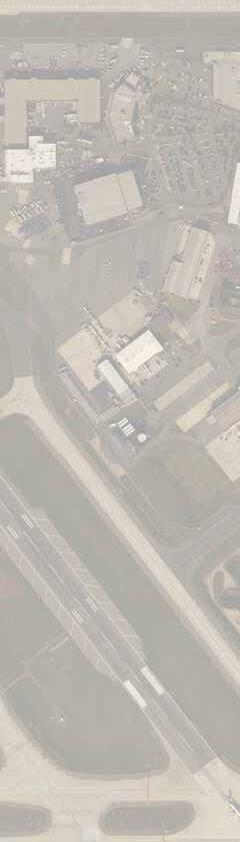
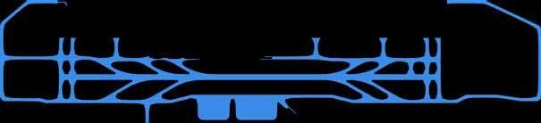
One project I worked on at Landrum & Brown was assisting in updating the ALP set for the Charlotte Douglas International Airport.
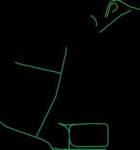
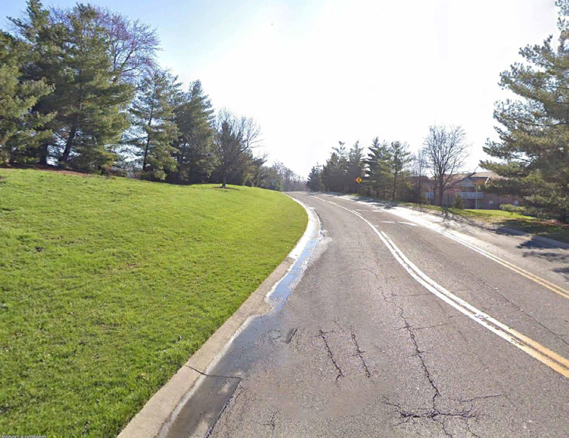
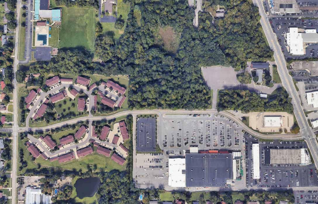
At Colerain Township I worked on tactical urbanism renderings for future street murals in the Township. As well as a sidewalk rendering that I created for a public meeting to show residents the new sidewalk being put in on Joseph Road.
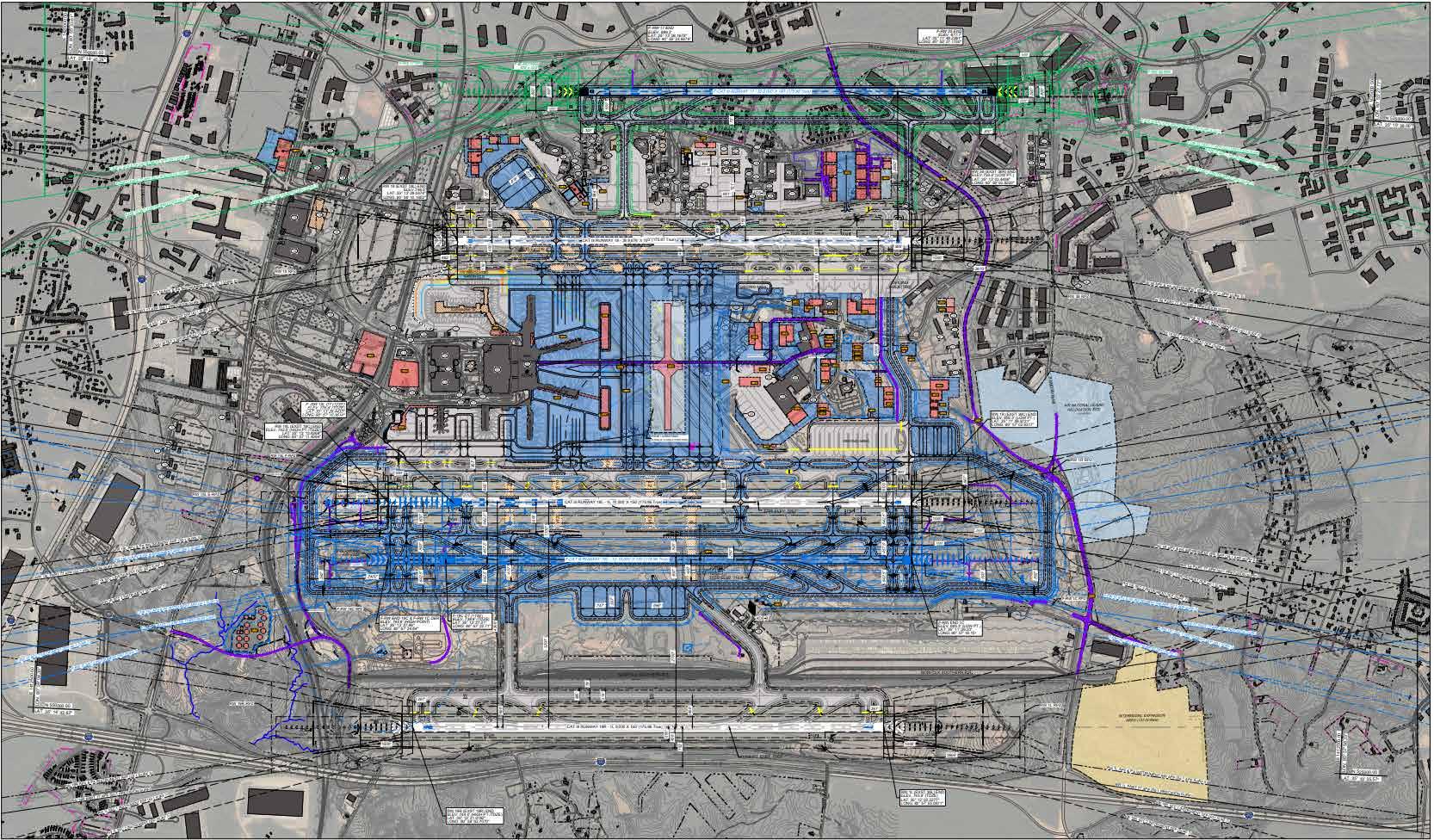
I assisted on the updates of the Airport Layout Plans (ALPs) for Charlotte Douglas International Airport. Additionally, I re-created the "Overall Future ALP" sheet as a graphic, using elements from AutoCAD and elements re-created in Illustrator.
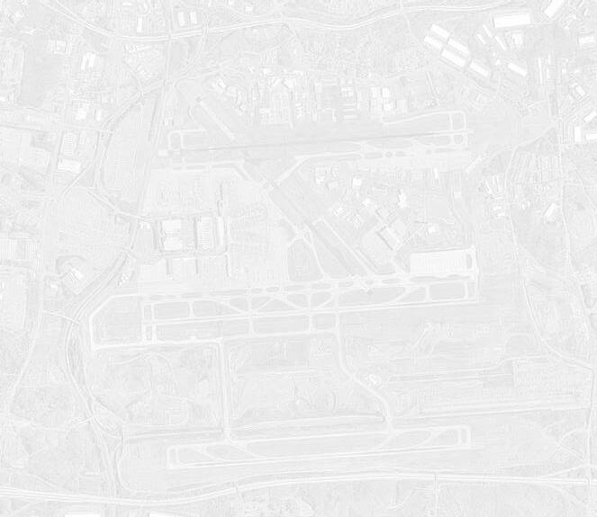


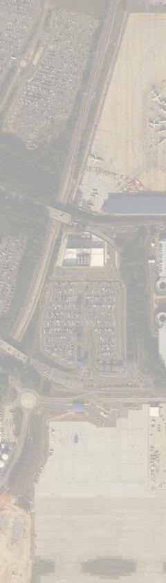

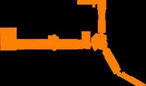

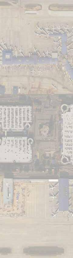


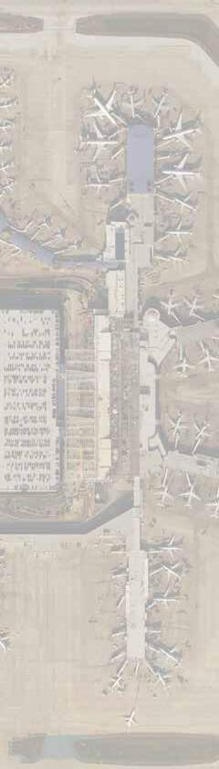


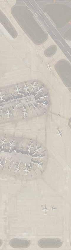


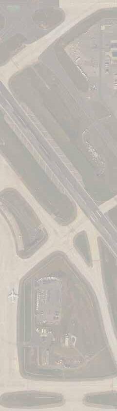


Featured here are three sheets that show: the updated airport land use planning, and the future terminal area. I assisted in the revisions to these plans as necessary such as text updates and layer creations for new additional elements.


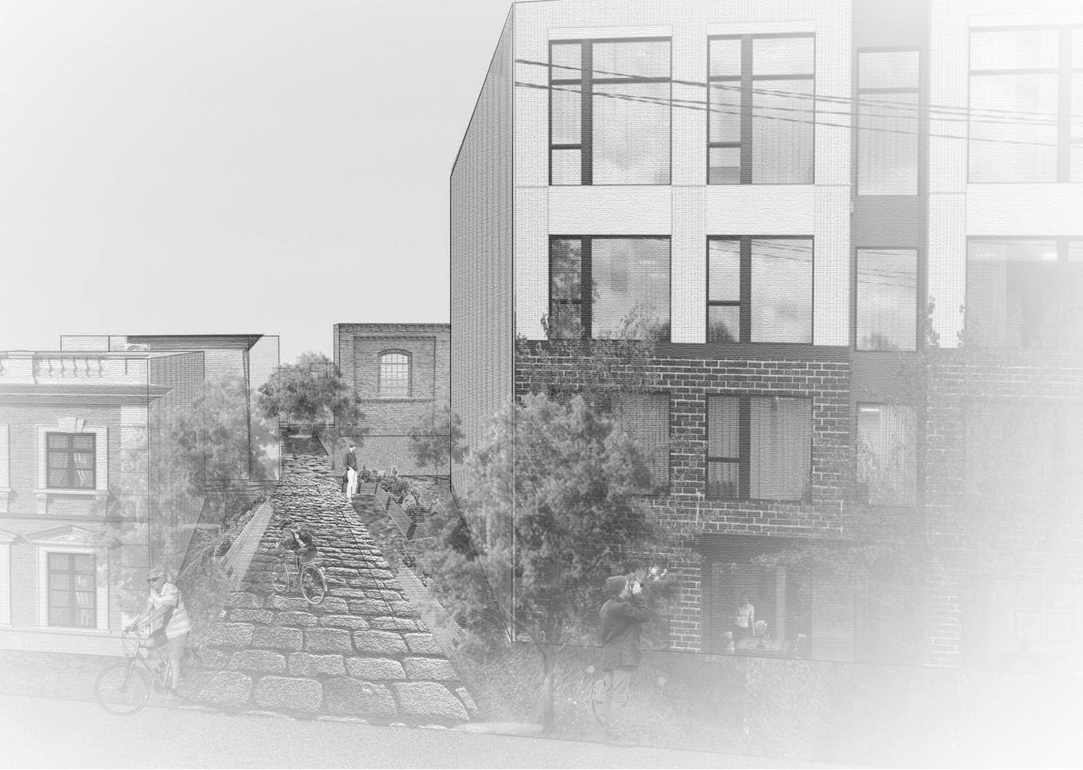
These are renderings of potential spots in Colerain, such as crosswalks and parking lots, that could benefit from tactical urbanism projects. These renderings demonstrate the potential decorative crosswalks have for safer pedestrian crossing, or a community plaza for an outdoor public space for the community to engage together in.
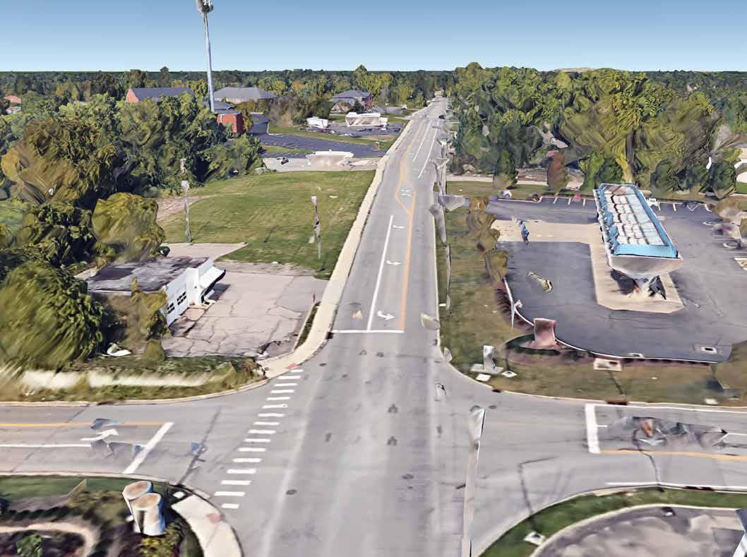


These are renderings I created of what a sidewalk would look like on the north side of Joseph Rd in Colerain. These renderings were put onto a flier I created and passed out at a meeting to explain to residents, who’s property is off of this road, the purpose of the sidewalk and the potential room it would take up. This sidewalk is very important considering the safety of the high school kids that have to use this road to get to Colerain High School everyday, and have been having to walk on the street.


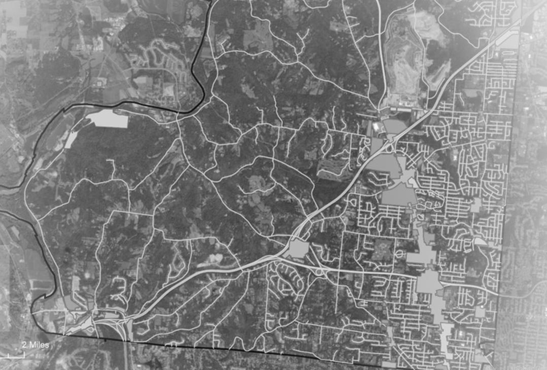
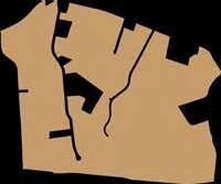
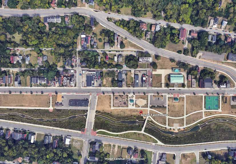
This project is a study of the neighborhood South Fairmount in Cincinnati, OH, and more specifically, looking at the highly invested in "Lick Run" in South Fairmount. The premise of the study was to analyze how that investment, centered around water and green space, has or has not positively impacted the community, and what can be done to improve that major investment.
After weeks of research and site visits to South Fairmount and the Lick Run, I created a design proposal for how the Lick Run could be better designed to serve the neighborhood and the community that lives there.
My vision for South Fairmount is to preserve the neighborhood's unique and historical assets, while also creating an interconnected community that fosters walkability, inclusivity, and equitable access to resources. My strategies to achieve this vision included commercial and residential infill, complete pedestrian pathways, community resilience hubs, and green infrastructure.

Parks + Gardens
Residential
Commercial
Mill Creek
Pedestrian Paths
Complete Paths
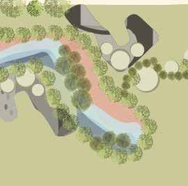
This final master plan for South Fairmount shows the proposed commercial and residential infill along Lick Run, and a proposed green and public space re-development. These strategies highlight how natural elements in the Lick Run can also be integrated into the new developments, and create opportunities in the neighborhood's public spaces.
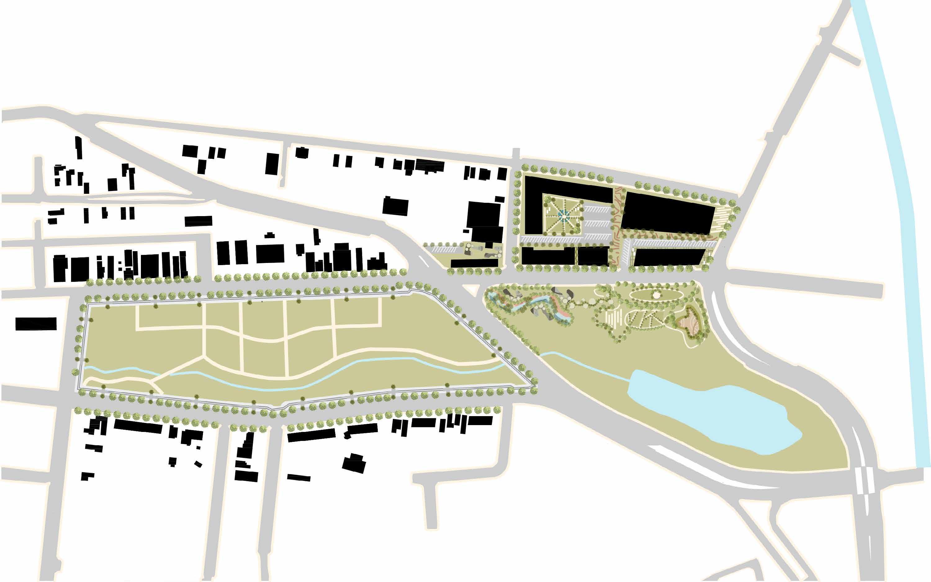
The 3D section to the right emphasizes my focus on transforming the existing paths around Lick Run into "complete paths." This involves developing multi-modal paths for biking and walking that incorporate tree lining along the paths, and using sustainable materials for stormwater management, and more.
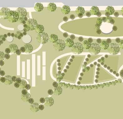
The cross sections below highlight Pinetree Street, which features essential neighborhood buildings that would be re-purposed into apartments, resource centers, and emergency shelters. The section also shows how the existing green space could be designed to better serve the community with communal gardens and farmers markets.


This model illustrates how the new buildings, pathways, and green spaces around the Lick Run work together to foster community and bring residents together. The substantial investment in Lick Run offers an opportunity to use its green spaces for creating inclusive areas that attract and retain people of all ages in South Fairmount.


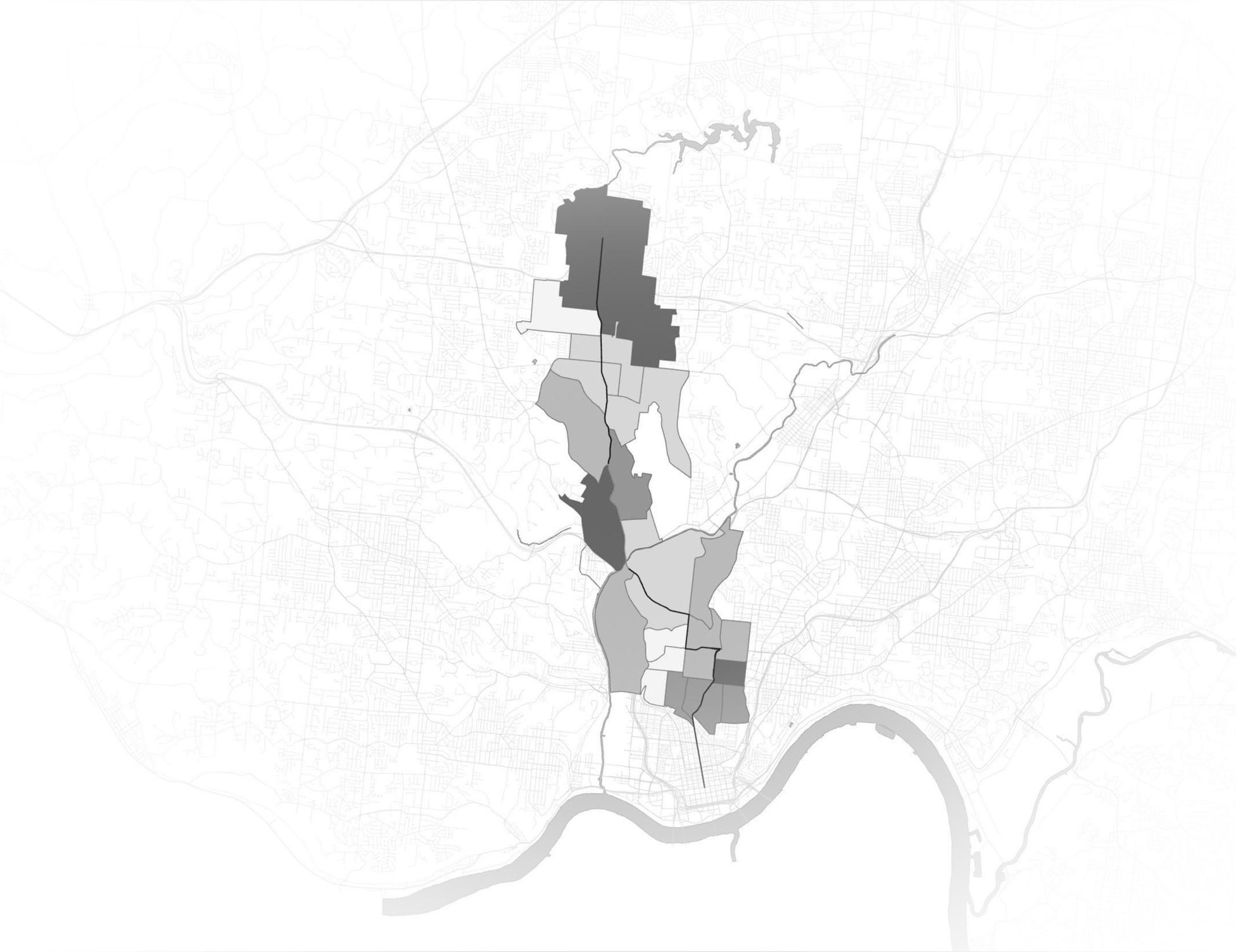
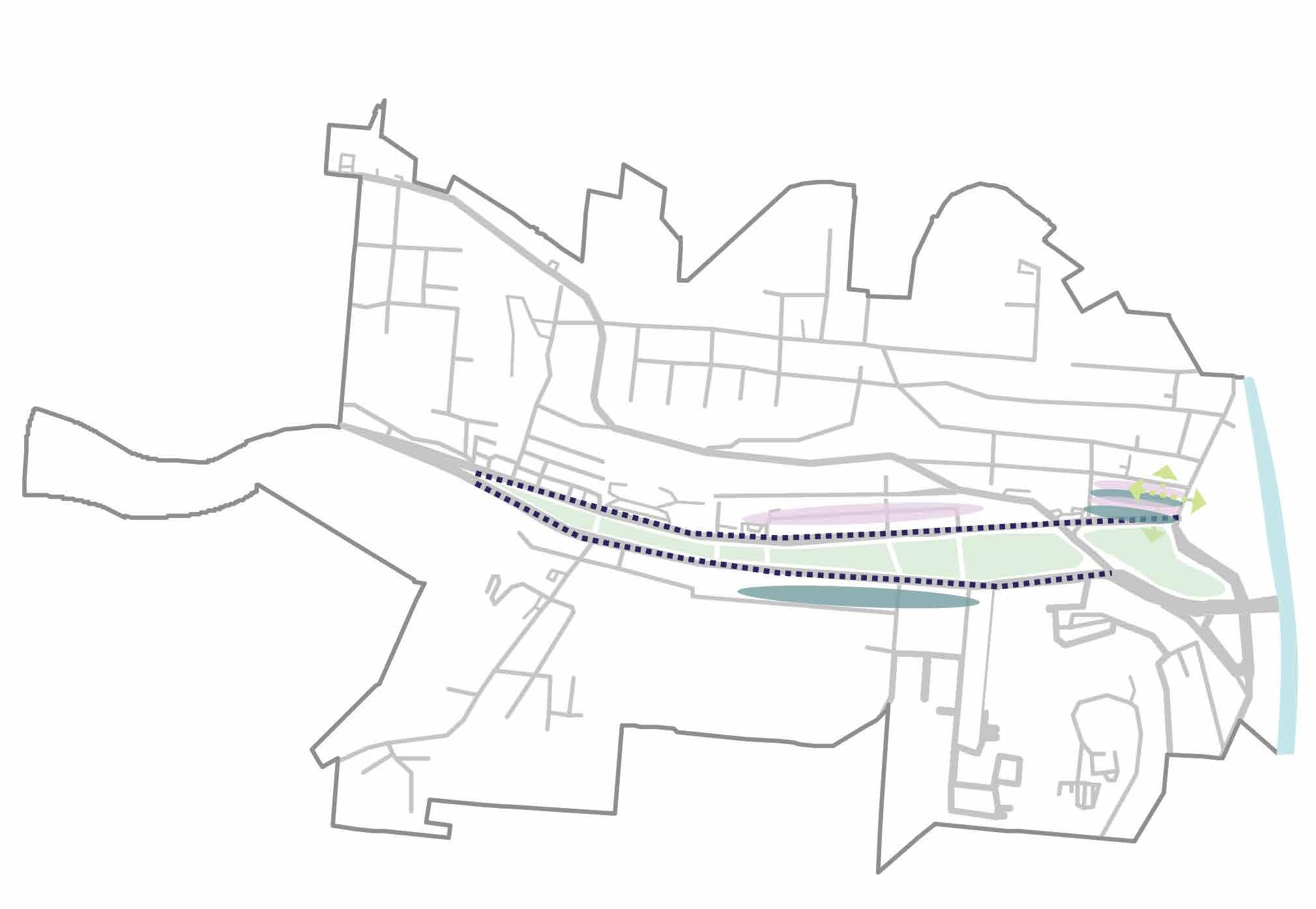
This project is a study of the new BRT route expecting to be installed along Hamilton Avenue, that was initiated in the Fall of 2022. The neighborhoods this route will cover range from CUF all the way up to Mount Healthy, which is expected to be around a 12 mile corridor. We studied the impact this new BRT route will have on it's surrounding neighborhoods, and later took a closer look into analyzing how Northside, specifically, will be affected.
This semester-long project was done entirely in collaboration with Lanie Tarowsky & Ella Lisac.
To set up our initial framework, my group looked at how equity comes into play when looking at the impact of the BRT route on the neighborhood Northside. By definition from the APA, Equity is recognizing planning practices that have had a disparate impact on certain communities and actively working with affected residents to create better communities for all. We first identified Inclusion, Access, and Opportunity as three words that are representative of how we thought equity should look in the corridor.

These are four guiding principles we named and used to guide our thinking for what we believed would strengthen the corridor and overall help contribute to strong, livable neighborhoods. These four principles can be looked at as sub categories of our three building blocks of equity.
Accessible Transportation Affordable Housing
Average used car cost $32,000 in OH during 2022. Median household income in OH is about $61,000.
1 in 3 residents or nearly 88,000 people struggle to pay rent each month/need affordable housing.
CleanEnvironments

39% of Americans in 2021 were estimated to live in counties with poor air quality.
Safe Streets
There were 269 pedestrian car accidents in Cincinnati during 2022. 182 were fatal.

These maps were used to show the correlation between Housing Cost as a % of Income and the Median Income throughout the entire corridor. These two metrics correlate extremely, showing inequity throughout the corridor because the higher median income tracts are the households getting to spend less money on housing cost, and the tracts with a lower income represent the residents who have to spend more than 30% of their income on housing. This data showed our group that housing needed to be made a priority in our vision for the future of the BRT route.


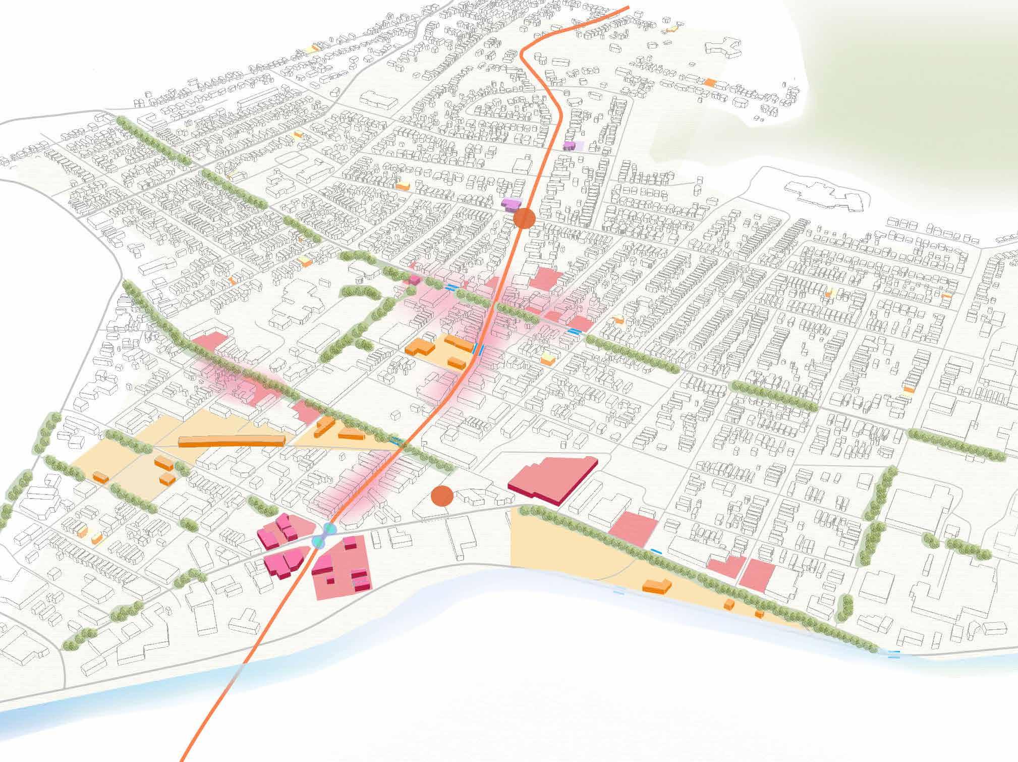
This master plan encompasses what we envision for the future of Northside, an affordable neighborhood that values green infrastructure, equity, and walkability, and a community that fosters sustainability and inclusivity.
Next, we took a closer look at sites in the neighborhood that we individually redeveloped. This site originally had a KFC and a Taco Bell, but the redevelopment of the site added town homes to the already existing town homes along Knowlton street, and a mixed-use building with ground level commercial, and apartments above with market-rate and affordable housing.
BEFORE AFTER
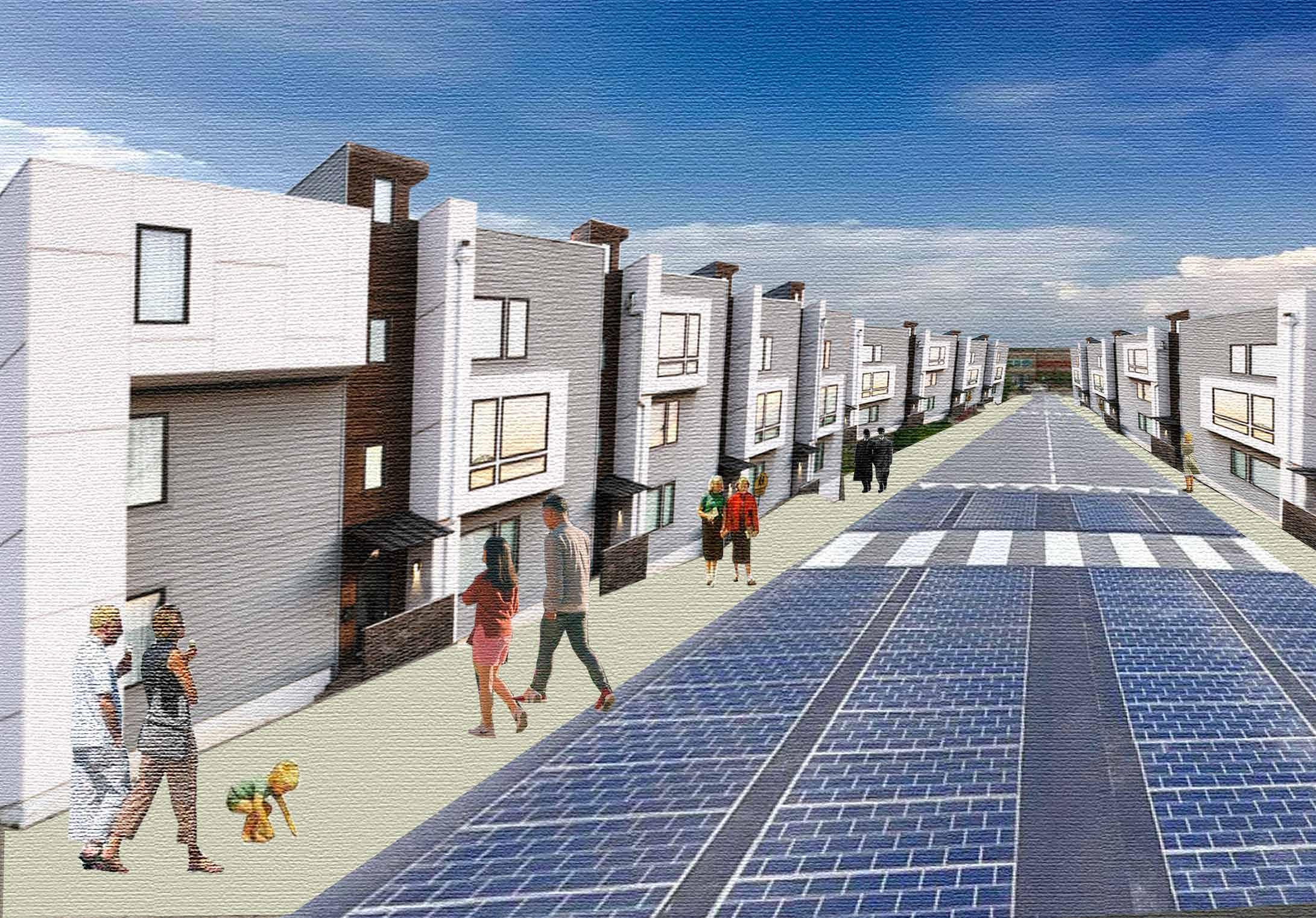
This is a collage that gives further insight into what the rows of Town Homes on Knowlton Street look like, as a continuation of the homes on Apple Street. Below you see the vision of 23 units of single family housing, that's not only increasing the density in the neighborhood, but continuing the existing fabric of the neighborhood as well.

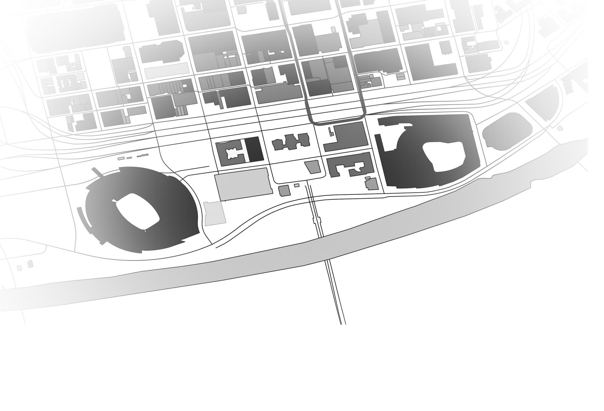
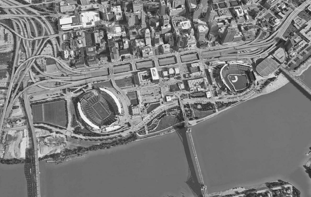
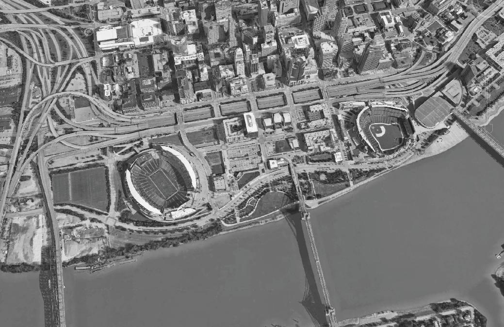
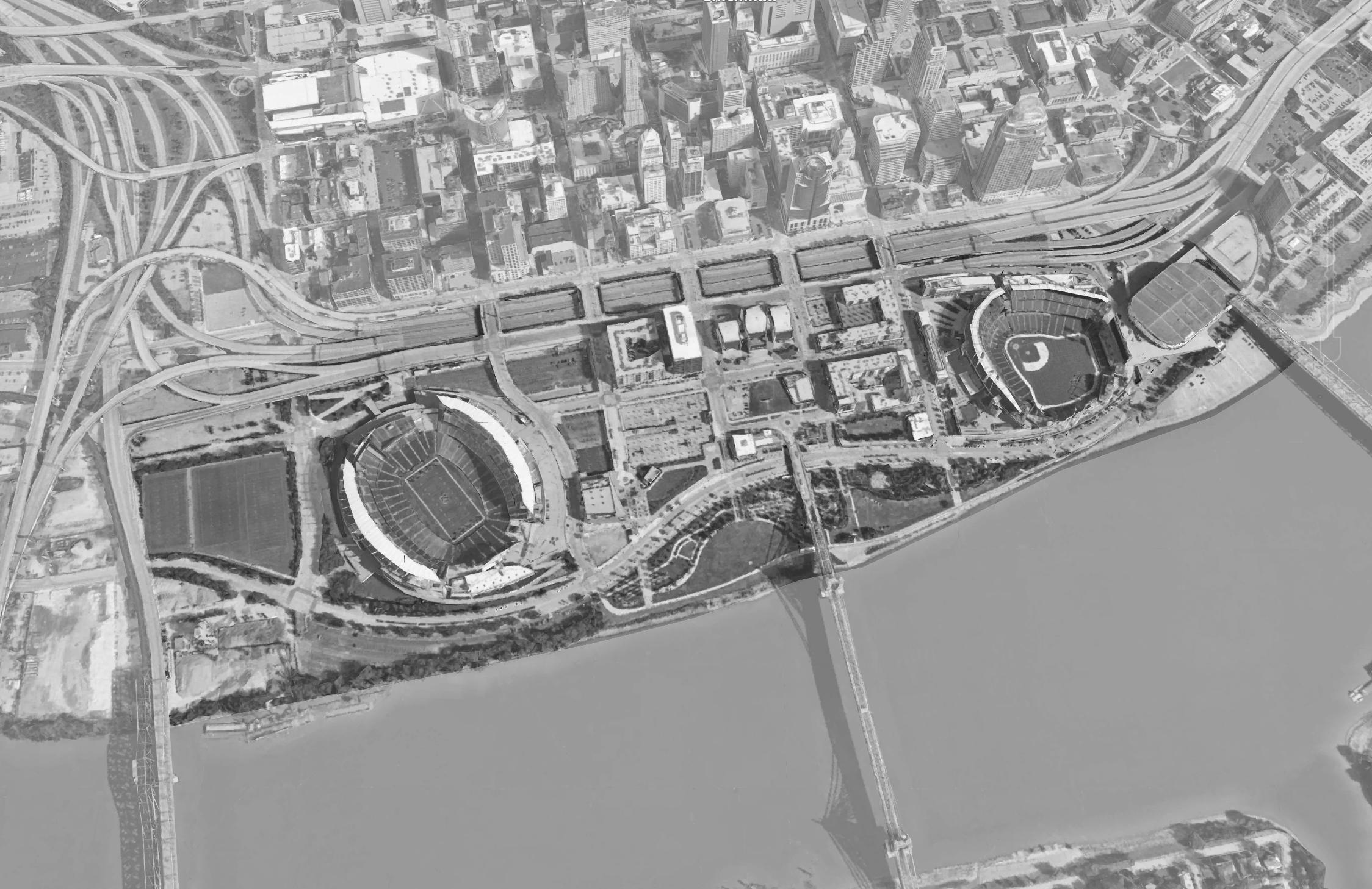
This project was a study of the good and bad urbanism of downtown Cincinnati, and more specifically, we looked at the Riverfront Site. We dived deeper into how we can better engage the Riverfront to downtown Cincinnati, and proposed site re-designs of elements that would bring us closer to that goal.
This semester-long project was done entirely in collaboration with Max Adams & Emily Linesch.
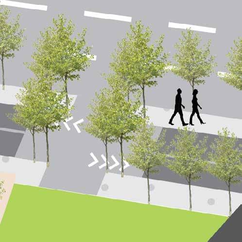
This is a vision map of all of the interventions we proposed to help engage and connect the Riverfront Site to downtown Cincinnati. Three of our main typology focuses include green space, redeveloping parking lots, and bike infrastructure.
With a vision of better connecting the Riverfront to downtown Cincinnati, we see a need for increasing engagement and communal activity spaces, enhanced tree cover, and extended bike paths and street car routes. We started with phases of each typology focus before creating one final map with all of our strategies working together.

PROPOSED SHARED BIKE LANES
PROPOSED BANK EXPERIENCE BIKE LANES
EXISTING BIKE LANES
PROPOSED SCENIC GREEN BIKE LANES
PROPOSED TREE COVER
EXISTING TREE COVER
Proposed Tree Cover
Proposed Bike Lanes
Proposed Streetcar Stops
Proposed Streetcar Route
Proposed Green space
Proposed Programs
Proposed Parking Lot
Revisions
Individually I focused on designing two interventions, burying the highway and re-developing an existing parking lot into a community plaza.
The highway burial will foster a walkable, communal area that creates a connection between the Riverfront and Downtown Cincinnati, and helps lessen the feeling of a barrier between the areas.
This community plaza will bring more community engagement, sustainability, and green space to the downtown site. There are still a numerous amount of other parking lots, but the loss of this parking, combined with the additional bike paths and extended public transit routes, will encourage more sustainable modes of transportation around downtown.


Here is the before and after of an intervention to bury the already with green space and trees.
BEFORE AFTER


already sunken highway
This community plaza will have restaurants, and a common area inside, and a solar roof, indoor and outdoor bike parking, bike paths, tree cover, and a shaded outdoor community space