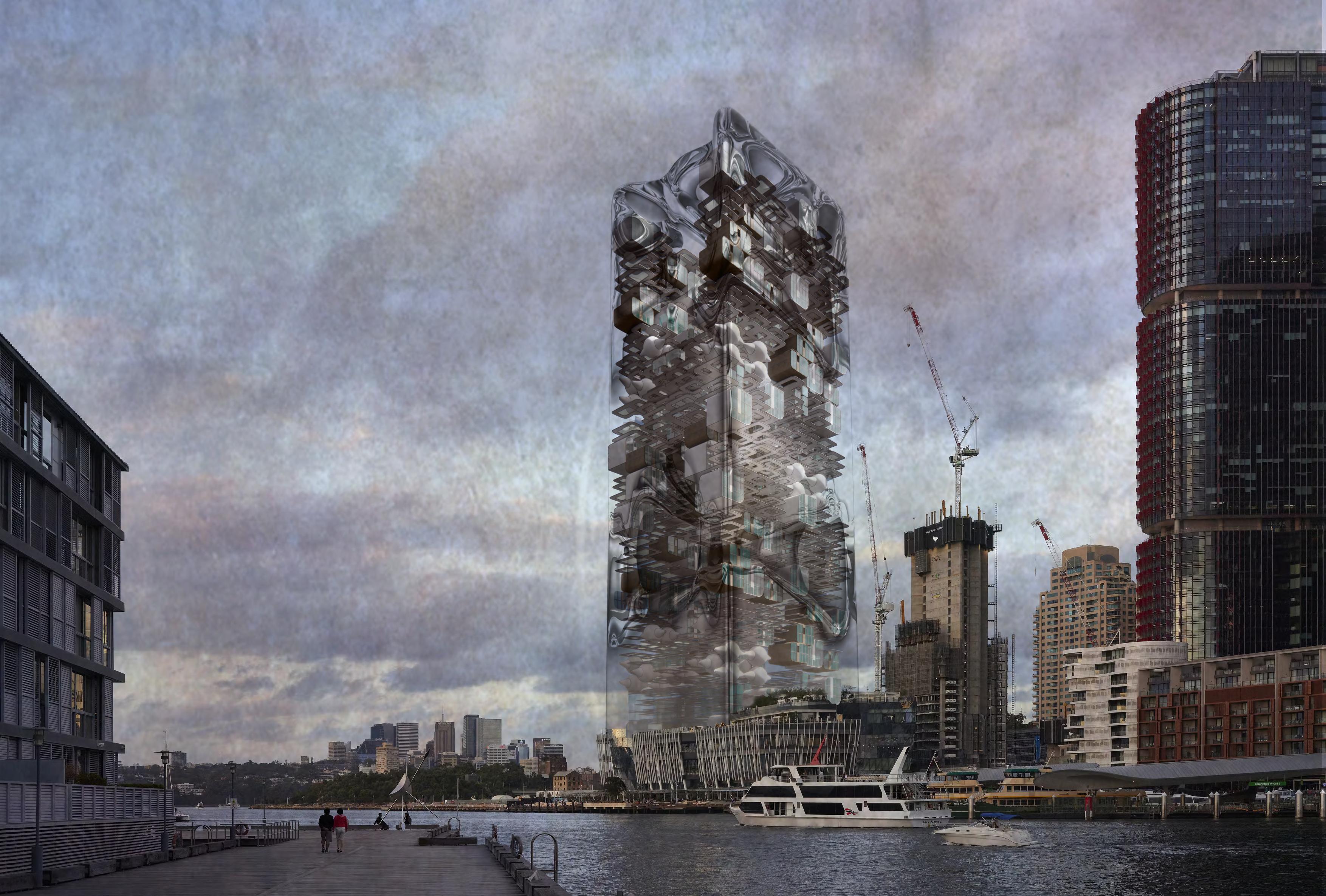
SELECTED PROJECTS
Lost in the forest Concept project
3D modelling, rendering
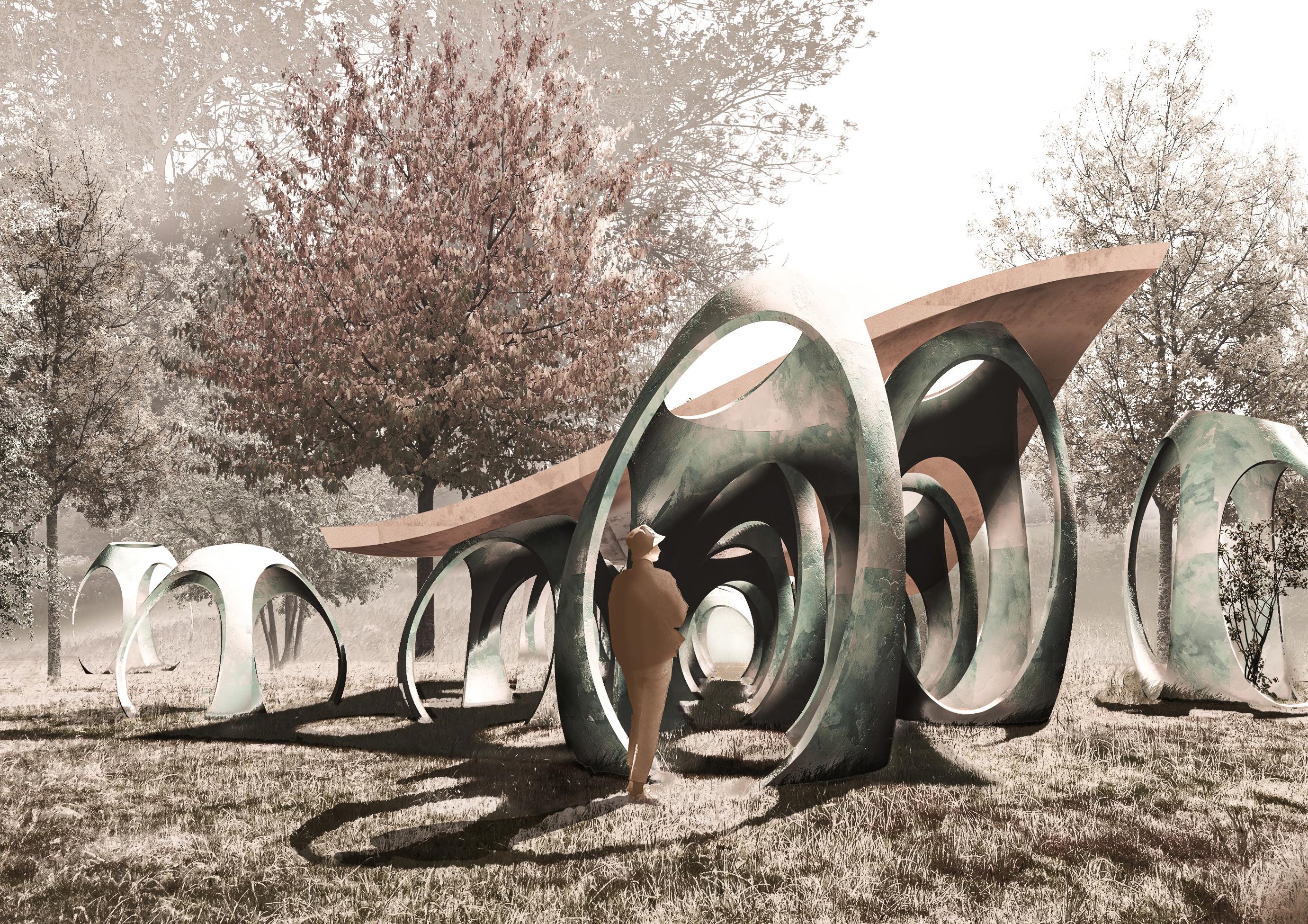
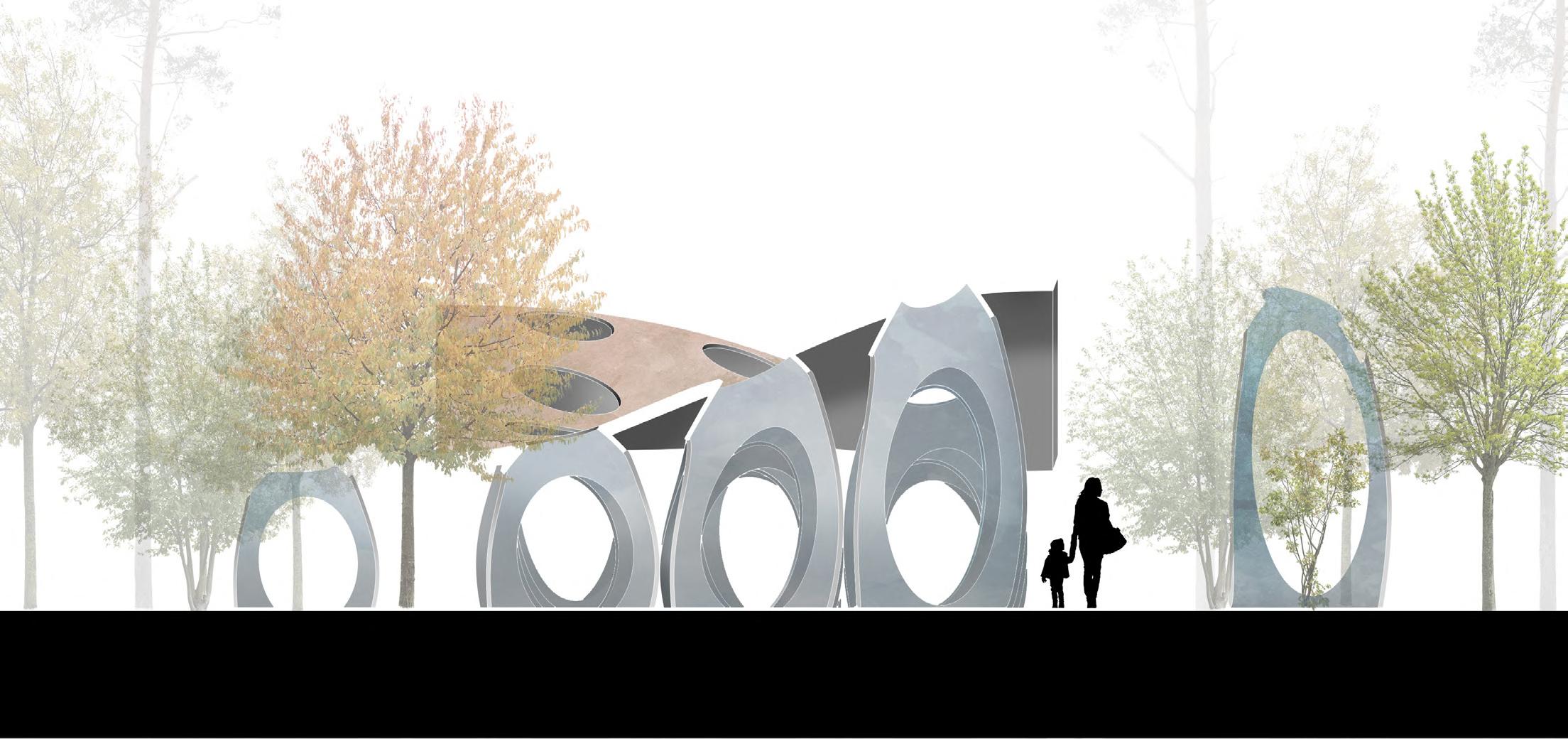
Lost in the forest
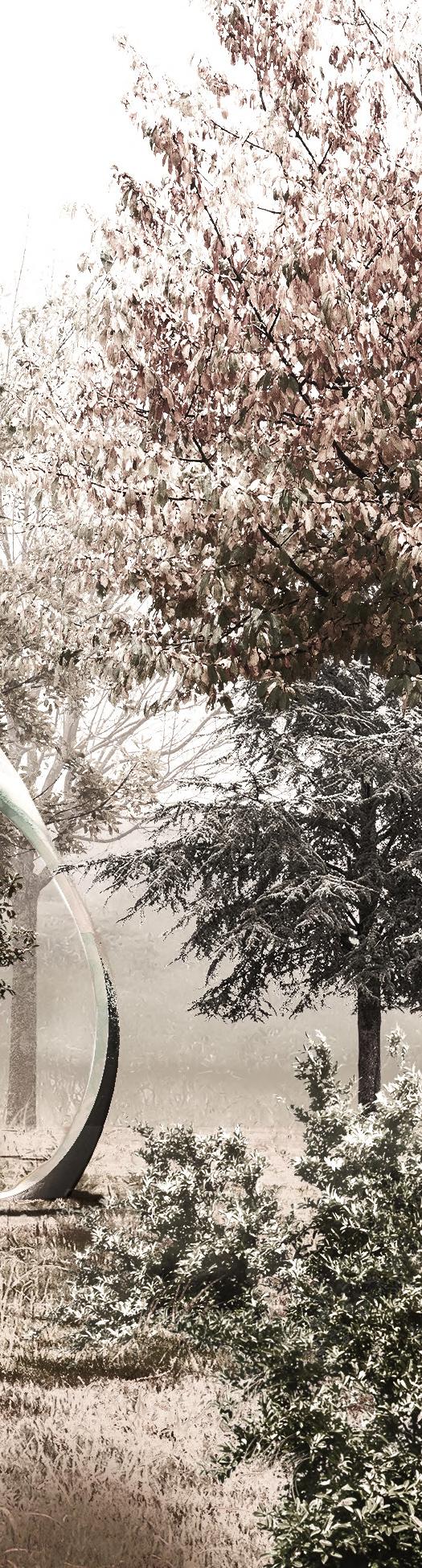
The installation is situated in a forest area, developing the eggshapped chambers between the trees. Its purpose is to create a contemplating space redefining the relationship between the visitor and the surrounding nature. The sky and the visual connection to the forest become the main protagonists.
Resort hotel-Thermal bath
Area of Project: Thessaloniki
Concept project
The hotel next to the airport of Thessaloniki, is developed around the central square. The building program is aparted by 3 main room cluster buildings, a reception building along with a multifunctional space, thermal bath and finally a restaurant. The main idea is that the buildings are framing the public space creating strong social environment. People enjoy their privacy but are also moving and interacting into this vast space.
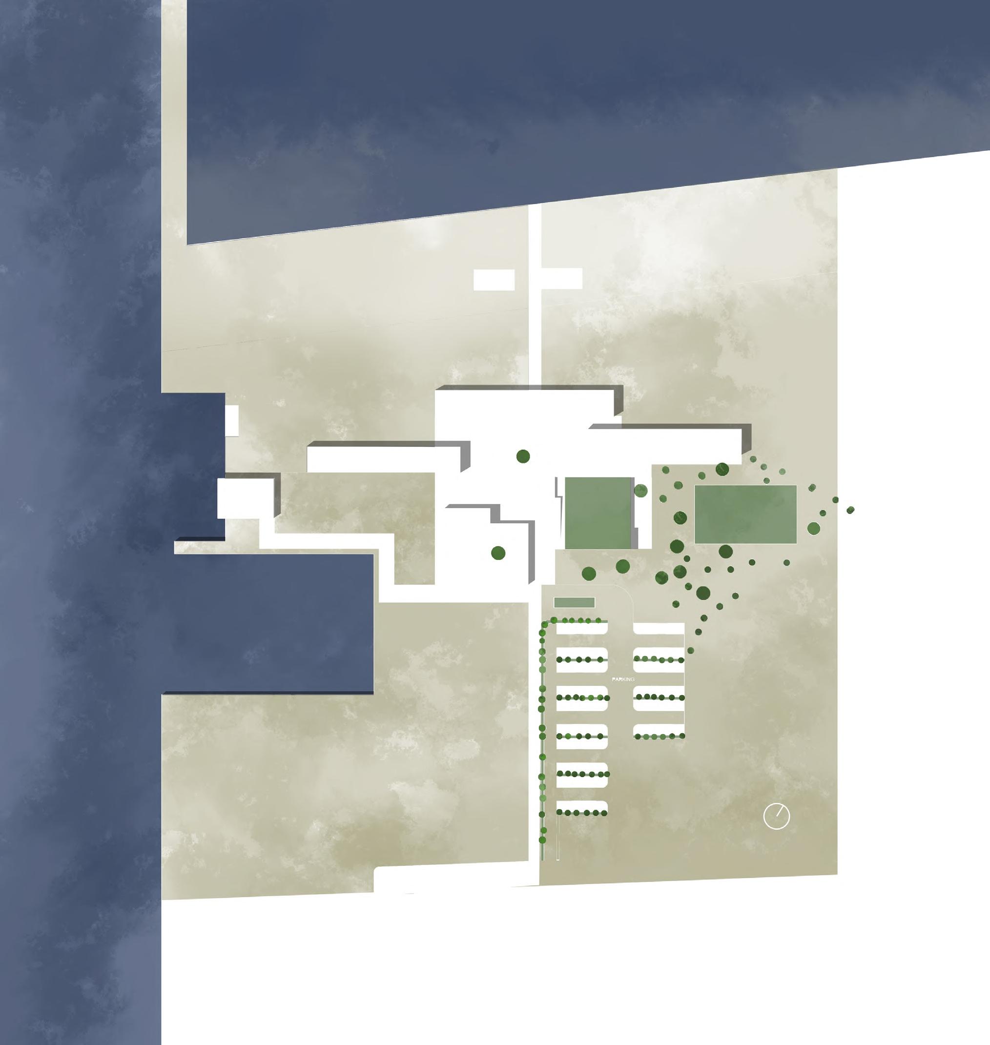

Centrality-Square 50m 30m 15m 10m 5m 2m 0m BEACH VOLLEY BEACH VOLLEY CENTRAL SQUARE Restaurant PARKING Football field Τhermal bath RECEPTION Hotel unit A Hotel unit C Hotel unit B Pergola Volumes clustering
The Plot

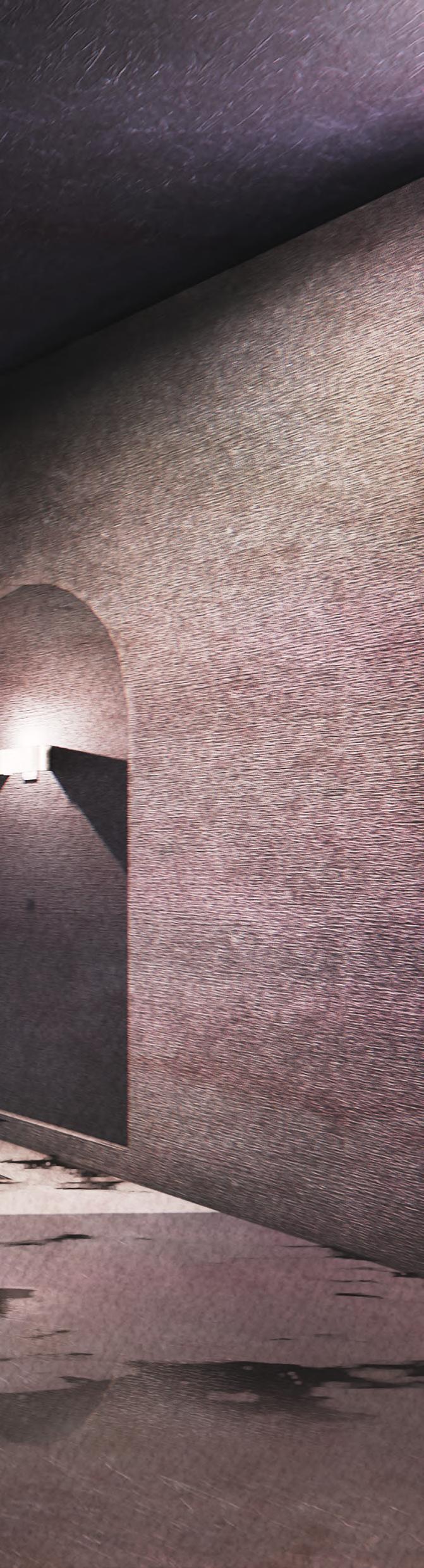
The thermal bath
Is situated underground. The feeling of restoration in the underground level through the playfulness of light and dark. The thermal pool with the spa is the central element of the underground, framing a small waterfall with recreational area.
 3D Modelling and visualizations by: Alexandros Memetzidis
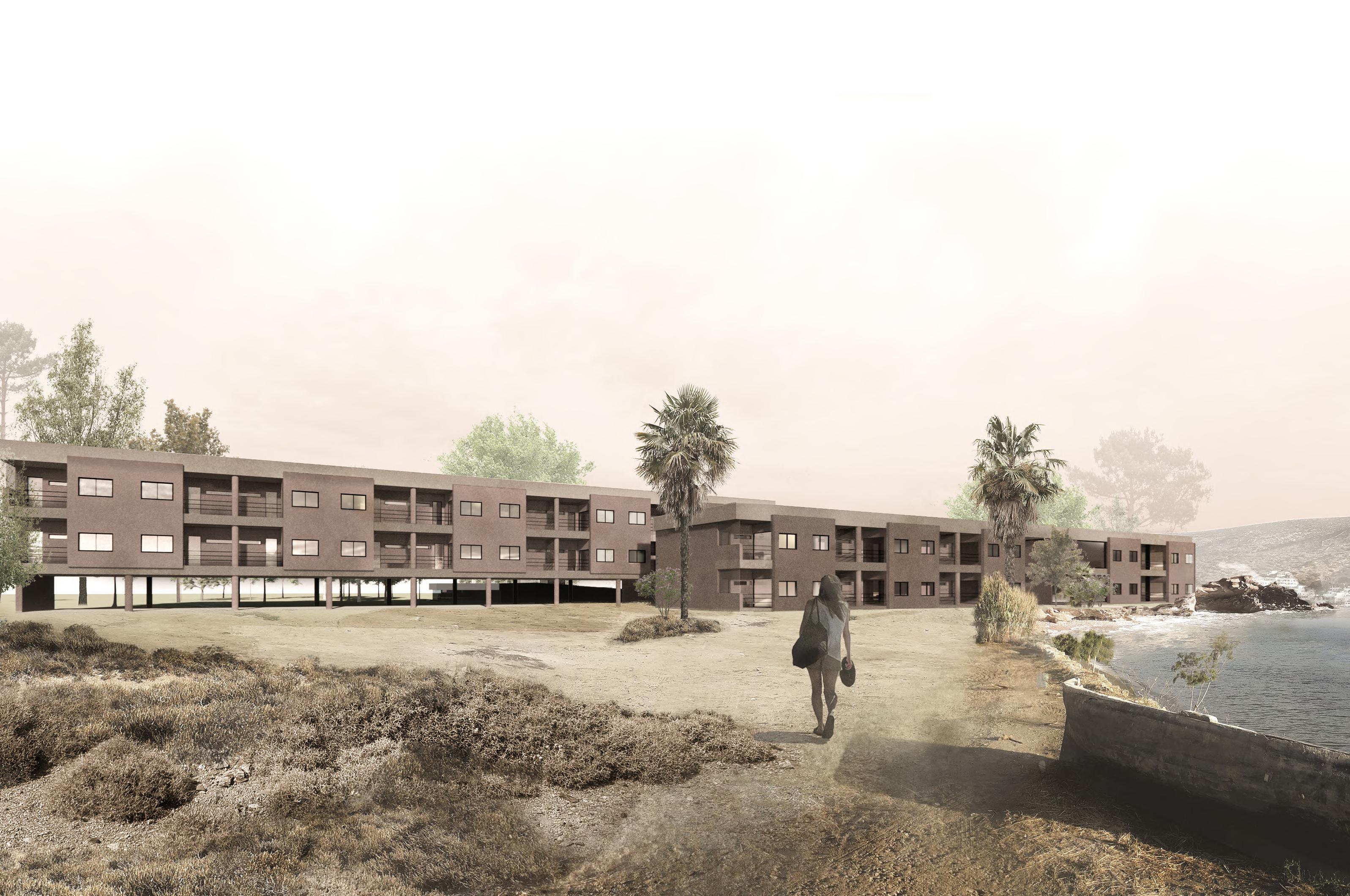
The hotel units
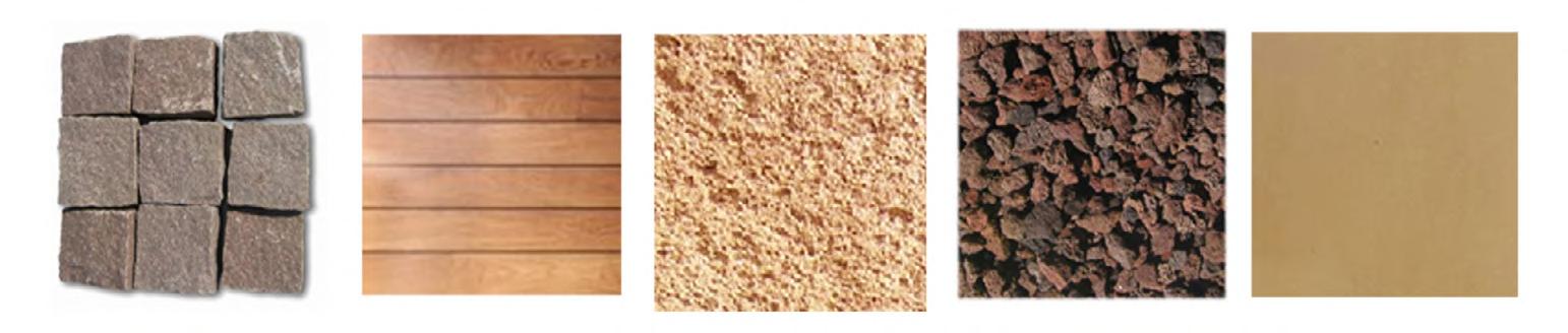
The 3 hotel units develop in front of the sea coast. The pozzolan coating aims in blending the building into the coastal line environment. The rooms are mirrored and connected with a semi transparent wooden material, enhancing the social interaction of the inhabitants.
Kourasanit coating is added in earth colors, to blend in with the surroundings. Under the two lateral units a pilotis is created under the building enancing the visual connection with the sea and allowing walk flows through the building masses. The central unit develops on the ground.

1.77 1.90 0.63 3.10 0.25 1.80 2.50 0.94 1.96 1.54 2.40 2.50 0.25 6.37 6.37 3.15 3.10 0.25 3.10 0.55 2.00 0.60 0.25 6.50 12.75
Pilotis Level A cement mortar binder-80mm External coating 2,5cm Insulation 5cm Fastening grid coating Brick wall 25cm Coating-1cm Level B Paving with pebbles-7cm Sealing protection-1cm Smoothing layer-2cm Waterproofing layers-2cm Slope lightweight concrete -10cm Reinforced concrete slab-20cm Water vapor barrier-1cm Thermal insulation-8cm Polyethylene film-1cm Soil-10cm Sand-10cm Cobblestones-10Χ10cm Reinforced concrete Sand Drainage Reinforced concrete c20 25 Waterproofing layer Pebble stones Geotextile Earth
Room plan Scale: 1/50
Cobble stones Wooden deck Kourasanit Thiraic Pebbles Industrial floor coating
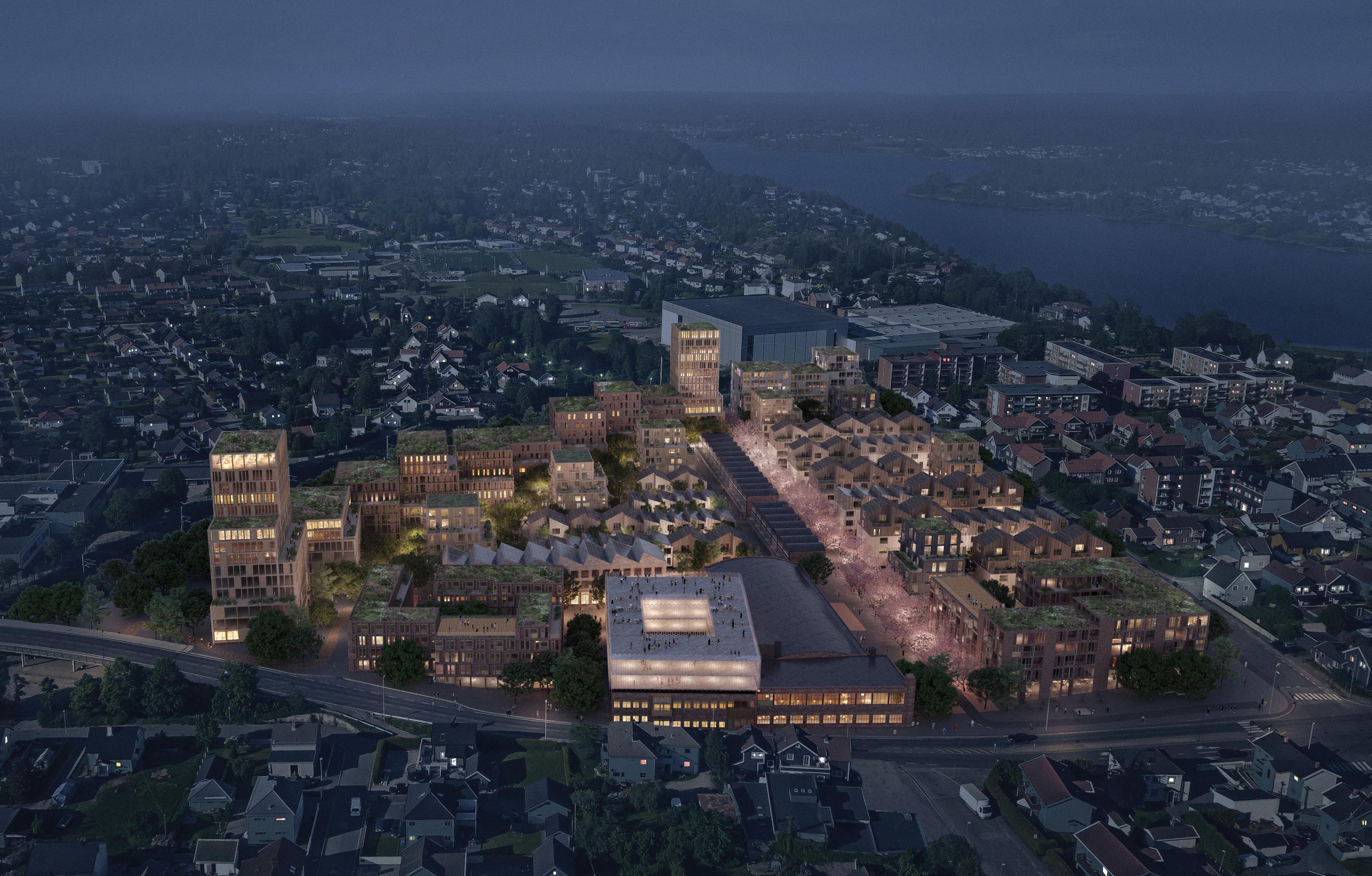
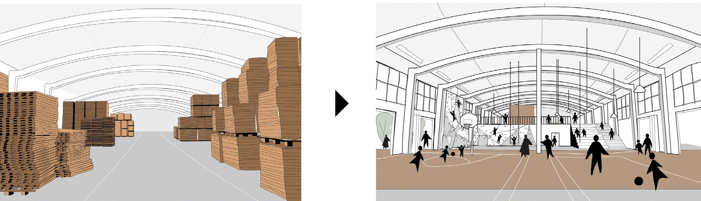
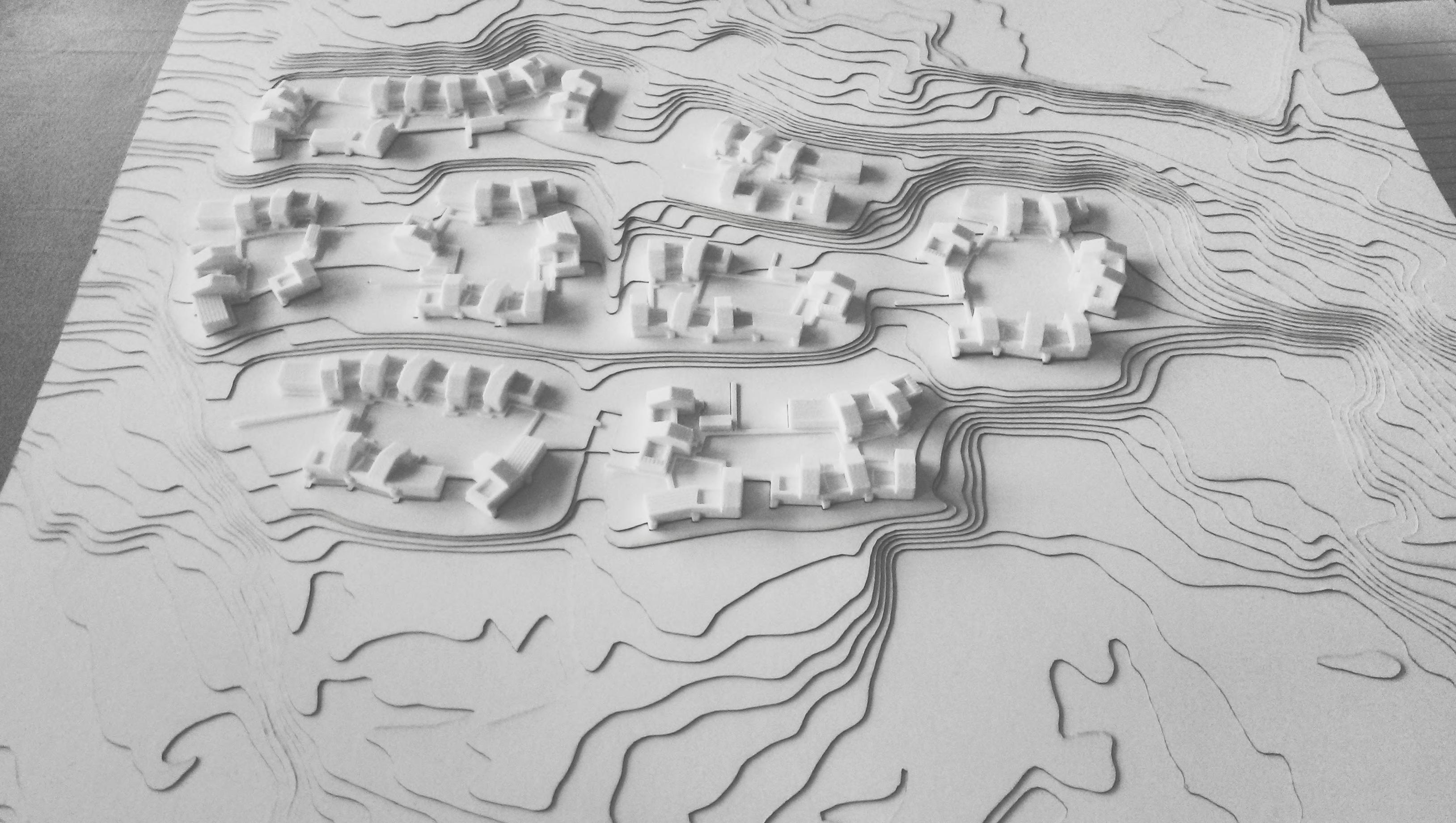
Petersontomten: ‘‘Fra bølgepappfabrikk til grønn bydel’’ Area of Competition: Sarpsborg (Norway)
Bypotensialer - Studieområdet
Petersonbyen is today defined as a clear triangle with a curved edge back towards the railway in the north. The plot is lower than the railway and is defined by a green south-facing landscape embankment that connects the area further along the railway to both the east and under the road towards southwest. To the south, the area is bounded by the access road that is a significant traffic artery with consequent noise challenges. The road also represents an important arrival to Sarpsborg via the Petersontomten area and thus creates good accessibility to the area and the possibility of significant connection. To the east, the area meets of the quiet residential town, with a building scale of 1-2 floors which must be taken into account in development. The plot is located in a valley and is therefore lowered in relation to its surroundings. This can be used for establishment of integrated parking under parts of the buildings, but without making deep parking basements. The city can thus be made partially car-free and create space for life between the houses.
Petersonbyen must be integrated in all respects for an optimal fit into Sarpsborg’s urban, topographical and climatic context. It aims for environmental solutions in every consideration and scale.The overall design of the city is adapted to the local conditions: Building volume and heights are optimized to avoid channeling of the wind. Spaces between buildings are optimized for access to daylight and sun. Traffic noise is kept out of the area.
Overall, the best possible microclimate is sought for optimal comfort in the city rooms all year round. The strategy results in optimization of views and quality values for all construction sites, and contact to green for everyone. Guidelines for the scope and location of the buildings, relate to the directions of the sky, as well as securing housing and urban space qualities, in a way so that they remain operational in a future planning process
KURLAND LANDEPARKEN
FISKEDAMMENE

Spor sklubber
GLENGSHØLEN Det ekrative blå-grønne landskapsrommet kobles opp med nye orbindel er mo både entrum og Pete sonbyen Ankomst fra ve t Primært for biler
XL / Performative city
L /Restorative Landscape
M / Resilient buildings
EVENTPARK
Fra park til park
Uniform or rising heights
A uniform or slightly rising building structure leads the wind over the Petersentomten
A healthy district with varied vegetation
The green urban area creates better well-being and less stress in everyday life
Convertible constructions
Jernbane errenget Forbinder Pete sonbyen, Stasjonen og Stadion Mobilite shub En mobilite shub Petersonsbyen tjener innbyggerne sen rum Skateparken
Den grønne aksen
En ny akse or sykli ter etableres under jernbanen og forbinder byen utenfor og innenfor jernbanen
Færde sga e Sykkelforbindelse til s asjonen
Stadion
Utviklingsplanen or stasjonsområde inkorporeres byens nye g ønne
Buildings and facilities must be able to be converted to others purpose in the future. For example, if we get fewer cars in In the future, parking basements should be able to change purpose.
Sarpsborghallen
Skateparken orbindes til Kulåsparken via Dov egata og Sarpsbo ghallen KULÅSPARKEN
Den flo te byparken orbindes til resten av byens grønne ne verk av gang og sykkelveier
S / Circular Prosess
Reuse of resources
All resources must be able to be reused in the future. We start with the existing plants that are reused in parts, or transformed into new uses.
M
forbindelser STASJONSOMRÅDET Byak en Den viktige aksen o eslås forlenge mot tadion ve t og Sarp fossen øst SARPSFOSSEN
Kartlegging av Sarpborgs potensialer Petersontomten skal spille en aktiv olle Sarpborgs remtidige u vikling, som en g ønn kulturell byutvikling koblet opp på byens mange at raksjoner og bruke e.
Jernbanegata Forbinder Stasjonen, handel og parker
OlavHaraldssonsgate
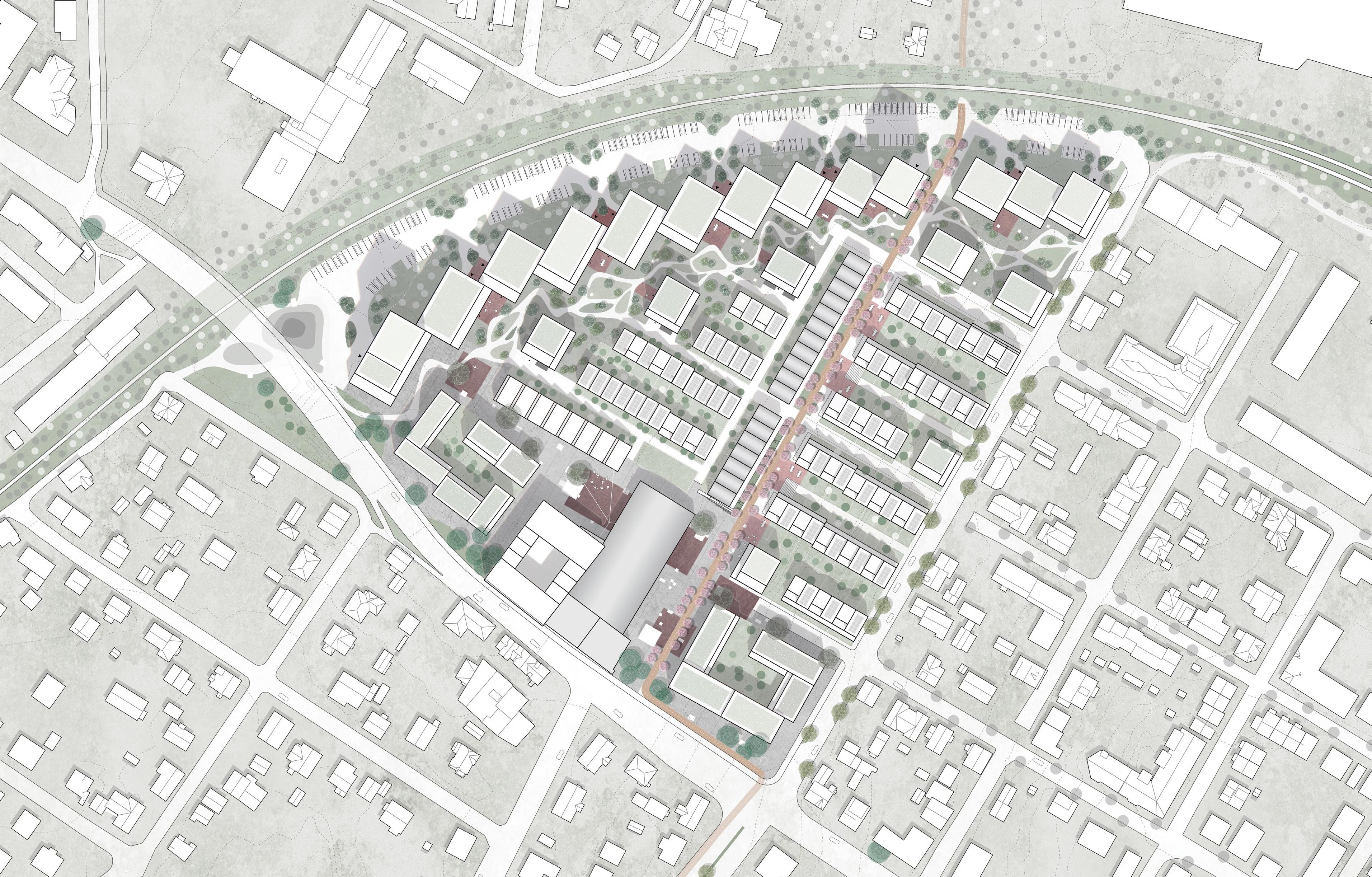
Bjørket ær furut e sti skating parkour Bro-lekeplassen jernbanen Lande barneskole elles terrasse grønne tak bjørke rær furutre bjørket ær sti parkering signalbygg Utsikten ressurskvartalet kvartalsplass vanndyser errasse Punktene KULTURBÅNDET gå dsrom elleskap yoga Scene Lønnet e furutre café Kronen Kulturtorvet markedsplass skøy ebane Kulturfabrikken gårdsrom g essplener bakhager lekega e orhager
Situasjonsplan 1:1000
frukt rær grussti elles errasse elles terrasse felles er asse bjørke rær Utsikten jernbaneterrenget fruk t ær lekega e bakhager er asse orhager e asse Gallerirekkene Rekkehusene elles errasse frukt rær sykkelvei grønne tak lekeplass grussti lindet e nedkjøring P bjørke rær Kirsebærtårnet parkering sti bjørketrær undergang bjørke rær Kirsebærtre bakhager solceller orhager forhager Follogata bakhager utendørs fitness Sykkelskur Lønne re nedkjøring P orhager orhager sykkelcafé/butikk dupleksboliger gå d om ellesskap dagligvarebutik Bykan en linde re furut e forbindelse til stasjonen HansNielsen Haugesgate A A’
båndet, Kulturbåndet grates sonbyen outdoor
The There urban connects
district ring
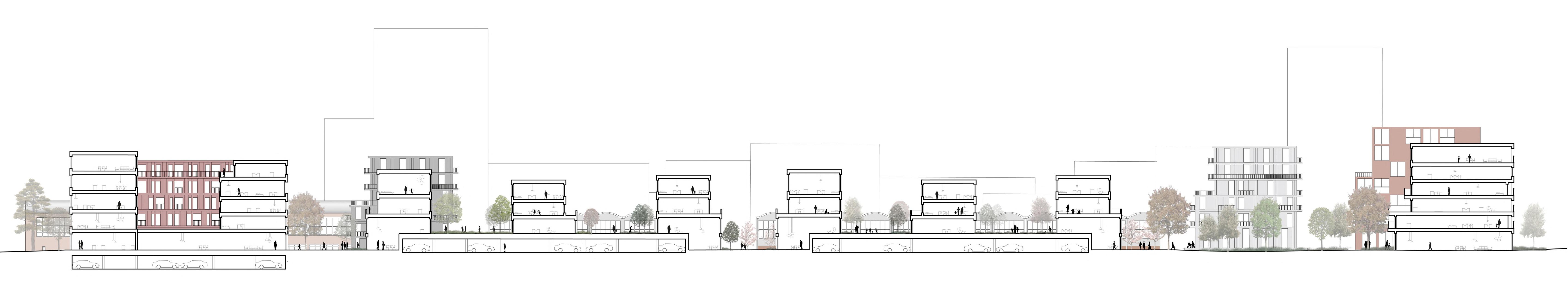
There are plans for a number of communities on different scales where everyone is helping to create a unique and socially anchored urban area for a large width of users. The neighborhoods of the district are bound together by one green city ring that simultaneously connects the area to the rest of Sarpsborg to the north, south, east and west. The district ring remains of three sub-courses, Kulturbåndet, Kirsebærstrøket and Byhavene.
Kulturbåndet, In the southern part of the planning area, culture unfolds into a complex course of urban space that simultaneously integrates the inner urban space in ”Kulturfabrikken” and spans an urban space flow between east and west in the plan.This is where Petersonbyen meets Sarpsborg’s citizens and visitors in urban spaces inside and out adapted solar conditions along edge zones for optimal outdoor spaces and microclimate for stay and activity all year round.
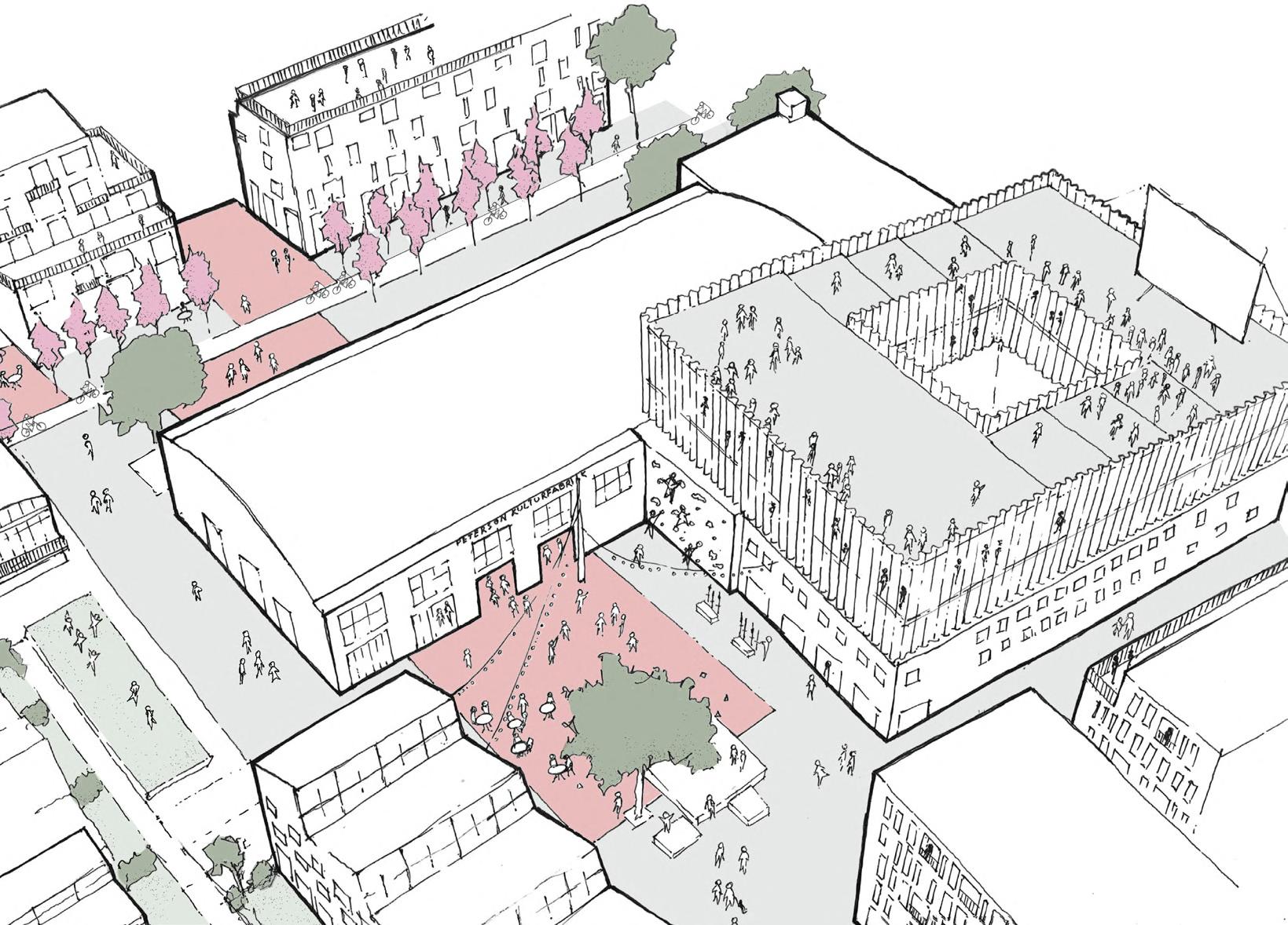
KULTURBÅNDET
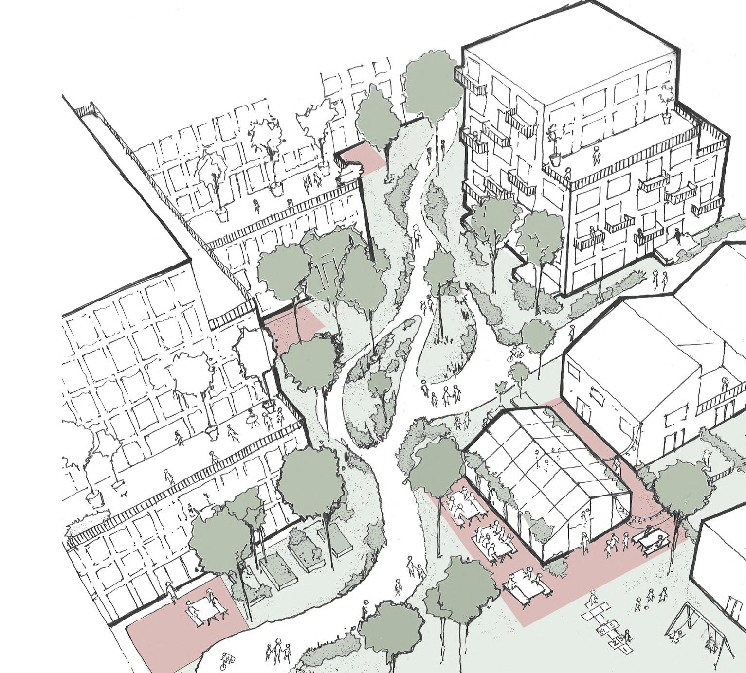
Kulturbåndet can potentially offer a room for market days with stalls and parties, as well as everyday activities such as outdoor fitness, yoga, table tennis and café visits. In the winter the central square can be converted into an ice ring. Here, several of the area’s materials can be reused for different coatings, so that a collage of hard coatings such as brick and concrete is created with elements such as steel beams for play and activity. A number of solitary trees are planted in selected places as space-forming elements.
The remaining open facades, after dismantling of neighboring halls, can be rebuilt with reusable bricks from others buildings on the site, and reuse of other building elements such as windows and the like. Concrete elements can be freshly cut and reused as furniture in the square, together with reuse stepping stones to mark coatings in the room.
Community of interest
grip Meet friends and colleagues Local meeting places with activities, communal dining, bicycle parking, renovation Local communities meet the neighbor The random encounter in the transition and edge zone The great community meet the city Life on the cultural square where the city gathers over a cup of coffee, to the market, smaller sporting events. Hællæ!
Challenges and potentials on the site are gathered in a simple move that continues to the north and southwest, but opens up to the green garden city to the east.
Main
Petersons Grip
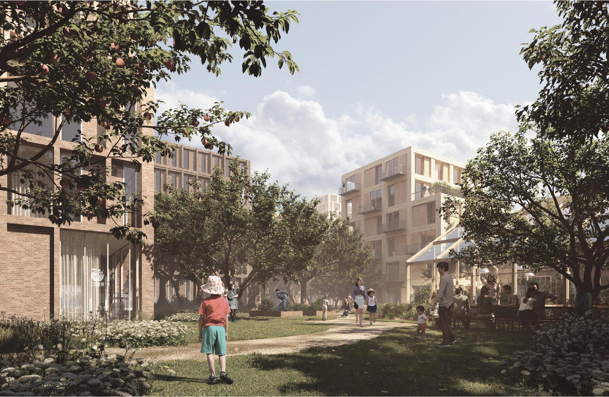
City homes and city gardens
Atelierrekkene Transformasjon av verksteder til 18 unike familieboliger
diagrams
Rekkehusene 31 new terraced houses. Possibly built in a hybrid steel and wood
Typology
Rendered view of Byhavene
Bykant
Kvartaler
Ankomstvei Hevede hager Hevede hager Lokalgate Rekkehus Punkthus
Snitt A
hybrid of Dupleks
52
Byhavene, along the buildings “Utsikten” are established as a series of various common garden rooms with a mixture of living and cultivation opportunities. The city gardens form the lush edge of the area towards the green railway terrain. Think here as far as possible established a soft landscape with a varied planting, play and living zones for the whole area.
An active nightlife in urban spaces and gardens
There is a clear trend among city dwellers to choose the city’s rooms for exercise. The city’s rooms have better access, and are more flexible both geographically and in terms of time than classic sports facilities and in some cases nature itself. The floor plan has inscriptions and signatures for the varied activity opportunities that can be taking place in the city space.
All construction sites have edge zones that belong to the properties and that thus not included in the road area. The edge zones must be planted after a more defined set of rules, and ensures that all buildings get one green buffer zone as a transition between the public and the private space.
Ankomstvei
Biler tillatt på myke trafikanters premisser
Hevede hager
Kirsebærstrøket
Sykkel- og gangstrøk
Lokalgate
Gatetun - biltrafik kun unntaksvis
Lokalgate
Punkthus
gardens
-
Duplex Apartments. Possibly as a concrete construction with wooden facades
Grønn korridor
and photoshopping
Handsketching
Concept development
The multiple layers that surround the central area, ressemble the onion structure.The external layer acts as noise barrier for the heavy infrustructure, moving into the urban floor which function as a promanade and parking, reaching the central park area.
The park functions as a formal mediatior between housing and offices. It creates some privacy boundaries but also brings users in contact throughout different times in the day.
The spiral path creates a continuous walk loop along the whole park. It devides the space into 3 subspaces with different qualities.
1 1 2 2 3 3 1 2 2 3 3
-
Depression-more natural Small elevation Flat surface-urban floor
Lake
water management
Formal meeting spot
Path around the lake
View of the main traffic street
Layering
Spiral path
Center of park
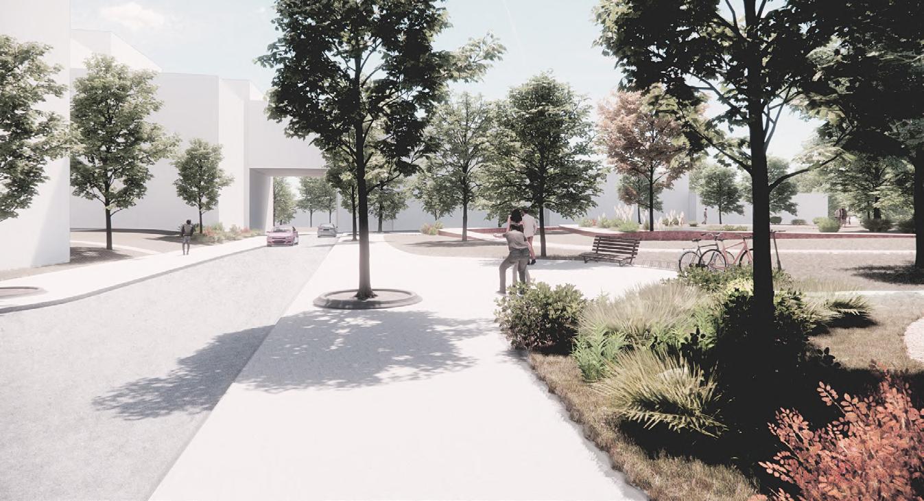
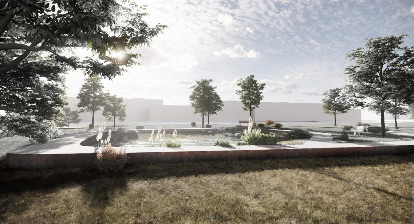
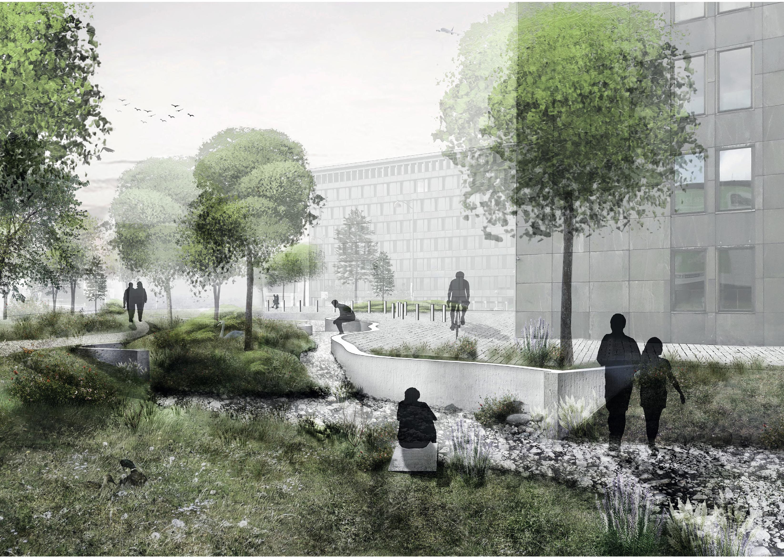
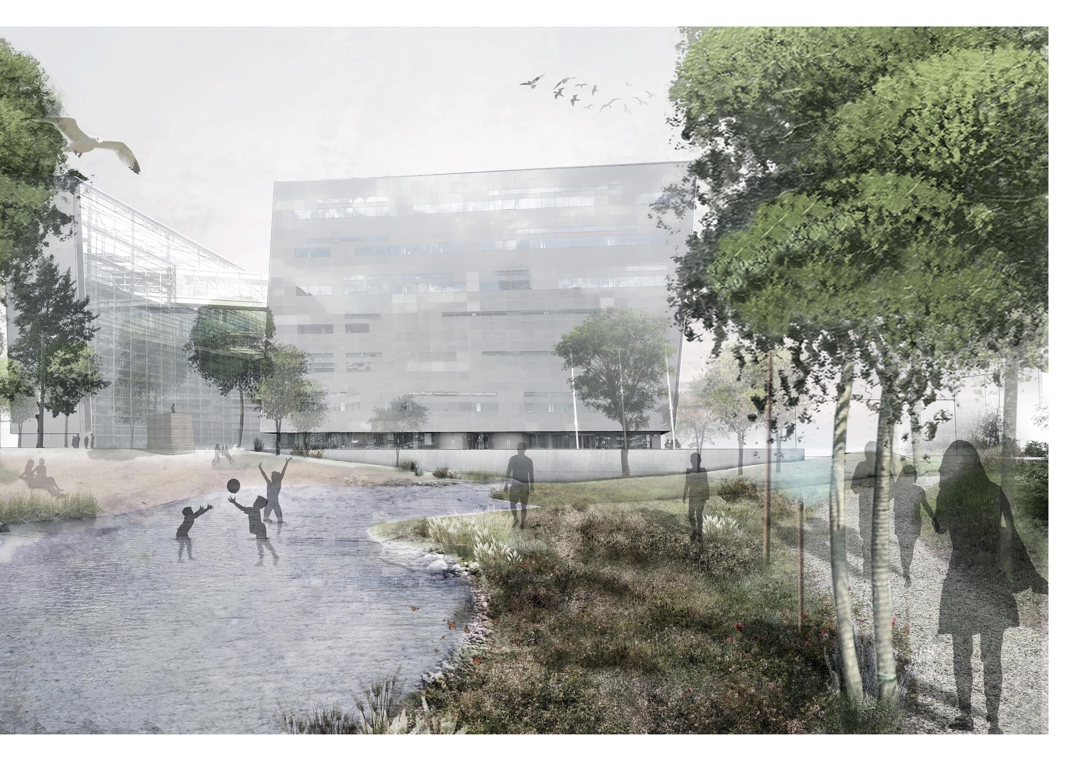
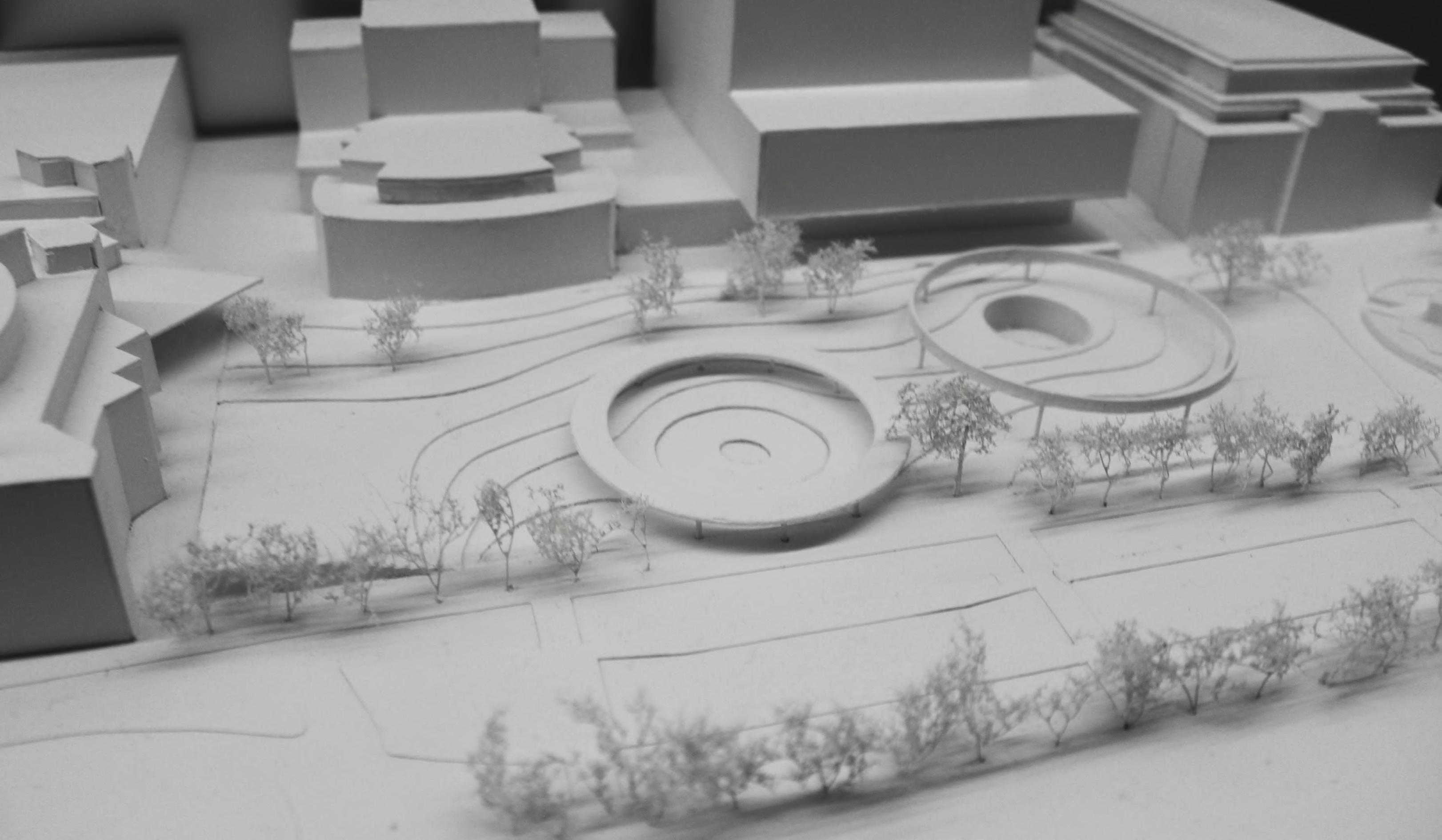
‘’Christians Brygge Coastal Land’’ PROJECT SITE: Slotsholmen
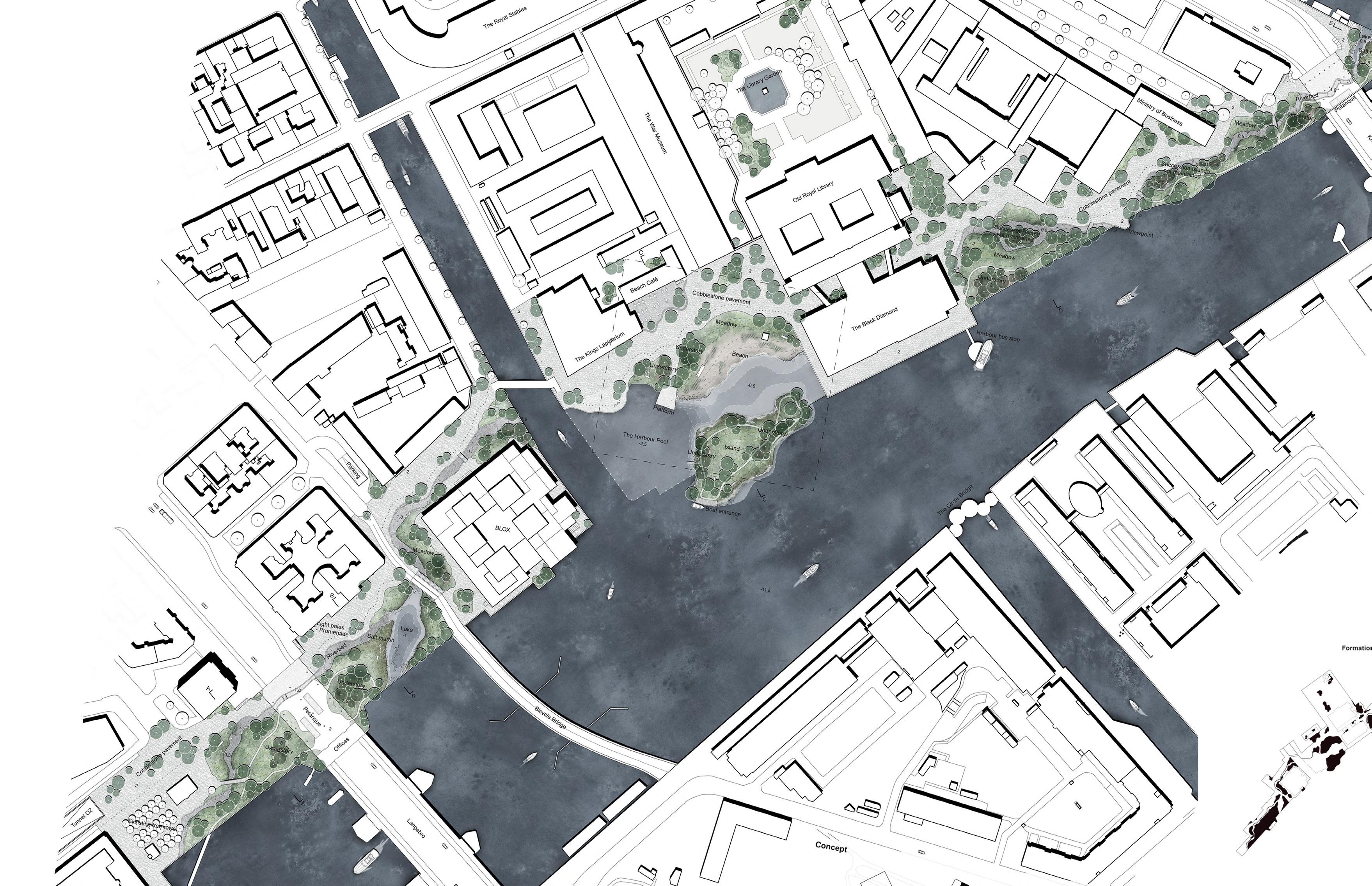
Christians Brygge Coastal Land is a new contemporary harbour landscape, that emphasizes a transition from the historical urban cityscape, through a landscape consisting of diverse Danish coastal nature typologies, ending up at the existing harbour front.
Stretching from Kalvebod Bølge in south, to the tip of Slotsholmen in North, a riverbed is meandering through the landscape creating a redefined city shore. The riverbed works as an anchor, holding on to the historical city center inwards while introducing a landscape consisting of Danish coastal nature outwards.
Coastal nature
The islands, that are emerging on the side of the riverbed closest to the harbour, are formed by the coastal nature typologies you find throughout Denmark. At the new harbour pool, a beach is introduced, as a dune landscape, planted with dunegrasses. Along the two lakes, reeds are appearing. Salt marshes, that are rising from the lakes, become meadows, the higher the terrain is, and groups of trees, with - and without understory, are placed throughout the islands. Within the riverbed, diverse dynamic biotops occur, according to the level of the sea or rainwater. Fragments of the riverbed will remain dry biotops with rocks and gravel.
Christians Brygge Harbour Pool will provide swimming facilities, wherefrom you can enter the water from a raised platform or from the new beach. The adventurous visitors can access the new island by crossing the lowest part of the pool.
The formation of this plazza-harbour bath works on two different levels.
Firstly it will create a public space for people, that will function in a hyperelocal level, for whole Copenhagen, which will stimulate social interaction, and
Secondly it will enrich the biodiversity in the urban nature of the area, providing the conditions for the coastal nature to thrive and create an ‘’artificial’’ natural environment in this urban square.
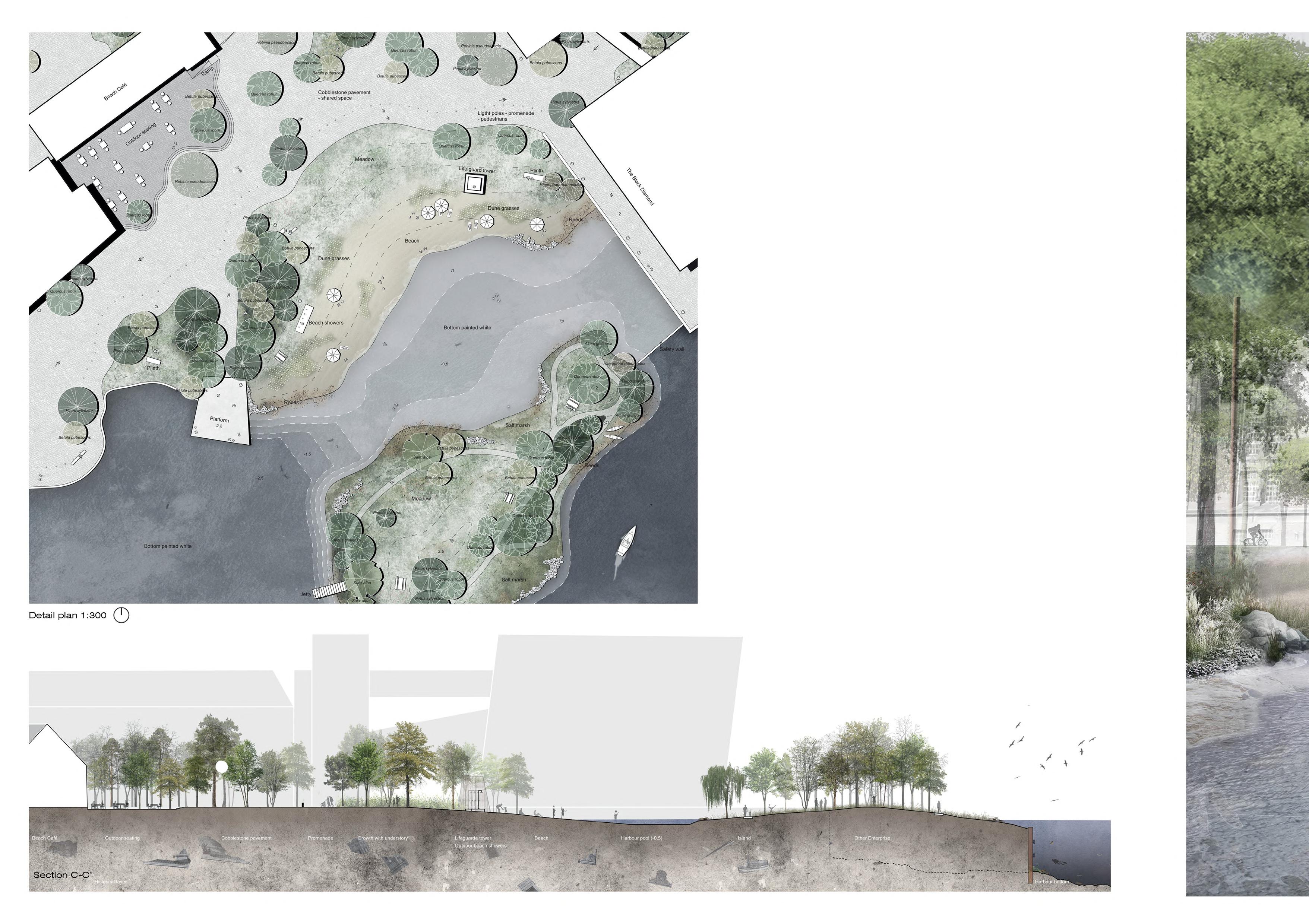
The bottom of the harbour pool is artificial, concrete surface. The area next to the Black Diamond is around half a meter deep so that it can be accessible and safe for children playing into this environment, and also allowing the access to the artificial island in front of the beach. The area in front of the platform is 2.5 meters deep allowing swimming and jumping from the platform for adults. All of this activity and human interaction within this space is happening in front of the beach cafe which resides at the rear area of the whole square creating a visual connection between these two.
The terrain is forming small hills in order to create viewing points which communicate between the natural environment and the built structures along the whole area.
In this way the big unused space between BLOX and Black diomond, as it is today, is fragmented into seperated spaces which are interlocked together and communicating through view and plantation, creating a friendly and more scaled to the human public space.
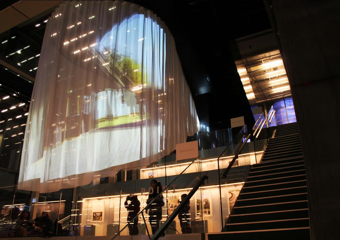
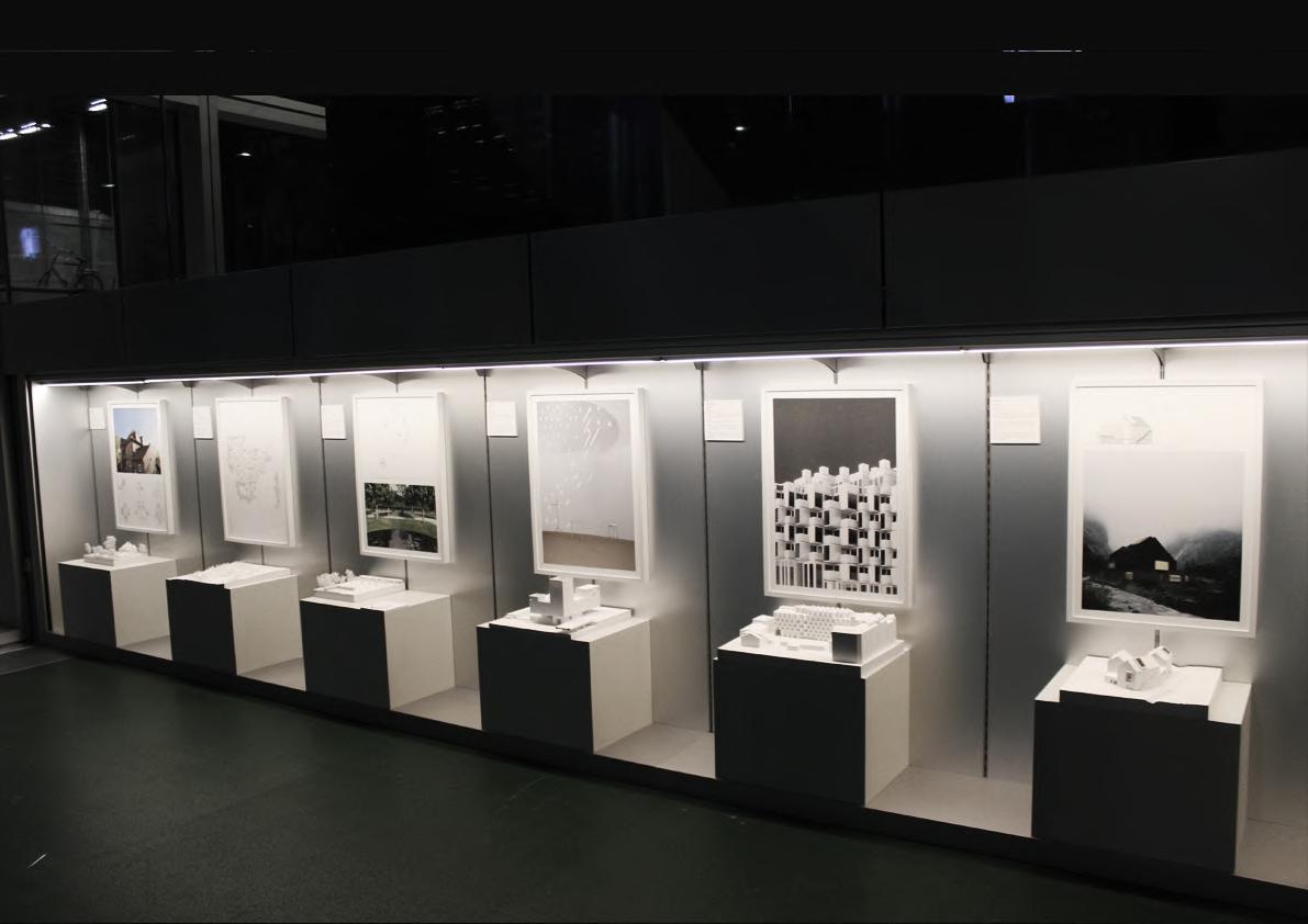
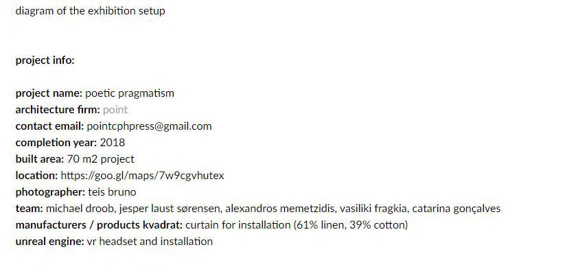
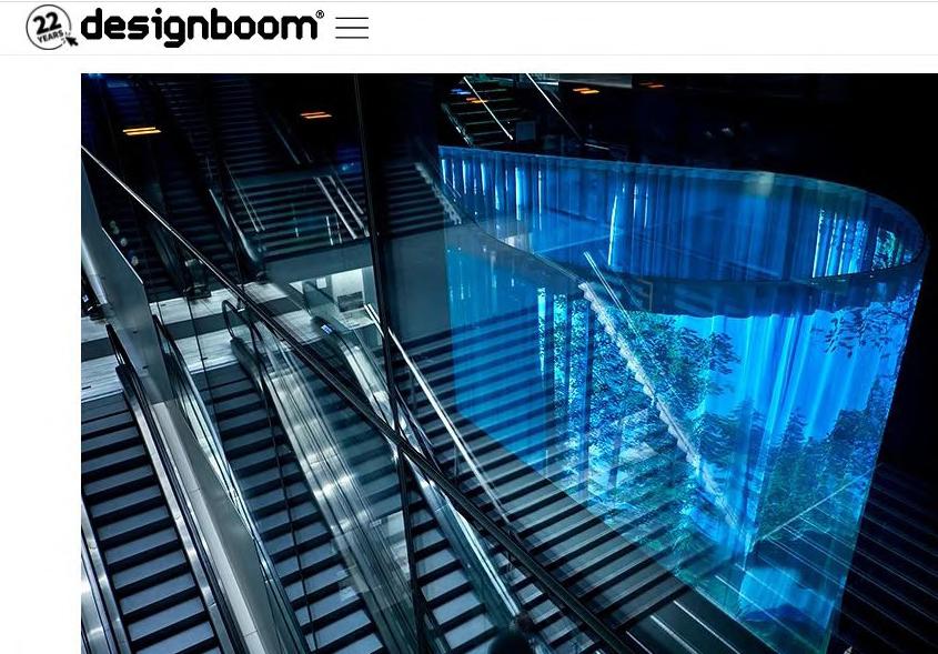
DRYER’S ARCHITECTURE GALLERY MODEL EXHIBITION
Dreyer’s Architecture Gallery is part of the Dreyers Fund’s special focus on newly-established architectural companies and is situated within the BLOX hub.
The fabric and construction is used to visualize some of the office’s projects which are projected through a projector that connects with VR equipment. The models complement each project’s presentation.
3D MODELS AS THE MAIN EXHIBIT
-
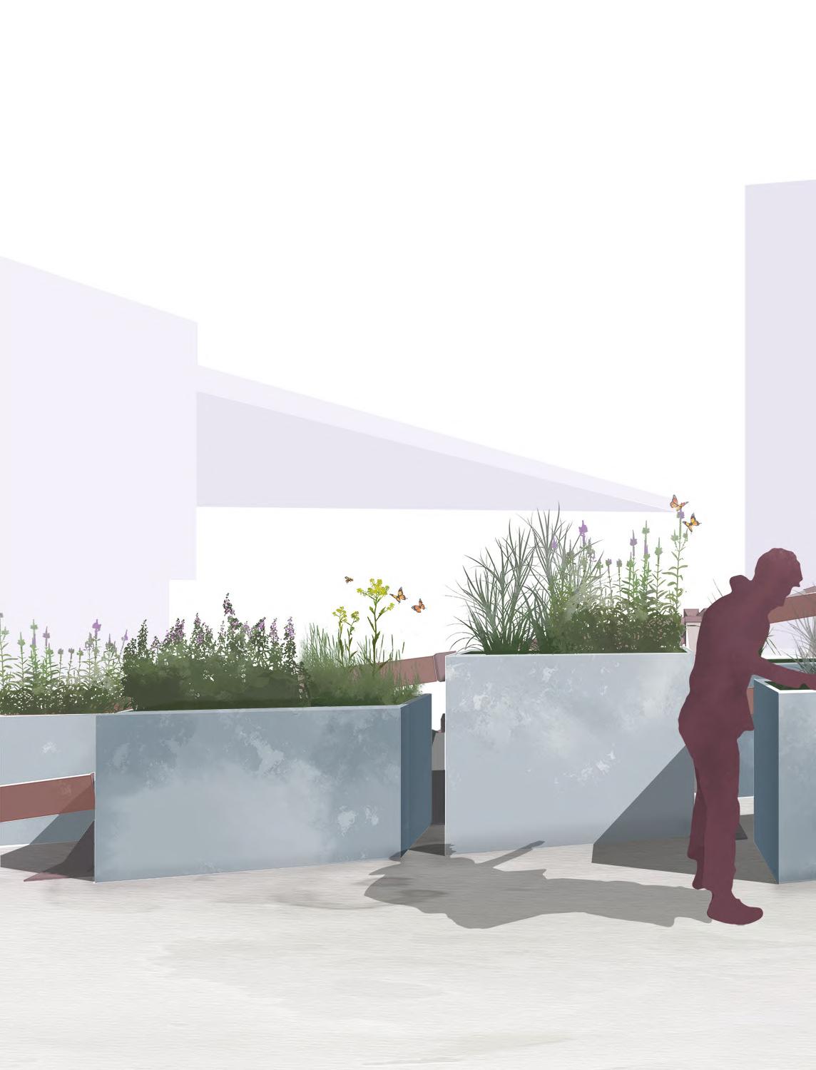
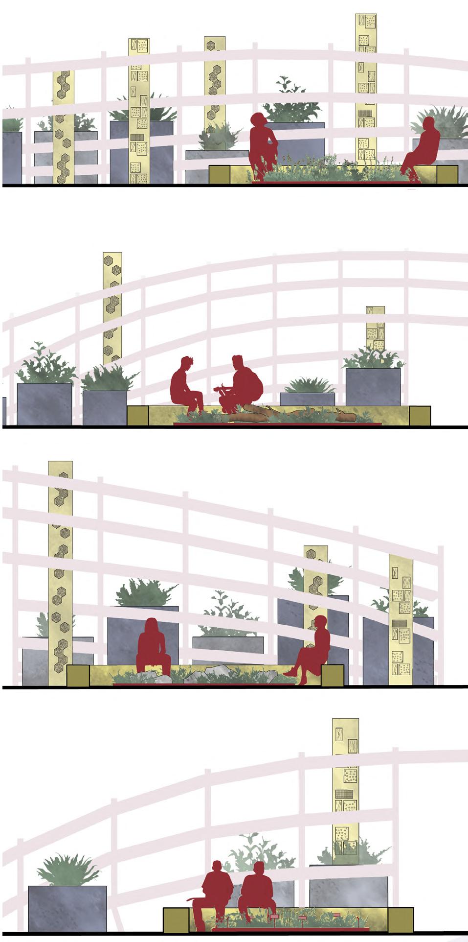
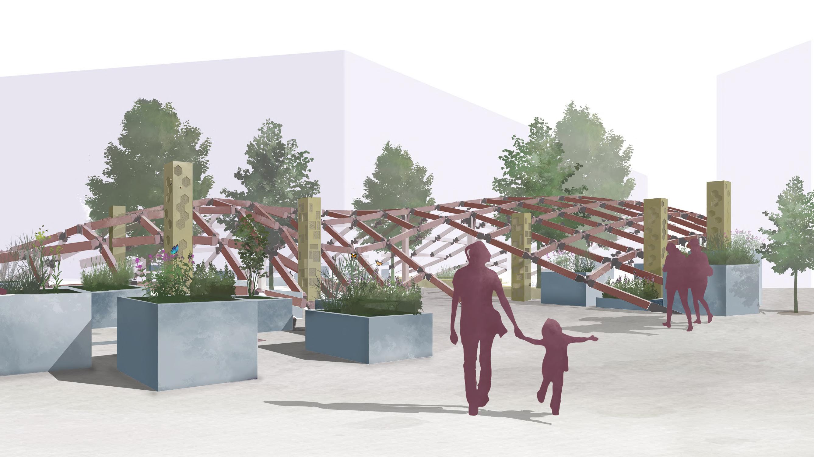
SEEST
Competition, Public space
Sustainable social housing of the future in Kolding
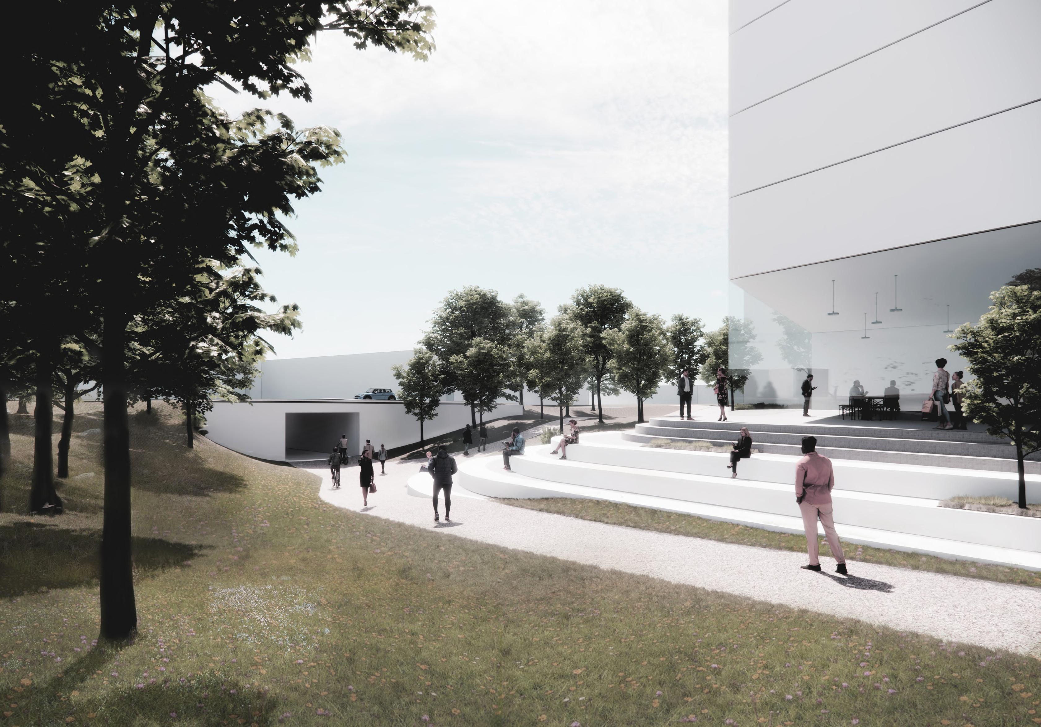
CENTENARY SQUARE-BIRMINGHAM
Competition, Public space
CV & SELECTED PROJECTS
By Alexandros Memetzidis
PORTFOLIO
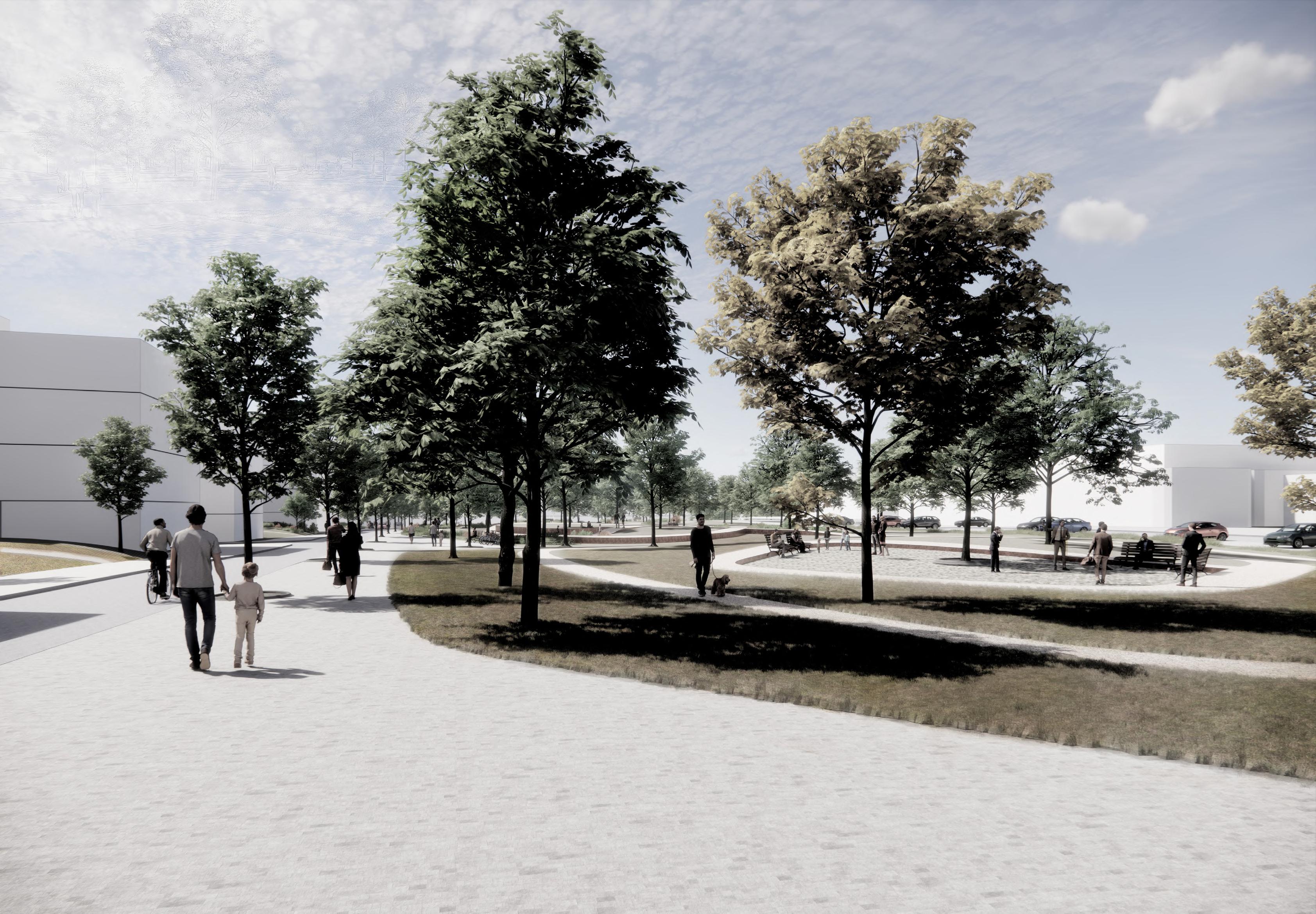 North park entrance