URBAN DESIGN PORTFOLIO
SELECTED WORKS
2023-2024
MARIA NIKOLAOU
Urban designer & Architect +45 52716299 marnikolaou.96@gmail.com
MSc in Urban Design / Urban Architercture
University of Aalborg
Department of Architecture
Aalborg, Denmark
MArch in Architercture
University of Patras
Department of Architecture
Patras, Greece
Erasmus +
Exchange Semester
Universita degli studi di Firenze, Italy
LANGUAGES
EXPERIENCE SKILLS
Freelancer
Architectural & Urban planning projects
3D Printer Operator
Stratasys Copenhagen, Denmark
Sustainable architect intern
Mellow Designs | Copenhagen, Denmark
Research internhsip traineePost conflit reconstruction
University of Aalborg Aalborg, Denmark
Mykolaiv
Master thesis project
(University of Aalborg, Denmark)
Individual work
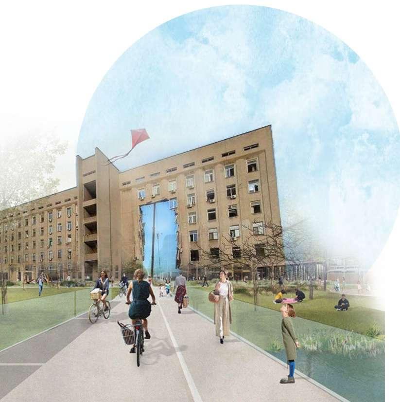
This thesis explores the intersection of urban design, post-conflict reconstruction, building back better, and livability, with a specific focus on the city of Mykolaiv in Ukraine. It investigates innovative approaches to enhance the urban fabric and quality of life in post-conflict Mykolaiv through new neighbourhood and street typologies. By analyzing theoretical frameworks and case studies, the research addresses the challenges and opportunities of rebuilding Mykolaiv after conflict, considering socio-cultural, economic, and environmental factors. Emphasizing post-conflict reconstruction as a guiding principle, the thesis aims to create sustainable, inclusive, and resilient urban development in Mykolaiv. It explores pedestrian-friendly infrastructure, efficient transportation systems, and integration of green spaces to create vibrant, safe, and livable urban environments. The findings contribute to the discourse on post-conflict reconstruction and urban design, offering practical recommendations and innovative solutions for Mykolaiv’s architects, urban planners, and policymakers, promoting the well-being and livability of the city’s communities.
On this scale, the development of new neighbourhoods in the city is examined. The scale is 1:20000, allowing the reader to understand the relationship between the new neighbourhoods and the broader urban fabric. The development of new building typologies, such as high-rise buildings, townhouses, and mixed-use buildings, has transformed the urban landscape creating vibrant and dynamic communities. Additionally, the city has placed a significant emphasis on creating more green spaces, including parks, public gardens, and other green areas. As a result, the city is now more livable, with improved air quality, an increased biodiversity, and more recreational opportunities. By examining this scale, one can gain insight into how urban planners and designers can use innovative building typologies and green infrastructure in order to create more sustainable and attractive urban environments.
At a 1:20000 scale, we examine the development of innovative street designs in the urban network. This map offers a comprehensive view of the city’s integration of new streets into its broader fabric. These new street types, including pedestrian-friendly lanes, bike paths, green corridors, and active storefronts, have transformed the urban landscape, fostering sustainability and livability. They address the growing need to reduce highway congestion, improve air quality, and promote active transportation. Green corridors connect pedestrians and cyclists, enhancing the city’s biodiversity. Active facades along main roads, like retail and commercial spaces, add vibrancy. Bike lanes encourage active transportation, reducing traffic and promoting healthier living
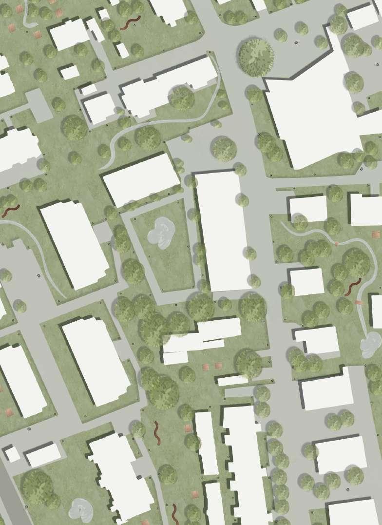

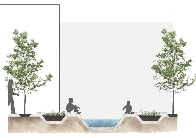
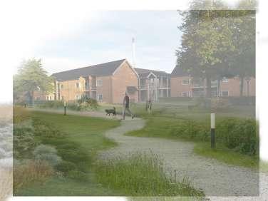
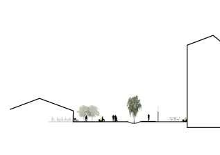
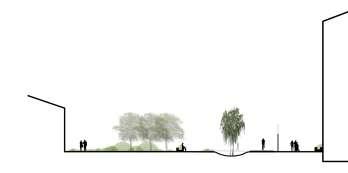
In the new neighborhood project, one section showcases innovative urban planning. It features a serene pocket park as a central gathering spot for residents to relax and enjoy recreational activities. By adding a water element, it not only enhances the aesthetics but also promotes a sense of tranquility. Green spaces are strategically placed throughout the city to encourage social interaction, physical activity, and a connection with nature. Specially designed play areas for children make the neighborhood family-friendly by providing a safe and stimulating environment. This blend of built and natural elements creates a vibrant and livable community.
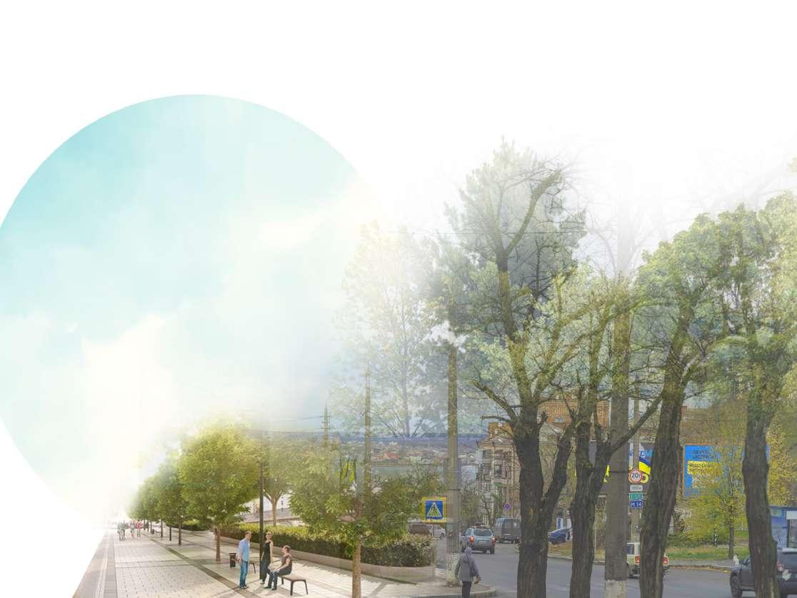
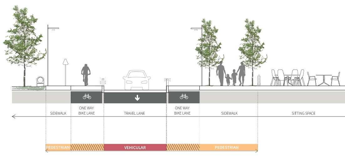
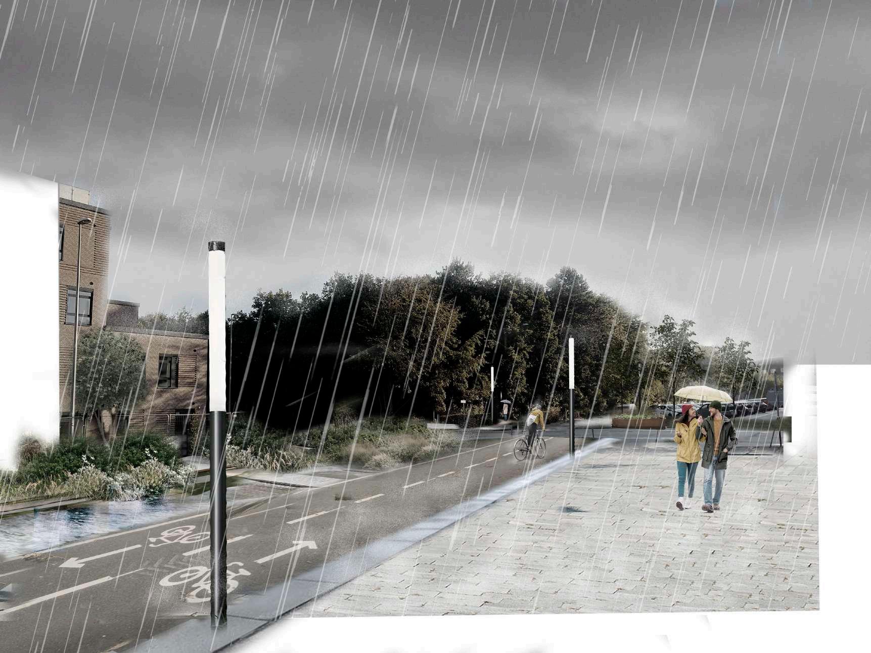
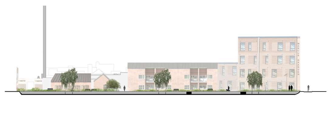
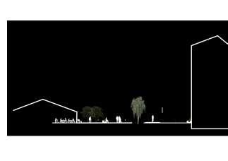
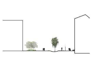
The redesigned street section represents an innovative urban design approach that prioritizes pedestrian and bicycle mobility while accommodating cars. It fosters a safe and welcoming environment for active commuters through sustainable transportation promotion, pedestrian zones, and bike lanes. The incorporation of green areas along the street not only enhances its appearance but also improves air quality and biodiversity in the city. The introduction of active facades like storefronts and outdoor seating enhances street life. With a focus on sustainable transportation, green infrastructure, and dynamic urban experiences, this revitalized street reflects a forward-thinking urban living vision.
Designing urban mobility in Ejby
Project of urban mobility
(University of Aalborg, Denmark)
Group work
analysis of the train station’s evolution
This project involves redesigning the interconnected mobility hub in Ejby, a station town in Fyn, Denmark. Over time, Ejby’s significance as a national transport hub has waned, and its historical functions have diminished. The town center has become fragmented, particularly in the northern part, which is the main focus for renovation.
We conducted citizen involvement activities during the analysis phase to better understand the perspectives of residents, workers, and students in Ejby. The project also presents analyses of the site’s aesthetics, functions, and connections. These analyses emphasize the importance of establishing missing connections and reinterpreting the town center to address future transportation challenges, especially for commuters.
The design proposal honors Ejby’s historical heritage while envisioning a revitalized future. It includes reopening Ejby Station and creating Ejby Bytorv, a new hub with various functions to enhance the town center. The design prioritizes public transportation, restricts car usage, and emphasizes connectivity and accessibility for pedestrians and cyclists in the new town center.
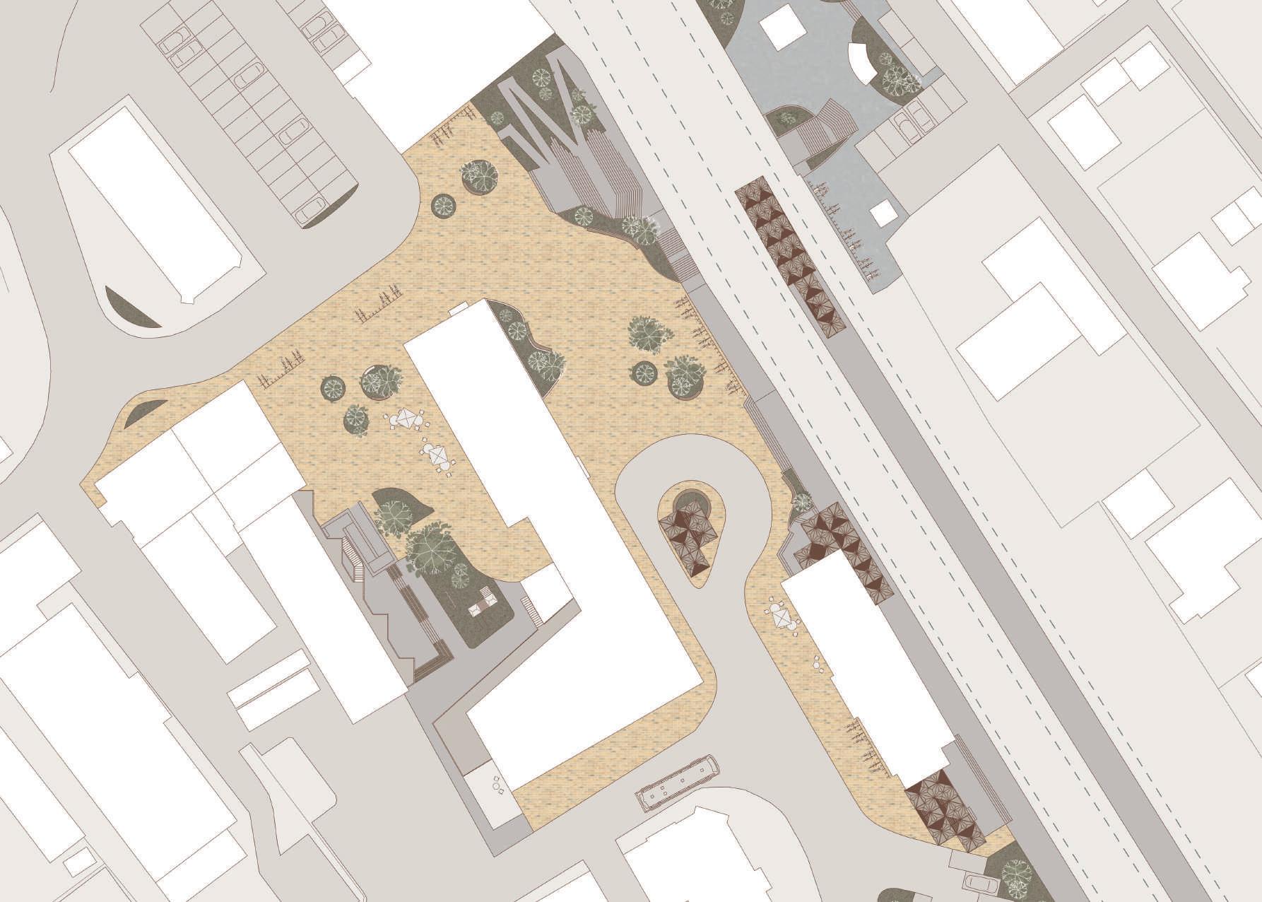
To ensure active facades and the station area as a catalyst for social interactions, the entirety of the ground floor level has been made into public functions. Further has different functions from around the town been moved to the new town centre to concentrate the already established functions
Creating a safe and communal space
The diagram illustrates how various user groups utilize Ejby Station and Ejby Bytorv. These activities serve as examples of what can occur in the area throughout the day. This fosters a sense of ownership and enhances safety.
Activities around the year
The diagram displays various activities that could occur at Ejby Bytorv throughout the year. These are suggestions for using the plaza, but it primarily serves as a space for people to meet, sit, and observe their surroundings
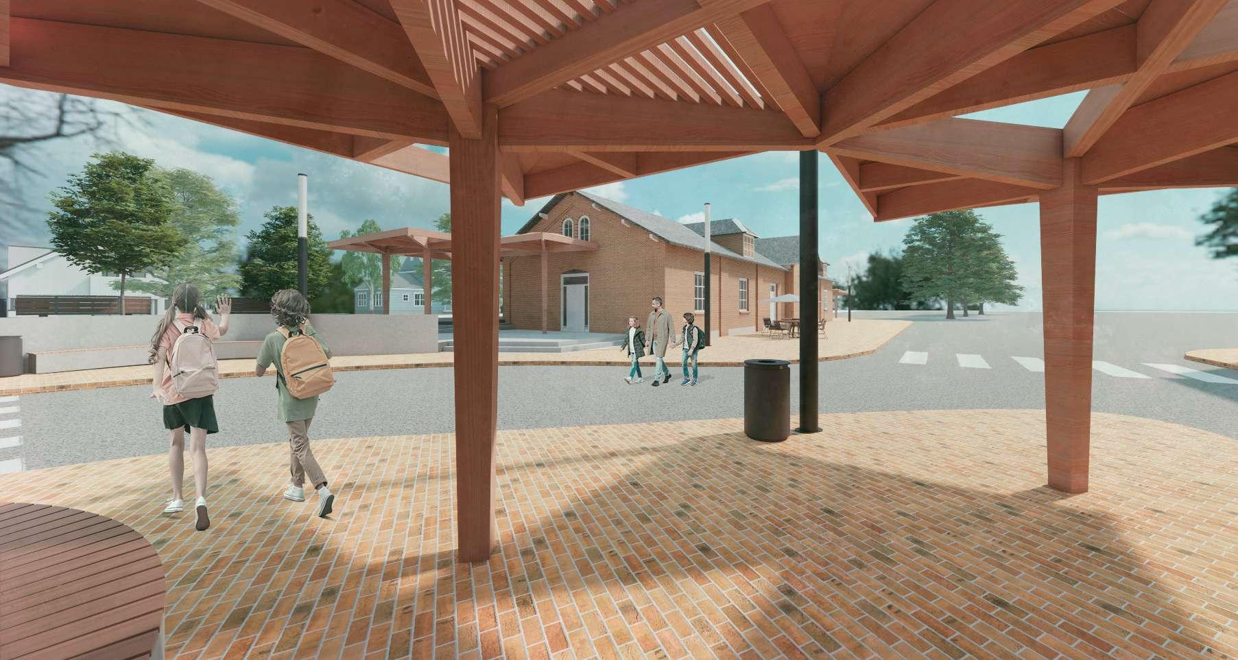
Accessibility for all
A new shelter is a crucial part of the mobility hub’s design. It’s adaptable with two roof options: one with lamella cover to allow sunlight, and another with a solid surface for rain protection. These roofs can be combined as needed, and the shelters feature a single column for easy movement, even on the narrow platform 2.
Urban transformation in Aalborg
(University of Aalborg, Denmark)
Group work
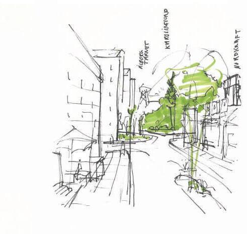
Karolinelund
& Østerbrokvarteret
site analysis and development potential
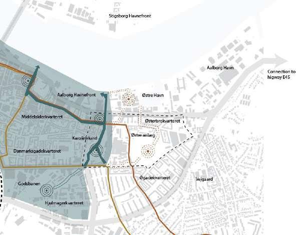
Karolinelund & Østerbrokvarteret is located close to the city centre of Aalborg, just south of the new development at Østre Havn, a new retail centre and residential area at the harbour front. According to Aalborg municipality, the city centre ends at Karolinelund and other plans from the municipality, including the vision for a greener city, does not include e.g. Østre Anlæg. Other notable axes are the new BRT route with a stop by Karolinelund, and the Super Bicycle Lane running just north of Karolinelund continuing through the project site west of Østre Anlæg.
Due to the ending of these axes of importance near Karolinelund, many of the areas surrounding Karolinelund, which are in close connection to the park itself, are being left out. These areas surrounding Østerbrokvarteret is just as important to develop, because of its proximity to the city centre. Therefore, this project is investigating the possibilities of future development in these areas surrounding Østerbro, and the possibility of connecting the important axes in the city to the project area.
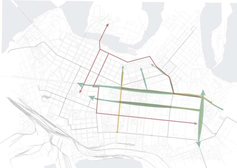
This illustration investigates the strategic, atmospheric, and general possibilities for the entirety of the project site.

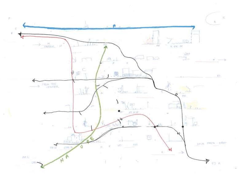

Connect the characteristics of the parks


Make a transition between the existing characteristics on site, and prioritising access for pedestrians and cyclists
Amplify key views and maintain connectivity to the city centre
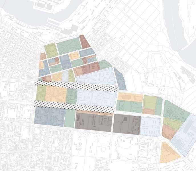
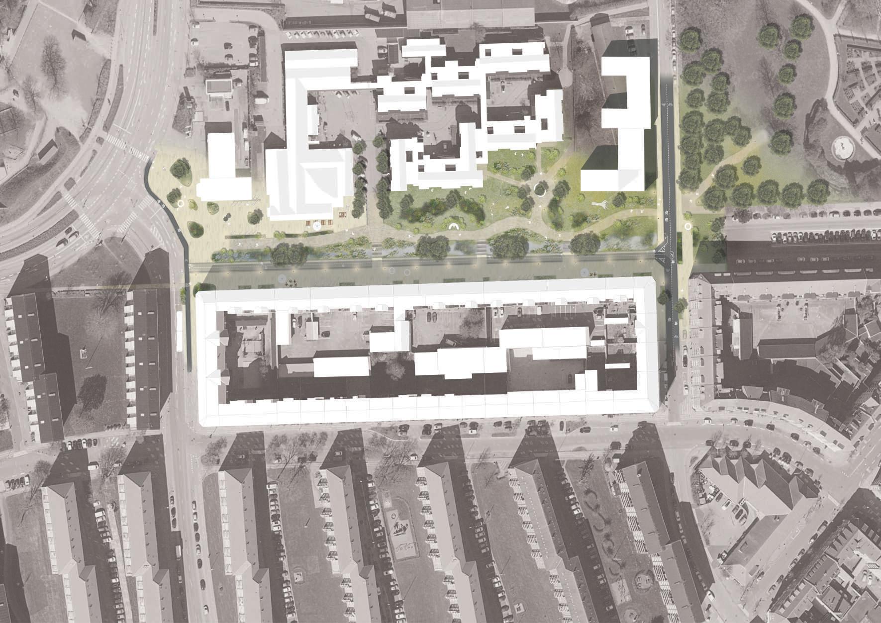
The masterplan shows the overall proposal and gives a visual for how the design for the site might look. It has different activities surrounding the area, with the transition from high buildings and urban transit in the south, to the lower buildings in the north with more greenery. The walking path is designed after the key views ensuring that the views are visible for the pedestrians taking the slow route through the green. The southern part is kept as a transit area for the bicyclist to give a direct connection to the train station and the BRT. The street is also closed from traffic and all parking is removed to facilitate for sustainable modes of transportation and opportunities for active street floors and temporary activities. The far east end of Fyensgade has been kept as is, with some parking remaining for the surrounding residential area. The Super Bicycle Lane going through the area is also prioritized for cyclists and will have no car traffic.
The design further emphasizes the connection to Karolinelund in the west, by implementing various surface materials and a more urban feel. The connection to Østre Anlæg in the east is highlighted through the use of vegetation and a focus on recreational activities. A new entrance has also been added at the south-west end of Østre Anlæg, to ensure access from this end.


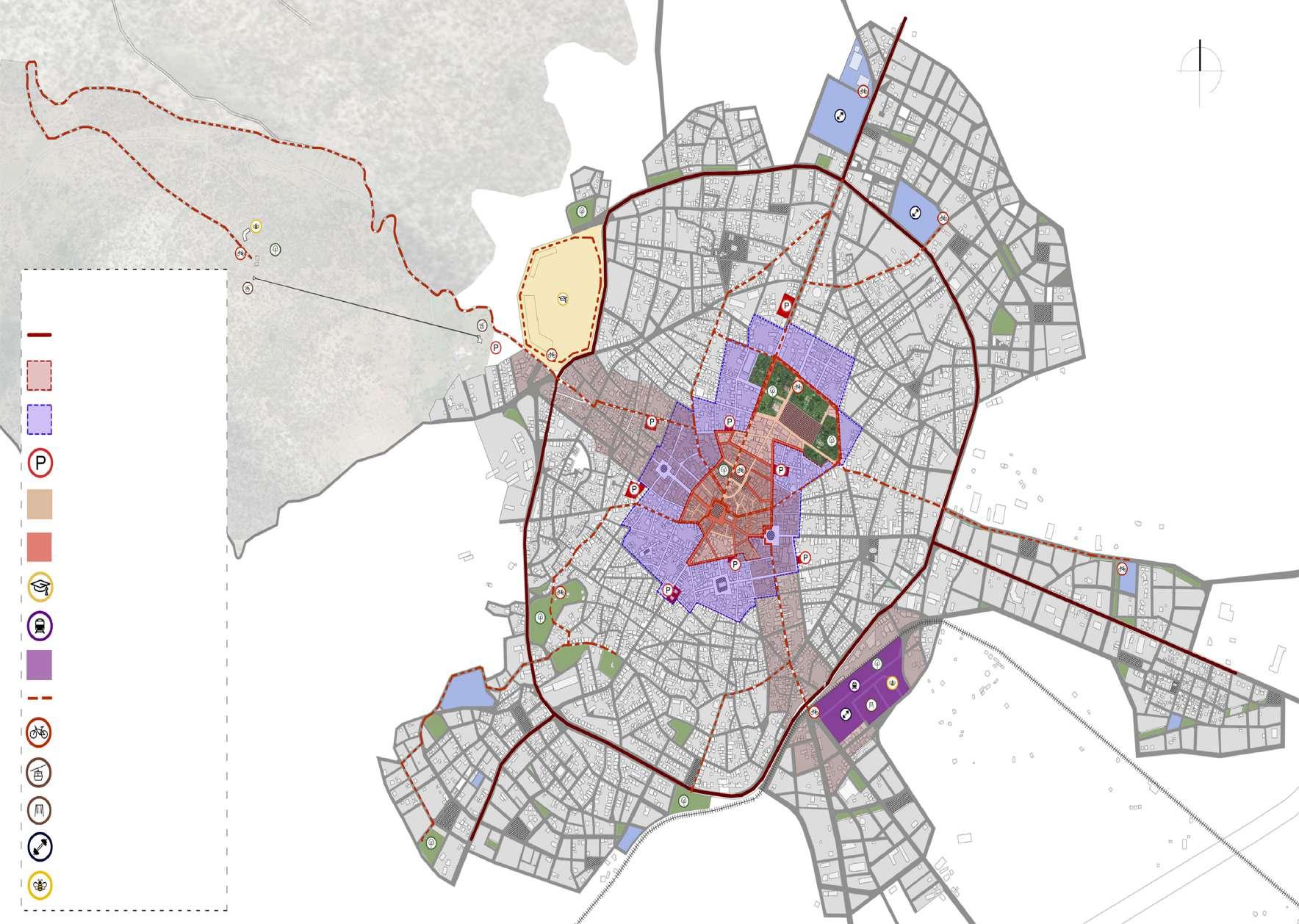
The city of Tripolis in a new
(University of Patras, Greece)

In recent years, urban revitalization has been on the rise in Greece, particularly in major city centers. This trend is driven by the need to modernize old Greek cities to meet evolving citizen needs. Greek cities are gradually changing in appearance and organization.
Our thesis focuses on Tripolis, the capital of Arcadia prefecture and the administrative center of the Peloponnese Region. The historical center of Tripolis is undergoing significant redevelopment that will transform its function and residents’ lifestyles. We aim to create a city in Tripolis that embraces human diversity and a multi-dimensional culture.
Our study examines how urban planning can impact a city positively or negatively, even when applied to a single urban block. Recent years have seen a resurgence of development in central areas, driven by globalization’s effects on production, economy, politics, and culture.
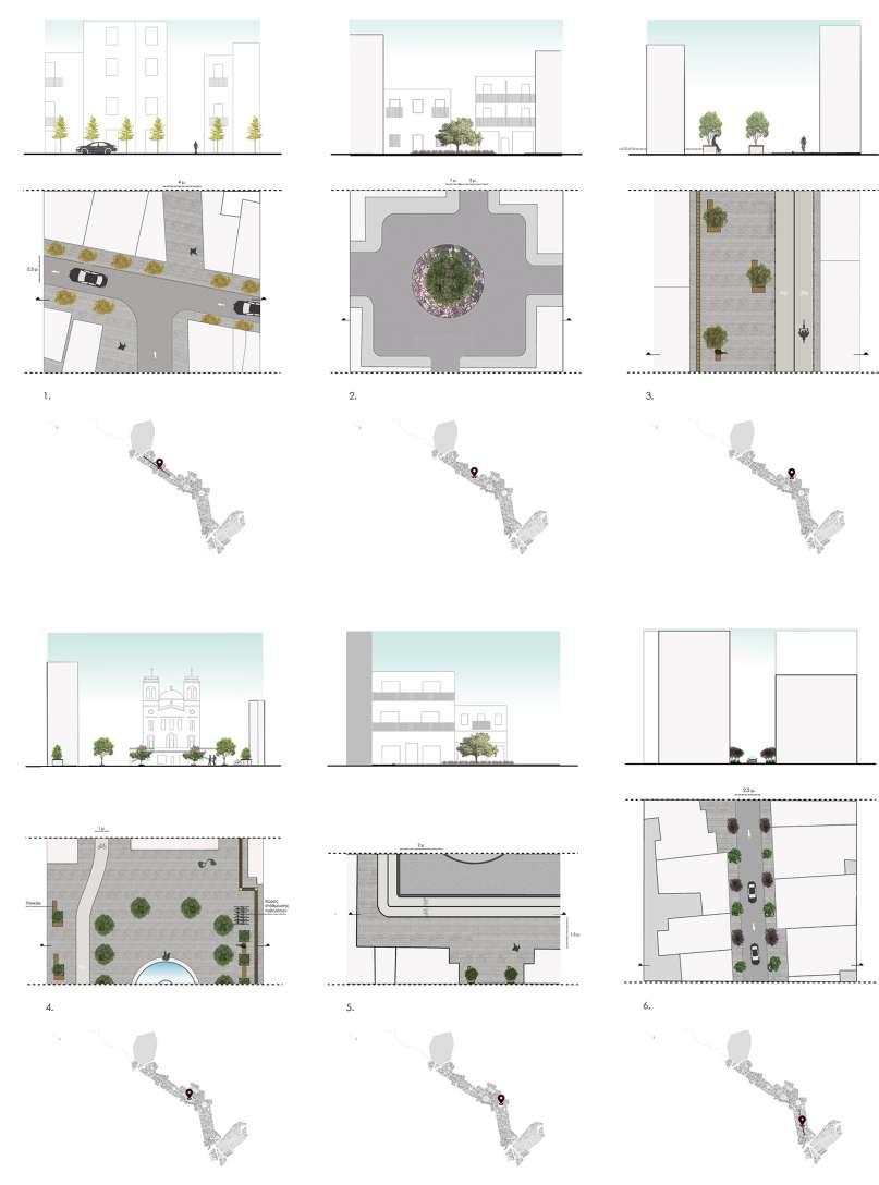
Our research starts with an exploration of Tripolis’ history, land use, and urban planning evolution. We also assess the current city conditions through surveys and on-site observations, identifying problems and potential through a SWOT analysis. We delve into the ongoing redevelopment of the historical center and its anticipated impact on the city and its residents.
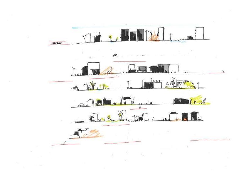
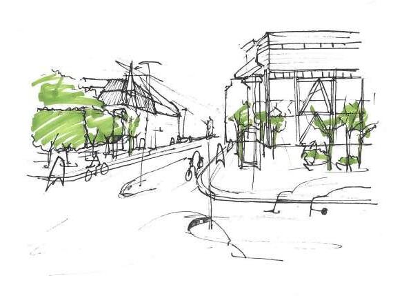
Balancing past and present, we propose interventions for Tripolis. We present our masterplan study, sector-specific proposals, and plant material analysis for the city’s central core, aiming for practical and innovative solutions.
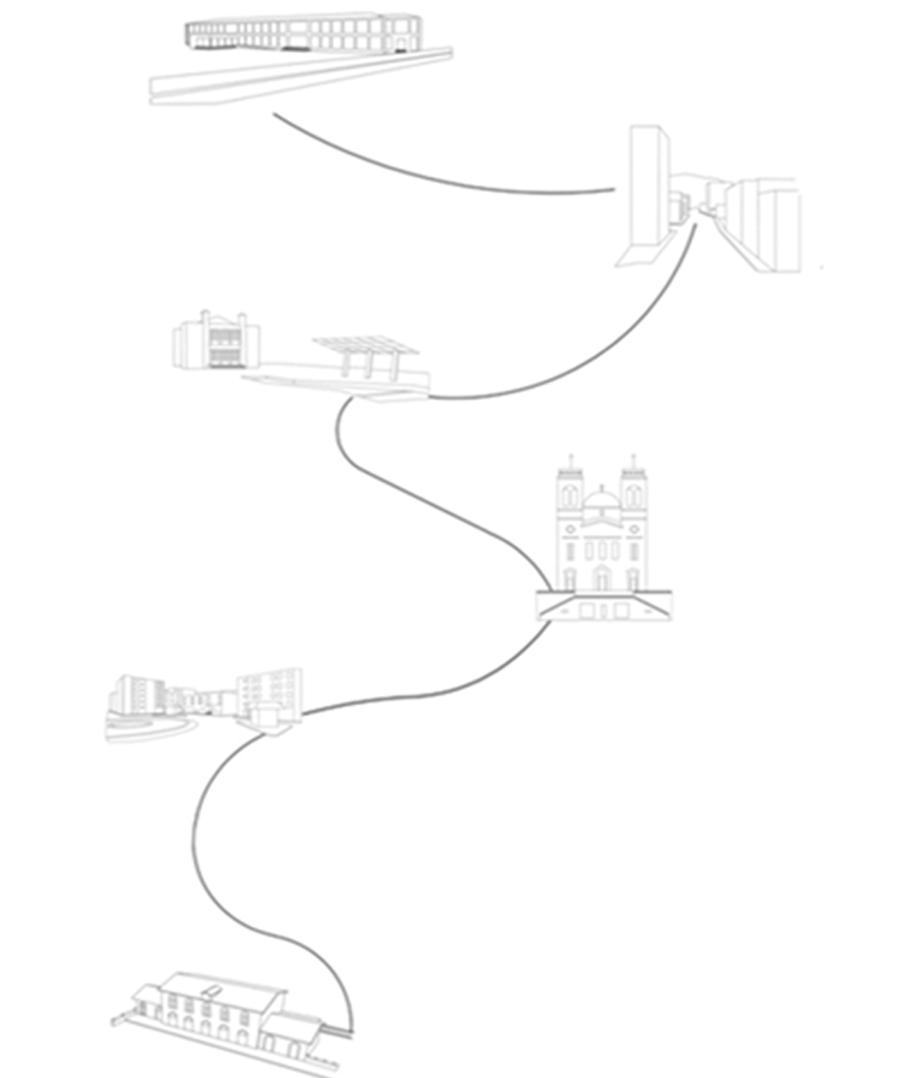
The route from the first point of the intervantion to the last.
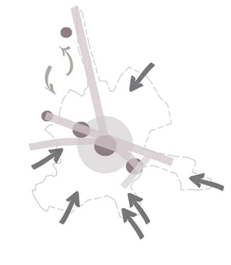
The ideogram of the city, city’s entrances and the basic spots of the intervantions

Thank you !