Planning Application Ref. No: 23/01423/FULEIA
Neighbour Consultation
Representations on behalf of C C Land – 23 April 2024


1 Undershaft, London EC3A 8EE
St Helen’s Square, London EC3

Planning Application Ref. No: 23/01423/FULEIA
Neighbour Consultation
Representations on behalf of C C Land – 23 April 2024
These Representations have been produced with the assistance of the following:

Planning Consultant
JDA Planning Consultancy
Over a 35-year career John Adams has advised developers & funds, landowners, and local authorities on the delivery of complex development projects. In London this has included leading a research project for British Land on the future growth of the City, advising estates, such as the Church Commissioners, Hyde Park Estate, and the Mercers Covent Garden, securing planning permissions for: British Land and Barratt for Aldgate Place, a major mixed use development on the edge of the City; Eden Walk a high density mixed use development in Kingston town centre; leading the team responsible for UCL’s growth in Bloomsbury and East London; securing planning permission for Barratt London on the site of the former Institute for Medical Research in Mill Hill; advising HS2 on alternative forms of redevelopment of Euston Station as an expert witness.
John led teams delivering major redevelopment across Manchester City Centre, Liverpool One, Trinity Leeds, Southgate Bath, Green Park Reading & new communities including the local plan allocation for Welborne, Hampshire and planning permission for Fawley Waterside, New Forest. His management experience including setting up the Drivers Jonas Manchester office, a leading planning & development practice; and, for ten years, managing partner of the Deloitte planning team in London.

Heritage Consultant
Stephen Levrant Heritage Architecture
SLHA is a nationally recognised practice of Conservation Architects and Historic Building Consultants. At SLHA, we conform to the belief that detailed knowledge and understanding of both the historic environment and existing townscape character are fundamental to informing design proposals to ensure they are responsive to local character.
Stephen Levrant is a chartered architect and Principal Architect of SLHA. After graduating from the Architectural Association School of Architecture in 1975, Stephen subsequently attained a further Diploma in Conservation from the Architectural Association in 1979 and has been a member of the Institute of Historic Building Conservation since its inception. Stephen Levrant has been elected a Fellow of the Royal Society of Arts, and of the Association for Studies in the Conservation of Historic Buildings and served on the latter committee for many years.
As a practice, SLHA has carried out innumerable appraisals within various legislative environments throughout the life of the company and have made a particular speciality of addressing the requirements of the National Planning Policy Framework (NPPF) and the National Planning Practice Guidance (PPG) as well its predecessors. We work across the UK in planning/urban design and practical project construction, exclusively within the historic environment.

Landscape Consultant
Kim Wilkie
Each place has its own special character and identity –a continuous conversation between the physical form and the lives lived and shaped within it. As a landscape architect I try to understand the memories and associations embedded in a place and the natural flows of people, land, water and climate.
After 25 years of running his own practice, Kim now works as a strategic and conceptual landscape consultant. He collaborates with architects and landscape architects around the world and combines designing with the muddy practicalities of running a small farm in Hampshire, where he is now based.
Kim studied history at Oxford and landscape architecture at the University of California, Berkeley, before setting up his landscape studio in London in 1989. He continues to teach and lecture in America; writes optimistically about land and place from Hampshire; and meddles in various national committees on landscape and environmental policy in the UK.
Currently Kim is working on a combination of new town extensions, Oxford campuses, private estates, the redesign of Wakehurst Place for the Royal Botanic Garden and a sculptural earthform for the Dulwich Picture Gallery.
Architectural Consultant
de Metz Forbes Knight Architects
dMFK Architects are appointed by C C Land on various projects in and around The Leadenhall Building. We have taken on the role of informal architectural guardians of the building, gently addressing matters that pertain to it’s architectural integrity, designing ongoing upgrades to keep it in step with the market, and assisting C C Land in matters affecting it’s maintenance.
We are an award-winning AJ100 architectural practice having been established for over 20 years, with one of our founding partners, Paul Forbes, having cut his teeth at Richard Rogers Partnership. We regularly work with important 20th Century buildings including The Salters Hall (Sir Basil Spence), Tower 42 (Richard Siefert), 201 Bishopsgate (SOM), Voysey House (CFA Voysey), and many others, and our client list includes The Office Group, British Land, Barratt London, Land Securities, Derwent London, Great Portland Estates, Lazari, WRE, The Royal Opera House, and Tate Britain.
In the case of The Leadenhall Building, we have been asked to assist in preparing architectural information to support their Representations regarding the 2023 planning application for 1 Undershaft, in particular the effect on the public realm which serves both buildings, and the wider city.

Planning Legal
Taylor Wessing
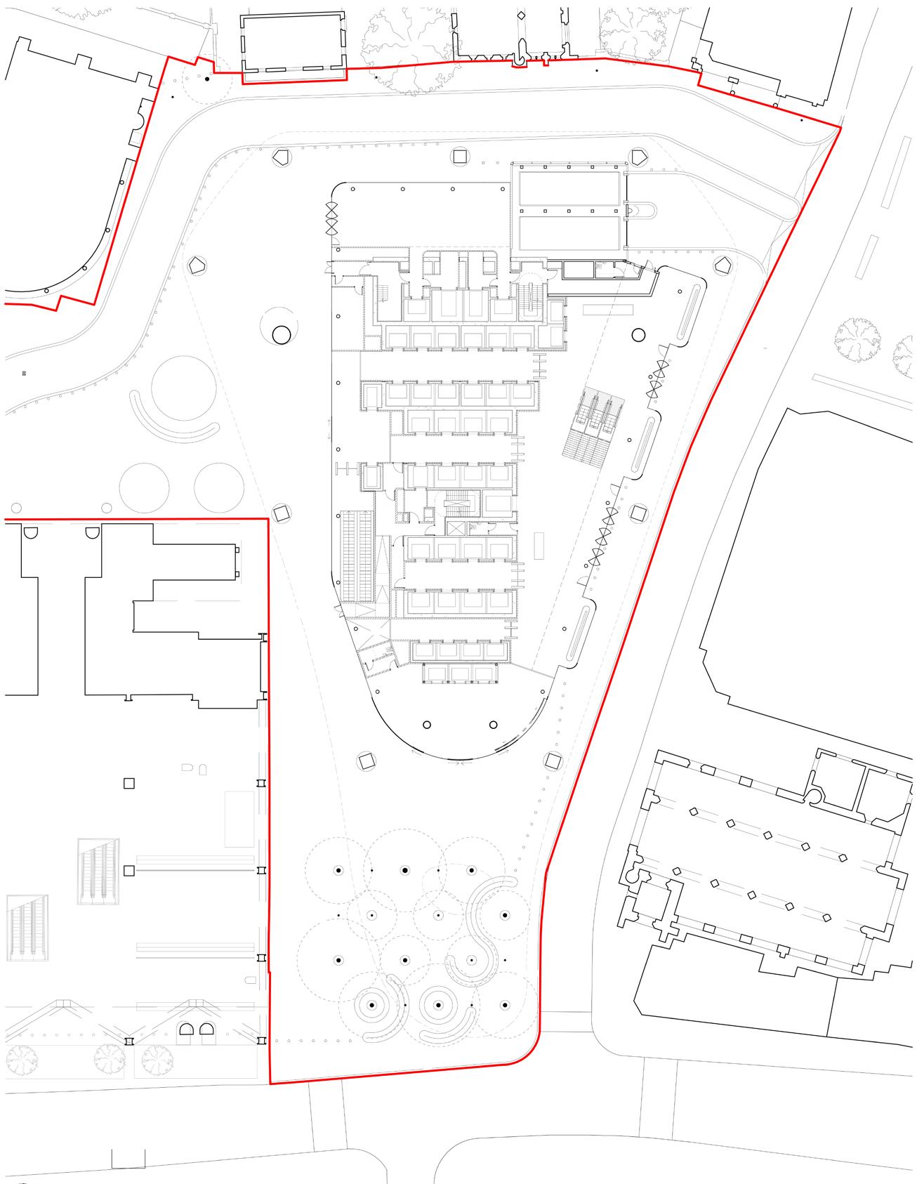


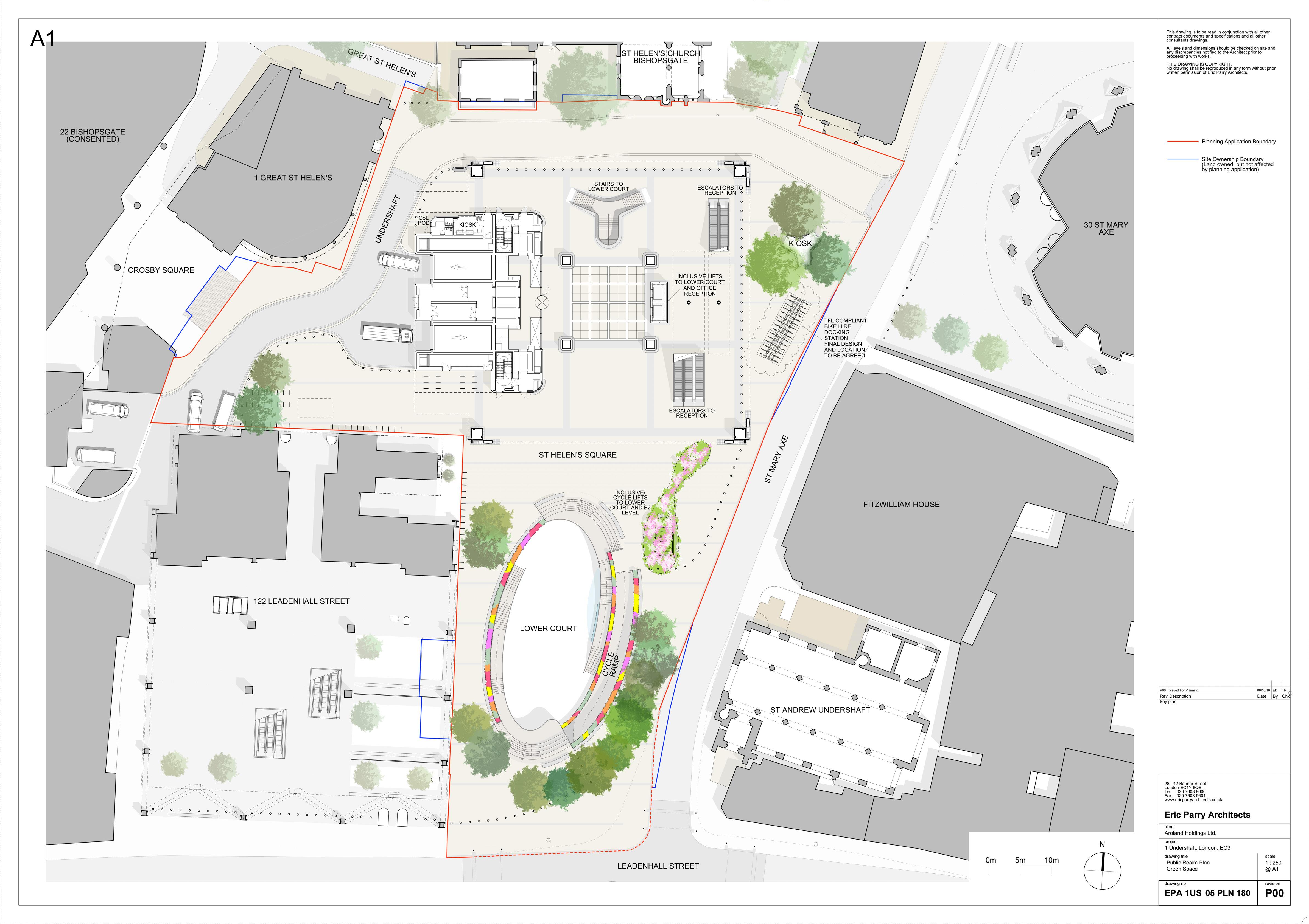
Total public realm: 4,505 m2
St Helen’s Square public realm: 2,433 m2 of which:
View of sky: 2,388 m2
Sky blocked by canopy / undercroft: 45 m2


St Helen’s Square public realm: 2,438 m2 (+5) (+0.2%) of which: Total public realm: 5,361 m2 (+856) (+19.0%)
View of sky: 2,438 m2 (+50) (+2.1%)


Total public realm: 3,770 m2 (–735) (–16.3%)
St Helen’s Square public realm: 1,723 m2 (–710) (–29.2%) of which:
View of sky: 723 m2 (–1,665) (–69.7%)
View of sky through glass canopy: 40 m2
Sky blocked by canopy / undercroft: 960 m2
Proposed internal footprint: 721 m2 (exc. from public realm) Proposed internal footprint: 25 m2 (exc. from public realm)
As owner of the neighbouring Leadenhall Building and active stakeholder in the City of London, C C Land have provided commentary on the 2023 redevelopment plans for 1 Undershaft as part of the statutory post submission consultation process.
We recognise the significance of the 1 Undershaft site in the City Cluster and the role this site needs to play in the future of the City of London.
We understand the acute importance of getting plans for the redevelopment of the 1 Undershaft site absolutely right.
C C Land fully support the existing 2019 planning consent for 1 Undershaft.
However we believe the 2023 redevelopment plans for 1 Undershaft are materially compromised on several matters and should not progress as currently submitted:
a. Substantive Loss of Existing Street Level Public Open Space
– The need to preserve and enhance the limited supply of public realm in the City of London is widely agreed and un-opposed.
– The existing area of St Helen’s Square is 2,433 m2. It is all open to the sky and elements. A substantial 29.6% (721 m2) of that area will be lost because of the increased ground level footprint.
– This loss is the equivalent of approximately 7% of publicly accessible open space in the eastern cluster. The eastern cluster already has, by far, the lowest proportion of open space in The City, and there is a recognised need for more open space.
– The development proposal with its over-hanging structure and protruding tongue will leave just 29.7% (723 m2) as open space open to the sky. Most of the space will be covered.
– Viewing platforms and access controlled areas are an acceptable addition, but not an equivalent replacement for street level public open space.
– The proposals will adversely impact workers, residents and visitors ability to access and enjoy “impromptu” amenity in the City Cluster
b. Detrimental Impact on Existing Public Amenity
– The emphasis on creating a park and public offer in the sky will draw pedestrian activity and visitors away from street level, reducing its vitality and viability at a time when bringing as much activity as possible into the streets and spaces of the City is crucial.
– The proposals lower the quality of the environment at street level and demote St Helen’s Square from the largest public open space in the City Cluster to a secondary, covered and unwelcoming transient area.
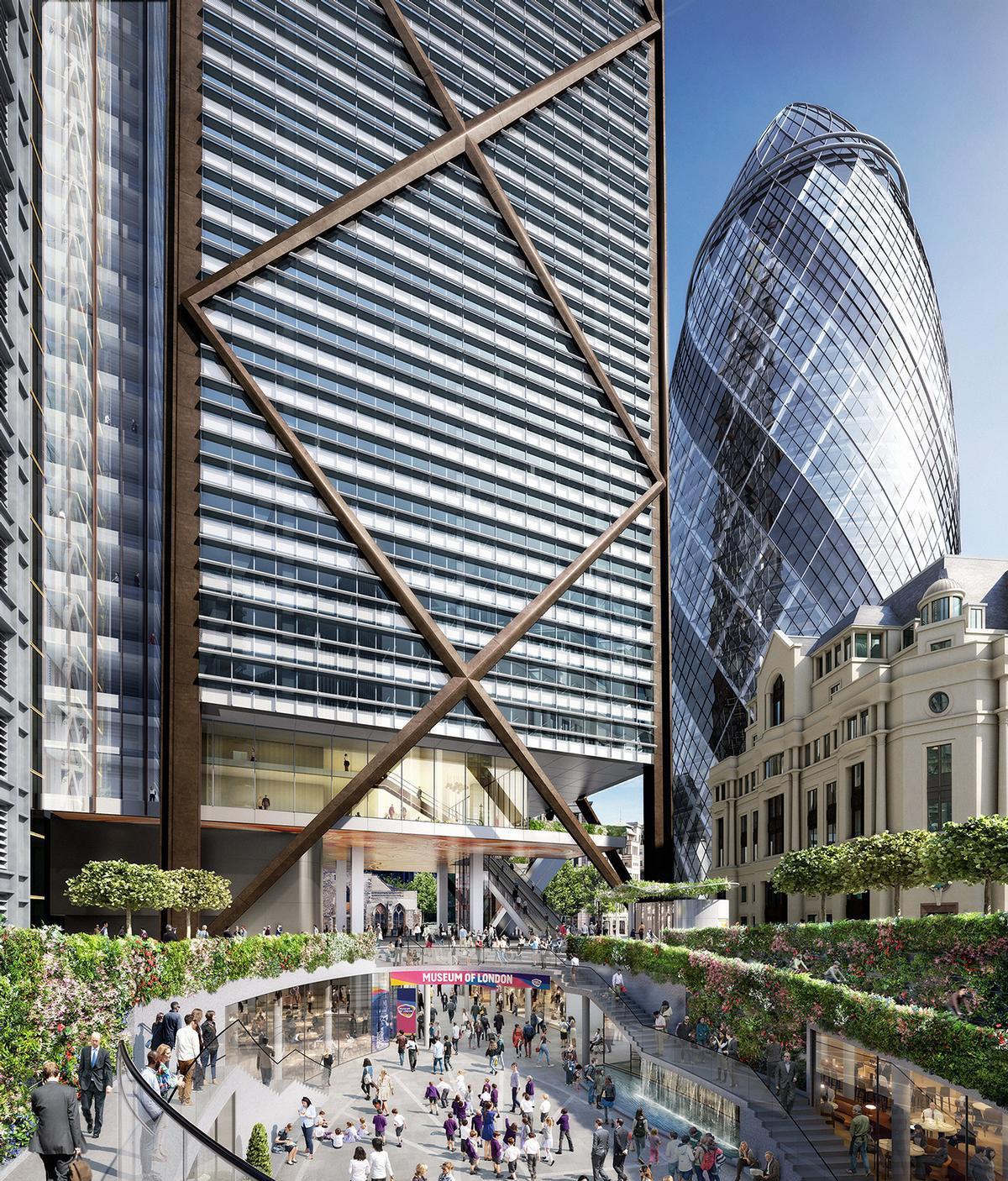
– The combination of medieval Churches and outstanding modern architecture viewed against the skyline from an outdoor open piazza makes the environment surrounding 1 Undershaft one of the most powerful and unforgettable experiences of the City.
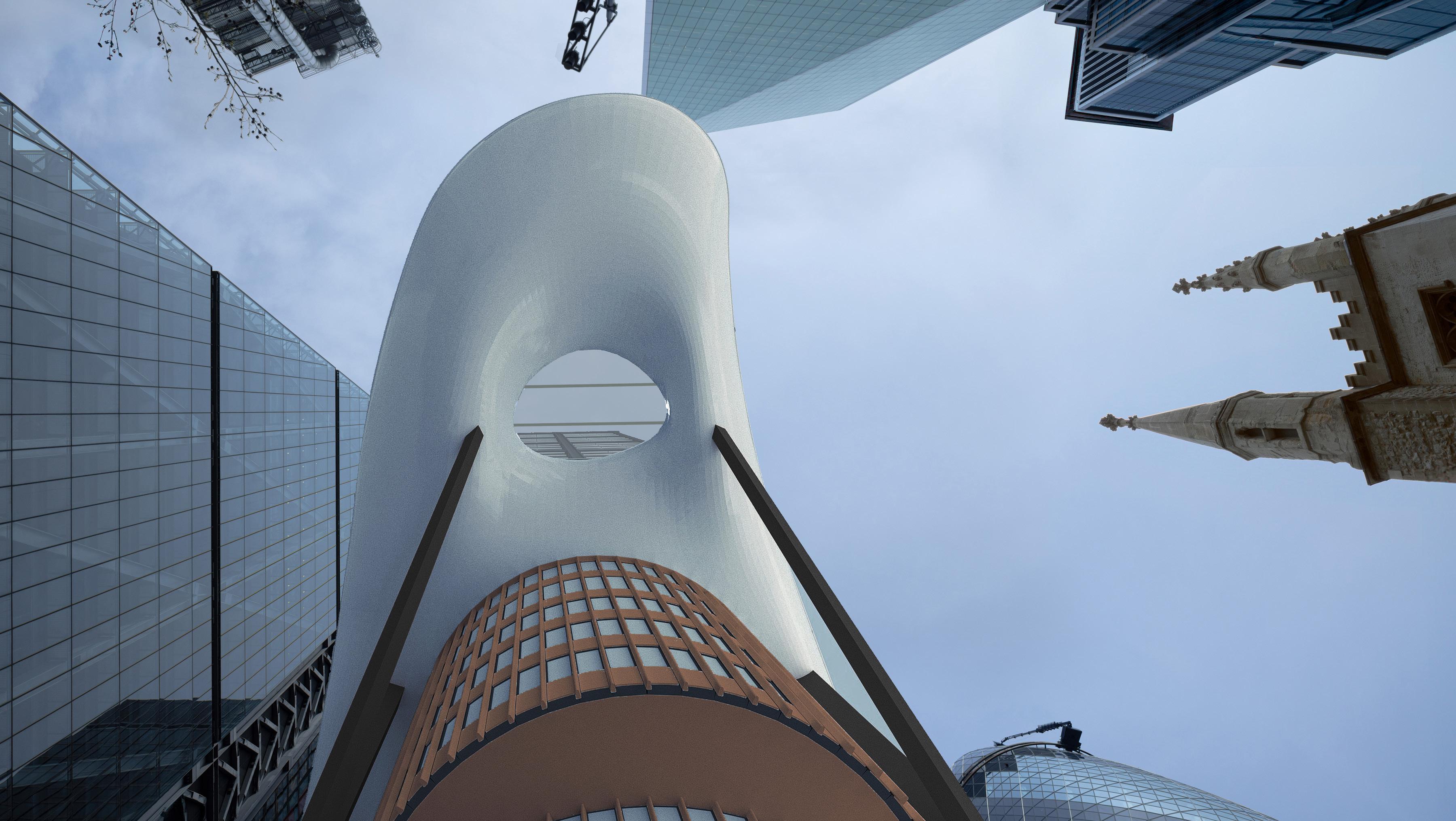
– The proposals stacked massing and alien Level 11 tongue, which overhangs most of the public realm, brutally undermines the beauty, character and attraction of the existing environment.
– The loss of connectivity between the two Grade I medieval churches (a substantial heritage benefit of the consented scheme omitted from the 2023 proposals).
– The City Cluster is renowned for its architectural excellence, hosting some of the most recognisable and iconic tall buildings in the world. The overbearing and oppressive 2023 redevelopment plans fall objectively short of beauty.
The 2023 redevelopment plans conflict with the 10 key policies relating to design, tall buildings, heritage and public realm in the Development Plan which comprises the London Plan 2021 and the City of London Local Plan 2015. It also conflicts with the emerging City Plan 2040 submission draft.
There is serious harm to the public realm, townscape and setting of heritage assets. Considerable weight should be given to the harm arising from the conflict with the Development Plan.
The 2023 redevelopment plans have a detrimental impact on occupiers of the eastern half of The Leadenhall Building in terms of overlooking, loss of daylight and loss of views.
Whilst we believe these are relevant concerns, it is accepted that they are not planning matters and our objections are not progressed on this basis.
We have considered the 1 Undershaft proposals primarily as a long term stakeholder in the future of the City of London.
We request that revisions are implemented to the 2023 redevelopment plans for 1 Undershaft which deliver:
– No loss of street level public open space from the existing situation
– Preserve and enhance St Helen’s Square as a vitally important civic space and focus for placemaking in the City Cluster for workers, residents and visitors
– No harmful townscape or heritage impact
– Architectural excellence within the City Cluster
The 2023 redevelopment plans for 1 Undershaft do not comprise the optimum solution for this critical site.
If unchanged, we believe Officers would be unable to support the 2023 redevelopment plans and the Planning Applications Sub Committee should refuse the application until the material issues outlined in this document are satisfactorily resolved.
This document comprises Representations on the 2023 redevelopment plans for 1 Undershaft London EC3A 8EE as detailed within Planning Application Ref. No: 23/01423/FULEIA
It has been produced on behalf of C C Land, owner of The Leadenhall Building by the following professional team:
Architect dMFK
Landscape Architect
Kim Wilkie
Heritage Consultant Stephen Levrant Heritage Architecture Planning Consultant JDA Planning Consultancy Limited Planning Legal Taylor Wessing
Headquartered in Hong Kong, C C Land are generational investors in prime real estate in London. The Leadenhall Building was acquired in 2017 and comprises the Group’s principal asset.
C C Land are a proactive stakeholder in the City of London:
– Sit on the Board of the City Property Association (CPA);
– One of the founding Members of the EC Bid;
– Sponsor the Sculpture in the City Programme; and
– Support the One City digital platform promoting the Square Mile.
C C Land believe in the City of London and share the City Corporation’s aspirations for the future of the Square Mile and the City Cluster in particular.
It is clear that these 2023 redevelopment plans proposals differ markedly from the existing 2019 consent for 1 Undershaft.
The proposals now have a material impact upon The Leadenhall Building and St Helen’s Square and significant implications upon our setting, our occupiers, and those who work/reside within and visit the City of London.
The 2023 redevelopment plans have a detrimental impact on occupiers of the eastern half of the Leadenhall Building in terms of overlooking, loss of daylight, and loss of views. Whilst we believe these are relevant concerns, we understand that they are not planning matters. C C Land have considered the 1 Undershaft proposals primarily as a long term stakeholder in the future of the City of London.
C C Land consider it is incumbent upon stakeholders to engage in the planning and development process. We advised the City of London on 21 February 2024 of our intention to submit formal representations as part of the Neighbour Consultation process.
The professional team have been provided information from the Applicant (see chapter 1.1) and have reviewed all documentation submitted on the City of London’s planning portal.
C C Land’s assessment has focused on the public realm and street scene at the base of the tower.
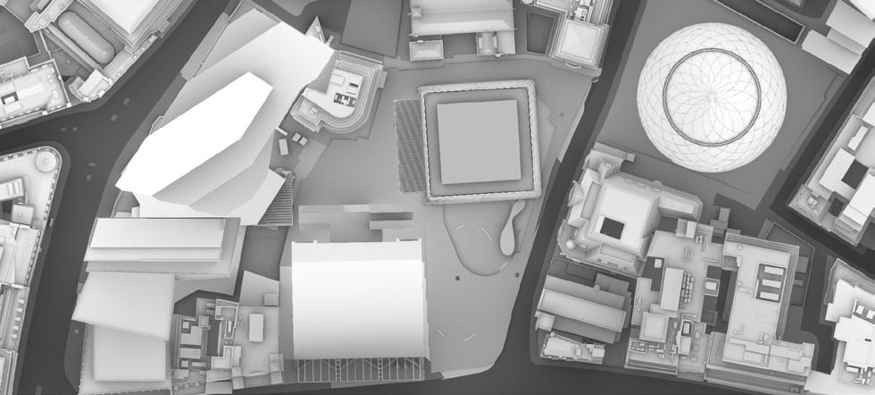
1. Photo of consultation drawings and model, October 2023.
2. Extract of information provided at initial stakeholder presentation, 31 October 2023.
STAKEHOLDER PRESENTATION
Pre-Application Consultation
The Statement of Community Involvement submitted with the planning application Ref. No: 23/01423/FULEIA states that engagement with the City of London Corporation planning department and other stakeholders commenced in early 2022.
C C Land initiated contact with the Applicant’s team on 8 September 2023 to request a briefing on the new redevelopment plans for 1 Undershaft.
An initial stakeholder presentation was given to C C Land by Eric Parry Architects on 31 October 2023.
Upon request a more detailed follow up explaining the impact of the new proposals on The Leadenhall Building and its environs was provided by the Applicants team to C C Land and dMFK on 23 November 2023.
Post-Submission Consultation
The following requested information has been provided by the Applicants team in recent weeks:
– 3D massing model, received 7 March 2024
– Additional section drawings, received 7 March 2024
– Public realm management plan, received 7 March 2024
– Hostile vehicle mitigation strategy, received 7 March 2024
– CGI video views from typical office floorplates of The Leadenhall Building, received 15 March 2024
– GIA overshadowing assessment (including 2019 consented scheme, not previously in planning applications) received 8 April 2024
– GIA revised overshadowing assessment (including full extent of site for analysis of 2019 consented scheme, and additional dates of analysis) received 22 April 2024
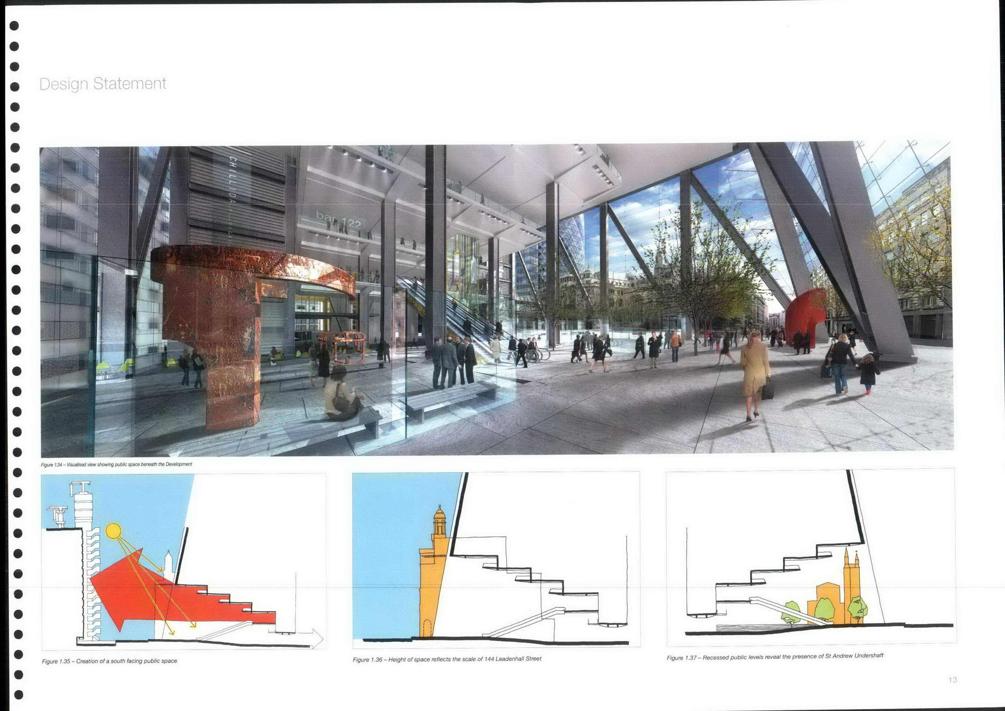
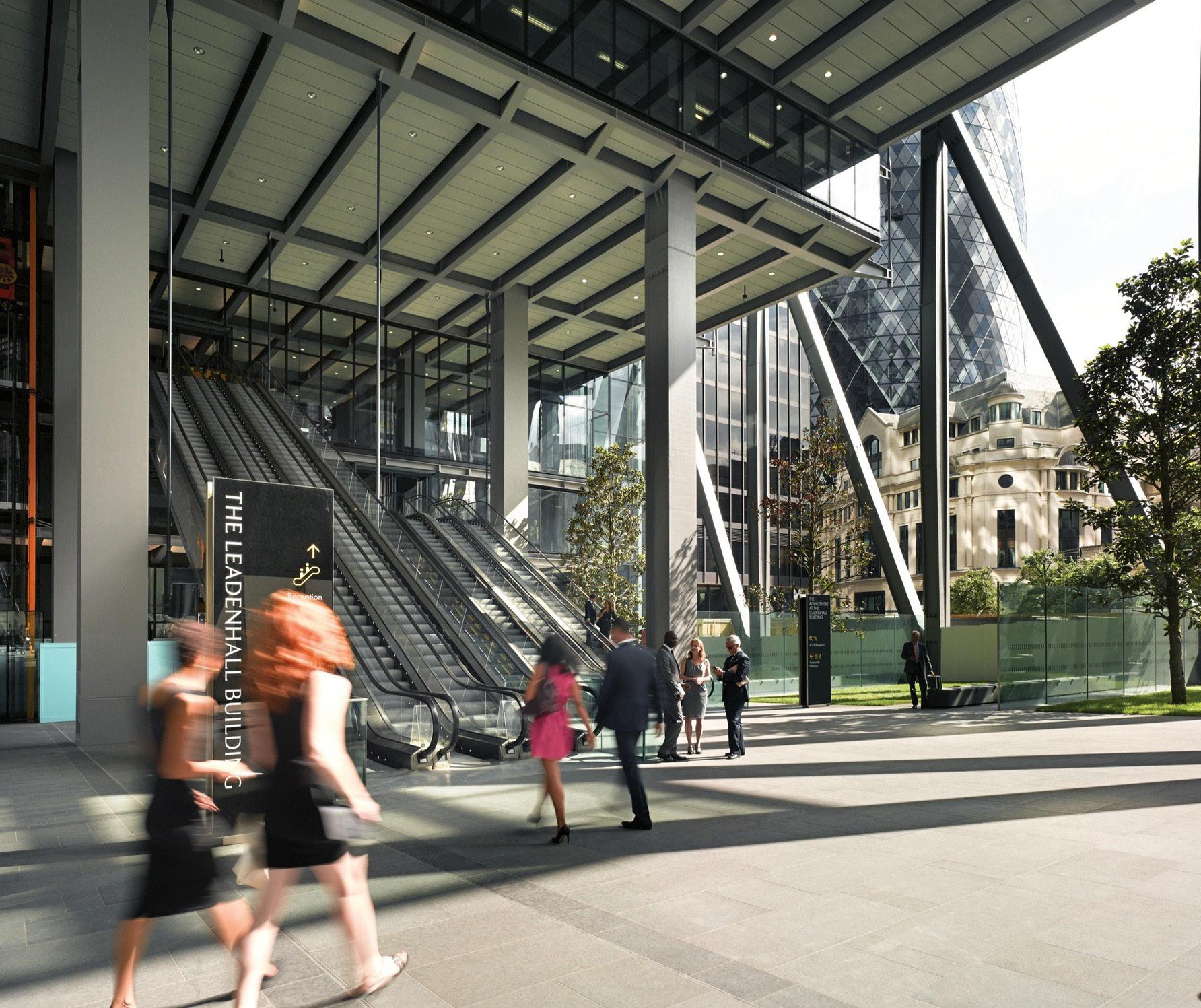
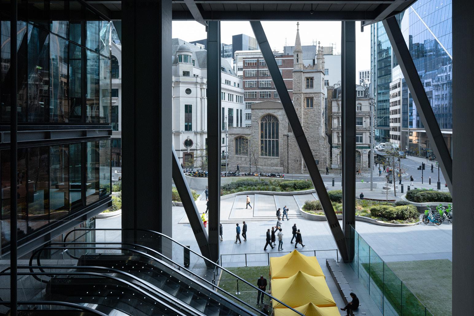
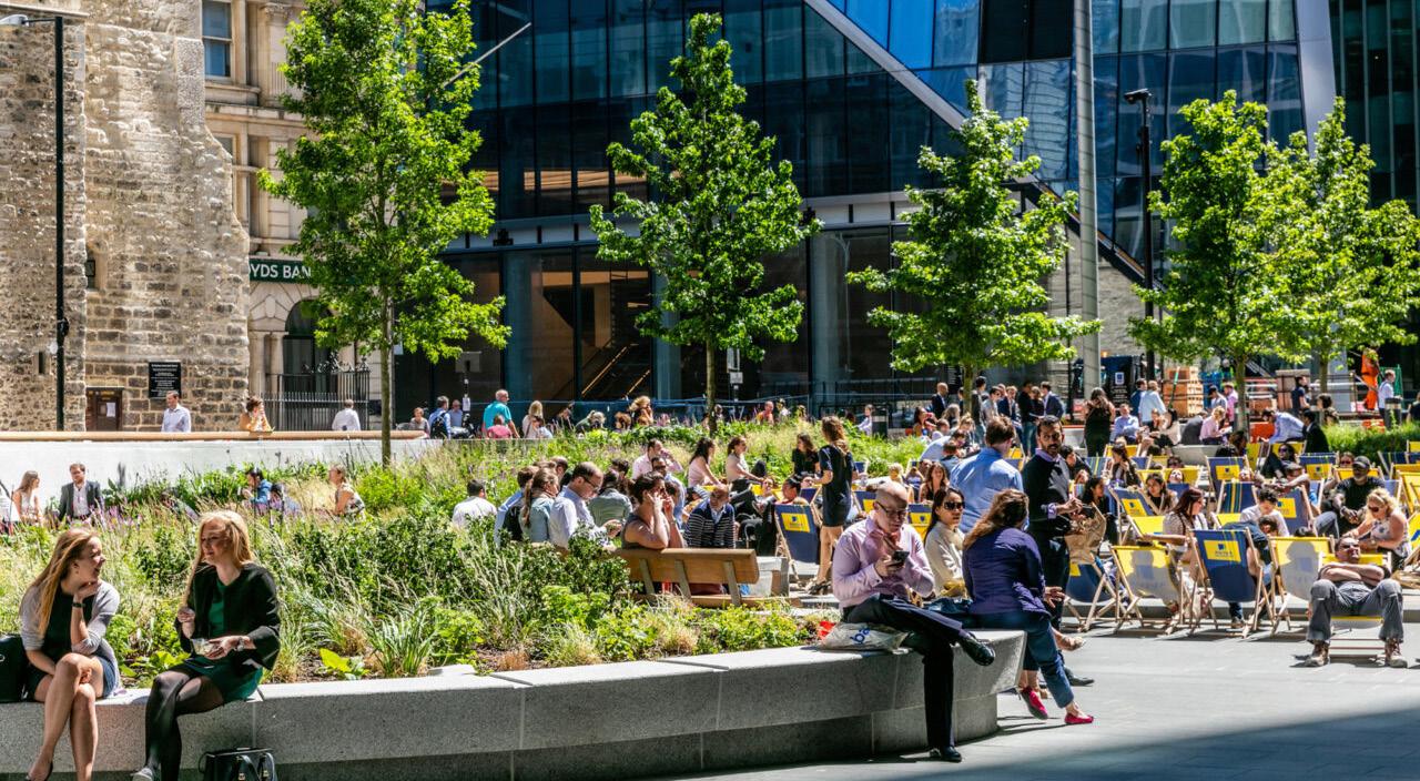
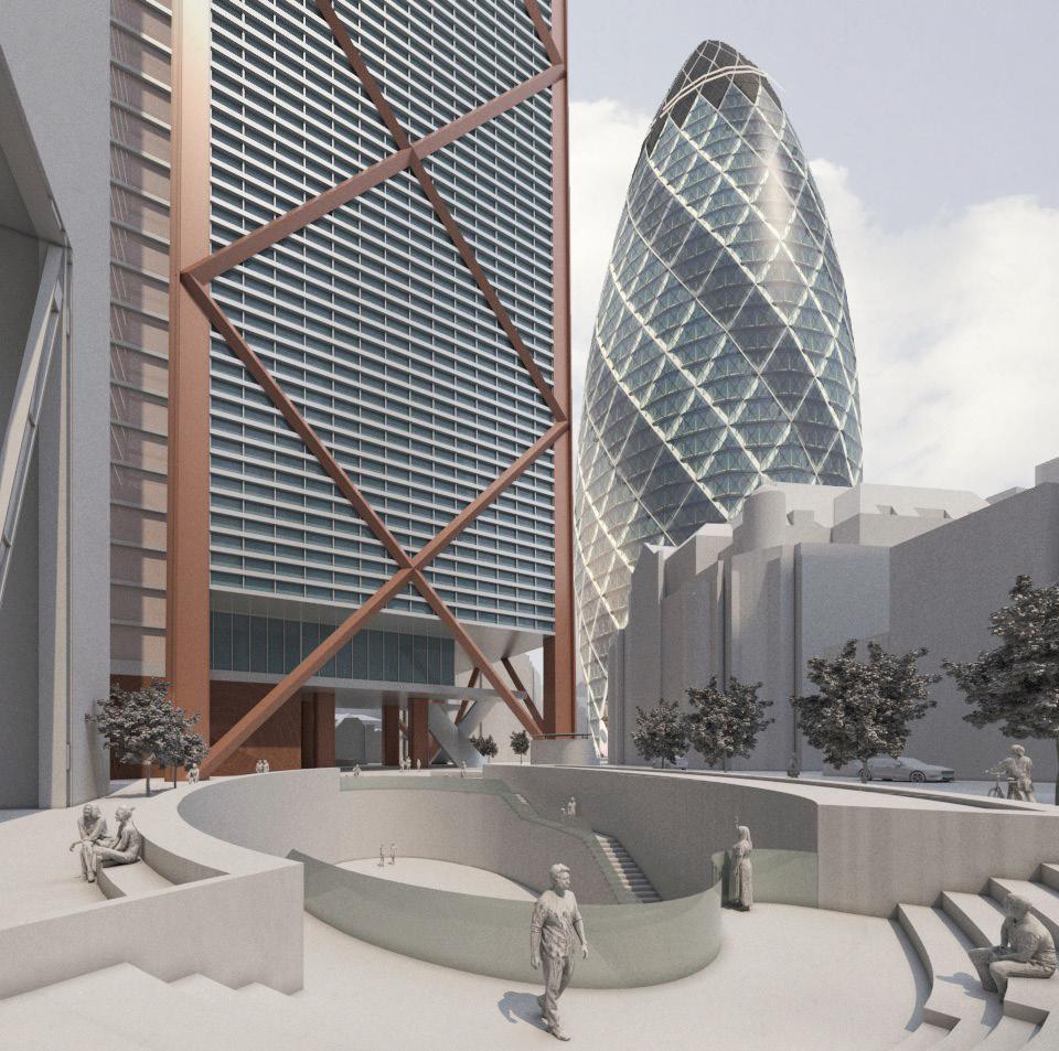
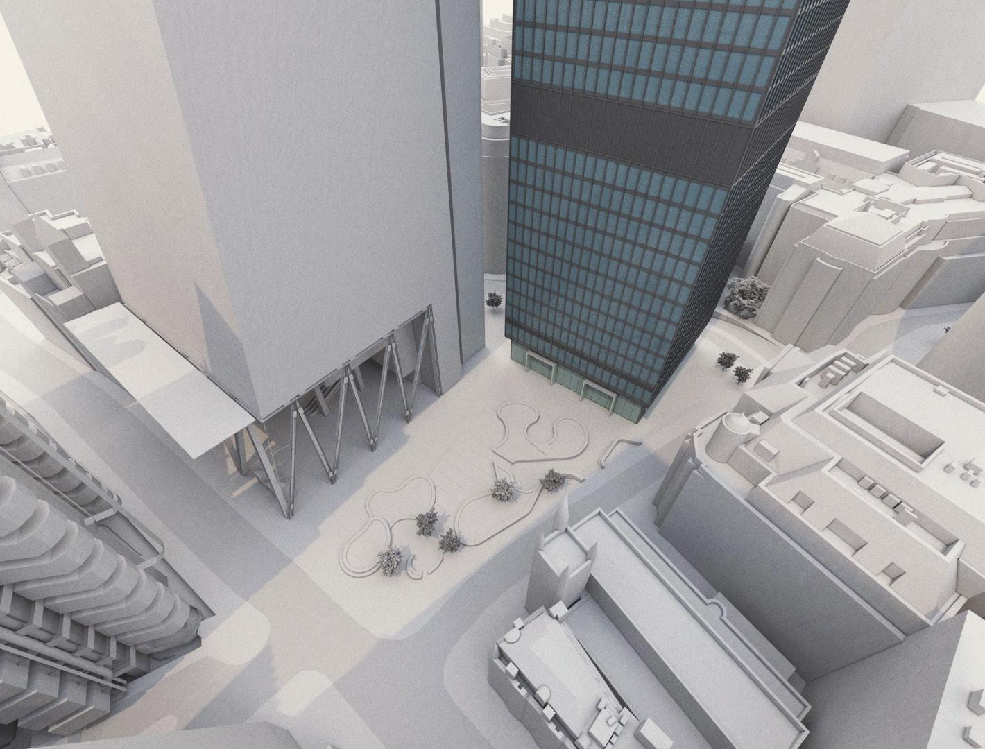
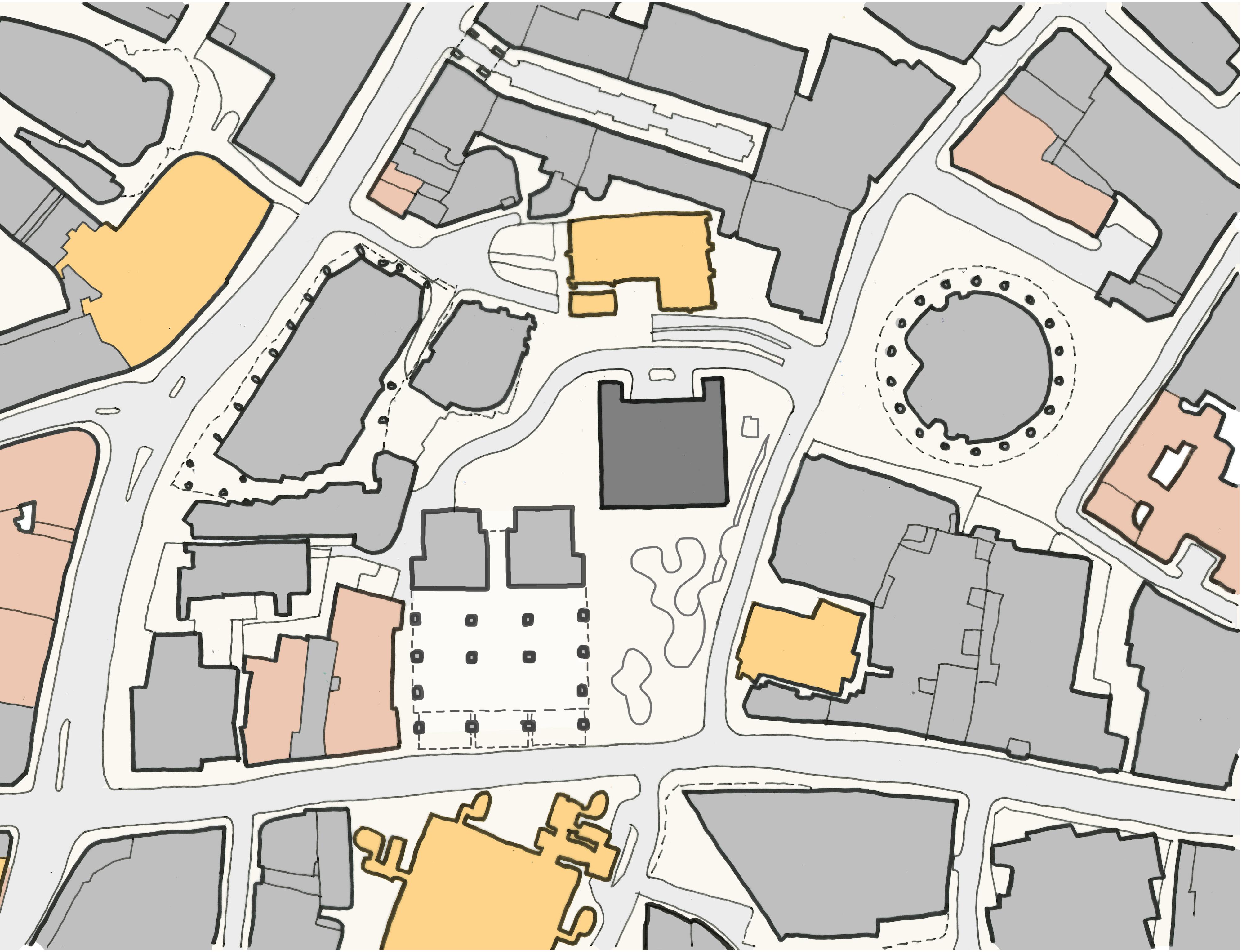
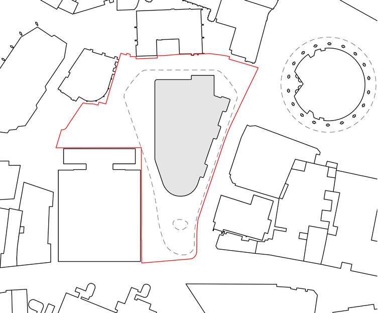
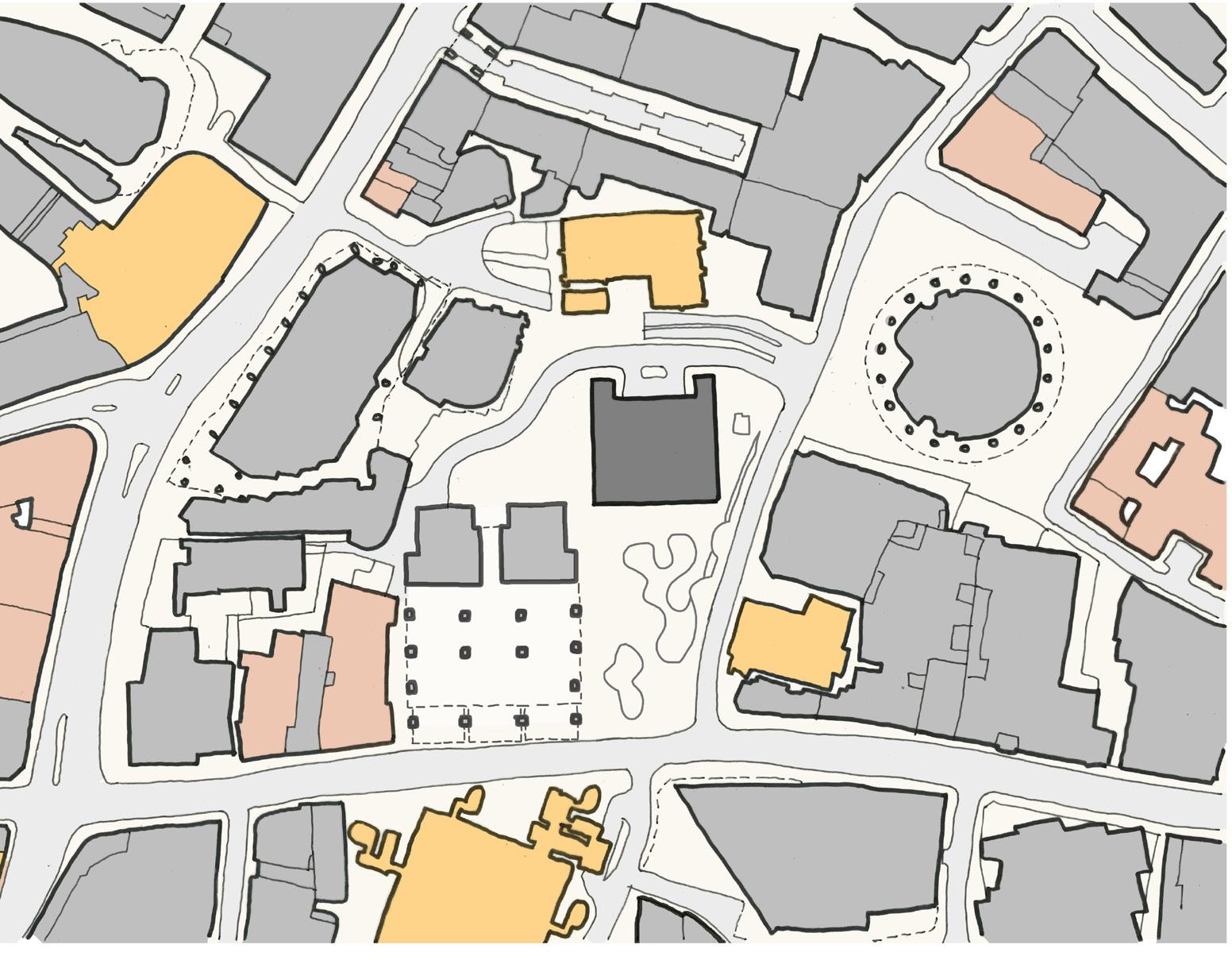
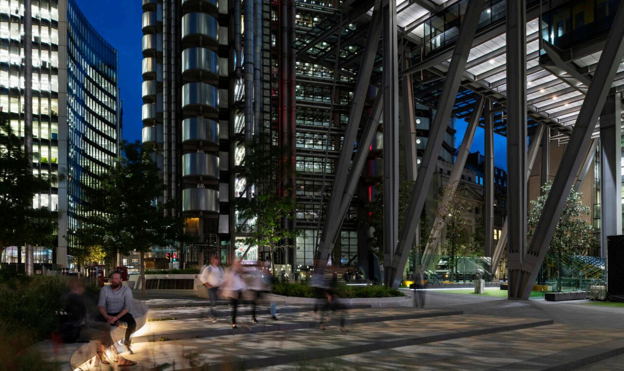
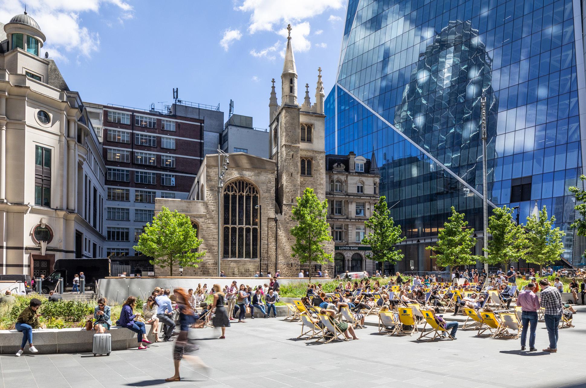
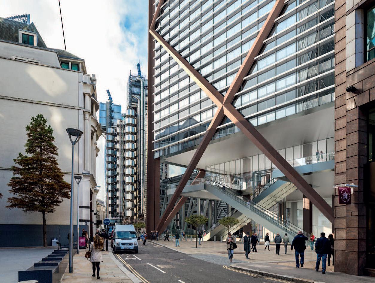
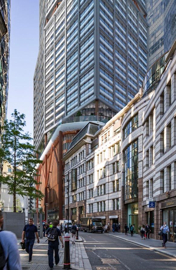
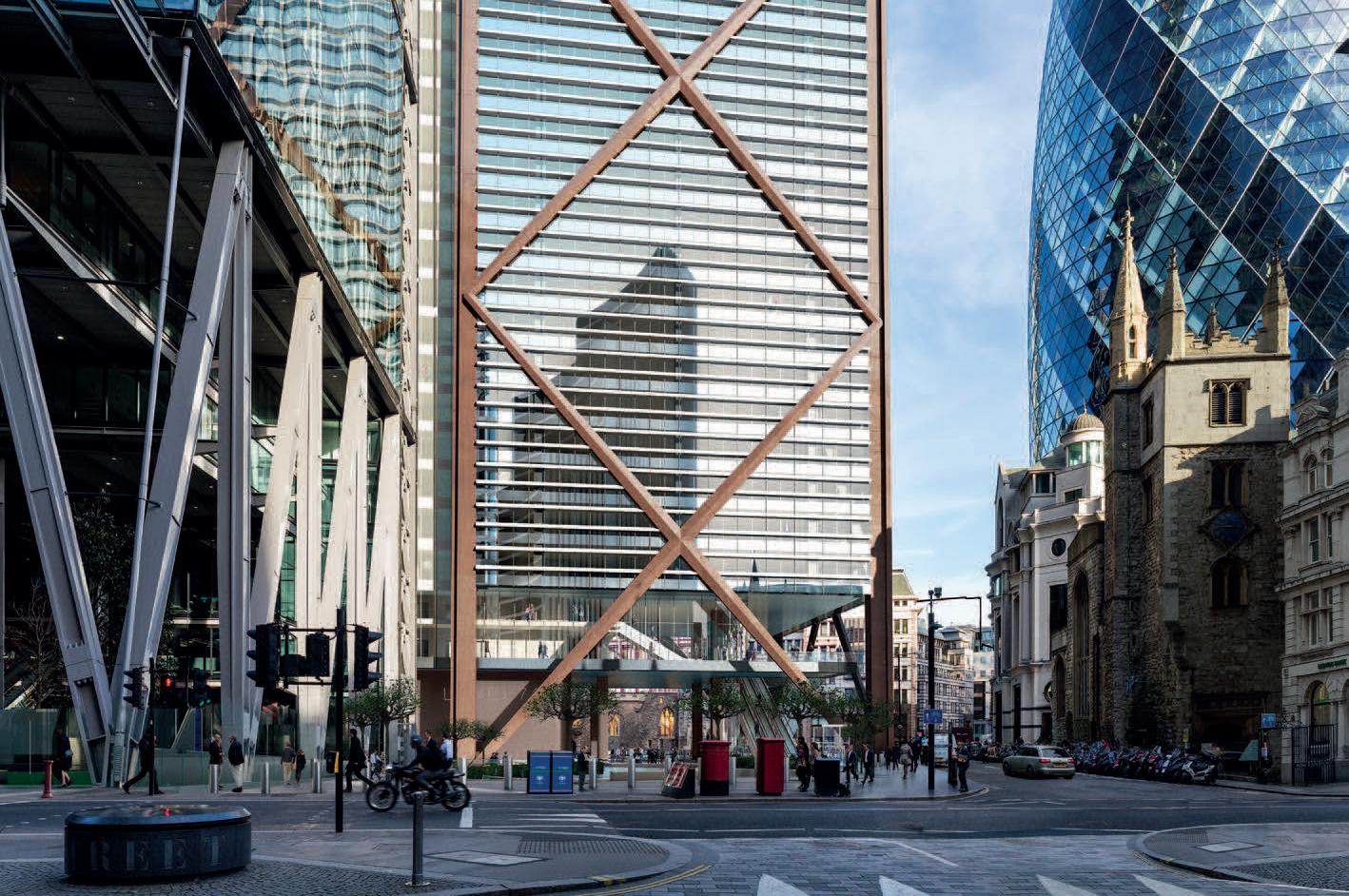
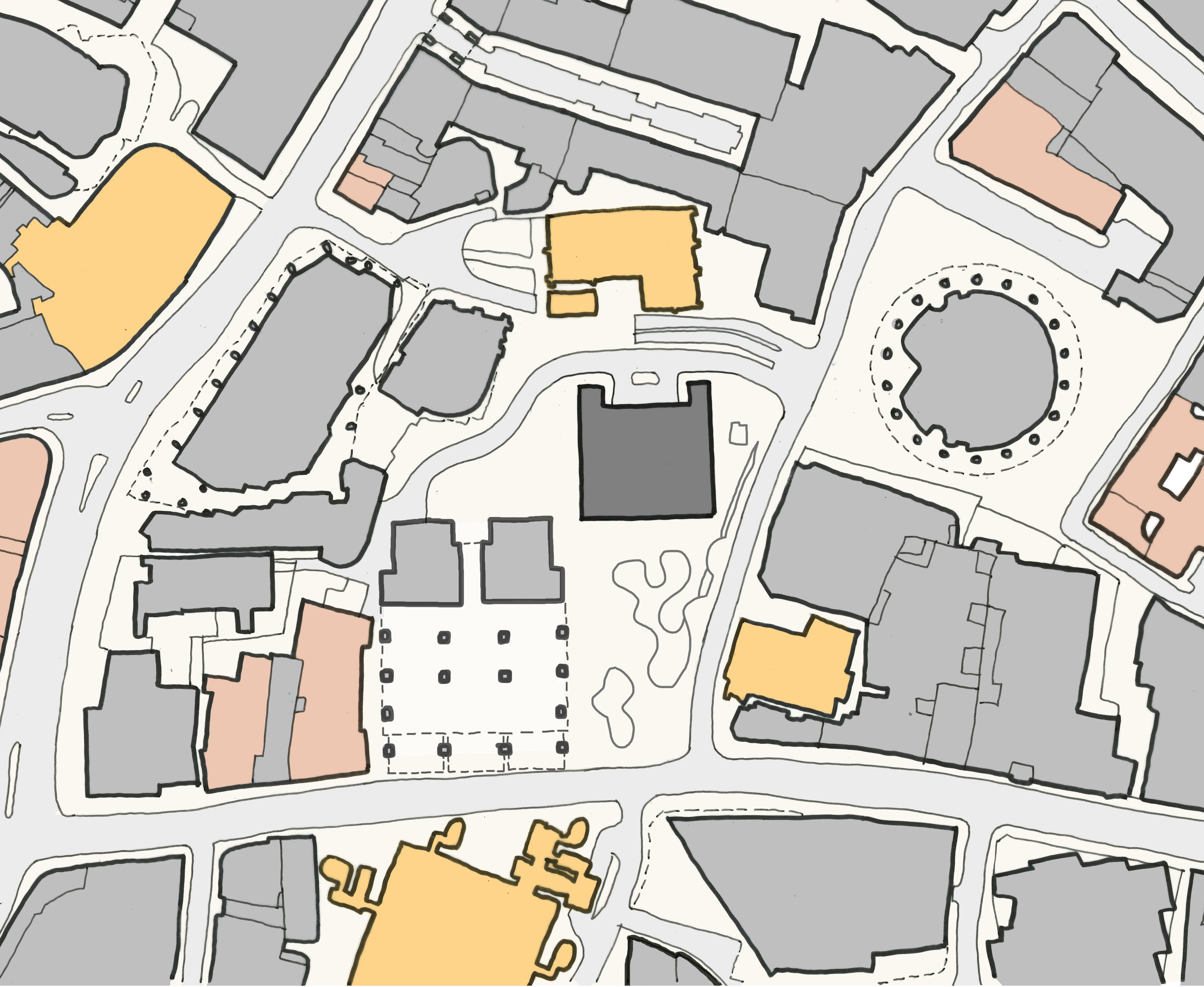
St Helen’s Square is a vitally important civic space and focal point for place making in the City Cluster. It frames the medieval Churches and outstanding modern architecture against the skyline. This is one of the most powerful and unforgettable outdoor experiences in the City.
St Helen’s Square is a significant open space fronting Leadenhall Street and St Mary Axe, attracting office workers, residents, and visitors of all age groups to meet, relax, play, and enjoy events within the iconic setting.
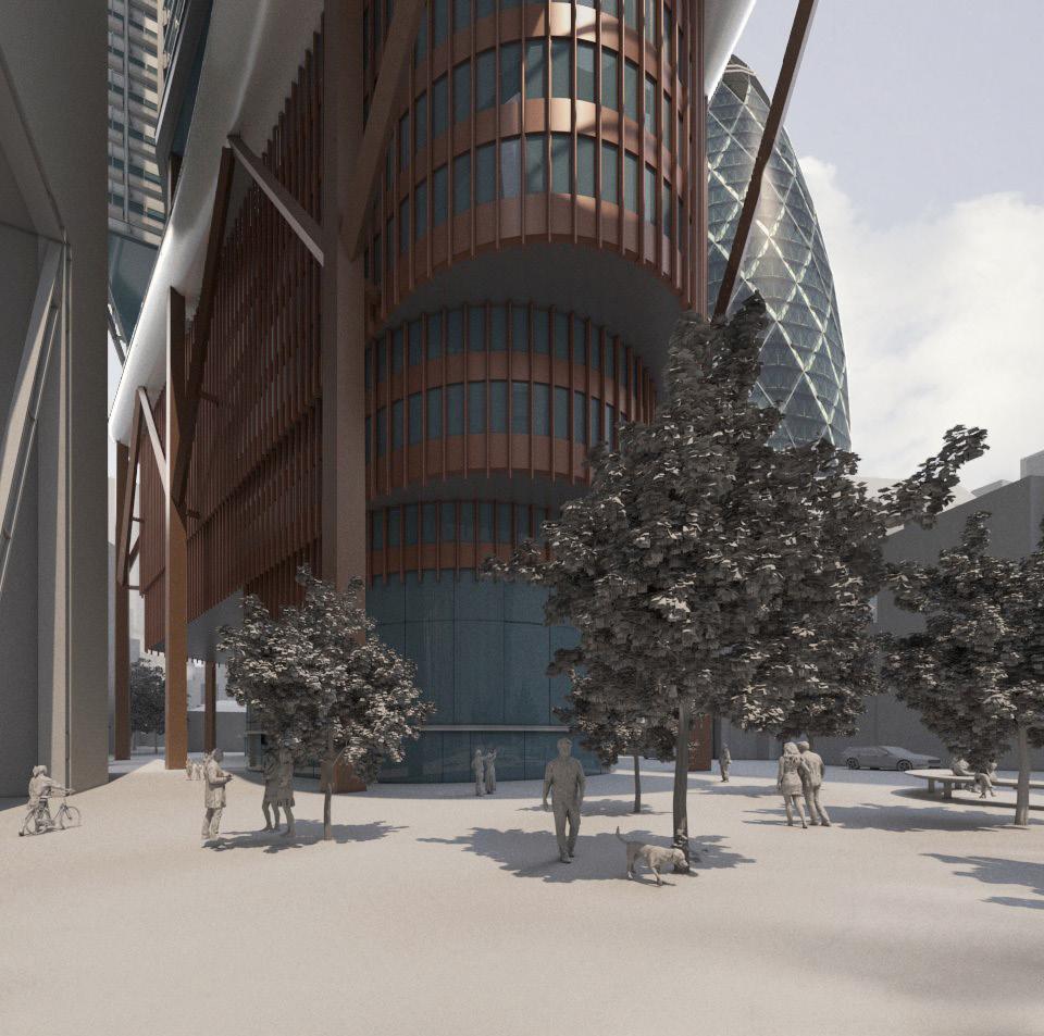
The Leadenhall Building adjoins St Helen’s Square and the Aviva Building, which are within the planning application site for 1 Undershaft. The Leadenhall Building’s public open space at street level flows into St Helen’s Square;
“Although the tower occupies the entire site, the scheme delivers an unprecedented allocation of public space – the lower levels are recessed on a raking diagonal to create a spectacular sun-lit, sevenstorey high space complete with shops, and soft landscaped public space. The public space offers a half-acre extension to the adjacent piazza of St Helen’s Square... This new public space provides a rare breathing space within the dense urban character of the City of London”. (RSHP Website Projects Page – Overview).
St Helen’s Square enjoys a high standard of sunlight and daylight, which lifts the quality of light and comfort levels in The Leadenhall Building’s adjacent covered open space.
The 2019 consent recognised the importance of protecting and enhancing the experience of St Helen’s Square and it’s connection to the Leadenhall Plaza. The following chapters assess the implications of the 2023 proposals for 1 Undershaft on St Helen’s Square.
From this analysis of the City Local Plan’s approach to public open space, and the character of St Helen’s Square, the following conclusions are reached:
1. There is a serious deficiency of public open space in the City, and in particular in the Eastern Cluster.
2. Planning policy and strategies for the Eastern Cluster look to protect, improve, and extend the area of public open space in the Eastern Cluster.
3. St Helen’s Square is the largest public open space in the Eastern Cluster, found at its heart, and in the words of the Cluster Vision, is a canvas for active and engaging public life.
4. St Helen’s Square has excellent daylight, sunlight, reflected light, and as a result is a very popular place for recreation and has the potential to host outstanding events.
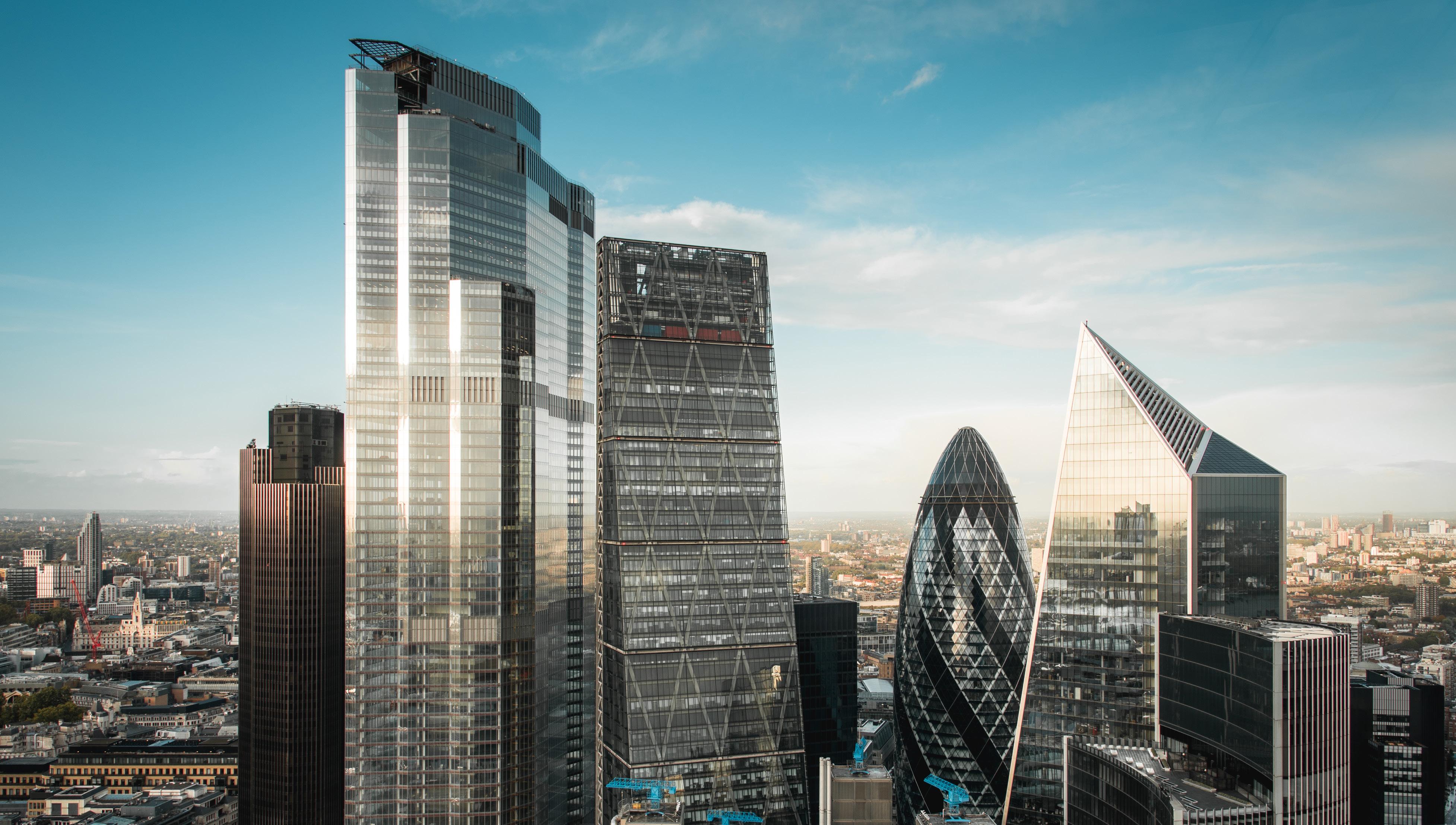
5. It has an internationally significant setting, which frames the sky above St Helen’s Square, including the Gherkin, the Grade I Listed St Andrew Undershaft Church, the Grade I Listed Lloyd’s Register building, and The Leadenhall Building.
6. Public open space in the City is a scarce and valuable resource. St Helen’s Square is one of the most important opportunities for public open space in the City, and the Eastern Cluster.
1. Public realm proposals, from The City Cluster Vision (2019), incorporating 1 Undershaft 2019 consent & highlighting two primary civic spaces in the Eastern Cluster. St Helen’s Square The Gherkin
2. Leadenhall Street opportunity diagram, from The City Cluster Vision (2019).
3. St Helen’s Square CGI, from The City Cluster Vision (2019).
The City Cluster Vision shows the importance of St Helen’s Square to the Open Space Strategy for the Eastern Cluster:
“Spaces such as St Helen’s Square (at the foot of 122 Leadenhall Street and 1 Undershaft) and The Plaza at the foot of 30 St Mary Axe (the Gherkin) provide the canvas for active and engaging public life to flourish and are supported by a range of social and cultural activities and events.”
The City’s own policies and strategies for public realm state that:
– There is a serious deficiency of public open space in the City, and in the Eastern Cluster.
– Planning policy and strategies for the Eastern Cluster look to protect, improve, and maximise the area of public open space in the Eastern Cluster.
St Helen’s Square is the largest public open space in the Eastern Cluster, found at its heart, and in the words of the Cluster Vision, is a canvas for active and engaging public life.
– It has an internationally significant setting, the sky above St Helen’s Square is framed by the Gherkin, St Andrew Undershaft Church (Grade 1 listed), the Lloyd’s Register (Grade 1 listed), and The Leadenhall Building.
– St Helen’s Square is at the centre of the planned growth of tall buildings, an area of exceptional density, which will put increasing pressure on open spaces. This reinforces the need to protect St Helen’s Square, and in the words of the City “make it work hard” and not to reduce it in size area and character.
Table 2: Distribution of Open Space
3.3.6 Table 3 below illustrates that the majority of open spaces within the City are civic squares and other hard-surfaced areas designed for pedestrians, with churchyards and cemeteries the second largest and amenity green space third. However, when assessing actual coverage, parks and gardens are the second largest category of open spaces within the City. In terms of public access, civic spaces and churchyards and cemeteries are the most public.
–
This chapter summarises a comparative analysis of the 2023 redevelopment proposals for 1 Undershaft (Planning Application Ref. No: 23/01423/FULEIA) against the 2019 consented proposals (16/00075/FULEIA) and the existing Aviva building and St Helen’s Square. It focuses on evaluating the impact of proposals on the street scene and provision of public realm.
The analysis involves a review of relevant drawings from each application, supplemented by additional diagrams and annotations highlighting the relationship with St Helen’s Square and the wider context. Further drawings, diagrams, and a comparison of verified and non-verified views are included in Appendix A: Comparison of 1 Undershaft Proposals.
The analysis highlights contrasting outcomes, underscoring the importance of thoughtful urban planning to preserve and enrich the public realm, In accordance with London Plan Policies D8 on public realm and D9 on tall buildings, and the design and public realm policies and strategies of the City of London:
– The 2023 proposal results in fragmentation and loss of coherence, particularly affecting the connection between St Helen’s Church Bishopsgate and St Helen’s Square. In contrast, the 2019 scheme improved connectivity and integration of public spaces, with the whole of St Helen’s Square retained and a net-gain in area with its undercroft and lower ground plaza.
– The scale and massing of the 2023 proposals encroach upon St Helen’s Square and fail to adequately compensate for the loss, diminishing the quality and vitality of the public realm, whereas the 2019 scheme avoided building into or over St Helen’s Square beyond the existing footprint of the Aviva building.
– The 2023 proposals’ podium and massing limit sky visibility, sunlight, and privacy for neighbouring buildings and streets. Conversely, the 2019 scheme’s generous undercroft integrates seamlessly with adjacent buildings, connecting St. Helen’s Square with St Andrew Undershaft Church, enriching pedestrian experience in the City Cluster.
The 2023 proposals project significantly further south, obscuring the iconic profile of The Leadenhall Building, diminishing it’s character and presence in views from Leadenhall Street and St Mary Axe in the east. Comparatively, the 2019 scheme tapered inwards at higher levels to maintain The Leadenhall Building’s aspect onto St Helen’s Square and views from the square of the Gherkin, St Andrew Undershaft Church, and Lloyds Building.
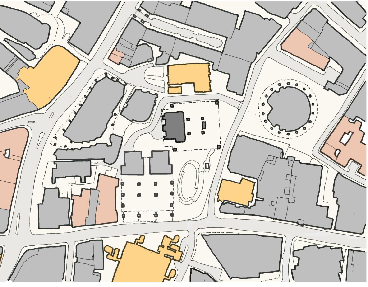
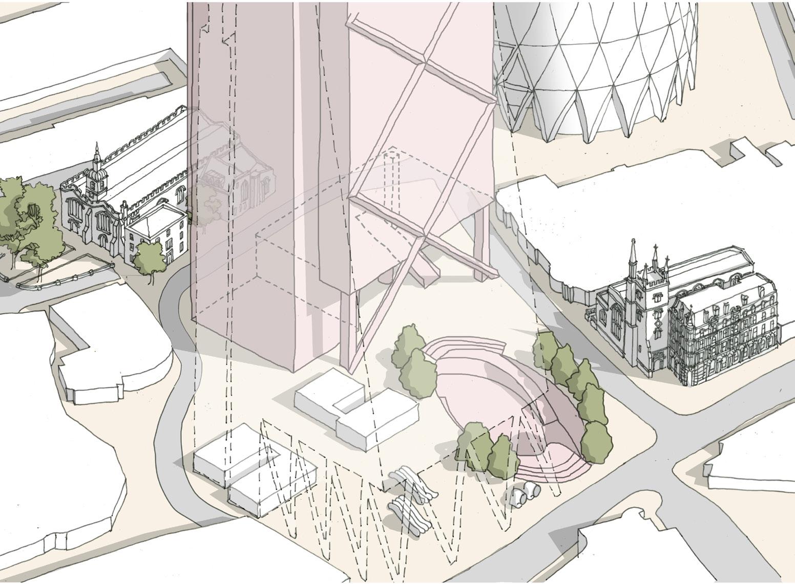
These plans demonstrate the significant loss of area, visible sky, quality, and usability of St Helen’s Square due to the encroachment of 2023 proposals into and above the street level public realm, compared to both the existing scenario and 2019 consented proposals.
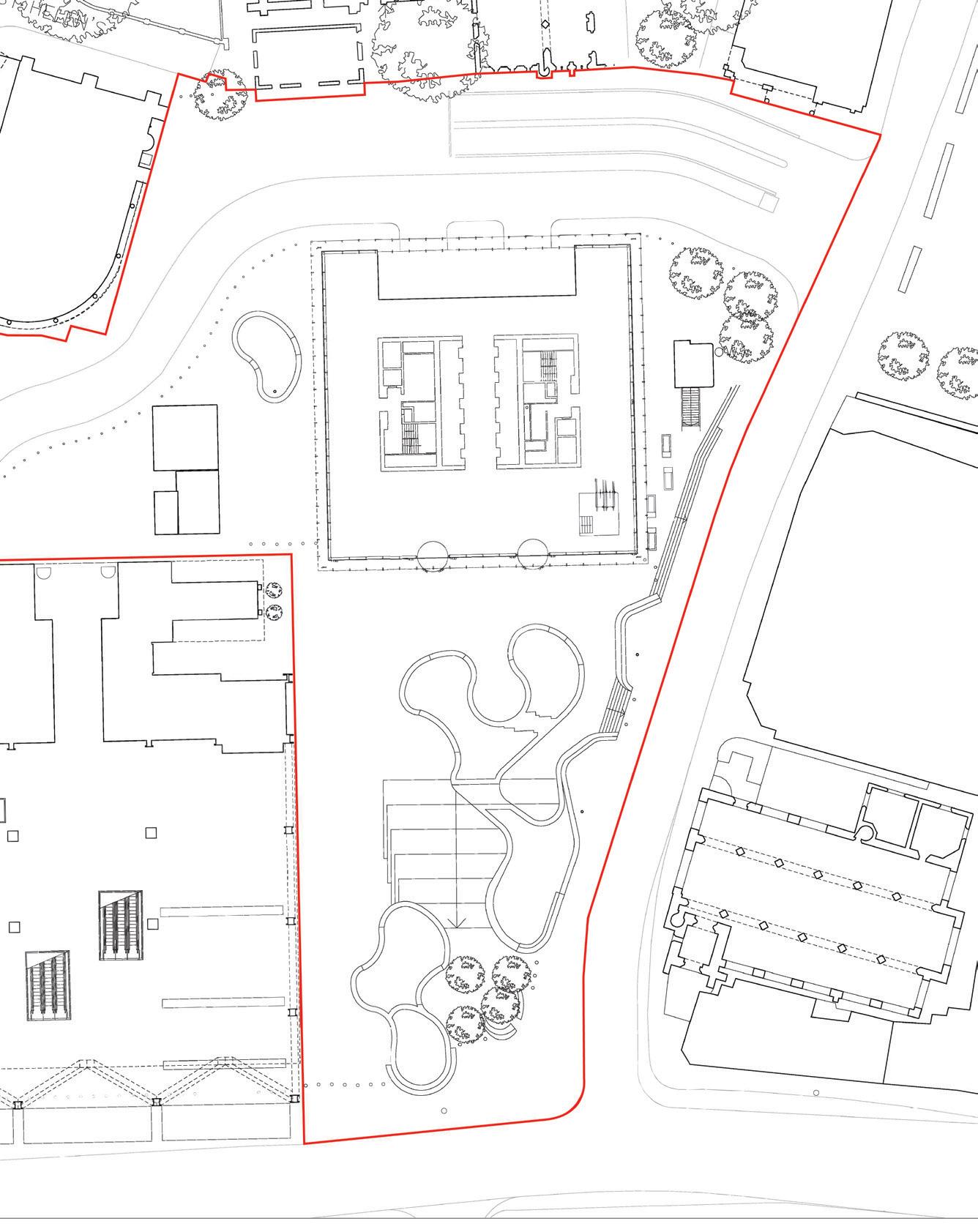
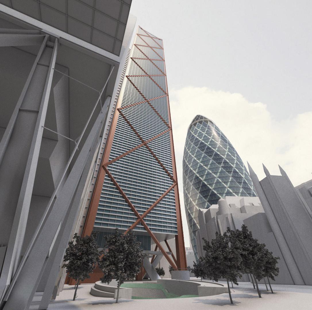
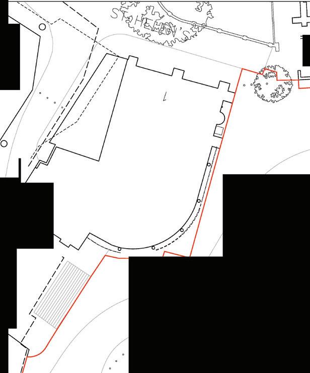
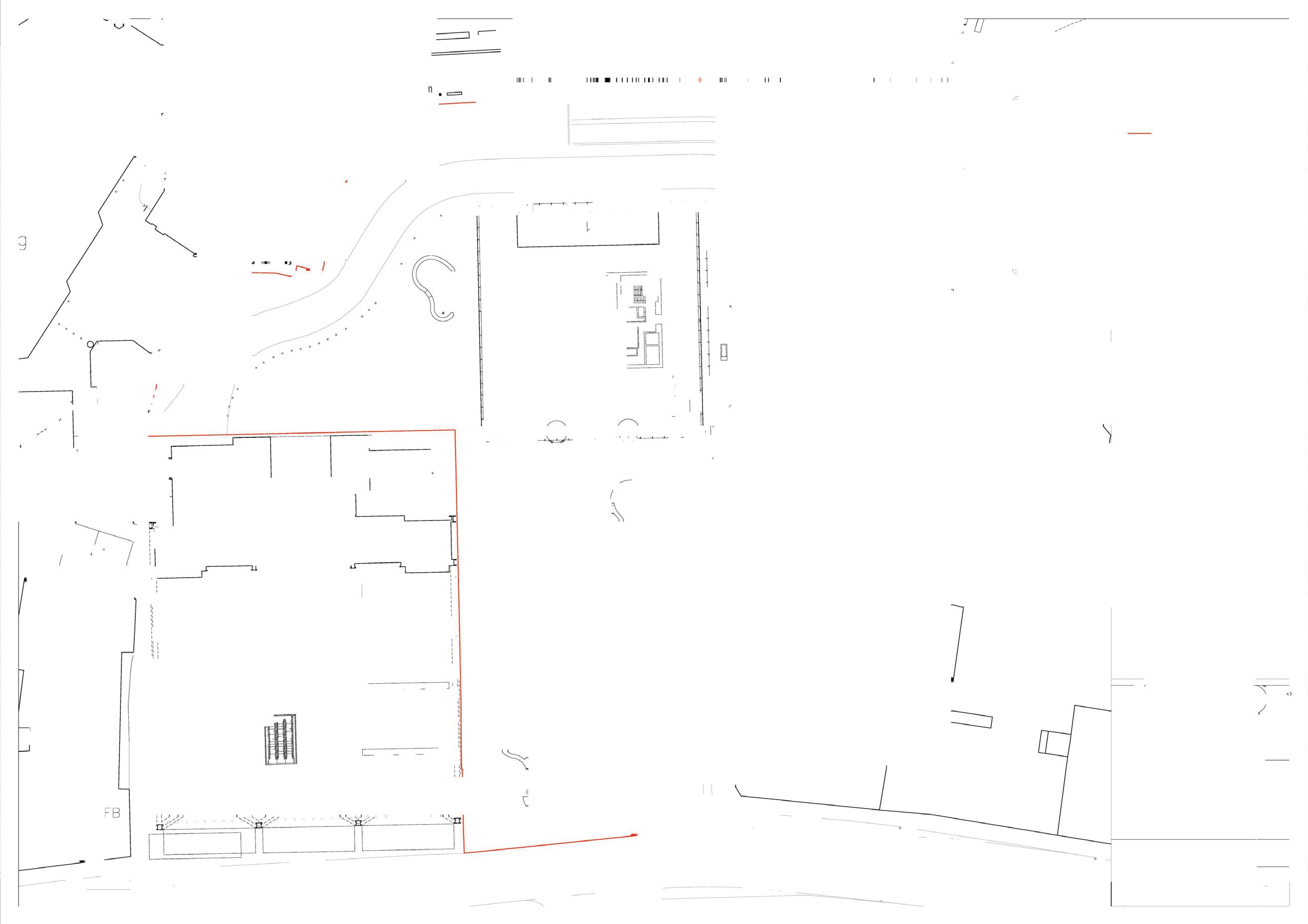
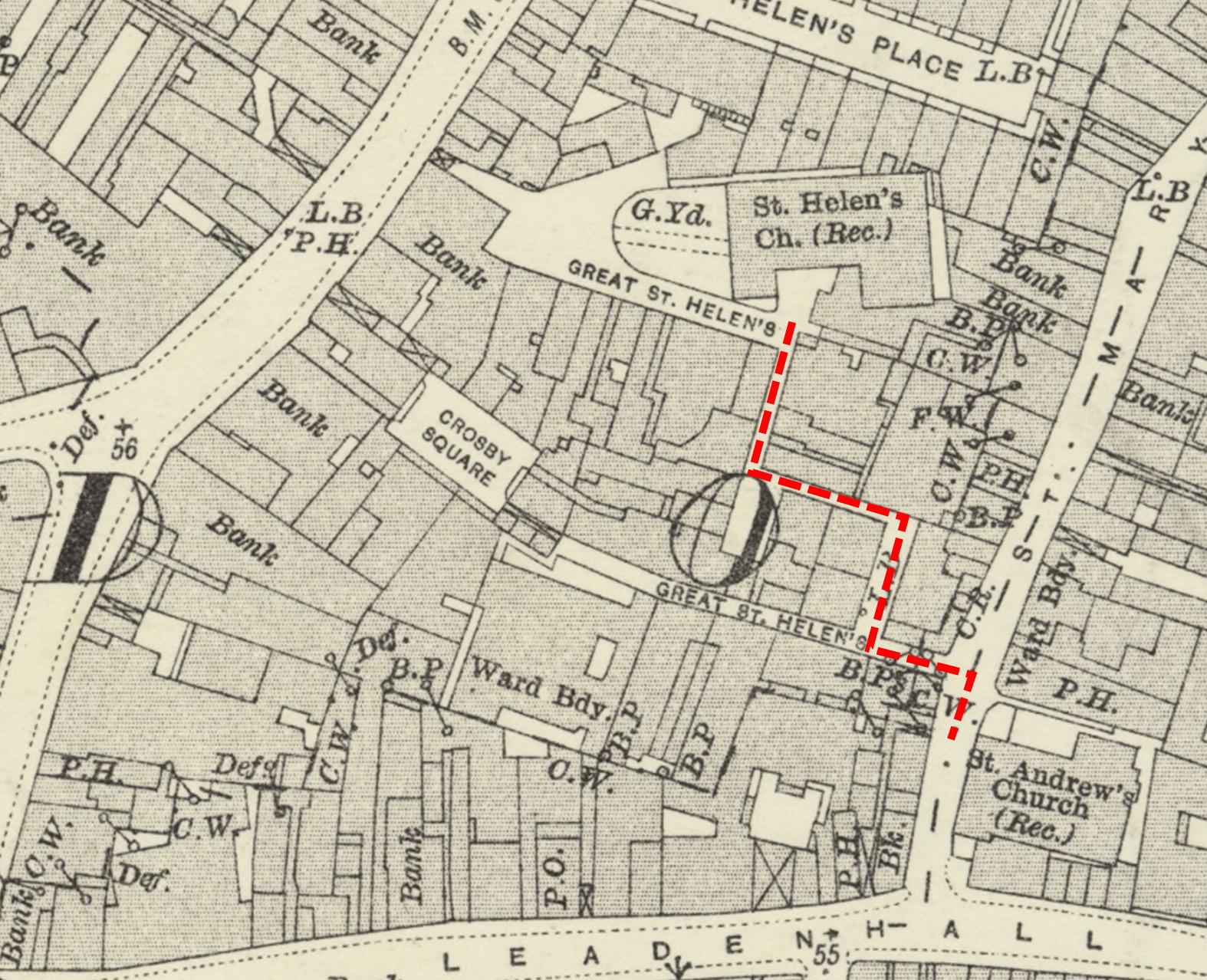
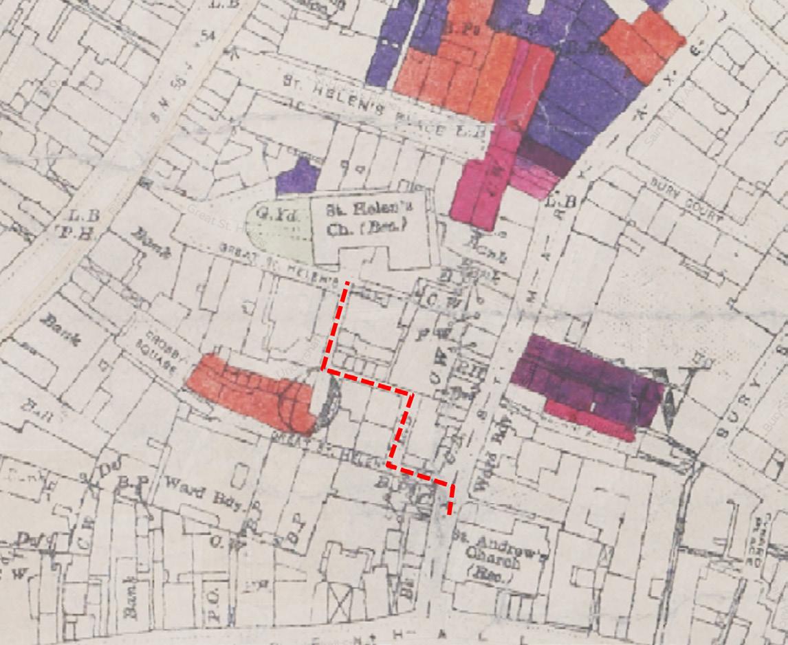
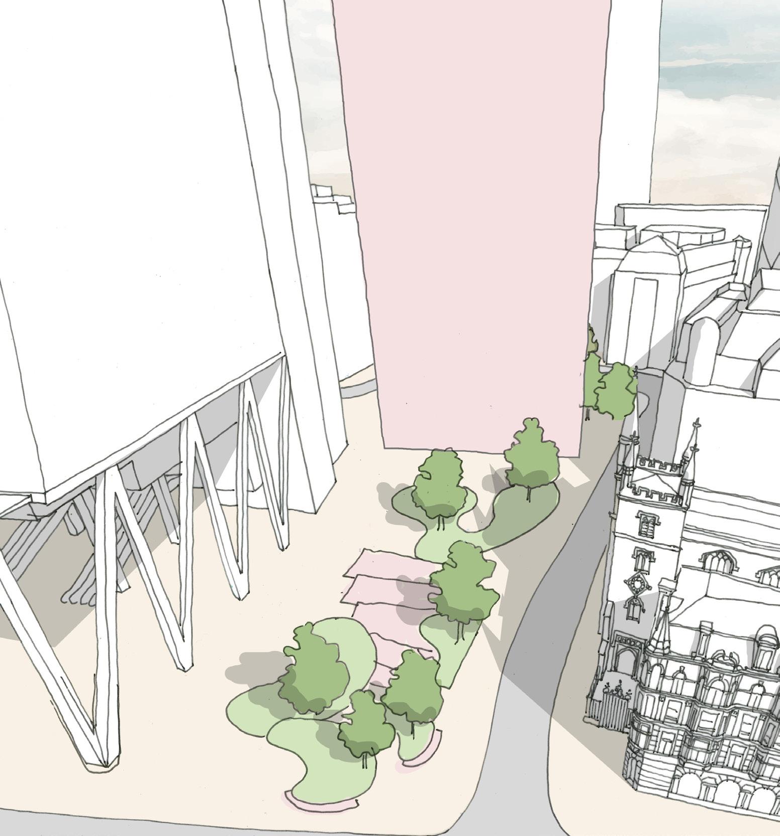
– The area of St Helen’s Square is 2,433 m2 with a depth of 65.9 m.
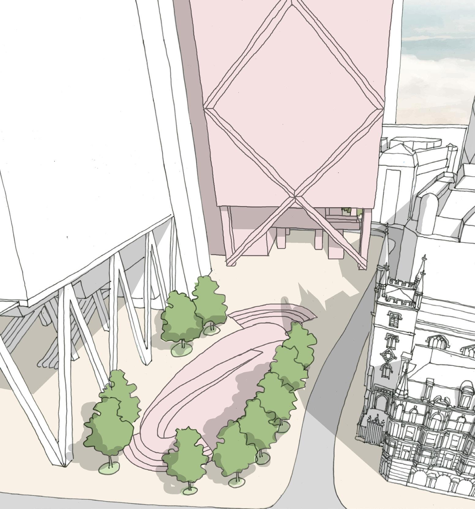
– The area of St Helen’s Square increases to 2,438 m2, the depth increasing to 74.3 m to the nearest ground floor structure.
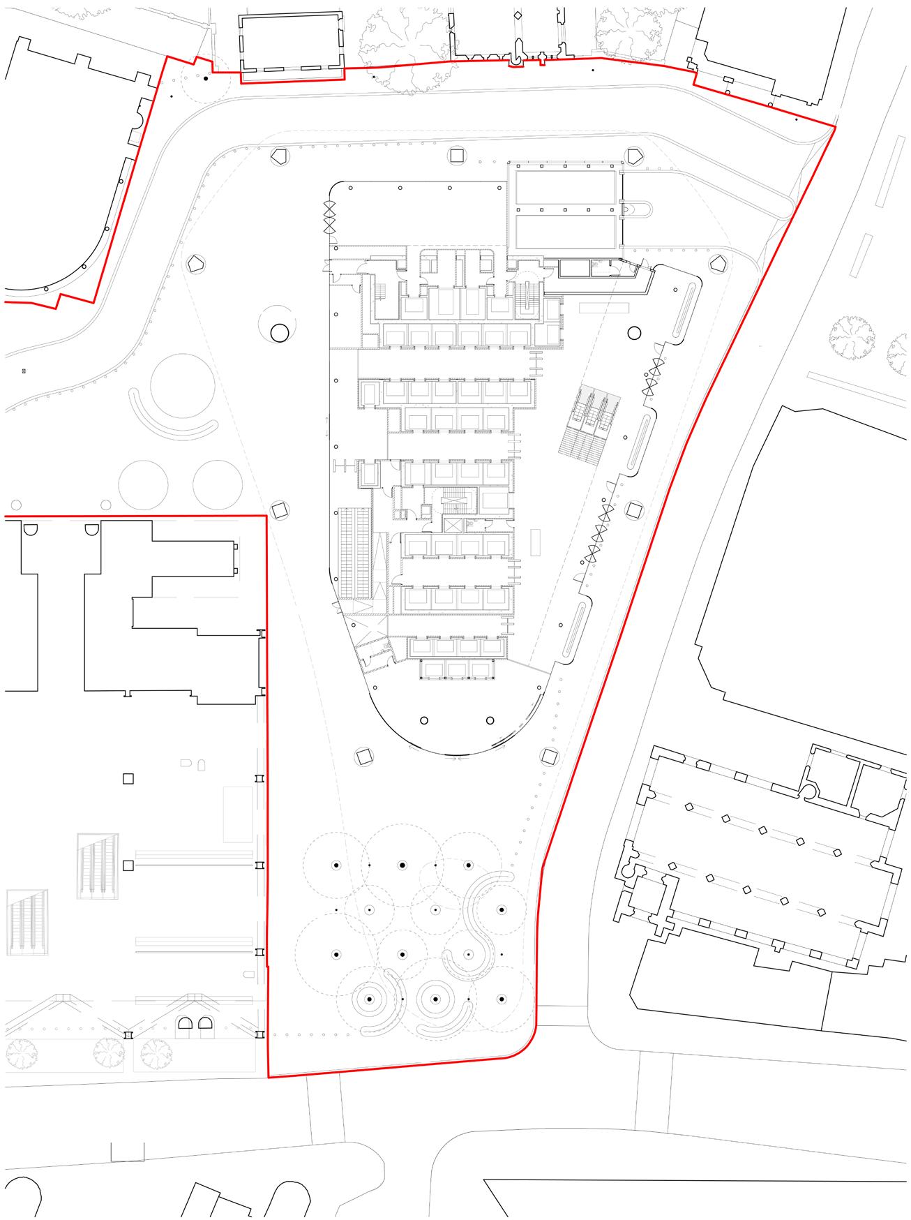
These plans illustrate the large increase of proposed massing overhanging and overshadowing St Helen’s Square in the 2023 application versus the 2019 consented scheme, which slightly improved the existing line of public realm to the south.

– Upper floorplate of Aviva building is entirely to the north of St Helen’s Square, causing no overshadowing or reduction of visible sky from street level.
– Increased floorplate is entirely to the north of St Helen’s Square, causing no additional overshadowing or reduction of visible sky from street level.
– Increased floorplate and projecting podium garden significantly encroaches into and overshadows St Helen’s Square, reducing areas of visible sky from street level.
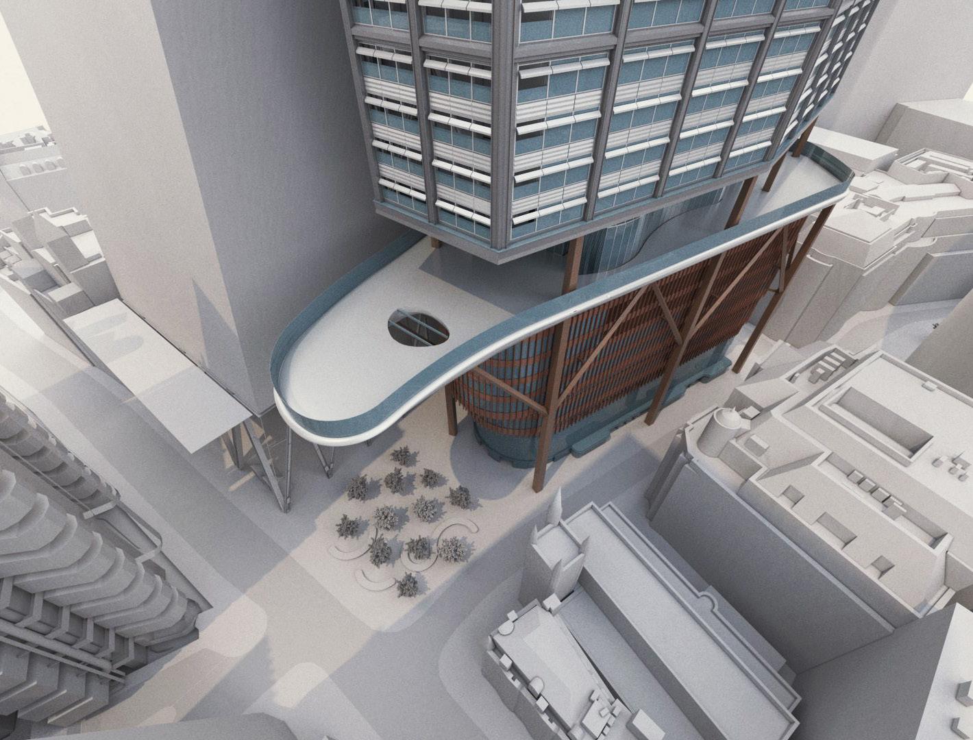
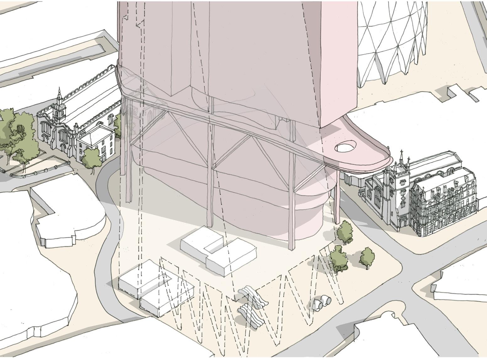
– Public realm at level 11 is not a like for like replacement and doesn’t compensate for the significant loss and harm caused at street level.
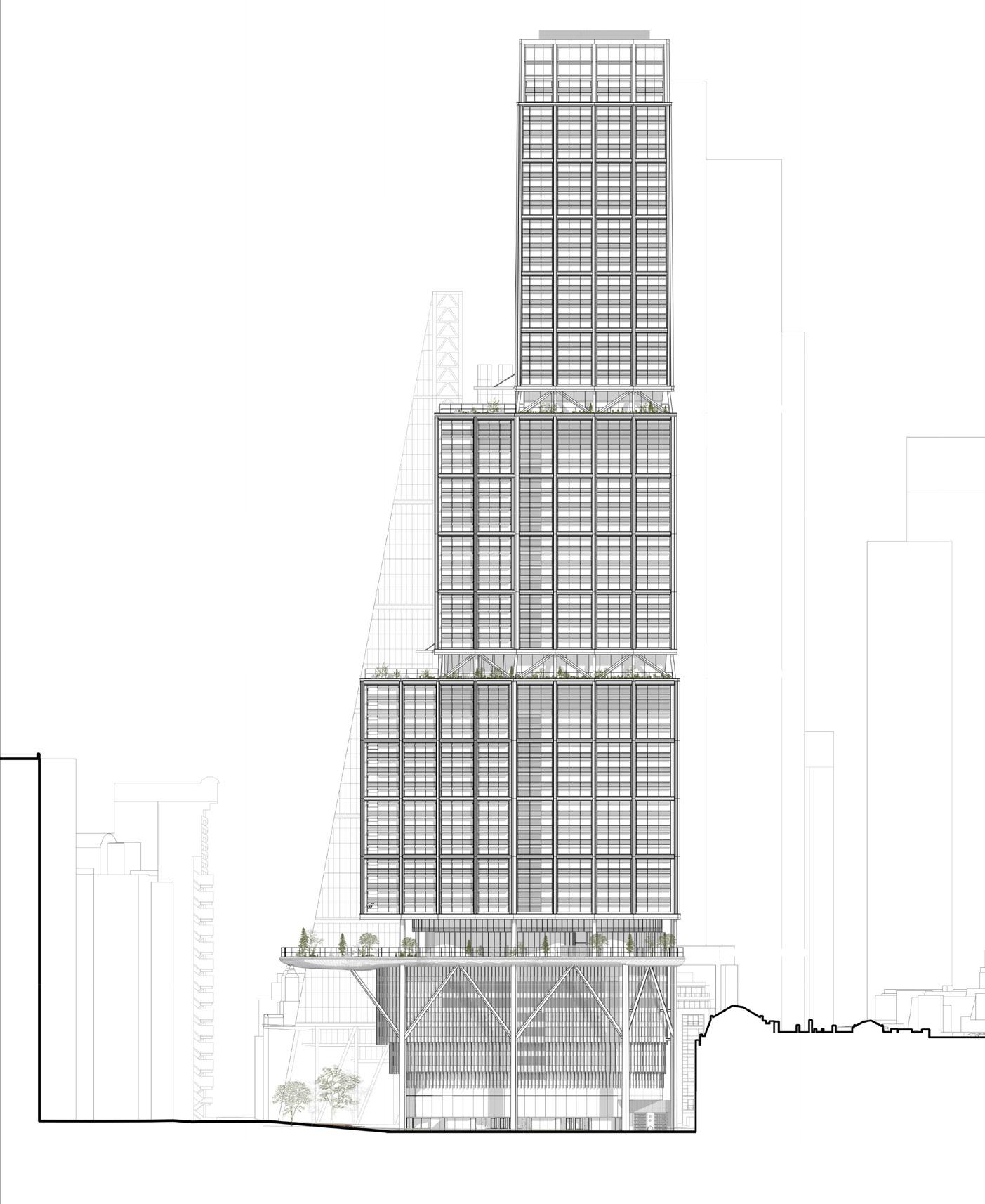
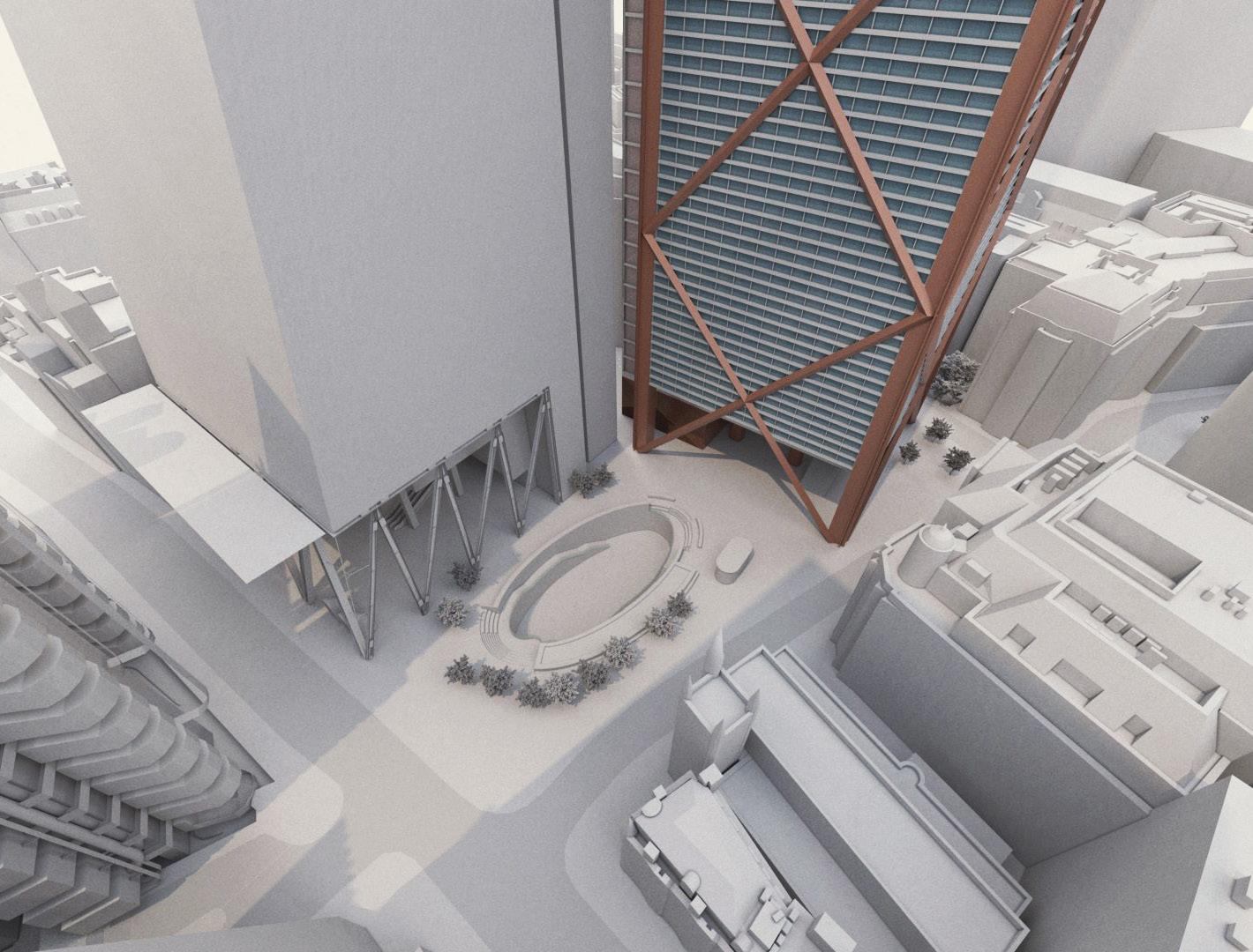
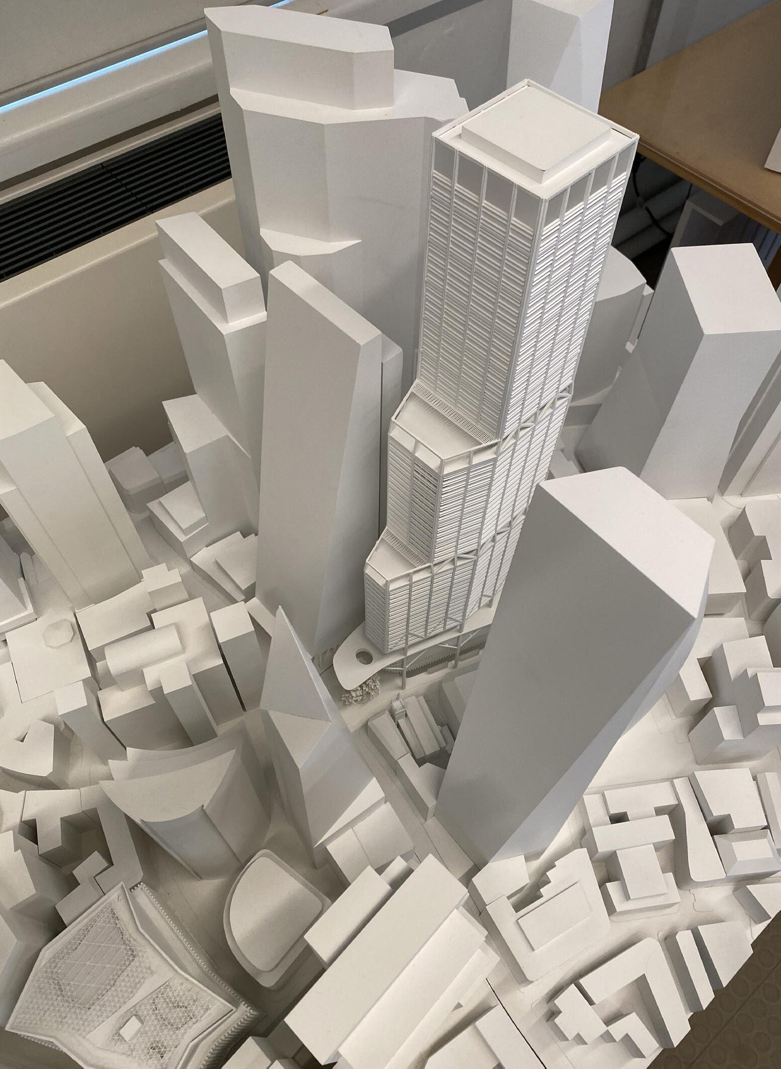
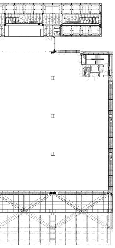
These plans show how the lower–middle massing of the tower of 1 Undershaft (see 2.4.1) in the 2023 application scheme has grown, in addition to the base, and is built over the existing St Helen’s Square.
– Upper floorplate of Aviva building is entirely to the north of St Helen’s Square, causing no overshadowing or reduction of visible sky from street level.
– Increased floorplate is entirely to the north of St Helen’s Square, and does not impose itself on the street level below.
– Increased lower–middle floorplate significantly encroaches into and overshadows
These plans show how the upper–middle massing of the tower of 1 Undershaft (see 2.4.1) in the 2023 application scheme has grown, in addition to the base, and is built over the existing St Helen’s Square.
– Upper floorplate of Aviva building is entirely to the north of St Helen’s Square, causing no overshadowing or reduction of visible sky from street level.
– Increased floorplate is entirely to the north of St Helen’s Square, and does not impose itself on the street level below.
– Increased upper–middle floorplate significantly encroaches into and overshadows St Helen’s Square, reducing areas of visible sky from street level.
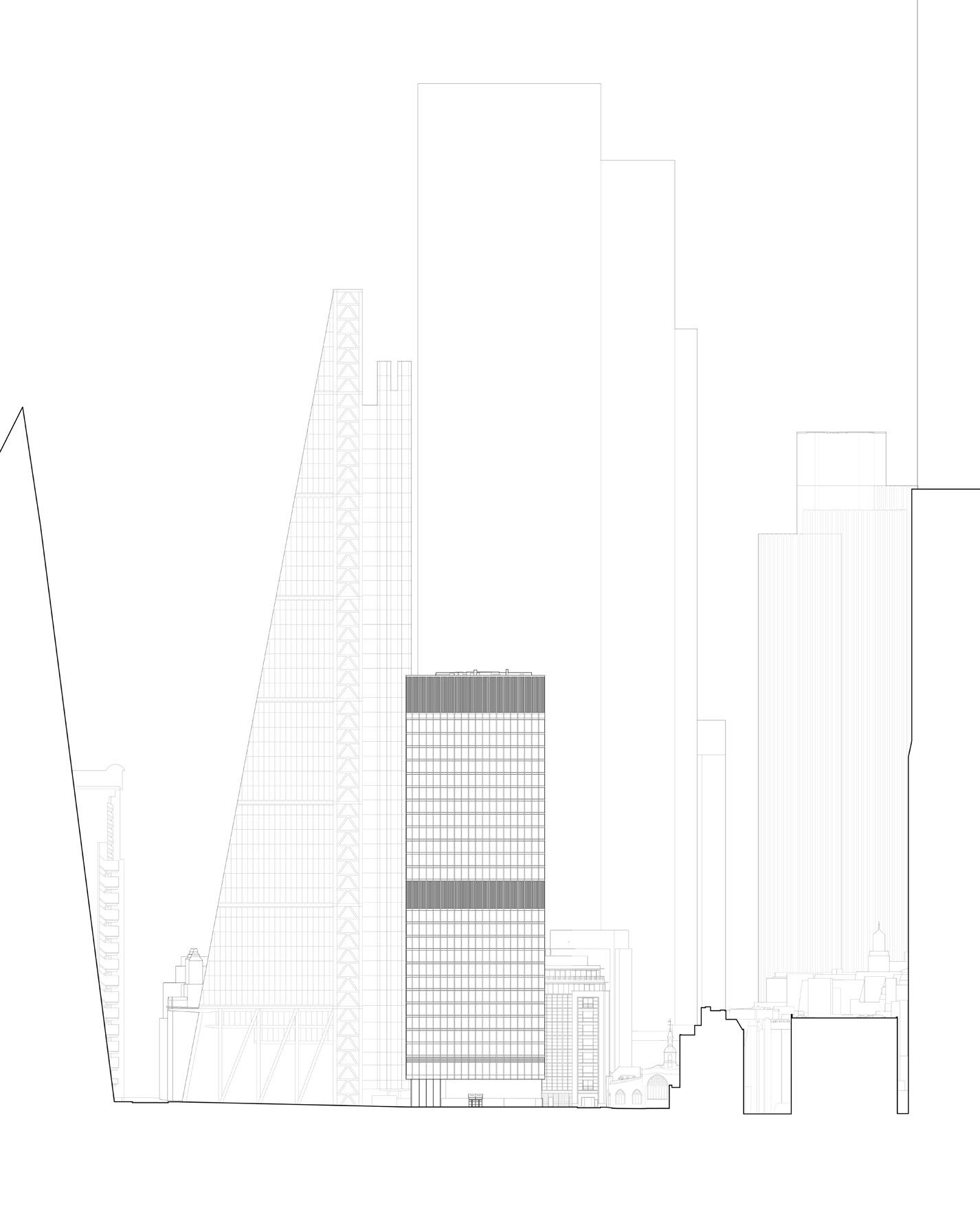
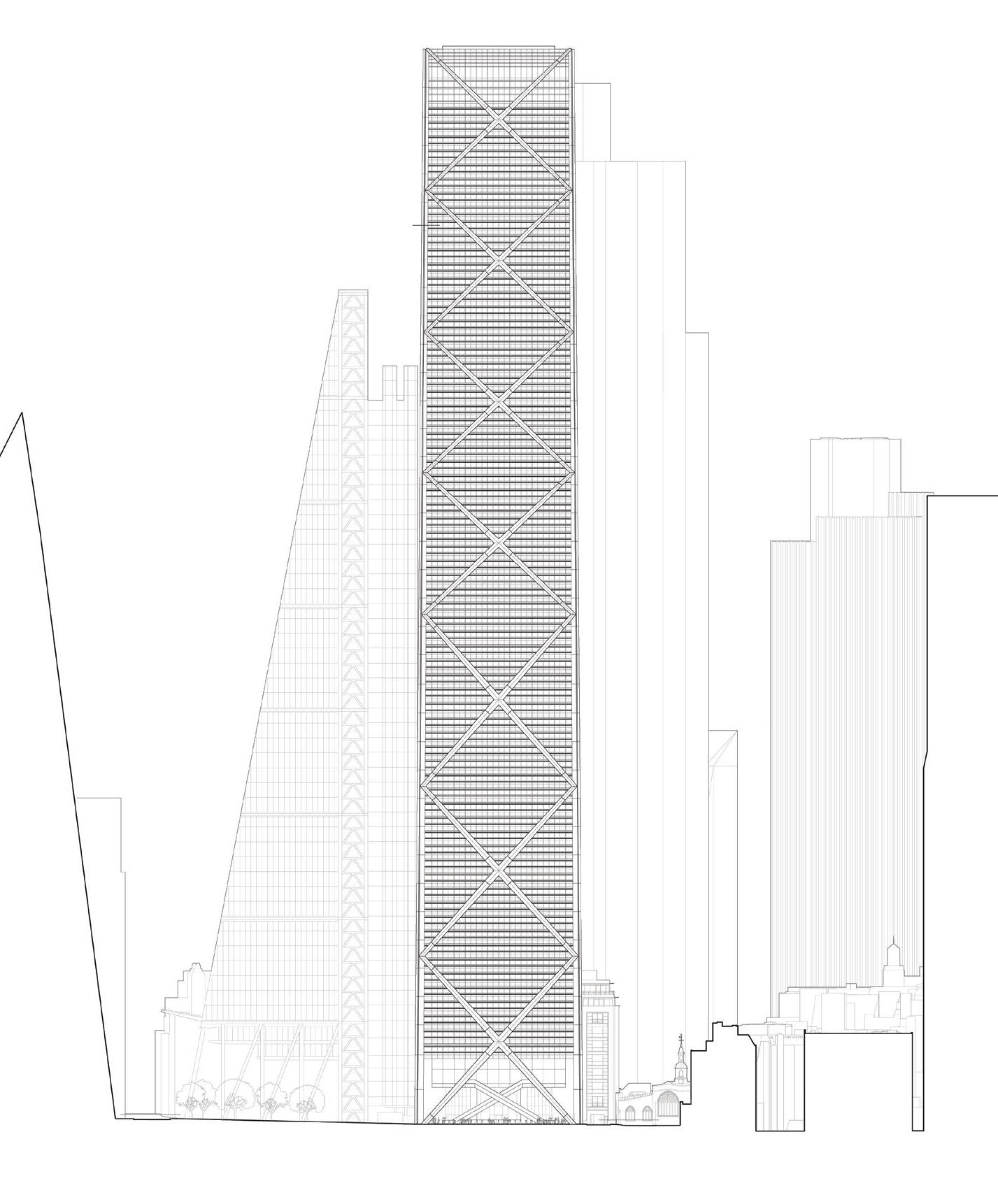
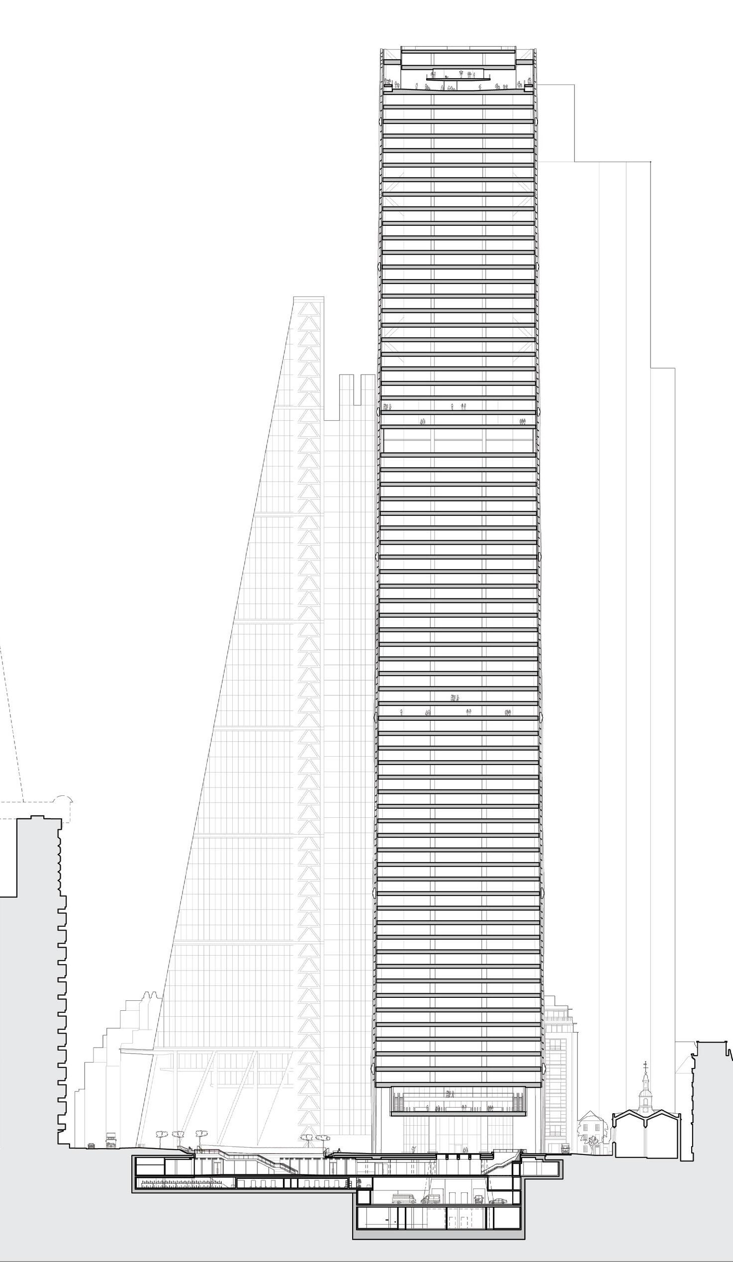
These elevations demonstrate how the increased massing of 1 Undershaft in the 2023 application obstructs the profile of The Leadenhall Building when viewed from Leadenhall Street and St Mary Axe to the east. In contrast, the 2019 consented scheme maintained the integrity of The Leadenhall Building in these views, showing respect and preservation of its architectural prominence.
+239.4m AOD
+133.0m AOD
– Massing of Aviva building is entirely to the north of St Helen’s Square, framing the iconic profile of The Leadenhall Building.
+304.9m AOD
– Increased massing of 1 Undershaft significantly diminishes The Leadenhall Building in views from St Mary Axe and Leadenhall Street in the east, and has an over-bearing and dominating impact on the townscape and heritage assets in St Mary Axe and Leadenhall.
Existing Extent Extent of 2023 Proposal
+309.6m AOD
+207.1m AOD
+136.2m AOD
+61.6m AOD
– The projecting podium, lower-middle, and upper-middle massing significantly reduce the extent of visible sky, sunlight, and privacy to surrounding buildings and streets, while overshadowing the public realm to St Helen’s Square (London Plan Policy D9, 3.9.7).
– Increased floorplate and projecting podium garden significantly overlap and obscure the iconic profile of The Leadenhall Building.
– Increased massing of 1 Undershaft significantly diminshes The Leadenhall Building in views from St Mary Axe and Leadenhall Street in the east.
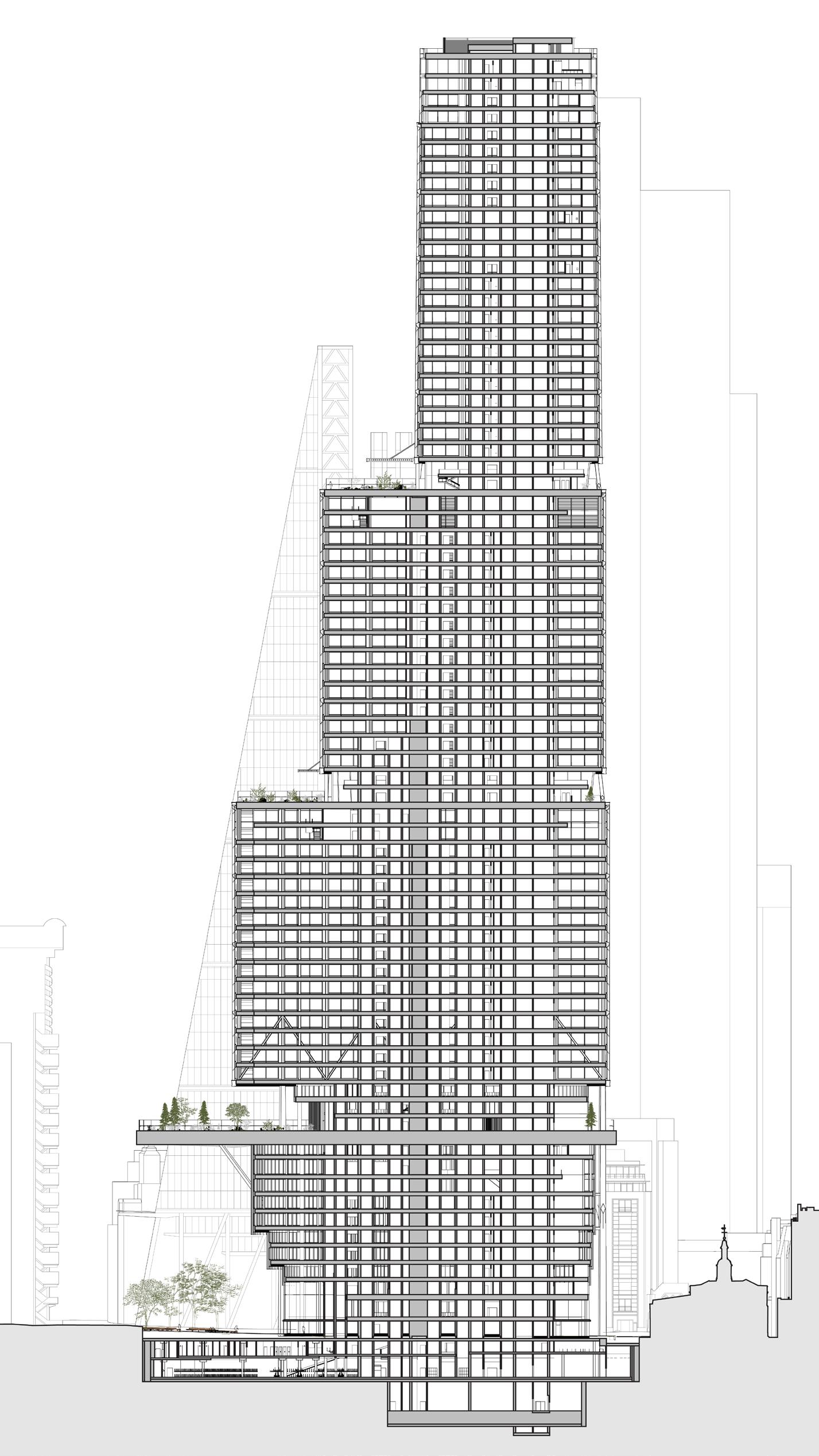
These sections illustrate how the 2019 consented scheme expands the size and connectivity of street-level public open space without encroaching onto or over St Helen’s Square. In contrast, the 2023 application proposals result in a significant loss of public open space and negative impacts on existing amenities by encroaching into and projecting over St Helen’s Square, which diminishes the area’s attractiveness and appeal.
– Massing of Aviva building is entirely to the north of St Helen’s Square, causing no overshadowing or reduction of visible sky from street level.
– All of St Helen’s Square retained and open to the sky, inviting pedestrians into an enhanced civic space with improved connectivity.
– The Undercroft of the 2019 scheme provides 1,635 m2 additional public realm and improves connections between St Helen’s Square / Leadenhall Plaza and St Helen’s Church / 30 St Mary Axe.
– Lower ground plaza creates 496m2 additional public realm, activated by 1,543 m2 of restaurants and shops.
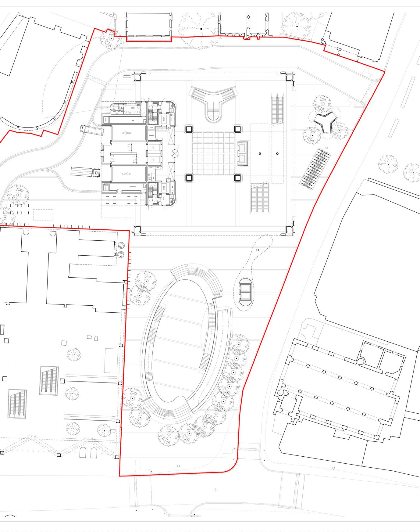
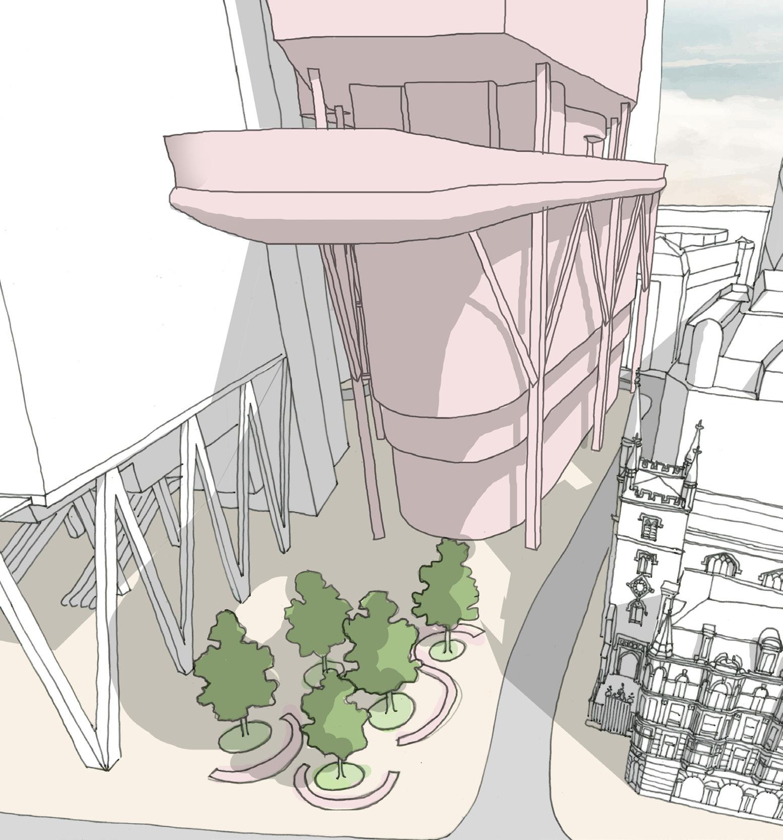
– The enlarged footprint intrudes into St Helen’s Square, resulting in the loss of 29.2% of the Square’s area (accounting for a slight realignment of the north of the square due to proposed column locations).
– Level 11 canopy covers an additional 39.5% of St Helen’s Square, demoting its significance and diverting activity away from street level, while significantly harming direct sunlight levels.
These context plans illustrate how the 2019 consented scheme helped stitch together existing public open spaces at 30 St Mary Axe and St Helen’s Square / Leadenhall Plaza by providing a new public space at street level and lower ground floor, connecting St Helen’s Church with St Helen’s Square. Comparatively, the 2023 application serves to fragment the existing public realm and block the connection between the Church and Square.
Total public realm: 4,505 m2
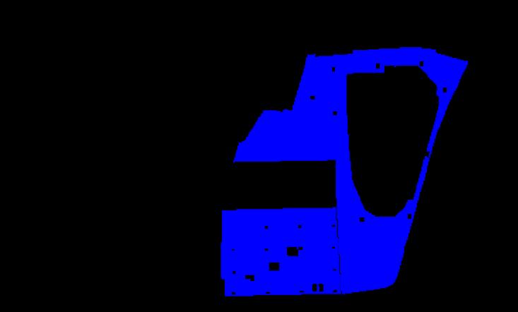
St Helen’s Square public realm: 2,433 m2
– St Helen’s Square is a unique and vitally important civic space in the heart of the City Cluster, framed by medieval Churches and iconic modern architecture.
– It provides 2,433 m2 of south-facing street level open space which is open to the sky and connected to the Leadenhall Plaza, encouraging a diverse array of activity and interaction.
Total public realm: 5,361 m2 (+856) (+19.0%)
St Helen’s Square public realm: 2,438 m2 (+5) (+0.2%)
– All of St Helen’s Square retained and open to the sky, inviting pedestrians into an enhanced civic space with improved connectivity.
– The Undercroft of the 2019 scheme provides 1,635 m2 additional public realm and improves connections between St Helen’s Square / Leadenhall Plaza and St Helen’s Church / 30 St Mary Axe.
– Lower ground plaza creates 496m2 additional public realm, activated by 1,543 m2 of restaurants and shops.
Context Buildings
Grade I Listed
Grade II / II* Listed
Public Open Space Roads

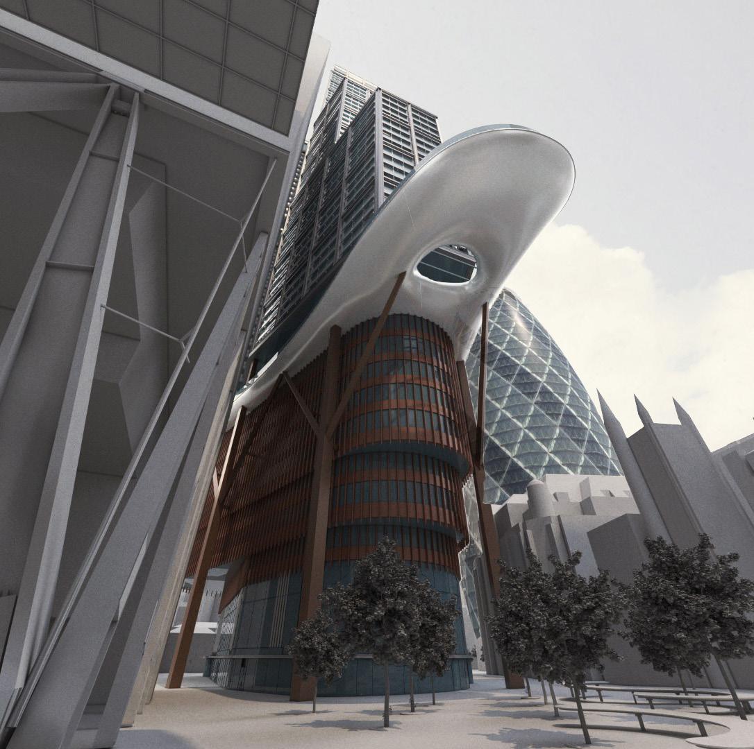
Total public realm: 3,770 m2 (–735) (–16.3%)
St Helen’s Square public realm: 1,723 m2 (–710) (–29.2%)
– The enlarged footprint intrudes into St Helen’s Square, resulting in the loss of 29.2% of the Square’s area (accounting for a slight realignment of the north of the square due to proposed column locations).
– Level 11 canopy covers an additional 39.5% of St Helen’s Square, demoting its significance and diverting activity away from street level, while significantly harming direct sunlight levels.
– Relocated servicing bay deteriorates relationship with 30 St Mary Axe and its associated public realm.
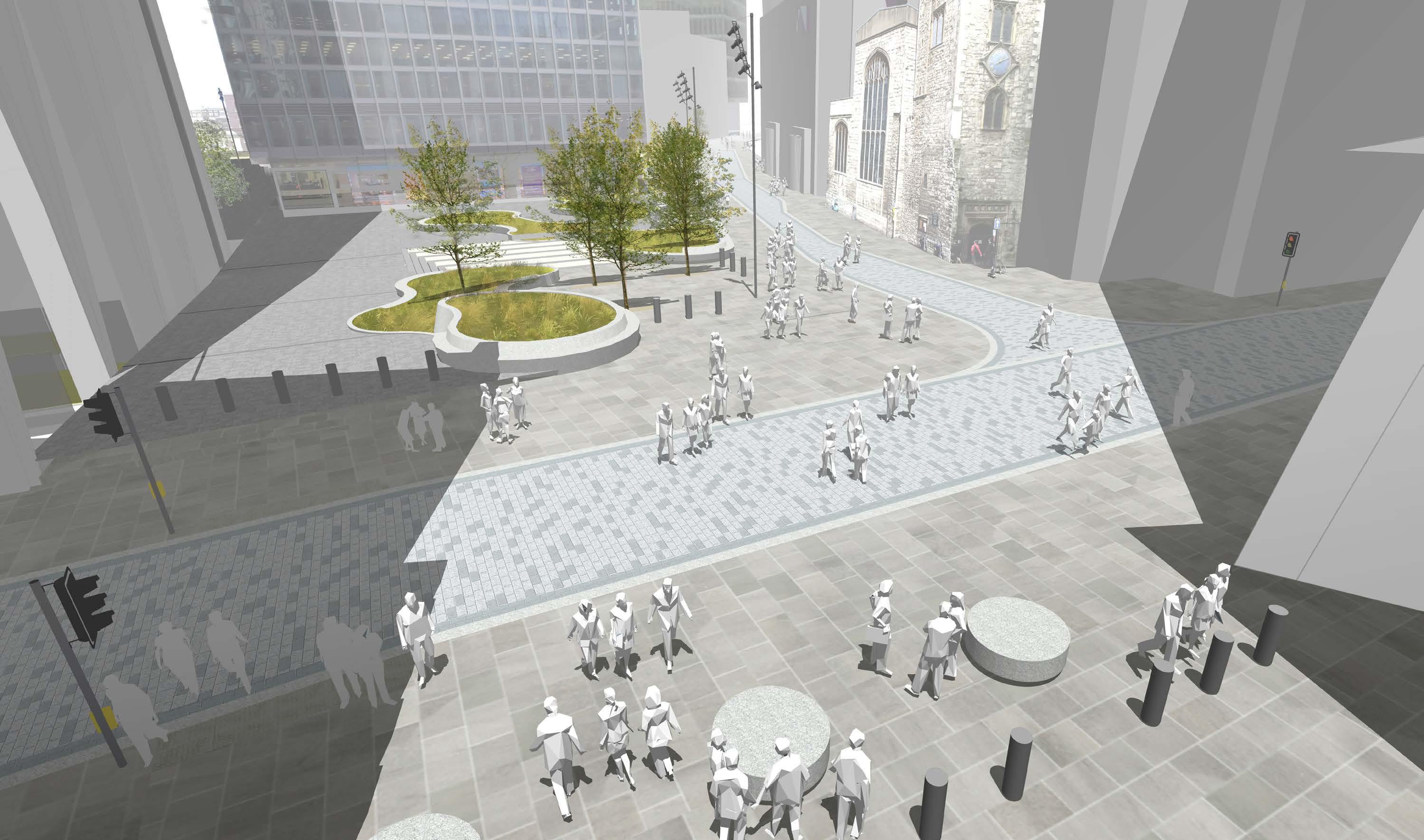
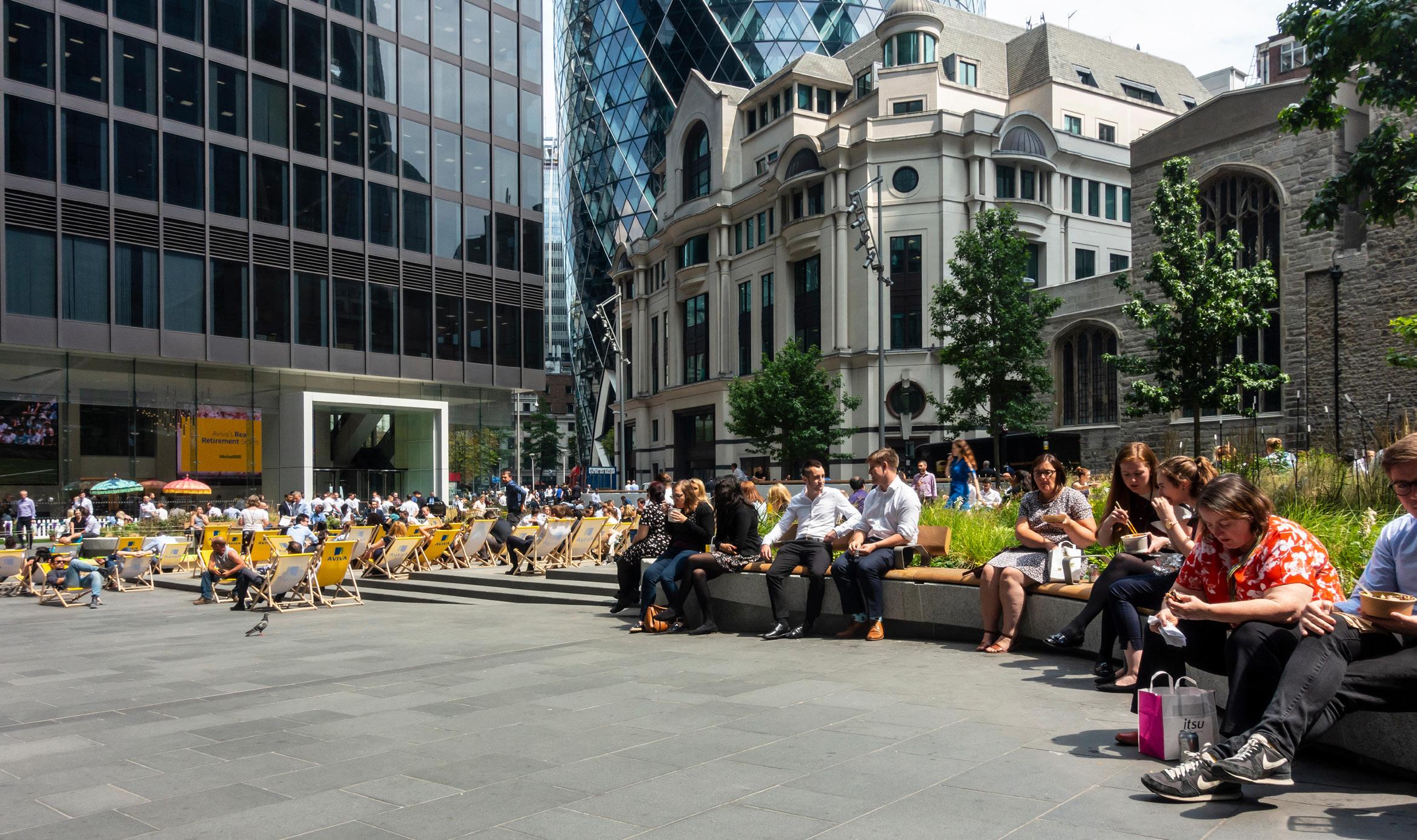
A city is defined by its public realm – the free, safe and open spaces where people can simply enjoy the sky and fresh air, regardless of age, wealth or background. They can move freely, saunter or sit, seek solitude or company, enjoy direct sun or green shade, snooze or chatter. The buildings may be magnificent, but it is the spaces between them that bring settlements alive and give inhabitants a sense of equality. The denser and taller the city, the more the public realm matters.
The City of London absolutely recognizes the significance of its open spaces and has particularly focused on the public realm at the heart of its tallest buildings – the Eastern Cluster. St Helen’s Square is pivotal. It is the largest open space, faces south and is surrounded both by medieval churches and some of the most iconic buildings of our time. You can only really appreciate and enjoy those buildings if you have the space to step back and see them. Pedestrian routes through the City radiate from the square. People cross the space constantly, it hums with lunchtime life in summer sunshine and warm evening gatherings. It keeps the City human.
Historically, open space has been very limited in this tight urban grain, so the few places where sunlight actually reaches the ground, creating a comfortable place for people to gather and enjoy the public realm, are especially important.
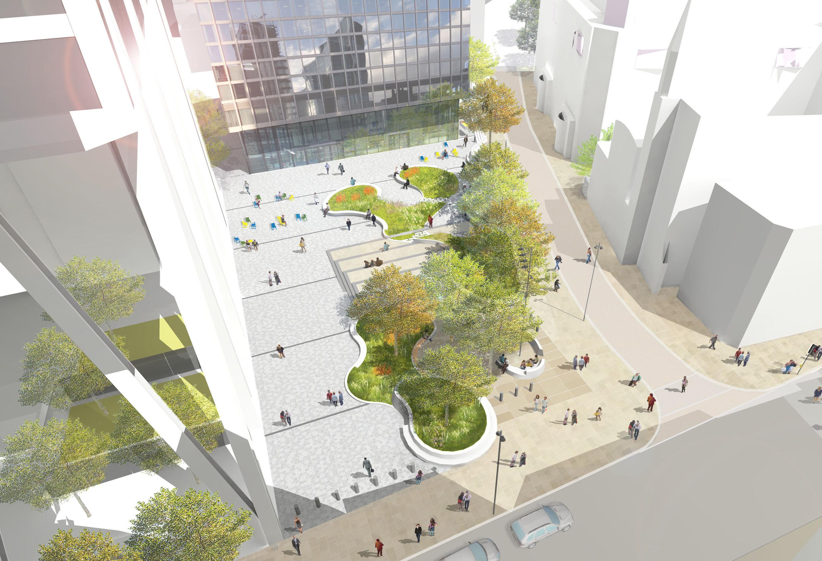
St Helen’s Square has been designed to encourage people to sit, eat and talk along the lively pedestrian routes through the space. The curving seating walls and movable deck chairs offer endless possibilities for sitting in pairs, groups or quietly contemplating the scene alone. People can follow the sun or seek shade, depending on the temperature. There is a sense of free and spontaneous engagement with one another and the urban scene. The open sky and sunlight with luxuriant greenery give instant relief in the dense, febrile atmosphere of the City. It is a place to escape the tensions of the office, make human contact and enjoy open air in the middle of a day often bookended by long, dark commutes.
William Whyte’s seminal studies of pedestrian movements in New York have shown not only how these simple gestures towards human comfort and interaction can transform how spaces are used. He also demonstrated how a lively sunlit public realm at street level transforms the safety, productivity and ultimately the value of the buildings that surround it.
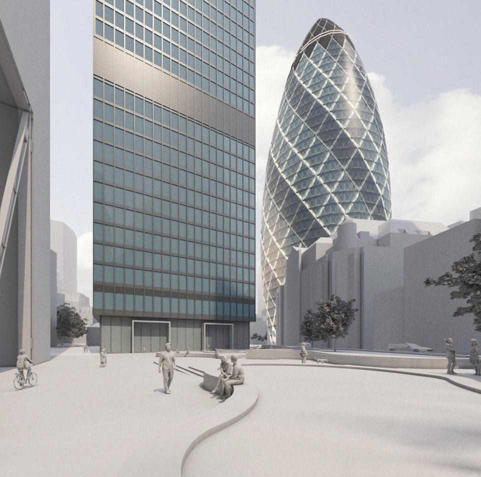
1. Images of St Helen’s Square; existing photo, & verified view from 2023 application.
2. Comparative CGI views of proposals from corner of Leadenhall Street / St Helen’s Square.
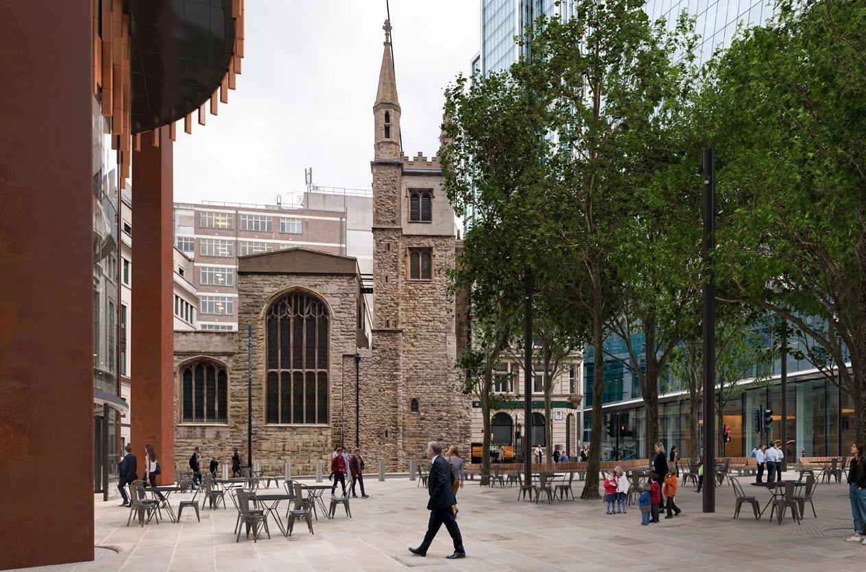
As the central pivotal space in the Eastern Cluster, St Helen’s Square connects the surrounding thoroughfares and also links to the plazas in front of St Helen’s church and the Gherkin. The easy and visible flow of these spaces and the careful framing of architecture, such as the Lloyd’s Building (Grade I listed), create a reassuring and instinctive wayfinding through the City. It allows people to wander and explore without having to rely on their phone screens.
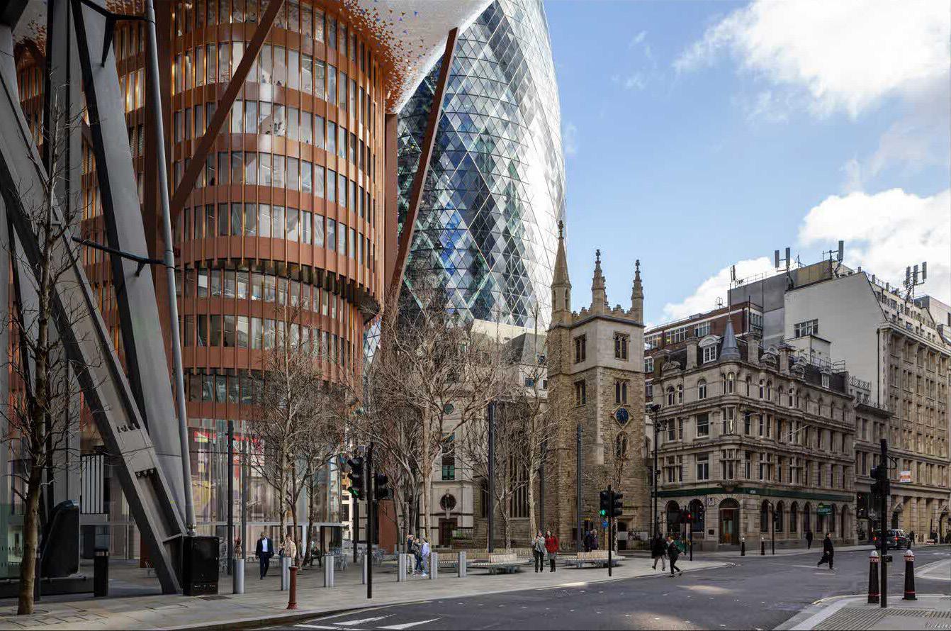
Eric Parry’s consented scheme for 1 Undershaft would make a significant contribution to the City and to London. As the second tallest building in the capital, it is designed to complete the composition of the City Cluster. Tall, slender and carefully positioned to complement its neighbours, the design of the new tower is both elegant and beautiful. It also addresses one of the most important urban spaces at the centre of the City, St Helen’s Square. With its south-facing square and oval connection to the shops below, the consented scheme opens to the space with simple generosity. It maximizes sunlight at street level, welcomes passing pedestrians into the square, reveals the connection between St Helen’s and St Andrew Undershaft and creates a warm, pivotal civic realm at the heart of the City, framed by some of the most iconic buildings of our time.
The 2023 proposals for an amended scheme that covers or overhangs most of the public realm undermines the beauty and benefits of the consented 2019 design:
– The amended building would no longer be slender and elegant, fitting gracefully into the composition of the cluster.
– The generous civic space which opens to the south of the building is largely replaced by built form and overhang.
– Midday summer sunshine no longer reaches most of the street and square. Reflected morning and evening light is blocked from the centre of the space.
– The rare urban moment of generous open sky, framed by fine buildings from the street level is removed.
– The viewing platform at the eleventh floor as a replacement for street level public square does not compare in terms of welcome, easy access and equitable public realm.
– The ‘comfort and quality of the user experience’ at ground level (prioritized by the City Strategy) is fundamentally compromised.
– The pivotal junction of Leadenhall and Lime Streets with St Mary Axe is pinched rather than opened and the connection between St Helen’s and St Andrew Undershaft churches is blocked.
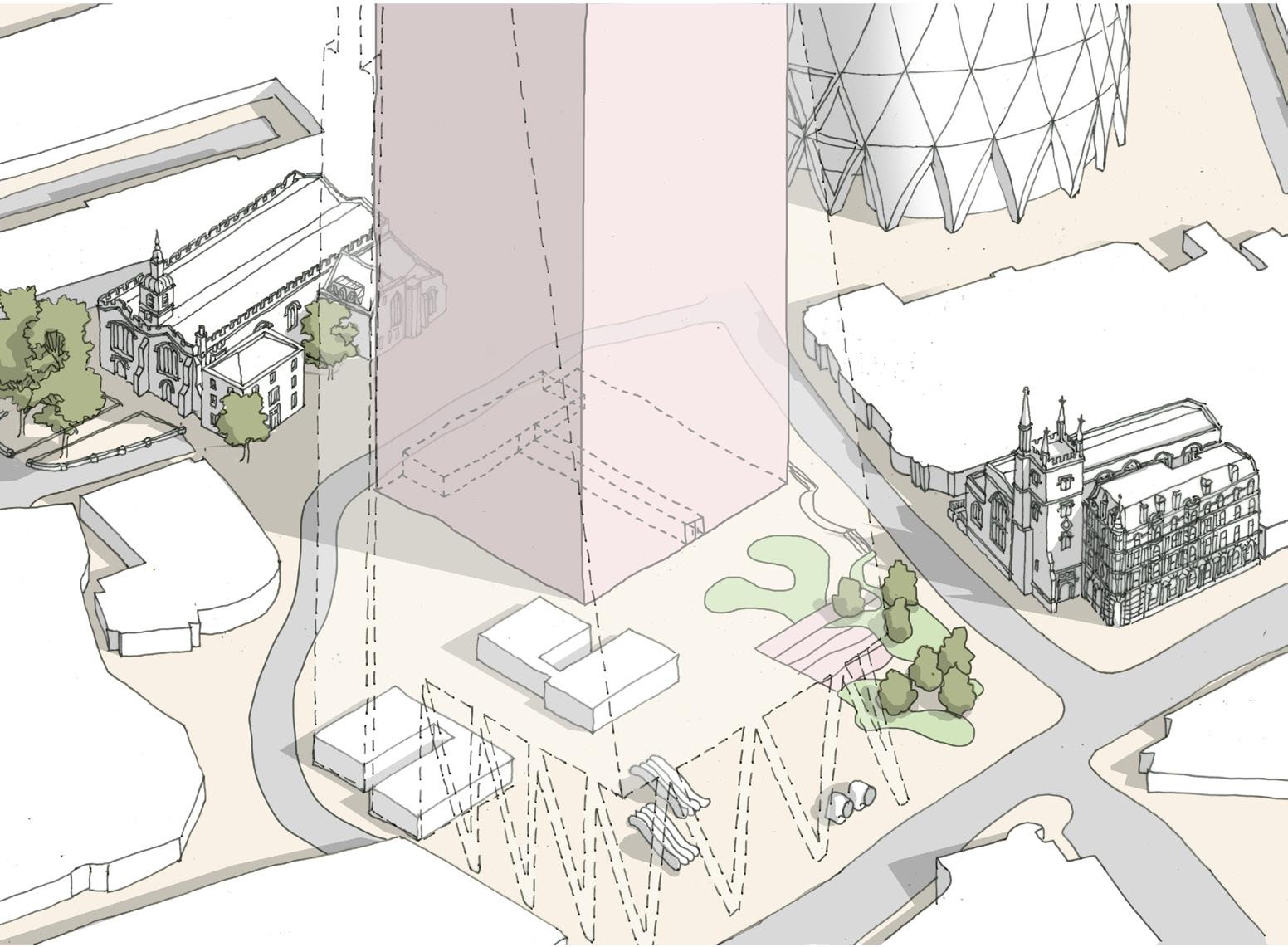
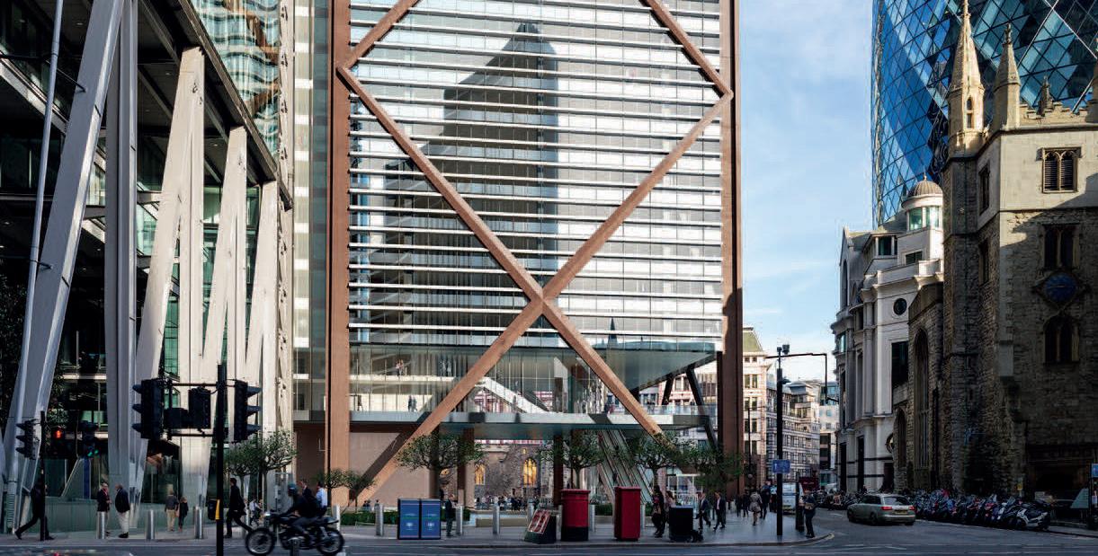
1. Verified view from Leadenhall Street / Lloyd’s Building junction, existing Aviva building & 2023 application.
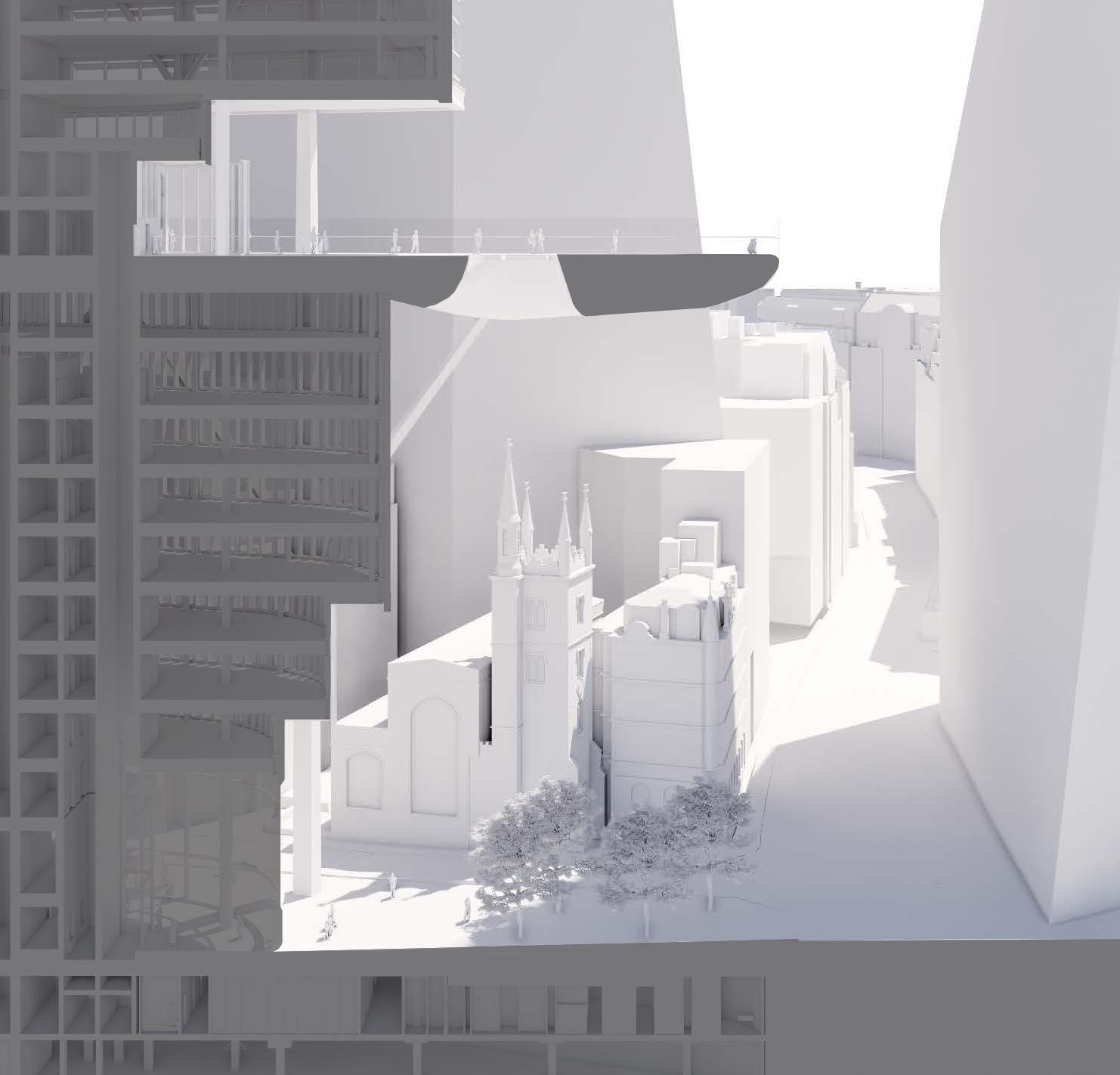
2. Perspective section of 1 undershaft, adapted from EPA stakeholder presentation 27 November 2023.
3. Reflected ceiling plans comparing extent of visible sky between proposals.

The existing area of St Helen’s Square is 2,433 m2. It is all open to the sky and elements. A substantial 29.6% (721 m2) -of that area will be lost because of the increased ground level footprint. This loss is the equivalent of approximately 7% of publicly accessible open space in the eastern cluster. The eastern cluster already has, by far, the lowest proportion of open space in The City, and there is a recognised need for more open space.
The development proposal with its over-hanging structure and protruding tongue will leave just 29.7% (723 m2) as open space open to the sky. Most of the space will be covered.

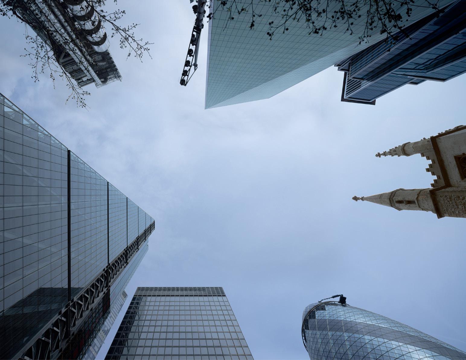
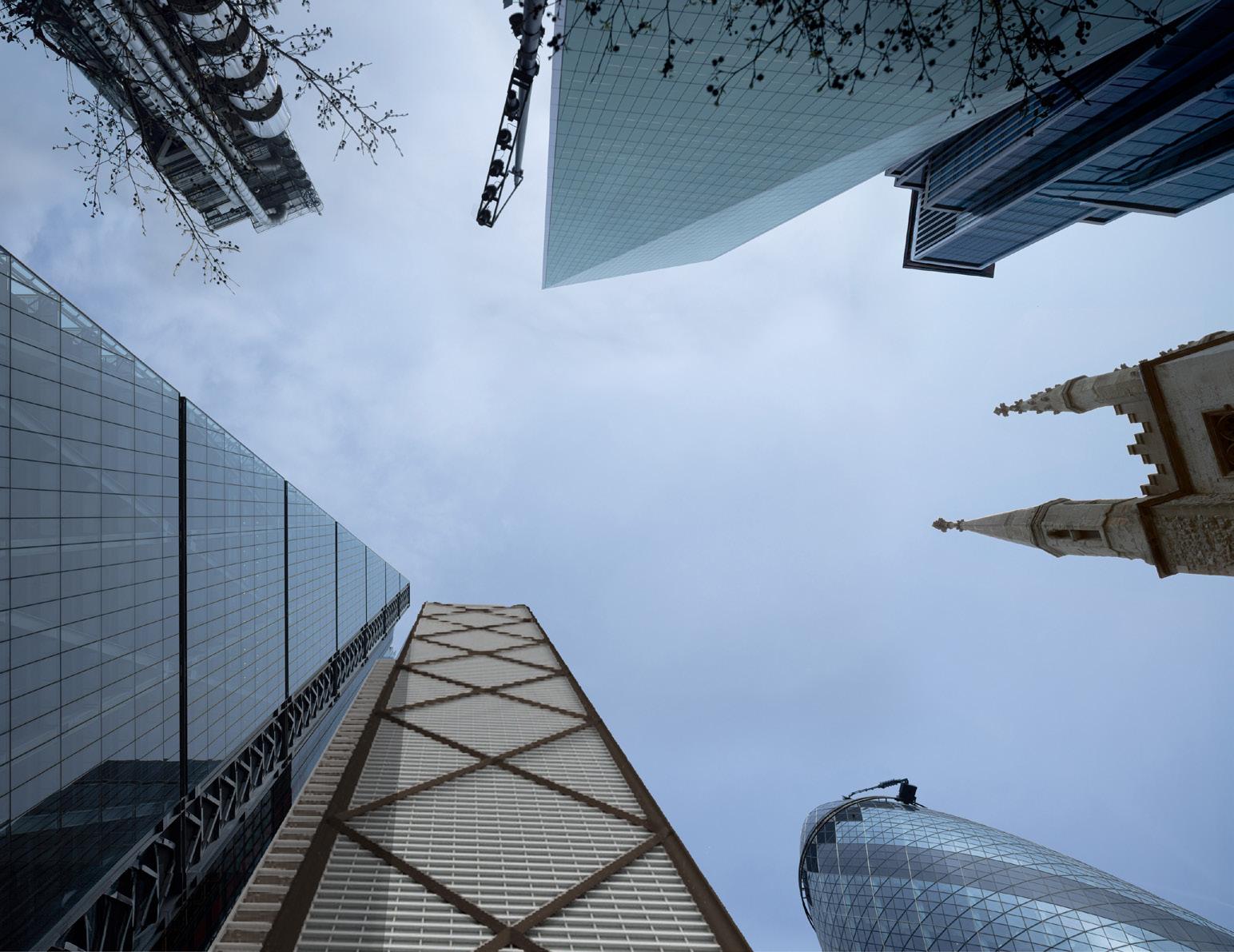
1. Existing view of sky from St Helen’s Square, with overlay of 2019 consented scheme & 2023 application proposals, highlighting significant loss of sky.
2. Section N–S through plaza to St Helen’s Square, & ground floor plan, 2019 consented scheme.
In sharp contrast, the 2019 extant planning permission kept the whole of St Helen’s Square and achieved a net-gain in area through the design of a lower ground plaza, creating a truly cathedral-like space extending through 1 Undershaft at street level.
It maximizes sunlight at street level, welcomes passing pedestrians into the space, opens the connection between St Helen’s and St Andrew Undershaft churches and creates a warm, pivotal civic realm at the heart of the City, framed by some of the most iconic buildings of our time.


1. Comparison of total sunlight hours to public realm between 1 Undershaft proposals, combining information from 2023 application & post-submission consultation, results shown at 21st June for all three proposals.

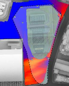
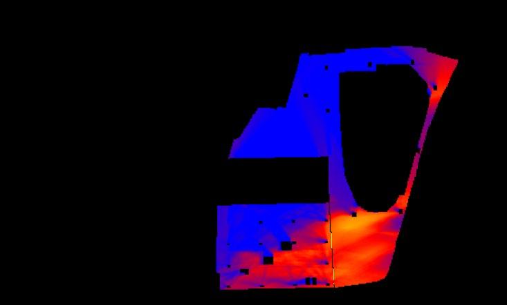
Increased massing of the lower and middle portions of 1 Undershaft, in addition to the L11 canopy, creates significant overshadowing in St
The centre of the square receives only approximately 3 hours of , with areas of the periphery dropping to less than
When compared to the existing situation, there is a clear and harmful reduction to the sunlight received, resulting in a detrimental impact to
In conclusion, the overshadowing assessments provided in both the submission documents and post-submission stakeholder report, demonstrate that there will be a noticeable and detrimental impact to the amount of direct sunlight received to St Helen’s Square as a result of the 2023 1 Undershaft proposal. St Helen’s Square will experience a significant reduction in direct sunlight received during summertime when the space is most frequently used for sitting out, resulting in what should be considered unacceptable harm to a unique external space within the eastern cluster.
It is accepted that there will be limited direct sunlight received in St Helen’s Square at Spring Equinox, March 21st, which is the BRE recommended testing time. This is due to the high density and height of surrounding buildings meaning the space will be already heavily overshadowed at this time of year, when the sun is at a mid-position in the sky dome. On this basis, the 2023 1 Undershaft proposal is unlikely to cause a noticeable reduction in direct sun.
However, at June 21st St Helen’s Square experiences excellent levels of direct sunlight in both the existing and consented situations. The 2023 1 Undershaft proposal however, results in a noticeable and substantial loss of sunlight due to the increased massing and proposed overhanging terrace. It is noted that the applicant has not provided a Permanent Overshadowing Study for 21st June, The BR Guide at paragraph 3.3.15 states. As an optional addition, plots for summertime (for example 21 June) maybe helpful as they will show the reduced shadowing then, although it should be borne in mind that 21 June represents the best case of minimum shadow, and that the shadows for the rest of the year will be longer.
St Helen’s Square will be less attractive, sitting out will be less pleasant, plant growth will be discouraged in summer, and increased moisture will be encouraged at ground level, giving rise to moss and slime. These findings are a clear departure from the BRE guidance in paragraph 3.3.1 of their handbook (Site layout planning for daylight and sunlight: a guide to good practice, BR 209 2022):
3.3.1 Good site layout planning for daylight and sunlight should not limit itself to providing good natural lighting inside buildings. Sunlight in the spaces between and around buildings has an important impact on the overall appearance and ambience of a development. It is valuable for a number of reasons, to:
– provide attractive sunlit views (all year)
– make outdoor activities like sitting out and children’s play more pleasant (mainly warmer months)
– encourage plant growth (mainly spring and summer)
– dry out the ground, reducing moss and slime (mainly in colder months)
– melt frost, ice and snow (in winter)
– dry clothes (all year).
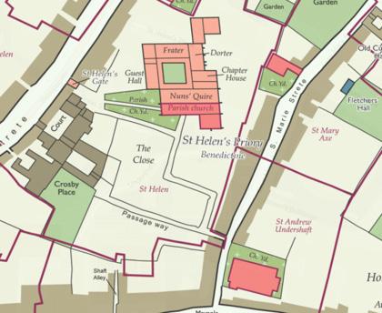
Pedestrian link between churches Defined visual link No visual link
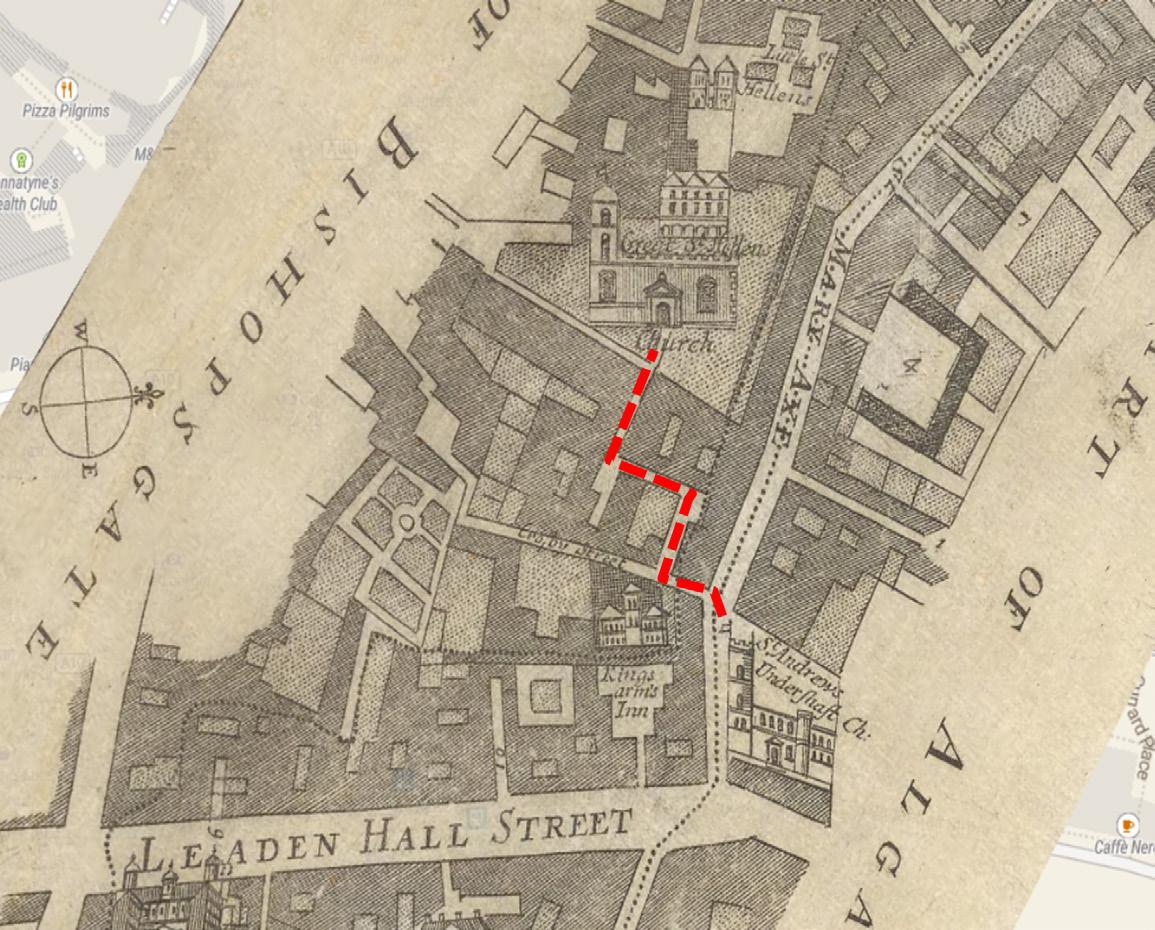
1. Aerial perspective sketches looking north-east across St Helen’s Square, comparing physical and visual relationships across historic public realm.
2. Historic Map Progression of historic link between St Andrew Undershaft Church and St Helen’s Church.
St Helen’s Church
St Helen’s Church
St Andrew Undershaft Church U n d e r s haft LeadenhallStreet StMaryAxe
St Andrew Undershaft Church U n d e r s haft LeadenhallStreet StMaryAxe
St Helen’s Church
Andrew Undershaft Church
Direct pedestrian route reinstated between churches via the public open space under 1 Undershaft
Direct visual link between churches & St Helen’s Square through the public open space under 1 Undershaft
No direct pedestrian route between churches (access via the pavement to St Mary Axe & Undershaft)
No visual link between the churches
No visual link between St Helen’s Church & Square
This chapter summarises the Heritage and Townscape Appraisal of the 2023 application undertaken by Stephen Levrant Heritage Architecture, included within these Representations as Appendix C.
The creation of St Helen’s Square in the mid-20th century contributed an important new public space to the City and revealed the architectural interest of St Andrew Undershaft Church in a way that enhances the legibility of the building to the general public. The active use of this square benefits the public experience and appreciation of nearby heritage assets, including: St Andrew Undershaft Church (Grade I), St Helen’s Bishopsgate (Grade I) and the Lloyds Building (Grade I).
The significance of St Helen’s Square as a positive component in the setting of a number of highly significant listed buildings is considerably underplayed within the submitted Built Heritage and Townscape Reports (prepared by Tavernor, Dec. 23). The report suggests the proposals will result in ‘no harm’ overall (after undertaking an internal balancing exercise). Although it is very much agreed that the historic setting of St Andrew Undershaft Church and St Helen’s Church Bishopsgate has been severely eroded, this does not provide sufficient justification for further harm. The very fact that their setting has been compromised, necessitates a much more carefully considered approach for future development, ensuring cumulative impacts do not further erode the ability to appreciate the considerable significance of these of these Grade I listed buildings. Therefore, each planning application for a new development must be rigorously tested against the baseline, and alternative schemes which may reduce or indeed negate any harmful effects.
It is evident the 2023 redevelopment plans will cause harm through both physical loss of the square and through the indirect impact to the settings of nearby heritage assets of exceptional significance, including: St Andrew Undershaft Church (Grade I), St Helen’s Bishopsgate (Grade I) and the Lloyds Building (Grade I). This harm is most prevalent in views across St Helen’s Square, in which the distracting and stark materiality of the current design juxtaposes that of other contemporary forms and dominates street level views, rather than allowing St Andrew Undershaft Church to remain as the focal point.
The connective route between the two Medieval churches, as evidenced by historic mapping, was reactivated as part of the 2019 scheme. Introducing a major heritage benefit and enhancement to public realm.
When consulted on the previous, consented scheme, Historic England stressed the benefits of the improved connection between the two medieval churches, stating: “The remodelling of the ground plane around the proposed tower will introduce high quality materials, increase permeability and create sight lines between the medieval churches of St Helen and St Andrew Undershaft. All of this will have a significant positive impact on the settings of these grade I listed buildings”. This benefit is lost in the 2023 application design.

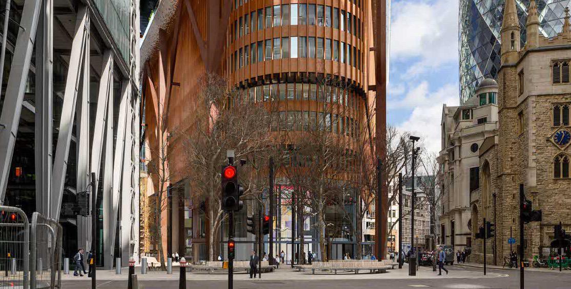
1. View from 30 St Mary Axe looking south east, 2019 consented scheme.
2. View from St Mary Axe / Bury Court looking south east, 2023 planning application.
3. Proposed north-south sections through 1 Undershaft and St Helen’s Square.
2.
The ‘tall building’ character in the Eastern Cluster is striking and dominant. Each of these tall buildings, whilst distinctive in their own right, present a harmonious composition through use of lightweight, reflective materiality and glazing. Close range views from the surrounding streetscapes illustrate that the buildings work together harmoniously in townscape views, allowing one another to be read in isolation, with their full elevations and external form appreciable, but can also be read as a collective and striking cluster in long-distance views from the wider cityscape. The townscape interest of the Eastern Cluster is appreciated at an international level, and thus, it is necessary for new design and development to respect the existing harmony between open spaces and built form and to be of outstanding quality.
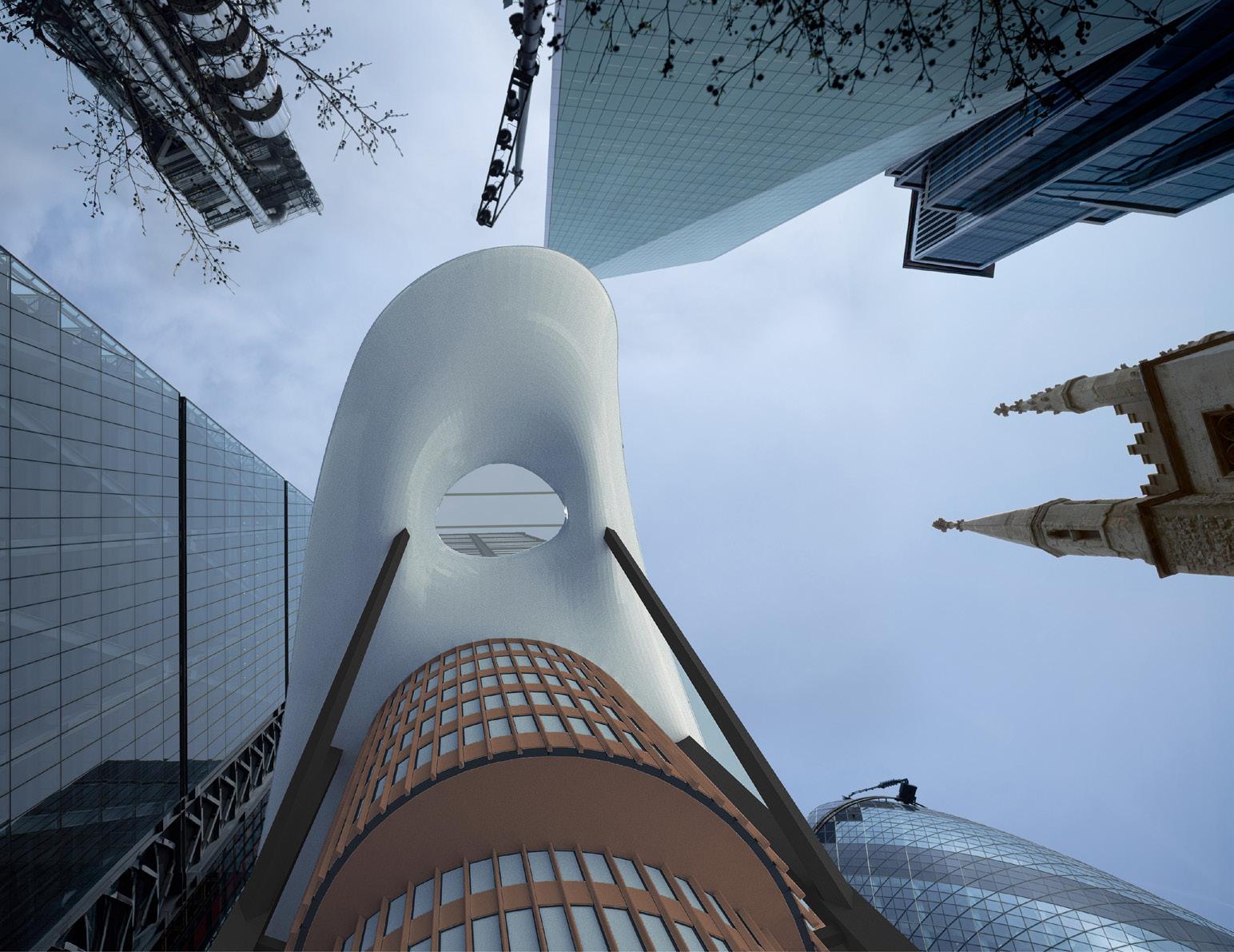
The revised 2023 design proposal for 1 Undershaft presents a jarring and alien element in its current context and its encroachment on the settings of nearby listed buildings is inappropriate and most importantly, avoidable. The protruding tongue together with the enlarged footprint, have eroded the character and ambience of the open space. Attempts to provide free, high-level public access present challenges for permeability and engagement. These high-level public spaces lack the casual or momentary engagement that is currently prevalent within the accessible, ground level space provided by St Helen’s Square. Instead, reaching these higher levels requires a deliberate investment of time and effort, placing an obligation on the participant. Even with the design rationale of the present proposal, the tongue does not flow from the elemental form but is planted in ungainly superposition on already incoherent and disparate taxis. This has not only eliminated the element of altruistic intent, also has no meaning as an essential contribution to the setting of a tall building.
The refined architectural panache and élan which had been applied to the previous, 2019 consented scheme, was undoubtedly beautiful and demonstrably more appropriate for this setting. It maintained and enhanced a sense of openness to the base of the building, which mirrors the contemporary form and welcoming character of The Leadenhall Building, with elements of the construction exposed in a light yet ‘truthful’ way. The 2023 design is the antithesis of beauty. Instead of a dignified, elegant repose, it is aggressive, forceful and un-restfully brutal.

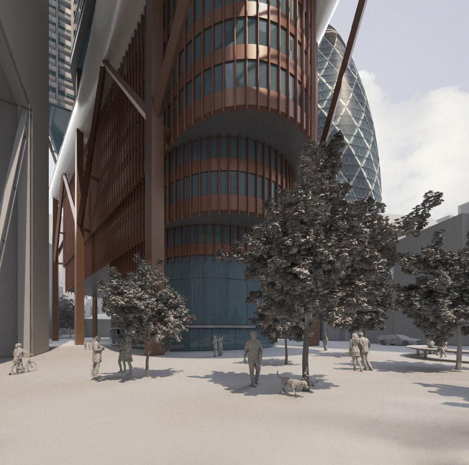
1. Aerial perspective sketches looking north across St Helen’s Square.
2. View north towards St Helen’s Square and St Helen’s Bishopsgate Church from Lime Street, 2019 consented scheme.
3. View north towards St Helen’s Square (St Helen’s Church obscured) from Lime Street, 2023 application.
– Upper floorplate of Aviva building is entirely to the north of St Helen’s Square, causing no overshadowing or reduction of visible sky from street level.
– Increased floorplate is entirely to the north of St Helen’s Square, causing no additional overshadowing or reduction of visible sky from street level.
– By lifting upward to create a generous undercroft, the base integrates well with the street frontage of adjacent buildings and reveals the connection between St Helen’s Church / Square, and St Andrew Undershaft Church, enhancing the pedestrian experience of the public realm in the heart of the City Cluster (contrary to London Plan Policy D9, and paragraph 3.9.8 advice on the design of the base of tall buildings).
– Increased floorplate and projecting podium garden significantly encroaches into and overshadows St Helen’s Square, reducing areas of visible sky from street level.
– The base of the building fails to adequately frame the public realm and streetscape. The significant reduction in size of St Helen’s Square and overshadowing by the projecting podium and middle massing cause significant harm to the quality of public realm and pedestrian experience (contrary to London Plan Policy D9, and paragraph 3.9.8 advice on the design of the base of tall buildings).
In conclusion, the revised proposal is considered to give rise to identifiable harm through inappropriate design, bulk and alien character. It is thus in direct conflict with the policies contained within the 1990 Planning (Listed Buildings and Conservation Areas) Act, the NPPF (Dec 2023) and local planning policies, with particular reference to Policy D9, (point d) of The London Plan; and DM 12.1, as it undermines a well utilised, open public space within the settings of some of the City’s most important heritage assets.
As stated within para.206 of the NPPF (2023), ‘Any harm to, or loss of, the significance of a designated heritage asset (from its alteration or destruction, or from development within its setting), should require clear and convincing justification’. It is asserted this justification in respect of settings has not been provided within the submitted reports.
It is therefore strongly recommended that the proposals are reconsidered in order to avoid harm to built historic environment.
Whilst it is recognised the 2023 proposals for 1 Undershaft will bring about a number of public benefits, it is clear these benefits could be achieved with an alternative scheme which could avoid any harm to heritage assets. The 2019 consented proposals were considered appropriate in this regard.
The 2023 design heavily reduces the sense of openness and will introduce an alien character in the immediate setting of the Grade I listed St Andrew Undershaft Church, contributing to a sense of visual clutter and distraction. This presents a direct conflict with the policies contained within the City of London Local Plan (2015), with particular reference to Policy CS 10 – Design, which requires that new development promote an attractive environment by: ‘Ensuring that the bulk, height, scale, massing, quality of materials and detailed design of buildings are appropriate to the character of the City and the setting and amenities of surrounding buildings and spaces’.
Policy DM 12.1 Managing change affecting all heritage assets and spaces also stresses that: ‘ The loss of routes and spaces that contribute to the character and historic interest of the City will be resisted’. The 2023 design has lost the substantial heritage benefit of reactivating the historic route between the two Grade I listed Church buildings. This should be considered in the planning balance for the current application.
Appendix B contains an assessment of the 2023 application for 1 Undershaft against the Development Plan policies relating to design, heritage and public realm.
City of London Local Plan 2015
– Core Strategic Policy
CS7 Eastern Cluster
– Core Strategic Policy CS10 Design
– Policy DM10.1 New Development
– Policy DM10.7. Daylight and Sunlight
– Policy DM12.1 Managing Change Affecting all Heritage assets and Spaces
– Core Strategic Policy CS14 Tall Buildings
– Policy CS19 Open Spaces and Recreation
– Policy DM19.1 Additional Open Space
Testing the 2023 application against these policies which require all development to protect, enhance and, where necessary, such as in the eastern cluster, increase public space and respect the townscape and heritage assets:
– The scale, bulk and massing of the base and middle of the building is not appropriate to the character of St Helen’s Square, St Mary Axe and Leadenhall Street. The design jars with, dominates and harms the setting of the buildings in St Mary Axe, including St Andrews Church (Grade I listed), the Lloyds Register (Grade I listed), and diminishes the amenities and character of St Helen’s Square.
– The design does not have an appropriate street level presence and relates poorly to the surrounding context.
– The impact on the skyline as experienced by pedestrians in the streets of Leadenhall and St Mary Axe, and St Helen’s Square, would be seriously compromised by the scale and massing of the lower section of 1 Undershaft, which would project out across St Helen’s Square.
– The proposals do not respect the relationship with existing tall buildingsThe scale and mass of the proposed building would merge with the scale of the Leadenhall Building at the lower levels, creating a dominant mass of building, completely changing the character and amenity of St Helen’s Square, the public open space beneath the Leadenhall Building, and the setting of St Andrew’s Church and the Lloyd’s Register.
– The eastern cluster already has, by far, the lowest proportion of open space in The City, and there is a recognised need for more open space.
– St Helen’s Square is the primary civic space in the Eastern Cluster but despite this, the proposals reduce its area by 29% (from 2,433 sq. to 1,723 sq.). This loss is the equivalent of ~7% of publicly accessible open space in the eastern cluster.
– The projecting floorspace and terrace gardens will overhang most of the remaining area, having a significant impact on the levels of sunlight and daylight enjoyed by pedestrians in the Square. The daylight and sunlight in St Helen’s Square would be dramatically reduced, changing completely the character of this important public open space. It could no longer be described (as set out in the 2019 Cluster Vision) as “the Principal Space serving the Eastern Cluster”. It would become a darker, secondary space, primarily providing pedestrian routes to and from the 1 Undershaft building.
–
– Due to the approximate floorspace increase of 31,000 sqm (20%) compared to the 2019 extant permission, as well as an increase in scale and massing, there will inevitably be a significant increase in pedestrian movement to and from the building (the effect is clearly shown in the forecast pedestrian movement scenarios at pages 38 – 49 of the Space Syntax Assessment, December 2023). Therefore, not only will there be a considerable number of additional pedestrians using St Helens Square, but it will also itself have a much-reduced area. It will therefore not be possible to provide the full range of open space activities that the Square currently provides.
– The opportunities for socialising, events and quiet relaxation will be diminished, preventing St Helens Square from performing its current role as “the canvas for active and engaging public life to flourish” (as described in the City Cluster Vision).
– St Andrews Church has an important relationship to St Helens Square, which is large enough to be a place for quiet reflection in the sun, alongside plants and trees, as well a place for socialising and events. That relationship will be harmed.
– St Helen’s Square is accessible for all, at all times of the day and evening. It is seamlessly connected to the streets and alleyways of the City, and to Leadenhall Plaza. The City Open Space Strategy states at paragraph 4.2.2:
“The first priority is to maintain and make the most of existing open space in the City, which is such a scarce and valuable resource.”
– The publicly accessible open space that is proposed at level 11 and close to the top of 1 Undershaft, requires lift access, is likely to require security checks like many of the roof terraces in the City.
– The proposals reduce the area for pedestrian routes through and around the new development because of the 29% reduction in St Helen’s Square.
– They do not provide an alternative public pedestrian route of at least an equivalent standard across the area of St Helen’s Square which will be lost to the development, and an important historic route between the two Grade I listed churches is also lost. Space that may be gained to the north, adjoining Undershaft Street, would be in shade throughout the day and would not be an equivalent replacement of area lost in St Helen’s Square.
– These terraces, however well designed and managed, are not an alternative to protecting and improving public open space at street level.
– The extant 2019 planning permission protected St Helen’s Square and extended the public open space by creating a lower ground plaza that is open to the sky and connected directly to the main square. It also creates a new public open space through the base of the building in an uninterrupted space 3 to 4 storeys in height.
This space also restored the historic visual and functional connection between the two medieval Churches flanking the open space, which is lost in the 2023 application.
Overall, the application conflicts with the key adopted policies relating to design, tall buildings, heritage and public realm in the City of London Local Plan 2015.
The London Plan 2021
– Policy D8 Public Realm
– Policy D9 Tall Buildings
The application conflicts with key criteria of Policy D8:
– Create new engaging new public realm for all.
Nearly one third of the primary civic space of St Helen’s Square is lost. The proposal for a viewing platform at the eleventh floor as a replacement for street level public square does not compare in terms of welcome, easy access and equitable public realm. It is not a replacement for the loss of space and harm to the character of St Helen’s Square.
Demonstrate an understanding of how the public realm functions and contributes to a sense of place.
The application does not show an understanding of how the existing public realm is used and its contribution to sense of place. The proposals would diminish St Helen’s Square in terms of its size and function, and its significant contribution to the sense of place in this part of the Eastern Cluster would be lost.
– Ensure the design of buildings contributes to a vibrant public realm.
The scale, bulk and massing of the base and middle of the building would not be appropriate to the character of St Helen’s Square, St Mary Axe and Leadenhall Street. The design jars with, dominates and harms the setting of the buildings in St Mary Axe, including St Andrews Church (Grade I listed), the Lloyds Register (Grade I listed), and diminishes the amenities and character of St Helen’s Square.
– Ensure that appropriate shade, shelter, seating and, where possible, areas of direct sunlight are provided.
Midday summer sunshine would no longer reach most of the square. Reflected morning and evening light would be blocked from the centre of the space. The rare urban moment of generous open sky, framed by fine buildings from the street level, would be removed.
The 2023 application is in direct conflict with the policies contained within the 1990 Planning (Listed Buildings and Conservation Areas) Act, the NPPF (2023) and Policy D9 (d) of the London Plan – Tall Buildings - which states:
“Proposals should take account of, and avoid harm to, the significance of London’s heritage assets and their settings. Proposals resulting in harm will require clear and convincing justification, demonstrating that alternatives have been explored and that there are clear public benefits that outweigh that harm. The buildings should positively contribute to the character of the area”.
The proposal for 1 Undershaft presents a jarring and alien element in its current context and its encroachment on the settings of nearby listed buildings is inappropriate and most importantly, avoidable. The protruding tongue together with the enlarged footprint, have eroded the character and ambience of the open space.
City Plan 2040 – Revised Proposed Submission Draft
– Draft Policy S12 Tall Buildings
– Draft Policy S21 City Cluster
– Draft Policy S14 Open Spaces and Green Infrastructure
– Draft Policy OS1 Protection and Provision of Open Space
The draft policies of the new draft City Plan 2040 apply an even higher test for the loss of existing open space than the existing Policy CS19 of the 2015 adopted plan.
Any loss of existing open space should be “wholly exceptional”, and it “must be replaced” on redevelopment by open space of equal or improved quantity and quality on or near the site.
The loss of historic open spaces will be resisted.The supporting text to Policy 13.2 emphasises the importance of ground level open space. It states that:
“As the City changes, there is a need for open spaces to play an increased role in supporting the life of the City. Open spaces provide a unique setting for people to spend time in free and accessible spaces, where they can pursue a variety of activities or simply enjoy being outdoors. Some parts of the City would benefit substantially from increased and improved open space provision….”
In the City Cluster there is a shortage of public open space and high-density development, will need to ensure that existing ground level open space works hard and is of an exemplary standard of design.
New spaces at ground level should be created where possible and supplemented through the addition of publicly accessible roof gardens and other spaces. This requirement should be applied with full force to the 2023 application. Public space in the sky, accessed by lifts, is not an alternative to protecting and improving public space at street level.
In addition, the 2023 proposals conflict the National Planning Policy Framework, 2023. The application must be determined in accordance with the development plan and national development management policies unless material considerations strongly indicate otherwise.
There is serious harm arising from the loss of part of St Helens Square, and impact on the remaining area of the Square and to the and townscape of St Mary Axe and Leadenhall. The proposals would result in clear and avoidable harm to the setting of two Grade I listed buildings.
This harm was not identified in the accompanying Planning or Heritage reports and thus the proposals were not adequately assessed against paragraph 208 of the National Planning Policy Framework (‘the NPPF’ or ‘the Framework’).
In its current form the application conflicts with the Development Plan. It should not be approved unless material considerations strongly indicate otherwise. There are no material considerations that indicate otherwise taking into account both the harm and benefits of the proposal.
The fact that there is an alternative scheme in the form of the 2019 consent, and, there are likely to be other options, which would deliver similar benefits, and not cause any material ‘harm’ to the setting of designated heritage assets, and enhance the streetscape and public realm, is a very important material consideration.
In conclusion, it is recommended that the 2023 application is re-designed. If it is not redesigned, particularly at the base of the building, it should be rejected to avoid unnecessary harm to the built historic environment, and to protect and enhance the public realm of St Helen’s Square, and the townscape of St Mary Axe and Leadenhall.
1. Comparative CGI views of proposals from

As a stakeholder in the City of London, C C Land object to the 2023 redevelopment plans for 1 Undershaft on the following grounds:
– The proposals would result in the loss of a significant area of St Helen’s Square, because of the enlarged footprint.
– The remaining area of St Helen’s Square would be seriously harmed by the protruding tongue, and the overhang of office structure.
– The area for pedestrian movement would be reduced, even though there will be a significant increase in pedestrian flows.
– The area for recreation, sitting, quiet enjoyment, play and reflection, and hosting events, would be seriously reduced because of the loss of street level public open space.
– The quality of the remaining area of public open space would be dramatically reduced, it would be almost entirely covered, with the experience of the sky and being open to the elements lost by the overhanging structures which would extend almost as far as Leadenhall Street itself.
– The spatial qualities and robust character of St Helen’s Square would be lost.
– The unique experience of the skyline framed by outstanding examples of 16th, 20th and 21st Century architecture would be lost.
– The sunlight enjoyed from spring to the autumn, and the setting of two Grade I Listed buildings seriously harmed by the projecting and overhanging office structure and white tongue of the terraced gardens.
– The proposals do not deliver a beautiful building in an area of architectural excellence.
The 2023 redevelopment plans for 1 Undershaft do not comprise the optimum solution for this critical site in the City Cluster.
If the proposals remain unchanged, we believe Officers should not support the 2023 redevelopment plans and the Planning Applications Sub Committee should refuse the application until the material issues outlined in this document are satisfactorily resolved.
–
C C Land believe there are two alternative approaches for the redevelopment of 1 Undershaft which would overcome the concerns identified in this report, and achieve the aims of all parties, and the City of London, in the interests of the wider community.
The first is the 2019 planning consent, which is extant and is an exemplary building, slender and brilliantly designed from street level up. This building delivered an enhancement to the quality and area of St Helen’s Square by two major interventions:
The refurbishment of St Helen’s Square, including the creation of a lower ground level plaza; and
– An extension of the public square under the new building in a full height space that would have connected the Grade I Listed churches visually, a significant indirect benefit of the proposals.
The second alternative approach is to reduce the massing of the protruding blocks and lower sections of the proposed redevelopment, and to pull the footprint back to reduce, if not avoid the loss of any public open space at street level and remove the projecting tongue which overhangs the open space.
The unique qualities of St Helen’s Square would be protected and enhanced. A building of outstanding architectural quality, and considerable stature, providing a variety of depth of floor plates, and a range of working and leisure experiences, would be created, following the vision for the Eastern Cluster.
We request that revisions are implemented to the 2023 redevelopment plans for 1 Undershaft which deliver:
– No loss of street level public open space from the existing situation
– Preserve and enhance St Helen’s Square as a vitally important civic space and focus for placemaking in the City Cluster for workers, residents and visitors
– No harmful townscape or heritage impact
– Architectural excellence within the City Cluster
C C Land look forward to having a constructive discussion with the City of London, the Applicant, and other stakeholders about the design of the 1 Undershaft proposals, and their relationship to St Helen’s Square and the surrounding streets.
If the proposals remain unchanged, we believe Officers should not support the 2023 redevelopment plans and the Planning Applications Sub Committee should refuse the application until the material issues outlined in this document are satisfactorily resolved.
Planning Application Ref. No: 23/01423/FULEIA
Neighbour Consultation
Representations on behalf of C C Land – 23 April 2024
End of Main Report
Planning Application Ref. No: 23/01423/FULEIA
Neighbour Consultation
Representations on behalf of C C Land – 23 April 2024
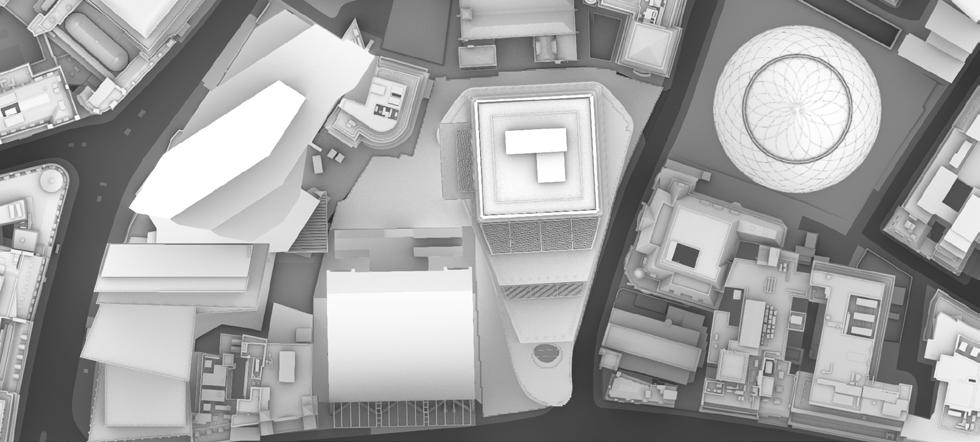
THE LEADENHALL BUILDING
6–8 BISHOPSGATE
LLOYD’S BUILDING
ST HELEN’S CHURCH BISHOPSGATE
UNDERSHAFT
ST HELEN’S SQUARE
FITZWILLIAM HOUSE
40
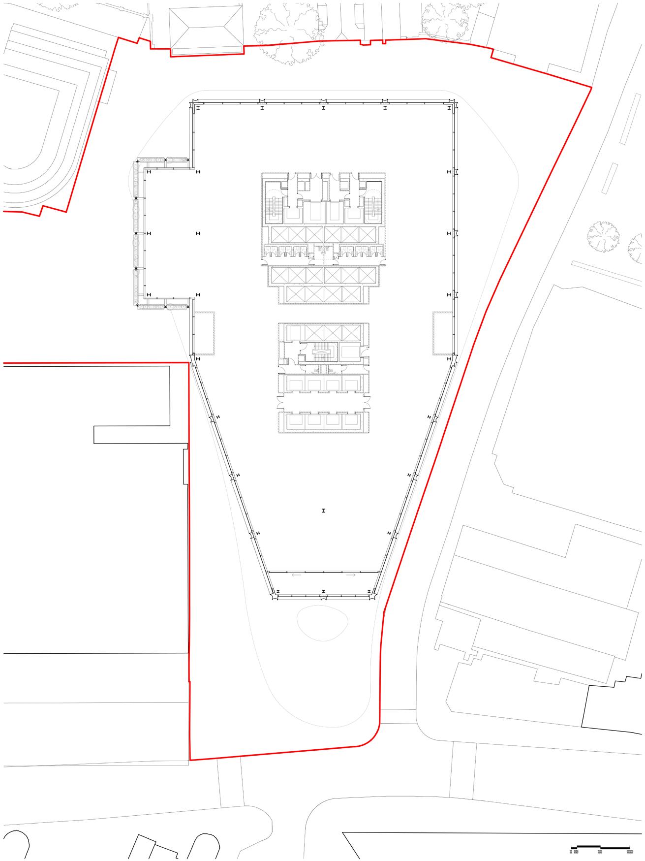
This appendix summarises a comparative analysis of the 2023 redevelopment proposals for 1 Undershaft (Planning Application Ref. No: 23/01423/FULEIA) against the 2019 consented proposals (16/00075/FULEIA) and the existing Aviva building and St Helen’s Square. It focuses on evaluating the impact of proposals on the street scene and provision of public realm.
The analysis involves a review of relevant drawings from each application, supplemented by additional diagrams and annotations highlighting the relationship with St Helen’s Square and the wider context, with further analysis, 3D verified and non-verified views. The information presented draws from a combination of the above planning applications, and is supplemented with the following information provided by the Applicant’s team as part of postsubmission consultation:
– 3D massing model, received 7 March 2024
– Additional section drawings, received 7 March 2024
– CGI video views from typical office floorplates of The Leadenhall Building, received 15 March 2024
– GIA overshadowing assessment (including 2019 consented scheme, not previously in planning applications) received 8 April 2024
– GIA revised overshadowing assessment (including full extent of site for analysis of 2019 consented scheme, and additional dates of analysis) received 22 April 2024
The analysis highlights contrasting outcomes, underscoring the importance of thoughtful urban planning to preserve and enrich the public realm, In accordance with London Plan Policies D8 on public realm and D9 on tall buildings, and the design and public realm policies and strategies of the City of London:
– The 2023 proposal results in fragmentation and loss of coherence, particularly affecting the connection between St Helen’s Church Bishopsgate and St Helen’s Square. In contrast, the 2019 scheme improved connectivity and integration of public spaces, with the whole of St Helen’s Square retained and a net-gain in area with its undercroft and lower ground plaza.
– The scale and massing of the 2023 proposals encroach upon St Helen’s Square and fail to adequately compensate for the loss, diminishing the quality and vitality of the public realm, whereas the 2019 scheme avoided building into or over St Helen’s Square beyond the existing footprint of the Aviva building.
– The 2023 proposals’ podium and massing limit sky visibility, sunlight, and privacy for neighbouring buildings and streets. Conversely, the 2019 scheme’s generous undercroft integrates seamlessly with adjacent buildings, connecting St. Helen’s Square with St Andrew Undershaft Church, enriching pedestrian experience in the City Cluster.
– The 2023 proposals project significantly further south, obscuring the iconic profile of The Leadenhall Building, diminishing it’s character and presence in views from Leadenhall Street and St Mary Axe in the east. Comparatively, the 2019 scheme tapered inwards at higher levels to maintain The Leadenhall Building’s aspect onto St Helen’s Square and views from the square of the Gherkin, St Andrew Undershaft Church, and Lloyds Building.
These context plans illustrate how the 2019 consented scheme helped stitch together existing public open spaces at 30 St Mary Axe and St Helen’s Square / Leadenhall Plaza by providing a new public space at street level and lower ground floor, connecting St Helen’s Church with St Helen’s Square. Comparatively, the 2023 application serves to fragment the existing public realm and block the connection between the Church and Square.
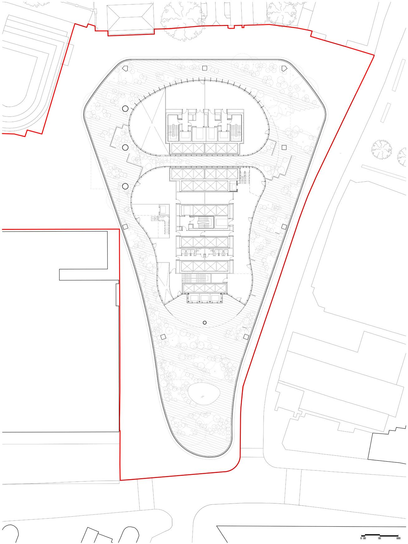
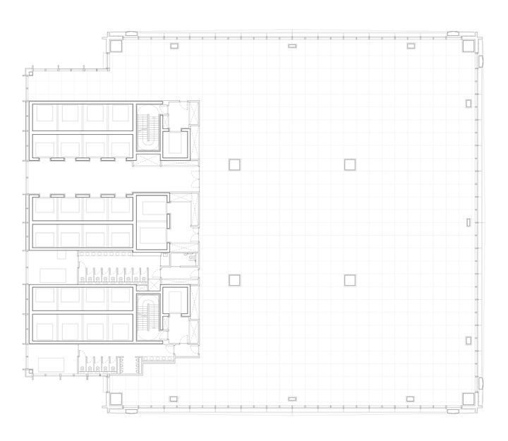
Total public realm: 4,505 m2
St Helen’s Square public realm: 2,433 m2
– St Helen’s Square is a unique and vitally important civic space in the heart of the City Cluster, framed by medieval Churches and iconic modern architecture.
– It provides 2,433 m2 of south-facing street level open space which is open to the sky and connected to the Leadenhall Plaza, encouraging a diverse array of activity and interaction.
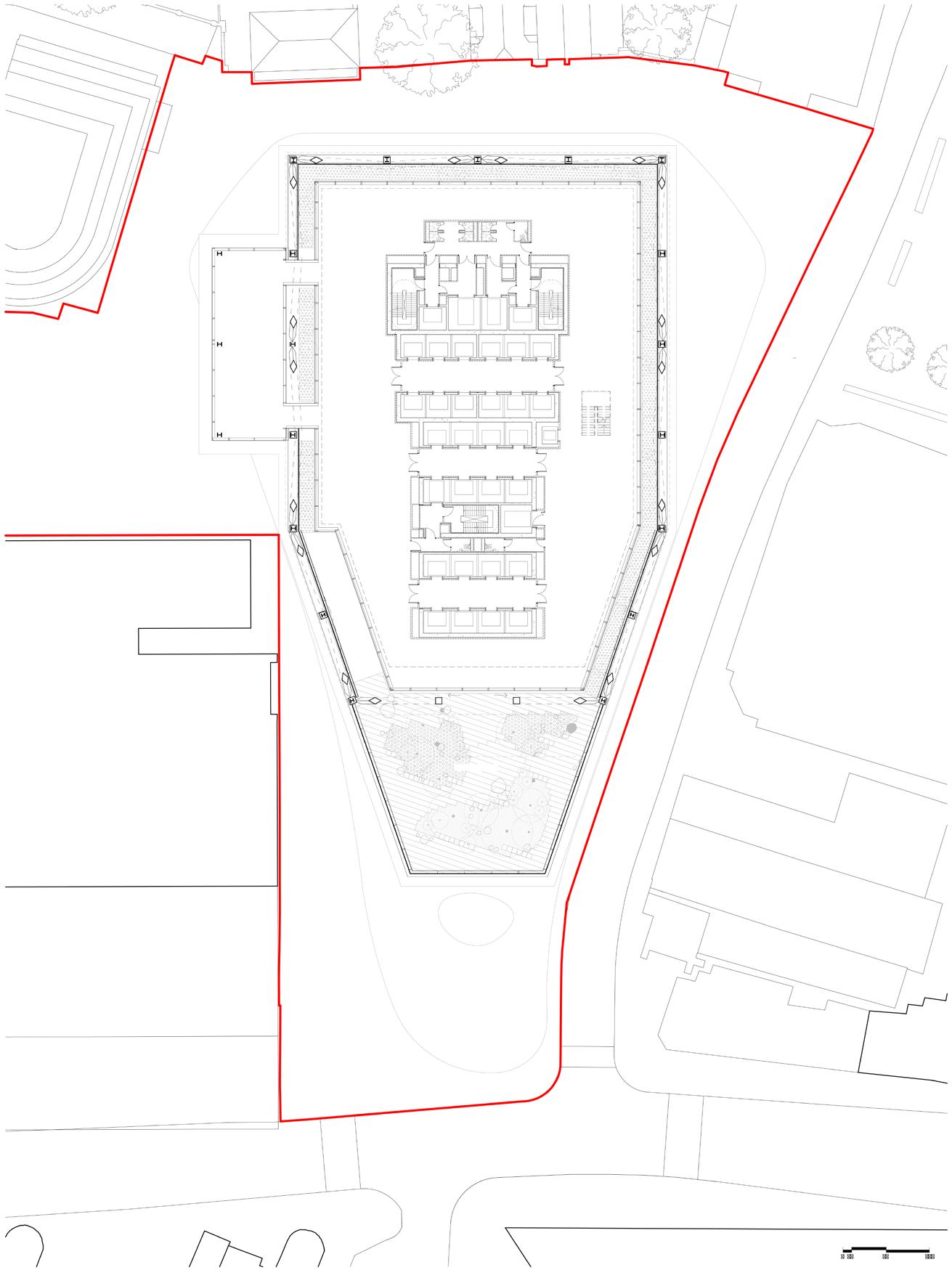
Total public realm: 5,361 m2 (+856) (+19.0%)
St Helen’s Square public realm: 2,438 m2 (+5) (+0.2%)
– All of St Helen’s Square retained and open to the sky, inviting pedestrians into an enhanced civic space with improved connectivity.
– The Undercroft of the 2019 scheme provides 1,635 m2 additional public realm and improves connections between St Helen’s Square / Leadenhall Plaza and St Helen’s Church / 30 St Mary Axe.
– Lower ground plaza creates 496m2 additional public realm, activated by 1,543 m2 of restaurants and shops.
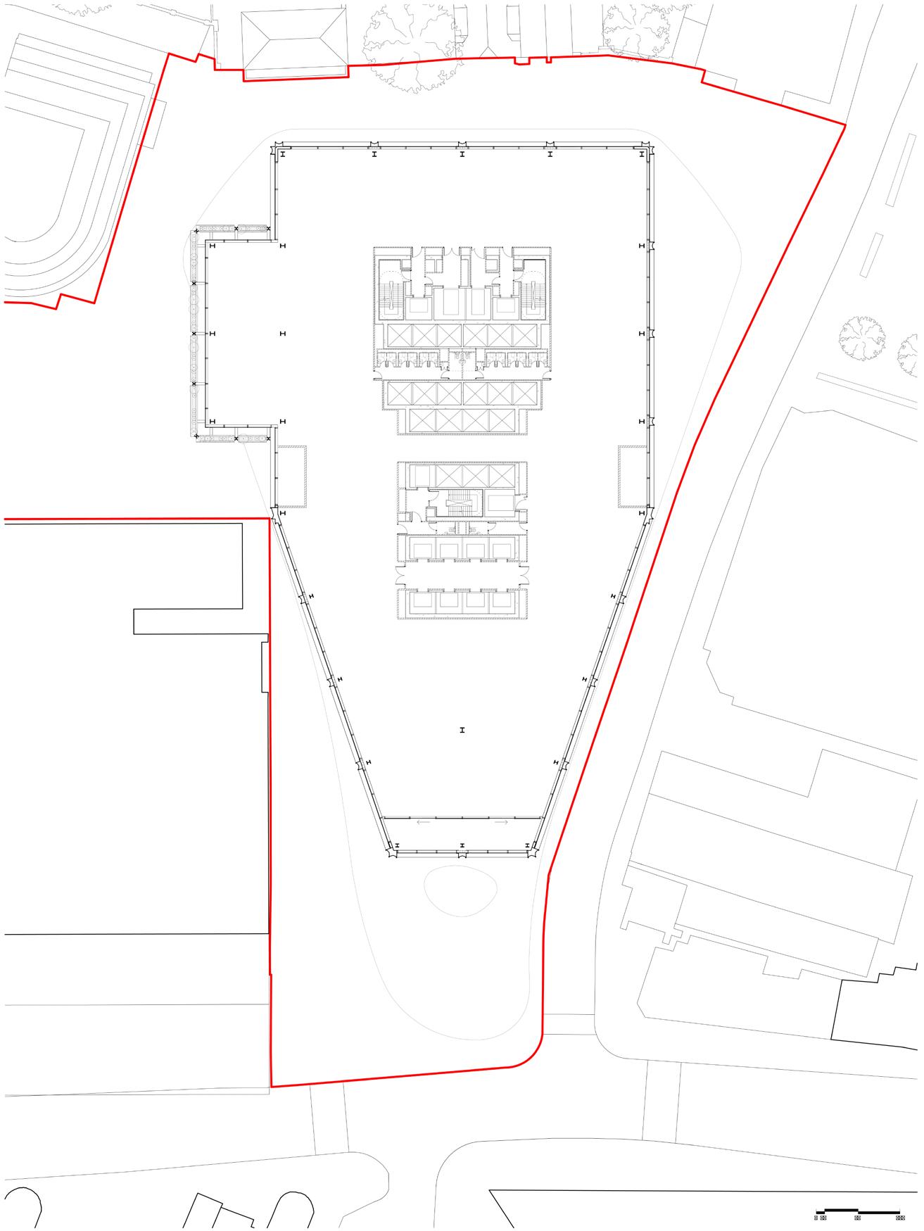
Total public realm: 3,770 m2 (–735) (–16.3%)
St Helen’s Square public realm: 1,723 m2 (–710) (–29.2%)
– The enlarged footprint intrudes into St Helen’s Square, resulting in the loss of 29.2% of the Square’s area (accounting for a slight realignment of the north of the square due to proposed column locations).
– Level 11 canopy covers an additional 39.5% of St Helen’s Square, demoting its significance and diverting activity away from street level, while significantly harming direct sunlight levels.
– Relocated servicing bay deteriorates relationship with 30 St Mary Axe and its associated public realm.
These plans demonstrate the significant loss of area, visible sky, quality, and usability of St Helen’s Square due to the encroachment of 2023 proposals into and above the street level public realm, compared to both the existing scenario and 2019 consented proposals.
– The area of St Helen’s Square is 2,433 m2 with a depth of 65.9 m.
THE LEADENHALL BUILDING
THE LEADENHALL BUILDING
– The area of St Helen’s Square increases to 2,438 m2, the depth increasing to 74.3 m to the nearest ground floor structure.
– The area is reduced to 1,723 m2 and the depth reduced to 37.2 m (half of the 2019 scheme).
These plans demonstrate the increase in public realm and amenity in the lower ground plaza of the 2019 consented scheme, compared to both the existing scenario and 2023 application.
– B1 massing extends beneath the entire length of St Helen’s Square to Leadenhall Street.
– Vehicular access is provided via ramp along Undershaft to the north.
– Existing ramp infilled, providing 364m2 of additional area to B1. Vehicular access is provided through new lifts.
– Lower ground plaza creates 496m2 of additional public realm, activated by 1,543 m2 of restaurants and shops.
– New area created in the lower ground plaza providing 414m2 of open air space with natural sunlighting / daylighting.
– Existing vehicle ramp is infilled and massing is expanded towards St Helen’s Church Bishopsgate, providing 556m2 of additional area. Vehicular access is provided through new lifts.
– No new public open space or retail units provided. Level is used primarily for end of trip facilities and waste management.
These plans illustrate the large increase of proposed massing overhanging and overshadowing St Helen’s Square in the 2023 application versus the 2019 consented scheme, which slightly improved the existing line of public realm to the south.
– Upper floorplate of Aviva building is entirely to the north of St Helen’s Square, causing no overshadowing or reduction of visible sky from street level.
– Increased floorplate is entirely to the north of St Helen’s Square, causing no additional overshadowing or reduction of visible sky from street level.
2023 Application
– Increased floorplate and projecting podium garden significantly encroaches into and overshadows St Helen’s Square, reducing areas of visible sky from street level.
– Public realm at level 11 is not a like for like replacement and doesn’t compensate for the significant loss and harm caused at street level.
These plans show how the lower–middle massing of the tower of 1 Undershaft (see 2.4.1) in the 2023 application scheme has grown, in addition to the base, and is built over the existing St Helen’s Square.
– Upper floorplate of Aviva building is entirely to the north of St Helen’s Square, causing no overshadowing or reduction of visible sky from street level.
– Increased floorplate is entirely to the north of St Helen’s Square, and does not impose itself on the street level below.
– Increased lower–middle floorplate significantly encroaches into and overshadows St Helen’s Square, reducing areas of visible sky from street level.
These plans show how the upper–middle massing of the tower of 1 Undershaft (see 2.4.1) in the 2023 application scheme has grown, in addition to the base, and is built over the existing St Helen’s Square.
– Upper floorplate of Aviva building is entirely to the north of St Helen’s Square, causing no overshadowing or reduction of visible sky from street level.
– Increased floorplate is entirely to the north of St Helen’s Square, and does not impose itself on the street level below.
– Increased upper–middle floorplate significantly encroaches into and overshadows St Helen’s Square, reducing areas of visible sky from street level.
These elevations demonstrate how the increased massing of 1 Undershaft in the 2023 application obstructs the profile of The Leadenhall Building when viewed from Leadenhall Street and St Mary Axe to the east. In contrast, the 2019 consented scheme maintained the integrity of The Leadenhall Building in these views, showing respect and preservation of its architectural prominence.
+239.4m AOD
+133.0m AOD
– Massing of Aviva building is entirely to the north of St Helen’s Square, framing the iconic profile of The Leadenhall Building.
+304.9m AOD
– Increased massing of 1 Undershaft significantly diminishes The Leadenhall Building in views from St Mary Axe and Leadenhall Street in the east, and has an over-bearing and dominating impact on the townscape and heritage assets in St Mary Axe and Leadenhall.
Existing Extent Extent of 2023 Proposal
+309.6m AOD
+207.1m AOD
+136.2m AOD
+61.6m AOD
– The projecting podium, lower-middle, and upper-middle massing significantly reduce the extent of visible sky, sunlight, and privacy to surrounding buildings and streets, while overshadowing the public realm to St Helen’s Square (London Plan Policy D9, 3.9.7).
– Increased floorplate and projecting podium garden significantly overlap and obscure the iconic profile of The Leadenhall Building.
– Increased massing of 1 Undershaft significantly diminshes The Leadenhall Building in views from St Mary Axe and Leadenhall Street in the east.
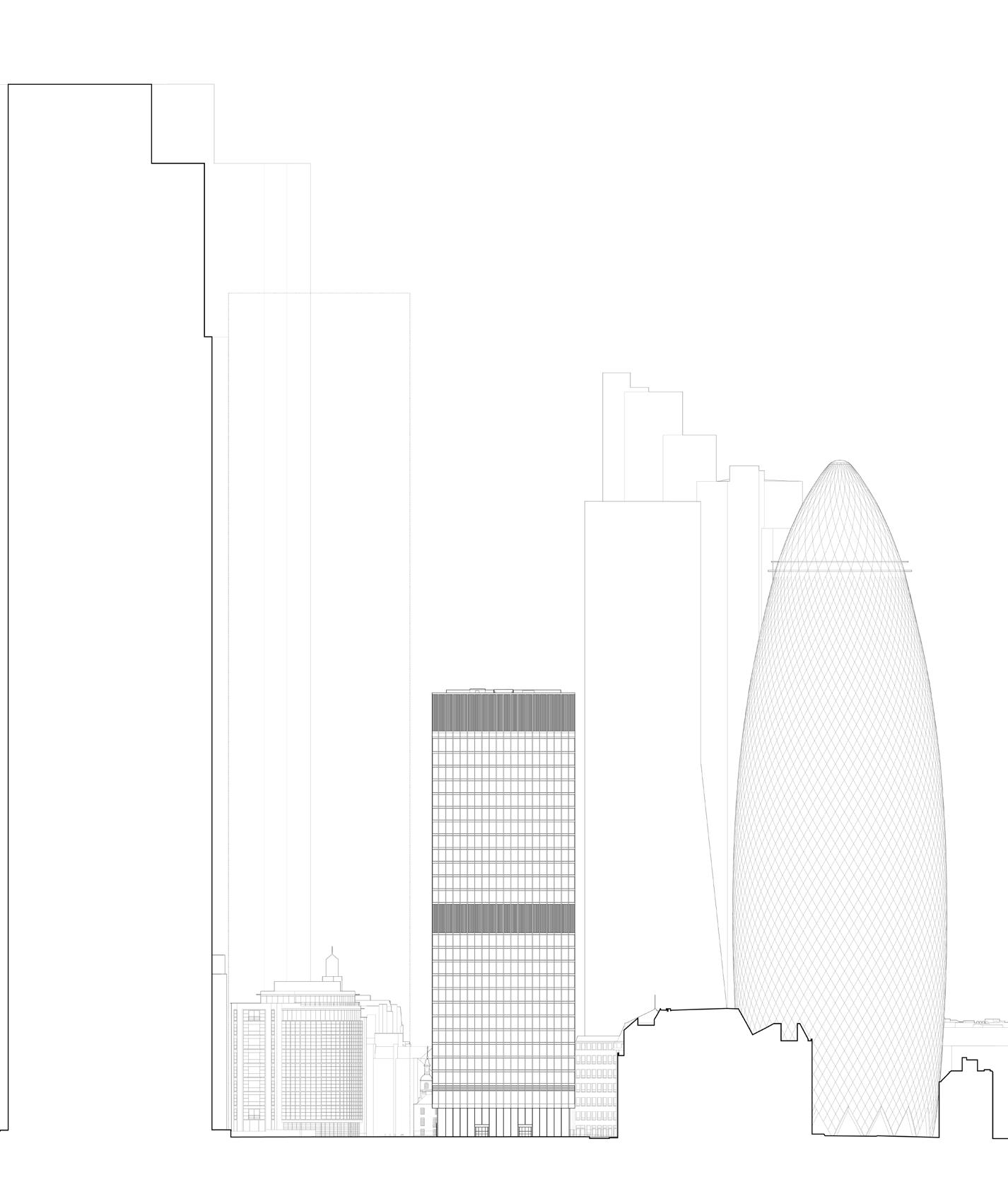
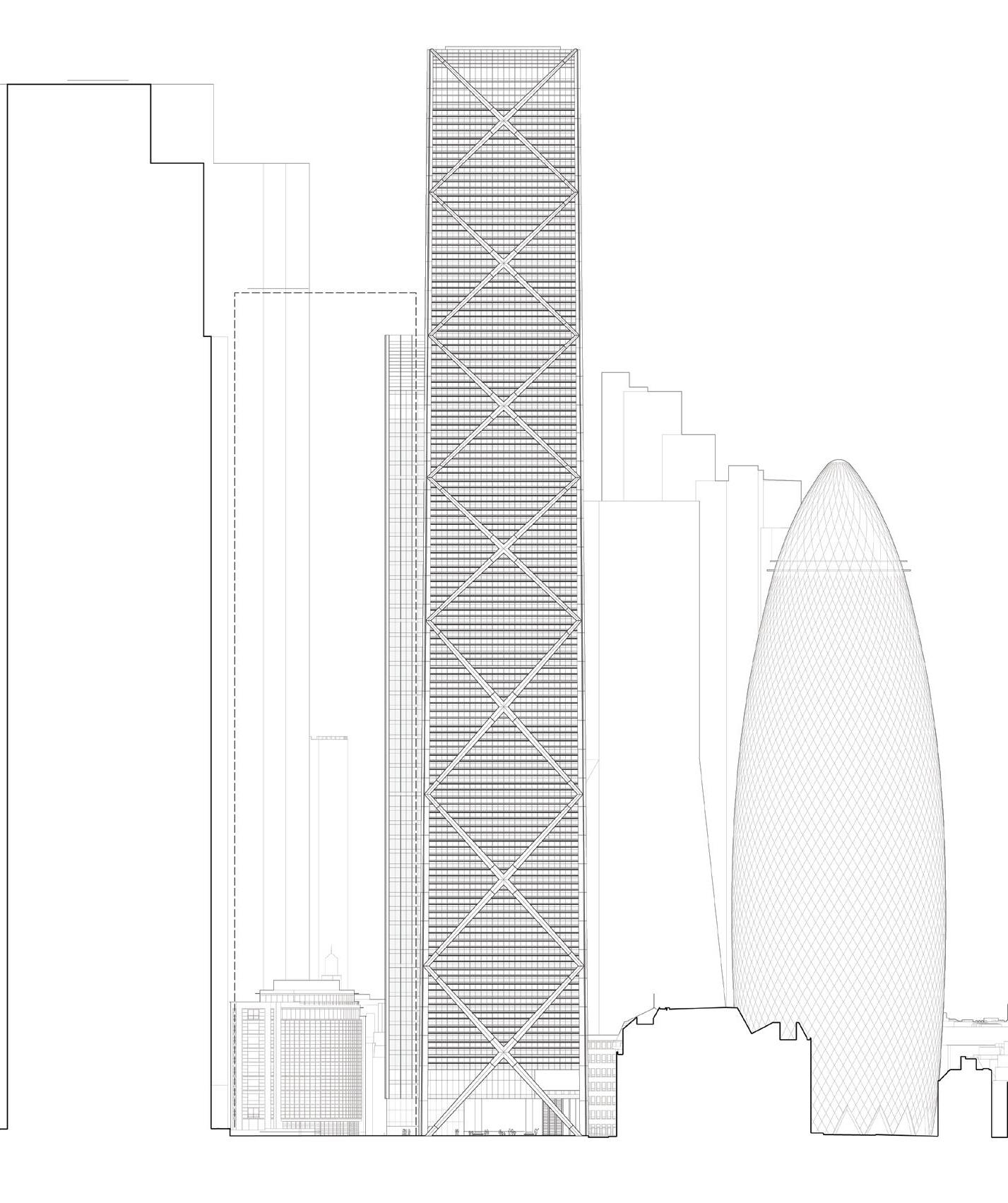
– Aviva Building provides visual link from St Helen’s Square to St Helen’s Church Bishopsgate through glazed lobby. 2019
– Undercroft provides additional public realm and improves connections between St Helen’s Church Bishopsgate and St Helen’s Square
– Undercroft reinstates the historic link between St Helen’s Church Bishopsgate and St Andrew Undershaft Church.
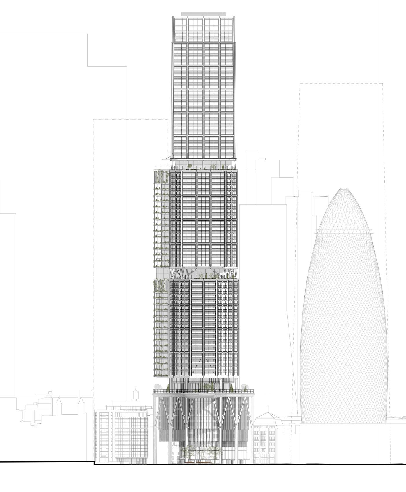
– Enlarged and relocated footprint severs links between St Helen’s Square / Leadenhall Plaza and St Helen’s Church Bishopsgate / The Gherkin.
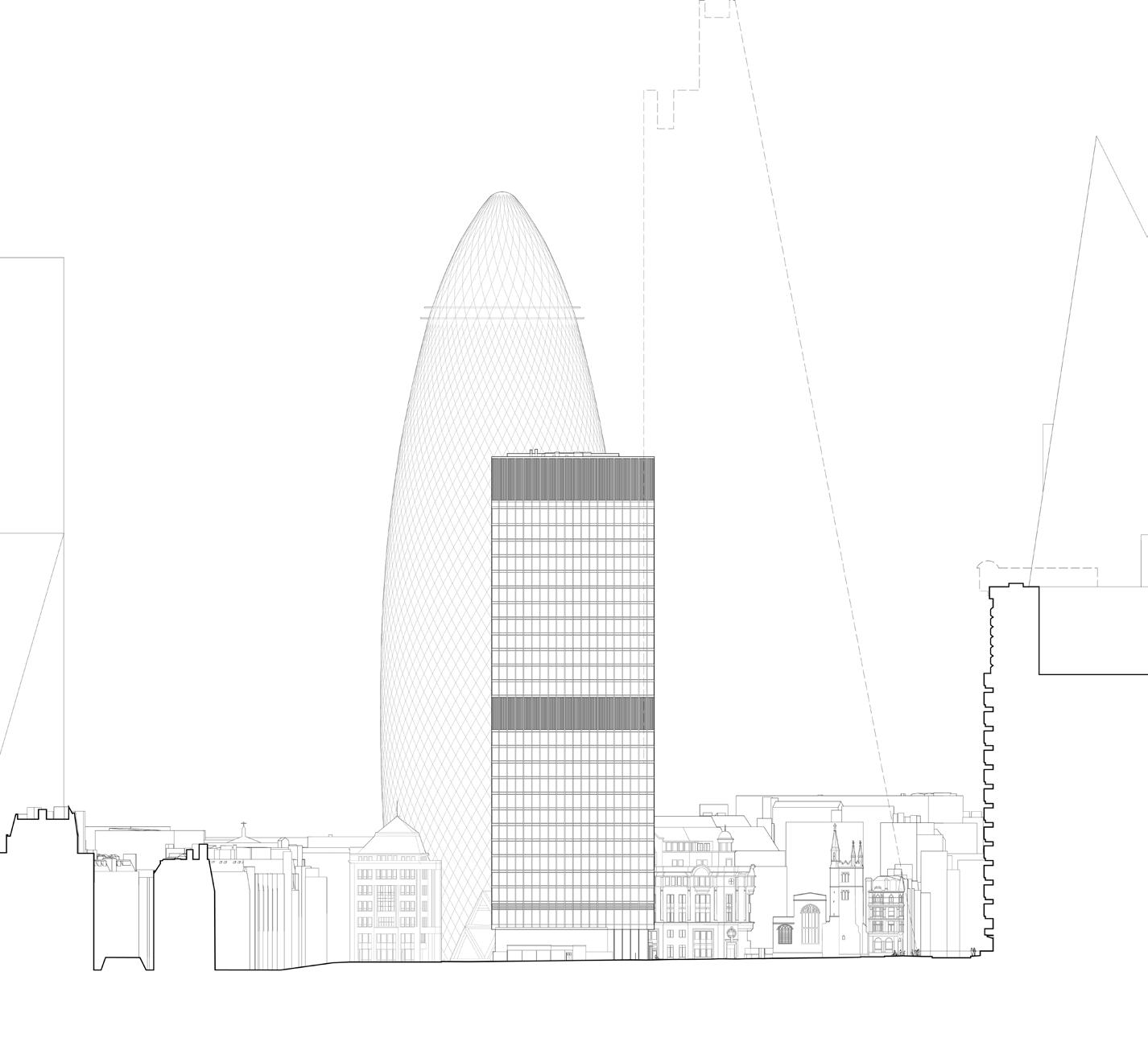
– Massing of the Leadenhall Plaza is designed to work with the Aviva building to frame views towards St Andrew Undershaft Church in the east. 2019
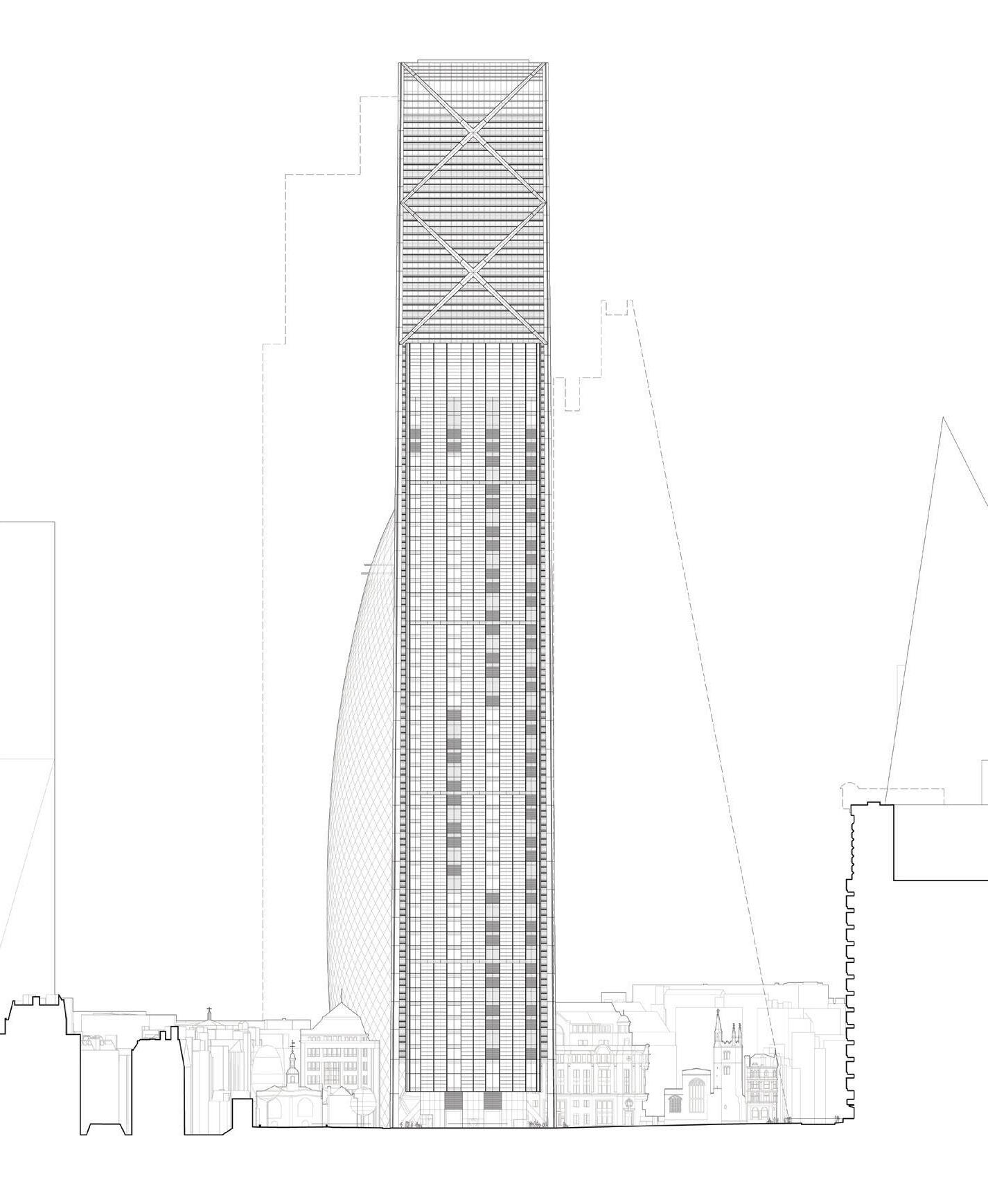
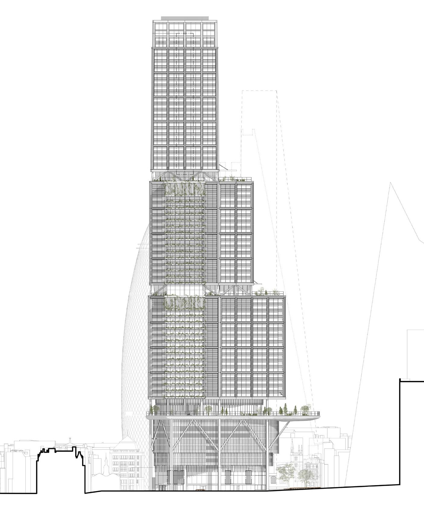
– Increased massing of 1 Undershaft is entirely to the north of St Helen’s Square, preserving views from the Leadenhall Plaza towards St Andrew Undershaft Church.
– Increased massing of 1 Undershaft projects into St Helen’s Square and encroaches on views towards St Andrew Undershaft Church from the Leadenhall Plaza.
+239.4m AOD
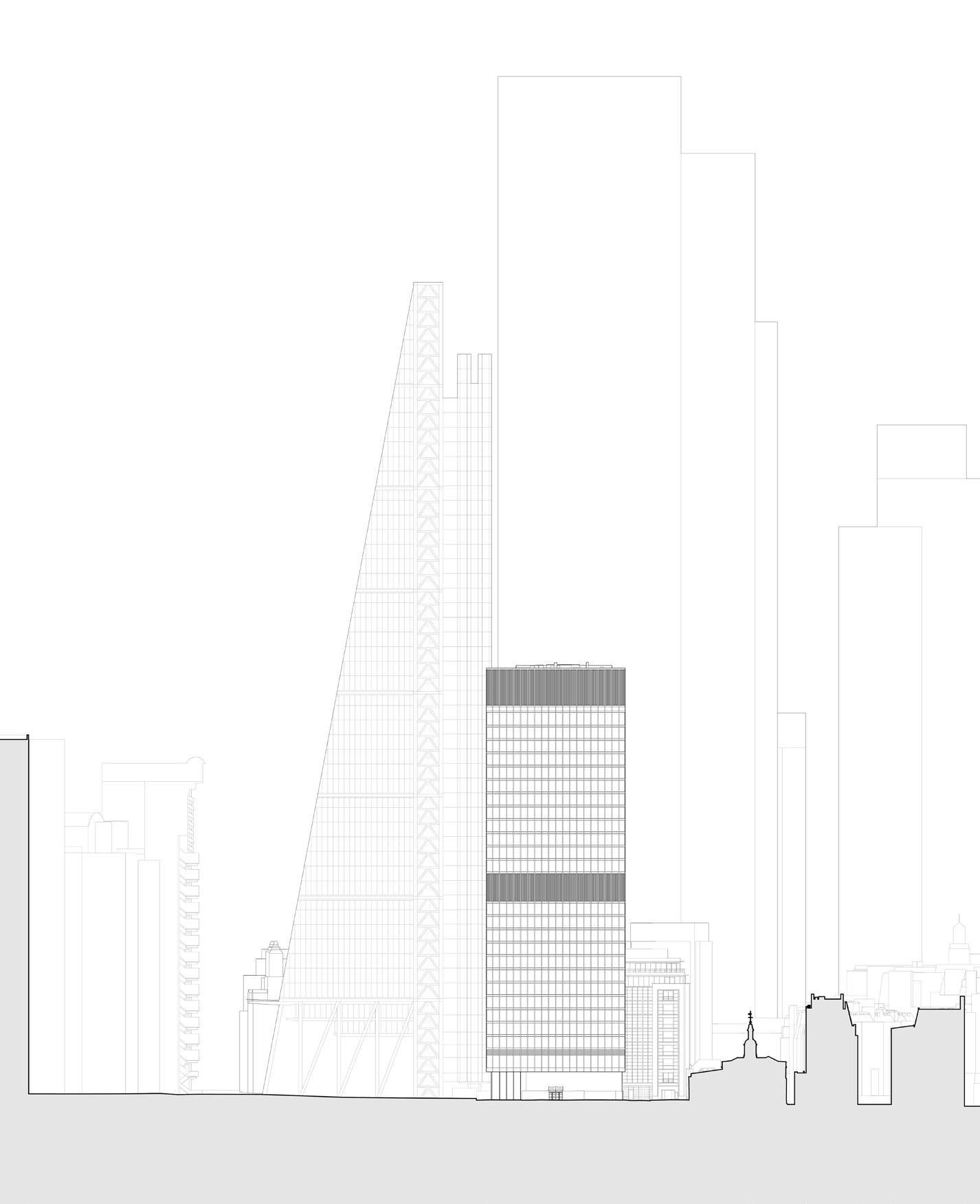
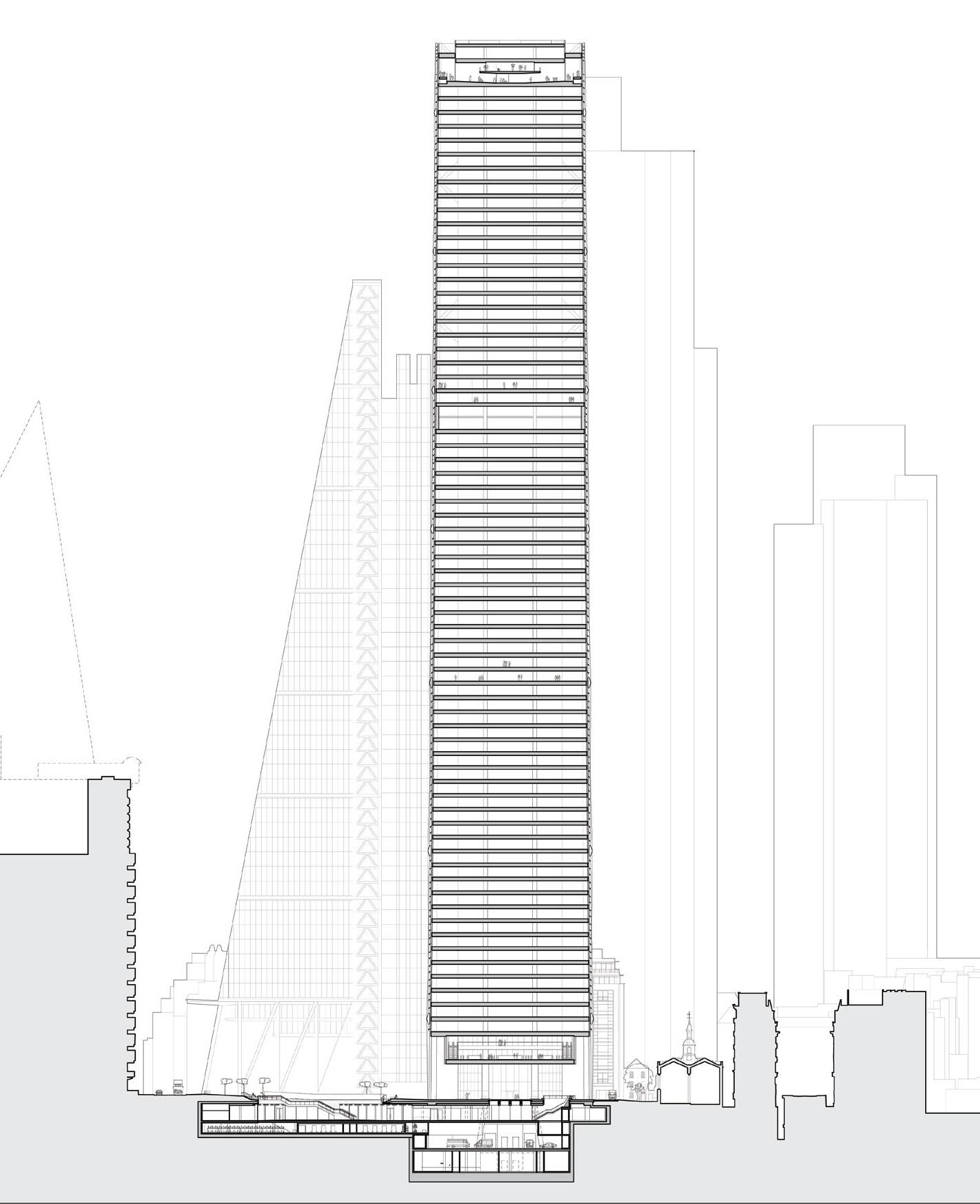
– Existing sections not submitted.
– St Helen’s Square provides 2,433 m2 of south-facing street level open space which is open to the sky.
– Ground floor lobby of Aviva Building provides views between St Helen’s Square and St Helen’s Church Bishopsgate.
– New lower ground plaza creates 496m2 additional area of public realm at Basement B1, activated by 1,543 m2 of shops and restaurants.
– Ground floor Undercroft provides 1,635 m2 additional public realm and improves connections between St Helen’s Square and St Helen’s Church Bishopsgate.
2019 Consent
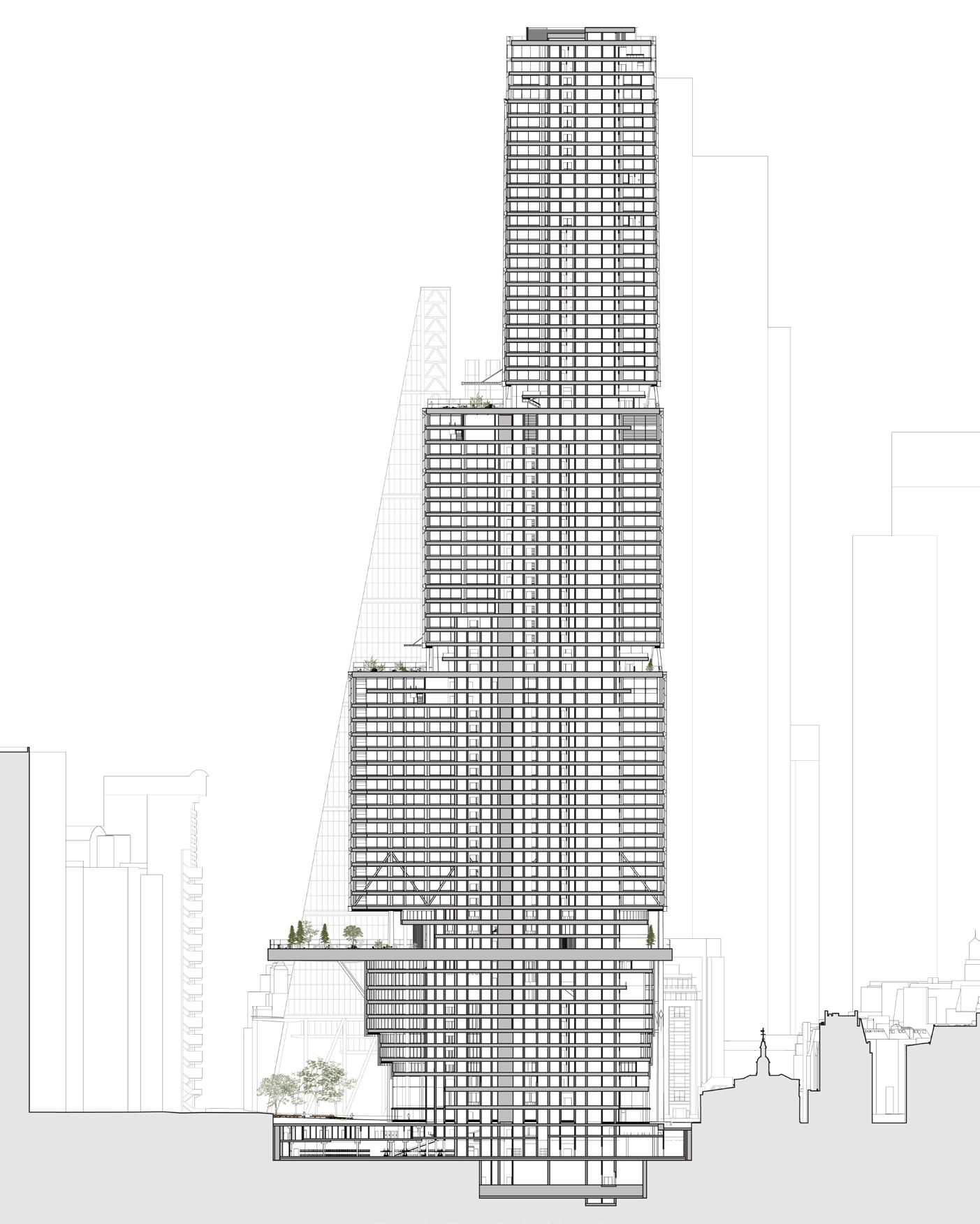
– Enlarged and relocated footprint results in loss of 721m2 area of public realm from St Helen’s Square.
– New massing severs link between St Helen’s Square and St Helen’s Church Bishopsgate.
These sections illustrate how the 2019 consented scheme expands the size and connectivity of street-level public open space without encroaching onto or over St Helen’s Square. In contrast, the 2023 application proposals result in a significant loss of public open space and negative impacts on existing amenities by encroaching into and projecting over St Helen’s Square, which diminishes the area’s attractiveness and appeal.
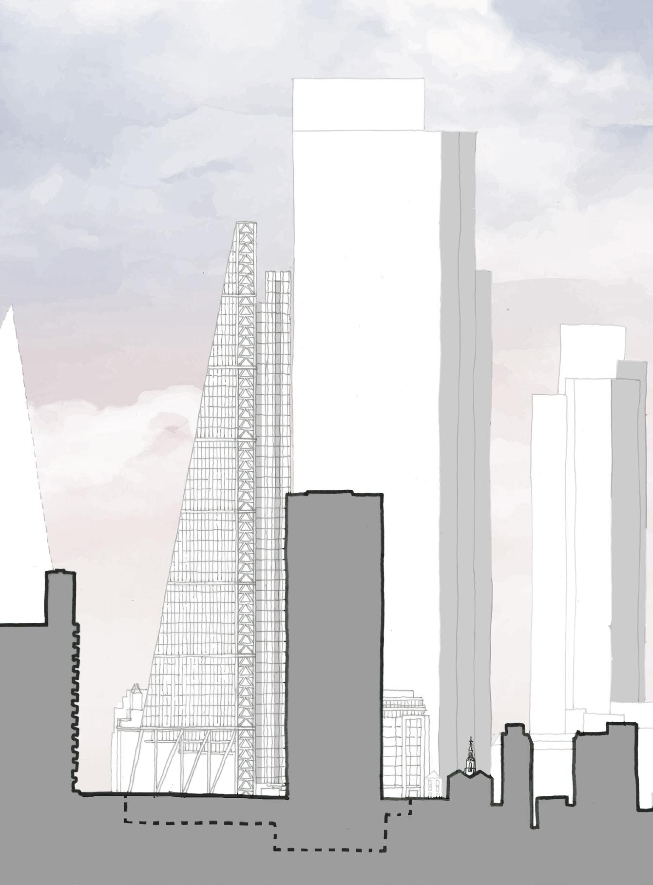
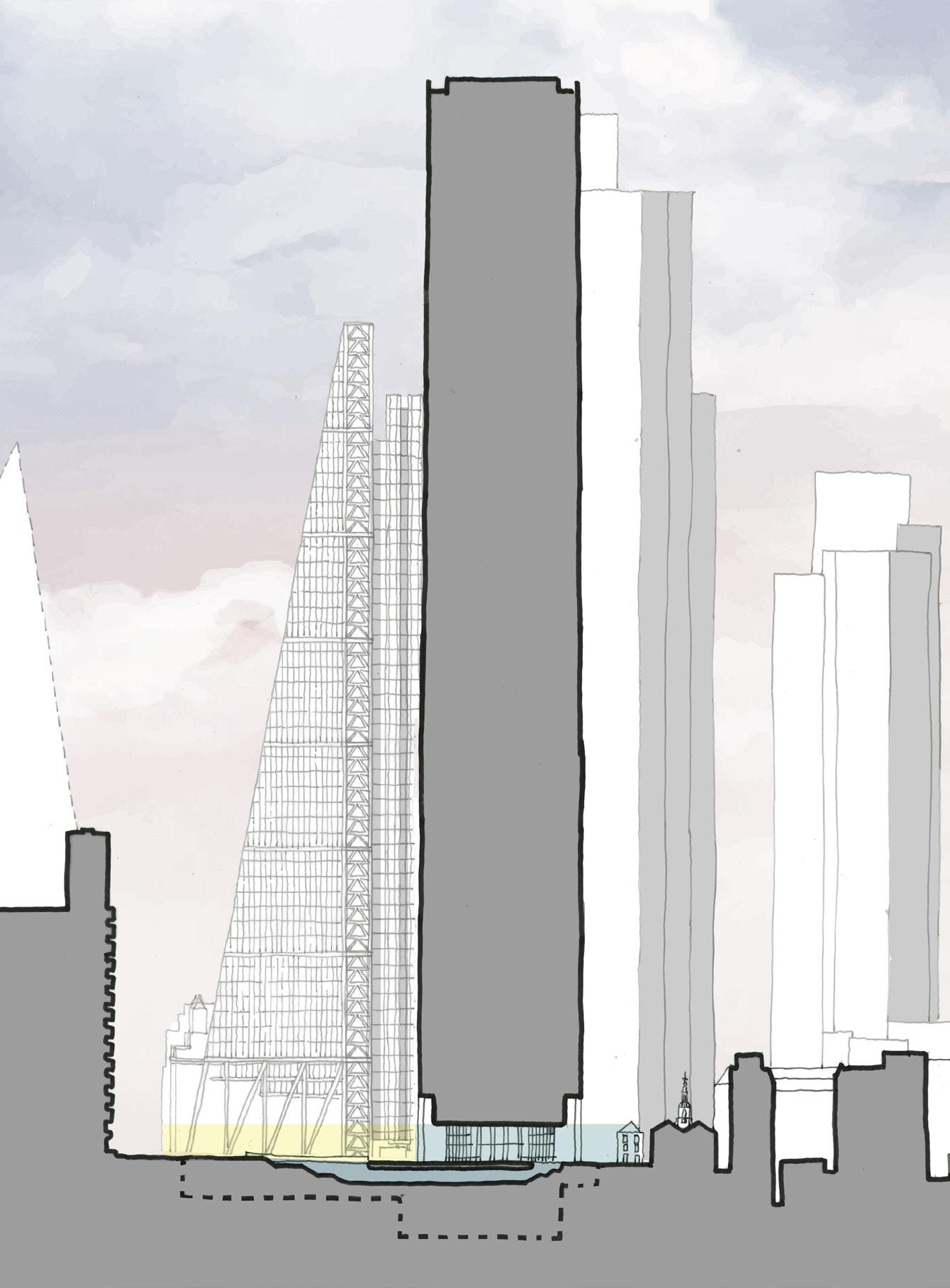
– Massing of Aviva building is entirely to the north of St Helen’s Square, causing no overshadowing or reduction of visible sky from street level.
– All of St Helen’s Square retained and open to the sky, inviting pedestrians into an enhanced civic space with improved connectivity.
– The Undercroft of the 2019 scheme provides 1,635 m2 additional public realm and improves connections between St Helen’s Square / Leadenhall Plaza and St Helen’s Church / 30 St Mary Axe.
– Lower ground plaza creates 496m2 additional public realm, activated by 1,543 m2 of restaurants and shops.
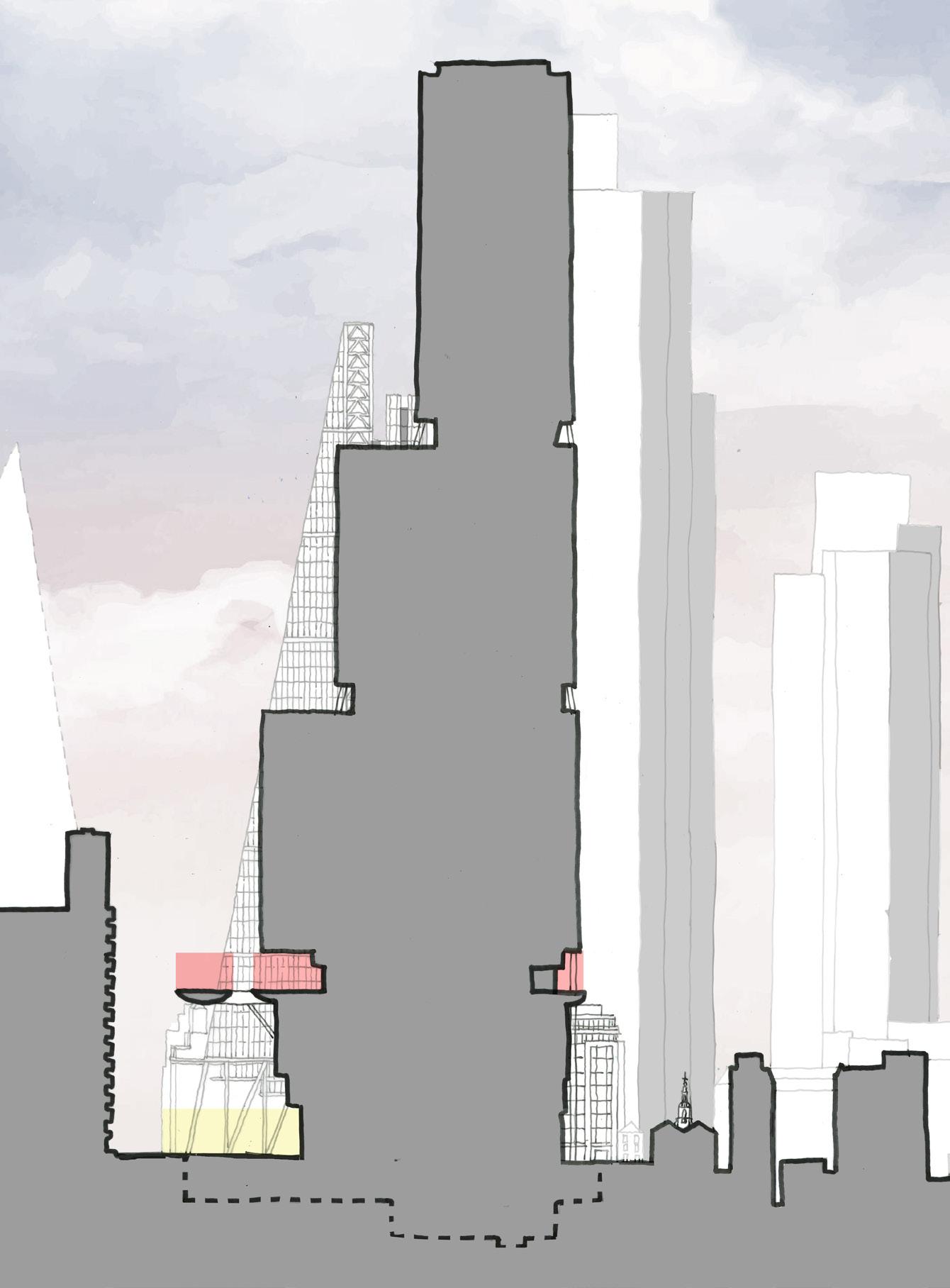
– The enlarged footprint intrudes into St Helen’s Square, resulting in the loss of 29.2% of the Square’s area (accounting for a slight realignment of the north of the square due to proposed column locations).
– Level 11 canopy covers an additional 39.5% of St Helen’s Square, demoting its significance and diverting activity away from street level, while significantly harming direct sunlight levels.
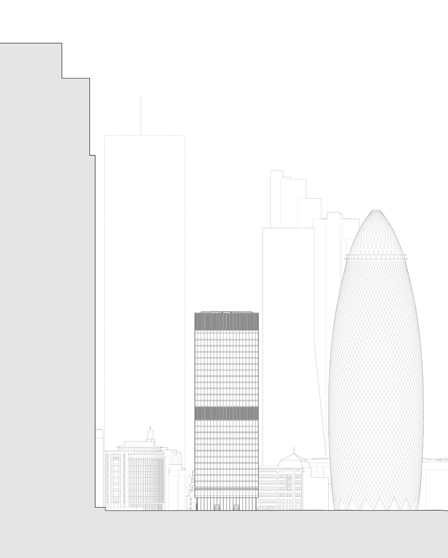
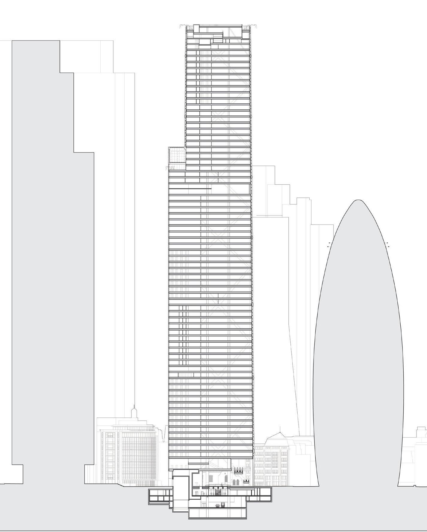
– Existing sections not submitted
– Aviva Building provides visual link from St Helen’s Square to St Helen’s Church Bishopsgate through glazed lobby.
– Undercroft provides additional public realm and improves connections between St Helen’s Church Bishopsgate and St Helen’s Square.
– Undercroft reinstates the historic link between St Helen’s Church Bishopsgate and St Andrew Undershaft Church.
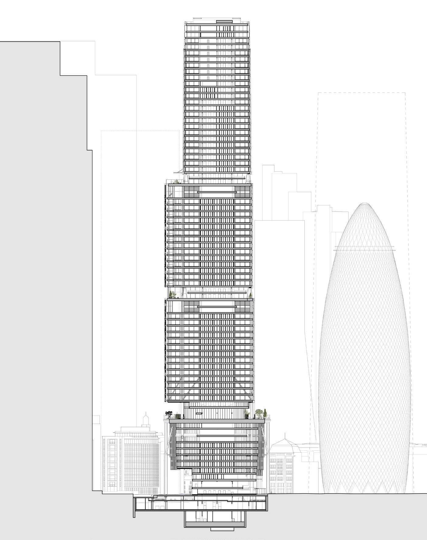
– Enlarged and relocated footprint severs links between St Helen’s Square / Leadenhall Plaza and St Helen’s Church Bishopsgate / The Gherkin.
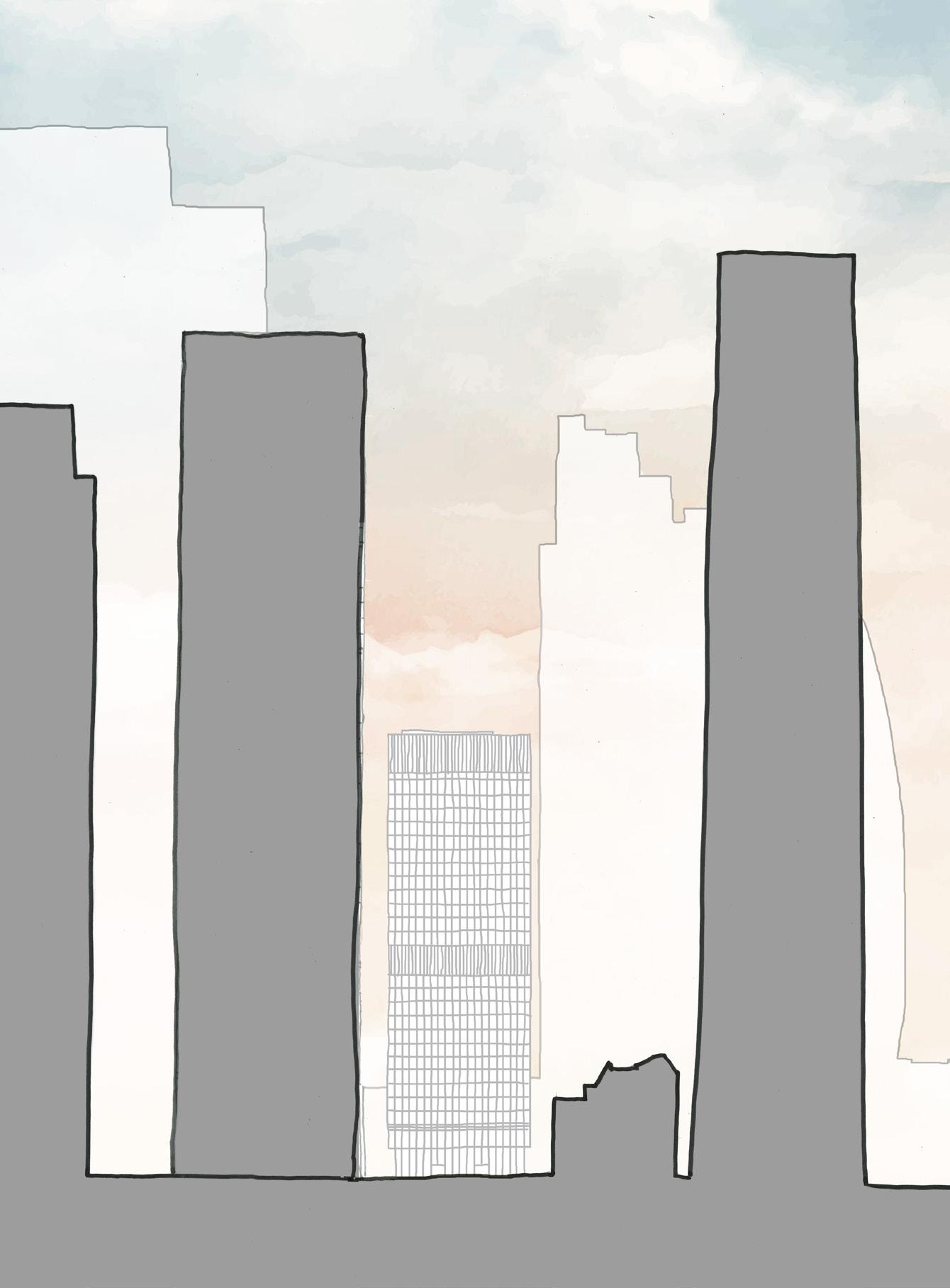
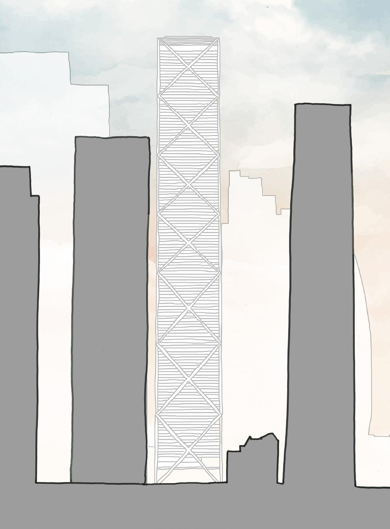
– Massing of Aviva building is entirely to the north of St Helen’s Square, causing no overshadowing or reduction of visible sky from street level.
– All of St Helen’s Square retained and open to the sky, inviting pedestrians into an enhanced civic space with improved connectivity.
– The Undercroft of the 2019 scheme provides 1,635 m2 additional public realm and improves connections between St Helen’s Square / Leadenhall Plaza and St Helen’s Church / 30 St Mary Axe.
– Lower ground plaza creates 496m2 additional public realm, activated by 1,543 m2 of restaurants and shops.
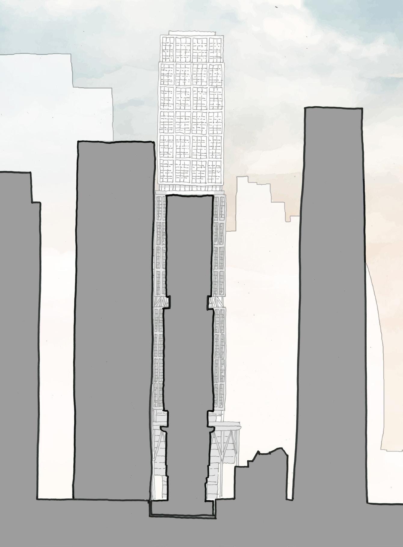
– The enlarged footprint intrudes into St Helen’s Square, resulting in the loss of 29.2% of the Square’s area (accounting for a slight realignment of the north of the square due to proposed column locations).
– Level 11 canopy covers an additional 39.5% of St Helen’s Square, demoting its significance and diverting activity away from street level, while significantly harming direct sunlight levels.
– Upper floorplate of Aviva building is entirely to the north of St Helen’s Square, causing no overshadowing or reduction of visible sky from street level.
– Increased floorplate is entirely to the north of St Helen’s Square, causing no additional overshadowing or reduction of visible sky from street level.
– By lifting upward to create a generous undercroft, the base integrates well with the street frontage of adjacent buildings and reveals the connection between St Helen’s Church / Square, and St Andrew Undershaft Church, enhancing the pedestrian experience of the public realm in the heart of the City Cluster (contrary to London Plan Policy D9, and paragraph 3.9.8 advice on the design of the base of tall buildings).
– Increased floorplate and projecting podium garden significantly encroaches into and overshadows St Helen’s Square, reducing areas of visible sky from street level.
– The base of the building fails to adequately frame the public realm and streetscape. The significant reduction in size of St Helen’s Square and overshadowing by the projecting podium and middle massing cause significant harm to the quality of public realm and pedestrian experience (contrary to London Plan Policy D9, and paragraph 3.9.8 advice on the design of the base of tall buildings).


St Helen’s Square: 2,433 m2
Undershaft West: 850 m2
Undershaft East: 505 m2
Undershaft North: 717 m2


St Helen’s Square: 2,438 m2 (+5) (+0.2%)
Undershaft West: 713 m2 (–137) (–16.1%)
Undershaft East: 1,818 m2 (+1,313) (+260.0%)
Undershaft North: 392 m2 (–325) (–45.3%)


St Helen’s Square: 1,723 m2 (–710) (–29.2%)
Undershaft West: 1,199 m2 (+349) (+41.1%)
Undershaft East: 413 m2 (–92) (–18.2%)
Total public realm: 4,505 m2
St Helen’s Square public realm: 2,433 m2 of which:
View of sky: 2,388 m2
Sky blocked by canopy / undercroft: 45 m2
St Helen’s Square public realm: 2,438 m2 (+5) of which: Total public realm: 5,361 m2 (+856) (+19.0%)
View of sky: 2,438 m2 (+50) (+2.1%)
Total public realm: 3,770 m2 (–735) (–16.3%)
St Helen’s Square public realm: 1,723 m2 (–710) (–29.2%) of which:
View of sky: 723 m2 (–1,665) (–69.7%)
View of sky through glass canopy: 40 m2
Sky blocked by canopy / undercroft: 960 m2
Proposed internal footprint: 721 m2 (exc. from public realm) Proposed internal footprint: 25 m2 (exc. from public realm)
The below schedule compares the existing, 2019 consent, and 2023 application in respect of the total area of public realm categorised by space, view of sky, and loss of area to the built area of the 1 Undershaft proposals.
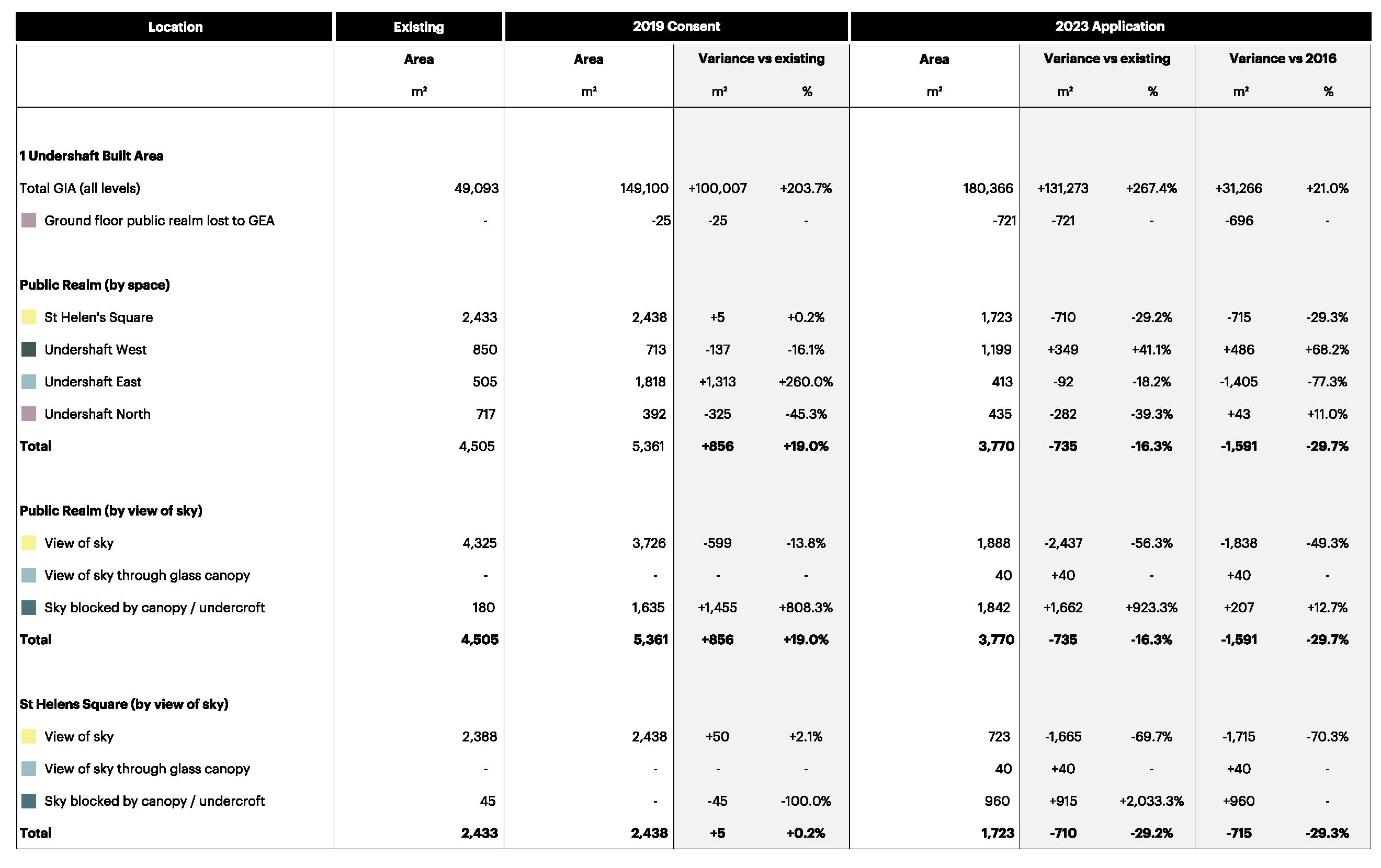
Comparison of total sunlight hours to public realm between 1 Undershaft proposals, combining information from 2023 application and post-submission consultation, with results shown at 21st June for all three proposals. The 2023 proposal will notably diminish direct sunlight to St Helen’s Square, adversely affecting outdoor activities and plant growth, in contradiction with BRE guidelines emphasizing the importance of natural light for outdoor spaces’ ambiance and functionality.
Increased massing of the lower and middle portions of 1 Undershaft, in addition to the L11 canopy, creates significant overshadowing in St
The centre of the square receives only approximately 3 hours of , with areas of the periphery dropping to less than
When compared to the existing situation, there is a clear and harmful reduction to the sunlight received, resulting in a detrimental impact to
Existing view of sky from St Helen’s Square taken on 27 March 2024, with comparative overlay of 2019 consented scheme & 2023 application, highlighting the significant loss of sky to the existing public realm in the 2023 application compared to the 2019 consent and existing scenario.
3D models of the proposed buildings have been added in the form of nonverified views taken from the purchased 3D context model (2019 consent) and information provided by the Applicant’s team (2023 application). Detail has been added to the 2019 consented massing model with reference to 2D drawings included in each planning application.
– The area of St. Helen’s Square measures 2,433 m2, entirely exposed to the sky and elements.
– All of St Helen’s Square retained and open to the sky, maximizing sunlight and inviting pedestrians into an enhanced civic space with improved connectivity.
– The enlarged footprint intrudes into St Helen’s Square, resulting in the loss of 29.2% of the Square’s area (accounting for a slight realignment of the north of the square due to proposed column locations).
– Level 11 canopy covers an additional 39.5% of St Helen’s Square, demoting its significance and diverting activity away from street level, while significantly harming direct sunlight levels.

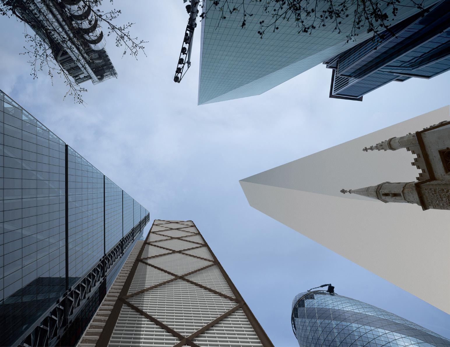
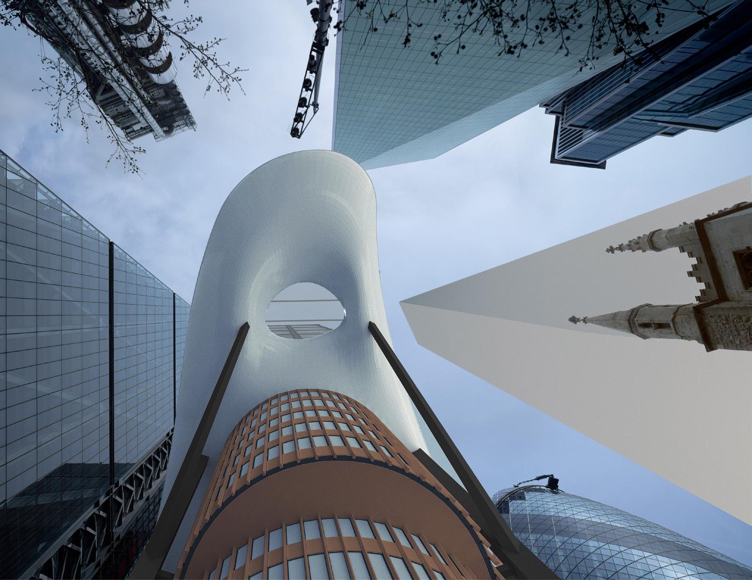
Aerial perspective sketches looking north-east across St Helen’s Square, comparing physical and visual relationships across historic public realm.
Pedestrian link between churches Defined visual link No visual link
St Helen’s Church Bishopsgate
St Helen’s Church Bishopsgate St Andrew Undershaft Church
No visual link between churches
No visual link between the churches
No visual link between St Helen’s Church & Square
Verified views taken from each planning application, and supplemented (where views were not included in applications) with purchased 3D context model (context placement and 2019 consent) and information provided by the Applicant’s team (2023 application). Detail has been added to the 2019 consented massing model with reference to 2D drawings included in each planning application.

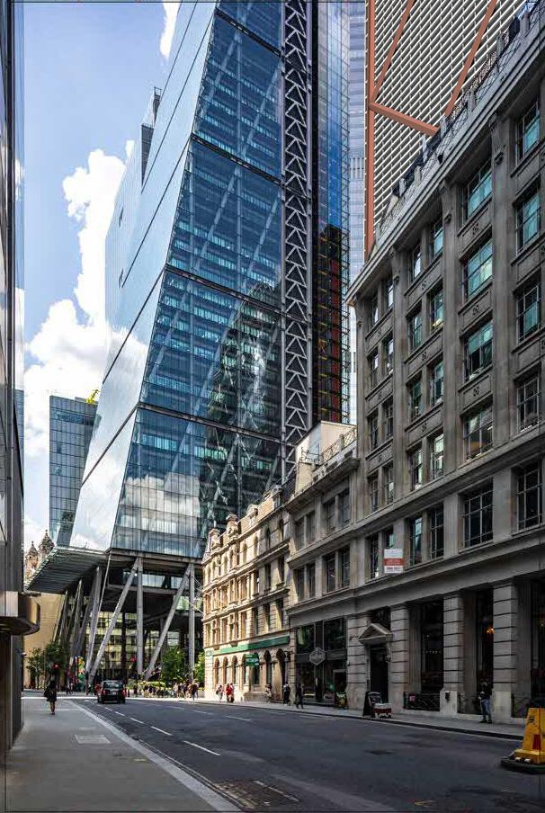
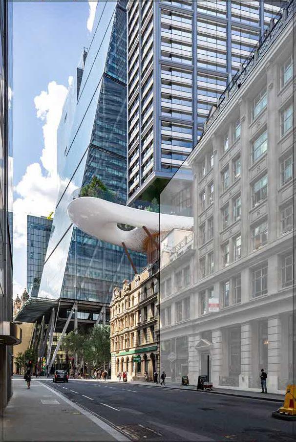
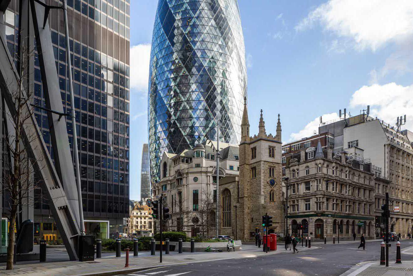
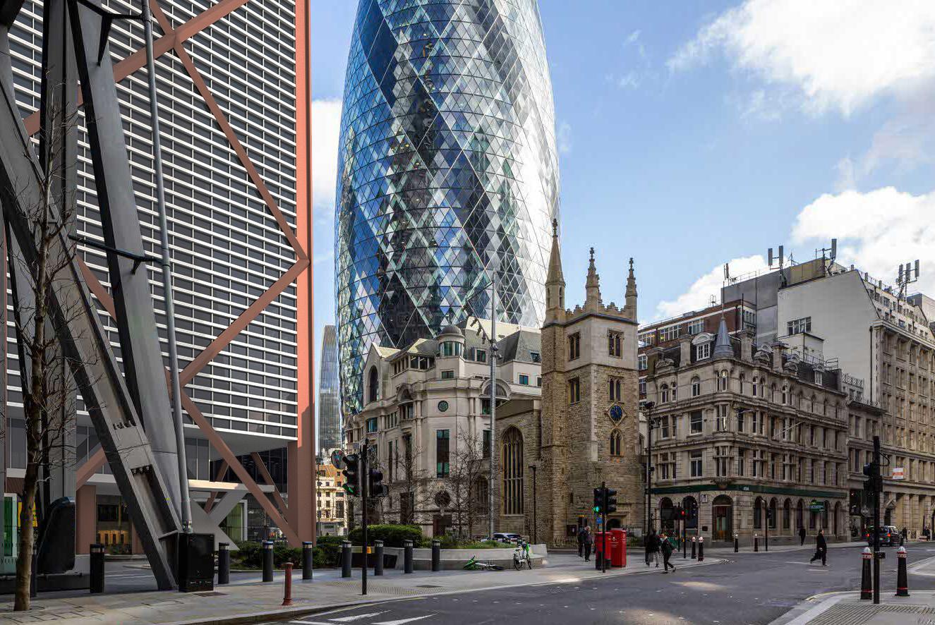

– View not included in 2019 consented application.
– Consented proposals overlaid on existing view for comparison (not verified) using purchased context model
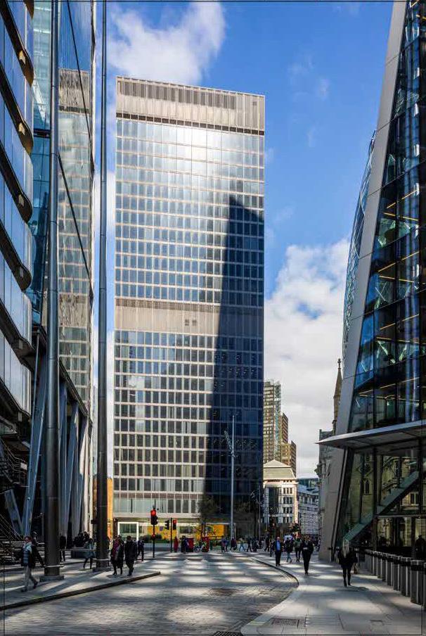
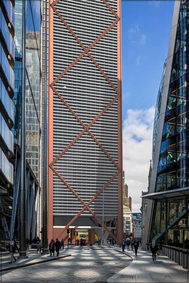
– View not included in 2019 consented application.
– Consented proposals overlaid on existing view for comparison (not verified) using purchased context model
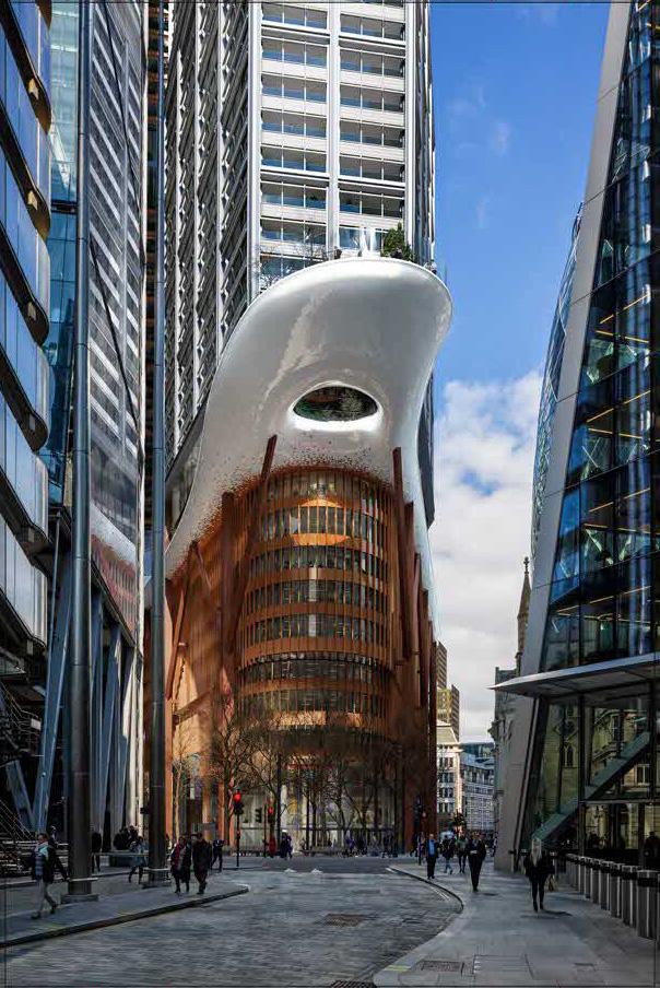
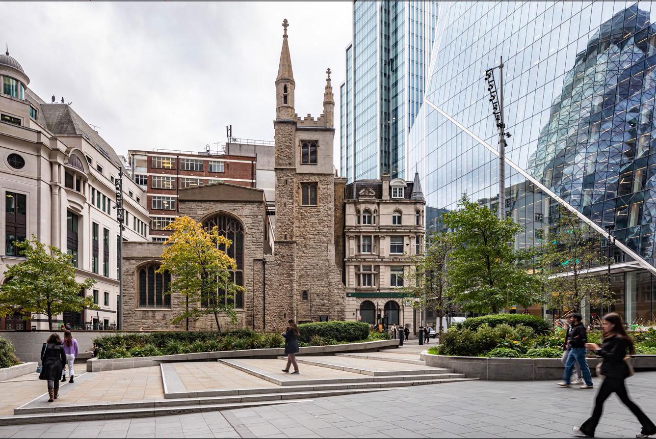
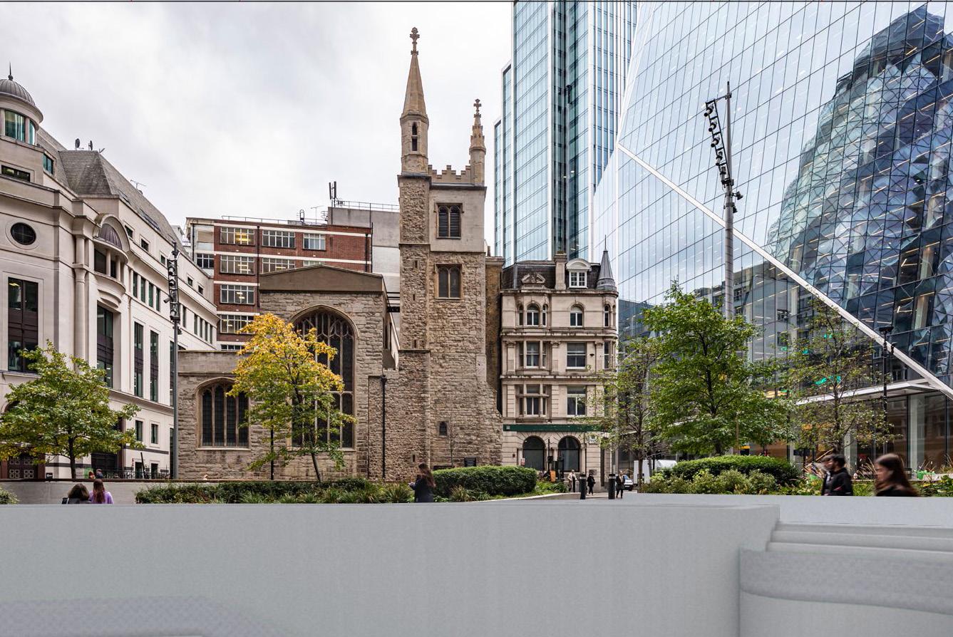
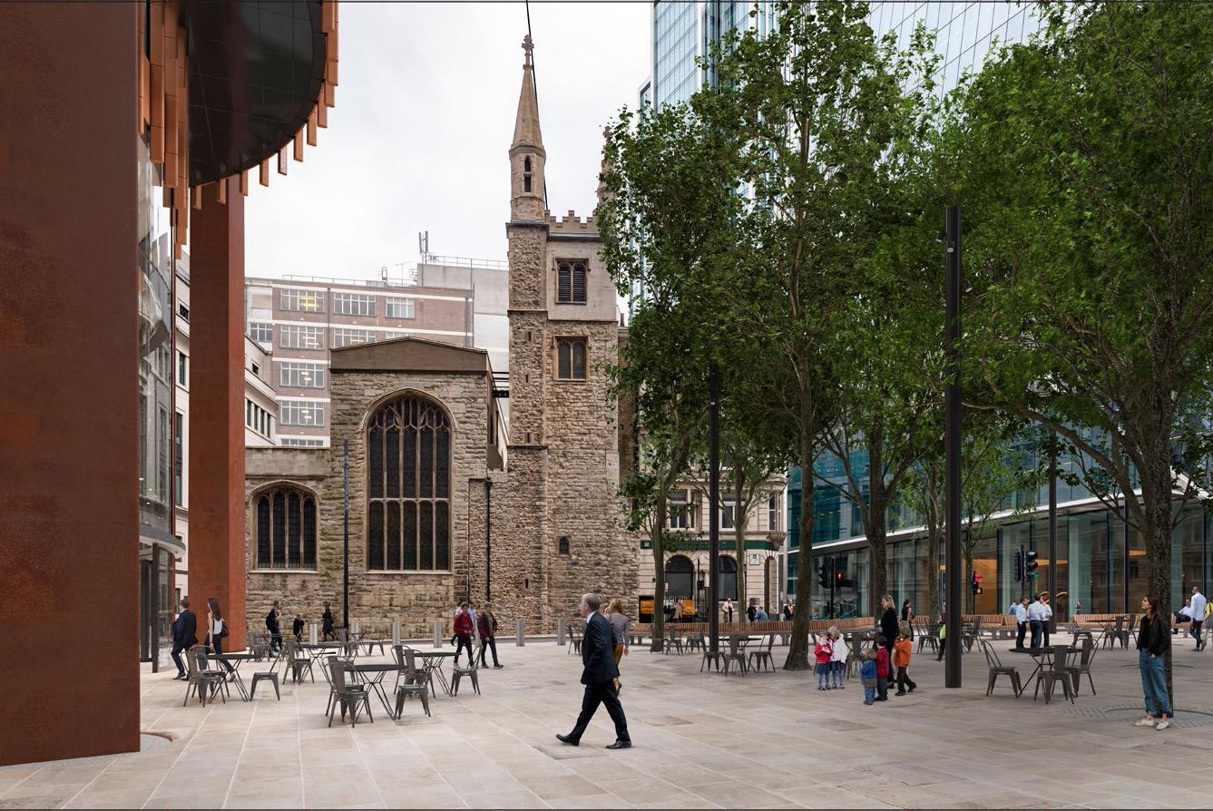
– View not included in 2019 consented application.
– Proposed undercroft and footprint of building above ground is out of the frame to the left (north) of the image.
– We have indicated where the proposed lower ground plaza is located.
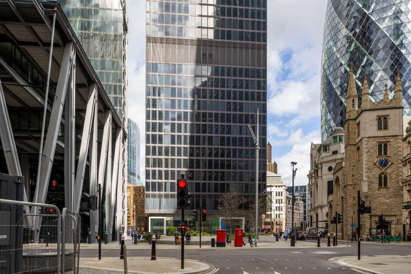
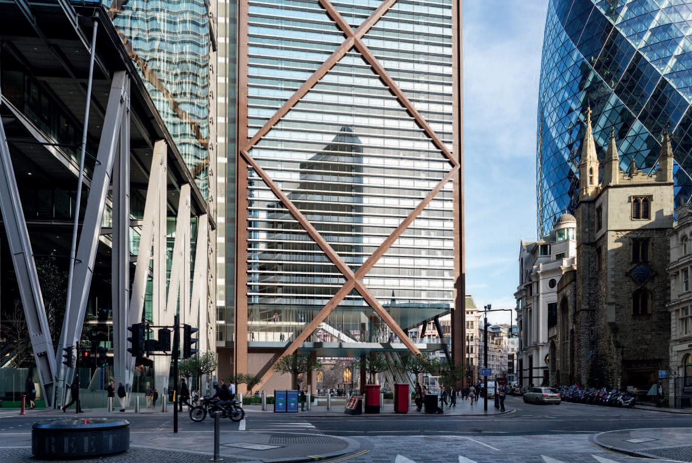

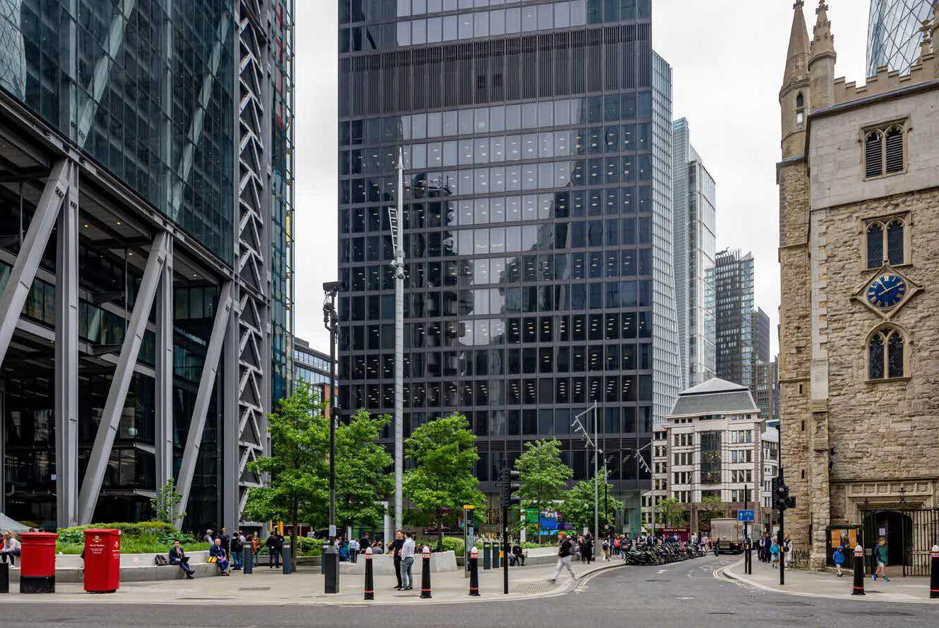
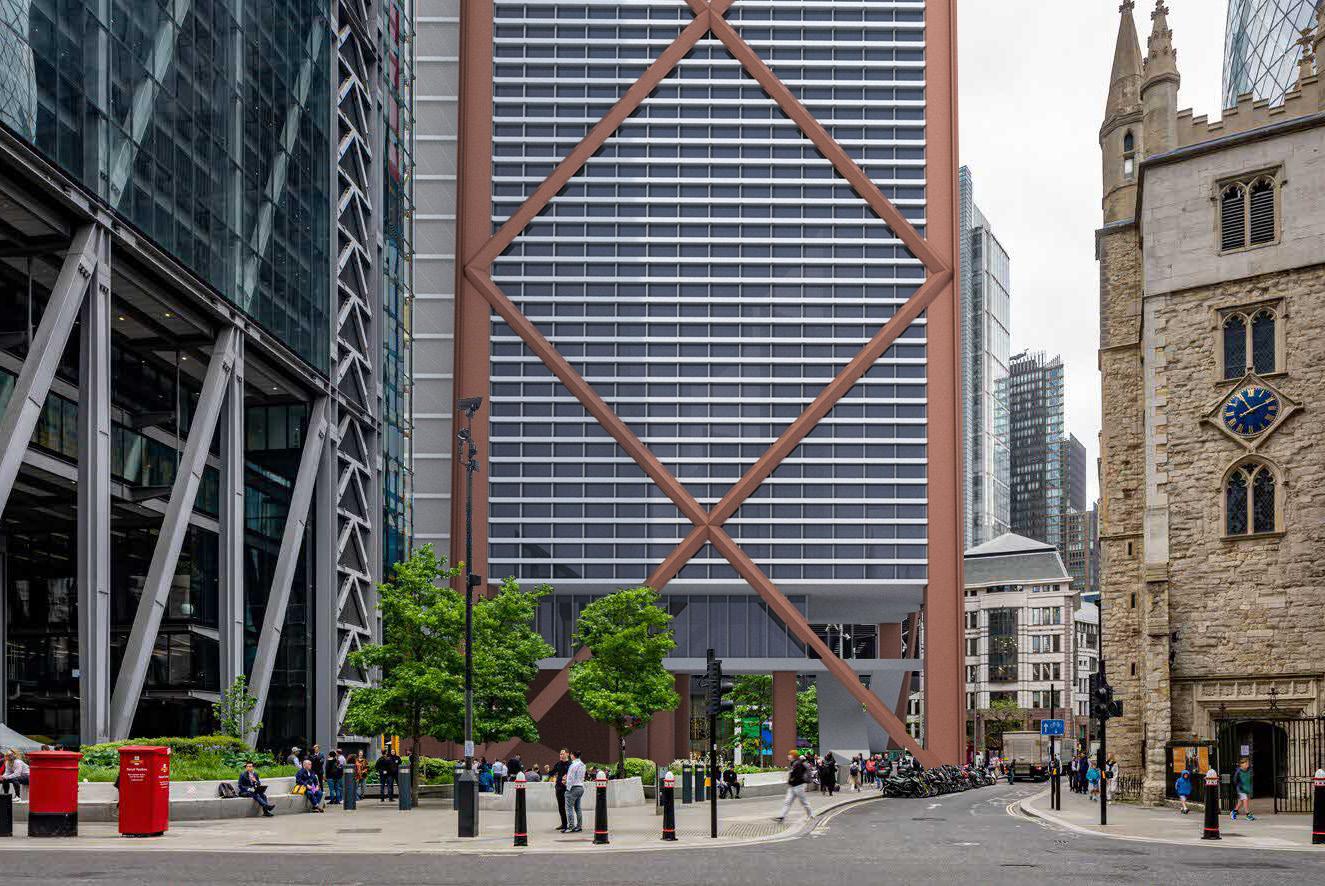
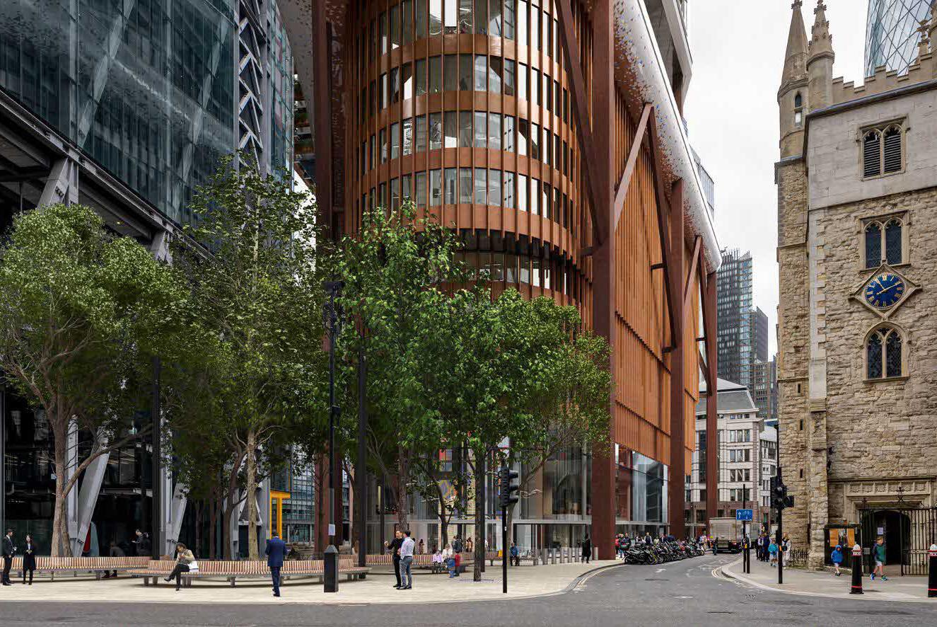
– View not included in 2019 consented application.
– Consented proposals overlaid on existing view for comparison (not verified) using purchased context model
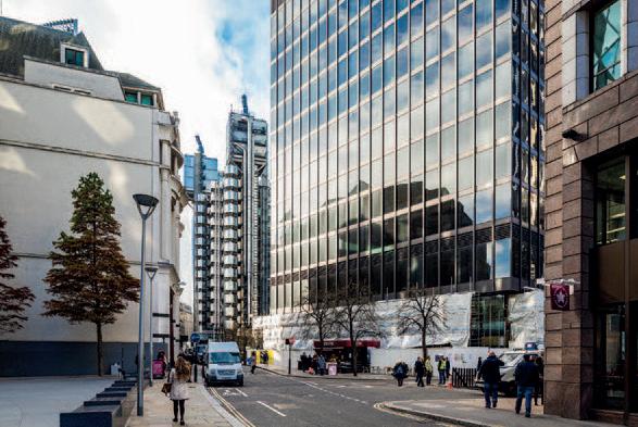
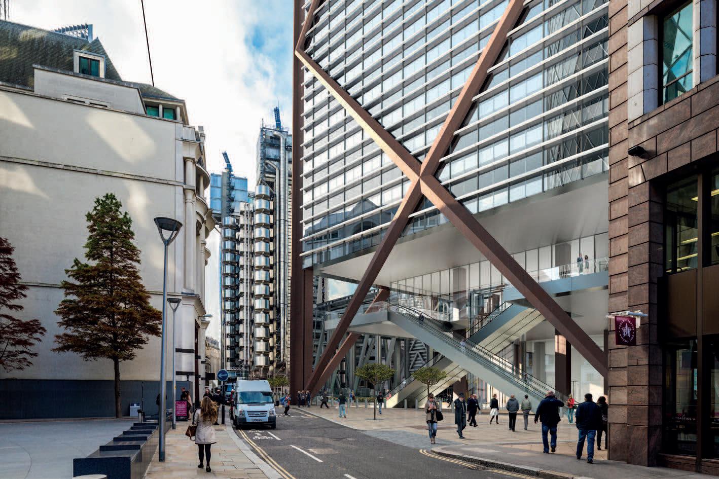
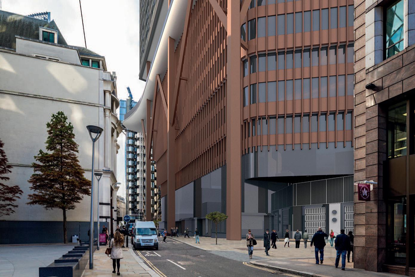
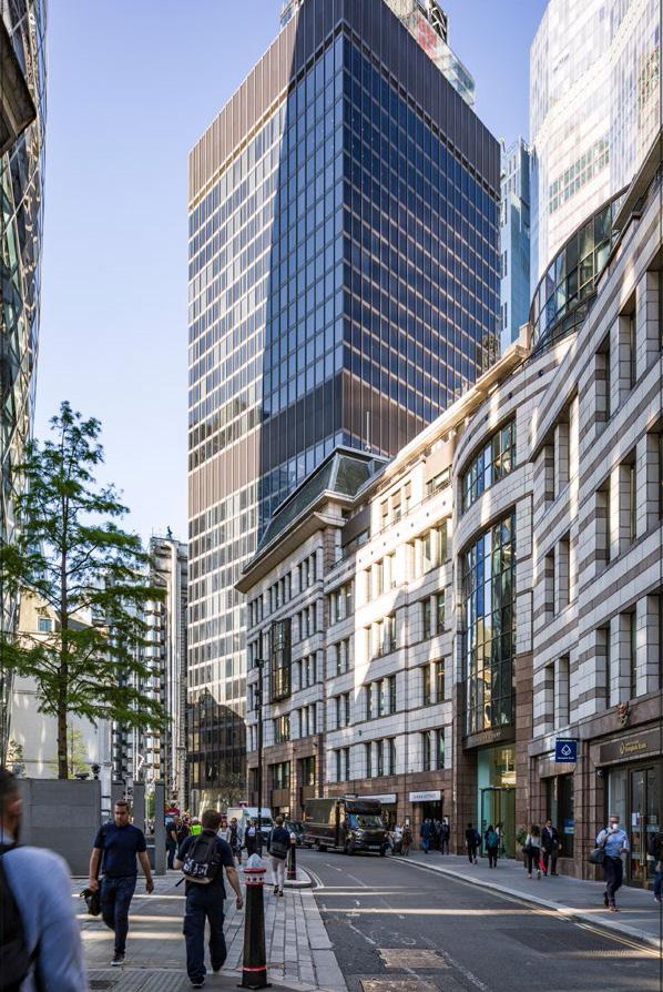
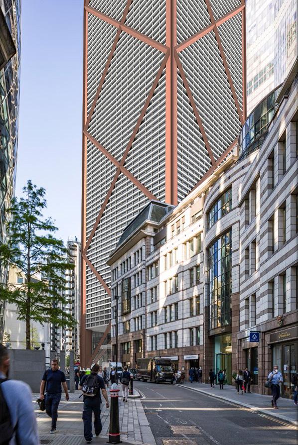
– View not included in 2019 consented application.
– Consented proposals overlaid on existing view for comparison (not verified) using purchased context model
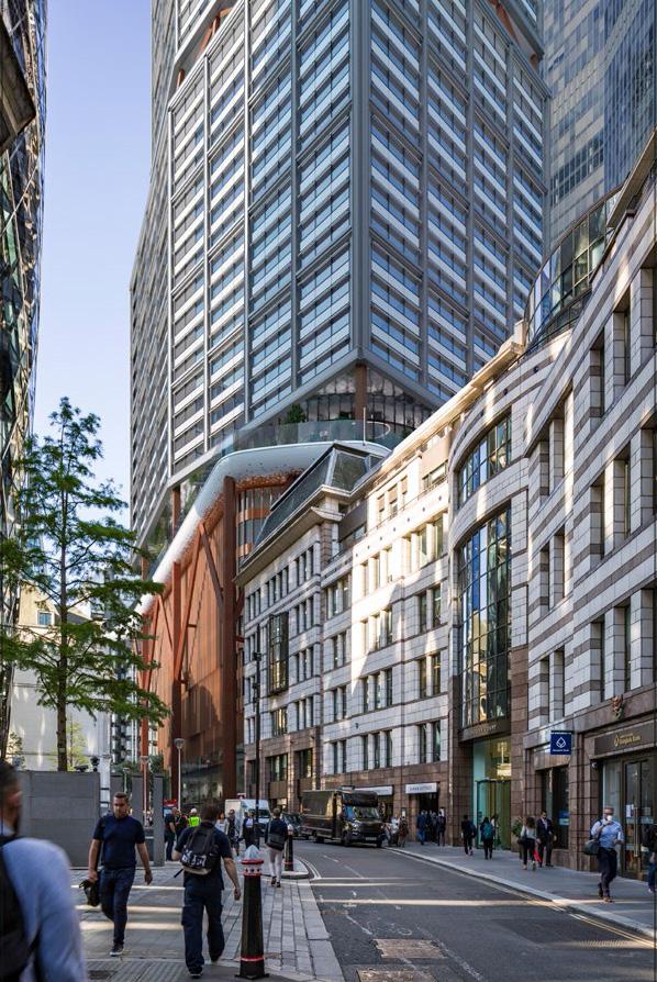
Non-verified views produced using purchased 3D context model (context placement and 2019 consent) and information provided by the Applicant’s team (2023 application). Where required, we have modelled various elements (2019 consent, landscaping) in more detail with reference to 2D drawings included in each planning application.
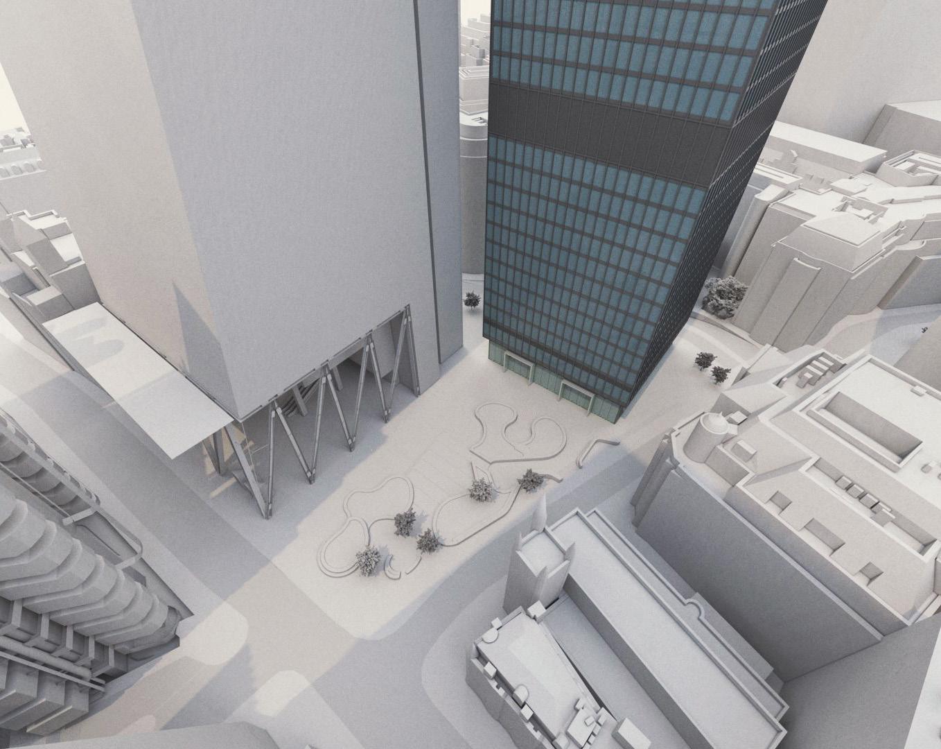
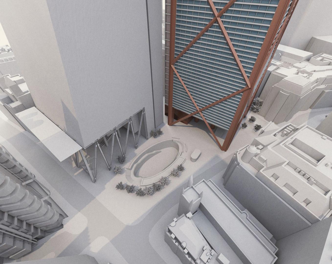
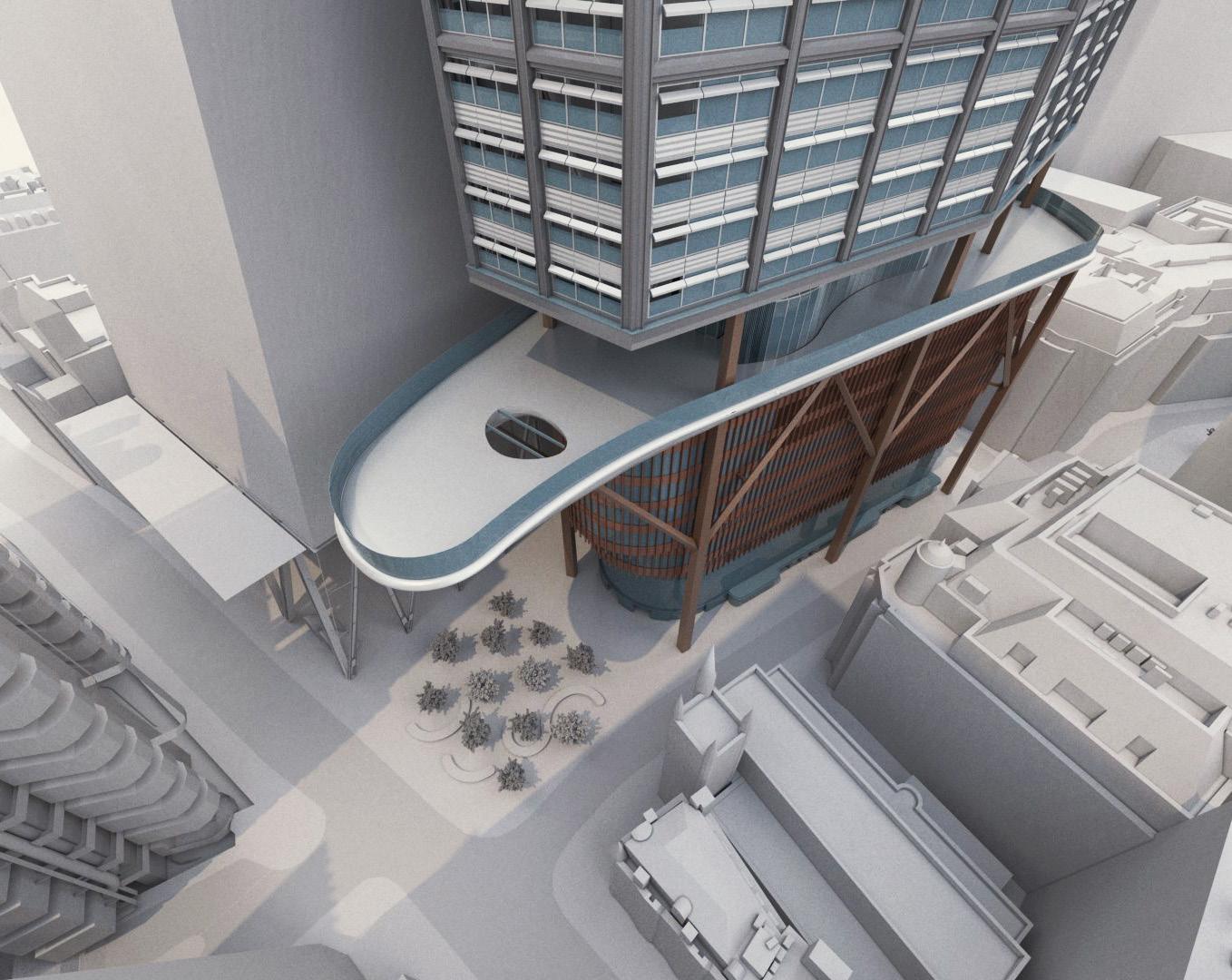
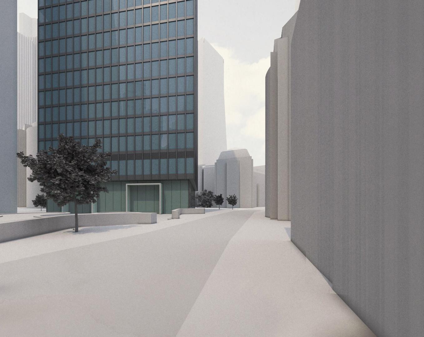
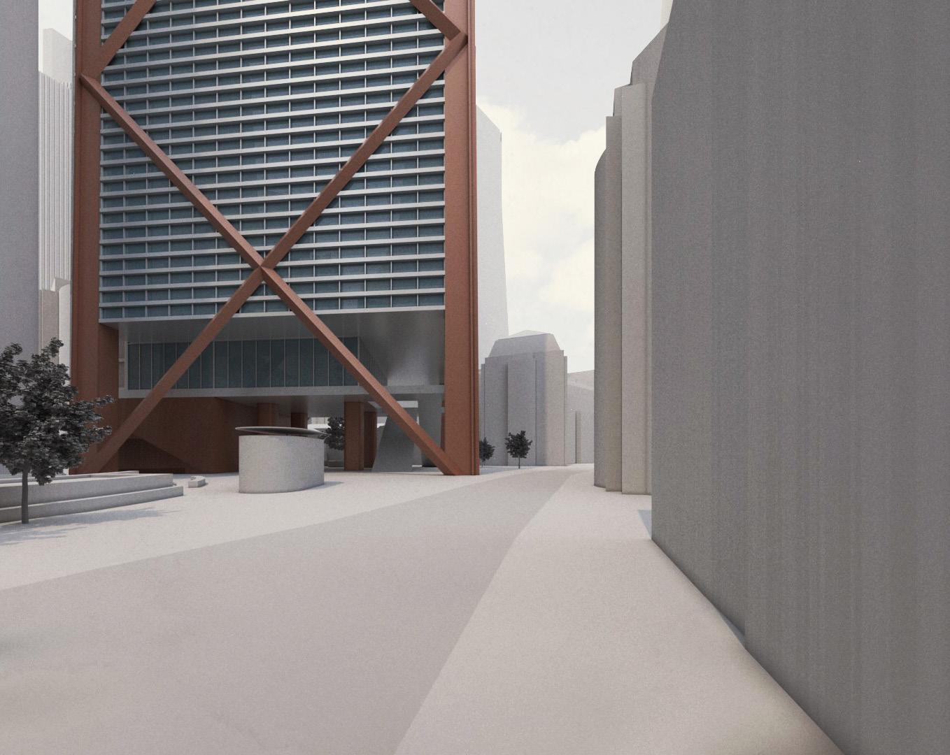
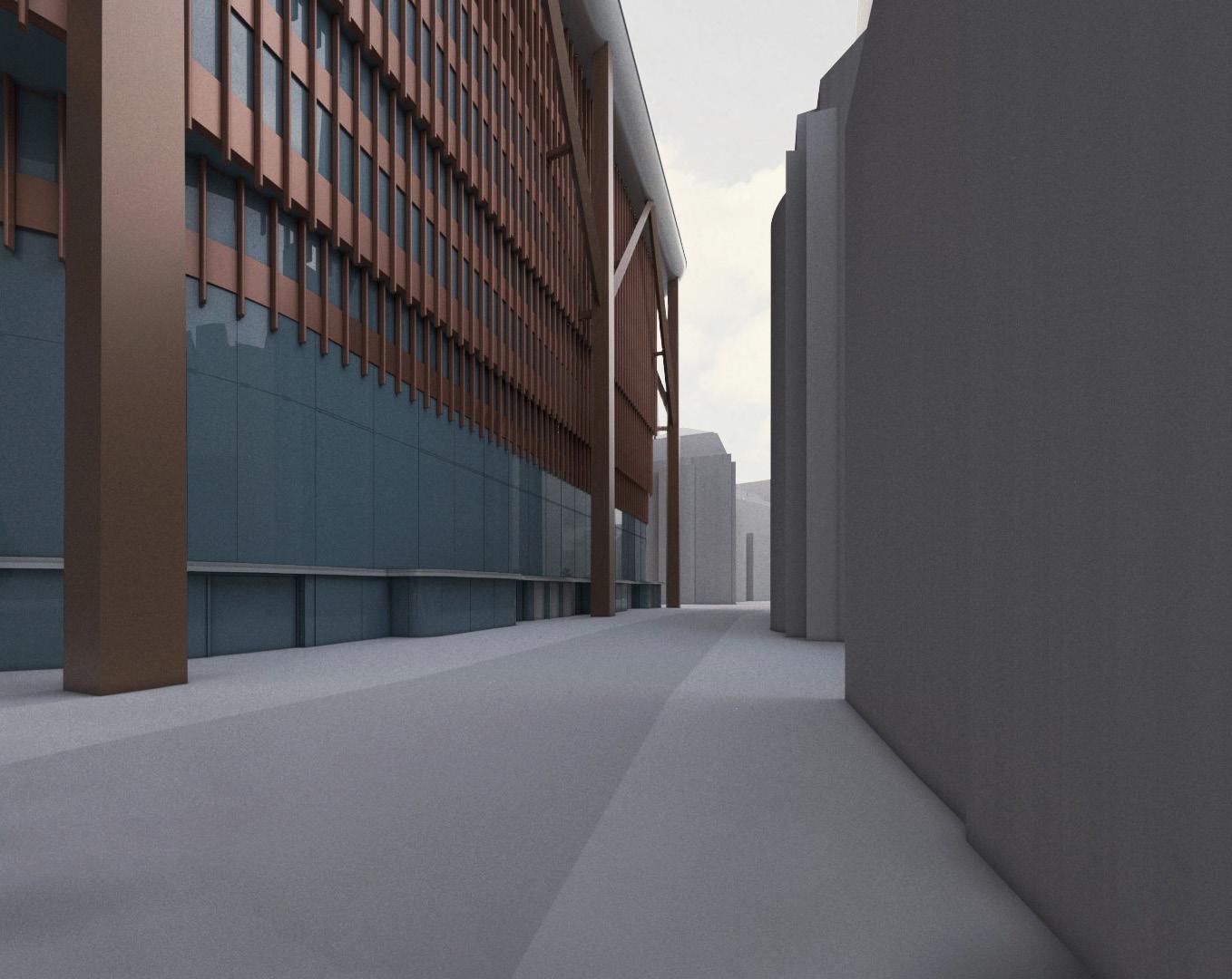
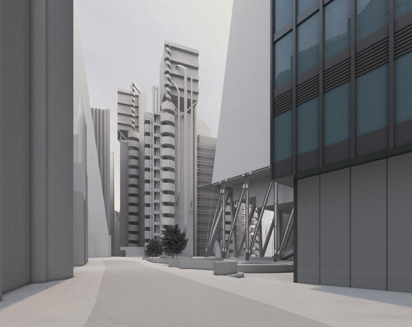
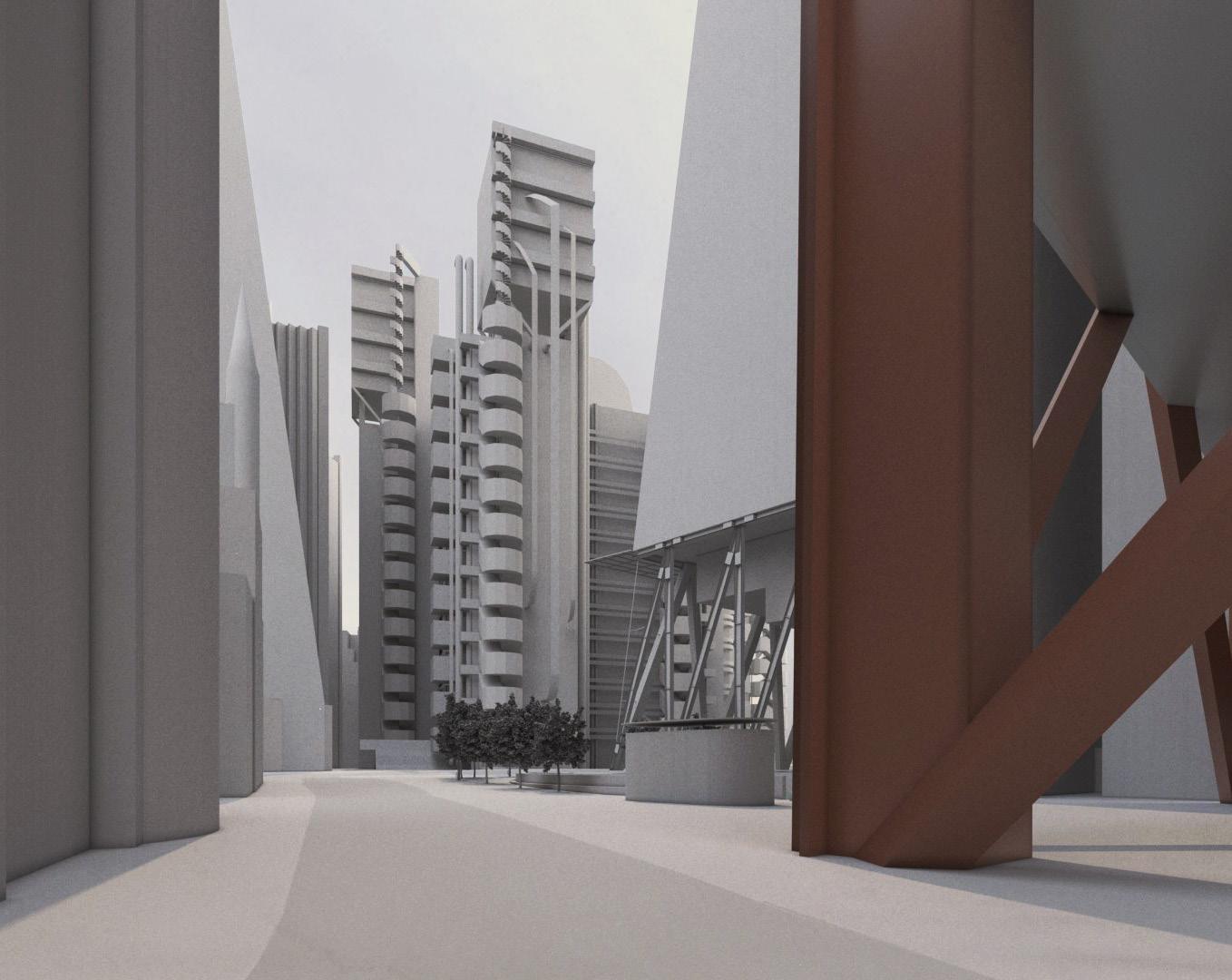
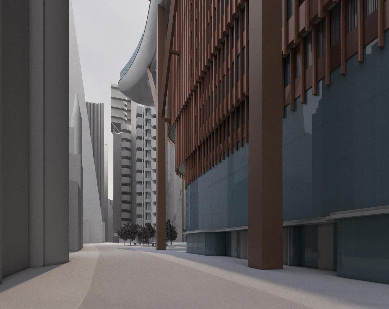
The followiung views are taken from specific time-frames of CGI video views from typical office floorplates of The Leadenhall Building, issued 15 March 2024 by the Applicant’s team on request as part of post-submission consultation.
Level 10
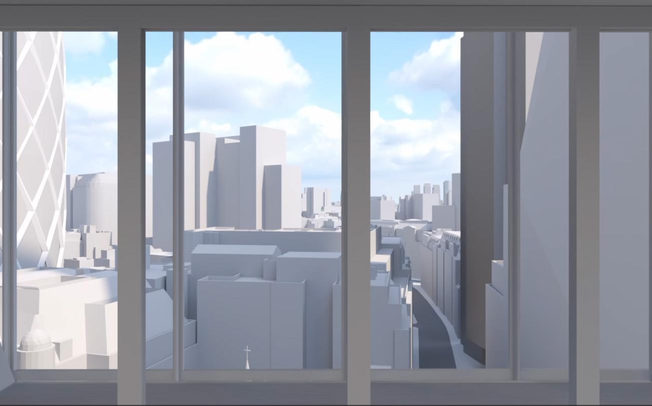
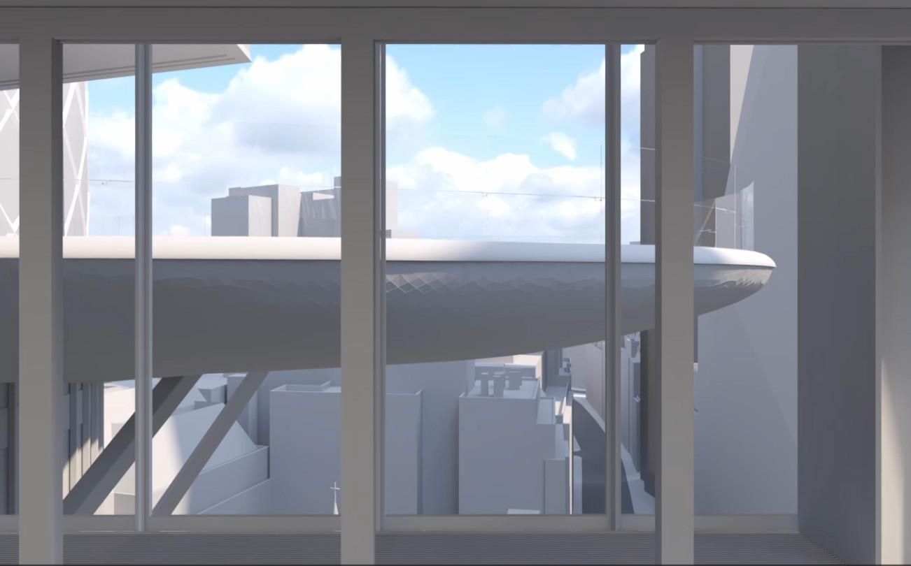
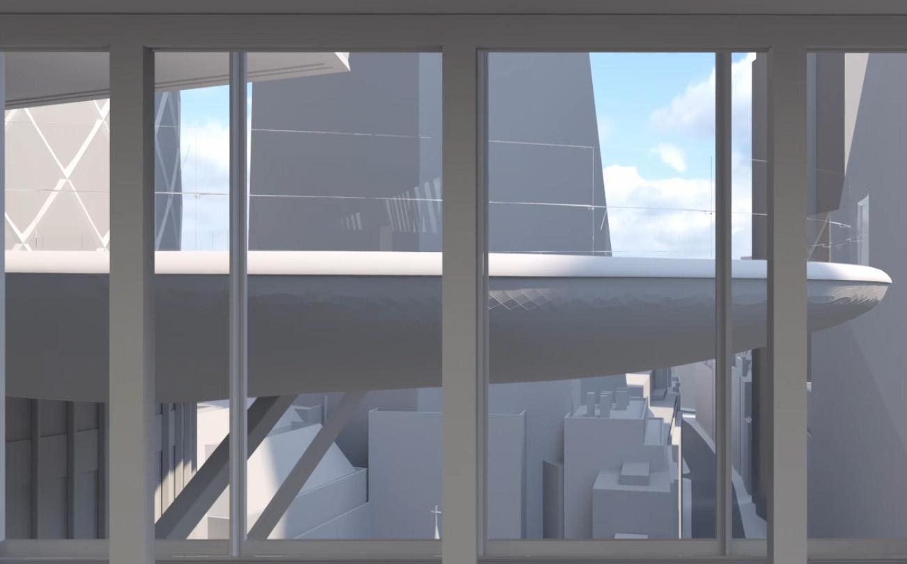
– Video not issued for 2019 consented application, however footprint of 2019 consent is out of the frame to the left (north) of the image, as per the existing building to 1 Undershaft.
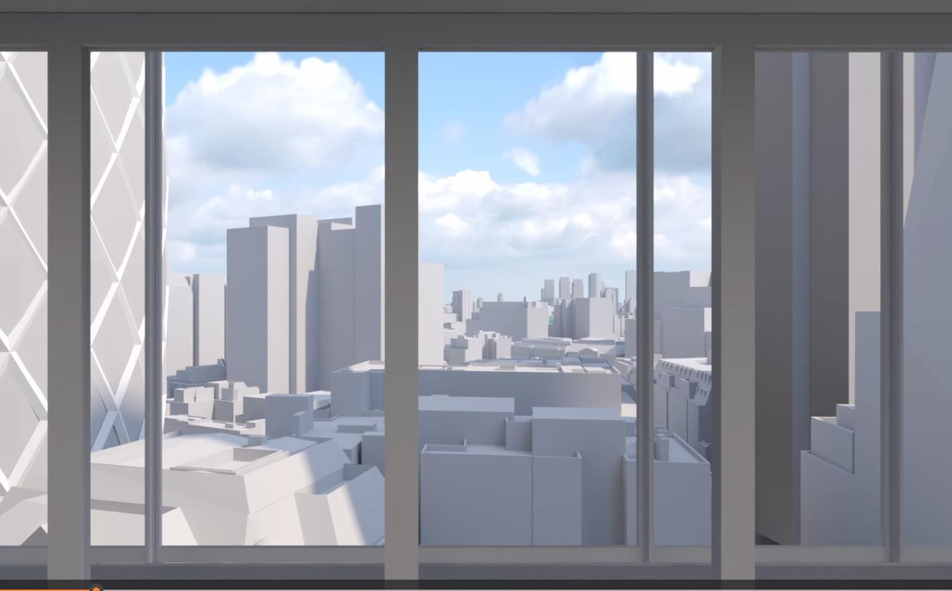
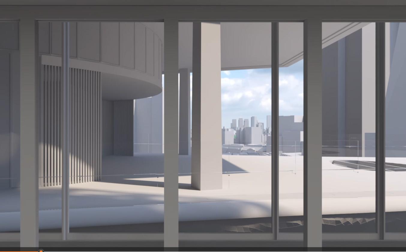
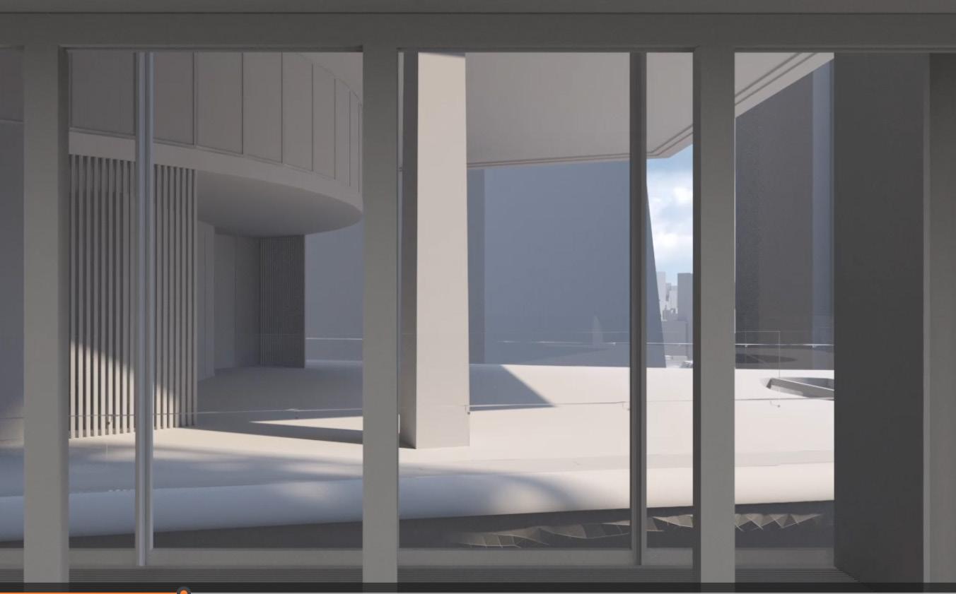
– Video not issued for 2019 consented application, however footprint of 2019 consent is out of the frame to the left (north) of the image, as per the existing building to 1 Undershaft.
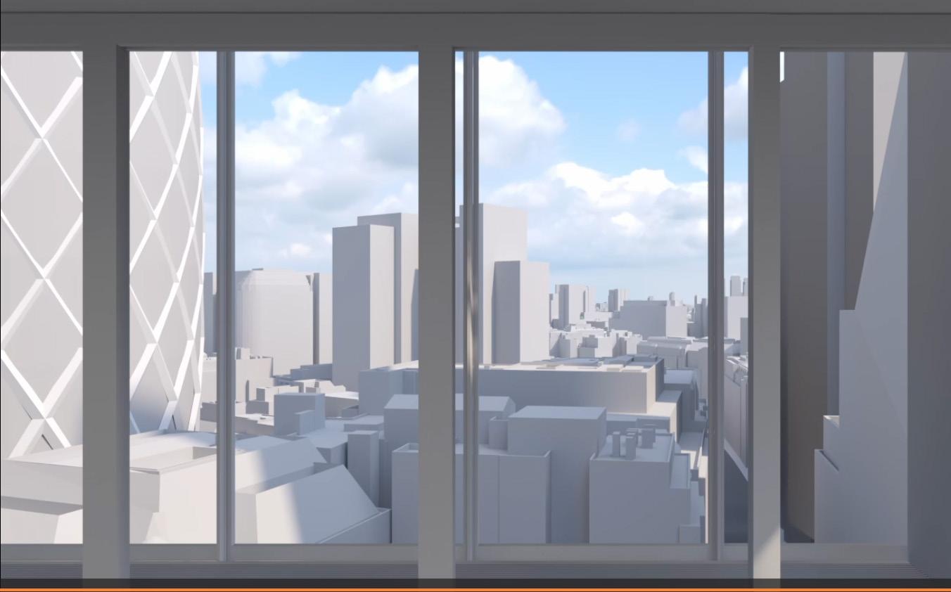
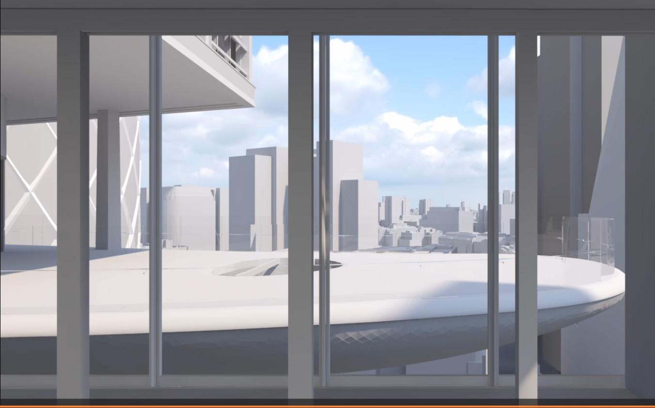
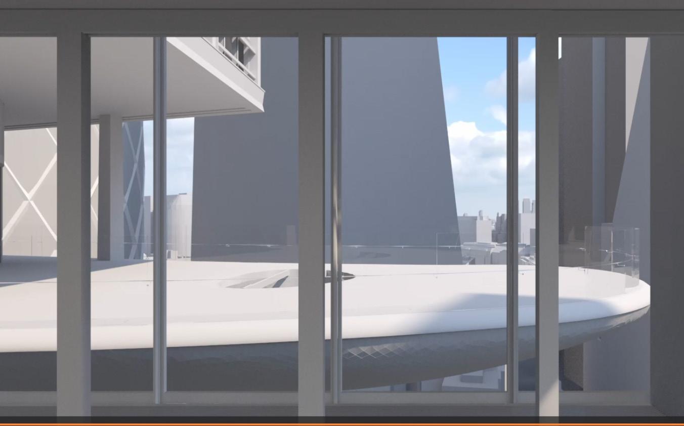
– Video not issued for 2019 consented application, however footprint of 2019 consent is out of the frame to the left (north) of the image, as per the existing building to 1 Undershaft.
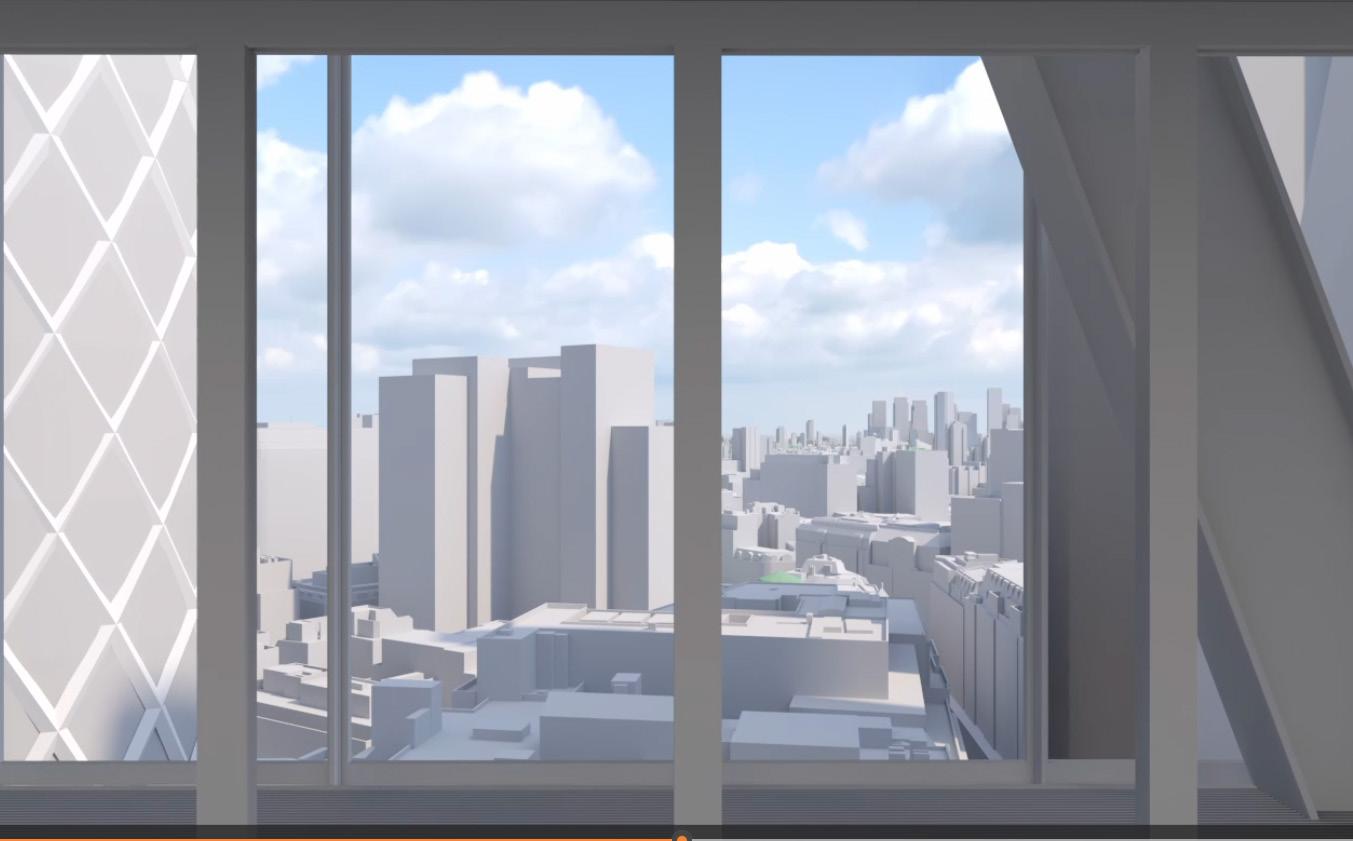
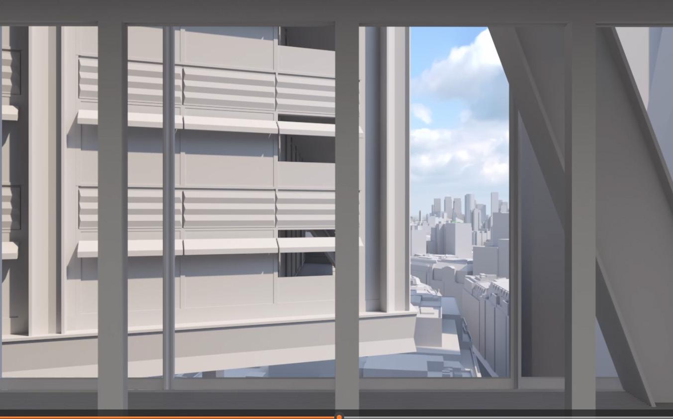
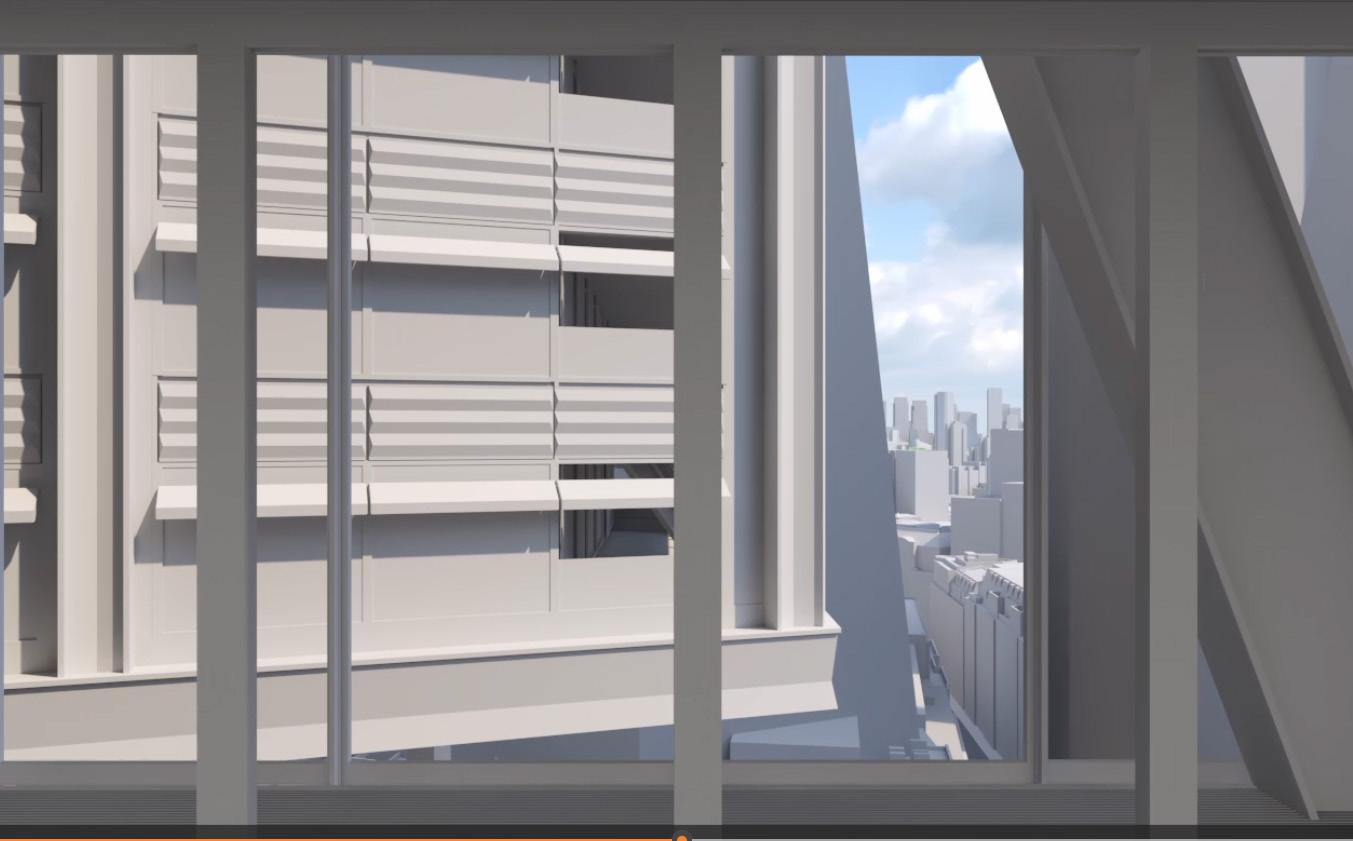
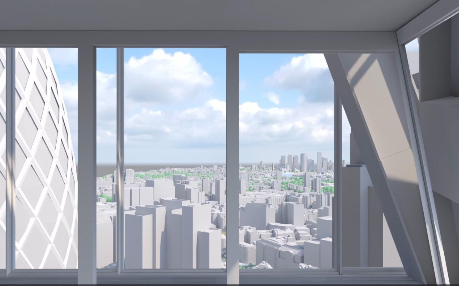
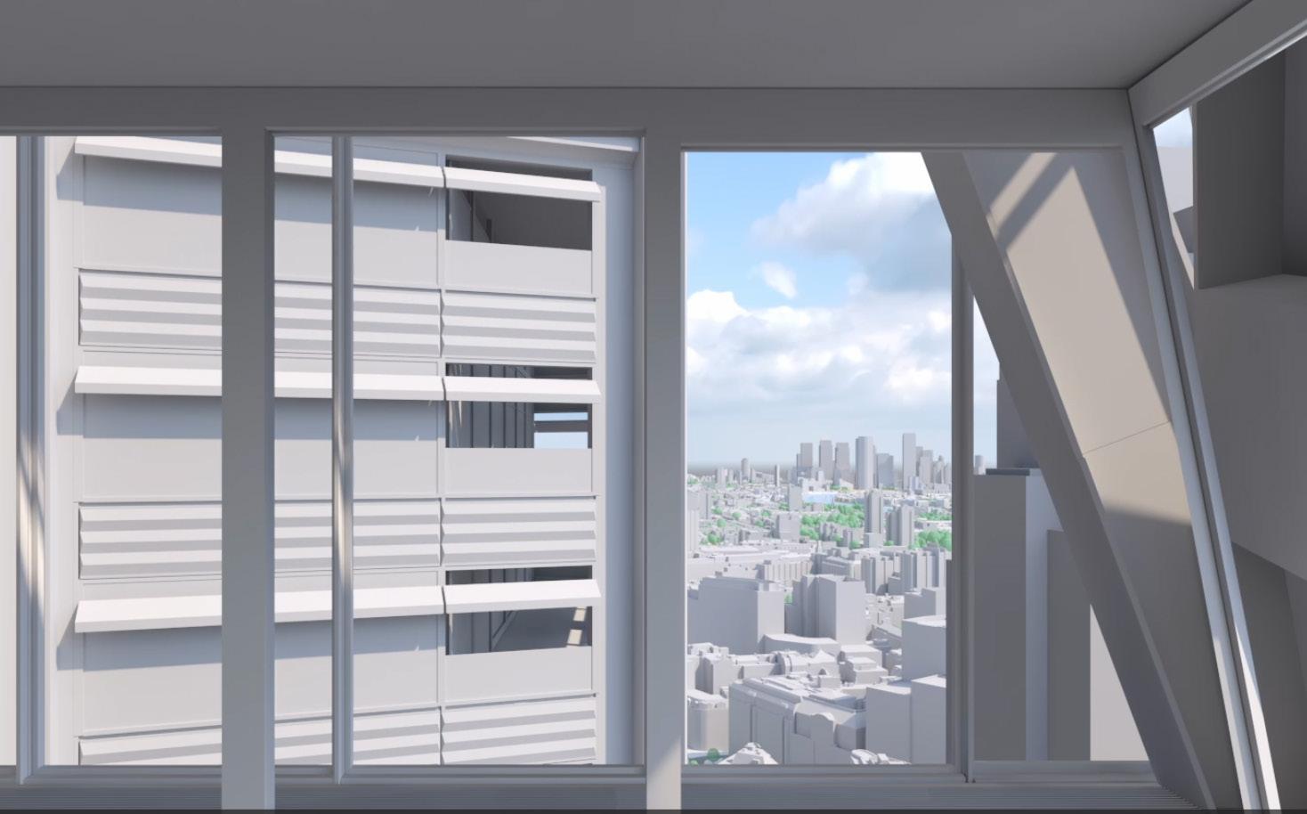
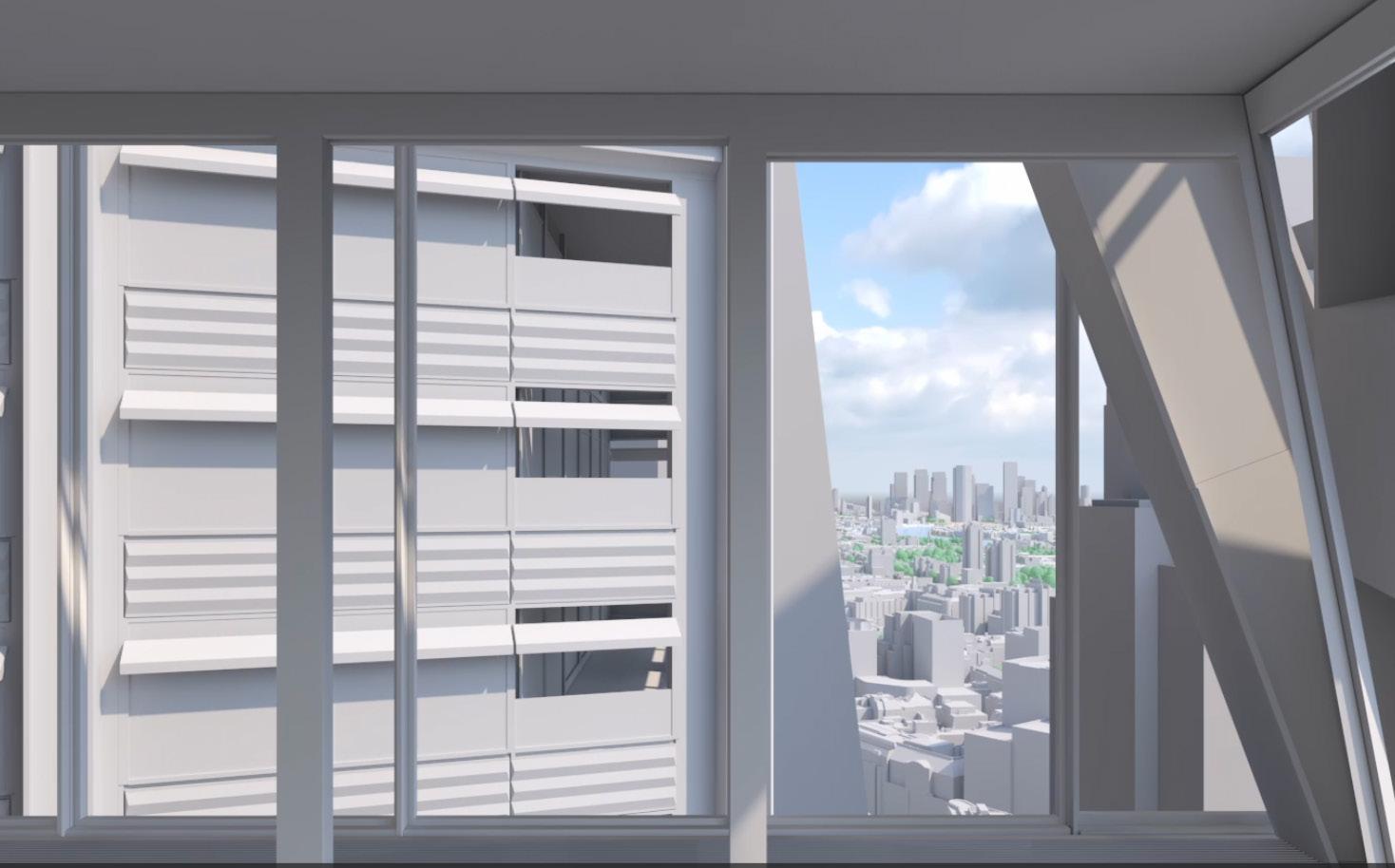
– Video not issued for 2019 consented application, however footprint of 2019 consent is out of the frame to the left (north) of the image, as per the existing building to 1 Undershaft.
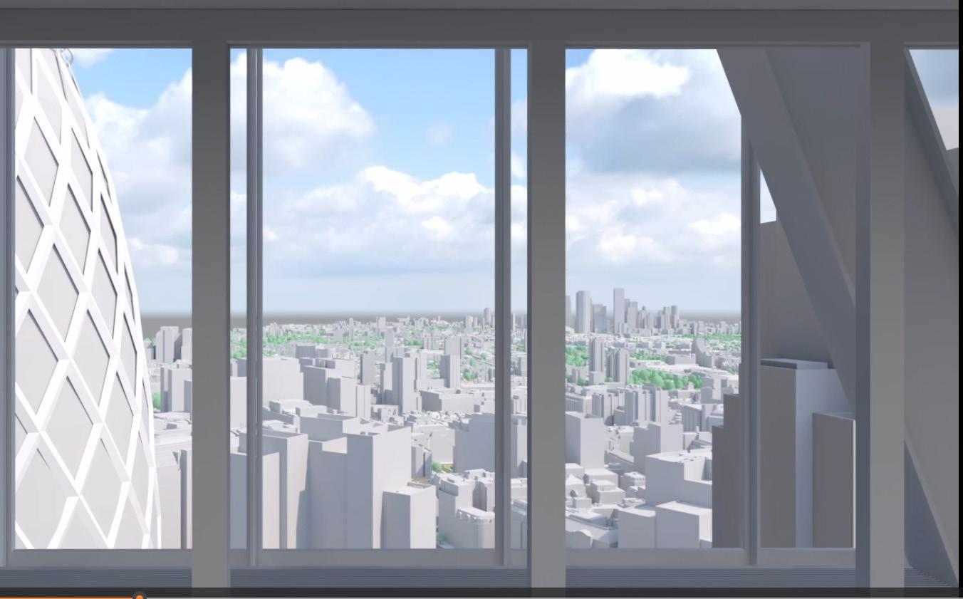
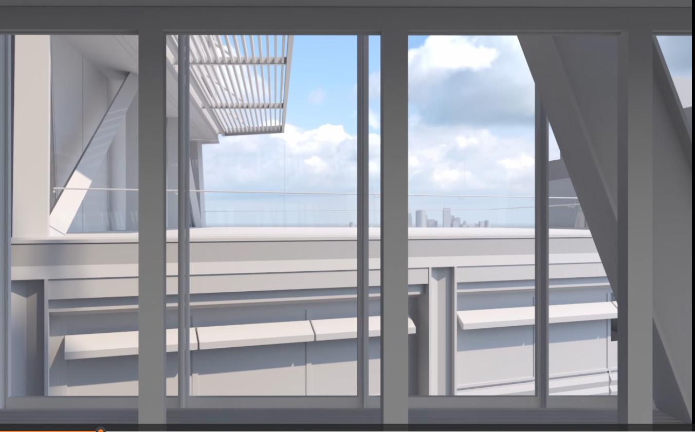
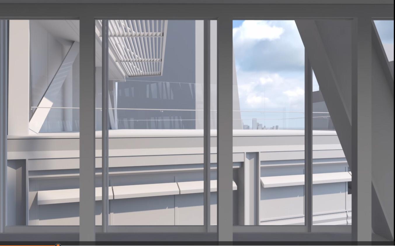
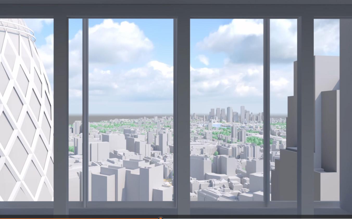
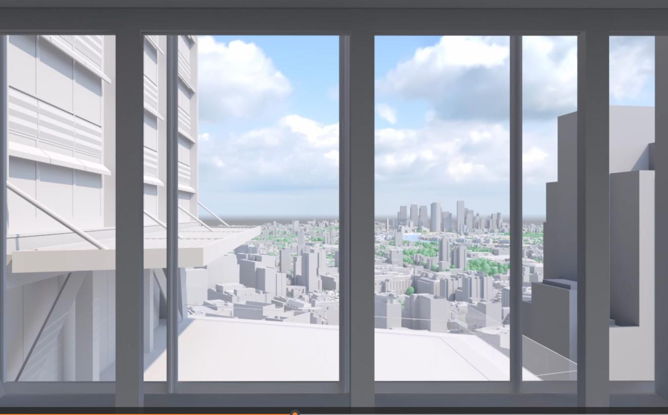
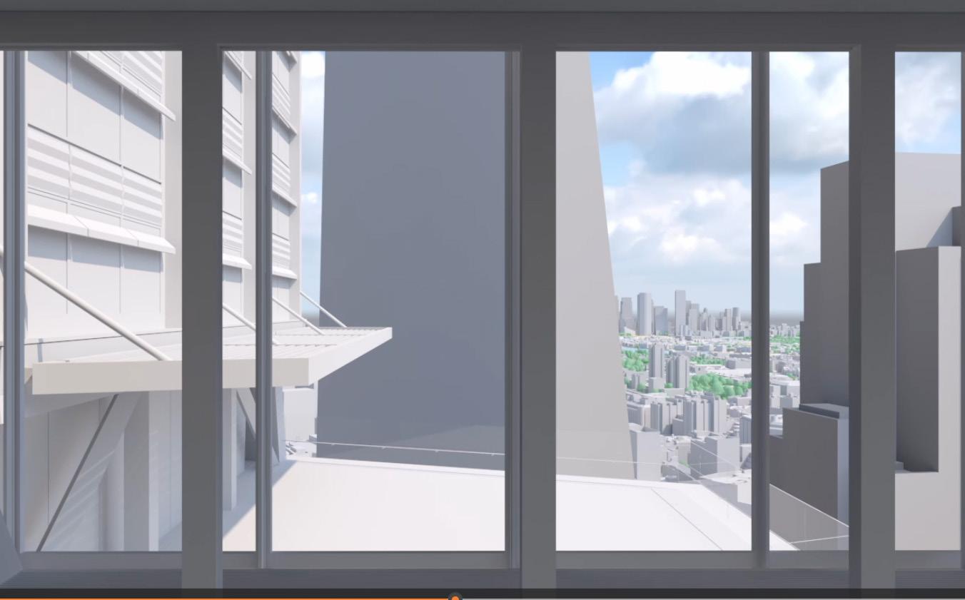
– Video not issued for 2019 consented application, however footprint of 2019 consent is out of the frame to the left (north) of the image, as per the existing building to 1 Undershaft.
Planning Application Ref. No: 23/01423/FULEIA Neighbour Consultation
Representations on behalf of C C Land – 23 April 2024
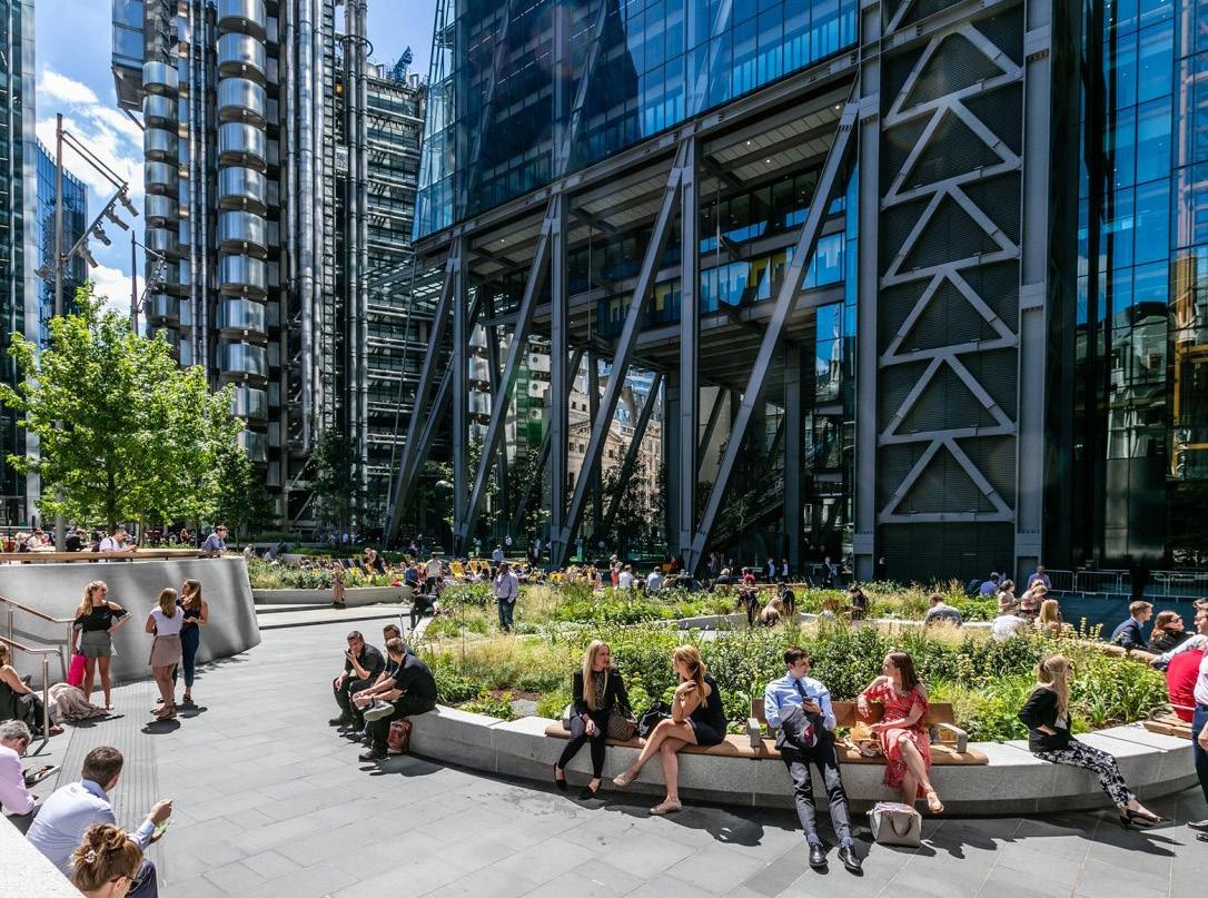

1.1 This report is an assessment of the 2023 application for 1 Undershaft against the Development Plan policies relating to design, heritage and public realm.
1.2 The scheme would result in a major increase in floorspace compared to the existing Aviva building, and the extant planning permission granted in 2019.
1.3 The increase in floorspace compared with the 2019 consent is achieved by increasing the scale and massing of the building, particularly the base and middle sections. Part of the increase is secured by a larger ground floor footprint and floorplates at the base of the building up to the 11th floor. This is analysed in the Architectural Review by dMFK which is set out in Chapter 3 of the representation report (‘the representation’) and the Architectural Appendix.
1.4 The importance of St Helens Square to the public realm in the Eastern Cluster is described in Chapter 2 of the representation.
1.5 The impact of this increase in scale on the public realm has been assessed by Kim Wilkie, landscape consultant. His findings and conclusions are set out in Chapter 4 of the representation.
1.6 The impact on built heritage assets and the townscape of St Mary Axe and Leadenhall are assessed by Stephen Levrant of Heritage Architecture in Chapter 5 of the representation, and Appendix C containing the Heritage Note.
1.7 Overall, these assessments conclude that the application proposals conflict with the ten key adopted policies relating to design, tall buildings, heritage and public realm in the Development Plan which comprises:
the London Plan 2021
the City of London Local Plan 2015
10 Key Development Plan Policies
The City of London Local Plan 2015
Core Strategic Policy CS7 Eastern Cluster
Core Strategic Policy CS10 Design
Policy DM10.1 New Development
Policy DM10.7. Daylight and Sunlight
Policy DM12.1 Managing Change Affecting all Heritage assets and Spaces
Core Strategic Policy CS14 Tall Buildings
Policy CS19 Open Spaces and Recreation
Policy DM19.1 Additional Open Space
The London Plan 2021
Policy D8 Public Realm
Policy D9 Tall Buildings
1.8 In addition, the 2023 proposals also conflict with aspects of the National Planning Policy Framework, 2023 and the emerging Draft City Plan 2040.
1.9 There is serious harm arising from the loss of part of St Helens Square, and impact on the remaining area of the Square and related public realm; and to the and townscape of St Mary Axe and Leadenhall. The proposals would result in clear and avoidable harm to the setting of two Grade I listed buildings.
1.10 This harm was not identified in the accompanying Planning or Heritage reports and thus the proposals were not adequately assessed against paragraph 208 of the National Planning Policy Framework (‘the NPPF’ or ‘the Framework’).
1.11 In its current form the application conflicts with the Development Plan. It should not be approved unless material considerations strongly indicate otherwise.
1.12 There are no material considerations that indicate otherwise taking into account both the harm and benefits of the proposal.
1.13 The fact that there is an alternative scheme in the form of the 2019 consent, and, there are likely to be other options, which would deliver similar benefits, and not cause any material ‘harm’ to the setting of designated heritage assets, and enhance the streetscape and public realm, is a very important material consideration.
1.14 In conclusion, it is recommended that the 2023 application is re-designed. If it is not redesigned, particularly at the base of the building, it should be rejected to avoid unnecessary harm to the built historic environment, and to protect and enhance the public realm of St Helen’s Square, and the townscape of St Mary Axe and Leadenhall.
2. Introduction
2.1 This is an appendix to C C Land’s Representations on the new redevelopment plans for 1 Undershaft London EC3A 8EE as detailed within Planning Application Ref. No: 23/01423/FULEIA. It has been produced on behalf of C C Land, owner of The Leadenhall Building.
2.2 The Leadenhall Building was acquired in 2017 and comprises the Group’s principal asset in London. It is fully let to 17 occupiers and accommodates up to 6,000 City workers.
2.3 C C Land believe in the City of London and share the City Corporation’s aspirations for the future of the Square Mile and the City Cluster in particular. C C Land supports the growth and improvement of the City:
sits on the Board of the City Property Association (CPA);
are one of the founding Members of the Eastern Cluster Bid;
sponsors the Sculpture in the City Programme; and
supports the One City digital platform promoting the Square Mile.
2.4 The Leadenhall Building adjoins St Helens Square and the Aviva Building which are within the application site for the redevelopment known as 1 Undershaft.
2.5 St Helen’s Square is an important open space fronting Leadenhall Street and St Mary Axe, attracting office workers, residents, and visitors of all age groups to meet, relax, play, and enjoy events in an iconic setting.
2.6 This appendix is a critique of the proposals against the Development Plan policies relating to design, heritage and open space. It comprises the following chapters:
Chapter 3 summarises the published strategies for public realm in the City, and the importance of St Helens Square as a primary civic space in the Eastern Cluster;
Chapter 4 is an assessment of the application against the Adopted City Local Plan 2015;
Chapter 5 is an assessment of the application against the public realm and tall building policies of the London Plan 2021;
Chapter 6 assesses the emerging policies in the Draft City Local Plan 2040;
Chapter 7 considers the design and heritage advice in the Framework;
Chapter 8 covers relevant issues considered in the Tulip Inspector’s Report and Secretary of State’s decision dated November 2021.
2.7 This document contains extracts from the Development Plan policies. The most important sections of these policies have been highlighted in bold. This report should be read in conjunction with the main representation report and the Architectural review of the proposals by dMFK Architects (Chapter 3 of the representation and Appendix A), Landscape Assessment by Kim Wilkie (Chapter 4 of the representation) , and Heritage & Townscape assessment by Stephen Levrant of Heritage Architecture (Chapter 5 of the representation and Appendix C).
3.1 The Strategy examines the supply and demand of open space in the City. The Executive Summary has the following key conclusions:
1. “The existing level of public open space is low in both absolute and relative terms;
2. The quality of public open space is generally high, but there are a number of challenges to maintaining these high standards;
3. The whole of the City can be described as deficient in open space and there is the need for all types of open space throughout the City;
4. There is a particular need for public open space in the Eastern Cluster and Aldgate Key City Places.
In the context of a growing week-day population it is considered that the most appropriate local standard is the maintenance of the existing City-wide ratio of 0.06 hectares public open space per 1,000 weekday day-time population.”
3.2
Table 2 of the Strategy shows how deficient the Eastern Cluster was in open space in 2015, before the planned growth in working population, including the growth from the proposed redevelopment of 1 Undershaft:
3.3 Paragraph 3.3.8 of the Open Space Strategy states:
“The ratio of existing publicly accessible open space to 1,000 people varies considerably across the City. Figure 4 demonstrates that the Eastern Cluster is most deficient in open space, due to the high concentration of office workers in the tall buildings in a small geographic area. In contrast Figure 5 illustrates that the Aldgate Key City Place is most deficient in open space in terms of the City’s residential population.”
3.4 Figure 4: Open Space Provision – Office Workers demonstrates that the Eastern Cluster will be under more pressure for open space provision, as much of the increased employment will be in the Eastern Cluster:
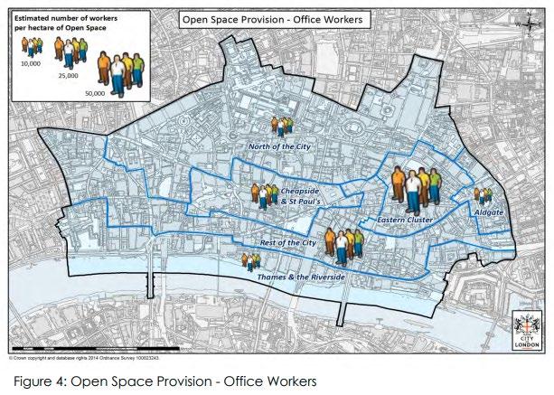
Summary
3.5 The City's Open Space Strategy has the following strategic objectives:
“1. Maintain and increase public access to existing open spaces and enhance the quality of these spaces, in terms of both design and management.
4.2.2 The first priority is to maintain and make the most of existing open space in the City, which is such a scarce and valuable resource.”
3.6 The second objective of the Open Space Strategy is to increase the amount of high quality public open space, particularly in the Eastern Cluster.
3.7 The strategy (which flows through to adopted policy) is clear – public open space should be protected, improved, and expanded at street level, in addition to the provision of roof terraces and gardens.
City Cluster Vision 2019
3.8 The City Cluster Vision 2019 demonstrates the importance of St Helen’s Square to the Open Space Strategy for the Eastern Cluster.
3.9 On page 25 it states:
“At the historic centre of the Cluster lies the crossroads of Leadenhall Street, St Mary Axe and Lime Street. These streets in particular offer iconic global addresses that are instantly recognisable and commercially attractive today, and as a set of streets regularly frequented by City workers and visitors alike, they engender a collective sense of community at the core of the cluster today. Their ability to connect and allow for interactions on a regular basis throughout the working day is undiminished and their continued activity and bustle is representative of the success and character of the area.”
As a result, the Cluster Vision identifies “major public realm enhancements focused on the historic routes of Leadenhall Street and St Mary Axe - Lime Street to provide greater pedestrian space, more frequent crossing points and more active, greener, and more social pedestrian realm.”
3.10 Of particular importance are the following paragraphs of the Strategy:
“In addition to this key crossroads, the centre of the City Cluster is defined not only by a Cluster of modern tall buildings, but also by a series of associated, generously proportioned open spaces that, whilst privately owned and managed, are publicly accessible. Spaces such as St Helen’s Square (at the foot of 122 Leadenhall Street and 1 Undershaft) and The Plaza at the foot of 30 St Mary Axe (the Gherkin) provide the canvas for active and engaging public life to flourish and are supported by a range of social and cultural activities and events.”
3.11 The report continues:
“The strategy acknowledges and supports the important spatial contribution offered by such large, high quality open spaces in terms of outdoor gathering, informal meetings events and activities alongside the relief provided by greenery within the ever-developing Cluster.”
3.12 The Vision document proposes a series of public realm enhancements shown on the figure on page 38 , and which is reproduced below:
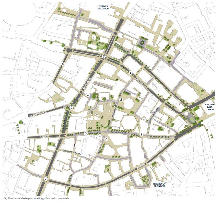
3.13 The Public Realm Masterplan in the City Vision shows the public open space to the north of Leadenhall Street annotated as ‘5’ in the above image) and to the west of St Mary's Axe (shown as ‘2’) as the largest area of public open space in the Eastern Cluster. St Helen’s Square forms the heart of this wider space.
3.14
3.15
The proposals include the street level space beneath the Leadenhall Building, St Helen’s Square, and the public realm proposed at street level beneath the 2019 planning permission for 1 Undershaft.
The illustrative sketch opportunities plan on page 42 of the report, which is reproduced below, shows the public realm enhancement of St Mary Axe - Lime Street.
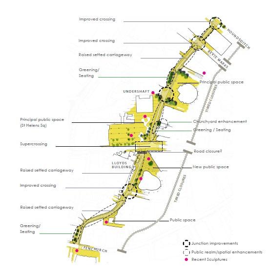
3.16
3.17
St Helen’s Square combined with the Leadenhall Building plaza is identified as the principal public space, and the masterplan envisages pedestrian priority being provided along St Mary Axe, and which is described as:
“one of the busiest pedestrian streets within the City Cluster, particularly at rush hour and lunchtimes but suffers from narrow, overcrowded footways. It has the potential to become a truly great City street acting as an address for some of the most celebrated and iconic buildings of the Cluster.”
The illustrations on pages 43, 44, and 45 of the report show the importance of the refurbished St Helen’s Square, combined with the pedestrian priority of St Mary Axe to the public cultural life of the City Cluster. They also demonstrate the importance and prominence of St Andrew's Church, Grade I Listed, to the setting of St Mary Axe and St Helen’s Square.
3.18 In Maps 1 & 2 (see below) St Helen's Square stands out as the largest open space at the heart of the area of change, framed by three important listed buildings.
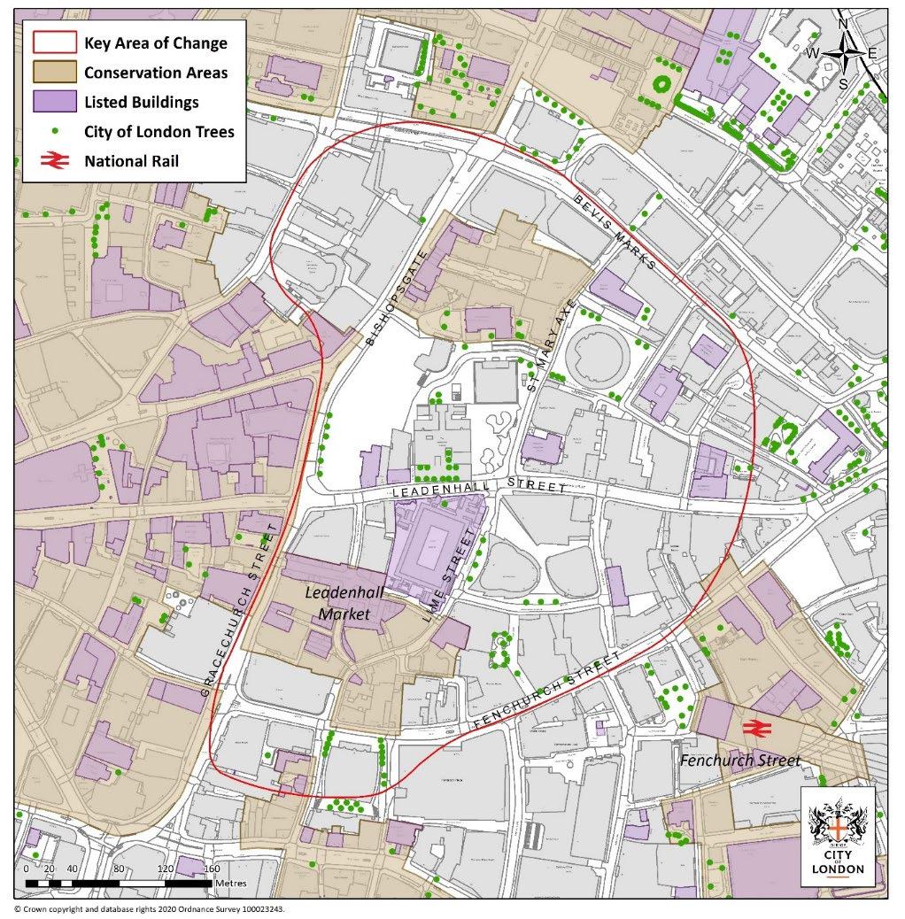
Map 1 : City Cluster Key Area of Change
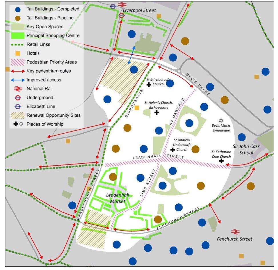
Map 2 : City Cluster Key Area of Change Diagram
3.19 Map 7 shows the proposed building heights in the Cluster. St Helen's Square is at the centre of the existing and planned growth of tall buildings, an area of exceptional density. The new tall buildings, including 1 Undershaft, will put increasing pressure on open spaces, in particular St Helen's Square.
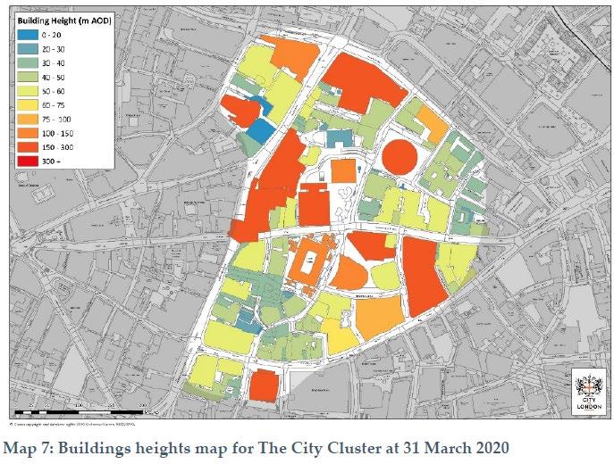
3.20 The report's conclusions at Chapter 6 start with the importance of the public realm:
"The City Cluster not only has the potential to accommodate growth it is an attractive destination for people working and visiting this area. High quality public realm projects to improve pedestrian connectivity and providing a high-quality public space will make a strong contribution to the dynamism of the City Cluster. The key pedestrian route between St Mary’s Axe and Leadenhall Street in particular creating a pedestrian core around key destination points."
3.21 St Helen’s Square is the largest public open space in the Eastern Cluster. It enjoys a very high quality of daylight and direct sunlight. It also benefits from reflected light from the surrounding tall buildings.
3.22 The Square has an outstanding aspect, with the sky being framed by the late Medieval St Andrews Church (Grade I), the Gherkin, the Lloyd's Register Building (Grade I) and the Leadenhall Building.
3.23 St Helen’s Square connects seamlessly to the Leadenhall building public open space. The Square allows sunlight and high quality of daylight to penetrate the space.
3.24 St Helen’s Square has high levels of pedestrian movement throughout the year. It is one of the most popular places for recreation - sitting, having a coffee or lunch, a
meeting place, and has the potential to host outstanding events for public enjoyment.
3.25 From this analysis of the City Local Plan's approach to public open space, and the character of St Helen’s Square, the following conclusions are reached:
i. There is a serious deficiency of public open space in the City, and in the Eastern Cluster in particular.
ii. Planning policy and strategies for the Eastern Cluster look to protect, improve, and extend the area of public open space in the Eastern Cluster.
iii. Planning policy and strategy emphasise the importance of historic routes. The consented 2019 scheme enhanced the connectivity between Grade I listed heritage assets and therefore accorded with the Open Space strategy. By contrast, the current proposals do not, as can be seen from the assessment of the impact of the proposals on open space and heritage assets.
iv. St Helen’s Square is the largest public open space in the Eastern Cluster, found at its heart, and in the words of the Cluster Vision, is a “canvas for active and engaging public life to flourish”. It has excellent daylight, sunlight and reflected light, and as a result is a very popular place for recreation and has the potential to host outstanding events for public enjoyment These important qualities would be materially diminished by the application proposals.
v. The sky above St Helen’s Square is framed by internationally recognised modern architecture and historic buildings including the Gherkin, the Grade I Listed St Andrew's Church, the Grade I Listed Lloyd's Register building, and the Leadenhall Building. It is an important breathing space, open to the sky, in an exceptionally densely built environment.
1 Undershaft Planning Policy Critique April
Spatial Strategy, Vision, and Strategic Objectives
4.1 The Spatial Strategy Chapter of the City Local Plan at page 21 shows upfront the challenge presented by tall buildings in the Eastern Cluster (our emphasis in bold):
“The east of the City has the highest density of business activity in the City and contains a cluster of tall buildings. New tall buildings are expected to be clustered in this area. The resulting significant increase in numbers of people either working in or commuting to this small area will put more pressure on public transport, streets, open spaces, and services.”
4.2 The vision for the Eastern Cluster on page 22 states:
“Office and employment growth will be successfully accommodated by a cluster of attractive, sustainably designed tall buildings, providing an iconic image of London that will help to attract significant global investment. The area will be safe for workers and visitors, with a high-quality street scene and environment, improving pedestrian movement and permeability, both within the area and outside to other parts of the City.”
Core Strategic Policy CS7: Eastern Cluster
4.3 The policy for the Eastern Cluster attaches great importance to the improvement of existing, and provision of new open spaces to support the growth in the workforce. Policy CS7 on page 74 states:
“To ensure that the Eastern Cluster can accommodate a significant growth in office floorspace and employment, while balancing the accommodation of tall buildings, transport, public realm and security and spread the benefits to the surrounding areas of the City, by:
1. Increasing the provision of sustainable, energy-efficient, attractive, high-quality office floorspace in a range of accommodation types, that meet the varied needs of office occupiers and achieve modernisation of office stock.
2. Promoting the Eastern Cluster as a location for inward investment, providing assistance to potential developers, investors and occupiers.
3. Delivering tall buildings on appropriate sites that enhance the overall appearance of the cluster on the skyline, and the relationship with the space around them at ground level, while adhering to the principles of sustainable design, conservation of heritage assets and
their settings and taking account of their effect on the wider London skyline and protected views.
4. Ensuring the safety of businesses, workers, residents and visitors, promoting natural surveillance of buildings, open spaces and streets and protecting against crime and terrorism.
5. Enhancing streets, spaces, and the public realm for pedestrians, providing new open and public spaces where feasible, increasing connectivity with surrounding areas and improving access to facilities and services, particularly in the Cheapside and Aldgate areas and towards the City Fringe.
6. Ensuring the provision of high-quality utilities (including CCHP where feasible) and communications infrastructure, encouraging early engagement and joint working between developers and utility providers and maximising the space under the streets, particularly through the use of pipe subways.
7. Delivering improvements to public transport to cope with the demands of the growing numbers of workers and visitors, implementing street and traffic management measures and ensuring that improvements do not compromise the quality of the environment.”
4.4 The design chapter, on page 90, recognises the challenge of a growing workforce, and the importance of protecting and enhancing the open spaces which contribute so much to the character of the City:
“3.10.5 The City has a large workforce whose numbers are expected to grow substantially. Most journeys within the Square Mile are on foot and this movement is particularly high during morning and evening peak times. Despite redevelopment throughout its history, the City has retained much of its historic street pattern, which provides convenient walking routes and allows for a high degree of pedestrian permeability. At the same time, the pattern of narrow streets and alleyways may post challenges in terms of accessibility, wayfinding, safety and increased pressure on the pedestrian environment. The City has numerous small open spaces, which provide valuable amenities, and many are of historic importance. The location and design of these small spaces requires innovative and sensitive solutions which respect their settings and create high quality, accessible areas for all the City’s communities. The City’s streets also provide space for public enjoyment, and the City Corporation has an extensive programme of public realm enhancement projects to improve the quality, sustainability, inclusivity and amenity of the public realm.”
4.5
Public realm enhancement projects close to the application site include Leadenhall Street, St Mary Axe as well as St Helen’s Square
Policy CS10: Design states:
“To promote a high standard of design and suitable buildings, streets and spaces, having regard to their surroundings and the historic and local character of the City and creating an inclusive and attractive environment by:
1. Ensuring that the bulk, height, scale, massing, quality of materials and detailed design of buildings are appropriate to the character of the City and the setting and amenities of surrounding buildings and spaces.
2. Encouraging design solutions that make effective use of limited land resources.
3. Ensuring that development has an appropriate street level presence and roofscape and a positive relationship to neighbouring buildings and spaces.
4. Requiring the design and management of buildings, streets, and spaces to provide for the access needs of all the City’s communities including the particular needs of disabled people.
5. Ensuring that new development respects and maintains the City’s characteristic network of streets and alleyways.
6. Delivering improvement in the environment, amenities and enjoyment of open spaces, play areas, streets, lanes and alleys through schemes in accordance with public realm enhancement strategies.
Ensuring that signs and advertisements respect the restrained character of the City.”
4.6 The intention of the policy is clear, to protect the character of the City and its spaces, to provide for the access needs of all the City's communities, including the needs of disabled people, and to deliver improvements in the environment, amenities, and enjoyment of open spaces in accordance with public realm enhancement strategies.
4.7 As set out in the Landscape Assessment by Kim Wilkie and the Heritage and Townscape assessment by Stephen Levrant the application for 1 Undershaft conflicts with several criteria of Policy CS 10:
Criterion 1 : The scale, bulk and massing of the base and middle of the building is not appropriate to the character of St Helen’s Square, St Mary Axe and Leadenhall Street. The design jars with, dominates and harms the setting of the buildings in St Mary Axe, including St Andrews Church (Grade I listed), the Lloyds Register (Grade I listed), and diminishes the amenities and character of St Helen’s Square. The revised design proposals are in direct conflict with the policies contained within CS 10 by virtue of the inappropriate design which does not align with the existing, cohesive character of the eastern cluster. The design does not have an appropriate street level presence and relates poorly to the surrounding context.
Criteria 3, 4 & 6 : The proposed building does not have an appropriate street level presence and a positive relationship to neighbouring buildings and spaces.
St Helen’s Square is the primary civic space in the Eastern Cluster but despite this, the proposals reduce its area by 29% (from 2,433 sq. to 1,723 sq.).
The projecting floorspace and terrace gardens will overhang most of the remaining area, having a significant impact on the levels of sunlight and daylight enjoyed by pedestrians in the Square.
Due to the approximate floorspace increase of 31,000 sqm (20%) compared to the 2019 extant permission, as well as an increase in scale and massing, there will inevitably be a significant increase in pedestrian movement to and from the building (the effect is clearly shown in the forecast pedestrian movement scenarios at pages 38 – 49 of the Space Syntax Assessment, December 2023).
Therefore, not only will there be a considerable number of additional pedestrians using St Helens Square, but it will also itself have a muchreduced area. It will therefore not be possible to provide the full range of open space activities that the Square currently provides.
The opportunities for socialising, events and quiet relaxation will be diminished, reducing the ability of St Helens Square to provide “the canvas for active and engaging public life to flourish” (as described in the City Cluster Vision).
St Andrews Church has an important relationship to St Helens Square, which is large enough to be a place for quiet reflection in the sun, alongside plants and trees, as well a place for socialising and events. That relationship will also be harmed.
St Helen’s Square is accessible for all, at all times of the day and evening. It is seamlessly connected to the streets and alleyways of the City, and to Leadenhall Plaza. The City Open Space Strategy states at paragraph 4.2.2, “The first priority is to maintain and make the most of existing open space in the City, which is such a scarce and valuable resource.”
The publicly accessible open space that is proposed at level 11 and close to the top of 1 Undershaft, requires lift access, is likely to require security checks like many of the roof terraces in the City. These terraces, however well designed and managed, are not an alternative to protecting and improving public open space at the base of the building at street level.
The extant 2019 planning permission protected St Helen’s Square and extended the public open space by creating a lower ground plaza that is open to the sky and connected directly to the main square. It also creates a new public open space through the base of the building in an uninterrupted space 3 to 4 storeys in height. This space also restored the historic visual and functional connection between the two medieval Churches flanking the open space, which is lost
4.8 These conclusions apply equally to the public realm and tall building policies of the City Local Plan, the London Plan, and the emerging 2040 Plan.
“To require all developments, including alterations and extensions to existing buildings, to be of a high standard of design and to avoid harm to the townscape and public realm, by ensuring that:
1 Undershaft Planning Policy Critique
1. the bulk and massing of schemes are appropriate in relation to their surrounds and have due regard to the general scale, height, building lines, character, historic interest and significance, urban grain and materials of the locality and relate well to the character of streets, squares, lanes, alleys and passageways;
2. all development is of a high standard of design and architectural detail with elevations that have an appropriate depth and quality of modelling;
3. appropriate, high quality and durable materials are used;
4. the design and materials avoid unacceptable wind impacts at street level or intrusive solar glare impacts on the surrounding townscape and public realm.
5. development has attractive and visually interesting street level elevations, providing active frontages wherever possible to maintain or enhance the vitality of the City’s streets;
6. the design of the roof is visually integrated into the overall design of the building when seen from both street level views and higher-level viewpoints;
7. plant and building services equipment are full screened from view and integrated into the design of the building. Installations that would adversely affect the character, appearance or amenities of the buildings or area will be resisted;
8. servicing entrances are designed to minimise their effects on the appearance of the building and street scheme and are fully integrated into the building’s design;
9. there is provision of appropriate hard and soft landscaping, including appropriate boundary treatments;
10. the external illumination of buildings is carefully designed to ensure visual sensitivity, minimal energy use and light pollution, and the discreet integration of light fittings into the building design;
11. there is provision of amenity space, where appropriate;
12. there is the highest standard of accessible and inclusive design.”
4.9 As set out in the Landscape and Heritage Assessments the proposals conflict with policy DM10.1; in particular, the proposals up to and including the roof terrace are not of a high standard of design, and do not avoid harm to the townscape and public realm. The bulk and massing of the lower level of the scheme would be out of scale in relation to the surroundings, and would have an adverse impact on the character, historic interest and significance, urban grain of the locality. The proposals would not relate well to the character of the surrounding streets and St Helen’s Square.
4.10 High quality roof gardens and terraces are encouraged by Policy DM 10.3, however, the roof terrace at 11th floor level would have a serious adverse impact on the
character of the surrounding streetscape and St Helen’s Square, and the setting of three Grade I Listed buildings.
4.11 The roof terrace at 11th floor level would not be an equivalent replacement for St Helen’s Square. Access to the roof terrace would require pedestrians to cross the barrier threshold of the entrances to the 1 Undershaft Building, and travel from ground to 11th floor by lift, having gone through security. However well managed, the roof terrace will not provide the same level of convenience, independence, and open access as well-designed public realm at street level as required by Policy DM10.8 .
Policy DM10.7 Daylight and Sunlight
“1. To resist development which would reduce noticeably the daylight and sunlight available to nearby dwellings and open spaces to unacceptable levels, taking account of the Building Research Establishment’s guidelines.
2. The design of new developments should allow for the lighting needs of intended occupiers and provide acceptable levels of daylight and sunlight.”
4.12 In addition, para 3.10.40 states:
“The amount of daylight and sunlight received has an important effect on the general amenity of dwellings, the appearance and enjoyment of open spaces and streets, and the energy efficiency of all buildings.”
4.13 The proposals conflict with policy DM10.7. They would reduce the daylight and sunlight in St Helen’s Square, and the public open space beneath the Leadenhall Building, to unacceptable levels. The daylight and sunlight in St Helen’s Square would be dramatically reduced, changing completely the character of this important public open space. It could no longer be described (as set out in the 2019 Cluster Vision) as “the Principal Space serving the Eastern Cluster”. It would become a darker, secondary space, primarily providing pedestrian routes to and from the 1 Undershaft building
4.14 Paragraph 3.10.40 recognises that the amount of daylight and sunlight received has an important effect on the appearance and enjoyment of open spaces and streets. The appearance and enjoyment of St Helens Square, and the Leadenhall public open space, would be seriously compromised because of the proposals, and the character and function of St Helen’s Square providing a “canvas for active and engaging public life to flourish” would be changed forever.
Policy DM12.1 Managing Change Affecting all Heritage assets and Spaces
“1. To sustain and enhance heritage assets, their settings and significance.
2. Development proposals, including proposals for telecommunications infrastructure, that influence heritage assets, including their settings, should be accompanied by supporting information to assess and evaluate the significance of heritage assets and the degree of impact caused by the development.
3. The loss of routes and spaces that contribute to the character and historic interest of the City will be resisted.
4. Development will be required to respect the significance, character, scale and amenities of surrounding heritage assets and spaces and their settings.
5. Proposals for sustainable development, including the incorporation of climate change adaptation measures, must be sensitive to heritage assets.”
4.15 In addition, Para 3.12.6 states:
“The pattern of streets, lanes, alleyways and other open spaces such as squares and courts is a distinctive element of the City’s townscape and is of historic significance. The City Corporation will seek to maintain the widths and alignments of streets, lanes, and other spaces where these have historic value or underpin the character of a location or their surroundings.”
4.16 As set out in Landscape Assessment by Kim Wilkie, the application proposals are in direct conflict with the requirements of DM 12.1; they would undermine a well utilised, open public space within the settings of some of the City’s most important heritage assets. Our submission demonstrates that St Helen’s Square makes a positive contribute to the townscape character of the Eastern Cluster and that its spatial qualities should be preserved.
4.17 Specifically, the proposals would conflict with criterion 3 of DM12.1, resulting in a significant reduction in the size of St Helen’s Square, and would seriously undermine its character and contribution to the historic interest of the City which is important for the historic route linking the two medieval (Grade I) churches - St Andrews and St Helen. This also leads to a conflict with criterion 3 of Policy DM16.2 – Pedestrian Movement (see below).
4.18 The proposals also conflict with criterion 4 of DM12.1, resulting in a loss of character, and significance of the surrounding heritage assets and spaces and their settings.
“To allow tall buildings of world class architecture and sustainable and accessible design in suitable locations and to ensure that they take full account of the character of their surroundings, enhance the skyline and provide a high-quality public realm at ground level, by:
1. Permitting tall buildings on suitable sites within the City’s Eastern Cluster.
2. Refusing planning permission for tall buildings within inappropriate areas, comprising conservation areas; the St. Paul’s Heights area; St. Paul’s protected vista viewing corridors; and Monument views and setting, as defined on the Policies Map.
3. Elsewhere in the City, permitting proposals for tall buildings only on those sites which are considered suitable having regard to: the potential effect on the City skyline; the character and amenity of their surroundings, including the relationship with existing tall buildings; the significance of heritage assets and their settings; and the effect on historic skyline features.
Ensuring that tall building proposals do not adversely affect the operation of London’s airports.”
4.19 As assessed by Kim Wilkie and Stephen Levrant and dMFK, the proposals conflict with CS14 by failing to take full account of the character of their surroundings and failing to provide a high-quality public realm at ground level.
4.20 More specifically, they conflict with criterion 3, since they fail to consider the character and amenity of their surroundings, including the relationship with existing tall buildings, the significance of heritage assets and their setting, and the effect on historic skyline features.
4.21 The impact on the skyline as experienced by pedestrians in the streets of Leadenhall and St Mary Axe, and St Helen’s Square, would be seriously compromised by the scale and massing of the lower section of 1 Undershaft, which would project out across St Helen’s Square.
4.22 The proposals do not respect the relationship with the existing tall building - the Leadenhall Building. The scale and mass of the proposed building would merge with the scale of the Leadenhall Building at the lower levels, creating a dominant mass of building, completely changing the character and amenity of St Helen’s Square, the public open space beneath the Leadenhall Building, and the setting of St Andrew’s Church and the Lloyd's Register.
“1. Pedestrian movement must be facilitated by provision of suitable pedestrian routes through and around new developments, by maintaining pedestrian routes at ground level, and the upper-level walkway network around the Barbican and London Wall.
2. The loss of a pedestrian route will normally only be permitted where an alternative public pedestrian route of at least an equivalent standard is provided having regard to:
• the extent to which the route provides for current, and all reasonably foreseeable future demands placed upon it, including at peak periods;
• the shortest practicable routes between relevant points.
3. Routes of historic importance should be safeguarded as part of the City’s characteristic pattern of lanes, alleys and courts, including the route’s historic alignment and width.
4. The replacement of a route over which pedestrians have rights, with one to which the public have access only with permission will not normally be acceptable.
5. Public access across private land will be encouraged where it enhances the connectivity, legibility and capacity of the City’s street network. Spaces should be designed so that signage is not necessary, and it is clear to the public that access is allowed.
6. The creation of new pedestrian rights of way will be encouraged where this would improvement movement and contribute to the character of an area, taking into consideration pedestrian routes and movement in neighbouring areas and boroughs, where relevant.”
4.23 The proposals conflict with criterion 1 by reducing the area for pedestrian routes through and around the new development as a consequence of the 29% reduction in the area of St Helen’s Square.
4.24 The proposals also conflict with criteria 2 and 3. They do not provide an alternative public pedestrian route of at least an equivalent standard across the area of St Helen’s Square which will be lost to the development, and an important historic route between the two Grade I listed churches is also lost. Space that may be gained to the north, adjoining Undershaft street, would be in shade throughout the day and would not be an equivalent replacement of area lost in St Helen’s Square.
“To encourage healthy lifestyles for all the City’s communities through improved access to open space and facilities, increasing the amount and quality of open spaces and green infrastructure, while enhancing biodiversity, by:
Seeking to maintain a ratio of at least 0.06 hectares of high quality, publicly accessible open space per 1,000 weekday daytime population:
I. Protecting existing open space, particularly that of historic interest, or ensuring that it is replaced on redevelopment by space of equal or improved quantity and quality on or near the site;
II. Securing public access, where possible, to existing private spaces;
III. Securing additional publicly accessible open space and pedestrian routes, where practical, particularly in the eastern part of the City;
IV. Creating additional civic spaces from underused highways and other land where this would not conflict with other strategic objectives;
V. Encouraging high quality green roofs, roof gardens and terraces, particularly those which are publicly accessible, subject to the impact on the amenity of adjacent occupiers.|
1. Improving access to new and existing open spaces, including those in neighbouring boroughs, promoting public transport access to nearby open space outside the City and ensuring that open spaces meet the needs of all the City’s communities.
2. Increasing the biodiversity value of open spaces, paying particular attention to sites of importance for nature conservation such as the River Thames. Protecting the amenity value of trees and retaining and planting more trees wherever practicable.
3. Improving inclusion and access to affordable sport, play and recreation, protecting and enhancing existing facilities and encouraging the provision of further facilities within major developments.”
4.25 The proposals conflict with criterion 2 by failing to protect existing open space that is of historic interest and failing to provide a replacement of equal or improved quantity and quality on or near the site. The provision of a roof garden at the 11th floor of the proposed building is not an equivalent to the protection and improvement of street level open space.
4.26 The proposals are also contrary to criterion 4 by failing to provide additional publicly accessible open space and pedestrian routes in the eastern part of the City. The loss of the street level open space provided by St Helen’s Square, and the harm to the remaining area of open space at street level, negate the contribution of additional publicly accessible open space at 11th floor or above within the proposed building.
“1. Major commercial and residential developments should provide new and enhanced open space where possible. Where on-site provision is not feasible, new or enhanced open space should be provided near the site, or elsewhere in the City.
2. New open space should:
• be publicly accessible, where feasible; this may be achieved through a legal agreement;
• provide a high-quality environment;
• incorporate soft landscaping and Sustainable Drainage Systems, where practicable;
• have regard to biodiversity and the creation of green corridors;
• have regard to acoustic design to minimise noise and create tranquil spaces.
3. The use of vacant development sites to provide open space for a temporary period will be encouraged where feasible and appropriate.”
4.27 The proposals fail to comply with DM19.1 : no additional open space is provided at street level, and the provision of roof gardens at the 11th floor and above does not meet the need identified in the open space strategy for additional street level open space.
5.1 Development Plans and development proposals should:
“A encourage and explore opportunities to create new public realm where appropriate.
B ensure the public realm is well-designed, safe, accessible, inclusive, attractive, well-connected, related to the local and historic context, and easy to understand, service and maintain. Landscape treatment, planting, street furniture and surface materials should be of good quality, fit-for-purpose, durable and sustainable. Lighting, including for advertisements, should be carefully considered and well-designed to minimise intrusive lighting infrastructure and reduce light pollution.
C maximise the contribution that the public realm makes to encourage active travel and ensure its design discourages travel by car and excessive on street parking, which can obstruct people’s safe enjoyment of the space. This includes design that reduces the impact of traffic noise and encourages appropriate vehicle speeds.
D be based on an understanding of how the public realm in an area function and creates a sense of place during different times of the day and night, days of the week and times of the year. They should demonstrate an understanding of how people use the public realm, and the types, location, and relationship between public spaces in an area, identifying where there are deficits for certain activities, or barriers to movement that create severance for pedestrians and cyclists.
E ensure both the movement function of the public realm and its function as a place are provided for and that the balance of space and time given to each reflects the individual characteristics of the area. The priority modes of travel for the area should be identified and catered for, as appropriate. Desire lines for people walking and cycling should be a particular focus, including the placement of street crossings, which should be regular, convenient and accessible
F ensure there is a mutually supportive relationship between the space, surrounding buildings and their uses, so that the public realm enhances the amenity and function of buildings, and the design of buildings contributes to a vibrant public realm
G ensure buildings are of a design that activates and defines the public realm and provides natural surveillance. Consideration should also be given to the local microclimate created by buildings, and the impact of service entrances and facades on the public realm
H ensure appropriate management and maintenance arrangements are in place for the public realm, which maximise public access and minimise rules
governing the space to those required for its safe management in accordance with the Public London Charter
I incorporate green infrastructure such as street trees and other vegetation into the public realm to support rainwater management through sustainable drainage, reduce exposure to air pollution, moderate surface and air temperature and increase biodiversity
J ensure that appropriate shade, shelter, seating and, where possible, areas of direct sunlight are provided, with other microclimatic considerations, including temperature and wind, taken into account in order to encourage people to spend time in a place
K ensure that street clutter, including street furniture that is poorly located, unsightly, in poor condition or without a clear function is removed, to ensure that pedestrian amenity is improved. Consideration should be given to the use, design and location of street furniture so that it complements the use and function of the space. Applications which seek to introduce unnecessary street furniture should be refused
L explore opportunities for innovative approaches to improving the public realm such as open street events and Play Streets
M create an engaging public realm for people of all ages, with opportunities for social activities, formal and informal play and social interaction during the daytime, evening and at night. This should include identifying opportunities for the meanwhile use of sites in early phases of development to create temporary public realm
N ensure that any on-street parking is designed so that it is not dominant or continuous, and that there is space for green infrastructure as well as cycle parking in the carriageway. Parking should not obstruct pedestrian lines
O ensure the provision and future management of free drinking water at appropriate locations in the new or redeveloped public realm.”
5.2 The assessment of St Helen’s Square undertaken by Kim Wilkie considers the context for the development and the function and contribution that public realm makes to the City. Against that understanding, he then assesses the impact of the development on the public realm, in accordance with the approach in criteria B, C & D of Policy D8. His conclusions are set out in Chapter 4, pages 29 and 31 of the representation and are set out below, firstly on the importance of public realm and St Helen’s Square to the City of London:
“ A city is defined by its public realm – the free, safe and open spaces where people can simply enjoy the sky and fresh air, regardless of age, wealth or background. They can move freely, saunter or sit, seek solitude or company, enjoy direct sun or green shade, snooze or chatter. The buildings may be magnificent, but it is the spaces between them that bring settlements alive and give inhabitants a sense of equality. The denser and taller the city, the more the public realm matters.
The City of London absolutely recognizes the significance of its open spaces and has particularly focused on the public realm at the heart of its tallest buildings – the Eastern Cluster. St Helen’s Square is pivotal. It is the largest open space, faces south and is surrounded both by medieval churches and some of the most iconic buildings of our time. You can only really appreciate and enjoy those buildings if you have the
space to step back and see them. Pedestrian routes through the City radiate from the square. People cross the space constantly, it hums with lunchtime life in summer sunshine and warm evening gatherings. It keeps the City human.
Historically, open space has been very limited in this tight urban grain, so the few places where sunlight actually reaches the ground, creating a comfortable place for people to gather and enjoy the public realm, are especially important.
St Helen’s Square has been designed to encourage people to sit, eat and talk along the lively pedestrian routes through the space. The curving seating walls and movable deck chairs offer endless possibilities for sitting in pairs, groups or quietly contemplating the scene alone. People can follow the sun or seek shade, depending on the temperature. There is a sense of free and spontaneous engagement with one another and the urban scene. The open sky and sunlight with luxuriant greenery give instant relief in the dense, febrile atmosphere of the City. It is a place to escape the tensions of the office, make human contact and enjoy open air in the middle of a day often bookended by long, dark commutes.
William Whyte’s seminal studies of pedestrian movements in New York have shown not only how these simple gestures towards human comfort and interaction can transform how spaces are used. He also demonstrated how a lively sunlit public realm at street level transforms the safety, productivity and ultimately the value of the buildings that surround it.”
“As the central pivotal space in the Eastern Cluster, St Helen’s Square connects the surrounding thoroughfares and also links to the plazas in front of St Helen’s church and the Gherkin. The easy and visible flow of these spaces and the careful framing of architecture, such as the Lloyd’s Building (Grade I listed), create a reassuring and instinctive wayfinding through the City. It allows people to wander and explore without having to rely on their phone screens.
Kim Wilkie then considers the 2019 consented scheme and compares it with the 2023 application:
“Eric Parry’s consented scheme for 1 Undershaft would make a significant contribution to the City and to London. As the second tallest building in the capital, it is designed to complete the composition of the City Cluster. Tall, slender and carefully positioned to complement its neighbours, the design of the new tower is both elegant and beautiful. It also addresses one of the most important urban spaces at the centre of the City, St Helen’s Square. With its south-facing square and oval connection to the shops below, the consented scheme opens to the space with simple generosity. It maximizes sunlight at street level, welcomes passing pedestrians into the square, reveals the connection between St Helen’s and St Andrew Undershaft and creates a warm, pivotal civic realm at the heart of the City, framed by some of the most iconic buildings of our time.
The 2023 proposals for an amended scheme that covers or overhangs most of the public realm undermines the beauty and benefits of the consented 2019 design:
• The amended building would no longer be slender and elegant, fitting gracefully into the composition of the cluster.
• The generous civic space which opens to the south of the building is largely replaced by built form and overhang.
• Midday summer sunshine no longer reaches most of the street and square. Reflected morning and evening light is blocked from the centre of the space.
• The rare urban moment of generous open sky, framed by fine buildings from the street level is removed.
• The viewing platform at the eleventh floor as a replacement for street level public square does not compare in terms of welcome, easy access and equitable public realm.
• The ‘comfort and quality of the user experience’ at ground level (prioritized by the City Strategy) is fundamentally compromised.
• The pivotal junction of Leadenhall and Lime Streets with St Mary Axe is pinched rather than opened and the connection between St Helen’s and St Andrew Undershaft churches is blocked.”
5.3 The existing area of St Helen's Square is 2,433 sqm. It is all open to the sky and the elements. A substantial 29% (710 sqm) of that area will be lost because of the increased ground level footprint. This loss is the equivalent of ~7% of publicly accessible open space in the eastern cluster.
The eastern cluster already has, by far, the lowest proportion of open space in The City, and there is a recognised need for more open space.
5.4 The proposed building with its over-hanging structure and protruding tongue will leave just 723 sq. m as open space open to the sky. Most of the space will be covered.
5.5 In sharp contrast, the 2019 extent planning permission kept the whole of St Helen's Square and achieved a net gain in area through the design of a lower ground plaza, creating a truly cathedral-like space extending through 1 Undershaft at street level.
5.6 It maximizes sunlight at street level, welcomes passing pedestrians into the space, opens the connection between St Helen's and St Andrew's churches and creates a warm, pivotal civic realm at the heart of the City and enclosed by some of the most iconic buildings in London.
5.7 Taking account of both Kim Wilkie’s views (as summarised above) and the representations prepared separately by dMFK, the application proposals conflict with various key criteria of Policy D8:
Criteria A & M : Create new engaging new public realm for all
Nearly one third of the primary civic space of St Helen’s Square is lost. The proposal for a viewing platform at the eleventh floor as a replacement for street level public square does not compare in terms of welcome, easy 1
access and equitable public realm. It is not a replacement for the loss of space and harm to the character of St Helen’s Square.
Criteria D & E : Demonstrate an understanding of how the public realm functions and contributes to a sense of place
The application does not show an understanding of how the existing public realm is used and its contribution to sense of place. The proposals would diminish St Helen’s Square in terms of its size and function, and its significant contribution to the sense of place in this part of the Eastern Cluster would be lost.
Criterion F : Ensure the design of buildings contributes to a vibrant public realm
The scale, bulk and massing of the base and middle of the building would not be appropriate to the character of St Helen’s Square, St Mary Axe and Leadenhall Street. The design jars with, dominates and harms the setting of the buildings in St Mary Axe, including St Andrews Church (Grade I listed), the Lloyds Register (Grade I listed), and diminishes the amenities and character of St Helen’s Square.
Criteria G & J - ensure that appropriate shade, shelter, seating and, where possible, areas of direct sunlight are provided
Midday summer sunshine would no longer reach most of the square. Reflected morning and evening light would be blocked from the centre of the space. The rare urban moment of generous open sky, framed by fine buildings from the street level, would be removed.
… Impacts
C Development proposals should address the following impacts:
1) visual impacts
a) the views of buildings from different distances:
i long-range views – these require attention to be paid to the design of the top of the building. It should make a positive contribution to the existing and emerging skyline and not adversely affect local or strategic views
ii mid-range views from the surrounding neighbourhood –particular attention should be paid to the form and proportions of the building. It should make a positive contribution to the local townscape in terms of legibility, proportions and materiality
iii immediate views from the surrounding streets – attention should be paid to the base of the building. It should have a direct relationship with the street, maintaining the pedestrian scale, character and vitality of the street. Where the edges of the site are adjacent to buildings of significantly lower height or parks and other open spaces
there should be an appropriate transition in scale between the tall building and its surrounding context to protect amenity or privacy.
b) whether part of a group or stand-alone, tall buildings should reinforce the spatial hierarchy of the local and wider context and aid legibility and wayfinding
c) architectural quality and materials should be of an exemplary standard to ensure that the appearance and architectural integrity of the building is maintained through its lifespan
d) proposals should take account of, and avoid harm to, the significance of London’s heritage assets and their settings. Proposals resulting in harm will require clear and convincing justification, demonstrating that alternatives have been explored and that there are clear public benefits that outweigh that harm. The buildings should positively contribute to the character of the area …
Public access
D Free to enter publicly-accessible areas should be incorporated into tall buildings where appropriate, particularly more prominent tall buildings where they should normally be located at the top of the building to afford wider views across London.
The supporting text includes the following key paragraphs:
The higher the building the greater the level of scrutiny that is required of its design. In addition, tall buildings that are referable to the Mayor, must be subject to the particular design scrutiny requirements set out in Part D of Policy D4 Delivering good design.
A tall building can be considered to be made up of three main parts: a top, middle, and base. The top includes the upper floors, and roof-top mechanical or telecommunications equipment and amenity space. The top should be designed to make a positive contribution to the quality and character of the skyline, and mechanical and telecommunications equipment must be integrated in the total building design. Not all tall buildings need to be iconic landmarks and the design of the top of the building (i.e. the form, profile and materiality) should relate to the building’s role within the existing context of London’s skyline. Where publicly-accessible areas, including viewing areas on upper floors, are provided as a public benefit of the development, they should be freely accessible and in accordance with Part G of Policy D8 Public realm. Well-designed safety measures should be integrated into the design of tall buildings and must ensure personal safety at height.
The middle of a tall building has an important effect on how much sky is visible from surrounding streets and buildings, as well as on wind flow, privacy and the amount of sunlight and shadowing there is in the public realm and by surrounding properties.
The base of the tall building is its lower storeys. The function of the base should be to frame the public realm and streetscape, articulate entrances, and help create an attractive and lively public realm which provides a safe, inclusive, interesting, and comfortable pedestrian
experience. The base should integrate with the street frontage of adjacent buildings and, where appropriate, enable the building to transition down in height.”
5.8 Stephen Levrant of Heritage Architecture reaches the following conclusions that are directly relevant to Policy D9 and the design and heritage policies in the City Local Plan:
1. St. Helen’s Square is an open public space of considerable townscape value by virtue of its form, contribution to accessible public realm, and historic associations with a significant phase of mid-20th century town planning (implemented by GMW Architects in the 1960s).
2. The creation of the square in the mid-20th century contributed an important new public space to the City and revealed the architectural interest of St Andrew Undershaft Church in a way that enhances the legibility of the building to the general public.
3. The active use of this square benefits the public experience and appreciation of nearby heritage assets, including: St Andrew Undershaft Church (Grade I), St Helen’s Church Bishopsgate (Grade I) and the Lloyds Building (Grade I).
4. St Helen’s Square is thus considered to make a beneficial contribution to the setting of the Grade I listed church, and thus, any compromise to the fundamental aspects which preserve its character are likely to give rise to a harmful impact on its setting.
5. The submitted assessment (Tavernor, Dec 2023) admits that the intrusion of the revised proposals on the square would incur ‘some harm’ to the setting of the Church, but suggests this harm is offset by the design benefits of the proposals, undertaking an internal balancing exercise to come to this conclusion. It is strongly contended the design changes do not offset the harm. The loss of open space is not “slight” and the ‘benefits’ of the proposed scheme are not equal to those identified in the consented scheme and should not be afforded the same degree of material weight.
6. The significance of St Helen’s Square as a positive component in the setting of a number of highly significant listed buildings is considerably underplayed within the submitted Built Heritage and Townscape Reports (prepared by Tavernor, Dec. 23). The report suggests the proposals will result in ‘no harm’ overall (after undertaking an internal balancing exercise). Although it is very much agreed that the historic setting of St Andrew Undershaft Church and St Helen’s Church Bishopsgate has been severely eroded, this does not provide sufficient justification for further harm. The very fact that their setting has been compromised, necessitates a much more carefully considered approach for future development, ensuring cumulative impacts do not further erode the ability to appreciate the considerable significance of these of these Grade I listed buildings. Therefore, each planning application for a new development must be rigorously tested against the baseline, and alternative schemes which may reduce or indeed negate any harmful effects.
7. It is evident that the revised scheme will cause harm through the indirect impact to the settings of nearby heritage assets of exceptional significance (see proposed views 53, 55, 56, 61 and 64 within TVIA, Tavernor, Dec.23). These are assessed in further detail within Section E of this report.
8. This harm is most prevalent in views across St Helen’s Square, in which the distracting and stark materiality of the current design juxtaposes that of other contemporary forms and dominates street level views, rather than allowing the St Andrew Undershaft Church to remain as the focal point.
9. As the degree of harm was significantly underplayed within the submitted heritage report, para.208 of the NPPF was not engaged as part of the Planning balance. This paragraph stipulates ‘where a development proposal will lead to less than substantial harm to the significance of a designated heritage asset, this harm should be weighed against the public benefits of the proposal including, where appropriate, securing its optimum viable use’.
10. It is clear the design proposals will result in some less than substantial harm to the settings of nearby heritage assets. This is identified within the text of the built heritage report and subsequently (and incorrectly) discounted through the suggestion the design outweighs this harm. This conclusion is misleading and leads to a misjudgement that para.208 of the NPPF should not be engaged.
11. Whilst it is recognised the 2023 proposals for 1 Undershaft will bring about a number of public benefits, it is clear these benefits could be achieved with an alternative scheme which could avoid any harm to heritage assets. The 2019 proposals were considered appropriate in this regard.
12. Identified heritage benefits within the revised scheme, such as glimpsed views to the Grade I listed St Paul’s Cathedral and oblique views of St Andrew Undershaft Church carry considerably less material weight than the heritage benefits in the consented scheme (2019), which opened up key views of St Helen’s Church Bishopsgate (Grade I) from St Helen’s Square, and enhanced pedestrian and visual interconnectivity with St Andrew Undershaft Church and the Lloyds Building. The original design approach to the base of the building was a considerable heritage benefit and was afforded significant material weight as part of the original application.
13. When consulted on the previous, consented scheme, Historic England stressed the benefits of the improved pedestrian connection between the two medieval churches, stating: “The remodelling of the ground plane around the proposed tower will introduce high quality materials, increase permeability and create sight lines between the medieval churches of St Helen and St Andrew Undershaft. All of this will have a significant positive impact on the settings of these grade I listed buildings. This benefit is lost in the present design.
14. The current design proposal has been assessed against a now outdated version of the NPPF, and so fails to address the concept of ‘beauty’.
15. The previous design, of 2016 (consented 2019), was undoubtedly ‘beautiful’. The tower was a triumph of contextual architectural expression, lifting the design above the merely competent, by subtly tapering the form, redolent of the entasis in the classical language, and achieving the same effect of visually enhancing the height and emphasising its verticality and slenderness. It was a direct descendant of the present building, which although mutilated, introduced the beauty of pure geometrical form, and proportionality of scale in its taxis. The consented tower respected the footprint and the open square setting. The refined and elegant architectural approach which was applied to the previously consented scheme was demonstrably more appropriate for this area, with a sense of openness to the base of the building which mirrors the contemporary form and welcoming character of the
Leadenhall Building, with elements of the construction exposed in a light yet ‘truthful’ way.
16. The ‘tall building’ character in the Eastern Cluster is striking and dominant. Each of these tall buildings, whilst distinctive in their own right, present a harmonious composition through use of lightweight, reflective materiality and glazing. Close range views from the surrounding streetscapes illustrate that the buildings work together harmoniously in townscape views, allowing one another to be read in isolation, with their full elevations and external form appreciable, but can also be read as a collective and striking cluster in long-distance views from the wider cityscape. The townscape interest of the Eastern Cluster is appreciated at an international level, and thus, it is necessary for new design and development to respect the existing harmony between open spaces and built form and to be of outstanding quality.
17. The revised 2023 design proposal for 1 Undershaft presents a jarring and alien element in its current context and its encroachment on the settings of nearby listed buildings is inappropriate and most importantly, avoidable. The protruding tongue together with the enlarged footprint, have eroded the character and ambience of the open space. The attempts at high-level public access, including that of the existing building on the site, through to the abandoned city schemes and High Paddington, were all failures. Other attempts at high-level free public access still suffer from a threshold barrier a casual or momentary engagement prevalent at the open Square at ground is entirely lacking and a deliberate investment in time and effort is required to make the journey upwards, placing an obligation on the participant. Even with the design rationale of the present proposal, the tongue does not flow from the elemental form but is planted in ungainly superposition on already incoherent and disparate taxis. This has not only eliminated the element of altruistic intent, also has no meaning as an essential contribution to the setting of a tall building.
18. The 2023 design heavily reduces the sense of openness and will introduce an alien character in the immediate setting of the Grade I listed Church, contributing to a sense of visual clutter and distraction. This presents a direct conflict with the policies contained within the City of London Local Plan (2015), with particular reference to Policy CS 10 – Design, which requires that new development promote an attractive environment by:Ensuring that the bulk, height, scale, massing, quality of materials and detailed design of buildings are appropriate to the character of the City and the setting and amenities of surrounding buildings and spaces.
19. Policy DM 12.1 Managing change affecting all heritage assets and spaces also stresses that: The loss of routes and spaces that contribute to the character and historic interest of the City will be resisted. The revised proposal is thus considered to give rise to identifiable harm through inappropriate design, bulk and alien character. It is thus in direct conflict with the policies contained within the 1990 Planning (Listed Buildings and Conservation Areas) Act, the NPPF (Dec 2023) and local planning policies, with particular reference to Policy D9, (point d) of The London Plan; and DM 12.1, as it undermines a well utilised, open public space within the settings of some of the City’s most important heritage assets.
20. As stated within para.206 of the NPPF (2023), ‘Any harm to, or loss of, the significance of a designated heritage asset (from its alteration or destruction, or from development within its setting), should require clear and convincing justification’. It
is asserted this justification in respect of settings has not been provided within the submitted reports.
21. It is therefore strongly recommended that the proposals are reconsidered in order to avoid harm to built historic environment.
5.9 Overall, the application conflicts with the two key policies of the London Plan - Policy D8 public realm, and Policy D9 tall buildings.
6. City Plan 2040 – Revised Proposed Submission Draft
1
6.1 The City Plan is being reviewed. The revised proposed submission draft, City Plan 2040, reflects the City of London’s proposals for a replacement plan. It does not carry as much weight as the adopted City Plan, or the London Plan, but is an important statement of the proposed policies to promote and guide development in the City over the next 15 years.
Draft Policy S12: Tall Buildings “ … 5. The suitability of sites for tall buildings within the identified areas and their design, height, scale and massing should take into consideration local heritage assets and other localised factors relating to townscape character and microclimate...
1. Tall buildings must have regard to:
• the potential effect on the City skyline, the wider London skyline and historic skyline features;
• the character and amenity of their surroundings, including the relationship with existing and consented tall buildings;
• the significance of heritage assets and their immediate and wider settings;
• the environmental impact on the surrounding buildings and public realm, including daylight and sunlight, solar glare, solar convergence, overshadowing and wind shear, and the capacity of the City’s streets and spaces to accommodate the development Consideration should be given to how the design of tall buildings can assist with the dispersal of air pollutants
Design and public access
2. The design of tall buildings must:
• achieve exemplar standard of architectural quality and sustainable and accessible building design;
• enhance the City skyline and views;
• provide adequate levels of daylight and sunlight within the new development;
• make a positive contribution to the townscape character;
• make a positive contribution to the quality of public realm, incorporate active frontages at ground floor and create a positive pedestrian experience;
• maintain adequate distance between buildings to ensure high quality experience at the street level;
• enhance permeability by providing the maximum feasible amount of publicly accessible open space at street level;
• incorporate publicly accessible open space within the building and its curtilage, including free to enter, publicly accessible elevated spaces at upper levels, which may include culture, retail, leisure or education facilities, open spaces including roof gardens or public viewing galleries;
• provide consolidation of servicing and deliveries to reduce potential vehicle movements;
• mitigate adverse impacts on the microclimate and amenity of the site and surrounding area and avoid the creation of building canyons; and
• demonstrate consideration of public safety requirements as part of the overall design
6.2 The proposal conflicts with Policy S12. The comments on Policy CS10 of the City Local Plan and Policies D8 and D9 apply with equal force to this draft policy.
6.3 The City Cluster Key Area of Change will accommodate a significant growth in office floorspace and employment, including through the construction of tall buildings, together with complementary land uses, transport, public realm and security enhancements, by;
“1. Increasing the provision of attractive world class buildings that are sustainable and offer a range of office accommodation to cater for the needs of varied office occupiers;
2. Encouraging complementary uses including leisure, culture and retail to support the primary office function in this area and providing active frontages at ground level.
3. Transforming Leadenhall Market into a seven day-week vibrant destination by encouraging culture, retail, food & beverage and other complementary uses, while preserving and enhancing its historic character and appearance.
4. Requiring the provision of new and improved open spaces at ground level, free to enter publicly accessible spaces such as roof gardens and roof terraces, and cultural and leisure destinations and other facilities, that will provide additional public space and experiences for people working in the City alongside visitors and residents.
5. Delivering tall buildings on appropriate sites in line with Policy S12 (Tall buildings) ensuring they positively contribute to the City’s skyline, preserving
heritage assets and their settings, taking account of the effect on the London skyline and on protected views;
6. Ensuring development proposals have regard to the immediate setting of Bevis Marks Synagogue (as set out in the Policy Map). Developments should form a positive relationship with the Synagogue without dominating or detracting from its architectural and historic value; and ensuring that the historic elements of the Synagogue’s setting are preserved and enhanced.
7. Protecting the City’s businesses, workers, residents and visitors against crime and terrorism by promoting the natural surveillance of streets, open spaces and buildings and implementing area-wide security measures, funded in part through s106 planning obligations;
8. Enhancing the streets, spaces and public realm to improve connectivity into and through the Cluster, and prioritising pedestrian movement in key streets such as St Mary Axe, Leadenhall Street and Lime Street; and creating new pedestrian routes through – and improving the accessibility of – Leadenhall Market.
9. Improving north-south connectivity for walking, wheeling and cycling through Gracechurch Street and Bishopsgate and east-west connectivity from Aldgate in the east to Bank in the west;
10. Delivering a high-quality public realm, maintaining the quality of the microclimate and increasing urban greening;
11. Activating streets, spaces and public realm at the ground floor and improving wayfinding through the streets and alleys.
12. Improving walking and cycling into and through the Cluster. Pedestrian movement should be given priority through re-allocation of road space on key routes during daytime.
13. Ensuring the provision of high-quality utilities and communications infrastructure and efficient use of the subsurface through early engagement and joint working between developers and utility providers;
14. Ensuring an area wide approach is taken to security and estate management to ensure the safety and comfort of workers and visitors, with a high-quality public realm and environment that reflects the status of the area;
15. Introducing new approaches to freight, construction logistics and servicing and delivering improvements to public transport to ensure the City Cluster can accommodate the planned level of growth.”
6.4 The revised proposed submission draft of the City Plan 2040 provides a clear indication of the direction of travel of policy relating to the protection and provision of open spaces. The proposal fails to enhance the primary civic space, St Helen’s Square, a key requirement of draft Policy S21 and the adopted City Local Plan, and the London Plan.
6.5 The City Corporation will work in partnership with developers, landowners, the churches and other agencies to promote a greener City by:
“1. Protecting existing open and green space;
2. Seeking the provision of new open and green space through development, public realm, or transportation improvements;
3. Increasing public access to existing and new open spaces;
4. Creating, maintaining and encouraging high quality green infrastructure;
5. Using planting and habitat creation to enhance biodiversity, combat the impacts of climate change and improve air quality;
6. Promoting the greening of the City through new development opportunities and refurbishments;
7. Ensuring new development and refurbishment protect and enhance the City’s biodiversity; and
8. Ensuring that the provision of new and enhanced open space, biodiversity and urban greening takes account of and contributes toward the green corridors identified in Figure 18 and the City Corporation’s Biodiversity Action Plan.”
Draft Policy OS1: Protection and Provision of Open Spaces
“The quantity, quality and accessibility of public open space will be maintained and improved.
1. Existing open space will be protected and enhanced. Any loss of existing open space should be wholly exceptional, and it must be replaced on redevelopment by open space of equal or improved quantity and quality on or near the site. The loss of historic open spaces will be resisted;
2. Additional publicly accessible open space and pedestrian routes will be sought in major developments, particularly in and near to areas of open space deficiency, in areas such as the riverside where it is a key component of placemaking, and where pedestrian modelling shows significant pressure on City streets;
3. Further open spaces will be created from underused highways and on development sites where feasible. Wherever possible, existing private spaces will be secured as publicly accessible open spaces as part of development;
4. Improvements to the accessibility, inclusion, design, greening, lighting and biodiversity of existing open spaces will be promoted and, where relevant, secured through development; and
5. Open spaces must be designed to meet the requirements of all the City’s communities. They should be free, accessible, welcoming and inclusive. The
design of open spaces should consider their context and how their use could contribute positively to the life of the Square Mile. This should include consideration of how seating, planting, lighting, and routes are designed and located; the potential for water features and noise attenuation; and opportunities for play, sport, recreation and leisure, taking into account likely users of the space….”
6.6 The draft policies for the public realm apply an even higher test for the loss of existing open space than the existing Policy CS19 of the adopted plan.
6.7 Any loss of existing open space should be “wholly exceptional”, and it “must be replaced” on redevelopment by open space of equal or improved quantity and quality on or near the site.
6.8 The loss of historic open spaces will be resisted. The supporting text to Policy 13.2 emphasises the importance of ground level open space. It states that:
“As the City changes, there is a need for open spaces to play an increased role in supporting the life of the City. Open spaces provide a unique setting for people to spend time in free and accessible spaces, where they can pursue a variety of activities or simply enjoy being outdoors. Some parts of the City would benefit substantially from increased and improved open space provision….”
Other places, such as the City Cluster, where there are deficiencies in open spaces and high-density development, will need to ensure that existing ground level open space works hard and is of an exemplary standard of design. New spaces at ground level should be created where possible and supplemented through the addition of publicly accessible roof gardens and other spaces.
6.9 The policy places the priority on existing ground level open space. It emphasises that new spaces at ground level should be created and supplemented through the addition of publicly accessible roof gardens. This means that roof gardens can supplement but cannot replace ground level publicly accessible open space.
6.10 In conclusion, the proposals conflict with the policies relating to design, heritage and open space in the City of London Local Plan 2015, and the Emerging 2040 submission draft. The protection of existing open space, the improvement of existing open space, and the provision of more open space, preferably at street level, is a fundamental theme of the policies of the plan, reinforced by the Emerging 2040 Plan.
6.11 This conflict with multiple policies results in a serious level of harm which goes to the heart of the adopted and draft City Local Plans, and the London Plan
7. National Planning Guidance & Legislation on Heritage & Design
7.1 National Guidance and legislation on heritage and design has been assessed in the Heritage and Townscape Assessment by Stephen Levrant of Heritage Architecture and is set out in this chapter.
Planning (Listed Building and Conservation Areas) Act, 1990.
7.2 Section 66 of the Act requires the Local Planning Authority to “have special regard to the desirability of preserving the building or its setting or any features of special architectural or historic interest which it possesses,” when considering whether to grant planning permission.
7.3 It is strongly maintained that St Helen’s Square makes a positive contribution to the setting of St Andrews Church (Grade 1) and the Lloyds Register (Grade I), and its spatial quality should be preserved in accordance with the requirements of Section 66 of the Act.
National Planning Policy Framework (NPPF) December 2023
7.4 The policies in the NPPF constitute the Government’s view of what sustainable development in England means in practice. In these terms, development proposals which fail to give due weight to the conservation of heritage assets are deemed not to be sustainable development, and consequently should not be supported. This is because one of the key dimensions of sustainability is to protect and enhance our natural, built and historic environment (NPPF para 8, point c).
7.5 Para 20 (point d) of the NPPF confirms that:
‘strategic policies should set out an overall strategy for the pattern, scale and design quality of places (to ensure outcomes support beauty and placemaking) and make sufficient provision for:
d) conservation and enhancement of the natural, built and historic environment, including landscapes and green infrastructure, and planning measures to address climate change mitigation and adaptation.
7.6 As set out in Section F of the Heritage and Townscape Assessment, the revised scheme lacks ‘beauty’ and challenges the surrounding built environment, both modern and historic, through its complete lack of coherence and repose. Instead, it is aggressive, forceful, and lacks any sense of restfulness. The stacking of the various elements or blocks, breaks up the sense of verticality and contributes to the unrestful, incoherent appearance.
7.7 The NPPF (para 205) stresses that:
“…‘when considering the impact of a proposed development on the significance of a designated heritage asset, great weight should be given to the asset’s conservation (and the more important the asset, the greater the weight should be). This is irrespective of whether any potential harm amounts to substantial harm, total loss or less than substantial harm to its significance’.
7.8 It will be evident that great weight must be given to preserving the setting of important, Grade I heritage assets in the City, including those adjacent to the application site
7.9 Para 206 of the NPPF stresses that:
‘any harm to, or loss of, the significance of a designated heritage asset (from its alteration or destruction, or from development within its setting), should require clear and convincing justification’ [our emphasis added].
7.10 This justification has not been provided within the submitted Planning Statement and the degree of harm has been underplayed within the submitted Built Heritage Assessment.
7.11 As the degree of harm was not recognised within the submitted heritage report, para 208 of the NPPF was not engaged as part of the Planning balance. This paragraph stipulates:
‘where a development proposal will lead to less than substantial harm to the significance of a designated heritage asset, this harm should be weighed against the public benefits of the proposal including, where appropriate, securing its optimum viable use’.
7.12
7.13
It is clear the design proposals will result in some ‘less than substantial harm’ to the settings of nearby heritage assets. This is identified within the text of the applicant’s built heritage report and subsequently (but incorrectly) discounted through the suggestion the design outweighs this harm.
This conclusion is misleading and leads to a misjudgement that para 208 of the NPPF should not be engaged. Whilst it is recognised the 2023 proposals for 1 Undershaft will bring about a number of public benefits, it is clear these benefits could be achieved with an alternative scheme which could avoid any harm to heritage assets. The 2019 proposals were considered appropriate in this regard.
7.14
7.15
1 Undershaft
Overall, the proposal appears jarring and alien in its current context and its encroachment on the settings of nearby listed buildings is inappropriate and most importantly, avoidable.
The revised proposals for 1 Undershaft are in direct conflict with the policies contained within the 1990 Planning (Listed Buildings and Conservation Areas) Act,
the NPPF (2023) and Local Planning Policies, with reference to Policy D9 (point d) of the London Plan 2021 which states:
“proposals should take account of, and avoid harm to, the significance of London’s heritage assets and their settings. Proposals resulting in harm will require clear and convincing justification, demonstrating that alternatives have been explored and that there are clear public benefits that outweigh that harm. The buildings should positively contribute to the character of the area”.
In its current form the application conflicts with the Development Plan. It should not be approved unless material considerations strongly indicate otherwise.
There are no material considerations that indicate otherwise taking into account both the harm and benefits of the proposal.
The fact that there is an alternative scheme in the form of the 2019 consent, and, there are likely to be other options, which would deliver similar benefits, and not cause any material ‘harm’ to the setting of designated heritage assets, and enhance the streetscape and public realm, is a very important material consideration.
In conclusion, it is recommended that the 2023 application is re-designed. If it is not redesigned, particularly at the base of the building, it should be rejected to avoid unnecessary harm to the built historic environment, and to protect and enhance the public realm of St Helen’s Square, and the townscape of St Mary Axe and Leadenhall. 1
8.0 Tulip Case Study
8.1
In November 2021, the Decision on: Land Adjacent to 20 Bury Street, London EC3A 5AX, Application Ref: 18/01213/FULEIA was issued by the Minister of State for Housing on behalf of the Secretary of State (SoS). The scheme, widely referred to as ‘the Tulip’ was dismissed following a Public Inquiry. The Inspector’s Report was dated 24 June 2021. The following sections from the Report are relevant to the current proposals.
8.2
The Tulip involved the loss of public space at street level. There were proposals to mitigate this loss by creating new open space at street level and connected to the street on the roof of a pavilion.
8.3 The Mayor of London objected strongly on the grounds that the proposal conflicted with policy D9 of the then recently adopted London Plan. The Mayor made the following points in 8.5 to 8.15:
“8.5 The existing plaza provides a highly valuable large, high quality open space at the heart of the Cluster, an area where the scarcity of such space is identified as posing a challenge for achieving the policy ambitions for growth The important spatial contribution that it makes relies upon its generous size, simplicity, openness and absence of clutter. It functions both as an area of transition for pedestrians and as a destination, where the movement of people is not programmed or managed, and as the intended setting for the Gherkin”.
8.4 This point stresses that open spaces within the Eastern Cluster should seek to be preserved, not only as significant contributors to the public experience of the area, but also as contributors to the designed setting for new Tall Buildings. This decision places considerable weight on the existing townscape character of the area, and its interrelationship to open public spaces. Paragraph 8.6 presses this point, stating that:
“Importantly, these characteristics allow opportunities for activation, which has been recognised as essential for the area to remain competitive as a world class destination… . In addition, the plaza has significant public value as an uncluttered space for quiet reflection and relief from the densely developed and busy city. It is therefore a civic space of strategic importance within the Cluster, accessible to thousands of workers and able to accommodate precisely the activities that the City Cluster Vision identifies as essential for its success”.
8.5 On the differentiation of ‘public open space’ at 8.14
“The difference between public realm at ground level and other levels is reflected in policy, in particular the more demanding requirement for its provision in emerging CoL policy (point 8.14)”.
8.6 The Mayor notes “this was identified as a concern by the London Review Panel which observed that the roof terrace was not equivalent to fully public open space at street level”.
8.7 Point 8.15 of the decision letter is also of relevance as it highlights the issue of access, stating that the Tulip proposal would mean that:
“Access would be regulated, restricted, and managed by security staff. It would be another heavily programmed space. The proposals would conflict with NLP policy D5, D8 and D9, LP policies CS7, CS10 and DM 10.1, the aims of the CoL Public Realm SPD, and the objectives of the City Cluster Vision 2019. This should be given very substantial weight”.
8.8 We share this concern about the roof gardens in 1 Undershaft. It is inevitable that some security will be required as visitors enter 1 Undershaft to use the lifts to the gardens. Even if it is less controlled than the Tulip, it requires entering a building and going up and down to the 11th floor in a lift. This is not the same experience as walking casually into or through St Helens Square at any time of day or night, as is currently the case and would continue to be with the extant 2019 permission.
8.9 The Mayor states at 8.65:
“…there is no evidence at all before the Inquiry that the proposals would bring additional visitors to the Tower of London. It was also accepted that an understanding of London’s heritage is better gained from visits to the assets themselves. Moreover, elevated views of London’s heritage are plainly something offered by all consented and existing viewing galleries.”
8.10 On this basis, the Mayor does not consider there to be any material heritage benefits of the viewing platform. We take a similar view on the viewing platform above Leadenhall Street in 1 Undershaft. There is no heritage benefit from that view being created. St Paul’s appears “naturally” in countless views from streets and spaces in the City and around London. There are many viewing points of St Paul’s from galleries and tall buildings. There is no need for another which overhangs and puts an existing public space into shadow and removing a remarkable view of the sky framed by ancient and modern buildings.
8.11 These submissions by the Mayor on the Tulip are highly relevant to the current case and the loss of part of St Helen’s Square.
8.12 The Inspector concluded that despite the proposed mitigation there was conflict with Policy D9 of the NLP and Policy CS X of the City of London Local Plan. He states at 14.66 to 14.69:
“14.66 The plaza around the Gherkin is one of very few open spaces in the Cluster and identified as a Principal public space in the City Cluster Vision. This aligns with Aim 3 of the City Public Realm SPD for less cluttered spaces.
14.68 As much of the scheme would be built on areas currently occupied by the ramp or the offices at 20 Bury Street, the effective loss of open space would be limited to two triangles of the plaza between the Gherkin and the roads on either side. Most of the proposals would stand on space that is not currently available to pedestrians. On the other hand, the buildings would occupy some useful areas around the Gherkin and half of its 360o setting would be lost. Functionally, there would be less space at ground level for public use or circulation, and the whole arrangement would be more complicated, while there would be more demand for open space. In restoring the street frontage, and reflecting the Gherkin’s glazing, the Pavilion would also further enclose St. Mary’s Axe and reduce the sense of openness along the street. Shrinking the ground level open space would also harm the character of the plaza as a plinth to the Gherkin…
14.69 In conclusion, I consider that, both visually and functionally, there would be harm and benefit compared with the current arrangement. While finely balanced, I find that the loss of public open space at ground level, and the intrusions into the plaza as a plinth to the Gherkin, would outweigh the increased public open space on the roof of the Pavilion, and additional seating in the Pocket Park, as well as the removal of the ramp and its retaining wall. Overall, the proposals for the plaza count against the scheme.”
8.13 This was part of the harm which led the Inspector to recommend refusal of the application. The main reason was harm to the setting of heritage assets.
8.14 The Secretary of State (‘SOS’) agreed with the Inspector. On the loss of, and impact on public space, the SOS agreed that the proposals count against the scheme at paragraph 30:
“30.In respect of the plaza, for the reasons given at IR14.66-14.69, the Secretary of State agrees with the Inspector that both visually and functionally, there would be harm and benefit compared with the current arrangement. He agrees that the loss of public open space at ground level, and the intrusions into the plaza as a plinth to the Gherkin, would outweigh the increased public open space on the roof of the Pavilion, and additional seating in the Pocket Park, as well as the removal of the ramp and its retaining wall. For the reasons given at IR14.128, he agrees with the Inspector that the proposal would be contrary to Policy D8 of the NLP and for the reasons given at IR14.135 contrary to Policy CS7.3 of the LP and that overall, that the proposals for the plaza count against the scheme. He attaches limited weight to this harm.”
8.15 He attached limited weight to this harm on the circumstances of that proposal. But it is part of his conclusion that the proposals were not in accordance with the Development Plan.
8.16 The Mayor made the following points in 8.5 to 8.6:
“8.5 The existing plaza provides a highly valuable large, high quality open space at the heart of the Cluster, an area where the scarcity of such space is identified as
posing a challenge for achieving the policy ambitions for growth. The important spatial contribution that it makes relies upon its generous size, simplicity, openness and absence of clutter. It functions both as an area of transition for pedestrians and as a destination, where the movement of people is not programmed or managed, and as the intended setting for the Gherkin”.
8.6 Importantly, these characteristics allow opportunities for activation, which has been recognised as essential for the area to remain competitive as a world class destination. They also underpin its identification as one of only two primary civic spaces in the Cluster. Those opportunities have been readily taken up, through the popular food market, cafe seating and the exhibition of sculpture. These uses are fully aligned with public realm policy and meet the needs of the City’s workers. They are only examples of how the space can be used and are not determinative of its potential. In addition, the plaza has significant public value as an uncluttered space for quiet reflection and relief from the densely developed and busy city. It is therefore a civic space of strategic importance within the Cluster, accessible to thousands of workers and able to accommodate precisely the activities that the City Cluster Vision identifies as essential for its success.”
8.17 St Helen’s Square is the other primary civic space of strategic importance in the Eastern Cluster. The same opportunities for activation apply to St Helen’s Square. This requires a space with scale and high quality of sunlight and daylight, and a sense of place.
Heritage & Townscape Appraisal of 2023 Application by Stephen Levrant Heritage Architecture 1 Undershaft, London EC3A 8EE
Planning Application Ref. No: 23/01423/FULEIA Neighbour Consultation
Representations on behalf of C C Land – 23 April 2024
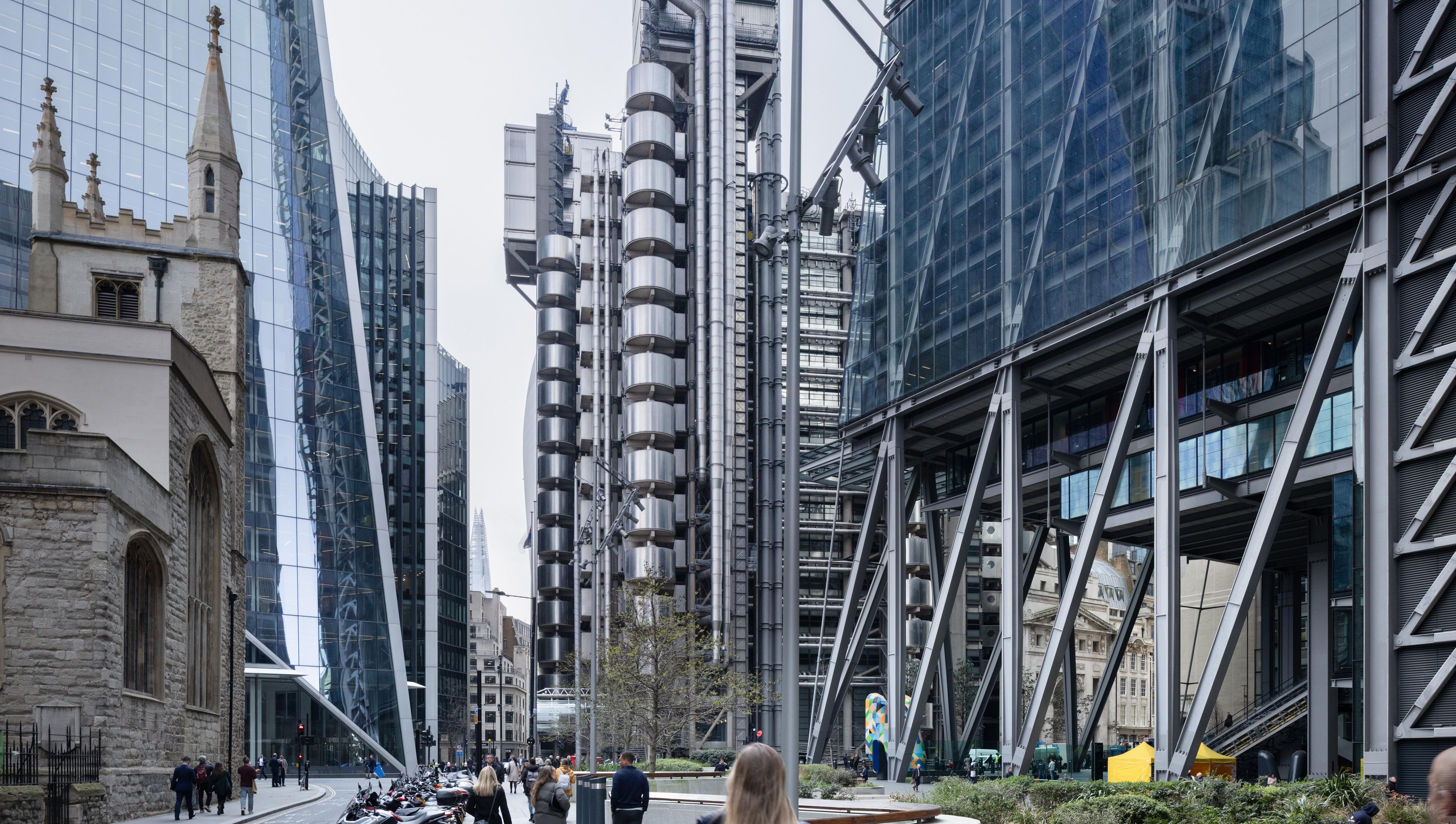


1. St. Helen’s Square is an open public space of considerable townscape value by virtue of its form, contribution to accessible public realm, and historic associations with a significant phase of mid-20th century town planning (implemented by GMW Architects in the 1960s)
2. The creation of the square in the mid-20th century contributed an important new public space to the City and revealed the architectural interest of St Andrew Undershaft Church in a way that enhances the legibility of the building to the general public.
3. The active use of this square benefits the public experience and appreciation of nearby heritage assets, including: St Andrew Undershaft Church (Grade I), St Helen’s Church Bishopsgate (Grade I) and the Lloyds Building (Grade I).
4. St Helen’s Square is thus considered to make a beneficial contribution to the setting of the Grade I listed church, and thus, any compromise to the fundamental aspects which preserve its character are likely to give rise to a harmful impact on its setting.
5. The submitted assessment (Tavernor, Dec 2023) admits that the intrusion of the revised proposals on the square would incur ‘some harm’ to the setting of the Church, but suggests this harm is offset by the design benefits of the proposals, undertaking an internal balancing exercise to come to this conclusion. It is strongly contended the design changes do not offset the harm The loss of open space is not “slight” and the ‘benefits’ of the proposed scheme are not equal to those identified in the consented scheme and should not be afforded the same degree of material weight.
6. The significance of St Helen’s Square as a positive component in the setting of a number of highly significant listed buildings is considerably underplayed within the submitted Built Heritage and Townscape Reports (prepared by Tavernor, Dec. 23). The report suggests the proposals will result in ‘no harm’ overall (after undertaking an internal balancing exercise). Although it is very much agreed that the historic setting of St Andrew Undershaft Church and St Helen’s Church Bishopsgate has been severely eroded, this does not provide sufficient justification for further harm. The very fact that their setting has been compromised, necessitates a much more carefully considered approach for future development, ensuring cumulative impacts do not further erode the ability to appreciate the considerable significance of these of these Grade I listed buildings. Therefore, each planning application for a new development
must be rigorously tested against the baseline, and alternative schemes which may reduce or indeed negate any harmful effects
7. It is evident that the revised scheme will cause harm through the indirect impact to the settings of nearby heritage assets of exceptional significance (see proposed views 53, 55, 56, 61 and 64 within TVIA, Tavernor, Dec.23) These are assessed in further detail within Section E of this report.
8. This harm is most prevalent in views across St Helen’s Square, in which the distracting and stark materiality of the current design juxtaposes that of other contemporary forms and dominates street level views, rather than allowing the St Andrew Undershaft Church to remain as the focal point.
9. As the degree of harm was significantly underplayed within the submitted heritage report, para.208 of the NPPF was not engaged as part of the Planning balance. This paragraph stipulates ‘where a development proposal will lead to less than substantial harm to the significance of a designated heritage asset, this harm should be weighed against the public benefits of the proposal including, where appropriate, securing its optimum viable use’
10. It is clear the design proposals will result in some less than substantial harm to the settings of nearby heritage assets. This is identified within the text of the built heritage report and subsequently (and incorrectly) discounted through the suggestion the design outweighs this harm. This conclusion is misleading and leads to a misjudgement that para.208 of the NPPF should not be engaged.
11. Whilst it is recognised the 2023 proposals for 1 Undershaft will bring about a number of public benefits, it is clear these benefits could be achieved with an alternative scheme which could avoid any harm to heritage assets. The 2019 proposals were considered appropriate in this regard.
12. Identified heritage benefits within the revised scheme, such as glimpsed views to the Grade I listed St Paul’s Cathedral and oblique views of St Andrew Undershaft Church carry considerably less material weight than the heritage benefits in the consented scheme (2019), which opened up key views of St Helen’s Church Bishopsgate (Grade I) from St Helen’s Square, and enhanced pedestrian and visual interconnectivity with St Andrew Undershaft Church and the Lloyds Building The original design approach to the base of the building was a considerable heritage benefit and was afforded significant material weight as part of the original application.
13. When consulted on the previous, consented scheme, Historic England stressed the benefits of the improved pedestrian connection between the two medieval churches, stating: “The remodelling of the ground plane around the proposed tower will introduce high quality materials, increase permeability and create sight lines between the medieval churches of St Helen and St Andrew Undershaft. All of this will have a significant positive impact on the settings of these grade I listed buildings. This benefit is lost in the present design.
14. The current design proposal has been assessed against a now outdated version of the NPPF, and so fails to address the concept of ‘beauty’.
15. The previous design, of 2016 (consented 2019), was undoubtedly ‘beautiful’. The tower was a triumph of contextual architectural expression, lifting the design above the merely competent, by subtly tapering the form, redolent of the entasis in the classical language, and achieving the same effect of visually enhancing the height and emphasising its verticality and slenderness. It was a direct descendant of the present building, which although mutilated, introduced the beauty of pure geometrical form, and proportionality of scale in its taxis. The consented tower respected the footprint and the open square setting. The refined and elegant architectural approach which was applied to the previously consented scheme was demonstrably more appropriate for this area, with a sense of openness to the base of the building which mirrors the contemporary form and welcoming character of the Leadenhall Building, with elements of the construction exposed in a light yet ‘truthful’ way.
16. The ‘tall building’ character in the Eastern Cluster is striking and dominant. Each of these tall buildings, whilst distinctive in their own right, present a harmonious composition through use of lightweight, reflective materiality and glazing. Close range views from the surrounding streetscapes illustrate that the buildings work together harmoniously in townscape views, allowing one another to be read in isolation, with their full elevations and external form appreciable, but can also be read as a collective and striking cluster in long-distance views from the wider cityscape. The townscape interest of the Eastern Cluster is appreciated at an international level, and thus, it is necessary for new design and development to respect the existing harmony between open spaces and built form and to be of outstanding quality.
17. The revised 2023 design proposal for 1 Undershaft presents a jarring and alien element in its current context and its encroachment on the settings of nearby listed buildings is inappropriate and most importantly, avoidable. The protruding tongue
together with the enlarged footprint, have eroded the character and ambience of the open space. Attempts to provide free, high-level public access present challenges for permeability and engagement. These high-level public spaces lack the casual or momentary engagement that is currently prevalent within the accessible, ground level space provided by St Helen’s Square. Instead, reaching these higher levels requires a deliberate investment of time and effort, placing an obligation on the participant.
18. Even with the design rationale of the present proposal, the tongue does not flow from the elemental form but is planted in ungainly superposition on already incoherent and disparate taxis. This has not only eliminated the element of altruistic intent, also has no meaning as an essential contribution to the setting of a tall building.
19. The 2023 design heavily reduces the sense of openness and will introduce an alien character in the immediate setting of the Grade I listed Church, contributing to a sense of visual clutter and distraction This presents a direct conflict with the policies contained within the City of London Local Plan (2015), with particular reference to Policy CS 10 – Design, which requires that new development promote an attractive environment by: Ensuring that the bulk, height, scale, massing, quality of materials and detailed design of buildings are appropriate to the character of the City and the setting and amenities of surrounding buildings and spaces.
20. Policy DM 12.1 Managing change affecting all heritage assets and spaces also stresses that: The loss of routes and spaces that contribute to the character and historic interest of the City will be resisted. The revised proposal is thus considered to give rise to identifiable harm through inappropriate design, bulk and alien character. It is thus in direct conflict with the policies contained within the 1990 Planning (Listed Buildings and Conservation Areas) Act, the NPPF (Dec 2023) and local planning policies, with particular reference to Policy D9, (point d) of The London Plan; and DM 12.1, as it undermines a well utilised, open public space within the settings of some of the City’s most important heritage assets.
21. As stated within para.206 of the NPPF (2023), ‘Any harm to, or loss of, the significance of a designated heritage asset (from its alteration or destruction, or from development within its setting), should require clear and convincing justification’. It is asserted this justification in respect of settings has not been provided within the submitted reports.
22. It is therefore strongly recommended that the proposals are reconsidered in order to avoid harm to built historic environment.
1 Undershaft – Heritage Report – Stephen Levrant April 2024
1.1 Instruction and purpose of report
1. Stephen Levrant Heritage Architecture (‘SLHA’) have been commissioned by CC Land to provide an objective review of the revised proposals for No.1 Undershaft, Bishopsgate, London (henceforth referred to as ‘the Site’ or ‘1 Undershaft’)
2. The Site is orientated to the south aspect of Undershaft and is bounded by the Grade I listed church of St. Helen Bishopsgate to the north, the piazza of St. Helen’s square and Leadenhall Street to the south, St. Mary Axe to the east, 22 Bishopsgate and the buildings of 1 Great St. Helen’s and 122 Leadenhall Street are located to the west and southwest.
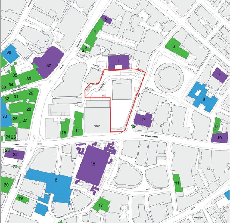
3. As illustrated by Figure 1 above, the Site is located within the setting of a number of Listed Buildings. The key designated heritage assets which are the focus of this review are:
• St Helen’s Church Bishopsgate (Grade I) – No.1, Fig.1
• The Lloyds Building (Grade I) – No.12, Fig.1
• St Andrew Undershaft Church (Grade I) No.16, Fig.1
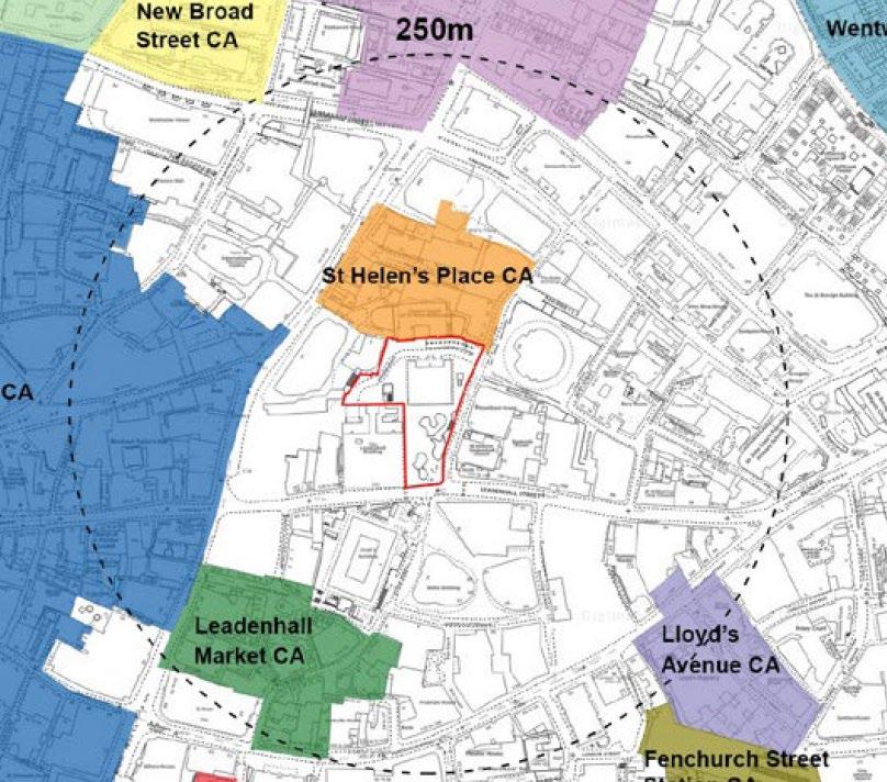

4. Although the Site is not located within a designated Conservation Area, the boundary of the St. Helen’s Place Conservation Area is located to the immediate north of Undershaft; and the Bank and the Leadenhall Market Conservation Areas are located on the west and south sides of Bishopsgate and Leadenhall Street respectively.
5. 1 Undershaft falls within the Eastern Cluster and is in the immediate vicinity of prominent buildings at 30 St Mary Axe (The ‘Gherkin’), 122 Leadenhall Street (Leadenhall Building / the ‘Cheesegrater’), Tower 42, 52-54 Lime Street (The Scalpel) and the proposed developments at 6-8 Bishopsgate and 22 Bishopsgate.
6. The most recent planning application for the Site (ref. 16/00075/FULEIA) (the “Consented Scheme”) was in January 2016 and granted on 08 November 2019 for: “Demolition of the existing buildings and construction of a ground plus 72 storey building (304.94m AOD) for office use (Class B1) [131,937sq.m GEA], retail (Class A1-A3) [2,178sq.m GEA] at ground and lower ground floor, a publicly accessible viewing gallery (Sui Generis) [2,930sq.m GEA] at level 7172 and a restaurant (Class A3) [1,220sq.m] at level 70. Public Realm improvement works, ancillary basement cycle parking, servicing and plant. [Total 154,100sq.m GEA]”.
7. A revised planning application has been submitted (December 2023, Planning ref: 23/01423/FULEIA), incorporating a number of design changes, including: introduction of a new Podium Garden at Level 11, additional massing extruded from levels 14 to 47 that extends outwards from the main square massing volume and changes to materiality and form. Please refer to the 2019 Design and Access Statement Report (Eric Parry Architects) and the 2019 Planning Statement (DP9 Ltd) for full details of the revised proposals.
8. This report will demonstrate that these design changes will have a considerable adverse impact upon the settings of designated heritage assets and public amenity space within the immediate setting of 1 Undershaft
9. The purpose of the following report is to assess the significance of St Helen’s Square as a component of both the built historic environment and as an integral public open space within the eastern cluster, which has gained a reputation of considerable international significance as the financial epicentre of the City of London. This significance is signalled through the quality and scale of architecture, with buildings old and new working harmoniously as a direct result of careful and well-articulated town planning.
10. SLHA is a nationally recognised practice of Conservation Architects, Heritage Planners, Surveyors and Historic Building Consultants with offices in London, Manchester and Bristol
11. Stephen Levrant is a chartered architect and Principal Architect of Heritage Architecture Ltd, a practice specialising in matters concerned with the historic and cultural environment.
12. After graduating from the Architectural Association School of Architecture in 1975, Stephen subsequently attained a further Diploma in Conservation from the Architectural Association in 1979 and has been a member of the Institute of Historic Building Conservation since its inception. Stephen Levrant has been elected a Fellow of the Royal Society of Arts, and of the Association for Studies in the Conservation of Historic Buildings and served on the latter committee for many years.
13. As a practice, Stephen Levrant Heritage Architecture has carried out innumerable appraisals within various legislative environments throughout the life of the company and have made a particular speciality of addressing the requirements of the National Planning Policy Framework (NPPF) and the National Planning Practice Guidance (PPG) as well its predecessors.
14. Heritage Architecture conforms to the belief that detailed knowledge and understanding of both the historic environment and existing townscape character are fundamental to informing design proposals to ensure they are responsive to local character. Individual appraisals on heritage assets and wider contextual townscape analysis thus form an integral part of our work.
1 Undershaft – Heritage Report – Stephen Levrant April 2024
1.3 Summary of Site and current Planning status
15. The former Commercial Union Building (also known as the Aviva Tower, c.28 storeys) is located within the centre of the Planning Application boundary, with an area of publicly accessible open space to the south known as St Helen’s Square.
16. The existing building was constructed in the 1960s and was designed by Gollins Melvin Ward Partnership in a geometric style reminiscent of Mies Van Der Rohe. In 1992, the building suffered extensive damage as a result of the Baltic Exchange bombing and was further damaged by the 1993 Bishopsgate bomb. As a result, the building was entirely reclad in the late 1990s
17. The Aviva Tower is currently covered by a Certificate of Immunity (COI) application (granted Sep 2022 – expiring Sep 2027). The COI means the building was assessed for statutory listing and considered not to be of sufficient interest to warrant statutory protection. It is understood the Twentieth Century Society consider the tower to be a ‘non-designated heritage asset’ (2023 consultation letter). This was countered by the Local Planning Authority, who have deduced the building does not warrant sufficient interest to warrant nondesignated status (Committee report).
1.4 Consultation
18. It is evident there has been an extensive, on-going consultation with the Local Planning Authority and Statutory Consultees over the past decade for the redevelopment of this site.
19. In 2013, proposals for the relandscaping of St Helen’s Square were submitted. Historic England (then English Heritage) raised no issue / objection with the proposed relandscaping of the square.
20. Historic England were once again consulted in 2015 for the original Eric Parry scheme (submitted 2016, consented 2019), during which time it was noted: “At ground floor level, in contrast to the impermeable footprint of the existing building, the new design is for a publicly accessible open ground floor below a triple-height raised base. This allows permeability through the site and a visual connection between the two medieval churches adjacent to the
site. A large elliptical court will be provided south of the proposed tower, providing a sunken public space, and ramp/stair access to a basement level retail mall that connects to the lift core of the tower to the north” the letter concluded that: “The remodelling of the ground plane around the proposed tower will introduce high quality materials, increase permeability and create sight lines between the medieval churches of St Helen and St Andrew Undershaft. All of this will have a significant positive impact on the settings of these grade I listed buildings and could clearly result in a heritage benefit”. (HE Letter 15 October 2015).
21. The most recent response from Historic England (in response to the revised proposals 2023) relates to archaeological considerations only.
22. The Twentieth Century Society have raised strong objections to the latest scheme within their letter (dated 26 Feb 2023), stating that: “When constructed, Aviva Tower was widely published and appreciated, seen as setting a new standard for office design… Architectural writer Kenneth Allinson has since reflected on the international significance of the building in popularising the piazza-and-tower system. In 1970 the design was awarded the Structural Steel Design Special Award and the scheme attained the Civic Trust Award for Townscape and Design Co-ordination”
23. The piazza, known today as St Helen’s Square formed part of the original masterplan for the area. Its significance and development are detailed further below.
1 Undershaft – Heritage Report – Stephen Levrant
1.5 Introduction
24. As outlined above, the Aviva Tower has been assessed for listing and was considered of insufficient interest to warrant statutory protection. The LPA do not consider the building to be a non-designated heritage asset, consequently the existing building has no recognised protection in local or national planning policy.
25. The Site, inclusive of St. Helen’s Square, does however make a contribution to the settings of a number of designated heritage assets including, but not limited to: the church of St. Helen Bishopsgate (Grade I), the Lloyd’s Building (Grade I), St Andrew Undershaft Church (Grade I), Leadenhall Market (Grade II*) as well as a number of Grade II listed buildings on Bishopsgate to the northwest and Leadenhall Street to the south west of 1 Undershaft.
1.6 Brief History of the area and Key Buildings relevant to the Proposals
26. The submitted HTVIA (Tavernor Consultancy) provides a comprehensive analysis of the long and varied history of the Site, utilising historic mapping and imagery where appropriate. The HTVIA highlights the significance of the area as a place of high potential for Roman archaeology, due to its siting within the historic settlement of Londinium and proximity to the Roman forum and basilica.
27. As noted above, there are two ancient churches in the close vicinity of the Site; St Andrew Undershaft Church established in the mid-12th century and St Helen’s Church Bishopsgate in the early 13th century. Whilst each building has been subject to various phases of rebuilding and redevelopment over the centuries, are highly significant examples of Medieval buildings which have survived the great fire of London in 1666 and the subsequent WWII and IRA bombings. These buildings present a significant and rare grouping of pre-19th century buildings which have stood the test of time, as such, despite the significant degree of change and evolution of their setting, it is contended that the setting of these assets must be given considerable weight and importance.
28. The land which would later come to be developed with the Aviva Building was densely developed with narrow dwellings arranged around central courts, resulting in a dense urban form during the 18th century. Historic mapping and
imagery illustrate that Leadenhall Street and St Mary Axe were key throughfares lined with terraced buildings. Since the 16th century, a narrow route running east to north-west from St Mary Axe has meandered through the dense grain of former buildings on the site providing one of the principal pedestrian links between the two historic churches. This is exemplified in a series of historic maps in Table 1, Appendix I.
29. Historic imagery further suggest St Andrew Undershaft Church was designed to be a local landmark, with some ‘breathing room’ provided by the width of Leadenhall Street and St Mary Axe. This is well represented in Figures 3 and 4 below).
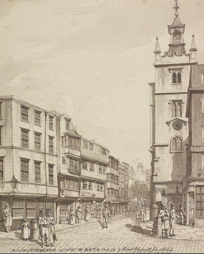
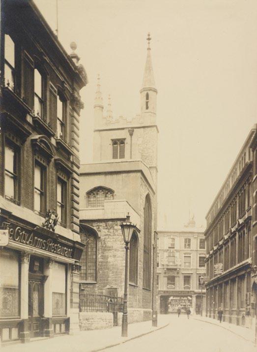

30. The character of the area became increasingly commercial throughout the 19th century, which saw the development of buildings such as Leadenhall Market (Grade II*).
31. The area was significantly impacted in the 1940s by enemy bombing, which resulted in substantial devastation of historic built form. This devastation was, however, the catalyst for a new phase of significant town planning which sought to rectify the area around Bishopsgate and St Mary Axe.
1.7 St. Helen’s Square – Historical Development and Significance
32. St Helen’s Square was established in the early 1960s, forming an open piazza setting to the Commercial Union Bank (the Site) and 122 Leadenhall Street (demolished), which was originally designed to accommodate office space for the Pacific and Oriental Steam Navigation Company (P&O Building)
33. The architectural practice, Gollins Melvin Ward & Partners (GMW), were appointed as lead architect for the redevelopment of the land to the north of Leadenhall Street, with the intention of designing the new office buildings as a harmonious composition of tower blocks, complete with an open piazza. Records suggest GMW persuaded their clients to combine the sites in order to tackle the ‘awkward shape’ of the Commercial Union site, and the shallow depth of the P & O site. An exchange of land was agreed, and outline planning consent was granted in March 1962.
34. St Helen’s Square was developed as part of GMWs masterplan, signalling a new era of office development during the post-war period. The buildings themselves were well-executed examples of structural innovation, utilising both curtain walling and the suspended structural system, which in turn enabled the ground floor of the building to be dramatically lightweight in visually open in appearance. This experience of ‘openness’ at ground floor was enhanced by the landscaped square (refer to Figures x and x below).
35. Terry Brown, former senior partner of GMW Architects, stated: “‘The urban design set piece it was part of, in combination with the P&O Building, demolished for the Cheesegrater, was groundbreaking at the time in that it brought two City Giants together to do a classic modern movement urban design scheme with the open space of the CU Plaza. In the fullness of time, this provided an important part of the setting for the Lloyds Building”. 1
36. The project was finally completed in 1969 and won a Civic Trust Award and the 1970 Structural Steel Design Award 2 The success of the finalised scheme is further supported by architectural writer, Kenneth Allinson, who suggests the
1 https://www.architectsjournal.co.uk/archive/parry-tipped-for-tallest-tower-in-city
2 https://c20society.org.uk/building-of-the-month/gollins-melvin-ward-partners-aviva-tower-london
1
building is of international significance through “popularising the piazza-andtower system”. 3
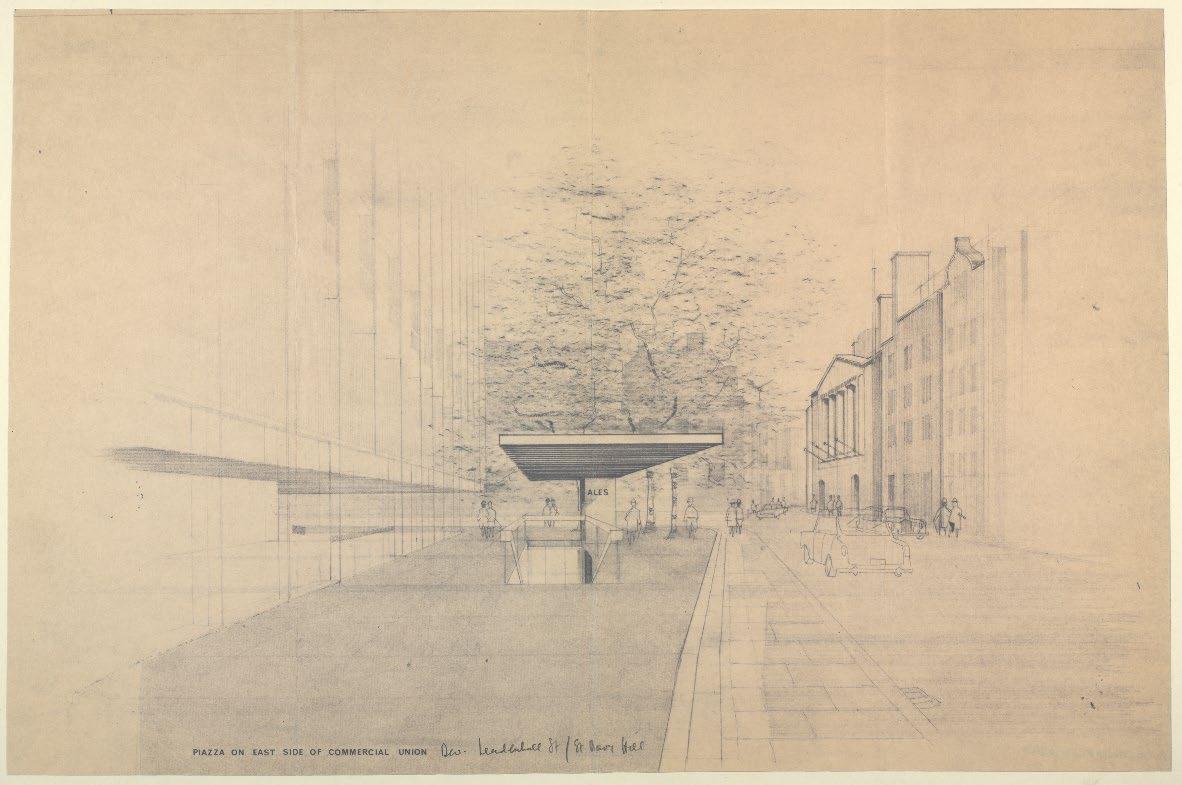
3 Twentieth Century Society Letter – 26 February 2023
1
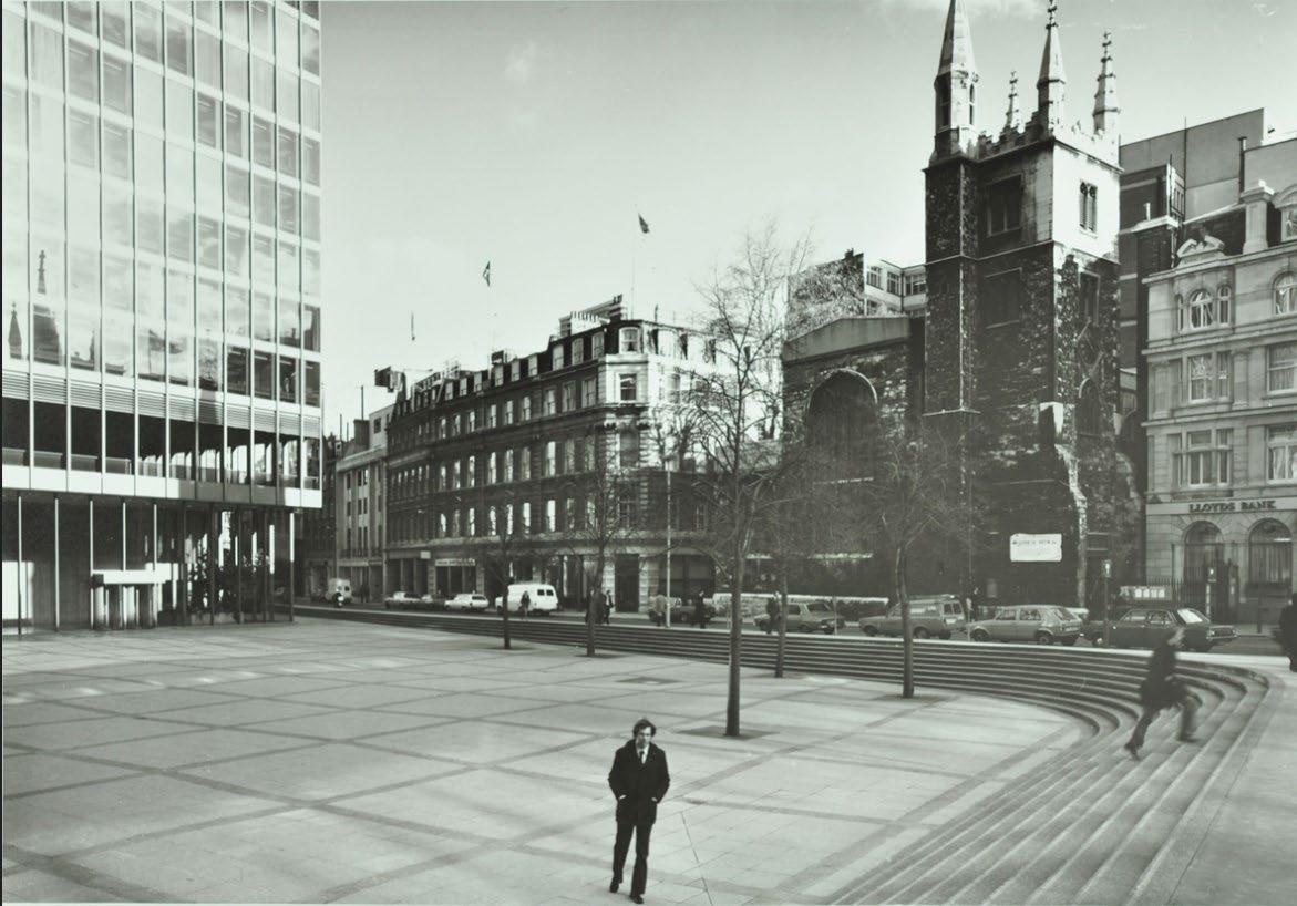

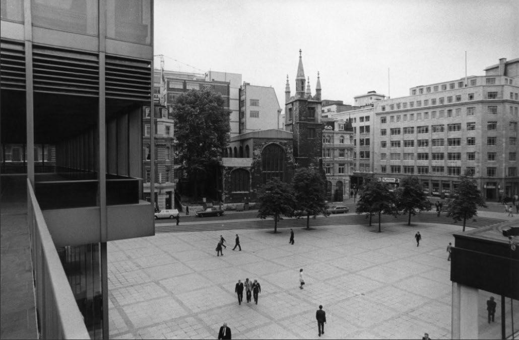
37. Both St Andrew Undershaft Church and St Helen’s Church Bishopsgate were listed at Grade I on 4th January 1950.
38. It can be assumed, therefore, that these assets would have been key considerations during the development phase of the GMW masterplan. This consideration is particularly evident in historic images of the completed development c.1960-1970s, which illustrate the prominence placed on St Andrew Undershaft Church as a local landmark. Although its historic setting has been compromised, the church has maintained its position as part of the setting of the square, forming a key focal point. The creation of the square in the mid-20th century provided an important new public space to the City and revealed the heritage asset in a way that enhances the legibility of the building to the general public St Helen’s Square is thus considered to make a beneficial contribution to the setting of the Grade I listed church, and thus, any compromise to the three fundamental aspects which preserve its character are likely to give rise to a harmful impact on its setting.
39. In the 1980s, the Lloyds building (Richard Rogers Partnership - RRP) became part of the City fabric which has addressed the Square from the southern aspect, and although this may not have been an overt criterion in its design, it now has an established relationship and is seen and appreciated in conjunctive views. The Lloyds Building was listed at Grade I on 19th December 2011 for significant architectural and historic interest as a pioneering example of ‘High Tech’ architecture. The building is also listed for ‘group value’, for which it is described as having, ‘many listed neighbours and it forms a wonderfully incongruous backdrop to many of these in captured vistas throughout the City. It has particular group value with the adjacent Grade II* Leadenhall Market, a significant Victorian commercial building to which Lloyd’s itself nods with its glazed atrium’.
40. Following the establishment of the Lloyds Building in the 1980s, the area saw further change, instigated by the IRA bombings of 1992 and 1993, which resulted in considerable devastation to the Bishopsgate area and a subsequent need for regeneration and rebuilding. The bombing severely affected the Aviva Tower and the P&O building fabric, however, the composition of St Helen’s Square and remarkably, the St Andrew Undershaft Church, survived.
1 Undershaft – Heritage
41. The need for redevelopment has now been fully realised with the construction of high-quality skyscraper buildings, principally following suit in successful application of the post-modern and High-Tech style, including: “the Gherkin” (Foster + Partners, completed 2004), the Leadenhall Building or ‘the Cheesegrater’ (RSHP, completed 2013) and 22 Bishopsgate (PLP architecture, completed 2020).
42. St Helen’s Square retained its original stepped and sunken form throughout the last 20th – early 21st century, up until the recent relandscaping scheme implemented in c.2017-2018 (by Maylim). Although this has altered the original appearance and levels of the square, the fundamental aspects that maintain its character have been preserved, these being: physical extent, responsiveness to scale of surrounding buildings and relationship to the open sky.

1.8 Existing Character
43. For the purposes of this assessment, the study area is limited to the immediacies of the Site, given this is the point of focus with regards to significance and impact. The relative boundaries are St Helen’s Church Bishopsgate to the north, St Andrew Undershaft Church to the east, Lime Street to the south and the A10 to the west.
St Helen’s Square
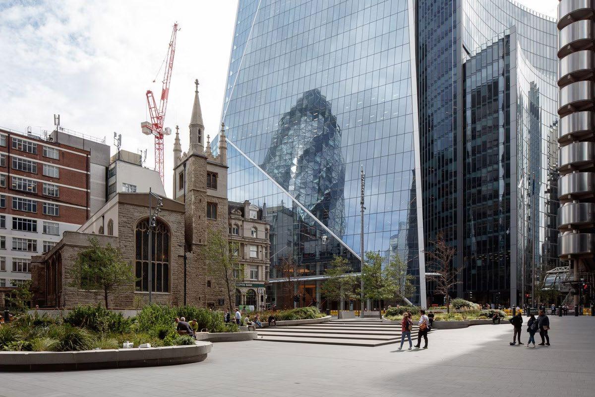

44. St. Helen’s Square is an identifiable, open public space of considerable townscape value, by virtue of its scale, form and contribution to accessible public realm. The Square further benefits from historic associations with a significant phase of mid-20th century town planning (implemented by GMW Architects) and physical and visual relationship to surrounding buildings, old and new alike. As noted in the previous section, the square has recently undergone a relandscaping scheme which has altered its original design;
however, the overarching spatial qualities, use and positive relationship to the surrounding townscape remains unchanged.
45. The space is actively used in the summer months, benefitting from being a central location amongst a variety of tall office buildings which receives good sunlight exposure. The scale of the space allows opportunity for activation, attracting large numbers of people and events, and also a place for quiet reflection in the setting of the Church, enhancing its setting. The active use of this square is thus considered to benefit the public experience of the built historic environment.
46. The demolition of the P&O building in 2008 altered the original composition of GMW’s masterplan. The Leadenhall building was established in its place. RSHP’s website asserts“the lower levels are recessed on a raking diagonal to create a spectacular, sun-lit seven-storey high space complete with shops, and soft landscaped public space. This public space offers a half-acre extension to the adjacent piazza of St Helen’s Square”. 4
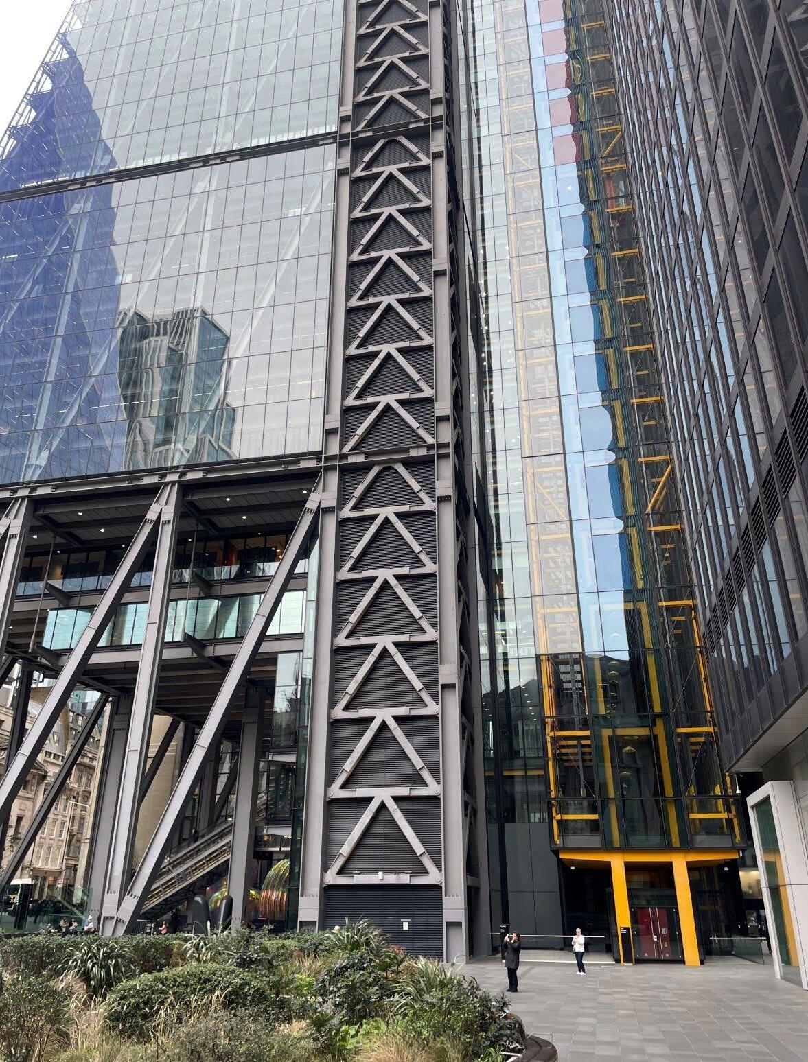
Tall Building character
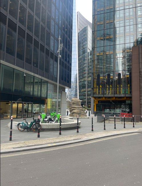
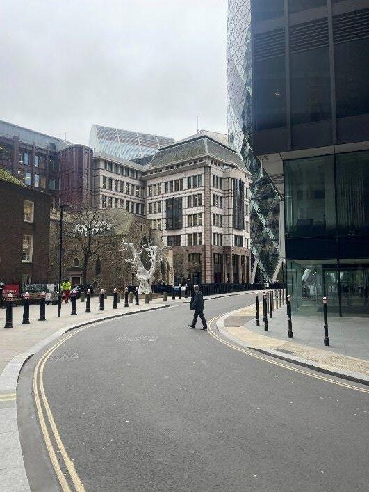

47. The land to the north of the Aviva Tower, known as ‘Undershaft’, is a comparatively secondary public space, by virtue of its siting, and lack of cohesion with surrounding buildings. Whilst the area is not inherently experienced as a negative space, it is generally used as a ‘back-of-house’ space to neighbouring buildings, including the Aviva Tower and the Leadenhall Building. This is exacerbated by the car ramp which is located to the south of St Helen’s Church Bishopsgateyard (identified as an area of separate townscape character).
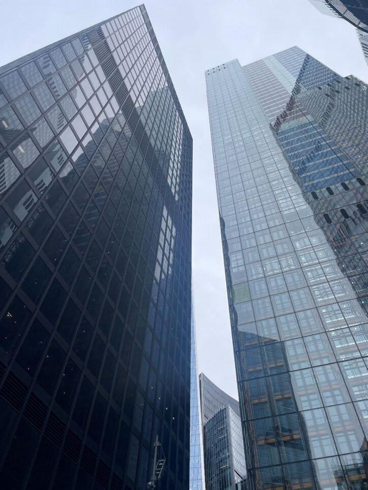
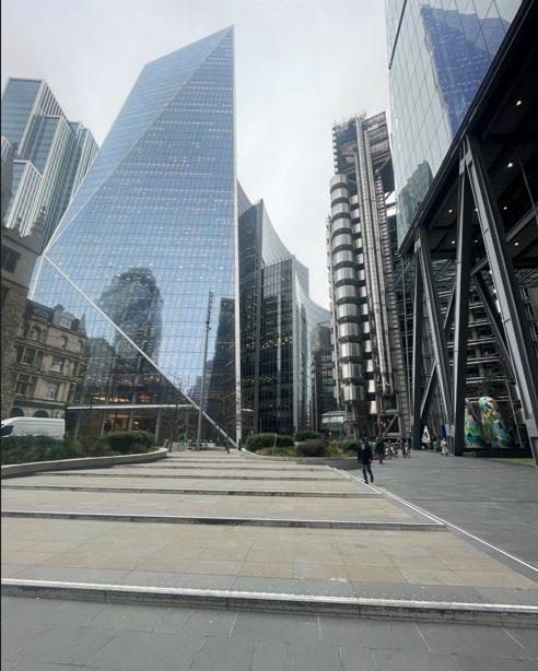

48. The ‘tall building’ typology is the most striking and dominant in this part of the City. Leadenhall Street was historically, and continues to be, the key throughfare running east to west through the City core. The street is now lined with buildings of considerable height and mass, reflecting the changing needs and economic development of London’s financial core.
49. The catalyst for this building type was instigated in the mid-20th century in the years after WWII, with the introduction of GMWs Commercial Union Building and the P&O building, for which St Helen’s Square provided an open, piazza setting. The innovative use of glazed curtain walling was pioneering for this area, an approach which has been taken for the majority of subsequent tall buildings, which have sought to exemplify modern building technique and are thus, inherently significant examples of their time. Key examples include: the Lloyds Building (Grade I), the Gherkin (41 storeys) and the Leadenhall Building (50 storeys), see Figure 13.
50. More recent developments in the Eastern Cluster, such as 22 Bishopsgate (62 storeys) and 52-52 Lime Street aka the ‘Scalpel’ (38 storeys), are also of considerable height and scale, solidifying the skyscraper identity of this part of the City (Figure 14).
51. Each of these tall buildings, whilst distinctive in their own right, present a harmonious composition through use of lightweight, reflective materials and glazing. Close range views from the surrounding streetscapes illustrate that the buildings work together harmoniously in townscape views, allowing one another to be read in isolation, with their full elevations and external form appreciable, but can also be read as a collective and striking cluster in long-distance views from the wider cityscape
52. The wide streets and open spaces contained within the eastern cluster are integral to the ability to appreciate each tall building and its architectural interest from a human scale. The townscape interest of the Eastern Cluster is appreciated at an international level, and thus, it is necessary for new design and development to respect the existing harmony between open spaces and built form and to be of outstanding quality
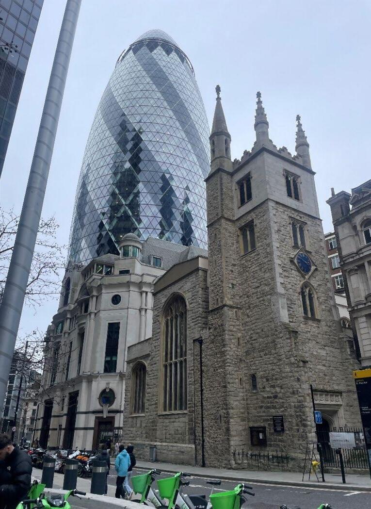
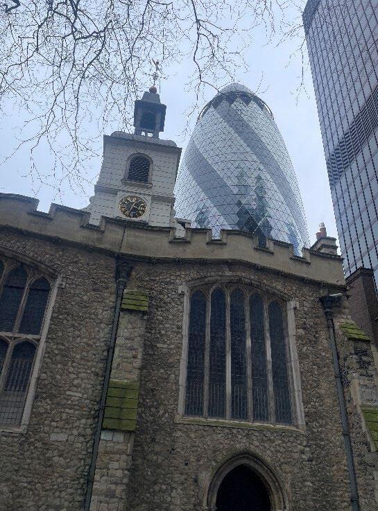
53. Areas identified as being of ‘historic character’ principally relate to buildings or sites which convey pre-19th century origins and are of significant historic interest, including St Helen’s Church Bishopsgate and its grounds and the Grade I listed St Andrew Undershaft Church, which is located to the southern aspect of St Mary Axe. Both buildings are significant and rare examples of Medieval townscape fabric which have survived various events, from the Great Fire of London to the IRA bombings of the early 1990s,
54. The fabric, character and materiality of these historic buildings present a tapestry of stone ashlar, brick and slate, signalling the various rebuilding phases over the centuries. This does not diminish their significance by any means, conversely, the eclectic mix of materials emulate the importance of these ecclesiastical buildings in this area over time.
1 Undershaft – Heritage Report –
55. The submitted Townscape Assessment (TVIA, Tavernor, Dec 2023) identifies the Site as being contained within Townscape Area 1: City Cluster. As illustrated in Figure 17 below (adapted from Figure 4.12, pg.14 of the submitted TVIA) this is a substantial area, covering nearly the full extent of 250m radius around the Site.
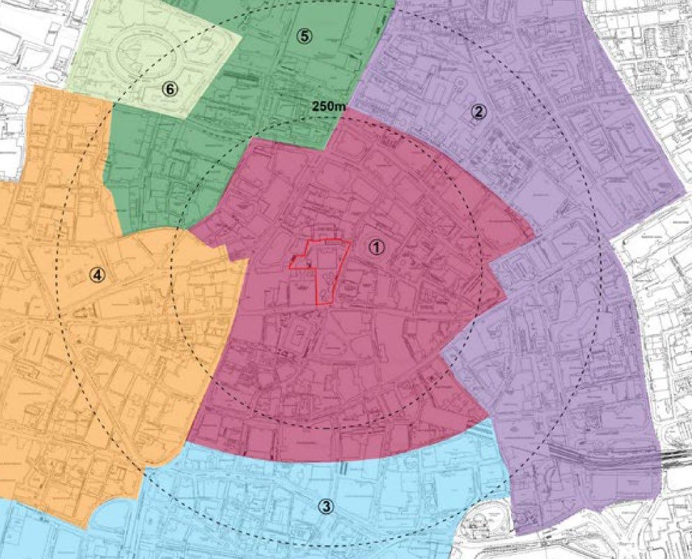
56. Within the assessment, there is little suggestion of the distinction of particular key open spaces, individual character (as suggested above) or how these are experienced in tandem with one another. The assessment of TCA1 fails to mention St Helen’s Square and its significant contribution of open public space, and the benefit this has on the legibility and permeability of the townscape.
57. The assessment simply states that: There are some historic buildings, including the neighbouring Grade I listed churches, and pockets of historic townscape (primarily St. Helen’s Place and Leadenhall Market Conservation Areas) within this TCA, all of which are set within close proximity to tall modern development.
The Proposed Development would be consistent with this existing townscape context in which the heritage assets are experienced and, while in some cases intensifying it, the Proposed Development would not change the fundamental character of that townscape context.
58. This assessment is heavily oversimplified and does not convey the nuances of the character and building typology of this area. This oversimplification of the baseline has led to an oversimplification of the impact on character.
59. It is evident that the revised proposals for the Site will have a fundamental and significant impact on the way in which heritage assets are understood and experienced within their setting. This is addressed in further detail in the following section, utilising the verified visuals from both the 2019 application and subsequent 2023 Planning application.
1 Undershaft – Heritage Report – Stephen Levrant April 2024
1.10 Introduction
60. The approved 2019 application and subsequent 2023 application for 1 Undershaft is supported by a detailed Built Heritage and Townscape assessment (Tavernor Consultancy), comprising two separate reports (submitted as ES Vol II, parts 1, 2 and 3 respectively).
61. Within the revised application, the Built Heritage and Townscape assessment is supported by verified views (70 locations were agreed with the CoL), supplementary non-verified views (27) and supplementary verified renders (24). The focus of the following report is on local, streetscape views around Leadenhall Street, St Mary Axe and Undershaft.
62. The key material change relates to how the base of the revised proposals relate to the existing heritage and townscape context around Leadenhall Street, Undershaft and St Mary Axe respectively
63. In light of the above, the following impact discussion focusses primarily on the potential impact on receptors in the immediate setting of the Site.
1.11 Importance of the baseline – Significance of St Helen’s Square
64. An understanding of the baseline position (i.e. existing setting) is of considerable importance, as it is the ‘true’ position from which to assess whether a proposal will incur a beneficial, neutral, or negative effect.
65. The built heritage and townscape report (Tavenor, 2023) appears to understand the significance of St Helen’s square as a positive contributor to the setting of St Andrew Undershaft Church, stating that: “The existing plaza on the Site is a post-war intervention and does not reflect the historic setting of these listed buildings. It is not an aspect of setting that contributes directly to the heritage significance of the Church and associated railings and its heritage significance would not be affected in principle by the remodelling of this space as envisaged by the Proposed Development. The existing open space does, however, form a positive aspect of the modern setting of the Church by enable open views across the square and from Leadenhall Street. Whilst the open square is not part of the historic setting of the church, it does nonetheless enable an appreciation of its special architectural and historic interest (i.e.
its heritage significance) by increasing the listed building’s prominence in the streetscape” (pg.316, Built Heritage report, Tavenor Dec. 2023)
66. The assessment also admits that the intrusion of the revised proposals on the square would incur some harm to the setting of the Church, but suggests this harm is offset by the design benefits of the proposals. The assessment states that: “Overall, the Proposed Development would result in a slight adverse impact on the ability to appreciate the heritage significance of the church though the increase in massing and subsequent slight loss of open space from which to appreciate the church. However, the Proposed Development would also result in numerous beneficial impacts to the setting of the church, including high-quality architectural design, public realm and landscaping proposals, and contribution to the settings of nearby heritage assets (pg.316, Built Heritage report, Tavenor Dec. 2023)
67. The loss of open space is not “slight” and the ‘benefits’ of the proposed scheme are not equal to those identified in the consented scheme and should not be afforded the same degree of material weight.
68. As noted in the significance appraisal above, St Helen’s Square was a carefully considered and well-articulated masterplan which sought to address the physical devastation of the Second World War, whilst signalling a new era of design and innovation with new office buildings, both in their structural form, scale and design; taking cues from the Seagram building in New York.
69. The Square was a significant component of this masterplan, addressing the scale and ambition of the new office buildings. The Square has a secondary layer of significance through its ability to respond equally to historic buildings of a more modest scale, whilst also being an effective and accessible public space.
1.12 Surrounding Heritage Assets – baseline
70. The Built Heritage Assessment identifies the setting of each Grade I listed building around the Site as having ‘low susceptibility for change’. As evidenced within the methodology section, this suggests the “heritage receptor can accommodate change without altering its significance or ability to appreciate that significance”. This conclusion is severely reductive and creates a baseline which is open to interpretation.
71. Whilst it is very much agreed that the historic setting of St Andrew Undershaft Church and St Helen’s Church Bishopsgate has been severely eroded, this does not provide sufficient justification for further harm. The very fact that their setting has been compromised, necessitates a much more carefully considered approach for future development, ensuring cumulative impacts do not further erode the ability to appreciate the considerable significance of these of these Grade I listed buildings. Therefore, each planning application for a new development must be rigorously tested against the baseline, and alternative schemes which may reduce or indeed negate any harmful effects.
1.13 Impact of the baseline on perception of effect
72. As Historic England’s 2019 Guidance Note on ‘Producing Statements of Heritage Significance’ makes clear, the reliance and use of tabulated matrices can lead to a reductionist approach when assessing the true ‘significance’ of impact or effect. It is evident through reading the submitted heritage and townscape report (Tavernor, Dec 2023) that there is a heavy reliance placed upon rigid matrices, which in turn has diluted the degree of impact to a resounding conclusion of ‘no harm’ to the setting of any designated heritage assets.
73. The built heritage report concludes a ‘major beneficial’ effect to the settings of Grade I listed buildings closest to the Site.
74. The revised design proposals will result in clear and identifiable harm to the setting of these Grade I listed buildings, especially when compared with the consented scheme. The following section will evidence this judgement utilising the following examples of key views which have been extrapolated from the 2019 TVIA report (consented scheme) and the updated 2023 reports (revised scheme).
1.14 Methodology
75. The relative importance and interest of each heritage asset is considered in the context of its surroundings, and the extent to which the setting contributes to the interest of the asset is considered. This understanding of heritage significance is framed by the policies outlined in Section 16 of the NPPF and reaffirmed by the PPG and Historic Environment Good Practice Advice in 1
Planning Note 2: Managing Significance in Decision-Taking in the Historic Environment (2015).
76. ‘Significance’ (for heritage policy) is defined in the NPPF (Annex 2) as: “ the value of a heritage asset to this and future generations because of its heritage interest. That interest may be archaeological, architectural, artistic or historic. Significance derives not only from a heritage asset’s physical presence, but also from its setting.
77. Where a proposal may have an effect on the surroundings in which the heritage asset is experienced, a qualitative assessment is made of whether, how and to what degree setting contributes to the significance of heritage assets. Setting is defined in the NPPF as: “the surroundings in which a heritage asset is experienced. Its extent is not fixed and may change as the asset and its surroundings evolve. Elements of a setting may make a positive or negative contribution to the significance of an asset, may affect the ability to appreciate that significance or may be neutral.”
78. The process and principles set out in Historic Environment Good Practice Advice Note 3: The Setting of Heritage Assets (December 2017) (‘HEAN 3’) has been the primary document utilised to guide the methodology in assessing impact on heritage assets. This has particular regard to setting, as is in accordance with the sections of the NPPF just cited.
79. The Guidance for Landscape and Visual Impact Assessments (‘GLVIA’) IEMA/LI (GLVIA3rd Edition 2013) has also been referenced for the purposes of determining townscape impacts.
80. Analysis has been further supported by on-site surveys undertaken in March 2024.
1 Undershaft – Heritage Report – Stephen Levrant April 2024
Existing + Consented
81. Existing tall buildings within this part of the Eastern Cluster present a consistently lightweight appearance at street level, allowing the contrasting materiality and form of heritage assets to remain focal points in local views. The exception to this being the Lloyds Building, which is much heavier in material and appearance, thereby cementing its presence in the streetscape. The open public spaces and open sky gaps allow of the individual expression of buildings, such as the Gherkin, to be read clearly from even close-range views.
82. The consented proposals (2019) sat comfortably within this established townscape context. This is particularly well illustrated in Verified View 61 (pg.198, Tavernor TVIA, 2016) (see Figure 18 below), in which the consented proposals for 1, Undershaft can be seen in conjunction with the Grade I listed St Andrew Undershaft Church.
83. The refined and elegant architectural approach which was applied to the previously consented scheme was demonstrably more appropriate for this area, with a sense of openness to the base of the building which mirrors the contemporary form and welcoming character of the Leadenhall Building, with elements of the construction exposed in a light yet ‘truthful’ way. It epitomised the Architectural Association’s 1847 adage of “Design with Beauty, Build in Truth”. The resultant architectural composition of the two buildings was suitably balanced and reminiscent of the original 1960s masterplan for the site, with the P&O building and Commercial Union Building built as a pair and designed to be read as a set piece, complete with an open plaza setting. The consented scheme was thus harmonious with the existing buildings around St Helen’s Square.
84. The 2019 scheme also allowed for glimpsed views of St Helen’s Church Bishopsgate, this substantial heritage benefit has been lost with the revised scheme (compare Figures 18 and 19 below). Connection and ancient linkage from St Mary Axe through narrow passageways and onto St Helen’s Church Bishopsgate, was an historically important route from the 16th century - the early 20th century (refer to mapping in Appendix I). The consented scheme proposed
to re-activate this route, which would have contributed enormously to the understanding and appreciation of the area’s local history
85. In the revised scheme, the experience of St Helen’s Square is dramatically altered, with the base of the proposed building presenting a solid and distracting element in the view, with the use of terracotta materiality and projecting podium garden tongue, diverting heavily from the lightweight character of other tall buildings in the area. Refer to Figure 19 below (Verified View 53 in Tavernor 2023 report, pg.223).
86. The distracting and stark materiality juxtaposes that of other contemporary forms and dominates street level views, rather than allowing the St Andrew Undershaft Church to remain as the focal point. As stated above, the revised scheme also severs views of St Helen’s Church Bishopsgate from Leadenhall Street
87. The projecting podium garden encroaches into both the physical experience of the square, and by association, into the open setting of St Andrew Undershaft Church, disrupting the appreciation of the asset against a clear sky background. The existing built form around the Church, notably the Gherkin and the Leadenhall building, have maintained a sense of breathing space, enabling the Medieval tower of the Church to be appreciated in short-to-mid range views along Leadenhall Street and St Mary Axe.
88. The revised design proposal heavily reduces the sense of openness and will introduce an alien character in the immediate setting of the Grade I listed Church, contributing to a sense of visual clutter and distraction (compare Figures 20-24 below).
89. Whilst it is recognised that the podium garden would allow for oblique views of St Andrew Undershaft Church and glimpsed views of St Paul’s Cathedral, this benefit is considered to possess limited weight, especially when compared with the 2019 scheme, which enhanced street-level views of St Andrew Undershaft Church and opened up views towards St Helen’s Church Bishopsgate from Leadenhall Street. The original design approach to the base of the building was
a considerable heritage benefit and was afforded significant material weight as part of the original application.
90. Further to the above, Verified Views 55 and 56 (Tavernor 2023 report, pgs.228234) illustrate that the latest design proposals will result in both a significant physical loss of public space, and indirectly impact upon the unified composition of existing built form in the area, with the proposed base of 1 Undershaft heavily encroaching into St Helen’s Square and blocking the distinctive form of the Gherkin, resulting in a considerable loss of open sky and cluttering effect. This is demonstrably exacerbated by the cantilevering podium garden
91. The podium element appears divorced from the tower above, exemplified through use of differing materials and proportions. The batons applied to the base of the building re-emphasize a cluttered appearance, which does not marry with the grid-like approach applied to the tower. The projecting tongue element creates further confusion to the overall composition and ability to read the new building as a standalone piece of architecture.
92. The CGIs for the revised scheme are also cropped in places, removing the projecting podium garden from the view, which is misleading.
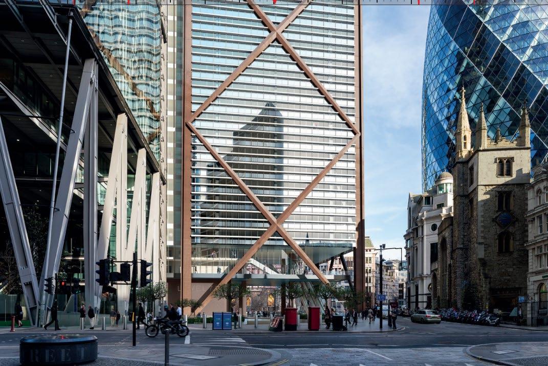
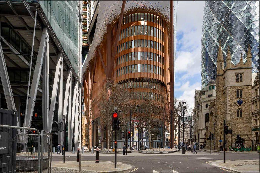
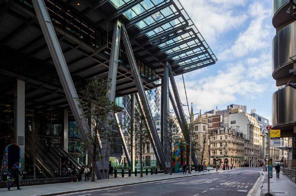
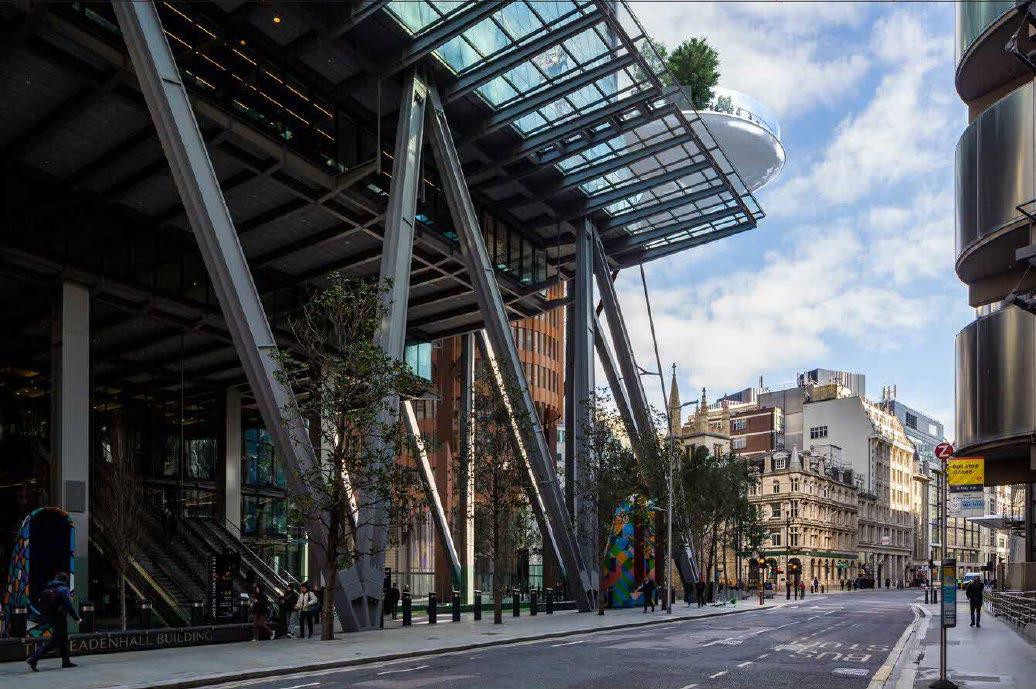
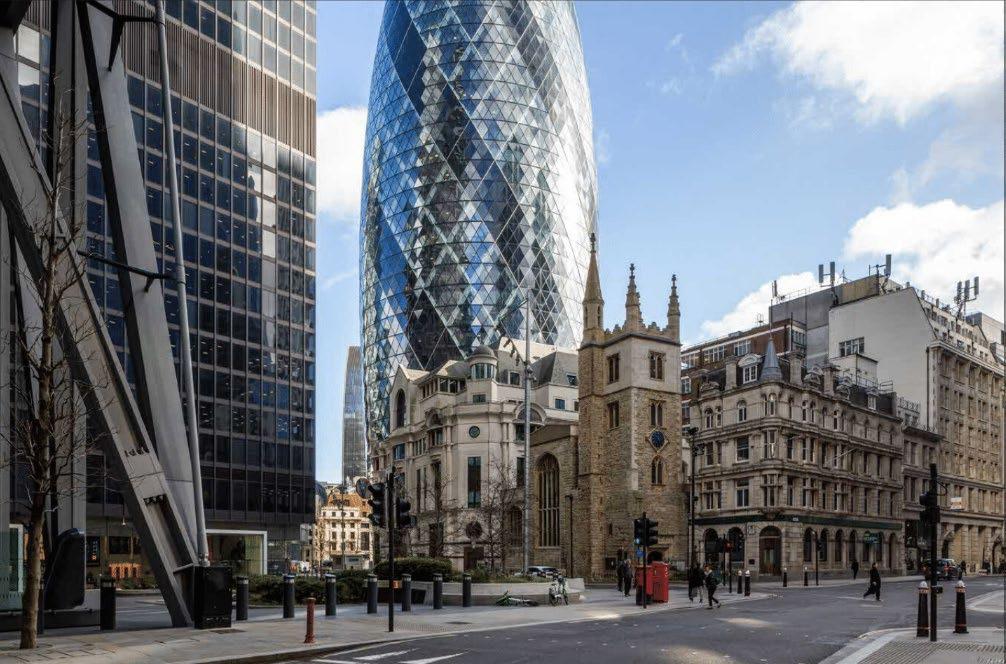
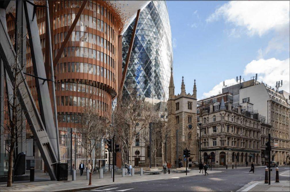
93. The comparative views taken from the western aspect of St Helen’s Square demonstrate the considerable loss of public realm, with the base of the proposed 1 Undershaft building encroaching heavily to the south (Figures 2425 below). This heavily impedes on the intended, visual connection from the Leadenhall Building towards St Andrew Undershaft Church, as adhered to by Rogers Stirk Harbour + Partners in preliminary sketches.
94. The heavy base of the building paired with the cantilevering podium garden, presents a cluttered appearance and does not respond well to the existing, pedestrian experience. It is clear during the design development process of the Leadenhall Building, RSHP regarded the open space of St Helen’s Square and its contribution to the neighbouring church very highly, ensuing a contextual and appropriate response which has in turn, enhanced the quality of the townscape and the pedestrian experience.
95. The base of the proposed building further fails to properly accord D9 with due consideration. The curving layers of protruding bays relate neither to the angular geometric forms of the towering blocks d of the main elements of the facades, nor to the protruding tongue to which they stepped form leads, with its more free-form organic pointed shape. The heavy mullions with their apron bands wrapping the bays are oppressive and heavy and add to the feeling of dominance where there should be lightness and welcoming, relating more emphatically to the ambience of the Square. The existing contouring and openness of the Square have a positive relationship heralding the lower storey of the building which was echoed and enhanced by the consented scheme. The new proposal is set in a bland almost featureless floor of masonry which has no definitive iconography to indicate an entrance of suitable scale and status.
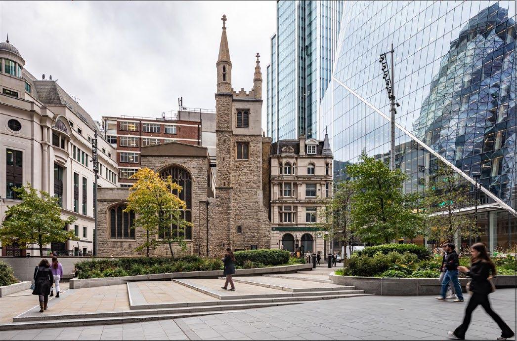
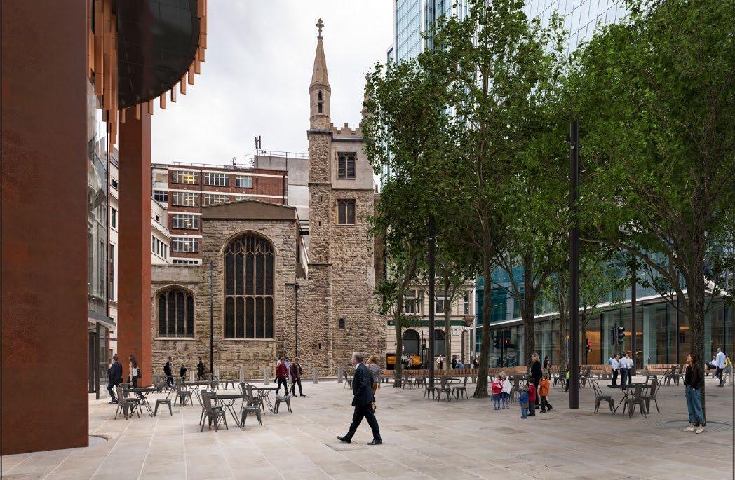
96. It is noted that some of the verified views included within the original application have been altered and / or omitted (note, view 66 in 2019 app (St Mary Axe, towards Leadenhall Street – pgs.208-209 of TVIA). This originally showed clear sightline towards the Grade I Lloyds Building (Figure 26 below). The view has since been repositioned in the current application (refer to view 61, pgs 251253 of TVIA), see Figure 27 below.
97. The original, consented scheme (2016, consented 2019) maintained clear line of sight towards the listed building, which terminated views along St Mary Axe. The revised proposal appears over dominant from St Mary Axe and does not complement the prevailing open and lightweight nature of tall buildings within the Eastern cluster. This is exacerbated by the use of terracotta materiality to the base of the building. The 2023 scheme is at odds with the street scene, introducing a bulky and distracting element which does not align with the existing, lightweight of built form in the area. Its complexity and use of terracotta-like materiality is at odds with the prevailing high-tec character of new buildings around St Marys Axe and Leadenhall Street.
98. The conclusion of ‘major beneficial’ in views from St Mary Axe is therefore refuted. As has been demonstrated in previous views, the consented scheme is much more appropriate and maintains the sense of spatial character and setting of the Lloyds Building. The consented scheme preserves and indeed enhances the ability to appreciate the special interest of the Lloyds Building, whereas the revised proposal causes a clear and measurable degree of harm, albeit less than substantial.
99. The Built Heritage and Townscape Assessment (ES VOL II, pg.268) suggests the podium garden would “relate well to the curved stair tower of the Lloyd’s Building. The reflectivity of the proposed ceramic tiled soffit would also complement the reflective character of the listed building’s metal cladding” This is a rather confusing assessment of the proposed scheme, which suggests the revised design is somewhat consistent with the form and high-tech style of the Lloyds building. As the visuals demonstrate, the buildings do not read as a cohesive pair and present inherently different architectural styles.
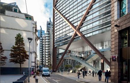
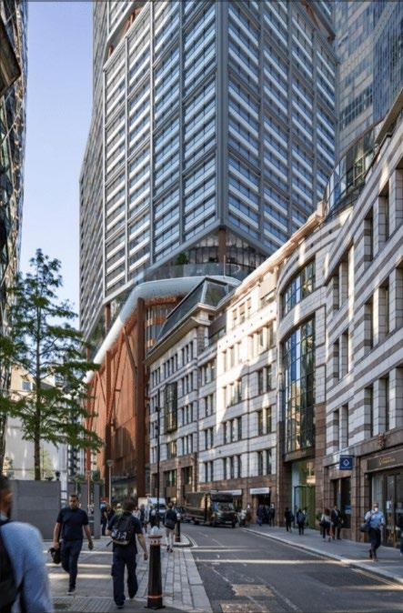

1
100. The latest edition of the NPPF, as issued in Dec 2023, includes the addition of ‘Beauty’ throughout the document and is now very much enshrined as part of government policy, following the publication of the ‘Building Better Building Beautiful’ Commission.
101. The quality of design is also encapsulated in the Government’s, National Design Guide.
102. Although the Built Heritage and Townscape Assessments (ES VOLUME II, THVIA) are dated December 2024, it uses the NPPF edition from September 2023 and thus fails to address the important changes in the edition of 2024. One of the most important additions is the application of “Beauty” and “Beautiful” throughout the document. The DAS also fails to address the policies contained in the latest NPPF.
103. Under section 2 of the THVIA, Legislation and Planning Policy, Context 2.4; it states that Chapter 12 of the NPPF is entitled ‘Achieving well-designed places’. It is now entitled “Achieving well-designed and beautiful places.” Thus, being able to evaluate the quality of design and architecture is ever more important and relevant. Further, the current edition of the NPPF (December 2024) as the emphasis on beauty as a thread running throughout the document.
104. The qualitative appraisal of the quality of architecture has been expounded for at least 2000 years, but the examination of objectivity and beauty probably dates from 1757 with the publication of a ‘Philosophical Enquiry into the Origin of Our Ideas of the Sublime and Beautiful’ by Edmund Burke. Other treatises have appeared from then up to the present day with Roger Scruton’s ’Beauty: a Very Short Introduction’ of 2011. The works that deal specifically with beauty in architecture are many, and those written before the last war use a common set of values and criteria to objectively assess qualities. One of the most succinct and erudite is “Essentials in Architecture, an analysis of the principles and qualities to be looked for in buildings” by John Belcher, 1907. He divides his treatise into four hierarchical parts: I, principles; II, qualities; III, factors; IV, materials. Of Principles there are only two, viz: “Truth” and “Beauty”. These are encapsulated in the motto of the Architectural Association, founded in 1847 “Design with Beauty Build in Truth.” Belcher’s very short chapter on beauty
expounds that it is a “very elusive principal, and despite the many efforts of the be made to determine its essential nature, it still remains “dearer for its mystery”. However, he does go on to give the qualities that define and contribute to beauty, such as “a noble building of imposing mass and graceful outlines (which) strikes deep and solemn cause in the human heart” and (has the) power to kindle the imagination and purify and stimulate the emotions”. The appreciation by the relations of the different parts to the whole and to one another in a building, and there is a further effect of grace and vitality, and incorporates “marvellous finish” combined with exquisite proportions to delight the eye.
105. The new proposal for “the Lick” building is not an object of beauty, and it must be assumed that it is not intended to be. The building is aggressive both in its stance and in the approach to its design. To understand more fully why the existing design is not beautiful, the attributes and qualities of the previous design, and of the existing building, need to be understood and fully appreciated.
106. The previous design, of 2016 (consented 2019), was undoubtedly beautiful. It was a direct descendant of the present building, which although mutilated, introduced the beauty of pure geometrical form, and proportionality of scale in its taxis. The existing building utilises the Meisian device of giving a setting “tower and piazza”, that even in the restrictive confines of the Square Mile, the space created is an essential element in the design. The space, now formed by St Helen’s Square, is the setting of the building, in stark contrast to the previous 2000 years of dense, close-grain development the architects GMW, and, more importantly, their clients, had realised is part of the intrinsic value of that space. Notwithstanding the reservations about the design of the landscaping within, St Helen’s Square was provided as an altruistic spin-off from pure design principles. The previous design continued that ethos, by reimagining the architecture to suit the present-day context, by increasing the height of the tower. When the present building was erected, the general datum of height was substantially lower than now, and in order to have presence and make a positive contribution to what is now the “Eastern cluster” that height is not only justified but essential.
107. However, Mr Parry did not simply extrude the design of the present building (which would have been untenable, if not intolerable) but with the support and understanding of his clients, continued an enhanced ethos. The consented tower respected the footprint and the open square setting. The tower was a triumph of contextual architectural expression, lifting the design above the merely competent, by subtly tapering the form, redolent of the entasis in the classical language, and achieving the same effect of visually enhancing the height and emphasising its verticality and slenderness. The cross bracing in that previous design is another important element of the architectural expression. It wraps and holds the form, but its success is dependent on its proportionality. This is the most subtle and difficult element to successfully achieve, although both the overall tapering form and the tapering diamond cross-bracing are familiar architectural tropes, they are here interpreted and combined in a way which lifts the design quality with élan and bravura
108. Another element in the attributes of the previous design is its materiality. Although zero carbon aspirations have had a dramatic effect on material selection since the previous scheme was designed, it was intended to provide a distinguished presence without ostentation. These attributes contribute to the qualities of the previous building design; the paramount of those being repose The essential quality of restfulness, the building belonging to its site and context. The concept of Repose, first articulated intellectually by Ruskin, is the vital element in assessing beauty. The qualities of proportion and scale are also contributors. Scale – not size per se – is considered in both the building itself and its context. The former is concerned with the elements and their functionality of use in the relationship of the various parts, particularly in the curtain wall construction, fenestration and framing; and the proportionality contributes to the appropriateness of scale. Even slight variations in the proportional relationship can upset the sense of repose, in the previous design it is well-balanced and supremely competent.
109. Scale at the contextual level, defines the height and relationship to the surrounding buildings and spaces. The footprint, height, slenderness and form, all contribute to harmonious depiction of scale in context. This is continued through the grounding of the building on the Square, which is a natural and cohesive element of the building, not only proportionally but in recognising an
1 Undershaft
iconography that identifies the entrance as a feature and most importantly carries through into the setting of St Helen’s, reviving the significant pedestrian link between the Churches.
110. These are all components in the objective appraisal of beauty.
111. The present design is the antithesis of beauty. Instead of dignified repose, it is aggressive, forceful, and lacks any sense of restfulness. The stacking of the various elements or blocks, breaks up the sense of verticality and contributes to the unrestful, incoherent appearance. The canted sections of the lower blocks are too bulky to have the charm of bays, and horizontal bands that separate the blocks are poorly proportioned and have discontinuity in the taxis. The tripartite massing has a disparate appearance resting on an eclectic base storey that is unbalanced and lacks the visual sturdiness of the piloti prevalent on other more recent architectural conceits. The top-most block, retaining its truncated footprint and battered elevations, but whereas the previous tower had the benefit of a continuous full height batter redolent of entasis, this has been so eroded as to be almost imperceptibly meaningless. By retaining that element, it appears as if the original design has suddenly grown bloated excrescences that are overbearing and oppressive.
112. The protruding “tongue” adds insult to injury. The impetus for this appears to be in mitigation for the loss of the public open space of St Helen’s Square. It is an alien feature that disrupts the already disparate stacked form. Such a protrusion has no precedent, but also no justifiable rationale. Attempts to provide free, high-level public access present challenges for permeability and engagement. These high-level public spaces lack the casual or momentary engagement that is currently prevalent within the accessible, ground level space provided by St Helen’s Square. Instead, reaching these higher levels requires a deliberate investment of time and effort, placing an obligation on the participant.
113. Even with the design rationale of the present proposal, the tongue does not flow from the elemental form but is planted in ungainly superposition on already incoherent and disparate taxis. There is nothing endearing or beautiful about a protruding tongue. It is a universal gesture of insult. The opportunistic acquisition of airspace over the established public Square, is a stark contrast to the altruistic architectural concepts of the existing and previous designs. The
protruding tongue together with the enlarged footprint have eroded the character and ambience of the open space. This has not only eliminated the element of altruistic intent, also has no meaning as an essential contribution to the setting of a tall building.
114. In November 2021, the Decision on the: LAND ADJACENT TO 20 BURY STREET, LONDON EC3A 5AX, APPLICATION REF: 18/01213/FULEIA was issued by the Minister of State for Housing on behalf of the Secretary of State (SoS). The scheme, widely referred to as ‘the Tulip’ was dismissed at Public Inquiry (closed in writing on 26 April 2020). The decision was upheld by the SoS in a subsequent review.
115. The following sections from this Decision are of relevance to the current proposals.
116. The SoS agreed with the Inspector’s decision on the issue of harm to the open plaza directly adjacent to the Gherkin, in which the Tulip building was proposed. Within point 8.5 of the decision, it is stated: “The existing plaza provides a highly valuable large, high quality open space at the heart of the Cluster, an area where the scarcity of such space is identified as posing a challenge for achieving the policy ambitions for growth. The important spatial contribution that it makes relies upon its generous size, simplicity, openness and absence of clutter. It functions both as an area of transition for pedestrians and as a destination, where the movement of people is not programmed or managed, and as the intended setting for the Gherkin”. This point stresses that open spaces within the Eastern Cluster should seek to be preserved, both as significant contributors to the public experience of the area, but also as contributors to the designed setting for new buildings. This decision places considerable weight on the existing townscape character of the area, and its interrelationship to open public spaces.
117. Point 8.6 of the Decision further presses this point, through stating that: “Importantly, these characteristics allow opportunities for activation, which has been recognised as essential for the area to remain competitive as a world class destination… . In addition, the plaza has significant public value as an uncluttered space for quiet reflection and relief from the densely developed and busy city. It is therefore a civic space of strategic importance within the Cluster, accessible to thousands of workers and able to accommodate precisely the activities that the City Cluster Vision identifies as essential for its success”.
1 Undershaft – Heritage Report – Stephen Levrant April 2024 48
1 Undershaft
118. The Decision letter provides their perspective on the differentiation of ‘public open space’, highlighting: “The difference between public realm at ground level and other levels is reflected in policy, in particular the more demanding requirement for its provision in emerging CoL policy (point 8.14)” The letter notes “this was identified as a concern by the LRP, which observed that the roof terrace was not equivalent to fully public open space at street level”.
119. Point 8.15 of the letter is also of relevance as it highlights the issue of access, stating that the Tulip would mean: “Access would be regulated, restricted, and managed by security staff. It would be another heavily programmed space The proposals would conflict with NLP policy D5, D8 and D9, LP policies CS7, CS10 and DM 10.1, the aims of the CoL Public Realm SPD, and the objectives of the City Cluster Vision 2019. This should be given very substantial weight”.
120. The SoS also identified the Tulip proposals would be in direct conflict with Policy S12(4), which states: New tall buildings will be required to enhance permeability and provide the maximum feasible amount of open space at street level and incorporate areas of publicly accessible open space or other facilities within the building and its curtilage, including at upper levels, available at no charge.
121. As evidenced in the excerpts from this relevant and critical decision by the SoS, the weight and importance of open spaces within the Eastern Cluster, and their contribution to the existing townscape character and experience of it is vital to maintaining a sense of place. This is upheld by local and national Planning Policy, as discussed further below.
Planning (Listed Building and Conservation Areas) Act, 1990.
122. Section 66 of the Act requires the Local Planning Authority to “have special regard to the desirability of preserving the building or its setting or any features of special architectural or historic interest which it possesses,” when considering whether to grant planning permission.
123. It is strongly maintained that St Helen’s Square makes a positive contribution to the setting of St Andrew Undershaft Church and the Lloyds Building (Grade I) and its spatial quality should be preserved in accordance with the requirements of Section 66 of the Act.
National Planning Policy Framework (NPPF) December 2023
124. The policies in the NPPF constitute the Government’s view of what sustainable development in England means in practice. In these terms, development proposals which fail to give due weight to the conservation of heritage assets are deemed not to be sustainable development, and consequently should not be supported. This is because one of the key dimensions of sustainability is to protect and enhance our natural, built and historic environment (NPPF paragraph 8, point c).
125. Para 20 (point d) of the NPPF confirms that ‘strategic policies should set out an overall strategy for the pattern, scale and design quality of places (to ensure outcomes support beauty and placemaking), and make sufficient provision for: d) conservation and enhancement of the natural, built and historic environment, including landscapes and green infrastructure, and planning measures to address climate change mitigation and adaptation.
126. As set out in Section F of this document, the revised scheme lacks ‘beauty’ and challenges the surrounding built environment, modern and historic through its complete lack of coherence and repose. Instead of it is aggressive, forceful, and lacks any sense of restfulness. The stacking of the various elements or blocks, breaks up the sense of verticality and contributes to the unrestful, incoherent appearance.
127. The NPPF (paragraph 205) stresses that ‘when considering the impact of a proposed development on the significance of a designated heritage asset, great
weight should be given to the asset’s conservation (and the more important the asset, the greater the weight should be). This is irrespective of whether any potential harm amounts to substantial harm, total loss or less than substantial harm to its significance’. It will be evident that great weight must be given to preserving the setting of important, Grade I heritage assets in the City.
128. Para 206 of the NPPF stresses that, ‘any harm to, or loss of, the significance of a designated heritage asset (from its alteration or destruction, or from development within its setting), should require clear and convincing justification’. This justification has not been provided within the submitted Planning statement and the degree of harm has been underplayed within the submitted Built Heritage Assessment.
129. As the degree of harm was significantly underplayed within the submitted heritage report, para.208 of the NPPF was not engaged as part of the Planning balance. This paragraph stipulates ‘where a development proposal will lead to less than substantial harm to the significance of a designated heritage asset, this harm should be weighed against the public benefits of the proposal including, where appropriate, securing its optimum viable use’
130. It is clear the design proposals will result in some less than substantial harm to the settings of nearby heritage assets. This is identified within the text of the built heritage report and subsequently (and incorrectly) discounted through the suggestion the design outweighs this harm.
131. This conclusion is misleading and leads to a misjudgement that para.208 of the NPPF should not be engaged.
City of London – Local Plan (adopted, 2015)
132. Policy CS 10 – Design requires that new development promote an attractive environment by:
• Ensuring that the bulk, height, scale, massing, quality of materials and detailed design of buildings are appropriate to the character of the City and the setting and amenities of surrounding buildings and spaces.
• Ensuring that development has an appropriate street level presence and
1 Undershaft
roofscape and a positive relationship to neighbouring buildings and spaces.
The revised design proposal is in direct conflict with the policies contained within CS 10 through inappropriate design which does not align with existing, cohesive character of the eastern cluster. The design does not have an appropriate street level presence and relates poorly to the surrounding context.
133. Policy DM 10.4 – Environmental Enhancement requires that new development should have regard to the City’s heritage, retaining and identifying features that contribute positively to the character and appearance of the City
134. It has been demonstrated that St Helen’s square makes a positive contribution to the townscape character of the Eastern Cluster and its spatial qualities should be preserved.
135. Policy DM 12.1 Managing change affecting all heritage assets and spaces requires new development will be required to:
• sustain and enhance heritage assets, their settings and significance.
• The loss of routes and spaces that contribute to the character and historic interest of the City will be resisted.
• respect the significance, character, scale and amenities of surrounding heritage assets and spaces and their settings.
The revised design proposal is in direct conflict with the requirements of DM 12.1, as it undermines a well utilised, open public space within the settings of some of the Cities most important heritage assets.
1 Undershaft – Heritage Report – Stephen Levrant April 2024
136. The London Plan seeks to develop an approach tailored for London to reflect the particular circumstances in the capital, and will act as the key document shaping planning decisions across Greater London. The London Plan is part of the Development Plan.
137. Policy D9 (Tall Buildings) sets out the definition, locations and impacts of tall buildings in London. Point C (iii) of this policy stresses that: “attention should be paid to the base of the building…It should have a direct relationship with the street, maintaining the pedestrian scale, character and vitality of the street. Where the edges of the site are adjacent to buildings of significantly lower height or parks or other open spaces there should be an appropriate transition in scale between the tall building and its surrounding context to protect amenity or privacy”.
138. Finally, Point D of this Policy (D9 C) states that: proposals should take account of, and avoid harm to, the significance of London’s heritage assets and their settings. Proposals resulting in harm will require clear and convincing justification, demonstrating that alternatives have been explored and that there are clear public benefits that outweigh that harm. The buildings should positively contribute to the character of the area”. The revised proposals for 1 Undershaft are demonstrably in conflict with this policy, given the design changes give rise to harm on the settings of Grade I listed assets, which could be avoided through an alternative design response.
139. Point b) of this policy further notes that: “whether part of a group or stand-alone, tall buildings should reinforce the spatial hierarchy of the local and wider context and aid legibility and wayfinding”. 1 Undershaft disrupts the pedestrian experience and impedes on the intended ‘breathing space’ around both the Leadenhall Building, the Lloyds Building and St Andrew Undershaft Church
The heavy base of the building paired with the cantilevering podium garden, presents a cluttered appearance and does not respond well to the existing, pedestrian experience. It is clear during the design development process of the Leadenhall Building, RSHP regarded the open space of St Helen’s Square and its contribution to the neighbouring church very highly, ensuing a contextual
and appropriate response which has in turn, enhanced the quality of the townscape and the pedestrian experience.
140. It is therefore considered the revised proposals are in direct conflict with the requirements of the London Plan Policy D9 C.
141. St. Helen’s Square is an open public space of considerable townscape value, by virtue of its form, contribution to accessible public realm, historic associations with a significant phase of mid-20th century town planning (implemented by GMW Architects).
142. The space is actively used in the summer months, benefitting from being a central location amongst a variety of tall office buildings which receive good sunlight exposure. The active use of this square benefits the public experience of nearby heritage assets, including the Grade I listed Lloyds building and St Andrew Undershaft Church, also Grade I.
143. Although, the Square has recently undergone a relandscaping scheme (c.20172018) which has undermined its original design, the overarching spatial qualities, use and positive relationship to the surrounding townscape and built historic environment remains unchanged.
144. The significance of St Helen’s Square and its spatial relationship within the built environment is heavily underplayed within the submitted Built Heritage and Townscape Reports (Tavernor, Dec. 23).
145. The assessment also admits the intrusion of the revised proposals on the square would incur some harm to the setting of the Church, but suggest this harm is offset by the design benefits of the proposals. It is strongly refuted that the design changes do not offset the harm and should not be afforded the same degree of material weight in the Planning balance
146. It is evident the revised scheme will cause harm through the indirect impact to the settings of nearby heritage assets of exceptional significance, including: St Andrew Undershaft Church (Grade I), St Helen’s Church Bishopsgate (Grade I) and the Lloyds Building (Grade I).
147. As stated within para.206 of the NPPF (2023), ‘Any harm to, or loss of, the significance of a designated heritage asset (from its alteration or destruction, or from development within its setting), should require clear and convincing justification’. Substantial harm to or loss of: b) assets of the highest significance, notably scheduled monuments, protected wreck sites, registered battlefields,
grade I and II* listed buildings, grade I and II* registered parks and gardens, and World Heritage Sites, should be wholly exceptional’
148. Identified heritage benefits within the revised scheme, such as glimpsed views to the Grade I listed St Pauls Cathedral and oblique views of St Andrew Undershaft Church carry considerably less material weight than the heritage benefits in the consented scheme (2019), which opened up key views of St Helen’s Church Bishopsgate (Grade I) from St Helen’s Square, and enhanced pedestrian and visual interconnectivity with St Andrew Undershaft Church and the Lloyds Building (both Grade I).
149. The refined and elegantly honest architectural approach which had been applied to the previous, consented scheme was demonstrably beautiful and more appropriate for this context, with a sense of openness to the base of the building which mirrors the contemporary form and welcoming character of the Leadenhall building, with elements of the construction exposed in a light yet ‘truthful’ way. The resultant architectural composition of the two buildings was suitably balanced and reminiscent of the original 1960s masterplan for the site, with the P&O building and Commercial Union Building (Aviva Tower) designed as a pair and to be read as a set piece, complete with an open piazza setting. The consented scheme was thus harmonious with the existing buildings around St Helen’s Square.
150. The revised design proposal appears jarring, overbearing, lacking in repose and alien in its current context. Its encroachment on the settings of nearby listed buildings is inappropriate and most importantly, avoidable.
151. The revised proposal is thus in direct conflict with the policies contained within the 1990 Planning (Listed Buildings and Conservation Areas) Act, the NPPF (2023) and Local Planning Policies, with particular reference to Policy D9, (point d) of the Local Plan Spatial Development Strategy 2021 which states: “proposals should take account of, and avoid harm to, the significance of London’s heritage assets and their settings. Proposals resulting in harm will require clear and convincing justification, demonstrating that alternatives have been explored and that there are clear public benefits that outweigh that harm. The buildings should positively contribute to the character of the area”.
152. It is therefore strongly recommend the proposals are reconsidered in order to avoid harm to the built historic environment.
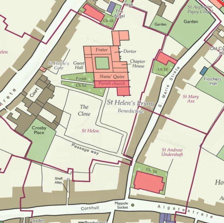
A Map of Tudor London, in about 1520. Reconstructed by modern historians and archaeologists and published by the Historic Towns Trust in 2018. Source: OldMaps.com
This early 16th century map has been reconstructed by historians and archaeologists who have studied surviving documents and finds. The buildings are coloured according to category (e.g. parish churches, civic and commercial buildings, defensive structures), and the map shows parish boundaries
Both St Andrew Undershaft Church and St Helen’s Church Bishopsgate are identified as being in existence by the 16th century.
The 1520s map illustrates a narrow passage leading from St Marys Gate (then S. Marie Street), running east to west across the subject site to Crosby Place (marked on the map in red), and running north-west towards St Helen’s Church Bishopsgate. This passage ran through the parish, and would have provided one of two a key access route for local inhabitants. The alternative entrance was located at Bishopsgate Street, to the north-west (identified as St Helen’s Gate).
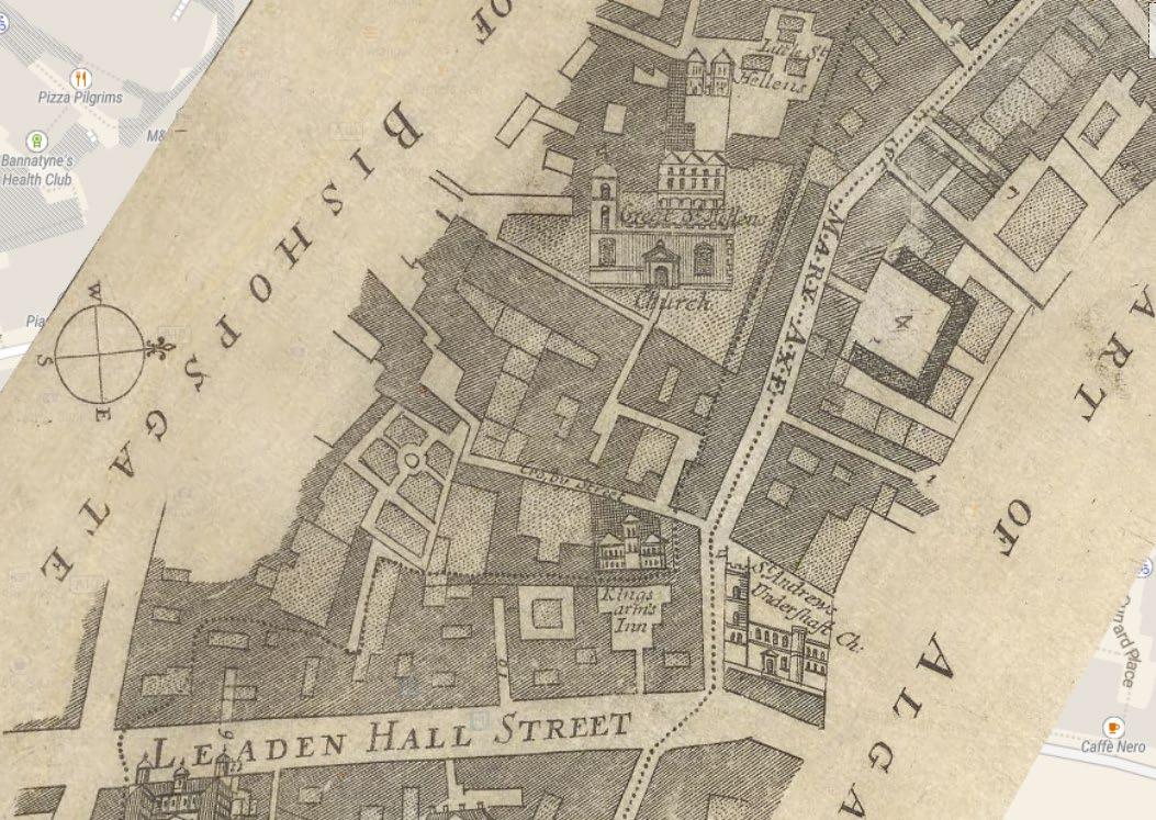
1720 Plan – Strype’s Survey of England
Source: OldMaps.com
The early 18th century map illustrates the area was heavily built up by 1720, with the exception of a series of open courtyards interspersed between buildings providing some relief to the dense urban form which had begun to rapidly sprawl. Just one of these open courtyards is marked on the plan to the south of the ‘Kings Arms Inn’.
Specific details of individual buildings and plots are limited on the plan. However, important buildings such as St Andrew Undershaft Church , St Helen’s Church Bishopsgate Bishopsgate and Leaden Hall market are shown pictorially.
The narrow passageway which leads from St Mary’s Axe on towards St Helen’s Church Bishopsgate Bishopsgate is shown to survive (marked in red).
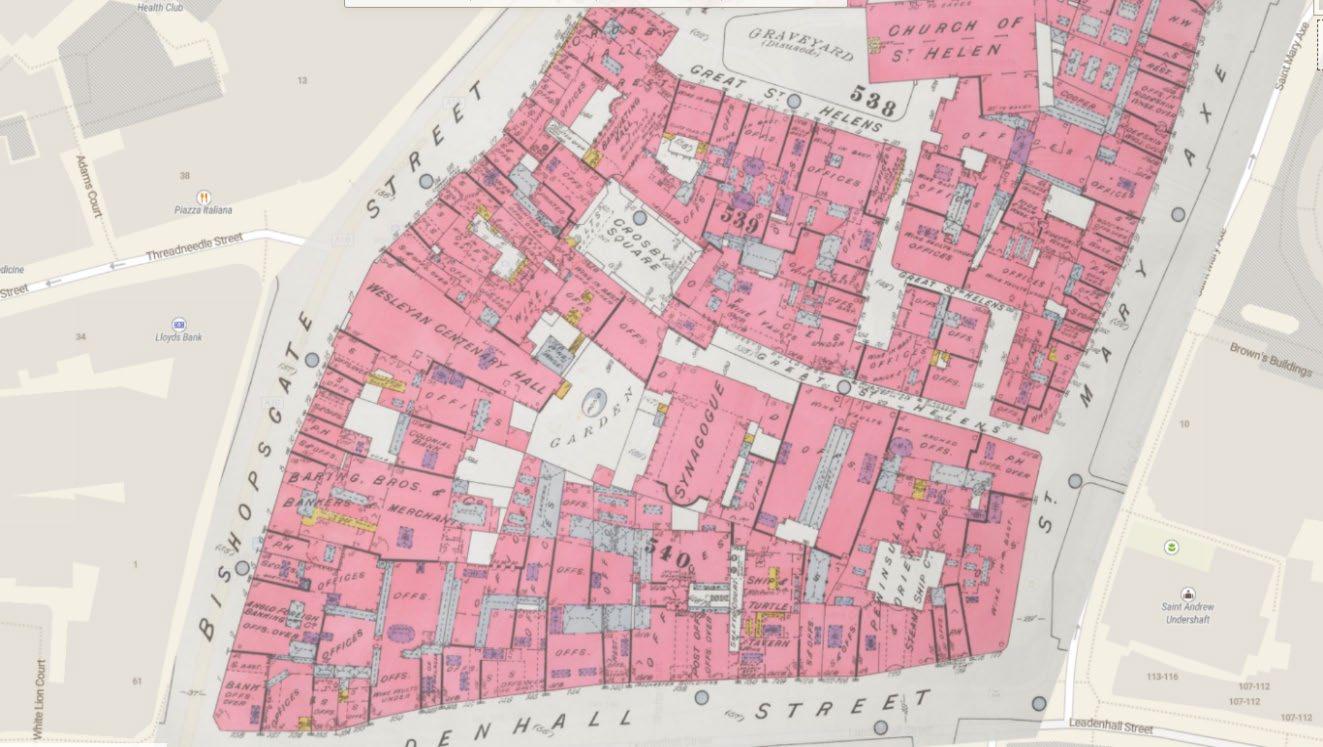
Goad Plan, 1887. Creator: Chas E Goad Limited. Publisher: Chas E Goad Limited. Source: OldMaps.com
This detailed 1887 plan of London is one of a series of twenty-three sheets in an atlas originally produced to aid insurance companies in assessing fire risks.
The plan provides considerable detail on the building footprints, their use, the number of floors and the height of the building, as well as construction materials. The individual shops, dwellings, churches and open spaces which make up the eclectic townscape fabric in the 19th century are well illustrated on the map.
The open courtyard marked on the map above (south of the Kings Inn) now forms an open, central courtyard to the Peninsular & Oriental Ship C. Offices. Further gardens and courtyards within this portion of the townscape are visible on this detailed map.
The narrow passageway which leads from St Mary’s Axe on towards St Helen’s Church Bishopsgate is shown to survive (marked in red).
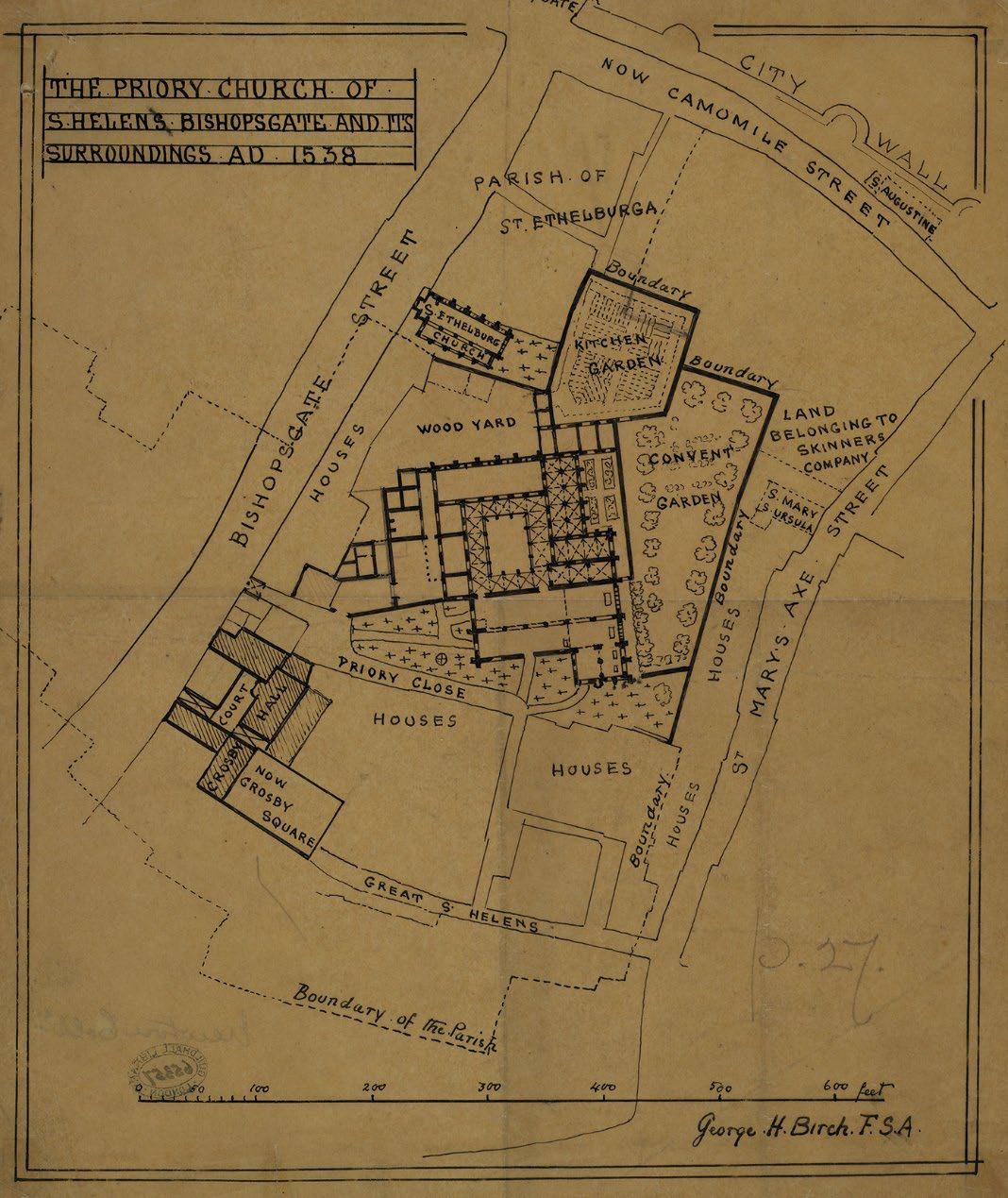
1900 Plan – St Helen’s Church
Bishopsgate, Priory Boundary and detailed plan. Source: London Picture Archive. Ref: 3363
Early 20th century plan illustrates the plan of the Church building and its grounds, inclusive of the Parish boundary as it was in 1900.
The historic, narrow route leading from St Mary’s Axe on towards the Church is marked on the plan in red.
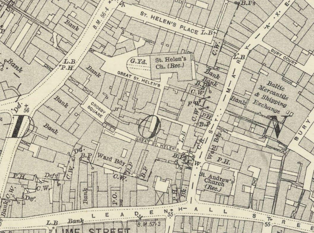
London (1915- Numbered sheets) V.11 Revised: 1914, Published: 1916. Source: OldMaps.com
This early 20th century OS map of Bishopsgate provides further detail on the relative plots boundaries around the area, now heavily built up with bank premises and buildings of commerce, signifying the increasing affluence in this part of the city and cementing its reputation as the financial district.
The historic, narrow route leading from St Mary’s Axe on towards the Church is marked on the plan in red.
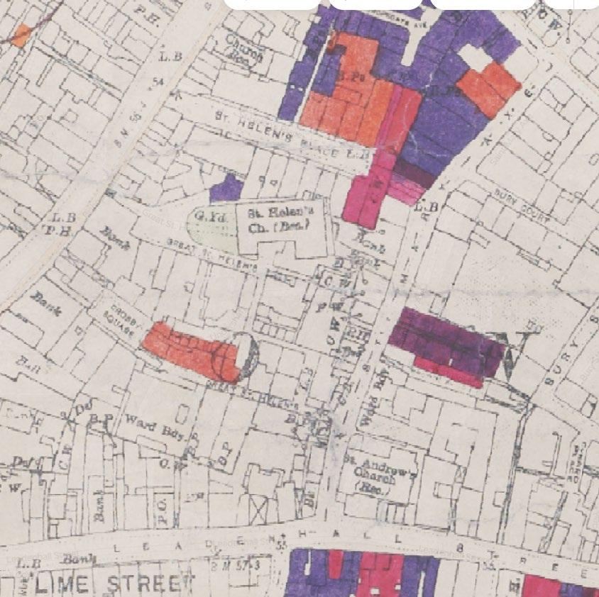
Bomb damage map. Ordnance Survey base sheets originally published in 1916, updated by the LCC to 1940.
Classified from Total Destruction (Black), through Seriously Damaged (Dark Red) to Clearance Areas (Green). Includes V1 and V2 Bomb locations.
The historic, narrow route leading from St Mary’s Axe on towards the Church is marked on the plan in red.