Reem Bannoura Birzeit
N D D E V E L O P M E N T
R
U R A
L
P L A N N I N G
F I N A L P R
01 02 03 04 0
06 07 08 09

N D D E V E L O P M E N T
U R A
P L A N N I N G
F I N A L P R
01 02 03 04 0
06 07 08 09
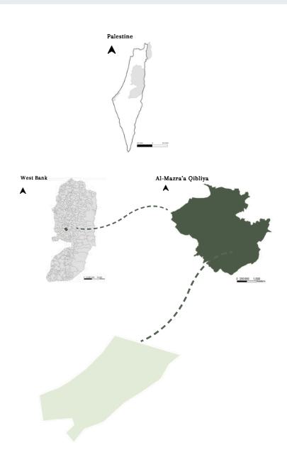
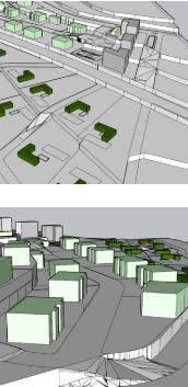
This project represents a focused design intervention within the broader context of Al-Mazra’a Al-Qibliya, a rural area in the Ramallah and Al-Bireh Governorate of the West Bank, Palestine. Selected as a segment of a larger land use plan. the site reflects the village’s rural character and development potential. The project draws from the wider land use strategy, integrating residential, mixed-use, and open space zones to create a cohesive and livable environment. By leveraging the site’s existing topography, natural assets like olive groves, and its strategic location near key access roads and industrial area. The design aims to enhance rural life while introducing sustainable mobility, public spaces, and social interaction points. This microscale proposal forms part of a holistic vision to strengthen Al-Mazra’a’s rural identity and guide its future development.
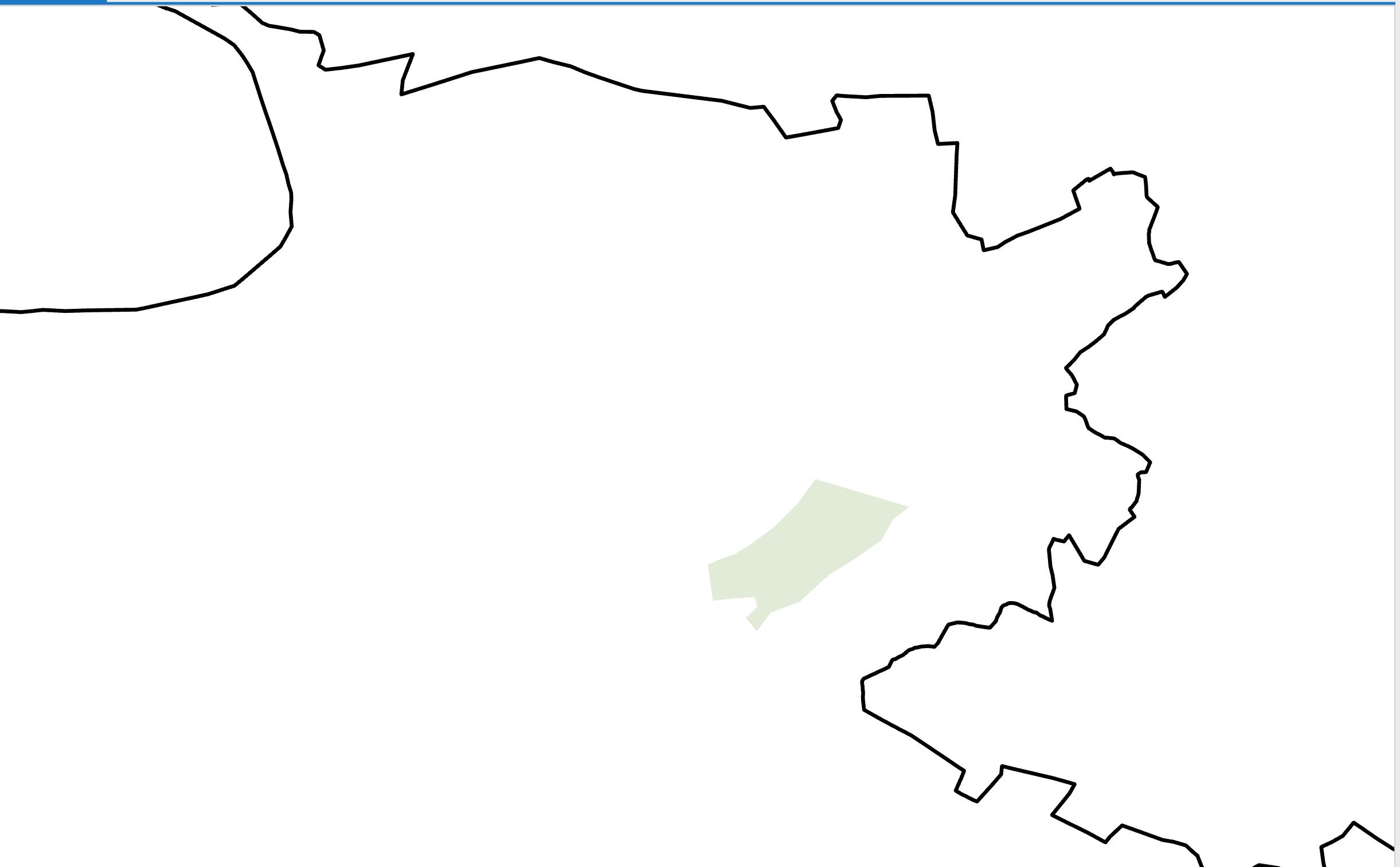
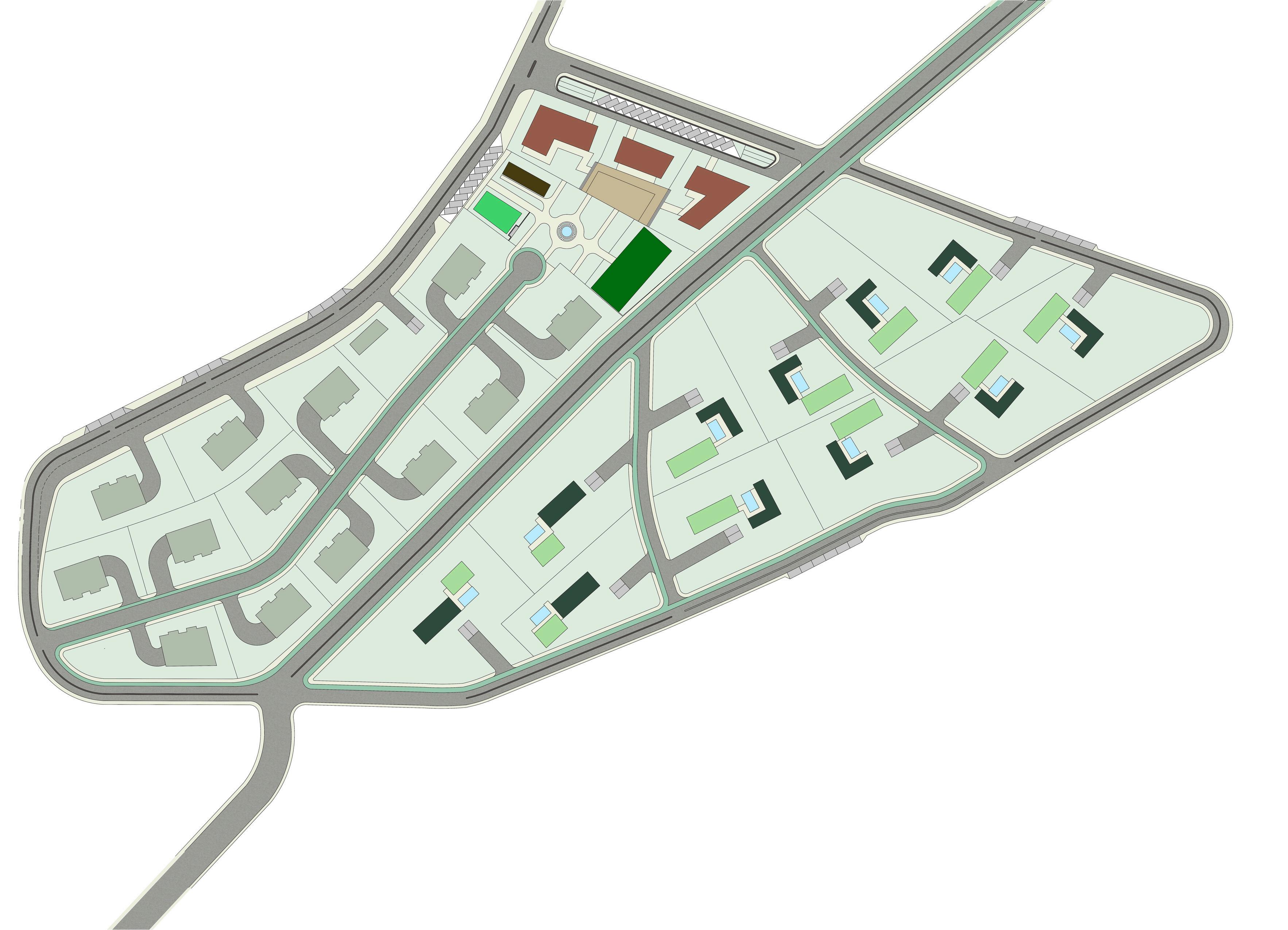
The site is 65 donum located within Al-Mazraa’ algharbiya, in the Ramallah and Al-Bireh Governorate in Palestine. It is 11 km away from Ramallah city and is 600 m above sea level. It is connected to the main road by a 3.5 km. It is bordered to the north by Kober and Abu Shkhaydam, and to the east by Abu Qash.
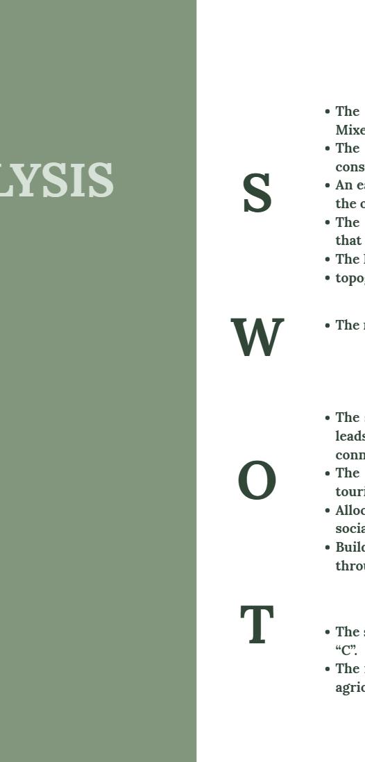
SThe Diversity land use of the site as it has: Residential, Mixed use, and open spaces.
The proximity to the stone factory which can be considered as a node.
An easy access to Abu-Shukhaidim from the north and to the old city, industrial, residential “b” from the south.
The olive trees which cover the area of medium value, that Enhance environmental quality and privacy.
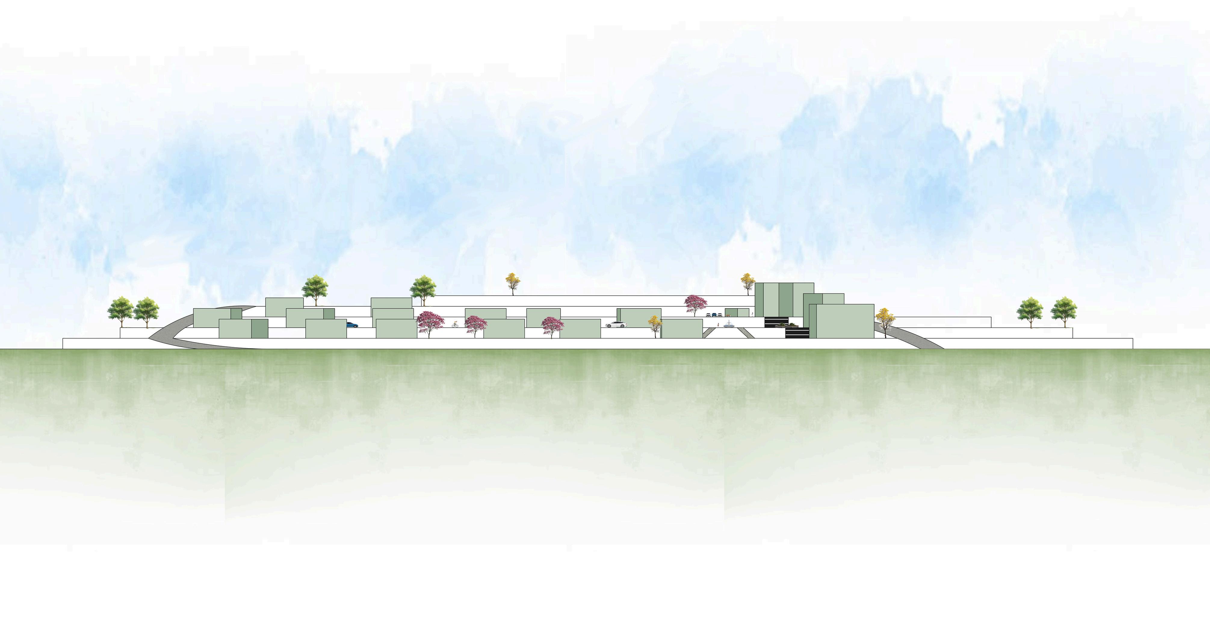
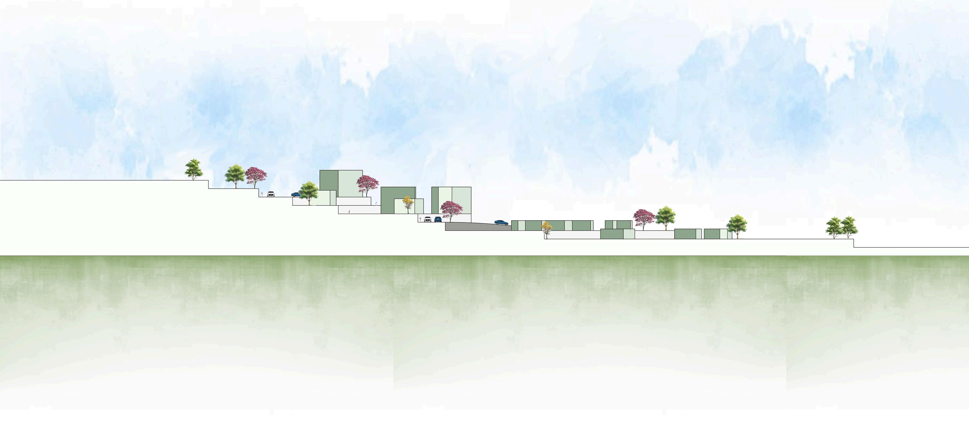
The Existing streets which go along with the topography. topographical hierarchy separates districts clearly.
WThe random unorganized parcellation for the lands.
OThe street which divide the site has a big potential as it leads to the industrial area, and could be used by trucks connecting between many areas.
The rural character and green areas could be an agrotourism district for locals.
Allocating space for public spaces and parks to serve as social gathering nodes.
Build a connection between the site’s different functions through pedestrian and bicycle paths.
TThe site is approximate to the lands that are classified as “C”.
The risk of the development to control over the medium agricultural value lands.
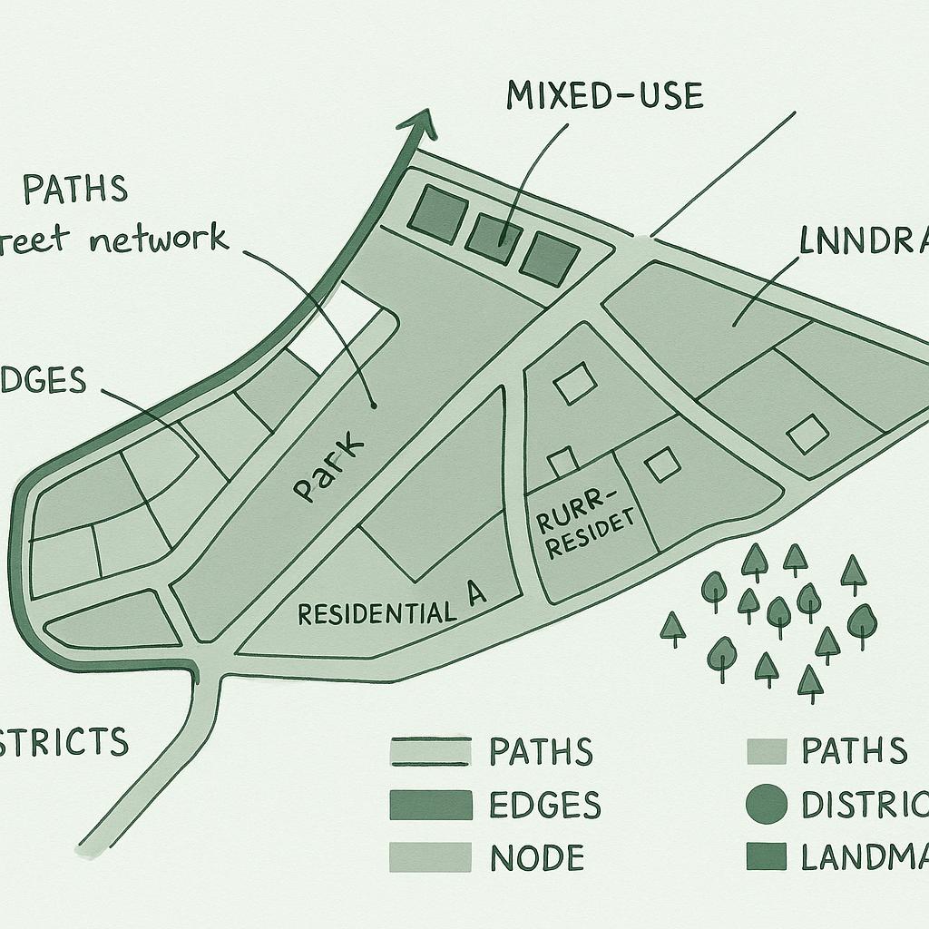
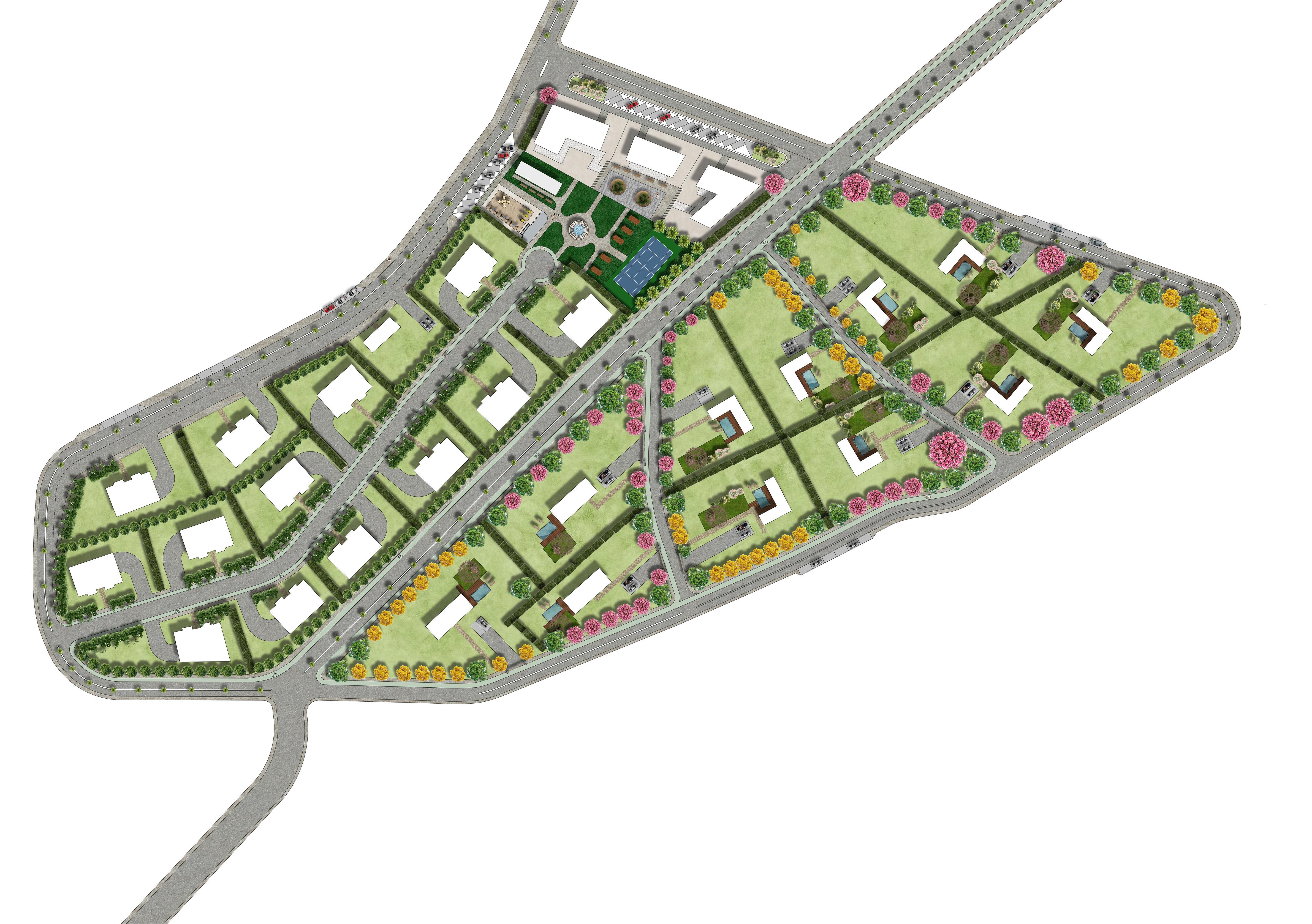
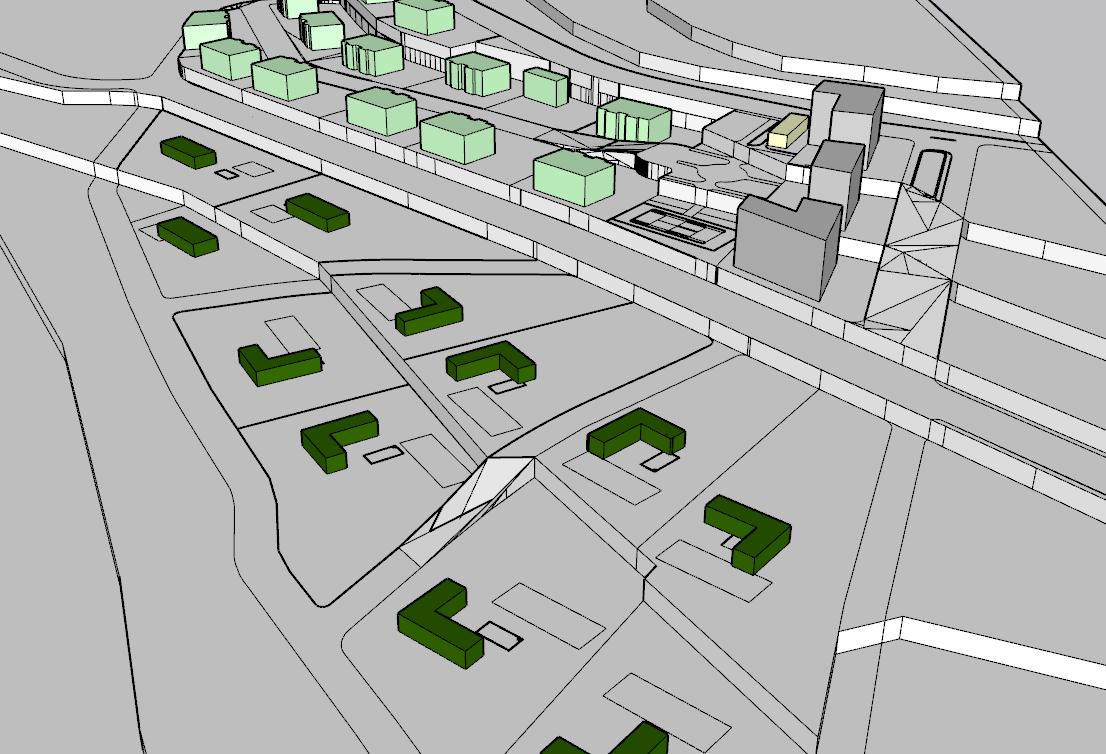
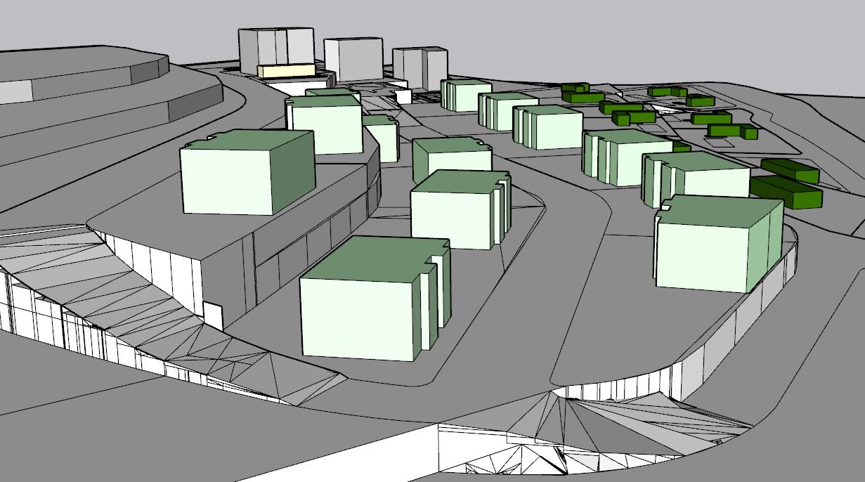
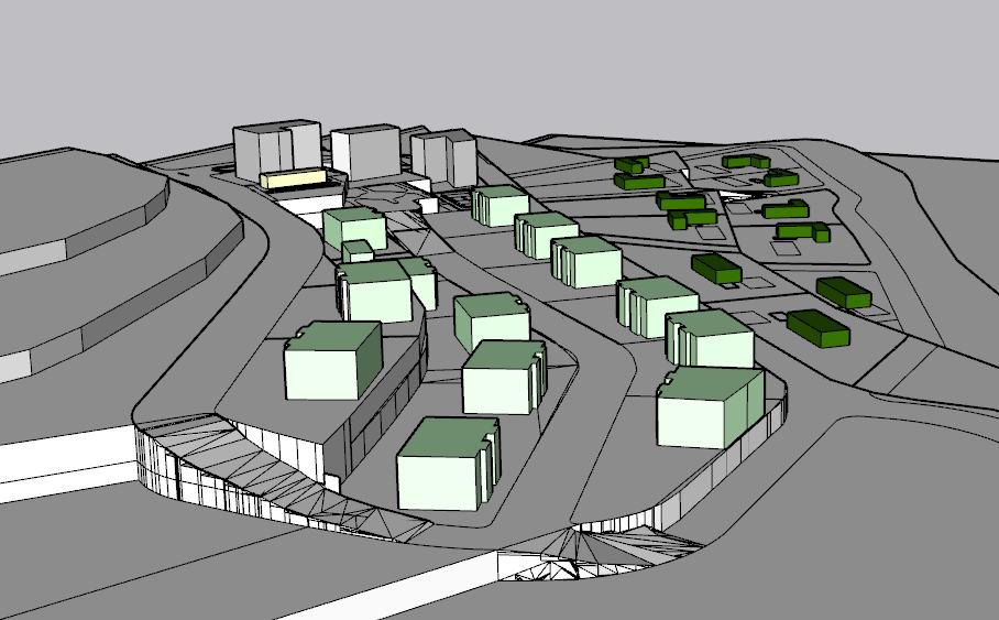
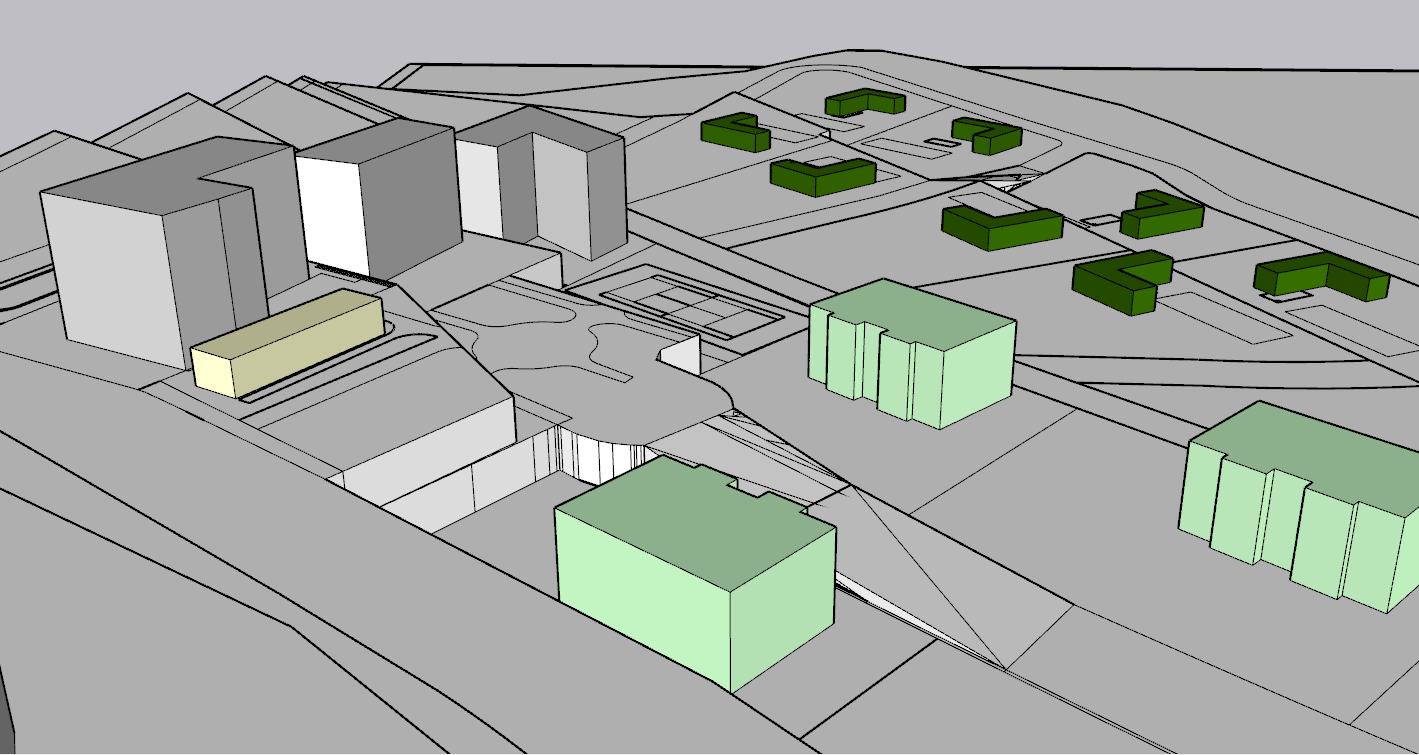
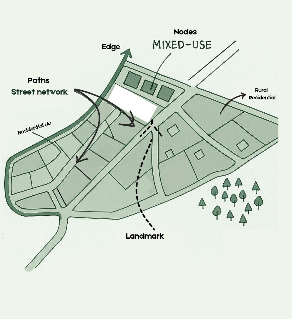
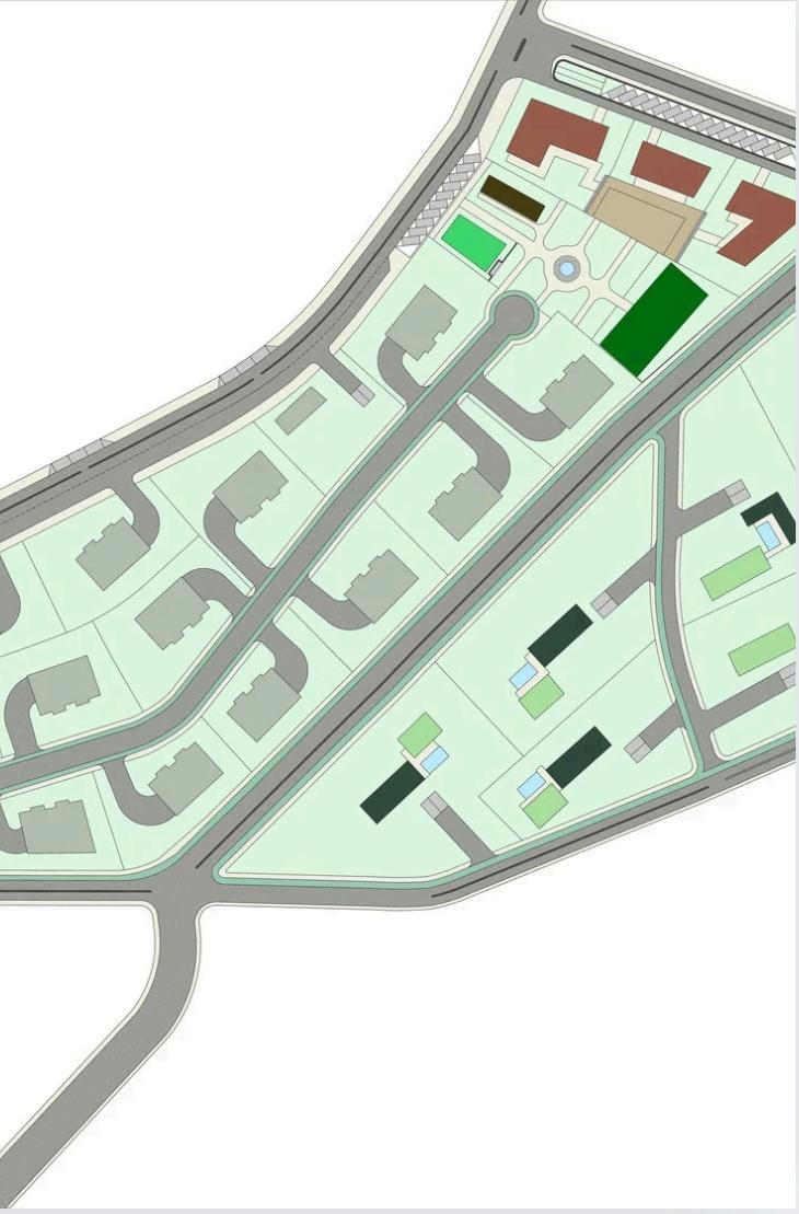
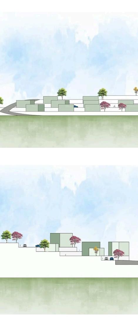
The grid-style street network organizes the site, balancing vehicular access with walkability and dedicated bike paths that connect rural homes, Residential A, the park, and mixed-use buildings. Subtle yet important edges define transitions—like the park separating the urban mixed-use zone from Residential A, and the shift from dense housing to spacious rural plots, reinforcing the rural character. The mixed-use area features 4-floor buildings with ground-level shops, Residential A offers 3-story housing with shared green space, and the rural zone includes large plots with 1-story homes and roof access. Key nodes include the active entrance to the mixed-use zone and the central park, which acts as both a social hub and a key landmark.


Greenary
Garden
Children playground
Fitness Playground
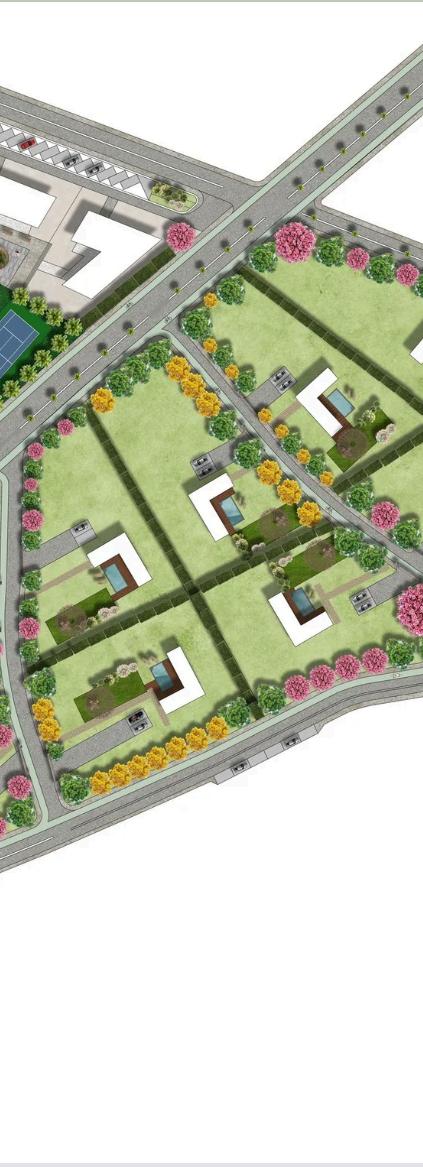
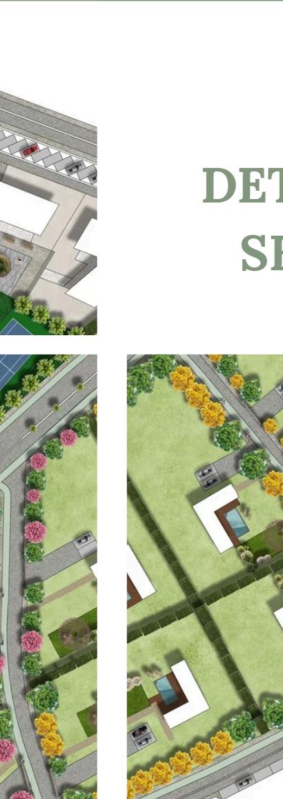
Rural Residntial
Mixed-Use
Plaza
Pedestrian Paths
Streets
Parking Lots
Water Elements