10 minute read
Design Proposal

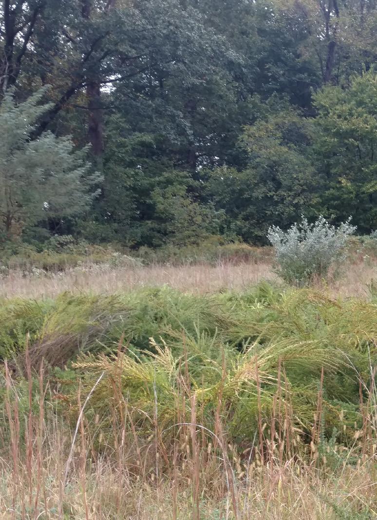
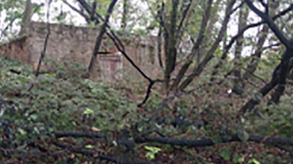
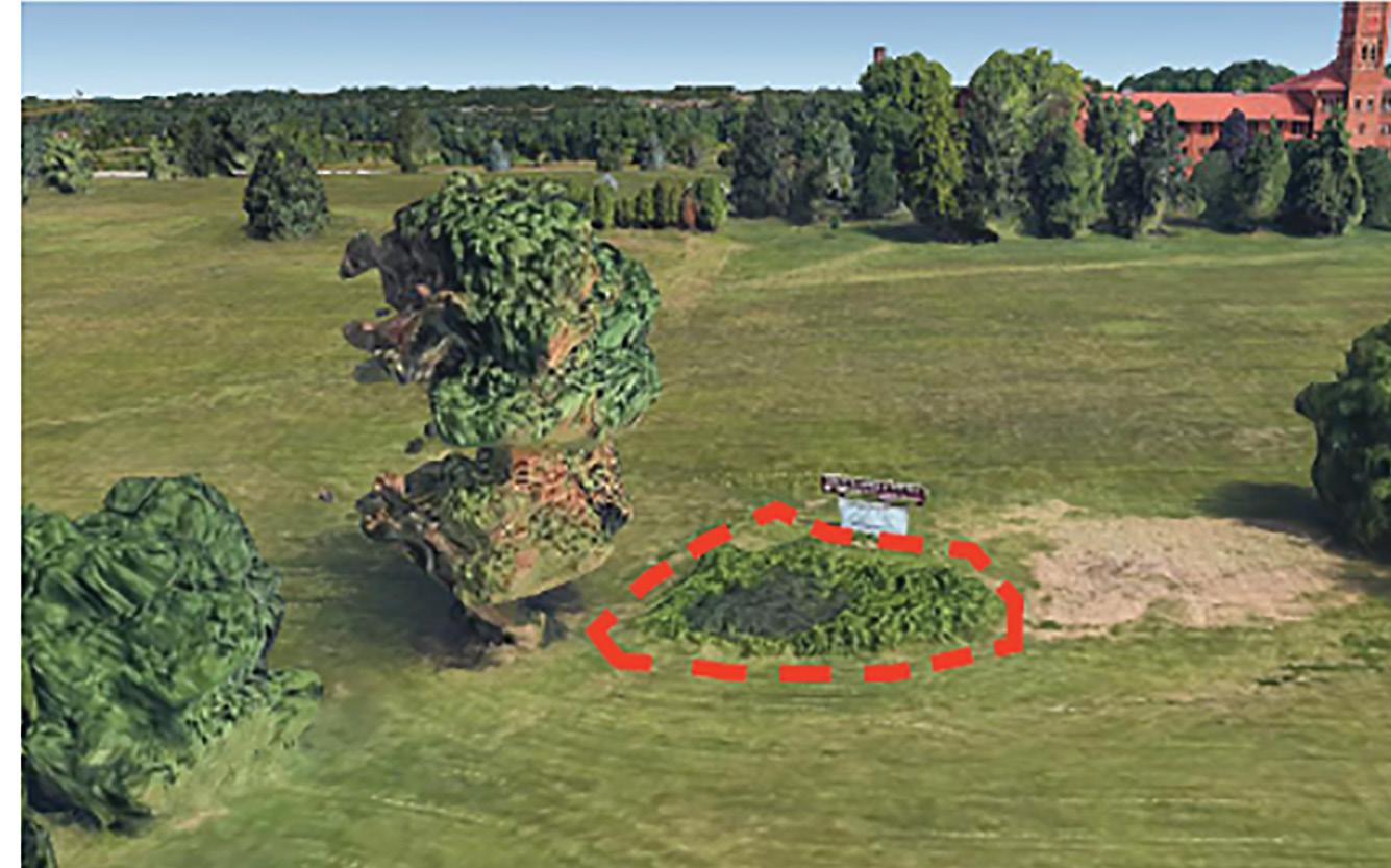
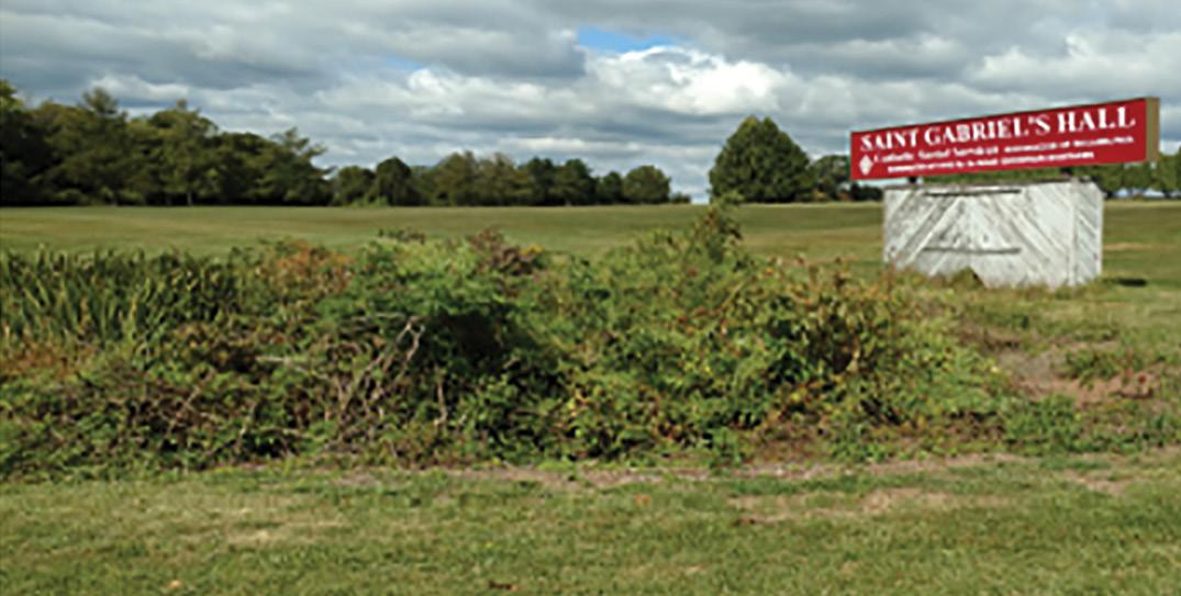
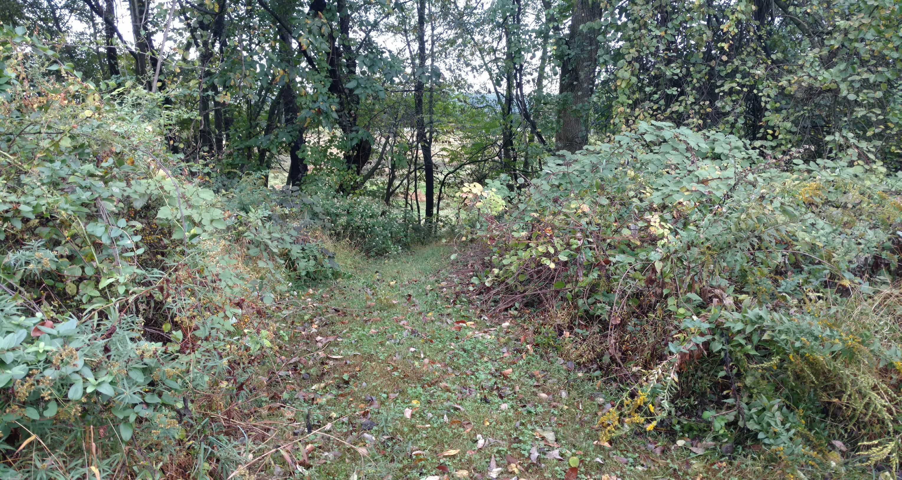
Woodland - Existing
Wooded-Upland Community (0.25 acres)
Advertisement
• degraded wooded-upland community • surrounds an old storage structure • surrounded by 10’ mowed paths • access to the storage structure is limited • to facility workers • vegetated by natural process Northwest View toward Oaks, PA
Storage Structure Mown Path
Baseline Inventory
maackii
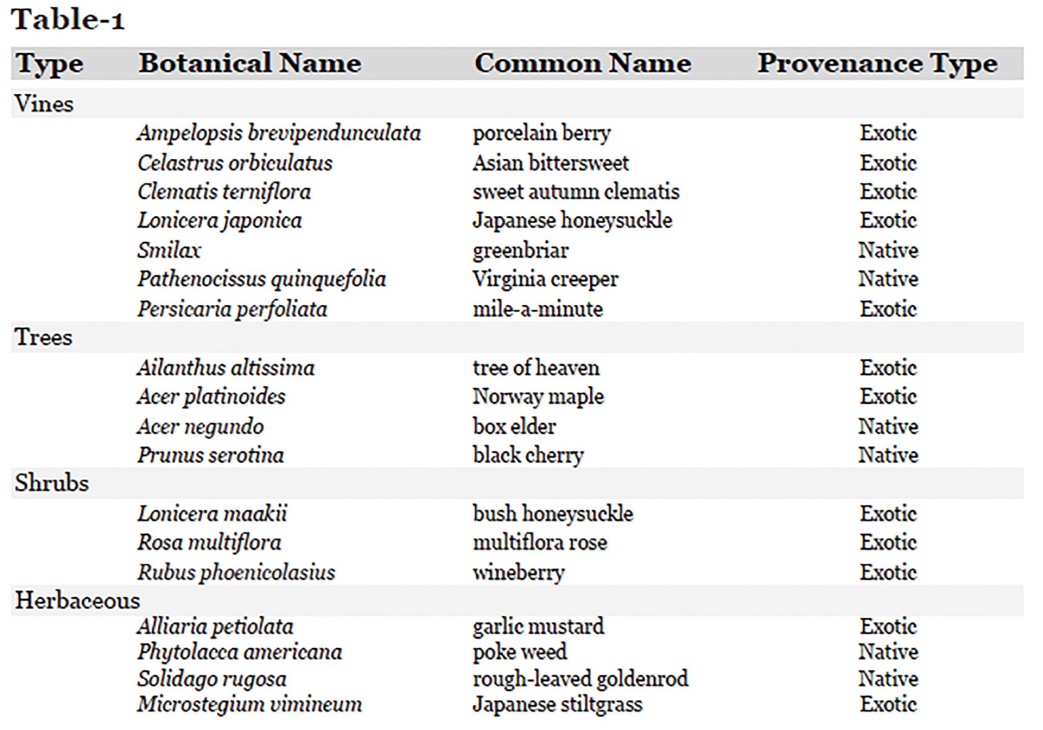
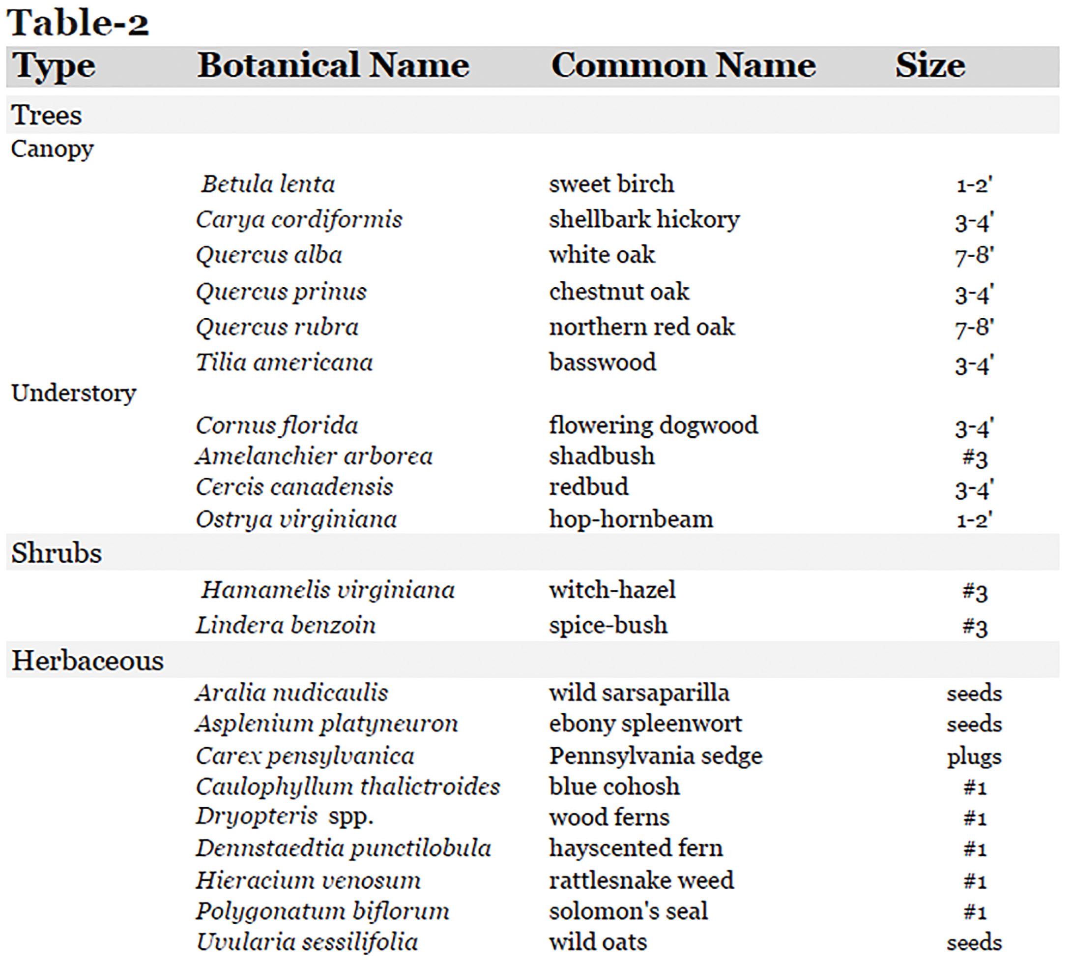
Table-1 shows that variety of species identified in this area. A majority of the species here are exotic and invasive.
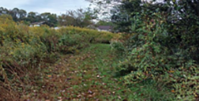
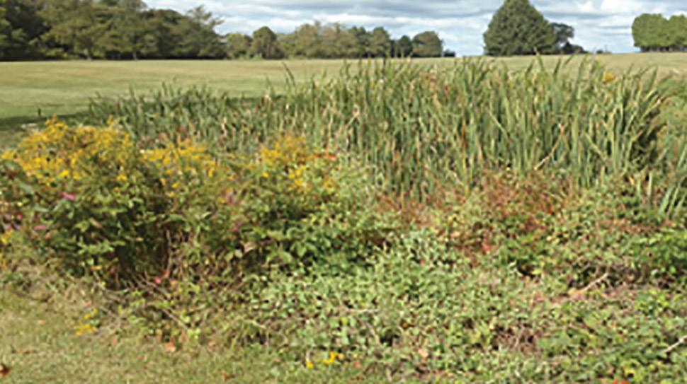
Wetland - Existing
Marsh-Wetland Community (0.05 acres)
• a man-made depression that has silted in and retains water Northwest View toward Oaks, PA
Mown Edge
Baseline Inventory
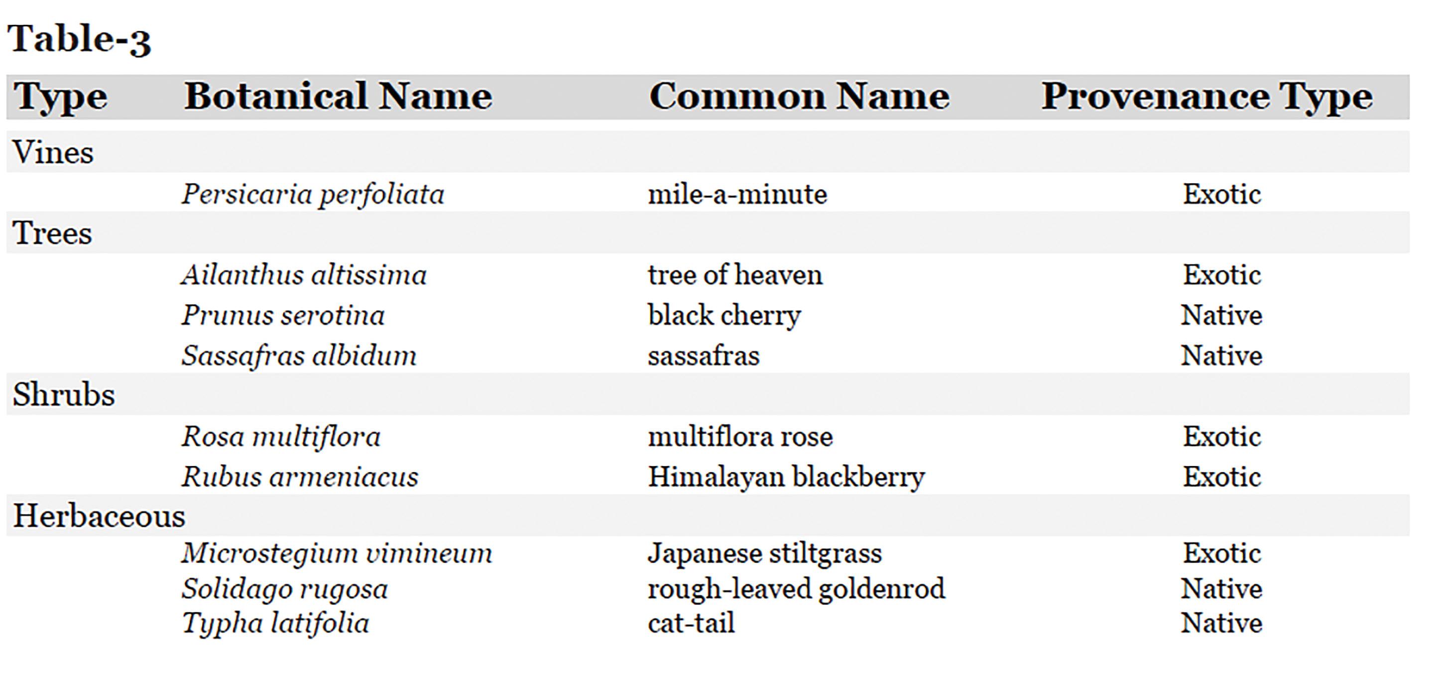
Table-1 shows that variety of species identified in this area. A majority of the species here are exotic and invasive.
Native Species Selection and Planting - Woodland
Ecological Reference Site - Valley Forge National Historical Park • similar underlying geology • similar soil types
Additional Reference - The Terrestrial Plant Communities of Pennsylvania • soils here slightly acidic • a south-facing slope, • Dry Oak-Mixed Hardwood Forest and the Red Oak-Mixed Hardwood forest plant communities.
Planting Notes • new plantings can be planted into the wooded up land during the following spring • high probability of deer herbivory • necessary to use tree tubes for new trees and deer enclosures for new native shrubs and herbaceous plants. Planting Notes Continued • herbaceous plants should be on average 12” - 18” height • shrubs should be on average 18”- 24” height • Tubex tree shelters with wooden stakes should be used on all container seedling trees until the caliper of the tree breaks the Tubex. [Approximately 3-5 years for fast growth species and 5-7 for slower growth species]. • continue to plant trees over time in order to diversify the compositional structure
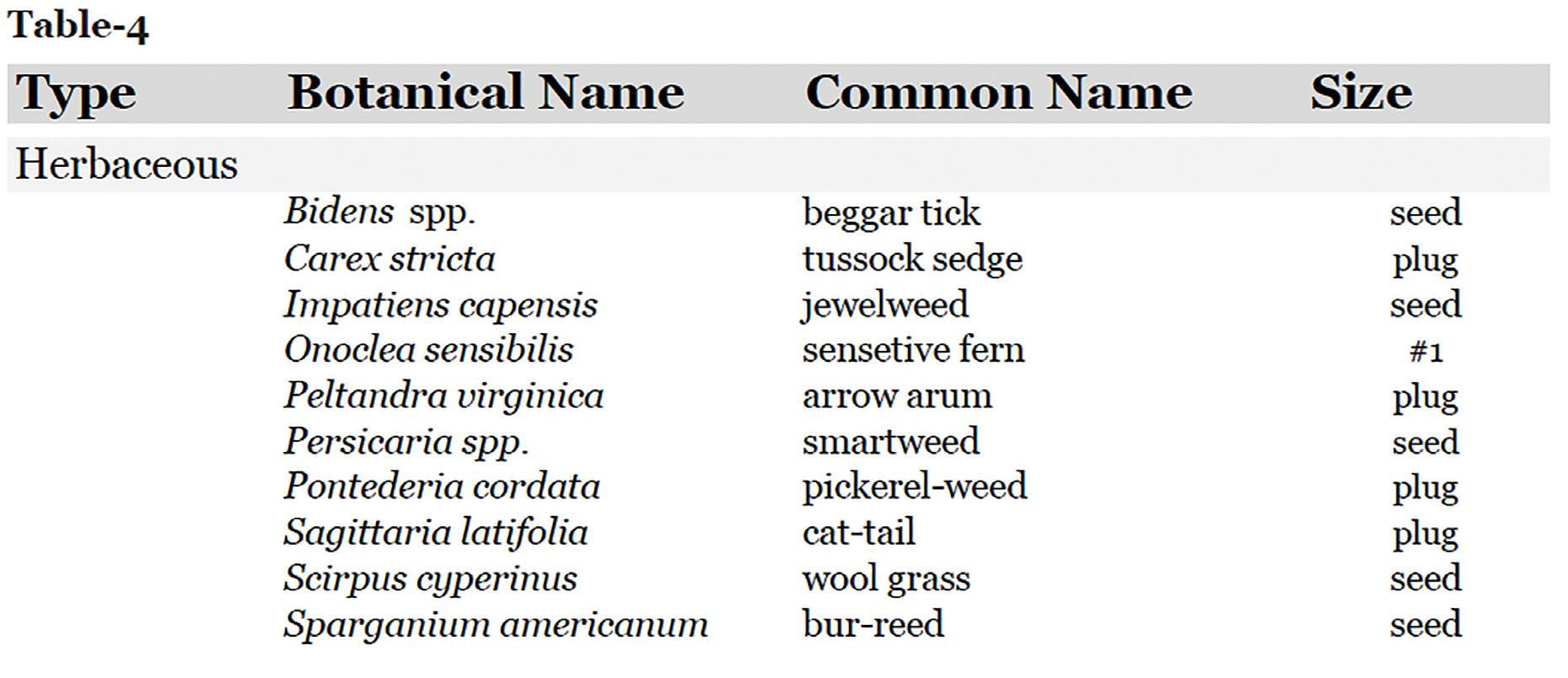
Native Species Selection and Planting - Wetland
• The Palustrine Plant Communities of
Pennsylvania serves as a reference • this area is upland depression and contains Typhus latifolia (cat-tail) • chosen to use the Marsh Basin and
Basin Wetland plant community
Woodland Invasive Species Removal
Year 1 • establish the baseline inventory for the site • use flagging tape to mark invasive trees • cut with a handsaw or chainsaw depending on the diameter of the trunk • paint stumps with a high concentrate herbicide • woody debris should be left on site to • decompose and maintain the energy cycle
Next • cut the invasive shrubs and vines that dominate the under story along the mowed trails and interior • use loppers, a handsaw, or a chainsaw • depending on size of the shrub and girth of the vine. • limit disturbance to surrounding native species, vines and shrubs • cut down at the base and paint with a high concentrate herbicide during the fall. • invasive herbaceous species should be selectively spot sprayed through a foliar application of a glyphosate using a backsprayer.
Additional Removal Notes
Management Plans
Woodland An ongoing connection with the site will need to be maintained do to: • a constant influx of invasive seeds via birds and other wildlife • the persistence of invasive seeds in the soil seed bank. • tree tubes and deer protection fencing will need to be monitored due to wildlife disturbance and the aggressive nature of invasive vines.
Operations • cut and paint new stems • spot spraying invasive herbaceous
Wetland An ongoing connection with the site will need to be maintained do to: • a constant influx of invasive seeds via birds and other wildlife • the persistence of invasive seeds in the soil seed bank. Operations Soil monitoring should take place to see if nutrient loads and silting is occurring.
• use a water-safe herbicide such as Rodeo will help to maintain the ecology of this area.
Monitoring Plans
Seed-bank Monitoring Goals • to study how long invasive seeds persist • to see if the new plantings are establishing a new community in the area.
• wooded-upland, 135’ transects will be established from south to north. (see figure 1 below for locations) • marsh wetland, 50’ transects will be established from east to west. • three evenly spaced points will be marked along the transect • using a hand shovel to cut into the soil, an approximately 4” core will be extracted with a spatula. • core should be sliced on the vertical access into three equal parts. • slices should then be placed into three separate aluminum baking pans. • label the pans as surface, middle layer, bottom layer respectively.
• place the seeds in the greenhouse, water as needed to keep moist and allow them to germinate. Once seedlings emerge, they should be identified, counted and recorded.
Year 1: Baseline Inventory Soil Samples taken in Early March and June . This phase should occur before the removal restoration project takes place in the fall.
Year 2-5: Soil samples taken Early March and June using the same method and locations as was established in year 1. At least five years of data should be collected. The same transects should be used each time.
Operations continued
Phases Plant Species Monitoring Goals • to study how the diversity has changed and whether or not it is increasing or decreasing.
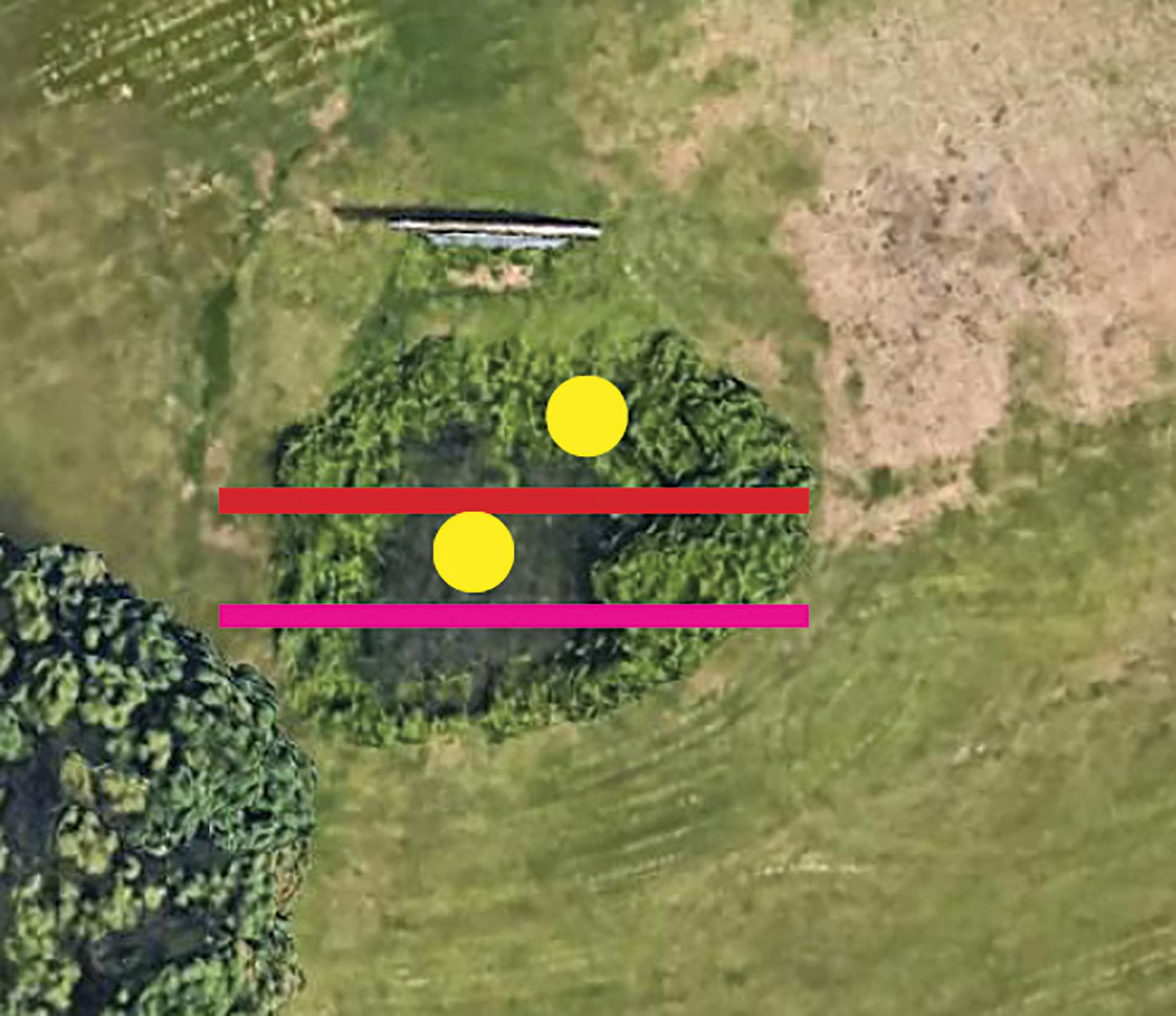
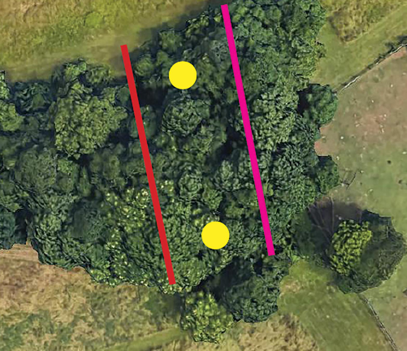
• transect will be used in both restoration sites and each will cross different condition types. See figure 1 for locations.
• wooded-upland, a transect will include the southern woodland edge, the interior lower slope, the interior center, the interior upland slope, and the northern wooded edge.
• marsh wetland, a transect will include the eastern grass-marsh edge, the upper interior slope, the lower interior slope or center, and the upper interior western slope, and the grassmarsh western edge. • a 5’x5’ quadrat should be placed in each of the points established along the transect. • plants within the quadrat will be identified. • species and number of stems of each should be counted and recorded.
Operations Operations continued
Phases Year 1: Baseline Inventory - Establish the transects and create the baseline before restoration is started. This process should occur twice in the first summer, once in June and once in August.
Year 2-5: Using the same method as year one, the transects should be monitored two times per summer, once in June and once in August.
Monitoring Plans
Wildlife Monitoring Goals • to study how the diversity has changed and whether or not it is increasing or decreasing.
• restoration monitoring points will be set in different habitat locations to monitor for breeding birds, insects and amphibians. See figure 1 for locations.
• wide variety of birds have been observed in both the
John Audubon Center property as well as the Pawlings
Farm at Valley Forge Park property • birds have been noted on E-Bird. • caterpillars and other insects provide a rich source of nutrients for adult birds to feed their young. • amphibians are good biological indicators and if present in the marsh wetland may indicate good water quality.
Additional Notes Phases Year 1: Baseline Inventory - Establish the monitoring points and create the baseline before restoration is started by looking for nesting areas on the ground, in shrubs, and in the trees. Spend two hours from 6:30am to 8:30am at a monitoring point weekly during May and June. Note any birds that are seen or heard, any amphibians seen or heard, and any insects seen. If a nest, scat, or other wildlife indicators are seen, note them.
Year 2-5: Using the same method as year one, the monitoring points should be used again as stations when looking and listening for wildlife. Any evidence of wildlife should be noted. Transects and Monitoring Points - Wooded-Upland Transects and Monitoring Points - Marsh-Wetland
Wildlife Monitoring Point
Seed Bank Transect
Plant Species Transect
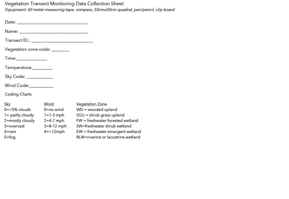
Monitoring Data Sheets
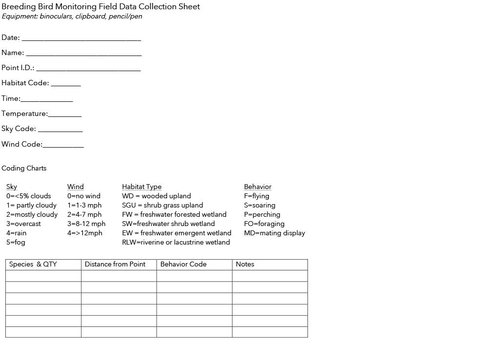

Monitoring Data Sheets

Restoration References
How does nature exposure make people healthier?: Evidence for the role of impulsivity and expanded space perception https://www.ncbi.nlm.nih.gov/pmc/articles/PMC6104990/
Cornell Labs https://www.birds.cornell.edu/home/
Lands for Life 2nd Edition. Natural Lands. 2014
Terrestrial and Palustrine Communities of Pennsylvania 2nd Edition. PA DCNR. 2012
The northern woodland edge and trail needs management and restoration.
Afterword
The design proposals in this report demonstrate how to achieve an enhanced level of both community connectivity and ecological services.
The campus-to-context connection will be strengthened by a sweeping conversion of lawn to natural lands.
The Mitchell Program and St. Gabe’s Hall relationship will be linked by the interventions on Connection Ave.
The entry experience will be heightened by forming a visual connection between the drive and the clock tower. The courtyard improvements will create a network of programmatic spaces within a beautiful landscape.
And the student-residents will gain deeper connections to the natural world during their stay at St. Gabriel’s Campus.
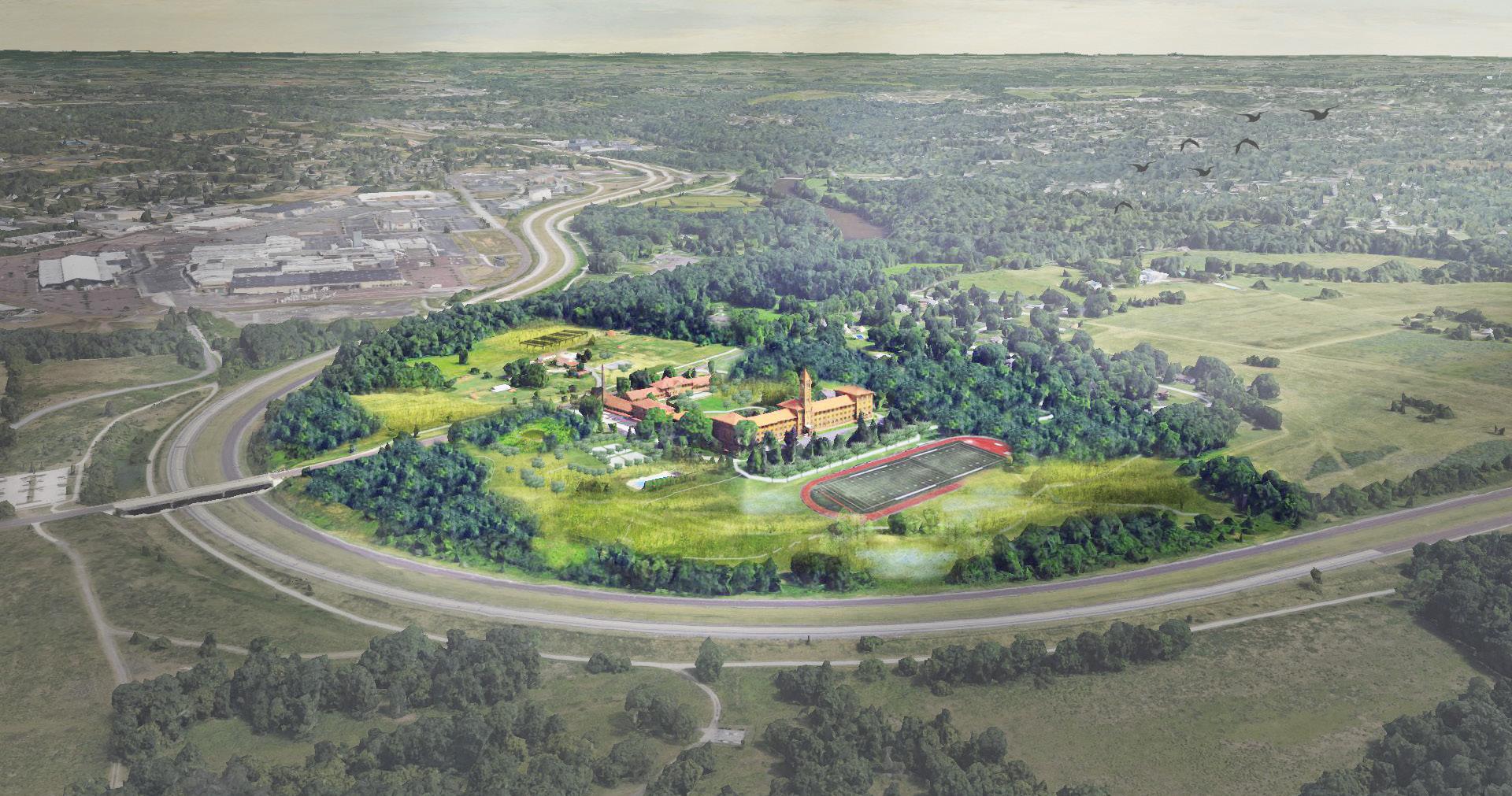
Valley Forge National Historical Park Oaks, PA
Pawlings Rd. Audubon Loop Trail Permaculture Garden Solar Fields
Pollinator
Meadow
Courtyard Refuge
Basketball
Courts Pool
Mountain Views Ripple Fields
Perkiomen Creek
John Audubon Center at Mill Grove
Allee Garden Woodland Walk Entrance Drive
Track & Field
Wetland Meadow Walk High Ropes Course
Schuylkill River Trail
Valley Forge National Historical Park
Image Sources
• All photos taken and graphics composed by Zachary Cross unless otherwise noted.
Table of Contents
• Aerials - Google Earth
Survey & Analysis
• 1798 Map - Untangling the History of the Pawling/Wetherill House at Walnut Hill Estate, Pawling Road, Lower Providence Township,
Montgomery County, Pennsylvania. Thomas Clinton McGimsey. University of Pennsylvania. 1992 • 1849 Map - Library of Congress • 1922 Aerial Photgraphs - Digital Library Company • Historic Aerials - Penn Pilot • Street View Photos - Google Street View • Typical Piedmont Landscape - weekendswiththebirds.blogspot.com • Typical Site Geology - addressinggettysburg.com • Typical Site Soil - sciencesource.com • eastern meadowlark - allaboutbirds.org • eastern bluebird - indianaaudubon.org • cedar waxwing - allaboutbirds.org • short eared owl - allaboutbirds.org • swallowtail - thoughtco.com • eastern-tailed blue butterfly - butterfliesathome.com • asclepias syriacas - everwilde.com • andropogon virginicus - greentecnursery.com • schedonorus pratensis - wildseed.co.uk • linaria vulgaris - first-nature.com • Chester County J.D.C. - cra-architects.com/project/chester-county-youth-center; Google Images • Montco J.D.C. - pp-js.org; Google Images • Delco J.D.C. - delcotimes.com - Pete Bannan; Google Images • Bucksco J.D.C. - Google Images • Philaco J.D.C - kmdarchitects.com Case Studies
• Prescribed Burn - twitter.com/valleyforgenhp • Bails - facebook.com/FriendsofVFPark • VF Meadow 01 - reverberations.net • VF Meadow 02 - facebook.com/LandscapesStructuresVAFO • Triumphal Arch - assets.simpleviewinc.com • Meadow Roots - ecolandscaping.org • Late Summer Meadow View - newsinteractive.post-gazette.com • Audubon Map - johnjames.audubon.org • Steep Slope - John James Audubon Center at Mill Grove Site and Natural Resources Plan. Wallace, Roberts, and Todd, LLC; Biohabitats, Inc. 2009 • Steep Slope 02; Woodland Edge Trail - Photos by Jessica Marie • Entrance Photo - Photo by Kate DeForest • Native Plantings - https://res.cloudinary.com/simpleview/image/upload/v1479417485/clients/vfcvb/MTK_2569_44c28c45-96c4-4c07-bc31-e52122d18306.jpg • Grasshopper Sparrow - inhf.org/webres/file/blog/grasshopper-sparrow.jpg • Temple Healing Garden Illustrative Map - Temple University, Department of Landscape Architecture & Horticulture
• Aerial and Axon Photos - Google Earth • Buitenschot Park - landezine.com/index.php/2016/07/buitenschot-park-by-hns-landscape-architects • Buitenschot Park - schiphol.nl/en/schiphol-as-a-neighbour/page/landscape-design-plan-to-combat-noise-nuisance • Precedent Hydrology - Photo by Mark Gallagher • Rain Garden - Google Image • Patio - matthew-cunningham.com/portfolio/hemlock-house/ • Outcrop - ssl.c.photoshelter.com/img-get/I0000N4j5NXqO1uc/s/860/860/holt-1227-037ca.jpg • Amelanchier - plantsmap.com • Betula - gobotany.nativeplanttrust.org/species/betula/lenta • Clethra- www.whiteflowerfarm.com/mas_assets/cache/image/3/f/3/4/16180.Jpg • Fothergilla - mgnv.org/2019/04/19/shrub-fothergilla-gardenii-dwarf-fothergilla-2/ • Rhus aromatica - houzz.com.au/photos/rhus-aromatica-gro-low-garden-minneapolis-phvw-vp~42567910 • Juniper - upload.wikimedia.org/wikipedia/commons/d/d8/Gerry%27s_Nose_NFLD_Juniperus_horizontalis_02.JPG • Pinus - wglt.org/sites/wglt/files/styles/x_large/public/201708/14882305009_63b272127d_o.jpg
Design Proposals