Assessing the provision of the service
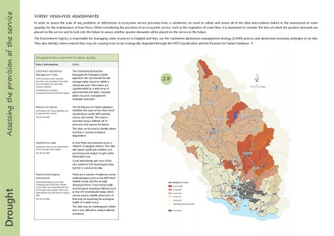
Water resources assessments In order to assess the scale of any problems or deficiencies in ecosystem service provision from a catchment, we need to collate and assess all of the data and evidence linked to the assessment of water quantity for the maintenance of base flows. When considering the provision of an ecosystem service, such as the regulation of water flow, it is important to consider the time at which the greatest demands are placed on the service and to look into the future to assess whether greater demands will be placed on the service in the future. The Environment Agency is responsible for managing water resources in England and they use the catchment abstraction management strategy (CAMS) process and abstraction licensing strategies to do this. They also identify where reduced flow may be causing rivers to be ecologically degraded through the WFD Classification and the Reasons for Failure Database. ďƒ˛
Designated sites important for water quality Data / information
Notes
Catchment Abstraction Management Plans
The Catchment Abstraction Management Strategies (CAMS) approach sets out how the EA will manage water resources within a catchment area. These plans are supplemented by a wide array of governmental and water company water resources management strategies and plans.
CAMS and other water resources documents are available for download from EA website and local water company websites GIS dataset from Geostore www.geostore.com/environment-agency
Reasons for failure WFD Reasons for Failure Database can be obtained from the EA. Not yet included
The EA Reasons for Failure database identifies the cause of less than Good classifications under WFD (activity, source, and sector). The cause is recorded using a defined set of pressures and reasons for failure. This data can be used to identify where low flow is causing ecological degradation.
Hydrometric data Hydrometry data can be obtained from the EA through a data request. Not yet included
In river flows are measured across a network of gauging stations. This data will require significant collation, preprocessing and analysis to get useful information out. Could alternatively get some of the very extensive CEH hydrological data, but this is commercial data.
Drought
Hydromorphological assessments Hydromorphological survey data collected as part of the River Habitat Survey (RHS) can be obtained from the EA through a data request. Other local organisations may also have this type of data. Not yet included
There are a number of walkover survey methodologies (such as the WFD River Habitat Survey and the recently developed Rivers Trust Fluvial Audit) and biological sampling methods (such as the LIFE Invertebrate Index), which can be used to identify where lack of flow may be impacting the ecological health of a watercourse. This data may be challenging to obtain and is very difficult to analyse without assistance.
28