3 minute read
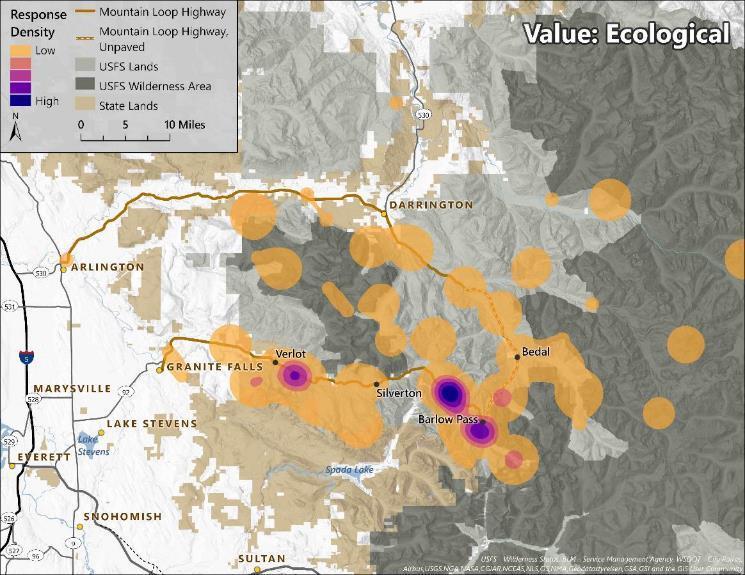
Figure 17e. Ecological response density across favorite places


Figure 17e. Ecological response density across favorite places (Reported by at least one respondent at 68 places)
38
Advertisement
d. Using maps to understand needs for greater access in the Mountain Loop area.
We asked respondents to identify places in the Mountain Loop area where they wanted to see improved access. In total, 395 places with access needs were identified by 339 respondents (28% of all respondents). Responses were linked to a specific location in the area about 83 percent of the time; the remaining 17 percent of responses were either general types of places (e.g. the entire Mountain Loop area, all roads in the area, non-existing mountain bike trails, etc.) or did not contain enough specificity to link to a known place (e.g. ‘flat rock waterfall’).
Places with access needs were distributed across the Mountain Loop area, with the highest density in the area near Three Fingers trailhead and Boulder Creek Wilderness, as well as sites along the highway between Verlot and Barlow Pass (Figure 18). Overall, respondents believed ‘Road improvement, ‘New trail access,’ and ‘Trail connections’would make places around the Mountain Loop Highway more accessible (Figure 19). Of responses that could not be linked to a place, most respondents had access issues with roads in the area, such as damaged or closed roads. The most frequently identified places with access needs included: Three Fingers Trailhead (50 responses; Figure 20), Big Four Ice Caves (33 responses; Figure 21), and the Monte Cristo area (28 responses; Figure 22). (See Table 5 for overall patterns in access issues across the sites.)
The access issues identified at Three Fingers trailhead include ‘Road improvement’and ‘Trailor motorized access’to the area. The road to Three Fingers is rough and a bridge washed out, requiring visitors to hike or bike an extra 8 miles to access the start of the strenuous trail. Respondents hope for more accessibility to the area, but some acknowledge that providing more accessibility for those without the proper preparation might exacerbate safety issues in a remote area. Though most respondents indicated they wanted the road fixed to improve access, others suggest a new trail or improving older trails in the region to allow for easier access.
The most frequently identified access issues at the Big Four Ice Caves include ‘New or improved trail access’and ‘Trail connections.’A bridge washed out in the area, eliminating easy access to the base of the ice caves and the area around the ice caves. Nearly all comments requested a bridge be rebuilt to enable the river crossing. This is especially noteworthy considering the Big Four Ice Caves was a popular favorite place, valued as a place for family; people talked about accessing the area with small children, over time, and across generations. Access issues might be amplified, in part, because it is a popular destination to take small children.
Considerations
Many factors raise concerns about access needs. Storms, floods, landslides and other natural events have washed out roads or closed trails in the Mountain Loop area. Some seek these roads to be rebuilt to allow easy access to trails. Yet, many respondents noted that when roads are rebuilt, trails receive increased use, which can change the nature of visitors’ experiences. In other cases, visitors may seek to connect trails or create loops allowing a greater variety of hiking modes and options. And, for others, access means increasing opportunities for people with different abilities, ages, or for families to enjoy the outdoors.
The most frequently identified access issues in the Monte Cristo area also involve trail issues. The trail to access the town site is a long, former vehicle road; many visitors to the area suggested this road (or other former vehicle roads in the area) be improved to allow for vehicle access to the site. Some respondents also noted that there’s a tricky river crossing in the area that could be enhanced with a bridge or a new trail route.
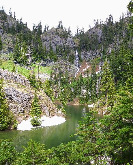
Waterfall in the Mount Baker-Snoqualmie National Forest